International Journal of Industrial Engineering Computations · International Journal of ......
16
* Corresponding author. Tel: +98-21-7724-0000 E-mail: [email protected] (F. Barzinpour) © 2014 Growing Science Ltd. All rights reserved. doi: 10.5267/j.ijiec.2013.08.004 International Journal of Industrial Engineering Computations 5 (2014) 55–70 Contents lists available at GrowingScience International Journal of Industrial Engineering Computations homepage: www.GrowingScience.com/ijiec Integrated decision making model for urban disaster management: A multi-objective genetic algorithm approach V. Esmaeili and F. Barzinpour * Department of Industrial Engineering, Iran University of Science and Technology, Tehran, Iran C H R O N I C L E A B S T R A C T Article history: Received June 2 2013 Received in revised format August 15 2013 Accepted August 15 2013 Available online August 31 2013 In recent decays, there has been an extensive improvement in technology and knowledge; hence, human societies have started to fortify their urban environment against the natural disasters in order to diminish the context of vulnerability. Local administrators as well as government officials are thinking about new options for disaster management programs within their territories. Planning to set up local disaster management facilities and stock pre-positioning of relief items can keep an urban area prepared for a natural disaster. In this paper, based on a real- world case study for a municipal district in Tehran, a multi-objective mathematical model is developed for the location-distribution problem. The proposed model considers the role of demand in an urban area, which might be affected by neighbor wards. Integrating decision- making process for a disaster helps to improve a better relief operation during response phase of disaster management cycle. In the proposed approach, a proactive damage estimation method is used to estimate demands for the district based on worst-case scenario of earthquake in Tehran. Since such model is designed for an entire urban district, it is considered to be a large-scale mixed integer problem and hence, a genetic algorithm is developed to solve the model. © 2013 Growing Science Ltd. All rights reserved Keywords: Urban disaster management Relief chain management Damage estimation Location and distribution model Multi-objective Hybrid Meta-heuristic approach 1. Introduction Natural disasters are outcomes of environmental forces, which endanger urban societies all around the world. Despite the progresses made in science and technological aspect of life, human has been unable to protect his life from the treats of these events, completely. Recent casualties all around the world, even in the developed countries, have provided enough evidences that we are vulnerable to calamities created by nature and there is still a necessity to study preventive and responding methods for these casualties. Whilst some of these disasters such as hurricanes and Tsunami are predictable, others might happen quite out of the blue, like earthquakes and landslides. Recent fatal earthquakes in Italy, Japan, and Haiti, floods in Pakistan, hurricanes and Tsunamis have left thousands of casualties, billions of dollars in terms of damages in assets and lots of homelessness.
Transcript of International Journal of Industrial Engineering Computations · International Journal of ......

* Corresponding author. Tel: +98-21-7724-0000
E-mail: [email protected] (F. Barzinpour) © 2014 Growing Science Ltd. All rights reserved. doi: 10.5267/j.ijiec.2013.08.004
International Journal of Industrial Engineering Computations 5 (2014) 55–70
Contents lists available at GrowingScience
International Journal of Industrial Engineering Computations
homepage: www.GrowingScience.com/ijiec
Integrated decision making model for urban disaster management: A multi-objective genetic algorithm approach
V. Esmaeili and F. Barzinpour* Department of Industrial Engineering, Iran University of Science and Technology, Tehran, Iran
C H R O N I C L E A B S T R A C T
Article history: Received June 2 2013 Received in revised format August 15 2013 Accepted August 15 2013 Available online August 31 2013
In recent decays, there has been an extensive improvement in technology and knowledge; hence, human societies have started to fortify their urban environment against the natural disasters in order to diminish the context of vulnerability. Local administrators as well as government officials are thinking about new options for disaster management programs within their territories. Planning to set up local disaster management facilities and stock pre-positioning of relief items can keep an urban area prepared for a natural disaster. In this paper, based on a real-world case study for a municipal district in Tehran, a multi-objective mathematical model is developed for the location-distribution problem. The proposed model considers the role of demand in an urban area, which might be affected by neighbor wards. Integrating decision-making process for a disaster helps to improve a better relief operation during response phase of disaster management cycle. In the proposed approach, a proactive damage estimation method is used to estimate demands for the district based on worst-case scenario of earthquake in Tehran. Since such model is designed for an entire urban district, it is considered to be a large-scale mixed integer problem and hence, a genetic algorithm is developed to solve the model.
© 2013 Growing Science Ltd. All rights reserved
Keywords: Urban disaster management Relief chain management Damage estimation Location and distribution model Multi-objective Hybrid Meta-heuristic approach
1. Introduction
Natural disasters are outcomes of environmental forces, which endanger urban societies all around the world. Despite the progresses made in science and technological aspect of life, human has been unable to protect his life from the treats of these events, completely. Recent casualties all around the world, even in the developed countries, have provided enough evidences that we are vulnerable to calamities created by nature and there is still a necessity to study preventive and responding methods for these casualties. Whilst some of these disasters such as hurricanes and Tsunami are predictable, others might happen quite out of the blue, like earthquakes and landslides. Recent fatal earthquakes in Italy, Japan, and Haiti, floods in Pakistan, hurricanes and Tsunamis have left thousands of casualties, billions of dollars in terms of damages in assets and lots of homelessness.
56
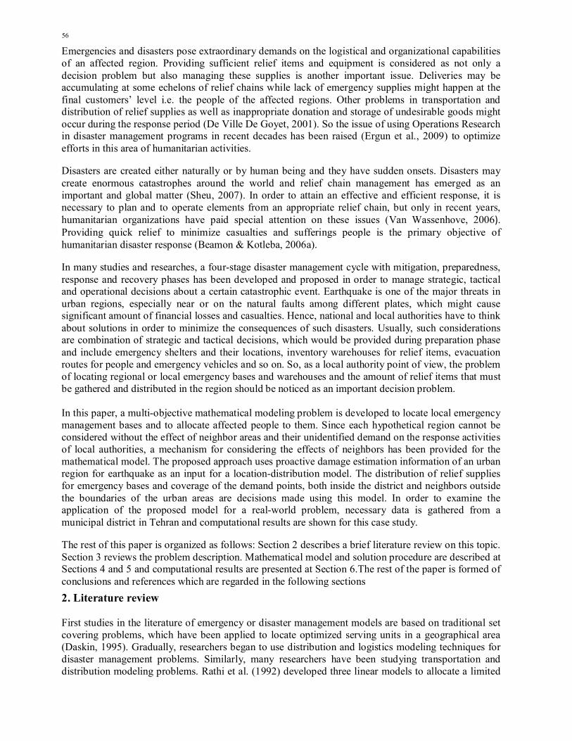
Emergencies and disasters pose extraordinary demands on the logistical and organizational capabilities of an affected region. Providing sufficient relief items and equipment is considered as not only a decision problem but also managing these supplies is another important issue. Deliveries may be accumulating at some echelons of relief chains while lack of emergency supplies might happen at the final customers’ level i.e. the people of the affected regions. Other problems in transportation and distribution of relief supplies as well as inappropriate donation and storage of undesirable goods might occur during the response period (De Ville De Goyet, 2001). So the issue of using Operations Research in disaster management programs in recent decades has been raised (Ergun et al., 2009) to optimize efforts in this area of humanitarian activities.
Disasters are created either naturally or by human being and they have sudden onsets. Disasters may create enormous catastrophes around the world and relief chain management has emerged as an important and global matter (Sheu, 2007). In order to attain an effective and efficient response, it is necessary to plan and to operate elements from an appropriate relief chain, but only in recent years, humanitarian organizations have paid special attention on these issues (Van Wassenhove, 2006). Providing quick relief to minimize casualties and sufferings people is the primary objective of humanitarian disaster response (Beamon & Kotleba, 2006a).
In many studies and researches, a four-stage disaster management cycle with mitigation, preparedness, response and recovery phases has been developed and proposed in order to manage strategic, tactical and operational decisions about a certain catastrophic event. Earthquake is one of the major threats in urban regions, especially near or on the natural faults among different plates, which might cause significant amount of financial losses and casualties. Hence, national and local authorities have to think about solutions in order to minimize the consequences of such disasters. Usually, such considerations are combination of strategic and tactical decisions, which would be provided during preparation phase and include emergency shelters and their locations, inventory warehouses for relief items, evacuation routes for people and emergency vehicles and so on. So, as a local authority point of view, the problem of locating regional or local emergency bases and warehouses and the amount of relief items that must be gathered and distributed in the region should be noticed as an important decision problem. In this paper, a multi-objective mathematical modeling problem is developed to locate local emergency management bases and to allocate affected people to them. Since each hypothetical region cannot be considered without the effect of neighbor areas and their unidentified demand on the response activities of local authorities, a mechanism for considering the effects of neighbors has been provided for the mathematical model. The proposed approach uses proactive damage estimation information of an urban region for earthquake as an input for a location-distribution model. The distribution of relief supplies for emergency bases and coverage of the demand points, both inside the district and neighbors outside the boundaries of the urban areas are decisions made using this model. In order to examine the application of the proposed model for a real-world problem, necessary data is gathered from a municipal district in Tehran and computational results are shown for this case study.
The rest of this paper is organized as follows: Section 2 describes a brief literature review on this topic. Section 3 reviews the problem description. Mathematical model and solution procedure are described at Sections 4 and 5 and computational results are presented at Section 6.The rest of the paper is formed of conclusions and references which are regarded in the following sections
2. Literature review First studies in the literature of emergency or disaster management models are based on traditional set covering problems, which have been applied to locate optimized serving units in a geographical area (Daskin, 1995). Gradually, researchers began to use distribution and logistics modeling techniques for disaster management problems. Similarly, many researchers have been studying transportation and distribution modeling problems. Rathi et al. (1992) developed three linear models to allocate a limited

V. Esmaeili and F. Barzinpour / International Journal of Industrial Engineering Computations 5 (2014)
57
number of transportation vehicles to generate the minimum penalty of inefficiency for distribution services. Barbarosoglu et al. (2001) developed a mathematical model for a tactical-operational decision problem based on helicopter mission planning for relief operations. The interactions among these decisions and conflicts are mirrored in different objective functions, which are used in a two-level hierarchical model. Ozdamar et al. (2004) studied the vehicle routing problem for distribution of relief items, Beamon and Kotleba (2006b) adopted an inventory control model for food demand in disasters. Sheu (2007) developed a hybrid fuzzy model for a logistics distribution problem in emergency events to respond to demands in a certain period. Tzeng et al. (2007) developed a multi-objective supply distribution model for to devastated areas. Doerner and Hartl (2008) investigated different transportation problems in health care logistics and disaster relief including warehouse locations, inventory and vehicle routing problems and so on with special focus on Austrian situation. Balcik and Beamon (2008) considered the facility location problem in order to respond to quick onset disasters. Mete and Zabinsky (2009) provided stochastic optimization approach for storage and distribution of medical. Ortuno et al. (2010) developed a lexicography goal programming model for supply distribution. Ng and Waller (2010) developed an evacuation route planning model to determine the relationship between uncertain demand and supply variations. Van Duin et al. (2010) described the conditions in which the city municipality under their study might need to use urban consolidation centers. Rosenthal et al. (2011) proposed a network problem with a single source for disaster relief problem. Qin et al. (2012) presented a single-period resource model for solving optimal order quantity in order to recover resources of the response equipment. Bretschneider and Kimms (2011) also developed a mixed-integer evacuation model to minimize evacuation time of a traffic routing in an area considering a safe evacuation process using network modeling approach. Chales and Lauras (2011) developed a quantitative modeling approach and a business process modeling approach in order to understand and to analyze humanitarian supply chains. Chakravarty (2011) considered a hybrid reactive proactive response system based on a threshold value for disaster intensity, which might affect costs and capacities in contingent planning.
Last mile distribution is the final stage of a humanitarian relief chain; it refers to delivery of relief supplies from local distribution centers to beneficiaries affected by disasters (Balcik et al., 2008). Knott (1987) developed a linear model for Last Mile Distribution problem in order to minimize the total transportation costs or to maximize the delivered food. Balcik et al. (2008) created a last mile distribution system based on vehicles to allocate relief items of local distributors to demand points. The distribution of goods by vehicles and selection of routes based on a schedule for vehicles in a specific planning horizon is their main concern. Rath and Gutjahr (2011) considered an international aid problem, which consists of location-allocation and routing model after a natural disaster to establish warehouses to provide relief commodities. Tricoire et al. (2011) formulated a bi-objective covering model with stochastic demand for a two-stage humanitarian logistics problem. Rottkemper et al. (2011) developed a planning method to optimize supply chain operations in humanitarian operations after occurrence of a sudden disaster. They considered inventory relocating problem in an uncertain demand situation after a disruption. Bozorgi-Amiri et al. (2011a, 2011b) investigated uncertainty in many parameters of a relief operation like demand, supply and operational costs associated with it. Location of relief centers and allocation of affected area to these centers can be determined under situation described in their model. Ben-Tal et al. (2011) developed a robust logistic planning method with uncertain demand for evacuation traffic flow and dynamic emergency response problems. Ozdamar and Demir (2012) provided a network flow model in coordinate vehicle routing for evacuation and delivery activities in response phase of a disaster. Since they used both distribution and evacuation, last mile delivery and evacuation are considered in their hierarchical optimization problem. Yazdian and Shahanaghi (2011) presented a multi-objective possibilistic programming approach for locating distribution centers and allocating customers’ demands in supply chains.

58
The applications of operations research and mathematical modeling in the area of humanitarian relief have been improved recently by applying logistics and supply chain concepts. To the best of our knowledge, there are few studies with decision integrity for both before and after a disaster occurs mirrored as preparation and response phases for disaster management cycle. On the other hand, uncertainty of some parameters in real-world problems, which might not be controllable or knowledgeable by local or regional authorities, is another important issue, which affects demand predictions and relief operations significantly (Roghanian & Foroughi, 2010).
This research tries to formulate a new mathematical model for the integration of preparation and response phases of disaster management cycle. Determining the location of local emergency bases and their inventory level and allocating affected areas to these bases are considered as the main problems, which have been considered in the proposed model. In order to test the applicability of the mathematical model, a real-world urban district of Tehran is considered. For a certain scenario of earthquake, proactive damages has been estimated for the urban area while due to lack of knowledge about neighbor areas, uncertain demands of outside wards have been regarded as an affecting parameter for the model. For large-scale real-world problems, the proposed mixed-integer model cannot be solved through conventional optimization algorithms; hence, a genetic algorithm is designed as a solution approach to the proposed model. This meta-heuristic solution is supposed to establish a near optimum answer to the following terms:
Number and location of emergency bases, Coverage of urban wards inside district and exterior area, Amount of storage for relief items in each emergency base and distribution of these goods
within urban district and exterior areas.
3. Problem description
Humanitarian supply chain management or relief chain management is a scientific approach to deliver the proper amount of relief items in the right places and at the right time. In disaster relief operations, logistics are required to implement response operations and to ensure their timeliness and efficiency. Distribution of the equipment and goods of humanitarian relief, the evacuation of the injured or the resettlement of those directly affected by the disaster requires a logistics system to maximize effectiveness (De Ville de Goyet, 2001). Storage and distribution of relief items from bases and warehouses located in an urban area is a significant research topic to maximize or, at least, to improve efficiency and effectiveness of efforts in the area of humanitarian relief chain management. Literature of supply chain management indicates that using location-allocation/distribution models in commercial area can optimize many strategic, tactical or operational decisions but there is still a lack of sufficient models in the literature of relief chains. To the best of our knowledge in this area, although there have been some researches on proactive damage estimation results for natural disasters like earthquakes, there is no connection between these kinds of studies and mathematical models, which are used for relief operations in urban districts.
In this paper, urban disaster management for a municipal district of Tehran City is considered. This district consists of 10 sub-regional areas and more than 350000 inhabitants. The main probable natural disaster in Tehran is earthquake and its consequences create major faults inside or near Tehran. Damage caused by a hypothetical earthquake has been estimated via an international software called RADIUS, which stands for Risk Assessment tool for Diagnosis of Urban Areas against Seismic Disaster. This earthquake-damage-estimation software has been developed as an international program to give a better understanding of the seismic vulnerability of cities. Total population and ward areas, building type distribution in each ward, a scenario for earthquake, ground conditions and soil types and lifeline facilities beside some modifiable damage estimation functions gives an estimation of damages for each area. In order to use this software, the whole district has been divided into equal blocks (or

V. Esmaeili and F. Barzinpour / International Journal of Industrial Engineering Computations 5 (2014)
59
pixels) and information requirements such as each block population or the number of buildings and width of streets and other factors has been imported to software using geographic information system (GIS). Damage estimation functions of the software have been modified based on historical results of earthquake in the urban areas of Iran. The results of the software demonstrated the worst-case scenario of an earthquake with magnitude of 7.2 in scale of Richter at midnight by a fault located in north of Tehran. A two-echelon relief chain location-allocation distribution model is shown in Fig. 1. The relief chain in this figure consists of local bases as distribution centers, which should be located in urban pixels and regional and non-regional wards, which form the demand pixels or blocks. They are equal rectangular areas considered as unified neighborhoods for damage estimation software. Regional pixels have been considered in the damage estimation process and demand characteristics have been identified for them. Non-regional pixels shown on the left of the figure are considered for areas outside the urban district and due to lack of information about them, their demands and damage estimation results are unknown.
Demands for regional and sub-regional wards depend on their population and damage severity estimated for each pixel. Based on the damage estimation for the urban area, there are four kinds of demand pixels which are sorted by a range of four colors; Red, yellow, green and blue. Red color shows the most vulnerable urban areas to earthquake and pixels distinguished with blue color show safest wards in the whole district. The main issue for this problem is to determine the number of local bases and their locations in the whole district. These bases are used to cover demand pixels, although this operation is affected by non-urban pixels. Therefore, there is a kind of trade-off between coverage of the whole urban area and partial coverage of the outside demands. Outside demand can also be interpreted as unknown demands from a neighbor area, which is not under the same municipal authority but cannot be ignored completely due to humanitarian goals of a relief operation. Therefore, percent of coverage for these pixels can be considered as a policy for disaster management authorities in the municipal organizations. Since all pixels are regarded as discrete units, the location problem is considered in a discrete space and center of each pixel would represent its characteristics in the model. Fig. 2 shows a picture of this district.
Fig. 1. Relief chain configuration
2
1
n-1
n
DC’s
1
3
2
m-2
m-1
m
District Demand Points
Pixel demands
1
2
3
o-1
o
Outside Demand Points
Uncertain Pixel
demands

60
Fig. 2. The municipal district used for case study divided into 10 sub-regional areas
4. Mathematical modeling
In this section, based on pro-active damage estimation results for a hypothetical earthquake in an urban area, a location-distribution mathematical model is developed considering the effect of neighboring areas on relief demand.
4.1 Assumptions
1. Damage estimation results are provided in preparation phase using pro-active methods and GIS data for the urban region.
2. Since adjacent areas are out of the municipal authority, their relief demand is estimated based on probabilistic parameters.
3. Relief distribution items considered in this model consists of food and water, medical and hygienic items, primary rescue equipment and blanket and cloths. These items are only regular daily commodities and do not need any special holding equipment.
4. Since the whole district is divided into 10 municipal sub-regions, it is assumed that a base located in a block can only serve other blocks in its own sub-region. This assumption helps to ignore unnecessary travels between sub-regions after an urban disaster and it also helps people to stay in a reasonable distance from their own residencies.
4.2 Indices l= 1, 2...L (the whole district should be divided to a defined number of municipal sub-regions), m= 1, 2...M (commodities and equipment that should be stored in emergency management bases can be defined by this index), i= 1, 2... I, j= 1, 2…J (coordinates (�, �) show blocks location in the district), k= 1, 2... K (damage severity priority for the region shown by colors: Red, yellow, Green, Blue…), o= 1, 2...O (neighboring areas outside urban region are divided into O pixels)

V. Esmaeili and F. Barzinpour / International Journal of Industrial Engineering Computations 5 (2014)
61
4.3 Parameters
��,(�,�)������
If a pixel with coordinates (�, �) belongs to level k of damage severity, this equals one; zero, otherwise,
��,(�,�)������
If a pixel with coordinates (�, �) belongs to region l, this equals one and zero, otherwise,
��,(�,�),(��,��) If a facility in (�, �) ∈ � is allowed to serve a demand point (�′, �′), this equals one; otherwise this equals zero.
In other words, each base can serve demand points in its own municipal section:
��,(�,�),���,��� = ��,(��,��)������
. ��,(�,�)������
; ∀�, (�, �) ∈ �, (�′, �′) ∈ �, (1)
�(�,�) Average set-up cost for facility at coordinates (�, �) ,
�(�,�),(��,��) Average distance between coordinates (�, �) and (�′, �′),
�� � Average transportation cost of equipment m in distance unit, ����,(�,�) Average Penalty cost for equipment type m shortage at (�, �),
�� Spatial volume of equipment type m, �� Maximum storage space of facility, ℎ����,(�,�) Average maintenance cost for equipment type m shortage at (�, �),
���(�,�) People population at coordinates (�, �),
��������,(�,�),� Average cost of meeting demand for commodity type m of an outside pixel o from a facility located at coordinates (�, �),
�����,� Demand for equipment type m from an adjacent pixel o outside urban region,
����,� Demand for equipment type m at level k of damage severity,
����,(�,�) Demand for equipment type m of damage severity in coordinates (�, �),
In other words:
����,(�,�) = Pop(�,�). �� ��,(�,�)������
�
. ����,�� ; ∀(�, �), � (2)
4.4. Decision variables
�(�,�) If population of coordinates (�, �) is covered by a facility, this equals one; otherwise this equals zero.
�(�,�) If a facility is located at coordinates (�, �) , this equals one; zero, otherwise.
��,(�,�),���,��� Amount of equipment type m transported from facility at coordinates (�, �) to demand point at coordinates(�′, �′),
��,(�,�),� Amount of equipment type m transported from facility at coordinates (�, �) to outside pixel o,
��,(�,�) Amount of equipment type m stored in a facility at coordinates (�, �),
��,(�,�) Amount of equipment type m shortage at demand point(�′, �′),
����� If outside pixel o is covered by a facility, this equals one; otherwise this equals zero, �� Percentage of demand coverage for an outside pixel.
4.5 Primary model
�����(�) = �����(�,�). �(�,�)�
(�,�)
(3)
�����(�) = � �� �. �(�,�),(��,��). ��,(�,�),(��,��)
�,(�,�),(��,��)
+ � ��������,(�,�),���,(�,�),�
�,(�,�),�
+ � ��ℎ����,(�,�). ��,(�,�)� + (����,(�,�). ��,(�,�))��,(�,�)
+ � �(�,�). �(�,�)
(�,�)
(4)
��� ��(�) = � ��
�
(5)

62
subject to
����,��� ≤ � ��,(�,�),���,���. �(�,�)
(�,�)∈�
; ∀ � ; ∀ (��, ��) ∈ � (6)
� ��,(�,�),���,���. ��,(�,�),���,��� + � ��,(�,�),,�
�(��,��)
≤ ��,(�,�) ; ∀�, �, (�, �) ∈ � (7)
� ��,(�,�),,�
�
= �����. �� ; ∀ � (8)
�� ≤ ����� (9) �. �� ≥ ����� (10)
� ��,(�,�),,�
�,�
≤ �. �(�,�) ; ∀(�, �) (11)
� ��,(�,�),(��,��)
�,(��,��)
≤ �. �(�,�) ; ∀(�, �) (12)
� ��,(�,�),(��,��)
(�,�)
= � ����,(��,��). ����,��� ; ∀(�′, �′), �
�
(13)
� ��,(�,�)
�
. �� ≤ ��. �(�,�); ∀(�, �) (14)
��,���,��� = ����,(��,��) − � ��,(�,�),(��,��). ��,(�,�),(��,��)
(�,�)
; ∀(�′, �′) (15)
��,(�,�), ��,(�,�),(��,��), ��,(�,�), �� ≥ 0, ��,(�,�),,� ; ∀(�, �), (�′, �′), �, � (16)
�(�,�) , �(�,�), ����� = 0 �� 1 ; ∀(�, �) (17)
First objective function (f1(x)) maximizes the coverage of pixels inside the municipal region. Second objective function (f2(x)) is related to costs associated to facility set-up and costs associated to tactical and operational level such as transportation, shortage and inventory holding. The third objective function (f3(x)) tries to maximize the percentage of coverage for pixels outside the municipal region.
First constraint in this shown by Eq. (6) is the maximal covering constraint used to ensure whether a facility is installed at(�, �) ∈ �coordinates; it can cover the population of a demand point at (�′, �′) ∈ �. Eq. (7) defines that the total amount of commodities assigned from a facility to demand pixels cannot exceed the amount of goods stored in its warehouse. Eq. (8) describes the amount of relief items assigned to pixels outside the municipal region. Eq. (9) and Eq. (10) show the relationships between two variable, i.e. coverage percentage for outside pixels (α) and the binary variable related to its coverage (i.e. if a pixel is covered, it might receive enough supplies to cover α percent of its population). Next four constraints are almost associated with relationship between binary and continuous variables for the proposed model. Eq. (11) and Eq. (12) bind the model to assign goods to demand pixels only from installed bases. Eq. (13) defines that quantity of relief items allocated to a demand pixel equals its demand if it is supposed to be covered. Eq. (14) defines the volumetric limit for storage areas in each base. Finally, Eq. (15) describes the amount of shortage as the difference between demand and supply for each facility.
5. Solution approach
Solving the proposed model for a large-scale problem in the simplest form, without considering multi-objective functions and other constraints that are added to the original problem because of the relief chain condition, is identical to solving a maximal covering problem (Eq. (3) & Eq. (6)) which is NP-hard (Jia et al., 2007). Conventional optimization algorithms cannot provide optimized solution to this model in a reasonable amount of time. Therefore, this is the reason that using heuristic and meta-heuristic algorithms becomes important to provide good-quality solutions for the problem. Among meta-heuristic methods, genetic algorithm (GA) is one of the most popular methodologies, because of

V. Esmaeili and F. Barzinpour / International Journal of Industrial Engineering Computations 5 (2014)
63
its applicability and quality of solutions and therefore, it is used to a wide range of location and set covering problems.
In order to use genetic algorithm as a solution approach for the proposed model, distinctiveness of the model must be identified and necessary modifications must be determined for GA's operators and representations like chromosomes, fitness function, population and parental selection, crossover and mutation operators and survival rules. The basic components of the solution approach are described in the following sub-sections.
5.1 Representation of chromosomes
In order to start initial steps of GA algorithm, representation of each solution, known as a member of population, is needed to be accomplished using proper chromosomes and genes in Genotype space. Each of these chromosomes can represent a solution for the main problem. Therefore, it can be compared with other fitness function used for the proposed model. Best fitted of each population usually has better chance of survival through the next generation and even there is usually more chance for them to be chosen as parents for the next generation. To encode our mixed-integer location-distribution problem to a genotype space, each chromosome in the proposed GA should represent a solution, which is combined of all decision variables for the mathematical model. For each decision variable, a relative matrix is considered and an initial solution is formed by these matrixes.
5.2 Fitness function
According to Coello et al. (2007) multi-objective evolutionary algorithms (MOEAs) is capable of encoding individual solutions in various representations, chromosome data structures, as well as directly computing related objective values. They also have some robust advantage compared with traditional multi-objective search techniques. MOEA approaches attempt to detect acceptable but approximate Pareto fronts and Pareto optimal solutions within limited computational time.
In our solution procedure, fitness function is designed as a barrier function, containing both normalized values of objective functions as well as quantities that have been regarded as penalties for violating each constraint. This fitness function (or barrier function) can be shown by Eq. (18) and Eq. (19):
������� = �� ���
��∗� � − � � �
��∗
��� � + � � �
����
∗� � − ��. �(�), (18)
where B(x) is a conventional Barrier function that can be described by Eq. (19) and � � to � � are weighting factors for each normalized term in the fitness function.
�(�) = �1
�� − ��(�)
�
�� �
+ �1
��
�
�� �
(19)
��,(�,�),(��,��): ��,(�,�),(�,�) = 1.0� + 003 × �
0 00 0
… 0 00 0
0 00 0
…2.2152 02.2152 0
…
0 00 00 00 0
… �
��,(�,�),�: ��,(�,�),� = �
0 00 0
…0 00 0
0 00 0
…0 00 0
…
0 221.59110 136.50010 73.3410 0 46.9773
… �

64
Table 1 Sample representation matrix for coverage of exterior pixels
OutZ 0 0 0 1 0 1 1 0 1 1 Z � Y
0 0 0 0 1 1 0 0 0 0
0 0 0 0 0 1 0 0 0 0 0 1 1 0 1 0 0 0 0 0 0 1 1 1 0 0 0 0 0 1 1 1 1 1 0 0
0 0 0 0 0 1 0 0 0 0
0 0 0 0 1 1 0 0 0 0 0 0 0 0 0 0 0 0 0 0 1 0 0 1 0 0 0
0 0 0 0 1 1 0 0 0 0
0 0 1 1 1 0 0 0 0 0 0 0 0 0 0 0 0 0 0 0 0 1 0 0 1 0 1
0.52 0 0 0 0 1 0 0 0 0
1 1 1 1 1 1 0 0 1 0 0 0 0 0 0 0 0 1 0 1 0 0 0 1 1 1 0
0 0 0 0 1 0 1 1 1 0
0 1 1 1 1 1 0 1 0 0 1 0 0 1 0 0 0 0 0 0 1 0 1 0 1 0 0
0.46 0 0 1 1 1 1 0 0 0
0 0 0 0 0 1 1 1 0 0 0 0 1 0 0 1 0 0 0 0 0 0 1 1 1 1 1 0 0 0 1 1 0 1 0 0 0 0 0 0 1 1 1 1 0
0.84 0 0 0 0 0 0 0 0 0
0 0 1 1 1 0 1 0 0 0 0 0 0 1 0 1 1 0 0 0 0 0 0 0 1 0 0 0 0 1 1 0 0 0 0 0 0 0 1 0 0 0 1 1 0
0 0 0 0 0 1 0 1 1 0
0 0 1 1 1 1 1 0 0 0 0 1 0 0 1 1 0 0 0 0 1 0 1 1 0 0 0
0.29 0 0 1 0 0 1 0 0 0
0 0 0 1 1 0 0 0 0 0 0 0 1 0 0 0 0 0 0 0 0 0 1 0 1 0 0
0.33 0 0 0 0 0 0 1 0 0
0 0 0 0 1 0 0 0 0 0 0 0 0 0 0 0 0 0 0 0 0 0 1 1 1 0 0 0 0 0 1 0 0 0 0 0
5.3 Initial population
The first generation is created by initializing the population of chromosomes, randomly. For each binary variable, a randomly 0-1 array is developed and based on these binary arrays, array for continuous variables acquire their values in order to have the least violating constraints. This process continues until the number of solutions reaches the population size for the algorithm. Then, fitness function is determined for each chromosome. Containing both good and diverse chromosomes in the initial population is an important factor for computational performance of genetic algorithm. Therefore, it is important to have some chromosomes with good fitness functions in the initial population.
5.4 Genetic operators
Parental selection is a mechanism to move from one generation of solutions to another one. There is always a chance that GA selects the most fitted solution chromosomes as a parent, but there should also be some diverse solutions in order to avoid pre-mature convergence to the final answer. Once parents are selected using their fitness and randomness, appropriate methods should be applied to generate new population.
In order to have a proper strategy for generating both diverse set of solutions and near optimal solutions, it is important to use GA's operators, properly. Recombination (crossover) and mutation are two operators used for the proposed solution approach, each with a probability of occurrence.
In our solution approach, the traditional crossover technique is used, randomly, sets cut-points in a pair of chromosomes and then exchanges the genes in two chromosomes. So, by merging two parent chromosomes, two legal offspring chromosomes can be generated. Mutation is less probable to happen and is aimed at generating only one offspring from a single parent. A part of simulated annealing process is chosen as mutation strategy for a single chromosome, i.e. a cooling mechanism occurs for a chromosome using Boltzmann distribution until it gets to an equilibrium state. The result is a more intensified solution with a chance of better fitness and is accepted as an offspring for its parent. Fig. 3 shows the cooling process for the mutation operator.

V. Esmaeili and F. Barzinpour / International Journal of Industrial Engineering Computations 5 (2014)
65
Fig. 3. Mutation operator as a part of SA algorithm adopted from (Coello et al., 2007)
5.5 Termination Condition During each generation, a pool of parents and offspring chromosomes is formed, a percent of the best fitted between parents and offspring chromosomes and a percent of random chromosomes are chosen for the next generation. This process continues until the stopping criterion of the GA, which is considered as the number of generations.
6. Computational Results
A numerical example for the proposed multi-objective model is presented for an urban district in Tehran to observe the decision results of the proposed approach for municipal authorities. The numerical example is used to show the effect of optimal decision-making process on population covering, operational and tactical costs and demand satisfaction in an urban area after a natural disaster. The real-world case study is based on a probable earthquake that can be caused by major faults in north of Tehran and its consequences are estimated by RADIUS. Total population and ward areas, building type's distribution in each ward, a scenario for earthquake, ground conditions and soil types and lifeline facilities in addition to some modifiable damage estimation functions gives an estimation of damages for each area via RADIUS. Hence, regional and local municipal authorities are responsible for the first relief operations and they can cooperate for a better preparation in their own district.
In order to use this software, the whole district has been divided into 207 equal 600600 (m2) pixels (or blocks), but only 136 pixels are urban blocks and considered for the study. The rest of the pixels are not within the territory of the urban district. Information requirements such as population of each pixel, total number of buildings in each ward, lifeline facilities, soil type, width of the routes and other parameters have been imported to software using GIS information. The worst-case scenario for earthquake in Tehran can be a 7.2 magnitude 2 in scale of Richter at midnight and the outputs are shown as four levels of devastation shown as red, yellow, green and blue in Fig. 4.
Pixels shown with red color are the ones predicted to have more than 202 devastated buildings in the aftermath of the earthquake. Pixels with yellow color might have 139-202 destroyed buildings, the green colored pixels are predicted to have 75-139 ruined buildings, the blue color pixels represent the safest wards and from 12 to 75 buildings might be destroyed in them.

66
Fig.4. Damage estimation output for the urban district and its municipal wards
A brief introduction of municipal district based on the parameters used in the mathematical model is provided here: The whole district is divided into 10 municipal wards (L= 1...10). Damage severity priority for the district is shown by 4 colors; Red, yellow, Green and Blue (K= 1, 2, 3, 4). Goods and relief items that should be supplied and stored in local emergency bases are divided into 4 categories which are: 1) response equipment, 2) medical and sanitary care, 3) food and water supply and finally 4) clothes and blanket (m= 1, 2, 3, and 4). The whole area which is considered in this model is 23 blocks length and 9 blocks width, (i= 1, 2... 23, j= 1, 2…9), but some parts of this area is not considered in the under-study urban district, so damage estimation result has not determined for these pixels because of insufficient information, etc. These pixels affect demand characteristics in the urban area and should be considered as an outside parameter for the under-study district. This is modeled thorough using of outside pixels in the mathematical model, which have their own parameters and decision variables. Demand parameter in these pixels is uncertain and follows a probability distribution described in Eq. (20). Mean value for this parameter is used in the model as the demand parameter for exterior pixels.
�����,� = �
4.5. ���� �� ������ �������� = ��� 3.5. ���� �� ������ �������� = ������ 2. ���� �� ������ �������� = �����1.5. ������ ������ �������� = ����
� = 1, . . , � ��� � = 1, . . , �,
(20)
where ���� is population of an outside pixel at o.
Data collection for this case was mostly from GIS information gathered by the district municipal authorities and updated through the years. Experts’ knowledge and Tehran municipal laws and standards have estimated some parameters. The following figures and tables describe the parameters
used in this model. Parameters like a�,(�,�)������
and a�,(�,�)������
can be determined from Fig. 4 from municipal
sub-regions and the damage estimation results for the pixels. Table 2 through Table 4 show the rest of parameters used in the model.
Table 2 Parameters related to type of commodity
Parameter Dem(m,k) tcm Costm holdm penm
M K=1 K=2 K=3 K=4 ���� ��������� Vm�� ����
�����
M=1 (medical and sanitary)
0.8 0.6 0.4 0.2 1500 3500 0.3 15000 20000
M=2 (rescue equipment)
0.8 0.6 0.4 0.2 1000 4125 0.8 7000 15000
M=3 (food and water)
0.8 0.6 0.4 0.2 1200 2900 0.5 10000 20000
M=4 (blanket and cloths)
0.8 0.6 0.4 0.2 800 3200 0.5 3000 15000
1
2
3 4 5 6
7 8
9
1

V. Esmaeili and F. Barzinpour / International Journal of Industrial Engineering Computations 5 (2014)
67
Table 3 Population of pixels of the region Coordinates (i)
Coordinates (j)
1 2 3 4 5 6 7 8 9
1 0 0 0 0 528 389 0 0 0 2 0 0 1848 500 713 3237 0 0 0
3 0 0 881 839 2942 4244 2728 0 0
4 0 0 0 2308 2404 3287 1282 0 0
5 0 0 2285 3053 3062 2972 3765 0 0 6 0 0 2591 2799 3166 3331 2282 365 0
7 2173 3666 4138 3228 2990 3146 1510 535 1322
8 1755 3044 3388 1912 2605 2616 690 879 846
9 0 3190 3529 2254 2487 2755 3132 2545 0 10 0 3692 3455 2227 2453 2713 3688 5926 0
11 0 0 3326 2913 2684 3218 3283 3038 0
12 0 0 1587 2488 3616 3417 2570 1983 0
13 0 0 0 3061 3283 2868 2743 1098 1024
14 0 0 2308 2833 2879 2321 2495 2764 0
15 0 0 2571 2770 2439 2818 1039 2147 0
16 0 0 3732 3391 3476 2396 4405 3278 0
17 0 0 7166 6678 1644 500 1016 1404 0
18 0 0 5654 4213 3117 1604 1773 0 0
19 0 0 1926 1692 5311 3310 0 0 0
20 0 0 0 2309 6071 2697 0 0 0 21 0 0 0 7747 6409 7090 2318 0 0
22 0 0 0 5226 4539 5216 0 0 0
23 0 0 0 5072 3801 4472 2635 0 0
Finally, by choosing w� = w� = 100 for the first and the second objective functions and w� = w� =10 for the third objective function and barrier function for the fitness of chromosomes, the model can be solved using the proposed GA. In order to test the quality of the solutions for this algorithm, an LP-relaxation technique is used for the original model for the urban district.
The solution to the LP model represents a lower bound for the original mixed-integer programming problem. In this technique, all binary variables are considered to be continuous and bounded in the interval of [0, 1]. Therefore, optimization tools like LINGO can easily solve this problem in a polynomial order. Summary of the results for 10 runs of GA algorithm are presented at Table 5. In addition, the same computer calculates computational results for both approaches; GA and LP-relaxed approaches and the results are summarized in Table 6.
Table 4 Yearly set-up cost for local bases (×106) Coordinates (i)
Coordinates (j) 1 2 3 4 5 6 7 8 9
1 135 135 135 135 135 135 135 135 135 2 1400 1400 1400 1400 1400 1400 1400 1400 1400 3 120 120 120 120 120 120 120 120 120 4 135 135 135 135 135 135 135 135 135 5 127 1270 1270 1270 1270 1270 1270 1270 1270 6 116 116 116 116 116 116 116 116 116 7 144 144 144 144 144 144 144 144 144 8 129 129 129 129 129 129 129 129 129 9 122 122 122 122 122 122 122 122 122 10 120 120 120 120 120 120 120 120 120 11 137 137 137 137 137 137 137 137 137 12 141 141 141 141 141 141 141 141 141 13 115 115 115 115 115 115 115 115 115 14 122 122 122 122 122 122 122 122 122 15 140 140 140 140 140 140 140 140 140 16 120 120 120 120 120 120 120 120 120 17 119 119 119 119 119 119 119 119 119 18 123 123 123 123 123 123 123 123 123 19 124 124 124 124 124 124 124 124 124 20 128 128 128 128 128 128 128 128 128 21 136 136 136 136 136 136 136 136 136 22 116 116 116 116 116 116 116 116 116 23 115 115 115 115 115 115 115 115 115

68
Table 5 Summary of results for different GA runs
Runs No. of GA generations
Computational time
District Coverage
Exterior Coverage
Total cost Total No. of
Bases 1 5 834.62 108 3 1.12e+12 59 2 5 789.57 103 4 1.003e+11 47 3 5 812.09 105 6 1.24e+12 63 4 10 1.538e+003 112 5 10.003e+11 46 5 10 1.679e+003 112 5 1.012e+11 49 6 10 1.714e+003 115 4 1.18e+12 54 7 12 7.6722e+003 119 5 9.47e+10 39 8 12 7.3415e+003 120 7 9.44e+10 38 9 12 7.4906e+003 118 8 9.98e+10 45 10 12 7.2114e+003 118 5 9.33e+10 35
Table 6 Computational results for the two solution approaches for the proposed model Algorithm Computational
time Total number of
bases Number of covered pixels in the region
Number of covered pixels outside the region
Total cost
GA 7.3415e+003 38 120 (97.561%) 7 (70%) 9.44e+10 LP-Relaxed 8.463e+007 53 116 (94.30%) 5 (50%) 5.68e+12
The results show that the applied weighting for fitness function and proper number of generation for the genetic algorithm to run (in a proper amount of time) can result into solutions with good qualities representing better solution than lower bound techniques.
7. Conclusion
In this paper, the problem of urban disaster management in the preparation phase has been considered as a decision aid for municipal authorities. A multi-objective mixed-integer location-distribution mathematical model has been proposed based on proactive damage estimation results for interior boundaries of an urban district. Since exterior wards have an uncertain effect on demand for relief items, a mechanism for regarding these neighbor areas has been considered for the proposed model and certain decision variables and parameters has been added to the model. Since such real-world problems are supposed to be large-scale problems, a genetic algorithm meta-heuristic approach has been developed in order to reach near optimal solutions in a reasonable amount of time. Computational results have shown that the suggested genetic algorithm has provided better solutions than lower bound technique when the number of generations increases for the algorithm. The proposed approach can be applied to a large numbers of urban disaster management situations when an urban district or city might be affected by demands opposed to the municipal authorities from exterior neighboring wards. Although, there must be enough knowledge about urban areas in order to run proactive damage estimation before any disaster occurs. References Balcik, B., & Beamon, B.M. (2008). Facility location in humanitarian relief. International Journal of
Logistics: Research and Applications, 11(2), 101–121. Balcik, B., Beamon, B.M., & Smilowitz, K. (2008). Last mile distribution in Humanitarian relief.
Journal of Intelligent Transportation Systems, 12(2), 51–63. Barbarosoğlu, G., Özdamar, L., & Cevik, A. (2002). An interactive approach for hierarchical analysis
of helicopter logistics in disaster relief operations. European Journal of Operational Research, 140(1), 118-133.
Beamon, B.M., & Kotleba, S.A. (2006). Inventory modeling for complex emergencies in humanitarian relief operations. International Journal of Logistics Research and Applications, 9(1), 1-18.

V. Esmaeili and F. Barzinpour / International Journal of Industrial Engineering Computations 5 (2014)
69
Beamon, B.M., & Kotleba, S.A. (2006). Inventory management support systems for emergency humanitarian relief operations in South Sudan. International Journal of Logistics Management, 17(2), 187-212.
Ben-Tal, A. Do Chung, B. Reddy Mandala, S., & Yao, T. (2011). Robust optimization for emergency logistics planning: Risk mitigation in humanitarian relief supply chains. Transportation Research Part B: Methodological, 45(8), 1177–1189.
Bozorgi-Amiri, A., Jabalameli, M.S., Alinaghian, M., Heydari, M. (2011a). A modified particle swarm optimization for disaster relief logistics under uncertain environment. International Journal of Advanced Manufacturing Technology, 60(1-4), 357-371.
Bozorgi-Amiri, A., Jabalameli M.S., & Mirzapour Al-e-Hashem S. M. J. (2011b). A multi-objective robust stochastic programming model for disaster relief logistics under uncertainty, OR Spectrum, 1-29.
Bretschneider, S., & Kimms, A. (2011). A basic mathematical model for evacuation problems in urban areas. Transportation Research Part A: policy and practice, 45(6), 523–539.
Chakravarty, A.K. (2011). A contingent plan for disaster response. Journal of Production Economics, 134(1), 3–15.
Charles, A., & Lauras, M. (2011). An enterprise modeling approach for better optimization modeling: application to the humanitarian relief chain coordination problem. OR Spectrum, 33(3), 815–841.
Coello, C. A. C., Lamont, G. B., & Van Veldhuisen, D. A. (2007). Evolutionary algorithms for solving multi-objective problems. Springer.
Daskin, M. S. (1995). Network and discrete location: models, algorithms, and applications. New York: John Wiley & Sons.
De Ville de Goyet, J. (2001). Emergency preparedness and disaster relief program, World Health Organization. Humanitarian Supply Management and Logistics in the Health Sector, Washington, D.C.
Doerner, K. F., & Hartl, R. F. (2008). Health care logistics, emergency preparedness, and disaster relief: new challenges for routing problems with a focus on the Austrian situation. In The Vehicle Routing Problem: Latest Advances and New Challenges (pp. 527-550). Springer US.
Jia, H., Ordonez, F., & Dessouky, M. M. (2007). Solution approaches for facility location of medical supplies for large-scale emergencies. Computers & Industrial Engineering, 52, 257–276.
Knott, R. (1987). The logistics of bulk relief suppliers. Disaster, 11, 113 –115. Ng, M., & Waller, S. T. (2010). Reliable evacuation planning via demand inflation and supply
deflation. Transportation Research Part E: Logistics and Transportation Review, 46(6), 1086-1094. Ortuño, M. T., Tirado, G., & Vitoriano, B. (2011). A lexicographical goal programming based decision
support system for logistics of Humanitarian Aid.Top, 19(2), 464-479. Mete, H. O., & Zabinsky, Z. B. (2010). Stochastic optimization of medical supply location and
distribution in disaster management. International Journal of Production Economics, 126(1), 76-84. Ozdamar, L., & Demir, O. (2012). A hierarchical clustering and routing procedure for large scale
disaster relief logistics planning. Transportation Research Part E, 48, 591–602. Ozdamar, L., Ekinci, E., & Kucukyazici, B. (2004). Emergency logistics planning in natural disasters.
Annals of Operations Research, 129, 217–245. Qin, J., Xing, Y., Wang, S., Wang, K., & Chaudhry, S. S. (2012). An inter-temporal resource
emergency management model. Computers and Operations Research, 39(8), 1909–1918. Rath, S., & Gutjahr, W. J. (2011). A math-heuristic for the warehouse location–routing problem in
disaster relief. Computers & Operations Research. Rathi, A.K., Church, R.L. & Solanki, R.S. (1992). Allocating resources to support a multicommodity
flow with time windows. Logistics and Transportation Review, 28 (2), 167–188. Roghanian, E., & Foroughi, A. (2010). An empirical study of Iranian regional airports using robust data
envelopment analysis. International Journal of Industrial Engineering Computations, 1(1), 65-72. Rottkemper, B., Fischer, K., Blecken, A., & Danne Ch. (2011). Inventory relocation for overlapping
disaster settings in humanitarian operations. OR Spectrum, 33, 721–749.

70
Sheu, J.B. (2007). An emergency logistics distribution approach for quick response to urgent relief demand in disasters. Transportation Research Part E, 43, 687-709.
Tricoire, F., Graf, A., & Gutjahr, W. J. (2011). The bi-objective stochastic covering tour problem. Computers & Operations Research, 39(7), 1582–1592.
Tzeng G.H., Cheng H.J., & Huang T.D. (2007). Multi-objective optimal planning for designing relief delivery systems. Transportation Research Part E, 43, 673–686.
Van Duin, J. H. R., Quak, H., & Muñuzuri, J. (2010). New challenges for urban consolidation centres: A case study in The Hague. Procedia-Social and Behavioral Sciences, 2(3), 6177-6188.
Van Wassenhove, L. N. (2005). Humanitarian aid logistics: supply chain management in high gear†. Journal of the Operational Research Society, 57(5), 475-489.
Yazdian, S.A., Shahanaghi, K. (2011). A multi-objective possibilistic programming approach for locating distribution centers and allocating customers demands in supply chains. International Journal of Industrial Engineering Computations, 2(1), 193-202.