INTERNATIONAL INSTITUTE FOR GEO-INFORMATION SCIENCE AND EARTH OBSERVATION SDI Capacity in Africa...
54
INTERNATIONAL INSTITUTE FOR GEO-INFORMATION SCIENCE AND EARTH OBSERVATION SDI Capacity in Africa Kate Lance [email protected] Map Africa 2007 29-30 Oct. 2007 Cape Town
-
date post
19-Dec-2015 -
Category
Documents
-
view
214 -
download
0
Transcript of INTERNATIONAL INSTITUTE FOR GEO-INFORMATION SCIENCE AND EARTH OBSERVATION SDI Capacity in Africa...

INTERNATIONAL INSTITUTE FOR GEO-INFORMATION SCIENCE AND EARTH OBSERVATION
SDI Capacity in Africa
Kate [email protected]
Map Africa 2007 29-30 Oct. 2007
Cape Town

My vantage point
Free, monthly newsletter SDI news & reference material Data, tools, standards Geospatial research &
applications Training opportunities Funding, scholarships &
awards Employment opportunities Calendar
http://www.gsdi.org/newsletters.asp
SDI-Africa Email Discussion List http://lists.gsdi.org/mailman/listinfo/sdi-africa

Outline
SDI snapshots various highlights of SDI capacity/progress in Africa
SDI performance measurement a more formal approach to evaluating SDI capacity
Treating ‘geospatial’ as a sector Sector-wide indicators to assess/compare SDI capacity in Africa
Final thoughts
a bottom-up, service-oriented architecture-based SDI
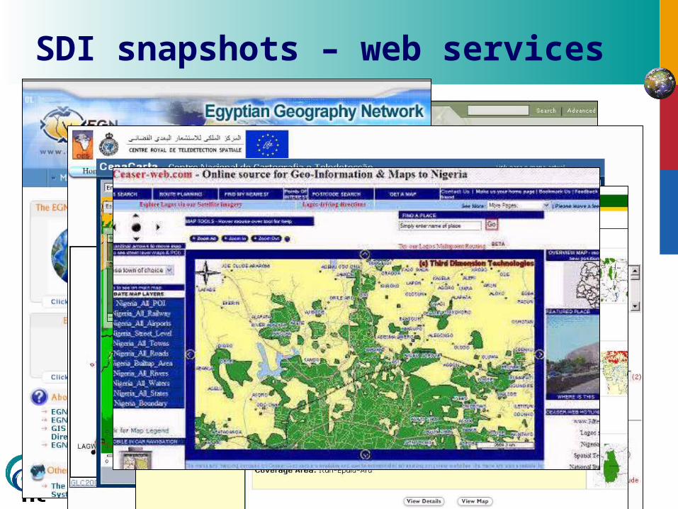
SDI snapshots – web services

Thus far…
Oct. 2006 SDI Conference in Kigali
- Jul. 2007 Several events to promote GI Science at Ministries, NGO’s, Private Companies
Aug. 2007 SDI training with participation from Pres. Office and RITA (Rwanda Information Technology Authority)
Sep. 2007 Set up of GIS Portals at the National University (open access) and in Kigali (restricted access)
Oct. 2007 Start metadata collection at selected ministries
Nov. 2007 Awareness Workshop for Ministries
SDI snapshots – Rwanda (2007)

Somali Water & Land Information Management (SWALIM) using int’l and open standards for metadata and online data access and distribution
Online Data Portal – Search & DownloadOnline Data Access – in development/testing
SDI snapshots – Somalia (2007)

SDI snapshots – assorted 2007 highlights (1)
Kenya: KNSDI in National Development Plan since 2002, but allocated budget by
govt for first time (2007) National standards workshop July 2007 - stakeholders endorsed Kenyan
ISO 19915 metadata profile Uganda:
Donor dialogue on natural res. mgt. (i.e., data mgt issues being raised; possibility of basket fund under Min. Finance)
Tanzania NSDI Steering committee prepared 2nd draft of NSDI policy (March 2007).
3rd draft will go to Parliament (viewed as key step to funding). Ethiopia:
At recent World Information Technology Forum (WIFOR) conference, Minister of Capacity Building chaired entire conference (sign of political commitment)

Niger Drafting of Niger National SDI Plan underway
Libya Libya Spatial Data Information Infrastructure (LSDI) part of a larger initiative to
develop the Libyan NII Geospatial metadata standard & catalog under development
Chad Organization of spatial data at the CNAR (Ministere de l'Enseignement Superieur
et de la Recherche Scientifique) & implementation of a spatial metadatabase for researchers
Botswana Integrated Geographic Information System (IGIS) National SDI Conference, 26-30 November 2007
South Africa Core data set maintenance and Interoperability awareness seminars (2007) – to
receive inputs for the National GIS Strategy Working draft of address standard for urban and rural areas (SANS 1883) – to
enable interoperability in existing address datasets
SDI snapshots – assorted 2007 highlights (2)

SDI snapshots – volunteered content OpenStreetMap (OSM)
a collaborative (wikipedia-like) project to create free vector maps using data from portable GPS devices. OpenStreetMap data are published under a Creative Commons license.
Mapping projects in Algeria, Cameroon, Congo-Kinshasa (DRC) Egypt, Ethiopia, Ghana, Kenya, Morocco, Mozambique, Nigeria, South Africa, Sudan, Tanzania, Uganda
First OSM mapping party in South Africa, Nov. 11.2007, Cape Town - Noordhoek “We will be meeting at 2pm. After a chat about the game plan, we will head
out and mapping. Afterwards we can meet at the Red Herring for pizza.”
Traks4Africa (T4A) Tracks4Africa community touring Africa, doing meticulous record
keeping of their travels using GPS devices
Non-conventional data producers Conservation community in particular

SDI snapshots – indigenous local knowledge / mapping

SDI snapshots – decision support & alerts
CSIR Advanced Fire Information Service With the detection a of a fire, email and SMS text messages
are created and sent to relevant authorities. Personal Digital Assistance Animated Weather System
(PAW) people can access satellite information on severe storms
through their cell phones. PAW provides near real time information on clouds, rainfall, wind and fires.
South Africa’s Meraka Institute has been playing a big role in customizing the product for South and Southern Africa and providing local information.
West-African Market Information Network (RESIMAO) Interactive maps on price levels for regional
commodities/markets.

SDI snapshots – earth observation (1)
Real-time African earth observation infrastructure is emerging (i.e., AlSat-2, NigeriaSat-1 & 2, EgyptSat-1, SumbandilaSAT) African countries launching their own earth observation
satellites, joining the league of ‘sensing’ countries
African satellite engineering teams designing and developing earth observation satellites, setting up ground receiving stations
Furthermore, African countries are working together to employ space technologies e.g., South Africa, Algeria, Nigeria, and Kenya jointly are part of
the African Resource Management (ARM) constellation

SDI snapshots – earth observation (2) The joint approach (potentially) will enable the
coordinated reception of imagery, as well as coordinated product development on a continent-wide basis
Map source: Fortescue and Ntisana, 2005

SDI snapshots – emerging market Private companies are developing road/street databases for African
users (e.g., TRAXmap, LeadDog) Foreign companies entering African market with belief their efforts will
reap adequate return. African-owned companies also tapping into market, in both product
and service development (e.g., MapIT, CEASER-MAP) South Africa-based MapIT signed a license and distribution agreement
with Tele Atlas. MapIT trying to build seamless street-level map of the whole of Africa to support the development of location base service
company already established office in Nigeria, and will eventually open in Ghana and Kenya as well.
Several foreign companies have set up offices in Africa (e.g, MAPS Geosystems, in Conakry and Dakar; ImageAfrica in East Africa; Google, in Kenya)
SuperMap established first distributing agent in Africa (Botswana) company plans to find and appoint a series of distributors/resellers in
Africa

SDI snapshots – external assistance
African Monitoring of Environment for Sustainable Development (AMESD) project EDF-funded, 21 million EURO over 4 years designed to help African countries introduce EO information to
better manage water and land resources. Global Monitoring for Environment and Security
(GMES) extended to Africa “GMES Africa” would be a continuation of AMESD
SERVIR-Africa Platform that integrates satellite and other geospatial data for
scientific research and decision making (NASA/USAID) Designed to enable users to search, browse, download, and
visualize geospatial information (particularly EO)
Among many initiatives…

African Geodetic Reference Frame (AFREF) initiative meant to unify and modernize the geodetic reference frame for Africa and the national and regional reference networks. When fully implemented, will consist of a network of
permanent GNSS/GPS stations whose generated data will be freely available to users anywhere in Africa
SDI snapshots – AFREF and MAFA
UNEDRA: University Network for Disaster Risk Reduction in Africa
Mapping Africa for Africa (MAFA) Fundamental data survey; data availability & metadata;
addressing data gaps
Other regional initiatives:
MadMappers

SDI snapshots – better communication Newsletters
Kenya NSDI Secretariat newsletter SWALIM updates & feature articles (Somalia) AFREF newsletter EIS-Africa newsletter SALB newsletter GLCN newsletter
Email lists - GI SIMaC email list (Somalia) Sudan Inter-agency Mapping list SDI-EA List (East Africa) (and blog) TZGISUG list (Tanzania); Botswana GIS Yahoo-group CGIS-NUR list (Rwanda) University Network for Disaster Risk Reduction in Africa (UNEDRA) SCGIS-Kenya (conservation GIS) ASIGEO (Senegal)
Etc.
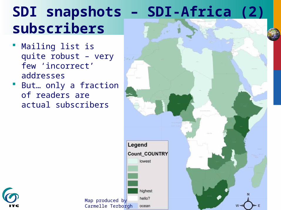
SDI snapshots – SDI-Africa (2) subscribers Mailing list is quite
robust – very few ‘incorrect’ addresses
But… only a fraction of readers are actual subscribers
Map produced by Carmelle Terborgh

SDI snapshots – SDI-Africa (3) no. page views/month
0
5,000
10,000
15,000
20,000
25,000
30,000
35,000
40,000
45,000
Dec-06 Jan-07 Feb-07 Mar-07 Apr-07 May-07 Jun-07 Jul-07 Aug-07 Sep-07 Oct-07

SDI snapshots – SDI-Africa (4) no. contributors/month
0
5
10
15
20
25
30
Sep-06 Oct-06 Nov-06 Dec-06 Jan-07 Feb-07 Mar-07 Apr-07 May-07 Jun-07 Jul-07 Aug-07 Sep-07 Oct-07 Nov-07

Are we headed in right direction?
Photo source: yahoo.com
How does all this activity add up?

Outline
SDI snapshots various highlights of SDI capacity/progress in Africa
SDI performance measurement a more formal approach to evaluating SDI capacity
Treating ‘geospatial’ as a sector Sector-wide indicators to assess/compare SDI capacity in Africa
Final thoughts

Evaluation status quo (1)
African governments (and govts worldwide) making use of geospatial technologies and in the process of developing and delivering an array of geospatial services.
Despite this ubiquitous investment in geospatial infrastructure, few government ministries or agencies evaluate public effort in this area. striking in light of public sector reforms that call for a greater emphasis
on efficiency and accountability.
The same goes for donors/development partners, who seldom are evaluating the outcomes of geospatial investment.

For example, the AFRICOVER project of the Food and Agricultural Organization (FAO) provided a bounty of geographic information for twelve countries in eastern and central Africa...
So? Could make for an excellent case study…
Evaluation status quo (2)
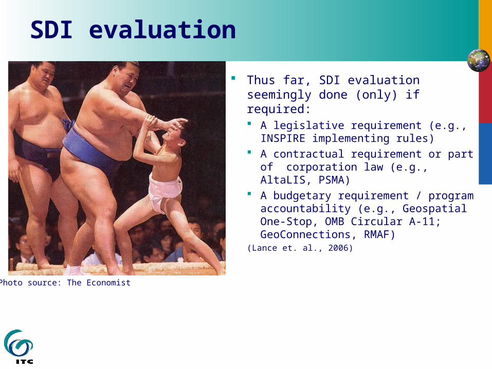
SDI evaluation
Thus far, SDI evaluation seemingly done (only) if required: A legislative requirement (e.g.,
INSPIRE implementing rules) A contractual requirement or part of
corporation law (e.g., AltaLIS, PSMA) A budgetary requirement / program
accountability (e.g., Geospatial One-Stop, OMB Circular A-11; GeoConnections, RMAF)
(Lance et. al., 2006)
Photo source: The Economist

Appropriate indicators / methods needed (new area for capacity building)

Vertical nature of evaluation
SDI activity
Ministry Ministry HealthHealth
Ministry Ministry Edu-Edu-cationcation
Ministry Ministry WaterWater
Ministry Ministry Agri-Agri-cultureculture
Ministry Ministry Transpor-Transpor-tationtation
$$$$ $$$$ $$$$ $$$$ $$$$
SDI activity
SDI activity
SDI activity
SDI activity
Graphic source: adapted from Doug Nebert

Utopia: horizontal evaluation
Ministry Ministry HealthHealth
Ministry Ministry Edu-Edu-cationcation
Ministry Ministry WaterWater
Ministry Ministry Agri-Agri-cultureculture
Ministry Ministry Transpor-Transpor-tationtation
Shared Data& Services
$$$$$$$$
$$$$ Deliver public service delivery to citizensDeliver public service delivery to citizens
Manage natural resourcesManage natural resources
Strengthen national securityStrengthen national security
$$$$ Design and monitor poverty reduction programsDesign and monitor poverty reduction programs
SDI activity
SDI activity
SDI activity
SDI activity
SDI activity
Graphic source: adapted from Doug Nebert
(in a vertical environment)
So… how to get horizontal evaluation?

Also, performance measurement only tells so much...
Source: Gilbert Garcin (artist)
Perf. meas. limited when it comes to non-quantitative (intangible) outcomes

And use of GI poorly understood
Rational decision-making is not the norm… ‘garbage can’ is norm

Ultimately…
Evaluation, an indication of an SDI initiative’s maturity i.e., SDI ‘taken seriously’ when results are expected or when
there are potential consequences for weak performance i.e., evaluation, part of legitimacy
Evaluation enables us to understand of the value/contribution of geospatial technologies
i.e., evaluation, part of value management

Outline
SDI snapshots various highlights of SDI capacity/progress in Africa
SDI performance measurement a more formal approach to evaluating SDI capacity
Treating ‘geospatial’ as a sector Sector-wide indicators to assess/compare SDI capacity in Africa
Final thoughts
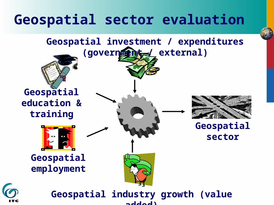
Geospatial sector evaluation
Geospatial industry growth (value added)
Geospatial investment / expenditures (government / external)
Geospatial employment
Geospatial sector
Geospatial education & training

Geospatial sector indicators can …
Facilitate identification of market trends, market opportunities, and enable service analysis
Enable cross-country comparisons: e.g. “geospatial opportunity index” or “SDI implementation deficit”
Inform policy makers Serve as starting point for research on SDI development

Geospatial employment
Source: Mondello et. al., 2004. 10-year industry forecast. ASPRS.
employment & labor/skill shortage statistics
Geospatial employment
However, more consistency needed in position/job classification or titles
E.g., Cartographer Geodetic Surveyor, Hydrographic Surveyor, Land Surveyor GIS Specialist, GIS Analyst, GIS Coordinator, GIS Researcher, etc. Photo interpreter Photogrammetrist Remote Sensing Specialist Etc.
Professionals working with geospatial technologies & services may currently be pegged as part of the Architecture-Planning-Engineering discipline or Information Technology (ICT) discipline
How to deal with the issue of ‘moonlighting’ (government employees who are also private sector employees)… to what extent will this inflate the numbers?)

Country 1997 1998 1999 2000 2001 2002 2003 2004 2005 2006 Total Benin 3 5 6 6 2 6 2 8 3 8 49 Burkina Faso 3 2 2 4 2 4 6 6 29 Cameroon 4 3 7 12 17 2 21 1 1 68 Ghana 3 4 2 1 3 1 5 3 4 26 Mali 1 4 3 2 1 1 1 13 Niger 1 1 2 4 Nigeria 32 27 20 14 10 25 10 19 9 15 181 Senegal 2 1 3 3 11 2 7 10 39 Year total 45 45 43 37 15 69 20 66 22 47 409
Students trained at RECTAS in past 10 years, at technician, technologist and post-graduate diploma levels (combined).
Distribution of colleagues who have benefited from ITC training
App Dev
Image Processing
Data Conversion
and MonitoringData Analysis
Dbase
0
50
100
150
200
250
Nigerian data infrastructure user skill requirements
Geospatial education/training

Geospatial industry growth
Definition of ‘geospatial industry’ is an issue National industry classifications for mapping/geospatial are not
well defined (and no international definition exists) One definition states: (Geospatial Industry Workforce Information System, 2007)
“The geospatial industry acquires, integrates, manages, analyzes, maps, distributes, and uses geographic, temporal, and spatial information and knowledge. The industry includes basic and applied research, technology development, education, and applications to address the plannng, decision-making, and operational needs of people and organizations of all types”
This definition much broader than surveying and mapping Comprehensive statistics on geospatial industry difficult to
produce as many relevant companies may be considered part of the mining, agriculture, consulting, and computer industries.

Census Survey of the Geomatics Industry (Statistics Canada, 2004)
Geomatics Industry
No. establishments 2,215
No. employees 27,300
Revenue $2.8 billion
Exports $497 million
Value Added $2.4 billion
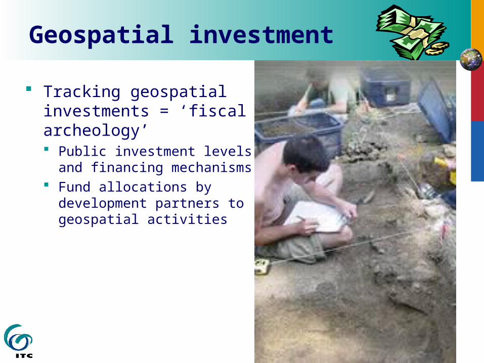
Geospatial investment
Tracking geospatial investments = ‘fiscal archeology’ Public investment levels and
financing mechanisms Fund allocations by
development partners to geospatial activities

Tracking investments: (example Egypt)
Ministry / Agency Project Project Amount Funding Implementation Period
Egyptian Environmental Affairs Agency (EEAA)
Egyptian Environmental Information System
CIDA Contribution: $12,783,000 EEAA Contribution: $1,800,000 CDN in Egyptian L.E.
Government of Egypt and Canadian International Development Agency (CIDA)
1997 to 2004
General Organization for Physical Planning (GOPP), part of the Ministry of Housing, Utilities and Urban Communities (MHUUC)
Support to GOPP in Planning and Geographic Information Systems
SIDA, Government of Sweden
Began in January 2005
General Organization for Physical Planning (GOPP)
Development of Regional Physical Planning Centers by the Establishment of a Network for a Geographical Information System
US $ 1,165,019 UNDP 1999-2004
Egyptian Survey Authority (ESA)
Training Programme for the Development of Managers and Supervisors for the National Cadastre
€ 1.256.053 Royal Netherlands Embassy
2001-2004
Egyptian Survey Authority (ESA)
Egyptian Cadastral Information Project (ECIM)
€7 million Finnish government 2002 -
Ministry of Health and Population, National Population Council
Demographic and Health Survey
USAID

Tracking investments: aid management / harmonization

Methodology (concerns/impediments)
How? Employment surveys? Central business registry? Geospatial establishment/enterprise census (e.g., Statistics Canada Census Survey of the Geomatics Industry)?
Geospatial expenditure tracking (e.g. South Africa’s survey instrument to assemble information on government science and technology expenditures; World Bank land mgt public expenditure reviews)?
BUT… Geospatial not a ‘traditional’ sector in budget or aid terms Geospatial not clearly identified within ICT or programmatic activities For sustainability and continuity (time series), data collection cannot be
based on a one-time survey Also, for international comparability, a common approach needed.
Is geospatial sector evaluation fanciful, exceeding feasibility?
Source: Gilbert Garcin (artist)


Survey of African remote sensing market (2008-2018)
Supported by USGS (time frame: Nov. 1, 2007 to Oct. 31, 2008) follow on to the NOAA-supported North America, Europe, and Asian
surveys (aerial and space borne) already conducted resulting report will analyze technical advances impacting RS over the
next 10 years; political, economic, environmental issues impacting RS; data/application usage projections; and sensor development projections.
Goal of the study is to: Further understand African remote sensing community needs Raise awareness of African remote sensing needs Positively impact data supply levels for African remote sensing users
Methods an on-line survey instrument and personal interview focusing on academic, government, and commercial end users, data to
be collected from eight sectors Contact: Sherry Loy, [email protected]
NOAA 2005-2015 Remote Sensing Industry Research
© Global Marketing Insights, Inc.
47

Survey of SA & SADC space arena
South Africa National Working Group on Space Science & Technology currently conducting an audit of the South African Space Arena a snapshot of the space arena part of a wider process to optimize the use of space science and
technology for sustainable development. Survey of the SADC space arena
meant to support the recommendations of the development of an African Institute of Space Science; DST contracted the Working Group to conduct the audit.
These surveys both are in the write-up stage. Summary docs will be made available on the SA space portal in due course.

INTERNATIONAL INSTITUTE FOR GEO-INFORMATION SCIENCE AND EARTH OBSERVATION
SDI Capacity in Africa
… we’re ‘there’ when evaluation of SDI capacity is institutionalized
and ‘geospatial’ is treated as a
sector…

Conclusion Continued communication about existing activities and capacities
(e.g., SDI-Africa) SDI performance & impact assessment, with focus on both direct
and indirect impact of geospatial technologies on economic growth and social development. In this context, more involvement of academic institutions is
recommended. Online global database of SDI evaluation practice, lessons learned Geospatial sector data collection should not be based on a one-time
survey, but be fully integrated into the country's national statistical system
Who/how? GI projects/agencies held more accountable International bodies support/initiate process of geospatial sector data
collection.

Conclusion - SDI professionals, new capacities needed
a capacity to: communicate across sectors, institutions and different interest groups; motivate (coax) people into action; lobby for political support; mobilize human and financial resources; prepare proposals and negotiate for projects; manage programs: diagnose problems, assess needs, set objectives, budget, monitor and evaluate, and report manage for results
These capacities are different from those that conventional GI professionals have. Do our training programs address this? Do our hiring practices address this?

Data Sharing Agreements
with all Counties
1995 1996 1997 1998
Exploratory Forums
Strategic Planning Retreat
Mission Statement/StrategicInitiatives Adopted
Guiding Principles Endorsedby Key Stakeholders
Newsletter/Web Site
Street CenterlineCustodial
Agreement
First Policy Board Meeting
13 Priority Business Info Needs Endorsed
Business Plan Started
Data Finder Operational
1999
Fair-Share FinancialModel & Benefits
Studies Completed
Public Benefit Found
Full FunctionalityPursued
2000
Custodial Agreements Two Priority
Information Needs
Board Endorsed
Business Plan
Policy for Private Access to
Regional Parcel Dataset
2001-02
Metro Council Sponsorship to
2003
Final note (1): MetroGIS Milestones (Minneapolis/St. Paul, Minnesota)
•Data Distribution Mech.•Regional Data Solutions•Performance Measures•“Umbrella” Agreements•Nat’l GeoData Alliance•Participant Satisfaction
Source: Randall Johnson, MetroGIS, 2001
Custodial Agreements Two Priority
Information Needs

Final note (2): enjoy the ride!