International coordination for continuity and ... · International coordination for continuity and...
23
2015/11/20 WIGOS Space 2040 Workshop Geneva, Switzerland, 18-20 Nov. 2015 1 International coordination for continuity and interoperability: a CGMS perspective Peng Zhang, CGMS WG-III Co-Chair NSMC/CMA In Cooperation with Suzanne Hilding, CGMS WG-III Co-Chair OPPA/NESDIS/NOAA
Transcript of International coordination for continuity and ... · International coordination for continuity and...
2015/11/20 WIGOS Space 2040 Workshop Geneva, Switzerland, 18-20 Nov. 2015 1
International coordination for continuity and interoperability: a CGMS perspective
Peng Zhang, CGMS WG-III Co-Chair NSMC/CMA
In Cooperation with
Suzanne Hilding, CGMS WG-III Co-Chair OPPA/NESDIS/NOAA
2015/11/20 WIGOS Space 2040 Workshop Geneva, Switzerland, 18-20 Nov. 2015 2
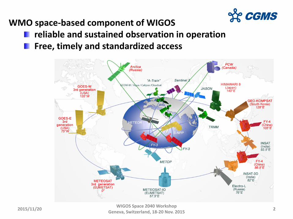
WMO space-based component of WIGOS reliable and sustained observation in operation Free, timely and standardized access
2015/11/20 WIGOS Space 2040 Workshop Geneva, Switzerland, 18-20 Nov. 2015 3
Outline
CGMS, especially WG III
Continuity
Interoperability
Challenges

2015/11/20 WIGOS Space 2040 Workshop Geneva, Switzerland, 18-20 Nov. 2015 4
1. CGMS and WG III • Coordination Group for Meteorological Satellites • Established in 1972, 16 members and 6 observers currently • Operational or R&D satellite operators contributing to WMO and WMO-
supported programmes (e.g. WWW, GAW, GCOS, JCOMM..) • WMO and IOC representing global user communities
2015/11/20 WIGOS Space 2040 Workshop Geneva, Switzerland, 18-20 Nov. 2015 5
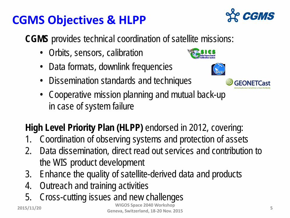
CGMS provides technical coordination of satellite missions: • Orbits, sensors, calibration • Data formats, downlink frequencies • Dissemination standards and techniques • Cooperative mission planning and mutual back-up
in case of system failure High Level Priority Plan (HLPP) endorsed in 2012, covering: 1. Coordination of observing systems and protection of assets 2. Data dissemination, direct read out services and contribution to
the WIS product development 3. Enhance the quality of satellite-derived data and products 4. Outreach and training activities 5. Cross-cutting issues and new challenges
CGMS Objectives & HLPP

2015/11/20 WIGOS Space 2040 Workshop Geneva, Switzerland, 18-20 Nov. 2015 6
CGMS Working Groups
• Working Group I: Global issues on satellite systems and telecommunication coordination
• Working Group II: Satellite data and products • Working Group III: Operational continuity and
contingency planning • Working Group IV: Global data dissemination
WG III monitors the risk of discontinuity in key data services for weather forecasting and climate monitoring, and deals with contingency action planning to mitigate such risks: global satellite planning supplemented by bilateral agreements based on the “help your neighbour” concept.
2015/11/20 WIGOS Space 2040 Workshop Geneva, Switzerland, 18-20 Nov. 2015 7
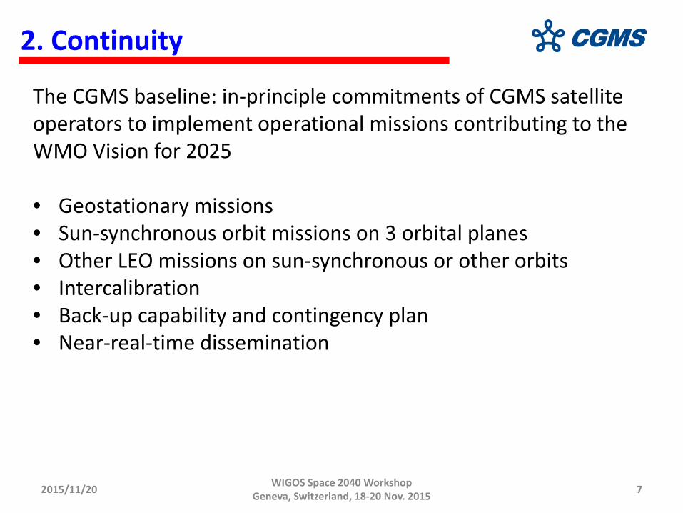
2. Continuity
The CGMS baseline: in-principle commitments of CGMS satellite operators to implement operational missions contributing to the WMO Vision for 2025 • Geostationary missions • Sun-synchronous orbit missions on 3 orbital planes • Other LEO missions on sun-synchronous or other orbits • Intercalibration • Back-up capability and contingency plan • Near-real-time dissemination
2015/11/20 WIGOS Space 2040 Workshop Geneva, Switzerland, 18-20 Nov. 2015 8
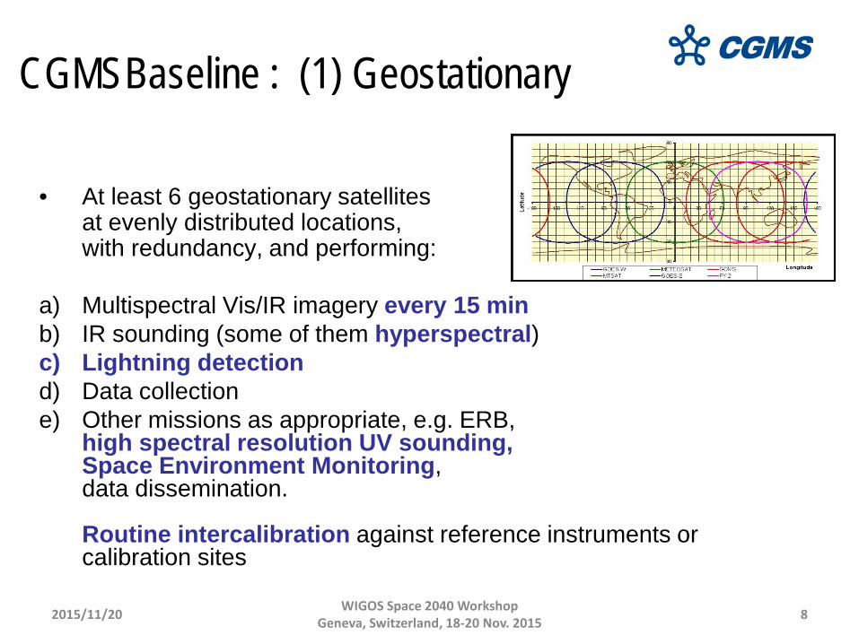
CGMSBaseline : (1) Geostationary
• At least 6 geostationary satellites at evenly distributed locations, with redundancy, and performing:
a) Multispectral Vis/IR imagery every 15 min b) IR sounding (some of them hyperspectral) c) Lightning detection d) Data collection e) Other missions as appropriate, e.g. ERB,
high spectral resolution UV sounding, Space Environment Monitoring, data dissemination. Routine intercalibration against reference instruments or calibration sites
2015/11/20 WIGOS Space 2040 Workshop Geneva, Switzerland, 18-20 Nov. 2015 9
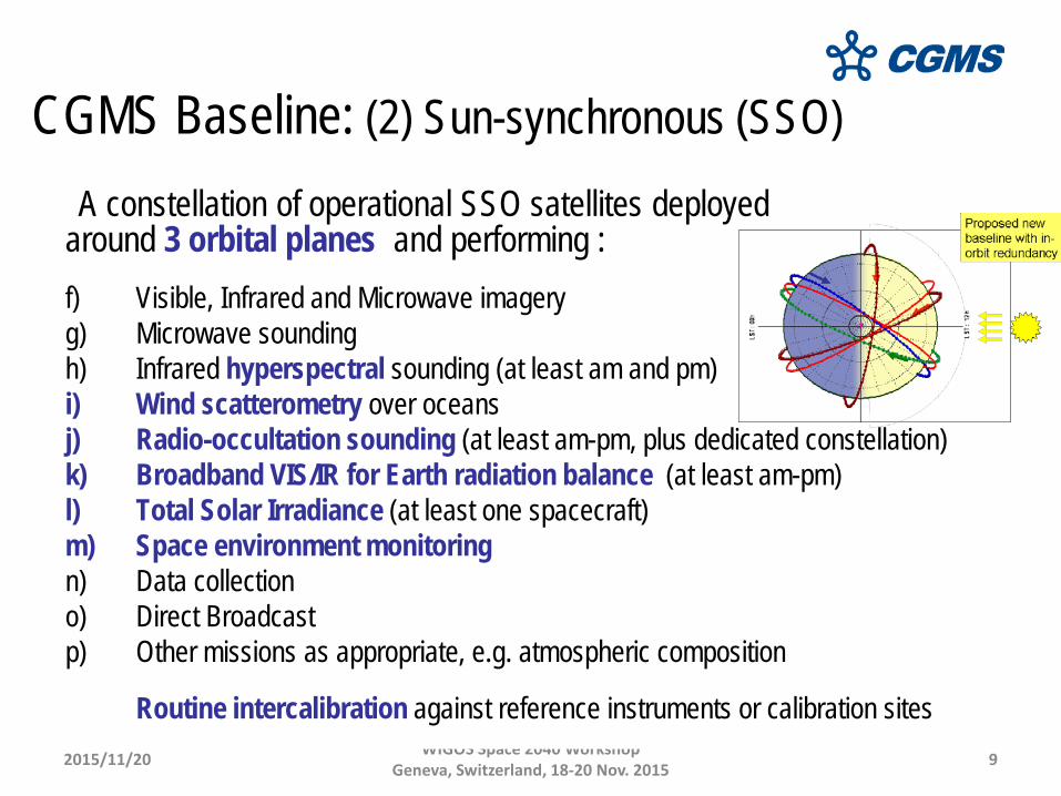
CGMS Baseline: (2) Sun-synchronous (SSO)
A constellation of operational SSO satellites deployed around 3 orbital planes and performing :
f) Visible, Infrared and Microwave imagery g) Microwave sounding h) Infrared hyperspectral sounding (at least am and pm) i) Wind scatterometry over oceans j) Radio-occultation sounding (at least am-pm, plus dedicated constellation) k) Broadband VIS/IR for Earth radiation balance (at least am-pm) l) Total Solar Irradiance (at least one spacecraft) m) Space environment monitoring n) Data collection o) Direct Broadcast p) Other missions as appropriate, e.g. atmospheric composition
Routine intercalibration against reference instruments or calibration sites
2015/11/20 WIGOS Space 2040 Workshop Geneva, Switzerland, 18-20 Nov. 2015 10
CGMS Baseline : (3) Other LEO missions
The following missions shall be performed “on an operational basis” by Low Earth Orbit satellites on “appropriate orbits”:
r) Ocean surface topography reference mission (high-precision, inclined orbit, in
addition to the 2 altimeters on SSO) s) Radio-Occultation sounding (constellation of sensors on appropriate orbits) t) Narrow-band VIS/NIR imagers (at least one SSO am spacecraft) for ocean
colour, vegetation, aerosol monitoring u) High-resolution multi-spectral VIS/IR imagers (constellation of SSO satellites,
preferably in am) for land surface imaging v) Infrared imagery for reference high-accuracy SST (one am spacecraft)
• All passive instruments should be inter-calibrated on a routine basis against
reference instruments or calibration sites.

2015/11/20 WIGOS Space 2040 Workshop Geneva, Switzerland, 18-20 Nov. 2015 11
Continuity requirements and implications on architecture
• Baseline should define for each mission : nominal coverage (spatial/temporal sampling ) back-up provisions if relevant (contingency planning)
• First thing is to secure long-term funding and nominal planning • Contingency planning approach
Risk analysis: for each mission, impact of degraded or no data? – Criteria for contingency situation ? – Mitigation strategy ? – Cooperative decision framework for mutual support ?
2015/11/20 WIGOS Space 2040 Workshop Geneva, Switzerland, 18-20 Nov. 2015 12
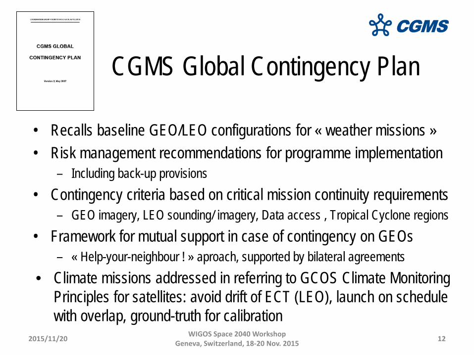
CGMS Global Contingency Plan
• Recalls baseline GEO/LEO configurations for « weather missions » • Risk management recommendations for programme implementation
– Including back-up provisions • Contingency criteria based on critical mission continuity requirements
– GEO imagery, LEO sounding/ imagery, Data access , Tropical Cyclone regions • Framework for mutual support in case of contingency on GEOs
– « Help-your-neighbour ! » aproach, supported by bilateral agreements • Climate missions addressed in referring to GCOS Climate Monitoring
Principles for satellites: avoid drift of ECT (LEO), launch on schedule with overlap, ground-truth for calibration
2015/11/20 WIGOS Space 2040 Workshop Geneva, Switzerland, 18-20 Nov. 2015 13
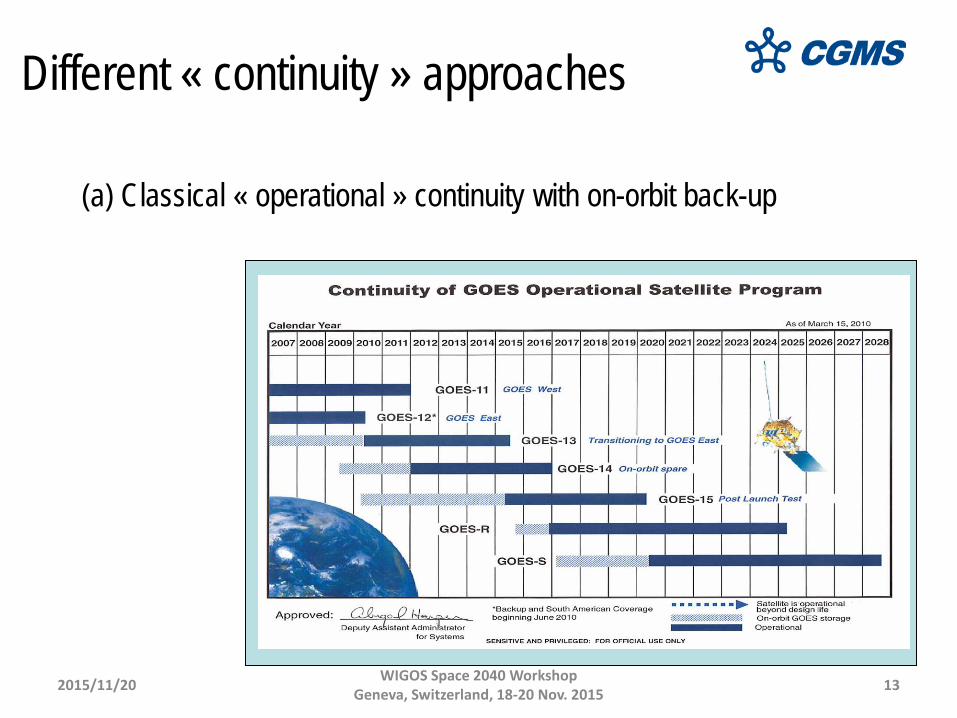
Different « continuity » approaches
(a) Classical « operational » continuity with on-orbit back-up
2015/11/20 WIGOS Space 2040 Workshop Geneva, Switzerland, 18-20 Nov. 2015 14
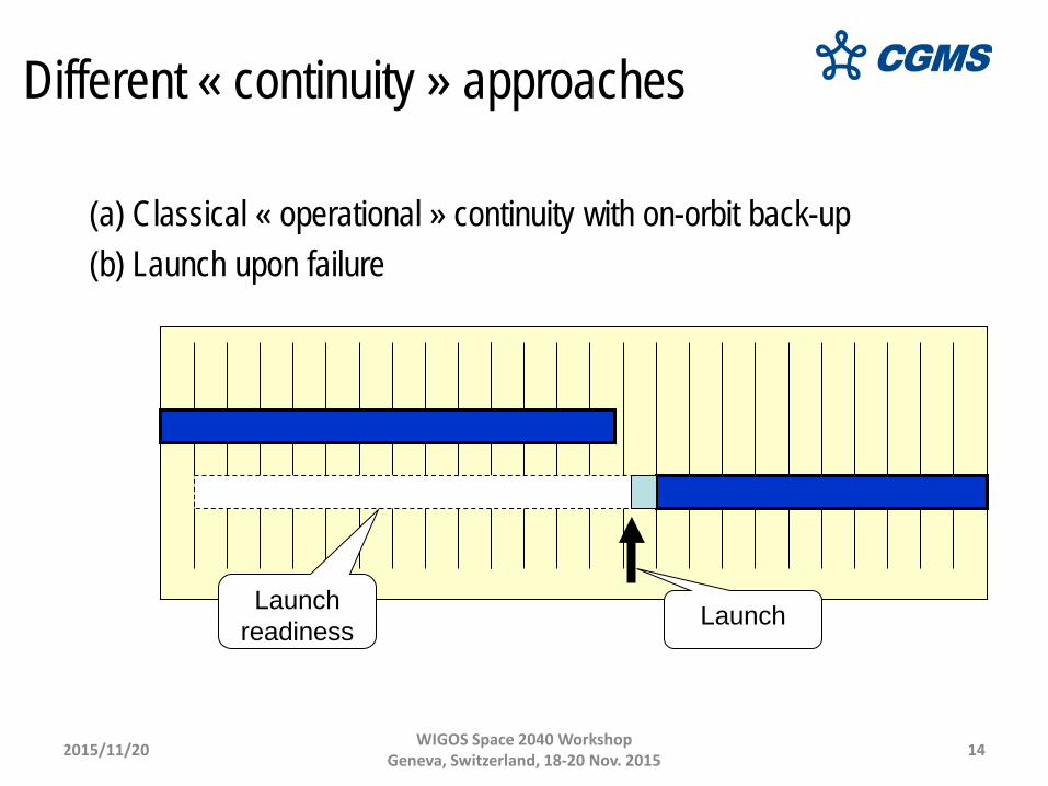
Different « continuity » approaches
(a) Classical « operational » continuity with on-orbit back-up (b) Launch upon failure
Launch readiness Launch

2015/11/20 WIGOS Space 2040 Workshop Geneva, Switzerland, 18-20 Nov. 2015 15
(a) Classical « operational » continuity with on-orbit back-up (b) Launch upon failure (c) Overlap for cross-calibration and product validation
Different « continuity » approaches

2015/11/20 WIGOS Space 2040 Workshop Geneva, Switzerland, 18-20 Nov. 2015 16
(a) Classical « operational » continuity with on-orbit back-up (b) Launch upon failure (c) Overlap for cross-calibration and product validation (d) Consecutive missions with reference for consistent calibration
Reference Reference
Different « continuity » approaches
2015/11/20 WIGOS Space 2040 Workshop Geneva, Switzerland, 18-20 Nov. 2015 17
Different « continuity » approaches
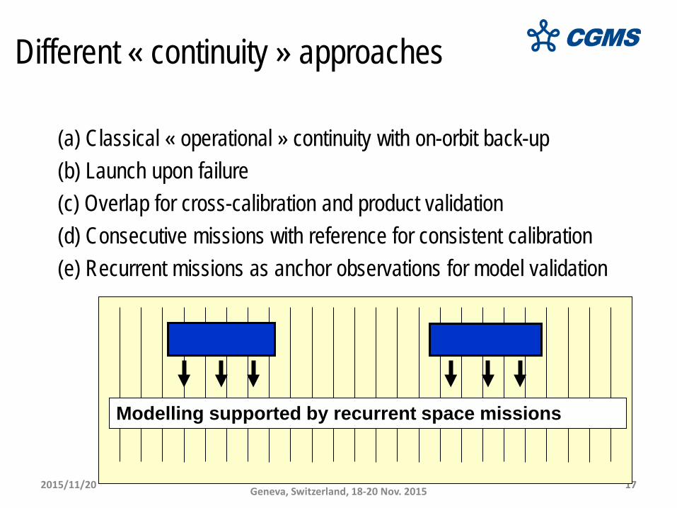
(a) Classical « operational » continuity with on-orbit back-up (b) Launch upon failure (c) Overlap for cross-calibration and product validation (d) Consecutive missions with reference for consistent calibration (e) Recurrent missions as anchor observations for model validation
Modelling supported by recurrent space missions
2015/11/20 WIGOS Space 2040 Workshop Geneva, Switzerland, 18-20 Nov. 2015 18
3. Interoperability
Interoperability is a key requirement which entails
comparable observations
standardized metadata
Interoperability should cover all the components for EO
2015/11/20 WIGOS Space 2040 Workshop Geneva, Switzerland, 18-20 Nov. 2015 19
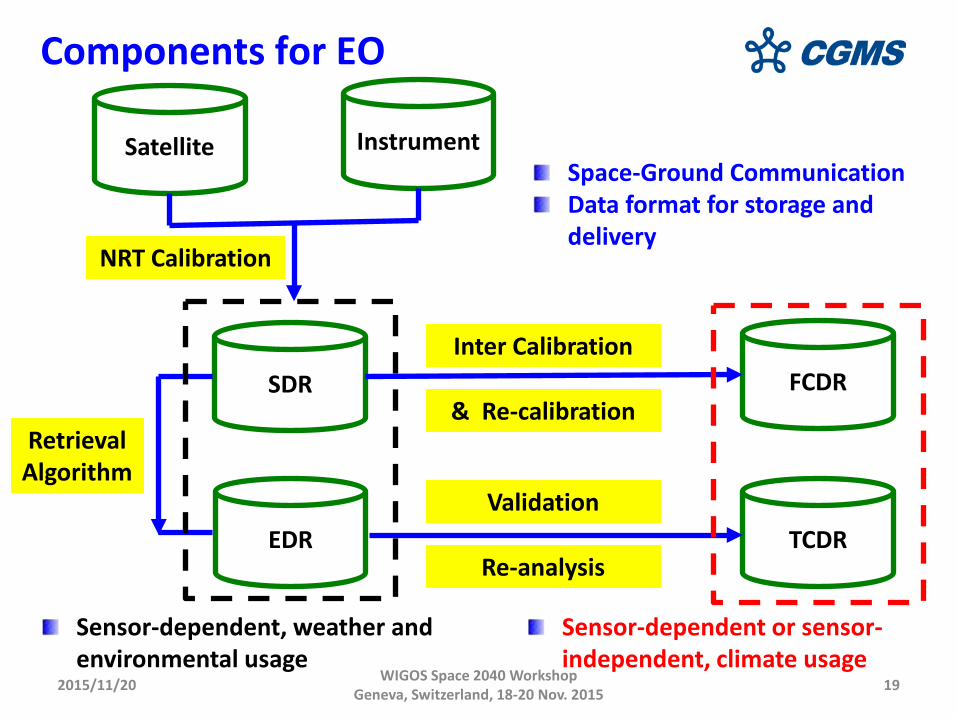
Components for EO
Satellite Instrument
SDR
EDR
FCDR
TCDR
Sensor-dependent, weather and environmental usage
Sensor-dependent or sensor-independent, climate usage
Retrieval Algorithm
NRT Calibration
Inter Calibration
& Re-calibration
Validation
Re-analysis
Space-Ground Communication Data format for storage and delivery
2015/11/20 WIGOS Space 2040 Workshop Geneva, Switzerland, 18-20 Nov. 2015 20
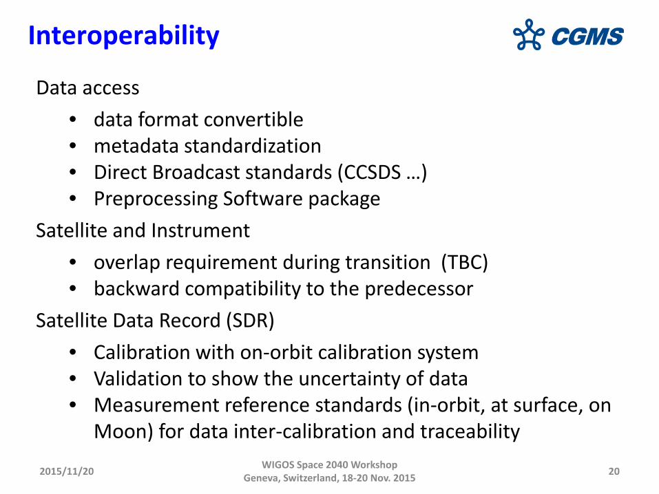
Data access • data format convertible • metadata standardization • Direct Broadcast standards (CCSDS …) • Preprocessing Software package
Satellite and Instrument • overlap requirement during transition (TBC) • backward compatibility to the predecessor
Satellite Data Record (SDR) • Calibration with on-orbit calibration system • Validation to show the uncertainty of data • Measurement reference standards (in-orbit, at surface, on
Moon) for data inter-calibration and traceability
Interoperability
2015/11/20 WIGOS Space 2040 Workshop Geneva, Switzerland, 18-20 Nov. 2015 21
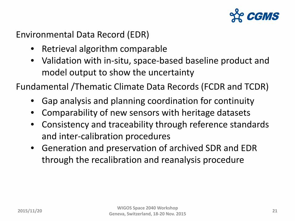
Environmental Data Record (EDR) • Retrieval algorithm comparable • Validation with in-situ, space-based baseline product and
model output to show the uncertainty Fundamental /Thematic Climate Data Records (FCDR and TCDR)
• Gap analysis and planning coordination for continuity • Comparability of new sensors with heritage datasets • Consistency and traceability through reference standards
and inter-calibration procedures • Generation and preservation of archived SDR and EDR
through the recalibration and reanalysis procedure
2015/11/20 WIGOS Space 2040 Workshop Geneva, Switzerland, 18-20 Nov. 2015 22
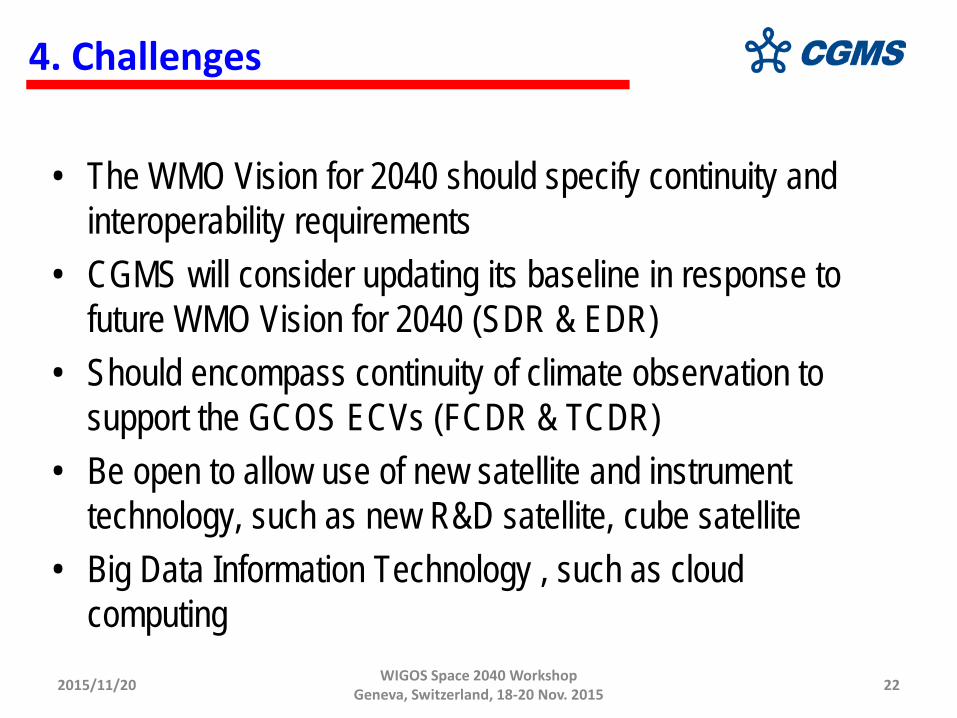
4. Challenges
• The WMO Vision for 2040 should specify continuity and interoperability requirements
• CGMS will consider updating its baseline in response to future WMO Vision for 2040 (SDR & EDR)
• Should encompass continuity of climate observation to support the GCOS ECVs (FCDR & TCDR)
• Be open to allow use of new satellite and instrument technology, such as new R&D satellite, cube satellite
• Big Data Information Technology , such as cloud computing
2015/11/20 WIGOS Space 2040 Workshop Geneva, Switzerland, 18-20 Nov. 2015 23
Special thanks to Dr. Jerome Lafeuille for His excellent work as rapporteur of CGMS WG-III ; Support and discussions for this slides