INTEGRATED HERITAGE IMPACT ASSESSMENT IN … Re Capital 10 Solar/FEIR/D3... · Postmasburg with...
14
SAHRA Case Id: 6299 INTEGRATED HERITAGE IMPACT ASSESSMENT IN TERMS OF SECTION 38(8) OF THE NATIONAL HERITAGE RESOURCES ACT, 1999 (ACT 25 OF 1999) PROPOSED DEVELOPMENT OF POSTMASBURG SOLAR PV ENERGY FACILITY 2 AND ASSOCIATED GRID CONNECTIONS ON A PORTION OF THE FARM KAPSTEWEL 436/ REMAINDER, ZF MCGAWU DISTRICT, TSANTSABANE LOCAL MUNICIPALITY, NORTHERN CAPE On behalf of: Postmasburg Solar PV Energy Facility 2 (Pty) Ltd November 2014 STÉFAN DE KOCK PERCEPTION Planning PO Box 9995 GEORGE 6530 Tel: 082 568 4719 Fax: 086 510 8357 E-mail: [email protected] www.perceptionplanning.co.za COPYRIGHT RESERVED
Transcript of INTEGRATED HERITAGE IMPACT ASSESSMENT IN … Re Capital 10 Solar/FEIR/D3... · Postmasburg with...
SAHRA Case Id: 6299
INTEGRATED HERITAGE IMPACT ASSESSMENT IN TERMS OF SECTION 38(8)
OF THE NATIONAL HERITAGE RESOURCES ACT, 1999 (ACT 25 OF 1999)
PROPOSED DEVELOPMENT OF POSTMASBURG SOLAR PV ENERGY FACILITY 2
AND ASSOCIATED GRID CONNECTIONS ON A PORTION OF THE FARM
KAPSTEWEL 436/ REMAINDER, ZF MCGAWU DISTRICT, TSANTSABANE LOCAL
MUNICIPALITY, NORTHERN CAPE
On behalf of: Postmasburg Solar PV Energy Facility 2 (Pty) Ltd
November 2014
STÉFAN DE KOCK PERCEPTION Planning PO Box 9995 GEORGE 6530 Tel: 082 568 4719 Fax: 086 510 8357 E-mail: [email protected] www.perceptionplanning.co.za
COPYRIGHT RESERVED

INTEGRATED HIA POSTMASBURG SOLAR PV ENERGY FACILITY 2
PERCEPTION Planning COPYRIGHT RESERVED
2
CONTENTS:
1. INTRODUCTION 2. INDEPENDENCE OF ASSESSOR 3. METHODOLOGY 4. DESCRIPTION OF STUDY AREA 5. PROPOSED DEVELOPMENT
5.1 Description of activity 5.2 Development alternatives
6. PLANNING CONTEXT 7. HISTORICAL BACKGROUND
7.1 Basic Pre-colonial perspectives (LSA) 7.2 Colonial perspectives
8. HERITAGE RESOURCES & ISSUES 8.1 Landscape Character 8.1.1 Cultural landscape context 8.2 Archaeology 8.3 Palaeontology 8.4 Eco-tourism
9. HERITAGE INFORMANTS/ INDICATORS & ASSESSMENT OF IMPACTS 9.1 Cultural landscape issues 9.2 Archaeology 9.3 Palaeontology
10. PUBLIC PARTICIPATION 11. LIMITATIONS AND ASSUMPTIONS 12. RECOMMENDATIONS
ANNEXURES:
1. Power of Attorney 2. Archaeological Impact Assessment 3. Palaeontological Impact Assessment
FIGURES: 1. Locality plan 2. Current aerial image 3. Uniform / Conceptual Layout (Excluded) 4. Preliminary Layout (Discarded) 5. Preferred / Mitigated Layout 6. Extract early mapping 7. Archaeological occurrences REFERENCES and ACKNOWLEDGEMENTS:
1. Cape Town Archives 2. Chief Directorate: Surveys & Mapping 3. Surveyor General Office ABBREVIATIONS: 1. CDSM – Chief Directorate Surveys & Mapping

INTEGRATED HIA POSTMASBURG SOLAR PV ENERGY FACILITY 2
PERCEPTION Planning COPYRIGHT RESERVED
3
2. DEA – National Department of Environmental Affairs 3. HIA – Integrated Heritage Impact Assessment 4. NHRA - National Heritage Resources Act, 1999 (Act 25 of 1999) 5. PHRA – Provincial Heritage Resources Agency 6. PHS – Provincial Heritage Site
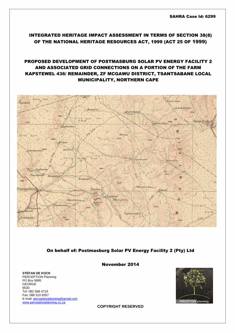
COVER: Compilation of early (1906-1914) mapping for the Postmasburg area (Source: Reconnaissance Series No 16, CDSM)

INTEGRATED HIA POSTMASBURG SOLAR PV ENERGY FACILITY 2
PERCEPTION Planning COPYRIGHT RESERVED
4
1. INTRODUCTION
PERCEPTION Planning was appointed by Postmasburg Solar PV Energy Facility 2 (Pty) Ltd to compile and submit to the South African Heritage Resource Agency (SAHRA) and Ngwao Boswa Kapa Bokoni an Integrated Heritage Impact Assessment (HIA) in terms of Section 38(8) of the National Heritage Resources Act, 1999 (Act 25 of 1999) with relation to proposed development of the property listed below (hereafter referred to as, “the site”). Sanction for submission of this HIA was provided by Mr. Craig Stanley (on behalf of registered owner), and is attached as part of Annexure 1. The cadastral land units subject to this application are as follows:
Kapstewel 436/ Remainder, Tsantsabane Local Municipality, ZF Mcgawu District, Northern Cape, measuring 1,070.2746 ha, registered to Schalk Victor and held under T3852/1999.
This report serves as an Integrated Heritage Impact Assessment (HIA) and includes inputs from the following specialist reports sanctioned as part of the HIA:
Basic archival background research (Perception Planning, S. de Kock);
Archaeological Impact Assessment (ACO Associates);
Desktop Palaeontological Impact Assessment (Natura Viva, Dr. J. Almond).
2. INDEPENDENCE OF ASSESSOR
With relation to the author’s appointment to compile an Integrated Heritage Impact Assessment in terms of Section 38(8) of the National Heritage Resources Act, 1999 (Act 25 of 1999), it is hereby declared:
This consultancy (including the author) is not a subsidiary, legally or financially, of the proponents;
Remuneration for professional services by the proponent in relation to this proposal is not linked to approval by any decision-making authority responsible for permitting this proposal;
Nor this consultancy, nor the author has any interests in secondary or downstream activities as a result of the authorisation of this project.
It is further hereby certified that the author has 17 years professional experience as urban planner (3 years of which were abroad) and 8 years professional experience as heritage practitioner. The author holds the following qualifications:
Urban and Regional Planning (B-Tech, CPUT, 1997)
Environmental Impact Assessment Management – Heritage, Environmental (Diploma, Dublin University, 2002)
Architectural & Urban Conservation (CDP, UCT, 2007)
Urban Design (CPD, UCT, 2009)
The author is professionally registered as follows:
Professional Heritage Practitioner (Association for Professional Heritage Practitioners)
Professional Planner (South African Council for Planners) 3. METHODOLOGY
As part of the compilation of this Integrated HIA report the site and its environs was studied, visited, photographed and assessed, which more specifically involved the following (for broad overview of HIA process refer to explanatory flow diagram below):
Field work carried out by Dr. Lita Webley and David Halkett on 19th October 2014;
Liaising with project manager, environmental consultant and various specialist consultants;
Assimilating findings and recommendations emanating from specialist inputs into HIA;
Identification of heritage-related issues and concerns;
Analysis of development site and its environs;
Identification of contextual spatial informants;
Establishing cultural significance, based on criteria set out in NHRA;
Identification of heritage-related design informants based on the above;
Focussed public participation process to be coordinated as part of Environmental Impact Assessment facilitated by Cape Environmental Impact Assessment Practitioners (Pty) Ltd;
Assess conformity of final proposed site layout to design informants identified;
Submission to competent authorities (SAHRA and Ngwao Boswa Kapa Bokoni) via SAHRIS.

INTEGRATED HIA POSTMASBURG SOLAR PV ENERGY FACILITY 2
PERCEPTION Planning COPYRIGHT RESERVED
5
4. DESCRIPTION OF STUDY AREA1
The proposed development site is ±23km north of Postmasburg, ±41km southeast of Olifantshoek and ±43km northeast of Danielskuil. The proposed development site will be situated off the R325 which links Postmasburg with Olifantshoek (see Figure 1).
Figure 1: Location of proposed development site in relation to surrounding settlements (Source: GoogleEarth)
Figure 2: Proposed site boundaries transposed onto recent aerial imagery (Source: GoogleEarth)
1 Partly transposed from AIA, Lita Webley and David Halkett, November 2014 and CapeEAPrac, October 2014

INTEGRATED HIA POSTMASBURG SOLAR PV ENERGY FACILITY 2
PERCEPTION Planning COPYRIGHT RESERVED
6
The proposed development site is approximately 450ha in size and forms the northern portion of the property (north-east of the Manganore Substation). Besides the Manganore substation, the only other buildings on proposed study-site are located in the north-eastern corner of property among low hills. These structures include an unoccupied house and outbuilding, as well as handling and watering facilities for cattle. Internal fencing for cattle only occurs close to the house, while old fences have been removed. Water reservoirs and troughs connected to a borehole and solar pump are located in close proximity to the abovementioned vacant buildings, for use by the cattle. An old opencast iron and manganese ore mine is located against the southern boundary of the farm property, for which Autumn Skies 128CC has prospecting rights. The ‘manganese’ railway line, associated with the mining activities on the property and surrounding area, is located directly to the south-west aligned between the farms Portions 2 and 3 and ends at the ‘Manganore’ load-out station on Portion 5 of Farm 436. Besides the surrounding mining activities, the development site is isolated by cattle farms to the west, north and east. Vehicular access to the site from the R325 is via two existing gravel roads, associated with the maintenance of the existing electrical powerlines, the mining activities and livestock farming activities on the property and surrounding the farm properties. One of these roads is aligned parallel to the 132kV powerline traversing the neighbouring property to the west (Portion 4 of 436), from the R325 to the Manganore Substation, while the other aligns from the R325, parallel to the abovementioned railway line onto 5/436, entering the target property on its southern boundary before traversing the entire extent of the property (past the mine and proposed solar site) to exit on the northern property boundary.
5. PROPOSED DEVELOPMENT 5.1 Description of activity
The proposed photovoltaic (PV) solar facility will have a net generation capacity of 75 MWAC (up to 86.25 MWDC installed capacity/ name plate capacity) and the development footprint will be approximately 225ha. The solar technology will be PV with fixed-tilt, single- or double- axis tracking mounting structures. The infrastructure associated with this PV development will include the following:
Solar field of PV modules/panel arrays with maximum structure height of ±3.5 metres;
Approximately 60 x inverter stations / mini-substations (including MV distribution transformers) at a height of ±3m;
On-site Switching Station / Substation of ±120m x 70m in size (including a transformer to allow the generated power to be connected to Eskom’s electricity grid);
Overhead 132kV transmission power line to distribute the generated electricity from the on-site substation to the existing Eskom Manganore 132/11kV Distribution Substation (located directly adjacent to & south east of the site). Transmission line will be a single circuit line, approx. 800m to 1km in length, with a maximum height of 32m, within a servitude width of 31m – 40m;
Auxiliary buildings, including: o Control Centre (±31m x 8m); o Office (±22m x 11m); o Warehouses (x2) (± 50m x 20m) o Canteen & Visitors Centre (± 30m x 10m) o Staff Lockers & Ablution (± 22m x 11m); and o Gate house / security offices (± 6m x 6m),
Internal electrical reticulation network (underground cabling);
Access road and internal road / track network;
Laydown areas, required for material & equipment (±200m x 150m);
Rainwater tanks; and
Perimeter fencing & lighting around the solar facility.
5.2 Development alternatives
Various alternatives, in terms of technology of the solar arrays, as well as layout for the solar arrays and associated infrastructure on the development site, will be considered and informed by the environmental constraints identified and assessed by the various specialists as part of the on-going environmental process. The following conceptual and preliminary layout alternatives, as well as the no-go option, are currently being considered for the proposed Postmasburg Solar PV Energy Facility 2:
5.2.1 Alternative 1 – Uniform Layout (Excluded)
A conceptual / uniform layout has been designed to make use of the entire approx. 450ha study area

INTEGRATED HIA POSTMASBURG SOLAR PV ENERGY FACILITY 2
PERCEPTION Planning COPYRIGHT RESERVED
7
identified for the RE Capital 10 Solar Development (the northern portion of cadastral unit RE/436, north of the Manganore Substation). As this initial uniform layout does not consider any of the existing infrastructure located on and adjacent to the site (existing access / internal roads, transmission lines, dwelling & reservoirs etc.), nor any potential site constraints / environmental sensitive areas (to be identified by the various specialist studies), it has been excluded from the on-going environmental process and will therefore not be assessed further.
Figure 3: Uniform / Conceptual Layout highlighted in blue, over the entire extent of the approx. 450ha study area. Property boundary / cadastral unit of RE/436 indicated as red line. Yellow lines indicate existing powerlines to the Manganore Substation, while brown lines indicate existing access & farm roads / tracks.
5.2.2 Alternative 2 – Preliminary Layout (Discarded) Alternative 2 is concentrated to the western portion of the abovementioned 450ha study site, close to the Manganore Substation. This preliminary layout considered the existing infrastructure on- and adjacent to- the site, as well as potential preliminary site constraints identified during the scoping / desktop investigations. Since the scoping phase, the extent and significance of potential sensitive areas on the site were confirmed via detailed site assessments undertaken by various specialists, and the solar layout adjusted to take these confirmed sensitive features into account. Therefore this Preliminary Alternative 2 layout has been discarded from the on-going environmental process. The
refined layout is presented as Alternative 3 – Preferred Alternative, discussed below, which has taken the avoidance / mitigation / management measures recommended in relation to identified sensitive areas into account.
Figure 4: Proposed Preliminary Layout highlighted in blue, designed to avoid hills, potential drainage line and wooded areas. Property boundary / cadastral unit of RE/436 indicated as red line. Yellow lines indicate existing powerlines to the Manganore Substation, while brown lines indicate existing access & farm roads / tracks.

INTEGRATED HIA POSTMASBURG SOLAR PV ENERGY FACILITY 2
PERCEPTION Planning COPYRIGHT RESERVED
8
5.2.3 Alternative 3 – Preferred / Mitigated Alternative The preferred Alternative 3 layout is ± 225ha is size and concentrated to the western portion of the abovementioned 450ha study site, close to the Manganore Substation. This layout has taken the existing infrastructure on- and adjacent to- the site into account, as well as sensitive ecological, visual and heritage/archaeological features confirmed to occur on the site. These features are centred predominantly on- and between- the hills located across the eastern portion of the site, as well as a small stormwater run-off wash, associated with the southern access road, aligned across the south-eastern site boundary. A large no-go area has been excluded from the PV layout to prevent encroachment onto sensitive features. This no-go area has been accommodated in this preferred solar layout alternative.
These adjustments aim to achieve the least possible environmental impact, while maintaining the economic viability of the project. The potential impacts (negative and positive) associated with this layout, as well as recommendations / measures focused on the construction, operation and decommissioning phases of the development, are detailed in this impact assessment report and included in the Environmental Management Programme (EMPr) for implementation.
5.2.4 Status Quo Alternative
This alternative proposes that the proposed development not go ahead and that the area in proximity to the Manganore Substation and R325 remain undeveloped as it is currently. The solar-power generation potential of the Postmasburg area, particularly in proximity to the Manganore Substation, is significant and will persist should the no-go option be taken. The ‘No-Go/Status Quo’ alternative will limit the potential associated with the land and the area as a whole for ensuring energy security locally, as well as the meeting of renewable energy targets on a provincial and national scale. Should the ‘do-nothing’ alternative be considered, the positive impacts associated with the solar facility (increased revenue for the farmer, local employment and generation of electricity from a renewable resource) will not be realised. The no-go alternative is thus not considered a favourable option in light of the benefits associated with the proposed solar facility development, however it will be used as a baseline from which to determine the level and significance of potential impacts associated with the proposed solar development during the Impact Assessment phase of the on-going environmental process.
6. PLANNING CONTEXT
A Town and Regional Planner has been appointed to facilitate the necessary Planning Application process for the proposed Postmasburg Solar PV Energy Facility 2, which will include a land use change application for the rezoning of at least 225ha, from Agricultural Zone I to Special Zone, and will be lodged at the Tsantsabane Local Municipality, in accordance with the Northern Cape Planning and Development Act (Act 7 of 1998), to allow for the development of the proposed Postmasburg Solar PV Energy Facility 2. Parallel to the rezoning application, a long term lease application will be lodged at the National Department of Agriculture, in accordance with the Subdivision of Agricultural Land Act (Act 70 of 1970) to allow for the development of the proposed Postmasburg Solar PV Energy Facility 2.
Figure 5: Preferred layout Alternative 3 avoids the
following identified sensitive areas / features:
Hills / koppies and intervening plains, that
contain deep sands & numerous protected tree
species (large yellow outline);
Historical farmstead complex;
Sensitive stone cairn & grave sites, D001, D002
& D005;
Visually sensitive areas (brown area); and
Small wash on south-eastern boundary.

INTEGRATED HIA POSTMASBURG SOLAR PV ENERGY FACILITY 2
PERCEPTION Planning COPYRIGHT RESERVED
9
7. HISTORICAL BACKGROUND
2
7.1 Basic Pre-Colonial perspectives (LSA)
There is archaeological evidence that specularite deposits in this part of the Northern Cape were mined during the Later Stone Age. Beaumont and Boshier (1974) excavated a prehistoric pigment (specularite) mine four (4) kilometers to the west of Bleskop at Jonas Vlakte on Doornfontein 446. The Doornfontein site represents a number of chambers which have been dug into a hillside. Archaeological excavations resulted in the discovery of large numbers of stone artefacts comprising mainly stone choppers and hammerstones which had been used to mine the specularite. In addition, the archaeologists discovered pottery, decorated ostrich eggshell pieces, beads and bone implements as well as faunal (bone) remains which provide information on the diet of the pre-colonial miners (Beaumont & Boshier 1974). Radiocarbon dates place the mining activities at about 1200 BP (00 AD). Fragmentary human remains from the Blinkklipkop mine which is 5km to the north-east of Postmasburg suggest that the early miners were of Khoisan physical type rather than representing Iron Age settlement. During his survey Morris (2005a) found a Later Stone Age shelter site on Wolhaarkop. Small specularite workings were pointed out on Wolhaarkop. Beaumont and Boshier (1974) also refer to some engraving sites nearby at Paling which is located on Driehoekspan 435 as well as on Beeshoek to the west of Postmasburg. These roughly pecked engravings occur on shale outcrops. According to Humphreys and Thackeray, Iron Age farmers only settled in the Northern Cape after A.D. 1600. The main area of Iron Age settlement and the only area, in which there is direct archaeological evidence for such settlement in the form of stone walling, are to the north-east of Kuruman. By the time the first European travellers arrived in this area they met only Iron Age Tswana-speaking people such as the Tlhaping. The Tswana settlement of Dithakong was located to the north-east of Kuruman in an area with many large springs. During the Webley et al (2010) survey, a site on the farm Gaston (to the west of MaCarthy) was discovered with pottery and stone tools. The remains could relate to the Koranna, a Khoekhoen group who were active along the Orange River in the 18
th century, or conversely
the Iron Age Tswana – although they are believed to have settled more to the north-east.
7.2 Colonial perspectives Morris (1990) points out that numerous early travellers, such as Lichtenstein, Campbell, Burchell, Backhouse and others visited and described the site of Blinkklipkop (ancient specularite mine which were mined by indigenous peoples in pre-colonial times) to the north of Postmasburg. However, European missionaries and farmers only began to settle in the Northern Cape during the 19
th century.
Their numbers were relatively small until the use of borehole water for farming. The area known as Griqualand West was first ‘roughly’ surveyed by F. Orpen and W. Stow in 1872. During the Webley et al (2010) survey of 20 farms to the west of MaCarthy it was discovered that they were all surveyed and beaconed between the years 1904 – 1911. This is very late when compared to the rest of the country. Many of the farmsteads contained buildings of calcrete blocks and a high percentage also had family graveyards in close proximity to the farmhouses. The farm Kapstewel was first surveyed in 1881
3 and included a surface area of 4,243 morgen and 313
square roods (±3,589 ha) and granted by quitrent to Benjamin Peiser during January 1895.
2 Transposed from AIA, ACO Associates, November 2014
3 SG Diagram 2611/1881

INTEGRATED HIA POSTMASBURG SOLAR PV ENERGY FACILITY 2
PERCEPTION Planning COPYRIGHT RESERVED
10
Figure 6: Approximate location of proposed development site transposed onto extract from early (1906-1914) mapping for
the area between Postmasburg and Danielskuil (Source: CDSM)
While early mapping (1906-1914) shows the location of a number of early farmsteads (e.g. Klipfontein, Beauplace, Mohumapella, Thakweneng) within close proximity of the proposed development site none of these seem to have been location within said site boundaries. At the time, vegetation west of the site is describes as 12ft high “dense bush”, while vegetation further east (beyond low hills along the eastern site boundary) is described as being 8-10ft high “thick bush”. Basic historic background research did not identify or highlight any significant historic or other heritage-related themes, which may be negatively impacted through the proposed development.
8. HERITAGE RESOURCES AND ISSUES 8.1 Landscape Character
8.1.1 Cultural landscape context The term “cultural landscape” refers to the imprint created on a natural landscape through human
habitation and cultivation over an extended period of time. While the Cape has been inhabited for many hundreds of thousands of years (pre-colonial history) prior to Western settlement (colonial history), the nomadic lifestyles of early inhabitants are not always as evident within the landscape as the significant imprints made by humans during the last two – three hundred years and more. Unlike ancient landscapes in parts of the world where environmental conditions allowed more intensive cultivation over periods much longer than locally have allowed natural and cultural components of the landscape to become interwoven, landscape components Northern Cape have not yet developed in such a manner. The fact that natural and cultural landscape components in the region is therefore more distinguished means that the cultural landscape is likely to be very vulnerable to the cumulative impact of inappropriate large-scale development. Ultimately, definition of a cultural landscape can be informed by the following elements, weighed through professional opinion, public values and statutory (legal) framework:
Natural Landscape
Public Memory
Social History
Historical Architecture

INTEGRATED HIA POSTMASBURG SOLAR PV ENERGY FACILITY 2
PERCEPTION Planning COPYRIGHT RESERVED
11
Palaeontology Archaeology
The site forms part of an arid rural landscape defined by a myriad of mining activities - particularly between Olifantshoek and Postmasburg. While relatively flat, the landscape is interspersed with low koppies, most of which have been scarred through mining activities. The Lohatla military base is just north of the proposed development site, while the Blinkklipkop specularite mine, (ancient specularite mine which were mined by indigenous peoples in pre-colonial time), is just south of Postmasburg. From a broad, regional perspective the cultural landscape is considered highly complex and potentially significant in terms of pre-colonial as well as pre-modern (traditional) landscape patterns. Given the cumulative impact of mining activities and more recent development patterns, it is therefore recommended that the relevant authority commission a broad-scale mapping, as meant within the context of this paragraph, as required in terms of Section 30(5) of the National Heritage Resources Act, 1999 (Act 25 of 1999). Without the benefit of the above research and mapping and given the pattern of existing development on and within the direct proximity of the site, it is therefore our contention that from a cultural landscape perspective, the proposed development site is of no local cultural significance.
8.2 Archaeology A copy of the Archaeological Impact Assessment (AIA), compiled by ACO Associates, is attached as
Annexure 2, the findings of which are summarised below with permission from authors. Kindly refer to specialist’s full report and findings. “A number of heritage impact assessments have been conducted in close vicinity to the study area during the last decade. None of these reports have identified sites of high significance. The polygon of the proposed development was provided to ACO Associates. The area was surveyed by Lita Webley and David Halkett on 19 October 2014. The property was accessed by the local farm roads and transects were walked across the study area. We drove along sections of the access road where this was possible. The field assessment identified:
A single stone artefact;
One grave and two stone cairns (which might represent graves) in the area of low suitability for PV infrastructure;
The remnants of a 20th century kraal complex including the base for a wire fence and various
concrete platforms. Indications are that in terms of archaeological heritage the proposed activity is viable; impacts are expected to be very limited and controllable. Construction of the proposed solar facility may proceed according to the layout assessed in this report. The following recommendations should be enforced:
The ECO should ensure that the stone cairns at D001 and D002 and the grave at D005 have a buffer of approximately 5 m around them and they should be declared off limits;
If any human remains are uncovered during construction, the ECO should have the area fenced off and contact SAHRA (Tel: 021 462 4502) immediately;
If there are any significant changes to the layout of the facility, the new design should be assessed by a heritage practitioner.”

INTEGRATED HIA POSTMASBURG SOLAR PV ENERGY FACILITY 2
PERCEPTION Planning COPYRIGHT RESERVED
12
Figure 7: Archaeological occurrences recorded on and within proposed site boundaries. Stone cairns and gravesite highlighted
with red dots (Source: ACO Associates, November 2014)
8.3 Palaeontology The findings and recommendations from a desktop palaeontological study (summarised below),
compiled by Natura Viva (Dr. John Almond) conclude that no further related studies or mitigation would be required. Kindly refer to specialist’s full report and recommendations (Annexure 3). “The Precambrian marine limestones of the Campbell Rand Subgroup that underlie the study area at depth may contain well-preserved stromatolites (fossil microbial domes). However, these readily-weathered bedrocks are poorly exposed in the flat-lying study area, where they are extensively mantled by fossil-poor Late Caenozoic deposits such as Kalahari sands, calcretes and surface gravels. It is concluded that the proposed Postmasburg Solar PV Energy Facility 2, including the short associated transmission lines to Manganore Substation, are unlikely to have significant impacts on local palaeontological heritage resources. It is therefore recommended that, pending the discovery of significant new fossils remains before or during construction, exemption from further specialist palaeontological studies and mitigation be granted for the proposed Postmasburg Solar PV Energy Facility 2 on Farm Kapstwel 436 near Postmasburg. Should any substantial fossil remains (e.g. well-preserved stromatolites, mammalian bones and teeth) be encountered during excavation, however, these should be safeguarded, preferably in situ, and reported by the ECO to SAHRA, i.e. The South African Heritage Resources Authority, as soon as possible (Contact details: Mrs Colette Scheermeyer, P.O. Box 4637, Cape Town 8000. Tel: 021 462 4502. Email: [email protected]) so that appropriate action can be taken by a professional palaeontologist, at the developer’s expense. Mitigation would normally involve the scientific recording and judicious sampling or collection of fossil material as well as associated geological data (e.g. stratigraphy, sedimentology, taphonomy) by a professional palaeontologist.”

INTEGRATED HIA POSTMASBURG SOLAR PV ENERGY FACILITY 2
PERCEPTION Planning COPYRIGHT RESERVED
13
8.4 Eco-tourism4
One of the goals of ecotourism is to offer tourists insight into the impact of human beings on the environment, and to foster a greater appreciation of our natural habitats and from an economic perspective, heritage resources may prove to be valuable resources when used in sustainable manner through eco-tourism. This may for example include investment in adaptive reuse of historic buildings so as to conserve and enhance the unique character and historic themes pertinent to this area. Heritage tourism can therefore serve as a driver for economic development, including infrastructure development and poverty alleviation through job creation. The broader region’s rich archaeological, palaeontological, historical and natural heritage has the potential to provide unique tourism opportunities when developed and used in responsible and sustainable ways. Given the location as well as pattern of existing land use within the proximity of the site and furthermore, the relative low density of heritage resources considered of cultural significance noted as part of this assessment, we do not consider that the proposed development would offer significant heritage-related eco-tourism opportunities associated with the development site.
9. HERITAGE INFORMANTS AND INDICATORS According to the requirements of Section 38(3) of the NHRA, land use planning and EIA processes must be informed by and incorporate heritage informants and indicators (as done through the mapping and grading of relevant heritage resources in Section 8 of this report). It is the purpose of this Section to define heritage informants and indicators pertaining to the way in which heritage resources must be incorporated into the overall layout and design of the proposed development as read in conjunction with preceding Sections.
9.1 Cultural landscape issues
From a regional and natural landscape perspective, the proposed development site forms part of a highly-transformed landscape altered through mining activities. While potentially significant, there is a lack of broad-scaled recording and mapping of regional cultural landscape patterns and therefore, based on the information available as well as the pattern of existing development within the proximity of the site, it is considered that the proposal would not a cultural landscape of significance.
9.2 Archaeology
All recommendations contained in AIA, as summarised in Section 8.2 of this HIA report shall be adhered to.
9.3 Palaeontology
It is recommended that no further palaeontological studies or mitigation be undertaken in respect of the proposed development site. Should substantial fossil remains be exposed during construction, however, the ECO should safeguard these, preferably in situ, and alert SAHRA as soon as possible so that appropriate action (e.g. recording, sampling or collection) can be taken by a professional palaeontologist.
10. PUBLIC PARTICIPATION
Due to the fact that there are no known local heritage conservation bodies in the Postmasburg area (registered as such with the relevant provincial heritage resources authority in terms of Section 25 of the National Heritage Resources Act, 1999 (Act 25 of 1999)), the Public Participation Process (PPP) for this HIA will be coordinated with that of the EIA Process facilitated by Cape Environmental Assessment Practitioners (Pty) Ltd (Cape EAPrac) in terms of the National Environmental Management Act, 1998 (Act 107 of 1998), so as to solicit possible heritage-related comments with relation to the proposed development.
11. LIMITATIONS AND ASSUMPTIONS
This report is limited to the assessment of the potential impact of the proposed facility on heritage resources found on/ within the proximity of the development site as defined in this report;
4 Section included in accordance with requirements set by National Department of Environmental Affairs

INTEGRATED HIA POSTMASBURG SOLAR PV ENERGY FACILITY 2
PERCEPTION Planning COPYRIGHT RESERVED
14
There is a limitation in terms of understanding the cumulative impacts of the project when taken in conjunction with other similar future development projects in the surrounding area.
12. RECOMMENDATION Having regard to the above assessment, it is recommended that:
12.1 This report fulfils the requirements of an Integrated Heritage Impact Assessment (HIA); 12.2 That the recommendations below be incorporated into the proposed development and that the
Department of Environmental Affairs be informed accordingly: Recommended Conditions of Approval
AIA-1 The ECO should ensure that the stone cairns at D001 and D002 and the grave at D005 have a buffer of approximately 5 m around them and they should be declared off limits.
AIA-2 If any human remains are uncovered during construction, the ECO should have the area fenced off and contact SAHRA (Tel: 021 462 4502) immediately.
AIA-3 If there are any significant changes to the layout of the facility, the new design should be assessed by a heritage practitioner.
PIA-1 Should any substantial fossil remains (e.g. mammalian bones and teeth) be encountered during excavation, however, these should be safeguarded, preferably in situ, and reported by the ECO to SAHRA, i.e. The South African Heritage Resources Authority, as soon as possible (Contact details: Mrs Colette Scheermeyer, P.O. Box 4637, Cape Town 8000. Tel: 021 462 4502 (Email: [email protected]), so that appropriate action can be taken by a professional palaeontologist, at the developer’s expense. Mitigation would normally involve the scientific recording and judicious sampling or collection of fossil material as well as associated geological data (e.g. stratigraphy, sedimentology, taphonomy) by a professional palaeontologist.
PERCEPTION Planning 27
th November 2014
SE DE KOCK B-Tech(TRP) EIA Mgmt (IRL) Pr Pln PHP