INSPIRE Hack - Europainspire.ec.europa.eu/events/conferences/inspire_2016/pdfs...INSPIRE Hack...
22
INSPIRE Hack Tomáš Mildorf University of West Bohemia INSPIRE Conference 2016
Transcript of INSPIRE Hack - Europainspire.ec.europa.eu/events/conferences/inspire_2016/pdfs...INSPIRE Hack...

INSPIRE Hack
Tomáš MildorfUniversity of West Bohemia
INSPIRE Conference 2016
INSPIRE Conference 2016
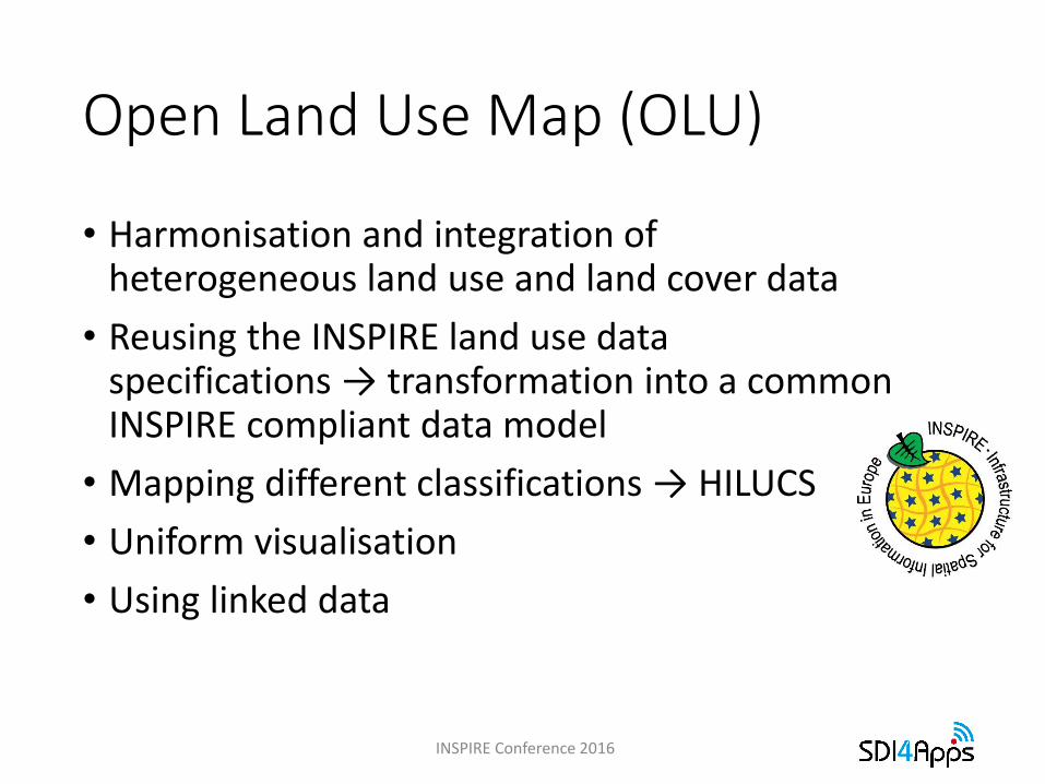
Open Land Use Map (OLU)
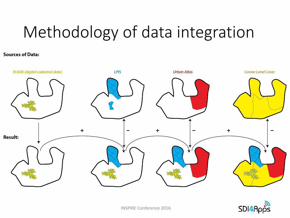
• Harmonisation and integration of heterogeneous land use and land cover data
• Reusing the INSPIRE land use data specifications → transformation into a common INSPIRE compliant data model
• Mapping different classifications → HILUCS
• Uniform visualisation
• Using linked data
INSPIRE Conference 2016
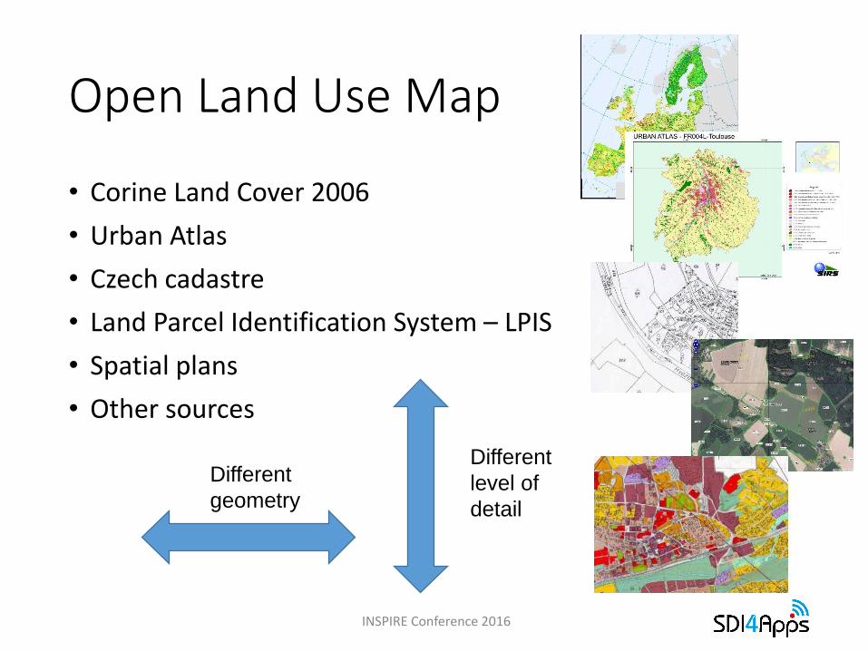
• Corine Land Cover 2006
• Urban Atlas
• Czech cadastre
• Land Parcel Identification System – LPIS
• Spatial plans
• Other sources
Different
level of
detail
Different
geometry
Open Land Use Map
INSPIRE Conference 2016
INSPIRE Conference 2016
Methodology of data integration
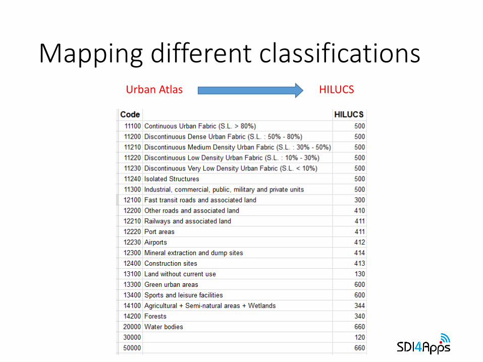
Mapping different classifications
INSPIRE Conference 2016
Urban Atlas HILUCS
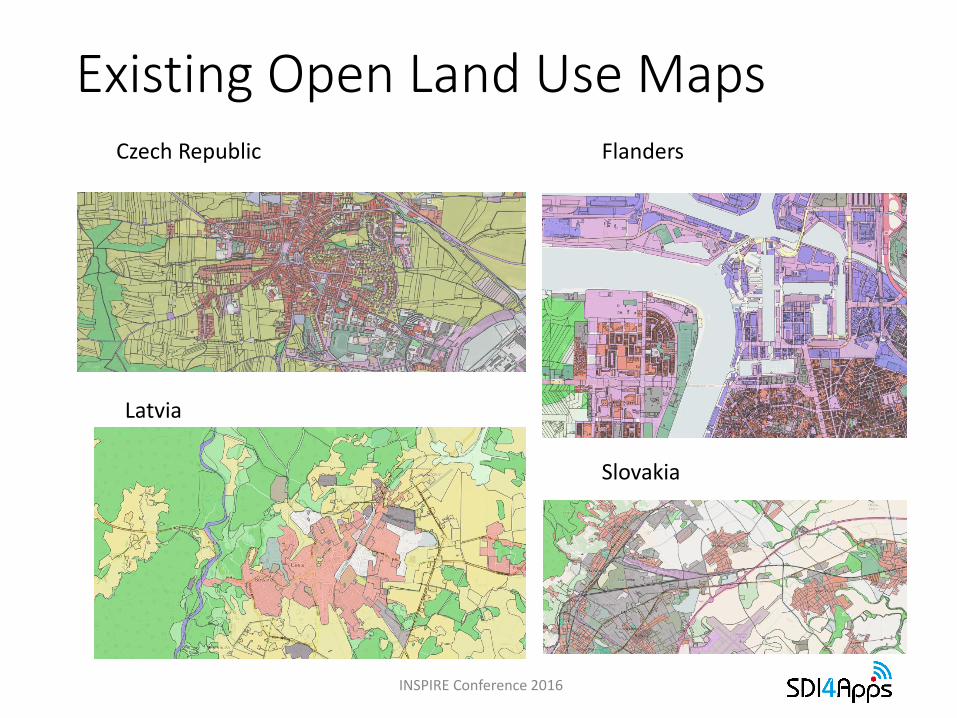
Existing Open Land Use Maps
INSPIRE Conference 2016
Czech Republic Flanders
Latvia
Slovakia
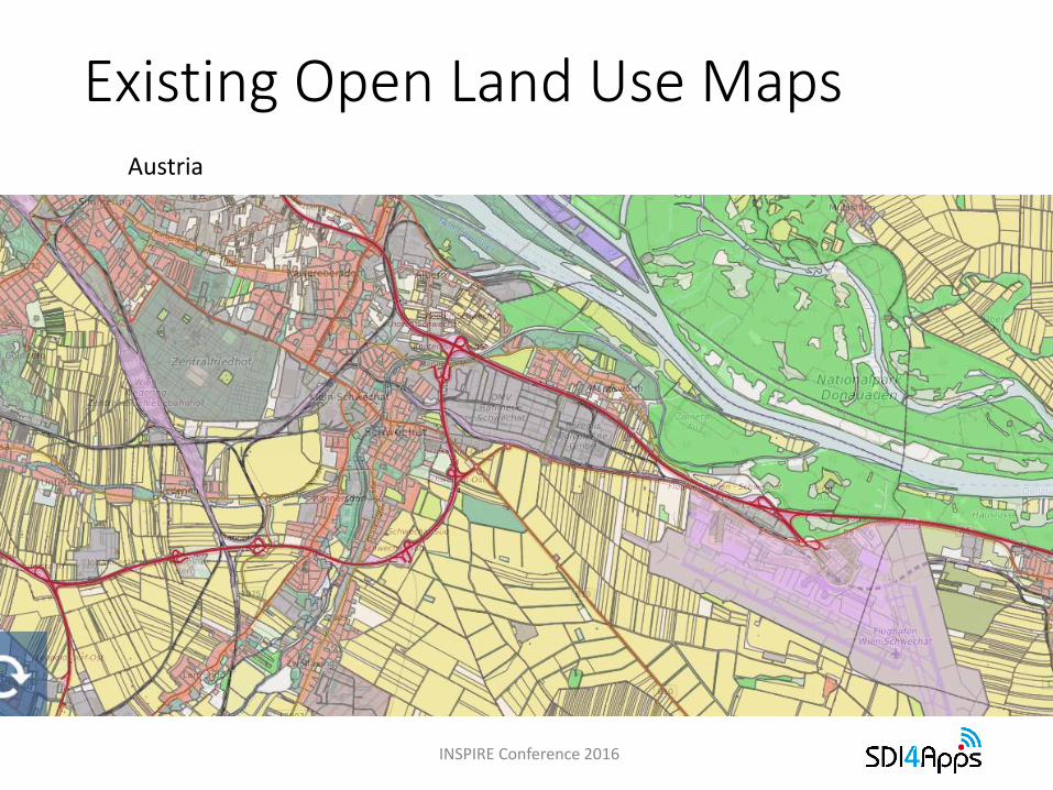
Existing Open Land Use Maps
INSPIRE Conference 2016
Austria
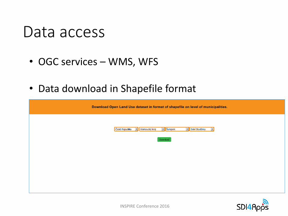
Data access
INSPIRE Conference 2016
• OGC services – WMS, WFS
• Data download in Shapefile format
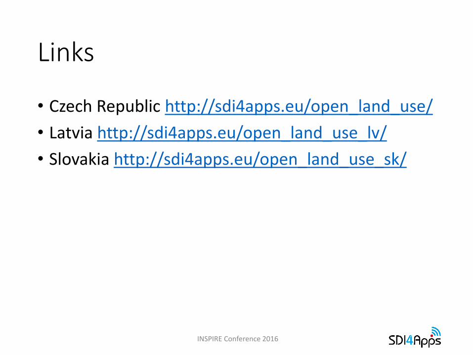
Links
• Czech Republic http://sdi4apps.eu/open_land_use/
• Latvia http://sdi4apps.eu/open_land_use_lv/
• Slovakia http://sdi4apps.eu/open_land_use_sk/
INSPIRE Conference 2016
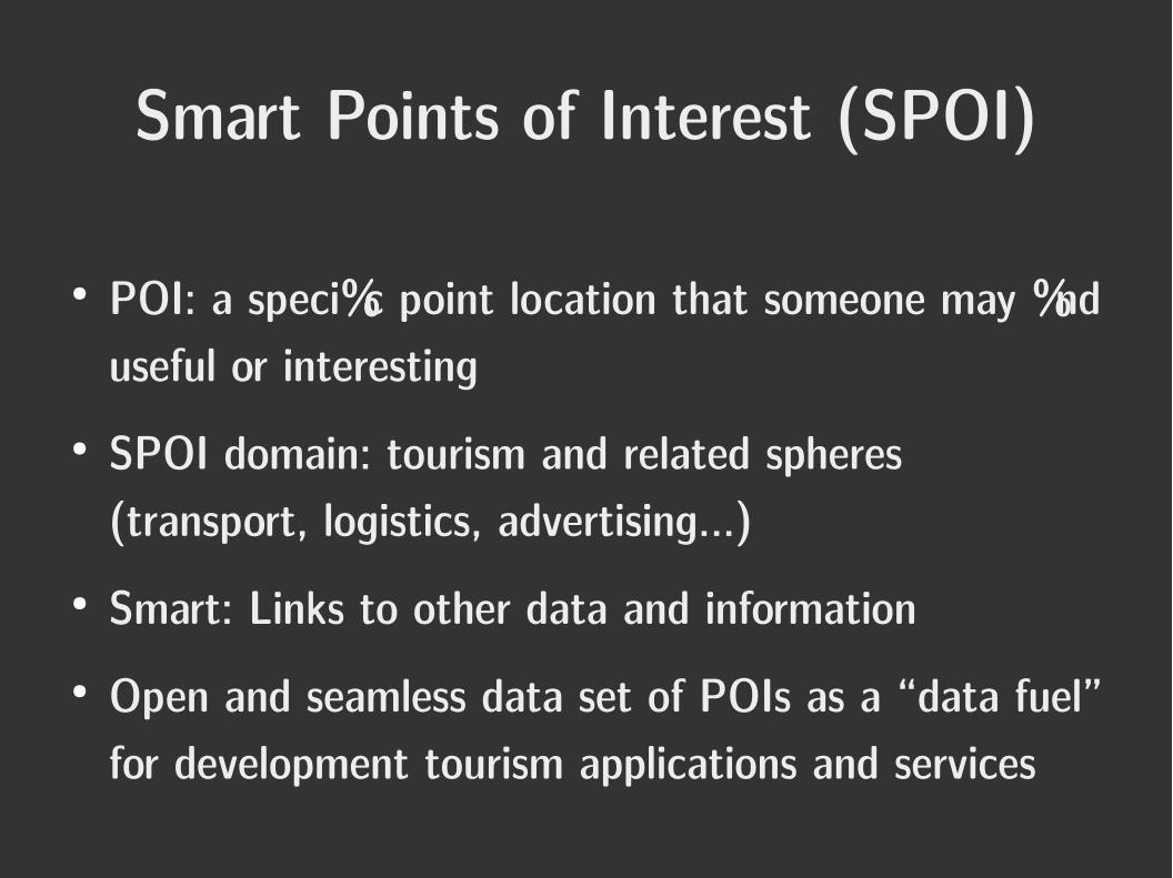
Smart Points of Interest (SPOI)
● POI: a specific point location that someone may find useful or interesting
● SPOI domain: tourism and related spheres (transport, logistics, advertising...)
● Smart: Links to other data and information● Open and seamless data set of POIs as a “data fuel”
for development tourism applications and services
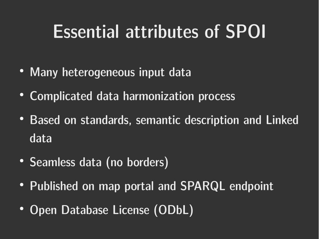
Essential attributes of SPOI
● Many heterogeneous input data● Complicated data harmonization process● Based on standards, semantic description and Linked
data● Seamless data (no borders)● Published on map portal and SPARQL endpoint● Open Database License (ODbL)
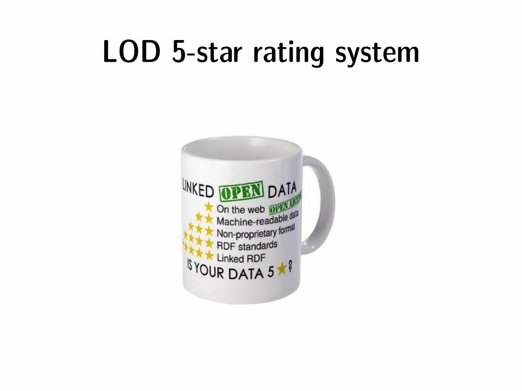
LOD 5-star rating system

24 178 570 POIs
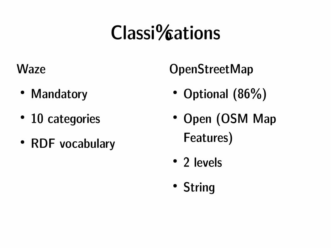
ClassificationsWaze● Mandatory● 10 categories● RDF vocabulary
OpenStreetMap● Optional (86%)● Open (OSM Map
Features)● 2 levels● String
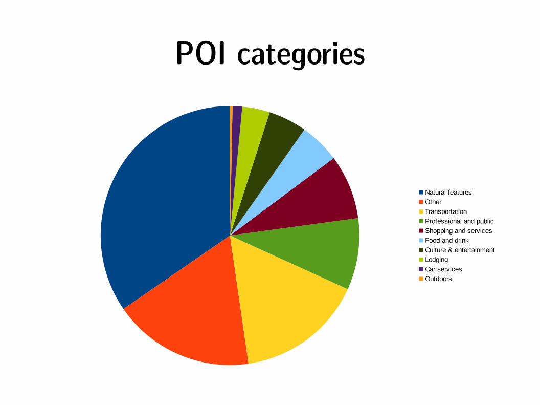
POI categories
Natural features
Other
Transportation
Professional and public
Shopping and services
Food and drink
Culture & entertainment
Lodging
Car services
Outdoors
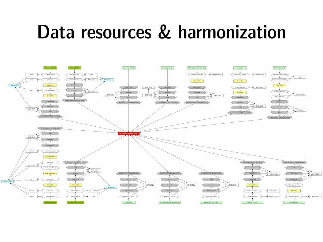
Data resources & harmonizationBelluno data (SHP)
Change character coding
Change coordinate system
QGIS
Filtering attributes
Text modification
LibreOffice Calc
Data (CSV)
Classification
Metadata
Links
Transformation to SPOI data model
Smart Points of Interest (RDF)
BASH script
GeoNames.org (ZIP)
Data downloadwget
Unpackingunzip
BASH script
Text modificationawk
Data (TXT)
Data (XML)
Classification
Metadata
Links
Transformation to SPOI data model
Saxon / JavaXSLT template
Natural Earth (KML)
Classification
Metadata
Links
Transformation to SPOI data model
Saxon / Java2x XSLT templates
Antwerpen (XML)
Classification
Metadata
Links
Transformation to SPOI data model
Saxon / JavaXSLT template
Transformation to SPOI data model
Links
Metadata
Classification
OpenStreetMap (BZ2)
Data downloadwget
Unpackingbunzip2
Data (TAR)
Unpackingtar
Data (OSM binary)
Filtering (attributes)
Converting
osmconvert
Data (OSM XML)
Filtering (nodes)osmfilter
Saxon / JavaXSLT template
BASH script
Citadel on the Move (JSON)
BASH script
Data download wget
Text modification sed + BASH script
Data (XML)
Transformation to SPOI data model
Links
Metadata
Classification
Saxon / JavaXSLT template
BASH script
Issy (XML)
Transformation to SPOI data model
Links
Metadata
Classification
Saxon / JavaXSLT template
Filtering (attributes)
UWB experimental ontologies (OWL)
Transformation to SPOI data model
Links
Metadata
Classification
Saxon / JavaXSLT template
Filtering (attributes)
Travel agency information (text)
Transcription to table LibreOffice Calc
Data (CSV)
Classification
Metadata
Links
Transformation to SPOI data model
Sicily (text)
Transcription to table LibreOffice Calc
Data (CSV)
Classification
Metadata
Links
Transformation to SPOI data model
BASH script
Saxon / JavaXSLT template
Format conversion Web service
Data (XML)
Pošumaví (XLS)
Transformation to SPOI data model
Links
Metadata
Classification
Saxon / JavaXSLT template
Text modification LibreOffice Calc
Format conversion Web service
Data (XML)
Zemgale (XLS)
Transformation to SPOI data model
Links
Metadata
Classification
Saxon / JavaXSLT template
Format conversion Web service
Data (XML)
Filtering (attributes)
Prague Open data (GML)
Transformation to SPOI data model
Links
Metadata
Classification
Saxon / JavaXSLT template
Filtering (attributes)
Wikidata (JSON)
Data download wget
Text modification BASH script
Classification
Metadata
Links
Transformation to SPOI data model
BASH script
BASH script
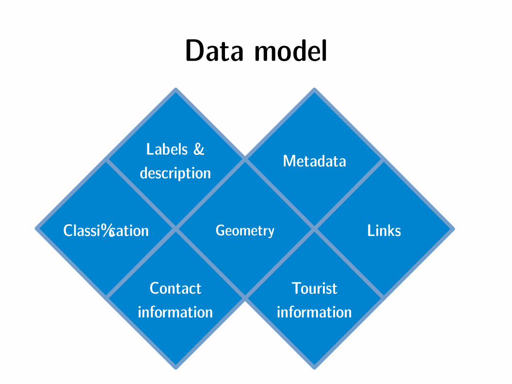
Data model
Classification Geometry Links
Labels &description
Metadata
Contactinformation
Touristinformation
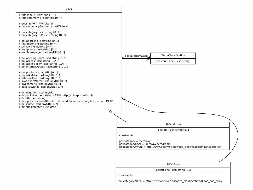
SPOI
+ rdfs:label : xsd:string [1..*]+ rdfs:comment : xsd:string [0..*]
+ geos:asWKT : WKTLiteral+ poi:secondaryGeometry : WKTLiteral
+ poi:category : xsd:string [0..1]+ poi:categoryOSM : xsd:string [0..1]
+ poi:address : xsd:string [0..1]+ foaf:mbox : xsd:string [0..*]+ poi:fax : xsd:string [0..*]+ foaf:phone : xsd:string [0..*]+ foaf:homepage : xsd:anyURI [0..*]
+ poi:openingHours : xsd:string [0..*]+ poi:access : xsd:string [0..*]+ poi:accessibility : xsd:string [0..*]+ poi:internetAccess : xsd:string [0..1]
+ poi:photo : xsd:anyURI [0..*]+ poi:wikidata : xsd:anyURI [0..1]+ rdfs:seeAlso : xsd:anyURI [0..*]+ skos:exactMatch : xsd:anyURI [0..*]+ owl:sameAs : xsd:anyURI [0..*]+ geos:sfWithin : xsd:anyURI [1..*]
+ dc:identifier : xsd:anyURI+ dc:publisher : xsd:string - SPOI (http://sdi4apps.eu/spoi)+ dc:title : xsd:string+ dc:rights : xsd:anyURI - http://opendatacommons.org/licenses/odbl/1.0/+ dc:source : xsd:anyURI [1..*]+ dcterms:created : xsd:date
WazeClassification
+ skos:prefLabel : xsd:string
poi:categoryWaze 11
SPOI:Airport
+ poi:iata : xsd:string [0..1]
constraints
poi:category = 'aeroway'poi:categoryOSM = 'aeroway.aerodrome'poi:categoryWAZE = http://www.openvoc.eu/waze_classification#Transportation
SPOI:Food
+ poi:cuisine : xsd:string [0..1]
constraints
poi:categoryWAZE = http://www.openvoc.eu/waze_classification#Food_and_drink
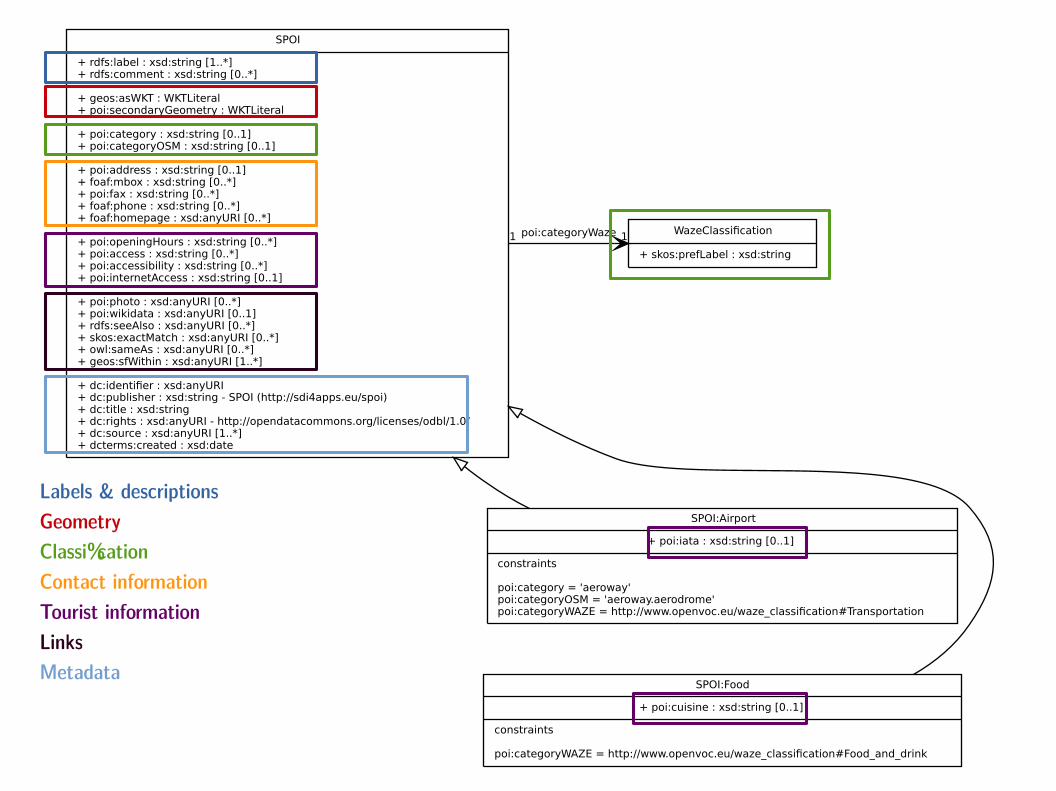
Labels & descriptionsGeometryClassificationContact informationTourist informationLinksMetadata
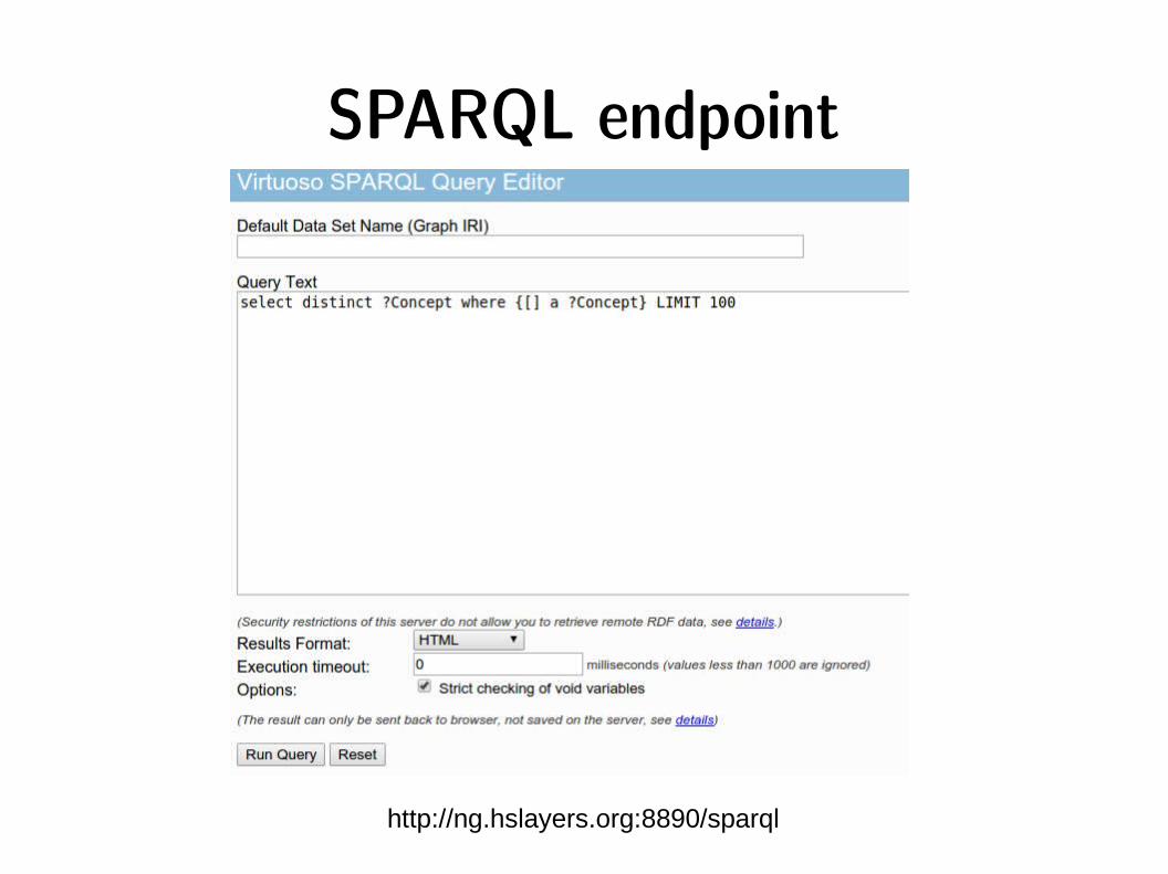
SPARQL endpoint
http://ng.hslayers.org:8890/sparql
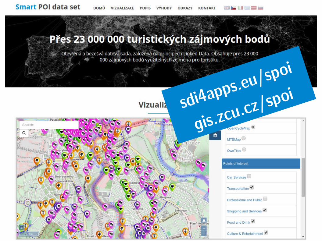
sdi4apps.eu/
spoi
gis.zcu.cz/sp
oi