INITIAL STUDY Case No. PR-2021-001058 Riverside Housing ...
91
COMMUNITY & ECONOMIC DEVELOPMENT DEPARTMENT PLANNING DIVISION INITIAL STUDY Case No. PR-2021-001058 Riverside Housing and Public Safety Element Updates and Environmental Justice Policies Project
Transcript of INITIAL STUDY Case No. PR-2021-001058 Riverside Housing ...

COMMUNITY & ECONOMIC DEVELOPMENT DEPARTMENT PLANNING DIVISION
INITIAL STUDY
Case No. PR-2021-001058
Riverside Housing and Public Safety Element Updates and
Environmental Justice Policies Project
Initial Study
March 2021 i
Case No. PR-2021-001058
Contents
Page
Environmental Factors Potentially Affected ............................................................................................ 1
Determination ......................................................................................................................................... 1
Evaluation of Environmental Impacts .................................................................................................... 2
I. Aesthetics ............................................................................................................................................ 4
Affected Environment ...................................................................................................................... 4
Discussion ........................................................................................................................................ 5
II. Agricultural and Forestry Resources ................................................................................................. 7
Affected Environment ...................................................................................................................... 7
Discussion ........................................................................................................................................ 8
III. Air Quality ...................................................................................................................................... 10
Affected Environment .................................................................................................................... 10
Discussion ...................................................................................................................................... 10
IV. Biological Resources ...................................................................................................................... 12
Affected Environment .................................................................................................................... 12
Discussion ...................................................................................................................................... 13
V. Cultural Resources ........................................................................................................................... 17
Affected Environment .................................................................................................................... 17
Discussion ...................................................................................................................................... 18
VI. Energy ............................................................................................................................................ 20
Affected Environment .................................................................................................................... 20
Discussion ...................................................................................................................................... 21
VII. Geology, Soils, and Paleontological Resources ............................................................................ 26
Affected Environment .................................................................................................................... 26
Discussion ...................................................................................................................................... 30
VIII. Greenhouse Gas Emissions ......................................................................................................... 35
Affected Environment .................................................................................................................... 35
Discussion ...................................................................................................................................... 35
IX. Hazards and Hazardous Materials .................................................................................................. 37
Affected Environment .................................................................................................................... 37
Discussion ...................................................................................................................................... 38
X. Hydrology and Water Quality ......................................................................................................... 42
Affected Environment .................................................................................................................... 42
Discussion ...................................................................................................................................... 44
XI. Land Use and Planning .................................................................................................................. 51
Affected Environment .................................................................................................................... 51
Discussion ...................................................................................................................................... 51

Riverside Housing and Public Safety Element Updates and Environmental Justice Policies Project
Initial Study March 2021 ii Case No. PR-2021-001058
XII. Mineral Resources ......................................................................................................................... 53Affected Environment .................................................................................................................... 53Discussion ....................................................................................................................................... 53
XIII. Noise ............................................................................................................................................. 55Affected Environment .................................................................................................................... 55Discussion ....................................................................................................................................... 56
XIV. Population and Housing ............................................................................................................... 57Affected Environment .................................................................................................................... 57Discussion ....................................................................................................................................... 58
XV. Public Services .............................................................................................................................. 59Affected Environment .................................................................................................................... 59Discussion ....................................................................................................................................... 60
XVI. Recreation .................................................................................................................................... 62Affected Environment .................................................................................................................... 62Discussion ....................................................................................................................................... 62
XVII. Transportation ............................................................................................................................. 64Affected Environment .................................................................................................................... 64Discussion ....................................................................................................................................... 65
XVIII. Tribal Cultural Resources .......................................................................................................... 67Affected Environment .................................................................................................................... 67Discussion ....................................................................................................................................... 68
XIX. Utilities and Service Systems ....................................................................................................... 70Affected Environment .................................................................................................................... 70Discussion ....................................................................................................................................... 71
XX. Wildfire ......................................................................................................................................... 73Affected Environment .................................................................................................................... 73Discussion ....................................................................................................................................... 73
XXI. Mandatory Findings of Significance ............................................................................................ 76Affected Environment .................................................................................................................... 76Discussion ....................................................................................................................................... 76
References Cited ........................................................................................................................................ 78I. Aesthetics ........................................................................................................................................... 78II. Agricultural and Forestry Resources ................................................................................................ 78III. Air Quality ...................................................................................................................................... 78IV. Biological Resources ...................................................................................................................... 78V. Cultural Resources ........................................................................................................................... 79VI. Energy ............................................................................................................................................. 79VII. Geology, Soils, and Paleontological Resources ............................................................................ 80VIII. Greenhouse Gas Emissions .......................................................................................................... 81

Riverside Housing and Public Safety Element Updates and
Environmental Justice Policies Project
Initial Study
March 2021 iii
Case No. PR-2021-001058
IX. Hazards and Hazardous Materials .................................................................................................. 81
X. Hydrology and Water Quality ......................................................................................................... 81
XI. Land Use and Planning .................................................................................................................. 82
XII. Mineral Resources ........................................................................................................................ 82
XIII. Noise ............................................................................................................................................ 82
XIV. Population and Housing .............................................................................................................. 83
XV. Public Services ............................................................................................................................. 83
XVI. Recreation .................................................................................................................................... 83
XVII. Transportation ............................................................................................................................ 84
XVIII. Tribal Cultural Resources ......................................................................................................... 84
XIX. Utilities and Service Systems ...................................................................................................... 84
XX. Wildfire ......................................................................................................................................... 84
XXI. Mandatory Findings of Significance ........................................................................................... 84
Table 1. Riverside VMT Summary ................................................................................................... 65

Riverside Housing and Public Safety Element Updates and
Environmental Justice Policies Project
Initial Study
March 2021 iv
Case No. PR-2021-001058
Acronyms and Abbreviations
AB Assembly Bill
AF acre-feet
AIA Airport Influence Area
amsl above mean sea level
AQMP air quality management plans
AUSD Alvord Unified School District
BMPs best management practices
CAAQS California Ambient Air Quality Standards
CALGreen California Green Building Standards Code
Caltrans California Department of Transportation
CalVeg Classification and Assessment with Landsat of Visible Ecological Groupings
CAP Climate Action Plan
CARB California Air Resources Board
CBC California Building Code
CBSC California Building Standards Code
CBSC California Green Building Standards Code
CDFW California Department of Fish and Wildlife
CEQA California Environmental Quality Act
CH4 methane
CHLs California Historical Landmarks
CIP Capital Improvement Program
City City of Riverside (governing entity)
CNPS California Native Plant Society
CO2 carbon dioxide
CRHR California Register of Historical Resources
DAMP Drainage Area Management Plan
DTSC Department of Toxic Substances Control
EIR environmental impact report
EPA U.S. Environmental Protection Agency
FEMA Federal Emergency Management Agency
FTA Federal Transit Administration
GHG greenhouse gas
GP 2025 City of Riverside General Plan 2025
GP FPEIR City of Riverside General Plan and Supporting Documents Final
Program Environmental Impact Report
gpm gallons per minute

Riverside Housing and Public Safety Element Updates and
Environmental Justice Policies Project
Initial Study
March 2021 v
Case No. PR-2021-001058
HVAC heating, ventilation, and air-conditioning
LID low-impact development
MRZ mineral resource zone
MS4 Municipal Separate Storm Sewer System
N2O nitrous oxide
NAAQS National Ambient Air Quality Standards
NAHC Native American Heritage Commission
NCA Neighborhood Conservation Area
NOP Notice of Preparation
NOX nitrogen oxides
NPDES National Pollutant Discharge Elimination System
NHTSA National Highway Traffic and Safety Administration
O3 ozone
OEM Office of Emergency Management
PM particulate matter
PM10 PM less than or equal to 10 microns
PRC Public Resources Code
proposed
Project
Riverside Housing and Public Safety Element Updates and
Environmental Justice Policies Project
PV photovoltaic
RCFCWCD Riverside County Flood Control and Water Conservation District
RCFD Riverside County Fire Department
RCHCA Riverside County Habitat Conservation Agency
RFD Riverside Fire Department
RHNA Regional Housing Needs Allocation
RIVTAM Riverside Traffic Analysis Model
RMC Riverside Municipal Code
ROGs reactive organic gases
RPD Riverside Police Department
RPS Renewables Portfolio Standard
RPU Riverside Public Utilities
RUSD Riverside Unified School District
RWQCB Regional Water Quality Control Board
SB Senate Bill
SCAG Southern California Association of Governments
SCE Southern California Edison
SCAB South Coast Air Basin
SCAQMD South Coast Air Quality Management District

Riverside Housing and Public Safety Element Updates and
Environmental Justice Policies Project
Initial Study
March 2021 vi
Case No. PR-2021-001058
SDAPCD San Diego Air Pollution Control District
SEMS Standardized Emergency Management System
SKR HCP Stephens’ Kangaroo Rat Habitat Conservation Plan
SMGB State Mining and Geology Board
SOI Sphere of Influence
SWPPP Stormwater Pollution Prevention Plan
TMDL total maximum daily load
USFWS U.S. Fish and Wildlife Service
USGS U.S. Geological Survey
UST underground storage tank
VMT vehicle miles traveled
WQMPs Water Quality Management Plans
WRCRCA Western Riverside County Regional Conservation Authority
WRC MSHCP Western Riverside County Multiple Species Habitat Conservation Plan

Initial Study
March 2021 1
Case No. PR-2021-001058
Environmental Factors Potentially Affected
The environmental factors checked below could be affected by the proposed Riverside Housing and
Public Safety Element Updates and Environmental Justice Policies Project (proposed Project) (i.e.,
the proposed Project would involve at least one impact that is a “Potentially Significant Impact”), as
indicated by the checklist on the following pages.
Aesthetics Agricultural and Forestry Resources Air Quality
Biological Resources Cultural Resources Energy
Geology/Soils/
Paleontological Resources
Greenhouse Gas Emissions Hazards and Hazardous
Materials
Hydrology/Water Quality Land Use/Planning Mineral Resources
Noise Population/Housing Public Services
Recreation Transportation Tribal Cultural Resources
Utilities/Service Systems Wildfire Mandatory Findings of
Significance
Determination
On the basis of this initial evaluation:
I find that the proposed Project COULD NOT have a significant effect on the environment, and a
NEGATIVE DECLARATION will be prepared.
I find that although the proposed Project could have a significant effect on the environment, there will not
be a significant effect in this case because revisions to the proposed Project have been made by or agreed to
by the project proponent. A MITIGATED NEGATIVE DECLARATION will be prepared.
I find that the proposed Project MAY have a significant effect on the environment, and an
ENVIRONMENTAL IMPACT REPORT is required.
I find that the proposed Project MAY have an impact on the environment that is “potentially significant” or
“potentially significant unless mitigated” but at least one effect (1) has been adequately analyzed in an
earlier document pursuant to applicable legal standards and (2) has been addressed by mitigation measures
based on the earlier analysis, as described on attached sheets. An ENVIRONMENTAL IMPACT REPORT
is required, but it must analyze only the effects that remain to be addressed.
I find that although the proposed Project could have a significant effect on the environment, because all
potentially significant effects (a) have been analyzed adequately in an earlier ENVIRONMENTAL
IMPACT REPORT or NEGATIVE DECLARATION pursuant to applicable standards, and (b) have been
avoided or mitigated pursuant to that earlier ENVIRONMENTAL IMPACT REPORT or NEGATIVE
DECLARATION, including revisions or mitigation measures that are imposed upon the proposed Project,
nothing further is required.
April 5, 2021
Signature Date
Matthew Taylor, Senior Planner City of Riverside
Printed Name For

Riverside Housing and Public Safety Element Updates and
Environmental Justice Policies Project
Initial Study
March 2021 2
Case No. PR-2021-001058
Evaluation of Environmental Impacts
1. A brief explanation is required for all answers except “No Impact” answers that are adequately
supported by the information sources a lead agency cites in the parentheses following each
question. A “No Impact” answer is adequately supported if the referenced information sources
show that the impact simply does not apply to projects like the one involved (e.g., the proposed
Project falls outside a fault rupture zone). A “No Impact” answer should be explained if it is
based on project-specific factors as well as general standards (e.g., the proposed Project will not
expose sensitive receptors to pollutants, based on a project-specific screening analysis).
2. All answers must take account of the whole action involved, including off-site as well as on-site,
cumulative as well as project-level, indirect as well as direct, and construction as well as
operational impacts.
3. Once the lead agency has determined that a particular physical impact may occur, the checklist
answers must indicate whether the impact is potentially significant, less than significant with
mitigation, or less than significant. “Potentially Significant Impact” is appropriate if there is
substantial evidence that an effect may be significant. If there are one or more “Potentially
Significant Impact” entries when the determination is made, an environmental impact report
(EIR) is required.
4. “Less than Significant with Mitigation Incorporated” applies when the incorporation of mitigation
measures has reduced an effect from a “Potentially Significant Impact” to a “Less-than-
Significant Impact.” The lead agency must describe the mitigation measures and briefly explain
how they reduce the effect to a less-than-significant level. (Mitigation measures from earlier
analyses, as described in #5, below, may be cross referenced.)
5. Earlier analyses may be used if, pursuant to tiering, program EIR, or other California
Environmental Quality Act (CEQA) process, an effect has been adequately analyzed in an earlier
EIR or negative declaration (Section 15063[c][3][D]). In this case, a brief discussion should
identify the following:
a. Earlier Analysis Used. Identify and state where earlier analyses are available for review.
b. Impacts Adequately Addressed. Identify which effects from the above checklist were within
the scope of and adequately analyzed in an earlier document pursuant to applicable legal
standards and state whether such effects were addressed by mitigation measures, based on the
earlier analysis.
c. Mitigation Measures. For effects that are “Less than Significant with Mitigation
Incorporated,” describe the mitigation measures that were incorporated or refined from the
earlier document and the extent to which they address site-specific conditions for the
proposed Project.
6. Lead agencies are encouraged to incorporate into the checklist references to information sources
for potential impacts (e.g., general plans, zoning ordinances). Reference to a previously prepared
or outside document should, when appropriate, include a reference to the page or pages where the
statement is substantiated.
7. Supporting Information Sources: A source list should be attached, and other sources used or
individuals contacted should be cited in the discussion.

Riverside Housing and Public Safety Element Updates and
Environmental Justice Policies Project
Initial Study
March 2021 3
Case No. PR-2021-001058
8. This is only a suggested form, and lead agencies are free to use different formats; however, lead
agencies should normally address the questions from this checklist that are relevant to a project’s
environmental effects in whatever format is selected.
9. The explanation of each issue should identify:
a. The significance criteria or threshold, if any, used to evaluate each question; and
b. The mitigation measure identified, if any, to reduce the impact to a less-than-significant level.

Riverside Housing and Public Safety Element Updates and
Environmental Justice Policies Project
Initial Study
March 2021 4
Case No. PR-2021-001058
I. Aesthetics
Potentially
Significant
Impact
Less than
Significant with
Mitigation
Incorporated
Less-than-
Significant
Impact
No
Impact
Except as provided in Public Resources Code
Section 21099, would the proposed Project:
a. Have a substantial adverse effect on a scenic vista?
b. Substantially damage scenic resources, including,
but not limited to, trees, rock outcroppings, and
historic buildings along a scenic highway?
c. In non-urbanized areas, substantially degrade the
existing visual character or quality of public views
of the site and its surroundings? (Public views are
those that are experienced from publicly accessible
vantage point). If the proposed Project is in an
urbanized area, would the proposed Project conflict
with applicable zoning and other regulations
governing scenic quality?
d. Create a new source of substantial light or glare that
would adversely affect daytime or nighttime views
in the area?
Affected Environment
City of Riverside General Plan 2025 (GP 2025), Figure LU-3, Riverside Parks, identifies the City of
Riverside’s (City’s) natural and scenic vistas. Within the northwest portion of the City is the Santa
Ana River floodplain. To the east, southeast, and west, the uplands and low mountains include Box
Springs Mountain, Alessandro Heights, Arlington Mountain, and La Sierra/Norco Hills. A variety of
prominent natural features in the City include Mount Rubidoux, Pachappa Hill, Sycamore Canyon,
Hawarden Hills, distinctive arroyos, and isolated hills. Open space areas include the Santa Ana River
Corridor, Box Springs Mountain Regional Park, Sycamore Canyon Wilderness Park, Mount
Rubidoux Park, and California Citrus State Historic Park.
The City does not include a State Scenic Highway. However, the City of Riverside General Plan and
Supporting Documents Final Program Environmental Impact Report 2025 (GP FPEIR) identifies the
City’s scenic parkways in Table 5.1-B, Scenic Parkways. According to GP FPEIR Table 5.1-B, the
City’s scenic parkways include:
• Victoria Avenue,
• Magnolia Avenue/Market Street,
• University Avenue,
• Van Buren Boulevard,
• Riverwalk Parkway,
• La Sierra Avenue,

Riverside Housing and Public Safety Element Updates and
Environmental Justice Policies Project
Initial Study
March 2021 5
Case No. PR-2021-001058
• Overlook Parkway,
• Canyon Crest Drive; and
• Arlington Avenue.
Discussion
a. Have a substantial adverse effect on a scenic vista?
Less-than-Significant Impact. Development of housing units under the proposed Project would
increase residential densities and non-residential land use intensities in specific areas. Development
under the proposed Project would be concentrated in existing transit corridors and not in open space
areas and would not block scenic views of the surrounding mountains or the Santa Ana River.
Pursuant to RMC standards and as part of each project’s design review process (RMC Chapter
19.710), all development under the proposed Project would require design review and must
demonstrate conformance with relevant GP 2025 policies and Riverside Municipal Code (RMC)
standards. For example, future development must demonstrate conformance with GP 2025 Objective
LU-3 policies, which are intended to preserve prominent ridgelines and hillsides as important
community visual assets (i.e., Policy LU-3.1). In addition, future development must comply with GP
2025 Objective OS-2 policies, which are intended to minimize the extent of urban development in the
hillsides and mitigate any significant adverse consequences associated with urbanization (i.e., Policies
OS-2.1 through OS-2.4). RMC standards would regulate land uses, building heights, setbacks,
landscaping, parking, fences and walls, and other development characteristics to protect the City’s
hills and ridgelines. The proposed Project would not have a substantial adverse effect on a scenic
vista and the impact would be less than significant.
b. Substantially damage scenic resources, including, but not limited to, trees, rock outcroppings, and
historic buildings along a scenic highway?
Less-than-Significant Impact. The proposed Project would not result in any effects on scenic
highways or scenic resources. Future development under the Housing Element update and zoning
code as well as specific plan amendments could occur in areas near the abovementioned GP 2025-
designated scenic parkways. There would be no development under the proposed Project on sites with
rock outcroppings and no scenic historic resources would be removed. Project-related impacts would
be reduced to less than significant through compliance with the RMC, Citywide Design Guidelines,
and Sign Guidelines. Pursuant to RMC requirements and as part of the design review process, the
City would assess all future development proposals on a project-by-project basis. The RMC would
regulate land uses, building heights, setbacks, landscaping, parking, fences and walls, and other
development standards to protect the City’s scenic parkways and resources. Compliance with the
RMC, Citywide Design Guidelines, and Sign Guidelines would ensure project impacts remain less
than significant.
c. In non-urbanized areas, substantially degrade the existing visual character or quality of public views
of the site and its surroundings? (Public views are those that are experienced from publicly accessible
vantage point). If the proposed Project is in an urbanized area, would the proposed Project conflict with
applicable zoning and other regulations governing scenic quality?
Less-than-Significant Impact. Updates to the Public Safety Element and inclusion of environmental
justice policies would not result in any effects on visual character or quality. The City includes a
mixture of developed, partially developed, and vacant land anticipated for future development. Where
Zoning Code and Specific Plan Amendments occur on vacant, rural, or agricultural land uses,

Riverside Housing and Public Safety Element Updates and
Environmental Justice Policies Project
Initial Study
March 2021 6
Case No. PR-2021-001058
implementation of the proposed Project would have the potential to alter the existing visual character
or quality of these sites. However, compliance with GP 2025 policies and RMC and specific plan
standards, as well as Citywide Design Guidelines and Sign Guidelines, would ensure no substantial
degradation of visual character and quality, and project impacts would be less than significant.
Future development must demonstrate conformance with GP 2025 Objective OS-4 policies, which are
intended to preserve designated buffers between urban and rural uses for their open space and
aesthetic benefits (i.e., Policies OS-4.1 and OS-4.2). Pursuant to RMC requirements and as part of the
design review process, the City would assess all future development proposals on a project-by-project
basis to prevent nonconforming uses and structures with the potential to affect the City’s visual
character. The RMC regulates land uses, building heights, setbacks, landscaping, parking, fences and
walls, and other development characteristics to protect the City’s visual character. Compliance with
GP 2025 Objective OS-4 policies, among others, as well as RMC standards would ensure impacts on
visual character would be less than significant.
d. Create a new source of substantial light or glare that would adversely affect daytime or nighttime
views in the area?
Less-than-Significant Impact. The development of new housing units and associated Zoning Code
and specific plan amendments to accommodate the housing could introduce new sources of light or
glare with the potential to adversely affect daytime or nighttime views in some areas. The Riverside
County Light Pollution Ordinance (Riverside County Ordinance No. 655) restricts nighttime lighting
for areas within a 15-mile radius (Zone A) and a 45-mile radius (Zone B) of the Palomar Observatory.
As shown in GP FPEIR Figure 5.1-1, Palomar Observatory Lighting Impact Zone, the southeastern
portion of the project area is within Zone B, or within a 45-mile radius of the observatory (45-mile
Radius Lighting Impact Zone). Any future development occurring within this area must demonstrate
conformance with Riverside County Ordinance No. 655. The City requires all development that
introduces light sources, or modifications to existing light sources, to incorporate shielding devices or
other light pollution–limiting design features (e.g., hoods or lumen restrictions); refer to GP FPEIR
Mitigation Measure AES-1. Pursuant to RMC and Specific Plan standards, and Citywide Design
Guidelines and Sign Guidelines, the City would assess all future development proposals on a project-
by-project basis, as part of the design review process, to regulate site lighting with the potential to
result in light and glare impacts. RMC Section 19.556, Lighting, and Section 19.590.070, Light and
Glare, include standards intended to protect the City from adverse light and glare impacts.
Compliance with Riverside County Ordinance No. 655 requirements, existing GP FPEIR Mitigation
Measure AES-1, and RMC Section 19.556 and Section 19.590.070, future development facilitated
pursuant to the proposed Project would not introduce new sources of substantial light or glare. The
impact would be less than significant.

Riverside Housing and Public Safety Element Updates and
Environmental Justice Policies Project
Initial Study
March 2021 7
Case No. PR-2021-001058
II. Agricultural and Forestry Resources
Potentially
Significant
Impact
Less than
Significant with
Mitigation
Incorporated
Less-than-
Significant
Impact
No
Impact
In determining whether impacts on agricultural resources
are significant environmental effects, lead agencies may
refer to the California Agricultural Land Evaluation and
Site Assessment Model (1997) prepared by the California
Department of Conservation as an optional model to use
in assessing impacts on agriculture and farmland. In
determining whether impacts on forest resources,
including timberland, are significant environmental
effects, lead agencies may refer to information compiled
by the California Department of Forestry and Fire
Protection regarding the state’s inventory of forest land,
including the Forest and Range Assessment Project and
the Forest Legacy Assessment Project, and forest carbon
measurement methodology provided in the Forest
Protocols adopted by the California Air Resources Board.
Would the proposed Project:
a. Convert Prime Farmland, Unique Farmland, or
Farmland of Statewide Importance (Farmland), as
shown on the maps prepared pursuant to the
Farmland Mapping and Monitoring Program of the
California Resources Agency, to non-agricultural
use?
b. Conflict with existing zoning for agricultural use or
conflict with a Williamson Act contract?
c. Conflict with existing zoning for, or cause rezoning
of forest land (as defined in Public Resources Code
Section 12220[g]), timberland (as defined by Public
Resources Code Section 4526), or timberland zoned
Timberland Production (as defined by Government
Code Section 51104[g])?
d. Result in the loss of forest land or conversion of
forest land to non-forest use?
e. Involve other changes in the existing environment
that, due to their location or nature, could result in
conversion of Farmland to non-agricultural use or
conversion of forest land to non-forest use?
Affected Environment
In 2005, Riverside County had a total of 223,848 acres of harvested crops. In 2018, the number had
dropped to 194,346 harvested acres (Riverside County Agricultural Commissioner 2018). This
represents a loss of 29,502 acres in 15 years, or approximately 13 percent. The Riverside County
Agricultural Commissioner’s office also reports statistics for regions of Riverside County, including the
Riverside/Corona District, which is where the proposed Project is located. For the 2005 to 2016
timeframe, the latest reported, the Riverside/Corona District went from 14,340 harvested acres to 7,020

Riverside Housing and Public Safety Element Updates and
Environmental Justice Policies Project
Initial Study
March 2021 8
Case No. PR-2021-001058
harvested acres, a reduction of approximately 51 percent (Riverside County Agricultural Commissioner
2018). This shows that the development pressure faced in the western end of the county, where the City
of Riverside is located, is more rapid than in the county.
The citrus industry was influential in the establishment of the City of Riverside in the late nineteenth
century and its influence continues today. The largest area of agriculture within City limits is the
Arlington Heights Greenbelt. The City’s Sphere of Influence (SOI) still contains large citrus groves,
especially in the Highgrove, Woodcrest, and Rancho El Sobrante areas; however, over time, many of
the large agricultural and citriculture areas have been converted to suburban uses.
In 1979, City of Riverside voters passed Proposition R: “Taxpayer’s Initiative to Reduce Costly
Urban Sprawl by Preserving the City of Riverside’s Citrus and Agricultural Lands, Its Unique Hills,
Arroyos and Victoria Avenue.” The two main features of Proposition R relate to: 1) preservation of
agriculture through application of the RA-5-Residential Agricultural Zone to two specific areas of the
City: and 2) protection of hillside areas through application of the RC Residential Conservation Zone
to areas of the City based on slopes over 15 percent. The two areas of the City which were zoned to
RA-5 are: 1) the Arlington Heights Greenbelt; and 2) an area commonly known as the Arlanza-La
Sierra Lands, a bluff top area above the Santa Ana River bordered by Tyler Street on the east and
Arlington Avenue on the west. Eight years later, City of Riverside voters approved Measure C as an
amendment to Proposition R, entitled “Citizens’ Rights Initiative to Reduce Costly Urban Sprawl, to
Reduce Traffic Congestion, to Minimize Utility Rate Increases and to Facilitate Preservation of the
City of Riverside’s Citrus and Agricultural Lands, its Scenic Hills, Ridgelines, Arroyos and Wildlife
Areas.” Measure C amended Proposition R by adding policies to promote agriculture. Measure C
relates to the Arlington Heights Greenbelt, the Arlanza-La Sierra Lands and any areas designated for
agricultural use in the then existing General Plan or Zoning Code.
Discussion
a. Convert Prime Farmland, Unique Farmland, or Farmland of Statewide Importance (Farmland), as
shown on the maps prepared pursuant to the Farmland Mapping and Monitoring Program of the
California Resources Agency, to non-agricultural use?
No Impact. The California Department of Conservation (CDOC) Farmland Mapping and Monitoring
Program designates the majority of the City as Urban and Built-Up Land (CDOC 2020). Several
small areas of the City are designated as Important Farmland, Farmland of Statewide Importance,
Unique Farmland, and Other Land (CDOC 2020). The areas designated as such occur primarily near
the southern boundary of the City, south of Victoria Avenue and west of Washington Street within the
Arlington Heights Neighborhood. The northeastern area of the City also contains land designated as
Important Farmland, Farmland of Statewide Importance, Unique Farmland, and Other Land (CDOC
2020). The areas designated as such occur primarily within the University of California, Riverside
West Campus. The proposed Project would not propose any new development in areas designated as
Important Farmland, Farmland of Statewide Importance, Unique Farmland, or Other Land. As such,
the proposed Project would not convert Prime Farmland, Unique Farmland, or Farmland of Statewide
Importance, and no impacts would occur.
b. Conflict with existing zoning for agricultural use or conflict with a Williamson Act contract?
No Impact. There are ten Williamson Act contract parcels within city limits. Four parcels are located
in the Prenda neighborhood and six are located in the southeastern portion of the city in the
Woodcrest area. Review of the GP 2025 Open Space and Conservation Element indicates none of the

Riverside Housing and Public Safety Element Updates and
Environmental Justice Policies Project
Initial Study
March 2021 9
Case No. PR-2021-001058
opportunity sites is within Williamson Act preserves or contracted land. As such, the proposed
Project would have no impact related to agricultural zoning or Williamson Act contract lands, and no
conflicts with existing zoning for agricultural uses would occur.
c. Conflict with existing zoning for, or cause rezoning of forest land (as defined in Public Resources
Code Section 12220(g)), timberland (as defined by Public Resources Code Section 4526), or timberland
zoned Timberland Production (as defined by Government Code Section 51104(g))?
No Impact. The proposed Project does not identify opportunity sites zoned for forest land. In
addition, there are no lands zoned as forest land, timberland, or timberland zoned Timberland
Production areas (as defined in Public Resources Code [PRC] 12220[g] and PRC 4526 or
Government Code 51104[g]) within the project area. The proposed Project would not affect forest
land or timberland or conflict with existing zoning for forest land.
d. Result in the loss of forest land or conversion of forest land to non-forest use?
No Impact. As described above, the proposed Project and Zoning Code and specific plan
amendments, do not identify opportunity sites zoned for forest land. As such, no impacts related to
the loss of forest land or conversion of forest land to non-forest use would occur.
e. Involve other changes in the existing environment that, due to their location or nature, could result in
conversion of Farmland to non-agricultural use or conversion of forest land to non-forest use?
No Impact. As mentioned above, no agricultural farmland or forest land resources are on the
identified opportunity sites, in additional, the proposed Project would not involve other changes to the
existing environment that could result in the conversion of Farmland to non-agricultural use or
conversion of forest land to non-forest use. As such, no impacts related to the conversion of
agricultural or forest land to other land uses would occur.

Riverside Housing and Public Safety Element Updates and
Environmental Justice Policies Project
Initial Study
March 2021 10
Case No. PR-2021-001058
III. Air Quality
Potentially
Significant
Impact
Less than
Significant with
Mitigation
Incorporated
Less-than-
Significant
Impact
No
Impact
Where available, the significance criteria established by
the applicable air quality management district or air
pollution control district may be relied upon to make the
following determinations. Would the proposed Project:
a. Conflict with or obstruct implementation of the
applicable air quality plan?
b. Result in a cumulatively considerable net increase of
any criteria pollutant for which the project region is
a nonattainment area for an applicable federal or
state ambient air quality standard?
c. Expose sensitive receptors to substantial pollutant
concentrations?
d. Result in other emissions (such as those leading to
odors) adversely affecting a substantial number of
people?
Affected Environment
The City is in the South Coast Air Basin (SCAB), which includes all of Orange County and the non-
desert portions of Los Angeles, Riverside, and San Bernardino Counties. The South Coast Air Quality
Management District (SCAQMD) is required, pursuant to the federal and state Clean Air Acts, to
reduce emissions of criteria pollutants for which the SCAB is in nonattainment. The SCAB is
currently classified as a nonattainment area for the federal and state ozone (O3) standards and the
standards regarding particulate matter (PM) less than or equal to 2.5 microns (PM2.5); it is also a
nonattainment area for the state standards regarding PM less than or equal to 10 microns (PM10)
(U.S. Environmental Protection Agency 2020; SCAQMD 2016).
Discussion
a. Conflict with or obstruct implementation of the applicable air quality plan?
Potentially Significant Impact. As mentioned above, the SCAQMD is required to reduce emissions
of criteria pollutants for which SCAB is in nonattainment status (i.e., O3, PM2.5, and PM10). The
SCAQMD has developed air quality management plans (AQMPs) to control these pollutants and
reach attainment levels. SCAQMD’s most recent plan to achieve air quality standards is the 2016
AQMP, adopted by the SCAQMD Governing Board on March 3, 2017. Implementation of the
proposed Project could lead to emissions that were not accounted for in the applicable air quality
plans. The proposed Project may conflict with or obstruct implementation of the SCAQMD’s AQMP.
This impact is potentially significant and will be analyzed in the forthcoming EIR.

Riverside Housing and Public Safety Element Updates and
Environmental Justice Policies Project
Initial Study
March 2021 11
Case No. PR-2021-001058
b. Result in a cumulatively considerable net increase of any criteria pollutant for which the project
region is a nonattainment area for an applicable federal or state ambient air quality standard?
Potentially Significant Impact. SCAB is presently in nonattainment status under the California
Ambient Air Quality Standards (CAAQS) for O3, PM2.5, and PM10 and in nonattainment status
under the National Ambient Air Quality Standards (NAAQS) for O3 and PM2.5. O3 is formed when
volatile organic compounds (VOCs), also referred to as reactive organic gases (ROGs), and nitrogen
oxides (NOX) react in the presence of sunlight. VOC sources include fuels (e.g., gasoline, natural gas,
wood, oil), solvents, petroleum processing and storage facilities, and pesticides. Sources of PM10 and
PM2.5 in both urban and rural areas include motor-vehicle exhaust, wood-burning stoves and
fireplaces, dust from construction, landfills, agricultural operations, wildfires, brush/waste burning,
dust from paved and unpaved road travel, and windblown dust from open lands.
The Housing and Public Safety Elements updates, development of environmental justice policies, and
Zoning Code and specific plan amendments under the proposed Project, would not directly result in
any construction activities or operational air quality emissions. However, future housing, public
infrastructure, and mixed-use developments in the City facilitated by the proposed Project could
result in emissions from their construction and operation. These potential indirect impacts of the
proposed Project could result in a cumulatively considerable net increase in criteria pollutants,
including those for which the region is in nonattainment status. This impact is potentially significant,
and further analysis will be provided in the forthcoming EIR.
c. Expose sensitive receptors to substantial pollutant concentrations?
Potentially Significant Impact. The SCAQMD defines sensitive receptors as people in the population
who are particularly susceptible to health effects due to exposure to an air contaminant. Land uses
where sensitive receptors are typically located include schools, playgrounds, childcare centers, long-
term health care facilities, rehabilitation centers, convalescent centers, hospitals, retirement homes, and
residences (SCAQMD 2005). Although the proposed Project would not directly result in any
construction activities or operational air quality emissions, future housing, public infrastructure, and
mixed-use developments in the City facilitated by the proposed Project could expose sensitive receptors
and environmental justice communities to substantial pollutant concentrations. This impact is
potentially significant and will be analyzed in the forthcoming EIR.
d. Result in other emissions (such as those leading to odors) adversely affecting a substantial number of people?
Less-than-Significant Impact. According to the California Air Resources Board’s (CARB’s) CEQA
Air Quality and Land Use Handbook, land uses associated with odor complaints typically include
sewage treatment plants, landfills, recycling facilities, waste transfer stations, petroleum refineries,
biomass operations, auto body shops, coating operations, fiberglass manufacturing facilities,
foundries, rendering plants, and livestock operations (CARB 2005). The proposed Project would not
include any of the odor-related uses identified by the SCAQMD.
The proposed Project would not directly result in any construction activities. However, future
housing, public infrastructure, and mixed-use developments in the City facilitated by the proposed
Project could result in construction activities, which could generate detectable odors from heavy-duty
equipment exhaust. These construction-related odors would be short term in nature and would cease
once construction was completed. In addition, SCAQMD Rule 402, Nuisance, prohibits the discharge
of air contaminants that cause a nuisance or annoyance for the public, including odors. All future
development resulting from the proposed Project would be required to comply with this rule. As such,
the impact of other emissions, including those leading to odors, would be less than significant.

Riverside Housing and Public Safety Element Updates and
Environmental Justice Policies Project
Initial Study
March 2021 12
Case No. PR-2021-001058
IV. Biological Resources
Potentially
Significant
Impact
Less than
Significant with
Mitigation
Incorporated
Less-than-
Significant
Impact
No
Impact
Would the proposed Project:
a. Have a substantial adverse effect, either directly or
through habitat modifications, on any species
identified as a candidate, sensitive, or special-status
species in local or regional plans, policies, or
regulations, or by the California Department of Fish
and Wildlife or U.S. Fish and Wildlife Service?
b. Have a substantial adverse effect on any riparian
habitat or other sensitive natural community
identified in local or regional plans, policies, or
regulations, or by the California Department of Fish
and Wildlife or U.S. Fish and Wildlife Service?
c. Have a substantial adverse effect on state or
federally protected wetlands (including, but not
limited to, marshes, vernal pools, coastal wetlands,
etc.) through direct removal, filling, hydrological
interruption, or other means?
d. Interfere substantially with the movement of any
native resident or migratory fish or wildlife species
or with established native resident or migratory
wildlife corridors, or impede the use of native
wildlife nursery sites?
e. Conflict with any local policies or ordinances
protecting biological resources, such as a tree
preservation policy or ordinance?
f. Conflict with the provisions of an adopted habitat
conservation plan, natural community conservation
plan, or other approved local, regional, or state
habitat conservation plan?
Affected Environment
The City is in the South Coast subregion of the southwestern California region and within the California
Floristic Province (Baldwin et al. 2012). The natural vegetation of the subregion consists primarily of
chaparral, sage scrub, annual grasslands, woodland, and riparian scrub and forest. Much of the natural
vegetation occurs in preserved open space or fragmented patches in areas that are not developed.
The City is within valley and foothills between the Santa Ana, San Bernardino, and San Jacinto
Mountains. Major topographic features in the vicinity of the study area include the Estelle Mountains
to the south, the Santa Ana Mountains to the west, the Box Spring Mountains to the immediate east,
the San Bernardino Mountains to the northeast, and San Jacinto Mountains to the southeast. Human
activities and land use in the City have historically involved ranching, farming, and mining. The City
comprises primarily urban land uses (residential, commercial, office, industrial, and infrastructure);
smaller portions of the City include farming lands, rural residential development, and open space,
including conservation lands.

Riverside Housing and Public Safety Element Updates and
Environmental Justice Policies Project
Initial Study
March 2021 13
Case No. PR-2021-001058
The topography of the City ranges from generally flat or gently sloping to areas of rugged terrain,
rolling hills, and steep slopes. The more rugged terrain is confined primarily to the southern portion
of the City, with the northern and central portion being composed of mainly flat lands. Elevations
range from approximately 700 feet above mean sea level (amsl) near the Santa Ana River to almost
1,400 feet amsl west of La Sierra. Soils in the City consist primarily of well-drained loams, ranging
from fine sandy loam to cobbly loam; they also include clay and gravelly loamy sand. Most of the
City is within the Santa Ana River Watershed, with a small portion of the eastern part occurring
within the San Jacinto Valley Watershed (see Section X, Hydrology and Water Quality, for details).
The major water feature in the City is the Santa Ana River. In addition, several arroyos and canals
cross the City, including Riverside Canal, Sycamore Canyon, Gage Canal, Spring Brook River/Wash,
Tequesquite Arroyo, Alessandro Arroyo, Prenda Arroyo, Woodcrest Arroyo, and Mockingbird
Canyon, along with smaller unnamed earthen and concrete-lined drainages.
The majority of the undeveloped lands, open space, and conserved land is at the northern border,
along the Santa Ana River corridor, and in the undeveloped foothills, canyons, arroyos, and
mountains of Sycamore Canyon Park, Mockingbird Canyon, and Alessandro Heights in the southern
portion. These open space areas contain native riparian, grassland, and scrubland habitats that support
many native plants and animals, including special-status species and sensitive natural communities.
These lands serve as wildlife corridors, which provide areas of undisturbed open space for regional
wildlife migration between natural habitats, thereby promoting the proliferation of indigenous animal
species. The remainder of the land cover types within the City are residential, commercial, and
industrial, including infrastructure-related land cover.
There are 10 major vegetation communities/land cover types within the City (Western Riverside
County Regional Conservation Authority [WRCRCA] 2021a), urban/developed (76 percent),
disturbed (1 percent), agriculture (7 percent), nonnative grassland (6 percent), coastal scrub
(7 percent), riparian scrub/woodland/forest (2 percent), woodlands/forest (1 percent), marsh
(< 1 percent), rock outcrops (< 1 percent), and open water/riverine (< 1 percent).
Discussion
a. Have a substantial adverse effect, either directly or through habitat modifications, on any species
identified as a candidate, sensitive, or special-status species in local or regional plans, policies, or
regulations, or by the California Department of Fish and Wildlife or U.S. Fish and Wildlife Service?
Potentially Significant Impact. The City contains native riparian, grassland, and scrubland habitats
(see Impact b, below, for details) as well as conservations lands (see Impact f, below) that have a
potential to support special-status plant and animal species. Based on a search of the California
Natural Diversity Database (California Department of Fish and Wildlife [CDFW] 2021); California
Native Plant Society (CNPS) Inventory of Rare, Threatened, and Endangered Plants of California
(CNPS 2021); and U.S. Fish and Wildlife Service (USFWS) Information for Planning and
Consultation database (USFWS 2021a), 44 special-status plant species and 43 special-status wildlife
species occur within the U.S. Geological Survey (USGS) 7.5-minute topographic quadrangles in
which the proposed Project occurs (Corona North, Riverside West, Riverside East, Fontana, San
Bernardino South, and Steele Peak). Twenty-eight of these species are federally and/or state-listed
species. If project work covered under the Housing Element update (e.g., future housing and mixed-
use development) or Public Safety Element update (e.g., public infrastructure, wildfire hazard control
and prevention measures) is performed within areas where any of these species are present, or if
Zoning Code and specific plan amendments are made where these species occur, then direct impacts
(e.g., permanent removal of habitat, injury and mortality from construction-related activities) and/or
indirect impacts (temporary disturbance of habitat; project-related disturbances from noise, night

Riverside Housing and Public Safety Element Updates and
Environmental Justice Policies Project
Initial Study
March 2021 14
Case No. PR-2021-001058
lighting, and increased human presence; degradation of habitat from increased dust, trash, erosion,
and sedimentation; introduction of invasive species) could occur as a result of project-related
construction and operational activities.
Impacts could be potentially significant and may require mitigation. The proposed Project’s potential
to adversely affect species identified as a candidate, sensitive, or special-status species in local or
regional policies/regulations will be analyzed, and mitigation will be developed, in the forthcoming
EIR.
b. Have a substantial adverse effect on any riparian habitat or other sensitive natural community
identified in local or regional plans, policies, or regulations, or by the California Department of Fish
and Wildlife or U.S. Fish and Wildlife Service?
Potentially Significant Impact. Seven vegetation communities classified by CDFW as sensitive
natural communities are reported to occur within the USGS Corona North, Riverside West, Riverside
East, Fontana, San Bernardino South, and Steele Peak 7.5-minute topographic quadrangles, based on
the record search (CDFW 2021). Based on an analysis of aerial photographs of the City, as well as
Classification and Assessment with Landsat of Visible Ecological Groupings (CalVeg) and Western
Riverside County Multiple Species Habitat Conservation Plan (WRC MSHCP) vegetation layers,
sensitive natural communities are present within the City, including coastal scrub, riparian
scrub/woodland/forest, woodlands/forests, marsh, and open water/riverine. USFWS-designated
critical habitat for least Bell’s vireo and Santa Ana sucker is present within the City along the Santa
Ana River corridor in the northern portion of the City (USFWS 2021b). All critical habitat within the
City is along the Santa Ana River; no critical habitat is present within the rest of the City. Because the
proposed Project would avoid placing development sites in areas containing greenbelts, arroyos and
canyons, and other areas of high biological sensitivity, it is anticipated that most sensitive natural
communities would be avoided under the proposed Project, although small patches of sensitive
natural communities may be affected (e.g., riparian scrub habitat in ditches and channels). However,
Public Safety Element updates (e.g., wildfire hazard control and prevention measures) could affect
sensitive natural communities should vegetation clearing and/or management be required.
Impacts could be potentially significant and may require mitigation. The proposed Project’s potential
to adversely affect riparian habitat or other sensitive natural community identified in local or regional
plans, policies, regulations or by the CDFW or USFWS will be analyzed, and mitigation will be
developed in the forthcoming EIR.
c. Have a substantial adverse effect on state or federally protected wetlands (including, but not limited
to, marshes, vernal pools, coastal wetlands, etc.) through direct removal, filling, hydrological
interruption, or other means?
Potentially Significant Impact. Federally protected wetlands and non-wetlands, as well as vegetated
and unvegetated state streambeds, are present within the City. Water feature types depicted in the
USFWS National Wetland Institute database present within the City include freshwater emergent
wetland, freshwater forested/shrub wetland, freshwater pond, riverine, and lake (USFWS 2021c).
Ditches and channels are also present throughout the City. Should project work covered under the
Housing Element update (e.g., future housing and mixed-use development) or Public Safety Element
update (e.g., public infrastructure, wildfire hazard control, and prevention measures) be performed, or
if Zoning Code and specific plan amendments are made in areas containing or adjacent to any
protected aquatic resources, then direct impacts (e.g., permanent loss of features, alteration of
hydrological conditions, diminished level of biological functions and values) and indirect impacts
(e.g., introduction of non-native species, erosion, sedimentation, chemical spills, alteration of
downstream hydrological conditions) could occur.

Riverside Housing and Public Safety Element Updates and
Environmental Justice Policies Project
Initial Study
March 2021 15
Case No. PR-2021-001058
The proposed Project’s potential to affect state or federally protected wetlands (including, but not
limited to, marsh, vernal pool, coastal, etc.) through direct removal, filling, hydrological interruption,
or other means will be analyzed, and mitigation will be developed in the forthcoming EIR.
d. Interfere substantially with the movement of any native resident or migratory fish or wildlife species
or with established native resident or migratory wildlife corridors, or impede the use of native wildlife
nursery sites?
Potentially Significant Impact. Wildlife corridors are present within the City, particularly in the
northern portion of the City along the Santa Ana River corridor, which provides a long, linear stretch
of open space with native habitats for regional wildlife movement and migration (including many
species of fish, amphibians, reptiles, birds, and small to medium-sized mammals), and in the southern
portion in the open foothill areas containing arroyos and canyons, which connect to other open areas
to the northeast and southwest. The portions of the Santa Ana River within the northern portion of the
City contain migratory passages and nursery sites for native fish. Nesting bird habitat is present
throughout the City, within the open lands as well as urban areas. Because the proposed Project
would avoid placing development sites in areas containing greenbelts, arroyos and canyons, and other
sensitive biological resources (e.g., the Santa Ana River), it is anticipated that major wildlife
movement corridors and native fish nursery sites would not be affected under the Housing Element
update and Zoning Code and specific plan amendments, although smaller wildlife movement
corridors may be affected (e.g., ditches and channels providing movement through urban areas).
However, Public Safety Element updates (e.g., wildfire hazard control and prevention measures)
could affect wildlife corridors should vegetation clearing and/or management in open areas be
required. Nesting birds in both urban areas and open lands could be affected during construction and
operations-related maintenance activities (e.g., vegetation clearing, tree trimming) resulting from
development associated with the proposed Project.
The proposed Project’s potential to interfere with the movement of native resident or migratory
wildlife species, interfere with established native resident or migratory wildlife corridors, or impede
the use of native wildlife nursery sites will be analyzed, and mitigation will be developed in the
forthcoming EIR.
e. Conflict with any local policies or ordinances protecting biological resources, such as a tree
preservation policy or ordinance?
Less-than-Significant Impact. The City of Riverside does not have an adopted Tree Protection
Ordinance. Construction and/or operational activities associated with the proposed Project could
require pruning or tree removal during vegetation clearing and grading and other construction
activities. Operational activities designed to keep housing and public safety areas landscaped, clear,
and accessible would require vegetation management, which could involve both tree-trimming and/or
tree removal. The trimming or removal of trees would be subject to the same local tree policies and
ordinances, regardless of whether the work was being performed as a part of construction or
operational activities.
Any proposed development activity within the City’s boundaries that proposes planting, pruning, or
removing a street tree within a city right-of-way must follow the requirements of the Urban Forestry
Policy Manual. The manual documents guidelines for the planting, pruning, preservation, and
removal of all trees in city rights-of-way. The specifications in the manual are based on national
standards for tree care established by the International Society of Arboriculture, the National
Arborists Association, and the American National Standards Institute.

Riverside Housing and Public Safety Element Updates and
Environmental Justice Policies Project
Initial Study
March 2021 16
Case No. PR-2021-001058
In addition, any new development associated with proposed Project within the City would be required
to comply with the RMC and County WRC MSHCP mitigation fees, and the Stephens’ Kangaroo Rat
Habitat Conservation Plan (SKR HCP) fee assessment area and mitigation fees. Any future applicant
of any proposed development within MSHCP/HCP plan boundaries would be required to pay a fee
and, i Title 16 of the RMC provides for payment of development fees to protect biological resources
where applicable.
The City is in the plan area for the Upper Santa Ana River HCP, which is currently in development.
Species like least Bell’s vireo, Santa Ana sucker, Santa Ana River woolly-star, burrowing owl, and 18
others are covered in this HCP (Upper Santa Ana River Sustainable Resources Alliance 2021). Also,
the General Plan 2025 includes policies1 to ensure that future development would not conflict with
any local policies or ordinances that protect biological resources.
With Project compliance with City policies and ordinances, it is anticipated that any construction
and/or operations-related activities associated with the proposed Project would have a less-than-
significant impact, either directly or through habitat modifications, on any local policies or ordinances
that protect biological resources.
f. Conflict with the provisions of an adopted habitat conservation plan, natural community conservation
plan, or other approved local, regional, or state habitat conservation plan?
Potentially Significant Impact. The City overlaps two adopted MSHCPs/HCPs, the WRC MSHCP
and the SKR HCP. The entire City is within the boundaries of the WRC MSHCP; the southeastern
portion of the City occurs within the boundaries of the SKR HCP plan area, including lands on the
SKR HCP Sycamore Canyon Core Reserve area. Should any activity (e.g., public infrastructure;
public infrastructure, wildlife hazard control, and management measures under the Public Safety
Element update) occur within conservation lands under these conservation plans, then the proposed
Project would have the potential to conflict with the provisions outlined in these MSHCPs/HCPs.
Project-related construction and/or operation activities may affect lands within the WRC MSHCP
conservation plan area to fulfill the conservation objectives of the overall reserve assembly, including
habitat management units, area plans and sub-units, criteria cells, public/quasi-public conserved
lands, cores and linkages, and species survey areas. In addition, the proposed Project may affect WRC
MSHCP covered species and riparian/riverine resources (e.g., riparian habitats, open waters,
wetlands, and riparian species). Project-related construction and/or operational activities may also
affect SKR HCP lands, including designated core reserves, plan fee areas, and suitable and occupied
habitat for Stephens’ kangaroo rat.
The proposed Project’s potential to conflict with the provisions of the WRC MSHCP and SKR HCP
will be analyzed, and mitigation will be developed in the forthcoming EIR.
1 Open Space Element, Policies OS-1.1–O.S-1.5, OS-1.8–OS-1.15, OS-2.2, OS-2.4, OS-4.2, OS-4.3, OS-5.1–OS-5.4, OS-
6.1–OS-6.4, OS-7.3; Air Quality Element, Policy AQ-1.9; Land Use Element, Policies LU-2.2, LU-3.1, LU-3.2, LU-4.1–LU-4.5, LU-5.1–LU-5.6, LU-7.1–LU-7.4, and LU-13.2; and Circulation and Community Mobility Element, Policies CCM-4.1–CCM-4.4).

Riverside Housing and Public Safety Element Updates and
Environmental Justice Policies Project
Initial Study
March 2021 17
Case No. PR-2021-001058
V. Cultural Resources
Potentially
Significant
Impact
Less than
Significant with
Mitigation
Incorporated
Less-than-
Significant
Impact
No
Impact
Would the proposed Project:
a. Cause a substantial adverse change in the
significance of a historical resource pursuant to
Section 15064.5?
b. Cause a substantial adverse change in the
significance of an archaeological resource pursuant
to Section 15064.5?
c. Disturb any human remains, including those interred
outside of dedicated cemeteries?
Affected Environment
The City is in the Santa Ana River Watershed, within the larger Jurupa Valley. Numerous
archaeological studies conducted over the years have identified many archaeological sites in the
region. Archaeological resource types in the region vary widely in size and intensity, from individual
isolated artifacts to small scatters of artifacts as well as large, dense accumulations of artifacts
associated with long-term human occupation. Archaeological materials can range in age from the
prehistoric to the historical period and be associated with both prehistoric and historical-period Native
American as well as historical-period non-Native American occupation of the region. Archaeological
sites such as prehistoric artifact scatters, rock art, and milling stations are common; larger village sites
have also been documented. Some examples of potential historical-period sites include refuse
scatters, water conveyance features, and infrastructure; remnants of farms, ranches, and homesteads;
and early residential structures and lots.
The Cultural Resources Ordinance (Title 20 of the RMC) recognizes four types of designations:
Landmark, Structure of Merit, Historic District, and Neighborhood Conservation Area (NCA). The
City has conducted several historical resource surveys, designated individually significant historical
resources and historic districts, and identified potentially significant individual resources and historic
districts.
Named “Riverside” in 1870 by a colony of agriculturalists/developers, Riverside’s early built
development included an irrigation network, including the City Landmark Highgrove Drop and
Upper Riverside Canal (1870–1886), and the extension of rail lines, all of which supported a
nationally prominent citrus industry. Historical resources could also be associated with development
of the Riverside Land and Irrigation Company, construction of transportation infrastructure, and
construction of numerous public works, such as parks, a library, schools, hotels, and other private and
municipal buildings, in the 1920s. They could also include buildings associated with residential and
commercial development from the post–World War II period and educational facilities associated
with the opening of the University of California, Riverside (1961) and La Sierra University (1964).

Riverside Housing and Public Safety Element Updates and
Environmental Justice Policies Project
Initial Study
March 2021 18
Case No. PR-2021-001058
Discussion
a. Cause a substantial adverse change in the significance of a historical resource pursuant to
Section 15064.5?
Potentially Significant Impact. Under CEQA, historical resources include intact buildings or
structures listed in or eligible for listing in the California Register of Historical Resources (CRHR),
locally designated by a municipality, or included in a local survey that meets the requirements of PRC
5024.1(g). California Historical Landmark (CHL) No. 770 and all consecutively numbered CHLs
following CHL No. 770 also qualify as historical resources under CEQA. Development throughout
the City is subject to Title 20 (Cultural Resources) of the RMC. Per Title 20, a Certificate of
Appropriateness is required for the rehabilitation, alteration, demolition, etc., “of any designated
Cultural Resource, eligible Cultural Resource, any element in a geographic Historic District
(contributing and non-contributing), or, a contributing feature or contributor to a Neighborhood
Conservation Area.” The approval or denial of a Certificate of Appropriateness is based on several
factors, including the proposed Project’s consistency with the Secretary of the Interior’s Standards for
the Treatment of Historic Properties and City-established design guidelines.
Future development associated with the proposed Project would occur on opportunity sites, which are
found throughout the City. Preliminarily identified opportunity sites are located in several existing
historic districts, such as the Mission Inn Historic District, and in eligible historic districts, such as the
Citrus Thematic Industrial area. Unidentified and unevaluated buildings more than 45 years old may
be identified as opportunity sites. The proposed Project could result in a significant impact on a
historical resource, per State CEQA Guidelines Section 15064.5. The proposed Project’s potential
impacts on historical resources will be analyzed, and mitigation will be developed in the forthcoming
EIR.
b. Cause a substantial adverse change in the significance of an archaeological resource pursuant
to Section 15064.5?
Potentially Significant Impact. State CEQA Guidelines Section 15064.5 defines an archaeological
resource as any artifact, object, or site about which it can be clearly demonstrated that, without merely
adding to the current body of knowledge, there is a high probability that the resource:
• Contains information needed to answer important scientific research questions and for which
there is a demonstrable public interest;
• Has a special and quality such as being the oldest of its type or the best available example of its
type; or
• Is directly associated with a scientifically recognized important prehistoric or historic event or
person.
In most situations, resources that meet the definition of a unique archaeological resource also meet
the definition of historical resource. As a result, it is current professional practice to evaluate
cultural resources for significance, based on their eligibility for listing in the CRHR. Even without
a formal determination of significance and nomination for listing in the CRHR, the lead agency can
determine that a resource is potentially eligible for such listing to aid in determining whether a
significant impact would occur. The fact that a resource is not listed in the CRHR, or has not been
determined eligible for such listing, and not included in a local register of historic resources does
not preclude an agency from determining that a resource may be a historical resource for the
purposes of CEQA.

Riverside Housing and Public Safety Element Updates and
Environmental Justice Policies Project
Initial Study
March 2021 19
Case No. PR-2021-001058
The updated Housing Element must show the exact locations where future development could occur
and identify the potential number of homes or other potential development that can be built at those
locations. In identifying opportunity sites, attempts have been made to eliminate locations with high
archaeological and paleontological sensitivity. Vacant lots, underutilized areas, developed areas with
unused space, areas near public transit, and areas near commercial or industrial buildings have been
identified as opportunity sites. It is possible that new infrastructure for public safety could also be
located in these areas. These locations have the potential to contain as-yet unknown or buried
archaeological materials and sites. As such, development facilitated by the proposed Project has the
potential to cause an adverse change in the significance of an archaeological resource, pursuant to
Section 15064.5 of the State CEQA Guidelines and will be analyzed in the forthcoming EIR.
c. Disturb any human remains, including those interred outside of dedicated cemeteries?
Less-than-Significant Impact. State law, including Health and Safety Code Section 7050.5 and PRC
Section 5097.98, provides guidance regarding how sites containing human remains must be treated.
PRC Section 5097 specifies the procedures to be followed in the event of the unexpected discovery of
human remains on nonfederal public lands. PRC Section 5097.5 considers it a misdemeanor to
knowingly and willfully excavate, remove, destroy, injure, or deface any historic or prehistoric ruins;
burial grounds; archaeological or vertebrate paleontological site, including fossilized footprints;
inscriptions made by human agency; rock art; or any other archaeological, paleontological, or historical
feature situated on public lands, except with the express permission of the public agency having
jurisdiction over the lands. The disposition of Native American burials falls within the jurisdiction of the
Native American Heritage Commission (NAHC), which prohibits willfully damaging any historic,
archaeological, or vertebrate paleontological site or feature on public lands (PRC Section 5097.9). PRC
Section 5097.98 stipulates that whenever the NAHC receives notification of a discovery of Native
American human remains from the county corner, it shall immediately notify those people it believes to
be the most likely descendants of the deceased Native American. The descendants may inspect the site
of discovery and make recommendations on the removal or reburial of the remains.
Health and Safety Code Section 7050.5 addresses the protection of human remains discovered in any
location other than a dedicated cemetery and makes it a misdemeanor for any person who knowingly
mutilates or disinters, wantonly disturbs, or willfully removes any human remains in or from any location
other than a dedicated cemetery without authority of law, except as provided in PRC Section 5097.99. It
further states that in the event of discovery or recognition of any human remains in any location other
than a dedicated cemetery, there shall be no further excavation or disturbance of the site or any nearby
area reasonably suspected to overlie adjacent remains until the coroner of the county in which the human
remains are discovered has determined that the remains are not subject to the provisions concerning
investigation of the circumstances, manner, and cause of any death and the recommendations concerning
the treatment and disposition of the human remains have been made to the person responsible for the
excavation, or to his or her authorized representative, in the manner provided in PRC Section 5097.98. If
the coroner determines that the remains are not subject to his or her authority and if the coroner
recognizes the human remains to be those of a Native American, or has reason to believe that they are
those of a Native American, he or she shall contact, by telephone within 24 hours, the NAHC.
Because previous archaeological studies have identified the presence of Native American human
remains within the City and adjacent areas, development projects proposed on vacant lands or on
other opportunity sites have the potential to discover previously unknown Native American human
remains. As such, development facilitated by the proposed Project has the potential to disturb human
remains, including those outside dedicated cemeteries. However, if human remains should be
discovered on vacant lands or other opportunity sites, however unlikely, they would be treated in
accordance with applicable codes and regulations, notably PRC Section 5097 and Health and Safety
Code Section 7050.5, which would ensure that impacts would be less than significant.
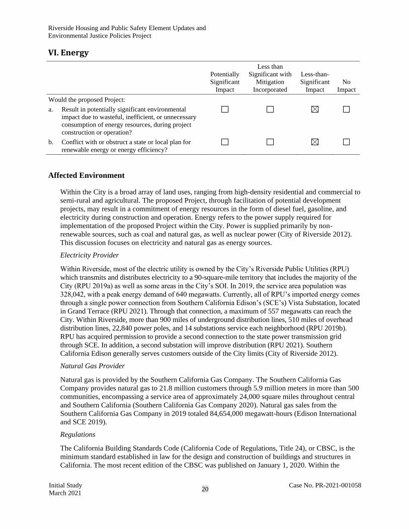
Riverside Housing and Public Safety Element Updates and
Environmental Justice Policies Project
Initial Study
March 2021 20
Case No. PR-2021-001058
VI. Energy
Potentially
Significant
Impact
Less than
Significant with
Mitigation
Incorporated
Less-than-
Significant
Impact
No
Impact
Would the proposed Project:
a. Result in potentially significant environmental
impact due to wasteful, inefficient, or unnecessary
consumption of energy resources, during project
construction or operation?
b. Conflict with or obstruct a state or local plan for
renewable energy or energy efficiency?
Affected Environment
Within the City is a broad array of land uses, ranging from high-density residential and commercial to
semi-rural and agricultural. The proposed Project, through facilitation of potential development
projects, may result in a commitment of energy resources in the form of diesel fuel, gasoline, and
electricity during construction and operation. Energy refers to the power supply required for
implementation of the proposed Project within the City. Power is supplied primarily by non-
renewable sources, such as coal and natural gas, as well as nuclear power (City of Riverside 2012).
This discussion focuses on electricity and natural gas as energy sources.
Electricity Provider
Within Riverside, most of the electric utility is owned by the City’s Riverside Public Utilities (RPU)
which transmits and distributes electricity to a 90-square-mile territory that includes the majority of the
City (RPU 2019a) as well as some areas in the City’s SOI. In 2019, the service area population was
328,042, with a peak energy demand of 640 megawatts. Currently, all of RPU’s imported energy comes
through a single power connection from Southern California Edison’s (SCE’s) Vista Substation, located
in Grand Terrace (RPU 2021). Through that connection, a maximum of 557 megawatts can reach the
City. Within Riverside, more than 900 miles of underground distribution lines, 510 miles of overhead
distribution lines, 22,840 power poles, and 14 substations service each neighborhood (RPU 2019b).
RPU has acquired permission to provide a second connection to the state power transmission grid
through SCE. In addition, a second substation will improve distribution (RPU 2021). Southern
California Edison generally serves customers outside of the City limits (City of Riverside 2012).
Natural Gas Provider
Natural gas is provided by the Southern California Gas Company. The Southern California Gas
Company provides natural gas to 21.8 million customers through 5.9 million meters in more than 500
communities, encompassing a service area of approximately 24,000 square miles throughout central
and Southern California (Southern California Gas Company 2020). Natural gas sales from the
Southern California Gas Company in 2019 totaled 84,654,000 megawatt-hours (Edison International
and SCE 2019).
Regulations
The California Building Standards Code (California Code of Regulations, Title 24), or CBSC, is the
minimum standard established in law for the design and construction of buildings and structures in
California. The most recent edition of the CBSC was published on January 1, 2020. Within the
Riverside Housing and Public Safety Element Updates and
Environmental Justice Policies Project
Initial Study
March 2021 21
Case No. PR-2021-001058
CBSC, the California Building Code (CBC) contains general building design and construction
requirements related to fire and life safety, structural safety, and access compliance (California Code
of Regulations, Title 24, Part 2). The CBC includes the mandatory California Green Building
Standards Code (CALGreen) for residential and nonresidential structures (California Code of
Regulations, Title 24, Part 11). The most recent version of CALGreen includes the 2019 Building
Energy Efficiency Standards (California Energy Commission 2019). These standards focus on four
key areas: smart residential photovoltaic systems, updated thermal envelope standards (preventing
heat transfer from the interior to exterior and vice versa), residential and nonresidential ventilation
requirements, and non-residential lighting requirements (California Energy Commission 2019).
RPU developed the Utility 2.0 Strategic Plan, a 10-year plan that calls for sustainable consumption of
water and electricity resources. The strategic plan identifies goals, strategies, objectives, and key
performance indicators to guide the allocation of resources and management of water and electricity
assets (City of Riverside 2017). The Utility 2.0 Strategic Plan’s key goals concern reliability and
resiliency, affordability, sustainability, customer experience, and operational excellence. To achieve
compliance with statewide targets related to water and electricity efficiency, renewable resources, and
greenhouse gas (GHG) emissions, the City has put into effect local policy provisions. All standards
presented in the Utility 2.0 Strategic Plan respond to the needs of development by achieving more
efficient and sustainable uses for resources.
Under California’s Renewables Portfolio Standard (RPS) program, all retail sellers of electricity in
the state must meet established renewable procurement targets in their retail electricity supply. The
renewable energy sources used by retail sellers of electricity include wind, solar photovoltaic (PV),
solar thermal, hydroelectricity, geothermal, and bioenergy. The RPS program was initially established
in 2002 by Senate Bill (SB) 1078, which required 20 percent of electricity retail sales to be served by
renewable resources by 2017. The program was subsequently accelerated in 2015 with SB 350, which
mandated a 50 percent RPS by 2030 and included interim annual RPS targets with 3-year compliance
periods that required 65 percent of RPS procurement to be derived from long-term contracts of 10 or
more years. In 2018, SB 100 was signed into law, which increased the RPS to (1) 50 percent of retail
sales by 2026 (moved up by 4 years from SB 350), (2) 60 percent of retail sales by 2030, and (3) 100
percent of retail sales by 2045 (with a carbon-free goal for 2045). RPU is required to meet the
renewable procurement targets under the RPS program.
Discussion
a. Result in potentially significant environmental impact due to wasteful, inefficient, or unnecessary
consumption of energy resources, during project construction or operation?
Less-than-Significant Impact. The proposed Project would not directly result in an impact on
energy resources. In particular, the Housing Element update is strictly a policy document that
contains goals, policies, and actions aimed at accommodating up to 24,000 new housing units by
2029 to meet the RHNA allocation; yet the Housing Element itself does not provide any entitlements
for the construction of these units. The proposed Project would allow up to 30,190 total units to be
built, including the 24,000 units required by the Regional Housing Needs Allocation (RHNA). The
Housing Element update encourages development in areas where the density can be supported by
existing infrastructure. Opportunity sites have been identified for accommodation of future and
mixed-use development to meet the housing demand. These opportunity sites are identified in Figures
5 through 18 appended to the NOP. In addition, although residential dwellings would be the largest
type of development in the City resulting from the Housing Element update, implementation of
proposed zoning code and specific plan amendments to allow fulfillment of the City’s RHNA would
also facilitate the development of housing and mixed-uses as well, including some lower-level

Riverside Housing and Public Safety Element Updates and
Environmental Justice Policies Project
Initial Study
March 2021 22
Case No. PR-2021-001058
commercial/retail, office, and potentially live/work uses. Areas proposed for rezoning are identified in
Figures 12 through 18. It is anticipated that approximately 11,501,959 square feet of non-residential
development could be accommodated in the proposed mixed-use zones under the proposed Project.
The Public Safety Element could also facilitate development of public infrastructure.
Although the Housing Element update and Zoning Code and Specific Plan amendments themselves
would not directly result in increased energy use, future developments in the City could result in an
increased consumption of energy resources. However, construction and operation of new housing,
public infrastructure, and mixed-use developments in the City would be required to comply with all
applicable state, regional and local plans, ordinances, and regulations related to energy efficiency.
Construction Energy Use
Future housing, public infrastructure, and mixed-use developments throughout the City facilitated
through project implementation would meet the residents’ varied housing needs. These future
developments would occur on parcels that are currently vacant or under-utilized as well as fully
improved. Such development would result in construction-related energy demand and consumption
related to the use of transportation fuels such as gasoline and diesel for construction workers’ vehicle
trips, hauling and material delivery, and operation of off-road construction equipment. In addition,
diesel-fueled portable generators may be necessary to meet additional electricity demands from
temporary on-site lighting, welding, and supplying energy to areas of the construction site where
electricity cannot be obtained through a hookup to the existing grid.
Unlike an individual development project for which project-specific construction information is
available, it is impractical to quantify construction-related energy consumption for all future
development that could contribute incrementally to construction emissions throughout the City.
Construction energy consumption would be evaluated for specific future housing and mixed-use
developments as future development applications are processed. The amount of fuel consumed by
these construction activities for each development would vary substantially, depending on the level of
activity, length of the construction period, specific construction operations, types of equipment, and
number of personnel. However, the construction of future housing, public infrastructure, and mixed-
use developments would involve construction activities typical of most land use developments within
the City. None of these future developments would be expected to require an extraordinary amount of
energy consumption during construction, as may occur with large industrial facilities such as new
power plants or large infrastructure facilities such as dams. Because construction activities are
considered to be relatively short-term and cease once construction of an individual project is
complete, they would represent a relatively short demand on local and regional fuel supplies and
would be easily accommodated. The operation of construction equipment for future housing, public
infrastructure, and mixed-use developments would also be required to comply with the latest U.S.
Environmental Protection Agency (EPA) and CARB engine emissions standards. These emissions
standards require highly efficient combustion systems that maximize fuel efficiency and reduce
unnecessary fuel consumption. Because of increasing transportation costs and fuel prices, contractors
and owners have a strong financial incentive to avoid wasteful, inefficient, and unnecessary
consumption of energy during construction. Overall, construction fuel consumption associated with
future housing, public infrastructure, and mixed-use developments in the City would not be any more
inefficient, wasteful, or unnecessary than other similar land use development projects of this nature.
Impacts would be less than significant.
Riverside Housing and Public Safety Element Updates and
Environmental Justice Policies Project
Initial Study
March 2021 23
Case No. PR-2021-001058
Operational Energy Use
Energy use associated with operation of future housing, public infrastructure, and mixed-use
developments in the City facilitated by the proposed Project would include electricity for interior and
exterior building lighting; heating, ventilation, and air-conditioning (HVAC); stoves and other kitchen
appliances; cleaning equipment; electronic systems; security systems; and more. Maintenance
activities during operations, such as landscape maintenance, could involve the use of electric or gas-
powered equipment. However, future developments would be required to comply with the applicable
Title 24 Building Energy Efficiency Standards, which have been established for both residential and
non-residential uses to provide minimum efficiency standards related to various building features,
including appliances, water and space heating and cooling, building insulation and roofing, and
lighting. Implementation of the Title 24 standards significantly reduces energy usage. The electricity
provider, RPU, is subject to California’s RPS. The RPS requires investor-owned utilities, electric
service providers, and community choice aggregators to increase procurement from eligible
renewable energy resources to 33 percent of total procurement by 2020 and to 60 percent of total
procurement by 2030. Renewable energy is generally defined as energy that comes from resources
that are naturally replenished within a human timescale, such as sunlight, wind, tides, waves, and
geothermal heat. The increase in reliance of such energy resources further ensures future development
facilitated by the proposed Project would not result in the waste of the finite energy resources.
In addition to on-site energy uses, future development facilitated by the proposed Project would also
result in transportation energy use associated with vehicle trips generated by the future residential and
mixed-use developments. Pursuant to the Federal Energy Policy and Conservation Act of 1975, the
National Highway Traffic and Safety Administration (NHTSA) is responsible for establishing
additional vehicle fuel standards and revising existing standards. Vehicles associated with future
residential and mixed-use developments facilitated by the proposed Project would be subject to future
compliance with federal fuel economy standards. In addition, project implementation would
accommodate future housing development throughout the City to meet the residents’ varied housing
needs. Future housing, public infrastructure, and mixed-use developments in the City facilitated by
the proposed Project would not result in any unusual characteristics that would result in excessive
operational fuel consumption. Some of these future developments would occur on parcels that are
currently vacant or under-utilized in the City, which could reduce vehicle miles traveled by future
residents where their housing is located within walking distance to commercial and other community-
serving uses. The new mixed-use developments, by their nature, would also serve to reduce
dependency on automobiles and the number of vehicle miles traveled. Fuel consumption associated
with individual development-related vehicle trips would not be considered inefficient, wasteful, or
unnecessary in comparison to other similar developments in the region.
Overall, future housing, public infrastructure, and mixed-use development activities would adhere to
all federal, state, and local requirements for energy efficiency, including the Title 24 standards, and
would not result in a substantial increase in demand or transmission service, resulting in the need for
new or expanded sources of energy supply or new or expanded energy delivery systems or
infrastructure. Residential, public infrastructure, and mixed-use development facilitated by the
proposed Project would not result in a potentially significant environmental impact due to a wasteful,
inefficient, or unnecessary consumption of energy resources during project construction or operation.
A less-than-significant impact would occur.

Riverside Housing and Public Safety Element Updates and
Environmental Justice Policies Project
Initial Study
March 2021 24
Case No. PR-2021-001058
b. Conflict with or obstruct a state or local plan for renewable energy or energy efficiency?
Less-than-Significant Impact. As discussed above, energy consumption would result from
construction and operation of future residential and some non-residential (i.e., mixed use,
infrastructure) uses in the City that would be facilitated by the proposed Project. All future residential
and mixed-use developments, facilitated by the proposed Project, would be required to comply with
the latest requirements of the CBC, which contains the mandatory CALGreen Standards, along with
the Building Energy Efficiency Standards. As proposed, all future housing, public infrastructure, and
mixed-use development projects would be required to obtain appropriate building permits and meet
all current building standards, including, but not limited to, the CBC, California Electrical Code, and
California Energy Code (Title 24).
California Green Building Standards Code
As discussed previously in the Affected Environment, the CBSC (California Code of Regulations,
Title 24) is the minimum standard establish in law for the design and construction of buildings and
structures in California. Within the CBSC, the CBC contains the mandatory CALGreen standards for
residential and nonresidential structures, including the 2019 Building Energy Efficiency Standards.
The requirements of CALGreen include, but are not limited to, the following measures:
• Compliance with relevant regulations related to future installation of electric vehicle charging
infrastructure in residential and non-residential structures;
• Mandatory periodic inspections of energy systems (i.e., furnace, air conditioner, mechanical
equipment) for nonresidential buildings of more than 10,000 square feet to ensure that all are
working at their maximum capacity according to their design efficiencies;
• Mandatory use of low-pollutant-emitting interior finish materials such as paints, carpet, vinyl
flooring, and particle board; and
• For some single-family and low-rise residential development developed after January 1, 2020,
mandatory on-site solar energy systems capable of producing 100 percent of the electricity
demand created by the residence(s). Certain residential developments, including those
developments that are subject to substantial shading, rendering the use of on-site solar
photovoltaic systems infeasible, are exempted from the foregoing requirement.
Building Energy Efficiency Standards
The 2019 Building Energy-Efficiency Standards represent a portion of the CBSC, which expands
upon energy-efficiency measures from the 2016 Building Energy-Efficiency Standards. The 2019
Building Energy Efficiency Standards are in effect for building permit applications submitted after
January 1, 2020.
The 2019 standards provide for additional efficiency improvements beyond the current 2016
standards. Non-residential buildings built in compliance with the 2019 standards are anticipated to
use approximately 30 percent less energy compared with buildings built in compliance with the 2016
standards, primarily due to lighting upgrades (California Energy Commission 2019).
For residences, compliance with the 2019 standards will result in homes using approximately 7
percent less energy because of energy efficiency measures compared with homes built under the 2016
standards. Once rooftop solar electricity generation is factored in, homes built under the 2019
standards will use approximately 53 percent less energy than those built under the 2016 standards
(California Energy Commission 2018).

Riverside Housing and Public Safety Element Updates and
Environmental Justice Policies Project
Initial Study
March 2021 25
Case No. PR-2021-001058
Future development would be subject to all relevant provisions of the most recent update to the
CBSC, including the Building Energy Efficiency Standards. Adherence to the most recent CALGreen
Standards and Building Energy Efficiency Standards would ensure that future residential and mixed-
use developments identified on opportunity sites would consume energy efficiently. Required
compliance with the CBSC would ensure that the building energy use associated with such future
development would not be wasteful, inefficient, or unnecessary. In addition, electricity supplied to
future residences and mixed-use developments by RPU would comply with the state’s RPS, which
requires investor-owned utilities, electric service providers, and community choice aggregators to
increase procurement from eligible renewable energy resources to 33 percent of total procurement by
2020 and 60 percent by 2030. As such, a portion of the energy consumed during operations would
originate from renewable sources.
Given that future development facilitated by the proposed Project would be subject to compliance
with all federal, state, and local requirements for energy efficiency, project implementation would not
conflict with or obstruct a state or local plan for renewable energy or energy efficiency, and a less-
than-significant impact would result.

Riverside Housing and Public Safety Element Updates and
Environmental Justice Policies Project
Initial Study
March 2021 26
Case No. PR-2021-001058
VII. Geology, Soils, and Paleontological Resources
Potentially
Significant
Impact
Less than
Significant with
Mitigation
Incorporated
Less-than-
Significant
Impact
No
Impact
Would the proposed Project:
a. Directly or indirectly cause potential substantial
adverse effects, including the risk of loss, injury, or
death involving:
☐ ☐ ☒ ☐
1. Rupture of a known earthquake fault, as
delineated on the most recent Alquist-Priolo
Earthquake Fault Zoning Map issued by the
State Geologist for the area or based on other
substantial evidence of a known fault? Refer to
Division of Mines and Geology Special
Publication 42.
2. Strong seismic ground shaking?
3. Seismically related ground failure, including
liquefaction?
4. Landslides?
b. Result in substantial soil erosion or the loss of
topsoil?
c. Be located on a geologic unit or soil that is unstable
or that would become unstable as a result of the
proposed Project and potentially result in an on-site
or off-site landslide, lateral spreading, subsidence,
liquefaction, or collapse?
d. Be located on expansive soil, as defined in Table 18-
1-B of the Uniform Building Code (1994), creating
substantial direct or indirect risks to life or property?
e. Have soils incapable of adequately supporting the
use of septic tanks or alternative wastewater disposal
systems in areas where sewers are not available for
the disposal of wastewater?
f. Directly or indirectly destroy a unique
paleontological resource or site or unique geologic
feature?
Affected Environment
Physiography
The City is situated north of the Peninsular Ranges and south of the Transverse Range, with the San
Bernardino Mountains to the north and the San Jacinto Mountains to the east. Elevations in the City
range from approximately 700 feet amsl near the Santa Ana River to almost 1,400 feet amsl west of
La Sierra. Land within the City is mostly flat, with natural slopes of less than 15 percent, although
some slopes of 25 percent are found in the eastern and western portions of the City. Steeper slopes
exist outside the City but within its SOI (Albert A. Webb Associates 2007).

Riverside Housing and Public Safety Element Updates and
Environmental Justice Policies Project
Initial Study
March 2021 27
Case No. PR-2021-001058
Subsurface Conditions
The City is generally underlain with subsurface deposits dating from the Mesozoic period, consisting
of granite, adamellite, Mesozoic granitic rock, granodiorite, and Mesozoic basic intrusive rocks.
Alluvium deposits date from the Quaternary (Albert A. Webb Associates 2007).
Seismicity and Seismic Hazards
Primary Seismic Hazards
Surface Fault Rupture
The City lies in a seismically active area of the United States; however, no Alquist-Priolo Fault Zones
or active faults has been mapped within the General Plan area (City of Riverside 2007). As shown in
Figure 7-1 of the GP 2025, the active faults include the San Andreas fault, the San Jacinto fault, and
the Elsinore fault. In a seismically active area, the potential of future faulting occurring in areas where
faults have not been mapped exists; however, the risk of surface fault rupture in the City is considered
low.
Seismic Ground Shaking
Ground shaking is the most widespread hazardous phenomenon associated with seismic activity, and
the City is located within a seismically active area. Several known faults in the region have the
potential to generate significant seismic ground shaking. The San Andreas fault is within 11 miles of
downtown and capable of producing an 8.3 magnitude (M) earthquake, the San Jacinto fault is
approximately 7 miles from downtown and capable of producing a 7.0 M earthquake, and the
Elsinore fault is within 13 miles of downtown and capable of producing a 6.0 M earthquake (City of
Riverside 2007). The risk of seismic ground shaking in the area is considered high.
Secondary Seismic Hazards
Liquefaction
Liquefaction occurs when saturated soils lose cohesion, strength, and stiffness with applied shaking,
such as that from an earthquake. The lack of cohesion causes solid soil to behave like a liquid,
resulting in ground failure. When a load such as a structure is placed on ground that is subject to
liquefaction, ground failure can result in the structure sinking and soil being displaced. Ground failure
can take on many forms, including flow failures, lateral spreading, lowering of the ground surface,
ground settlement, loss of bearing strength, ground fissures, and sand boils. Liquefaction within
subsurface layers, which can occur during ground shaking associated with an earthquake, can also
result in ground settlement.
The majority of the City has not been evaluated for liquefaction by the California Geological Survey
(California Geological Survey 2021). However, soils prone to liquefaction are located throughout the
City, particularly along watercourses, arroyos, and the Santa Ana River. Riverside has four primary
liquefaction areas, the area along the Santa Ana River, a broad area south and west of Riverside
Municipal Airport, a portion in western Riverside spanning La Sierra Avenue, and a smaller area
along the City’s southern boundary. Most of the land in the SOI is not susceptible to liquefaction
(City of Riverside 2007).

Riverside Housing and Public Safety Element Updates and
Environmental Justice Policies Project
Initial Study
March 2021 28
Case No. PR-2021-001058
Lateral Spreading
Lateral spreading is a phenomenon in which a surficial soil displaces along a shear zone that formed
within an underlying liquefied layer. The surficial blocks are transported downslope or in the
direction of a free face, such as a bay or creek, by earthquake and gravitational forces. Lateral
spreading is generally the most pervasive and damaging type of liquefaction-induced ground failure
generated by earthquakes. In general, for lateral spreading to occur, soils must consist of saturated,
cohesionless sandy sediments in an area where there is a high groundwater table and an open face
such as a cliff or streambank. The risk of lateral spreading in the City is highest near the Santa Ana
River and along arroyos and watercourses.
Expansive Soils and Weak Soils
Expansive soils are characterized by their ability to undergo significant volume changes (i.e., shrink
and swell) due to variations in moisture content. Expansive soils are typically very fine grained and
have a high to very high percentage of clay. They can damage structures and buried utilities and
increase maintenance requirements. The presence of expansive soils is typically associated with high
clay content. Generally, future development in areas with expansive soils may require special
building foundations or grade preparation, such as the removal of problematic soils and replacement
with engineered soils. However, the relative strength or weakness of alluvial soils also depends on the
combination of clay and sand.
Soils considered to have a high shrink-swell potential occur primarily west of Riverside Municipal
Airport and within the Lake Mathews drainage area but can be found throughout the City (City of
Riverside 2007). The highest risk of impacts resulting from expansive soils are expected to be near
the airport and the Lake Mathews drainage area, though other areas may be affected as well.
Weak soils can compress or collapse under the weight of buildings and fill, causing settlement
relative to the thickness of the weak soil. Usually the thickness of weak soil varies, and differential
settlement does occur. Some weak soils, specifically unconsolidated settlements, can amplify shaking
during an earthquake and, when saturated, can be susceptible to liquefaction.
Soil associations in the City are generally well-drained sandy loams that are moderately deep;
however, weak soils have been found in the north western portion of the City, in the area surrounding
State Route 91 (Albert A. Webb Associates 2007). The highest risk of impact resulting from weak
soils is expected to be in the northeastern part of the City, though other areas may be affected as well.
Erodible Soils
Soils erosion is a natural process by which soil particles are removed by wind, water, or gravity.
Different soils will have different susceptibilities to erosion, depending on particle size, gradation,
organic structure, and permeability. In addition, topography, including the length and steepness of a
slope, and the presence of vegetative cover influence a soil’s susceptibility to erosion. Soils
containing a high percentage of silt or very fine clay are generally the most erodible.
The City is underlain by areas that are susceptible to erosion. Soils with high potential for erosion are
particularly prevalent in the northwest portion of the City, near Arlington Avenue; the southeast
portion of the City, near Gentian Avenue; and south of Lake Mathews (Albert A. Webb Associates
2007).
Riverside Housing and Public Safety Element Updates and
Environmental Justice Policies Project
Initial Study
March 2021 29
Case No. PR-2021-001058
Landslides
Landslides occur when the stability of a slope changes from a stable to an unstable condition. The
stability of a slope is affected by the following primary factors: inclination, material type, moisture
content, orientation of layering, and vegetative cover. In general, steeper slopes are less stable than
more gently inclined ones. Although most of the City is relatively flat, the western and northeastern
portions of the City are susceptible to landslides and rockfalls (City of Riverside 2007).
Paleontological Resources
Fossils (paleontological resources) preserve information about ancient animals and plants (University
of California Museum of Paleontology n.d.). There are two types of fossils: body fossils (remains of
an organism) and trace fossils (e.g., footprints, burrows, trails). Fossils can add to the scientific record
by providing information about the anatomy of an organism and clues to its life processes, the
successive evolutional evolution of organisms, and successive colonization of habitats. Fossils are a
nonrenewable resource; that is, once destroyed, a fossil cannot be replaced. Fossils represent
irreplaceable evidence of past life on the planet (National Park Service 2020).
Fossils occur within geologic units. A geologic unit is a volume of rock or sediment of identifiable
origin with an age range that is defined by distinctive and dominant features. Generally, geologic
units of middle Holocene age (last approximately 5,000 years) are too recent to yield significant
fossils, but geologic units in certain older depositional environments have the potential to yield
significant fossils (Society of Vertebrate Paleontology 2010). Significant fossils (or sensitive
paleontological resources) are defined by the Society of Vertebrate Paleontology (2010) as being
“identifiable vertebrate fossils, large or small, uncommon invertebrate, plant, and trace fossils, and
other data” that provide information valuable to the scientific community. Geologic units have
varying potential to contain significant fossils, called paleontological sensitivity.
The following analysis is based on information presented in a report from the California Museum of
Paleontology describing fossils retrieved near the project area, a report prepared for RPU regarding
the study area (Powers Engineers 2010), and the County of Riverside Paleontological Sensitivity
Model. The analysis evaluates the likelihood of significant paleontological resources being present in
geologic units with high paleontological sensitivity in the study area.
Mapping in the study area shows surficial deposits as Dune sand, Holocene alluvium, Pleistocene
nonmarine deposits, and Mesozoic granitic rocks (Rogers 1965, 1967; Power Engineers and Deméré
2010). The granite rocks ring the lower elevations of the City (Power Engineers 2010). Paleozoic and
Mesozoic metamorphic rock, late Mesozoic plutonic rock, and Cretaceous and Cenozoic sedimentary
rock underlie the surficial units. Sedimentary geologic units underlying the study area that are older
than the Holocene (i.e., Dune sand and Holocene alluvium) have the potential to contain significant
paleontological resources.
Significant paleontological resources exist in many areas in Southern California, including in
Riverside County near the City. According to the investigation executed by the Natural History
Museum of Los Angeles County, several vertebrate fossils have been recovered from unspecified
Pleistocene geologic units and the early Pliocene to early Pleistocene San Timoteo Formation (Bell
pers. comm.). Fossils that were recovered include Masticophis (a genus of whip snake) and members
of the Bovidae, Equidae, and Camelidae families. In addition, a south-trending bend in the Santa Ana
River yielded fossils from Ice Age mammals, including Mammuthus (an extinct genus of mammoth)
(Albert A. Webb Associates 2007). Because people collected fossils from the site and lands along the
Santa Ana River in this area have been converted to residential development, the previous exposure
that yielded the fossils is no longer visible.

Riverside Housing and Public Safety Element Updates and
Environmental Justice Policies Project
Initial Study
March 2021 30
Case No. PR-2021-001058
The County of Riverside Paleontological Sensitivity Model maps paleontological sensitivity
throughout Riverside County, including the City of Riverside. It recognizes four categories of
sensitivity, High A, High B, Low, and Undetermined. According to the Society of Vertebrate
Paleontology (2010), a geologic unit with undetermined paleontological sensitivity requires a field
study by a qualified paleontologist to determine the paleontological potential of this unit before an
impact determination and mitigation program can be made. Accordingly, geologic units with High A,
High B, and Undetermined paleontological sensitivity have the potential to yield significant
paleontological resources.
The County of Riverside Paleontological Sensitivity Model shows that most of the area within the
City limits contains geologic units with High A, High B, or Undetermined paleontological sensitivity,
with a minority containing geologic units with low paleontological sensitivity.
Discussion
a.1. Directly or indirectly cause potential substantial adverse effects, including the risk of loss, injury, or
death involving: Rupture of a known earthquake fault, as delineated on the most recent Alquist-Priolo
Earthquake Fault Zoning Map issued by the State Geologist for the area or based on other substantial
evidence of a known fault? Refer to Division of Mines and Geology Special Publication 42.
Less-than-Significant Impact. As discussed under Primary Seismic Hazards, although the City lies
within a seismically active area, no Alquist-Priolo Fault Zones or active faults transverse the City.
The proposed Project could result in the development and construction of new housing and public
safety infrastructure. Although the proposed Project would provide the framework for future
development, no specific development projects are proposed as part of these changes. Policy PS-1.1
of GP 2025 ensures that that all new development in Riverside abides by the most recently adopted
City and state seismic and geotechnical requirements. As such, any future development occurring
because of the proposed Project would require a geotechnical investigation and/or compliance with
the CBC, which would address the risk of fault rupture. The proposed Project, which consists of
changes to elements of GP 2025 would not exacerbate the risk of surface fault rupture. Because the
risk of fault rupture is considered low in the City, development resulting from the proposed Project
would be required to prepare a geotechnical investigation disclosing the site-specific risk of fault
rupture at a future development site, and the proposed Project would not exacerbate the risk of surface
fault rupture, this impact would be less than significant.
a.2. Directly or indirectly cause potential substantial adverse effects, including the risk of loss, injury, or
death involving: Strong seismic ground shaking?
Less-than-Significant Impact. As discussed under Primary Seismic Hazards, the City is in a
seismically active area near several active faults that can produce earthquakes of 6.0 M or greater.
Seismic ground shaking could be felt throughout the City. The proposed Project could result in the
development and construction of new housing and public safety infrastructure. As such, future
developments constructed because of the proposed Project could experience seismically related
ground shaking during an earthquake. However, future development resulting from the proposed
Project would be required to comply with general plan policies and CBSC requirements, which would
require preparation of a geotechnical investigation, thereby reducing risks to life from damage to
newly constructed buildings and structures as the result of seismic ground shaking. As the proposed
Project would not exacerbate the risk of ground shaking, future developments facilitated by the
proposed Project would be required to comply with General Plan policies and building code
requirements, this impact would be less than significant.

Riverside Housing and Public Safety Element Updates and
Environmental Justice Policies Project
Initial Study
March 2021 31
Case No. PR-2021-001058
a.3. Directly or indirectly cause potential substantial adverse effects, including the risk of loss, injury, or
death involving: Seismically related ground failure, including liquefaction?
Less-than-Significant Impact. As discussed under Secondary Seismic Hazards, although soils that
are prone to liquefaction are located throughout the City, the highest liquefaction risk is concentrated
in four areas, the area along the Santa Ana River, the area south and west of Riverside Municipal
Airport, an area in western Riverside spanning La Sierra Avenue, and a smaller area along the City’s
southern boundary. Although the proposed Project would not include any specific developments, the
Housing and Public Safety Elements updates, development of environmental justice policies, and
Zoning Code and specific plan amendments, could result in the development and construction of new
housing, mixed-use, and public safety infrastructure. Development could be proposed on parcels that
are underlain by liquefiable soils. However, future development resulting from the proposed Project
would be required to comply with General Plan policies, such as Policy PS-1.6, which requires the
City building official to explore and implement, where feasible, best practices and latest technologies
to minimize damage to structures in areas determined to have a high liquefaction potential during
seismic activities. In addition, future development resulting from the proposed Project would comply
with CBSC requirements (e.g., submission of a preliminary soils report and a soils engineering
analysis). The report would identify any liquefiable soils at the development site and provide
recommendations to reduce the risk associated with liquefaction. Because any future development
occurring as a result of the proposed Project on potentially liquefiable soils would comply with
general plan policies and CBSC requirements and may require a soils report and engineering analysis
that would provide recommendations to reduce the risk of liquefaction during a seismic event, the
proposed Project would result in a less-than-significant impact related to liquefaction.
Less-than-Significant Impact. As discussed under Expansive Soils and Weak Soils, weak soils are
present in different areas of the City, and although the proposed Project would not include any
specific development, changes to the General Plan could provide for future development of
residential units, which could be proposed on these soils. However, as discussed above regarding
liquefaction, future development resulting from the proposed Project would comply with CBSC
requirements, which could require the submission of a preliminary soils report and a soils engineering
analysis, depending on the site. The report would identify any weak soils at development sites and
provide recommendations to reduce the risks associated with construction on these parcels. Because
any future development facilitated by the proposed Project would comply with the recommendations
in the applicable soils report, as well as standard regulations required by the CBC, the proposed
Project would result in a less-than-significant impact related to weak soils.
Less-than-Significant Impact. As discussed under Lateral Spreading, lateral spreading poses the
greatest risk in cohesionless sandy sediments over a high groundwater table in the vicinity of an open
face, such as a cliff or a streambank. The risk of lateral spreading in the City is highest near the Santa
Ana River and along arroyos and watercourses; none of the opportunity sites are in these areas. While
the proposed Project does not include any specific development, changes to the general plan could
provide for future development of housing and mixed-use development at opportunity sites, which
could place development in areas that are at risk of lateral spreading. However, any development
resulting from the proposed Project would be required to comply with standard regulatory
requirements of the CBC, which would require construction, including foundations, to be designed to
minimize risk resulting from lateral spreading. Future developments would also be subject to GP
2025 Policy PS-1.1, which would ensure that all new development in the City would abide by the
most recently adopted City and state seismic and geotechnical requirements. The proposed Project
would result in a less-than-significant impact related to lateral spreading.

Riverside Housing and Public Safety Element Updates and
Environmental Justice Policies Project
Initial Study
March 2021 32
Case No. PR-2021-001058
a.4. Directly or indirectly cause potential substantial adverse effects, including the risk of loss, injury, or
death involving: Landslides?
Less-than-Significant Impact. As discussed under Landslides, although most of the City is relatively
flat, the western and northeastern portions are susceptible to landslides and rockfalls. Although the
proposed Project would not include any specific developments, the proposed Project could result in
the development and construction of new housing, public safety infrastructure, and mixed-use
development on opportunity sites. However, GP 2025 includes policies that limit development on
steep or unstable slopes, and none of the opportunity sites are in these areas. Policy PS-1.4
recommends the use of open space easements and other regulatory techniques to prohibit
development and avoid creating public safety hazards where geologic instability is identified and
cannot be mitigated. Because future development projects facilitated by the proposed Project would
comply with policies in GP 2025, the proposed Project would result in a less-than-significant impact
related to landslides.
b. Result in substantial soil erosion or the loss of topsoil?
Less-than-Significant Impact. Although the proposed Project would not include any specific
developments, the proposed Project could result in the development and construction of new housing,
mixed-use development, and public safety infrastructure at opportunity sites. As a result, new
development could occur on a variety of slopes, grades, and soil types where erosion could occur. As
discussed under Erodible Soils, soils with a high susceptibility to erosion are located throughout the
City but are especially prevalent in the northwest portion of the City near Arlington Avenue and in
the southeast portion of the City near Gentian Avenue. . Development facilitated by the proposed
Project could require excavation, stockpiling of spoil materials, and grading, which could expose soils
to erosion or lead to the loss of topsoil. However, as discussed in Section X, Hydrology and Water
Quality, development of sites one acre or larger facilitated by the proposed Project would require a
Stormwater Pollution Prevention Plan (SWPPP) in compliance with the Construction General Permit,
local stormwater ordinances, and other related requirements. The SWPPP would require best
management practices (BMPs) for earthmoving and clearing activities to minimize any mobilization
of sediment, stabilize disturbed areas, and control sediment. Because the proposed Project itself does
not include any construction that could lead to erosion, and future developments facilitated by the
proposed Project would be required to implement a SWPPP that would include erosion control
BMPs, this impact would be less than significant.
c. Be located on a geologic unit or soil that is unstable or that would become unstable as a result of the
proposed Project and potentially result in an on-site or off-site landslide, lateral spreading, subsidence,
liquefaction, or collapse?
Less-than-Significant Impact. Although the proposed Project would not include any specific
developments, the proposed Project could result in the development and construction of new housing,
public safety infrastructure, and mixed-use development, which could be located on parcels that are
underlain by liquefiable soils. Liquefaction is discussed above in Impact a.3.
Soil type and groundwater depth vary across the City, but it is assumed that the risk of lateral
spreading is highest near the Santa Ana River and along arroyos and watercourses, areas where the
risk for liquefaction is higher than it is in the rest of the county. Lateral spreading is discussed
above in Impact a.3.
Although the proposed Project would not include any specific developments, future developments
that could result from the proposed Project could be placed on geologic unit or soil that is unstable or
that would become unstable because of the proposed Project. However, any development resulting

Riverside Housing and Public Safety Element Updates and
Environmental Justice Policies Project
Initial Study
March 2021 33
Case No. PR-2021-001058
from the proposed Project would be required to comply with CBSC requirements, which would
require submission of a preliminary soils report and a soils engineering analysis to identify unstable
geologic units and/or soils. The report would provide recommendations to reduce the risk associated
any potential instability at a future development site. Future developments would also be subject to
GP 2025 Policy PS-1.1, which would ensure that all new development in the City would abide by the
most recently adopted state seismic and geotechnical requirements. Because the proposed Project
would not construct any new development, and future development resulting from the proposed
Project would be required to abide CBSC requirements and City policies, the proposed Project would
result in a less-than-significant impact related to the placement of structures on an unstable geologic
unit or soil.
d. Be located on expansive soil, as defined in Table 18-1-B of the Uniform Building Code (1994),
creating substantial direct or indirect risks to life or property?
Less-than-Significant Impact. As discussed under Expansive Soils and Weak Soils, the City is
underlain by soils with a high shrink-swell potential, particularly in the area west of Riverside
Municipal Airport and within the Lake Mathews drainage area. Although the proposed Project
would not include any specific developments, future developments that could result from the
proposed Project could be placed on expansive soils. However, future development facilitated by
the proposed Project would comply with CBSC requirements, which would require the submission
of a preliminary soils report and a soils engineering analysis. The report would identify any
expansive soils at development sites and provide recommendations to reduce the risks associated
with construction on these parcels. Because any future development facilitated by the proposed
Project would comply with the recommendations in the applicable soils report, as well as standard
regulations required by the CBC, the proposed Project would result in a less-than-significant impact
related to expansive soils.
e. Have soils incapable of adequately supporting the use of septic tanks or alternative wastewater
disposal systems in areas where sewers are not available for the disposal of wastewater?
Less-than-Significant Impact. Although the proposed Project would not include any specific
developments, the City’s Housing and Public Safety Elements and environmental justice updates
could result in the development and construction of new housing and mixed-use development and
public safety infrastructure. The opportunity sites are located near existing wastewater
infrastructure. As discussed in Section XIX, Utilities and Service Systems, development resulting
from the proposed Project would connect predominantly to existing water and wastewater disposal
lines maintained by the City of Riverside Public Works Department and would not rely on septic
tanks or alternative wastewater disposal systems. However, it is possible that some housing units,
such as accessory dwelling units, could be constructed on sites that are served by septic systems.
This development is expected to be minimal and a negligible percentage of overall housing
development. It would most likely not be located on soils that would be incapable of adequately
supporting the use of septic tanks or alternative wastewater disposal systems. As such, the impact
would be less than significant.
f. Directly or indirectly destroy a unique paleontological resource or site or unique geologic feature?
Potentially Significant Impact. Because paleontological resources are generally located below the
ground surface, ground disturbance associated with construction, such as excavating, grading, and
resurfacing, in a geologic unit that may contain significant fossils could affect paleontological
resources that may be present at the site. The proposed Project would enable future development and
the construction of new housing, public safety infrastructure, and mixed-use development. In
identifying opportunity sites, attempts have been made to eliminate locations with high

Riverside Housing and Public Safety Element Updates and
Environmental Justice Policies Project
Initial Study
March 2021 34
Case No. PR-2021-001058
paleontological sensitivity. The Public Safety Element could also facilitate development of new
public infrastructure. Accordingly, future developments facilitated by the proposed Project could
involve ground disturbance. Depending on the depth of disturbance and how far below ground surface
the paleontological resources may be located, these ground disturbances have the potential to damage
or destroy such resources.
As discussed above, the County of Riverside Paleontological Sensitivity Model shows that most of
the area within the City limits contains geologic units with High A, High B, or Undetermined
paleontological sensitivity, with a minority containing geologic units with Low paleontological
sensitivity. Because the opportunity sites under the proposed Project are situated throughout the City,
it is likely that some of these sites are located on geologic units with High A, High B, or
Undetermined paleontological sensitivity. Project construction could disturb previously unknown
significant fossils, potentially damaging or destroying these fossils. It is unlikely that operation of the
proposed Project would include ground-disturbing activities. However, future development facilitated
by the proposed Project could result in the need for operations-period ground disturbance, such as
landscaping or maintenance. Depending on the location and depth of ground disturbance, proposed
operations could disturb previously unknown significant fossils, potentially damaging or destroying
such fossils.
GP 2025 Policy HP-1.3 protects paleontological resources. The policy states that the City shall
protect sites of archaeological and paleontological significance and ensure compliance with all
applicable state and federal cultural resources protection and management laws in its planning and
project review process. However, despite compliance with Policy HP-1.3, impacts would remain
potentially significant and this topic will be evaluated in the forthcoming EIR.

Riverside Housing and Public Safety Element Updates and
Environmental Justice Policies Project
Initial Study
March 2021 35
Case No. PR-2021-001058
VIII. Greenhouse Gas Emissions
Potentially
Significant
Impact
Less than
Significant with
Mitigation
Incorporated
Less-than-
Significant
Impact
No
Impact
Would the proposed Project:
a. Generate greenhouse gas emissions, either directly
or indirectly, that may have a significant impact on
the environment?
b. Conflict with an applicable plan, policy, or
regulation adopted for the purpose of reducing the
emissions of greenhouse gases?
Affected Environment
Increases in fossil fuel combustion and deforestation have increased concentrations of GHGs in the
atmosphere. Rising atmospheric concentrations of GHGs more than natural levels result in increasing
global surface temperatures—a phenomenon commonly referred to as climate change. The primary
associated GHG emissions are carbon dioxide (CO2), methane (CH4), nitrous oxide (N2O), and
fluoridated compounds. Assembly Bill (AB) 32 sets forth the regulatory framework in California to
reduce emissions to 1990 levels by 2020. SB 32 builds on AB 32 and establishes a longer-term goal
of 40 percent below 1990 levels by 2030. Unlike criteria pollutants, which are primarily pollutants of
regional and local concern, GHGs are a global problem, and GHG impacts are inherently cumulative.
As part of the City of Riverside’s Climate Economic Prosperity Action Plan and Climate Action Plan
(CAP), prepared in 2016, the City developed a community-wide baseline GHG emissions inventory;
according to Appendix C of the RRO-CAP, 2007 and 2010 inventories were used as a baseline for
modeling done in 2016.
Discussion
a. Generate greenhouse gas emissions, either directly or indirectly, that may have a significant impact
on the environment?
Potentially Significant Impact. The proposed Project, which includes Housing and Public Safety
Elements updates, development of environmental justice policies, and Zoning Code and Specific Plan
amendments, would not directly result in any construction-related or operational GHG emissions.
However, subsequent housing, public infrastructure, and mixed-use developments facilitated by the
Housing and Public Safety Element updates could result in GHG emissions from their future
construction and operation. Consequently, the proposed Project has the potential to have an indirect
significant impact on the environment. The impact is potentially significant and will be analyzed in
the forthcoming EIR.
b. Conflict with an applicable plan, policy, or regulation adopted for the purpose of reducing the
emissions of greenhouse gases?
Potentially Significant Impact. The City adopted its CAP in January 2016. The CAP includes
baseline and forecast GHG inventories, reduction targets, and measures to reach those targets (City of
Riverside 2016). The construction of new housing, mixed-use development, and public infrastructure
facilitated by the proposed Project could increase forecast emissions in the city, above emissions
Riverside Housing and Public Safety Element Updates and
Environmental Justice Policies Project
Initial Study
March 2021 36
Case No. PR-2021-001058
levels projected in the CAP, which may impede attainment of the CAP targets. The proposed Project
could result in a potentially significant impact related to a conflict with applicable plans, policies, or
regulations adopted for the purpose of reducing emissions of GHGs. This impact is potentially
significant and will be analyzed in the forthcoming EIR.

Riverside Housing and Public Safety Element Updates and
Environmental Justice Policies Project
Initial Study
March 2021 37
Case No. PR-2021-001058
IX. Hazards and Hazardous Materials
Potentially
Significant
Impact
Less than
Significant with
Mitigation
Incorporated
Less-than-
Significant
Impact
No
Impact
Would the proposed Project:
a. Create a significant hazard to the public or the
environment through the routine transport, use, or
disposal of hazardous materials?
b. Create a significant hazard to the public or the
environment through reasonably foreseeable upset
and accident conditions involving the release of
hazardous materials into the environment?
c. Emit hazardous emissions or involve handling
hazardous or acutely hazardous materials,
substances, or waste within one-quarter mile of an
existing or proposed school?
d. Be located on a site that is included on a list of
hazardous materials sites compiled pursuant to
Government Code Section 65962.5 and, as a result,
would it create a significant hazard to the public or
the environment?
e. Be located within an airport land use plan area or,
where such a plan has not been adopted, be within
two miles of a public airport or public use airport,
and result in a safety hazard or excessive noise for
people residing or working in the project area?
f. Impair implementation of or physically interfere
with an adopted emergency response plan or
emergency evacuation plan?
Affected Environment
Hazardous materials in various forms can cause death, serious injury, or long-lasting health effects
and damage buildings, homes, and other property. Hazards to human health and the environment can
occur during the production, storage, transportation, use, or disposal of hazardous materials.
Household hazardous waste refers to the used or leftover contents of consumer products that contain
materials with one of the four characteristics of a hazardous waste, toxicity, ignitability, corrosivity,
or reactivity. Other important areas of concern for the analysis of hazards and hazardous materials
under CEQA are Airport Influence Areas (AIAs), which are used in land use planning to identify
areas that are commonly overflown by aircraft as they approach and depart an airport or as they fly
within established airport traffic patterns. Other considerations are disaster preparedness and
emergency response, which are important for establishing the most effective and efficient ways to
address issues regarding hazards and minimize their effects on life and property, reduce the potential
for disasters, and recover from the effects of disasters as quickly as possible.

Riverside Housing and Public Safety Element Updates and
Environmental Justice Policies Project
Initial Study
March 2021 38
Case No. PR-2021-001058
Hazardous Materials
A review of the State Water Resources Control Board’s GeoTracker and the Department of Toxic
Substances Control’s (DTSC’s) EnviroStor identified multiple hazardous material cleanup sites
within the City, including Leaking Underground Storage Tank (LUST) Cleanup Sites, Cleanup
Program Sites, Military Cleanup Sites, and DTSC Cleanup Sites located throughout the City. A brief
description of the sites is included below.
• LUST Cleanup Sites: Includes all Underground Storage Tank (UST) sites that have had an
unauthorized release (i.e., leak or spill) of a hazardous substance.
• Cleanup Program Sites: Includes all "non-federally owned" sites that are regulated under the State
Water Resources Control Board's Site Cleanup Program and/or similar programs conducted by
each of the nine Regional Water Quality Control Boards.
• Military Cleanup Sites: Includes all cleanup sites that are located on existing military bases or
those that are to be transferred.
• DTSC Cleanup Sites: There are several sub-categories within the DTSC’s Cleanup Sites
category. These can include Cal-Mortgage, Evaluation, Federal Superfund, Formerly Used
Defense Sites, School, State Response, and Voluntary Cleanup sites.
Typically, residential and institutional land uses are not associated with a significant impact from
hazardous materials. Although several chemicals and other hazardous materials are used in
households, including automotive batteries and fluids, such as oil, paints, and cleaning chemicals,
several programs and facilities have been established for proper disposal of these materials.
Schools
According to the GP 2025’s Education Element, the City hosts three universities (University of
California, Riverside; California Baptist University; La Sierra University), a college (Riverside
Community College), two school districts (Riverside and Alvord Unified School Districts), and
several private schools throughout the City.
Airports
Riverside Municipal Airport is within the western portion of the City limits (and is the only airport
within the City). The airport includes two intersecting runways and occupies some 441 acres. March
Air Reserve Base and Flabob Airport are adjacent to the City, in Riverside County.
Discussion
a. Create a significant hazard to the public or the environment through the routine transport, use, or
disposal of hazardous materials?
Less-than-Significant Impact. Implementation of the proposed Project would lead to additional
development as well as other land use activities that would require the routine transport, use, or
disposal of hazardous materials and hazardous wastes within the City. If accidentally released, these
materials could result in exposure risks for construction personnel and nearby residents. Such
transport, use, and disposal must comply with applicable federal and state regulations, such as the
Resource Conservation and Recovery Act, Department of Transportation Hazardous Materials
Regulations, etc. Although fuel, paint products, lubricants, solvents, cleaning products, and fertilizers
would be transported, used, and disposed of, these materials are typically used in construction
projects and would not represent the transport, use, and disposal of acutely hazardous materials.

Riverside Housing and Public Safety Element Updates and
Environmental Justice Policies Project
Initial Study
March 2021 39
Case No. PR-2021-001058
For facilities that handle hazardous materials during operations, California Health and Safety Code
Section 25507 requires businesses to establish and implement a Hazardous Materials Business Plan
for emergency response to a release or threatened release of a hazardous material. This requirement
applies to businesses that handles a hazardous material or a mixture above the thresholds described in
Section 25507.
Because of the nature of residential and some commercial development, especially mixed-use
developments, only common hazardous materials, such as solvents, paints, and fuels, would be used.
These materials would be used infrequently and in small amounts. Releases involving these materials
would be localized and cleaned up as they occur. The routine transport, use, or disposal of hazardous
materials associated with implementation of the proposed Project would be a less-than-significant
impact.
b. Create a significant hazard to the public or the environment through reasonably foreseeable upset
and accident conditions involving the release of hazardous materials into the environment?
Potentially Significant Impact. As mentioned under the Affected Environment, LUST Cleanup Sites,
Cleanup Program Sites, Military Cleanup Sites, and DTSC Cleanup Sites exist throughout the City.
As such, hazardous materials sites with the potential for contaminated on-site soil and/or groundwater
exist. It is possible that implementation of the updates to the proposed Project could result in
development occurring within or immediately adjacent to one of these hazardous materials sites,
especially if new residential and mixed-use development facilitated by the proposed Project occurs in
previously designated industrial areas. Depending on the contaminant characteristics and extent of
contamination, excavation activities conducted during construction could encounter contaminated
groundwater and/or contaminated soil. Contaminated sites would require remediation in coordination
with the applicable federal, state, and/or local agency (e.g., EPA, State Water Resources Control
Board, DTSC, or the Environmental Health or Fire Department). For contaminated sites, construction
could also require implementation of engineering controls to minimize the risk of potential exposure
to hazardous waste for construction personnel and the surrounding environment. Because of the
potential for significant impacts, this topic will be analyzed further in the forthcoming EIR.
c. Emit hazardous emissions or involve handling hazardous or acutely hazardous materials, substances,
or waste within one-quarter mile of an existing or proposed school?
Potentially Significant Impact. School sites are located throughout the City, and implementation of
the proposed Project could result in construction occurring near an existing or proposed school.
Construction activities arising from the proposed Project would involve the routine transport, use, and
disposal of hazardous materials; however, these would be materials that are typically used in
construction projects and would not include acutely hazardous materials. The transport, use, and
disposal of typical construction hazardous materials would comply with applicable federal, state, and
local regulations.
Because there are multiple hazardous material cleanup sites within the City’s boundaries, it is
possible that the proposed Project could result in development in contaminated areas near a school
site. However, contaminated sites would require remediation in coordination with the applicable
federal, state, and/or local agency. They could also require implementation of engineering controls to
minimize the risk of exposure for construction personnel and the surrounding environment, including
nearby schools. This topic will be analyzed further in the forthcoming EIR.

Riverside Housing and Public Safety Element Updates and
Environmental Justice Policies Project
Initial Study
March 2021 40
Case No. PR-2021-001058
d. Be located on a site that is included on a list of hazardous materials sites compiled pursuant to
Government Code Section 65962.5 and, as a result, would it create a significant hazard to the public or
the environment?
Potentially Significant Impact. A review of the State Water Resources Control Board’s GeoTracker
and DTSC’s EnviroStor websites identified multiple hazardous material cleanup sites within City
boundaries, including State Water Resources Control Board LUST Cleanup Sites, Cleanup Program
Sites, and Military Cleanup Sites and DTSC Cleanup Sites (State Water Resources Control Board and
DTSC 2020). Because the proposed Project would promote additional development, including in
industrial areas that could be rezoned for residential and/or mixed uses, it is possible that construction
could occur within or immediately adjacent to one of the aforementioned hazardous material cleanup
sites, including sites classified as “Cortese List” sites.2 Soil and groundwater disturbances within
these locations have the potential to expose construction personnel and the surrounding environment
to hazardous waste. Sites under the purview of the State Water Resources Control Board or DTSC
would be required to undergo remediation and cleanup to the satisfaction of said agencies before
construction activities could commence. Hazardous waste handled during remediation would require
compliance with all applicable federal, state, and local laws. This topic could result in potentially
significant impacts and will be analyzed in the forthcoming EIR.
e. Be located within an airport land use plan area or, where such a plan has not been adopted, be within
two miles of a public airport or public use airport, and result in a safety hazard or excessive noise for
people residing or working in the project area?
Less-than-Significant Impact. Because the proposed Project could occur in all parts of the City, the
potential exists for development to occur within Riverside Municipal Airport’s AIA and to be subject
to noise level restrictions, along with intensity and height limitations within aircraft hazard zones
(County of Riverside 2005a). According to the 2005 Riverside County Airport Land Use
Compatibility Plan Policy Document (County of Riverside 2005b), the AIA for Riverside Municipal
Airport is characterized as follows: The instrument approach route and typical extent of the airport
traffic pattern define the of the AIA boundary for Riverside Municipal Airport. To the east and west,
this boundary coincides mostly with the outer edge of the airport’s FAR Part 77 conical surface. A
westward extension encompasses locations where aircraft on a precision instrument approach are
lower than 1,000 feet above the airport elevation.
As mentioned, construction facilitated as a result the City’s Housing and Public Safety Element
updates would be required to adhere to intensity and height limitations within aircraft hazard zones.
Flabob Airport is a small pubic-use airport north of the Sana Ana River in the City of Jurupa Valley.
March Air Reserve Base is also outside the City; however, it is not a public use airport. The proposed
Project would not propose future residential and/or mixed-use development on opportunity sites
within a flight path or a restricted AIA for any of the airports within or adjacent to the City. The
proposed Project would not result in a change in air traffic patterns or result in a safety hazard for
people residing or working in the City, and there would be a less-than-significant impact.
Although development occurring within an AIA would be subject to noise level restrictions, the
potential exists for noise impacts to result in potentially significant effects due to proximity to an
airport. This could require further consideration to identify mitigation to reduce potential impacts.
2 Facilities or sites identified as meeting the Cortese List requirements include (a) hazardous waste and
substance sites from DTSC’s EnviroStor database, (b) LUST sites from the State Water Board’s GeoTracker database, (c) active “cease and desist” orders and “cleanup and abatement” orders, and (d) hazardous waste facilities subject to corrective action identified by DTSC (California Environmental Protection Agency 2021).

Riverside Housing and Public Safety Element Updates and
Environmental Justice Policies Project
Initial Study
March 2021 41
Case No. PR-2021-001058
Additional details are provided in this document under Section XIII, Noise. As such, potentially
significant impacts associated with noise will be analyzed in the forthcoming EIR under the resource
area pertaining to noise.
f. Impair implementation of or physically interfere with an adopted emergency response plan or
emergency evacuation plan?
Less-than-Significant Impact. The City's Office of Emergency Management (OEM), also known as
the Riverside Fire Department (RFD) Emergency Services Division, administers an all-hazards
community-based emergency management program. RFD ensures multi-jurisdictional cooperation
and communication for emergency planning and response management through activation of the
Standardized Emergency Management System (SEMS). Also, pursuant to requirements of the
Disaster Mitigation Act of 2000, the City, along with the County of Riverside, prepared the Riverside
County Operational Area Multi-Jurisdictional Local Hazard Mitigation Plan (most recent iteration
was prepared in July 2018). The purpose of the plan is to identify Riverside County’s hazards
(including within the City), review and assess past disaster occurrences, estimate the probability of
future occurrences, and set goals to mitigate potential risks and reduce or eliminate long-term risks to
people and property from natural and man-made hazards (County of Riverside 2018).
The GP 2025 includes several policies related to emergency plan implementation. Policies PS-9.1 and
PS-9.3 require the City to maintain and test the City’s Emergency Operations Plan. Policy PS-9.5
ensures that the City will provide information to the public regarding disaster preparedness. Policy
PS-9.7 and PS-9.8 require the City to identify actions to reduce the severity and risk to the
community from hazards. Policy PS-10.3 ensures that public safety infrastructure and staff resources
will keep pace with new development. Policy PS-10.4 ensures that development will have adequate
ingress and egress. Policy PS-10.5 requires coordination to educate the community about hazard
safety. Policy PS-10.6 ensures coordination between the City and public safety departments. Policy
PS-10.7 and Policy PS-10.8 encourage funding for emergency response programs. Policy PS-10.9
requires the City to maintain the Emergency Operations Center and allow for expansion (City of
Riverside 2018). The updates to the Public Safety Element, as part of the proposed Project, will also
address emergency response and preparedness in the City, including the provision of high-quality and
responsive emergency management services to all residents and businesses in Riverside.
With continued use of SEMS and the Riverside County Operational Area Multi-Jurisdictional Local
Hazard Mitigation Plan, as well as implementation of GP 2025 policies and Public Safety Element
principles, goals, policies, and actions developed for the proposed Project, the proposed Project would
result in less-than-significant impacts.

Riverside Housing and Public Safety Element Updates and
Environmental Justice Policies Project
Initial Study
March 2021 42
Case No. PR-2021-001058
X. Hydrology and Water Quality
Potentially
Significant
Impact
Less than
Significant with
Mitigation
Incorporated
Less-than-
Significant
Impact
No
Impact
Would the proposed Project:
a. Violate any water quality standards or waste
discharge requirements or otherwise substantially
degrade surface or groundwater quality?
b. Substantially decrease groundwater supplies or
interfere substantially with groundwater recharge
such that the proposed Project may impede
sustainable groundwater management of the basin?
c. Substantially alter the existing drainage pattern of
the site or area, including through the alteration of
the course of a stream or river or through the
addition of impervious surfaces, in a manner that
would:
1. Result in substantial erosion or siltation on- or
off-site;
2. Substantially increase the rate or amount of
surface runoff in a manner that would result in
flooding on- or off-site;
3. Create or contribute runoff water that would
exceed the capacity of existing or planned
stormwater drainage systems or provide
substantial additional sources of polluted runoff;
or
4. Impede or redirect floodflows?
d. In flood hazard, tsunami, or seiche zones, risk
release of pollutants due to project inundation?
e. Conflict with or obstruct implementation of a water
quality control plan or sustainable groundwater
management plan?
Affected Environment
Surface Hydrology
The City is located predominantly within the Regional Water Quality Control Board (RWQCB)
Middle Santa Ana River Watershed Management Area and the Santa Ana Hydrologic
Unit/Watershed. A small area in the southeastern section of the City is in the Perris Valley drainage
area of the San Jacinto Watershed. The major surface water feature in the City is the Santa Ana River
on the northern boundary of the City, along with several arroyos and canals that cross the City,
including Riverside Canal, Sycamore Canyon, Gage Canal, and Spring Brook River/Wash. There are
11 primary drainage areas, 10 of which eventually flow into the Santa Ana River. Surface drainage
generally flows in a northerly direction.

Riverside Housing and Public Safety Element Updates and
Environmental Justice Policies Project
Initial Study
March 2021 43
Case No. PR-2021-001058
The headwaters of the Santa Ana River are in the San Bernardino Mountains. The river flows more
than 100 miles to the Pacific Ocean. The Santa Ana River Watershed drains 2,840 square miles,
covering portions of San Bernardino, Riverside, and Orange Counties (Water Education 2021). Santa
Ana River Reach 3 is the receiving water for most of the City. Several arroyos, either in their natural
state or piped underground, are tributary to the Santa Ana River across the City. The major arroyos
include Springbrook Wash, Tequesquite Arroyo, Alessandro Arroyo, Prenda Arroyo, Woodcrest
Arroyo, and Mockingbird Canyon. The area of the City within the San Jacinto Watershed is drained
by the Perris Valley Storm Drain, which flows into the San Jacinto River. The headwaters of the San
Jacinto River are in the San Jacinto Mountains. The river drains to Canyon Lake and ultimately to
Lake Elsinore. Approximately 80 percent of the City is covered with impervious surfaces (City of
Riverside 2016). Local drainage facilities generally consist of underground closed conduits and storm
drains, primarily in developed portions of the City. These collect and convey stormwater to regional
facilities, including the Santa Ana River.
Water Quality
Water quality in a typical surface water body is influenced by processes and activities that take place
within the watershed. The quality of the stormwater runoff from within the City is typical of urban
watersheds where water quality is affected primarily by discharges from both point and nonpoint
sources, including winter storms, overland flows, exposed soils, roofs, parking lots, and streets. Water
quality in the project vicinity is affected directly by stormwater runoff from streets and properties,
which deliver fertilizers; pesticides; automobile/traffic-related pollutants (e.g., oil, grease, metals);
sediment, with associated attached pollutants from soil erosion; trash; and other pollutants.
Constituents or pollutants in stormwater runoff vary with surrounding land uses, impervious surface
area, and topography as well as with the intensity and frequency of rainfall or irrigation. The City is
generally developed. The ground surface is covered by pavement (roads and parking lots) or
structures (homes, offices, and commercial buildings); however, there are also open space areas.
Street surfaces are the primary sources of pollutants in stormwater runoff in urban areas.
Common sources of stormwater pollution in urban areas include construction sites; parking lots; large
landscaped areas, with associated fertilizers and pesticides; and household and industrial sites.
Grading and earthmoving activities associated with new construction can accelerate soil erosion.
Grease, oil, hydrocarbons, and metals deposited by vehicles and heavy equipment accumulate on
streets and paved parking lots and are eventually carried into storm drains by runoff. The Santa Ana
River (Reach 3) is 303(d) listed as impaired for copper, indicator bacteria, and lead. The Middle Santa
Ana River Waterbodies – Nitrogen Compounds TMDLs [total maximum daily load] was approved on
May 16, 2007 (State Water Resources Control Board 2018).
Groundwater
The City is predominantly within the Riverside-Arlington subbasin, within the larger Upper Santa Ana
Valley Groundwater Basin (Department of Water Resources Basin Number 8-002.03). A small area in
the eastern portion of the City is within the San Jacinto Groundwater Basin (Department of Water
Resources Basin Number 8-005). Because of topography and underlying geology, some areas of the
City are not within a recognized groundwater basin. Because the Upper Santa Ana Valley – Riverside-
Arlington subbasin is designated as a very low-priority basin, a groundwater sustainability plan under
the Sustainable Groundwater Management Act is not required. The San Jacinto Groundwater Basin is
designated as a high-priority basin. The Eastern Municipal Water District’s Board of Directors became
the exclusive groundwater sustainability agency for the western portion of the San Jacinto Groundwater
Basin on April 24, 2017. Because the basin is not critically overdrafted, a groundwater sustainability
plan will be submitted to the Department of Water Resources by January 31, 2022.

Riverside Housing and Public Safety Element Updates and
Environmental Justice Policies Project
Initial Study
March 2021 44
Case No. PR-2021-001058
Groundwater basins are recharged from natural runoff/infiltration from precipitation, treated
wastewater, and imported water as well as infiltration from Santa Ana River flows, underflows
from the neighboring Chino Subbasin, and return irrigation flows (Department of Water Resources
2004). Inorganic constituents were present at high concentrations in about 33 percent of the
primary aquifers and at moderate concentrations in about 29 percent of the primary aquifers.
Nutrients (nitrate plus nitrite) were present at high concentrations in approximately 25 percent of
the primary aquifers and moderate concentrations in about 25 percent of the primary aquifers (Kent
and Belitz 2012).
The City’s water supply is from groundwater sources that are sustained by groundwater basins. The
City extracts domestic water from the Bunker Hill, Riverside North, and Riverside South basins
through wells operated by RPU and the Gage Canal Company. Water for domestic use is not
extracted from the Arlington and Rialto-Colton basins because of poor water quality and the lack of
transmission lines.
Flooding
Flooding in the City could result from intense storms or dam failure. The City is predominantly
outside the Federal Emergency Management Agency (FEMA) 100-year floodplain in Zone X, an
area with minimal flood hazard above the 500-year flood level. However, some areas of the City are
within the FEMA 100-year floodplain (Zones A and AE). This includes about one-third of the
Northside Specific Plan area. Flood hazards are greatest within and adjacent to channels, creeks,
streams, and arroyos, including the Santa Ana River and several dams. Some portions of the Santa
Ana River are also within the 100-year floodway (Zone AE). Moderate flood hazards, between the
limits of the 100-year and 500-year floods (Zone X [shaded]), and areas with reduced flood risks
because of levees are also present in the City. A portion of the southeastern section of the City is in
FEMA Zone D (i.e., areas with possible but undermined flood hazards where no flood hazard
analysis has been conducted) (FEMA 2008).
Discussion
a. Violate any water quality standards or waste discharge requirements or otherwise substantially
degrade surface or groundwater quality?
Less-than-Significant Impact. Project construction facilitated by the proposed Project would have
the potential to temporarily increase sediment loads and affect surface water quality. Updates to the
City’s Housing Element as well as Zoning Code and specific plans could result in the need for
ground disturbance, such as landscaping or maintenance, during operation as well. For individual
development projects facilitated by the proposed Project that would be subject to National Pollutant
Discharge Elimination System (NPDES) requirements, a project-specific SWPPP would be
developed and implemented in compliance with the Construction General Permit, local stormwater
ordinances, and other related requirements. Areas with one acre or more of disturbance would need
to have a SWPPP prepared and implemented. Also, individual development projects may require
grading permits and interim erosion control plans to be submitted prior to construction.
Construction BMPs would control or prevent the discharge of pollutants, including concrete, waste
from pavement cutting, petroleum products, chemicals, wastewater, sediments, and non-stormwater
discharges, to storm drains and watercourses. In addition, construction materials and wastes would
be stored, handled, and disposed of properly to prevent contact with stormwater. Earthmoving and
clearing activities would be performed during dry weather only to minimize any mobilization of
sediment. Temporary erosion controls, as applicable, would be implemented to stabilize disturbed
areas until permanent erosion controls can be established.

Riverside Housing and Public Safety Element Updates and
Environmental Justice Policies Project
Initial Study
March 2021 45
Case No. PR-2021-001058
Future development, consistent with and facilitated by the proposed Project, would increase the
impervious surface area in the City. Operation could increase the levels of pollutants (e.g., trash, oil,
grease, pesticides) and introduce pollutants into storm drains that would have the potential to degrade
water quality. However, the City requires individual development projects to comply with existing
State Water Quality Control Board and City stormwater regulations, including compliance with
NPDES requirements related to preventing the transport of pollutants. The Santa Ana Drainage Area
Management Plan (DAMP) provides a selection of BMPs, as required by NPDES. Project-specific
Water Quality Management Plans (WQMPs) would be prepared that would outline the low-impact
development (LID) BMPs required to meet water quality standards and reduce stormwater runoff.
This is a standard requirement for all projects creating or replacing more than 5,000 square feet of
impervious area.3 LID project design features may include infiltration beds, swales, or basins;
stormwater retention in detention ponds or constructed wetlands; rain harvesting; catchment
technologies, such as rain gardens and cisterns; and permeable paving elements (City of Riverside
2019). Implementation of the City’s Municipal Separate Storm Sewer System (MS4) permit, DAMP,
and WQMP would provide the most comprehensive and effective approach to reducing water
quality impacts from urbanization.
The Northside Specific Plan EIR also analyzed water quality concerns and includes measures
addressing water quality including the creation of regional water quality basins. An updated
hydrology and water quality study is currently underway (City of Riverside 2020). In addition, on-
site detention, and stormwater infiltration measures such as swales, rain gardens, permeable paving,
and other stormwater management BMPs encouraged by the City’s Water Efficient Landscaping
and Irrigation ordinance (RMC chapter 19.570) and the Citywide Water Efficient Landscaping and
Irrigation Design Guidelines would be implemented by future development under the proposed
Project, where feasible. The WQMP also identifies the appropriate BMPs to be implemented on a
project-specific basis. These stormwater management BMPs are required to meet minimum water
quality standards. Design recommendations included in the WELO and Guidelines are not
requirements but can be implemented to meet WQMP guidelines as required for a given project.
The Citywide Green Action Plan also includes goals related to protecting water quality including
maintaining high water quality through appropriate recharge, conservation, management of sources,
source water protection and contaminated source remediation. The proposed Project would not
violate any water quality standards or waste discharge requirements or otherwise substantially
degrade surface water or groundwater quality. Impacts would be less than significant.
b. Substantially decrease groundwater supplies or interfere substantially with groundwater recharge such that the proposed Project may impede sustainable groundwater management of the basin?
Less-than-Significant Impact. Drinking water supplies in the City, primarily from groundwater
supplies, are provided by RPU. Additional water is also provided by the Western Municipal Water
District, the Eastern Municipal Water District, and the Riverside Highland Water Company from both
groundwater and importation. Development facilitated by the proposed Project would increase the
population, which would increase the demand for water supplies. The potential to increase
groundwater supplies will be analyzed in individual project-specific assessments through a Water
Supply Assessment prior to project approvals.
RPU’s water supplies are supplied predominantly by local groundwater originating from the Bunker
Hill Basin, also known as the San Bernardino subbasin within the larger Upper Santa Ana Valley
Groundwater Basin. RPU’s water supply from the Bunker Hill Basin is considered reliable during
3 City of Riverside Public Works Department Water Quality Management Plans Applicability Checklist
Riverside Housing and Public Safety Element Updates and
Environmental Justice Policies Project
Initial Study
March 2021 46
Case No. PR-2021-001058
single-year and multi-year dry periods. The Bunker Hill Basin is adjudicated, and its safe-yield and
export rights are well defined and managed. Other groundwater supply basins for the City (i.e., the
Colton, Riverside North, and Riverside South basins) are subject to groundwater management under
a 1969 judgment (Langridge et al. 2016).4 None of these basins is currently in a critical overdraft
condition (City of Riverside 2016; Department of Water Resources 2020). Adverse environmental
impacts are not expected from the use of groundwater sources because groundwater extraction would
be within the safe yield of the groundwater basin. To increase water supply reliability, RPU intends to
augment natural recharge in the Bunker Hill and Riverside Basins through conjunctive use projects
and develop other forms of conservation (e.g., recycled water) (City of Riverside 2016).
Individual projects may either increase or decrease the impervious area on the individual project site.
However, any change in impervious cover would impact potential groundwater recharge.
Implementation of the some of the individual development projects facilitated by the proposed Project
would increase the impervious surface area and potentially decrease groundwater recharge. However,
some of the individual residential, public infrastructure, and mixed-use projects facilitated by the
proposed Project could decrease the impervious surface area through the addition of impervious
surfaces and landscaping compared to existing conditions and potentially increase groundwater
recharge. Also, the Riverside Citywide Water Efficient Landscaping and Irrigation Design
Guidelines encourage the use of stormwater infiltration measures such as infiltration beds, swales,
basins, and permeable paving. These features would be implemented on future development under
the proposed Project, where feasible, and would allow runoff to infiltrate the soil media and
percolate into the ground. Landscape features would allow groundwater recharge and increase
recharge potential within individual project areas. In addition, RPU does not operate groundwater
recharge facilities within the City. The proposed Project would not substantially decrease
groundwater supplies or interfere with groundwater recharge such that the Project would impede
sustainable management of the basin. Impacts are considered less than significant.
c.1. Substantially alter the existing drainage pattern of the site or area, including through the alteration
of the course of a stream or river or through the addition of impervious surfaces, in a manner that
would: Result in substantial erosion or siltation on- or off-site?
Less-than-Significant Impact. Project construction activities facilitated by the proposed Project
would temporarily alter existing drainage patterns and could result in temporary on-site erosion and
siltation. Generally, the City is largely built out and urbanized. As a result, impacts related to erosion
or siltation would not be significant for future development occurring on partially or fully developed
sites. Where development would occur on undeveloped properties, the potential exists to alter the
existing drainage pattern of the site or area. However, new development would be subject to NPDES
requirements. Areas with one acre or more of disturbance would prepare and implement a SWPPP.
The SWPPP would reduce the potential for erosion, siltation, or other contamination and prevent
runoff from construction sites during storm events. Erosion, siltation, and other possible pollutants
associated with the implementation of projects would be addressed during the WQMP and grading
permit process. Project-specific WQMPs would outline the LID BMPs required to adequately reduce
stormwater runoff and erosion.
4 The 1969 Western Judgment adjudicated three basins, the Colton Basin Area (Rialto-Colton Basin), the
Riverside Basin Area, and the San Bernardino Basin Area (with Lytle and Bunker Hill Basins). Each of these three basin areas was thought to have surface and groundwater connections that could affect the minimum flows at Riverside Narrows required by the Orange County Judgment. In addition, exporters in downstream Riverside County were concerned about the sustainability of groundwater withdrawals over time.

Riverside Housing and Public Safety Element Updates and
Environmental Justice Policies Project
Initial Study
March 2021 47
Case No. PR-2021-001058
GP 2025 includes numerous policies related to stormwater control and the protection of drainage
courses in the City. The updates to the Public Safety Element as part of the proposed Project would
also address flood hazards in the City, including minimizing the risks and consequences associated
with natural hazards, like flood hazards, within Riverside. Also, development-related project runoff
would be evaluated individually prior to approvals and construction and required to be attenuated on-
site. As a result, off-site discharges would be the same as the undeveloped or baseline condition, and
alterations in existing drainage patterns would be minimized. Riverside citywide landscaping,
irrigation, and mixed-use design guidelines provided in the Riverside Citywide Design Guidelines
and Sign Guidelines (City of Riverside 2019) also include design features such as planters,
permeable pavers, and other LIDs that allow drainage. Runoff from impervious areas would be
directed to permeable surfaces, landscaping, or other low-impact design areas. In addition, storm
drain infrastructure would be designed and maintained in compliance with the City’s MS4 permit and
applicable general plan policies and ordinances. The proposed Project would not alter the existing
drainage pattern of project sites in a manner that would result in substantial erosion or siltation.
Impacts would be less than significant.
c.2. Substantially alter the existing drainage pattern of the site or area, including through the alteration
of the course of a stream or river or through the addition of impervious surfaces, in a manner that
would: Substantially increase the rate or amount of surface runoff in a manner that would result in
flooding on- or off-site?
Less-than-Significant Impact. Some of the residential development to be facilitated by the proposed
Project could increase the amount of impervious surface area compared with existing conditions. It is
likely that the proposed Project would result in an increase in impervious area that would result in a
net increase in the volume of runoff and floodwater leaving some of the individual opportunity sites.
However, the City is predominantly outside the FEMA 100-year floodplain. Because the City
participates in the National Flood Insurance Program, it must ensure that individual projects meet
federal standards for flood protection. To avoid flooding and/or placing new development within flood
areas, the City requires building pads to be elevated above flood levels. Also, underground storm
drains and streets must be designed to accommodate the 10-year storm from curb to curb; 100-year
storms are accommodated within street rights-of-way. In addition, the Riverside County Flood
Control and Water Conservation District (RCFCWCD) requires improvements to comply with its
standards for flood control. Project runoff for new development facilitated by the proposed Project
would be evaluated prior to approvals and construction and required to be attenuated on-site. As a
result, off-site discharges would be the same as the undeveloped or baseline condition. Project-
specific WQMPs, as applicable, would be prepared, outlining the LID BMPs required to reduce
stormwater runoff. Future development must implement the BMPs identified in the project-specific
SWPPP prior to the commencement of construction to reduce on- or off-site flooding. On-site
stormwater runoff and flooding would be minimized through site development using citywide
landscape and irrigation and mixed-use design guidelines provided in the Riverside Citywide
Design Guidelines and Sign Guidelines (City of Riverside 2019). In addition, the GP 2025 includes
numerous policies related to stormwater control and reduced flood risks. An engineering review of
drainage calculations and development plans by the City of Riverside Department of Public Works
would further ensure that no significant increases in peak-flow rates or runoff volumes would occur.
The grading and drainage plans for individual projects would be reviewed by the City to ensure that
on-site drainage and LID features would be adequate with respect to preventing on-site or off-site
flooding. Updates to the Public Safety Element would reduce the risks associated with flooding, with
policies and actions incorporated. The Public Safety Element update indicates where existing flood
hazard areas are located and where building in flood hazard areas should be avoided. The Public
Safety Element update also provides guidance regarding where development and flood control
Riverside Housing and Public Safety Element Updates and
Environmental Justice Policies Project
Initial Study
March 2021 48
Case No. PR-2021-001058
infrastructure should be located to avoid contributing to flood hazards. The proposed Project would
not alter the existing drainage pattern of the site in a manner that would result in a substantial increase
in runoff or flooding, and impacts would be less than significant.
c.3. Substantially alter the existing drainage pattern of the site or area, including through the alteration
of the course of a stream or river or through the addition of impervious surfaces, in a manner that
would: Create or contribute runoff water that would exceed the capacity of existing or planned
stormwater drainage systems or provide substantial additional sources of polluted runoff?
Less-than-Significant Impact. All future individual construction projects more than 1 acre in size
implemented under the proposed Project would be required to have coverage under the state’s
General Permit for Construction, including implementation of a SWPPP. BMPs would be
implemented to reduce adverse water quality impacts resulting from development. Development
would also be required to comply with water quality measures pursuant to the City’s MS4 permit.
Future development, consistent with the proposed Project, would increase the amount of impervious
surface area and associated runoff in the City. Runoff may carry pollutants and potentially degrade
water quality. New development proposed under the project updates would be required to prepare and
implement a project specific WQMP. The WQMP would outline the BMPs required to adequately
reduce stormwater runoff; these would be approved prior to development approvals and issuance of
grading permits.
Each new development or redevelopment project within the City that is subject to CEQA would be
required, as part of the CEQA process or entitlement process, to demonstrate that stormwater runoff
from the site would not result in an exceedance of the capacity of the existing or future storm drain
system, meaning that other developments in the area could not negatively affect storm system
capacity. RCFCWCD and the City have identified facilities that are currently undersized. Facilities
would be expanded and/or new facilities would be constructed to accommodate both existing and
planned development, as needed.
The City has developed a 5-year Capital Improvement Program (CIP), which includes a Storm Drain
Program. The City would continue to fund and undertake storm drain improvement projects identified
in the CIP. Storm drain improvements are prioritized to ensure that drainage improvements are
installed concurrently with street improvement projects, in coordination with RCFCWCD projects.5
This program would include improvement projects that eliminate flooding during major storm events.
Although the CIP addresses issues regarding existing undersized drainage facilities, not runoff
increases anticipated due to general plan implementation, the City is required to routinely monitor and
evaluate the effectiveness of the storm drain system and adjust as needed. In addition, the City
requires development pads to be elevated above flood levels. Underground storm drains and streets
are designed to accommodate the 10-year storm, and 100-year storms are accommodated within street
rights-of-way. The Northside Specific Plan EIR also analyzed hydrology infrastructure concerns. The
undeveloped areas within the Northside requires improvements to storm drain infrastructure to
support additional development. The creation of regional water quality basins could be used for
hydromodification management flow control for development projects (City of Riverside 2020). The
proposed Project would not create or contribute runoff water that would exceed the capacity of
existing or planned stormwater drainage systems or provide substantial additional sources of polluted
runoff. Impacts would be less than significant.
5 Capital improvements are funded out of the Storm Drain Fund, codified in Riverside Municipal Code Section
16.08.050, which authorizes the City to collect storm drain fees with the issuance of building permits.

Riverside Housing and Public Safety Element Updates and
Environmental Justice Policies Project
Initial Study
March 2021 49
Case No. PR-2021-001058
c.4. Substantially alter the existing drainage pattern of the site or area, including through the alteration
of the course of a stream or river or through the addition of impervious surfaces, in a manner that
would: Impede or redirect floodflows?
Less-than-Significant Impact. Some areas of the City are within the FEMA 100-year floodplain,
including areas within and adjacent to creeks, arroyos, and rivers, such as the Santa Ana River. The GP
2025 includes numerous policies related to preventing flood risks, deterring development near flood-
prone areas, and requiring feasible mitigation of flood risk impacts on applicable development projects.
A few areas of opportunity sites lie within the 100-year flood zone. Goal 4 of the Local Hazard
Mitigation Plan is designed to protect the community from flood and storm-related losses (City of
Riverside 2018) and sets forth several mitigation strategies to minimize impacts from flooding. The
updates to the Public Safety Element as part of the proposed Project will further address flood
hazards, augmenting existing policies and minimizing the risks and consequences of natural hazards,
like flood hazards, within Riverside. The Public Safety Element update indicates where flood zone
areas are located and the policies the City requires to protect these areas from flood hazards. In
general, flood-prone areas are designated for open space and recreational uses rather than sensitive
facilities and development. Because of the proximity to the Santa Ana River, potential flood risks are
associated with dams and reservoirs in and close to the City, canals and arroyos, and low-lying areas
that are routinely subject to flooding during heavy rains. Flood mitigation projects in the City include
the Challen and Ryan Bonaminio Park Storm Preparation Projects and the Mount Rubidoux Roadway
Drainage Improvements (City of Riverside 2018).
The City would review all development proposals to determine if a project is proposed in a flood
hazard area. New construction within a 100-year flood zone would be required to mitigate flood
hazards by providing on-site drainage, using anchoring to prevent floating structures, elevating
buildings above flood levels, and including flood proofing. Buildings would be inspected and
certified by a professional engineer, surveyor, or building inspector. As discussed previously,
building pads would be elevated above flood levels. Underground storm drains and streets would be
designed to accommodate the 10-year storm, and 100-year storms would be accommodated within
street rights-of-way. Runoff from new development proposed under the proposed Project would be
evaluated and attenuated on-site if located within a 100-year flood zone. Various areas within the
Northside area do not have sufficient drainage capacity and flooding occurs in developed areas
located directly adjacent to the existing channel alignment. Floodplain areas designated on FEMA
maps would require a detailed hydraulic analysis which will need to be processed through FEMA
(City of Riverside 2020). Stormwater infiltration measures such as infiltration beds, swales, basins,
and other landscape features encouraged by the Citywide Water Efficient Landscaping and
Irrigation Design Guidelines would be implemented on future development under the proposed
Project where feasible. These features would increase on-site infiltration and minimize the potential
for overland floodflows.
Updates to the Public Safety Element would reduce risks associated with flooding. The Public Safety
Element update indicates where existing flood hazard areas are located to avoid building in flood
hazard areas; it also provides policies regarding flood control infrastructure. The proposed Project
would not impede or redirect floodflows, and impacts would be less than significant.
d. In flood hazard, tsunami, or seiche zones, risk release of pollutants due to project inundation?
Less-than-Significant Impact. The City is not located in a coastal area and is not prone to
inundation due to tsunamis. Seiche occurs in an enclosed or partially enclosed body of water, such
as a lake or reservoir. Lake Evans in Fairmont Park may be subject to seiche. However, Lake Evans,
which is surrounded by a park area, outlets directly to the Santa Ana River; the risk of inundation
related to a seiche in Lake Evans is considered minimal. In the event of a flood hazard, to reduce the

Riverside Housing and Public Safety Element Updates and
Environmental Justice Policies Project
Initial Study
March 2021 50
Case No. PR-2021-001058
risk of a pollutant release, individual projects facilitated by the proposed Project would comply with
the requirements of local water quality programs and associated municipal stormwater-related
NPDES permits (e.g., MS4 permit, DAMP, project-specific WQMP) as well as GP 2025 policies and
Public Safety Element updates to manage flood risk and water quality. Compliance with these
requirements would minimize risks related to a release of pollutants due to any potential inundation in
a flood hazard, tsunami, or seiche zone.
Updates to the Public Safety Element would reduce flood risks and any associated release of
pollutants. The Public Safety Element update indicates where existing flood hazard areas are located
and where building construction, including associated storage areas for pollutants, should be avoided.
Public Safety Element policies require measures to minimize risks associated with the storage,
transport, and disposal of hazardous materials as well as associated impacts on surface and
groundwater. The proposed Project would not release pollutants because of inundation by flood,
tsunami, or seiche. Impacts would be less than significant.
e. Conflict with or obstruct implementation of a water quality control plan or sustainable groundwater
management plan?
Less-than-Significant Impact. Implementation of the proposed Project would not conflict with or
obstruct implementation of a water quality control plan or sustainable groundwater management plan.
Some of the potential future development or redevelopment facilitated by the proposed Project would
result in an increase in impervious area, which could decrease groundwater recharge capacity and
increase the volume of runoff and associated pollutants. Future development under the proposed
Project would be required to comply with the appropriate water quality objectives for the region.
Commonly practiced BMPs would be implemented to control construction site runoff and reduce
discharges of pollutants (i.e., stormwater and other nonpoint-source runoff) to storm drain systems.
As part of compliance with permit requirements during ground-disturbing or construction activities,
implementation of water quality control measures and BMPs would ensure that water quality
standards would be achieved, including water quality objectives that protect designated beneficial
uses of surface water and groundwater, as defined in the Water Quality Control Plan for the Santa
Ana River Basin (Region 8). The NPDES Construction General Permit also requires stormwater
discharges not to contain pollutants that cause or contribute to an exceedance of any applicable water
quality objectives or water quality standards, including designated beneficial uses. The RWQCB has
determined that implementation of the DAMP and MS4 permit would also protect the beneficial uses
of all receiving waters. In addition, GP 2025 policies would require a sustainable groundwater
management plan to protect groundwater recharge areas and groundwater resources. Citywide Water
Efficient Landscaping and Irrigation Design Guidelines provided in the Riverside Citywide Design
Guidelines and Sign Guidelines (City of Riverside 2019) include the use of stormwater infiltration
measures such as infiltration beds, swales, basins, permeable paving, and other landscape features.
These features would allow water to percolate into the ground and groundwater to recharge. A
groundwater sustainability plan is not required for the Upper Santa Ana Valley – Riverside-Arlington
subbasin because it is designated as a very low-priority basin. A groundwater sustainability plan for
the San Jacinto Groundwater Basin will be submitted to the Department of Water Resources by
January 31, 2022. The proposed Project would not conflict with or obstruct implementation of a water
quality control plan or sustainable groundwater management plan, and the impact would be less than
significant.

Riverside Housing and Public Safety Element Updates and
Environmental Justice Policies Project
Initial Study
March 2021 51
Case No. PR-2021-001058
XI. Land Use and Planning
Potentially
Significant
Impact
Less than
Significant with
Mitigation
Incorporated
Less-than-
Significant
Impact
No
Impact
Would the proposed Project:
a. Physically divide an established community?
b. Cause a significant environmental impact due to a
conflict with any land use plan, policy, or regulation
adopted for the purpose of avoiding or mitigating an
environmental effect?
Affected Environment
The City includes a diverse mix of land uses, with a higher intensity of land uses concentrated from
west to east along major corridors. The City’s residential development is concentrated north and west
of State Route 91. South and east of Victoria Avenue, is characterized predominately by rural or
semi-rural land uses (agriculture, open space, and low-density residential). The University of
California, Riverside straddles a section of Interstate 215 to the northeast.
The City has 28 individual neighborhoods, each with its own characteristics, history, architecture,
housing types, and amenities. as identified in GP 2025.
City of Riverside General Plan 2025
The Land Use and Urban Design Element from GP 2025 details the City’s vision for its future
development and within the greater planning area, which extends to the SOI. The Land Use and
Urban Design Element contains objectives and policies that are to be implemented through a variety
of planning tools.
State housing law requires the Housing Element to identify specific sites that are potentially suitable
for residential development. The City has compiled an inventory of opportunity sites. These include
properties that are dispersed throughout the City, thereby minimizing the potential for adverse
changes to neighborhood character and aesthetics and reducing the potential for significant
environmental impacts. As part of the initial site investigation, the City identified opportunity sites
that are potentially suitable areas for future housing expansion (see Figures 5–18).
Discussion
a. Physically divide an established community?
Potentially Significant Impact. Adoption of the 2021–2029 Housing Element update would not
physically divide an established community. The Housing Element update is strictly a policy
document; it does not provide entitlements to any specific land use development or redevelopment
project. The Housing Element update encourages and facilitates development and redevelopment of a
range of housing types and affordability levels. However, residential, and mixed-use developments
facilitated by the Housing Element update would require a zoning code amendment to rezone up to
652 acres within City boundaries and accommodate new housing with a variety of densities and
income levels as part of the proposed Project. The proposed Project would also require specific plan
amendments to seven of the City’s specific plans (Canyon Springs Business Park, Downtown, Hunter

Riverside Housing and Public Safety Element Updates and
Environmental Justice Policies Project
Initial Study
March 2021 52
Case No. PR-2021-001058
Business Park, La Sierra University, Magnolia Avenue, Riverside Marketplace, and University
Avenue). As stated in the project description, the Housing Element update must designate exact
locations where future housing can be built. The Housing Element update provides areas that could be
designated for additional housing, primarily infill development close to infrastructure and other
services to address the City’s housing needs. This includes the development of market-rate,
affordable, senior, and workforce housing; special-needs housing; housing for the homeless; and
housing for those who are vulnerable to housing insecurity. The locations of the opportunity sites may
abut or be within disadvantaged communities, and development of future housing under the proposed
Project could physically divide an established community. In addition, it is possible that new public
safety infrastructure might be constructed that could divide an established community. The impact
would be potentially significant for development pursuant to the proposed Project, and this topic will
be analyzed in the forthcoming EIR.
b. Cause a significant environmental impact due to a conflict with any land use plan, policy, or
regulation adopted for the purpose of avoiding or mitigating an environmental effect?
Potentially Significant Impact. The Housing Element update addresses the State mandate to update
the local housing element of the general plan and accommodate the housing allocation designated in
the Southern California Association of Governments (SCAG) 6th cycle of the RHNA, adopted by
SCAG in March 2021. The RHNA quantifies the need for housing within each jurisdiction during
specified planning periods. The 6th cycle Housing Element update, and the RHNA, approved March
2021, specifically identifies the need for 18,458 additional homes, including 4,861 very low-income,
3,064 low-income, and 3,139 moderate-income units; 7,394 units would be above moderate-income
housing (SCAG 2021).
The previously adopted Housing Element cycle, covering the 2013–2021 period, included a RHNA
allocation of 10,025 units, of which only a small portion was built during the last 7 years. The
increase in the City’s RHNA housing number is reflective of the state’s current housing crisis, due in
part to the difficulty associated with enabling the construction of new homes to keep up with the need
for them. In addition, the City will need to identify space for the allocation of 18,458 units plus an
additional approximately 6,500 units to allow for some sites that may not be developed to full
potential (net loss requirement), for a total of approximately 24,000 new homes for the 2021–2029
cycle.
Opportunity sites have been identified to accommodate future housing and mixed-use development;
this includes potential redevelopment sites that will help the City meet the housing demand. The
Housing Element update proposes to rezone up to 652 acres within City boundaries to accommodate a
variety of housing types and densities to accommodate the needs of all income. This may result in a
potentially significant impact because this requires entitlements to rezone 652 acres for residential or
mixed-use development. However, the updates to the Housing Element, Public Services Element, and
the zoning code and specific plan amendments, as well as the addition of environmental justice
policies, are at the policy level. Construction and operation of any additional housing to be facilitated
by the proposed Project would require additional environmental review to assess the project-specific
impacts. This topic will be analyzed in the forthcoming EIR.
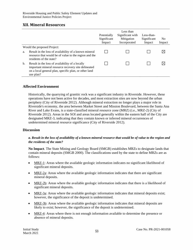
Riverside Housing and Public Safety Element Updates and
Environmental Justice Policies Project
Initial Study
March 2021 53
Case No. PR-2021-001058
XII. Mineral Resources
Potentially
Significant
Impact
Less than
Significant with
Mitigation
Incorporated
Less-than-
Significant
Impact
No
Impact
Would the proposed Project:
a. Result in the loss of availability of a known mineral
resource that would be of value to the region and the
residents of the state?
b. Result in the loss of availability of a locally
important mineral resource recovery site delineated
on a local general plan, specific plan, or other land
use plan?
Affected Environment
Historically, the quarrying of granitic rock was a significant industry in Riverside. However, these
operations have not been active for decades, and most extraction sites are now beyond the urban
periphery (City of Riverside 2012). Although mineral extraction no longer plays a major role in
Riverside's economy, the area between Market Street and Mission Boulevard, between the Santa Ana
River and Lake Evans, is a state-classified mineral resource zone (MRZ) (i.e., MRZ-2) (City of
Riverside 2012). Areas in the SOI and areas located generally within the eastern half of the City are
designated MRZ-3, indicating that they contain known or inferred mineral occurrences of
undetermined mineral resource significance (City of Riverside 2012).
Discussion
a. Result in the loss of availability of a known mineral resource that would be of value to the region and
the residents of the state?
No Impact. The State Mining and Geology Board (SMGB) establishes MRZs to designate lands that
contain mineral deposits (SMGB 2000). The classifications used by the state to define MRZs are as
follows:
• MRZ-1: Areas where the available geologic information indicates no significant likelihood of
significant mineral deposits.
• MRZ-2a: Areas where the available geologic information indicates that there are significant
mineral deposits.
• MRZ-2b: Areas where the available geologic information indicates that there is a likelihood of
significant mineral deposits.
• MRZ-3a: Areas where the available geologic information indicates that mineral deposits exist;
however, the significance of the deposit is undetermined.
• MRZ-3b: Areas where the available geologic information indicates that mineral deposits are
likely to exist; however, the significance of the deposit is undetermined.
• MRZ-4: Areas where there is not enough information available to determine the presence or
absence of mineral deposits.

Riverside Housing and Public Safety Element Updates and
Environmental Justice Policies Project
Initial Study
March 2021 54
Case No. PR-2021-001058
The proposed opportunity sites are located in areas classified MRZ-2 and MRZ-3, described in the
Open Space and Conservation Element of GP 2025; however, mineral extraction does not play a
major role in the City’s economy and there are no known substantial mineral deposits. Development
over MRZ-2 and MRZ-3 designated areas would not result in a loss of known mineral resources that
would be of value to the region and residents of the state. There would be no impact related to the loss
of availability of a known mineral resource that would be of value to the region and the residents of
the state.
b. Result in the loss of availability of a locally important mineral resource recovery site delineated on a
local general plan, specific plan, or other land use plan?
No Impact. Because of existing conditions within the City, implementation of the proposed Project
would not result in the loss of availability of a locally important mineral resource recovery site
delineated in GP 2025, a specific plan, or any other land use plan. Also, the area between Market
Street and Mission Boulevard, between the Santa Ana River and Lake Evans, which is a state-
classified MRZ (MRZ-2), would not be affected by the proposed Project because there are no
opportunity sites in this area. Impacts would be less than significant.

Riverside Housing and Public Safety Element Updates and
Environmental Justice Policies Project
Initial Study
March 2021 55
Case No. PR-2021-001058
XIII. Noise
Potentially
Significant
Impact
Less than
Significant with
Mitigation
Incorporated
Less-than-
Significant
Impact
No
Impact
Would the proposed Project:
a. Generate a substantial temporary or permanent
increase in ambient noise levels in the vicinity of the
proposed Project in excess of standards established
in a local general plan or noise ordinance or
applicable standards of other agencies?
b. Generate excessive ground-borne vibration or
ground-borne noise levels?
c. Be located within the vicinity of a private airstrip or
an airport land use plan, or, where such a plan has
not been adopted, within two miles of a public
airport or public use airport and expose people
residing or working in the project area to excessive
noise levels?
Affected Environment
GP 2025 identifies the major sources of noise within the City. Major noise sources that currently and
will in the future influence the noise environment within the City include:
• Major arterial roadway networks;
• Major freeway and interstate facilities, such as State Route 91, State Route 60 and Interstate 215;
• Railway networks for both commuter (Metrolink and Amtrak) and freight (Union Pacific and
BNSF) operations;
• Airport noise, including Riverside Municipal Airport, Flabob Airport, and March Air Reserve
Base; and
• Stationary noise sources for all land uses.
Other noise sources that could have the potential to affect land uses within the City would be
construction noise sources.
The proposed Project would facilitate an increase in the housing stock within the City boundary. The
geographic scope of the proposed Project is extensive and could be surrounded by other noise-
sensitive land uses as well as many of the noise sources listed above.

Riverside Housing and Public Safety Element Updates and
Environmental Justice Policies Project
Initial Study
March 2021 56
Case No. PR-2021-001058
Discussion
a. Generate a substantial temporary or permanent increase in ambient noise levels in the vicinity of the
proposed Project in excess of standards established in a local general plan or noise ordinance or
applicable standards of other agencies?
Potentially Significant Impact. Development facilitated by the proposed Project would have the
potential to introduce new noise sources through the addition of new housing and other stationary
sources, including public safety infrastructure, which could affect noise-sensitive land uses. The City
has identified locations as opportunity sites where potential housing and mixed-use development
could be sited. These locations vary considerably with respect to the surrounding noise environment;
however, all locations would increase the number of vehicles accessing the local roadway and
freeway/interstate network or even the commuter rail network. Other noise sources may introduce
new stationary noise sources, such as HVAC systems or other stationary noise sources, that could
affect surrounding land uses. In addition, any new housing, mixed-use development, or development
for the purposes of public safety would require construction that would affect surrounding noise-
sensitive land uses. Although any new development would be required to comply with the guidance
included with the Riverside Municipal Code, specifically Chapters 7.25, 7.30, and 7.35, and the limits
included in the Noise Element of GP 2025, the introduction of new noise sources could result in an
increase in noise above applicable thresholds. As such, impacts could be potentially significant and
could require further consideration to identify mitigation to reduce potential impacts. This topic will
be analyzed in the forthcoming EIR.
b. Generate excessive ground-borne vibration or ground-borne noise levels?
Potentially Significant Impact. As discussed above, the proposed Project could result in the
development, redevelopment, and construction of new housing, mixed-use development, and public
safety infrastructure that would require the use of heavy construction machinery. Although the City
does not include a codified threshold for vibration, the Noise Element of GP 2025 does reference
guidance, plans, and legislation by such agencies as the Federal Transit Administration (FTA). The
FTA’s Transit Noise and Vibration Impact Assessment Manual (FTA 2018) includes thresholds for
damage and human annoyance from vibration and ground-borne noise. These, along with the
California Department of Transportation (Caltrans) thresholds, represent guidance by which any
construction impacts would be analyzed. Because the proposed Project would include new
construction that may require the use of vibration-producing construction equipment in proximity to
vibration-sensitive land uses, impacts could be potentially significant and could require further
consideration to identify mitigation to reduce potential impacts. This topic will be analyzed in the
forthcoming EIR.
c. Be located within the vicinity of a private airstrip or an airport land use plan, or, where such a plan
has not been adopted, within two miles of a public airport or public use airport and expose people
residing or working in the project area to excessive noise levels?
Potentially Significant Impact. As discussed above, the update to the City’s Housing and Public
Safety Elements could result in development and redevelopment throughout the City. Because there
are multiple airports within the City or in proximity to the City, some locations that are slated for new
housing may be located within an airport land use plan or in proximity to an airport. Impacts could be
potentially significant and could require further consideration to identify mitigation to reduce
potential impacts, and this topic will be analyzed in the forthcoming EIR.

Riverside Housing and Public Safety Element Updates and
Environmental Justice Policies Project
Initial Study
March 2021 57
Case No. PR-2021-001058
XIV. Population and Housing
Potentially
Significant
Impact
Less than
Significant with
Mitigation
Incorporated
Less-than-
Significant
Impact
No
Impact
Would the proposed Project:
a. Induce substantial unplanned population growth in
an area, either directly (e.g., by proposing new
homes and businesses) or indirectly (e.g., through
extension of roads or other infrastructure)?
b. Displace a substantial number of existing people or
housing, necessitating the construction of
replacement housing elsewhere?
Affected Environment
Section 15126(d) of the State CEQA Guidelines requires a discussion of a proposed Project’s
potential to foster economic or population growth, either directly or indirectly, including ways in
which a project could remove an obstacle to growth. Implementation of the Housing and Public
Safety Elements update, development of environmental justice policies, and Zoning Code and
Specific Plan amendments, have the potential to induce growth, as discussed below.
Growth does not necessarily create significant physical changes to the environment. However,
depending upon the type, magnitude, and location of growth, it can result in significant adverse
environmental effects. The proposed Project’s growth-inducing potential would be significant if it
would result in unavoidable significant effects in one or more environmental issue areas.
The City is primarily a residential community with steady population growth (i.e., approximately
40,000 new residents every decade since the 1960s) (City of Riverside 2018). The City’s population
in 2020 was 328,155 (Department of Finance 2020). There are approximately 90,722 housing units in
the City, and the average household size is 3.28 persons per dwelling unit (Department of Finance
2020).
Homelessness, including those living in public rights-of-way or in natural open spaces or recreational
areas, is a public health concern. Homelessness is a complex social problem. Major factors that
contribute to homelessness include a lack of employment opportunities and access to affordable
housing, a decline in available public assistance, a lack of affordable health care, and other
circumstantial issues, such as domestic violence, physical or mental illness, and drug or alcohol
addiction.
Low-income and minority communities and neighborhoods occur within the City, and in general, may
be disproportionately burdened by, or vulnerable to, sources of pollution and other disproportionately
high and adverse impacts related to public health, social equity, and environmental justice.6
6 Environmental justice is the fair treatment and meaningful involvement of all people regardless of race, color,
national origin, or income, with respect to the development, implementation, and enforcement of environmental laws, regulations, and policies.

Riverside Housing and Public Safety Element Updates and
Environmental Justice Policies Project
Initial Study
March 2021 58
Case No. PR-2021-001058
Discussion
a. Induce substantial unplanned population growth in an area, either directly (e.g., by proposing new
homes and businesses) or indirectly (e.g., through extension of roads or other infrastructure)?
Potentially Significant Impact. The proposed Project includes goals to encourage housing, meet the
City’s housing needs with diverse household types, and provide for households that are vulnerable to
housing insecurity. The expectation is that as growth occurs, consistent with GP 2025, housing would
serve all income levels, including very low-, low-, moderate-, and above moderate-income residents
and special-needs residents. The proposed Project is a policy-level planning effort that encourages
and facilitates the development and redevelopment of a range of housing types and affordability
levels while facilitating mixed-use development and public safety infrastructure. The proposed
Project does not include specific development proposals. Because of the rezoning of sites, there
would be an increase in the number of new housing units between 2021 and 2029, up to
approximately 24,000 to fulfill the RHNA. Rezoning that would occur as part of the proposed Project
would allow for development of up to 30,190 housing units. Based on the City’s current Housing
Element, the average household size is 3.28 persons per dwelling unit. The rezoning of opportunity
sites has the potential to increase the City’s population if all housing units are constructed and all
residents are new to the City (City of Riverside 2018). It is also possible that existing residents that
are currently sharing homes may locate to new units. According to SCAG, the population of the City
is projected to increase to 395,800 by 2045, which represents an increase of 20.61 percent from the
2020 population of 328,155 (Department of Finance 2020). This increase in population resulting from
30,190 new housing units would result in population increase that would be greater than the 2045
population projection of 67,645 new residents. As such, impacts could be potentially significant by
inducing substantial unplanned population growth in an area either directly or indirectly. This topic
will be analyzed in the forthcoming EIR.
b. Displace a substantial number of existing people or housing, necessitating the construction of
replacement housing elsewhere?
Less-than-Significant Impact. The proposed Project is a policy-level planning effort that encourages
and facilitates the development and redevelopment of a range of housing types and affordability
levels. The proposed Project does not include specific development proposals. Because of the sites to
be rezoned are located throughout the City, the potential exists for an increase in the number of new
housing units, up to approximately 30,190. Some redevelopment could result in the removal of
existing housing (up to 222 DU), but this is anticipated to be minimal and would not displace a
substantial number of people or existing housing units. Any existing units removed through
redevelopment would be replaced with new units. The impact would be less than significant.

Riverside Housing and Public Safety Element Updates and
Environmental Justice Policies Project
Initial Study
March 2021 59
Case No. PR-2021-001058
XV. Public Services
Potentially
Significant
Impact
Less than
Significant with
Mitigation
Incorporated
Less-than-
Significant
Impact
No
Impact
Would the proposed Project:
a. Result in substantial adverse physical impacts
associated with the provision of new or physically
altered governmental facilities or a need for new or
physically altered governmental facilities, the
construction of which could cause significant
environmental impacts, in order to maintain
acceptable service ratios, response times, or other
performance objectives for any of the following
public services:
☒ ☐ ☐ ☐
Fire protection?
Police protection?
Schools?
Parks?
Other public facilities?
Affected Environment
The RFD provides fire protection for the City. In addition to the 14 stations, the Riverside County
Fire Department (RCFD) provides service to unincorporated territory within the City’s SOI.
The Riverside Police Department (RPD) provides police protection services to the City. Three RPD
stations and one aviation support site are located in Riverside. The RPD does not use a formula for
calculating the number of officers per capita. Instead, staffing for the RPD is based on business and
residential growth and evaluated on a project-by-project basis.
The City is served by two public school districts, the Riverside Unified School District (RUSD) and the
Alvord Unified School District (AUSD). RUSD’s 47 schools include 30 elementary schools, one
special-education preschool, six middle schools (grades 7–8), five comprehensive high schools, two
continuation high schools, two alternative schools, and the Riverside Virtual School. AUSD includes 14
elementary schools, four middle schools, three comprehensive high schools, one continuation high
school, and one alternative education center. Approximately 42,000 students are enrolled in grades K–
12 at RUSD, and 20,000 students are enrolled at AUSD. In addition, RUSD has nearly 7,000 adult
education students enrolled in its district (City of Riverside 2021a, 2021b).
The Riverside Public Library system provides library service to the City. Eight existing libraries serve
the City and the Main Library replacement will be open in 2021. . The libraries offer books and e-
media, wi-fi and internet access, printing services, home delivery for books and audiovisual materials,
technology and literacy programs, reference and research services, public meeting rooms, and
community programs. The Main Library will house 60,000 books and other materials, a community
room, a bookstore space, a 100-seat community room, a 2-story City archive, and an outdoor arcade
space for community events such as youth performances, farmers markets, concerts, and family
festivals. Construction on the new Main Library is expected to be complete in late 2021.

Riverside Housing and Public Safety Element Updates and
Environmental Justice Policies Project
Initial Study
March 2021 60
Case No. PR-2021-001058
Library service needs and standards are determined by the following methods: volumes by population;
community need/service gaps, including services provided/not provided by other area departments and
agencies; customer requests; and the innovation/success of pilot projects. The City does not collect
assessed development impact fees on the library’s behalf. Library funding sources include the general
fund, trust funds, gift funds/donations, and grants. In addition, voters approved the Riverside Library
Parcel Tax (Measure I) in November 2011 to fund library services through June 2022.
The City has many different types of parks, including population-based parks, both neighborhood and
community; resource-based parks that include natural or man-made resources to serve the citywide
population; and open space parks that allow public access to undeveloped natural spaces. The City has
68 parks and additional open space areas with 2,940.61 acres of City-owned parkland (City of Riverside
2020); however, only 2,595.07 acres of existing parkland is counted in the totals below (refer to Section
XVI, Recreation). According to the City of Riverside’s Comprehensive Park, Recreation, and
Community Services Master Plan, adopted on February 4, 2020, the City plans to create seven new park
sites in underserved areas of the City and revitalize existing parks (City of Riverside 2020).
The City currently funds the operation of nine community centers, three senior citizen centers, and two
service centers. As part of the Riverside Renaissance Initiative, the Bobby Bonds Youth Opportunity
Center, the Orange Terrace Community Center, and the Bordwell Childcare Center were opened.
The City is the steward of the Museum of Riverside, which is a department within the City that oversees
the trust of artifacts, archives, and historic sites owned by the City. The Museum of Riverside is
responsible for three historic sites, and houses more than 200,000 artifacts in its collections. The
Museum also offers educational programs, special cultural events, and school programs.
Discussion
a. Result in substantial adverse physical impacts associated with the provision of new or physically
altered governmental facilities or a need for new or physically altered governmental facilities, the
construction of which could cause significant environmental impacts, in order to maintain acceptable
service ratios, response times, or other performance objectives for any of the following public services:
Fire protection?
Potentially Significant Impact. The proposed Project could result in an increase in population of
approximately 99,000 persons, which is 20.61percent of what was anticipated under the typical
growth scenario through 2045. This increase in population would result in a permanent increase in
demand for fire protection services in areas served by the RFD. Significant impacts on service ratios,
response times, and other performance objectives of fire protection could occur. This topic will be
analyzed in the forthcoming EIR.
Police protection?
Potentially Significant Impact. The proposed Project would result in an increase in population up to
approximately 99,000 persons, which is 20.61percent of what was anticipated under the typical
growth scenario through 2045. This increase in population would result in a permanent increase in
demand for police protection services in areas served by the RPD. Significant impacts on service
ratios, response times, performance, and other performance objectives of police protection could
occur. This topic will be analyzed in the forthcoming EIR.

Riverside Housing and Public Safety Element Updates and
Environmental Justice Policies Project
Initial Study
March 2021 61
Case No. PR-2021-001058
Schools?
Potentially Significant Impact. Future development and population growth, consistent with the
proposed Project, would increase the demand for RUSD and AUSD school facilities and services over
time. However, future residential development would comply with Riverside Municipal Code
Chapter 16.56, School Development Fee, which establishes coordination between the City and the
applicable school district to develop a school development fee for mitigating the impact of residential
development on local school districts. In addition, legislation allows school districts to collect impact
fees from developers of new residential and commercial uses. Pursuant to Government Code
Section 65996, school fees imposed through the Education Code are deemed to be full mitigation for
new development projects; the City cannot impose additional mitigation measures. School impact
fees would be imposed on future development within the RUSD and AUSD services areas.
Compliance with the established regulatory framework, which requires payment of school impact
fees, would offset the cost of providing service for any additional students generated by new
development; however, there would still be the potential for impacts.
Future development must also comply with GP 2025 Policies ED-1.1 and ED-3.1. GP 2025 Policy
ED-1.1 requires an adequate level of infrastructure and services to be provided to accommodate
campus growth at all educational levels. GP 2025 Policy ED-3.1 requires educational institutions to
accommodate the needs of City residents. Even with compliance with the abovementioned regulatory
framework, there could still be temporary or permanent capacity issues that could result in inadequate
educational facilities would be available to serve the projected growth in population. As such, impacts
related to schools would be potentially significant and this topic will be analyzed in detail in the EIR.
Parks?
Potentially Significant Impact. The existing parkland-to-resident ratio is 7.91 acres per 1,000
residents. Implementation of the proposed Project would increase the population by approximately
99,000, resulting in a population of 427,065 and decreasing the ratio to 6.08 acres per 1,000 residents.
Although the parkland-to-resident ratio could be lowered with implementation of the proposed
Project, the projected parkland-to-resident ratio would remain compliant with both the current
standard of 3 acres per 1,000 residents and the suggested standard of 5 acres per 1,000 residents (City
of Riverside 2020). In addition, the City would continue to meet the ratio for developed and natural
parks and would not experience a parkland deficiency. Impacts from the proposed Project related to
the demand for parks would be less than significant. The proposed Project would allow build-out of
up to 30,190 dwelling units, which would result, if all units were constructed and all were occupied
by residents new to the City, in a population increase of up to 99,000 persons. While the parks-to-
resident ratio may still meet City goals, deterioration of existing parks and recreational facilities may
occur in localized areas. In addition, the increase in population may result in the need for construction
of new parks or recreation facilities, the construction of which could result in significant
environmental impacts. Impacts related to parks will be analyzed in detail in the EIR.
Other public facilities?
Potentially Significant Impact. As discussed in Section XIV, Population and Housing, estimated
population growth from the proposed Project, including rezoning, has the potential to increase the
City’s population by approximately 99,000, which is 20.61 percent of protected population growth for
2045. This increase in population would permanently increase the demand for other public services,
such as libraries, community centers, and museums. Significant impacts could occur due to the
demand for additional public facilities or services. This topic will be analyzed in the forthcoming
EIR.

Riverside Housing and Public Safety Element Updates and
Environmental Justice Policies Project
Initial Study
March 2021 62
Case No. PR-2021-001058
XVI. Recreation
Potentially
Significant
Impact
Less than
Significant with
Mitigation
Incorporated
Less-than-
Significant
Impact
No
Impact
Would the proposed Project:
a. Increase the use of existing neighborhood and
regional parks or other recreational facilities such
that substantial physical deterioration of the facility
would occur or be accelerated?
b. Include recreational facilities or require the
construction or expansion of recreational facilities
that might have an adverse physical effect on the
environment?
Affected Environment
The City has 68 parks and additional open space areas with approximately 2,940.61 acres of City-
owned parkland (City of Riverside 2020). According to the City’s Comprehensive Park, Recreation,
and Community Services Master Plan, adopted on February 4, 2020, the City plans to create seven
new park sites in underserved areas of the City and revitalize existing parks (City of Riverside 2020).
The City is currently preparing a Trails Master Plan update that will be used to address and guide
development of new trails in the City.
The City’s Comprehensive Park, Recreation, and Community Services Master Plan defines parks as
areas that are “intended as public green space where City dwellers can escape from the rush of urban
life.” The City categorizes its parks into three categories: Developed Parks, Natural Parks, and
Miscellaneous Facilities (City of Riverside 2020).
Discussion
a. Increase the use of existing neighborhood and regional parks or other recreational facilities such
that substantial physical deterioration of the facility would occur or be accelerated?
Potentially Significant Impact. The City currently has 2,940.61 acres of existing parkland; however,
spaces categorized as Undeveloped City-owned Property cannot be included in the parkland-to-resident
ratio analysis, as determined by the City’s Comprehensive Park, Recreation, and Community Services
Master Plan (City of Riverside 2020). Approximately 345.54 acres of parkland in the City is categorized
as Undeveloped City-owned Property. For the purposes of the parkland-to-resident ratio analysis, the
City currently has 2,595.07 acres of existing parkland. Implementation of the proposed Project would
not add any open space or parkland in the City. The City has limited or eliminated opportunity sites that
were designated as open space as well as any areas that contain a sensitive habitat or species.
The Parks and Recreation Element of GP 2025 currently has an adopted standard of 3 acres per 1,000
residents (City of Riverside 2012). This is further broken down to 2 acres of neighborhood park land
per 1,000 persons and 1 acre of community park land per 1,000 residents (City of Riverside 2012).
The City of Riverside’s Comprehensive Park, Recreation, and Community Services Master Plan
recommends increasing this standard to 5 acres per 1,000 residents (City of Riverside 2020).

Riverside Housing and Public Safety Element Updates and
Environmental Justice Policies Project
Initial Study
March 2021 63
Case No. PR-2021-001058
The City of Riverside parkland ratio goals versus parkland ratios with implementation of the
proposed Project would decrease the parkland-to-resident ratio. The 2020 City population was
approximately 328,155 (Department of Finance 2020). The existing parkland-to-resident ratio is 7.91
acres per 1,000 residents. Although the parkland-to-resident ratio could be lowered with
implementation of the proposed Project, the projected parkland-to-resident ratio would remain
compliant with both the current standard of 3 acres per 1,000 residents and the suggested standard of
5 acres per 1,000 residents. The City would continue to meet the ratio for developed and natural parks
with implementation of the proposed Project. While the parks-to-resident ratio may still meet City
goals, deterioration of existing parks and recreational facilities may occur in localized areas.
Significant impacts could occur due to this demand for existing recreational facilities in the City if all
units were constructed and all were occupied by residents new to the City. This topic will be analyzed
in the forthcoming EIR.
b. Include recreational facilities or require the construction or expansion of recreational facilities that
might have an adverse physical effect on the environment?
Potentially Significant Impact. The proposed Project does not propose recreational facilities or
require the construction or expansion of recreational facilities that might have an adverse physical
effect on the environment. However, the proposed Project would facilitate the development and
redevelopment of housing and mixed-use development throughout the City, and new residents would
increase the demand for parks and recreational facilities in the areas of the opportunity sites.
Although the parkland-to-resident ratio could be lowered with implementation of the proposed
Project, the projected parkland-to-resident ratio would remain compliant with both the current
standard of 3 acres per 1,000 residents and the suggested standard of 5 acres per 1,000 residents.
While the parks-to-resident ratio may still meet City goals, the need to construct or expand additional
parks in potentially new areas of the City could occur if all units were constructed and all were
occupied by residents new to the City. In addition, the increase in population may result in the need
for construction of other new recreation facilities, including playgrounds, ballfields, and/or
community centers, the construction of which could result in significant environmental impacts.
Significant impacts could occur as the construction or expansion of new recreational facilities could
result in adverse physical effects on the environment. This topic will be analyzed in the forthcoming
EIR.

Riverside Housing and Public Safety Element Updates and
Environmental Justice Policies Project
Initial Study
March 2021 64
Case No. PR-2021-001058
XVII. Transportation
Potentially
Significant
Impact
Less than
Significant with
Mitigation
Incorporated
Less-than-
Significant
Impact
No
Impact
Would the proposed Project:
a. Conflict with a program, plan, ordinance, or policy
addressing the circulation system, including transit,
roadway, bicycle, and pedestrian facilities?
b. Conflict or be inconsistent with State CEQA
Guidelines section 15064.3, subdivision (b)?
c. Substantially increase hazards because of a
geometric design feature (e.g., sharp curves or
dangerous intersections) or incompatible uses (e.g.,
farm equipment)?
d. Result in inadequate emergency access?
Affected Environment
The existing roadway network, bikeways, local transit services, and planned roadway, bikeway, and
transit improvements in the area are described in GP 2025, Circulation and Community Mobility
Element. The regional road network within the City includes Interstate 215, State Route 91, and State
Route 60. The major arterial street layout for the City forms a grid pattern. The City has an active
Neighborhood Traffic Management Program7 to minimize and/or prevent the intrusion of cut-through
traffic into residential neighborhoods. Transit services are provided by the Riverside Transit Agency,
Sunlight Transit Agency, Metrolink, and Amtrak. The City has four park-and-ride facilities for
commuters as well as bicycle and pedestrian facilities, such as bike lanes, bike routes, trails,
sidewalks and paths, trails, crossing facilities, and curb treatments throughout the City.
Vehicle-miles-traveled (VMT) data from the Riverside Traffic Analysis Model (RIVTAM) show that:
• Riverside VMT per service population is 6 percent lower than the average for western Riverside
County, and
• Total VMT per household (i.e., total VMT in the City divided by the number of households) is
higher than that of the region. The higher VMT per household is likely an indication that
Riverside attracts people from the surrounding region more so than other jurisdictions, generating
VMT from visitors and employees at a higher rate than other cities. This could be due to the
City’s robust downtown, multiple university campuses, employment areas, and commercial uses
that attract regional trips.
The VMT summary for the City is provided in Table 1.
7 City of Riverside, Public Works Department. n.d. Neighborhood Traffic Management Program. Available:
https://riversideca.gov/publicworks/traffic/pdf/NeighborhoodTrafficManagement.pdf.

Riverside Housing and Public Safety Element Updates and
Environmental Justice Policies Project
Initial Study
March 2021 65
Case No. PR-2021-001058
Table 1. Riverside VMT Summary
Total VMT City of Riverside
Riverside
County
Western Riverside
County SCAG Region
VMT per Service Population 27.8 29.3 29.8 24.3
VMT per Household 130.1 120.9 126.4 106.4
Source: Fehr & Peers, 2021;RIVTAM Base Year (2012).
The City of Riverside Active Transportation Plan is currently being developed to integrate walking,
bicycling, and other transportation modes into a single plan that includes policies, infrastructure
recommendations, and supporting programs and implementation strategies to improve mobility and
congestion. In addition to the GP 2025, other city plans related to transportation and traffic include
Pedestrian Target Safeguarding Plan, Active Transportation Plan, the Complete Streets Ordinance,
and the Trails Master Plan (PACT).
Discussion
a. Conflict with a program, plan, ordinance, or policy addressing the circulation system, including transit,
roadway, bicycle, and pedestrian facilities?
Potentially Significant Impact. The proposed Project would not directly result in any activities that
would conflict with a program, plan, ordinance, or policy regarding the circulation system, including
transit, roadway, bicycle, and pedestrian facilities. Future development would be subject to individual
review to determine consistency with applicable programs, plans, ordinances, and policies and
determine if any additional analysis and project-specific mitigation measures are needed. However,
construction of up to 30,190 housing units and up to 11,501,959 sf of other uses per the Housing
Element update, would result in additional vehicles on the existing roadway network. Although
adding housing and increasing the number of vehicles would not necessarily conflict with programs,
plans, ordinances, or policies, the proposed Project could prohibit future programs, plans, ordinances,
or policies (i.e., GP 2025, Trails Master Plan, Bicycle Master Plan, etc.). As such, this impact is
potentially significant, and further analysis will be provided in the forthcoming EIR.
b. Conflict or be inconsistent with State CEQA Guidelines section 15064.3, subdivision (b)?
Potentially Significant Impact. State CEQA Guidelines Section 15064.3(b) requires CEQA documents
for land use and transportation projects to evaluate impacts of projects on VMT. The proposed Project
would not directly result in any activities that would conflict with or be inconsistent with State CEQA
Guidelines. However, construction of an additional 30,190 housing units, or more, and other
nonresidential development in the City, per the Housing Element update, would result in additional
VMT over the 8-year period. This impact is potentially significant, and further analysis will be provided
in the forthcoming EIR.
c. Substantially increase hazards because of a geometric design feature (e.g., sharp curves or dangerous
intersections) or incompatible uses (e.g., farm equipment)?
Less-than-Significant Impact. The proposed Project would not directly result in any activities that
would substantially increase hazards because of a geometric design feature through implementation
of policy changes and updates. Although construction of an additional 30,190 housing units to be
facilitated by the proposed Project as well as other nonresidential development in the City would not
necessarily result in direct traffic hazards (i.e., vehicle, bicyclist, pedestrian accidents), the proposed
Project would be policy based; as such, projects may not yet be designed that could lead to traffic

Riverside Housing and Public Safety Element Updates and
Environmental Justice Policies Project
Initial Study
March 2021 66
Case No. PR-2021-001058
hazards, although further review is required. However, future roadways would be designed in
compliance with City of Riverside codes and standards (chapter 19.102), which would be verified in
design review and plan check on a project-by-project basis. This impact would be less than
significant.
d. Result in inadequate emergency access?
Potentially Significant Impact. The proposed Project would not directly result in any activities that
would result in inadequate emergency access. Construction of up to approximately 30,190 housing
units and other nonresidential development, per the Housing Element update, could require additional
public services for future residents. The proposed Project is not expected to impair emergency access
because opportunity sites are proposed near essential services. GP 2025 contains policies to
encourage development of safe transportation systems and ensure that development does not conflict
with emergency response or access during project operations. The updates to the Public Safety
Element as part of the proposed Project would also address emergency preparedness and response,
including the provision of high-quality and responsive emergency management services to all
residents and businesses in the City. During construction, traffic in the surrounding areas is
anticipated to be minimal and limited to on-site construction-related equipment entering and exiting
the individual project areas. Once construction activities are completed, all roadways would be
restored to their previous condition or be improved to accommodate growth in compliance with City
requirements for individual development projects. However, each project will require evaluation for
emergency access, since site plans are unknown, and implementation of the proposed Project could
result in inadequate access for any emergency response entities. Impacts would be potentially
significant and the topic will be evaluated in detail in the EIR.

Riverside Housing and Public Safety Element Updates and
Environmental Justice Policies Project
Initial Study
March 2021 67
Case No. PR-2021-001058
XVIII. Tribal Cultural Resources
Potentially
Significant
Impact
Less than
Significant with
Mitigation
Incorporated
Less-than-
Significant
Impact
No
Impact
Would the proposed Project cause a substantial adverse
change in the significance of a tribal cultural resource,
defined in Public Resources Code Section 21074 as either
a site, feature, place, cultural landscape that is
geographically defined in terms of the size and scope of
the landscape, sacred place, or object with cultural value
to a California Native American tribe, and that is:
a. Listed or eligible for listing in the California
Register of Historical Resources, or in a local
register of historical resources as defined in Public
Resources Code section 5020.1(k), or
b. A resource determined by the lead agency, in its
discretion and supported by substantial evidence, to
be significant pursuant to criteria set forth in
subdivision (c) of Public Resources Code Section
5024.1. In applying the criteria set forth in
subdivision (c) of Public Resource Code Section
5024.1, the lead agency shall consider the
significance of the resource to a California Native
American tribe.
Affected Environment
A Tribal Cultural Resource (TCR) is a site, feature, place, cultural landscape, sacred place, or object
that is of cultural value to a recognized Native American tribe. The resource may be in or eligible for
listing in CRHR or a local historic register, or a lead agency may choose to treat a resource as a TCR.
The City is located near an ethnographic transition zone between the Gabrielino/Tongva, Serrano,
Luiseño, and Cahuilla Native American tribes. All four groups are speakers of Takic languages,
which are part of the Uto-Aztecan linguistic stock. Detailed ethnohistoric discussions will be
provided in the forthcoming EIR.
CEQA requires public agencies to evaluate the implications of their project(s) on the environment and
include significant historic resources as part of the environment. According to the California Code of
Regulations, Title 14, Section 15064.5, public agencies must treat any cultural resource as significant,
unless the preponderance of evidence demonstrates that it is not historically or culturally significant.
On September 25, 2014, California Governor Jerry Brown signed into law AB 52, which amended
PRC Section 5097.94 and added Sections 21073, 21074, 21080.3.1, 21080.3.2, 21082.3, 21083.09,
21084.2, and 21084.3 to establish a new category of environmental resources that must be considered
under CEQA, TCRs. For projects with applications filed on or after July 1, 2015, lead agencies are
also required to consult with California Native American tribes that are traditionally and culturally
affiliated with the geographic area of a future development facilitated by the proposed Project if the
tribe requested to the lead agency, in writing, to be informed by the lead agency of proposed projects
in the geographic area and the tribe requests consultation prior to determining whether a negative
declaration, mitigated negative declaration, or EIR is required for a project.
Riverside Housing and Public Safety Element Updates and
Environmental Justice Policies Project
Initial Study
March 2021 68
Case No. PR-2021-001058
SB 18, California Government Code Section 65352.3, enacted in 2004, requires local governments to
consult with Native American tribes at the earliest point in the local government land use planning
process. It establishes responsibilities for local governments to contact, refer plans to, and consult
with California Native American tribes as part of adoption or amendment of any general or specific
plan proposed on or after March 1, 2005. SB 18 requires public notice to be sent to tribes listed on the
NAHC’s SB 18 Tribal Consultation List within the geographical areas affected by proposed changes.
Tribes must respond to the CEQA lead agency within 90 days and indicate whether they want to
consult. Consultations are for the purpose of establishing meaningful dialogue regarding preserving or
mitigating impacts on places, features, and objects described in Sections 5097.9 and 5097.993 of the
PRC that may be affected by the proposed adoption of or amendment to a general or specific plan.
Discussion
a. Would the proposed Project cause a substantial adverse change in the significance of a tribal cultural
resource, defined in Public Resources Code Section 21074 as either a site, feature, place, cultural
landscape that is geographically defined in terms of the size and scope of the landscape, sacred place, or
object with cultural value to a California Native American tribe, and that is: Listed or eligible for listing
in the California Register of Historical Resources, or in a local register of historical resources as
defined in Public Resources Code section 5020.1(k)?
Potentially Significant Impact. Although efforts will be made by the City to exclude any areas of
known tribal cultural resources from proposed development, as-yet unknown tribal cultural resources
on vacant lots or other opportunity sites may be present. It is possible that such resources would be
eligible for listing in the CRHR or a local register of historic resources, as defined in PRC Section
5020.1(k). As defined in PRC Section 5020.1(k), a local register of historical resources means a list of
properties officially designated or recognized as historically significant by a local government,
pursuant to a local ordinance or resolution. Because the City will screen proposed locations for
development, it is not likely that locations identified on local registers would be selected. For future
proposed locations of development, a cultural resources records search and consultation with
affiliated Native American tribes will determine whether locally registered historic resources would
be adversely affected.
Because future development facilitated by the proposed Project has the potential to affect tribal
cultural resources, defined in PRC Section 21074 as either a site, feature, place, cultural landscape
that is geographically defined in terms of the size and scope of the landscape, sacred place, or object
with cultural value to a California Native American tribe, this potential impact will be analyzed in the
forthcoming EIR. The results of consultation with traditionally and culturally affiliated tribes will also
be incorporated into the forthcoming EIR.
b. Would the proposed Project cause a substantial adverse change in the significance of a tribal cultural
resource, defined in Public Resources Code Section 21074 as either a site, feature, place, cultural
landscape that is geographically defined in terms of the size and scope of the landscape, sacred place, or
object with cultural value to a California Native American tribe, and that is: A resource determined by
the lead agency, in its discretion and supported by substantial evidence, to be significant pursuant to
criteria set forth in subdivision (c) of Public Resources Code Section 5024.1?
Potentially Significant Impact. In compliance with AB 52, the City will conduct a Sacred Lands
File search through the NAHC to determine if Native American traditional sites or places are within
proposed development areas. In addition, the City will conduct consultation with Native American
tribes that have requested to be consulted, per the guidelines set forth in AB 52.

Riverside Housing and Public Safety Element Updates and
Environmental Justice Policies Project
Initial Study
March 2021 69
Case No. PR-2021-001058
Because the proposed Project would involve amendments to the GP 2025 and seven specific plans,
per SB 18, the City will send project notification/consultation letters to the tribes listed on the NAHC
Tribal Consultation List. The City will consult with those tribes requesting consultation to determine
if significant Native American traditional sites or places are within proposed development areas.
Because future developments have the potential to affect tribal cultural resources, defined in PRC
Section 21074 as either a site, feature, place, cultural landscape that is geographically defined in
terms of the size and scope of the landscape, sacred place, or object with cultural value to a California
Native American tribe and determined by the lead agency, in its discretion and supported by
substantial evidence, to be significant pursuant to criteria set forth in subdivision (c) of PRC
Section 5024.1, this potential impact will be analyzed in the forthcoming EIR. The results of
consultation with traditionally and culturally affiliated tribes, per AB 52 and SB 18, will also be
incorporated into the EIR.

Riverside Housing and Public Safety Element Updates and
Environmental Justice Policies Project
Initial Study
March 2021 70
Case No. PR-2021-001058
XIX. Utilities and Service Systems
Potentially
Significant
Impact
Less than
Significant with
Mitigation
Incorporated
Less-than-
Significant
Impact
No
Impact
Would the proposed Project:
a. Require or result in the relocation or construction of
new or expanded water, wastewater treatment,
stormwater drainage, electric power, natural gas, or
telecommunications facilities, the construction or
relocation of which could cause significant
environmental effects?
b. Have sufficient water supplies available to serve the
proposed Project and reasonably foreseeable future
development during normal, dry, and multiple dry
years?
c. Result in a determination by the wastewater
treatment provider that serves or may serve the
proposed Project that it has adequate capacity to
serve the proposed Project’s projected demand in
addition to the provider’s existing commitments?
d. Generate solid waste in excess of state or local
standards, or in excess of the capacity of local
infrastructure, or otherwise impair the attainment of
solid waste reduction goals?
e. Comply with federal, state, and local management
and reduction statutes and regulations related to
solid waste?
Affected Environment
Water is provided mainly by RPU in the City, which supplied 74,928 acre-feet (AF), or 24,415
million gallons, of water to 295,000 people within its service area in 2015. The 2015 Urban Water
Management Plan projects that RPU will supply 124,703 AF (40,634 million gallons) of water by
2040 to meet increasing demand under anticipated buildout from GP 2025. In 2015, RPU received
75,126 AF of water from two sources. Approximately 99 percent (74,926 AF) was local groundwater;
less than 1 percent (200 AF) was recycled water from the Regional Water Quality Control Plant (City
of Riverside Public Utilities Department 2016).
The Western Municipal Water District also provides water in an approximately 10-square-mile area
in the southeast part of the City. In 2015, the Western Municipal Water District received 78,852 AF
of water from three sources. Approximately 82 percent (64,371 AF) was imported and purchased
from the Metropolitan Water District or the Meeks and Daley Water Company; approximately 11
percent (8,481 AF) was from the Western Municipal Water District’s existing desalter system,
groundwater, and recycled supplies; and approximately 8 percent (6,000 AF) was banked water from
extraordinary supplies; refer to the Western Municipal Water District Urban Water Management Plan,
Chapter 6, System Supplies (City of Riverside Public Utilities Department 2016).

Riverside Housing and Public Safety Element Updates and
Environmental Justice Policies Project
Initial Study
March 2021 71
Case No. PR-2021-001058
The City of Riverside Public Works Department provides for the collection, treatment, and disposal
of nearly all wastewater generated within the City through its Riverside Regional Water Quality
Treatment Plant and complies with state and federal requirements governing the treatment and
discharge of wastewater. According to the City’s Wastewater Collection and Treatment Facilities
Integrated Master Plan (Integrated Master Plan), the City’s wastewater service area includes more
than 800 miles of sewer gravity mains, ranging in diameter from 6 to 48 inches. The City also
operates 18 wastewater pump stations, which range in size from 100 gallons per minute (gpm) to
2,000 gpm (City of Riverside 2008). Small areas of the City are served by septic systems.
The City of Riverside Public Works Department is responsible for the collection and disposal of
approximately 70 percent of the City’s residential solid waste. The remainder of the City’s solid
waste disposal needs are met by a private contractor, Burrtec Waste. Non-hazardous waste is
processed through the County of Riverside–owned Robert A. Nelson Transfer Station under a 20-year
contract (California Integrated Waste Management Board 2002). Waste is then transferred to the
Badlands Landfill for disposal. In addition, the Riverside County Department of Waste Resources
operates four other landfills that also serve the City, Blythe, Desert Center, Lamb Canyon, and Oasis
landfills. The City is also served by the El Sobrante Landfill, which is operated by Waste
Management, Inc. All landfills are Class III disposal sites. The Riverside County Department of
Waste Resources operates the Agua Mansa Permanent Household Hazardous Waste Facility, which
provides the City a location for hazardous household waste disposal.
The California Integrated Waste Management Act, under the PRC, required local jurisdictions to
divert at least 50 percent of all solid waste by January 1, 2000. The City is currently achieving a
69 percent diversion rate, well above state requirements. In addition, CALGreen required all
developments to divert 50 percent of nonhazardous construction and demolition debris and
100 percent of excavated soil and debris from land clearing associated with all nonresidential projects
beginning January 1, 2011 (California Legislative Information 2021).
Discussion
a. Require or result in the relocation or construction of new or expanded water, wastewater treatment,
stormwater drainage, electric power, natural gas, or telecommunications facilities, the construction or
relocation of which could cause significant environmental effects?
Potentially Significant Impact. Development and population growth facilitated by the proposed
Project would require the installation of water, wastewater, electrical, natural gas, and
telecommunication connections to existing utilities outside development boundaries. Development
and redevelopment would also require stormwater drainage improvements. The potential exists for
significant environmental impacts from the installation of these connections. This topic will be
evaluated in the forthcoming EIR.
b. Have sufficient water supplies available to serve the proposed Project and reasonably foreseeable
future development during normal, dry, and multiple dry years?
Potentially Significant Impact. Development and population growth facilitated by the proposed
Project would result in increased demand for potable and nonpotable water. As described above, the
City receives water mainly from RPU; however, southeast Riverside receives water from the Western
Municipal Water District. With the addition of up to 30,190 housing units and as much as 11,501,959
square feet of non-residential uses, future development would result in additional water demands
compared with existing conditions. The proposed Project would have the potential to result in
significant impacts on water supplies, and this topic will be further analyzed in the forthcoming EIR.

Riverside Housing and Public Safety Element Updates and
Environmental Justice Policies Project
Initial Study
March 2021 72
Case No. PR-2021-001058
c. Result in a determination by the wastewater treatment provider that serves or may serve the proposed
Project that it has adequate capacity to serve the proposed Project’s projected demand in addition to the
provider’s existing commitments?
Potentially Significant Impact. Development and population growth facilitated by the proposed
Project would result in additional demand for wastewater treatment from the City’s wastewater
treatment provider. This increase could exceed the treatment capacity of wastewater treatment
facilities that serve the City. As the proposed Project has the potential to result in significant impacts
on water treatment demand, this topic will be further analyzed in the forthcoming EIR.
d. Generate solid waste in excess of state or local standards, or in excess of the capacity of local
infrastructure, or otherwise impair the attainment of solid waste reduction goals?
Potentially Significant Impact. Development and population growth facilitated by the proposed
Project would result in a permanent increase in solid waste disposal demands compared with existing
conditions. Future development would also involve temporary construction-related solid waste
demands. This increase in solid waste flow could exceed the permitted capacity of landfills that serve
the City. The potential exists for significant impacts from an increase in solid waste disposal
demands, and this topic will be further analyzed in the forthcoming EIR.
e. Comply with federal, state, and local management and reduction statutes and regulations related to
solid waste?
Less-than-Significant Impact. Development and redevelopment facilitated by the proposed Project
would comply with City waste disposal requirements as well as CALGreen requirements; as such, the
proposed Project would not conflict with any federal, state, or local regulations related to solid waste.
The impact would be less than significant.

Riverside Housing and Public Safety Element Updates and
Environmental Justice Policies Project
Initial Study
March 2021 73
Case No. PR-2021-001058
XX. Wildfire
Potentially
Significant
Impact
Less than
Significant with
Mitigation
Incorporated
Less-than-
Significant
Impact
No
Impact
If located in or near state responsibility areas or lands
classified as very high fire hazard severity zones, would
the proposed Project:
a. Substantially impair an adopted emergency response
plan or emergency evacuation plan?
b. Due to slope, prevailing winds, and other factors,
exacerbate wildfire risks of, and thereby expose
project occupants to, pollutant concentrations from a
wildfire or the uncontrolled spread of a wildfire?
c. Require the installation or maintenance of associated
infrastructure (such as roads, fuel breaks, emergency
water sources, power lines, or other utilities) that
may exacerbate fire risk or that may result in
temporary or ongoing impacts on the environment?
d. Expose people or structures to significant risks,
including downslope or downstream flooding or
landslides, as a result of runoff, post-fire slope
instability, or drainage changes?
Affected Environment
This section describes the existing wildfire conditions within the City, identifies associated regulatory
requirements, and evaluates potential impacts related to implementation of the proposed Project.
No part of the City is immune to fire danger. Structural and automobile fires represent the most common
types of fire in urban areas and can be caused by a variety of human, mechanical, and natural factors.
Urban fires have the potential to spread to other structures or areas, particularly if not quickly
extinguished. Proactive efforts, such as fire sprinkler systems, fire alarms, fire-resistant roofing, and
construction methods, can collectively lessen the likelihood and reduce the severity of urban fires. Areas
of dense, dry vegetation, particularly in canyon areas and on hillsides, pose the greatest potential for
wildfire risks. Development in and near these natural landscapes would increase potential risks related to
fire for people and personal property. In case of fire, the City would be served by the RFD.
According to the California Fire Hazard Severity Zone Viewer, portions of the City are in areas
classified as Very High Fire Hazard Severity Zones (California Department of Forestry and Fire
Protection 2020).
Discussion
a. Substantially impair an adopted emergency response plan or emergency evacuation plan?
Less-than-Significant Impact. According to the GP 2025 Public Safety Element (City of Riverside
2018), the major urban/rural interface areas with a high-fire risk include Mount Rubidoux, the Santa
Ana River Basin, Lake Hills, Mockingbird Canyon/Monroe Hills, Sycamore Canyon, Box Springs
Mountain, and La Sierra/Norco Hills. The introduction of residential and non-residential development
into this natural landscape would increase potential risks related to fire for people and property.

Riverside Housing and Public Safety Element Updates and
Environmental Justice Policies Project
Initial Study
March 2021 74
Case No. PR-2021-001058
As discussed in Section IX, Hazards and Hazardous Materials, the RFD ensures multi-jurisdictional
cooperation and communication for emergency planning and response management through
activation of the SEMS. Also, the City and Riverside County prepared the Riverside County
Operational Area Multi-Jurisdictional Local Hazard Mitigation Plan (LHMP - most recent iteration
was prepared in July 2018). The purpose of the LHMP is to identify Riverside County’s hazards
(including those within the City), review and assess past disaster occurrences, estimate the probability
of future occurrences, and set goals to mitigate potential risks and reduce or eliminate long-term risks
for people and property from natural and man-made hazards (County of Riverside 2018).
GP 2025 includes several policies related to emergency plan implementation. Policies PS-9.1 and
PS-9.3 require the City to maintain and test the City’s Emergency Operations Plan. Policy PS-9.5
ensures that the City will provide information to the public regarding disaster preparedness. Policy
PS-9.7 and PS-9.8 require the City to identify actions to reduce the severity and risk to the
community from hazards. Policy PS-10.3 ensures that public safety infrastructure and staff resources
will keep pace with new development. Policy PS-10.4 ensures that development will have adequate
ingress and egress. Policy PS-10.5 requires coordination to educate people about hazard safety. Policy
PS-10.6 ensures coordination between the City and public safety departments. Policy PS-10.7 and
Policy PS-10.8 encourage funding for emergency response programs. Policy PS-10.9 requires the
City to maintain the Emergency Operations Center and allow for expansion (City of Riverside 2018).
The updates to the Public Safety Element, as part of the proposed Project, would also proactively
address wildfire hazards by minimizing the risks and consequences associated with natural and man-
made hazards within Riverside through the development of goals, policies, and actions. In addition, as
discussed in Section XVII, Transportation, the proposed Project would not directly result in any
activities that would result in inadequate emergency access. Construction of an additional 30,190
housing units plus other non-residential development, per the Housing Element update, could require
additional public services for future residents. The proposed Project is not expected to impair
emergency access because opportunity sites are proposed near essential services.
The proposed Project represent a policy-level planned effort that facilitates but does not directly
implement development proposals. Future development within the City would be required to comply
with local regulations, including the general plan and development code. Also, the opportunity sites
identified for rezoning are in developed areas of the City or on vacant lots and not designated as open
space. Impacts related to impairing an adopted emergency response or evacuation plan would be less
than significant.
b. Due to slope, prevailing winds, and other factors, exacerbate wildfire risks of, and thereby expose
project occupants to, pollutant concentrations from a wildfire or the uncontrolled spread of a wildfire?
Less-than-Significant Impact. Three primary factors are used in assessing wildfire hazards,
topography, weather, and fuel. Future development facilitated by the proposed Project could be
affected by weather conditions. The proposed Project would not include housing and non-residential
development within wildfire hazard areas. The proposed Project is a policy-level planning effort that
does not identify specific development proposals. Future development would be required to comply
with local regulations, including GP 2025 and municipal code. Also, the opportunity sites identified
for rezoning are largely in developed areas of the City. Impacts related to exacerbating wildfire risks
would be less than significant.

Riverside Housing and Public Safety Element Updates and
Environmental Justice Policies Project
Initial Study
March 2021 75
Case No. PR-2021-001058
c. Require the installation or maintenance of associated infrastructure (such as roads, fuel breaks,
emergency water sources, power lines, or other utilities) that may exacerbate fire risk or that may result
in temporary or ongoing impacts on the environment?
Less-than-Significant Impact. Future development may require new public infrastructure and
utilities, which would be installed to meet fire service requirements. However, the proposed Project is
a policy-level planning effort that does not provide site-specific development or design proposals. All
improvements would be subject to City development standards and verified as part of either a
building permit or construction approval process. As part of the standard development review
process, the City’s Development Review Committee, which includes the fire and building
departments, evaluates developments in high fire-risk areas to ensure that improvements meet their
requirements. This coordination is independent of the CEQA process; it would be unaffected by the
proposed Project. Impacts related to fire risk due to the installation or maintenance of associated
infrastructure would be less than significant.
d. Expose people or structures to significant risks, including downslope or downstream flooding or
landslides, as a result of runoff, post-fire slope instability, or drainage changes?
Less-than-Significant Impact. The creation of additional impermeable surfaces in association with
the proposed Project could exacerbate an existing flooding issue. However, the proposed Project is a
policy-level planned effort that does not provide site-specific development or design proposals. All
future development would be subject to City development standards and verified as part of either a
building permit or construction approval process. Impacts related to downstream flooding and
drainage changes would be less than significant.
Development associated with the proposed Project would not be susceptible to landslides. Grading
and construction would be completed in compliance with 2019 CBC regulations, County of Riverside
ordinances, and Riverside Municipal Codes related to grading, thereby reducing the potential for
slope instability to occur. Also, opportunity sites are not proposed on the steepest slopes or within
flood hazard areas. In addition, implementation of the proposed Project would not directly or
indirectly result in substantial adverse effects, including the risk of loss, injury, or death involving
landslides. The potential for downstream flooding, as well as changes in drainage patterns, would be
lessened through regulations. Given the lack of landslide evidence, compliance with CBC regulations,
County of Riverside ordinances, and Riverside Municipal Codes would ensure that potential impacts
associated with post-fire flooding, runoff, or slope instability would be less than significant.

Riverside Housing and Public Safety Element Updates and
Environmental Justice Policies Project
Initial Study
March 2021 76
Case No. PR-2021-001058
XXI. Mandatory Findings of Significance
Potentially
Significant
Impact
Less than
Significant with
Mitigation
Incorporated
Less-than-
Significant
Impact
No
Impact
a. Does the proposed Project have the potential to
substantially degrade the quality of the environment,
substantially reduce the habitat of a fish or wildlife
species, cause a fish or wildlife population to drop
below self-sustaining levels, threaten to eliminate a
plant or animal community, substantially reduce the
number or restrict the range of a rare or endangered
plant or animal, or eliminate important examples of
the major periods of California history or prehistory?
b. Does the proposed Project have impacts that are
individually limited but cumulatively considerable?
(“Cumulatively considerable” means that the
incremental effects of a project are considerable
when viewed in connection with the effects of past
projects, the effects of other current projects, and the
effects of probable future projects.)
c. Does the proposed Project have environmental
effects that will cause substantial adverse effects on
human beings, either directly or indirectly?
Affected Environment
CEQA provides that an EIR shall focus on the significant effects on the environment, discussing the
effects with emphasis in proportion to their severity and probability of occurrence. Pursuant to CEQA
Guidelines Section 15065, an EIR must be prepared if a project may have a significant effect on the
environment where any of the conditions below occur.
Discussion
a. Does the proposed Project have the potential to substantially degrade the quality of the environment,
substantially reduce the habitat of a fish or wildlife species, cause a fish or wildlife population to drop
below self-sustaining levels, threaten to eliminate a plant or animal community, substantially reduce the
number or restrict the range of a rare or endangered plant or animal, or eliminate important examples
of the major periods of California history or prehistory?
Potentially Significant Impact. A significant impact would occur only if the proposed Project would
have an identified potentially significant impact on a fish or wildlife species, a plant or animal
community, or historical, archeological, or paleontological resources. As discussed in Section IV,
Biological Resources, project impacts could be potentially significant and may require mitigation.
The proposed Project’s potential to adversely affect biological resources will be analyzed in the
forthcoming EIR. As discussed in Section V, Cultural Resources, project impacts could be potentially
significant and may require mitigation. The proposed Project’s potential to adversely affect cultural
resources will be analyzed in the forthcoming EIR.

Riverside Housing and Public Safety Element Updates and
Environmental Justice Policies Project
Initial Study
March 2021 77
Case No. PR-2021-001058
The proposed Project could degrade the quality of the environment, reduce, or threaten fish or
wildlife species (endangered or otherwise), or eliminate important examples of the major periods of
California history or pre-history. Impacts from the proposed Project are potentially significant and
will be analyzed in the forthcoming EIR.
b. Does the proposed Project have impacts that are individually limited but cumulatively considerable?
(“Cumulatively considerable” means that the incremental effects of a project are considerable when
viewed in connection with the effects of past projects, the effects of other current projects, and the
effects of probable future projects.)
Potentially Significant Impact. The effects of the proposed Project, when combined with the effects
of past, present, current, pending, and reasonably foreseeable future projects in the area, would not
result in cumulatively considerable impacts for the topics found to be less-than-significant in this
Initial Study.
The potential for cumulative impacts occurs when the independent impacts of the proposed Project
are combined with impacts from other development in the surrounding area and result in impacts that
are greater than the impacts of the proposed project alone. Current and reasonably foreseeable
projects are located within the City and vicinity whose development, in conjunction with that of the
proposed Project, may result in cumulative impacts. Impacts of the proposed Project on both an
individual and cumulative basis will be addressed in the forthcoming EIR for the following subject
areas: aesthetics, air quality, biological resources, cultural resources, GHG emissions, hazards and
hazardous waste, land use and planning, noise, population and housing, public services,
transportation, tribal cultural resources, and utilities and service systems.
c. Does the proposed Project have environmental effects that will cause substantial adverse effects on
human beings, either directly or indirectly?
Potentially Significant Impact. As indicated by the analyses provided in this Initial Study, the
proposed Project could produce potentially significant impacts with regard to aesthetics, air quality,
biological resources, cultural resources, GHG emissions, hazards and hazardous waste, land use and
planning, noise, population and housing, public services, transportation, tribal cultural resources, and
utilities and service systems. As a result, these potential effects will be analyzed in the forthcoming
EIR.

Riverside Housing and Public Safety Element Updates and
Environmental Justice Policies Project
Initial Study
March 2021 78
Case No. PR-2021-001058
References Cited
I. Aesthetics
City of Riverside General Plan 2025
City of Riverside Municipal Code Section 19
City of Riverside Housing Element Update Environmental Impact Report, August 2017.
County of Riverside Light Pollution Ordinance No. 655
II. Agricultural and Forestry Resources
California Department of Conservation. 2020. Data Viewer. Available:
https://maps.conservation.ca.gov/agriculture/DataViewer/index.html. Accessed February 2021
City of Riverside. 2012. General Plan Open Space and Conservation Element. November. Available:
https://riversideca.gov/cedd/sites/riversideca.gov.cedd/files/pdf/planning/general-
plan/12_Open_Space_and_Conservation_Element.pdf. Accessed February 2021.
Riverside County Agricultural Commissioner's. 2018. Agricultural Production Reports. Available:
https://www.rivcoawm.org/resources/publications-databases. Accessed March 2021.
III. Air Quality
CARB. 2005. Air Quality and Land Use Handbook: A Community Health Perspective. April. Available:
https://ww3.arb.ca.gov/ch/handbook.pdf. Accessed January 2021.
SCAQMD. 2005. Guidance Document for Addressing Air Quality Issues in General Plans and Local
Planning. May 6. Available: https://www.aqmd.gov/docs/default-source/planning/air-quality-
guidance/complete-guidance-document.pdf?sfvrsn=4. Accessed January 2021.
SCAQMD. 2016. National Ambient Air Quality Standards (NAAQS) and California Ambient Air Quality
Standards (CAAQS) Attainment Status for South Coast Air Basin. February. Available:
https://www.aqmd.gov/docs/default-source/clean-air-plans/air-quality-management-plans/naaqs-
caaqs-feb2016.pdf?sfvrsn=2. Accessed January 2021.
United States Environmental Protection Agency. 2020. Nonattainment Areas for Criteria Pollutants
(Green Book). Updated December 31, 2020. Available: https://www.epa.gov/green-book. Accessed
January 2021.
IV. Biological Resources
Baldwin, B.G., D.H. Goldman, D.J. Keil, R. Patterson, T.J. Rosatti, and D.H. Wilken, eds. 2012. The
Jepson Manual: Vascular Plants of California, second edition. Berkeley, CA: University of California
Press.
California Department of Fish and Wildlife (CDFW). 2021. California Natural Diversity Database.
Sacramento, CA. Wildlife and Habitat Data Analysis Branch. Element reports for Plan Area USGS
7.5-minute quadrangle maps. Data date: February 2021.

Riverside Housing and Public Safety Element Updates and
Environmental Justice Policies Project
Initial Study
March 2021 79
Case No. PR-2021-001058
California Native Plant Society (CNPS). 2021. Inventory of Rare and Endangered Plants (online edition,
v7-11). Sacramento, CA: California Native Plant Society. Available: http://www.cnps.org/inventory.
Accessed: February 2021.
Western Riverside County Regional Conservation Authority (WRCRCA). 2021a. MSHCP Data
Downloads, Vegetation 2012. Riverside Conservation Authority. Available: https://data-
wrcrca.opendata.arcgis.com/. Accessed: January 2021.
Western Riverside County Regional Conservation Authority (WRCRCA). 2021b. MSHCP Fees.
Available: https://www.wrc-rca.org/development-applications/permits-and-fees/. Accessed: February
2021.
Riverside County Habitat Conservation Agency (RCHCA). 1996. Habitat Conservation Plan for the
Stephens’ Kangaroo Rat in Western Riverside County, California. Volume 1. March 1996.
RCHCA. 2021. Stephens' Kangaroo Rat Mitigation Fee. Available: https://www.rchca.us/185/Stephens-
Kangaroo-Rat-Mitigation-
Fee#:~:text=The%20Mitigation%20Fee%20is%20%24500,is%20%24250%20per%20residential%20
unit. Accessed: February 2021.
Upper Santa Ana River Sustainable Resources Alliance. 2021. About the HCP,
http://www.uppersarhcp.com/About.aspx. Accessed March 2021.
U.S. Fish and Wildlife Service (USFWS). 2021a. USFWS IPaC Resource List. Carlsbad, CA. February
2021.
U.S. Fish and Wildlife Service (USFWS). 2021b. Critical Habitat GIS Data. Carlsbad, CA. Available:
http://www.fws.gov/carlsbad/GIS/CFWOGIS.html. Accessed: January 2021.
U.S. Fish and Wildlife Service (USFWS). 2021c. National Wetlands Inventory. Washington, D.C.
Available: http://www.fws.gov/wetlands/. Accessed: January 2021.
V. Cultural Resources
None.
VI. Energy
City of Riverside. 2012. General Plan – Open Space and Conservation Element. Available:
https://riversideca.gov/cedd/sites/riversideca.gov.cedd/files/pdf/planning/general-
plan/12_Open_Space_and_Conservation_Element.pdf. Accessed January 22, 2021.
City of Riverside. 2017. Utility 2.0 Strategic Plan. Available: https://riversideca.gov/utilities/about-
rpu/pdf/Utility%202.pdf. Accessed January 22, 2021.
California Energy Commission. 2019. Building Energy Efficiency Standards. Available:
https://www.energy.ca.gov/programs-and-topics/programs/building-energy-efficiency-standards/2019-
building-energy-efficiency. Accessed January 22, 2021.
California Code of Regulations, Title 24. 2019. California Building Standards Code. Available:
https://www.dgs.ca.gov/BSC/Codes. Accessed January 22, 2021.
California Code of Regulations, Title 24, Part 2. 2019. California Building Code. Available:
https://codes.iccsafe.org/content/CBC2019P2. Accessed January 22, 2021.

Riverside Housing and Public Safety Element Updates and
Environmental Justice Policies Project
Initial Study
March 2021 80
Case No. PR-2021-001058
California Code of Regulations, Title 24, Part 11. 2019. California Green Building Standards Code.
Available: https://codes.iccsafe.org/content/CAGBSC2019/cover. Accessed January 22, 2021.
Edison International and Southern California Edison. 2019. 2019 Annual Report. Available:
https://www.edison.com/content/dam/eix/documents/investors/corporate-governance/eix-sce-2019-
annual-report.pdf. Accessed: January 25, 2021.
Riverside Public Utilities. 2019a. 2019 Financial Report. Available:
https://www.riversideca.gov/utilities/about-rpu/pdf/2019%20Annual%20Report.pdf. Accessed:
January 25, 2021.
Riverside Public Utilities. 2019b. Riverside Public Utilities 101. Available:
https://www.riversideca.gov/utilities/PDF/RPU_101_Web_2015.pdf. Accessed January 25, 2021.
Riverside Public Utilities. 2021. RPU Virtual Tour. Available: https://www.riversideca.gov/utilities/about-
rpu/general-info-virtual-tour.asp. Accessed January 25, 2021.
Southern California Association of Governments (SCAG). 2020. Regional Housing Needs Assessment.
Available: https://scag.ca.gov/sites/main/files/file-attachments/rhna-draft-allocations-090320-
updated.pdf?1602188695. Access January 25, 2021.
Southern California Gas Company. 2020. Company Profile. Available: https://www.socalgas.com/about-
us/company-profile. Accessed January 25, 2021.
VII. Geology, Soils, and Paleontological Resources
Printed References
Albert A. Webb Associates. 2007. City of Riverside General Plan and Supporting Documents EIR.
Available: https://riversideca.gov/cedd/sites/riversideca.gov.cedd/files/pdf/planning/general-
plan/vol2/5-6_Geology_and_Soils.pdf. Accessed: February 4, 2021.
California Geological Survey. 2021. CGS Information Warehouse. Available:
http://maps.conservation.ca.gov/cgs/informationwarehouse/index.html?map=regulatorymaps.
Accessed January 26, 2021.
City of Riverside. 2007. Riverside General Plan 2025, 18 Public Safety Element. Available:
https://riversideca.gov/cedd/planning/city-plans/general-plan-0. Accessed: January 26, 2021.
National Park Service. 2020. Fossils and Paleontology: Paleontological Resource Monitoring. Available:
https://www.nps.gov/subjects/fossils/resource-monitoring.htm. Accessed: January 22, 2021.
Power Engineers and Deméré, T. 2010. Riverside Transmission Reliability Project. Paleontology
Technical Report. June.
Rogers, T.H. 1965. Geologic Map of California: Santa Ana Sheet. Available:
https://www.conservation.ca.gov/cgs/Documents/Publications/Geologic-Atlas-Maps/GAM_019-Map-
1965.pdf. Accessed: January 25, 2021.
Rogers, T.H. 1967. Geologic Map of California: San Bernardino Sheet. Available:
https://www.conservation.ca.gov/cgs/Documents/Publications/Geologic-Atlas-Maps/GAM_014-Map-
1967.pdf. Accessed: January 25, 2021.

Riverside Housing and Public Safety Element Updates and
Environmental Justice Policies Project
Initial Study
March 2021 81
Case No. PR-2021-001058
Society of Vertebrate Paleontology. 2010. Standard Procedures for the Assessment and Mitigation of
Adverse Impacts to Paleontological Resources. Impact Mitigation Guidelines Revision Committee.
Available: http://vertpaleo.org/Membership/Member-
Ethics/SVP_Impact_Mitigation_Guidelines.aspx. Accessed: January 22, 2021.
University of California Museum of Paleontology. n.d. What is a Fossil? Available:
https://ucmp.berkeley.edu/paleo/fossils/. Accessed: January 22, 2021.
Personal Communications
Bell, Alyssa. Natural History Museum of Los Angeles County, Los Angeles, CA. January 2, 2021—letter
report to Diana Roberts, Senior Environmental Planner, ICF, San Jose, CA.
VIII. Greenhouse Gas Emissions
City of Riverside. 2016. Economic Prosperity Action Plan and Climate Action Plan. January. Available:
https://corweb.riversideca.gov/cedd/sites/riversideca.gov.cedd/files/pdf/planning/other-
plans/2016%20Riverside%20Restorative%20Growthprint%20Economic%20Proposerity%20Action%
20Plan%20and%20Climate%20Action%20Plan.pdf. Accessed January 2021.
IX. Hazards and Hazardous Materials
California Environmental Protection Agency 2021. Cortese List Data Resources. Available:
https://calepa.ca.gov/sitecleanup/corteselist/. Accessed: January 28, 2021.
City of Riverside 2007. Riverside General Plan 2025 Education Element. Available:
https://riversideca.gov/cedd/sites/riversideca.gov.cedd/files/pdf/planning/general-
plan/09_Education_Element.pdf. Accessed: January 28, 2021.
City of Riverside 2018. Riverside General Plan 2025 Public Safety Element. Available:
https://riversideca.gov/cedd/sites/riversideca.gov.cedd/files/pdf/planning/general-
plan/18_Public_Safety_Element_with%20maps.pdf. Accessed: January 28, 2021.
County of Riverside 2005a. Riverside Municipal Airport and Environs. Available:
http://www.rcaluc.org/Portals/13/PDFGeneral/plan/newplan/41-
%20Vol.%202%20Riverside%20Municipal.pdf. Accessed: January 28, 2021.
County of Riverside 2005b. Compatibility Map Delineation. Available:
http://www.rcaluc.org/Portals/13/PDFGeneral/plan/newplan/20-
%20Vol.%201%20Riverside%20Municipal.pdf. Accessed: January 28, 2021.
County of Riverside. 2018. County of Riverside Multi-Jurisdictional Local Hazard Mitigation Plan.
Available:
https://www.rivcoemd.org/Portals/0/FINAL%20PUBLIC%20VERSION%20Riv_Co_%202018%20
Multi%20Jurisdictional%20Local%20Hazard%20Mitigation%20Plan.pdf. Accessed: January 28,
2021.
X. Hydrology and Water Quality
California Department of Water Resources. 2004. California’s Groundwater Bulletin 118, Upper Santa
Ana Valley Groundwater Basin, Riverside-Arlington Subbasin. February 27.

Riverside Housing and Public Safety Element Updates and
Environmental Justice Policies Project
Initial Study
March 2021 82
Case No. PR-2021-001058
_____. 2020. SGMA Basin Prioritization Dashboard. Available: https://gis.water.ca.gov/app/bp-
dashboard/final/. Visited: March 15, 2021.
City of Riverside. 2019. Riverside Citywide Design Guidelines and Sign Guidelines. Adopted November
2007 Resolution No. 21544. Amended January 2019. Resolution No. 23405.
City of Riverside - Annex. 2018. Local Hazard Mitigation Plan. Approved by FEMA July 30, 2018.
City of Riverside Public Utilities Department. 2016. Draft 2015 Urban Water Management Plan. Prepared
by Water Systems Consulting, Inc. June.
Federal Emergency Management Agency. 2008. FEMA’s National Flood Hazard Layer (NFHL) Viewer.
Available: https://hazards-
fema.maps.arcgis.com/apps/webappviewer/index.html?id=8b0adb51996444d4879338b5529aa9cd.
Accessed: January 25, 2021.
Kent, Robert, and Belitz, Kenneth, 2012, Groundwater quality in the Upper Santa Ana Watershed study
unit, California: U.S. Geological Survey Fact Sheet 2012-3037, 4 p.
Langridge, Ruth. Brown, Abigail. Rudestam, Kirsten and Conrad, Esther. 2016. An Evaluation of
California’s Adjudicated Groundwater Basin, Report for the State Water Resources Control Board.
Water Education Foundation. 2021. Santa Ana River. Available:
https://www.watereducation.org/aquapedia/santa-ana-river. Accessed: January 22, 2021.
State Water Resources Control Board. 2018. 2014/2016 California Integrated Report (Clean Water Act
Section 303(d) List/305(b) Report). Last updated: 2018. Available: https://www.waterboards.ca.gov/
water_issues/programs/tmdl/integrated2014_2016.shtml. Accessed: January 22, 2021.
XI. Land Use and Planning
City of Riverside. 2012. General Plan 2025 – Land Use Element. Available:
https://riversideca.gov/cedd/sites/riversideca.gov.cedd/files/pdf/planning/general-
plan/12_Open_Space_and_Conservation_Element.pdf. Accessed January 29, 2021.
Southern California Association of Governments (SCAG). 2020. Regional Housing Needs Assessment.
Available: https://scag.ca.gov/sites/main/files/file-attachments/rhna-draft-allocations-090320-
updated.pdf?1602188695. Access January 28, 2021.
XII. Mineral Resources
City of Riverside. 2012. General Plan Open Space and Conservation Element. November. Available:
https://riversideca.gov/cedd/sites/riversideca.gov.cedd/files/pdf/planning/general-
plan/12_Open_Space_and_Conservation_Element.pdf. Accessed February 2021.
SMGB. 2000. Guidelines for Classification and Designation of Mineral Lands. Available:
https://www.conservation.ca.gov/smgb/Guidelines/Documents/ClassDesig.pdf. Accessed: February
2021
XIII. Noise
City of Riverside 2021 City of Riverside Municipal Code. Last revised: January 21, 2021 Available:
https://library.municode.com/ca/riverside/codes/code_of_ordinances?nodeId=PTIICOOR_TIT7NOC
O_CH7.35GENORE. Accessed: 2/1/2021.

Riverside Housing and Public Safety Element Updates and
Environmental Justice Policies Project
Initial Study
March 2021 83
Case No. PR-2021-001058
City of Riverside(a) 2016 City of Riverside General Plan Noise Element. Available:
https://riversideca.gov/cedd/sites/riversideca.gov.cedd/files/pdf/planning/general-
plan/10_Noise_Element_with%20maps.pdf. Accessed: 2/1/2021.
FTA. 2018. Transit Noise and Vibration Impact Assessment Manual. Final. FTA Report No. 0123.
Washington, DC. Prepared for Federal Transit Administration (Washington DC).
XIV. Population and Housing
City of Riverside. 2018. General Plan Housing Element. June 19. Available:
https://riversideca.gov/cedd/sites/riversideca.gov.cedd/files/pdf/planning/general-
plan/Housing%20Element_Adopted%2006-19-18_Housing%20Policy%20Chapter%20only.pdf.
Accessed January 2021.
SCAG. 2020. SoCal Connect Demographics and Growth Forecasts. September 3. Available:
https://scag.ca.gov/sites/main/files/file-attachments/0903fconnectsocal_demographics-and-growth-
forecast.pdf?1606001579. Accessed January 2021.
Department of Finance. 2020. E-1 Population Estimates for Cities, Counties, and the State — January 1,
2019 and 2020. May. Available: https://www.dof.ca.gov/Forecasting/Demographics/Estimates//E-1/.
Accessed January 2021.
XV. Public Services
City of Riverside. 2020. Comprehensive Park, Recreation & Community Services Master Plan. February
4. Available:
https://www.riversideca.gov/park_rec/sites/riversideca.gov.park_rec/files/56402%20Riverside%20Ma
ster%20Plan%20Final%2002-26-20.pdf. Accessed January 2021.
City of Riverside. 2021a. At Home in Riverside, Riverside Unified School District. Available:
https://www.riversideca.gov/athomeinriverside/rusd.asp. Accessed: February 2021.
City of Riverside. 2021b. At Home in Riverside, Alvord Unified School District. Available:
https://www.riversideca.gov/athomeinriverside/alvord.asp. Accessed: February 2021.
XVI. Recreation
City of Riverside. 2020. Comprehensive Park, Recreation & Community Services Master Plan. February
4. Available:
https://www.riversideca.gov/park_rec/sites/riversideca.gov.park_rec/files/56402%20Riverside%20Ma
ster%20Plan%20Final%2002-26-20.pdf. Accessed January 2021.
City of Riverside. 2012. Parks and Recreation Element. November. Available:
https://riversideca.gov/cedd/sites/riversideca.gov.cedd/files/pdf/planning/general-
plan/15_Park_and_Recreation_Element.pdf. Accessed January 2021.
Department of Finance. 2020. E-1 Population Estimates for Cities, Counties, and the State — January 1,
2019 and 2020. May. Available: https://www.dof.ca.gov/Forecasting/Demographics/Estimates//E-1/.
Accessed January 2021.

Riverside Housing and Public Safety Element Updates and
Environmental Justice Policies Project
Initial Study
March 2021 84
Case No. PR-2021-001058
XVII. Transportation
Fehr & Peers. Draft Existing Conditions Transportation Report, Riverside Housing Element Update.
January 2021.
2025 Riverside General Plan, Circulation and Community Mobility Element, 2018.
XVIII. Tribal Cultural Resources
None.
XIX. Utilities and Service Systems
California Legislative Information. 2021. Public Resources Code, Part 1, Integrated Waste Management.
Available:
https://leginfo.legislature.ca.gov/faces/codes_displayText.xhtml?lawCode=PRC&division=30.&title=
&part=1.&chapter=1.&article=2. Accessed: March 2021.
City of Riverside. 2008. Wastewater Collection and Treatment Facilities Integrated Master Plan.
Available: https://riversideca.gov/pworks/masterplan-wastewater.asp. Accessed: February 2021.
City of Riverside Public Utilities Department. 2016. 2015 Urban Water Management Plan. Available:
https://www.riversideca.gov/utilities/about-rpu/pdf/RPU_2015_UWMP_June.pdf. Accessed: February
2021.
California Integrated Waste Management Board. 2002. City of Riverside: A Model for Local Government
Recycling and Waste Reduction. Publication #310.02.003. January.
XX. Wildfire
California Department of Forestry and Fire Protection. 2020. California Fire Hazard Severity Zone
Viewer. Available: https://gis.data.ca.gov/datasets/789d5286736248f69c4515c04f58f414. Accessed:
January 28, 2021.
City of Riverside. 2018. General Plan Public Safety Element. February. Available:
https://riversideca.gov/cedd/sites/riversideca.gov.cedd/files/pdf/planning/general-
plan/18_Public_Safety_Element_with%20maps.pdf. Accessed January 2021.
XXI. Mandatory Findings of Significance
None