INDIAN LAKES IMPROVEMENT PROJECT · The Indian Lakes chain of lakes in northeastern Indiana is...
47
Study conducted by: COMMONWEALTH BIOMONITORING 8061 Windham Lake Drive Indianapolis, IN 46214 317-297-7713 INDIAN LAKES IMPROVEMENT PROJECT A Lake and River Enhancement Project funded by the Indiana Department of Natural Resources Division of Soil Conservation Indianapolis IN For the Five Lakes Conservation Club Wolcottville, Indiana Submitted: January 2001
Transcript of INDIAN LAKES IMPROVEMENT PROJECT · The Indian Lakes chain of lakes in northeastern Indiana is...

S tudy conducted by:
COMMONWEALTH BIOMONITORING 8061 Windham Lake Dr i ve I nd ianapo l i s , IN 46214 317-297-7713
INDIAN LAKES IMPROVEMENT PROJECTA Lake and River Enhancement Project
funded by the Indiana Department of Natural ResourcesDivision of Soil Conservation
Indianapolis IN
For the Five Lakes Conservation ClubWolcottville, Indiana
Submitted: January 2001

Table of Contents
Page NumberExecutive Summary iI. Introduction
A. Background of the study 1B. Steps necessary to formulate a lake management plan 2
II. Identifying critical information
A. What do we already know about the lakes? 3B. Summary of available information 6
III. Collection of additional necessary information
A. Annual water budget 7B. Threatened and endangered species in the area 9C. Numbers and kinds of livestock in the watershed 11D. Stormwater management practices 11E. Property ownership 13F. Wetland quality 13G. Sediment nutrient values 13H. Wastewater treatment practices 16 I. Land use information in the watershed 16J. Bacteria update 17
IV. Identification of problems
A. Nutrient loading based on measured values 18B. Nutrient loading based on modeling 20
V. Proposed solutions 22
VI. Preliminary cost estimates 24
VII. Easements 29
VIII. Public participation 30
IX. Project constraints 31

X. Signs of success 34
XI. References 35
Table of Contents (Continued)
Page No.
Figures
Fig. 1 The Indian Lakes Chain 1Fig. 2 Rare biological resources 10Fig. 3 Town of Wolcottville stormwater system 12Fig. 4 Plat map of the watershed 14Fig. 5 Wetlands in the watershed 15Fig. 6 Land use in the watershed 16Fig. 7 Sites used for bacteria sampling 18Fig. 8 Annual phosphorus loading in the watershed 22Fig. 9 Strategies and proportions of P-removal 24Fig. 10 LARE land treatments planned for the watershed 26Fig. 11 Typical sediment-clogged channel 28Fig. 12 Sensitive wetland areas on Witmer Lake 33Fig. 13 Photograph of the first cisco caught in the 34
watershed since 1975.
Tables
Table 1 Nutrient levels in sediments at channel inlets 13Table 2 Estimated P- loading from various sources 18Table 3 Phosphorus removal goals 22Table 4 Sediment removal - site dimensions 26Table 5 Potential project constraints 31
Appendices
Eutromod summaryNutrient sampling resultsPublic meeting attendanceInformation handoutsChannel dredging permit applicationGrant applications for dredging projectU.S. Army Corps of Engineers letter - dredgingLARE watershed land treatment summary

Storm filter information

EXECUTIVE SUMMARY
The Five Lakes Conservation Club received a grant from the Indiana Department of NaturalResources Division of Soil Conservation through the Indiana Lake and River EnhancementProgram. The purpose of the grant was to assist the club develop an “Engineering Feasibility Plan”for improving water quality in Witmer, Westler, Dallas, Hackenberg, and Messick Lakes in theIndian Lakes chain of LaGrange County, Indiana.
All available information on lake quality was assembled. Then new information wasgathered on lake water budgets, rare biological resources, watershed land use, stormwatermanagement, property ownership, wetland quality, sediment nutrient values, wastewater treatment,and bacteria. The new information was used to identify problems in the lakes and work towardeconomical solutions.
Excessive phosphorus loading was identified as the major impediment to water quality inthe Indian Lakes chain. Four major phosphorus control treatments were identified: (1) sedimentremoval in lake channels receiving off-site drainage and from the Mill Pond on Little Elkhart Creek,(2) additional wastewater treatment at the Adams Lake Regional Sewer District, (3) stormwaterrunoff treatment in the Town of Wolcottville, and (4) a volunteer program of algae harvesting. Thetotal estimated cost of these measures was $81,000.
As part of the project, a sediment dredging permit application was sent to the IndianaDepartment of Natural Resources Division of Water. Applications for financial assistance weremade to the IDNR LARE program and to the Build Indiana Fund (BIF). Verbal agreements toparticipate in the proposed treatments were obtained from the Town of Wolcottville and the AdamsLake Regional Sewer District. A local farmer agreed to allow dredged sediments to be applied onagricultural land.
Two public meetings were also held as part of the project. The first meeting explained theplanning process and invited local participation. The second meeting explained the findings of thestudy and some of the possible outcomes. Some landowners participated in a voluntary risk-assessment exercise. In examining their own use of land surrounding the lakes, thirty-threelandowners identified erosion from walkways, seawalls, and stormwater runoff as the highest risksto water quality (1.8 points on a scale from 1 to 3).
As a sign of improving conditions in the lakes, the existence of the pollution-intolerant fishCoregonus artedii (cisco) was confirmed from the Indian Lakes chain for the first time since 1975.

1
INDIAN LAKES IMPROVEMENT PROJECT
I. INTRODUCTION
A. BACKGROUND OF THE STUDY
The Indian Lakes chain of lakes in northeastern Indiana is composed of Witmer, Westler,Dallas, Hackenberg, and Messick Lakes. These five lakes in LaGrange County have a combinedsurface area of 685 acres. The chain has a watershed area of about 51 square miles, fed mostly byLittle Elkhart Creek (Figure 1).
Each of the Indian Lakes has been sampled several times over a 25 year period by IDEM,SPEA, and a private consultant (F.X. Browne). These studies indicated the possibility that nutrientlevels in the lakes were increasing and that the quality of the lakes was declining. State-endangeredcisco, a pollution-sensitive fish once common in the lakes, were thought to be extirpated. Livestockhave ready access to streams draining into the lakes. Some of the areas around the lakes wereunsewered. Urban runoff from the Town of Wolcottville, immediately upstream from the chain,could also be contributing to water quality problems.
The Five Lakes Conservation Club received funding from the Indiana Lake and RiverEnhancement program of IDNR in April 1999 to conduct a Feasibility Study designed to help solvesome of the lakes problems. This report includes collected additional needed information to finalizean action plan for improving lake quality.
Figure 1. Indian Lakes

2
B. STEPS NECESSARY TO FORMULATE A PLAN
1. Critical information gaps are identified
2. Specific problems in the watershed which could interfere with lake quality are identified
3. Practical, economical solutions to the problems are identified
4. Specific sites for management are identified and their selections are justified
5. Potential project constraints (excessive costs, land uses, etc.) are identified
6. Sites where easements could be necessary are identified
7. Impacts of the proposed project on condition of the lake are determined
8. A wetland assessment and vegetation survey of areas which may be affected by the proposed project are included
9. A survey of biological and habitat integrity near the proposed project sites are made to determine if the project could impair present lake
uses
10. A prediction of the effects of the plan on pollutant loading, lake quality, lakewetlands, aquatic habitat, and flooding is made
11. The process of obtaining permits necessary for construction is begun and documented
12. Conceptual drawings for proposed structures are made
13. Preliminary project cost estimates and timelines are prepared so the Five Lakes Conservation Club can prepare for future phases of the plan
14. Potential sources of funding for future work necessary to carry out the plan are identified
15. The minutes of two meetings with local landowners and people potentially affected by the project are presented

3
16. An information handout explaining the plan (and made available at the two public meetings) is presented
II. IDENTIFYING CRITICAL INFORMATION
A. WHAT DO WE ALREADY KNOW ABOUT THE LAKES?
USGS, 1980. Drainage atlas of Indiana.
The Indian Lakes Chain is fed mainly by Little Elkhart Creek, which has a totaldrainage area of 31 square miles. Other lakes in the watershed upstream fromthe Indian Lakes Chain include Blackman, Adams, Shockopee, Cree,Tamarack, and Nauvoo. Another unnamed tributary with a drainage area of 15 square
miles flows into the lower two lakes in the Indian Lakes Chain fromthe north. Lakes upstream from this tributary include Martin, Olin, and Oliver.Outflow from Atwood Lake also flows into the chain.
Grant, W.F., 1998. Movement of septic system effluent from lake developments into near-shoreareas of 18 Indiana lakes. LaGrange County Health Dept. Report.
This report included data on fecal coliform bacteria, phosphorus, and “leachate detector” information for all five of the Indian Lakes chain. The report found that all five of
these lakes had surrounding soils with severe limitations for septicsystems. The septic leachate detector found septic tank effluent in all five lakes and fecalcoliform bacteria counts above 200 MPN/100 ml in all lakes but Messick. The study alsofound that bacteria levels were highest when the lakes had high water in May and June. Thebacteria dropped to safe levels in July and August, as the lake levels also dropped. Thestudy attributed this to the greater influence of septic tanks during high water levels.
Indiana Lake Classification System and Management Plan, 1986. Indiana Department ofEnvironmental Management, Indianapolis IN.
Trophic status of the lakes was determined during the 1970s. The Trophic Indicesranged from 25 (Westler Lake) to 29 (Hackenberg Lake).The average value was 27, which is considered “Class II” (medium quality).
Indiana Natural Resources Commission, 1996. Wetlands within public freshwater lakes. IndianaRegister 19:940-953

4
Includes maps of Witmer, Dallas, Hackenberg, and Messick Lakes, showingwetland profiles (significant wetlands and areas of special concern).

5
Indiana Department of Natural Resources, 1998. Indiana lakes exotic plant survey. Lake and RiverEnhancement Program, Indianapolis, IN
Information was collected by IDNR on the presence of exotic plants in Indianalakes. All five of the Indian Lakes chain lakes supported Eurasian milfoil andcurlyleaf pondweed. These were “common” in all lakes except Messick, wherethey were “abundant.” Purple loosestrife was known to be present (but rare)around Witmer, Westler, and Dallas Lakes.
Indiana Department of Environmental Management, 1996. Indiana Lake Water Quality Update for1989-1993.
Trophic status of the lakes was determined during the 1990s. The IDEM TrophicIndices ranged from 15 (Dallas Lake) to 34 (Hackenberg Lake). The average valuewas 23. This is an improvement from earlier years.
F.X. Browne, 1992. Diagnostic study of 10 lakes in LaGrange County. Report for the IDNR Lakeand River Enhancement Program, Indianapolis IN.
This study included nutrient and modelling data for the Indian Lakes Chain. The study alsocalculated the IDEM Trophic Index values for each
lake. The average value was 41 (much higher than previous studies). Thehighest value (56) was for Hackenberg Lake. The lake showing the largestincrease was Westler (from 18 to 52). Livestock feedlots were found at 13 sitesin the watershed. However, modelling indicated that row crop agriculture
contributed the largest percentage of nutrients by volume. Very high fecal coliform bacterialevels (greater than 200,000 per 100 ml) were found in several lake inlets. The epilimnionof all lakes was only 5 meters deep. Recommendations for lake management included“nutrient inactivation” and “hypolimnion aeration.”
Frey, D.G, 1955. Distributional ecology of the cisco in Indiana. Investigations of Indiana Lakes andStreams 4: 177-228, Indiana Univ. Dept. of Zoology.
During 1952, the author collected water quality data from four of the IndianLakes chain lakes to determine whether cisco (a fish which requires very high waterquality) could maintain viable populations there. Only Dallas andMessick Lakes had viable cisco layers, where water temperature did not exceed20 degrees C and dissolved oxygen remained greater than 3 mg/l. All four oflakes were known to have supported cisco populations at one time. By 1952,only Dallas Lake still had a remnant population of this fish. Dissolved oxygenwas present in the water column of Dallas Lake to a depth of 16 meters during

6
summer stratification.
Spacie & Loeb, 1990. Long-term trends in trophic state of Indiana lakes following phosphorusreduction. Verh. Internat. Verein. Limnol. 24:464-469.
Among the lakes examined in this study was Dallas Lake. It had a meanretention time of 0.4 years. Phosphorus loading was 1.3 g/sq m/yr. This
amount of P-loading was in the “excessive” level, meaning the eutrophicationrate would be above normal. The mean chlorophyll-a concentration was 7.4ug/l, the mean water column phosphorus concentration was 25.7 ug/l, and themean Secchi disk reading was 2.2 meters.
USGS, 1997. Water resources data: Indiana. Water year 1997. Report # IN-97-1, Water ResourcesDivision, Indianapolis IN
The legal level of the Indian Lakes Chain, as established by the LaGrangeCounty Circuit Court in 1954, is 897.36 feet above sea level. The highestlevel recorded since 1945 is 901.17 feet (Apr. 7, 1978), while the lowestlevel has been 896.34 feet. During a typical year, lake level varies byabout 2 feet between maximum and minimum.
SPEA, 1998. Secchi Disk Summary Data - 1998. Indiana University, Bloomington, IN
Volunteer monitoring data for Witmer, Dallas, and Westler Lakes. The SecchiDisk values during July and August of 1998 averaged 4 feet in Witmer Lake to5.4 feet in Dallas Lake. Carlson Trophic Status Index based on Secchi Diskreadings ranged from 53 in Dallas Lake to 57 in Witmer Lake. The U.S.EPAclassification for these values based on water transparency place each of thelakes in the “poor” category. Carlson TSI values place in lake in the “eutrophic”category.
IDNR, 1998. Fish Management Reports. Witmer, Westler, Dallas, Hackenberg, Hackenburg Lakes.
IDNR fisheries biologists collected fish from all five of the Indian Lakes duringthe summer of 1998. They also conducted a creel survey of fishermen. Themost frequently caught fish in the creel survey were bluegill (46%) and blackcrappie (30%) with an estimated total weight of over 3000 pounds. Local lakeresidents accounted for only 16% of the fishermen interviewed. In the fisheriessurveys conducted by biologists, bluegill accounted for about three-quarters of

7
all fish caught in each lake, but up to 26 additional species were present (no ciscowere caught). The only fish commonly stocked in the lakes are channel
catfish, which appeared to be doing well in each lake. No diseased fish werecaught. No serious shoreline erosion or nuisance aquatic plant growths werenoted.

8
B. SUMMARY OF AVAILABLE INFORMATION
Water quality of the Indian Lakes Chain has declined significantly during the past 50 years. The IDNR fisheries data suggested that since 1975 the lakes no longer support the pollutionintolerant fish Coregonus artedii (cisco). The epilimnion (the upper layer of water where oxygen ispresent during the summer) in Dallas Lake has been reduced from 16 meters to 5 meters duringthis time. The other four lakes have had similar reductions in the amount of aerated water.
Nutrient and sediment inputs are still too high. If they remain where they are, the lakes willcontinue to age more rapidly than the natural rate. Most of the lakes are presently classified as“Class II” which means that they have an intermediate level of concern. Such lakes frequentlysupport extensive growths of macrophytes or algae but seldom to the extent that their uses areimpaired.
Most of the nutrient and sediment inputs to the chain are from Little Elkhart Creek feedingWitmer Lake, simply because this stream’s watershed area is so large. However several smaller,unnamed tributaries draining into the lakes also have excessively high nutrient inputs. The inlets toMessick Lake at CR 550 S and to Hackenberg Lake at CR 75 W were identified as problem areas byF.X. Browne. Of the five lakes, water quality is consistently lowest in Hackenberg. The F.X.Browne trophic estimates probably over-stated the water quality problems, since no index valuesbefore or afterward were as high as those presented in their study.
Fecal coliform levels have been high in the lakes at times, especially during high water. Some studies suggest that septic tanks from lakeshore property owners are contributing to the highbacteria levels. Sewers are currently being built to serve some lake homes and alleviate thisproblem. The Town of Wolcottville’s wastewater treatment plant no longer discharges its effluent tothe lakes, thereby eliminating a previously important source of nutrient loading.
The lakes have a healthy fish community, dominated by bluegill. Nuisance species such ascarp are present but in very small numbers and do not appear to have increased significantly overtime.

9
III. COLLECTION OF ADDITIONAL NECESSARY INFORMATION
WHAT ADDITIONAL INFORMATION DO WE NEED TO MAKE GOOD DECISIONS ABOUTLAKE MANAGEMENT IN THIS WATERSHED?
A. Annual water budget B. Endangered, threatened and rare species in the area
C. Numbers and kinds of livestock in the watershed D. Stormwater management practices in the watershed E. Property ownership F. Wetland quality G Sediment nutrient values at inlet sites
H. Wastewater treatment practices upstream from Wolcottville I. Land use information in the watershed
J. Bacteria update
A. ANNUAL WATER BUDGET
This information was prepared using available data on watershed size, average evaporation rate,and local precipitation. The size of each sub watershed was obtained from the U.S. GeologicalSurvey [1]. In the North Branch of the Elkhart River, each square mile of watershed area isassociated with an average of 7.5 gallons of runoff per second [2].
INPUTS area annual input(square miles) (billion gallons)
Little Elkhart Creek 31 7.3Oliver Lake tributary 15 3.6Atwood Lake tributary 1 0.2Other tributaries 1 0.2Local runoff 0.5 0.1Groundwater 0.1Direct Precipitation 0.7
OUTPUTS
Messick Lake outflow 11.1Evaporation 1.1Seepage 0.1

10
This information was prepared using data from the Indiana Lake Classification and ManagementPlan
Lake Surface Area Mean Depth Estimated Volumeacres feet billion gallons
Witmer 204 35 2.3Westler 88 20 0.6Dallas 283 35 3.2Hackenberg 42 12 0.2Messick 68 21 0.5
The total surface area of the lakes is 665 acres.Total volume of the lakes is 6.8 billion gallonsMean residence time of a gallon of water is as follows:
Witmer 0.3 yrs (110 days)Westler 0.1 yrs (36 days)Dallas 0.4 yrs (150 days)Hackenberg 0.02 yrs (7 days)Messick 0.05 yrs (18 days)

11
B. ENDANGERED, THREATENED AND RARE SPECIES AND HIGH QUALITY NATURAL AREAS
The IDNR Natural Heritage Program catalogues the presence of endangered, threatened, and rarespecies and high quality natural areas in Indiana. On April 21, 1999 Ronald Hellmich of the IndianaNatural Heritage Data Center provided the following on-file information from the Indian Lakes Chainarea:
Species Status Location Date ______________ ______________ ____________ ____
Wild calla State endangered Indian Lakes 1900
Cisco State special concern Sec 31, 32, 33 1955Cisco State special concern Sec 24,25,26,30 1975
Bluespotted State special concern Sec 31,32 1997salamander
Eastern State endangered Sec 19, 24 1992massasauga
Sandhill crane State endangered Sec 25 (nest) 1996
Marsh wren State endangered Sec 19, 24 1986
River otter State endangered Sec 25, 30 1999
Aquatic Habitat Status Location Date______________ ___________ ____________ ____
Wetland/MarshSignificant Sec 19, 24 1984
LAND AND WATER CONSERVATION FUND SITE - Dallas Lake Park
A map showing more precise locations of these natural heritage items is shown in Figure 2:

12

13
C. NUMBERS AND KINDS OF LIVESTOCK IN THE WATERSHED
LaGrange County has one of the highest densities of livestock in Indiana. According to datafrom the Purdue University agricultural statistic department, LaGrange County ranks in the upper25% of Indiana counties for overall livestock density. The county has 41,000 cattle, 108,000 hogs,1500 sheep, and 1.3 million chickens. There are no data specific to the Little Elkhart Creekwatershed. However, if livestock density is equally distributed throughout the county, the LittleElkhart Creek watershed would host approximately 5000 cattle, 14,000 hogs, 200 sheep, and170,000 chickens. Manure production from this amount of livestock would result in approximately150,000 kg of phosphorus per year. Since the goal of this plan is to reduce phosphorus loading tothe lakes to below 3000 kg per year, good manure management is going to be very important. Precise location of these sources was outside the scope of the present project.
D. URBAN STORMWATER - WOLCOTTVILLE
The Town of Wolcottville (population 900) is located directly upstream from the IndianLakes chain. The town has a stormwater drainage system which flows into Little Elkhart Creek. Amap of the stormwater system was provided by the town and is shown in Figure 3. Urbanstormwater runoff is an important source of nutrient loading in many lake watersheds. An estimateof phosphorus loading from this source was calculated using the following assumptions:
Urban Area = 140 haAnnual Precipitation = 1 meterAverage P Concentration = 0.46 mg/l (U.S.EPA [10] average for urban areas)Runoff Coefficient = 40% (D.M Gray, Principles of Hydrology)
Anual Loading
Total Area 1,400,000 square metersTotal Volume 1,400,000 cubic meters
Total Annual Runoff 600,000 cubic meters per year60,000,000 liters per year
Total Annual P Loading 30 kg
Target areas for control will be discussed in Section V.

14

15
E. LAND OWNERSHIP
Most of the land directly around the lakes is sub-divided into small lots for residentialdevelopment. A plat map showing land ownership of the larger parcels in the watershed is shownin Figure 4.
F. WETLANDS
There are numerous wetlands in the watershed. A map of wetlands based on the NationalWetland Inventory maps is shown in Figure 5. Most of these are “palustrine” (shallow, freshwater,not flowing) with a high potential for sediment and nutrient filtration.
G. IDENTIFICATION OF SEDIMENT NUTRIENT “HOTSPOTS”
Single samples of bottom sediments where tributaries fed the lakes were sampled fornitrogen and phosphorus during the summer of 1999 to help determine whether sediment traps ordredging would be beneficial. Sites with elevated levels of nutrients (greater than the mean forIllinois lakes, as reported by Illinois EPA) are noted. The sites and sampling results are shown inthe Appendix and summarized below:
Table 1. Nutrient Levels in Bottom Sediments at Channel Inlets
Site Nitrogen Phosphorus Elevated? mg/kg mg/kg
Illinois Mean [7] 3400 600
Witmer trib. (SE) 2000 640 yesWitmer trib. (NE) 1600 1500 yesWitmer trib. (SW) 4300 820 yesMill Pond (U/S Witmer) 4800 950 yes
Dallas drainage pipe 920 73 no
Westler ditch 1400 160 noWestler channel 4400 1500 yes
Hackenburg inlet 2200 140 no

16

17

18
H. WASTEWATER TREATMENT PRACTICES UPSTREAM FROM WOLCOTTVILLE
The Adams Lake Regional Sewer District has a waste stabilization lagoon system serving apopulation of approximately 850. The system discharges treated sanitary wastewater to LittleElkhart Creek upstream from Wolcottville. The lagoons were installed in 1992 and dischargeseasonally. There are no other sewered communities in the watershed. Wastewater flow from theAdams Lake Regional Sewer District is approximately 25 million gallons annually. The AdamsLake RSD has an NPDES permit which requires total phosphorus in the wastewater to be below 1mg/l. If the RSD meets this limit consistently, the annual phosphorus loading from this source willbe 100 kg. As the lagoons age, the 1 mg/l limit will be increasingly difficult to meet. A typicalwaste stabilization lagoon discharges approximately 6 mg/l total phosphorus [9]. At this rate, theannual loading from the Adams Lake RSD will be 600 kg.
I. LAND USE INFORMATION IN THE WATERSHED
Land uses, obtained from the Indiana Geological Survey spatial database for the Wolcottvillearea, are shown in Figure 6. Nearly 90% of the land use in the watershed is agricultural, includinglivestock production, row crop agriculture, and pasture.
Fig. 6. Watershed land use

19
J. BACTERIA UPDATE
Local resident Robert Christen volunteered to conduct a study of potential disease-causingbacteria in the lakes. He used a modification of the fermentation tube technique with EC media(Standard Method 908 C). One milliliter of lake water was pipetted into each fermentation tube. Afresh sterile pipette was used for each sample. Incubation was allowed to occur at 30 degrees C for48 hours. Positive tubes were identified by the presence of cloudy media and formation of a gasbubble. A positive reading in this test corresponds to a coliform bacteria level greater than 100cells per 100 ml. Since Indiana water quality standards for whole body contact require a long-termaverage concentration of E. coli less than 125 cells per 100 ml, this presence-absence estimate is agood approximation of the level at which health risks associated with swimming in the water beginto occur.
Bacteria samples were collected and analyzed on August 15, 1999 at 10 sites on Witmer,Westler, and Dallas lakes and 1 site on Little Elkhart Creek as it flows into the Indian Lakes chain. The sites are shown in Figure 7 and listed below:
Little Elkhart Creek in WolcottvilleWitmer Lake - by islandWitmer Lake - at main inletWitmer Lake - northeast endWitmer Lake - north sideWitmer Lake - Troyer channelWitmer Lake - Coody BrownsWestler Lake - inlet from Witmer LakeWestler Lake - channel near marinaWestler Lake - 2nd channel on west sideDallas Lake - inlet from Westler Lake
Only the Little Elkhart Creek sample was positive. Based on samples collected that day,health risks associated with swimming in the lakes appeared to be low.

20
Figure 7. E coli Sampling SitesEach black dot represents a site sampled on 8/15/99

21
IV. IDENTIFICATION OF PROBLEMS
A. NUTRIENT LOADING BASED ON MEASURED CONCENTRATIONS
According to the Vollenheider Model of nutrient loading, an accumulation of 0.7 grams ofphosphorus per square meter per year would be acceptable for Dallas Lake (a normal rate ofeutrophication would occur at this input). A level higher than this would be excessive. Datapresented by Spacie and Loeb [3] indicated that the loading to Dallas Lake in the 1980s wasapproximately 1.3 grams per square meter per year, which is about 2 times higher than theacceptable level.
Where is the phosphorus coming from? Data from the F.X. Browne study [4] suggest thatLittle Elkhart Creek contributes most of the phosphorus, primarily because of its large watershedsize. A typical phosphorus value for this stream was 0.12 mg/l (50% lower during baseflow, 50%higher during stormflow). Other streams had higher P values but were much smaller watersheds(Table 2).
Table 2. Estimated phosphorus loadings from various sources
Annual Flow Phosphorus Phosphorusliters mg/l kg/yrx 109
Little Elkhart Creek 28 0.12 3,340 (61%)Unnamed Tributary 1 3 0.30 900 (17%)Unnamed Tributary 2 1 0.30 300 (5%)Atwood Lake Tributary 1 0.05 50 (1%)Local Runoff * 1 0.80 800 (15%)Precipitation 1 0.01 10 (<1%)
TOTAL 5,400
* local runoff includes areas immediately surrounding the lakes but where no distinct channels for runoff occur.

22
Since the F.X. Browne study was completed, the Town of Wolcottville has moved its wastewatertreatment plant discharge to Little Elkhart Creek downstream from Messick Lake. Approximately 0.1mgd of phosphorus-containing wastewater is no longer added to the Indian Lakes Chain from thissource. This has resulted in an estimated decreased phosphorus loading of 700 kg/yr from LittleElkhart Creek. Now, the estimated loading (in kg/yr and relative percentages) is:
Little Elkhart Creek 2640 (56%)Unnamed Tributary 1 900 (19%)Unnamed Tributary 2 300 (6%)Atwood Lake Tributary 50 (1%)Local Runoff 800 (17%)Precipitation 10 (<1%)
TOTAL 4700 kg/yr

23
B. NUTRIENT LOADING BASED ON MODELING
The EUTROMOD model developed by Duke University allows estimates of nutrient loadingbased on land use in the watershed. The following data were used in the model:
Agricultural Land Use 6700 haForest Land Use 800 haUrban Land Use 200 haFeedlots 20 haNumber of Septic Tanks 1000
For Witmer Lake, the following items were also added to the model:
Lake Area 0.85 sq. kmMean Depth 10.5 m
The model predicts the following results for Witmer Lake with present land uses (actualmeasurements from F.X. Browne are also shown for comparison):
Predicted Actual
Feeder stream Phosphorus 0.12 mg/l 0.12 mg/lFeeder stream Nitrogen 2.5 mg/l 4 mg/lWater column Phosphorus 0.06 mg/l 0.09 mg/lWater column Nitrogen 0.6 mg/l 1.1 mg/lChlorophyl a 10 ug/l 7 ug/lSecchi Depth 2.1 m 2 mTrophic Status Index 58 57
The predicted vs. actual values are reasonably close for almost all parameters. The model alsopredicts a phosphorus loading rate of about 4000 kg/yr. This compares favorably with the ratepredicted by instream measurements (4700 kg/yr, see above). Based on these data, the Eutromodmodel appears to be very effective at predicting lake responses to various changes in land use inthe Indian Lakes watershed. A summary of the model results is included in the Appendix.

24
Figure 8.

25
V. Proposed Solutions to Excessive Phosphorus Loading
To keep the Indian Lakes chain healthy for years to come, we need to reduce phosphorusloading by 50% from the levels measured in 1992. At that time, annual loading was estimated to be5600 kg/yr. Therefore, our goal would be to reduce phosphorus loading by 2800 kg/yr. How dowe most effectively reduce phosphorus loading? First, we need to identify where the largest ormost concentrated sources are located within the watershed. These will be the most cost-effectiveto control. Based on available land use data, the following sites were probably among the mostconcentrated phosphorus sources in 1992:
Wolcottville Wastewater Treatment Plant 700 kg/yr 15%Adams Lake Regional Sewer District 600 kg/yr 13%Lakeshore septic tanks 350 kg/yr 7%Concentrated Livestock (Feedlots) 250 kg/yr 5%Lakeshore lawn runoff 200 kg/yr 4%Wolcottville Stormwater Runoff 30 kg/yr 1%
Phosphorus inputs from the Wolcottville Wastewater Treatment Plant were eliminated in1997 by moving the discharge downstream of the lakes. In addition, sewers have been installedaround Witmer Lake, eliminating about 250 septic tanks. These two improvements have alreadyremoved about 800 kg/yr (almost 30% of our original goal). The new goal is to find and remove anadditional 2000 kg/yr of phosphorus inputs to the lakes.
Table 3 summarizes a plan for eliminating some of the remaining sources of phosphorusloading to the Indian Lakes Chain. Each method is discussed in more detail below.
Table 3. Annual Phosphorus Removal Methods and Goals
LARE Land Treatments 400 kg/yrAdams Lake RSD Phosphorus Removal 600 kg/yrNutrient-enriched Sediment Dredging 500 kg/yrEliminate Remaining Septic Systems 350 kg/yrWolcottville Urban Runoff Control 30 kg/yrAlgae Harvest 100 kg/yr

26
Figure 9

27
VI. PRELIMINARY COST ESTIMATES OF ELEMENTS OF THE PLAN
BEST MANAGEMENT PRACTICES FOR LAND TREATMENT
The following are estimated costs to remove one kilogram of phosphorus from urbanstormwater (based on data presented by Brown and Schueler in [5]):
0.2 acre pond $2501.4 acre pond $180Organic filter $790
There is no reason to believe that phosphorus removal in urban and agricultural stormwateris significantly different, so at least $200 per kg seems to be a reasonable estimate for nonpointsource phosphorus control costs. If our goal is to reduce phosphorus loading in the watershed by2000 kg per year, an annual cost of about $400,000 would necessary to simply treat stormwaterrunoff. The Lake and River Enhancement program is currently involved with installation of variousland treatments in the watershed (these include grassed waterways, filter strips, and water andsediment control basins). Project areas currently active are shown in yellow in Fig. 10, which wasproduced by the Noble County SWCD. A total of $54,000 has been dedicated to this projectthrough1999. However, it is doubtful that enough resources could be allocated to land treatmentalone to reach the 2000 kg per year goal.
ALUM TREATMENT OF WASTEWATER
Alum treatment of domestic wastewater originating from waste stabilization lagoons isaccomplished by pumping liquid aluminum sulfate from a boat directly into the water to be treated. This type of treatment costs approximately $8 per kg of phosphorus removed. This price is basedon the use of 25 drums of alum per year at $80 per drum and applicator labor costs ofapproximately $3000 per year. The total cost to remove the 600 kg/yr of phosphorus originatingfrom the Adams Lake Regional Sewer District, based on this figure, is approximately $5,000 peryear. The only potential negative effect from alum treatment is the need to dredge the lagoonssomewhat more frequently due to the accumulation of additional aluminum phosphate in thesediments.
The sewer district management is not required by any permit to do phosphorus removalbeyond 1 mg/l or to pay for additional removal. However, a 1 mg/l limit is extremely difficult tomeet with a lagoon wastewater treatment system and the district is interested in allowing alumtreatment on an experimental basis.

28

29

30
URBAN STORM FILTERS
Storm filters for treatment of urban runoff are capable of removing 90% of fine sediment inthe water. An example of such a filter and its use is shown in the Appendix. Assuming, as shownin other studies of urban runoff [11], that half of the phosphorus in stormwater runoff is particulate,it is possible to remove approximately 30 kg of phosphorus per year by installing storm filters inthe Town of Wolcottville. Several storm filters placed strategically in town could treat two-thirds ofthe runoff in Wolcottville. This would remove approximately 30 kg of phosphorus. The estimatedannual cost for this treatment is approximately $200 per kg ($6000 per year). Although this is onlya small fraction of the total annual P-loading in the watershed, an added benefit of an urbanstormwater filter would be the removal of other floatables (trash), often present in urban areas,before they entered Little Elkhart Creek and the Indian Lakes Chain. An example of a storm filter andits possible use is shown in the Appendix.
NUTRIENT REMOVAL BY SEDIMENT DREDGING
Sediments from agricultural areas often contain high levels of nutrients. These can becarried by streams and deposited in the still water areas of lakes. Nutrient-enriched sediments canbe trapped before they reach the lakes. In the Indian Lakes chain, there are several channels whichact as natural sediment deposition areas. Sediments accumulated there can be dredged outperiodically and returned to the land as fill or fertilizer. Based on estimates provided by severalcontractors, it costs about $15 per cubic meter to remove, transport, and dispose of sediment. Ifthe sediment contains 1 g/kg of phosphorus and a cubic meter of sediment weighs 1000 kg, eachcubic meter contains 1 kg of phosphorus. Based on these figures, the cost for phosphorus removalby sediment excavation is $15 per kg. An additional cost is necessary if a sediment trap has to beconstructed.
Several sites which contain nutrient-enriched sediments have been identified (Table 1). Aphotograph of a typical site is shown in Figure 11. These sites have easy access for heavyequipment and no structures will need to be built. A summary of the sites is shown below. Apermit application to remove sediments from these sites was submitted to IDNR Division of Wateron March 9, 2000 (see Appendix).

31
Table 4. Sediment Removal - Site Dimensions
Width (m) Length (m) Depth (m) Volume (m3)
SE Witmer 7 10 0.65 200SW Witmer 10 30 0.65 200N Witmer 10 30 0.65 200Channels Witmer 10 210 0.65 1360NE Westler 7 40 0.65 200Main Westler 20 20 0.65 240 TOTAL SEDIMENT TO BE REMOVED 2400 m3
ESTIMATED COST (@ $15 per cubic meter) $36,000 + $4000 oversight
Phosphorus removed 1 g/kg * 1000 kg/m3 * 2400 m3 = 2400 kg
The rate of sediment accumulation has not been estimated. However, if sediment is removed onceevery 5 years, the annual phosphorus removal rate will be approximately 500 kg/yr.
Additional sediment removal from a mill pond upstream from Wolcottville is economically feasible. This privately-owned pond (named Wolcott Lake in the Indiana Lakes guide published by IDNR)acts as an efficient trap for sediments generated in the 30 square miles upstream from the IndianLakes chain. No permit has been sought for this site yet. The 25 acre pond has accumulatedapproximately 2000 cubic meters of nutrient-rich sediment which could be periodically excavatedand removed from the watershed.
Sediment disposal will occur on an upland site. One landowner has been identified as willing toaccept this sediment. A verbal agreement has been made but no legal documents have beensigned. A copy of the “easement” letter explaining the project to the landowner is shown in SectionVII below.
ALGAE HARVESTING
Volunteer labor could be effective in reducing some of the phosphorus loading. Algae cellstypically contain a large amount of phosphorus. A pound of dried algae may contain as much as 3grams of phosphorus. Lakeshore property owners on channels which develop severe algae blooms(“moss”) could manually remove and compost the algae each summer. Composting is necessaryso the nutrients do not run back into the lake as the algae decompose. There is no financial cost forthis method of phosphorus removal. A hundred volunteers each harvesting 300 pounds of algae
32
per summer could potentially remove up to 100 kg of phosphorus from a waterbody in the courseof a year.
This type of phosphorus removal is effective both as a treatment and as an educational tool. Getting local lake associations personally involved with the project could serve as a way to getlandowners along the lake shore to manage their property in more water-friendly ways. Organizinglocal “moss-harvest” competitions would help stimulate involvement.
SUMMARY OF POTENTIAL PROJECT COSTS
Land Treatments $54,000 in 1999 (IDNR on-going project)Sediment Removal $40,000 each time, as necessary, for channels
$30,000 each time, as necessary, for mill pondWastewater Treatment $ 5,000 annuallyStorm Filters $ 6,000 annuallyAlgae Harvest No cost
VII. EASEMENTS
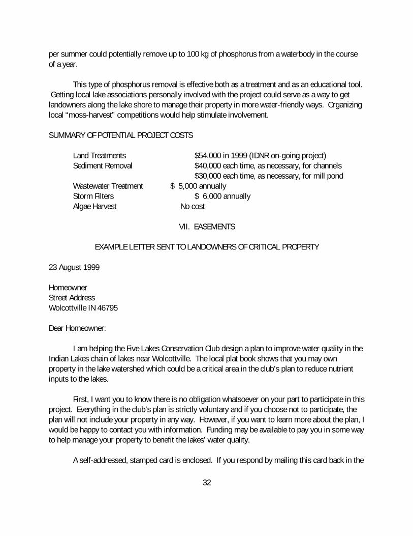
EXAMPLE LETTER SENT TO LANDOWNERS OF CRITICAL PROPERTY
23 August 1999
HomeownerStreet AddressWolcottville IN 46795
Dear Homeowner:
I am helping the Five Lakes Conservation Club design a plan to improve water quality in theIndian Lakes chain of lakes near Wolcottville. The local plat book shows that you may ownproperty in the lake watershed which could be a critical area in the club’s plan to reduce nutrientinputs to the lakes.
First, I want you to know there is no obligation whatsoever on your part to participate in thisproject. Everything in the club’s plan is strictly voluntary and if you choose not to participate, theplan will not include your property in any way. However, if you want to learn more about the plan, Iwould be happy to contact you with information. Funding may be available to pay you in some wayto help manage your property to benefit the lakes’ water quality.
A self-addressed, stamped card is enclosed. If you respond by mailing this card back in the

33
next week or so, I will contact you with more information. If I don’t receive your card, I will assumeyou don’t want to participate and no one will contact you in any way. In any case, thanks for yourtime!
Sincerely,VIII. PUBLIC PARTICIPATION
A public meeting was held June 19, 1999 at the Wolcottville Elementary School. Twenty-five people attended (see participant list in the Appendix). A flier explaining the purpose of theproject was prepared by Commonwealth Biomonitoring and passed out to each person attendingthe opening meeting (a copy is included in the Appendix). There was a question and answerperiod. Bob Christen and Tom Patterson of the Five Lakes Conservation Club fielded questionsabout local concerns. Greg Bright of Commonwealth answered questions about how the projectwas funded, what it hoped to accomplish, and when it was to be completed.
Approximately 100 copies of the Michigan State University brochure “Managing ShorelineProperty to Protect Water Quality” were passed out at the first meeting. The 4-page brochureincluded three assessments individual property owners could make to determine the degree of riskto water quality associated with their use of land. Bob Christen and Tom Patterson volunteered tocollect these forms and return them to Commonwealth when completed.
The first set of brochures was returned within 4 weeks from a group of 33 landowners onDallas Lake. The brochures assign a degree of risk from 1 (low) to 3 (high) for three different landuses. The following results were obtained:
Mean Risk
Septic Systems 1.3Lawn Care 1.5Erosion 1.8 (walkways, seawalls, storm runoff)
The activity with the largest potential to adversely affect water quality, based on these “self-audit”results, is from abrupt concrete seawalls on many properties. The second highest risk wasassociated with stormwater runoff being allowed to flow directly into the lake in many places. Remedial measures for these type of projects are strictly voluntary for each lakeshore landowner. The exercise was useful for getting local lot owners to consider how their use of the land affects thelakes.
A second public meeting was held at the same location on Saturday, October 2, 1999. Another flier was passed out. This flier (a copy is in the Appendix) explained what the study wasfinding out about lake quality and how local people could help keep pollutants out of the water.

34
The first outlines of a lake management plan were presented. Included in the plan were thepossibilities of sediment removal, wetland restorations, stormwater filters, and wastewatertreatment. The ultimate goal of the plan is to reduce phosphorus loading to the lakes by 50%. Themeeting was attended by 36 people from all five lakes. An attendance roster is attached in theAppendix.

35
IX. PROJECT CONSTRAINTS
As with most environmental restoration projects on public and private land, there areconstraints which could keep the plan from being implemented. Some of the major potentialconstraints are listed in Table 5.
Table 5. Potential Project Constraints and Remedies
Proposed Action Potential Constraints Potential Remedies
Sediment Removal High cost Public assistance grantsPermits requiredContamination
Wastewater Treatment Disinterest by RSD Cost-sharing with RSD
Storm Filters Maintenance Provide volunteer laborFilter costs Buy the filters as needed
Algae Harvesting Lack of interest Competitions
The Five Lakes Conservation Club submitted an early draft of this report as a basis for a secondLARE grant to carry out these proposals in January 2000. The club also submitted a Build IndianaFund grant request for mill pond dredging to the Indiana Legislature in January 2000. Copies ofthese grant requests are included in the Appendix.
An IDNR permit application in accordance with the “Lakes Preservation Act” was submitted onMarch 8, 2000 (see Appendix). This application is for the removal of nutrient-enriched sedimentsin six channels. The permit request was modified in July 2000 for sediment removal in only threeof the channels (two on Westler Lake, one on Witmer Lake) because fewer than 100% of theaffected landowners returned forms acknowledging the project on three other channels. Verbalpermission to dispose of the sediments on agricultural ground has been obtained.
The Town of Wolcottville has indicated verbally that they will help with the installation andmaintenance of storm filters. They do not have any money to allocate to this program. Financialhelp will be required, possibly through volunteers or through donations from the Five LakesConservation Club. The LARE grant application asked for $5000 for this purpose. This request isnot contingent on the sediment removal proposal.

36
The Adams Lake Regional Sewer District has expressed a desire to participate in an experimentalphosphorus treatment project. It is not clear yet who will pay for this. The LARE grant requestasked for $5000 for this purpose. The request is not contingent on the sediment removal proposal.
There do not appear to be any biological resource constraints. The Department of NaturalResources does not have any significant wetland areas on the channels of Witmer Lake (Figure 12)and no threatened species are known to be in the project area (Figure 2). No changes in water levelare required. No construction beyond the physical removal of sediments is required.
Fig. 12. Significant wetland areas on Witmer Lake (IDNR Division of Water)

37
X. SIGNS OF SUCCESS
As noted previously, the Indian Lakes chain once supported a thriving population of cisco(Coregonus artedii), a native fish in the trout family that requires good water quality. The last ciscoreported from the Indian Lakes chain was collected in 1975. Cicso had been thought to have beenextirpated entirely from the Indiana Lakes since then [8]. Many other Indiana lakes which oncesupported cisco have suffered the same fate as the lakes became more rapidly eutrophic in the1960s.
However, in July 1998, local resident Phil Terwilliger caught a mature cisco in Dallas Lake. A photograph of the fish is shown in Figure 13. Most likely, a new population of cisco has beenable to become established once more from fish migrating downstream from Oliver Lake where theystill exist. The re-establishment of cisco in Dallas Lake is a positive sign of water qualityimprovements in the watershed.
Figure 13. Cisco from Dallas Lake - 1998

38
XI. REFERENCES
1. Hoggatt, R.E. 1975. Drainage areas of Indiana streams. U.S. Geological Survey, WaterResources Division, Indianapolis, IN.
2. Arvin, D.V. 1989. Statistical summary of streamflow data for Indiana. U.S. GeologicalSurvey Open-file Report 89-62, Indianapolis, IN.
3. Spacie, A. and S. Loeb, 1990. Long-term trends in trophic state of Indiana lakes followingphosphorus reduction. Verh. Internat. Verein. Limnol. 24: 464-469.
4. F.X. Browne, 1992. Diagnostic study of 10 lakes in LaGrange County. Report for the IDNRLake and River Enhancement Program, Indianapolis, IN.
5. Brown, W. and T. Schueler, 1997. National pollutant removal performance database forstormwater BMPs. Center for Watershed Protection, Silver Spring, MD.
6. Wetzel, R.G. 1975. Limnology. W.B. Saunders Company, Philadelphia PA. 743 pp.
7. Kelly, M.H. and R.L. Hite, 1981. Chemical analysis of surficial sediments from 63 Illinoislakes, summer 1979. Illinois EPA, Division of Water Pollution Control, Springfield IL. 92pp.
8. Whitaker, J.O. and J.R. Gammon, 1988. Endangered and threatened vertebrate animals ofIndiana: their distribution and abundance. Ind. Acad. Sci. Monograph Number 5. Indianapolis, IN.
9. Culp, R.L., G.M. Wesner, and G.L. Culp, 1978. Handbook of Advanced WastewaterTreatment. Van Nostrand Reinhold, NY.
10. U.S.EPA, 1983. Results of the Nationwide Urban Runoff Program. Vol. I . Final Report. EPA Water Planning Division, WH-554, Washington, D.C.
11. Harper, H.H. et al., 1992. The use of wetlands for controlling stormwater pollution. Woodward-Clyde Consultants, Portland, Ore. Prepared for US EPA Region V WatershedManagement Unit, Chicago, IL.

39
EUTROMOD - Witmer Lake Calculations Surface Water Runoff & Soil Loss
Land Use Category Runoff Coeff USLE: RE USLE:K É????????????????????????????????????????????? ?????????? º Agriculture1 º 0.25 º 400 º 0.34 º Agriculture2 º 0.22 º 400 º 0.34 º Agriculture3 º 1.469E-39 º 400 º 1.47E-39 º Agriculture4 º 1.469E-39 º 400 º1.47E-39 º Agriculture5 º 1.469E-39 º 400 º1.47E-39 º Forest º 0.15 º 400 º 0.34 º Urban1 º 0.3 º º º Urban2 º 0.4 º º º Feedlots º 1.469E-39 º º º Other1 º 1.469E-39 º 400 º1.47E-39 º Other2 º 1.469E-39 º 400 º1.47E-39 º Other3 º 1.469E-39 º 400 º1.47E-39 ?????????????????????????????????????????????????????????????¼ º Precipitation Mean º 100 cm º º Precipitation CV º 0.25 º ??????????????????????????????????????¼
Phosphorus Concentration Estimates
Land Use Category Dissolved Sed-Attach Total É????????????????????????????????????????????? ?????????? º Agriculture1 º 0.1 º 220 º ***** º Agriculture2 º 0.1 º 220 º ***** º Agriculture3 º 1.469E-39 º 1.47E-39 º *****

40
º Agriculture4 º 1.469E-39 º 1.47E-39 º ***** º Agriculture5 º 1.469E-39 º 1.47E-39 º ***** º Forest º 0.01 º 220 º ***** º Urban1 º 1 º ***** º 0.2 º Urban2 º 1 º ***** º 0.1 º Feedlots º 4 º ***** º1.47E-39 º Other1 º 1.469E-39 º 1.47E-39 º ***** º Other2 º 1.469E-39 º 1.47E-39 º ***** º Other3 º 1.469E-39 º 1.47E-39 º ***** º Precipitation º 0.01 º ***** º 0.05 ?????????????????????????????????????????????????????????????¼

41
????????????????????????????????¼
Phosphorus Loading Estimates - By Category
Loading (kg/yr) Expected É????????????????????????????????????????????????????????????» º Agriculture º º 3419 º º Forest º º 13 º º Urban º º 16.5 º º Feedlots º º 250 º º Precipitation º º 42.5 º º Septic Tanks º º 375 º º Point Sources º º 0 º º Other º º 0 º ?????????????????????????????????????????????????????????????¼
Estimated Total = 4016 (kg/yr)
Predicted Lake Trophic State Variables - Based on HydrologicVariability Variable (units) 5th %ile Expected 95th%ile É????????????????????????????????????????????????????????????» º Total P-in (mg/l) º º 0.1255 º º Total N-in (mg/l) º º 2.5266 º º Total P (mg/l) º 0.0460 º 0.0591 º 0.0758 º Total N (mg/l) º 0.5952 º 0.6203 º 0.6465

42
º Chlor a (ug/l) º 8.3317 º 10.1448 º 12.3525 º Secchi Depth (m) º 2.1837 º 2.0981 º 2.0208 º Prob Hypo Anoxia º 0.0000 º 0.0075 º 0.0000 º Prob BG Dominant º 0.0000 º 0.0000 º 0.0000 º THMs º 0.0000 º 0.0000 º 0.0000 º TSI º 55.3852 º 58.1480 º 60.9108