Indian Institute of Government of India Centre for Space ...
14
Remote Sensing and Satellite Based Meteorology in India By: Riddhish Chetan Soni Research Scholar, Geosciences division, Indian Institute of Remote Sensing (IIRS), Indian Space Research Organisation (ISRO), Department of Space , Govt. of India. Indian Institute of Remote Sensing Government of India Centre for Space Science and Technology Education in Asia Pacific
Transcript of Indian Institute of Government of India Centre for Space ...

Remote Sensing and Satellite Based Meteorology in India
By: Riddhish Chetan Soni Research Scholar,
Geosciences division, Indian Institute of Remote Sensing (IIRS),
Indian Space Research Organisation (ISRO), Department of Space , Govt. of India.
Indian Institute of
Remote Sensing
Government of India Centre for Space Science
and Technology Education
in Asia Pacific

Contents
1. Indian Space Research Organisation 2. Disaster Management 3. Meteorology 4. Earth Observation 5. Application of satellite data in INDIA 6. Introduction of FENGYUN Meteorological Satellite data reception in India 7. Use of SWAP and SMART Software 8. Further Demands regarding FENGYUN satellite products and Application
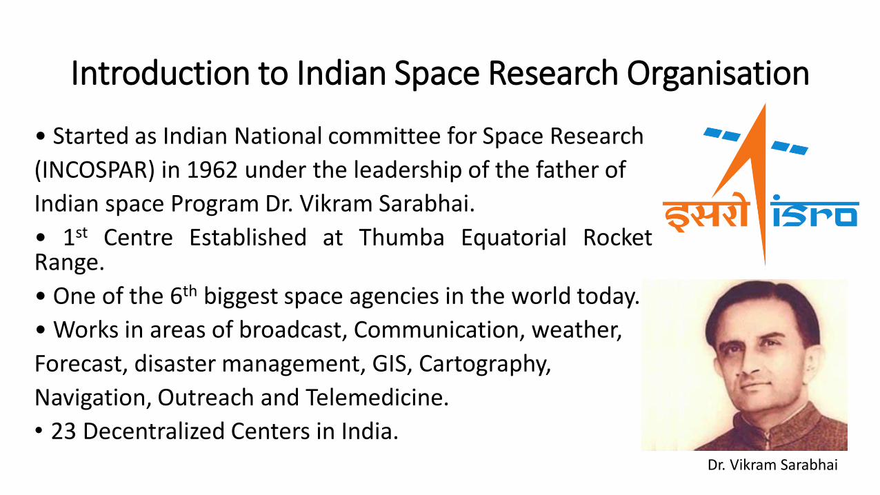
Introduction to Indian Space Research Organisation
• Started as Indian National committee for Space Research
(INCOSPAR) in 1962 under the leadership of the father of
Indian space Program Dr. Vikram Sarabhai.
• 1st Centre Established at Thumba Equatorial Rocket Range.
• One of the 6th biggest space agencies in the world today.
• Works in areas of broadcast, Communication, weather,
Forecast, disaster management, GIS, Cartography,
Navigation, Outreach and Telemedicine.
• 23 Decentralized Centers in India.
Dr. Vikram Sarabhai

Disaster Management
• Satellite Images provide a synoptic birds eye view of the Earth’s surface along with major calamities like forest fires, floods, landslides, cyclones.
• Disaster Management Support program (DMS) using space based inputs.
• Portals like Bhuvan, National Database for Emergency Management and MOSDAC.

Meteorology
• Indian Meteorological Department primary user of Meteorological satellites of INSAT satellite series.
• Data of Meteorological aspect processed by INSAT Meteorological Data Processing System (IMDPS) in New Delhi.
• Other Meteorological satellites include KALPANA-1 with a VHRR instrument providing daily data every 30min.
• Products include images, water vapour, atmospheric motion vectors, sea surface temperature, long wave radiation, tropospheric humidity, NDVI, AOD.

• monitoring of cyclone intensity, its location, and various other weather systems such as fog, thunderstorms, Western disturbances and Norwesters, etc.,
• 40 Digital Meteorological Data Dissemination (DMDD) stations set up by IMD.
• 1158 AWS of IMD and 1000 AWS of ISRO, 969 Automatic rain gauge stations.
• 353 cyclone warning centres.
• Disaster Warning and Dissemination System (DWDS) collective data accumulation from ISRO, IMD and News channels.
• Imp Links: www.imd.gov.in
: https://live.mosdac.gov.in/

Earth Observation
• Applications include Agricultural Crops Inventory, Water Resources Information System, Ground Water Prospects, Forest Working Plans, Biodiversity and Coral Mapping, Potential Fishing Zones, Ocean State Forecasts, Rural Development, Urban Development, Inventory & Monitoring of Glacial Lakes / Water Bodies, Location based Services using NavIC constellation, Disaster Management Support Programme, Cyclone and Floods Mapping & Monitoring, Landslide Mapping & Monitoring, Agricultural Drought, Forest Fire, Earthquakes, Extreme Weather Monitoring and experimental Forecasts and so on.
• EO data: https://bhuvan.nrsc.gov.in/bhuvan_links.php
:https://vedas.sac.gov.in/

Applications of Satellite Data in India
Agriculture and Soils Renewable energy
Forest and environment Geology
Governance Land Resources
Ocean Sciences Rural Development
Urban Development Water Resources
Weather and Climate National Meet Outcomes
Introduction of FENGYUN Meteorological Satellite data reception in India
• International cooperation is a strategic area for a space programme.
• Memoranda of Understanding (MoU) signed with Afghanistan, Algeria, Armenia, Argentina, Australia, Bangladesh, Brazil, Brunei Darussalam, Bulgaria, Canada, Chile, China, Egypt, France, Germany, Hungary, Indonesia, Israel, Italy, Japan, Kazakhstan, Kuwait, Mauritius, Mexico, Mongolia, Morocco, Myanmar, Norway, Portugal, Peru, Republic of Korea, Russia, Sao-Tome & Principe, Saudi Arabia, Singapore, South Africa, Spain, Sultanate of Oman, Sweden, Syria, Tajikistan, Thailand, The Netherlands, Ukraine, United Arab Emirates, United Kingdom, United States of America, Uzbekistan, Venezuela and Vietnam.

• The National Satellite Metrological Center and China Meteorological Administration (CMA) have launched dedicated meteorological and oceanographic satellites viz. FY-2 series and FY-4 series of Geostationary Satellites and FY-1, FY-3 series and TanSat series LEO satellites for earth observation.
• These Meteorological satellites provide important data products with application in areas of atmosphere, land, ocean and radiation. With a constellation of 25 satellites producing 122 data products with 5827TB of data and 81,203 users.
• At the Geoscience and Geohazards division of Indian Institute of Remote Sensing, ISRO, we work in research areas of Risk and vulnerability assessment, Flash flood hazard mapping and modelling, Snow melt runoff modelling, Mapping of glaciers, glacial lakes and modelling of glacial lake outburst flood, Forest fire and degradation analysis, Ecosystem vulnerability to climate change and Extreme precipitation modelling.
• Integrating FENGYUN Satellite data products into these domains can help us in better decision making and providing real time analysis for Disaster detection, management, response and mitigation scenarios in future.

Use of SWAP and SMART Software
• MOSDAC provides information about meteorology, oceanography and tropical cyclones. (https://www.mosdac.gov.in/)
• Scatterometer satellite data is given through ftp://ftp.mosdac.gov.in/).

• In terms of Earth Observation applications, we use Earth observation archival system called as VEDAS (Visualization of Earth Data and Archival System) division of ISRO through (https://vedas.sac.gov.in/vedas/). It uses Satellites like RESOURCESAT, TERRA, AQUA, IRS, Oceansat and Cartosat series.

Further Demands regarding FENGYUN satellite products and Applications
• We would like to know how FENGYUN satellite products can help in fulfilling the United Nations Sustainable Development Goals and help us in areas of Biodiversity and ecosystem sustainability, Disaster resilience, Energy and mineral resources management, Food security and precision agriculture, Public health surveillance, Sustainable urban development, Infrastructure and transportation management and finally Water resources management.
• Hyperspectral satellite development in China.
• Application of TANSAT satellite for air quality mapping in India.
• Ash cloud monitoring.

THANK YOU