India and Its Physiographic Divisions
41
-
Upload
shristi-suvarna -
Category
Education
-
view
39 -
download
0
Transcript of India and Its Physiographic Divisions


PHYSICAL FEATURES
OF INDIA

SHRUSTI PRASHANT SUVARNASTD : IX DIV : C
HOLY ANGELS’ SCHOOL

INTRODUCTION You have already learnt earlier that India is a vast country with
varied landforms. What kind of terrain do you live in? If you live in the plains you are familiar with the vast stretches of plain
land. In contrast, if you live in hilly region, the rugged terrain withMountains and valleys are common features. In fact, our country
has practically all major physical features of the earth i.e. mountains, plains, deserts, plateaus and islands. You must be
Wondering how these physical features have been formed. We will learn more about major physical features of India and how
they have been formed.

PLATE TECTONICS IS A THEORY OF GEOLOGY. IT HAS BEEN DEVELOPED TO EXPLAIN LARGE SCALE MOTIONS OF THE EARTH'S LITHOSPHERE. THIS THEORY BUILDS
ON OLDER IDEAS OF CONTINENTAL DRIFT AND SEAFLOOR SPREADING.
DISSIPATION OF HEAT FROM THE MANTLE IS THE ORIGINAL SOURCE OF ENERGY DRIVING PLATE
TECTONICS. EXACTLY HOW THIS WORKS IS STILL A MATTER OF DEBATE. THE DRIVING FORCES OF PLATE MOTION CONTINUE TO BE ACTIVE SUBJECTS OF ON-
GOING RESEARCH.[
THEORY OF PLATE TECTONICS

WORLD : PLATE MARGINS

MOVEMENT OF PLATES
THE LITHOSPHERE CONSISTS OF TECTONIC PLATES. THERE ARE EIGHT MAJOR AND MANY
MINOR PLATES. THE LITHOSPHERIC PLATES RIDE ON THE ASTHENOSPHERE. THESE PLATES MOVE
AT ONE OF THREE .EARTHQUAKES, VOLCANIC ACTIVITY, MOUNTAIN-
BUILDING, AND OCEANIC TRENCH FORMATION OCCUR ALONG PLATE BOUNDARIES.

MOVEMENT OF PLATESTHESE PLATES MOVE AT ONE OF THREE TYPES OF PLATE BOUNDARIES.
CONVERGENT BOUNDARY : IN THIS CASE THE PLATES COME TOWARDS EACH OTHER.
DIVERGENT BOUNDARY : IN THIS CASE THE PLATES MOVE AWAY FROM EACH OTHER.
TRANSFORM BOUNDARY: IN THIS CASE THE PLATES MAY COLLIDE, CRUMBLE ,OR ONE MAY SLIDE UNDER THE OTHER.AT
TIMES, THEY MAY HORIZONTALLY PASTEACH OTHER .
DID YOU KNOW ?
Most Volcanoes and earthquakes in the world are located at plate
margins but some occur within the plates.

GONDWANALANDGondwana, formerly Gondwanaland, is the name given to a southern supercontinent which was formed when Pangaea broke up, starting 180 million years ago , in the early middle Jurassic.The Pangaean global supercontinent completed its formation 250 million years ago . After the split, Gondwana separated from Laurasia, which was the northern part of Pangaea. There were then these two large segments, nearly equal in area.While the northern hemisphere continent Laurasia moved further north, Gondwana drifted south. It included most of the landmasses in today's southern hemisphere, including Antarctica, South America, Africa, Madagascar, Australia–New Guinea, and New Zealand, as well as Arabia and the Indian subcontinent, which have now moved entirely into the Northern Hemisphere.Gondwana itself began to break up in the mid-Jurassic, about 170 . It split into the present-day continents listed above.

AFRICA
SOUTHAMERICA
ARABIA
INDIA
ANTARCTICAAUSTRALIA
NEW GUINEA
BEFORE

MAJOR PHYSIOGRAPHIC
DIVIDIONS

MAJOR PHYSIOGRAPHIC DIVIDIONS
INDIA CAN BE DIVIDED INTO FIVE PHYSIOGRAPHIC REGIONS. THEY ARE :
1.THE NORTHERN MOUNTAINS2.NORTHERN PLAINS
3.THE PENINSULAR PLATEAU4.INDIAN DESERT
5.THE COASTAL PLAINS6.ISLANDS

HIMALAYAN MOUNTAIN
S
NORTHERN
PLAINS
PENINSULAR
PLATEAU
INDIAN DESERT
COASTAL PLAINS
ISLANDS
MAJORPHYSIOGRAPHIC
DIVISIONS

HIMALAYAN MOUNTAINS
This is the highest mountain system on earth, the name Himalaya means the House of Snow and it consists of several parallel mountain ranges. 30 to 50 million years in different stages the Indian Plate has collided with the Eurasian Continental Plate to form the Himalaya Mountains. The Himalaya system is the most common type of mountain formation, folded. They are created by tectonic plates pushing against each other and the only direction for these earth to move is up. The mountains nearly extend 2400 km in an ellipse across southern Asia from the bend of the Indus River in the northwest to the Brahmaputra in the east. They form a barrier that . The Himalaya system, averaging 400 km in Kashmir to 150 km in Arunachal Pradesh in width, rises sharply from the Indo-Gangetic Plain and separates northern India from the plateau of Tibet, in China. The Himalayas form the earths highest mountain region, containing 9 of the 14 highest peaks in the world. The average height is 6000 metres.


RELIEF

SOME HIGHEST PEAKS OF THE HIMALAYAS
PEAK COUNTRY HIEGHT IN METRES
Mt. Everest Nepal 8848
Kanchenjunga India 8598
Makula Nepal 8481
Dhaulagiri Nepal 8172
Nanga Parvat India 8126
Annapurna Nepal 8078
Nanda Devi India 7817
Kamer India 7756
Namcha Barwa India 7756
Gurla Mandhata Nepal 7728

MT. EVEREST

KANCHENJUNGA

MAKULA
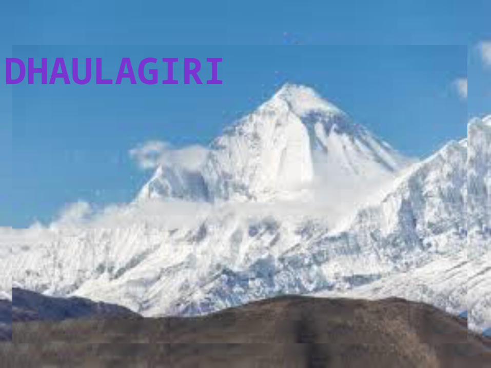
DHAULAGIRI

NANGA PARVAT

ANNAPURNA

NANDA DEVI

KAMER

NAMCHA BARWA

GURLA MANDHATA

NORTHERN PLAINS
The Gangetic Plains is the large space of level land that is made by the Ganges River in the northern parts of India and the border surrounding areas of the Himalayas. It is an important part of the countries of India, Nepal, and Bangladesh. Its space of about 700,000 square kilometers or 270,000 square miles is the home of about 1 billion persons (about one in every seven persons alive today).Its western edge is the Thar Desert; its northern edge is the Himalaya Mountains, the highest mountains on world; its eastern edge is the Ganges Delta of Bangladesh, the largest River delta in the world; and its southern edge is made by the Vindhya and Satpura Mountains and Chota Nagpur Plateau of middle India.
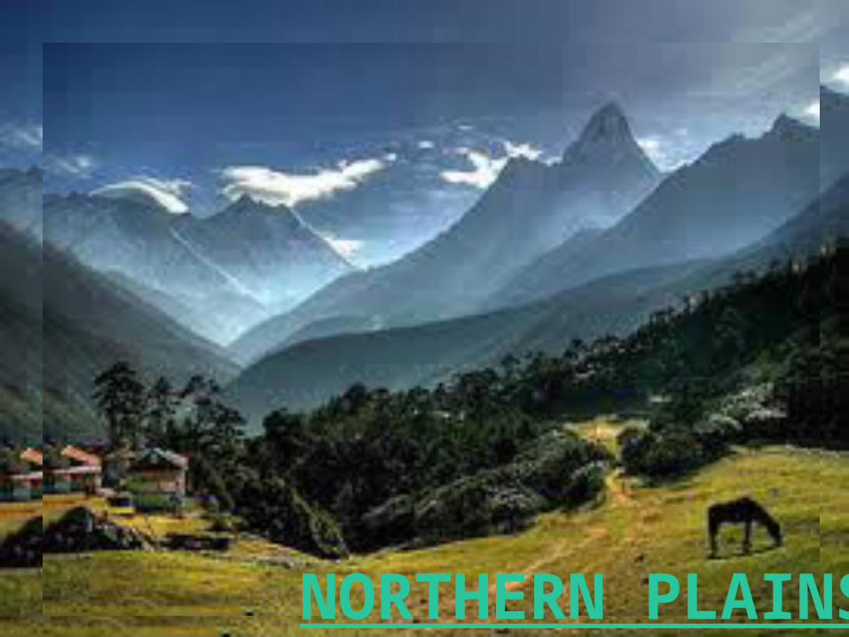
NORTHERN PLAINS

THE PENINSULAR PLATEAUThe Deccan Plateau is a large plateau in India which
covers the majority of the southern part of the country. It is between three mountain ranges and extends over eight
Indian states; in particular the states of Andhra Pradesh, Karnataka, Kerala and Tamil Nadu are on this
plateau.The plateau covers 422,000 square kilometers
(163,000 sq mi), 43 percent of India's landmass. The Deccan Traps formed between 60 and 68 million years
ago,[5] at the end of the Cretaceous period. The bulk of the volcanic eruption occurred at the Western
Ghats (near Mumbai) some 66 million years ago. This series of eruptions may have lasted fewer than
30,000 years in total.[6] The gases released in the process may have played a role in the Cretaceous–Tertiary
extinction event, which included the extinction of the non-avian dinosaurs. The consensus among the scientific
community is that the extinction was triggered by the Chicxulub impact event in Central America, but that
the Deccan eruptions also damaged the world's environment.[7] The release of volcanic gases,
particularly sulfur dioxide, during the formation of the traps contributed to contemporary climate change. Data point to an average fall in temperature of 2 °C (36 °F) in
this period.[

Deccan Traps near Matheran, east ofMumbai.
The Deccan Traps near Pune.
Deccan Traps near Matheran, east of Mumbai

INDIAN DESERT
The Thar Desert) Also Known As The Great Indian Desert, Is A Desert In Western Republic Of India And Southeastern Pakistan. It
Is Mostly In The Indian State Of Rajasthan. It Extends Into The Southern Portion Of Haryana And Punjab States And Into Northern
Gujarat State. In Pakistan, The Desert Covers Eastern Sindh Province And The Southeastern Portion Of Pakistan's Punjab Province. In Pakistan's Punjab Province It Is Known As The
Cholistan Desert. Tharparkar District Of Province Sindh Pakistan Is Also A Part Of Thar Desert. The Thar Desert Is Bounded On The
Northwest By The Sutlej River, On The East By The Aravalli Range, On The South By The Salt Marsh Known As The Rann Of Kachchh
(Parts Of Which Are Sometimes Included In The Thar), And On The West By The Indus River. In India It Consists Of The Following
DistrictsIts Boundary To The Large Thorny Steppe To The North Is Badly
Defined. Depending On What Areas Are Included Or Excluded, The Nominal Size Of The Thar Can Vary Significantly.

A NASA satellite image of the Thar Desert. The image also shows the international border between India and Pakistan. The desert is at the center left of the image; the Indus River and its tributaries are to the left side of the desert, and the dark green line at the bottom center of the image is the Aravalli Range.

INDIAN DESERT

THE COASTAL PLAINSA coastal plain is an area of flat, low-lying land adjacent to a seacoast. One of the world's largest coastal plains is located in eastern South America. The Gulf Coastal Plain of North America extends northwards from the Gulf of Mexico along the Lower Mississippi River to the Ohio River, which is a distance of about 500 miles (800 km). During the Cretaceous period, the central area of the United States was covered by a shallow sea, which disappeared as the land rose. Large fossilized aquatic birds called Hesperornis and Ichthyornis, found in western Kansas, indicate that the shallow sea was rife with fish
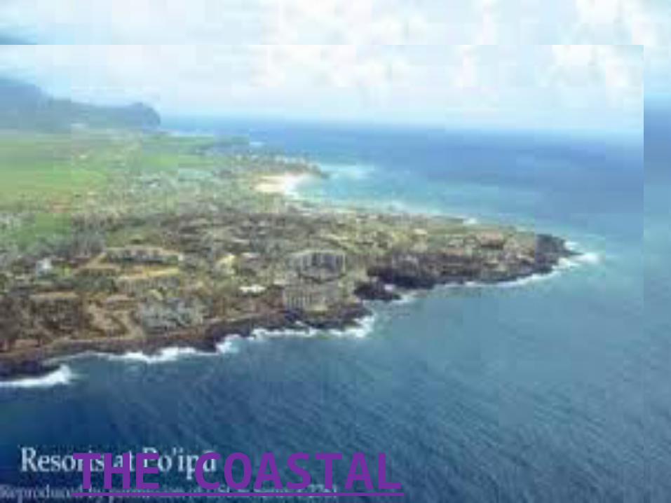
THE COASTAL PLAINS

ISLANDSAn island is a piece of ground that is surrounded by water. Water is all around an island. Islands are smaller than continents.Arrange the following island in order of their sizes, the largest first. The largest island in the world is Greenland, unless Australia is believed to be an island.Some islands are their own countries. Examples of islands that are their own countries include Cuba, Iceland, and Madagascar. There are many others. Other islands have more than one country, such as Borneo and Hispaniola.

ISLANDS

CORALS
Corals Are Formed By Small Animals, The Polyps Of The Phylum Cnidaria. They Are Marine, Either On Continental Shelves Or Round Oceanic Islands. They Live In Colonies.
All The Polyps In A Colony Are Zooids: They Are All Clones, Genetically Identical.. Colonies Of The Same Species
Release Gametes Together, Over One, Two Or Three Nights Around A Full Moon.
Each Coral Animal Is Like A Little Bag. The Opening On Top Is The Mouth. Tentacles (Little Arms) Around The Mouth Carry Stinging Nematocysts, Which Paralyse The Small
Animals Eaten By The Coral Polyps. Coral Usually Grows In Tropical Oceans. A Few Corals Grow In Cold Water, Like The
Oceans Around The British Isles And Norway.

CORALS