IN THE MATTER of applications pursuant to the ... - hamilton.govt.nz · level in the investigation...
64
Page 1 IN THE MATTER of applications pursuant to the Resource Management Act 1991 BY Weston Lea Limited FOR land use and subdivision consents for a large scale residential development and associated land use activities and sites works at Peacocke, Hamilton STATEMENT OF EVIDENCE (TRAFFIC) Alasdair Gray 29 March 2019
Transcript of IN THE MATTER of applications pursuant to the ... - hamilton.govt.nz · level in the investigation...

Page 1
IN THE MATTER of applications pursuant to the
Resource Management Act 1991
BY Weston Lea Limited
FOR land use and subdivision consents for a large scale residential development and associated land use activities and sites works at Peacocke, Hamilton
STATEMENT OF EVIDENCE (TRAFFIC)
Alasdair Gray
29 March 2019

Page 2
1 INTRODUCTION 1. My name is Alasdair David Angus Gray. My qualifications and experience are
as follows:
a. I hold a Bachelor of Science degree (Civil Engineering, 1986) from the
University of Aberdeen. I am a Corporate Member of the Institution of
Professional Engineers New Zealand and a Chartered Professional
Engineer. I hold a Ministry for the Environment Making Good Decisions
certificate.
b. I have worked in the transportation field as a civil/transportation
engineer for more than 30 years and have been involved at a senior
level in the investigation and development of projects in Hamilton City
and the Waikato region for more than 20 years. I am based in Hamilton
and established my own consultancy, Gray Matter Ltd, in January 2006.
For 5 years prior to that I was Group Engineer, Asset Development, with
Opus International Consultants Ltd in Hamilton, managing
approximately 30 technical staff in a range of road projects. For the
previous 5 years I was a senior civil/transportation engineer with
AECOM’s predecessor in Hamilton.
c. I am familiar with the transport issues arising in and around Waikato,
having provided advice to Hamilton City Council, Waipa and Waikato
District Councils and other local authorities, Waikato Regional Council,
NZ Transport Agency, and developers on projects in the area over the
past 20 years. I have the following specific experience with respect to
the matters currently in front of the Hearing Commissioner Panel:
i. Traffic engineer supporting NZ Transport Agency, Hamilton and
Tauranga City Councils, and Rotorua, Waipa, Waikato and
Matamata Piako District Councils in transport-related aspects of
District Plan changes, reviews and variations including the
Ruakura Board of Inquiry;
ii. Consultant civil/transportation engineer for developers,
landowners and local authorities assisting in preparing and

Page 3
reviewing Notices of Requirement for road projects and consent
applications, including in Peacocke Stage 1A;
iii. Assisting NZTA with traffic engineering and transport planning
for the state highway network, including two years’ experience
as the network safety engineer for the Manawatu State highway
network, investigation and implementation of the SH3/Airport
Road roundabout, and advice on responding to the impacts of
development on the SH3 corridor in south Hamilton;
iv. Assisting Te Awa River Ride Trust, NZTA, Waikato DC, Waipa
DC and HCC in investigations and funding applications for the
Ngaruawahia to Horotiu and Cambridge to Hamilton Sections of
the cycleway;
v. Project Manager for HCC and NZ Transport Agency for the
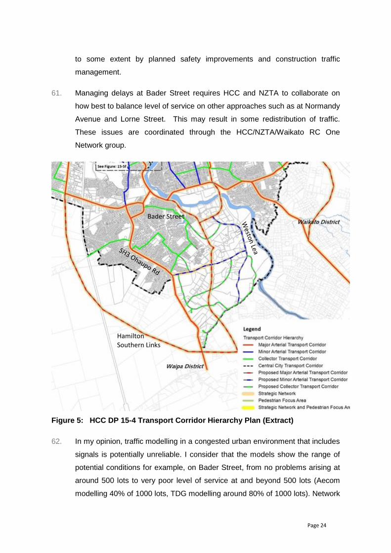
Southern Links Investigation and Notice of Requirement relating
to the arterial road network to the south of Hamilton, including
the Peacocke arterials;
vi. Assisting HCC with preparation of the Indicative and Detailed
Business Cases for the successful application for funding from
the Housing Infrastructure Fund, including traffic engineering and
transport economics, option selection and evaluation, and the
management case for implementation;
vii. Assisting HCC and NZTA with feedback on the draft transport
assessment for this application and supporting investigations;
and,
viii. I am currently project managing the implementation of the
Peacocke network infrastructure, including strategic transport
and wastewater packages.
2 EXPERT CODE OF CONDUCT 2. I have read the Code of Conduct for Expert Witnesses contained in the
Environment Court Practice Note 2014 and have complied with that practice

Page 4
note in preparation of this evidence. I agree to comply with it in presenting
evidence at this hearing.
3. I have the following relationships with the parties to the hearing. None of these
are material to the outcome of the hearing and my role in relation to the
applications by Weston Lea Limited does not conflict with these relationships:
a. I and my company, Gray Matter Ltd, regularly provide expert
transportation advice to HCC. This includes advice to HCC as
regulatory authority and as road controlling authority. There are no
other matters which I or my company are providing advice on which
conflict with the advice I have provided in relation to the Weston Lea
Limited applications;
b. My company, Gray Matter Ltd, has been engaged by HCC/NZTA as a
joint commission to provide project management advice for the
Southern Links Project, and for design of related works (HCC) including
the SH3 Ohaupo Road/East-west arterial roundabout and the Bader
Street safety works. This role and the nature of the advice I provide to
those parties does not conflict with my opinions in relation to the
applications by Weston Lea Limited
c. I am the project manager engaged by HCC for the Peacocke network
infrastructure. This includes provision of the bridge, road, and
wastewater connections. My engagement is to deliver infrastructure
and extends to the start of construction. This engagement was
confirmed on 8 August 2018. While the delivery of this infrastructure is
relevant to the Amberfield development, my role in its delivery is not in
conflict with the opinions I have provided in my evidence.
4. The evidence that I give is within my area of expertise, except where I have
stated my reliance on other identified evidence. I have considered all material
facts that are known to me that might alter or detract from the opinions that I
express in this evidence.

Page 5
3 SCOPE OF EVIDENCE 5. I have been retained by HCC to provide traffic engineering and transport
planning advice relating to the consent applications by Weston Lea Limited
(the applicant).
6. I am familiar with the existing and planned road network near the site. I have
travelled along and visited Peacocke Road on several occasions to observe
traffic conditions on Peacocke Road and connecting routes, including Bader
Street.
7. The purpose of this statement of evidence is to address matters raised in the
applications relating to transport and consideration of submissions in this
regard.
8. My evidence covers:
a. A summary of my conclusions and an update of key changes planned in
the area.
b. Review and assessment of applicant’s traffic assessment (this includes
assessment against relevant statutory provisions (e.g. RMA, Regional
Policy Statement, District Plan;
c. The status and programme for planned transport infrastructure in the
area;
d. Current and expected traffic conditions;
e. Responses to submissions related to transport and traffic;
f. Discussion of some aspects of the Proposal;
g. Comments from expert caucusing;
h. Recommended conditions; and,
i. My conclusions.
9. In preparing this evidence I have participated in expert conferencing and
reviewed the following:

Page 6
a. Assessment of Environmental Effects prepared by Merestone Ltd, and
its:
i. Appendices A, B, and C – Objectives and Policies, Rules and
Criteria;
ii. Appendix I – Integrated Transport Assessment Report;
iii. Scheme Plans;
iv. Engineering Design Drawings (high level review);
b. s92 further information responses relating to transport, received 17
August 2018, including:
i. Appendix L – Traffic and Transportation;
ii. Appendix O – Scheme Plan Update;
c. Submissions relating to traffic and transport;
d. Addendum of changes on 25 Feb 2109 including an updated staging
plan.
e. Additional information received 28 March 2019 an updated staging plan.
10. I participated in expert conferencing for traffic witnesses between December
2018 and January 2019. I have attached the Joint Witness Statement
prepared at the final conferencing session, which shows general agreement
between the participants about the likely level of effects and suggestions for
conditions to manage them to acceptable levels.
4. SUMMARY AND NETWORK CONTEXT UPDATE 11. In summary, I consider that subject to appropriate conditions as set out in the
S42A report, the adverse effects of the development can be managed to an
acceptable level. This is because:

Page 7
a. The location of the development, closer to the town centre and key
destinations, will have a relatively beneficial effect compared to more
distant development.
b. The Waikato Expressway will provide some improvement in conditions
when it is operational (late 2020/early 2021).
c. The proposed Waikato River Bridge should be operational in 2023.
d. Construction traffic is most likely to be in the opposite direction to peak
demand and can be managed through temporary traffic management.
e. Traffic effects from dwellings would commence around mid-2021, so
would be around 225 dwellings occupied by 2023 and 350 dwellings by
2024.
f. Development is likely to be less than my proposed 350 dwellings
threshold for monitoring and control before the new bridge is
operational.
g. My proposed limit of 500 lots before the bridge is operational provides
protection against unexpected conditions or a delay in the bridge
resulting in unacceptable effects.
h. Works within the Southern Links designation will require the approval of
HCC as the requiring authority.
12. It would be desirable for the applicant and HCC as road controlling authority
and requiring authority to resolve differences in some of the proposal’s design
features to reduce the risk of disagreement during detailed design. In particular
these relate to:
a. Conflicting demands and operations in narrow roads – e.g. stormwater
treatment space, parking, driveways, refuse collection. (internal roads –
HCC as road controlling authority)
b. Alignments and activities in Hamilton Southern Links designation (refer
paragraph 50 for more detail).

Page 8
13. The main effects relate to development in advance of the proposed new
Waikato River bridge being completed. The effects will relate to safety,
efficiency and accessibility effects mainly on the Peacocke Road, Norrie
Avenue, Bader Street corridor with potential adverse effects on safety at
Raynes Road and other connections to SH3. These can be mitigated through
improvement works and monitoring and controls restricting development or
requiring additional mitigation.
14. It is worth highlighting that HCC is currently implementing changes to the
Peacocke road network as part of the Peacocke programme (refer Figure 1
below). These are designated and funded for construction. Land acquisition is
under way.
15. These projects change the transportation network context from existing
conditions, through road construction phases and temporary traffic
management, to different long term operational conditions by 2024, at the
same time as construction and occupation of the Weston Lea development
takes place.
16. The key works relevant to the application are:
a. A new arterial road connection from Peacocke across the Waikato River
with associated local road works:
i. This is currently being designed with the bridge to be complete
by June 2023.
ii. The arterial will connect Peacocke to the Wairere Drive/Cobham
Drive interchange currently under construction and provides an
alternative transport connection, reducing demand on Bader
Street; and,
b. An upgrade of Peacocke Road to an urban minor arterial for the
northern portion of the Weston Lea Frontage. This is due to be
complete by June 2024.
c. An east-west minor arterial road due to be linked to Peacocke Road by
June 2025. Enabling works for the SH3 Ohaupo Road roundabout are

Page 9
due to commence within a few months, with the roundabout complete
by late 2020.
Figure 1: Peacocke Programme (solid red lines for construction)
17. Since the Weston Lea application has been prepared so as not to rely on the
HCC infrastructure changes it means that if the consent is granted, it would be
desirable for relevant conditions to allow for different infrastructure to be
provided by HCC.

Page 10
5. REVIEW AND ASSESSMENT OF APPLICANT’S TRAFFIC ASSESSMENT – GENERAL OVERVIEW
18. In June 2018 I reviewed the Integrated Transport Assessment (ITA) for the
Amberfield Subdivision and concluded that:
a. The ITA (TDG, May 2018) met the information requirements in the
District Plan Section 1.2.1 for a Broad ITA (Table 15-3b); and
b. More detail was required to confirm the accuracy of the information and
how it affects the scale and extent of the effects.
19. I subsequently contributed to HCC’s further information request and checked
the response for adequacy. I concluded that the response was adequate but
that some discussion was still needed to resolve the network performance
discrepancies.
20. The ITA Section 2 provides detailed descriptions of the existing transport
network, including crashes, traffic volumes and turning movements. I note that
the traffic data is from 2016 but do not consider that a significant deficiency. My
review is based on current traffic flows from HCC counts and modelled using
the turning proportions from the 2016 counts.
21. The ITA Section 3 provides a description of the planned transport network but
later concludes that all of the subdivision traffic can be accommodated without
significant infrastructure additions (for example, the Southern Links arterial link
to the bridge over the Waikato River). I do not agree with this as discussed
below.
22. The ITA Section 4 describes the proposed subdivision including details on road
widths and cross-sections, with some intersection layouts and alignments
including for Peacocke Road. The applicant’s team presented some of this
information during pre-application engagement. HCC staff raised concerns in
relation to some of the features, particularly relating to road widths and the
ability of corridors to accommodate their other transport corridor functions,
including stormwater, utility servicing, waste management and other service
vehicles in operation, and passenger transport. HCC prefers cross sections

Page 11
consistent with the Waikato Regional Technical Specifications1. The proposal
continues with narrower corridors in some areas, and provides information
such as swept paths and conceptual bus routes to demonstrate adequacy. My
assessment is on the basis that detailed design will be to HCC’s satisfaction as
road controlling authority and I focus on the adequacy of the corridor width,
with some comments in principle on details. I suggest that where there is
potential dispute on standards, these are explicitly listed in conditions.
23. The ITA Section 5 reviews the Hamilton District Plan objectives, policies and
rules. In general, the proposed subdivision appeared consistent with the
Hamilton District Plan, but I have concerns about the basis for staging and
options for passenger transport, and the cumulative impact of minimum
standards, even with the updated staging plan.
24. The transportation assessment states that specific consideration has been
given to effective staging. My understanding is that although the extents of
stages are fixed with the updated staging plan, the sequence and timing is not.
This presents risks for connectivity and makes forecasting and managing the
effects of development more difficult.
Using passenger transport as an example, ITA Figure 24 shows a possible Stage 1
bus route turning in roads that will not exist until later stages (See Figure 2 below). I
have suggested that for each stage a requirement for passenger transport
accessibility is included in conditions.
1 https://www.hamilton.govt.nz/our-council/council-publications/manuals/Pages/default.aspx The Regional Infrastructure Technical Specifications (RITS) have been adopted by the Hamilton City Council in June 2018. The RITS sets standards for design and construction of public infrastructure and is intended to provide clarity and consistency for contractors, developers, and consultants in the Waikato region. It includes standards for earthworks, transportation, water, wastewater, stormwater, landscapes, and accepted materials. WRITS is a technical guideline document with more detailed information than the District Plan and prepared more recently than the District Plan. It includes, for example, typical cross-sections, inspection regimes, design criteria, etc.

Page 12
Figure 2: Bus Route and Staging
25. Section 41c of the S92 response (Table heading Basis of Modelling / Trip
Generation/ Network Impacts) states that the first stage of the subdivision is
unlikely to be completed before 2020 with the remainder of the subdivision
likely to be completed over the following seven years. I have relied on that
timing in my review.
26. I consider that there is a higher risk of poor operational performance where
minimum standards are applied and a combination of narrow roads, limited
space on sites for parking, and multiple demands on the road corridor
combine. For example, section 5.1 considers that that the transportation
network “is affordable, sustainable and responsive…” with a contributing factor
being “…the provision of on-street parking to improve integration of the
infrastructure with land use”. In my opinion, the proposal has to be specifically
designed to manage on street parking and provide a minimum standard
because the combination of narrow frontages in some areas, and the need for
driveways, landscaping and stormwater management reduces the space
available for on street parking, increasing the risk of inappropriate parking at
driveways, bends and intersections, and compromising widths and visibility.
To reduce the risk of conflict between road controlling authority expectations
and the Consent-holder’s proposals, it would be desirable for the Applicant to
demonstrate at the hearing how the proposed layouts will meet the operational

Page 13
demands on the roads and consider specific features to be incorporated in
conditions. This should consider:
a. Activities such as:
i. Coordination of design and construction of driveways, parking
bays and landscaping with bus stops, refuge islands, and
intersections;
ii. Maintenance - channel cleaning, clearing swales, etc.
iii. Deliveries and collections by large vehicle (such as house
moving and construction deliveries),
iv. Managing conflicting demands, e.g. stormwater and parking,
v. Refuse collection (noting HCC has committed to wheelie bins
using trucks fitted with automatic lifting arms commencing July
2020); and,
b. Scenarios where roadside parking, where available, is occupied.
27. The original ITA traffic forecasts (Section 6) are based on the previous WRTM
model (WRTM 900 zone 2006). They use a vehicular trip generation per
household of 8 trips/household/day and suggest that only 6500veh/day will
travel beyond the subdivision. In the long term, although still slightly low in my
opinion, this is reasonable and consistent with NZTA Research Report RR453
for Trips and Parking relating to land use 50th percentile rates. However, in the
short term, with no passenger transport service commitments, no shops and no
schools, I expect that almost all of the trips will be external, so the trip
generation per household will be higher. This becomes relevant if conditions to
manage traffic effects relate traffic generation to household numbers. The
assignment of the traffic to the network is reasonable, with most using the
Bader Street corridor (Peacocke Road, Norrie Avenue, Bader Street). The S92
response (41a, 41c) states that the critical scenarios and worst case for the
Amberfield analysis are the 2021 base with subdivision. I do not agree with this
and consider that a longer timeframe should have been considered. Typically,
I would consider a minimum 10-year period consistent with HCC’s 10-year plan

Page 14
to be appropriate since it matches infrastructure spending and implicit levels of
service based on a statutory consultation process. For major arterial corridors
I would expect a longer period, but since the SH3 corridor has a planned
alternative (Southern Links) and the Peacocke Programme will implement
significant network changes this is less relevant.
28. Section 6.2 of the ITA discusses 2013 WRTM modelling (WRTM 2500 zone
2013) I arranged as part of the Southern Links and Housing Infrastructure
Fund Detailed Business Case. This results in total traffic volumes consistent
with the 2006 WRTM modelling. In general, I consider the traffic generation
and assignment to be reasonable. I note that there is some traffic forecast to
use Dixon Road, but I am not sure why, when Peacocke Road is a more
convenient route south and there are better alternative routes for destinations
north of Dixon Road. I do not consider the traffic expected on Dixon Road to
take place and do not consider it further. I expect that the preferred route to the
south will be Peacocke Road.
29. ITA Section 6.2 notes the relieving effect of the proposed Waikato River Bridge
and how the relative timing of the subdivision completion and the bridge being
constructed would need to be monitored to determine if the proposed upgrade
of the Normandy Avenue / Lorne Street intersection is necessary as what
would potentially be an interim mitigation measure. I do not consider that the
Lorne Street left turn lane mitigation suggested will be effective enough to
make a significant difference.
30. ITA Section 7 considers the transportation effects and concludes that the
effects of the subdivision traffic are relatively minor because the Peacocke
Road, Norrie Avenue, Bader Street corridor generally has priority and in the
rest of the network in the area the relatively large volumes of traffic on the
roads associated with the network make the effect of the subdivision traffic
relatively minor. Section 7.2 considers intersection performance. The
modelling suggests that intersection performance2 will remain satisfactory with
the only significant deterioration being a morning peak change in level of
service from D (35 – 50 seconds average delay/vehicle) to E (50-80 seconds
average delay/vehicle) but my understanding is that this relies on diversion of
2 Bader Street/Normandy Avenue is the intersection of most interest and potential concern.

Page 15
other trips away from the main affected intersections of Normandy
Avenue/Bader Street and Normandy Avenue /Lorne Street intersection. The
S92 response (43vi) notes that the 2013 WRTM also indicates an issue at the
Ohaupo Road/Raynes Road intersection with LOS D and concludes that this is
an existing issue not significantly aggravated by the proposed subdivision
generated traffic. In my view this is based on efficiency and does not consider
safety sufficiently.
31. Section 7.3 considers road safety and relies on a proposed shared path
between the subdivision and the existing urban area on Peacocke Road, and
on improvements on the Bader/Norrie corridor planned by HCC in response to
Peacocke Stage 1A development.
32. Peacocke Road south of the subdivision is raised as an existing safety concern
in the ITA but no mitigation is proposed and concludes that the additional traffic
does not make improvements necessary. The Peacocke 10-year programme
does not extend south of the Amberfield site, where Peacocke Road is
relatively fast and winding. I consider that a combination of HCC speed
management options, temporary traffic management and progressive
infrastructure should deal with this and manage adverse effects adequately.
33. ITA Section 8 on mitigation sets out the Peacocke Stage 1 mitigation (SH3
Ohaupo Road/East-West Arterial Road roundabout and
Waterford/Norrie/Bader traffic management) currently being designed) and
suggests that would reduce Stage 1 traffic that would use the Peacockes Road
– Norrie Street – Bader Street route. These have been adopted for
implementation by HCC and construction on Bader Street is planned to be
commenced within a few months. Peacocke/Norrie should be constructed next
year. I do not consider that there will be any significant reduction from the
roundabout south of Dixon Road and traffic management on the
Waterford/Norrie/Bader corridor except during construction, when delays are
likely.
34. The ITA also describes a sealed and lit shared path to provide for safe access
for pedestrians and cyclists and mitigate effects on existing pedestrians and
cyclists on Peacocke Road. Depending on the timing of the Peacocke Road

Page 16
urban upgrade, this may not be needed, since the upgrade includes pedestrian
and cycle facilities.
35. Section 8.3 describes changes at the Normandy Avenue/Lorne Street
intersection proposed as mitigation by applicant if traffic monitoring
demonstrates this is required. These comprise an additional 30m left turn only
lane from the south to increase capacity on this approach by separating
through and left traffic allowing more efficient signal phasing. In my opinion the
effectiveness of such a short lane would be marginal because the through
traffic queues would be longer and obstruct the lane. In addition, the extra lane
and narrower through lanes have adverse safety effects. The NZTA
submissions states that this should not be relied upon as mitigation. As the
intersection road controlling authority, this means that the intersection
alteration may not be authorised.
36. The ITA does not consider construction traffic effects or management. The S92
response (50) does not provide information on construction traffic timing or
quantities. It comments on Raynes Road as an option, but raises concerns
about speed and safety, suggesting Dixon Road and Waterford Road as a
possible alternative to Bader Street. I note that Waipa DC raised concerns
about use of Raynes Road. In my opinion, construction traffic effects will be a
sensitive issue for the community. There will be construction traffic for the
subdivision as well as for the Peacocke infrastructure programme
implementation.
37. I consider that contractor staff trips are likely to dominate traffic demands. I
understand that the Weston Lea earthworks achieve cut-fill balance, so bulk
earthworks movements should not result in off-site traffic. For simplicity,
assuming 2km of development infrastructure network/year, a road formation
width of 12m and a nominal depth (pavement, trenches, etc. of 1m, a nominal3
truck capacity of 12cum would mean around 2,000trucks/km/year equivalent to
8 trucks/day (loads) or 16 vpd (two way traffic). A factor of three should be
sufficient to allow for inefficiencies and extra trips for different development
phases, disciplines and deliveries (roads, pipes, etc.), and means a nominal
allowance around 50 vpd. Assuming around 25 contracting staff and one car
3 Mix of 8cum truck and 20cum truck and trailer deliveries.

Page 17
each means staff traffic of around 50 vpd mainly in the opposite direction to
existing peak traffic. My estimate of typical construction traffic is therefore
around 100 vpd and 30-40vph in peaks, but mainly in the opposite direction to
commuter traffic. That is equivalent to less than a 2% change in existing Bader
Street daily and peak traffic. Daily traffic can vary by 10% so the construction
traffic should not result in significant issues.
38. It would be desirable for the Applicant to provide additional information on the
nature and level of construction traffic at the hearing to confirm it will remain
manageable.
39. Following the first phase of construction, house building will commence. That
traffic. Although there will be busy phases, where there may be more than 7 –
10 trips/day/dwelling, house building traffic is likely to be less than typical
household traffic and during peak periods in the opposite direction to
commuting traffic. I do not consider that housebuilding traffic will be a
significant issue.
40. Construction traffic management will need to be carefully planned and
managed. The S92 response suggests a construction traffic management plan
as a condition of consent. I consider that to be appropriate and suggest that it
should be consistent with the relevant conditions applicable to the Hamilton
Southern Links designation. A construction traffic management plan prepared
prior to construction when staging and timing is known can minimise the
adverse effects of construction traffic. Including planning for heavy traffic
routes and monitoring pavement condition reduces the potential for avoidable
noise and vibration. This is reflected in the draft conditions.
6. LOCAL TRANSPORT INFRASTRUCTURE PROGRAMME 41. HCC and NZTA plan significant transport infrastructure improvements affecting
the Peacocke area as part of the Waikato Expressway and the Hamilton
Southern Links Project.
42. When operational (expected 2020) the Hamilton Section of the Waikato
Expressway is expected to reduce traffic through Hamilton slightly and provide
some relief to the Cambridge Road approach to the city by providing easier

Page 18
access to Hamilton’s arterial network at Ruakura Road and the Greenhill Road
interchanges. It is also expected to attract some SH3 and SH39 traffic across
via SH21 Airport Road. These should combine to reduce traffic in the vicinity of
Bader Street/Normandy Avenue/Lorne Street but I expect that the relief will be
taken up quickly by redistribution of traffic currently avoiding congestion, and
by traffic growth.
43. The Wairere Drive/Cobham Drive grade separation is under construction and
likely to be complete within 12 – 18 months. This will provide an efficient
connection to Wairere Drive once the Waikato River Bridge to Peacocke is
complete, and also provide a useful construction access for the river bridge,
and potentially other early projects in the north end of the Peacocke area.
44. The State Highway components and HCC’s north-south arterial are currently at
pre-implementation stage, including environmental monitoring, with active
property acquisition under way for NZTA. In the long term these will transform
the traffic environment, especially on SH3, by providing more direct routes and
additional arterial connections between the south and west of Hamilton to the
city centre and to the ring road in the east, including a new river bridge west of
Hamilton Gardens carrying an additional two lanes parallel to the existing
Cobham Bridge. However, they are not programmed for construction within the
current National Land Transport Plan, so I have not considered them as
anything other than long term changes that would be likely to reduce the
impact of the subdivision.
45. The Peacocke transport network infrastructure, including most of the HCC
Southern Links arterials, are at implementation stage. Design, construction
and property funding approved by NZTA and MBIE, including from the Housing
Infrastructure Fund, with no further approvals required. The works being
progressed to construction include:
a. The Waikato River bridge linking Peacocke Road to east Hamilton and
north via Wairere Drive: Design consultant appointed and under way
with procurement for physical works commencing by June 2020, and
the bridge operational by 2024 at the outside and desirably earlier
(during 2023);

Page 19
b. The SH3 roundabout south of Dixon Road is currently finalising
design, with enabling utility works planned this year and the main
works commencing next year, with completion in 2021;
c. The Peacocke east-west arterial (SH3 roundabout to Peacocke Road)
is programmed for completion by 2025. I have brought the design
forward to allow construction to take place when required.
d. The Peacocke Road urban upgrade timing is expected to be
completed by 2024.
46. The traffic management works proposed for the Peacockes Road – Norrie
Street – Bader Street route are shown in Appendix B of the ITA. These are
currently being designed with construction expected within two years. Current
consultation plans are attached.
47. NZTA’s submission highlights concerns at the Raynes Road/SH3 intersection.
A right turn bay was installed recently but the intersection is still of concern to
NZTA for safety. Investigations are under way but no funding is committed.
48. HCC expects to spend around $220M in Peacocke on transport infrastructure
over the next ten years, and more than $360M in total on trunk utilities.
Including the proposed Weston Lea development, HCC expects residential
development to deliver around 3,700 houses over the next ten years. That will
result in a very complex and changing environment in terms of the transport
network, frontage development, construction traffic and temporary traffic
management.
49. The proposed subdivision layout along Peacocke Road matches the design of
a collector road upgrade that does not align with the HCC design that informed
the designation. There are lots within the Hamilton Southern Links designation.
Examples highlighting differences are in Figure 3.

Page 20
Figure 3: Differing road alignments and space allocation (Left – Southern Links, centre - TDG, right – Subdivision plans)
50. I understand that development within the Southern Links designation has been
agreed between HCC and the applicant, relying on the applicant completing
earthworks within their site that match ground levels to proposed road levels
and reduce the need for earthworks cut and fill. It is not clear whether the
alignment of the collector and resulting lot layout has been agreed.
51. During expert caucusing the participants were advised that requiring authority
approval was not required prior to the hearing, so any works within the
Hamilton Southern Links designation are subject to HCC approval as requiring
authority. However, if HCC’s preferred minor arterial alignment differs
significantly from the TDG collector road design there may be:
a. An extremely wide road corridor, resulting in inefficient use of land and
higher maintenance costs;
b. A need to alter the subdivision layout along that frontage to make use of
the space; and,
c. Pressure on HCC to alter their design to match the collector, potentially
compromising HCC’s design options.
Expected to be 9m. Shown as 17.9m
Redundant space

Page 21
52. It would be desirable to understand whether the different alignments are likely
to be a point of significant disagreement between a future consent holder and
HCC as requiring authority.
7. CURRENT AND EXPECTED TRAFFIC CONDITIONS 53. In general, there is little dispute about traffic conditions other than at the Bader
Street/Normandy Avenue intersection, and the closely related and influential
intersection of Lorne Street and Normandy Avenue. The traffic modelling
presented in the application and the concerns raised in submissions for Bader
Street suggest wide ranging conditions from good level of service to very long
delays. This was discussed and noted in the Joint Witness Statement.
a. Waikato Regional Traffic Model4 (WRTM) modelling suggests few
problems other than Lorne Street, whether WRTM 900 Zone (2006)
(Applicant’s modelling) or WRTM 2500 zone (2013) modelling (my
check).
b. The application suggested acceptable performance up to 80% of a
nominal 1000 lot development (Joint Witness Statement 3.b.)
c. The NZTA modelling using LINSIG and existing SCATS data suggests
that the intersection is operating close to capacity (NZTA Submission
70, paragraph 70, point 1). The Linsig modelling suggested around 40%
of a nominal 1000 dwelling development (Joint Witness Statement 3.d.)
d. As part of my assessment of the applications, I arranged for traffic
observations (including using HCC SCATS traffic signal loop count and
video data) and intersection traffic modelling using SIDRA. The traffic
observations and modelling I arranged included modelling Bader Street
on its own, and in conjunction with Lorne Street. Modelling for Bader
Street alone suggested that there was reserve capacity.
e. When modelled as coordinated with Lorne and Bader combination, the
Gray Matter Ltd SIDRA modelling showed problems for the existing
4 There was an update to the model before the 2013 census that increased the original 900 zones to 2500, which is generally used to describe each model, but some references use the census year (2006 for 900 zone and 2013 for 2500 zone versions),

Page 22
scenario (nominally 2016) and future scenarios. This is more consistent
with WRTM modelling findings, but WRTM is, in my view, operating as a
strategic model and therefore less reliable for individual intersections.
SIDRA is, in my experience, quite conservative for performance, and
may overstate level of service concerns.
f. Subsequent modelling using Paramics (applicant during caucusing)
suggested 50% would be acceptable (Joint Witness Statement 3.e).
HCC’s Traffic Systems Engineer considered some of the phasing
changes relied upon as optimistic.
54. I therefore took opportunities to observe traffic conditions, including passing
visits, and some observing queues. Attachment C shows my photographs of
queue lengths by time for a typical Wednesday morning. This shows a short
period of long queues. For the vehicles in those queues, the delays would be
likely to exceed two minutes, but all vehicles appeared to clear within two
green lamp traffic signal cycles. Level of service targets are typically over a
peak hour, so the long queues will be averaged out by shorter queues.
55. I discussed the operation with HCC’s Transport Systems Engineer, John
Kinghorn, who manages the city’s traffic signal system. He confirmed my
understanding that the busier Lorne Street intersection should dominate the
intersection pair because it links two major arterials (refer Figure 20) and that
the intersection is being monitored and actively directed by HCC to manage
poor levels of service on Bader Street, which is a collector road.
56. Figure 4 shows Bader Street traffic (2014 comparison) to be well within the
typical range for collector roads, and less than some local roads. Current daily
traffic is around 7500vpd.
57. Hamilton’s District Plan Transport Corridor Hierarchy Plan and Definitions (f)
states for collector roads:
“A ‘collector’ transport corridor performs both a movement and property
access function. These transport corridors often move goods and people
between local destinations or to higher order transport corridors for further
travel. Property access is provided with few restrictions. Depending on the

Page 23
land use environment heavy freight and through traffic may be limited on
these corridors. Intra-city passenger transport services are likely to use
these routes.” (Figure 5 shows Peacocke hierarchy)
58. NZS 4404:2010 Land development and subdivision infrastructure suggests that
traffic around 8,000 vehicles/day would be expected for a collector.
Figure 4: Average Daily Traffic by road hierarchy
59. An increase in traffic of 3,500 to 5,000 vpd (based on a recommended 500 lot
cap) does not change the function of Bader Street, and remains within the
current range of traffic volumes for collector roads. Pukete Road north of
Wairere Drive carries 10,000vpd and is also a collector road. The busiest
collector in 2014 was Victoria Street at around 16,000vpd. That has two lanes
over much of its length.
60. Since the increase is significantly less than the doubling typically accepted as
resulting in noticeable adverse effects on noise, significant noise effects are
unlikely. I consider that any amenity effects are most likely to relate to
pedestrians and others crossing the Bader Street corridor, and will be relieved
Page 24
to some extent by planned safety improvements and construction traffic
management.
61. Managing delays at Bader Street requires HCC and NZTA to collaborate on
how best to balance level of service on other approaches such as at Normandy
Avenue and Lorne Street. This may result in some redistribution of traffic.
These issues are coordinated through the HCC/NZTA/Waikato RC One
Network group.
Figure 5: HCC DP 15-4 Transport Corridor Hierarchy Plan (Extract)
62. In my opinion, traffic modelling in a congested urban environment that includes
signals is potentially unreliable. I consider that the models show the range of
potential conditions for example, on Bader Street, from no problems arising at
around 500 lots to very poor level of service at and beyond 500 lots (Aecom
modelling 40% of 1000 lots, TDG modelling around 80% of 1000 lots). Network
Hamilton Southern Links
Bader Street

Page 25
priorities can be altered by the road controlling authority. For example,
performance at Bader Street can be managed to deliver different outcomes:
a. Bader Street intersection levels of service, considered alone, would be
satisfactory, and could, for example for the morning peak, be made
excellent by maximising green time for Bader Street at a cost to others;
and,
b. Bader Street approach performance, if balanced against the higher
traffic volume competing demands of Lorne Street and Normandy
Avenue, would lead to limited green time and very long queues on
Bader Street.
63. In practice, HCC is actively managing the SCATS (Sydney Coordinated
Adaptive Traffic Signals) protocols at the combined intersection to ensure that
Bader Street is not unduly disadvantaged. This is likely to mean more delays
for Normandy Avenue and Lorne Street traffic, which would lead to
redistribution of trips. HCC having to actively manage the intersection is
consistent with the NZTA LINSIG findings (Submission 70) that the intersection
combination is approaching capacity.
64. To support expert caucusing discussions, I prepared the chart shown in Figure
6 below. This is conceptual only and mainly intended to illustrate how network
changes are likely to affect Bader Street.

Page 26
Figure 6: Conceptual Illustration of Changes in Demand/Performance – Bader St
65. In my opinion there will be:
a. A slight increase in traffic from growth in the area (dashed line goes up-
throughout);
b. A reduction in in delay from the Waikato Expressway Hamilton Section
becoming operational (black line goes down a bit – 2019/20);
c. An increase in traffic during construction (starts 2020 but will be for
many stages), likely to be in the opposite direction to peak traffic (with
construction staff going the opposite way to commuters), so unlikely to
be of concern;
d. A gradual increase in peak traffic as the dwellings in Weston Lea are
occupied. Taking approximately a year is consistent with HCC data for
time from building consent application to certification;
e. Significant relief when Waikato River bridge is operational (2023/2024);
based on typical traffic distribution in peak direction (say 30% town
centre)) when the bridge is operational. There will be traffic effects from
changes resulting from the bridge in the east to west direction, but
these do not relate to the proposal;
f. Traffic growth continues – next changes will depend on north – south
arterial;
g. If HCC is successful in achieving a reduction in low occupancy vehicles,
the traffic growth and effects would be less.
66. I consider that there is reserve capacity compared to minimum desirable levels
of service. There will be adverse effects on traffic - mainly efficiency on Bader
Street. If these become unexpectedly high, HCC signals management can deal
with them. There are other intervention options such as travel demand
management and increased bus use that should reduce demand.

Page 27
8. RESPONSES TO SUBMISSIONS RELATED TO TRANSPORT AND TRAFFIC 67. I have reviewed the following submissions relevant to traffic and transportation
and present my comments in response in Table 1 below.
No Name Submission topic
Response (and options to address in conditions)
2 Hubbard Delay approval subject to building of bridge
Limit on development without bridge. Monitoring and controls after set level of development.
3 Robinson Reject proposal until adequate infrastructure/ roading/ schooling is in place.
Limit on development without bridge. Minimum infrastructure requirements prior to development (e.g. intersection, pedestrian/cycle connection) and progressive implementation associated with staged construction.
5 Marsden Only pass if correct infrastructure is in place Efficiency of the road network must be addressed.
Limit on development without bridge – as above Efficiency criteria in monitoring. Peacocke programme infrastructure being implemented now and planned Southern Links to support safety and access.
8 Cumpstone Infrastructure, Bridge, truck parking, noise Bader Street not capable of carrying additional traffic. Bridge needs to be built before Amberfield goes ahead. (Specific comments on AEE)
Limits on development without bridge – as above Detailed design of road layouts subject to HCC (and NZTA where relevant) authorisation. Suggestion for Applicant to address further at hearing.
9 Letford (Infrastructure paraphrased) Widen road at the edge of the river for cars and buses and parking. Segregate cycleways
Detailed design approvals – segregation for cycleways on arterials being considered. Limited access to river from edge. Esplanade required and proposed.
10 Phillips (paraphrased) Before development starts, roading needs to be improved (Waterford/Peacocke intersection and surrounding areas)
Limit on development without bridge – as above. Detailed design of Bader Street safety improvements under way. Construction planned in 2019. Peacocke/Waterford intersection improvements being considered. Concept prepared. Works planned for 2019/20.
12 Bos (Paraphrased) 8-80yr principles cycle connection. Lower speed limits. Detailed comments on proposal.
Detailed design approvals (Comments passed on to designer of traffic management)
14 White Subdivision to go ahead once the appropriate infrastructure is in place to handle extra traffic.
Limit on development without bridge

Page 28
No Name Submission topic
Response (and options to address in conditions)
26 Edwards (paraphrased extracts) Development needs to be coordinated, staged appropriately, and properly managed. Concerns include road safety on Peacocke. Impose conditions or defer until bridge etc. is complete.
Limit on development without bridge Construction traffic management
35 Keehan (paraphrased) Upgrade Normandy Lorne (three lanes eastbound plus LT lane) – then 150 lots Further development subject to river bridge and Bader Street traffic calming being in place. Peacocke Road urban upgrade design approach.
Limit on development without bridge Construction traffic management Detailed design approvals I do not consider increase in Lorne St capacity appropriate at this stage. Detailed design of safety improvements under way. Construction planned later in 2019.
39 June Construction traffic routes Raynes Road improvement Further mitigation for road safety
Require construction traffic management plan, including consideration and management of heavy traffic routes. Temporary traffic management, speed reduction at SH3 Raynes Limit on development without bridge Safety improvements on Bader corridor planned
44 Maxwell (paraphrased) Manage dust No development before bridge
Require construction management plan Limit on development without bridge
46 McConnell (paraphrased) Lower density (>1 acre)
Conflicts with transport principles and compact form. Applicant should respond.
51 Westbrook (paraphrased) Delay start until new river bridge and arterials are constructed.
Limit on development without bridge Construction traffic management plan
55 June (Same address as 39) Paraphrased Inadequate access before bridge is operational Insufficient consideration of construction traffic Mitigation proposed by HCC inadequate
Limit on development without bridge Construction traffic management plan Mitigation proposed by HCC is for Peacocke Stage 1A to assist pedestrians and safety, not parking or efficiency. Also assists for Amberfield higher flows. Main mitigation is bridge. Speed management will also be considered by HCC.
58 CAW Support separate paths Oppose roundabout design Modify local road cross sections with cycle lanes to be separate shared paths
Comments passed to Peacocke 1A mitigation designer. Detailed design framework to be resolved. 30km/h or 40km/h speeds on local roads should reduce risk of crashes.
63 WDC Monitor Dixon and Raynes and be ready with mitigation Construction traffic management plan to avoid Raynes.
Raynes mitigation. Less need for Dixon. Construction traffic management plan following consultation with Waipa DC

Page 29
No Name Submission topic
Response (and options to address in conditions)
65 HCC (Participated in conferencing). Some aspects resolved.
Limit on development without bridge. Construction traffic management plan. Detailed design framework to be resolved.
69 WEL Space for above ground infrastructure Minimum berm width 1.5m Early engagement
Detailed design framework to be resolved. Design in /following consultation with strategic utilities.
70 NZTA ((Participated in conferencing). Supports in principle but staged. Modelling uncertain, poor LOS likely. Limit at 80 second average delay, commencing monitoring at 100th dwelling (and at 100 code of compliance intervals)
Limit on development without bridge Support monitoring framework. Expert conferencing resolved most issues.
Table 1 – Submission topics and comments
9. DISCUSSION 68. From a transport planning perspective, development in the Peacocke area is
consistent with HCC’s objectives for a compact form, supporting a strong town
centre and alternative modes because of shorter trip lengths, compared to
development elsewhere, especially north.
69. This locational advantage should lead to positive effects from greater potential
for walking and cycling, reduced traffic growth on existing corridors with no
relief planned, and consequential safety and amenity benefits for the wider
community.
70. My comments in relation to the traffic assessment are:
a. I do not consider the dated nature of WRTM 900 zone modelling to be a
significant deficiency. I have completed the coarse check with WRTM
2500 zone modelling and have not relied on either for intersection
performance. The likely range of potential demand has been resolved
through traffic modelling discussions in conferencing;
b. I do not agree that all of the subdivision traffic can be accommodated
without significant infrastructure additions (for example, the Southern
Links arterial link to the bridge over the Waikato River);

Page 30
c. I am concerned about the proposed road corridors being sufficient to
meet operational requirements. Even if the roads comply with district
plan minimum requirements, they can present operational difficulties.
For example:
i. Some stormwater treatment devices are wider than standard
parking bays and intrude into carriageway clearances;
ii. Previous concepts showed rain gardens wider than typical
parking bays with consequences for manoeuvring, bay length,
etc. but these have been redesigned.+
d. Fixing the extent of sequencing is an advantage, sequencing presents
risks for connectivity and makes forecasting and managing the effects
of development more difficult;
e. I do not consider that the Lorne Street left turn lane mitigation
suggested will be effective enough to make a significant difference;
f. The assessment does not consider safety at Raynes Road in much
Detail. I consider this to need a combination of network management
(e.g. acceptance of speed controls);
g. NZTA may not authorise the Lorne Street mitigation, resulting in
adverse effects that are not addressed; and
h. More attention is necessary for construction traffic management.
71. I had concerns, and raised these in discussions with the applicant’s traffic
engineer, about:
i. The basis for staging – partially resolved by fixing extents;
ii. Options for passenger transport – no useful response;
iii. Cumulative impact of minimum standards on operation and
servicing; and,
iv. Detailed design, including:

Page 31
v. The location of the proposed Peacocke Road upgrade within the
designation – leading to increased maintenance costs;
vi. The potential for conflicting dependencies and competition for
space in narrow corridors (e.g. vehicle crossings, landscaping,
parking, stormwater management and services).
72. My concerns about the basis for staging were partly addressed during the
expert caucusing with presentation of the revised staging plan. It does not fix
the extent or timing of stages but makes linking infrastructure improvements to
stages more straightforward.
73. Where there is potential for a dispute on standards (e.g. road cross sections
and detailing that do not meet HCC Regional Infrastructure Technical
Specification standards), these should be explicitly listed in conditions,
including on street parking requirements;
74. HCC were initially concerned about the development not including a collector
road approximately parallel to Peacocke Road. I consider the likely traffic
volumes and proximity to Peacocke Road mean that it is reasonable not to
have two parallel “movement” routes, but issues such as passenger transport
remain uncertain.
10. EXPERT CAUCUSING 75. I participated in expert caucusing on three days (20 December 2018, 29
January 2019, and 28 February 2019) with informal exchanges of information
and views in between.
76. The final session substantially resolved many differences and provides a
common basis for assessment, and a framework for conditions to deal with the
most significant issues, including construction traffic management,
infrastructure and staging, and monitoring and controls to manage traffic before
it becomes unacceptable. Key considerations that lead to my conclusions are:
a. Acceptance that, subject to appropriate temporary traffic management,
traffic conditions on the routes affected (with a focus on Bader Street)
will remain acceptable. These works are designed and should be

Page 32
complete this year. Other works such as at the Peacocke/Waterford
intersection are likely to be next year.
b. Construction traffic is most likely to be in the opposite direction to peak
demand.
c. The Waikato Expressway will provide some improvement in conditions
when it is operational (late 2020/early 2021).
d. The proposed Waikato River Bridge should be operational in 2023.
e. Based on the Weston Lea programme (refer attachment A Gantt chart),
and a likely 100-125 dwellings/year, traffic effects from dwellings would
commence around mid-2021, so would be around 225 dwellings
occupied by 2023 and 350 dwellings by 2024.
f. As Figure 4 shows, the traffic generation will increase cumulatively as
houses are occupied. That provides time for monitoring and
intervention, should unexpected effects occur.
77. I therefore consider it likely that development will remain below the 350
dwellings threshold for monitoring and control before the bridge is operational.
The “hard cap” of no more than 500 lots before the bridge is operational
provides protection against unexpected conditions or a delay in the bridge
resulting in unacceptable effects.
11. RECOMMENDED CONDITIONS 78. The expert caucusing resulted in draft conditions for the planners to
incorporate. I have discussed these with Ms Cockerell and she refined and
incorporated them in the draft conditions presented in the S42A report.
79. The S42A draft conditions related to traffic, in my view, reflect my expectations
from the caucusing conditions, refined to be more effective in terms of
sequence and triggering action/controls.


Attachment A: Expert Conferencing Agreed Statement.

BEFORE INDEPENDENT HEARING COMMISSIONERS APPOINTED BY THE HAMILTON CITY COUNCIL
IN THE MATTER of the Resource Management Act 1991 (Act)
AND
IN THE MATTER of an application for subdivision and land use consent for the
Amberfield development pursuant to the Act
APPLICANT Weston Lea Limited
CONSENT AUTHORITY Hamilton City Council
JOINT STATEMENT OF THE TRANSPORTATION WITNESSES
FEBRUARY 28, 2019
JWS 28 Feb 2019 Transportation
1

INTRODUCTION
This report presents a record of the outcomes from the expert caucusing on the topic of transportation.
The caucusing was undertaken on Thursday 28 February 2019 commencing at 9am and concluding after 6pm. This session followed from two informal sessions held by the parties on 20 December 2018 and 29 January 2019.
The attendance of the experts was confirmed prior to commencing the formal caucus. Given the complex and inter‐related nature of the issues under consideration relating to modelling, construction timing, phasing, budgeting and possible take‐up for development of Amberfield, it was agreed by the parties that several experts in these related fields should also attend and record their expert technical opinions where this was appropriate.
These positions are made clear in the JWS below.
PURPOSE
This Statement is written in response to the Hearing Panel Chair’s Direction that the experts should conference and document areas/topics of agreement and areas/topics of disagreement prior to the section 42A report being circulated so any matters can also be addressed in that report.
The parties were assisted with the drafting of this Statement by Murray Kivell, Hearings Commissioner and member of the Council’s Hearing Commissioner Panel.
CODE OF CONDUCT
The witnesses confirm that in producing this Joint Statement they have read and complied with the Environment Court Consolidated Practice Note 2014 –
Expert Witness Code of Conduct.
JWS 28 Feb 2019 Transportation
2

ATTENDEES ‐ TRANSPORTATION
Alasdair Gray (AG) Hamilton City Council ‐ Consent Authority Civil/Transportation Engineer, Gray Matter Ltd
Tony Penny (TP) Weston Lea Ltd ‐ Applicant Transportation Engineer, TP Consulting Ltd
Shaun Lion‐Cachet (SL‐C) Hamilton City Council and NZTA ‐ Submitter Transportation Engineer, Aecom
ATTENDEES – STRATEGIC DELIVERY ISSUES
Ray O’Callaghan (ROC) Weston Lea Ltd ‐ Applicant (civil engineering) O’Callaghan Design Ltd
Andrew Parsons (AP) Hamilton City Council – Submitter (network infrastructure delivery, requiring authority representative) (Left the session 11.25am)
Barry Dowsett (BD) NZTA – Submitter (One network partner)
(Intermittent attendance)
Note:
Participants discussed Requiring Authority approval and agreed it was not a matter that needed to be resolved as part of this caucus.
Gillian Cockerell, section 42A reporting planner provided the without predjudice draft conditions.
Participants discussed the relationship between the Private Developer Agreement (PDA) and the application and agreed that the infrastructure necessary for mitigation should be reflected in conditions whether or not a PDA is in place. The participants agreed that a PDA is not a matter that is critical for traffic caucusing.
JWS 28 Feb 2019 Transportation
3

Topics a. Discussion Outcome/Expert position (subject to SLC input) 1. Transportation ‐ underlying assumptions –
Surrounding network, land use and proposal.
a. Nature and timing of network changes (Waikato Expressway, Peacocke Waikato River Bridge and extension to Wairere Drive, SH3 E‐W Arterial roundabout, Bader corridor traffic management/ safety improvements.
b. Anticipated strategic network infrastructure construction traffic (routes/types/volumes).
c. Strategic network growth trends/changes.
General agreement unlikely to be significant differences. No need to review at formal caucusing.
1.1. Context and significance 1.2. Points discussed a. The following changes are expected:
Waikato Expressway Hamilton Section – 2020 completion
Wairere Cobham overbridge under way – completion 2020.
Bader Street corridor safety improvements – 2019 start ‐ 2020 completion
Peacocke Waikato River Bridge 2020 start‐2023 completion
Peacockes Road urban upgrade (at Adare section) 2023 – 2025 completion.
1.3. Points of agreement a. WRTM 2021 network matches closely enough. b. WEx unlikely to have a transformational impact
but will benefit. c. Peacocke Waikato River bridge will provide relief.
Participants (AG, TP, ROC, AP) agreed to use the infrastructure timing at Attachment A as the basis for the assessment.
1.4. Points of disagreement a. None 1.5. Consequences/Actions a. None
JWS 28 Feb 2019 Transportation
4

2. Transportation underlying assumptions – Proposal
a. Timing of development (consent/development programme, infrastructure/subdivision construction, dwellings.
b. Anticipated construction traffic (routes/ types/ volumes).
c. Projected demand (e.g. 100‐150 households/year). d. Application of demand to staging (if stage sequence
committed in application (not currently fixed)).
2.1. Context and significance a. ROC explained development programme was optimistic and was therefore conservatively high in relation to traffic generation.
b. The revised staging plan submitted by the applicant in February can be read as sub‐stages to make up the total of the stages below.
c. The numbers and timings are approximate.
Refer Attachment A for a Gantt chart and development timing. AG prefers to retain chart with y axis numbers shown. TP contends numbers have no basis. AG, BD, SL‐C and TP agree that chart is a notional basis to assist with explanation.
2.2. Points discussed a. Assumed construction start date 2019 b. 100 – 125 households per year c. 100 houses August 2022 d. 475 houses total July 2025 e. Construction traffic, imported materials and
builders only. Amberfield are seeking cut to fill balance and may need to dispose of topsoil late in project.
f. The first 100 lots will be accessed from a single intersection. The upgrade of Peacocke Rd and formation of the final intersection should be taken into account when planning construction and the interim access intersection.
g. The next 125 lots are likely to require two intersections with Peacocke Rd.
JWS 28 Feb 2019 Transportation
5

h. Earthworks are likely to be formed for different stages as combined construction activity to achieve better cut fill balance.
2.3. Points of agreement a. A construction management plan will be required.b. It will be complicated and needs to be flexible and
updated as the area changes. c. Where on the Slinks network it must satisfy the
designation conditions of Southern Links. d. TTM for works not within the designation should
complement the Southern Links conditions. e. The NZTA COPPTM standards and principles will
apply. f. It needs to take into account other construction
and development in the Peacocke area. g. The principles for traffic management should
apply equally to all works and development in Peacocke.
h. Desirable to have a single point of review and audit for all Peacocke traffic management plans.
i. It would be desirable for communication to the public of Amberfield traffic management and other works to be coordinated. Frequency to be confirmed.
j. It would be desirable for timing of the Peacockes Rd construction to be coordinated with the formation of Amberfield intersections with Peacockes Rd.
k. It would be desirable to have emergency/alternative access as part of Amberfield construction staging.
The participants (AG, TP, ROC, AP, BD, SL‐C) agreed that the points were a reasonable basis for dealing with matters as consent conditions and manage effects of construction traffic. AP agreed that a single point of contact (h) for review and audit was equivalent to named Council staff as per the submission. AP agreed that an overall construction traffic management plan (a, b) would be satisfactory as long as it was updated for progressive stages. AP agreed that the requirement for review was likely to be covered by the above but the suitability of the construction traffic management plan should be checked at least at six monthly intervals. AP agreed that subject to the above HCC submission point 46 would be addressed.
2.4. Points of disagreement a. None 2.5. Consequences/Actions a. Reflected in conditions
JWS 28 Feb 2019 Transportation
6

3. Traffic modelling analysis a. Summary of work to date (Stantec, NZTA and HCC modelling – all based on nominal 1000 lots total), WRTM, SIDRA, LINSIG, Microsimulation.
b. The application ITA suggested acceptable performance for 80% of development modelled using WRTM 900 zone and SIDRA.
c. Gray Matter SIDRA review showed no problems when Bader St modelled as single intersection until 50% development but problems for existing traffic when modelled as joint Bader/Lorne intersection.
d. Aecom LINSIG modelling showed poor performance starting around 40% of development.
e. Stantec Paramics modelling showed acceptable performance up to 50% of subdivision development with optimised traffic signal phasing and cycle times for Normandy Avenue intersections at Bader St and Lorne St.
f. HCC’s Transport Systems Engineer considered existing phasing close to optimum for existing traffic and changes in delays on Bader St and Normandy Ave were dominated by Lorne St performance and allocation of priority between approaches.
g. Mooven monitoring data (2018) showed queue lengths and travel times on the Bader St approach to Normandy Avenue consistent with delays that approximate LOS C/D.
h. The modelling shows that the traffic volumes and likely effects of Amberfield subdivision on efficiency at Raynes Rd and Dixon Rd are likely to be insignificant.
The traffic experts (AG, SL‐C, TP) agree that effects on efficiency are likely to be insignificant at intersections other than at the Bader St/Normandy Ave/Lorne St intersections. The participants (AG, SL‐C, TP, BD) agreed so as to provide a common base for assessment that the existing performance was around level of service C/D at Bader St and that at approximately 40% of development performance was likely to remain acceptable and less than LOS E/F. Participants (AG, SL‐C, TP, BD) agree that not‐with‐standing the uncertainties from the various modelling the effects from the traffic can be managed by the way of conditions including monitoring and appropriate mitigation in a timely manner. These modelling outputs have informed the three traffic experts opinions on what level of development should be permitted before monitoring or other interventions are required. The experts agree that monitoring should commence at 350 lots and mitigation be required if monitoring shows performance worse than appropriate thresholds (see draft conditions at Attachment B).
JWS 28 Feb 2019 Transportation
7

3.1. Context and significance a. 3.2. Points discussed a. 3.3. Points of agreement a. Conditions should be constructed around a set of
trigger thresholds and a requirement for mitigation.
3.4. Points of disagreement a. None 3.5. Consequences/Actions a. Reflected in conditions.
4. Performance expectations .1. The expected traffic volumes lie within the range of volumes that would be anticipated for the affected roads and their position in the road hierarchy (arterial, collector, local). Therefore, significant impacts on general amenity are unlikely.
.2. Specific amenity (noise, vibration, dust etc) and most safety and access effects can be managed by appropriate conditions for road upgrades and construction traffic management.
.3. The efficiency (refer 3 above) and safety performance at key intersections and along Bader St should be monitored to ensure that effects remain consistent with the expected levels.
.4. Monitoring is not expected to be useful once the bridge over the Waikato river to the Hamilton Ring Road and Cobham Dr is operational.
The traffic experts (AG, SL‐C, TP) agreed that the performance framework set out in Attachment C is an appropriate structure for inclusion in conditions.
4.1. Context and significance a. 4.2. Points discussed a. 4.3. Points of agreement a. 4.4. Points of disagreement a. None 4.5. Consequences/Actions a. Reflected in conditions.
JWS 28 Feb 2019 Transportation
8

5. Draft conditions .1. The key traffic conditions comprise three topics: a) Residential development thresholds
(e.g. 350 lots), traffic monitoring and mitigation
b) Construction traffic management planning
c) Infrastructure requirements associated with development staging
.2. These topics are addressed in draft conditions attached at Attachment B.
5.1. Context and significance a. 5.2. Points discussed a. TP confirmed road designs met minimum
standards and RITS for local roads. All roads within Amberfield are being applied for as local. Refer section 2 of civil report.
The experts (SL‐C, TP, AG) agree the internal road network traffic engineering matters can therefore be addressed through detailed design approval processes included in standard conditions.
5.3. Points of agreement a. General acceptance of the structure and intent of the draft conditions.
b. It would be desirable for the conditions to be consistent with the relevant conditions of the Hamilton Southern Links designation.
Participants (AG, TP, SL‐C, ROC) agreed.
5.4. Points of disagreement a. TP disagreed with the efficiency thresholds of 55 seconds per vehicle for state highway approaches to the intersections at Lorne St and Bader St. TP suggested that the threshold should be 80 seconds as specified in the NZTA submission.
TP’s reason for disagreement was that there should be a greater tolerance for inconvenience and delays during the interim stages of development of a new area. SL‐C considered that 80 seconds would be likely to be acceptable given the existing congested environment. AG preferred the district plan standards of 55 seconds for arterials but noted that there was the option for higher thresholds where existing
JWS 28 Feb 2019 Transportation
9

congestion might mean that 55 seconds was already exceeded.
5.5. Consequences/Actions a. Differences of opinion to be dealt with in evidenceb. Relevant criteria where its being discussed needs
to be highlighted in the draft conditions. c. Southern Links conditions used as base for draft
conditions for Construction Traffic Management Plan, Network Traffic Management Plan and Construction Traffic – General.
6. Mitigation options and effectiveness Works .1. Bader corridor
a. Minor safety works including pedestrian refuge and shared cycled path currently being designed and proposed for construction commencing 2019 (refer Attachment D)
.2. Norrie/Peacockes corridor a. Timing and improvements to be finalised but
intended for construction in 2020 b. Timing and improvements associated with
expansion of stage 1a Peacocke’s structure plan .3. Peacockes Rd to Amberfield northern intersection
a. Speed management b. Improvements to rural standard c. Interim walkway/cycleway d. Temporary traffic management e. Construction formation to urban minor arterial
.4. Peacockes Rd north of East‐West arterial a. Speed management b. Improvements to rural standard c. Temporary traffic management d. Construction formation to urban minor arterial
The experts (AG, TP, SL‐C, ROC) agreed that the mitigation options whether individually or in combination should be able to manage effects of additional development (up to 350 lots and beyond with a bridge) to remain within the thresholds. The experts agreed therefore there was little merit to get into detailed evaluation of the mitigation options. 6.3.c. The need for the interim shared path (walkway/cycleway) should be reviewed in light of proposed construction programme for the minor urban arterial along Peacockes Rd (refer to condition relating to transport network management plan).
JWS 28 Feb 2019 Transportation
10

e. Interim construction to urban collector standard .5. Peacockes Rd south of East‐West arterial
a. Speed management b. Improvements to rural standard c. Temporary traffic management d. Construction to urban minor arterial e. Interim construction to urban collector standard
.6. Peacockes Road elsewhere (rural) a. Minor safety improvements b. Temporary traffic management
.7. Peacockes/Raynes Road/SH3 Ohaupo Road a. Safety improvements b. Temporary traffic management
.8. Normandy/Bader/Lorne traffic signal optimisation
.9. Lorne/Normandy intersection modification
.10. PT and active modes
.11. Bridge
6.5.a. AP explained that in relation to HCC submission point 50, HCC’s requirement for a minor arterial standard for Peacocke Rd south of East‐West arterial was a requirement for the long‐term form of the corridor and an appropriate interim standard (urban collector) would be acceptable to HCC. Participants agreed that this could be achieved through appropriate conditions relating to the upgrade of Peacockes Rd south of the East‐West arterial.
6.1. Context and significance a. 6.2. Points discussed a. 6.3. Points of agreement a. 6.4. Points of disagreement a. None 6.5. Consequences/Actions a.
JWS 28 Feb 2019 Transportation
11

JWS 28 Feb 2019 Transportation
12

Peacocke Network Infrastructure Programme and Relationship with Amberfield Development
Peacocke Network Infrastructure Programme (From HIF DBC with AG detail and comments)
WBS
codeWork package
Initiation/
Background
Completion
I&R
completion
D&PD
Completion
Construction
Start DateCompletion Comment
- Bader Street Safety works - Bader Street Complete Complete Under Way Apr-19 Dec-20 Platforms, Refuges, etc.
- Bader Street Safety works - Norrie, Waterford, Peacocke Complete Jun-20 Dec-20 Jun-21
A A. Wairere/Cobham Overbridge (Funding contribution only) ($3M) Complete Complete Complete Under way Jun-20 Potential delay to completion
B B. SH3/Dixon Road Intersection and East-West Arterial Stage 1 ($12.6M) Complete Complete Under Way Dec-19 Jun-21 Enabling out to tender, main works late 19/20 start.
CC. Extension of Wairere Drive and Bridge over Waikato River to Peacocke North-
South Arterial ($177M)Mar-19 Jul-19 Jun-20 Dec-21 Jun-24
BBO under way
C1C1. Wastewater strategic storage and pressure main back to the existing Far
Eastern Interceptor ($8.6M)Mar-19 Sep-19 Jun-20 Jun-19 Jun-23
WSP-Opus under way
DD. Peacocke Rd Urban Upgrade from Wairere Extension to East-West Arterial
($12.6M)TBC 2019 Sep-19 Jun-20 Dec-20 Jun-22
Likely to have to wait for Adare earthworks
E E. East-West Arterial Stage 2 ($34M) Aug-19 Jun-20 Jan-21 Dec-23 Jun-24 Award of PS soon
F F. North-South Arterial Road Land ($36.4M) Mar-19 Sep-19 Jun-20 Dec-25 Jun-28 Notices soon
- Waikato Expressway - Hamilton Section Under Way Under Way Under Way Under Way Jun-20 Month not certain
Amberfield Indicative programme for house completion stages 1 to 4 (From Ray's Gantt Chart from January Caucus 2)
ID Task Name Duration Start Finish3 Hearing decision 1 day 28/06/2019 28/06/20194 Design and construction of Stage 1 (incl.release of titles) 20 mons 26/08/2019 5/03/20215 Start of house occupation in Stage 1 1 day 5/07/2021 5/07/20216 Complete 100 house builds in Stage 1 52 weeks 5/07/2021 1/07/20227 Stage 2 earthworks, roading, services and titles (125 lots) 17 mons 2/11/2020 18/02/20228 Start of house occupation in Stage 2 1 day 20/06/2022 20/06/20229 Complete 125 house builds in Stage 2 52 weeks 20/06/2022 16/06/2023
10 Stage 3 earthworks, roading, services and titles (125 lots) 17 mons 1/11/2021 17/02/202311 Start of house occupation in Stage 3 1 day 19/06/2023 19/06/202312 Complete 125 house builds in Stage 3 52 weeks 19/06/2023 14/06/202413 Stage 4 earthworks, roading, services and titles (125 lots) 17 mons 1/11/2022 19/02/202414 Start of house occupation in Stage 4 1 day 18/06/2024 18/06/202415 Complete 125 house builds in Stage 4 52 weeks 18/06/2024 16/06/202516 Total Completed Houses17 100 houses 1 day 15/08/2022 15/08/202218 225 houses 1 day 10/07/2023 10/07/202319 350 houses 1 day 8/07/2024 8/07/202420 475 houses 1 day 8/07/2025 8/07/2025
Attachment A
JWS 28 Feb 2019 Transportation
13

Say background growth is 2%/year for both SH and Bader.
Presume graph is based on peak period.
Region SH RS RP Site Ref Description
NZMG
East
NZMG
North Lane Type
Equipment
(Current)
AADT
(2013)
AADT
(2014)
AADT
(2015)
AADT
(2016)
AADT
(2017) % Heavy
Accepted
Days
Growth
(%/pa) AG
calc
03 - Waikato 1N 553 0.218 ID:01N00553 200m east of Lorne Ohaupo intersection (SH1\3 Int) 2711190 6374704 Both Non-Continuous Single Loop 13258 12965 13505 14418 16525 10.1 28 4.9%
03 - Waikato 3 0 0.1 ID:00300000 Start of SH3 - Virtual 2711004 6374553 Both Virtual Virtual 25304 25406 24618 - 27738 8.9 - 1.9%
03 - Waikato 3 0 3.02 ID:00300003 285m Sth of Dixons Rd 2712396 6372366 Both Non-Continuous Single Loop 12853 13286 14135 14535 15255 5.7 28 3.7%
JWS 28 Feb 2019 Transportation
14

It should be consider conceptual only.
Chart Inputs
Network Traffic Bader Street focus - say 10% of 6,800 vpd = 680vph, 70:30 split
Nominal starting traffic approaching Normandy Ave is 480vph.
Background growth = 2%
Development 100hh 0.9peak trips/hh 70:30 directional 63 vph
125hh 0.9peak trips/hh 70:30 directional 79 vph
2017 2018 2019 2020 2021 2022 2023 2024 2025 2026 2027 2028
Original traffic 480 480 480 480 480 480 480 480 480 480 480 480
Linear 2% Growth 0 10 19 29 38 48 58 67 77 86 96 106
Expected traffic (2% background growth) 480 490 499 509 518 528 538 547 557 566 576 586
Step -5% Expressway (5% reduction at intersection in 2020) 480 490 499 483 492 502 511 520 529 538 547 556
New Dwellings 0 100 225 350 475 600 725 850
Development 0 63 142 221 300 379 458 537
Traffic with development (100 - 125 dwellings year starting 2021)480 490 499 483 492 565 653 741 829 917 1005 1093
Assumption -30% Waikato River Bridge -222 -249 -275 -302 -328
Traffic with development and Waikato River Bridge (30% reduction in 2024)480 490 499 483 492 565 653 519 580 642 704 765
The purpose of this chart is to provide a basis for discussion of:
- relative timing of traffic impacts from growth (background, development), and
- traffic changes from road network infrastructure (expressway, bridge)
- the duration of adverse effects
2017 2018 2019 2020 2021 2022 2023 2024 2025
Expected traffic (2% background growth) 480 490 499 509 518 528 538 547 557
Expressway (5% reduction at intersection in 2020) 480 490 499 483 492 502 511 520 529
Traffic with development (100 - 125 dwellings year starting 2021) 480 490 499 483 492 565 653 741 829
Traffic with development and Waikato River Bridge (30% reduction in 2024) 480 490 499 483 492 565 653 519 580
0
100
200
300
400
500
600
700
800
900
Notional illustration of traffic effects based on am peak hourly traffic, linear growth and all effects
being directly related to Bader Street peak period approach volume
Year
Bader Street Traffic Conditions - Illustration of infrastructure and growth impacts
Expressway attracts 5% off network, improving
Amberfield house occupation starts
Waikato River Bridge attracts traffic going east
If bridge doesn't happen
Shaded areas show nett impact of development recognising effect of
JWS 28 Feb 2019 Transportation
15

WESTON LEA RECOMMENDED SUBDIVISION CONSENT CONDITIONS – TRANSPORT CAUCUS – SPECIFIC CONDITIONS
STAGING OF DEVELOPMENT AND TRAFFIC MONITORING
(3a) Prior to commencement of works, the consent holder shall establish, in consultation with HCC, NZTA and Waipa District Council, a monitoring framework for traffic effects. The framework shall include and not be limited to:
a) Baseline conditions for traffic flows and turning movements, safety and accessibility for:
i) SH3 Normandy Avenue/Bader Street/Lorne Street intersections (NZTA and HCC as road controlling authorities);
ii) Bader Street corridor, comprising Bader Street, Norrie Street and Peacockes Road (HCC as road controlling authority);
iii) SH3 Ohaupo Road/Raynes Road/Peacockes Road intersection combination (NZTA, HCC and Waipa DC as road controlling authorities).
iv) Normandy / Odette Intersection.
b) Baseline conditions for efficiency for SH3 Normandy Avenue/Bader Street/Lorne Street intersections (NZTA and HCC as road controlling authorities);
c) For each year, land development and infrastructure progress and timing for the Amberfield Development, including number of lots serviced.
d) For each year, the number of 224c certificates issued, building consents issued, building code of compliance certificates (information to be made available by HCC for Amberfield and for Peacocke Structure Plan Area).
e) Methodologies for traffic monitoring and reporting.
i) The efficiency monitoring shall measure the average delay per vehicle during the worst 30 minute period on the:
(1) Normandy Ave northern approach to the Lorne Street intersection
(2) Normandy Ave southern approach to the Bader Street intersection
(3) Lorne Street approach to the Normandy Avenue intersection
(4) Bader Street approach to the Normandy Avenue intersection
ii) The days and periods for monitoring efficiency shall include:
(1) The period from 7am ‐ 9am
(2) At least two mid‐week days excluding holidays and school holiday periods.
iii) The safety monitoring shall cover all of the intersections tabulated in (3a.f below) for all day.
f) Safety criteria and efficiency criteria and level of service (for Bader/Normandy/ Lorne intersections) thresholds shall apply to the intersections below and be no worse than tabulated below unless otherwise agreed in writing between the consent‐holder and the relevant road controlling authorities.
Attachment B
JWS 28 Feb 2019 Transportation
16

Criterion and measure
Bader/ Normandy/
Lorne
Bader Street Corridor
SH3/ Dixon Road
Peacockes/ Raynes
Intersection
SH3/ Raynes
Intersection
Normandy / Odette
Intersection
Safety Collective risk (High‐risk intersection and high‐risk road manual)
Low N / A Low (currently N/A due to low
DSI)
Low (currently N/A due to low
DSI)
High (currently 4 serious
crashes in the last 5 years, no
fatal)
Low
Intersection injury crash rate (NZTA EEM Crash Prediction)
No increase from baseline, specific crash rate 0.36, expected
crash rate 3.22
No increase from baseline, specific crash rate 0.93, expected crash rate
3.61
No increase from baseline, specific crash
rate 0
No increase from baseline, specific crash
rate 0
No increase from baseline, specific crash rate 1.76, expected
crash rate 1.80
No increase from baseline, specific crash rate 0.18,
expected crash rate 0.83
Pedestrian and/or cyclist crashes
Zero DSI Zero DSI Zero DSI Zero DSI Zero DSI Zero DSI
Accessibility Pedestrian crossing (Ave delay per pedestrian)
One traffic signal cycle
30sec N/A N/A N/A N/A
Pedestrian crossing facilities Pedestrian phase
400m intervals
N/A N/A N/A N/A
Efficiency Average delay/vehicle State highway 55 seconds n/a n/a n/a n/a n/a Local roads 80 seconds n/a n/a n/a n/a n/a
JWS 28 Feb 2019 Transportation
17

(31c) Within three months of 224c certificates being issued for 350 lots, the consent‐holder shall implement and report to HCC the results of the monitoring on an annual basis
(31d) Should monitoring by the consent holder or relevant road controlling authority in accordance with Conditions 31a and 31b show that acceptable level of service criteria was exceeded, no more than 350 lots shall be developed (s224c certificate) unless:
a) A solution has been implemented to mitigate the adverse effects of development to the satisfaction of the relevant road controlling authorities on the intersection or corridor where the acceptable level of service criteria has been exceeded; or,
b) Approved in writing by the relevant road controlling authorities where mitigation is committed (design commenced and implementation funding certain) for completion within 12 months of issue of s223c certificates (nominal period for subdivision to be occupied and generate traffic).
(31e) No more than 500 lots will be available for residential development (application for s224c certificates) prior to a solution being implemented and operational to mitigate the adverse effects of development to the satisfaction of the relevant road controlling authorities on the SH3 Normandy Avenue/Bader Street/Lorne Street intersections (NZTA and HCC as road controlling authorities).
(31f) Condition 31e will no longer apply once the Hamilton Ring Road extension and bridge across the Waikato river are open to traffic.
CONSTRUCTION MANAGEMENT PLAN
(4) Prior to the commencement of any earthworks or construction activities for any stage of works onsite (excluding site investigations and enabling works) the Consent Holder shall submit a Construction Management Plan (CMP) for approval in a technical certification capacity to Hamilton Strategic Development Unit Manager or nominee. CMPs may be submitted for individual stages of works. The objective of the CMP is to establish procedures to manage and control any potential off‐site nuisance or adverse effects.
(5) The Construction Management Plan (CMP) shall include but not limited to: (a) Details of the works, intended construction timetable (including staging) and hours of operation (b) Contact details of the person in charge of construction works or another person responsible for
implementing this Plan. (c) Methods to control dust, debris on roads and silt laden runoff during construction (d) Existing network utilities (e) Construction Traffic Management Plan, (refer condition (XX (12) (f) Quality assurance/quality control (g) General methods to mitigate and manage construction noise and vibration in order to comply with
the applicable noise limits (h) Identification of any special construction activities (including any pile driving and concrete pours)
that may require specific mitigation measures in order to comply with the applicable noise limits. (i) Communication details for adjacent land owner liaison during the construction stage (j) A complaints handling procedure.
JWS 28 Feb 2019 Transportation
18

12.0 Construction Traffic Management Plan 12.1 A Construction Traffic Management Plan (CTMP), shall be prepared by a suitably qualified and
experienced person in accordance with the NZTA Code of Practice for Temporary Traffic Management and after consultation with the Territorial Authority Chief Executive or nominee. The CTMP shall be submitted to the Territorial Authority Chief Executive or nominee, for certification that the plan satisfies this condition no later than forty (40) working days prior to the commencement of any stage during Construction Works. Construction of any relevant stage of the Project shall not commence until the Requiring Authority Consent Holder has received the Chief Executive’s or nominee’s written certification of the CTMP for that stage of works.
12.2 The objective of the CTMP is to provide a framework to be adopted by the Requiring Authority Consent Holder to ensure that the adverse traffic and access related effects of the construction of the Project will be avoided, remedied or mitigated.
12.3 When requesting certification of a CTMP, the Requiring Authority Consent Holder shall provide the certifying Territorial Authority with a letter from the New Zealand Transport Agency and each other Territorial Authority whose roads are affected by the Project’s construction traffic confirming that the Requiring Authority Consent Holder has adequately consulted with that Territorial Authority in relation to Condition 12.5(i) and any effects on that Territorial Authority’s road network and included adequate measures to manage such effects.
12.3A Where the certifying Territorial Authority affected has implemented processes and/or convened a group to coordinate construction traffic management planning, monitoring of road conditions and implementation of mitigation works, the Consent Holder shall: a) Participate in the construction traffic management planning coordination processes. b) Arrange for suitably qualified and experienced person to attend meetings when
convened. c) Take all reasonable measures in response to the consultation outcomes with the
relevant road controlling authority. 12.4 The CTMP shall have regard to and where appropriate implement any relevant actions
identified in the minutes arising from Community Liaison Group meetings (Refer Hamilton Southern Links Designation Conditions 3.3 and 3.14).
12.5 The CTMP shall describe the measures that will be undertaken to avoid, remedy or mitigate the local and network wide construction traffic effects of construction of the Project. In particular (but not limited to), the CTMP shall describe: a) Measures to maintain pedestrian, cycling and vehicle access to roads and property to
defined and approved levels of service. The CTMP shall identify notification thresholds and processes for communicating with affected parties and shall consider whether there are specific user needs that require specific responses.
b) Measures to maintain access for emergency vehicles, and methods to ensure that emergency service providers are regularly informed of the timing and sequencing of works, road closures and alternative routes.
c) The manner in which service providers are regularly informed of the timing and sequencing of works, road closures and alternative routes.
d) The timing and sequencing of any road closures that will be required and the nature and duration of any traffic management measures that will result, including any temporary restrictions, detours or diversions;
JWS 28 Feb 2019 Transportation
19

e) Measures to ensure safe interaction between Project‐related construction traffic and local road traffic where any temporary or existing local roads cross the Southern Links corridor.
f) Measures to ensure safe access to the Project site. g) Measures to monitor the performance against agreed levels of service of all access
points to the Project site, and all key state highway and arterial local road intersections used by Project‐related construction traffic, and the procedures to be followed where intervention is deemed necessary in order to maintain acceptable and reasonable operating conditions on local roads and on the State Highway network.
h) Measures to ensure that any staging of Construction Works will adequately avoid, remedy or mitigate traffic‐related adverse effects.
i) Measures to be adopted to identify routes to be used (and roads to be specifically avoided) for Project‐related Heavy Commercial Vehicles (HCVs) for shifting bulk materials (such as earth fill or pavement materials or water) (Bulk HCVs) and implement temporary traffic management controls in accordance with the Code of Practice for Temporary Traffic Management (COPTTM).
j) Measures to ensure the use and reinstatement (to a mutually agreed standard) of local roads to be used as haul roads. The CTMP shall also describe the assessment and monitoring of road conditions and implementation of mitigation works.
13.0 General Construction Traffic 13.1 The Requiring Authority Consent Holder shall ensure there is no off‐site Project‐related Bulk
HCV traffic entering or leaving the site: a) on Sundays; or b) on public holidays or after 4.00 pm on working days prior to long weekends.
13.2 The maximum hours of work for off‐site Project‐related Bulk HCVs to enter or leave the site shall be 7.00am – 7.00pm.
24.0 Transport Network Management Plan 24.1 As part of the outline plan detailed design, the Requiring Authority Consent Holder shall
submit a Transport Network Management Plan (TNMP), to be certified by the Territorial Authority Chief Executive or nominee. The objective of the TNMP is to provide a framework to ensure that any adverse effects associated with the operation of the Project can be avoided, remedied or mitigated. The TNMP shall describe proposed procedures, requirements and standards necessary for achieving the objective of the TNMP as it relates to the effects of and opportunities for connectivity related to the Amberfield development and shall include (but not be limited to): d) An updated Design Philosophy Statement that establishes the standards,
philosophies and references for construction final design outcomes required to achieve the objective of the TNMP. This shall include the intersection design philosophy as a part of a whole‐route approach to road and intersection management and operation.
e) The localised traffic impacts together with accompanying mitigation measures required as a direct or indirect result of road closures, diversions, new intersection arrangements and other measures needed to accommodate the Project, including options for an emergency/alternative access;
f) The provision of cycle infrastructure and the design of cycle features and whether they are consistent with current best practice guidelines;
g) The provision of pedestrian infrastructure and whether the design of pedestrian infrastructure is consistent with current best practice guidelines;
JWS 28 Feb 2019 Transportation
20

h) Consideration of staged bus service infrastructure features such as, but not limited to: i) Bus priority detection equipment at all signalised intersections along the
route; ii) Bus stopping lay‐bys at appropriate locations along the route; iii) Passenger waiting facilities and shelters with bus information as part of
the final road design; and iv) Bus priority measures at all non‐signalised, controlled intersections;
i) The provision of pedestrian and cyclist connectivity to and from Hamilton Gardens and along the Waikato River and Peacocke gully system; and
j) The provision of pedestrian and cyclist connectivity from areas west of the Peacocke North‐South Major Arterial to areas east of the arterial in the vicinity of the Glenview Club.
24.2 In managing traffic safety effects across the whole of the Project (or staged Project) at the detailed design stage, the Requiring Authority Consent Holder shall undertake a Road Safety Audit for the relevant stage of the Project in accordance with NZ Transport Agency’s Road Safety Audit (RSA) for Projects. The Consent Holder shall distinguish between the client role of the Consent Holder and the final decision‐making client role of the road controlling authority. A copy of the RSA shall be provided to the Territorial Authority Chief Executive or nominee.
24.3 In managing traffic effects of the completed Works (or staged completed Works) at their implementation as operational measures, the Requiring Authority Consent Holder shall undertake a Post Implementation Review (PIR) in accordance with NZ Transport Agency’s PIR policy, having regard to the Project objectives and the objectives of the TNMP. A copy of the PIR shall be provided to the Territorial Authority Chief Executive or nominee.
.
JWS 28 Feb 2019 Transportation
21

Criteria, acceptable level of service thresholds and the level of service thresholds criteria shall apply to the peak hour from traffic counts and be no worse than tabulated below unless otherwise agreed in writing between the consent‐holder and the relevant road controlling authorities.
Criterion and measure Bader/ Normandy/
Lorne
Bader Street Corridor
SH3/ Dixon Road
Peacockes/ Raynes
Intersection
SH3/ Raynes
Intersection
Normandy / Odette
Intersection
Safety Collective risk (High‐risk intersection and high‐risk road manual)
Low N / A Low (currently N/A due to low
DSI)
Low (currently N/A due to low
DSI)
High (currently 4 serious
crashes in the last 5 years, no
fatal)
Low
Intersection injury crash rate (NZTA EEM Crash Prediction)
No increase from baseline, specific crash rate 0.36, expected
crash rate 3.22
No increase from baseline, specific crash rate 0.93, expected crash rate
3.61
No increase from baseline, specific crash
rate 0
No increase from baseline, specific crash
rate 0
No increase from baseline, specific crash rate 1.76, expected
crash rate 1.80
No increase from baseline, specific crash rate 0.18,
expected crash rate 0.83
Pedestrian and/or cyclist crashes
Zero DSI Zero DSI Zero DSI Zero DSI Zero DSI Zero DSI
Accessibility Pedestrian crossing (Ave delay per pedestrian)
One traffic signal cycle
30sec N/A N/A N/A N/A
Pedestrian crossing facilities Pedestrian phase
400m intervals
N/A N/A N/A N/A
Efficiency Average delay/vehicleState highway 55 seconds n/a n/a n/a n/a n/a Local roads 80 seconds n/a n/a n/a n/a n/a
Attachment CJWS 28 Feb 2019 Transportation
22

Attachment D
JWS 28 Feb 2019 Transportation
23
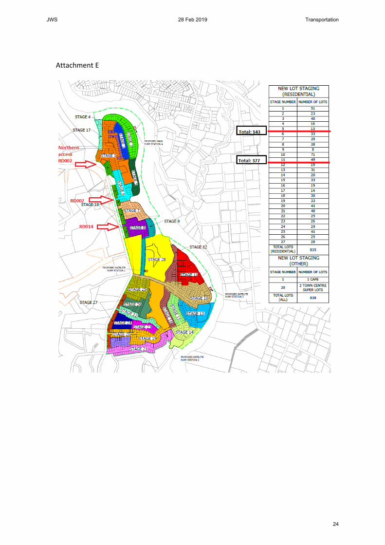
Attachment E
JWS 28 Feb 2019 Transportation
24

Attachment B: A Gray Observations related to SCATS traffic volumes approaching Bader Street signals.
The 10 minute increase in queuing (8:05am – 8:15am) appears more likely to be a result of SH3 traffic than Bader Street. Proposed increase of around 600 veh/hr approaching would mean a doubling of approach traffic. Allowing up to stage 3 would be less than 300 lots, or around 16 approach veh/5 minute increment.


Page 37

Page 38

Page 39

Illustration of Traffic to show Bader Street Traffic in context of road hierarchy collector status.