Image Interpretation Dichotomous Keys - Charles Darwin...
3
1 ENV202/502 – Introductory Remote Sensing Wk 5 Dr Karen Joyce School of Environmental and Life Sciences Bldg Purple 12.3.09 1 Lecture 5 – How is Imagery Analysed? ENV202/502 – Introductory Remote Sensing Wk 5 Your Job • Join a ‘topic table’ – Mangroves (Malcolm, Claudia, Jack) – Water quality / coastal (Nuzhat, Patrice, Laura) – Natural Hazards (Valentina, Emma) – Fire (David, Robin, Jess, Jenni, Barb) – Deforestation / wildlife habitat (Alfredo, Yunnie, Elda, Annie) – Other Vegetation / agriculture (Xin, Herman, Stephanie, Andrew, Rachel) • Visit Padlet to select a scoop topic from one of your peers http://padlet.com/wall/env202-502-scoops • Review their scoops and post your reactions, and / or suggest new scoops for them • Rescoop to your page if you like 2 ENV202/502 – Introductory Remote Sensing Wk 5 3 Image Interpretation • Systematic approach from general to specific interpretation • Interpretation involves both: – Detection of a feature – Identification of a feature • Automated photo and image interpretation now uses this technique Source: S.Phinn ENV202/502 – Introductory Remote Sensing Wk 5 4 Dichotomous Keys ENV202/502 – Introductory Remote Sensing Wk 5 5 Interpretation and Class Aggregation ENV202/502 – Introductory Remote Sensing Wk 5 6 Classification Guidelines (from USGS LU/LC mapping) • Overall accuracy >= 85% • Individual category accuracy should be about equal • Repeatable results between interpreter and over time • Applicable over extensive areas • Suitable for use with data obtained at different times of the year • Categories should be divisible into more detailed sub categories • Aggregation of categories must be possible • Comparison with future date should be possible • Multiple uses of a category should be recognised where possible
Transcript of Image Interpretation Dichotomous Keys - Charles Darwin...
1
ENV202/502 – Introductory Remote Sensing Wk 5
Dr Karen Joyce
School of Environmental and Life Sciences
Bldg Purple 12.3.091
Lecture 5 – How is Imagery Analysed?
ENV202/502 – Introductory Remote Sensing Wk 5
Your Job
• Join a ‘topic table’
– Mangroves (Malcolm, Claudia, Jack)
– Water quality / coastal (Nuzhat, Patrice, Laura)
– Natural Hazards (Valentina, Emma)
– Fire (David, Robin, Jess, Jenni, Barb)
– Deforestation / wildlife habitat (Alfredo, Yunnie, Elda, Annie)
– Other Vegetation / agriculture (Xin, Herman, Stephanie,
Andrew, Rachel)
• Visit Padlet to select a scoop topic from one of your peers
http://padlet.com/wall/env202-502-scoops
• Review their scoops and post your reactions, and / or suggest
new scoops for them
• Rescoop to your page if you like
2
ENV202/502 – Introductory Remote Sensing Wk 53
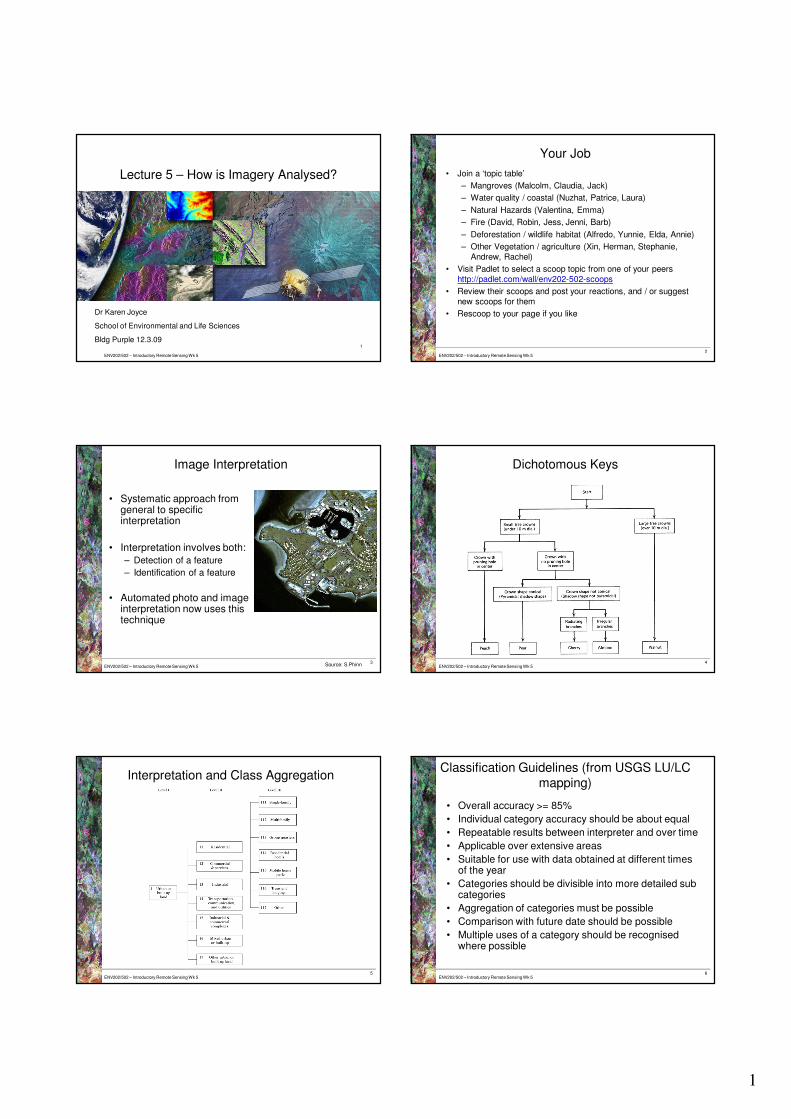
Image Interpretation
• Systematic approach from general to specific interpretation
• Interpretation involves both:
– Detection of a feature
– Identification of a feature
• Automated photo and image interpretation now uses this technique
Source: S.Phinn ENV202/502 – Introductory Remote Sensing Wk 54
Dichotomous Keys
ENV202/502 – Introductory Remote Sensing Wk 55
Interpretation and Class Aggregation
ENV202/502 – Introductory Remote Sensing Wk 56
Classification Guidelines (from USGS LU/LC
mapping)
• Overall accuracy >= 85%
• Individual category accuracy should be about equal
• Repeatable results between interpreter and over time
• Applicable over extensive areas
• Suitable for use with data obtained at different times of the year
• Categories should be divisible into more detailed sub categories
• Aggregation of categories must be possible
• Comparison with future date should be possible
• Multiple uses of a category should be recognised where possible
2
ENV202/502 – Introductory Remote Sensing Wk 57
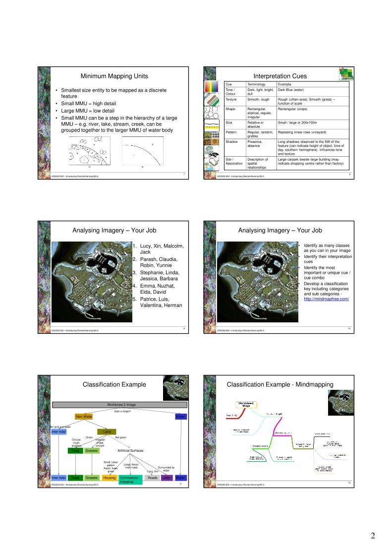
Minimum Mapping Units
• Smallest size entity to be mapped as a discrete feature
• Small MMU = high detail
• Large MMU = low detail
• Small MMU can be a step in the hierarchy of a large
MMU – e.g. river, lake, stream, creek, can be grouped together to the larger MMU of water body
ENV202/502 – Introductory Remote Sensing Wk 58
Interpretation CuesCue Terminology Example
Tone /
Colour
Dark, light, bright,
dull
Dark Blue (water)
Texture Smooth, rough Rough (urban area); Smooth (grass) –
function of scale
Shape Rectangular,
eliptical, regular,
irregular
Rectangular (crops)
Size Relative or
absolute
Small / large or 200x100m
Pattern Regular, random,
gridlike
Repeating linear rows (vineyard)
Shadow Presence,
absence
Long shadows observed to the SW of the
feature (can indicate height of object, time of
day, southern hemisphere). Influences tone
and texture
Site /
Association
Description of
spatial
relationships
Large carpark beside large building (may
indicate shopping centre rather than factory)
ENV202/502 – Introductory Remote Sensing Wk 59
Analysing Imagery – Your Job
1. Lucy, Xin, Malcolm, Jack
2. Parash, Claudia, Robin, Yunnie
3. Stephanie, Linda, Jessica, Barbara
4. Emma, Nuzhat,
Elda, David
5. Patrice, Luis,
Valentina, Herman
ENV202/502 – Introductory Remote Sensing Wk 510
Analysing Imagery – Your Job
• Identify as many classes as you can in your image
• Identify their interpretation cues
• Identify the most important or unique cue /
cue combo
• Develop a classification
key including categories
and sub categories -http://mindmapfree.com/
ENV202/502 – Introductory Remote Sensing Wk 5
Classification Example
11
Worldview 2 Image
Non Water Water
LandInter-tidal
Trees Grasses Artificial Surfaces
Housing Commercial /
Industrial
Roads Jetty WaterInter-tidal Trees Grasses
Dark or bright?
Small, urban pattern
Assoc. trees,
grass
Not greenGreenCircular, rough,
shadows
Irregular shape, smooth
Large, Assoc. main roads
Long, thin
Surrounded by water
Btn land and water
ENV202/502 – Introductory Remote Sensing Wk 5
Classification Example - Mindmapping
12

3
ENV202/502 – Introductory Remote Sensing Wk 5
Student Choice – What’s the Point of
Hyperspectral Imagery?
13ENV202/502 – Introductory Remote Sensing Wk 5
Student Choice – What’s the Point of
Hyperspectral Imagery?
14
ENV202/502 – Introductory Remote Sensing Wk 5
Student Choice – How Can We Compare
Sensors with Different Spectral Sensitivities?
15ENV202/502 – Introductory Remote Sensing Wk 5
Student Choice – How Can We Compare
Sensors with Different Spectral Sensitivities?
16
ENV202/502 – Introductory Remote Sensing Wk 517
Student Choice – How Can We Compare
Sensors with Different Spectral Sensitivities?