Image based 3d_modeling_cpd_2011
24
Image-Based 3D Modeling Close-Range Photogrammetry for the extraction of 3D measurements 4 May 2011 DCC - Survey & Mapping Division 1
-
Upload
andrea-acinelli -
Category
Technology
-
view
88 -
download
0
Transcript of Image based 3d_modeling_cpd_2011
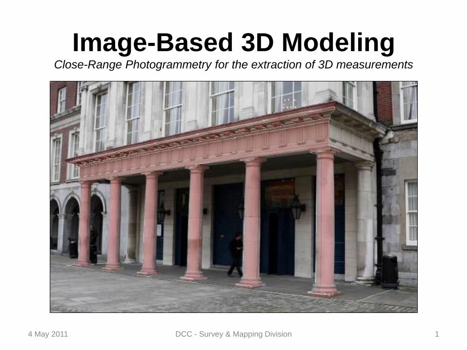
Image-Based 3D ModelingClose-Range Photogrammetry for the extraction of 3D measurements
4 May 2011 DCC - Survey & Mapping Division 1
Image-Based 3D Modeling
INTRODUCTION
CLOSE-RANGE PHOTOGRAMMETRIC SURVEY
SURFACE RECONSTRUCTION
TEXTURE-MAPPING & VISUALIZATION
CONCLUSIONS
4 May 2011 DCC - Survey & Mapping Division 2

Image-Based 3D Modeling
DEFINITION
“ Photogrammetry is the science, and art, of determining the size and shape
of objects as a consequence of analysing images recorded on film or
electronic media.”
4 May 2011 DCC - Survey & Mapping Division 3
( Close Range Photogrammetry and
Machine Vision – K.B. Atkinson, 2003)
Albrecht Durer

Image-Based 3D Modeling
APPLICATIONS
Architecture
Cultural Heritage
Engineering
3D City Modeling
Planning
Archeology
Geology
Film & Animation
Accident Reconstruction
Forensic
Medical & Biological
4 May 2011 DCC - Survey & Mapping Division 4
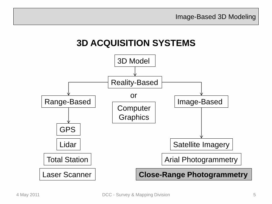
Image-Based 3D Modeling
3D ACQUISITION SYSTEMS
4 May 2011 DCC - Survey & Mapping Division 5
3D Model
Range-Based
Reality-Based
Image-Based
GPS
Total Station
Lidar
Laser Scanner
Satellite Imagery
Arial Photogrammetry
Close-Range Photogrammetry
or
Computer
Graphics
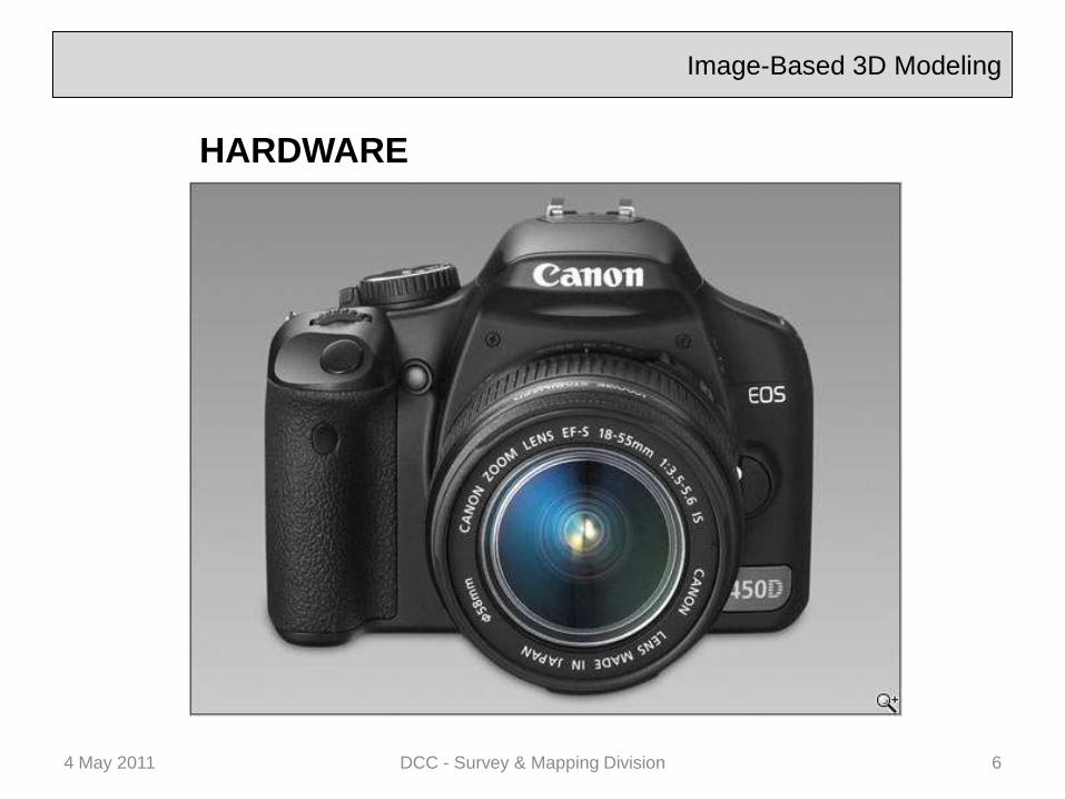
HARDWARE
Image-Based 3D Modeling
4 May 2011 DCC - Survey & Mapping Division 6
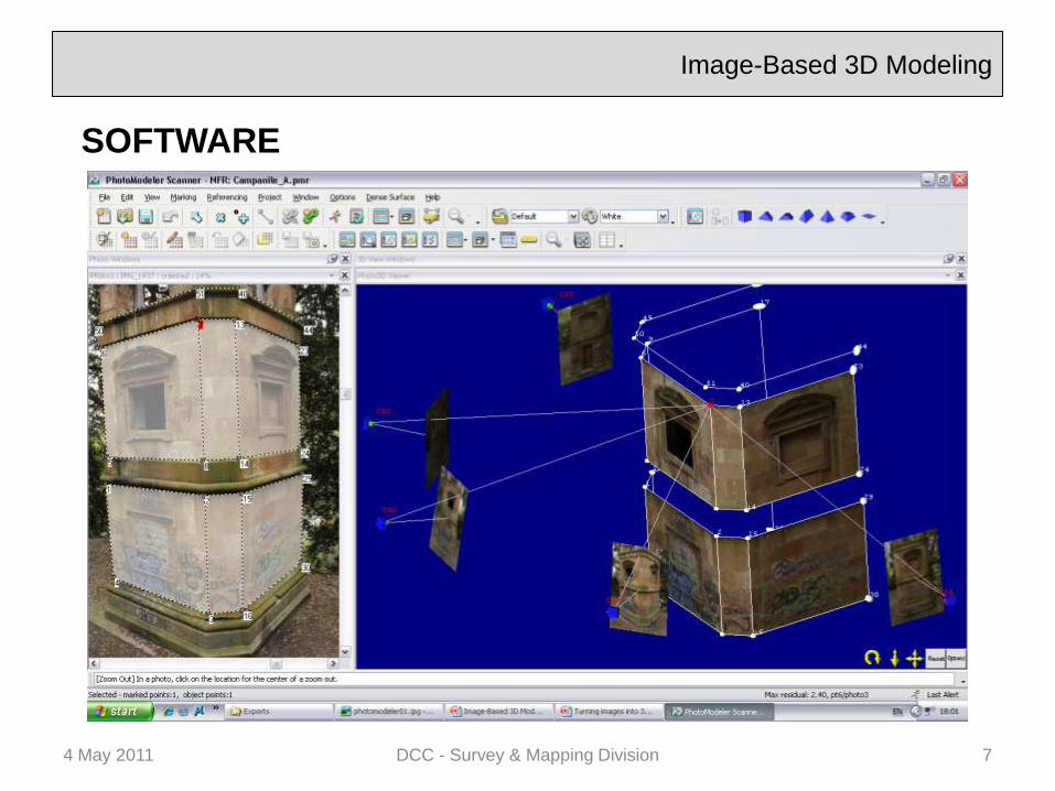
SOFTWARE
Image-Based 3D Modeling
4 May 2011 DCC - Survey & Mapping Division 7
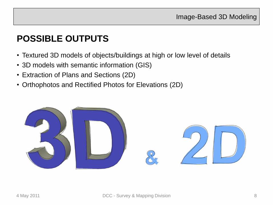
Image-Based 3D Modeling
4 May 2011 DCC - Survey & Mapping Division 8
POSSIBLE OUTPUTS
• Textured 3D models of objects/buildings at high or low level of details
• 3D models with semantic information (GIS)
• Extraction of Plans and Sections (2D)
• Orthophotos and Rectified Photos for Elevations (2D)
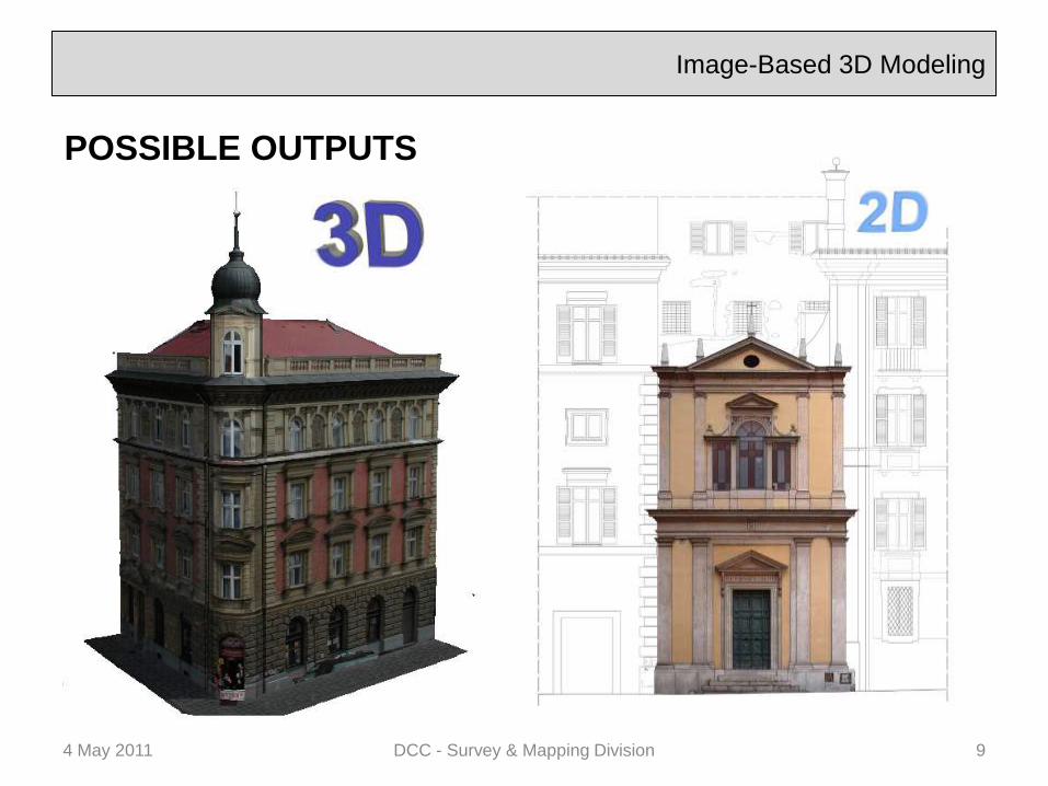
Image-Based 3D Modeling
4 May 2011 DCC - Survey & Mapping Division 9
POSSIBLE OUTPUTS
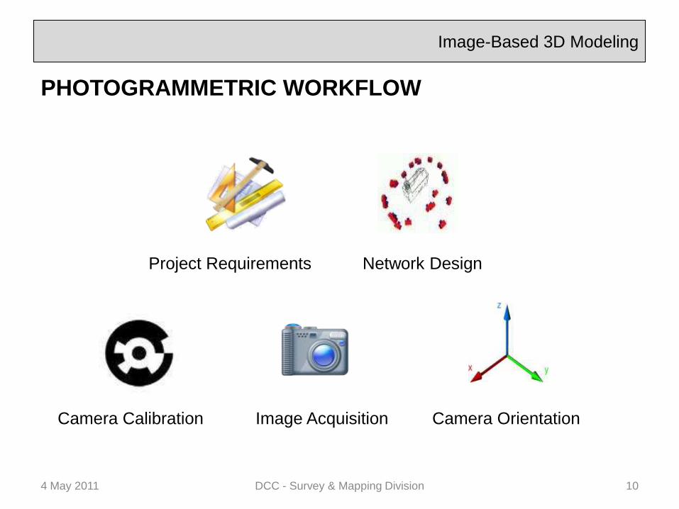
Image-Based 3D Modeling
PHOTOGRAMMETRIC WORKFLOW
4 May 2011 DCC - Survey & Mapping Division 10
Camera OrientationImage AcquisitionCamera Calibration
Network DesignProject Requirements

Image-Based 3D Modeling
PROJECT REQUIREMENTS
• Close co-operation with client or contractor
• Defining object or area to be measured
• Type of output results required
• Resolution of fine details (smallest
object feature to be measured)
• Scale
• Coordinate System
• Accuracy to be achieved (it has to fit the
purpose)
• Time schedule for on-site work, data
processing and output delivery
• Staff and cost management
4 May 2011 DCC - Survey & Mapping Division 11

Image-Based 3D Modeling
NETWORK DESIGN
• Image Scale
• Resolution / Image quality
• Object environment / surroundings
• Depth of field
• Imaging angle
• Number and distribution of image points
• Intersection angles / Ray intersection
• Field of view
• Visibility / Occlusion / Self-Occlusion
4 May 2011 DCC - Survey & Mapping Division 12

Image-Based 3D Modeling
CAMERA CALIBRATION Also known as Internal Orientation
• Camera's focal length
• Lens distortion (Radial & Decentring)
• Sensor Width and Height (W,H)
• Principal Point (xp,yp).
4 May 2011 DCC - Survey & Mapping Division 13

Image-Based 3D Modeling
CAMERA CALIBRATION
• Test-field calibration
• Self-Calibration
4 May 2011 DCC - Survey & Mapping Division 14
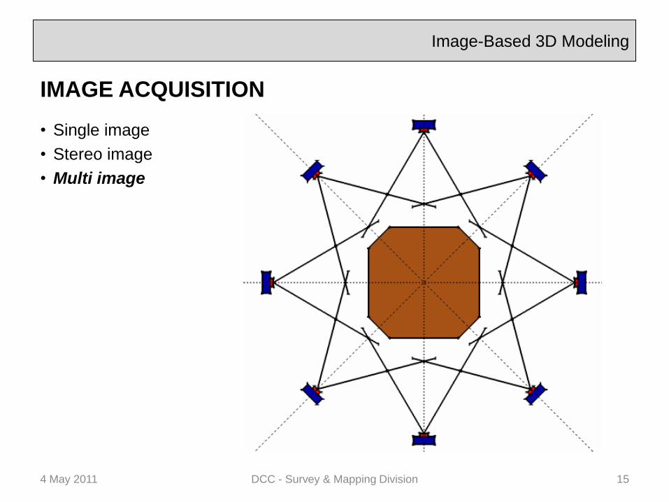
Image-Based 3D Modeling
IMAGE ACQUISITION
• Single image
• Stereo image
• Multi image
4 May 2011 DCC - Survey & Mapping Division 15
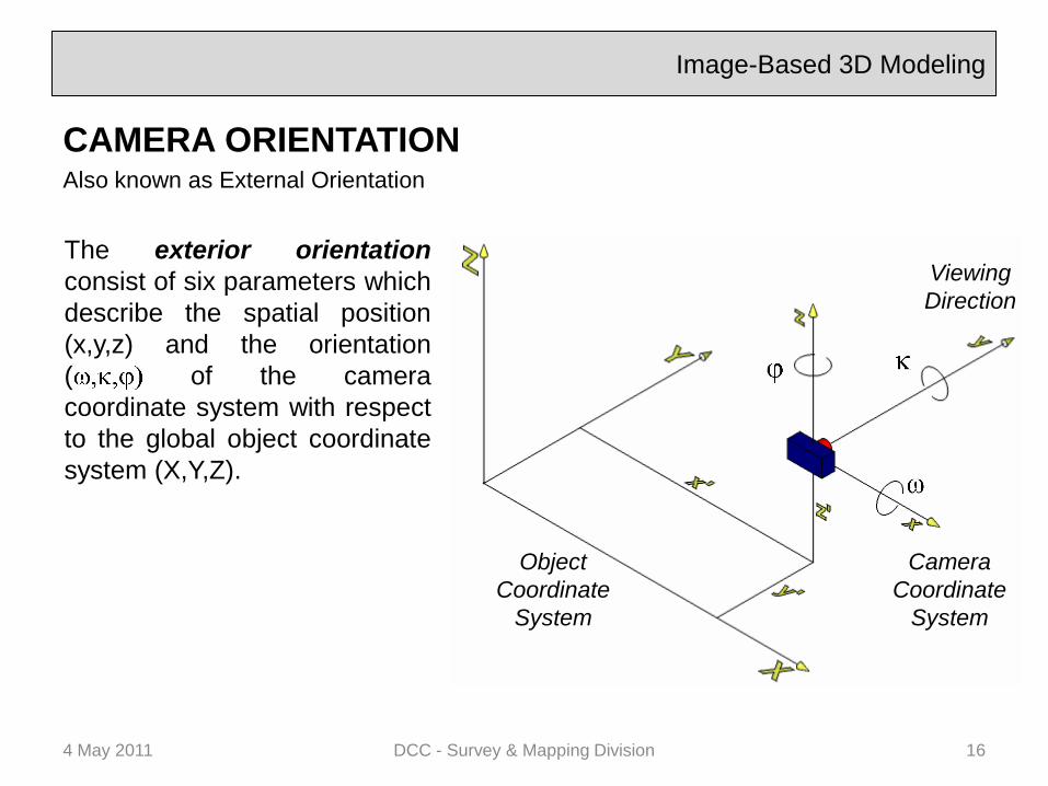
Image-Based 3D Modeling
CAMERA ORIENTATIONAlso known as External Orientation
4 May 2011 DCC - Survey & Mapping Division 16
The exterior orientation
consist of six parameters which
describe the spatial position
(x,y,z) and the orientation
( of the camera
coordinate system with respect
to the global object coordinate
system (X,Y,Z).
Camera
Coordinate
System
Object
Coordinate
System
Viewing
Direction

Image-Based 3D Modeling
SURFACE RECONSTRUCTION
4 May 2011 DCC - Survey & Mapping Division 17
Regular geometric shapes Free-form shapes
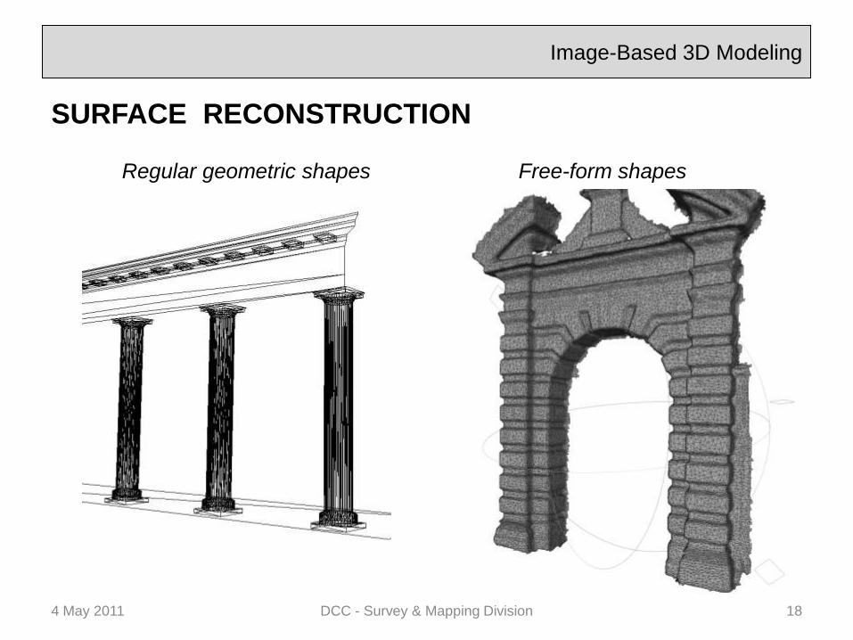
Image-Based 3D Modeling
SURFACE RECONSTRUCTION
4 May 2011 DCC - Survey & Mapping Division 18
Regular geometric shapes Free-form shapes

Image-Based 3D Modeling
FREE-FORM SHAPES –Point Clouds
4 May 2011 DCC - Survey & Mapping Division 19
Stereo Images
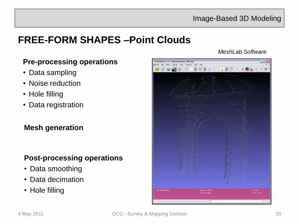
Image-Based 3D Modeling
FREE-FORM SHAPES –Point Clouds
4 May 2011 DCC - Survey & Mapping Division 20
Pre-processing operations
• Data sampling
• Noise reduction
• Hole filling
• Data registration
Mesh generation
Post-processing operations
• Data smoothing
• Data decimation
• Hole filling
MeshLab Software
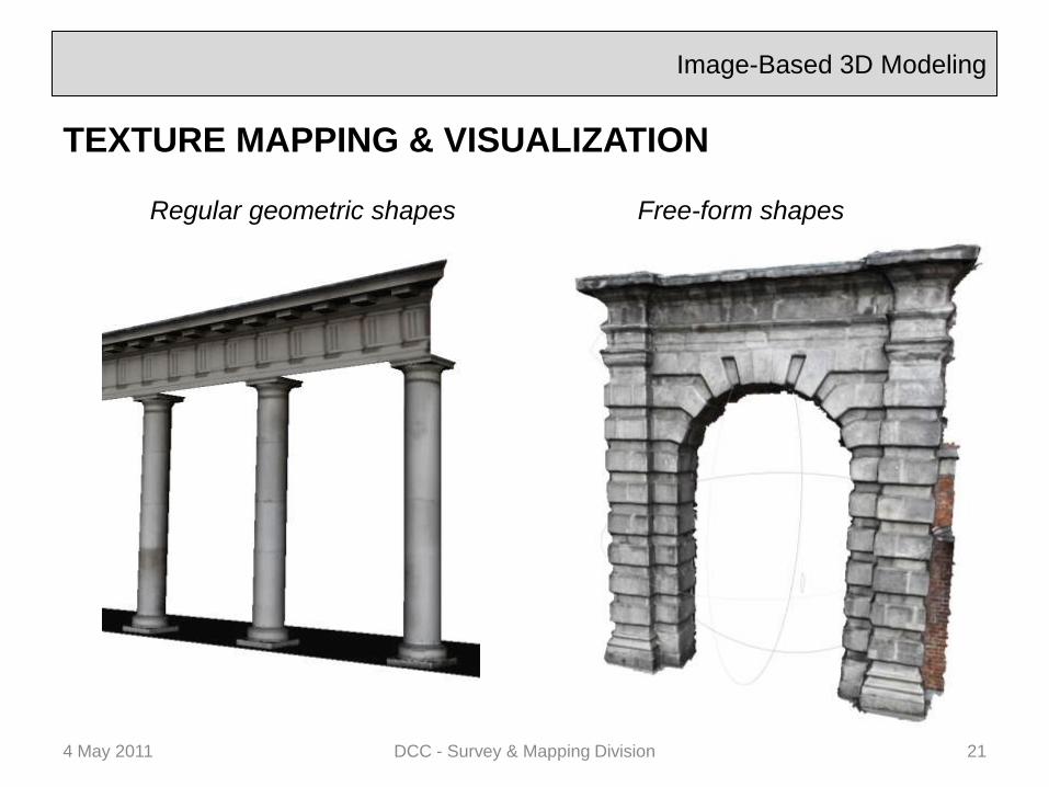
Image-Based 3D Modeling
TEXTURE MAPPING & VISUALIZATION
4 May 2011 DCC - Survey & Mapping Division 21
Regular geometric shapes Free-form shapes
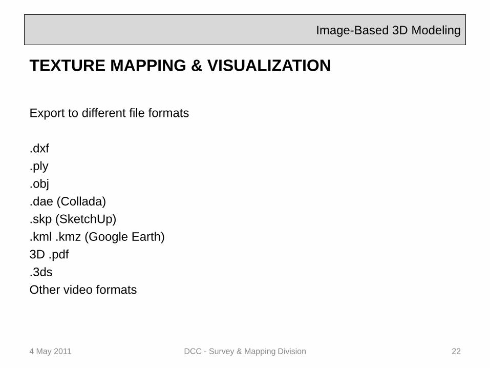
Image-Based 3D Modeling
TEXTURE MAPPING & VISUALIZATION
Export to different file formats
.dxf
.ply
.obj
.dae (Collada)
.skp (SketchUp)
.kml .kmz (Google Earth)
3D .pdf
.3ds
Other video formats
4 May 2011 DCC - Survey & Mapping Division 22
Image-Based 3D Modeling
CONCLUSIONS
Benefits:
• Mobility of the system
• Multiple distance range
• Low cost
• No restriction for type of surface (as far as they are
textured)
• Accuracy and resolution of a Laser Scanner
Problems:
• Not suitable for very large and complex sites (best
used to integrate with other techniques)
• Lighting conditions
4 May 2011 DCC - Survey & Mapping Division 23
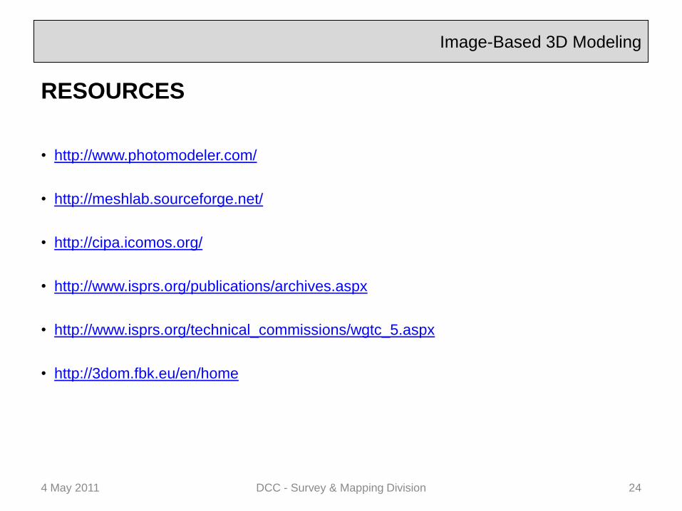
Image-Based 3D Modeling
RESOURCES
• http://www.photomodeler.com/
• http://meshlab.sourceforge.net/
• http://cipa.icomos.org/
• http://www.isprs.org/publications/archives.aspx
• http://www.isprs.org/technical_commissions/wgtc_5.aspx
• http://3dom.fbk.eu/en/home
4 May 2011 DCC - Survey & Mapping Division 24