Ilhéus do Porto Santo Um tesouro a preservar Islets of Porto Santo … · Ilhéus do Porto Santo:...
51
Ilhéus do Porto Santo Um tesouro a preservar Islets of Porto Santo A treasure to be preserved
Transcript of Ilhéus do Porto Santo Um tesouro a preservar Islets of Porto Santo … · Ilhéus do Porto Santo:...
Ilhéus do Porto Santo Um tesouro a preservarIslets of Porto Santo A treasure to be preserved
Islets of Porto SantoA treasure to be preserved
Ilhéus do Porto SantoUm tesouro a preservar

04 05Ilhéus do Porto Santo: um tesouro a preservar Islets of Porto Santo: a treasure to be preserved
Autores AuthorsFilipe Alves, José Rodrigues, Ricardo Montes, Dília Menezes, Paulo Oliveira, Virgínia Silva
Edição EditionServiço do Parque Natural da Madeira (SPNM)
Ano Year2015
Versão inglesa English versionAcademia de Línguas da Madeira
Design e arte gráfica Design and artworkSPNM
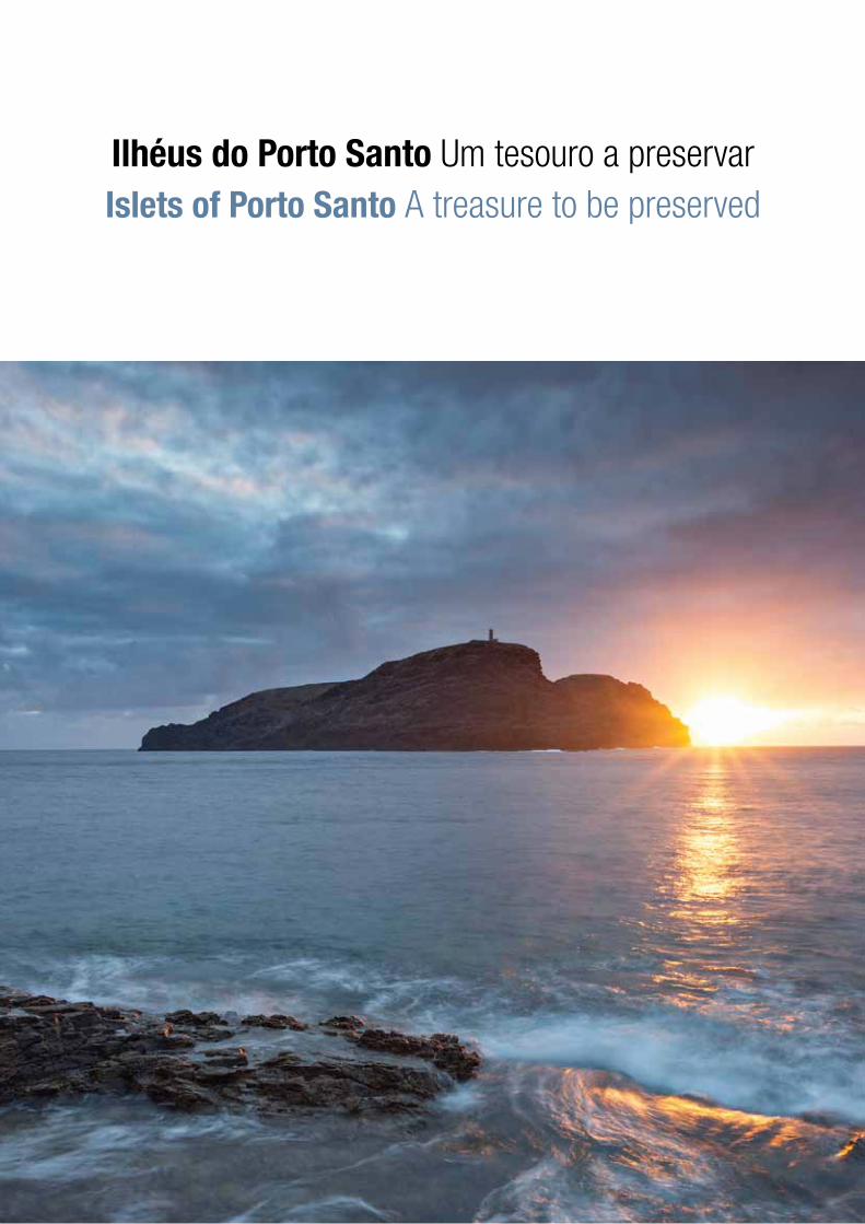
Foto de capa Cover photoPôr-do-sol no Ilhéu de Ferro / Sunset in Islet of Ferro, ©Luís Afonso
Foto de contracapa Back cover photoNavio Madeirense / Ship Madeirense, ©Nuno Sá
Impressão PrintingManica – Soluções Digitais, Lda.
ISBN 978-989-20-5947-1 | Depósito legal:0000000 | Tiragem: 2000 exemplares
Elaborado no âmbito do projeto Produced in the scope of the projectLIFE ILHÉUS DO PORTO SANTO (LIFE09 NAT/PT/000041)
Vista a partir do Ilhéu de Cima View from Islet of Cima
PA

Nota introdutória
Apresentação da obra
O Porto Santo
Rede de Áreas Marinhas Protegidasdo Porto Santo
Localização
Enquadramento legal
Uso humano
Histórico
Atual
Ilhéus do Porto Santoe área marinha adjacente
O Ilhéu da Cal
O Ilhéu das Cenouras
O Ilhéu de Cima
O Ilhéu de Ferro
O Ilhéu da Fonte da Areia
O Ilhéu de Fora
Área marinha
Gestão e conservação
Projeto LIFE ILHÉUS DO PORTO SANTO
Glossário
Acrónimos
Legislação
Bibliografia recomendada
Agradecimentos
Crédito das imagens
Introductory note
Presentation of the work
The Porto Santo
Network of Marine Protected Areasof Porto Santo
Location
Legal framework
Human use
Historical
Current
Islets of Porto Santoand the adjacent marine area
The Islet of Cal
The Islet of Cenouras
The Islet of Cima
The Islet of Ferro
The Islet of Fonte da Areia
The Islet of Fora
Marine area
Management and conservation
Project LIFE ILHÉUS DO PORTO SANTO
Glossary
Acronyms
Legislation
Recommended reading
Acknowledgments
Image credits
Table of contentsÍndice
0 81 21 82 2
3 23 53 63 64 35 0
5 25 66 06 67 07 47 88 68 89 49 69 69 69 79 8
07Ilhéu da Cal Islet of Cal
PA
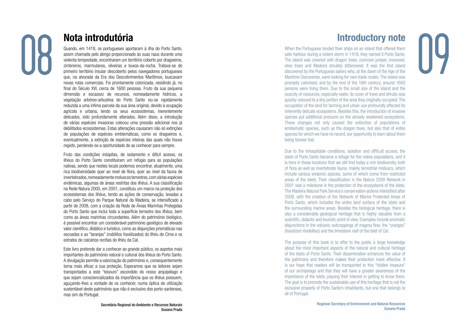
Nota introdutóriaQuando, em 1418, os portugueses aportaram à ilha do Porto Santo, assim chamada pelo abrigo proporcionado às suas naus durante uma violenta tempestade, encontraram um território coberto por dragoeiros, zimbreiros, marmulanos, oliveiras e buxos-da-rocha. Tratava-se do primeiro território insular descoberto pelos navegadores portugueses que, na alvorada da Era dos Descobrimentos Marítimos, buscavam novas rotas comerciais. Foi prontamente colonizada, residindo já, no final do Século XVI, cerca de 1600 pessoas. Fruto da sua pequena dimensão e escassez de recursos, nomeadamente hídricos, a vegetação arbóreo-arbustiva do Porto Santo viu-se rapidamente reduzida a uma ínfima parcela da sua área original, devido à ocupação agrícola e urbana, tendo os seus ecossistemas, inerentemente delicados, sido profundamente alterados. Além disso, a introdução de várias espécies invasoras colocou uma pressão adicional nos já debilitados ecossistemas. Estas alterações causaram não só extinções de populações de espécies emblemáticas, como os dragoeiros e, eventualmente, a extinção de espécies inteiras das quais não houve registo, perdendo-se a oportunidade de as conhecer para sempre.
Fruto das condições inóspitas, de isolamento e difícil acesso, os ilhéus do Porto Santo constituíram um refúgio para as populações nativas, sendo que nestes locais podemos encontrar, atualmente, uma rica biodiversidade quer ao nível de flora, quer ao nível da fauna de invertebrados, nomeadamente moluscos terrestres, com várias espécies endémicas, algumas de áreas restritas dos ilhéus. A sua classificação na Rede Natura 2000, em 2001, constituiu um marco na proteção dos ecossistemas dos ilhéus, tendo as ações de conservação, levadas a cabo pelo Serviço do Parque Natural da Madeira, se intensificado a partir de 2008, com a criação da Rede de Áreas Marinhas Protegidas do Porto Santo que inclui toda a superfície terrestre dos ilhéus, bem como as áreas marinhas circundantes. Além do património biológico, é possível encontrar um considerável património geológico de elevado valor científico, didático e turístico, como as disjunções prismáticas nas escoadas e as “laranjas” (rodólitos fossilizados) do Ilhéu de Cima e os estratos de calcários recifais do Ilhéu da Cal.
Este livro pretende dar a conhecer ao grande público, os aspetos mais importantes do património natural e cultural dos ilhéus do Porto Santo. A divulgação permite a valorização do património e, consequentemente torna mais eficaz a sua proteção. Esperamos que os leitores sejam transportados a este “tesouro” escondido do nosso arquipélago e que sejam consciencializados da importância que os ilhéus possuem, aguçando-lhes a vontade de os conhecer, numa óptica de utilização sustentável deste património que não é exclusivo dos porto-santenses, mas sim de Portugal.
Secretária Regional do Ambiente e Recursos NaturaisSusana Prada
When the Portuguese landed their ships on an island that offered them safe harbour during a violent storm in 1418, they named it Porto Santo. The island was covered with dragon trees, common juniper, ironwood, olive trees and Madeira shrubby bittersweet. It was the first island discovered by the Portuguese sailors who, at the dawn of the Age of the Maritime Discoveries, were looking for new trade routes. The island was promptly colonised, and by the end of the 16th century, around 1600 persons were living there. Due to the small size of the island and the scarcity of resources, especially water, its cover of trees and shrubs was quickly reduced to a tiny portion of the area they originally occupied. The occupation of the land for farming and urban use profoundly affected its inherently delicate ecosystems. Besides this, the introduction of invasive species put additional pressure on the already weakened ecosystems. These changes not only caused the extinction of populations of emblematic species, such as the dragon trees, but also that of entire species for which we have no record, our opportunity to learn about them being forever lost.
Due to the inhospitable conditions, isolation and difficult access, the islets of Porto Santo became a refuge for the native populations, and it is here in these locations that we still find today a rich biodiversity, both of flora as well as invertebrate fauna, mainly terrestrial molluscs, which include various endemic species, some of which come from restricted areas of the islets. Their classification in the Natura 2000 Network in 2001 was a milestone in the protection of the ecosystems of the islets. The Madeira Natural Park Service’s conservation actions intensified after 2008, with the creation of the Network of Marine Protected Areas of Porto Santo, which includes the entire land surface of the islets and the surrounding marine areas. Besides the biological heritage, there is also a considerable geological heritage that is highly valuable from a scientific, didactic and touristic point of view. Examples include prismatic disjunctions in the volcanic outcroppings of magma flow, the “oranges” (fossilized rhodolites) and the limestone reef of the Islet of Cal.
The purpose of this book is to offer to the public a large knowledge about the most important aspects of the natural and cultural heritage of the Islets of Porto Santo. Their dissemination enhances the value of the patrimony and therefore makes their protection more effective. It is our hope that readers will be transported to this “hidden treasure” of our archipelago and that they will have a greater awareness of the importance of the islets, piquing their interest in getting to know them. The goal is to promote the sustainable use of this heritage that is not the exclusive property of Porto Santo’s inhabitants, but one that belongs to all of Portugal.
Regional Secretary of Environment and Natural ResourcesSusana Prada
Introductory note
08 09
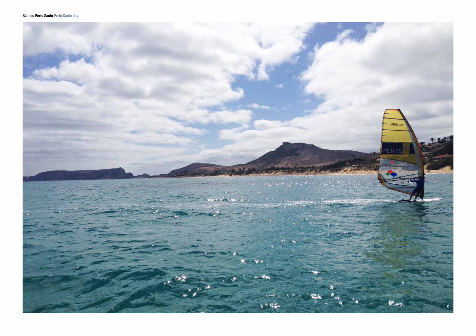
Baía do Porto Santo Porto Santo bay
PA

Este poderia ser o poético título de mais uma publicação do Serviço do Natural da Madeira (SPNM) que nos últimos anos tem registado, em livro, os mais importantes aspetos de todas as Áreas Naturais Protegidas sob a sua gestão.
Falar de insularidade é, sem dúvida alguma, falar dos seis ilhéus que rodeiam a ilha do Porto Santo, cuja dificuldade de acesso devido às condições adversas de desembarque, não permitem a visitação permanente e em segurança.
Exceção feita ao Ilhéu de Cima ou do Farol, cujas visitas organizadas são hoje em dia uma constante, este livro constitui uma oportunidade única de melhor conhecer um tesouro tão bem acantoado, não por vontade humana mas por força da natureza que, sendo por vezes impiedosa, veda amiúde o caminho ao Homem que dela tem desejo de disfrute.
Esta obra, agora lançada, dá a conhecer toda a importante e, muitas vezes, única e rara riqueza natural existente nos seis ilhéus. Desde as espécies de flora, algumas apenas agora descobertas pelo Homem, passando pela fauna residente, migratória e até fóssil, até aos impressionantes registos geológicos, vamos aqui conhecer bens naturais de valor inestimável que importa salvaguardar.
Graças ao apoio conjugado do Programa Life Natureza e Biodiversidade da União Europeia e do Governo Regional da Madeira, foi possível encetar uma série de ações de conservação e recuperação da biodiversidade, cujos resultados mais salientes se expressam já nesta publicação.
Mas, este livro presta também uma justa homenagem àqueles que, durante décadas, trabalharam e viveram explorando os recursos naturais, sobretudo geológicos, e que dura e indelevelmente deixaram a sua marca na paisagem de alguns destes ilhéus. Seja na exploração das minas de calcário, seja na missão de farolagem. Também, e em consciência, é prestado tributo ao Povo do Porto Santo que tão cuidadosamente soube acautelar tamanha preciosidade natural.
Criada em 2008, a Rede de Áreas Marinhas Protegidas do Porto Santo (RAMPPS) convida o leitor a uma visita que será garantidamente inesquecível ao Ilhéu de Cima ou do Farol, cujas condições de visitação foram substancialmente melhoradas e que permite não só disfrutar dos valores naturais terrestres mas também de toda a envolvente marinha, incluindo um mergulho nas águas transparentes sobre um fundo azul de impressionante beleza.
Miguel Maria Domingues
Apresentação da obra
“Ilhéus onde,por ordem da mãe natureza, o tempo parou”
12Vista do Ilhéu da Cal a partir de um abrigo View from a shelter in Islet of Cal
AP

This could well be the poetic title of yet another publication of the Service of the Natural Park of Madeira (SPNM), which over the last few years has recorded in book form the most important aspects of all the Protected Nature Areas it is responsible for managing.
To speak about insularity is, without doubt, to speak about the six islets that surround Porto Santo Island. Their access is complicated by the adverse conditions that do not allow for continuous and safe visitation.
Except for the Islet of Cima or Farol, where organised visits are a constant occurrence today, this book provides a unique opportunity to become better acquainted with a well-guarded treasure, a fact that is not due to human will, but to the forces of nature that at times show no mercy, time and time again blocking Man’s way, whose wish is to make use of the treasure.
The work now being launched presents all the important, and many times unique and rare, natural riches found on the six islets. From the species of flora, some of which are only now being discovered by Man, and the fauna (resident, migratory and even fossil), to the impressive geological records, here we learn about the natural assets of inestimable value that must be safeguarded.
Thanks to joint support from the Programme Life Nature and Biodiversity of the European Union and from the Regional Government of Madeira, it was possible to undertake a series of actions for the conservation and recuperation of the biodiversity, the most outstanding results of which are presented in this publication.
But this book also pays just homage to those who, over a period of decades, worked and lived exploiting, principally, the geological natural resources, whose hard work left an indelible mark on the landscape of some of these islets, both through the mining of limestone and the lighthouse operations. Conscience also requires that tribute be paid to the inhabitants of Porto Santo, who so carefully knew how to care for such a natural treasure.
Created in 2008, the Network of Marine Protected Areas of Porto Santo (RAMPPS) invites the reader to visit the Islet of Cima or Farol, a visit guaranteed to be an unforgettable experience. The conditions for visiting the islet have been improved considerably and allow visitors to not only appreciate the riches of nature on land, but those of all the surrounding marine areas, as well, including a dive into the transparent waters over a blue background of impressive beauty.
Miguel Maria Domingues
Presentation of the work
“Islets where,by order of Mother Nature, time stopped”
14Vista do Porto Santo a partir do Ilhéu de Cima Porto Santo from Islet of Cima
PA

Ilhéu da Cal Islet of Cal
MS
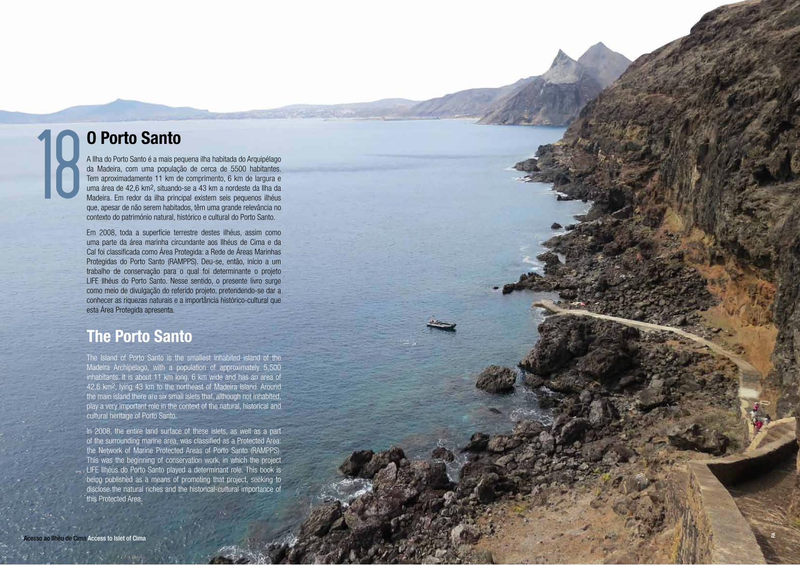
A Ilha do Porto Santo é a mais pequena ilha habitada do Arquipélago da Madeira, com uma população de cerca de 5500 habitantes. Tem aproximadamente 11 km de comprimento, 6 km de largura e uma área de 42,6 km2, situando-se a 43 km a nordeste da Ilha da Madeira. Em redor da ilha principal existem seis pequenos ilhéus que, apesar de não serem habitados, têm uma grande relevância no contexto do património natural, histórico e cultural do Porto Santo.
Em 2008, toda a superfície terrestre destes ilhéus, assim como uma parte da área marinha circundante aos Ilhéus de Cima e da Cal foi classificada como Área Protegida: a Rede de Áreas Marinhas Protegidas do Porto Santo (RAMPPS). Deu-se, então, início a um trabalho de conservação para o qual foi determinante o projeto LIFE Ilhéus do Porto Santo. Nesse sentido, o presente livro surge como meio de divulgação do referido projeto, pretendendo-se dar a conhecer as riquezas naturais e a importância histórico-cultural que esta Área Protegida apresenta.
The Island of Porto Santo is the smallest inhabited island of the Madeira Archipelago, with a population of approximately 5,500 inhabitants. It is about 11 km long, 6 km wide and has an area of 42.6 km2, lying 43 km to the northeast of Madeira Island. Around the main island there are six small islets that, although not inhabited, play a very important role in the context of the natural, historical and cultural heritage of Porto Santo.
In 2008, the entire land surface of these islets, as well as a part of the surrounding marine area, was classified as a Protected Area: the Network of Marine Protected Areas of Porto Santo (RAMPPS). This was the beginning of conservation work, in which the project LIFE Ilhéus do Porto Santo played a determinant role. This book is being published as a means of promoting that project, seeking to disclose the natural riches and the historical-cultural importance of this Protected Area.
O Porto Santo
The Porto Santo
18
Acesso ao Ilhéu de Cima Access to Islet of Cima FA

Pedra do Sol (fenómeno geológico) no Ilhéu de Cima Pedra do Sol (geologic phenomena) in Islet of Cima FA
A RAMPPS é constituída pela parte terrestre dos seis ilhéus – da Cal ou de Baixo; das Cenouras; de Cima, dos Dragoeiros ou do Farol; de Ferro; da Fonte da Areia; e de Fora ou Rocha do Nordeste – e pela parte marinha circundante aos ilhéus da Cal e de Cima, incluindo a zona onde se encontra afundado o navio Madeirense.
De natureza vulcânica e com relevo acentuado, é nestes ilhéus que se destacam três geomonumentos singulares, plenos de valor científico, didático e turístico, que, por serem recursos naturais não renováveis, carecem ser conservados, valorizados e geridos no âmbito dos trabalhos de conservação da natureza. Os ilhéus guardam um património natural de grande relevância, estando incluídos na Rede Natura 2000 como Sítio de Importância Comunitária.
RAMPPS is made up of the land area of the six islets – Cal or Baixo; Cenouras; Cima, Dragoeiros or Farol; Ferro; Fonte da Areia; and Fora or Rocha do Nordeste – and by the marine area surrounding the islets of Cal and Cima, including the area where the ship Madeirense was sunk.
Being volcanic in nature and having steep slopes, these islets host three unique geomonuments with highly scientific, didactic and touristic value. Given that these are non-renewable natural resources, they must be preserved and managed within the scope of nature conservation actions. Therefore, the Porto Santo islets represent a valuable natural heritage, being included in the Natura 2000 Network as a Site of Community Importance.
Redede Áreas Marinhas Protegidasdo Porto Santo
The Network of Marine Protected Areas of PortoSanto (RAMPPS)
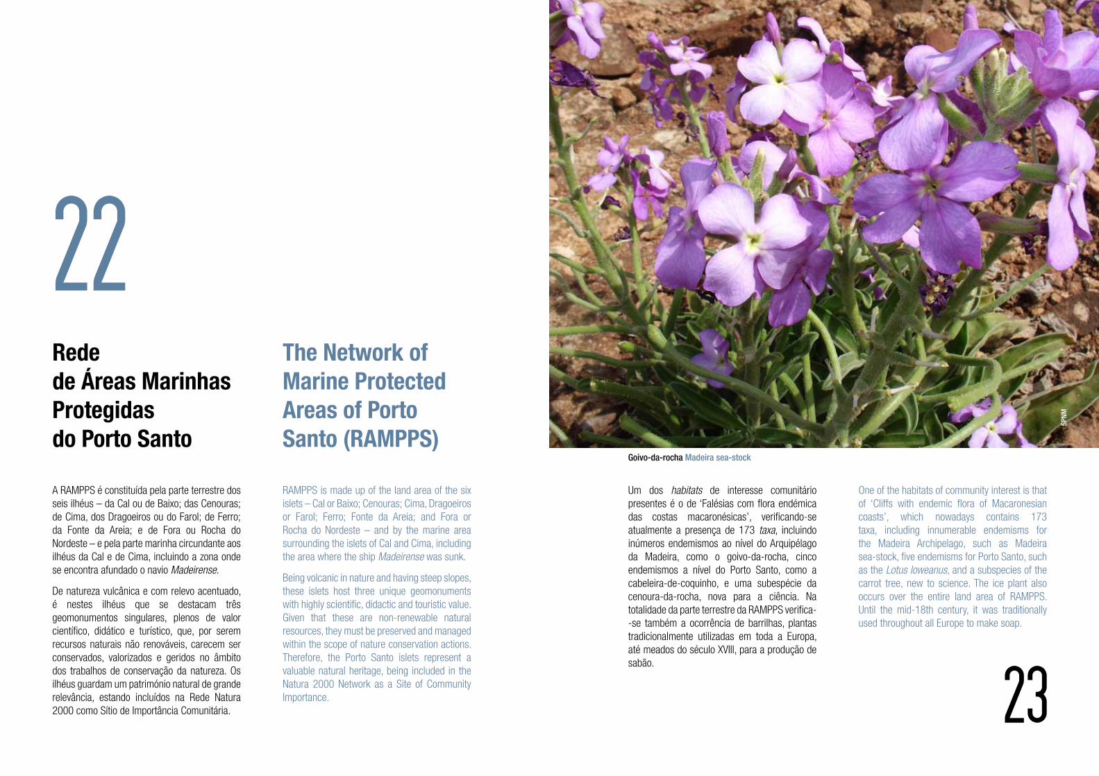
One of the habitats of community interest is that of ‘Cliffs with endemic flora of Macaronesian coasts’, which nowadays contains 173 taxa, including innumerable endemisms for the Madeira Archipelago, such as Madeirasea-stock, five endemisms for Porto Santo, such as the Lotus loweanus, and a subspecies of the carrot tree, new to science. The ice plant also occurs over the entire land area of RAMPPS. Until the mid-18th century, it was traditionally used throughout all Europe to make soap.
Um dos habitats de interesse comunitário presentes é o de ‘Falésias com flora endémica das costas macaronésicas’, verificando-se atualmente a presença de 173 taxa, incluindo inúmeros endemismos ao nível do Arquipélago da Madeira, como o goivo-da-rocha, cinco endemismos a nível do Porto Santo, como a cabeleira-de-coquinho, e uma subespécie da cenoura-da-rocha, nova para a ciência. Na totalidade da parte terrestre da RAMPPS verifica--se também a ocorrência de barrilhas, plantas tradicionalmente utilizadas em toda a Europa, até meados do século XVIII, para a produção de sabão.
22
23
Goivo-da-rocha Madeira sea-stock
SPNM
2524
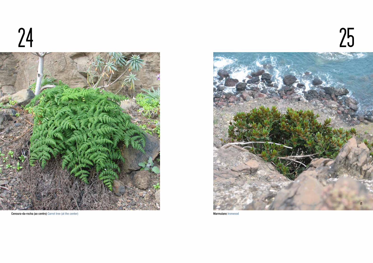
Cenoura-da-rocha (ao centro) Carrot tree (at the center) Marmulano Ironwood
FF
CN

In regard to the bryophytes of the islets, 12 species of mosses belonging to two families (Pottiaceae and Bryaceae) have been catalogued. This taxonomic group is highly diversified on the islets of Cal and Cima.
The islets are preferred locations, crucial for the nesting of marine birds. Three islets – Cima, Cal and Ferro – are classified internationally as IBA (Important Bird and Biodiversity Area), within the scope of BirdLife International. Four species of pelagic marine birds are known to nest here: Cory’s shearwater, Bulwer’s petrel, Madeiran storm petrel and little shearwater, as well as two coastal marine birds: the common tern and the Atlantic yellow-legged gull. There are records of a small roseate tern colony, a threatened species worldwide, which despite efforts made in recent times, has not been observed among the nesting marine birds. In order to underscore its importance, the SPNM decided to register the vessel it operates in Porto Santo with the name of this bird.
No que se refere à brioflora dos ilhéus, estão inventariadas 12 espécies de musgos pertencentes a duas famílias (Pottiaceae e Bryaceae). Refira-se a elevada diversidade deste grupo taxonómico nos ilhéus da Cal e de Cima.
Note-se que os ilhéus são locais preferenciais e cruciais para a nidificação da avifauna marinha. Existem três ilhéus – Ilhéu de Cima, Ilhéu da Cal e Ilhéu de Ferro – que estão classificados, num contexto internacional, como IBA (Área Importante para as Aves e Biodiversidade), no âmbito da BirdLife International. É conhecida a nidificação de, pelo menos, quatro espécies de aves marinhas pelágicas, nomeadamente a cagarra, a alma-negra, o roque-de-castro e o pintainho, e ainda de duas aves marinhas costeiras: o garajau-comum e a gaivota-de-patas-amarelas. Existem registos da ocorrência de uma pequena colónia de garajau-rosado, uma espécie ameaçada no contexto mundial, que contudo, nos tempos mais recentes, não obstante os esforços dirigidos, não tem sido observada entre as aves marinhas nidificantes. De modo a realçar a importância da referida ave foi atribuído o seu nome à embarcação do SPNM que opera no Porto Santo e que apoia todas as atividades relativas aos trabalhos de conservação, gestão e sensibilização.
26 27Garajau-comum Common tern FV
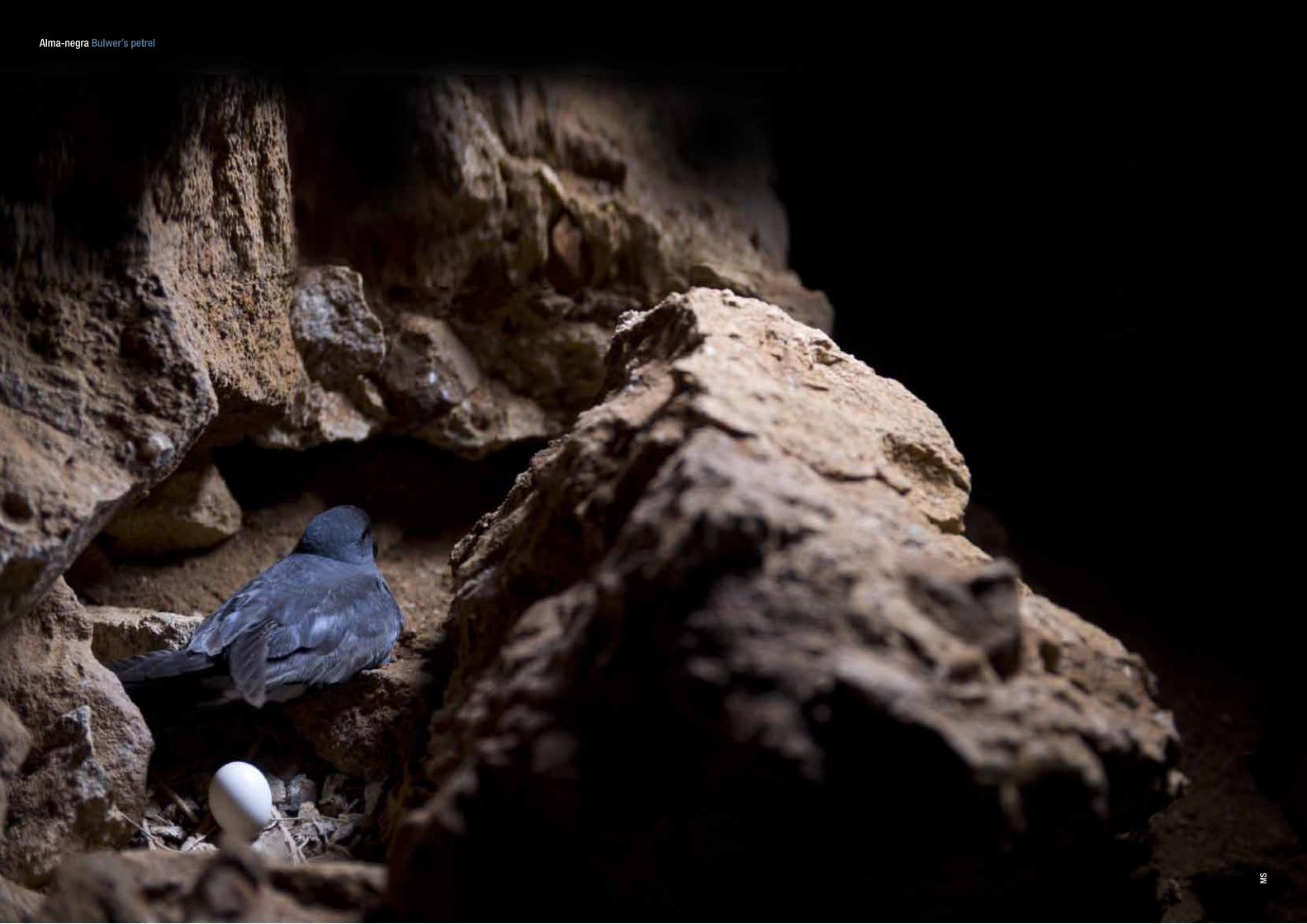
Alma-negra Bulwer’s petrel
MS
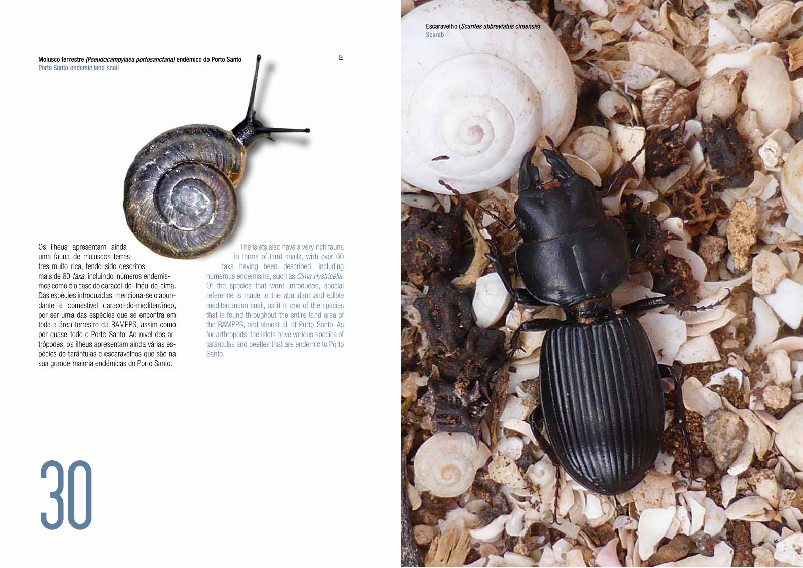
Os ilhéus apresentam ainda uma fauna de moluscos terres-tres muito rica, tendo sido descritos mais de 60 taxa, incluindo inúmeros endemis-mos como é o caso do caracol-do-ilhéu-de-cima. Das espécies introduzidas, menciona-se o abun-dante e comestível caracol-do-mediterrâneo, por ser uma das espécies que se encontra em toda a área terrestre da RAMPPS, assim como por quase todo o Porto Santo. Ao nível dos ar-trópodes, os ilhéus apresentam ainda várias es-pécies de tarântulas e escaravelhos que são na sua grande maioria endémicas do Porto Santo.
The islets also have a very rich fauna in terms of land snails, with over 60
taxa having been described, including numerous endemisms, such as Cima Hystricella. Of the species that were introduced, special reference is made to the abundant and edible mediterranean snail, as it is one of the species that is found throughout the entire land area of the RAMPPS, and almost all of Porto Santo. As for arthropods, the islets have various species of tarantulas and beetles that are endemic to Porto Santo.
30
Molusco terrestre (Pseudocampylaea portosanctana) endémico do Porto Santo Porto Santo endemic land snail
Escaravelho (Scarites abbreviatus cimensis)Scarab
IS
DT
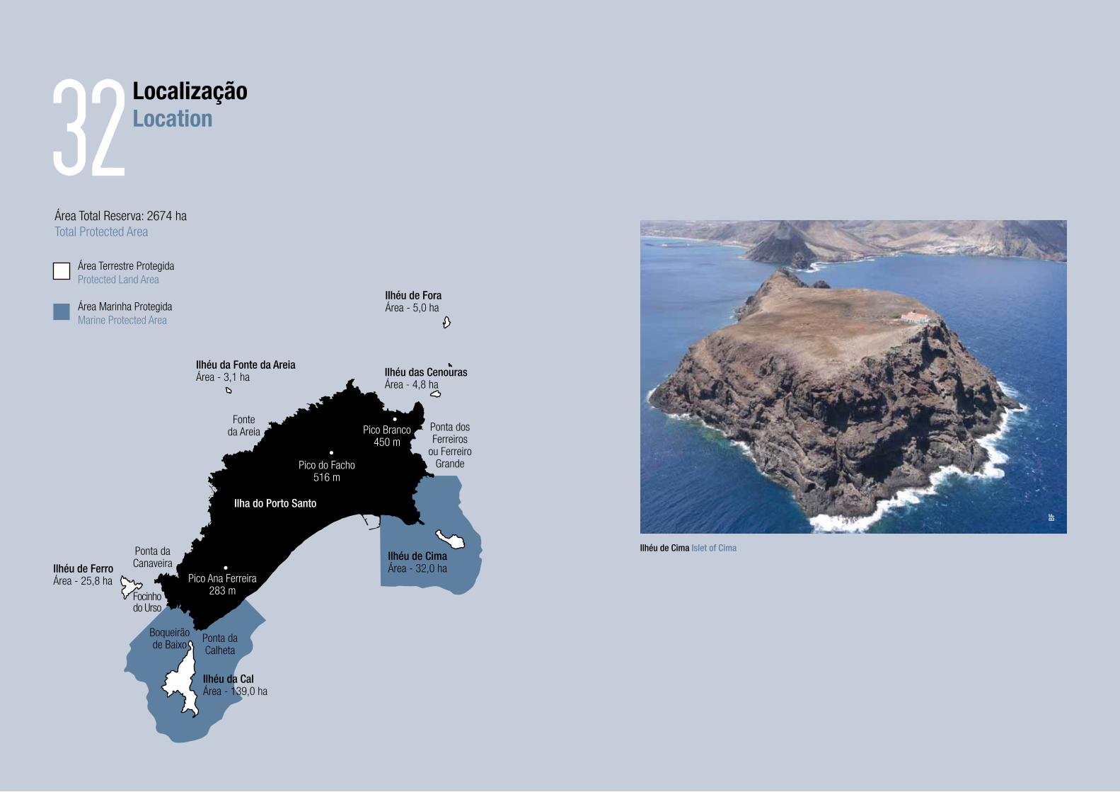
Ilhéu de ForaÁrea - 5,0 ha
Ilhéu da Fonte da AreiaÁrea - 3,1 ha Ilhéu das Cenouras
Área - 4,8 ha
LocalizaçãoLocation
Área Total Reserva: 2674 haTotal Protected Area
Área Terrestre ProtegidaProtected Land Area
Fonteda Areia
Pico do Facho516 m
Ponta dosFerreiros
ou FerreiroGrande
Ponta daCanaveira
Focinhodo Urso
Boqueirãode Baixo
Ponta daCalheta
Ilhéu de FerroÁrea - 25,8 ha
Ilhéu da CalÁrea - 139,0 ha
Ilhéu de CimaÁrea - 32,0 ha
Área Marinha ProtegidaMarine Protected Area
Pico Branco450 m
Pico Ana Ferreira283 m
Ilha do Porto Santo
32
Ilhéu de Cima Islet of Cima
BF

Enquadramento legalLegal framework
Os ilhéus do Porto Santo são propriedade da Região Autónoma da Madeira, sendo que, desde 2008, a RAMPPS possui o estatuto legal de área protegida1. A gestão desta Área Protegida está a cargo do Serviço do Parque Natural da Madeira (SPNM), entidade pública tutelada pela Secretaria Regional do Ambiente e dos Recursos Naturais.
O Regulamento do Plano de Ordenamento e Gestão da RAMPPS2 conforma o Plano Municipal de Ordenamento do Território, bem como os programas e projetos, de iniciativa pública ou privada, a realizar na sua área de intervenção.
1 - Decreto Legislativo Regional n.º 32/2008/M, de 13 de agosto.
2 - Resolução n.º 1295/2009 do n.º 100 da Série I do JORAM,
de 02 de outubro.
The islets of Porto Santo are the property of the Autonomous Region of Madeira and since 2008 the RAMPPS has had the legal status of protected area1. The management of this Protected Area is the responsibility of the Madeira Natural Park Service (SPNM), a public entity under the Regional Secretariat of the Environment and Natural Resources.
The Regulations of the Zoning and Management Plan of the RAMPPS2 shape the Municipal Land Use Zoning Plan and the programmes and projects, both public and private, to be carried out in its area of intervention.
1 - Regional Legislative Decree no. 32/2008/M, of 13 August.
2 - Resolution n.º 1295/2009 of no. 100 of Series I of JORAM (Official Gazette of the Autonomous Region of
Madeira) of 02 October.
35
Visita aos ilhéus no âmbito do Projeto LIFE ILHÉUS DO PORTO SANTO Visit to Porto Santo Islets in the scope of the LIFE project
SPEA
Uso humano
Histórico
Human use
Historical
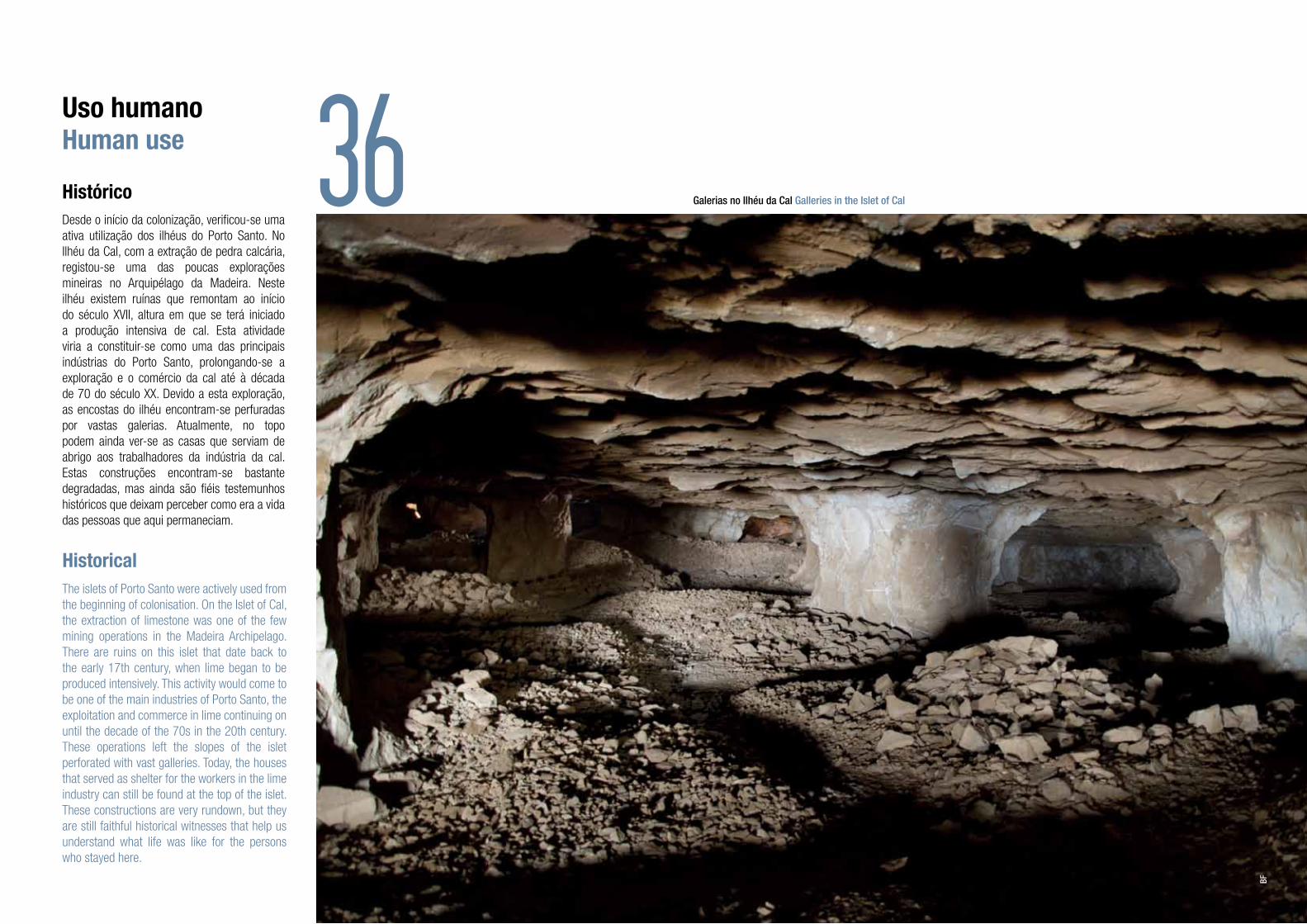
Desde o início da colonização, verificou-se uma ativa utilização dos ilhéus do Porto Santo. No Ilhéu da Cal, com a extração de pedra calcária, registou-se uma das poucas explorações mineiras no Arquipélago da Madeira. Neste ilhéu existem ruínas que remontam ao início do século XVII, altura em que se terá iniciado a produção intensiva de cal. Esta atividade viria a constituir-se como uma das principais indústrias do Porto Santo, prolongando-se a exploração e o comércio da cal até à década de 70 do século XX. Devido a esta exploração, as encostas do ilhéu encontram-se perfuradas por vastas galerias. Atualmente, no topo podem ainda ver-se as casas que serviam de abrigo aos trabalhadores da indústria da cal. Estas construções encontram-se bastante degradadas, mas ainda são fiéis testemunhos históricos que deixam perceber como era a vida das pessoas que aqui permaneciam.
The islets of Porto Santo were actively used from the beginning of colonisation. On the Islet of Cal, the extraction of limestone was one of the few mining operations in the Madeira Archipelago. There are ruins on this islet that date back to the early 17th century, when lime began to be produced intensively. This activity would come to be one of the main industries of Porto Santo, the exploitation and commerce in lime continuing on until the decade of the 70s in the 20th century. These operations left the slopes of the islet perforated with vast galleries. Today, the houses that served as shelter for the workers in the lime industry can still be found at the top of the islet. These constructions are very rundown, but they are still faithful historical witnesses that help us understand what life was like for the persons who stayed here.
36 Galerias no Ilhéu da Cal Galleries in the Islet of Cal
BF

Com a entrada em funcionamento do farol, em 1901, também o Ilhéu de Cima passou a ter presença humana permanente, por parte dos faroleiros que, em difíceis condições de habitabilidade, ali prestavam serviço. No entanto, só em 1925 são criadas as condições para que os faroleiros sejam acompanhados pelos seus familiares durante as suas estadias em serviço. As instalações então criadas podiam receber até cinco famílias, que ali se instalavam durante largas temporadas. A permanência dos faroleiros e das suas famílias levou a que se iniciasse um movimento de visitantes ao ilhéu, fossem estes meros curiosos ou outros familiares próximos. Esta afluência de visitas ao Ilhéu de Cima acabou por tornar-se uma tradição porto-santense, enraizada em alguns grupos locais.
With the lighthouse going into operation in 1901, the Islet of Cima began to have the permanent presence of man, due to the lighthouse keepers who, under difficult living conditions, rendered their services there. But it was only in 1925 that conditions were created that made it possible for the lighthouse keepers to be accompanied by their families during their stays on duty. The installations created at that time could house up to five families, who settled there for long periods of time. The fact that the lighthouse keepers and their families stayed there led to the beginning of a movement of visitors to the islet, whether out of curiosity or because they were close relatives. This influx of visitors to Islet of Cima became a tradition in Porto Santo, finding roots in some local groups.
Uso humanoHuman use 38
Farol do Ilhéu de Cima Lighthouse in Islet of Cima
MS

Os registos históricos evidenciam ainda que, apesar dos difíceis acessos e da inexistência de fontes de água doce, existiram outras iniciativas para rentabilizar sobretudo os três ilhéus com maior área: o de Cima e o da Cal, como já referido, e também o de Ferro. Desde a criação de áreas de pasto comum para cabras e ovelhas, a exploração de pedreiras e salinas, passando pela introdução de coelhos para caça, o aproveitamento de plantas para a indústria da tinturaria ou do sabão, até à utilização de terrenos para o cultivo de cereais, com maior ou menor sucesso, as tentativas de usufruir economicamente dos ilhéus do Porto Santo foram-se sucedendo. Esta utilização intensiva, ao longo de séculos, viria, no entanto, a traduzir-se em efeitos nefastos nas espécies e ecossistemas dos ilhéus.
The historical records also show that, despite the difficult accesses and the lack of fresh water sources, there were other initiatives to make profitable use of the three largest islets, in particular: Cima and Cal, as already stated, as well as Ferro. The initiatives ranged from the creation of common pastures for goats and sheep, quarrying and salt pool operations, to the introduction of rabbits for hunting, the use of plants for the dyeing and soap-making industry, and the use of lands for growing grains. To greater or lesser degrees of success, the attempts to benefit economically from the islets of Porto Santo followed one after the other. This intensive use over centuries would, however, prove to cause harmful effects on the species and ecosystems of the islets.
Uso humanoHuman use
40
Vestígios de ocupação humana no Ilhéu da Cal Traces of human occupation in Islet of Cal
Vista exterior das galerias no Ilhéu da Cal Exterior view of the galleries in Islet of Cal
AP
BF
Uso humano
Atual
Human use
Current
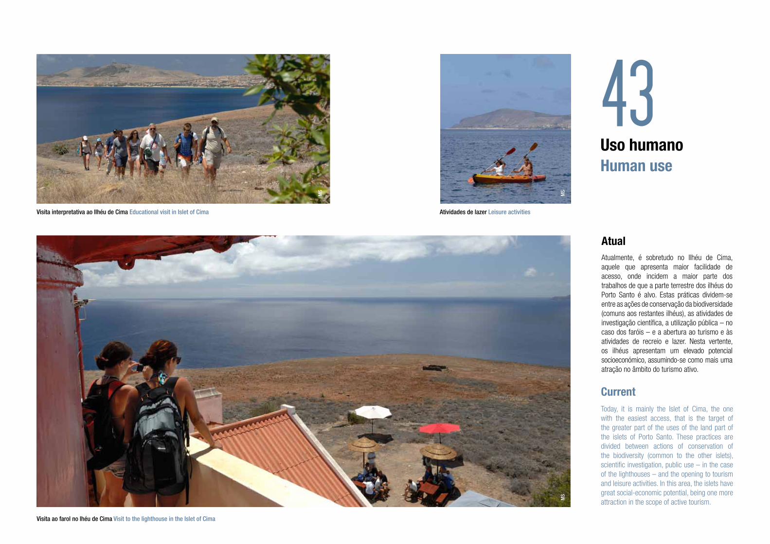
Atualmente, é sobretudo no Ilhéu de Cima, aquele que apresenta maior facilidade de acesso, onde incidem a maior parte dos trabalhos de que a parte terrestre dos ilhéus do Porto Santo é alvo. Estas práticas dividem-se entre as ações de conservação da biodiversidade (comuns aos restantes ilhéus), as atividades de investigação científica, a utilização pública – no caso dos faróis – e a abertura ao turismo e às atividades de recreio e lazer. Nesta vertente, os ilhéus apresentam um elevado potencial socioeconómico, assumindo-se como mais uma atração no âmbito do turismo ativo.
Today, it is mainly the Islet of Cima, the one with the easiest access, that is the target of the greater part of the uses of the land part of the islets of Porto Santo. These practices are divided between actions of conservation of the biodiversity (common to the other islets), scientific investigation, public use – in the case of the lighthouses – and the opening to tourism and leisure activities. In this area, the islets have great social-economic potential, being one more attraction in the scope of active tourism.
43Visita interpretativa ao Ilhéu de Cima Educational visit in Islet of Cima Atividades de lazer Leisure activities
MS
MS
MS
Visita ao farol no Ihéu de Cima Visit to the lighthouse in the Islet of Cima

De igual modo, as visitas organizadas de caráter educativo e pedagógico, sobretudo as proporcionadas a instituições de ensino e a outros grupos, têm assumido uma importância e regularidade crescente, dando a descobrir o Ilhéu de Cima e toda a sua biodiversidade.
Likewise, the organised visits of an educational and pedagogical nature, especially those offered to schools and other groups, have become more important and regular, promoting the discovery of the Islet of Cima and all its biodiversity.
44
FA
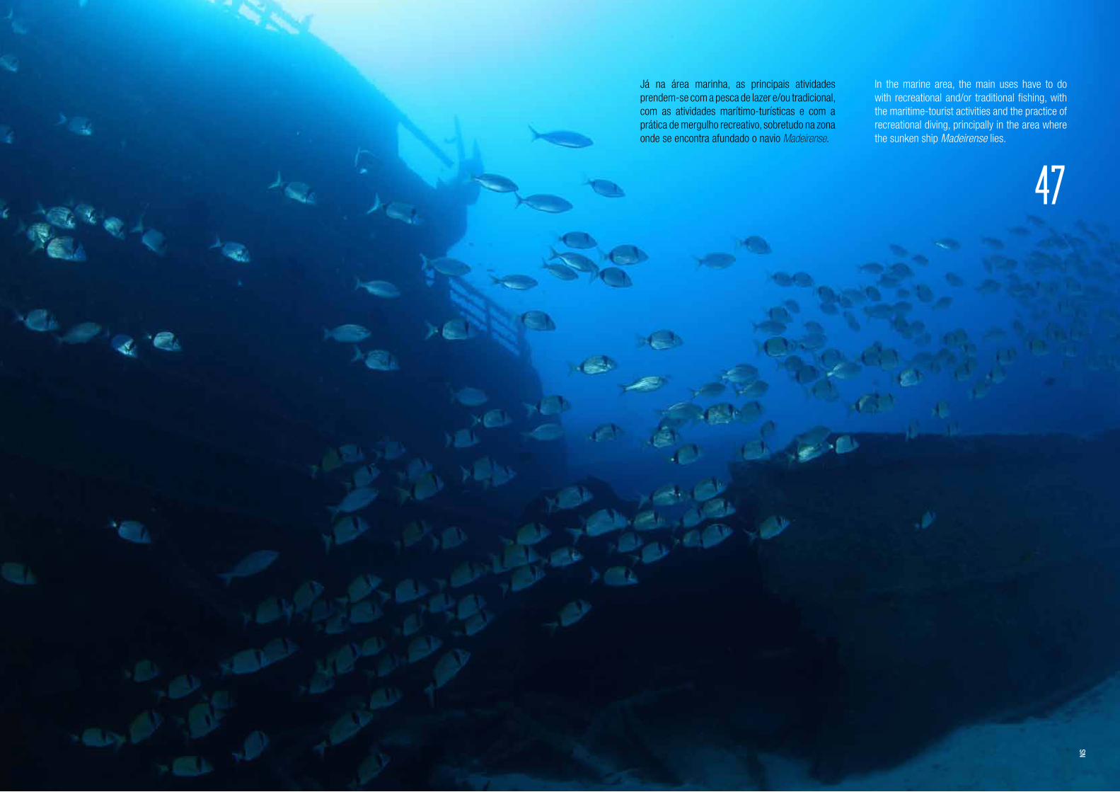
Já na área marinha, as principais atividades prendem-se com a pesca de lazer e/ou tradicional, com as atividades marítimo-turísticas e com a prática de mergulho recreativo, sobretudo na zona onde se encontra afundado o navio Madeirense.
In the marine area, the main uses have to do with recreational and/or traditional fishing, with the maritime-tourist activities and the practice of recreational diving, principally in the area where the sunken ship Madeirense lies.
47
NS
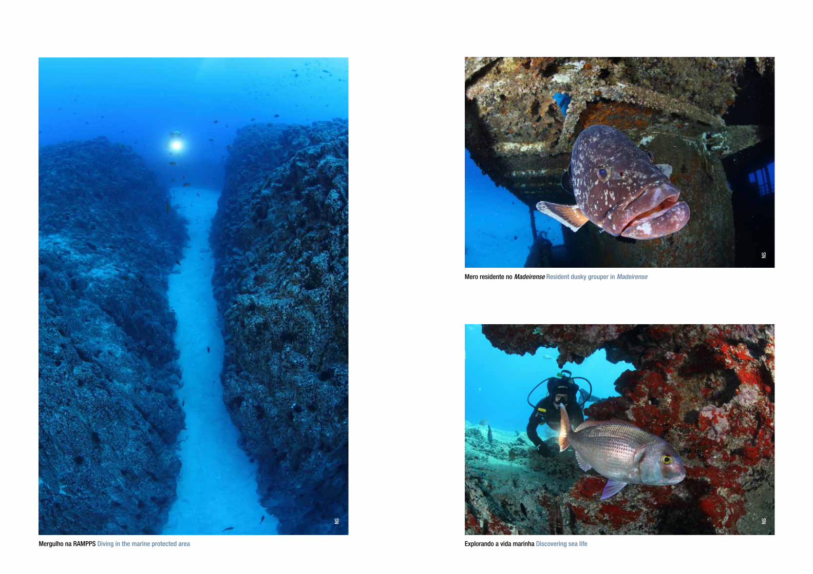
Mergulho na RAMPPS Diving in the marine protected area Explorando a vida marinha Discovering sea life
Mero residente no Madeirense Resident dusky grouper in Madeirense
NS NSNS

Ilhéus do Porto Santoe área marinha adjacente
Islets of Porto Santoand the adjacent marine area
O Ilhéu da Cal
O Ilhéu das Cenouras
O Ilhéu de Cima
O Ilhéu de Ferro
O Ilhéu da Fonte da Areia
O Ilhéu de Fora
The Islet of Cal
The Islet of Cenouras
The Islet of Cima
The Islet of Ferro
The Islet of Fonte da Areia
The Islet of Fora
O Ilhéu da CalThe Islet of Cal
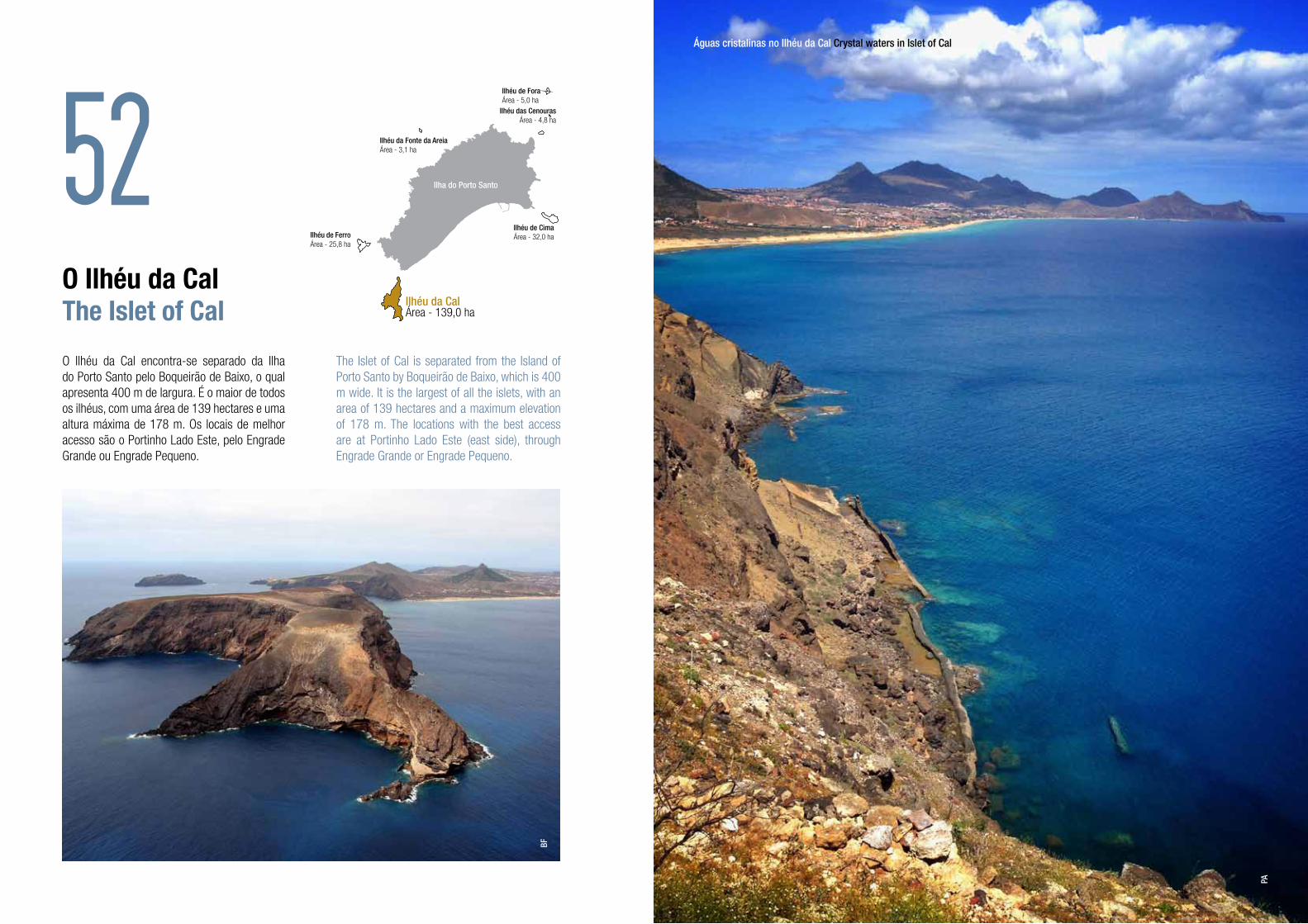
O Ilhéu da Cal encontra-se separado da Ilha do Porto Santo pelo Boqueirão de Baixo, o qual apresenta 400 m de largura. É o maior de todos os ilhéus, com uma área de 139 hectares e uma altura máxima de 178 m. Os locais de melhor acesso são o Portinho Lado Este, pelo Engrade Grande ou Engrade Pequeno.
The Islet of Cal is separated from the Island of Porto Santo by Boqueirão de Baixo, which is 400 m wide. It is the largest of all the islets, with an area of 139 hectares and a maximum elevation of 178 m. The locations with the best access are at Portinho Lado Este (east side), through Engrade Grande or Engrade Pequeno.
52Ilhéu de ForaÁrea - 5,0 ha
Ilhéu da Fonte da AreiaÁrea - 3,1 ha
Ilhéu das CenourasÁrea - 4,8 ha
Ilhéu de FerroÁrea - 25,8 ha
Ilhéu da CalÁrea - 139,0 ha
Ilhéu de CimaÁrea - 32,0 ha
Ilha do Porto Santo
BF
Águas cristalinas no Ilhéu da Cal Crystal waters in Islet of Cal
PA

É nas camadas de cor mais clara, com cerca de 15 milhões de anos (Miocénico Médio), correspondentes a antigos recifes de colónias de corais e areias da acumulação dos seus restos esqueléticos, que foi extraída a pedra calcária para a indústria da cal.
O ilhéu é parte constituinte de uma IBA, sendo conhecida a nidificação de, pelo menos, seis espécies de aves marinhas e três terrestres.Aqui pode igualmente ser encontrada uma espécie de tarântula (Hogna biscoitoi) e de escaravelho (Eurygnathus latreillei latreillei, que é predador de moluscos terrestres) endémicas do Porto Santo. Ocorre ainda uma espécie de molusco terrestre, o caracol-do-ilhéu-da-cal, que atualmente é exclusiva deste ilhéu, ocupando uma área restrita que lhe confere o estatuto de conservação de “criticamente “ameaçada”. É, também, o ilhéu que apresenta o segundo maior número de espécies endémicas de flora da Macaronésia e o que alberga a maior quantidade de briófitos.
Por altura dos descobrimentos, o Ilhéu da Cal apresentava um coberto vegetal constituído essencialmente por zimbros e marmulanos. Em consequência da continuada pressão humana que este ilhéu sofreu, nos nossos dias já não existem zimbros e restam poucos exemplares de marmulano, único elemento arbóreo indígena existente.
The limestone, that was intensively explored, was extracted from the lighter layers, with about 15 million years (Mid Miocene), which corresponded to old reefs composed of coral colonies and accumulation of sand.
The islet is part of an IBA, where at least six species of marine birds and three land species nest. Also found here are a species of tarantula (Hogna biscoitoi) and beetle (Eurygnathus latreillei latreillei, a predator of snails) that are endemic to Porto Santo. There is also one land snail species, Cal Idiomela, that is currently limited to a restricted area in this islet; reason why it has a “critically endangered” conservation status. This islet also has the second largest number of endemic species of flora of Macaronesia and is home to the largest number of bryophytes.
At the time of the discoveries, the Islet of Cal had a vegetal cover made up essentially of common juniper and ironwood. The continued
pressure of man on this islet has led to the fact that today no juniper is left here and there are few occurrences of ironwood, the only indigenous shrub-tree element still existing.
O Ilhéu da CalThe Islet of Cal 54
Tarântula (Hogna biscoitoi) Tarantula
Escaravelho (Eurygnathus latreillei latreillei) Scarab
Caracol-do-ilhéu-da-cal Cal IdiomelaFV
ASDT

O Ilhéu das CenourasThe Islet of Cenouras
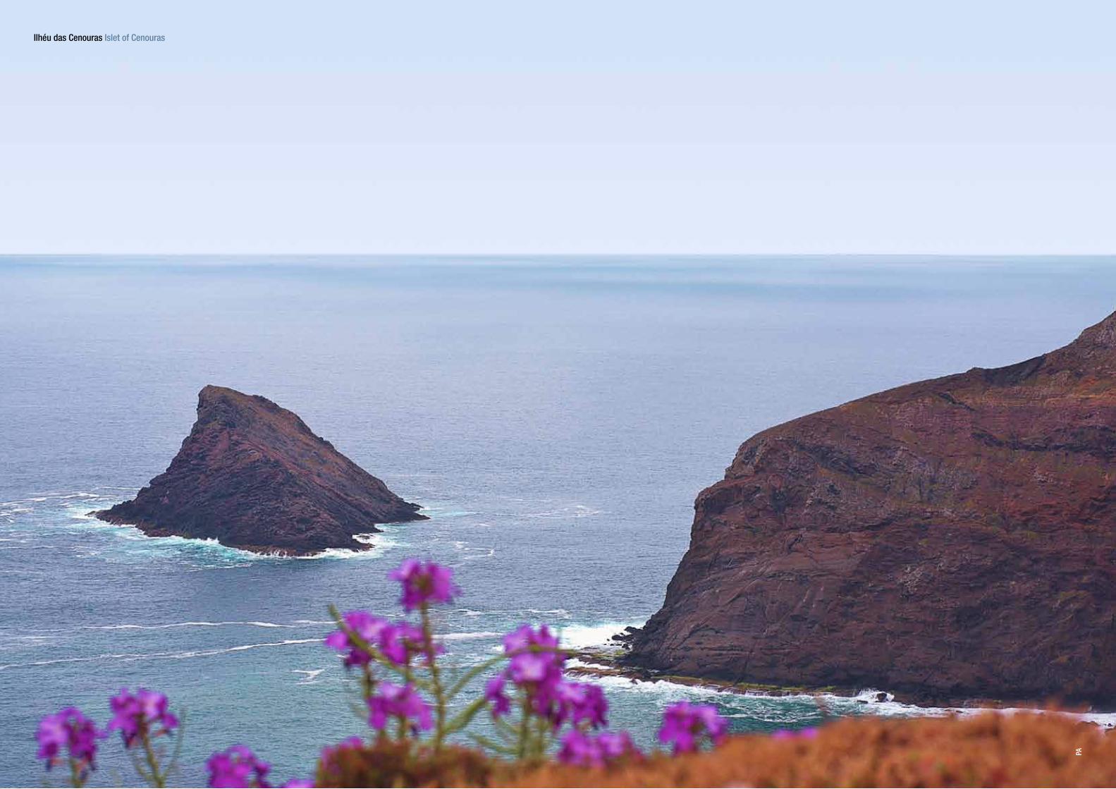
O Ilhéu das Cenouras fica situado a nordeste do Porto Santo, a cerca de 500 m da Ponta Branca. Apresenta uma área de 4,8 hectares, com uma orografia acidentada e uma altitude máxima de 109 m. O acesso a este ilhéu depende do estado do mar, que, quando calmo, permite o desembarque em rochas da parte sul.
Alberga na sua flora um total de 29 taxa, destacando-se a ocorrência da cabeleira-de-coquinho, endémica do Porto Santo. Crê-se que o nome do ilhéu advém do facto de, no passado, ter tido elevadas densidades da planta cenoura-da-rocha, agora inexistente neste ilhéu.
The Islet of Cenouras lies northeast of Porto Santo, about 500 m from Ponta Branca. It has an area of 4.8 hectares, with a maximum altitude of 109 m. Access to this islet depends on sea conditions, which when calm allow coming ashore on rocks on the south side.
Its flora includes a total of 29 taxa, among which are Lotus loweanus, an endemic species of Porto Santo. The name of the islet is believed to derive from the fact that, in the past, it was densely covered by carrot trees, a plant no longer found on this islet.
56Ilhéu de ForaÁrea - 5,0 ha
Ilhéu da Fonte da AreiaÁrea - 3,1 ha
Ilhéu de FerroÁrea - 25,8 ha
Ilhéu da CalÁrea - 139,0 ha
Ilhéu de CimaÁrea - 32,0 ha
Ilha do Porto Santo
Ilhéu das Cenouras Islet of Cenouras
Cabeleira-de-coquinho Lotus loweanus
SPEA
JC
Ilhéu das CenourasÁrea - 4,8 ha
Ilhéu das Cenouras Islet of Cenouras
PA

O Ilhéu de CimaThe Islet of Cima
O Ilhéu de Cima encontra-se separado do Porto Santo pelo Boqueirão de Cima, com uma largura de 450 m e com o fundo cheio de baixios. Tem uma área de 32 hectares, com o topo a 121 m, local onde, em 1900, começou a ser construído o farol. É formado por escoadas lávicas basálticas, por vezes apresentando estruturas em disjunção prismática, escórias e cinzas. O acesso ao ilhéu faz-se pelo pequeno cais que fica a oeste.
The Islet of Cima is separated from Porto Santo by Boqueirão de Cima, 450 m wide with a bottom full of sand banks. The islet has an area of 32 hectares and is 121 m high at the top, where construction on the lighthouse began in 1900. It is formed by basaltic lava flows, with some structures of prismatic disjunction, slag and ash. Access to the islet is by the small quay on the west side.
60Ilhéu de ForaÁrea - 5,0 ha
Ilhéu da Fonte da AreiaÁrea - 3,1 ha
Ilhéu das CenourasÁrea - 4,8 ha
Ilhéu de FerroÁrea - 25,8 ha
Ilhéu da CalÁrea - 139,0 ha
Ilhéu de CimaÁrea - 32,0 ha
Ilha do Porto Santo
Vista da Serra de Fora para o Ilhéu de Cima View from Serra de Fora to Islet of Cima
PA
PA
Farol no Ilhéu de Cima Lighthouse in Islet of Cima
Caracol-do-ilhéu-de-cima Cima Hystricella DT

This islet is part of an IBA. Among the snail species, one is exclusive to this islet, the Cima Hystricella, with an area of geographic distribution slightly larger than 600 m2. The islet is rich in terms of flora, with 138 taxa, 10 of which are endemic to Macaronesia and three are invasive species. According to historical accounts, in the early days of the colonisation, the Islet of Cima was covered by dragon trees and junipers.
The islet also has geologic phenomena of great interest, such as Cabeço das Laranjas, with a concentration of red algae fossils (rodolites) with 15-14 million years age, and Pedra do Sol, with a structure in radial disjunction.
Este ilhéu é parte constituinte de uma IBA. Ao nível dos moluscos terrestres, regista-se a presença de uma espécie exclusiva deste ilhéu, o caracol-do-ilhéu-de-cima, com uma área de distribuição ligeiramente superior a 600 m2. É um ilhéu rico no que à flora diz respeito, com a presença atual de 138 taxa, dos quais 10 são endémicas da Macaronésia e três têm caráter invasor. Segundo relatos históricos, nos primórdios da colonização o Ilhéu de Cima estava coberto por dragoeiros e zambujeiros.
O ilhéu ostenta ainda fenómenos geológicos de elevado interesse, como são o Cabeço das Laranjas, cuja concentração de fósseis de algas vermelhas (rodólitos) apresenta idades entre os 15-14 milhões de anos, e a Pedra do Sol, evidenciando uma estrutura em disjunção radial.
63
Topo do Ilhéu de Cima Top of Islet of Cima
PA
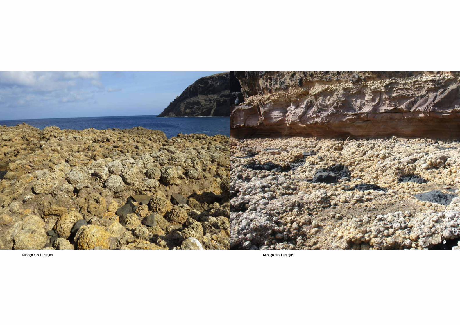
Cabeço das Laranjas Cabeço das Laranjas
FA MD
O Ilhéu de FerroThe Islet of Ferro
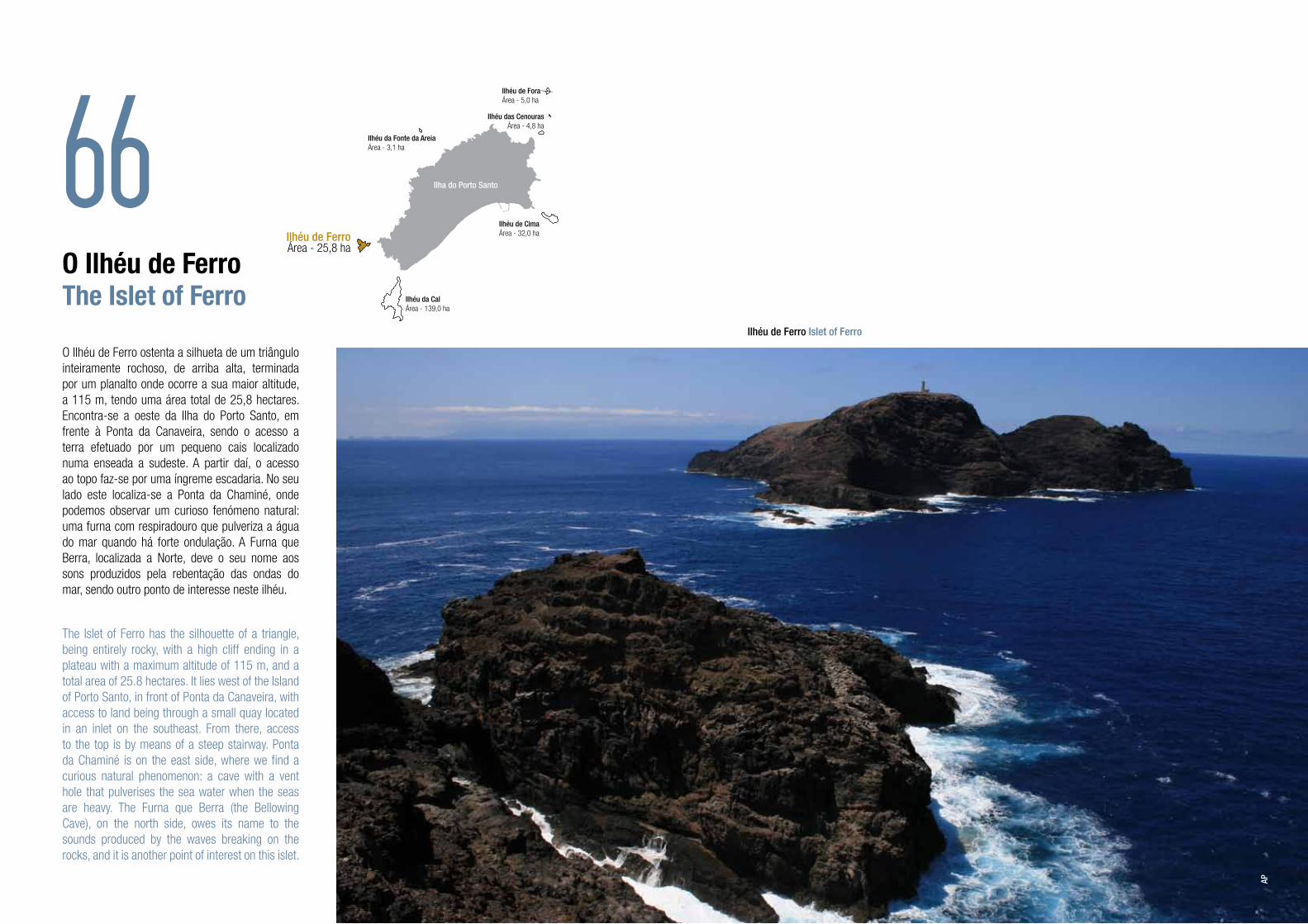
O Ilhéu de Ferro ostenta a silhueta de um triângulo inteiramente rochoso, de arriba alta, terminada por um planalto onde ocorre a sua maior altitude, a 115 m, tendo uma área total de 25,8 hectares. Encontra-se a oeste da Ilha do Porto Santo, em frente à Ponta da Canaveira, sendo o acesso a terra efetuado por um pequeno cais localizado numa enseada a sudeste. A partir daí, o acesso ao topo faz-se por uma íngreme escadaria. No seu lado este localiza-se a Ponta da Chaminé, onde podemos observar um curioso fenómeno natural: uma furna com respiradouro que pulveriza a água do mar quando há forte ondulação. A Furna que Berra, localizada a Norte, deve o seu nome aos sons produzidos pela rebentação das ondas do mar, sendo outro ponto de interesse neste ilhéu.
The Islet of Ferro has the silhouette of a triangle, being entirely rocky, with a high cliff ending in a plateau with a maximum altitude of 115 m, and a total area of 25.8 hectares. It lies west of the Island of Porto Santo, in front of Ponta da Canaveira, with access to land being through a small quay located in an inlet on the southeast. From there, access to the top is by means of a steep stairway. Ponta da Chaminé is on the east side, where we find a curious natural phenomenon: a cave with a vent hole that pulverises the sea water when the seas are heavy. The Furna que Berra (the Bellowing Cave), on the north side, owes its name to the sounds produced by the waves breaking on the rocks, and it is another point of interest on this islet.
66Ilhéu de ForaÁrea - 5,0 ha
Ilhéu da Fonte da AreiaÁrea - 3,1 ha
Ilhéu das CenourasÁrea - 4,8 ha
Ilhéu de FerroÁrea - 25,8 ha
Ilhéu da CalÁrea - 139,0 ha
Ilhéu de CimaÁrea - 32,0 ha
Ilha do Porto Santo
Ilhéu de Ferro Islet of Ferro
AP

Constitui, juntamente com os Ilhéus da Cal e de Cima, uma IBA, sendo também área de nidificação para as mesmas espécies presentes nesses outros dois ilhéus. Ao nível dos invertebrados, apresenta uma fauna bastante rica, com a presença de diversos endemismos do Porto Santo, como é o caso da tarântula-caranguejeira (ou tarântula-do-porto-santo) e do escaravelho Scarites abbreviatus cimensis, e ainda de duas espécies de moluscos terrestres exclusivas deste ilhéu: Discula calcigena maxima e Leptaxis nivosa craticulata. Relativamente à flora, encontram-se neste ilhéu pelo menos 94 taxa, dos quais nove são endémicos da Macaronésia.
Together with the Islets of Baixo and Cima, it constitutes an IBA, and is a nesting site for the same species found on the other two islets. The invertebrate fauna is very rich, and includes various endemisms of Porto Santo, such as the tarantula of Porto Santo and the beetle Scarites abbreviatus cimensis, as well as two species of land snails that are exclusive to this islet: Discula calcigena maxima and Leptaxis nivosa craticulata. There are at least 94 taxa of flora on this islet, nine of which are endemic to Macaronesia.
68Tarântula-caranguejeira Tarantula
Vista aérea do Ilhéu de Ferro Aerial view of Islet of Ferro
FV
BF
Caracol endémico do Ilhéu de Ferro (Leptaxis nivosa craticulata) Ferro Leptaxis
DT

O Ilhéu da Fonte da AreiaThe Islet of Fonte da Areia
O Ilhéu da Fonte da Areia situa-se em frente ao sítio com o mesmo nome, estando separado por um canal de mar com 1700 m de largura. Tem uma área total de 3,1 hectares e uma altitude máxima de 79 m. O desembarque só é possível com mar calmo, fazendo-se, então, pelo litoral do lado este. Apresenta interessantes particularidades do ponto de vista geológico, como é exemplo a profusão de rochas com solidificação prismática hexagonal nas suas falésias quase verticais.
Sendo o mais pequeno dos ilhéus, é igualmente aquele que possui uma menor diversidade florística, com apenas oito taxa. É notável que duas destas espécies sejam endémicas do Arquipélago da Madeira. Ao nível da fauna, destaca-se a presença do caracol-do-ilhéu-da-fonte-da-areia, que é endémico deste ilhéu.
The Islet of Fonte da Areia lies in front of
the place with the same name, being separated by a sea channel 1700 m wide. It has a total area of 3.1 hectares and a maximum altitude of 79 m. Debarkation is only possible when the sea is calm, being done on the coast on the east side. There are interesting particulars from the geological point of view, an example being the profusion of prismatic hexagonal rocks on the almost vertical cliffs.
Being the smallest of the islets, it is also the one with the least diversity of flora, with only eight taxa. It is worth noting that two of these species are endemic to the Madeira Archipelago. The fauna is marked by the presence of the land snail Fonte da Areia Discula, endemic to this islet.
70Ilhéu de ForaÁrea - 5,0 ha
Ilhéu da Fonte da AreiaÁrea - 3,1 ha
Ilhéu das CenourasÁrea - 4,8 ha
Ilhéu de FerroÁrea - 25,8 ha
Ilhéu da CalÁrea - 139,0 ha
Ilhéu de CimaÁrea - 32,0 ha
Ilha do Porto Santo
Ilhéu da Fonte da Areia Islet of Fonte da Areia
BF
Caracol-do-ilhéu-da-fonte-da-areia Fonte da Areia Discula DT

Ilhéu da Fonte da Areia Islet of Fonte da Areia
SPEA

O Ilhéu de ForaThe Islet of Fora
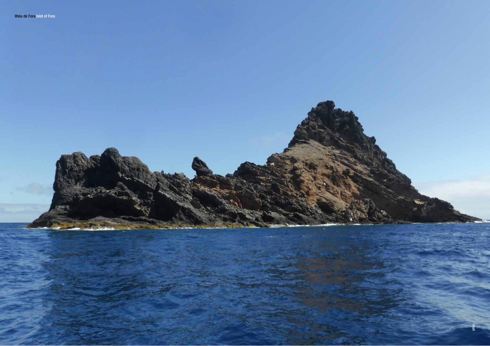
O Ilhéu de Fora situa-se a nordeste da Ilha do Porto Santo, sendo aquele que fica mais afastado desta. Tem uma área de 5 hectares e uma altitude máxima de 67 m.
Apresenta diversos endemismos, destacando-se, ao nível da fauna, duas espécies de moluscos terrestres exclusivas deste ilhéu: Discula calcigena gomesiana e Leptaxis wollastoni forensis. No que respeita à flora, verifica-se a ocorrência de um total de 15 taxa, sendo quatro deles endémicos da Macaronésia.
The Islet of Fora lies to the northeast of the Island of Porto Santo and is the islet furthest from the main island. It has an area of 5 hectares and a maximum altitude of 67 m.
There are various endemisms, the fauna being noted for two endemic species of land snails exclusive to this islet: Discula calcigena gomesiana and Leptaxis wollastoni forensis. The flora totals 15 taxa, four of which are endemic to Macaronesia.
74Ilhéu de ForaÁrea - 5,0 ha
Ilhéu da Fonte da AreiaÁrea - 3,1 ha
Ilhéu das CenourasÁrea - 4,8 ha
Ilhéu de FerroÁrea - 25,8 ha
Ilhéu da CalÁrea - 139,0 ha
Ilhéu de CimaÁrea - 32,0 ha
Ilha do Porto Santo
Ilhéu de Fora Islet of Fora
SPEA
Caracol endémico do Ilhéu de Fora (Leptaxis wollastoni forensis) Fora Leptaxis
DT
Ilhéu de Fora Islet of Fora
SPEA

Área marinha Marine areaOs habitats marinhos desta Área Protegida apresentam águas cristalinas e um elevado valor natural, biológico e paisagístico. Nalguns locais do litoral este, norte e da zona da Calheta, as plataformas rochosas planas ficam emersas na baixa-mar, dando origem ao aparecimento de poças de maré, as quais constituem habitats muito peculiares só comparáveis às enseadas encontradas na Reserva Natural das Ilhas Selvagens.
The marine habitats of this Protected Area have crystal clear waters with a high natural, biological and landscape value. In some places of the east and north littoral and in the area of Calheta, the flat rocky platforms appear at low tide, creating tide pools that are especially unique habitats that can only be compared to the inlets found in the Nature Reserve of the Ilhas Selvagens.
78
Mergulho na RAMPPS Exploring the marine protected area
NS

A RAMPPS apresenta um conjunto de habitats marinhos pertencentes ao Anexo I da Diretiva Habitats, tais como ‘Enseadas e baías pouco profundas’, ‘Grutas marinhas submersas ou semisubmersas’, ‘Bancos de areia permanentemente cobertos por água de mar pouco profunda’ e ‘Lodaçais e areias a descoberto na maré baixa’. Nos mares do Porto Santo podem ser observadas espécies emblemáticas, como o mero, a tartaruga-boba, o golfinho-comum ou a baleia-de-bryde.
The RAMPPS has a set of marine habitats belonging to Annex I of the Habitats Directive, such as ‘Shallow inlets and bays’, ‘Semi-submerged or submarine sea caves’, ‘Sandbanks which are slightly covered by sea water all the time’ and ‘Mudflats and sandflats not covered by seawater at low tide’. The seas of Porto Santo are inhabited by emblematic species, such as the dusky grouper, the loggerhead sea turtle, the short-beaked common dolphin and the Bryde’s whale.
80 81
Área marinha protegida envolvente ao Ilhéu da Cal Marine protected area around Islet of Cal Mero residente no Madeirense Resident dusky grouper in Madeirense
BF NS

No plano dos habitats artificiais, o navio Madeirense, propositadamente afundado no ano 2000, constitui um elemento de particular relevo, não só pelo efeito agregador de fauna que produziu, mas também pela atratividade gerada para o mergulho amador, um importante vetor económico para o Porto Santo.
Artificial habitats include the ship Madeirense, sunk on purpose in 2000, which is a particularly important element, not only due to the effect it produced in gathering fauna together, but also for the attraction it generated for amateur divers, an important economic vector for Porto Santo.
82Proa do Madeirense Bow of Madeirense
NS
NS
Vida marinha na RAMPPS Marine life in the marine protected area

Paisagens subaquáticas únicas Unique underwater environments
NS
86Gestão e conservaçãoManagement and conservation
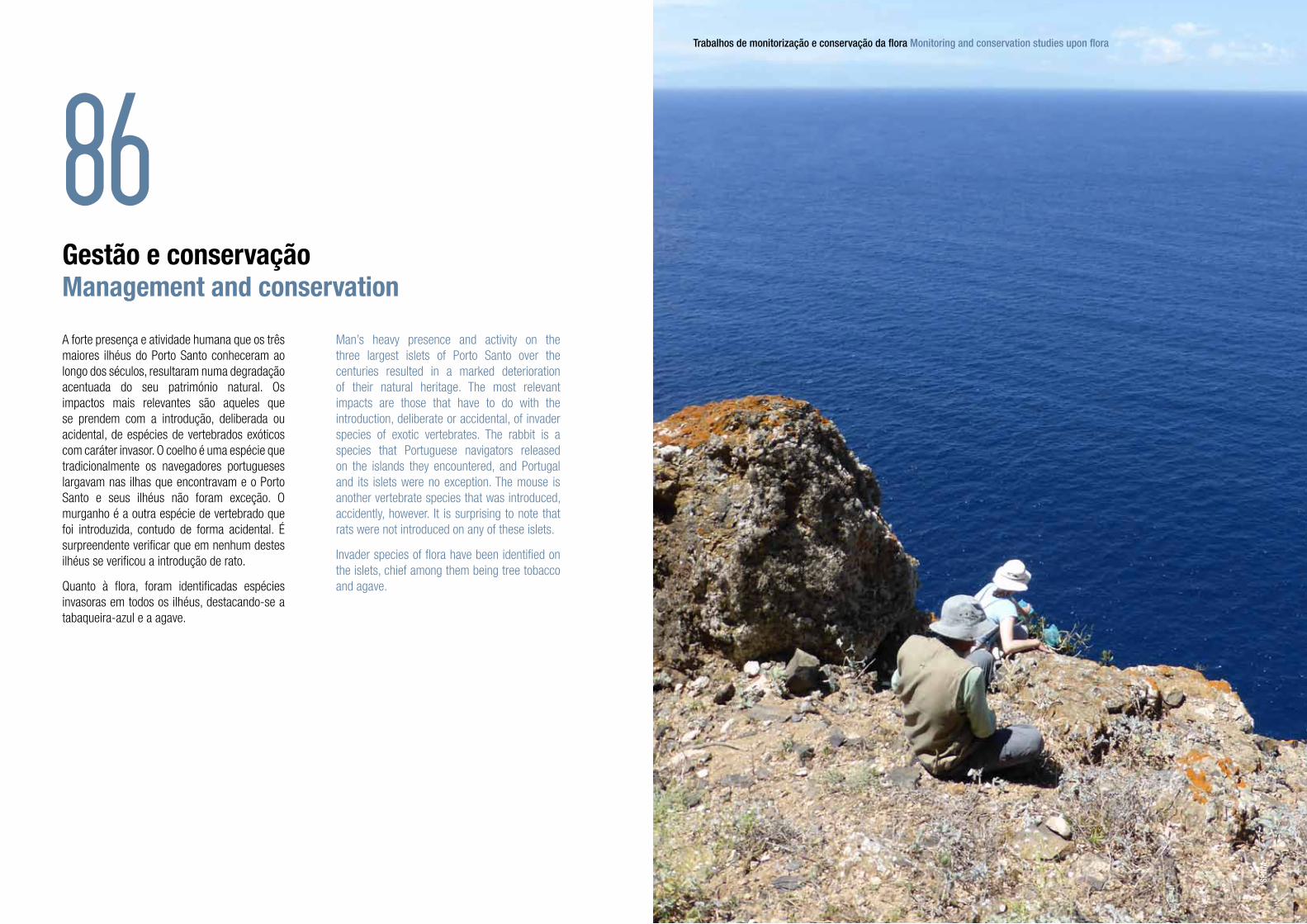
A forte presença e atividade humana que os três maiores ilhéus do Porto Santo conheceram ao longo dos séculos, resultaram numa degradação acentuada do seu património natural. Os impactos mais relevantes são aqueles que se prendem com a introdução, deliberada ou acidental, de espécies de vertebrados exóticos com caráter invasor. O coelho é uma espécie que tradicionalmente os navegadores portugueses largavam nas ilhas que encontravam e o Porto Santo e seus ilhéus não foram exceção. O murganho é a outra espécie de vertebrado que foi introduzida, contudo de forma acidental. É surpreendente verificar que em nenhum destes ilhéus se verificou a introdução de rato.
Quanto à flora, foram identificadas espécies invasoras em todos os ilhéus, destacando-se a tabaqueira-azul e a agave.
Man’s heavy presence and activity on the three largest islets of Porto Santo over the centuries resulted in a marked deterioration of their natural heritage. The most relevant impacts are those that have to do with the introduction, deliberate or accidental, of invader species of exotic vertebrates. The rabbit is a species that Portuguese navigators released on the islands they encountered, and Portugal and its islets were no exception. The mouse is another vertebrate species that was introduced, accidently, however. It is surprising to note that rats were not introduced on any of these islets.
Invader species of flora have been identified on the islets, chief among them being tree tobacco and agave.
Trabalhos de monitorização e conservação da flora Monitoring and conservation studies upon flora
SPNM
88
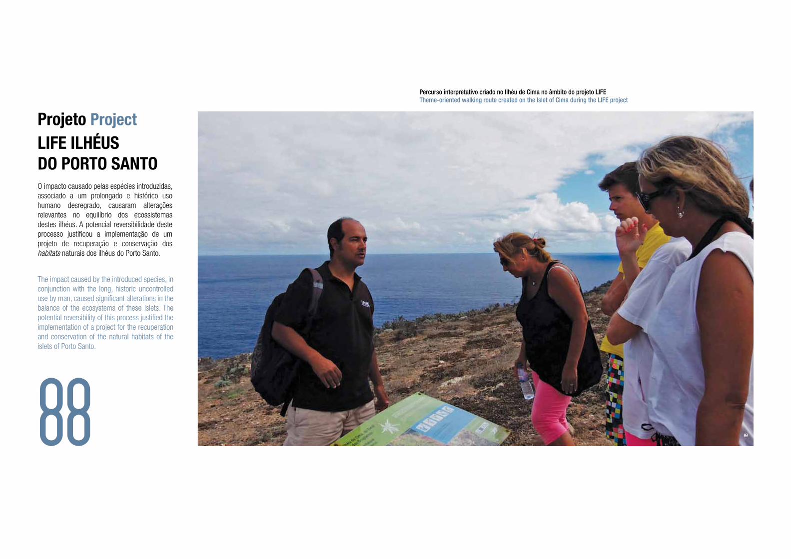
Projeto ProjectLIFE ILHÉUSDO PORTO SANTOO impacto causado pelas espécies introduzidas, associado a um prolongado e histórico uso humano desregrado, causaram alterações relevantes no equilíbrio dos ecossistemas destes ilhéus. A potencial reversibilidade deste processo justificou a implementação de um projeto de recuperação e conservação dos habitats naturais dos ilhéus do Porto Santo.
The impact caused by the introduced species, in conjunction with the long, historic uncontrolled use by man, caused significant alterations in the balance of the ecosystems of these islets. The potential reversibility of this process justified the implementation of a project for the recuperation and conservation of the natural habitats of the islets of Porto Santo.
Percurso interpretativo criado no Ilhéu de Cima no âmbito do projeto LIFETheme-oriented walking route created on the Islet of Cima during the LIFE project
IB

Assim, entre 2010 e 2015, o SPNM, em parceria com a SPEA - Sociedade Portuguesa para o Estudo das Aves, implementou o projeto intitulado ‘Travar a perda da Biodiversidade Europeia através da recuperação de habitats e espécies dos Ilhéus do Porto Santo e área marinha envolvente’ (LIFE09 NAT/PT/000041). Os objetivos específicos desta iniciativa passaram por eliminar as pressões que condicionavam o bom funcionamento do ecossistema, promovendo um adequado usufruto destes espaços por parte da população e visitantes.
As ações estruturantes consistiram na retirada das espécies invasoras, a promoção direta da recuperação de espécies mais vulneráveis, o incentivo a um forte apoio público às medidas implementadas e ainda a criação de condições adequadas para os visitantes.
So it was between 2010 and 2015 that the SPNM, in partnership with SPEA - Sociedade Portuguesa para o Estudo das Aves (the Portuguese Society for the Study of Birds), implemented the project ‘Travar a perda da Biodiversidade Europeia através da recuperação de habitats e espécies dos Ilhéus do Porto Santo e área marinha envolvente’ [Halt the loss of European Biodiversity through the recuperation of habitats and species of the Islets of Porto Santo and the surrounding marine area] (LIFE09 NAT/PT/000041). The specific objectives of this initiative included the elimination of pressures that hindered the proper functioning of the ecosystem, promoting an appropriate usufruct of these areas by the local population and visitors.
The structuring actions included the removal of invader species, the direct promotion of the recuperation of the more vulnerable species, the incentive for strong public support of the measures implemented and the creation of suitable conditions for visitors.
Remoção de plantas invasoras Removing invasive plants
Monitorização de aves marinhas no Ilhéu de CimaMonitoring sea birds in Islet of Cima
CM FA
90 91

Vista noturna no Ilhéu da Cal com o Porto Santo ao fundo Night view from Islet of Cal, with Porto Santo as background
MS
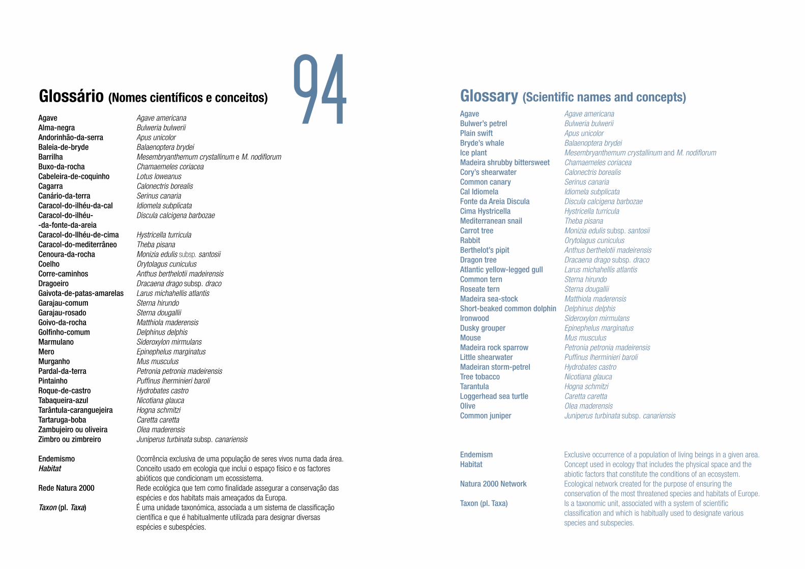
94Glossário (Nomes científicos e conceitos) Glossary (Scientific names and concepts)
Agave Agave americanaAlma-negra Bulweria bulweriiAndorinhão-da-serra Apus unicolorBaleia-de-bryde Balaenoptera brydeiBarrilha Mesembryanthemum crystallinum e M. nodiflorumBuxo-da-rocha Chamaemeles coriaceaCabeleira-de-coquinho Lotus loweanusCagarra Calonectris borealisCanário-da-terra Serinus canariaCaracol-do-ilhéu-da-cal Idiomela subplicataCaracol-do-ilhéu- Discula calcigena barbozae-da-fonte-da-areia Caracol-do-Ilhéu-de-cima Hystricella turriculaCaracol-do-mediterrâneo Theba pisanaCenoura-da-rocha Monizia edulis subsp. santosiiCoelho Orytolagus cuniculusCorre-caminhos Anthus berthelotii madeirensisDragoeiro Dracaena drago subsp. dracoGaivota-de-patas-amarelas Larus michahellis atlantisGarajau-comum Sterna hirundoGarajau-rosado Sterna dougalliiGoivo-da-rocha Matthiola maderensisGolfinho-comum Delphinus delphisMarmulano Sideroxylon mirmulansMero Epinephelus marginatusMurganho Mus musculusPardal-da-terra Petronia petronia madeirensisPintainho Puffinus lherminieri baroliRoque-de-castro Hydrobates castroTabaqueira-azul Nicotiana glaucaTarântula-caranguejeira Hogna schmitziTartaruga-boba Caretta carettaZambujeiro ou oliveira Olea maderensisZimbro ou zimbreiro Juniperus turbinata subsp. canariensis
Endemismo Ocorrência exclusiva de uma população de seres vivos numa dada área.Habitat Conceito usado em ecologia que inclui o espaço físico e os factores abióticos que condicionam um ecossistema.Rede Natura 2000 Rede ecológica que tem como finalidade assegurar a conservação das espécies e dos habitats mais ameaçados da Europa.Taxon (pl. Taxa) É uma unidade taxonómica, associada a um sistema de classificação científica e que é habitualmente utilizada para designar diversas espécies e subespécies.
Agave Agave americanaBulwer’s petrel Bulweria bulweriiPlain swift Apus unicolorBryde’s whale Balaenoptera brydeiIce plant Mesembryanthemum crystallinum and M. nodiflorumMadeira shrubby bittersweet Chamaemeles coriaceaCory’s shearwater Calonectris borealisCommon canary Serinus canariaCal Idiomela Idiomela subplicataFonte da Areia Discula Discula calcigena barbozaeCima Hystricella Hystricella turriculaMediterranean snail Theba pisanaCarrot tree Monizia edulis subsp. santosiiRabbit Orytolagus cuniculusBerthelot’s pipit Anthus berthelotii madeirensisDragon tree Dracaena drago subsp. dracoAtlantic yellow-legged gull Larus michahellis atlantisCommon tern Sterna hirundoRoseate tern Sterna dougalliiMadeira sea-stock Matthiola maderensisShort-beaked common dolphin Delphinus delphisIronwood Sideroxylon mirmulansDusky grouper Epinephelus marginatusMouse Mus musculusMadeira rock sparrow Petronia petronia madeirensisLittle shearwater Puffinus lherminieri baroliMadeiran storm-petrel Hydrobates castroTree tobacco Nicotiana glaucaTarantula Hogna schmitziLoggerhead sea turtle Caretta carettaOlive Olea maderensisCommon juniper Juniperus turbinata subsp. canariensis
Endemism Exclusive occurrence of a population of living beings in a given area.Habitat Concept used in ecology that includes the physical space and the abiotic factors that constitute the conditions of an ecosystem.Natura 2000 Network Ecological network created for the purpose of ensuring the conservation of the most threatened species and habitats of Europe.Taxon (pl. Taxa) Is a taxonomic unit, associated with a system of scientific classification and which is habitually used to designate various species and subspecies.
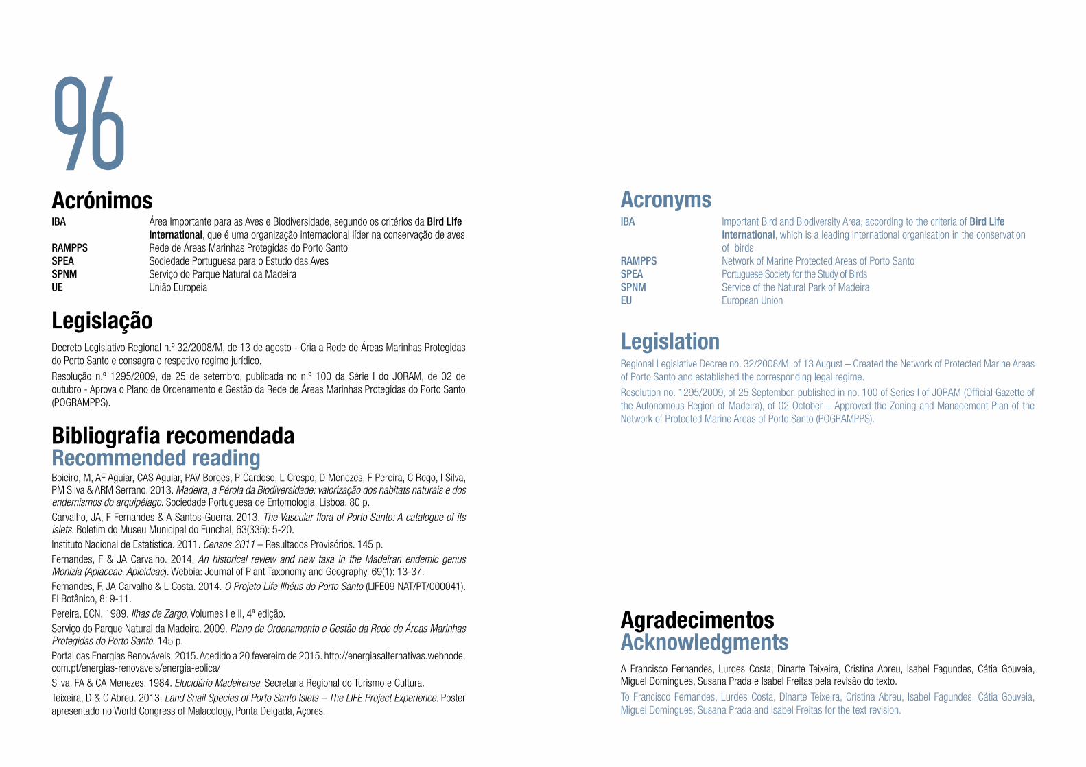
96AcrónimosIBA Área Importante para as Aves e Biodiversidade, segundo os critérios da Bird Life International, que é uma organização internacional líder na conservação de avesRAMPPS Rede de Áreas Marinhas Protegidas do Porto SantoSPEA Sociedade Portuguesa para o Estudo das AvesSPNM Serviço do Parque Natural da MadeiraUE União Europeia
LegislaçãoDecreto Legislativo Regional n.º 32/2008/M, de 13 de agosto - Cria a Rede de Áreas Marinhas Protegidas do Porto Santo e consagra o respetivo regime jurídico.
Resolução n.º 1295/2009, de 25 de setembro, publicada no n.º 100 da Série I do JORAM, de 02 de outubro - Aprova o Plano de Ordenamento e Gestão da Rede de Áreas Marinhas Protegidas do Porto Santo (POGRAMPPS).
Bibliografia recomendadaRecommended readingBoieiro, M, AF Aguiar, CAS Aguiar, PAV Borges, P Cardoso, L Crespo, D Menezes, F Pereira, C Rego, I Silva, PM Silva & ARM Serrano. 2013. Madeira, a Pérola da Biodiversidade: valorização dos habitats naturais e dos endemismos do arquipélago. Sociedade Portuguesa de Entomologia, Lisboa. 80 p.Carvalho, JA, F Fernandes & A Santos-Guerra. 2013. The Vascular flora of Porto Santo: A catalogue of its islets. Boletim do Museu Municipal do Funchal, 63(335): 5-20.Instituto Nacional de Estatística. 2011. Censos 2011 – Resultados Provisórios. 145 p.Fernandes, F & JA Carvalho. 2014. An historical review and new taxa in the Madeiran endemic genus Monizia (Apiaceae, Apioideae). Webbia: Journal of Plant Taxonomy and Geography, 69(1): 13-37.Fernandes, F, JA Carvalho & L Costa. 2014. O Projeto Life Ilhéus do Porto Santo (LIFE09 NAT/PT/000041). El Botânico, 8: 9-11.Pereira, ECN. 1989. Ilhas de Zargo, Volumes I e II, 4ª edição.Serviço do Parque Natural da Madeira. 2009. Plano de Ordenamento e Gestão da Rede de Áreas Marinhas Protegidas do Porto Santo. 145 p.Portal das Energias Renováveis. 2015. Acedido a 20 fevereiro de 2015. http://energiasalternativas.webnode.com.pt/energias-renovaveis/energia-eolica/Silva, FA & CA Menezes. 1984. Elucidário Madeirense. Secretaria Regional do Turismo e Cultura.Teixeira, D & C Abreu. 2013. Land Snail Species of Porto Santo Islets – The LIFE Project Experience. Poster apresentado no World Congress of Malacology, Ponta Delgada, Açores.
IBA Important Bird and Biodiversity Area, according to the criteria of Bird Life International, which is a leading international organisation in the conservation of birdsRAMPPS Network of Marine Protected Areas of Porto SantoSPEA Portuguese Society for the Study of BirdsSPNM Service of the Natural Park of MadeiraEU European Union
LegislationRegional Legislative Decree no. 32/2008/M, of 13 August – Created the Network of Protected Marine Areas of Porto Santo and established the corresponding legal regime.
Resolution no. 1295/2009, of 25 September, published in no. 100 of Series I of JORAM (Official Gazette of the Autonomous Region of Madeira), of 02 October – Approved the Zoning and Management Plan of the Network of Protected Marine Areas of Porto Santo (POGRAMPPS).
Acronyms
AgradecimentosAcknowledgmentsA Francisco Fernandes, Lurdes Costa, Dinarte Teixeira, Cristina Abreu, Isabel Fagundes, Cátia Gouveia, Miguel Domingues, Susana Prada e Isabel Freitas pela revisão do texto.
To Francisco Fernandes, Lurdes Costa, Dinarte Teixeira, Cristina Abreu, Isabel Fagundes, Cátia Gouveia, Miguel Domingues, Susana Prada and Isabel Freitas for the text revision.

98Crédito das imagens Image creditsAP António Pestana
AS Artur Serrano
BF Bernardo Faria
CM Cristina Medeiros
CN Carlos Nóbrega
DT Dinarte Teixeira
FA Filipe Alves
FF Francisco Fernandes
FV Filipe Viveiros
IB Isabel Brandão
IS Isamberto Silva
JC José Carvalho
MD Miguel Domingues
MS Motion Studios
NS Nuno Sá
PA Paulo Anastácio
SPEA Sociedade Portuguesa para o Estudo das Aves
Vista noturna da Ilha da Madeira a partir do Ilhéu da Cal Night view of Madeira Island from the Islet of Cal MS