ii - - ResearchOnline@JCU
160
Transcript of ii - - ResearchOnline@JCU


ii
DedicationThis book is dedicated to those people who were affected by the 26 December 2004 earthquakes and tsunamis. Their lives will have changed forever and they will all need the help and compassion that the world can provide to recover. This book is also dedicated to the International Coral Reef Initiative and partners, one of which is the Government of the United States, operating through the US Coral Reef Task Force. Of particular mention is the support to the GCRMN from the US Department of State and the US National Oceanographic and Atmospheric Administration.
Note: The conclusions and recommendations of this book have not been specifically endorsed by, or reflect the views of, the many organisations which have supported the production of this book, both financially and with content.
The research reported herein is based on early analyses of complex datasets and should not be considered definitive in all cases. Institutions or individuals interested in all consequences or applications of AIMS’ research are invited to contact the CEO at the Townsville address given below.
Front Cover: Coral reef uplifted by the tsunami; Simeulue Island Sumatra; Craig Shuman, Reef Check Foundation, Los Angeles USA.
Back Cover: Maximum wave heights from the 26 December 2004 tsunami, from 10 to 2 m in dark red, 1 m in green/yellow to no waves in blue: Alessio Piatanesi, Istituto Nazionale di Geofisica e Vulcanologia, Rome, Italy.Maps were provided by ReefBase and the World Fish Center. We especially wish to thank Teoh Shwu Jiau.
The figure on page 28 in Chapter 1 is reprinted with permission from a 3 September 2005 article in New Scientist entitled ‘Tsunami waves shot along mid-ocean ridges’. Taken from www.newscientist.com, © New Scientist.
The figure on page 21 in Chapter 1 is © Commonwealth of Australia, Geoscience Australia. All rights reserved. Reproduced by permission of the Chief Executive Officer, Geoscience Australia, Canberra, ACT. Apart from any use as permitted under the Copyright Act 1968, no part may be reproduced by any process without prior written permission from Geoscience Australia. Requests and inquiries concerning reproduction and rights should be addressed to the Manager Copyright, Geoscience Australia, GPO Box 378, Canberra ACT 2601, or by email to [email protected].
The 2 figures on pages 49 and 50 in Chapter 3 are reprinted with permission from Current Biology, Volume 15, Baird A, Campbell SJ, Anggoro AW, Ardiwijaya RL, et al., Acehnese reefs in the wake of the Asian tsunami, Pages 1926-1930, Copyright 2005, with permission from Elsevier Ltd.
© Australian Institute of Marine Science, 2006
Office Locations:Townsville, Queensland PMB No 3, Townsville MC Qld 4810 Telephone (07) 4753 4444Facsimile (07) 4772 5852 Darwin, Northern TerritoryPO Box 40197 Casuarina NT 0811Telephone (08) 8920 9240Facsimile (08) 8920 9222
Perth, Western AustraliaPO Box 83, Fremantle WA 6959Telephone (08) 9433 4440Facsimile (08) 9433 4443
www.aims.gov.au
ISSN 1447-6185

iii
Contents
Acknowledgements . . . . . . . . . . . . . . . . . . . . . . . . . . . . . . . . . . . . . . . vCo-sponsors and supporters of the GCRMN . . . . . . . . . . . . . . . . . . . . . . . . . viIntroduction . . . . . . . . . . . . . . . . . . . . . . . . . . . . . . . . . . . . . . . . . . .1The Executive Summary, conclusions and recommendations . . . . . . . . . . . . . . . . .5
1. Earthquakes, plate tectonics and the Indian Ocean tsunami . . . . . . . . . . . . . 172. Earthquakes, tsunamis and other stresses to coral reefs and coastal resources . . . 313. Status of coral reefs in Indonesia after the December 2004 tsunami . . . . . . . . . 434. Post-tsunami status of coral reefs in Malaysia . . . . . . . . . . . . . . . . . . . . . 575. Post-tsunami status of coral reefs and other coastal ecosystems on the Andaman Sea coast of Thailand . . . . . . . . . . . . . . . . . . . . . . . . . 636. Status of coral reefs in Myanmar: post-tsunami assessment. . . . . . . . . . . . . . 797. The effects of the 2004 tsunami on mainland India and the Andaman and Nicobar Islands . . . . . . . . . . . . . . . . . . . . . . . . . . . . . . . . . . 858. Status of coral reefs in Sri Lanka after the tsunami . . . . . . . . . . . . . . . . . . 999. Post-tsunami status of the coral reefs of the islands and atolls of the Maldives. . . 11110. Status of the coral reefs of the Seychelles after the December 2004 tsunami. . . . 12511. Post-tsunami status of coral reefs of Eastern Africa and South Arabia . . . . . . . 135
Appendix I. Suggested Reading. . . . . . . . . . . . . . . . . . . . . . . . . . . . . . . 143Appendix II. List of Acronyms . . . . . . . . . . . . . . . . . . . . . . . . . . . . . . . 147Sponsoring organisations, coral reef programs and monitoring networks . . . . . . . . 149
Notes: Only the key references specific for each chapter are included in the above; many of the unpublished reports and internet sites used to generate these chapters are not specifically referenced. The important baseline information can be obtained from organisations which have assisted in this publication or from Suggested Reading (Appendix I), particularly the chapters in the recent CORDIO (2005) and GCRMN (2004) on page 143. Data and information reported from internet sites in this book were obtained between October 2005 and February 2006.
We have used the singular ‘tsunami’ and more frequently the plural ‘tsunamis’ in this book. A single ‘tsunami’ (by definition a series of waves) was generated by the powerful earthquake event on 26 December 2004 that ruptured 1,300 kilometres of the fault line north to the Andaman Islands. This combined action generated many ‘waves’, which reflected off land masses and continental shelves to form a complex pattern of waves that lasted many hours. The use of ‘tsunamis’ is aimed to convey the concept that the damage was caused by many waves arriving from different directions, rather than a single massive wave.


�
ACknowledgements
Many people assisted in gathering the information for this book, with the major contributions from the 60 authors and contributors of the national chapters and the geologists who translated the complex science of geomorphology and plate tectonics for the lay reader. Special thanks go to Phil Cummins, David Garnett, Viacheslav Gusiakov and Kenji Satake. These contributions simplified the task for the editors to combine material into the GCRMN ‘Status Report’ format. The reader is urged to seek the original texts and contact the contributors for more details. Not all reference sources are included; the principle sources of information are listed in the chapters and in Suggested Reading on p. 143. We apologise if some critical references and internet sites have been omitted. This report will be lodged by Karenne Tun and Marco Nordeloos on ReefBase, the global coral reef database at The WorldFish Center, www.reefbase.org and www.gcrmn.org. We wish to thank David Garnett, Joanna Ruxton, Madeleine Nowak, and Robin South for their careful editorial contributions. We owe staff at AIMS special thanks, especially the professional and friendly Science Communication team, Steve Clarke, Wendy Ellery and Tim Simmonds – thank you.
Parts of this report are being translated into the Thai language and we offer special thanks for Cherdsak Virapat, assisted by Thamasak Yeemin, Maitee Duangsawasdi, Cherdchinda Chotiyaputta, and Yves Henocque for their assistance in producing that volume.
The GCRMN partners have assisted in the report: Gregor Hodgson brings the Reef Check network and volunteers; Jamie Oliver, Marco Noordeloos and Karenne Tun provide the ReefBase platform to ensure that GCRMN data can reach the world; and Olof Linden, David Obura, David Souter and Jerker Tamerlander coordinate the CORDIO program (Coral Reef Degradation in the Indian Ocean) that has generated and organised much of the information on the effects of the tsunami on the coral reefs of the Indian Ocean. The co-sponsors of the GCRMN have provided substantial assistance, advice and support: The Intergovernmental Oceanographic Commission of UNESCO; the United Nations Environment Programme (UNEP); IUCN - The World Conservation Union; the World Bank; the Convention on Biological Diversity; AIMS; WorldFish Center; and the ICRI Secretariat, held concurrently by Japan and Palau. These meet voluntarily in association with ICRI meetings to provide guidance to the GCRMN. Carl Gustaf Lundin Chairs the GCRMN Management Group and Bernard Salvat, Chairs the GCRMN Scientific and Technical Advisory Committee. He assisted with manuscripts and advise on the format and structure of the report. We wish to thank them all.
Support for the GCRMN comes primarily from the US Department of State, the National Oceanographic and Atmospheric Administration (NOAA) and the Australian Institute of Marine Science (AIMS); UNEP in Cambridge and Nairobi administers the funds. Without their support there would be no global coordination and no report – thank you. Funds to print this book have come from: the Government of the USA (Department of State and NOAA); the Australian Agency for International Development (AusAID); IUCN - The World Conservation Union; the United Nations Environment Programme (UNEP); WWF International; IOC - UNESCO; the Ministry of the Environment and the Nature Conservation Bureau of Japan; and the CRC Reef Research Centre for the Great Barrier Reef. Through their assistance, we can provide this book at no cost to people around the world who are working to conserve coral reefs, often voluntarily.

�i
Status of Coral Reefs in Tsunami Affected Countries: 2005
Co-sponsors and supporters of GCrMn:
GCRMN Management Group IOC-UNESCO –Intergovernmental Oceanographic Commission of UNESCOUNEP – United Nations Environment ProgrammeIUCN – The World Conservation Union (Chair)The World Bank, Environment DepartmentConvention on Biological DiversityAIMS – Australian Institute of Marine ScienceWorldFish Center, and ReefBaseICRI Secretariat – Governments of Japan and Palau GCRMN Scientific and Technical Advisory Committee.
GCRMN Operational PartnersReef Check Foundation, Los AngelesReefBase, WorldFish Center, PenangCORDIO – Coral Reef Degradation in the Indian Ocean, Sweden and Sri LankaWorld Resources Institute, Washington DCNOAA – Socioeconomic Assessment group, Silver Springs.
Major GCRMN Financial SupportersThe Government of the USA, through the US Department of State and NOAA – National Oceanographic and Atmospheric AdministrationAIMS – Australian Institute of Marine ScienceUNEP – United Nations Environment Programme via USA counterpart funds.
Financial Supporters of ‘Status of Coral Reefs of the Tsunami Affected Countries: 2005’US Department of State, Washington DC, USA in association with the ICRI Secretariat – Governments of Palau and JapanNOAA – National Oceanographic and Atmospheric Administration, Silver Springs Maryland USAAusAID - Australian Agency for International Development UNEP – Regional Seas, and GPA Coordination Office, The Hague, The NetherlandsIUCN – the World Conservation Union, Gland SwitzerlandWWF – EuropeIOC-UNESCO - Intergovernmental Oceanographic Commission of UNESCO;CRC Reef - Cooperative Research Centre for the Great Barrier Reef, Townsville AustraliaNature Conservation Bureau, Ministry of the Environment, Tokyo, JapanIOI – International Ocean Institute
Hosts of the GCRMNAIMS – Australian Institute of Marine ScienceReefBase at WorldFish Centre PenangCRC Reef Research Centre LtdIMPAC- International Marine Project Activities Centre Ltd.

�
The tsunamis of Sunday 26 December 2004 caught many people unprepared and unaware in Indian Ocean countries. This unexpected event struck without apparent warning on a clear day; many local people and tourists were on the beach and some walked over coral reef flats as the water receded to investigate a hidden realm. Within minutes, a series of massive waves returned to carry them away and invade the land. The tsunamis resulted in more than 250,000 people killed or missing and caused massive destruction to coastal resources and infrastructure. Our focus in this book is on the impacts on the natural coastal resources, especially the coral reefs and associated ecosystems, and the responses by the international community. But we cannot ignore that far more damage was done to the lives of people of the region and the world.
The tsunamis however were not totally novel and there has been a long history of previous earthquakes and tsunamis in the Indian Ocean (summarised in Chapter 1, p 17). These are firmly embedded in the folk lore of many indigenous communities, who retreated to higher ground before the waves; most of the victims, however, lacked experience of the potential consequences of earthquakes and tsunamis.
The tsunamis initially caught many national and international agencies, and the media unaware as there had been no tsunamis in these countries in recent history. Moreover, the earthquake occurred early on a Sunday morning during a festive season in many parts of the world. Thus, the early news reports of the event did not convey the full magnitude of the damage, and many of the national and international responses were delayed. But as news of the massive damage filtered through, the response picked up and many people returned from vacation to assist in the efforts. This book has been written to collate and synthesise the many summaries of reef damage performed throughout the region for decision makers and it also summarises some of the responses. The paragraphs below highlight some of the tsunami responses of the governments and organisations which supported this report.
The USA responded quickly to the disaster through a massive relief and humanitarian assistance program (US$237 million) led by the U.S. Agency for International Development (USAID) in concert with the military. Within weeks of the disaster, a long-term recovery and reconstruction program of US$630 million was designed and implemented in India, Indonesia, the Maldives, Thailand and Sri Lanka. In Thailand, for example, the USAID Regional Development Mission/Asia supports the Sustainable Coastal Livelihoods Program that is working to restart and diversify livelihoods, while enhancing the capability of government agencies to improve planning and coordination of reconstruction. The program is demonstrating that the natural environment is important in mitigating future coastal hazards while maximizing income earning opportunities for poor coastal communities along the Andaman Sea. Lessons learned will be shared among
IntroduCtIon

2
Status of Coral Reefs in Tsunami Affected Countries: 2005
tsunami-affected countries at regional workshops. In addition, the USA is contributing US$17 million as strategic support for the development of a multi-hazard early warning system for the Indian Ocean in concert with the IOC-UNESCO and the international donor community. USAID is leading this contribution in collaboration with the National Oceanic and Atmospheric Administration (NOAA), the U.S. Geological Survey, the U.S. Forest Service, and the U.S. Trade and Development Authority.
The Indian Ocean tsunami was a tragedy of epic proportions that caused a devastating loss of life in an area heavily reliant on the sea for livelihoods. The Government of Australia responded quickly to requests for assistance, placing teams and urgently needed supplies on the ground to support international and domestic humanitarian and emergency relief efforts. The Australian Government’s overseas aid agency, AusAID, coordinated these efforts in partnership with both government and non-government agencies. To help communities recover, Australia committed more than US$750 million in additional development funding to Indonesia, including over US$210 million to Aceh; US$16 million to Sri Lanka; US$12.5 million to Thailand; and US$2.5 million to the Maldives and Seychelles. In addition to providing financial resources, Australian expertise has also proved useful in the rehabilitation effort. With knowledge built from managing the largest World Heritage Area, the know-how of organisations like Australia’s Great Barrier Reef Marine Park Authority helped in assessing the health of, and restoring, marine ecosystems vital to local livelihoods. Fishing economies are now being re-established and tourists again being drawn to the natural beauty of the tropics. Finally and significantly, Australia continues to work closely with regional partners to strengthen the existing Pacific tsunami early warning system and develop an Indian Ocean warning system in case of future emergencies.
The Government of Japan sent an investigating team to several tsunami affected countries in January and February 2005 to identify immediate requirements for reconstruction and humanitarian assistance, including environmental aspects. The Ministry of the Environment published the ‘GCRMN Status of Coral Reefs in East Asia Seas Region: 2004’ that includes complete national status chapters, and added a special chapter on post-tsunami rapid assessment, in cooperation with the WorldFish Center and GCRMN national coordinators in the region. Japan and Palau are co-hosting the ICRI Secretariat from July 2005 to June 2007 and initiated a discussion on post-tsunami measures, as well as any disaster counter measures, on coral reefs and related ecosystems within ICRI forums.
Immediately after the tsunamis, UNEP deployed experts to Indonesia, Sri Lanka, the Maldives, and Thailand and soon after, to the Seychelles and Yemen. Rapid environmental assessments identified significant immediate environmental concerns, while subsequent detailed assessments have helped guide the recovery process. In addition to assessment activities, UNEP has worked closely with national authorities in tsunami affected countries to address the environmental dimensions of the disaster through technical assistance, advisory services, capacity building, networking and pilot projects. In February 2005, UNEP organised a conference in Cairo, Egypt, involving experts from the affected countries and supporting international institutions. They formulated 12 principles for guiding coastal zone rehabilitation and management consistent with promoting more sustainable forms of coastal development (www.gpa.unep.org/tsunami/). Later in 2006, the UNEP World Conservation Monitoring Center (WCMC) in cooperation with the International Coral Reef Action Network (ICRAN) and the World Conservation Union (IUCN) published ‘In the front line: Shoreline protection and other ecosystem services from mangroves and coral reefs’; a report examining the role of these ecosystems in buffering the impacts of natural hazards (www.unep-wcmc.org/resources/PDFs/In_the_front_line.pdf).

�
Introduction
UNEP places high value on strengthening technical knowledge and continues to work with a broad range of partners to identify and develop good practices in coastal zone management for disaster risk reduction. These efforts, as with this GCRMN report, will help to establish a solid understanding of the environmental dimensions of disasters required to make informed decisions in environmental management, disaster recovery and risk reduction.
The Intergovernmental Oceanographic Commission (IOC) of UNESCO has 134 member states and is involved in tsunami and coral reef issues. The IOC’s International Tsunami Information Center (ITIC) maintains and develops relationships with scientific research and academic organizations, civil defense agencies, and the public with a mission to mitigate the hazards associated with tsunamis by improving tsunami preparedness. Building upon its experience in developing a warning system for the Pacific Ocean, the IOC is now leading efforts to develop compatible tsunami international warning systems for the 28 countries within the Intergovernmental Coordination Group for the Indian Ocean (ICG/IOTWS), as well as for the Caribbean and Adjacent Seas, and the North East Atlantic, Mediterranean and Connected Seas. In 2005, the IOC completed national assessments of current early warning capacity and unmet needs for the Indian Ocean and is drafting an implementation plan based on those findings. In the interim, the Pacific Tsunami Warning Center in Honolulu, Hawaii of NOAA is providing data for the wider Indian Ocean until the end of 2007. This book is being launched at the IOC/WESTPAC meeting in Phuket, Thailand, in February 2006 to focus attention on the need to develop a global tsunami early warning system, which is a priority task of the IOC.
IUCN, the World Conservation Union responded with short and long-term activities. As an immediate response, IUCN collaborated with international organisations to distribute relief aid and set up post-tsunami reef and beach clean-up programs. IUCN members and partner institutions in the region, as well as the Swedish funded CORDIO (the Coral Reef Degradation in the Indian Ocean) program, provided up-to-date information and assessments on the environmental damage caused to terrestrial and marine coastal ecosystems, as well as the impact on local economies and livelihoods throughout the Indian Ocean. As a support measure, IUCN established a recovery fund, and rapidly deployed underwater assessment teams to the affected countries. Now IUCN continues to play a key role in long-term recovery and restoration, by assessing the ecological damage, prioritising actions and implementing rehabilitation programs for natural resources and affected ecosystems in the region. The development of a strategic response outlines a commitment to supporting post-tsunami processes. The best way to make a difference is to ensure that lessons are learnt and applied in the rehabilitation and reconstruction process so that future developments reduce the level of vulnerability to natural disasters. These lessons will be applicable for other natural disasters (e.g. hurricanes, floods, earthquakes) to help reduce damage and suffering.
Following the Indian Ocean tsunami disaster, the WWF Network, with the help of loyal donors, worked to assess the environmental damage, rehabilitate natural coastal defenses such as coral reefs and mangroves, and introduce state-of-the-art, environmentally sensitive aquaculture techniques to shrimp farms in Indonesia, with the potential to expand to other impacted countries. WWF responded to the tsunami by facilitating the development of ‘Green Reconstruction Guidelines’ in Indonesia. Based on these Guidelines and national level technical support, WWF is providing environmental guidance to the UN Special Envoy office, governments and NGOs, and has developed global partnerships with the relief sector serving as the special environment advisor to the American Red Cross and World Vision. In so doing, WWF has addressed both immediate post-crisis needs and supported the establishment of
�
Status of Coral Reefs in Tsunami Affected Countries: 2005
natural resource management systems so essential to the interlinked priorities of long-term human welfare and ecological health.
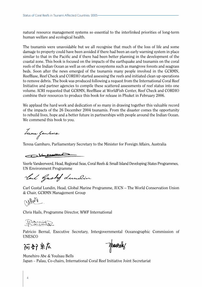
The tsunamis were unavoidable but we all recognise that much of the loss of life and some damage to property could have been avoided if there had been an early warning system in place similar to that in the Pacific and if there had been better planning in the development of the coastal zone. This book is focused on the impacts of the earthquake and tsunamis on the coral reefs of the Indian Ocean as well as on other ecosystems such as mangrove forests and seagrass beds. Soon after the news emerged of the tsunamis many people involved in the GCRMN, ReefBase, Reef Check and CORDIO started assessing the reefs and initiated clean up operations to remove debris. The book was produced following a request from the International Coral Reef Initiative and partner agencies to compile these scattered assessments of reef status into one volume. ICRI requested that GCRMN, ReefBase at WorldFish Center, Reef Check and CORDIO combine their resources to produce this book for release in Phuket in February 2006.
We applaud the hard work and dedication of so many in drawing together this valuable record of the impacts of the 26 December 2004 tsunamis. From the disaster comes the opportunity to rebuild lives, hope and a better future in partnerships with people around the Indian Ocean. We commend this book to you.
Teresa Gambaro, Parliamentary Secretary to the Minister for Foreign Affairs, Australia
Veerle Vandeerwerd, Head, Regional Seas, Coral Reefs & Small Island Developing States Programmes,UN Environment Programme
Carl Gustaf Lundin, Head, Global Marine Programme, IUCN – The World Conservation Union & Chair, GCRMN Management Group
Chris Hails, Programme Director, WWF International
Patricio Bernal, Executive Secretary, Intergovernmental Oceanographic Commission of UNESCO
Munehiro Abe & Youlsau Bells Japan – Palau, Co-chairs, International Coral Reef Initiative Joint Secretariat

5
abstraCt
The major findings of the 60 authors and contributors of this Status of Coral Reefs in Tsunami Affected Countries: 2005 were that:
zx On 26 December 2004, a major earthquake off Sumatra and a series of secondary earthquakes throughout the Andaman and Nicobar Islands caused many simultaneous tsunamis that radiated around the Indian Ocean;
zx The tsunamis arrived as huge surges of water that powered over the coral reefs to smash on the land, resulting in enormous loss of life and destruction of property;
zx Damage to the coral reefs in the Indian Ocean was patchy, site dependent and heavily influenced by local environmental conditions such as coastal bathymetry and damage on land and;
zx Most of the damage to coral reefs resulted from sediment and coral rubble thrown about by the waves, and smothering by debris washed off the land;
zx Coral reef damage was greatest in Indonesia, Thailand, the Andaman and Nicobar Islands, and Sri Lanka, whereas there was little damage in countries further away from the source of the tsunamis because much of the wave energy had dissipated;
zx Most of the coral reefs of the region, however, escaped serious damage and will naturally recover within 5 to 10 years providing that effective management is implemented to reduce damage from human activities;
zx A small number of coral reefs were significantly damaged and may take 20 or more years to recover; and they may not return to the previous structure;
zx The major threats to the coral reefs of the Indian Ocean continue to be from human activities, such as over-fishing, deforestation and climate change. These were far more damaging to coral reefs than the tsunami;
zx Immediately following the tsunami, many in the local community and volunteers organised beach and reef clean up activities to minimise damage to the coral reefs from debris;
exeCutIve summAry, ConClusIons
And reCommendAtIons
Clive Wilkinson, DaviD souter anD Jeremy GolDberG

�
Status of Coral Reefs in Tsunami Affected Countries: 2005
zx The coral reefs absorbed some of the tsunami energy, thereby possibly providing some protection to the adjacent land, however, mangroves and coastal forests afforded the most protection to infrastructure on the land and probably reduced the loss of life in these areas;
zx Damage to mangroves was highly variable, ranging from little damage in many areas, to the destruction of entire forests in some areas, such as Aceh province;
zx Seagrass beds were largely unaffected, although some areas were either eroded or smothered by sediments; and
zx The major recommendations call for: the establishment of an early warning system; capacity building in integrated coastal management; improved fisheries management and coral reef monitoring; the establishment of more marine protected areas; careful reparation and rehabilitation of tsunami damage; and the development of stronger national oceans policies.
oriGin of the report This report on the effects of the tsunamis of 26 December 2004 on the coral reefs of Indian Ocean countries compiles and summarises many reports and reef damage assessments into a single volume and also makes the findings, especially the recommendations, available for decision makers and people of the region. The tsunami occurred 16 days after the Status of Coral Reefs of the World: 2004 report was released in Washington D.C. The partners in the International Coral Reef Initiative requested that the Global Coral Reef Monitoring Network in partnership with Reef Check, ReefBase and the CORDIO (Coral Reef Degradation in the Indian Ocean) program update that report with a focus on the affected countries and assemble recommendations on how to mitigate similar disasters in the future.
The primary earthquake was the world’s largest seismic event in the last 40 years. This earthquake, measuring between 9.15 and 9.3, originated about 30 km deep within the earth’s crust off the coast of Sumatra, Indonesia. It set off a ‘chain reaction’ with the rupture of a 1,200 km segment of fault running northward through the Andaman and Nicobar Islands resulting in a wave of secondary earthquakes. The total energy released was equivalent to a 100-gigaton bomb, more than 1,500 times that of the largest nuclear bomb ever detonated and 100 times the energy of the 1906 San Francisco earthquake. These earthquakes resulted in major uplifts and subsidence of the ocean floor and displaced more than 30 cubic kilometres of seawater. The subsequent tsunamis were the most devastating in recorded history: between 229,000 and 289,000 people were killed; more than 1 million were displaced; and regional damage estimates exceed several billion dollars. The devastation was unparalled in modern times, causing major economic disruption for the countries of the Indian Ocean and serious, but short-term damage to tourism, primary and secondary industry sectors.
Immediately following the disaster, there was considerable concern amongst local and international communities, scientists, governments and NGOs regarding the potential impact of the tsunami on the coral reefs. This was particularly important because of the crucial role that reefs play in providing food and livelihoods for millions of people. There was a rapid response in most countries, assisted by UN agencies, NGOs and by ICRI and GCRMN partners to assess the damage and especially to remove the debris from the reefs, and thus prevent further damage. These assessments are assembled into this report.

�
Executi�e Summary, Conclusions and Recommendations
The Executive Summary provides a brief overview of:zx the sequence of events that resulted in the earthquakes and tsunamis;zx how the tsunami impacts compare with other natural and human stresses; zx the effects of the Indian Ocean tsunami on coral reefs and other ecosystems (in the
national chapters); andzx recommendations for policies and rebuilding activities to ensure a sustainable
recovery of the natural ecosystems.
the indian oCean earthquakes and tsunaMis There was no point on Earth which was not disturbed by the 26 December 2004 earthquake and subsequent tsunamis. The origins of the tsunamis can be traced back to the break up of the super-continent Gondwanaland several hundred million years ago. The gigantic Indian and Australian tectonic plates moved northward at approximately 6 cm per year and collided with the Eurasian super-continent, and this has resulted in major zones of stress where the plates subduct (slide) under the Eurasian plate. Enormous quantities of energy accumulate over decades to centuries resulting in the compression and deformation of the plates. This energy is released as earthquakes when the friction bonds break; larger earthquakes may displace the seafloor vertically and form tsunamis.
A tsunami is defined as a ‘natural phenomenon consisting of a series of waves generated when water is rapidly displaced on a massive scale’. Tsunamis are among the most terrifying natural hazards because they can originate from distant events and occur without any apparent warning. Tsunamis have particularly long wavelengths and travel at high speeds over great distances while losing little energy. Thus they are difficult to detect from the air or by ships, although radar satellites can detect the subtle changes in the ocean height indicative of tsunamis. As a tsunami approaches shallow waters, the velocity of the waves decreases with minimal loss of energy, such that the waves increase in height, which enables them to penetrate far inland, causing severe damage to infrastructure and coastal vegetation.
The earthquake on 26 December released enormous pressures that had accumulated in the zone where the Indian and Australian Plates pushed up against and were sliding under the Eurasian Plate off northern Sumatra. The surface epicentre was near the island of Simeulue and is now evident as a 2 - 3 m uplift at the northern end of the island, while the southern end subsided by a similar amount. The pressure released during the primary earthquake transferred the energy towards the northwest along the fault zone line between the Indian and Eurasian plates, causing a series of earthquakes measuring up to 7.5 through the Andaman and Nicobar Islands over the following 8 minutes. These earthquakes released the compression in the Burma Sub-Plate uplifting the northern end of the Andaman Islands by 1 - 3 m, while the southern part of the Nicobar Islands subsided by an equivalent amount.
Thus, the damage on 26 December was not caused by a single earthquake–tsunami event, but by a series of tsunamis that were generated as very large areas of the Sumatra and Burma sub-plates (off the Eurasian Plate) were either uplifted or subsided. These tsunamis then spread outward around Sumatra, eastward to Thailand and Malaysia, and westward to India, Sri Lanka and then out into the Indian Ocean. This complex pattern of several tsunamis being generated at widely different locations over an 8 minute period provides a partial explanation why some

�
Status of Coral Reefs in Tsunami Affected Countries: 2005
areas experienced massive waves, whereas adjacent areas were only slightly affected. If 2 tsunamis arrived simultaneously at a location, there was an augmentative effect, giving rise to very large waves; whereas if they were out of sequence, the waves cancelled each other, thereby reducing the wave size and contained energy. This pattern was seen along the coast of Thailand where some areas such as Khao Lak were hit by a series of waves to 10 m height, whereas areas to the north and south received 1 - 3 m waves that resulted in little damage.
Another major 8.7 strength earthquake followed on 28 March 2005 approximately 200 km to the southeast along the coast of Sumatra near the island of Nias. While this earthquake caused massive loss of life and damage on land, it did not generate a tsunami.
the iMpaCts of tsunaMis and other stresses on Coral reefs
The earthquake on 26 December resulted in major, but localised damage to some coral reefs e.g. the example on the cover of this report. Damage occurs when an earthquake fractures the reef and shatters fragile corals or causes a coral reef to be uplifted out of the water (Simeulue Island, Sumatra and Andaman Islands). The tsunamis following the earthquakes damaged coral reefs through 3 mechanisms: wave action which dislodged, smashed and moved coral and rubble; smothering of corals by increased sediment movement; and mechanical damage and smothering by debris from the land. The effects were very localised with some areas seriously damaged, whereas large areas of adjacent coral reef were either slightly affected or undamaged.
In most of these countries, the tsunami washed directly over coral reefs, which may have provided some limited protection to the land behind. There is anecdotal evidence that there was more damage on land behind coral reefs that had been extensively mined e.g. in Sri Lanka than in areas where the reefs were intact. However, the protection was minimal where the waves were particularly large. In contrast, mangrove forests and other coastal vegetation were particularly effective in minimising the damaging effects of the waves on land and also in trapping large items of debris.
Tsunamis and earthquakes are natural stresses that damage reefs and have affected coral reefs for millions of years. Coral reefs have evolved with these stresses, along with volcanoes, tropical storms, freshwater inundation, plagues of predators and diseases. They normally recover naturally if the stresses are not too severe, repetitive, or compounded by other threats.
In all of the Indian Ocean countries, the tsunamis have caused less damage to coral reefs than the cumulative direct anthropogenic stresses such as over-fishing, destructive fishing, sediment and nutrient pollution, and unsustainable development on or near them. Moreover, many of the coral reefs in these countries were extensively damaged during the El Niño global climate change event of 1998, when about 90% of the world’s corals were killed by coral bleaching. The tsunamis have compounded the damage from 1998 by killing some newly settled corals and by hurling around the coral rubble produced after much of the live coral was killed by coral bleaching. Other climate change factors, such as a potential increase in storm strength and frequency and an increase in ocean acidity, pose greater threats to reefs in the future than natural disturbances.

�
Executi�e Summary, Conclusions and Recommendations
The most important conclusion from most countries was that there was insufficient awareness of the value of ecosystem goods and services and management capacity to conserve the coral reefs and mangroves from ongoing human damage. While the tsunami resulted in some severe impacts, ongoing human pressures, such as deforestation and destructive fishing practices, prior to the tsunami caused more damage than the tsunami. All countries recommended stronger conservation and protection of their coral reefs and other coastal resources to guarantee the sustainable provision of goods and services and also to enhance their resistance and resilience against natural disturbances.
status of Coral reefs by Country
Indonesia (Chapter 3): The primary earthquake off northern Sumatra generated a massive tsunami with a series of waves as high as 30 m that smashed onto the adjacent coasts and caused catastrophic damage to the Acehnese people and their infrastructure. The estimates of deaths range from 170,000 to 220,000. The greatest damage to Aceh Province was in Meulaboh to Banda Aceh, Aceh Besar and Aceh Jaya. Almost half of the Acehnese fishermen died and about 40,000 homes were lost. Approximately 65 - 70% of the small-scale fishing fleet was lost, virtually all of the aquaculture areas were destroyed. The Indonesian government assessed that there was 30% damage to 97,250 hectares of coral reef at a net loss of $US 332.4 million, however, there was little baseline information on the status of coral reefs in northern Sumatra. Reefs near the epicentre on Simeulue Island were uplifted out of the water and killed, whereas nearby deeper reefs were apparently unaffected. On other reefs there was substantial mechanical damage, mainly due to debris and sediments washed off the land. The tsunami damage was in addition to considerable prior damage from human activities, especially destructive fishing including bomb fishing. In most places these prior human impacts have exceeded damage due to the tsunami. It was also estimated that approximately 600 hectares of seagrasses were destroyed, along with large areas of mangroves, possibly as much as 85,000 hectares destroyed. It is estimated that most of the reefs and seagrass beds will recover in approximately 10 years provided that damaging human activities are minimised and mangrove forests are replanted.
Malaysia (Chapter 4): Malaysia escaped most of the tsunami damage because it was shielded by Sumatra and received only secondary waves, there were 68 deaths however, and considerable property damage in fishing villages with 232 fish farmers being affected. There was little structural damage to the coral reefs and most areas were largely unaffected. Some erosion occurred on upper reef slopes and reef crests, with minor sediment re-suspension and physical damage to corals; deeper water reefs were not damaged. The tsunami highlighted the lack of documented information on the pre-tsunami status of Malaysian coral reefs.
Thailand (Chapter 5): The Andaman Sea coast was directly opposite the sites of the secondary earthquakes in the Andaman and Nicobar islands, and hence was seriously damaged by a series of tsunamis. The official death toll is 5,395 with another 2,932 listed as missing. Damage to the coral reefs was highly variable. Approximately 13% of reefs were severely damaged, whereas 61% were either not damaged or only slightly damaged. Reef damage was caused by the waves dislodging, breaking and moving corals, and by smothering and abrasion by sediments and debris washed off the land. It is estimated that most coral reefs will recover naturally and relatively rapidly as there are large areas of healthy corals. Much of the land sourced debris was removed soon after the tsunami following a concerted effort by Thai nationals. The tourism industry was heavily affected by the tsunami and there was substantial damage to fisheries

�0
Status of Coral Reefs in Tsunami Affected Countries: 2005
infrastructure. There was little damage to the mangrove forests and less than 5% of seagrass beds were affected.
Myanmar/Burma (Chapter 6): The tsunami caused minimal to no damage in Myanmar, although 61 people died. There were no reports of damage to the coral reefs in the Myeik (Mergui) archipelago, with most reports coming from dive operators present in the area when the tsunamis hit. A Reef Check expedition confirmed that the damage to the coral reefs was minimal.
India (Chapter 7): There was major damage to the coastal areas of southeast India and especially to the Andaman and Nicobar Islands. The secondary earthquakes occurred throughout these islands with entire reefs uplifted vertically out of the ocean (in the northern Andamans), whereas other reefs were thrust downwards several metres (in the southern Andamans and Nicobars). Mainland coral reefs were largely unaffected and suffered no severe degradation; damage was localised and negligible. There was major erosion on land and many reefs have been damaged by sediments and debris; but data are few. Many beaches were seriously eroded which may interfere with turtle nesting. It is anticipated that the majority of the affected reefs will recover within 5 years, assuming that human threats can be minimized by sustainable management and enforcement of legislation.
Sri Lanka (Chapter 8): The tsunami that affected Sri Lanka arrived from both Sumatra and Andaman and Nicobar Islands. The waves first struck the northeast coast near Trincomalee and then wrapped around the island to impact on the southwest coast. This resulted in major loss of life (31,000) and substantial structural damage. Damage to the coral reefs of Sri Lanka was highly variable. Reefs on the east and northeast coast were severely damaged, while reefs on the northwest coast were generally unaffected. Corals were damaged at all sites on the reefs of Tangalle, Kudawella, Kapparatota/Weligama, Polhena, Unawatuna, and Hikkaduwa. However, the damage was patchy and frequently caused by the movement of rubble from corals killed by the bleaching in 1998. In other areas, live branching and massive colonies (up to 50 cm) were toppled, while others were smothered by resuspended marine sediments. There was severe, but patchy, beach erosion on many coasts which was exacerbated by extensive, illegal coral mining in the area. Corals facing the open ocean sustained more damage than those within lagoons
Maldives (Chapter 9): The tsunami arrived as large surges of water that flowed over the low coral cays of the Maldives causing major damage to infrastructure and the tourism industry. There were 82 reported deaths, with 26 listed as missing, and economic losses amounting to US$480 million; more than 35% of the national GDP. Direct damage to coral reefs appears to be minor, but there were poor baseline data on biodiversity and ecosystem condition prior to the disaster. The most significant effects of the tsunamis were a surge in illegal harvesting of coral for re-rebuilding and declines in revenue from tourism.
Seychelles (Chapter 10): The tsunami had lost considerable energy by the time the waves struck the Seychelles; the death toll was 3 and estimates of the economic losses are US$30 million for damage to houses, beaches, coastal vegetation, roads and bridges. Torrential rain immediately after the tsunami added to the damage by causing extensive flooding in the low lying areas of Mahé, Praslin and La Digue. The tsunami had negligible impacts on the coral reefs of the inner Seychelles; however, there were a few sites with significant local damage.

��
Executi�e Summary, Conclusions and Recommendations
The severity of the damage depended on the degree of exposure, the local bathymetry, the geological composition of the reef and its condition. Only the coral reefs in the direct path of the tsunami or those growing on degraded coral rubble formed after the 1998 bleaching were damaged. Little damage occurred on consolidated carbonate reefs or on granitic islands. The reefs around Mahé where sheltered to some degree by the outer northern islands.
East Africa and Yemen (Chapter 11): There were variable impacts on the countries of the region with fatalities recorded in Somalia (298), Yemen and Socotra (1), Tanzania (3) and Kenya (1). There was only minor physical damage to coral reefs in Tanzania and Kenya; one large coral was toppled in Kiunga Marine National Reserve and none of 300 individually marked colonies in the shallow lagoon area of Mombasa were damaged. Damage to coral reefs in Somalia is presumed to be similar to nearby regions, and only minor damage was recorded on Socotra. The reefs and coastal areas of East Africa and the islands were saved from damage by the large distances from the origin, the protection by the Seychelles, Cargados Carajas and Saya de Malha Banks in the middle of the Indian Ocean, and because the waves arrived during low tide.
hope for a sustainable future: ConClusions and reCoMMendations The authors and contributors to this report have made the following requests and suggestions to national governments and international agencies for improved management of coastal resources based upon the lessons learned during and after the tsunami.
Early Warning Systems: Many lives could have been saved on 26 December 2004 if there had been a tsunami early warning system in countries of the Indian Ocean similar to the operational one in the Pacific Ocean. Often there was considerable time available to issue warnings, but there was no mechanism to transmit those warnings to the people. Similarly the people in these countries had not been given adequate education of the dangers of tsunamis that follow earthquakes, despite a long history of earthquakes that have occurred from the subduction zone off Sumatra. There are many stories of people who felt the earthquakes and then ventured onto the reef flats as the waters receded; this should have been a clear signal that a tsunami was likely to follow.
Recommendation 1: that governments and international agencies be supported in the development of interactive, early warning systems for all countries of the Indian Ocean that employ recent technology and warn of impending danger through mobile phone networks, public address systems, radio and television; Recommendation 2: that governments be encouraged to develop coastal vulnerability and habitat mapping to ensure that developments only occur in secure areas, with exclusion zones prohibiting development declared to protect their peoples and economies from future tsunamis, tropical storm surge and rising sea level damage; Recommendation 3: that governments and international agencies develop basic shoreline monitoring and research programs to promote understanding of seasonal and long-term trends in sediment transport and erosion, and the role that ecosystems play in providing coastal protection;Recommendation 4: that governments protect coral reefs, mangroves, coastal forests, and dunes, by ensuring the secure disposal of solid wastes, waste oil and pesticides.

�2
Status of Coral Reefs in Tsunami Affected Countries: 2005
Capacity Building and Awareness Raising: Coastal communities in Indonesia, Thailand and the Andaman and Nicobar Islands which retained traditional knowledge of the potential danger from tsunamis were able to flee the destructive waves. They interpreted the warning earthquake signs and receding coastal waters and moved to higher ground. There were also isolated examples of people who had received prior education on the dangers and warned others of impending danger; however large numbers of people were unaware of the dangers and perished as a result.
Recommendation 5: that governments develop coastal education and awareness programs to prepare communities and involve them in coastal preparedness and disaster response procedures;Recommendation 6: that traditional knowledge be reinforced by incorporating it into education curricula with a focus on threats to coastal resources and the need for proactive management;Recommendation 7: that governments and international agencies develop training programs to build local capacity in ecosystem management, including fisheries management, socio-economic monitoring and the development of alternative livelihoods.
Rehabilitation of Coral Reefs and Mangrove Forests: Fortunately, the damage to the coastal resources in most countries was minimal with only a few areas severely damaged. Most coral reefs will recover naturally in 5 to 10 years provided that other damaging stresses are removed. The critical issue was to remove debris and most countries implemented urgent clean up operations. Similarly, mangrove forests that have only been slightly damaged will re-seed themselves and recover. However there may be a need to replant areas that have been cleared or severely damaged by the tsunami. There have been approaches to some countries with offers to repair coral reefs using ‘electric’ technology or placement of concrete blocks. The International Coral Reef Initiative has advised that caution be applied before these procedures are introduced as they are small-scale, unproven, expensive, divert attention from effective management, and may prove destructive in the long-term.
Recommendation 8: that governments and international agencies continue to clear debris from beaches, coral reefs and mangrove forests to prevent further damage and facilitate more rapid recovery of the ecosystems. These procedures should be integrated into effective waste disposal (see Recommendation 4);Recommendation 9: that governments and international agencies reduce human stresses on coral reefs in order to promote conditions that favour natural recovery of coral reefs and exercise caution about introducing unproven and expensive technology promoted to repair damaged coral reefs. Replanting of coastal mangrove forests may be necessary in severely damaged areas.
Sustainable Coastal Rehabilitation and Rebuilding: The scale of the tsunami damage in these Indian Ocean countries has necessitated urgent reconstruction measures and the re-establishment of livelihoods; however, there have been some inappropriate examples. In some countries, timber to build houses has been sourced from nearby forests, including some that were formerly protected. Sand and rock has been collected from coral reefs for building material; even though this is illegal. There has been considerable effort by aid donors to provide replacement fishing boats and gear, however, there is a risk that unwise rehabilitation may lead to unsustainable results in the future, such as: landslides in the former forests and sediments flooding onto reefs; mined coral reefs with reduced potential to protect shorelines from storm

��
Executi�e Summary, Conclusions and Recommendations
surges; and over-fishing with the use of larger and more powerful boats and more efficient fishing gear leading to collapses in fish stocks.
Recommendation 10: that reconstruction material should be drawn from sustainable sources and not from local protected areas or steep forested hills; sand and rock should not be dredged or mined from coral reef flats; and replacement fishing equipment should match the gear that was lost, with a diversion of some of the excess fishing effort into the development of alternative livelihoods; Recommendation 11: that rebuilding should, wherever feasible, be set back behind the coastal forests and dunes to provide a buffer against future storm surges, tsunamis and sea level rise, and that the replacement buildings be built to storm resistant standards.
Integrated Coastal and Catchment Management: The coral reefs will recover if the ongoing level of human and natural stress is not excessive. However, the community structure of some of the more damaged reefs may differ from the original reef. Effective management can reduce the impacts of human activities, but the natural stresses are beyond human intervention. Therefore, effective integrated coastal and catchment management will provide the best conditions for reef recovery and will also provide the reefs with the potential for greater resistance and resilience against future stresses like the Indian Ocean tsunamis. Effective management will also assist these countries to ensure that their reefs continue to provide sustainable yields of resources for their people and economies.
Recommendation 12: that governments develop stronger partnerships between all major stakeholders, government institutions and NGOs, and especially with local communities through stronger communication, exchanges of lessons learned, devolution of some authority for local management, enforcement of regulations for integrated management, and the control of damaging practices; Recommendation 13: that governments involve communities in decision making on marine and coastal rehabilitation, and policy and legislation development to reduce the impact of similar catastrophes in the future;Recommendation 14: that governments implement integrated coastal and catchment management to minimise damage from land-based activities that cause sedimentation, nutrient pollution and over-exploitation, particularly during the intense reconstruction phase; Recommendation 15: that governments increase efforts in policing and enforcing legislation and regulations aimed at the sustainable use of natural resources e.g. controlling illegal resource extraction, particularly blast fishing and coral mining;Recommendation 16: that tourism development be managed to ensure sustainable long-term benefits for the government and communities through establishing carrying capacity levels, enforcing pollution regulation laws, and ensuring that local communities benefit from activities by achieving meaningful employment and associated economic activities.
Sustainable Fisheries and Rehabilitation: Prior to the tsunami, most countries reported over-exploitation of marine resources and considerable use of destructive fishing methods (blast and poison fishing, trawling and the use of push nets near reefs, and small mesh nets and traps) such that fisheries stocks were near collapse in many areas. The destructive effect of the tsunami has reduced fishing capacity, smashed boats and gear, and affected the livelihoods of many thousands of people. Thus a balancing act is required to re-establish employment for the fishers, while introducing sustainable fishing practices and economic incentives to ensure

��
Status of Coral Reefs in Tsunami Affected Countries: 2005
that illegal methods are controlled so that communities will have sustainable fisheries benefits in the future. Many of the replacement boats and motors provided by donors use different technology and are more efficient than those used previously, which has meant that a sector of the community involved in boat building and repairs and in motor maintenance are either unemployed or lack the skills and equipment to practice former occupations.
Recommendation 17: that governments advise communities on sustainable fishing practices and provide economic incentives to reduce illegal and damaging activities and assist in developing alternative livelihoods to reduce the pressures on reef resources;Recommendation 18: that aid donors be alerted to the potential of introducing inappropriate technology and increasing fishing capacity into already threatened fisheries sectors. They are encouraged to seek advice from experienced environment or fisheries managers;Recommendation 19: that governments assess stocks and trends in economically important reef and pelagic fishes to assist in developing sustainable fisheries, and develop or strengthen regulations to ensure sustainability e.g. by introducing certification schemes. Such assessments should include the identification of socially acceptable and sustainable livelihoods for coastal populations.
GENDER EQUITABLE AID TO TSUNAMI VICTIMS?In the developing countries of the Indian Ocean, the December 26 tsunami affected mostly poor, coastal, patriarchal societies in which women are usually economically weaker and culturally subordinate to men. Since men and women play different roles in the fishing economy and in the home, the disaster affected them differently as the vulnerability of women depends greatly on their social, cultural and economic status. In these communities, the traditional role of women is to nurture and to provide care to the old, the young and the injured. After the tsunami struck, many women who survived the tragedy had increased workloads due to the numerous amounts of injured and ill people. Futher, these women also suffered disproportionally from the indirect impacts of private and public life, as the disaster was compounded by economic, political and family relationships. Aside from their primary duties, wives and daughters in fishing communities also usually have to help in the family business by complementing the work of their fishermen husbands or fathers. As such, they help to unload fish, clean and mend nets, vend fish, process fish, and look after livestock, cultured fish and field crops. In almost all instances, the unpaid work or the income from the women go a long way to help the family to stave off poverty. Yet the immediate plans of most governments in the affected regions were focussed on rebuilding the fisheries, with minimal help reaching the women to assist them to rebuild their own livelihoods. To support long-term economic recovery, women as well as men must have access to financial aid for job reconstruction. When these women’s livelihoods are destroyed, compensating solely the fishermen may throw many homes into deeper poverty. Empowering women will increase their resilience and reduce their vulnerability to future disasters. Helping women gain confidence and self-esteem will assist them to take control of their own lives and decrease their vulnerability in times of crises (from Choo Poh Sze, WorldFish Center, [email protected]).

�5
Executi�e Summary, Conclusions and Recommendations
More Marine Protected Areas within Networks: MPAs are considered as ‘ecological insurance’ against acute and chronic disturbances. The most effective and proven mechanism for conserving coastal resources is through the development of a network of MPAs that include significant no-take areas and linking these together so that supplies of larvae are conserved for ‘downstream’ areas. Many of the countries of the Indian Ocean have designated MPAs to conserve coral reefs; however few have effective management plans and enforcement of legislation, such that the resources continue to decline.
Recommendation 20: that governments continue to develop and improve MPA design and legislation to ensure better coral reef protection within expanding network of MPAs; Recommendation 21: that governments develop specific cross-sectoral MPA legislation which is administered by a dedicated department with well-trained human resources and financial and logistic support; Recommendation 22: that governments include adjacent islands and coastal areas into MPAs as buffer zones with regulations enforced to reduce damage from illegal and destructive activities and land-based pollution; Recommendation 23: that governments are encouraged to ensure that local communities be supported to participate in resource management, especially the planning and monitoring of MPAs and provided with control and ownership of resources; Recommendation 24: that governments and international agencies are requested to repair facilities in existing MPAs by replacing damaged mooring buoys and monitoring equipment, and strengthening enforcement patrols to reduce damaging activities.
Coral Reef Monitoring and Databases: These Indian Ocean countries were inhibited in their ability to conduct valid assessments of the damage by the tsunami to coral reefs because there were inadequate baseline data on the affected areas or that the existing data on coral reef status were scattered throughout many different government agencies, research institutes and universities. Thus much of the information on reef status in this report is based on rapid assessments of damage or anecdotal reports from tourism operators and sports divers.
Recommendation 25: that governments develop and maintain ecological and socio-economic coral reef monitoring, and collaborate with universities and NGOs to ensure that all data are collated into centralised databases to assist in the conservation and management of coral reefs and to assess potential for long-term recovery;Recommendation 26: that governments develop stronger community and government partnerships to improve coral reef monitoring, data systems and sharing of information to determine long-term trends in coral reef health in order to improve management of social and ecological aspects.
Oceans Governance and Policy Development: The tsunami has alerted governments around the Indian Ocean to the value and importance of their coastal resources, especially the coral reefs and mangrove forests. The tsunami also demonstrated that legislation and monitoring efforts were too weak or fragmented across too many different departments and management agencies. Most countries did not have well developed national oceans policies in place to manage their coastal resources sustainably. Many people have requested that the opportunity presented by the tsunami should be used to strengthen national policies and legislation, and involve local communities in the conservation and management of their coastal resources.
Recommendation 27: that governments develop national oceans policies to ensure that all sectors of government and the community share the common objectives of conserving coastal and marine resources for future generations;

��
Status of Coral Reefs in Tsunami Affected Countries: 2005
Recommendation 28: that governments develop stronger legislation through a single management agency and improve monitoring, especially to monitor and assess the effectiveness of natural resource management; Recommendation 29: that Indian Ocean governments and international agencies develop regional networks to exchange information and share expertise in order to improve regional cooperation and coordination for the future conservation of coral reefs.
The authors of this report urge that these recommendations be given serious consideration and implemented, thereby seizing the opportunity presented by the tragic tsunami event of 26 December 2004 of focusing global attention on the need for the sustainable management and conservation of coral reefs and other coastal resources.

��
suMMary
zx The Indian Ocean tsunami originated from a 9.15 - 9.3 magnitude earthquake in Sumatra that released pressure which had built up over hundreds of years along the fault between 2 tectonic plates;
zx In the 10 minutes after the fault break started off northwest Sumatra, the rupture spread north along a 1,300 km length of the fault line to the Andaman and Nicobar Islands;
zx The tsunami generated many waves because the earthquake caused a sudden vertical displacement of a vast section of the ocean floor, displacing a huge mass of seawater;
zx Tsunamis passing through the deep ocean are difficult to detect, can exceed speeds of 600 km/hour, and arrive at coasts thousands of kilometres from the earthquake as high energy, long wavelength waves;
zx The waves slow as they encounter the continental shelf, bays, islands or estuaries and increase in height; thereby causing massive damage when they reach the shoreline;
zx The Indian Ocean tsunami was not the first of this type in the region and more will occur in the future; and
zx Natural hazard risk analyses should be undertaken and an early warning system implemented to better prepare vulnerable coastal communities for environmental threats in the future.
introduCtion
The 26 December 2004 earthquake off northwest Sumatra, Indonesia was the largest seismic event on Earth in more than 40 years. The earthquake originated 30 km below the sea floor off the coast of Sumatra and triggered the rupture of a 1,300 km segment of the fault line between the Indian and Eurasian tectonic plates that extended through the Andaman and Nicobar Islands. The energy released was equivalent to a 100-gigaton bomb, over 1,500 times that of the largest nuclear bomb ever detonated and 100 times the energy of the 1906 San Francisco
1. eArthquAkes, PlAte teCtonICs And the IndIAn oCeAn tsunAmI
Phil Cummins anD Jeremy GolDberG

��
Status of Coral Reefs in Tsunami Affected Countries: 2005
earthquake. This earthquake on the sea floor displaced more than 30 cubic kilometres of seawater and formed the most devastating tsunami in recorded history; more than 230,000 people were killed, and more than 1 million have been displaced in the affected countries in Southeast and South Asia and Eastern Africa. The tsunami has caused major economic losses in many of the Indian Ocean countries, devastating primary and secondary industries and disrupting the tourism economy. The impacts of this event were truly global; the tsunami was observed in all oceans of the world and the whole earth continued to ‘ring’ from the shock of the earthquake for months afterward. This chapter provides a brief summary of the origin of the earthquake and subsequent tsunami.
The technical details of the initiation of the Great Sumatra-Andaman Earthquake. The magnitude includes all activity over the next 10 minutes when the earthquake progressed in a northwest direction for 1,300 km to the northern Andaman Islands (from www.earthquake.usgs.gov).
Magnitude 9.15 - 9.3
Date 26 December 2004
Time 00:58:53 (UTC) Coordinated Universal Time(7:58:53 am local time at epicentre)
Location 3.307° North , 95.947° East
Depth 30 km (18.75 miles)
Region Off of the western coast of northern Sumatra, Indonesia
Distances to major population centres
255 km (155 miles) SW of Banda Aceh, Sumatra, Indonesia 310 km (195 miles) W of Medan, Sumatra, Indonesia 1,260 km (780 miles) SW of Bangkok, Thailand 1,605 km (990 miles) NW of Jakarta, Java, Indonesia
What is a tsunaMi?Tsunami is a Japanese word – tsu, 津, meaning ‘harbour’ and nami, 波 or 浪, meaning ‘wave’ – that is now used worldwide to denote a large sea wave generated by a sudden vertical displacement of the sea surface. This displacement of water may be caused by undersea earthquakes, landslides, major volcanic eruptions, or large meteorite impacts. Once a large volume of the ocean is displaced vertically, the disturbance spreads outward in a tsunami as the ocean attempts to re-establish its gravitational equilibrium. When the horizontal scale of the disturbance is much greater than the water depth, the whole column of water from surface to seafloor moves coherently in a horizontal direction. Typically a large tsunami will pass over the deep ocean as a small wave, often less than one metre high, but travelling at speeds of 600 km/hour or more. Thus it may pass under ships without notice, which is why Japanese fishermen coined the name to describe a wave that had destroyed their homes on land, whilst they had not noticed anything at sea. As the tsunami approaches shallow water, it slows down and increases dramatically in amplitude, sometimes reaching tens of metres in height.
The physics of tsunamis is that of shallow-water waves, because they have long periods (the time between 2 successive waves) and wavelengths (the distance between 2 consecutive waves). However, they are very different from the wind-generated waves which are the normal ocean waves. Wind-generated waves only cause water movement near the sea surface with typical periods of 10 - 20 seconds and wavelengths of 100 - 200 m. In contrast, tsunamis involve water movement all the way to the seafloor (e.g. 3 - 4 kilometres depth in the deep ocean), with

��
Earthquakes, Plate Tectonics & the Indian Ocean Tsunami
periods of 10 - 60 minutes and wavelengths of 100 km or more i.e. they involve the movement of much larger masses of water. The destructive force occurs when the energy contained in a wave thousands of metres deep is concentrated in the shallows of the continental shelf, and particularly in shallow estuaries.
Although a tsunami large enough to affect an entire ocean basin is a rare event that may occur once in a generation, large tsunamis almost always cause major damage because they can efficiently transport energy over great distances at high speed. Tsunamis are among the world’s most terrifying natural hazards as they may originate from a distant, unseen and unfelt source, and thus can arrive without apparent warning. Many past tsunamis have been responsible for major losses of life and property. Thus, they may be deeply embedded in folklore and are thought to have caused major disruption to some societies, such as the demise of the Minoan civilisation, which may be attributed to the eruption of the Santorini volcano and the ensuing tsunami around 1500 BC. Although the Pacific Ocean has the highest frequency of tsunamis of all the world’s oceans, tsunamis have also caused considerable destruction in the Mediterranean Sea and the Indian and Atlantic Oceans.
tsunaMis and subduCtion Zone earthquakes
The earthquake and tsunami of 26 December took place along a major tectonic feature on the Earth’s surface termed a ‘subduction zone’. These zones are created because the Earth’s surface is in constant motion as the outer rock ‘carapace’, termed the lithosphere, is created and destroyed. This outer carapace is composed of a number of rigid plates, which form along mid-ocean ridges and are destroyed at subduction zones, where the plates converge with one sliding beneath the other. This process of convergence and destruction is termed ‘subduction’, and plate boundaries along which the process is occurring are called ‘subduction zones’. The subduction zone where the 26 December 2004 earthquake occurred was formed due to the northward movement of the Indian and Australian plates that have been in motion since the break up of the Gondwana ‘super-continent’ between about 50 and 150 million years ago. As these plates moved northward at a rate of 6 to 7 centimetres per year (similar to fingernail growth), the oceanic lithosphere at their leading edges was driven into the Earth’s interior beneath the Eurasian plate along the Sunda Arc. This arc extends from Timor in the east, through southern Indonesia to the Andaman Islands in the northwest. While precise measurements of ground surface movement have established that the Indian and Australian plates are separate entities, the boundary between the 2 is so diffuse that it is not clear which plate is subducting (‘sliding’) beneath the northern part of Sumatra. However, it is known that the Indian plate is subducting beneath the Nicobar and Andaman Islands. The tectonic structure of the overriding plate is also complicated. Not only is the Sunda block (sub-plate), on which most of Sumatra lies, separated from the Eurasian plate to the north, but also the southwest edge of the Sunda block, is separated from the Indian and Australia plates by a microplate, that is often referred to as the Burma Microplate or the Andaman Sliver. Despite this complexity, the earthquake effectively originated from the combined pressure of the 2 plates (sometimes erroneously referred to as the ‘Indo-Australian plate’) subducting beneath Sumatra.
Subduction zones are typically characterized by intense geological activity. The subduction process pulls both the subducting plate and the overriding plate downward along the axis of the subduction zone, creating a deep trench. These marine trenches are the deepest parts of the

20
Status of Coral Reefs in Tsunami Affected Countries: 2005
ocean, ranging from 4 km deep at a shallow trench to 10 km deep at the Mariana Trench, east of the Philippines. The volatile elements dragged into the Earth’s hot interior at subduction zones induce melting of the sub-crustal material above the subducting plate, often leading to the development of a chain of active volcanoes in the overriding plate parallel to the axis of the subduction zone. Krakatoa is one such volcano among more than 100 other active volcanoes along the Indonesian archipelago (see the map in Chapter 2, p 36).
These volcanoes are also important sources of tsunamis. Prior to 2004, the only historically documented Indian Ocean-wide tsunami was produced by the 1883 eruption of Krakatoa. This tsunami killed 36,000 people in Indonesia and caused considerable damage throughout the Indian Ocean, including the Seychelles: “At 4:00 pm on the 27th of August, a tidal wave suddenly came rushing at about 4 miles an hour, and reaching a height of about 2 ½ feet above the usual high springs. It receded in about a quarter of an hour, leaving boats high and dry. It then returned, and the same thing continued all the next day, …” (H. W. Estridge, Collector of Customs at Mahé, Seychelles, 1883). Other large tsunamis in the Arabian Sea, Bay of Bengal, and the Indian Ocean between Java and Australia (see Table p 25), as well as the 2004 tsunami, have been caused by earthquakes in subduction zones.
When the ‘supercontinent’ Gondwana broke apart about 150 million years ago, 2 large tectonic plates, India and Australia, broke away and started sliding in a northerly direction at a very slow, but a very steady and powerful pace. They collided with the supercontinent of Eurasia, thereby setting up the conditions for the 26 December 2004 earthquake.

2�
Earthquakes, Plate Tectonics & the Indian Ocean Tsunami
Subduction zones are the source of 90% of the world’s earthquakes. Earthquakes occur when there is an almost instantaneous movement, either along the interface of the 2 converging plates or within the subducting plate as it bends and dives into the Earth’s interior. At depths shallower than 30 km, the rocks are brittle and when stresses build up, either within the plates or at the interface between them, there may be an instantaneous fracture that results in an earthquake. Inter-plate earthquakes are the result of movement at these shallower depths, where the contact between the plates exhibits ‘stick-slip’ friction, meaning that the friction pulls the upper plate downward, causing massive stresses to accumulate around the point of contact. An earthquake occurs when the stress exceeds the frictional forces, the temporary point of fusion breaks, and the upper plate ‘pops’ upward. This shallow interaction along the plate contact zone is called a thrust fault, the geological term for the contact between 2 rock masses pushing against each other. These subduction zone thrust faults are much larger than typical thrust faults and are called ‘megathrusts’. The large earthquakes which occur when the subduction zone plate boundary ruptures are called ‘megathrust earthquakes’. Because a continuous megathrust can extend for thousands of kilometres along the axis of a subduction zone, these faults produce the largest earthquakes. Of the 12 largest earthquakes since 1900, 11 were megathrust earthquakes.
Most megathrust zones occur in deep marine trenches, therefore the vertical rebound of the overriding plate at the fault rupture point displaces massive volumes of water, thereby generating a tsunami. Megathrust and (in exceptional cases) other submarine earthquakes are responsible for 75% of the world’s tsunamis.
These 3 diagrams illustrate the sequence of a subduction earthquake. In (a) the tectonic plate to the left is attempting to subduct under the plate to the right. However, due to frictional forces, it has temporarily fused with the top plate, causing both plates to be deformed, especially the top plate which is being bent in the direction of the 2 red arrows; when the friction bonds (wavy line) break during an earthquake (b), the plate to the right ‘springs’ back into its original position (red arrows are reversed), thereby displacing large volumes of water. This displaced water then spreads outwards as a tsunami (c).

22
Status of Coral Reefs in Tsunami Affected Countries: 2005
Corals as reCorders of subduCtion Zone earthquakes
The damage to coral reefs by the 2004 tsunami and the protective function of reefs on coasts is discussed in the following chapters. Corals, however, are particularly valuable in recording the precise amounts of uplift and subsidence associated with subduction zone earthquakes. Charles Darwin recognized that corals record vertical movement by noting that barrier reefs form on subsiding coasts, while marine terraces form on uplifting coasts. Dating of marine terraces formed as a result of uplift during earthquakes, has often provided valuable information on the size and frequency of large subduction zone earthquakes. This information is especially important in the Indian Ocean, where the recurrence time of subduction zone earthquakes is long compared to the historical record.
Individual coral colonies can also be used to measure vertical movement. Porites ‘microatolls’, large colonies growing in shallow water, can be used to measure uplift and subsidence at the scale of centimetres. This technique has been refined over the past 20 years, so that it is possible to estimate with confidence the sudden uplift and subsidence associated with earthquakes, and also the slower vertical movements that occur due to strain accumulation in the crust prior to an earthquake. Researchers used this technique to estimate subsidence prior to the 2004 Sumatra earthquake and were so alarmed by the measured rate of strain accumulation (as well as the size of past earthquake events recorded in the coral growth structure), that they started distributing pamphlets to coastal communities in Sumatra to warn of the danger. These studies now suggest that a high rate of strain is accumulating to the southeast of the Simeulue 2004 and Nias 2005 earthquakes, close the site of a massive earthquake in 1833; another major earthquake is thought to be imminent. Since the 2004 and 2005 Sumatra earthquakes, coral studies have provided valuable data on the vertical movements which occurred before and after these earthquakes.
the Great suMatra-andaMan earthquake of 26 deCeMber 2004This massive earthquake ruptured a 1,300 km segment of the Sunda Arc megathrust stretching from Sumatra (approximately 3°N) to the Andaman Islands (approximately 14°N). The earthquake began off northwest Sumatra near Simeulue Island at 7:59 am, when the initial rupture occurred deep within the earth’s crust. The fault displacement reached its maximum of 15 - 20 metres near the northern tip of Sumatra as the rupture spread northward along the plate boundary at 2.4 kilometres per second (8,640 kilometres per hour). As the rupture propagated northward into the Andaman Islands, the velocity apparently slowed and the fault displacement lessened, such that 8 minutes after the initial rupture, the maximum fault displacement was 10 metres in the Andaman Islands. The entire rupture process lasted about 10 minutes. The initial earthquake was the largest earthquake since the 1964 Alaska earthquake. It caused severe shaking in Sumatra and the Nicobar Islands, and was felt thousands of kilometres away in Sri Lanka, northern Thailand and the Maldives. It generated seismic waves that circled the globe many times, and stimulated harmonic vibrations of the whole earth that were still detectable on seismometric instruments months after the earthquake. Large aftershocks continued for many months along much of the shallow plate boundary that was ruptured by the earthquake; this was the most energetic earthquake ‘swarm’ ever observed.
The earthquake caused widespread permanent movement of the earth’s surface. There was over 6 metres of horizontal displacement in parts of the Andaman and Nicobar Islands as well as uplift and subsidence: the western margins were uplifted by about 1 m (maximum uplift was

2�
Earthquakes, Plate Tectonics & the Indian Ocean Tsunami
1.5 m on Great Nicobar), while the eastern margins subsided by a similar amount, thereby permanently submerging many parts of these islands. There is spectacular visual evidence of these changes: some beaches were elevated, coral reefs were thrust out of the water (see cover photo), and mangrove forests and buildings were lifted and destroyed. Smaller earth movements of a few centimetres, were detected thousands of kilometres distant from the earthquake by GPS observations.
This map of the affected area shows the 2 major tectonic plates (India and Australia) pushing up against the smaller Sunda Plate and the Burma Microplate. The 26 December earthquake started 30 km below the epicentre and the rupture of the plate boundary then spread in a northwesterly direction to the northern Andaman Islands. The initial earthquake was followed immediately by a swarm of earthquakes for 1,300 km in 3 stages (ellipses), slowing down in the north. The tsunami was generated by seafloor movement along the entire length of the rupture zone, especially the more southerly parts where the fault rupture extended to shallow depth.

2�
Status of Coral Reefs in Tsunami Affected Countries: 2005
There were many examples of land displacements caused by the earthquake: zx The northwestern flank of Simeulue Island was raised 1.5 m (cover photo);zx The southeast end of the Nicobar Islands dropped about 2 m, permanently flooding
the Campbell Lighthouse on Great Nicobar Island; zx Car Nicobar moved more than 6 m horizontally in a west-by-southwest direction;zx The island of Phuket in Thailand moved 28 cm to the southwest; zx Pulau Langkawi in Malaysia continued to slide southwest for another 80 days after
the first rapid shift to add 6 cm to the original slide; and zx Singapore moved 2 cm westward.
There has been much debate about the actual magnitude of the earthquake (usually determined by the strength of the seismic waves that are generated). However, massive earthquakes like the
These 2 photographs from the Andaman and Nicobar Islands illustrate the tilting of the Burma Microplate. Parts of the northwest Andaman Islands were uplifted out of the water, here seen as a coral reef flat that is now permanently exposed (top photo); whereas in the southwest Nicobar Islands, some islands have permanently submerged, flooding buildings and fields(bottom photo). Photos contributed by Professors Sudhir K. Jain and Javed Malik, Indian Institute of Technology, Kanpur.

25
Earthquakes, Plate Tectonics & the Indian Ocean Tsunami
Sumatra-Andaman event generate such a complex pattern of waves that routine analyses may fail. The initial magnitude measurements during the first hour following the earthquake were 8.0 - 8.5, but these were gross under-estimates. More careful analysis later suggested that the magnitude was 9.0, which is the magnitude preferred by the U.S. Geological Survey. Even more sophisticated analyses performed in the months after the earthquake suggest that the magnitude was 9.15 - 9.30, which is probably a more accurate reflection of the earthquake size.
The fault movement associated with the Great Sumatra-Andaman Earthquake changed the stress field in the region surrounding the rupture area, altering the stresses on nearby faults. These changes in local stress conditions were predicted to generate another large megathrust earthquake along the Sumatra subduction zone. This prediction proved to be correct on 28 March 2005, when another massive earthquake (magnitude 8.7) occurred about 200 km to the southeast on that fault line. This earthquake destroyed 300 buildings and killed 1,000 people on the island of Nias. There was widespread panic that this earthquake would cause another tsunami; for example, 20 people were killed in Sri Lanka attempting to evacuate low-lying coastal areas. While a local tsunami of 3 m wave height was generated by this earthquake on nearby Simeulue Island, there was negligible impact on more distant coastlines. One of the reasons was that, unlike the December 2004 earthquake, much of the initial fault slip of the March 2005 earthquake was concentrated near 30 km depth beneath the earth’s surface. This resulted in less vertical movement of the sea floor, and most of this vertical movement was on the islands of Nias and Simeulue. Thus, much less water was displaced than would be expected from a megathrust earthquake of this magnitude.
There is a long history of large earthquakes and tsunamis in the Indian Ocean that have resulted in
major damage and loss of life.
Year Date Source Location MagnitudeMaximum
Height (m)
Deaths
1762 2 Apr Arakan coast (Myanmar)1797 10-11 Feb West Sumatra 8.4 >3001818 18 Mar South Sumatra1819 16 Jun Near Cutch 7.71833 24 Nov West Sumatra 8.7-9.21843 5-6 Jan North Sumatra 7.21861 16 Feb North Sumatra 8.3-8.5 7 >9001881 31 Dec Nicobar Is. 7.9 11883 27 Aug Sunda Strait (Krakatoa) 35 >36,0001907 4 Jan West Sumatra 7.6 >4001921 11 Sep Java 7.51941 26 Jun Andaman Is. 7.71945 27 Nov Makran 8.1 151977 19 Aug Java 8.3 301994 2 Jun Java 7.6 13 2002004 26 Dec West Sumatra-Andaman Is. 9.3 48 >230,000

2�
Status of Coral Reefs in Tsunami Affected Countries: 2005
the indian oCean tsunaMi of 26 deCeMber 2004The Great Sumatra-Andaman Earthquake caused major uplift and subsidence of the sea floor, resulting in the displacement of approximately 30 cubic kilometres of sea water directly above the fault. This initiated the waves which spread outwards throughout the Indian Ocean in what is now known as the Indian Ocean (or ‘Boxing Day’) Tsunami.
Catastrophic effects of the tsunami were almost immediately felt along the coast in northwest Sumatra, closest to the earthquake epicentre. The tsunami arrived within 30 - 40 minutes, with measured run-up heights exceeding 30 m. Entire villages were flattened and there was little time to escape. The height of the tsunami was also influenced by local geography; waves entering bays often increased in height as the sides of the bay constricted the movement of the water thereby magnifying the wave height. Moreover, the waves increased in height as they travelled up narrowing valleys, with 48 m being the highest wave height recorded in a valley in Indonesia. Waves 5 - 10 m high hit Thailand and Sri Lanka approximately 1½ - 2 hours after the earthquake. Because of the geometry of the seabed movement, with uplift on the western edge of the overriding plate and subsidence further east, the leading edge of the tsunami travelling to the east resulted in an initial withdrawal of the sea, whereas the leading edge travelling to the west resulted in inundation. Thus, people who first saw the wave in Thailand were given an apparent warning by the sudden withdrawal of the sea; in some cases people were saved when this warning was recognized and they retreated. However, this natural warning was not well understood, and many people ventured out onto the reef flats. The subsequent waves claimed many lives. In Sri Lanka, the first effect of the wave was inundation, and people had little or no warning.
While the height of the tsunami which spread throughout the Indian Ocean was less than 1 m (as measured by radar satellites which happened to be measuring ocean height in the area when the tsunamis occurred), it still reached heights of 1 - 2 metres as it entered shallow water many thousands of kilometres away from the earthquake. For example, a 1.5 m wave was observed in South Africa, 8,500 km from the tsunami. The energy radiating at right angles to the fault line was much greater than that directed along the length of the fault; this is typical of
This diagram illustrates how a tsunami generated by an earthquake at a subduction fault builds up in height as it approaches the coast to arrive as a massive wave (from Viacheslav Gusiakov, Institute of Computational Mathematics and Mathematical Geophysics, Russian Academy of Sciences).

2�
Earthquakes, Plate Tectonics & the Indian Ocean Tsunami
The Indian Ocean tsunami originated when the earthquake ruptured a section of the plate boundary fault stretching from Simeulue Island, off northwest Sumatra, to the Andaman Islands in the north. This sequence of figures, illustrating numerical simulations of the tsunami computed at 50, 100, 150 and 200 minutes after the earthquake, shows the complex interactions of the tsunami wavefront. As the tsunami approached the coast of Thailand it slowed considerably as it was impeded by the continental shelf, whereas the tsunami travelled more rapidly westward through the Indian Ocean to wrap around the island of Sri Lanka and cause major loss of life along the south west of the island (from Kenji Satake, Geological Survey of Japan and the National Institute of Advanced Industrial Science and Technology, Tsukuba, Japan).

2�
Status of Coral Reefs in Tsunami Affected Countries: 2005
earthquake-generated tsunamis. Thus, most of the tsunami energy was radiated in an east-west direction after the Great Sumatra-Andaman Earthquake, which occurred along a north-south fault line. This explains why Thailand and Sri Lanka were hit by large waves, while Myanmar and Bangladesh were not.
lookinG toWards the future
The 26 December Sumatra-Andaman earthquake was the first of its size to be recorded since the advent of modern seismic instrumentation. It generated data which will be used to study earthquakes and deep earth structure for many years to come. The tsunami was the first to be recorded and investigated with high-quality tide-gauges around the world and multiple satellite passes of wave height in the open ocean. Long after the tsunami had struck the Indian Ocean, scientists monitoring sea level gauges were able to observe the waves being propagated into the Atlantic and Pacific oceans. These instruments recorded the passage of the tsunami as far north as Kamchatka, Russia in the Pacific Ocean, Nova Scotia, Canada in the Atlantic Ocean and to the Antarctic. This is the first tsunami that has been continuously tracked throughout all oceans, and is now referred to as the world’s first verified ‘global tsunami’.
The catastrophic event of December 2004 was not an isolated event in the Indian Ocean or elsewhere. Tectonic plates will continue to move and compress other plates, and more earthquakes and tsunamis will occur in the future at scales equal to, or possibly greater than, the 2004 disaster. The level of destruction from the Great Sumatra-Andaman Earthquake and Indian Ocean tsunami was massive, due to the scale of the earthquake and because large numbers of people lived near the coast around the Indian Ocean. As human populations
The tsunamis generated on 26 December were of such magnitude that they travelled around the world. This map shows that the waves followed the mid-ocean ridge down the Indian Ocean to break on the ice walls of the Antarctic and also around South Africa and along the Mid-Atlantic Ridge to break on Rio de Janeiro (reprinted with permission from New Scientist, ©2005).

2�
Earthquakes, Plate Tectonics & the Indian Ocean Tsunami
increase and continue developing coastal areas by felling coastal forests and reclaiming land from the sea, the threats from tsunamis will increase, potentially resulting in major losses of life and damage to property. Hopefully, this earthquake and associated tsunami will act as a warning to governments and international agencies to provide effective early warning systems and undertake natural hazard risk assessments to ensure that villages, towns and cities are not built in the most susceptible areas and preferably are built away from the water’s edge. The damage caused by the tsunami also accentuates the call to protect natural coastal defences of mangrove forests and coral reefs. There is some evidence in the following chapters that mangrove forests attenuated the tsunami energy and provided direct shelter to human populations from debris carried by the waves, e.g. fishing boats, and prevented people being washed out to sea. Similarly, there is anecdotal evidence that offshore coral reefs may have broken some of the force of the tsunami and slightly mitigated wave damage.
The Great Sumatra-Andaman Earthquake, and the Nias Earthquake of 28 March, 2005, appear to have released much of the strain energy accumulated along a 1,500 km section of the Sunda-Andaman Arc. Therefore, the likelihood of another major earthquake occurring along this part of the subduction zone in the near future appears low. However, the occurrence of these earthquakes may have increased the likelihood that another large earthquake may occur either to the north or east of this segment. The subduction zone to the southeast (near central Sumatra), caused a major earthquake in 1833 and has accumulated substantial strain energy since then. While the tectonic setting and earthquake history of the northern extension of the Andaman Trench are not well understood, another great earthquake similar to the 1762 event along the Arakan coast of Myanmar is possible.
Greater international efforts are required to improve our understanding of the tsunami threat and to develop tsunami-warning capabilities in the Indian Ocean in order to better cope with the inevitability of future earthquakes. There was no effective early-warning system in the Indian Ocean prior to the December tsunami. An effective system would have saved thousands of lives by providing advanced warning of the coming tsunami and allowing time to evacuate to higher ground. For example, the tsunami took 2 hours to reach Thailand and Sri Lanka, and more than 4 hours to reach Australia. At the World Conference on Disaster Reduction in early 2005, the United Nations began extensive plans to create a global warning system to lessen the threat of deadly natural disasters as history shows that a similar event is inevitable.
author ContaCts
Phil Cummins, Geoscience Australia, Canberra, Australia, [email protected]; Jeremy Goldberg, International Marine Project Activities Centre, Townsville, Australia, [email protected].
revieWers
David Garnett, Sarah Gotheil, Viacheslav Gusiakov, Bernard Salvat, Kenji Satake, Kerry Sieh, David Tappin and Kristian Teleki.

�0
Status of Coral Reefs in Tsunami Affected Countries: 2005
referenCesTwo major summaries were published in the journals Science and Nature:Science, 308: 1126-1146 (2005) articles by CJ Ammon et al., R Bilham, T Lay et al., J Park et
al., and M West et al.Nature, 434: 573-582 (2005) articles by K Sieh, S Stein, and EA Okal.
Cummins P, Leonard M (2005) The Boxing Day 2004 tsunami – a repeat of 1833? Geoscience Australia, AUSGEO news, Issue 77.
Hilman Natawidjaja D, Sieh K, Ward S, Edwards RL, et al. (2004) Paleogeodetic records of seismic and aseismic subduction from central Sumatran microatolls. Journal of Geophysical Research, 109: B4, B04306, doi:10.1029/2003JB002398.
Kious WJ, Tilling RI (2005) This dynamic earth: the story of plate tectonics, Online Edition, http://pubs.usgs.gov/publications/text/dynamic.html.
Titov V, et al. (2005) The global reach of the 26 December 2004 Sumatra tsunami. Science, 309: 2045-2048.
useful internet sites
United States Geological Survey, www.earthquake.usgs.gov;National Earthquake Information Center, http://neic.usgs.gov;National Environment Research Council, www.nerc-bas.ac.uk/tsunami-risks;http://geology.com;Wikipedia, www.en.wikipedia.org/wiki/Tsunami.
The earthquake shattered this 7 km long bank of Heliopora coral in Sumatra (Annelise Hagan)

��
The series of tsunamis that struck Indian Ocean countries on 26 December 2004 constituted one of the greatest disasters in world history, with about 250,000 people dead or missing, more than a million estimated as homeless, and financial losses running into several billion dollars.
There was considerable media speculation that the tsunami had caused serious damage to coral reefs and other coastal ecosystems in the Indian Ocean. However, the damage to the reefs and mangroves was relatively modest, with the waves causing far less damage to the reefs than the El Niño/La Niña global climate change switches of 1998. It is estimated that coral bleaching and mortality during 1998 resulted in the effective loss of 16% of the world’s coral reefs. In December 2004, there were small areas of coral reef loss and major damage, but in many instances the reefs adjacent to these areas were largely intact. The recovery potential for the corals is high as there are large reservoirs of breeding corals nearby.
In fact, direct and indirect human pressures have caused considerably more damage than the tsunami. However, the tsunami is delaying recovery from these earlier stresses by overlaying an additional stress. The coral reefs in the Indian Ocean will largely recover from the tsunami damage in 5 to 10 years, provided that effective management is implemented to control the human stresses and there are few natural disasters in future.
This chapter poses 2 specific questions:zx What protective function, if any, do coral reefs and mangrove forests provide by
dissipating much of the tsunami energy? zx How do earthquakes and tsunamis compare as stress events on coral reefs and
mangrove forests with the multitude of other natural and anthropogenical stresses?
2. eArthquAkes, tsunAmIs And other stresses to CorAl reefs And CoAstAl resourCes
Clive Wilkinson

Status of Coral Reefs in Tsunami Affected Countries: 2005
�2
Were Coral reefs iMportant in reduCinG tsunaMi daMaGe?Coral reefs play a major role in protecting adjacent shorelines from wave erosion, especially in reducing the effect of tropical storm waves and surges. This is clearly evident on tropical islands, where there are sandy beaches, seagrass beds and mangrove forests behind the reefs. This protective function will become particularly important in the future as predictions for global climate change include rising sea levels and increases in the incidence and severity of tropical cyclonic storms. This protective function will be essential for the survival of peoples living on coral atolls (e.g. the Maldives, Kiribati and Tuvalu), which consist of coral sand islands that are rarely more than 2 m above high water.
Evidence gathered after the December 2004 tsunamis showed that large waves, often more than 10 m high, passed relatively unimpeded over the coral reefs. A preliminary analysis by UNEP GRID scientists detected little protection of the land immediately behind the coral reefs in Indonesia, Thailand and Sri Lanka. However, there was apparently greater damage behind reef flats which had been lowered by mining corals from the reefs (e.g. Sri Lanka and possibly the Maldives), than in areas that had not been mined. This evidence remains strongly anecdotal and may never be verified, as tsunamis are particularly rare events (from Arjan Rajasuriya).
Some coral reefs sustained damage, especially those in channels between islands and passes between coral reefs. Here the tsunami energy was concentrated by the island topography to create strong surges and currents. Many corals in these areas suffered considerable damage with large coral heads weighing several tonnes and many branching and table corals being either shattered or overturned, thereby absorbing some of the wave energy.
The consensus appears to be that coral reefs are particularly important in protecting shorelines from storm surges; this function will be more important in the future. The height of the waves generated on 26 December far exceeded most tropical storms, overwhelming much of the capacity of the reefs to protect the land.
did ManGroves and Coastal forests reduCe tsunaMi daMaGe?There is clear evidence that mangroves played a protective role in reducing the energy of the tsunami. Some mangrove areas on Sumatra, Indonesia were almost totally destroyed as they absorbed much of the tsunami energy. Along the coastlines of India and Sri Lanka, there are reports of villages that were spared the full force of the tsunami by their protective mangroves and coastal forests. Fishing boats and other debris were caught in the trees, and thus did not smash into houses behind them; moreover people were able to climb the trees to avoid being washed out to sea.
The evidence gathered by UNEP GRID was that, while mangroves tend to grow in more sheltered waters such as estuaries, these mangroves absorbed much of the tsunami surge up rivers. Similarly, intact coastal forests of hibiscus and casuarina growing on coastal dunes also absorbed much of the wave energy, thus protecting nearby coastal infrastructure. This was evident in most of the affected countries. In addition some coastal forests were extensively damaged as they absorbed the energy of the waves.

Earthquakes, Tsunamis and Stresses to Coral Reefs and Coastal Resources
��
There was strong evidence of the protective function of coastal forests in a study lead by researchers from Denmark and India. They showed that along the straight shoreline of the Cuddalore District of Tamil Nadu, India, the villages and lands behind tree shelterbelts were significantly less affected than exposed villages. In the north, large areas of mangroves remained intact and 3 villages behind them were relatively undamaged, while 2 exposed villages were flattened. Towards the south, 5 villages behind plantations of Casuarina trees experienced only partial damage, whereas coastal villages to the north and south of the forests were completely destroyed. The plantations were relatively undamaged, although the first rows of 5 to 10 trees closest to the shore were uprooted. Previous human activities had reduced the mangrove cover by 26% (from 5.7 to 4.2 million ha) between 1980 and 2000. The tsunami has illustrated that the loss of these forests has increased the vulnerability of the shoreline to erosion, as well as losing the fisheries nursery and forestry benefits of the mangroves (from Danielsen F and 11 others (2005) Science, 310: 643).
CAN CORAL REEFS PROVIDE PROTECTION FROM TSUNAMIS?There were many anecdotal reports suggesting that intact and healthy coral reefs reduced tsunami damage to communities on the coast. Some reports also suggested that human modification of the marine and coastal environment increased the damage on land e.g. a paper by Lui et al. (2005) in Science attributed the derailment of a passenger train in Sri Lanka to coral mining in the immediate area. There were, however, no quantitative comparisons of wave runup heights or inundation distances in the presence and absence of reefs in this area. Without these, it is not possible to asses whether this claim is valid. As a converse, measurements by the United States Geological Survey along the Acehnese coast (http://walrus.wr.usgs.gov/news/reports.html) suggest that flow heights at the coast were significantly higher directly behind reefs, when compared to adjacent areas where natural breaks in the reef occur or where reefs were absent (Reefs: mean flow height in meters ± standard error = 28.6 ± 3.65, n = 4. Non-reefs: 22.06 ± 1.23, n = 12, t (0.05),14 = -2.232, p = 0.043). My field observations in Aceh indicate that the limit of inundation at any location was generally determined by a combination of wave height and coastal topography; the tsunami only stopped when it reached the equivalent inland elevation contour. This is an important issue that requires rigorous analysis, rather than repeated anecdote. There are dangers in overstating the protective capacity of reefs, because this will promote a false sense of security, and when the next wave comes the result will be an enduring loss of credibility in science. Another unanticipated consequence of linking tsunami damage to human activity is to place an unfair burden of guilt on the surviving fishermen, farmers and businesses of the affected regions. Healthy coral reefs can provide coastal communities with many valuable goods and services, including protection from wind driven waves, however, expecting these ecosystems to provide protection from large tsunamis is overly optimistic and unrealistic (from Andrew Baird).
References: Baird AH, and 9 others (2005) Acehnese reefs in the wake of the Asian tsunami. Current Biology, 15: 1926-1930; Liu PL-F, and 8 others (2005) Observations by the International Tsunami Survey Team in Sri Lanka. Science, 308: 1595.

Status of Coral Reefs in Tsunami Affected Countries: 2005
��
threats and stresses to Coral reefs
For many years threats and stresses to coral reefs have been grouped under 2 general categories: natural and anthropogenic. Recent events, such as the coral bleaching events and the recent tsunami suggest that another category should now be added; natural stresses exacerbated by human activities.
Natural ThreatsCoral reefs have evolved over millions of years with the ‘true natural stresses’ that have shaped coral reef evolution e.g. major events such as ice ages with resulting climate change, sea level rises and falls, and meteor strikes. For the 8,000 years since the last ice age, coral reefs have thrived under relatively benign conditions and coped with tropical cyclonic storms, fresh water inundation, earthquakes, volcanoes, and low levels of plagues and diseases. Recovery to their former status has generally been rapid, but has often taken a few decades. Thus reefs are able to recover rapidly from stresses, provided that these events are not repeated regularly or exacerbated by additional anthropogenic stresses. The natural threats can be categorized as: geological events; climate and weather events; and biological stresses.
Geological Events: Earthquakes, volcanoes and tsunamis have caused localised, but often severe, episodic damage to coral reefs for millions of years. Earthquakes are relatively common
AN ATTEMPT AT A GUINNESS WORLD RECORD SAVED AN INDIAN VILLAGE FROM THE TSUNAMI
The people of Naluvedapathy in Vedaranyam district, Tamil Nadu, India planted 80,244 saplings in 2002 in an attempt to enter the Guinness book of records. They created a kilometre-thick, mini-forest of casuarina, coconut and other varieties of trees. Thus when the villagers walked to the Bay of Bengal, they could hear the crashing waves, but could not see them. All that effort paid off on 26 December 2004 when many villages and towns in Tamil Nadu were crushed as the giant waves swept across open beaches. Their village of about 600 houses suffered minimal damage and few deaths when the water engulfed the area, and huge waves flooded their homes, paths and farms. But the thousands of trees helped break the impact. Nagappan, an old farmer, says the village has always had trees but the numbers increased vastly when the local administration sold the idea to villagers to create a world record 3 years ago: “We were saved by these trees. Other coastal villages should also create a tree cover for their safety,” he says. Seventy-year-old Marimathu trembles as she recalls the events: “I was on a hilltop and saw this giant wave come towards the shore... I managed to run to safety but this place was inundated with water. Trees have been planted over a period of time by my grandparents and others. I have been in this village all through my life but this tree cover expanded in the last 15 years. Tell others to plant trees!” The sandbanks and mangroves along a stretch of coast near Kanyakumari and Pondicherry protected some other villagers from the wrath of the tsunami, but the forests of Naluvedapathy provided enough protection for the entire village. The motto is: ‘Guinness is good for you!’ (from BBC NEWS: http://news.bbc.co.uk/go/pr/fr/-/1/hi/world/south_asia/4269847.stm).

Earthquakes, Tsunamis and Stresses to Coral Reefs and Coastal Resources
�5
along the arc through New Caledonia, Vanuatu, Solomon Islands, Papua New Guinea and up through the Philippines to Japan. This arc also continues through southern Indonesia and the Andaman and Nicobar Islands, the origin of the December 2004 disasters.
A clear example of substantial localised damage caused by an earthquake is seen on the cover of this report, where a coral reef on Simeulue Island, Indonesia was lifted out of the water during the earthquake. A similar example is the Huon Peninsula of Papua New Guinea, where there are uplifted coral terraces dating back 300,000 to 600,000 years, with new terraces being formed every 2,000 to 12,000 years. Coral reefs located very close to earthquakes have been fractured, and large blocks, and fragile corals, such as branching Acropora species observed to collapse and slide down steep slopes. Frequently, reefs adjacent to the damage or the uplift remain unaffected, as was seen during the earthquakes on 26 December 2004 and 28 March 2005, where there was little noticeable effect on the corals in deeper water. Recovery is generally rapid after such damage, as coral larvae are readily available from nearby undamaged reefs.
Most damage from volcanoes results from the release of large amounts of ash. For example, the Pinatubo eruption in 1991 resulted in the smothering of reefs of the central west of the island of Luzon in the Philippines. Similarly, eruptions in Montserrat in the Caribbean in 1995 and Rabaul in Papua New Guinea in 1994 released large quantities of ash that smothered nearby coral reefs. Volcanoes that release larva e.g. Hawaii, Reunion and Indonesia do damage corals in the immediate area, but these lava flows provide new substrate for corals, which quickly colonise the new rock.
Tsunami damage frequently resembles that caused by tropical storms, as confirmed by observations following the Indian Ocean tsunami. Most reefs suffered minor to minimal damage, with a maximum of 10% damage in most areas, suggesting that the coral reefs did absorb some of the tsunami energy, thereby partially reducing the impacts on land. The wave height, however, was much greater than is generated during tropical storms. A tropical storm
HAWAIIAN STUDY FINDS THAT TREES BUFFER TSUNAMI IMPACTTrees and bushy plants between buildings and the ocean helped reduce the impact of the tsunami waves in the Maldives, according to a report from University of Hawaii researchers. Pandanus (hala) trees and bushes like hibiscus are less intrusive than mangroves, but still attenuate wave energy. They effectively trap rocks and slow water. Similarly, concrete walls and safety glass in hotels also reduced injuries. The researchers travelled to the Maldives about 6 weeks after the tsunami as part of a study to make hotels and other buildings in Hawaii safer. This illustrates that disasters like tsunamis cause similar problems in all oceans. People in the Maldives outside those involved in tourism, are generally poor and now there has been a reduction in tourist numbers because of damage to the hotels. A similar thing happened after Hurricane Iniki struck Kauai, when the economic ‘engine’ for the island stopped; it was years before it recovered. Like the Maldives, there was not major loss of life, but there was a significant loss of ‘the way of life’ (from Barbara Keating and Charles Helsley, reported in Associated Press, www.newsday.com).

Status of Coral Reefs in Tsunami Affected Countries: 2005
��
can send damaging waves onto a coral reef for many days, with each wave compounding the impact of the previous waves. Most of the waves on 26 December washed over the reefs to smash on the beaches, whereas storm waves predominantly break on the reefs. Meteor strikes have caused massive damage to coral reefs during major extinction events, but no recent events have damaged marine ecosystems.
Climate and weather: Tropical storms (cyclones, typhoons and hurricanes) are typical features of tropical seas; usually striking outside a band 7oS to 7oN either side of the equator. Most coral reefs outside this band have experienced tropical storms and they usually recover from the related damage. The damage is usually localised with nearby areas either partly damaged or untouched and able to provide supplies of coral reef larvae to repopulate the damaged areas. Reefs that experience many tropical storms, such as those on Guam and atolls in the Pacific, develop low profile, wave resistant coral communities.
Corals can also be killed by fresh water inundation during tropical storms. These events are usually localised and cause most damage on shallow coral reef flats. Again, coral reefs usually recover rapidly from these stresses. Unusually warm and calm weather can damage coral reefs by causing coral bleaching (see below).
Biological stresses: Corals and other reef organisms are subject to biological stresses including predators and diseases. In recent decades, plagues of predators, such as the crown-of-thorns starfish (Acanthaster planci) and the coral eating gastropod, Drupella, have caused massive coral damage, often destroying large areas of reefs. While both animals have evolved on coral
This map shows the major seismic activity zones of earthquakes and volcanoes that lead to tsunamis. The 26 December 2004 earthquake occurred roughly in the middle of the fault line from Timor in the east to the Nicobar Islands in the north (from Viacheslav Gusiakov).

Earthquakes, Tsunamis and Stresses to Coral Reefs and Coastal Resources
��
reefs, there is considerable debate about whether these events are totally natural or have been caused, or exacerbated, by human activities. There is now mounting evidence that the incidence and severity of such plagues is correlated with human disturbance to ecosystems or global climate change.
Diseases of corals and other coral reef biota are also natural stresses that presumably have evolved with the organisms over millions of years. There is, however, increasing evidence that the incidence and seriousness of coral diseases has increased in recent decades, again strongly correlated with human disturbance to ecosystems. Much of this evidence has come from events in the wider Caribbean during the 1980s and 1990s.
Anthropogenic PressuresWhile natural stresses have occurred on coral reefs throughout their evolution and development, anthropogenic stresses are more recent phenomena that now result in major coral reef damage. The ‘Status of Coral Reefs of the World: 2004’ report listed 10 specific anthropogenic stresses, clustered in 3 categories: direct human pressures; global change threats; and poor governance,
SCIENTISTS DISCOVER ‘DEAD ZONE’ AT TSUNAMI EPICENTREOn the first scientific expedition to the epicentre of the December 2004 tsunami, biologists found little or no effect on deep-sea fauna except at one site off Sumatra roughly 4,000 m (2.5 miles) deep. Scientists taking part in a worldwide marine survey made an 11-hour dive at the tsunami epicentre five months after the disaster and were shocked to find a ‘dead zone’ virtually devoid of life. Instead, there was nothing but eerie emptiness. The powerful lights of the scientists’ submersible vehicle, piercing through the darkness, showed no trace of anything alive. A scientist working on the Census of Marine Life project, Ron O’Dor, of Dalhousie University in Canada, said: “You’d expect a site like this to be quickly recolonized, but that hasn’t happened. It’s unprecedented. Normally, when you go to the bottom of the sea anywhere and take a sample or look around, there’s always something alive,” Professor O’Dor said. “But five months after the earthquake, this entire plain, created by the collapse of the cliff, was essentially devoid of life.” The group had expected to find several species of fish, plus cephalopods, sea cucumbers, brittle stars, corals, sponges, crustaceans and worms. Professor O’Dor thought the collapsing cliff had buried the food sources of bottom feeders, which in turn had an effect on larger predators. “No one has ever got to a site like this so quickly before,” he said. “It may just be that it takes a while for things to get back to normal. The sea is very cold at this depth, and typically the speed of life is proportional to temperature. Nothing happens very fast at 4° C.” The tsunami epicentre findings were included in a report marking the halfway point in an ambitious project to catalogue all life in the oceans by 2010. Starting the 10-year project in 2000 with about 250 collaborators, an almost seven-fold increase has taken place in five years with more than 1,700 experts from 73 nations working to produce the first Census by 2010. Large numbers of new species have been discovered in some of the deepest and remotest corners of the ocean. Scientists believe that all the marine species known at present may only account for about a tenth of those that exist (from the Census of Marine Life, www.coml.org).

Status of Coral Reefs in Tsunami Affected Countries: 2005
��
awareness and political will. These stresses have been largely responsible for the global crisis for coral reefs; current estimates suggest that 20% of the world’s reefs have been destroyed so that natural repair mechanisms are no longer effective. Most of the damage is directly proportional to the level of nearby human activities, particularly when several stresses occur simultaneously on the same reefs. The resultant damage, however, varies considerably and it is not possible to rank stressors in order of severity. Nutrient and sediment pollution are more damaging for reefs close to large land masses with large populations, while destructive fishing may be the major threat to remote reefs. Global climate change is becoming an increasing threat, with damage resulting from increases in ocean temperatures and acidification of the oceans. All these threats are manifestations of poor awareness and understanding of the problems facing coral reefs, and inadequate corrective measures due to a lack of political will by international and national decision makers.
Direct human pressuresSediment pollution: Sediments directly stress corals by reducing available light energy, impeding coral recruitment and smothering corals, which also leads to more coral disease. Sediment pollution frequently results from: poor land use; deforestation in the immediate catchment areas; coastal development; and dredging for ports and channels.
Nutrient and chemical pollution: Most corals have evolved in low nutrient environments, thus nutrient and chemical pollution (i.e. organic nutrients, inorganic nutrients, complex organic compounds and heavy metals) is a major cause of loss of coral reefs downstream. These pollutants arrive on the reefs in sediments, untreated sewage, agricultural and animal husbandry wastes, and industrial discharge, and stress the corals by: promoting plankton growth which in turn reduces available light; assisting the growth of many coral competitors; and accelerating the development of coral diseases.
Over-fishing and destructive fishing: This is the most pervasive stress on most coral reefs as human populations increase, regional economies grow, and the global demand for seafood increases. In the past, only a few coral reefs were within range for subsistence fishing boats, but now larger motorised aluminium and fibreglass boats mean that over-fishing on remote reefs is possible. Initial target species are those closely associated with coral reefs, such as groupers, snappers and large wrasses. As catches decrease, the fishers begin using more efficient traps, fine mesh nets and spears in order to catch any fish. When these methods fail to produce adequate catches, the fishers may resort to using bombs to maintain catches. Fishing down the food chain from the predators, to omnivores, to herbivores, and eventually to planktivores can disrupt the natural ecology of a coral reef. For example, the removal of algal grazing fish promotes overgrowth by macro-algae and the loss of predators and omnivores can lead to increases in coral predators. Another example of overfishing is evident in the rarity of sharks on many reefs because they are fished for the Asian shark fin trade.
Bomb fishing and anchoring cause direct physical damage to the coral framework, thus reducing fish habitat. It is now rare to see a fish longer than 10 cm on many reefs in Eastern Africa, South and Southeast Asia and the Caribbean. A relatively recent destructive fishing technique, which causes serious damage to reefs, is the use of cyanide to stun fish hiding in the corals. Cyanide fishing is used to supply the aquarium trade and the live-food fish trade in Asian restaurants. It is a particularly mobile trade moving from reef to reef and driven by an almost insatiable market for high quality fish in Hong Kong and nearby areas on mainland China.

Earthquakes, Tsunamis and Stresses to Coral Reefs and Coastal Resources
��
Coastal development: As populations increase and economies grow, coastal development also increases. Inappropriate modification of shorelines can damage natural ecosystems by altering current patterns and increasing the quantity of suspended sediment. Port dredging, construction of hotels, jetties and airports over coral reefs, and building rock retaining walls to prevent shoreline erosion can also lead to damage. A particularly destructive practice is excessive mining of coral rock and sand. This practice, although illegal, has increased recently in an effort to hasten rebuilding after the tsunami.
Global change threatsWhile direct human pressures have damaged coral reefs for many decades and remain the most significant current threat, global climate change now poses an even greater threat to the health of coral reefs in the near to long-term future. Current climate change predictions are for increases in sea surface temperatures, sea level rise, increases in the frequency and severity of tropical storms, and rising concentrations of dissolved CO2. Sea level rise is not a problem for corals, but will threaten human populations on low lying coral islands. In contrast increases in temperatures, more tropical storms and acidification of oceans are now major threats to coral reefs. The damaging coral bleaching and severe hurricanes in the wider Caribbean in 2005 both resulted from raised sea surface temperatures.
Coral bleaching: This is predominantly caused by higher than normal sea surface temperatures.The recent increases in damaging coral bleaching are directly correlated with global climate change events. The major El Niño - La Niña changes in 1997-98 resulted in devastating coral death throughout the Indian Ocean, in southeast Asia and the western Pacific; it was estimated that 16% of the world’s coral reefs were effectively destroyed in 1998 (some have since recovered). In recent years El Niño events have become more frequent, with the interval reducing from about 12 years to less than 7 years, although the historical record is too short to confirm this trend. There were also significant coral bleaching events in 2000, 2002, 2003 and 2005 in various parts of the world, but not on the scale of 1998. There was, however, a major bleaching event of the magnitude of the 1998 event on the Australian Great Barrier Reef in 2002.
Tropical storms: An increase in the frequency and intensity of tropical storms is also a predicted result of global climate change. Such storms will threaten coral reefs and slow the recovery of reefs damaged by other events. The storm surges that occur during tropical storms will have potentially devastating consequences for low coral islands, especially the atoll nations (Maldives, Tuvalu, Marshall Islands and Kiribati) as sea level rises.
Rising concentrations of CO2: Increased amounts of atmospheric CO2 caused by increases in greenhouse gas emissions will lead to a rise in the concentration of dissolved CO2 in seawater. This increase in CO2 will result in more acidic seawater, thus reducing the rate of calcification in corals and other marine organisms such as calcifying algae, molluscs and foraminifera.
Diseases, plagues and invasive species: These all appear to be increasing; there are strong correlations between the presence on coral reefs of major disease, plague outbreaks and invasive species and human disturbances to the natural environment. Coral disease has been frequently observed to follow pollution or coral bleaching events; the implication being that stressed corals are less capable of resisting infections. Currently 29 coral diseases have been described in more than 150 species of Caribbean and Indo-Pacific corals; there has been more damage to reefs in the Wider Caribbean from these diseases, than in the Indo-Pacific.

Status of Coral Reefs in Tsunami Affected Countries: 2005
�0
Concurrently, there has been an apparent proliferation in plagues of coral predators, such as the crown-of-thorns starfish (Acanthaster planci). Such plagues are increasingly reported close to large human populations, especially where there is evidence of over-fishing and/or increases in nutrient runoff from the land. Both these situations would favour the increased survival of the planktonic and juvenile stages of the starfish. There are also more reports of damage to corals from the predatory gastropod mollusc, Drupella. Furthermore the widespread death of the algal grazing sea urchin, Diadema antillarum, in the Caribbean in the early 1980s resulted in major changes to those reefs with massive algal overgrowth.
Invasive species are now being recognised as a major potential threat to the ecological balance of coral reefs. The disease that killed Diadema antillarum was probably introduced to the Caribbean from the Panama Canal. Invasive species which have damaged reefs in Hawaii and the Caribbean are suspected of being introduced via the ballast-water or hulls of cargo ships, or from ill informed releases of aquarium specimens.
Governance, awareness and political willPopulations and poverty: Anthropogenic stresses are increasing because of the increase in human populations and their interactions with coral reefs. These stresses are related to poverty and an increasing need for people to migrate to coastal lands away from unproductive farming land. This leads to increases in the exploitation of coral reef resources beyond sustainable limits. Such pressures will continue to increase around coral reefs, unless corrective action is taken.
Poor capacity and insufficient resources: Most countries with coral reefs have inadequate funding and logistic resources to be able to effectively manage their coral reefs. The majority of these countries are either small island developing states (SIDS) or developing tropical coastal states that are being requested by the global community to conserve the rich resources of food and biodiversity on their coral reefs. This will only be possible if the global community can provide these countries with the training, funds and resources necessary to implement and maintain effective conservation measures. For example, the governments of many developing countries have declared marine protected areas (MPAs) to protect coral reefs, but have insufficient resources to enforce the conservation regulations.
Low political will and governance capacity: This often results from a lack of relevant information about the importance of coral reefs and the problems facing them at all levels of society, from small communities through to government officials. Governments are often faced with the need to feed and house increasing populations using limited funds, and may consider that environmental issues can be solved in the future. The international community can assist with activities targeted at managing the degradation of coral reefs at the community level, while also assisting in the implementation of effective government that is a precursor to reducing corruption.

Earthquakes, Tsunamis and Stresses to Coral Reefs and Coastal Resources
��
ConClusion: tsunaMis and Coral reefs
The massive damage caused by the tsunami on land was not evident on coral reefs and other coastal ecosystems in the Indian Ocean. While there were some examples of extensive damage, most of the damage to the reefs and mangroves was relatively modest; comparable to a severe tropical storm. Thus, from the perspective of coral reefs, tsunamis should be considered as another non-preventable natural stress, which occurs infrequently. However, the tsunami damage on land can be ameliorated by effective management which can protect the barrier and fringing reefs from mining and other damage, safeguard mangroves and coastal forests, and ensure that development is set back behind the primary line of sand dunes.
Natural resource management should continue to focus on the major stresses causing persistent damage to coral reefs: direct human pressures; global change threats; and inadequate governance, awareness and political will. It is predicted that the coral reefs in the Indian Ocean will recover from the damage caused by the tsunami within 5 to 10 years, provided that the anthropogenic pressures are reduced. Coral reefs will retain greater resistance and resilience to natural damage if effective management is implemented. Likewise, effective management will provide tropical shorelines with better protection from the increasing storm surges expected to occur with global climate change.
revieWers
Glenn Dolcemascolo, Nicola Doss, Helen Fox, Bernard Salvat and Kristian Teleki.
referenCes
The material in this chapter has been drawn from the following papers which have longer lists of source material:
Chatenoux B, Peduzzi P (2006) Impacts from the 2004 Indian Ocean Tsunami: analysing the potential protecting role of environmental features. Natural Hazards, in press, (written by UNEP GRID).
Wilkinson C (2004) Executive Summary. In: Wilkinson C (ed.) Status of coral reefs of the World: 2004, Global Coral Reef Monitoring Network and Australian Institute of Marine Science, Townsville, Queensland, Australia, pp. 7-50.
Wilkinson C (2006) Finding the balance in coral reef conservation: lessons from the global report and the Indian Ocean tsunami. Paper presented at the ‘Reefs of the World’ session at the World Maritime Technology Conference, 07 March 2006 and published in the proceedings.


��
suMMary
zx The 2004 tsunami was the worst natural disaster in the history of Indonesia. More than 120,000 people died or are still missing; more than 500,000 people lost their homes; and more than 250,000 houses were destroyed or damaged; the total damage bill exceeds US$4.45 billion (approximately 97% of Aceh’s GDP);
zx Seawalls, flood control walls, irrigation canals and jetties have been severely affected with damage estimates in Aceh of US$72.1 million;
zx The agriculture, aquaculture, fisheries and tourism sectors were seriously damaged, threatening food supplies and livelihoods. Fishing was the most important activity in the affected areas and 42,000 - 58,000 fishers and their families were affected, with the total damage estimated at US$52.0 million;
zx Coral reef damage was assessed as 30% damage to 97,250 ha of reefs; damage varied greatly between sites, with some reefs structurally damaged by the earthquake while nearby reefs were minimally affected; most reefs showed moderate tsunami-related impacts and some reefs were entirely destroyed; and
zx The most serious ongoing threats to the reefs are from debris washed into the ocean, and coastal pressures of over-fishing, pollution, and unsustainable development. Most reefs will eventually recover if not stressed further.
introduCtion The 2004 tsunami caused massive damage to Aceh Province, Northern Sumatra and killed more people and destroyed more property than any other event in the recorded history of Indonesia. The first waves struck Simeulue Island, 40 km from the epicentre, just minutes after the earthquake. The most damage on land was in nearby Aceh Province, with severe and widespread impacts found from Meulaboh to Banda Aceh, Aceh Besar and Aceh Jaya. Waves as high as 30 m hit the western and northern coasts of Sumatra, causing catastrophic damage to the coastline and its inhabitants. The tsunami wrapped around the island and waves flooded villages up to 500 m inland on the northeast coast of Sumatra. Flooding on the west coast reached at least 2 km inland and seawater surged as far as 6 km into rivers and estuaries.
3. stAtus of CorAl reefs In IndonesIA
After the deCember 2004 tsunAmI
CiPto aJi GunaWan, Gerry allen, GiorGio bavestrello, Carlo Cerrano, ayu Destari, bob Foster, annelise haGan, ibnu hazam, zeehan JaaFar, yan manuPutty, nishan Perera, silvia PinCa, ivan silaban
anD yunalDi yaha

��
Status of Coral Reefs in Tsunami Affected Countries: 2005
The devastation in Indonesia was extensive: more than 120,000 people died or are still missing; more than 500,000 individuals were displaced from their homes and more than 250,000 houses were destroyed or damaged. Approximately 750,000 people were direct victims of the tsunami, but many more suffered indirectly by the loss of relatives, friends, livelihoods or other trauma. Estimates of the total damage exceeded US$4.45 billion (approximately 97% of Aceh’s GDP) and economies in the affected regions are expected to shrink by approximately 14%, including $US1 billion in lost productivity.
Satellite images of the region show considerable changes to the coastline and sea bottom of surrounding waters. Seawalls, flood ways and jetties have been severely damaged. Damage to flood control and sea wall systems were estimated at $US72.1 million in Aceh alone. The loss of many beaches along the west coast will probably reduce the reproductive potential of hawksbill, leatherback and green turtles as these animals rely on these beaches for nesting. Two marine reserves, Pulau Weh Marine Reserve (3,900 ha) and Kapulauan Banyak Marine Recreation Area (227,500 ha), are located within the disaster zone, although detailed impact assessments on Indonesian MPAs have not been conducted.
The coral reefs and mangrove forests were also damaged during the tsunami. Direct and indirect damage to the coastline by the tsunami include solid waste runoff containing high concentrations of heavy metals, groundwater contamination and unstable coastal infrastructure.

�5
Status of Coral Reefs in Indonesia After the December 200� Tsunami
The most serious ongoing threats to the coral reefs are from natural and man-made debris, such as vehicles, sediments, trees, coastal infrastructure, and other miscellaneous objects washed into the ocean. Approximately 5-7 million m3 of debris accumulated in the affected areas and by mid-2005, it was estimated that 500,000 m3 of mud and debris still covered the ground in Banda Aceh alone. The large amounts of remaining debris and sediment will continually abrade and smother the corals and prevent settlement of new coral larvae.
status of Coral reefs pre-tsunaMi Many of the 17,500 islands in the Indonesian archipelago are surrounded by coral reefs. More than 590 hard coral species had been recorded prior to the tsunami, with many reefs containing more than 140 species. Coral reef monitoring has been coordinated by the Coral Reef Rehabilitation and Management Programme (COREMAP) since 1994 and they have established 648 permanent monitoring sites throughout Indonesia; almost double the 340 original sites. This program, together with international agencies including Reef Check throughout Indonesia, Project Wallacea in Wakatobi, The Nature Conservancy in Komodo, and WWF in Bali and Karimunjawa, stimulated local training and coordination across the archipelago.
Human impacts are the major causes of coral reef degradation in Indonesia. Coastal populations and development have increased pollution and deforestation, thus contributing to
AN EYEWITNESS ACCOUNT “We lived on a river bend in the village of Lhoknga, Aceh and from our terrace we had a view through the trees of waves breaking on the offshore reef. Sunday morning, December 26, 2004, was sunny, with a light offshore and head high swell. At 8:00 am we felt the initial tremor and ran to the grass, well clear of trees, and crouched as the earthquake gained in intensity. The girls prayed to Allah, and their chanting grew faster as the power of the tremors increased. Then the tremors increased even more. The ground was rising and falling like a piston. After about 4 min, the earthquake slowed to a stop. My immediate thoughts were to get what we needed from the house between tremors before an even larger quake collapsed it. The tremors returned in bursts and we dodged in and out of the house, timing our runs between them. After about 20 min, we heard 3 loud, muffled booms coming from the ocean. This was accompanied by a roaring sound, like a high pitched jet plane. We ran towards the river to see through the trees and saw a 12 metre green wave with a lip of yellow foam rearing just off the reef near the river mouth. I knew that such a wave could easily wash over our property. The girls started screaming as the ocean began to push up the river with great streaks of yellow and white foam, rising rapidly up our 3 m embankment. We jumped in the car, and while my attention was focused ahead, my wife Nurma looked back to see Bebe, a 65 year old herbalist struggling up the road with her children and grand children around her. There was nothing we could do as the wave was only a couple of metres from them - they were seconds from death. There was nearly 80% loss of life in the kampungs (villages) of Monikuen and Weuraya with almost every house destroyed. Nothing was left except a few Casuarina trees stripped of their branches to the 10 m mark. My wife lost her mother, 2 brothers, and 30 members of her extended family” (from David Lines, [email protected]; full report on www.sifr.jcu.edu.au/ahb/dave.php).

��
Status of Coral Reefs in Tsunami Affected Countries: 2005
sedimentation and pollution of the water discharging onto the coral reefs. Destructive fishing practices have also seriously damaged coral reefs, especially bomb and cyanide fishing which are widespread throughout Indonesia. The collection of fish for the live food fish and aquarium trades has resulted in significant damage which was clearly evident before the tsunami.
Several agencies are responsible for coral reef management: the State Minister for the Environment oversees environmental concerns; the Directorate General for Forest Protection and Nature Conservation, the Ministry of Environment, the Ministry of Forestry and the Ministry of Marine Affairs are all involved. Indonesia is currently implementing a decentralized Environmental and Natural Resources Management Programme to devolve responsibility for natural resources to regional and local governments.
The estimated damage and losses to the economy of indonesia illustrate the magnitude of the 26 December 2004 earthquake and tsunami (in US$ million, from BAPPENAS 2005).
Total Impact Property
Damage Losses Total Private Public
Social Sectors 1,674.9 65.8 1,740.7 1,440.6 300.1
Housing 1,398.3 38.8 1437.1 1408.4 28.7
Education 110.8 17.6 128.4 9.0 119.4
Health 82.5 9.4 91.9 23.2 68.6
Culture/Religion 83.4 - 83.4 - 83.4
Infrastructure 636.0 240.8 876.8 325.9 550.8
Transport 390.5 145.4 535.9 165.8 370.1
Communications 18.9 2.9 21.8 8.6 13.2
Energy 67.8 0.1 67.9 1.1 66.9
Water/sanitation 26.6 3.2 29.8 18.3 11.4
Flood control 132.1 89.1 221.2 132.1 89.1
Productive Sectors 351.9 830.2 1,182.1 1,132.0 50.1
Agriculture 83.9 140.9 224.8 194.7 29.9
Fisheries 101.5 409.4 510.9 508.5 2.5
Enterprises 166.6 280.0 446.6 428.9 17.7
Cross Sectoral 257.6 394.4 652.0 562.9 89.1
Environment 154.5 - 154.5 548.9 -
Governance 89.1 - 89.1 - 89.1
Bank/finance 14.0 - 14.0 14.0 -
Total Impact 2,920.4 1,531.2 4,451.6 3,461.4 990.1

��
Status of Coral Reefs in Indonesia After the December 200� Tsunami
status of Coral reefs post-tsunaMi The initial assessment of coral reef damage by the Central Planning Agency BAPPENAS (Badan Perencanaan Pembangunan Nasional) estimated 30% damage to 97,250 ha of reefs at a net loss of US$332.4 million. Rapid assessments indicate that damage varied greatly between sites, although there was limited pre-tsunami coral reef information from northern Sumatra. Some reefs directly affected by the earthquake showed substantial mechanical damage, yet other reefs nearby were minimally affected. Most reefs showed moderate tsunami-related impacts and some reefs were entirely destroyed (see cover photograph).
Pulau Weh: The coral reefs surrounding Pulau Weh, just offshore from Banda Aceh, were less than 300 km from the earthquake epicentre. There were no significant changes to hard coral cover seen 100 days after the tsunami compared with 2003 surveys. The mean coral cover at 3 shallow water sites (< 2 metres) was approximately 43% in March 2003 and 47% in March 2005. Tsunami-related damage at other sites was patchy and directly linked to the sea bottom topography and shape and the structure of the reefs. Firmly attached corals on a solid base were largely unaffected by the tsunami with only occasional broken branches. Corals growing on loose sand or rubble suffered much greater damage, with many colonies overturned, buried or thrown across the reef. The increased sedimentation in some areas has caused some coral bleaching, probably due to decreased light levels. However, Acropora corals were still able to reproduce and these areas are expected to fully recover within a few years.
Further surveys at 15 sites around Pulau Weh in 2005 showed damage ranging from barely detectable breakage to severe impacts. The coral reef at Gapang Lagoon (also known as Lhok Weng Bay) was essentially destroyed and reduced to rubble, rock and detached mangrove trees. The sand in the lagoon was completely sucked out by the tsunami and washed into deeper water. Approximately 14 ha (60%) of mangrove forests fringing the bay were also destroyed. Almost 75% of the reefs near Iboih village were totally destroyed. There was a predictable pattern in the damage; shallow reef flats in bays or narrow channels suffered the greatest damage, while sites with a steep shoreline plunging into deep water were usually undamaged. More than 90% of the damage occurred at depths less than 10 m, and reefs sheltered from the open ocean were generally less affected. Lightly affected areas are expected to rapidly recover in a few years, although severely impacted sites (such as Gapang Lagoon) may take decades to fully recover.
Kuala Jambu Air: There was relatively little damage to this 10,000 ha estuary on the north coast of Sumatra which contains mangrove forests that support shrimp, crabs, fishes and many bird species. The forests are exploited for charcoal.
Blok Kluet: There was minor damage to the 200 ha of wetlands at Blok Kluet, 20 km south of Tapak Tuan. The wetlands include freshwater swamps and peat forests, and contain endangered fauna such as the Sumatran tiger, Muara crocodile, and hawksbill and leatherback turtles.
Simeulue Island: Although this island was heavily damaged by the tsunami, the local people retained traditional knowledge that allowed them to escape to higher ground immediately after the earthquake. The coastal wetland systems were in relatively good condition prior to the tsunami, and this added to the coastal protection. The coral reefs, seagrass beds and mangroves contain many endangered species, including 3 turtle species, dugong and many birds. While the eastern and southern coasts of Simeulue did not suffer major damage, the northwest coast

��
Status of Coral Reefs in Tsunami Affected Countries: 2005
was heavily affected. The earthquake uplifted large areas of the reefs by 1-2 m above sea level, which killed the corals (see front cover). All the organisms on these exposed reefs are still in place, but have been bleached by the sun. Some large colonies of Porites were broken off and rolled ashore. The situation was similar on the northern island of Salaut Kecil, where the whole bedrock platform was uplifted and exposed, and there are numerous cracks in the platform caused by the earthquake. The submerged parts of the coral reefs remain alive, although many corals show mechanical damage and signs of disease. The branching Acropora corals were most affected, whereas the encrusting and massive growth forms (Porites, Goniastrea) appear to be intact. Many coral colonies were partially buried by sediments, and now have dead areas. This is particularly evident in reefs in front of rice paddies, where the tsunami penetrated more than 1 km inland and the backwash carried mud to the sea, which smothered the corals and made the water particularly turbid.
Pulo Aceh Islands: Previous bomb fishing had severely damaged the coral reefs of this group (Breueh, Nasi, Teunom, Batee, and several small islands), which stimulated the government to designate the Aceh Besar district as a conservation area. The tsunami seriously damaged the Pulo Aceh islands: coconut trees were uprooted; turtle nesting beaches completely destroyed; and seagrass beds were seriously damaged which may affect the dugongs in the future.
Impact on fish communities: The ratio of coral eating to algal eating fish changed at Simeulue Island, as a result of heavy siltation and mechanical damage to the corals (e.g. Langi Bay). The scarcity of coral eating fish (Chaetodon trifasciatus, C. trifascialis, C. triangulum, C. ornatissimus, C. meyeri) may be a direct consequence of the loss of corals. Now many algal eating fish (Acanthuridae, Scaridae and Siganidae) are grazing the green algae on rubble and dead coral. A good sign for the future is that there are many juvenile fish (70% of algal eaters and 80% of coral eaters are juveniles) in the sites most affected by siltation.
Seagrass damage: There are few data on the status of Indonesian seagrass beds either before or after the tsunami. There are significant seagrass beds around the Aceh Besar Island Group (Pulo Aceh), Weh Island group, Simeulue Island group and the Pulau Banyak group. Most damage to the seagrass beds was probably caused by the reverse currents which dragged large quantities of debris and sediment into the ocean, smothering or eroding significant areas of seagrass. BAPPENAS estimated a loss of approximately 600 ha, equivalent to a net economic loss of US$2.3 million. Based on the location of the islands and the damage caused by the tsunami on land, all of the seagrass beds around Pulo Aceh Islands and half of those around the Simeulue and Weh Islands are thought to have been destroyed.
Mangrove damage: Only 10% of the 345,000 ha of mangrove forests in Aceh (predominantly on Simeulue Island) remain in good condition. Large areas of mangrove forests around Aceh were in serious decline prior to the 2004 tsunami, with estimates in 2000 indicating that more than 25,000 ha had been damaged, mostly due to increased coastal development. There are currently few data on the impact of the tsunami on Indonesian mangroves, but reports from residents and humanitarian organisations estimate that damage was localised to a few areas.

��
Status of Coral Reefs in Indonesia After the December 200� Tsunami
WERE HUMAN IMPACTS WORSE THAN THE TSUNAMI? Although the Sumatra-Andaman tsunami was one of the greatest natural disasters in recorded history, the damage to corals on the northwest coast of Aceh, Indonesia was surprisingly limited, although some small areas were devastated. Prior reef condition varied widely within the region and was clearly correlated with human activities. The cover of live coral was high where fishing had been controlled, whereas there was low coral cover and high algal cover on reefs where there was considerable destructive fishing e.g. with bombs. The shift from coral dominated reefs to ones that are dominated by algae may be exacerbated by the tsunami because of an influx of sediments and nutrients. However, it appears that chronic human misuse has been more destructive to reefs in Aceh than this rare natural disturbance. The strength and height of the tsunami was so great that the waves washed straight over the reefs and the prior human damage to the reefs had no effect on the magnitude of damage on land (from Andrew Baird, [email protected]).
The influence of human activities on hard coral cover is clearly illustrated at these sites (measured on 8 replicate 10 m line transects from 0.5 to 2 m at 15 sites on Pulau Weh and Pulau Aceh in early 2005). The ‘open access’ sites had significantly lower coral cover due to destructive and damaging fishing than sites in ‘marine reserves’. The sites managed under the traditional ‘Acehnese system’ of management had the highest coral cover.

50
Status of Coral Reefs in Tsunami Affected Countries: 2005
The shallow hard coral communities in Aceh did not change significantly as a result of the tsunami. Bars are the mean percent cover of 5 morphological categories of Acropora (1 = table; 2 = finger like; 3 = branching; 4 = branching tables; 8 = corymbose), and 5 taxonomic groups of other hard corals (5 = Montipora; 6 = Faviidae; 7 = Porites; 9 = other Scleractinia; 10 = Pocilloporidae) on 8 replicate 10 m line intercept transects recorded at less than 2 m depth (from Andrew Baird).
These data on the status of West Indonesian coral reefs from the COREMAP project illustrate that there has been a slight improvement in coral cover over the last decade with improvement in the ‘Excellent’ and ‘Good’ categories (high and medium coral cover respectively). Most reefs, however, remain heavily degraded despite this slight improvement (from www.coremap.or.id/).

5�
Status of Coral Reefs in Indonesia After the December 200� Tsunami
These estimates of mangrove damage in Indonesia due to the tsunami demonstrate that these forests absorbed a large amount of the wave force, possibly protecting infrastructure and people inshore (from WIIP 2005).
Area Mangroves damaged (%) Area of damaged mangroves (ha)
Aceh Besar 100 26,823
Banda Aceh 100 < 500
Pidie 75 17,000
Aceh Utara / Bireun 30 26,000
Aceh Barat 50 14,000
soCio-eConoMiC daMaGe
Entire villages and communities along the west coast of Sumatra were destroyed with widespread associated damage to social and economic systems. The remoteness of many affected areas made assessments difficult, but the post-tsunami socio-economic impacts are now well documented. Survivors, government agencies, and international NGOs are working to address and rehabilitate the social and ecological systems damaged by the tsunami. The economic sectors most affected by the tsunami were aquaculture, fishing and small enterprises, such as rice cultivation. Aquaculture and rice cultivation were severely affected by damage to canal systems, pond dykes, contamination and flooding by salt water. Most of the damage to fisheries infrastructure was loss and damage to fishing boats, equipment and harbour facilities.
Agriculture: Vast areas of low lying and cultivated land remained completely submerged in seawater for months after the tsunami, with more than 40,000 ha of rice and other irrigated crops damaged. More than 80,000 wells will need to be repaired or replaced and the total irrigation infrastructure damage in Aceh Province was US$37.9 million. The FAO is providing seeds, fertilizers and tractors to 8,900 people to help restore food security and livelihoods amongst tsunami-affected farmers and other vulnerable groups.
Aquaculture: Aquaculture in Aceh Province formerly produced 20,000 tonnes of shrimp and fish annually. Tsunami damage to this sector has been estimated at US$51 million with an additional US$8 million damage to hatcheries and government facilities. Approximately 1,000 fish cage farms in Northern Sumatra were destroyed and 27,000 - 48,000 ha of aquaculture ponds in Aceh were seriously damaged, with most of the damage in Banda Aceh, Aceh Besar, Pidie, Aceh Barat, Aceh Jaya, Nagan Raya and Simeulue. The depth of existing ponds has been reduced due to sediment accumulation. Aceh provided a substantial proportion of the wild caught shrimp larvae (Penaeus monodon) for hatcheries; it is unclear what impact these losses will have on Indonesian shrimp farms. It will take 6-12 months to repair the ponds, with production expected to begin 2 years later.
Fisheries: The total damage to the fisheries sector was estimated at US$52.0 million; 65-70% of Aceh’s small-scale fishing fleet was destroyed. Fishing was the main economic activity in the affected areas for 42,000 - 58,000 fishers and their families. There is also a major industry in Aceh in building boats for fishermen. France is funding trawler repairs and USAID is providing grants to build ice factories. Despite these successes, most fishermen have not returned to work, either because they still lack boats or because they are housed in displaced persons camps, which are too far from the ocean to allow them to resume fishing.

52
Status of Coral Reefs in Tsunami Affected Countries: 2005
Tourism: The tourism industry in Aceh was not large; the hotel and restaurant sector contributed only 6.3% of the regional GDP. The businesses in the affected areas, however, have been destroyed and significant assistance is required to rehabilitate the industry.
rehabilitation and reCovery efforts
The massive devastation in Aceh Province provoked an urgent international response: more than 100 international NGOs and donors, 430 local NGOs and various government and intergovernmental agencies started rehabilitation and recovery. For example, the Government of Australia has promised US$800 million in assistance to Indonesia for rehabilitation.
Government activities: BAPPENAS has formed a unit for Aceh to coordinate the large amount of national and international assistance for rehabilitation and reconstruction. The Ministry of Environment is analysing problems related to pollution, water quality and damage to coastal resources and the Forestry Department is rehabilitating coastal forests and protecting the remaining forests from damaging human activities and harvesting for rebuilding materials.
Non-governmental activities: WWF is developing Green Reconstruction Guidelines for Aceh and is working with other NGOs to ship sustainably grown timber to the region for rebuilding. USAID is focusing on returning communities to their villages by rebuilding, and providing technical assistance for governance and reconciliation. Major projects include rebuilding more than 240 km of road, 110 bridges, numerous schools, a teacher training centre at Banda Aceh University, markets and sanitation systems. Approximately 200,000 people will also benefit from efforts to stimulate local economies by the provision of business loans and work-for-food programs.
Coral cover before and after the tsunami varied greatly between sites at Weh Island. Coral reefs located in bays or channels between islands were most severely damaged (from Allen and Erdmann 2005).

5�
Status of Coral Reefs in Indonesia After the December 200� Tsunami
ConClusions and reCoMMendations One year after the tsunami, Indonesia is in transition from short-term relief efforts towards long-term recovery of livelihoods, communities and economies. However, the same pre-tsunami threats to the coastal environment remain and should be addressed to accelerate recovery. Large human pressures that previously degraded Indonesian coral reefs and their associated resources still remain. The international support provides an opportunity to reduce the ongoing coastal pressures of over-fishing, poor water quality, and inappropriate development, and thus increase the health and resilience of Indonesian coral reefs. Financial resources should be focused on the root causes of persistent degradation of Indonesian coral reefs, rather than being diverted into short-term projects. The focus should be on the long-term, large-scale rehabilitation of coral reefs to ensure that these resources, and the communities reliant upon
CONSERVATION ORGANISATIONS TEAM UP TO ASSESS CORAL REEFSA two-week survey of more than 660 kilometres of Aceh’s southwest coast by the Khaled bin Sultan Living Oceans Foundation, Reef Check and IUCN - The World Conservation Union suggests that sedimentation (exacerbated by the tsunami), overfishing, and the use of destructive fishing methods may represent a greater threat to Aceh’s reef ecosystems than the immediate impacts of the earthquakes and tsunami. A multinational team of 7 scientists and 3 support crew covered the area affected by the earthquakes and tsunami. Using the globally-standardised Reef Check protocol, the team recorded food fish sizes and abundance, as well as mobile and attached invertebrates including corals. A special survey was carried out to detect newly settled corals as a measure of recovery. There was relatively minor physical damage to coral reefs caused by the tsunami as compared with the well-documented devastation experienced on land. Tsunami damage included overturned corals and swathes of broken corals where large tree branches and tree trunks had been washed across the reef as the waves receded. Even in areas where severe tsunami damage was recorded, there were still large areas of intact, living coral reef present nearby. These areas may act as an important source of larvae for recolonisation of the damaged reefs. However, only 18 new coral recruits were recorded, with 15 in the Banyak Island group, on 5,280 quadrats surveyed for recruits. This low density of coral recruits indicates that recovery is proceeding very slowly and a longer-term, more insidious type of reef damage could occur if the observed turbidity and sedimentation continue. In addition to inhibiting coral settlement, sedimentation can directly injure and kill adult corals. A low abundance and small mean size of the 10 primary food fish families in Aceh was recorded suggesting that stocks of these fish are over-fished. There were many juveniles but very few large adult fish were seen. Evidence of destructive fishing practices was common. The earthquakes and tsunami have left the Acehenese more dependent than ever on their marine resources for survival. Coral reefs can recover relatively quickly following a reduction in fishing pressure. There is now an opportunity to invest in a long-term strategy to rehabilitate the marine resources of Aceh through education, coastal management, regular monitoring and the establishment and maintenance of marine protected areas (from Craig Shuman and Greg Hodgson, [email protected]; Foster et al. 2006).

5�
Status of Coral Reefs in Tsunami Affected Countries: 2005
them, are sustained through time. The following recommendations are proposed to address these ongoing threats and stimulate recovery after the tsunami disaster:
zx reconstruction materials such as timber, rock and sand should be drawn from sustainable sources and not from local protected forests and reef areas;
zx there should be increased monitoring and prevention of destructive fishing practices to facilitate reef recovery;
zx vulnerability mapping of coastal areas is needed to assist resources managers determine which are the most hazardous areas and designate these as exclusion zones for development;
zx communities should be involved in rehabilitation decision making and in policy and legislation development to assist in the successful recovery of coastal resources;
zx fishing communities should be advised on sustainable fishing practices and provided with economic incentives to reduce illegal and damaging activities;
zx more emphasis would be appropriate on improving legislation to protect coral reefs and improving MPA design to ensure better coral reef protection, preferably within an expanding network of MPAs; and
zx the development of stronger community and government partnerships will improve coral reef monitoring, data management systems and conservation of coral reefs with better sharing of information to improve awareness within communities of the need for resource conservation.
revieWers
Karenne Tun, Kristian Teleki and Joanna Ruxton.
aCknoWledGeMents
Data and information for this report were drawn from various internet pages such as:The New England Aquarium (2005), (www.neaq.org/temp/tsunami_report.pdf); FAO (2005),
The numbers of herbivore (Acanthuridae, Scaridae, Siganidae) and corallivore fishes (Chaetodontidae) per 500 m2 (average ± SE) at 2 sites on northern Simeulue and in Salaut Kecil show that there are many more juvenile fishes (white bars) than adults (black bars) at most sites (from Giorgio Bavestrello).

55
Status of Coral Reefs in Indonesia After the December 200� Tsunami
(www.fao.org/tsunami/); USAID (2005), (www.usaid.gov/id/); UNEP (2005), (www.unep.org/tsunami/tsunami_rpt.asp); Wetlands International-Indonesia Programme (2005), (www.wetlands.or.id/tsunami/tsu-index.htm); Wildlife Conservation Society - Indonesia Program (2005), (www.reefbase.org/tsunami.asp).
author ContaCtsCipto Aji Gunawan, Ibnu Hazam, Yan Manuputty, Ivan Silaban and Yunaldi Yaha, Reef Check Indonesia, JI. Pengembak no. 1, Sanur, Bali, Indonesia, 80228, Phone: +62 361 285 297, Fax: +62 361 286 383, [email protected]; Gerry Allen, [email protected]; Giorgio Bavestrello, Università Politecnica delle Marche, [email protected]; Carlo Cerrano, Università di Genova, Corso, [email protected]; Ayu Destari, Fisheries Diving Club, Bogor Agricultural University, Indonesia, [email protected]; Bob Foster, Reef Check Foundation, [email protected]; Annelise Hagan, Khaled bin Sultan Living Oceans Foundation, [email protected]; Zeehan Jaafar, National University of Singapore, [email protected]; Nishan Perera, IUCN - The World Conservation Union, [email protected]; Silvia Pinca, College of Marshall Islands, [email protected]. (Authors are in alphabetical order.)
DID THE TSUNAMI AID CROPS IN INDONESIA? From atop a coconut tree where he fled to escape the onrushing water, Muhammad Yacob watched the tsunami turn his rice paddy into a briny, debris-strewn swamp; but 9 months later, they are harvesting their best-ever crop. They initially feared that salt water had poisoned the land. “The sea water turned out to be a great fertilizer, and we are looking at yields twice as high as last year” said Yacob, 66. Rice is the staple food and is not the only crop thriving on tsunami-affected land in Aceh. Farmers say vegetables, peanuts and fruit are also growing well, spurring hopes that agriculture will recover faster than expected. But bumper harvests for some are misleading; UN surveys indicate that 81% of the agricultural land damaged by tsunami in Indonesia, Sri Lanka, Maldives, India and Thailand is again cultivable. However, much fertile land remains contaminated with seawater or marine sand. Recovery in the worst-hit areas may take 3 - 5 years. The tsunami and mud have destroyed or clogged countless drainage systems, and there are few people left to clear the land and replant. Yacob, a father of 8, has received no tsunami aid from the government, and points to a rusting threshing machine, mangled by the tsunami. He lost 1,000 cocoa plants and has no money for seedlings. The preliminary estimates were that half of the land would be lost, but now fields of lush, green rice paint a more optimistic picture. High rainfall in most Indian Ocean countries washed the salt out more quickly than expected and the higher yields may be due to new, rich top soil and compost dumped by the tsunami. The rice harvest is helping to restore some of the pre-tsunami rhythms of life to the countryside, which is still littered with damaged buildings and tent camps housing tens of thousands of survivors. The UN World Food Program expects to be feeding 750,000 tsunami victims well into 2006, and life remains tough even for farmers with good crops. Sur Salami has never grown corn so high, but any heavy rain combined with a high tide, will flood half of his land. The earthquake dropped his land bringing the sea 50 m closer to his fields. “But we cannot lose hope. Whom can I complain to?” (from Chris Brummitt, Associated Press).

5�
Status of Coral Reefs in Tsunami Affected Countries: 2005
referenCes
Allen GR, Erdmann MV (2005) Post-Tsunami Coral Reef Assessment Survey, Pulau Weh, Aceh Province, Sumatra. Report for Conservation International-Indonesia.
Baird AH, Campbell SJ, Anggoro AW, Ardiwijaya RL, et al. (2005) Acehnese Reefs in the Wake of the Asian Tsunami, Current Biology, 15: 1926-1930.
BAPPENAS and the International Donor Agency (2005) Indonesia: Preliminary Damage and Loss Assessment, the December 26, 2004 Natural Disaster. Consultative Group on Indonesia, 99 pp. (www.bappenas.go.id).
Foster R, Hagan A, Perera N, Gunawan CA, et al. (2006) Tsunami and earthquake damage to coral reefs of Aceh, Indonesia. Reef Check Foundation, Pacific Palisades, California, USA, 32 pp.
Samek JH, Skole DL, Chomentowski W (2004) Assessment of impact of the December 26, 2004 tsunami in Aceh Province Indonesia. Center for Global Change and Earth Observations, 16 pp.
Tun K, Oliver J, Kimura T (2005) Summary of Preliminary Rapid Assessments of Coral Reefs in Affected Southeast Asian Countries following the Asian Tsunami Event on December 26 2004. WorldFish Center, GCRMN, the Government of Japan and the Japan Wildlife Research Center.

5�
suMMary
zx Malaysia escaped most of the tsunami damage because it was shielded by Sumatra and received only secondary waves;
zx The northern states of Perlis, Kedah Perak and Selangor on the west coast of Peninsular Malaysia and the outlying islands of Penang and Langkawi were damaged;
zx A ‘red flag’ warning system on some beaches prevented a higher casualty rate, but there were 68 deaths of mostly picnickers and children;
zx Most of the damage was to the fisheries sector: 7,721 fishers were directly affected; 3,626 fishing vessels were lost or damaged (worth US$7.5 million); coastal fishing villages, squatter settlements, jetties, bridges and shops were damaged; and inshore fisheries landings dropped by more than half. Damage to the aquaculture industry affected 232 fish farmers with economic losses of US$7.24 million. There was only minor damage to tourism infrastructure, however, tourist arrivals dropped for fear of more tsunamis;
zx There was little damage to coral reefs and most areas were unaffected. Some erosion occurred on upper reef slopes and reef crests, with minor sediment re-suspension and some coral breakage in shallow water; and
zx The assessments highlighted the poor condition of the reefs prior to the tsunami with high sediment loads damaging coral reefs; the pre-tsunami status of Malaysian coral reefs was poorly documented.
introduCtion The first tsunamis generated by the earthquake 30 km beneath the northwest coast of Sumatra and along the fault to the west of the Andaman and Nicobar Islands reached the north-west states of Peninsular Malaysia and outlying islands about 3 hours later at 12:15 pm on 26 December 2004. These were slower secondary (‘shadow’) waves with speeds around 160 km per hour, compared to the primary waves (800 km/h) which hit other regions. The nearshore wave amplitude ranged from less than 1 m to a maximum of 3 m in the coastal states of Perlis, Kedah, Perak and Selangor, and the outlying islands of Langkawi and Penang.
4. Post-tsunAmI stAtus of CorAl reefs In mAlAysIA
karenne tun, yusri yusuF anD aFFenDi yanG amri
5�
Status of Coral Reefs in Tsunami Affected Countries: 2005
There were 68 deaths reported in Malaysia; 52 in Penang, 12 in Kedah, 3 in Perak and 1 in Selangor. The deaths in Penang included many picnickers and children who were playing on public beaches when the waves struck, especially at Pasir Panjang Beach (27 deaths) and Miami Beach (23 deaths). The victims could not escape in time because blockages, such as the concrete barrier behind Pasir Panjang and a highway behind Miami Beach, prevented rapid evacuation. The casualty rate could have been higher, if it had not been for a red flag warning system used by lifeguards in some resort beaches in Penang.
Although most casualties were in Penang, there was significant structural damage in Kuala Muda in Kedah. The shadow waves did not penetrate more than 200 m into most areas, with the greatest inundation distance being 500 m to 3 km along several rivers. Thus, there was little

5�
Post-Tsunami Status of Coral Reefs in Malaysia
damage to infrastructure and no damage to the electrical and water supply, telecommunication and transportation sectors. The railroads, waterways, roads and airports were unaffected, and there were no recorded disease outbreaks. Most of the reported damage was to the fisheries sector; more than 25% of the registered fishers were affected, with a loss of 3,500 fishing vessels valued at RM$28 million (US$7.5 million). Many private and public jetties and bridges were destroyed or seriously damaged, as were several yachts at private marinas in Pulau Rebak and Burau Bay in Langkawi.
status of Coral reefs pre-tsunaMi Malaysian coral reefs cover 4,000 km2 with most (85%) in Sabah and Sarawak. Most reefs on Peninsular Malaysia are along the eastern coast and offshore islands, with few reefs along the west coast. These reefs fringe the northern offshore islands of Pulau Langkawi, Pulau Payar and Pulau Perak in the state of Kedah and Pulau Pangkor, Pulau Jarak and Pulau Sembilan in the state of Perak. Small, poorly developed and heavily degraded coral reefs occur in the southern state of Negeri Sembilan, at Port Dickson and Tanjung Tuan.
There are few published reports on coral reef status along the west coast of Peninsular Malaysia, and there are no long-term coral reef monitoring programs, although several NGOs assist the Marine Park authorities with coral reef surveys at Pulau Langkawi and Pulau Payar.
Prior to the tsunami, live coral cover on the heavily developed tourism side of the island of Pulau Langkawi ranged from 20 - 50%, while the relatively undeveloped north and northeast
HOW MANGROVES SAVED PENANG FISHERMENFor over a decade, inshore fishermen in Penang fought to preserve the mangrove swamps near their villages. On 26 December, they received the ultimate payback for their perseverance; the swamps acted as a buffer against the tsunami and saved some of them from death and prevented further destruction to their homes. Penang Inshore Fishermen Welfare Association adviser P. Balan was thankful that the effort to plant 25,000 mangrove saplings in areas like Pulau Betong, Balik Pulau, Batu Kawan and Kuala Sungai Pinang proved to be useful. “When the first tidal wave came in the middle of the day on December 26, the fishermen were returning from sea. When they realised how strong the waves were, they clung tight to the mangrove trees and were spared from the waves. Even their property on land was saved because the mangroves served as a buffer,” he said. Rousli Ibrahim from Sungai Chenaam said that 3 of his friends took refuge in the mangrove swamps and were shielded from the strong waves. “Thank God, the trees protected them,” the 57-year- old fisherman said. “Mangrove forests have been around my village since the early 1970s and many of us fish for crabs there. Although many trees were destroyed before, we have succeeded in replanting more saplings and today many of us are thankful.” The Association chairman Saidin Hussein believed that if there had been more mangrove swamps in Pulau Betong, the loss of life and massive damage to fishing boats in the area would have been reduced. “Whenever I made noise that there were insufficient mangrove trees in the area, I was accused of being orang tua bodoh (a silly old man),” said the 73-year-old, who still goes out to sea daily (from The New Straits Times, 7 January 2005).

�0
Status of Coral Reefs in Tsunami Affected Countries: 2005
coasts had good live coral cover (between 50.5% and 58.3%). However, live coral cover in the Pulau Payar Marine Park was decreasing, despite being protected. In 1982, live coral cover was 43.2% but by 2002, it had decreased to 33%. Reduction in live coral cover was attributed to increasing and unregulated numbers of tourists visiting the Marine Park.
status of Coral reefs post-tsunaMi Scientists were concerned that the coral reefs of Pulau Langkawi, Pulau Payar and Pulau Perak were damaged during the tsunami, and rapid assessments were conducted in January 2005 at Pulau Payar by Coral Cay Conservation (CCC) and the Fisheries Research Institute, and at Pulau Langkawi and Pulau Perak by several agencies, including WWF-Malaysia, Universiti Malaya, Universiti Kebangsaan Malaysia, Malaysian Society of Marine Sciences and the WorldFish Center.
Langkawi Archipelago: There was little or no coral reef structural damage observed during rapid assessments and Reef Check surveys. A few coral colonies were overturned or broken, but the damage may have resulted from anchor impacts. There was a low proportion of recently killed, broken and overturned corals. Some corals were covered with a thin layer of silt at all sites, but this may have been a recent occurrence and not due to the tsunami. The diversity and abundance of coral reef fishes and invertebrates was low; most likely the result of existing environmental conditions.
Pulau Payar Marine Park: CCC was conducting research with the Department of Marine Parks at the time of the tsunami. They reported negligible to no tsunami-related impacts on the coral reefs at Pulau Payar; this was corroborated by other agencies.
Pulau Perak: This reef has a pristine coral wall which extends beyond a depth of 30 m. Minimal to no structural damage to the coral reefs was observed during Reef Check surveys; there was no damage on the reef walls or on the bottom. The water was particularly clear and no silt was observed on any corals. This reef has very high diversity and abundance of coral reef fishes and invertebrates.
Pulau Jarak and Pulau Sembilan: While there has been no specific assessment, sport divers report no physical damage to these coral reefs caused by the tsunami.
Mangrove Damage: Post-tsunami surveys of mangroves in Kedah and Penang (the 2 states with the most damage) showed negligible direct damage to mangroves by the tsunami. The Fisheries Research Institute reported minimal physical damage to mangroves at Kuala Teriang, Pulau Langkawi and the estuary of Merbok River.
Seagrass Damage: Seagrasses on the sheltered eastern coast of Penang and northern coast of Langkawi were not damaged.
soCio-eConoMiC iMpaCts
Fisheries Damage: Official reports estimate that 7,721 fishers were directly affected by the tsunami and 3,626 fishing vessels with a combined value of more than RM$28 million (US$7.5 million) were lost or damaged. Coastal fishing villages, squatter settlements, jetties, bridges and shops were also damaged and post-tsunami inshore fisheries landings are reported to have dropped by more than half.

��
Post-Tsunami Status of Coral Reefs in Malaysia
Aquaculture Damage: The Malaysian aquaculture industry was severely damaged by the tsunami and 232 fish farmers suffered economic losses of RM$27.1 million (US$7.24 million). Biopsies on dead fish from aquaculture cages at one site in Sungai Udang, Penang, indicated that mortality was due to physical injuries and parasitic infections. Fish gills and some internal organs had haemorrhaged, probably due to secondary bacterial or viral infections.
Tourism Damage: The Malaysia Tourism Promotion Board reported that the holiday islands of Langkawi and Penang were largely spared the full impact of the tsunami due to shelter from Sumatra. There were no foreign tourist casualties, and only minor damage to infrastructure, boats, marinas and beachfront hotels (e.g. intrusion of salt water and mud into swimming pools). Debris was quickly removed and business returned to full operation within a few days. However, tourist arrivals to Langkawi have dropped due to the fear of more tsunamis.
rehabilitation and reCovery efforts
The Government of Malaysia provided immediate financial assistance to all legitimate victims of the disaster. There was additional financial assistance as soft loans to fishers by the Fisheries Development Authority of Malaysia and bank loans from the Agriculture Bank of Malaysia (details of the financial assistance are online at www.streaminitiative.org/pdf/MalaysiaMarch.pdf).
reCoMMendations and ConClusions The post-tsunami assessments showed that there was negligible tsunami impact to the reefs surveyed. But these assessments highlighted the poor condition of the reefs prior to the tsunami, with high levels of sediment damaging coral reef communities. Malaysia was fortunate that only weak shadow waves with maximum amplitudes of 3 m hit the shore at most areas. The most severe impacts were to fishing communities and aquaculture sectors and many communities are still rebuilding almost one year after the event. The impact to tourism infrastructure was minimal, and arrival numbers are now recovering.
The tsunami underscored a major gap in general baseline information and data for coral reef management and conservation. The post-tsunami coral reef assessments at many sites could not be compared to the prior condition because there were few baseline data, or there was poor access to existing information which is scattered among many agencies as unpublished data, reports or spreadsheets. Malaysia has considerable potential expertise and infrastructure to undertake more in-depth research and monitoring on coral reefs, but the allocated resources are insufficient for the task; thus we recommend:
AN EYEWITNESS ACCOUNT “I did not feel the aftershock but I stood up to look at the sea and was stunned to see a huge whirlpool in front of my apartment. To my right, I could see the tsunami heading on towards the northeast corner of Penang. As the waves approached the shallows, it was possible to see them rise in height and crash onto the shoreline. It looked like a giant washing machine in front of my apartment. We were lucky as we were away from the beach and up the hill behind. There was no warning” (from Reuben Walters, Penang, Malaysia).

�2
Status of Coral Reefs in Tsunami Affected Countries: 2005
zx That a national coral reef database and management system be established to integrate, consolidate and centralise existing coral reef information and details of past and ongoing coral reef projects in Malaysia at one location (with other marine ecosystem data). This would enable rapid access to information during critical emergencies such as the tsunami, and assist coral reef management. Public access to the information could be facilitated using the internet or other resource sharing arrangements;
zx That an integrated national coral reef monitoring program be initiated by a central coordination body working with local universities, government agencies and NGOs to survey and monitor the major coral reef areas in Malaysia;
zx That specific, cross-sectoral Marine Protected Areas legislation be developed to be administered by a dedicated department with well-trained human resources and financial and logistic support to conserve the coral reefs of Malaysia; and
zx That marine park boundaries be expanded to include islands adjacent to the marine parks in areas subjected to increasing impacts from terrestrial sources (e.g. sediments), to improve management of the islands and coastal areas.
aCknoWledGeMents
Data and information were extracted from the following sources, and the authors would like to acknowledge their contribution: CONSRN,www.streaminitiative.org/pdf/MalaysiaMarch.pdf;Coral Cay Conservation, www.reefbase.org/Tsunami.asp.
author ContaCts
Karenne Tun and Yusri Yusuf, WorldFish Center, PO Box 500 GPO, 10670 Penang, Malaysia, [email protected] and [email protected]; Affendi Yang Amri, Universiti Malaya Maritime Research Institute, University of Malaya, 50603 Kuala Lumpur, Malaysia, [email protected].
revieWers
Choo Poh Sze, David Garnett, Kevin Hiew, Lee Yoke Lee, Mohd Nizam Basiron, Joanna Ruxton and Kristian Teleki.
referenCes
Chee PE, Siow R, Ali M (Eds.). Interim report of impact of tsunami on fisheries and coastal areas. Fisheries Research Institute, Penang, Malaysia; containing reports by Alias AH, Latun AR, Arshad MA, Ali M, Harith H (2005) and Kua BC, Bakar P, Abdul Latif F, Ramly R, Abdullah SZ, Abdullah A, Veloo P (2005).
Khor HT, Lim WS (2005). Impact of the tsunami on Penang’s economy. Penang Economic Monthly, Volume 7, Issue 1: 1-10, (www.seri.com.my/EconBrief/EconBrief2005-01.pdf).
Lee YL, Affendi YA, Tajuddin BH, Yusuf YB, et al. (2005). A post-tsunami assessment of coastal living resources of Langkawi Archipelago, Peninsular Malaysia. NAGA, WorldFish Center Newsletter Vol. 28 No. 1 & 2: 17-22.
WorldFish Center (2005). Result of preliminary studies on the impact of the tsunami on fisheries and coastal areas of Penang and Kedah in Malaysia. NAGA, WorldFish Center Newsletter Vol. 28 No. 1 & 2: 23-25.
Yalciner AC, Ghazali NH, Abd Wahab AK (2005). Report on December 26, 2004, Indian Ocean Tsunami, Field Survey on July 09-10, 2005 North West of Malaysia, Penang and Langkawi Islands. (http://yalciner.ce.metu.edu.tr/malaysia-survey/yalciner-etal-malaysia-survey-sep-22-2005.pdf).

��
suMMary
zx The official death toll is 5,395 with another 2,932 listed as missing; more than 8,000 people were injured; 407 villages, 4,800 houses and 24 schools were damaged or destroyed;
zx There were huge losses to the fishing and aquaculture industries; more than 5,000 fishing vessels were lost, along with fishing gear, aquaculture ponds, cages and shrimp hatcheries; 8 harbours were severely damaged; 150 large and 776 small tourist boats were damaged or lost;
zx More than 1,500 hectares of farm land was inundated with salt water; and more than 2,000 pigs and 7,600 poultry birds were lost;
zx The economic losses were estimated at US$321 million for the tourism sector and $43 million for the fisheries sector;
zx Generally the coral reefs were not seriously damaged; 13% were severely damaged; 47% suffered low to moderate impacts; and 40% had no visible impact from the tsunami. The damage was site-specific, with considerable variation between sites and within sites;
zx The mangroves and seagrasses were not seriously damaged;zx Thai nationals cleaned up much of the debris from the land soon after the tsunami;zx Most of the coral reefs will recover naturally in 5 to 10 years, because there are large
areas of healthy corals nearby. However, recovery is dependent on limiting damage from human activities; and
zx The tsunami presents an opportunity to implement effective, integrated coastal management to make tourism, fisheries and community livelihoods sustainable, to control human damage, and to strengthen the resistance of coral reefs and coastal habitats against natural hazards.
5. Post-tsunAmI stAtus of CorAl reefs And other CoAstAl eCosystems on the AndAmAn seA
CoAst of thAIlAnd
niPhon PhonGsuWan, thamasak yeemin, suChai WoraChananant, maitree DuanGsaWasDi, CherDChinDa ChotiyaPutta anD James Comley

��
Status of Coral Reefs in Tsunami Affected Countries: 2005
introduCtion The Andaman Sea coast of Thailand is approximately 460 km east of a major source of the tsunamis that struck on 26 December 2004, approximately 1.5 hours after the earthquakes in the Andaman and Nicobar Islands. A series of waves struck the coast between 9:40 and 10:30 am local time. The first waves passed almost unnoticed in most locations (although some areas experienced waves 4 to 10 metres high). The second series of waves, however, ranged from 2 to 16 m high and caused severe damage to the coastal resources in 6 provinces along the Andaman Sea: Ranong; Phang Nga; Phuket; Krabi; Trang; and Satun. Phang Nga province was the most affected, although Phuket and Krabi were also severely damaged. The level of destruction varied with province greatly depending on characteristics such as coastal orientation, topography, offshore bathymetry, slope, elevation and the presence or absence of natural barriers, as well as man-made factors such as coastal land use and development. The official records report that 5,395 people were killed, another 2,932 are still reported as missing, and more than 8,000 were injured, although estimates vary considerably. There were many casualties amongst tourists, especially those from Europe, with 543 people from Sweden confirmed dead or missing. Many

�5
Post-Tsunami Status of Coral Reefs and other Coastal Ecosystems on the Andaman Sea Coast of Thailand
of the locals and tourists were oblivious to the potential threat of tsunamis which may follow earthquakes, as they had no traditional knowledge. The final number of deaths may never be known, as many people of ethnic Moken (sea gypsies) and Burmese origin were not registered; many Moken escaped the tsunami as traditional knowledge had been handed down through the generations. It has been estimated that at least 3,000 Burmese may have been killed during the tsunami in Thailand.
The Royal Thai Government immediately established an emergency fund of US$2.5 million (100 million Baht) for resource assessment as part of the program on recovery and rehabilitation of natural resources and environment. Of this, US$123,000 (4,950,000 Baht) was earmarked for coral reefs, seagrasses and endangered marine animals. After the initial humanitarian efforts, the priorities shifted to the environment, psychological and social needs, care for vulnerable groups and livelihood restoration. The Department of Marine and Coastal Resources (DMCR) of the Ministry of Natural Resources and Environment (MONRE), in collaboration with 9 Thai universities and the private sector, immediately conducted rapid impact assessments on coral reefs, seagrass beds and mangroves under the coordination of the Phuket Marine Biology Center (PMBC). Within 2 weeks of the tsunami, 220 people had surveyed more than 300 sites in 174 coral reef regions. The scientists included many with detailed knowledge of the status of the ecosystems prior to the tsunami. The Department of National Parks, Wildlife and Plant Conservation assessed infrastructure impacts and facilities in protected areas, and the Department of Fisheries investigated the impacts on fishing vessels and aquaculture infrastructure. The Thai government also established a sub-committee on environmental and livelihood rehabilitation and several task forces focused on coral reef habitats, geo-hazards and community livelihoods.
Simultaneously, many governments, international agencies and NGOs arrived to assist with assessments and to offer aid. For example, a contingent of French police officers arrived with heavy lifting equipment to remove items such as fishing boats from the waters around Ko Phi Phi.
status of Coral reefs pre-tsunaMi Thailand has approximately 153 km2 of coral reefs, 300 islands, and a total coastline of more than 2,600 km. The coral reefs are found in 4 distinct areas: the inner part of the Gulf of Thailand (Chonburi); the east coast of the Gulf of Thailand (Rayong, Chanthaburi and Trad); the west coast of the Gulf of Thailand (Prachuab Kirikhan, Chumporn, Surathani, Nakhon Si Thammarat, Songkhla, Pattani and Narathiwat); and along the coastline of the 6 provinces on the Andaman Sea. There were more than 250 hard coral species, but only the coral reefs along the Andaman Sea were affected by the tsunami. These Andaman Sea coast reefs had the highest coral diversity values in the Indian Ocean and were largely unaffected by the 1998 bleaching event.
Prior to the tsunami, a comprehensive reef assessment of more than 250 sites in the Gulf of Thailand and 169 sites in the Andaman Sea was conducted using manta tow surveys by the Department of Fisheries between 1995 and 1998. In the Andaman Sea, approximately 4% of the reefs were assessed to be in excellent condition, 13% were good, 33% were fair, but 50% were regarded as being in poor condition. These assessments were based on the proportion of live to dead coral cover. Monitoring data for 2003-2004 are available for some, but not all of the survey sites.

��
Status of Coral Reefs in Tsunami Affected Countries: 2005
These estimates of the ‘health’ of Andaman Sea coral reefs in 2002-03 before the tsunami illustrate that very few (17.5%) of the surveyed reefs were rated as being in good to excellent condition, although reefs are the basis of a major dive tourism industry (values shown represent the percentage of reefs in each category).
Province Excellent Good Moderate DeterioratedSeverely
deterioratedRanong 1.5 7.6 36.4 37.9 16.6
Phang Nga 1.8 5.4 28.2 29.9 34.7
Phuket 2.0 7.7 23.6 35.0 31.7
Krabi 3.5 13.5 49.6 23.2 10.2
Trang 5.0 26.9 28.1 16.9 23.1
Satun 10.7 19.2 36.2 18.8 15.1
Overall Mean 4.1% 13.4% 33.7% 26.9% 21.9%
Since the restructuring of the government in Thailand in 2002, the newly formed DMCR has taken over responsibility for coordinating coral reef conservation and monitoring in Thailand, but has insufficient capacity to assemble the extensive data held by the universities and other organisations. Coral reef monitoring data had been compiled into a single database at Chulalongkorn University in the mid 1990s, but the database was not maintained. The DMCR, the Department of Fisheries and the Marine National Park authorities all have mandates under different laws to protect coral reefs; however, there is minimal coordination of the activities of national agencies, provincial governments and the private sector in coral reef management. Enforcement is weak due to overlapping jurisdiction and misunderstandings over responsibilities. The major emphasis of marine park management is to support the tourism economy rather than focusing on conservation and enforcing regulations. All this has led to an ineffective control of widespread destructive fishing and other damaging practices in coral reef areas, resulting in deterioration of Thailand’s coral reefs.
status of Coral reefs post-tsunaMi The surveys of 174 sites immediately after the tsunami determined that 13% of the sites were severely damaged, 47% suffered low to moderate impacts and 40% had no visible impact from the tsunami. The overall impact was site-specific, with considerable variation in the damage between sites and within sites.
Shallow water coral reefs and those growing in channels between islands were most affected and suffered greater impacts, mostly due to the local coastal structures which concentrated the force of the waves into narrow areas. Deep water coral reefs and those around Phuket suffered little damage. At 23 sites, including 4 in Mu Ko Surin National Park, more than 50% of the reef was severely damaged. These areas may be closed to tourism in the future to facilitate recovery. Most impacts were site-specific and the majority of tsunami damage on Thailand’s coral reefs can be classified into 3 categories:
1. Wave action which dislodged, broke and moved living and dead corals;2. Smothering of corals by increased sedimentation; and3. Deposition of land-based debris and the resultant mechanical damage.

��
Post-Tsunami Status of Coral Reefs and other Coastal Ecosystems on the Andaman Sea Coast of Thailand
Rapid anecdotal assessments of 70 well used dive sites by the Dive Operators Club Thailand, Phuket in the Surin and Similan archipelago found that 73% of dive sites suffered only slight damage, 8% suffered moderate damage, and 19% were heavily damaged by the tsunami. Another assessment of 56 sites by a team organised by the New England Aquarium, USA, found that 14% of the reefs were severely damaged or destroyed; about 50% sustained moderate damage; and on 36% there was little or no damage. Shallower reefs were more damaged than those in deeper water. They found that human activities, especially over-fishing and global warming caused more damage than the tsunami. These 2 data sets are comparable to those obtained by the DMCR.
Ranong Province: Ranong has the least coral reef area along the Andaman Sea, with most of the reefs in shallow turbid waters along the eastern sides of the offshore islands. There are no fringing coral reefs on the mainland. Approximately half of the coral reefs in Ranong showed high damage, mostly resulting from wave impacts and smothering by sand. The other sites also showed some damage. The coral reef damage was greatest on islands in the Laem Son National Park, especially Khang Khao, Kam Yai, Kam Nui and Larn.
Phang Nga Province: The most extensive and best developed fringing reefs in Thailand are in Phang Nga Province. These include shallow intertidal reefs and deeper water reefs on the offshore islands. Reefs in shallow mainland waters were severely affected by the tsunami, with up to 80% of the reefs suffering major damage. Ka Island, Krung Noi Cape and Krang Yai Cape were significantly damaged by waves which toppled many coral heads and smothered and buried corals. This damage is additional to the degradation since the 1970s by offshore tin mining and increased sediment loading. The popular dive sites of Khai Nok Island, Khai
Estimates of tsunami damage to Thai coral reefs collated by the Department of Marine and Coastal Resources were developed from 320 spot check assessments at 174 coral reef sites along the Andaman Sea coast. The assessments of damage to corals (breakage, smothering, removal) were completed within 2 weeks of the tsunami. Most of the reefs were not severely damaged, however, in some provinces (especially Phang Nga) there was severe damage where the waves were channelled between islands. Numbers in parentheses refer to specific locations in each province.
Province No impact0%
Minimal impact1-10%
Low impact11-30%
Medium impact
31-50%
Heavy impact>50%
Ranong 0 2 2 1 7
Phang Nga 21 12 16 10 13
(Surin Islands) (0 of 21) (5 of 12) (7 of 16) (5 of 10) (4 of 13)(Similan Islands)
(11 of 21) (7 of 12) (8 of 16) (5 of 10) (7 of 13)
Phuket 12 5 3 1 0
Krabi 12 8 4 4 2(Phi Phi Islands)
(5 of 12) (4 of 8) (2 of 4) (3 of 4) (1 of 2)
Trang 2 4 2 0 0
Satun 22 5 3 0 1
Total 69 (39.7%) 36 (20.7%) 30 (17.2%) 16 (9.2%) 23 (13.2%)

��
Status of Coral Reefs in Tsunami Affected Countries: 2005
Nai Island, Dok Mai Island and Mu Sang Rock show no tsunami impacts and are relatively unaffected. The most damage to coral reefs was in the east-west channels between islands. Corals on steep slopes were also damaged by sliding substrate and debris, while patch reefs near sandy bottoms were most vulnerable to smothering.
Surin Islands: The coral reefs were variably affected by the tsunami depending upon the local sea floor topography, dominant coral types and the direction of the striking waves. Reefs in the channels between North Surin Island and South Surin Island as well as between South Surin Island and Torinla Island suffered the most damage. Whereas, the main reef areas received low to moderate impacts: individual colonies were broken; massive corals were overturned; and many colonies were covered by sand. Reefs along the eastern side of Tachai Island showed low to medium impact and there was no damage at Richelieu Rock, a popular diving site. The most extensive damage was at Ao Chong Kad (southern coast of Surin Island) and a few nearby sites in the straits between islands. There was moderate damage at Ao Pak Kaad and to the corals in shallow water at Torinla Island, while the fringing reefs around the islands were only slightly affected. The overall situation, however, was of relatively minor reef damage. The major issue now is to re-establish the park management presence to control illegal fishing and facilitate reef recovery after the tsunami.
Assessments at Mu Koh Surin National Park by Coral Cay Conservation (CCC) suggested that the coral reef is healthy; more than 270 reef fish species and 70 hard coral species were identified and live coral cover was very high (~75%) on the northeast coast of North Surin Island. However, the tsunami destroyed about 8% of the total live coral cover. The greatest tsunami-related damage was in areas lacking substantial pre-tsunami hard coral cover. There are encouraging signs of coral re-growth and the park is expected to recover in a few years, provided other stresses are adequately managed.
Similan Islands: The coral reefs along the southern islands suffered minor impacts, except for Miang Island, where damage was severe. The northeast of Payu Island and Beacon Point along the south showed moderate tsunami damage. The highly popular dive sites of Sunset Point, Deep Six, West of Eden, Pusa Rock, and Breakfast Bent were all relatively unaffected. However, there was significant damage to China Wall and Snapper Alley on Similan 9. At Snapper Alley Point, there were considerable impacts down to depths of 30 m, with approximately 40% of corals damaged by the tsunami, particularly at 10 to 20 m depth. Large table corals were overturned or broken; large amounts of sand, often 2 m deep, were removed, and there is a bloom of an unknown diatom species on the newly exposed rock surfaces.
Phuket Province: The tsunami caused minimal damage to most coral reefs around Phuket with the exception of the southern corner of Patong Bay, where 10-30% of corals were damaged. Damage was limited to shallow water communities along the reef flats and principally resulted from debris being swept across the reef. No major damage was found on shallow reef flats around the south east tip of Phuket, where coral reefs have been regularly monitored for the last 27 years. Coral cover in early 2005 was as high as has ever been measured. The maximum tsunami height was approximately 3 m and waves dismantled and moved stands of dead Acropora (killed during anomalously low sea levels in 1997-98) so that rubble now covers corals on small areas of the reef flat. Deeper water corals along Koh Hi Island and Koh Aeo Island were unaffected, and tourist dive sites such as Waeo Island, Pu Island, Kata Bay, Hae Island and Racha Noi Island were minimally affected.

��
Post-Tsunami Status of Coral Reefs and other Coastal Ecosystems on the Andaman Sea Coast of Thailand
It is anticipated that reef recovery in Phuket and surrounding regions will be relatively rapid, with the most severely damaged areas recovering within 5-10 years, provided there are no other stresses (such as coral bleaching and death from abnormally high sea temperatures). This optimism is based on: rapid rates of recovery following damaging storms; rapid coral growth rates; and the present good condition of many nearby reefs.
A BIZARRE FISH KILL IN SNAPPER ALLEYAt 9:26 am on 26 December 2004, as dive ship Philkade floated over Snapper Alley in the Similan Islands, Thailand, 4 tourists with dive master Anaknan Kirklit suddenly found that the water began to swirl and they were pulled down to 20 m and back up again. Their bubbles went sideways and the 30 m boat Philkade was shaken like a toy in a bathtub; whisked one way, then spun in a whirlpool. The divers surfaced and were surrounded by hundreds of floating red-and-white coral groupers, with their swim bladders bulging from their mouths; they were dying from being forced to the surface too quickly. The boat returned to Snapper Alley in April, 2005, with 7 marine biologists supported by the National Geographic Society and lead by Greg Stone of the New England Aquarium to survey the damage. The scene was heartbreaking; hundreds of table Acropora corals were scattered and broken around like giant dinner plates. But generally the damage was patchy; some areas had been pounded by the waves, while others were unscathed. In a passage between 2 Surin islands, the waves had sculpted strangely beautiful underwater sand dunes, 3 m high. Coral ecologist, Emre Turak found broken stumps of gorgonian and Acropora corals, beheaded and smothered in sediment. Most broken corals can regenerate in 3 to 10 years, but many of these were buried in the sand and are now dead. Near Tachai Island in the Surins, Gerry Allen, a fish expert from Western Australian Museum, reported that huge Porites coral heads had been violently dislodged, and toppled like Easter Island stone statues. Near the coast at Patong Bay, there were many dead corals, but also the unmistakable signs of human impacts. The tsunami had just added to the destruction from years of city silt and boat anchors battering the corals. In the Phi Phi islands where more than 1,000 people died, the corals were also devastated. The worst scene was at Lanah Bay where 80 to 90% of the corals were toppled and killed by sediment, including 500 to 700 year old Porites colonies. But the final figures were encouraging: 36% of sites suffered very light damage or none at all; 50% had moderate damage; and only 14% were severely damaged. The reef fish were largely unaffected, except for localised kills at Snapper Alley. Gerry Allen said that the damaged reefs were like “ghost towns, but the rubble fields in deeper waters are like fish refugee camps, supporting huge concentrations of fish.” These damaged reefs should recover quickly, except where the corals have been smothered; but recovery will depend on how humans affect the reefs. Australian coral scientist, Charlie Veron said “For reefs, … this tsunami was just another bad day.” Reefs have endured cyclones, tsunamis and earthquakes over millions of years, and recovered each time. But unlike natural disasters, human impacts are unrelenting; the scientist saw clear evidence of over fishing, coastal development, and global warming. All these preceded the tsunami, and all will continue as the damage from the waves heals (part of this was printed in the National Geographic magazine, December 2005).

�0
Status of Coral Reefs in Tsunami Affected Countries: 2005
Krabi Province: Most coral reefs along the nearshore islands of Hong Island and Dam Hok-Dam Kwan Island suffered minimal damage from the tsunami. However, approximately 30% of corals in the pass between Dam Hok and Dam Khwan and at Hang Nak Cape were damaged, such as corals being toppled by waves or crushed by large objects.
Phi Phi Islands: There was slight damage to 20% of the reefs (0 - 33% coral colonies damaged or dead), on the eastern side of Phi Phi Leh (6 km south of Phi Phi Don) and Koh Bida Island, another 20% suffered moderate damage (34 - 66% corals damaged/dead), and there was severe damage to 60% of the reefs (67-100% corals damaged/dead). Soft and gorgonian corals were extremely vulnerable to excess sediments with some corals being fragmented. The main cause of coral loss was from the sediments washed off the land, as well as the large quantities of debris from houses and tourist resorts washed onto Phi Phi Ley from the heavily populated parts of Phi Phi Don. There was still debris smothering parts of the reef up to 6 months after the tsunamis. Some soft corals have recovered, but hard coral recovery will take several years. There has been a massive clean-up of debris on Phi Phi by hundreds of volunteer divers. Other damaging effects of the tsunamis include a substantial reduction in the number of turtles, sea horses and small fish (e.g. blennies), some of which rely on coral reefs for habitat (from University of Plymouth).
There was major damage on Mai Phai Island, Lolana Bay and northern Phi Phi Leh Island. Coral reefs in channels between Rok Nai and Rok Nok Islands suffered significant damage. However, the well known dive sites near Bida Islands, Maya Bay, Ngai Island and Hin Muang-Hin Daeng Rocks are in satisfactory condition and are still open to diving.
Trang Province: There was little or no tsunami damage to most (75%) of the coral reefs in Trang Province. A few corals were toppled on the shallow water reefs around Muk and Takeang Islands, and overall the impacts to coral reefs in this province are small and should cause no disruption to diving and tourism activities
Satun Province: Approximately 87% of surveyed reefs were also unaffected by the tsunamis e.g. the coral reefs around Bulon Island and Tarutao Island showed no damage. There was severe damage to some corals at Kata and the southern and western sides of Adang Island of the Adang-Rawi Islands, but this damage was the exception in the Province.
Mangrove and coastal vegetation damage: There was minimal damage to the 181,374 hectares of mangrove forest along the Andaman Sea coast. These mangroves stabilize banks, act as nursery grounds for reef fish, and protect reefs from terrestrial runoff and sediments; but the forests have been threatened by increased infrastructure development, coastal aquaculture and the use of mangroves for landfills. According to the DMCR, only 306 hectares of mangrove forests (0.2% of the national area) were damaged by the tsunami, with most damage being in Phang Nga Province. There was only 1.6 hectares of forest damaged in Satun Province.
The freshwater-based coastal forests and peat swamps were damaged by the increased salinity and the force of the waves. More than 700 hectares of trees were broken or severely damaged and will require re-planting and a further 14,000 hectares of trees that have lost their leaves from the increased salt levels may recover within a few months. However, the damaging effects of salt in many peat swamps may continue for many months because many of them have not been

��
Post-Tsunami Status of Coral Reefs and other Coastal Ecosystems on the Andaman Sea Coast of Thailand
EYEWITNESS ACCOUNT FROM KRABI PROVINCE26 December 2004: Before the waves came, the sea was calm, visibility was exceptionally good (30 m) and diving conditions seemed perfect. It was full moon the night before and we were expecting strong currents, but everything seemed fine. The 5 novice divers and I descended to 2 m in the mouth of Bidah Nok Bay. The strongest current I have ever experienced pushed us 500 m West out to sea. I inflated the diver’s inflatable vests and we passed over the shallow rocks at the entrance. All this took 1 minute, but we had travelled 500 m. Some divers were swept several hundred metres south, while others were dragged downwards, even after dropping their lead weights and inflating their vests. Some divers saw the sand lift up from the bottom in whirlpools. Most divers reported either small or large whirlpools everywhere. Some appeared like tall thin tornados in the water, while others were 100 m in diameter and caught divers and boats. A very large whirlpool outside Bidah Nok Bay was so powerful that boats were torn from the mooring buoys, or the mooring lines ripped huge coral heads from the bottom. The current slowed and the divers and boats were carried safely out to sea. From the boats, the sea appeared to turn white, probably from the sand lifting, and the sea was very confused with large waves forming in every direction, whirlpools and general chaos. The divers reported seeing more sharks and large tuna than normal, and all were heading rapidly out to sea. None of the divers realised this had been a tsunami, and assumed that the strange conditions were connected to the full moon. We then dived on the protected side of the island in calmer conditions, although the currents were unusual and continually changed directions. There were also fewer fish than normal. The total time of both dives was about 1 hour, and the large whirlpool was always there. Reports started coming in on the radios of large waves hitting the islands, so we returned to land still unaware of what had happened. Then we saw large amounts of debris 500-600 m out to sea from Lanta.
30 December 2004: We made our first return dive near Ko Phi Phi to look for trapped bodies. Ton Sai Bay was filled with ship wrecks, bungalows, buildings and a huge amount of debris. The beaches on the West side were covered in debris and there was total devastation on land. The 2 concrete hotels were still standing but were surrounded by 1-2 m of wreckage. The corals in Ton Sai bay were badly broken and had furniture, clothes, electric wires etc. wrapped around them. There were more than 150 wrecked boats in this area. Other divers reported very little coral damage at Bidah Nok and Nai, although there was a layer of sand over much of the coral; the fish appeared to be clearing the sand off the corals.
15 January 2005: I returned to our dive sites at Ko Haa and saw little damage, although some corals were broken and rubble was spread over the area. Our seahorses and pipefish were in their normal habitats and marine life appeared to be more plentiful. Cuttlefish were mating, rare frogfish and unusual moray eels were present, and a few whale sharks were seen. The general consensus is that the diving was better than normal, although there were still some strange currents and visibility was still poor (from Saffron Kiddy, Narima Diving Thailand, [email protected]).

�2
Status of Coral Reefs in Tsunami Affected Countries: 2005
properly drained or flushed with freshwater. It has been recommended that a program of long-term monitoring of some key species, such as rotifers and other plankton, should be conducted.
Seagrass damage: Only 3.5% of the more than 7,900 hectares of seagrass beds along the Andaman coast was affected by the tsunami, with most damage from sedimentation. There was total destruction of only 1.5% of the seagrass beds. However, the seagrass beds in Thailand are under greater threats from pollution and sedimentation from industry, housing and tourism developments, effluent from shrimp aquaculture, destructive fishing practices and siltation from tin mining. These beds serve as a major productivity base for fisheries, assist in coastline stabilisation, and are a food source for endangered species such as the green turtle and dugong. The most affected area was Yao Yai Island in Phang Nga province, which lost 10% of its seagrass habitat. Seagrasses growing in the intertidal zone at Kuraburi, Phang Nga Province may have reduced the soil erosion of beaches during the tsunami. There was minimal damage or habitat loss in Talibong Island, Trang Province, which has the largest seagrass beds that serve as dugong feeding grounds. About 10% of the area was affected by siltation and superficial erosion; these seagrasses should recover within one year, although those buried under heavier sands may take longer.
soCio-eConoMiC iMpaCts
The tsunami resulted in massive losses to Thailand’s 2 main economic sectors; it is estimated that there was US$321 million in losses in the tourism sector, and $43 million losses in fisheries. More than 300 hotels/resorts were damaged with 40% of the 53,000 rooms either damaged or destroyed. In addition 200 restaurants and 4,300 shops that were tourism-dependent were totally or partially destroyed. The real and perceived damage to supporting infrastructure meant that many of the surviving tourism facilities suffered (and continue to suffer) major reductions in tourist numbers. The downturn in tourism has meant that many who were employed in the industry or supplied products have lost their livelihoods. The tsunami affected 58,000 people by damaging 407 villages, 4,800 houses and destroying 24 schools.
The total fisheries catch in 2000 was estimated at 3.7 million metric tonnes and valued at US$1.1 billion, however the tsunami has caused huge losses to the fishing and aquaculture industry with the destruction of fishing vessels, fishing gear, aquaculture ponds, cages and shrimp hatcheries. Eight harbours were severely damaged and approximately 150 large tourist vessels and 776 small tourist boats were damaged or lost.
The agricultural sector was also affected by the tsunami: more than 1,500 hectares of farm land was inundated with salt water and more than 2,000 pigs and 7,600 poultry birds were lost.
Issues related to land ownership and rights have probably become the most important causes of most social problems after the tsunami. The accumulated problems of unclear documentation and lack of an accountable property claiming system has been exacerbated by the tsunami making the settlement of land problems particularly difficult. Now there are many conflicts over land for conservation and private use.

��
Post-Tsunami Status of Coral Reefs and other Coastal Ecosystems on the Andaman Sea Coast of Thailand
This table lists the approximate losses to Thai fisheries infrastructure as a result of the tsunami.
Affected equipment Extent of losses or damage
Large fishing vessels 1,137 vessels lost
Small fishing boats 4,228 boats lost
Push nets 3,313 fishermen affected
Stake traps 683 fishermen affected
Bamboo traps 2,537 fishermen affected
Aquaculture ponds 11 ponds destroyed
Cages 5,977 fishermen affected
Shrimp hatcheries 277 hatcheries destroyed
rehabilitation and reCovery efforts
The tsunami resulted in large amounts of land-based debris that posed an immediate problem for the natural coastal resources. Clean-up efforts for coral reefs, beaches, and seagrass beds were a top priority of the government and agencies assisting Thailand, and activities were initiated immediately after the tsunami. For example, the UNDP provided funds to purchase boats, dive gear, and lift bags within a few weeks of the tsunami and they also initiated a larger and long-term clean up program. The operations were coordinated by MONRE with additional support from the private sector, all key stakeholders, and international organizations such as UNEP.
EYEWITNESS ACCOUNT FROM WWFMany of the people affected by the tsunami were foreign tourists vacationing on the popular beaches of Phuket, Khao Lak, and Phi Phi Island. Among the fatalities were 3 Marine National Park rangers working on the Naucrates Turtle Conservation project on Phra Thong Island. Six were badly injured. “I have just been to Surin Islands for a visit. The infrastructure on the island was completely flattened, but the park’s staff and the 180 Moken people who live there are safe. They saw the warning signs of the water going down very quickly and drawing on their local folk wisdom, they knew what to expect and scrambled to higher ground. This is another lesson learned about the importance of local knowledge. The tsunami has been a terrible tragedy for all those involved, and a shock for people all over the world. As we begin to rebuild, we should learn the lessons of the past and make sure Thailand’s coastal tourism is achieved in a more sensitive and equitable manner, which over the long term provides a better quality of life and more sustainable fishing- and tourism-based livelihoods for local people, and a better tourism experience for their surviving relatives for generations to come”. WWF Thailand is establishing a coral reef recovery research and monitoring program in the Surin Islands. Surveys showed 2 to 10% of the coral reefs in the Andaman Sea have been damaged, broken, or covered in sediment and debris. In Koh Phi Phi, a quarter of the reefs are reported to be damaged. In the meantime, WWF Thailand is providing information for foreign divers wanting to assist in coral reef clean up efforts (from Robert Mather, Director, WWF Thailand).

��
Status of Coral Reefs in Tsunami Affected Countries: 2005
Researchers from Ramkhamhaeng University and 35 volunteer divers from ‘Save Whaleshark’ of the Thai Sea Conservation Club assisted in restoration in Krabi Province by returning overturned corals to their normal positions and attaching broken coral pieces to hard substrate to prevent them being abraded by sediments. After 3 months, 40% of corals that were left over-turned were already dead, while only 4.5% of colonies that were rehabilitated by being turned back over were dead, and only 19% of these had lost coral tissue. Most (95%) of the fragments of staghorn corals (Acropora) that were re-attached with plastic wire had survived, and 70% showed an increase in live coral tissue with new branches after 5 months. There were also large resource management and conservation benefits in these efforts by the researchers and volunteers as the public took a keen interest in progress.
Immediately following the tsunami, the Thai government requested technical support for expertise, equipment, capacity building, environmental rehabilitation and community livelihood recovery. Further requests included UN support for rapid environmental assessments, response plans, and an early warning system. In response, the UN organised 3 inter-agency missions:
zx from 28 December to 12 January 2005, the Office for the Coordination of Humanitarian Affairs (OCHA) sent a United Nations Disaster Assessment and Coordination (UNDAC) team to assess emergency requirements;
zx from 4 to 8 January 2005, a UNDP/World Bank/FAO mission assessed medium and long-term damage and potential partnerships to aid livelihood and environmental recovery;
PHI PHI TSUNAMI DIVE CAMPThe Phi Phi Dive Camp was a private project established to deal with the tsunami damage and reduce long-term damage to the coral reefs from the large amounts of debris in the sea around the Phi Phi islands. A rapid clean up of the beaches and other attractions was needed to return the National Park to its near pristine condition. Funding from the Piers Simon Appeal Fund, the Pacific Asia Travel Association (PATA) and many private donations helped establish the dive camp for more than 4,000 volunteers as well as 25 local Thai employees. Experienced divers with a minimum of 100 dives worked 6 days a week for 6 months and made more than 7,500 dives. Twice as many people worked on the surface assisting the divers, including snorkellers, beach clean up teams, boat support and registration staff. Every conceivable household item was recovered, including TV sets, stereos, refrigerators, washing machines, electrical wiring, and hundreds of mattresses that weigh a ‘ton’ when wet. Personal items such as clothing, shoes, toys, I.D. cards and passports were among the most alarming finds. Larger objects such as complete bungalows, buildings, roofing material, walls and concrete slabs were raised with the use of lifting bags; 280 tons of debris were removed by hand. The clean-up operation has been very thorough and now only monthly dive clean ups are organised, and volunteer beach clean-up teams operate everyday to clean the beaches as the tides bring in more rubbish. The Phi Phi Islands are well placed to set up appropriate monitoring systems to protect the natural resources, however it is important to ensure that the development mistakes of the past are not repeated (from Andrew Hewett, Project Coordinator, [email protected]).

�5
Post-Tsunami Status of Coral Reefs and other Coastal Ecosystems on the Andaman Sea Coast of Thailand
zx from 10 to 13 January 2005, a UN/ILO/IOM mission assessed the needs of government agencies as well as individuals working in the field including migrant workers and indigenous communities.
Following discussions with Thai officials, the Australian Agency for International Development (AusAID) provided AU$400,000 to fund an 18-month program to improve Thailand’s capacity to manage coastal zone sustainability for both aquaculture and tourism. The program will develop guidelines for improved coastal management focused on National Parks and include measures to improve water quality, wastewater management, aquaculture operations and eco-tourism.
WWF initiated a program for dive operators and individual divers to: develop ‘best practice’ standards; prevent the illegal trade of marine related souvenirs; report any illegal activities within marine parks; and support legal and policy reform to improve the management and protection of coral reefs.
More than 45 international partners have donated US$61 million of assistance for nearly 200 projects in support of a wide range of government agencies and community organizations to assist people in the tsunami-affected areas of Thailand.
reCoMMendations and ConClusions Coral reef conservation and management is a priority for Thailand. Despite increased awareness and the implementation of protective measures, more can be done to improve the management of coastal resources. The following recommendations are proposed to ensure the long-term sustainability of coastal resources and livelihoods:
zx initiate integrated capacity building programs, which include MPA management training;
zx establish better coordination and cooperation between stakeholders via Integrated Coastal Management and establish more collaborative programs with exchanges of lessons learned;
zx work towards better MPA effectiveness in coral reef protection and expand and enlarge the network of MPAs;
zx reef areas which had suffered high impacts should be closed to tourism to assist natural recovery without human interference;
zx encourage the DMCR to request stronger legislation and monitoring efforts to protect coral reefs and to monitor long-term recovery;
zx develop robust and effective universal reef health indices to assess the status of coral reefs;
zx introduce sustainable fishing practices and economic incentives to ensure that illegal methods are no longer practiced to assist in livelihood recovery within fishing communities;
zx develop an effective early warning system and enhance coastal preparedness and response to disasters;
zx use traditional knowledge from local coastal communities in education curricula focussing on threats to coastal resources;

��
Status of Coral Reefs in Tsunami Affected Countries: 2005
zx develop data management systems of coral reef information for national and regional access; and
zx increase public awareness and education programs to ensure that the public are better informed about coral reef and coastal zone issues.
The coastal ecosystems of Thailand will recover naturally from the tsunami impacts; however, systematic assessments are required to follow the recovery and to assess the effectiveness of management actions in ensuring rehabilitation. There is a need to improve technical expertise, equipment, monitoring capacity and geographical information system (GIS) research to closely monitor the status of affected coastal resources and provide advice for resource management. The tsunami presents an opportunity to implement effective integrated coastal management (ICM) to link the amelioration of natural hazards and the recovery of community livelihoods, coral reefs and coastal habitats.
VOLUNTEER DIVERS CLEAR TSUNAMI DEBRIS: FROM DECK CHAIRS TO KITCHEN SINKS
A joint mission conducted by the United Nations Development Programme (UNDP), The World Bank and The Food and Agricultural Organization (FAO) has prompted UNDP to provide clean-up equipment to help rehabilitate Thai coral reefs affected by the December 26 tsunami. Heavy debris, from deck chairs to kitchen sinks, is damaging corals. “We’ve seen suitcases, kitchen sinks, deck chairs and hotel linen sitting on the reefs,” says Hakan Bjorkman, Deputy Resident Representative of UNDP in Thailand. “This kind of unusual debris calls for special clean-up care. We are working quickly to give the Department of Marine and Coastal Resources the tools they need to clear these reefs. Coral reefs along the Andaman coast are not only a habitat for marine life, essential to the livelihoods of local fishermen, they are also a crucial source of income for the Thai tourism industry,” says Mr. Bjorkman. The Department sought help from volunteer divers to clean up debris from coral along the coast, and carefully replacing and re-attaching broken corals. The UN 3-day Disaster Assessment Mission with the DMCR found that an average of 5% of the coral reefs along the coast and around the main islands have been damaged. However, the Similan Islands had suffered extreme sedimentation damage from sand dumped onto the corals. The assessment team concluded that future development of sustainable eco-tourism and the recovery and diversification of livelihoods in fishing communities will rely heavily on the restoration and protection of coral reefs (from Cherie Hart, UNDP, [email protected]).
��
Post-Tsunami Status of Coral Reefs and other Coastal Ecosystems on the Andaman Sea Coast of Thailand
aCknoWledGeMents
This report was assembled with additional contributions from: Australian Government AusAID Report; Coastal Habitats and Resources Management (CHARM); Department of Marine and Coastal Resources; Dive Operators Club Thailand – Phuket; FAO; Hollie Bailey, Tadashi Kimura; Robert Mather; Phuket Marine Biological Center, WWF – Thailand; and Cherdsak Virapat.
author ContaCts
Niphon Phongsuwan, Phuket Marine Biological Center, Phuket, [email protected]; Thamasak Yeemin, Ramkhamhaeng University, Bangkok, [email protected]; James Comley, Coral Cay Conservation, London, [email protected]; Suchai Worachananant, Kasetsart University, Bangkok, Thailand, [email protected]; Maitree Duangsawasdi and Cherdchinda Chotiyaputta, Dept of Marine and Coastal Resources, Bangkok.
revieWers
Barbara Brown, Suchana Chavanich, Yves Henocque, Anond Snidwongs, Kristian Teleki, Songpol Tippayawong and Alphons van Lieshout.
referenCes
Phongsuwan N, Brown BE (in press) The influence of the Indian Ocean tsunami on coral reefs of western Thailand, Andaman Sea, Indian Ocean. Atoll Res Bull (Theme Issue on the Indian Ocean Tsunami).
Rigg J, Law L, Tan-Mullins M, Warr CG (in press) The Indian Ocean tsunami – socio-economic impacts in Thailand. Journal of Geography.
Satapoomin U, Phongsuwan N, Brown BE (in press) A preliminary synopsis of the effects of the Indian Ocean tsunami on the coral reefs of western Thailand. Phuket Marine Biological Center Research Bulletin.
Many online reports were used including: Australian Government: AusAID (2005), (www.ausaid.gov.au); Coral Cay Conservation (2005), (www.coralcay.org/science/download_reports.php); Chulalongkorn University (2005), and the Department of Marine and Coastal Resources and Phuket Marine Biological Center (2005), reports on the effects of the tsunami on coastal resources; Mather R (2005), (www.wwfthai.org/eng/resources/publication/publication.asp); UNDP (2005), (www.undp.or.th/focus/tsunami.html); UNDP/World Bank/FAO (2005), (www.un.or.th/tsunamiinthailand/assesmentreps.html); UNEP (2005), (www.unep.org/tsunami/tsunami_rpt.asp); USAID (2005), (www.usaid.gov/pubs/cbj2003/ane/th/); WWF (2005), (www.wwf.org.au/news/n187).


��
6. stAtus of CorAl reefs In myAnmAr: Post-tsunAmI Assessment
suMMary
zx There were 61 - 65 reported deaths in Burma/Myanmar due to the tsunami, although many Burmese people working in Thailand are reported as missing;
zx While the tsunami damage was comparatively minor, 32 coastal villages in 12 townships were affected, with 1,000 - 1,300 houses destroyed or damaged, and damage to schools, pagodas, bridges and rice mills;
zx 144 small fishing vessels were lost or damaged, with estimated financial losses of US$250,000; and
zx The tsunamis caused minimal to no damage to the coastline of Burma/Myanmar or to the coral reefs in the Myeik (Mergui) archipelago.
introduCtion Most of the coast of Myanmar/Burma is dominated by major rivers, large estuaries and delta systems, extensive coastal mangrove forests and soft sediment environments. Coral reefs are mostly found around the 800 islands of the Myeik Archipelago in the south.
The tsunamis reached the outer islands of the Myeik archipelago 2 to 4 hours after the initial earthquakes and the northern coastline of Myanmar 3 to 5.5 hours later. Official assessments of 22 localities from the Myeik Archipelago, Taninthayi Division and Ayeyarwaddy Delta indicate that tsunami wave height along the Myanmar coast was 0.5 - 2.9 m, which many locals suggested was similar to the ‘rainy season high tide’.
Although Myanmar was closer to the epicentre than Sri Lanka, India or the Maldives, the tsunami damage was comparatively minor. According to the Myanmar government, UN agencies and NGOs, 32 coastal villages in 12 townships were affected with 61 to 65 deaths, 1,000 - 1,300 destroyed or damaged houses, 144 fishing boats were destroyed or damaged, and there was damage to several schools, pagodas, bridges and rice mills. It is probable that there were more Burmese people killed while working in Thailand; many people were reported as missing.
karenne tun anD GeorG heiss

�0
Status of Coral Reefs in Tsunami Affected Countries: 2005
status of Coral reefs pre-tsunaMi
The coral reefs of Myanmar are perhaps the least studied and documented reefs in the world, with fewer than 8 reports available on coral reef status. Some surveys have been conducted by Reef Check Europe, but most information is from secondary sources.
The Myeik Archipelago contains 12,500 km2 of land and 1,700 km2 of coral reefs, including fringing reefs, submerged pinnacles and seamounts, limestone caves, sheer and sloping rock

��
Status of Coral Reefs in Myanmar
walls, and boulder-strewn sand bottoms with an unknown number of coral species (estimates range from 65 to 97 species of hard corals). Prior to the tsunamis, the best accounts of the coral reefs were from anecdotal reports by recreational divers visiting the Burma Banks and the Myeik archipelago on live-aboard dive boats operating out of Thailand. These accounts were generally similar: the coral reefs were mostly in very good to excellent condition, with high coral cover in many areas; plentiful large fish, with sharks, manta rays and schooling jacks frequently encountered, especially on the outer islands along the shelf edge. However, there was evidence of human damage, regular reports of blast fishing, blast scars visible on many reefs and fishing debris such as tangled nets. Harvesting of sea cucumbers for food and export was intensive, as was the collection of other reef invertebrates for the ornamental and aquarium trade.
The first coral reef data were collected in 2001 by Reef Check Europe, during ‘The Quiksilver Crossing’ expedition. Subsequent surveys were made in 2003, 2004 and 2005 in cooperation with ‘Europe Conservation Switzerland’ (www.reefcheck.de). These surveys were conducted at 9 sites in the middle to southern region of the Myeik Archipelago, around the islands near Lampi Island (Kyunn Tann Shey), which is a declared National Park. Hard coral cover ranged from 32.5% to 82.5%. The Reef Check ‘Scorecard’ index of impact showed medium to high effects of over-fishing, and medium to high impacts from the harvest of invertebrates.
status of Coral reefs post-tsunaMi
There was limited information from Myanmar following the tsunamis, and vast areas of coastline were initially suspected of having been affected. The official government reports were of only mild effects from the tsunamis, and subsequent assessments by NGOs and unofficial reports by tour operators and tourists have substantiated these reports.
NO TSUNAMI EFFECT – THE ‘BURMA PLATE IS SAFE!’“The day when the tsunami hit other coastal regions of Asia, I was at Ngapali Beach, Myanmar just in front of Laguna Lodge. At 7:45 am the sea was calm and the morning sun just out. The whole day appeared normal, as we did not have any TV or phone communication. We heard the next day after returning to Yangon, what had happened and how lucky everyone thought we were. But it was not luck - the nature of the ‘Burma Plate’ spared Myanmar’s coastline. The elders of Myanmar’s coastal areas know that this was not luck, but due to the natural design of the underwater world in the Bay of Bengal. In Rakhine State, the nature of the ‘Burma Plate’ explains why Myanmar’s beaches in the northwest coast were safe from the tsunami. For about 30 to 35 miles into the open sea, the water level is only 3 to 10 m deep, followed by a reef then a natural deep sea wall that drops to 30 to 80 m, which serves as a natural protection. The tsunami waves hit the wall and were effectively stopped. There was and can be in the future no impact from such a disaster to the beaches of Rakhine State. For old fishermen, this is also the reason why this part of Myanmar’s beaches is free from big sharks, which stop and turn away from the deep undersea wall” (from Mrauk Oo, Ngwe Saung, www.exploremyanmar.com).

�2
Status of Coral Reefs in Tsunami Affected Countries: 2005
The first coral reef assessments were conducted at 7 sites between February and March 2005 around the southern islands of the Myeik Archipelago, just north of Thailand by Reef Check Europe in conjunction with the WorldFish Center and the GCRMN. The damage was minimal, with a few broken or overturned corals and some covered by a fine layer of sand at the 3 southern sites. There were no observations of accumulated rubble or burial by sand. The reefs in the Myeik Archipelago were effectively spared, despite being close to the reefs in Thailand, which were damaged. The tsunamis had diminished to less than 0.5 m by the time they reached the southern Myeik Archipelago and the Myanmar coast. Dive operators indicated that the coral reefs in the vicinity of Lampi Island were also unaffected by the tsunamis.
soCio-eConoMiC iMpaCts
Fisheries Damage: Most of the villages damaged by the tsunamis were fishing villages. The initial total costs of lost fishing vessels and gear was estimated at US$185,000. More recent reports estimate that 144 small vessels were lost or damaged, with financial losses estimated to be about $250,000.
Aquaculture Damage: There was minimal aquaculture along the affected coastline, but minor damage occurred to cage culture farms of sea bass.
rehabilitation and reCovery efforts
Coral reef rehabilitation and recovery efforts are not necessary in Myanmar, as there was minimal damage from the tsunamis.
reCoMMendations, ConClusions and prediCtions Myanmar is the only country in Southeast Asia without a government or NGO supported coral reef monitoring program. Government officials responsible for coral reefs have expressed an interest in initiating coral reef monitoring, but they lack the capacity or the technical expertise.
ROCKY SHORELINE HELPED MYANMAR14 January 2005 - The reclusive country of Myanmar was ‘incredibly fortunate’ not to have suffered more from the tsunamis, says Joanna MacLean of the International Federation of the Red Cross. According to various reports from the UN, local agencies and the IFRC, the death toll is not expected to exceed 100. “It is really amazing. I was in Thailand at the time and came back immediately afterwards fearing the worst.” The military government has been cooperative in the wake of the aftermath, but MacLean credited Myanmar’s rocky shoreline and the angle of the coast with preventing the damage that killed thousands in Thailand and many more on the Andaman Islands, 320 km from Myanmar. The Irrawaddy Delta south of Yangon was hardest hit, however, the loss of life was stemmed, because survivors fled for higher ground after the first wave. The 3 waves were half an hour apart, which meant the people who saw the first wave and even saw the second, had time to go to the monasteries, which are always on higher ground, and the schools. Between 5,000 and 6,000 people were left homeless, but many have returned to their villages (from Joanna MacLean, International Federation of the Red Cross).

��
Status of Coral Reefs in Myanmar
Myanmar has some of the region’s most pristine reefs, but reef status is difficult to determine due to a lack of baseline information. The consensus is that the coral reefs of Myanmar are generally in very good to excellent condition. However, there are growing concerns that destructive fishing is increasing rapidly, including trawling and long-line fishing near reefs, and blast fishing. There are many reports of illegal and destructive fishing by foreign fishers, and the harvest of reef invertebrates for the ornamental and aquarium trade is increasing.The coral reefs of Myanmar are currently threatened because: there is a lack of legislation; local government enforcement and scientific capacity is weak; many NGOs cannot operate coral reef programs in Myanmar; and over-exploitation of reef resources and increasing coastal development are increasing. Urgent action is needed to prevent the coral reefs of Myanmar from declining to unsustainable levels.
The conservation and management of coral reefs should be a priority issue in Myanmar, and a concerted effort to formulate comprehensive multi-level programs should be initiated. However, as there are no coral reef programs in Myanmar, it would be timely to formulate and implement conservation programs that include:
zx a comprehensive biodiversity assessment of coastal ecosystems;zx ecosystem monitoring programs, with particular emphasis on coral reefs and
mangroves;zx training programs to build local capacity in ecosystem management;zx the involvement of Myanmar in regional and sub-regional programs to facilitate
regional corporation and coordination, and to exchange lessons learned;zx the identification of key areas for protection, and eventual establishment of MPAs for
these areas; andzx the initiation of public awareness and education programs.
revieWers
Barbara Brown, School of Biology, University of Newcastle upon Tyne, United Kingdom; Chou Loke Ming, National University of Singapore; Niphon Phongsuwan, Phuket Marine Biological Center, Joanna Ruxton, AIMS Library.
author ContaCts
Karenne Tun, WorldFish Centre, PO Box 500 GPO, 10670 Penang, Malaysia, [email protected]; Georg Heiss, Reef Check Europe, Center for Tropical Marine Ecology (ZMT), Fahrenheitstr. 6, 28359 Bremen, Germany, [email protected].
referenCes
CONSRN (2005) Impacts of the tsunami on fisheries, aquaculture and coastal living livelihoods in Myanmar (www.streaminitiative.org/pdf/050203Myanmar.pdf).ReliefWeb (February 2005) Impact of the tsunami on the lives and livelihood of people in
Myanmar with special focus on Labutta township, Ayeyarwaddy division (www.reliefweb.int/rw/rwb.nsf/db900SID/EVIU-6AKDE8?OpenDocument).
Satake Y, et al. (June 2005) Report on Post Tsunami Survey along the Myanmar Coast for the December 2004 Sumatra-Andaman Earthquake. Active Fault Research Center. National Institute of Advanced Industrial Science and Technology, (www.unit.aist.go.jp/actfault/english/topics/Myanmar/index.html).
WHOSEA (January 2005) Myanmar tsunami situation report, (www.w3.whosea.org/EN/Section23/Section1108/Section1835/Section1851/Section1869_8657.htm).

��
Status of Coral Reefs in Tsunami Affected Countries: 2005
MYANMAR TSUNAMI FEARS EASED01 April 2005 - The sighting of hundreds of dolphins, whales and porpoises off the southern Myanmar coast has eased concerns that marine mammals may have been affected by the December tsunamis, a semi-official newspaper reported. Foreign and Myanmar conservation experts made the observations during a survey of the Tanintharyi coast and particularly in the waters of the Myeik archipelago, which is rich in marine biodiversity. The survey has dispelled concerns that (whale and dolphin) habitats may have been damaged by the tsunamis reported Mya Than Tun, a research officer of the Department of Fisheries. Myanmar suffered relatively little damage and loss of life from the tsunamis. A 2 week survey by the Wildlife Conservation Society, the Whales and Dolphin Conservation Society and the Convention on Migratory Species in Germany included scientists from Myanmar, Bangladesh, India and Sri-Lanka and was led by Brian Smith, a conservation zoologist. This was the first such survey conducted in Myanmar and Tint Tun, a Myanmar biologist with the Wildlife Conservation Society, said the survey will be used to determine the population of marine mammals in the coastal waters (from The China Post).

�5
suMMary
zx Mortality from the tsunamis was high, with more than 7,000 deaths in the Nicobar group alone (the final number may never be known as many indigenous people on remote islands may have perished). On the mainland, there were a similar number of fatalities ;
zx The greatest losses were in fishing communities although the waves destroyed roads, jetties, other basic infrastructure and entire villages;
zx There was major damage to the coastal resources of southeast India, particularly to mangrove and coastal forests. On the Andaman and Nicobar Islands there was considerable damage to the coral reefs and beaches, as well as the forests;
zx The earthquakes changed the bathymetry of the coral reefs and coasts of the Andaman and Nicobars: reefs in the South Andamans to the Nicobars subsided by 1 - 3 metres; many reefs in the northern Andamans were uplifted out of the water and died; and some beaches have almost disappeared, while new beaches have formed;
zx There was major damage to large areas of coral reefs of the Andamans and Nicobars, particularly due to debris being washed off the land and smothering by sediments;
zx Mainland coral reefs in the Gulf of Mannar and elsewhere suffered very minor, localised damage. Many mainland beaches were seriously eroded; and
zx The affected reefs are expected to recover within 5-10 years, if there is effective resource management and enforcement of legislation controlling destructive fishing, coral mining, over-harvesting of reef resources, coastal development, sedimentation and pollution.
introduCtion The first earthquake on 26 December 2004, initiated a chain reaction of earthquakes under the Andaman and Nicobar Islands that shook the entire Andaman Sea region. The end result was that the Burma Plate, which supports the Islands, tilted during an earthquake ‘swarm’ lasting
7. the effeCts of the 2004 tsunAmI on mAInlAnd IndIA And the AndAmAn And nICobAr IslAnds
Jk Patterson eDWarD, saranG kulkanri, r Jeyabaskaran, sri lazarus, anita mary, k venkataraman, sWayam Prabha Das,
Jerker tamelanDer, arJan raJasuriya, k Jayakumar, ak kumaraGuru, n marimuthu, robert sluka, anD J JeralD Wilson

��
Status of Coral Reefs in Tsunami Affected Countries: 2005
for about 8 minutes after the major quake off Sumatra. Thus, these islands were both a source of the tsunamis that spread out across the Indian Ocean and themselves impacted by tsunamis from the whole series of plate movements on that morning. The effects were very different on the mainland of India and the offshore Andaman and Nicobar Islands. For this reason, these 2 regions are discussed separately in this chapter.
Andaman and Nicobar Islands: Damage on the islands was caused by 2 events: the earthquakes and the subsequent tsunamis. Within 10 minutes of the earthquakes, waves as high as 15 m in the Nicobar group and 4 m in the Andaman group were washing over the islands. Buildings on Great Nicobar, Car Nicobar and Little Andaman islands were completely washed away, while

��
The Effects of the 200� Tsunami on Mainland India and the Andaman and Nicobar Islands
others, such as the Passenger Terminal at Phoenix Bay in Port Blair, collapsed as the ground shook. The waves killed more than 7,000 people in the Nicobar group alone and destroyed roads, jetties, and other basic infrastructure. The final number of fatalities may never be known as many communities of indigenous people on remote islands may have been lost. Relief efforts carrying supplies and aid to the Islands were delayed because of the distance from the mainland and because they are particularly rugged with few accessible ports or airports.
The subduction of the India Plate under the Burma Plate, which supports the Andaman and Nicobars, has changed the local coral reef and coastline topography. The whole Burma Plate tilted with shallow reefs from the South Andamans to the Nicobars being submerged by 1-2 metres, such that the previous reef flats are now several metres below sea level. However, in the northern Andamans, large sub-tidal areas were uplifted out of the ocean resulting in some of these reefs being permanently exposed; thus large areas of reef are now dead. Other changes to the coastal zones include some beaches disappearing due to major erosion, while other beaches have been created. Since 26 December, there have been more than 400 after-shocks, with some of the islands from the Southern Andamans to Nicobar Islands being raised by a further 20 - 25 cm. Nearly 6.8% of the land area of the Nancowry group is now submerged.

��
Status of Coral Reefs in Tsunami Affected Countries: 2005
Mainland India: The tsunamis reached mainland India approximately 2 hours after the Great Sumatra-Andaman earthquake and reached the western Indian coast after about 3 hours. Although the east coast of Sri Lanka absorbed much of the wave energy, the waves still refracted around Sri Lanka and inundated coastal areas. The Tamil Nadu coast of southeast India was the worst affected region on the mainland, with serious damage to the coastal districts of Chennai, Cuddalore, and Nagapatinam Kaniyakumari by waves between 2.5 and 5 m in height. Large areas along the Chennai coast were inundated up to 590 m inland. In some ports, the unusual tsunami currents dragged fishing boats out of the harbour.
The heavily polluted waters of the Adyar and Cooum Rivers were flushed out to sea as the tsunamis opened the river mouths, which are normally closed by sand banks. These river waters polluted the coastal environment with E. coli and Salmonella bacteria being found more than 10 km offshore. Furthermore, the increased nutrient loadings resulted in a phytoplankton and microbial bloom off the coast of Chennai.
status of Coral reefs pre-tsunaMi Coral reefs in India cover approximately 5,790 km2 and are divided into 3 major zones: the Andaman and Nicobar Islands; the coral reefs of the mainland; and the Lakshadweep Islands. Reef structure and species diversity vary considerably between these areas due to differences in size and prevailing environmental conditions. More than 260 hard coral species, 145 soft coral species, and 1,200 fish species have been recorded from Indian coral reefs. Prior to the tsunamis, coral reefs along mainland India were heavily exploited and threatened by continual damage from destructive fishing, coral mining, over-harvesting of reef resources, coastal development, sedimentation and pollution. These threats were less severe in the
EYEWITNESS ACCOUNT FROM WWF-INDIAThe Andaman and Nicobar Islands were particularly hard hit by the tsunamis, claiming more than 10,000 lives. Most of the 356,000 residents on the remote island chain, including the majority who live in the capital city of Port Blair, were affected and thousands were made homeless. Some of the luckier ones were able to leave their homes for higher ground after high tide waters swept across low-lying areas. “It was the morning of December 26th when the first earthquake hit. About an hour later we heard people shouting all around saying that ‘water is coming, water is coming’. Our house is surrounded by a creek and water suddenly rose and spilled over the bank and came rushing into the house. That is when my wife and I and our 2 dogs went to the back of the house, climbed a small hill and sat there for an hour before the water receded. We then went down to assess the damage; our house was seriously damaged from the earthquake and the sea water. The general mood was very grim. People have suffered. I lost everything I had acquired from all over the world during my 29 years of service in the Indian Navy and Coast Guard. This is a personal loss for me but life moves on. At the moment, our thoughts and actions are with the people who have suffered personal tragedies. It is certain, though, that people whose life and livelihood is the sea will return. After all, you can’t expect fishermen to sit on a hill. Life has to go on” (from Debesh Banerjee, Honorary Secretary, WWF-India, Andaman and Nicobar Islands).

��
The Effects of the 200� Tsunami on Mainland India and the Andaman and Nicobar Islands
Andaman and Nicobar Islands, where sedimentation and over-fishing were the most significant threats, affecting 55% of reefs. India developed a National Biodiversity Strategy Action Plan in 2004, which included a strategy for conserving coral reefs, although they were already protected under the Wildlife (Protection) Act of 1972. Despite the existence of several marine protected areas (MPAs), reefs in the region have continued to deteriorate due to increasing poverty among growing coastal populations, weak management practices and inconsistent monitoring activities.
The Andaman and Nicobar Islands are a remote chain of 530 islands, closer to Thailand than mainland India, and they divide the Bay of Bengal from the Andaman Sea. Although only 38 islands are inhabited, the population is growing rapidly, increasing from 279,000 in 1991, to 405,000 in 2001. Prior to the tsunamis, most of the islands were relatively pristine with extensive fringing reefs in good condition. The biodiversity of the Andaman and Nicobars is more similar to Southeast Asian reefs than South Asia, because the currents facilitate greater larval exchange with the reefs to the east. More than 1,000 fish species and 200 coral species have been identified. Porites species were dominant in the northern and southern Andaman Islands, while Acropora species were the most common on the middle Andaman and Nicobar
TSUNAMIS UNCOVER INDIAN SHRINESAlthough the tsunamis caused considerable devastation, it also uncovered a few treasures: the remains of ancient, long-forgotten Indian seacoast shrines. The tsunami waves eroded the sands around 3 large rocks with elaborate carvings of animals, as well as the vestiges of 2 temples, near the coastal town of Mahabalipuram in Tamil Nadu. Mahabalipuram is well-known for ancient, intricately carved stone temples along the shore and these uncovered remains appear to be from a port city built in the 7th century. According to descriptions by early European writers, the area was home to 7 temples, 6 of which were supposedly submerged. The recently exposed 2 m rocks include an elaborately sculpted elephant head, a horse in flight, a reclining lion, and a small niche with a statue of a deity. According to archaeologists, lions, elephants, and peacocks decorated temples during the Pallava period in the 7th and 8th centuries. Archaeologists from the Archaeological Survey of India are continuing excavations. Director of excavations Alok Tripathi says there can be no doubt that the finds are from 8th century Hindu religious structures (from Science, Volume 308, Issue 5720).
The number of hard coral species and genera decreases from the Andaman and Nicobar Islands to the isolated parts of the west coast of India.
Region Number of Genera Number of Species
Andaman & Nicobar Islands 43 134
Gulf of Mannar 36 128
Lakshadweep Islands 37 103
Gulf of Kachchh 24 37
West coast patches 17 29

�0
Status of Coral Reefs in Tsunami Affected Countries: 2005
Islands. The 1998 bleaching event had little effect in the Andaman and Nicobars, and live coral cover averaged 65% before the tsunamis.
Mainland Indian coral reefs are found primarily in 2 locations: the Gulf of Mannar and the Gulf of Kachchh. There are also fringing reefs surrounding offshore islands along the central west coast. The marine environment in the Gulf of Mannar in southeast India has been declared as India’s first marine biosphere reserve. Prior to the tsunamis, 530 fish species and more than 100 hard coral species had been identified. Coral reefs occur around 21 islands between Rameshwaram and Tuticorin, but 2 are now submerged due to coral mining. Live coral cover was estimated as 41% in 2004, with Keezhakkarai and Tuticorn Islands containing the highest cover, predominantly branching Acropora and Montipora species, as well as massive Favia, Hydnophora, Goniastrea and Gonipora species. The Thalayari Island and Upputhanni Island reefs were dominated by massive corals, while Kariyachalli Island and Anaipar Island were dominated by table corals (Acropora cytherea and Acropora corymbosa). The Tuticorn Island group had been severely degraded by coral mining so that coral diversity was poor. The reefs of the Vembar Island group consisted mostly of dead coral boulders and macroalgae assemblages.
There are shallow patch reefs growing on sandstone platforms around 34 islands in the Gulf of Kachchh. These reefs have low diversity because of the high salinity levels, large temperature fluctuations, and high sedimentation, with approximately 20% coral cover.
Lakshadweep Islands: The Lakshadweeps are made up of 12 atolls on the northern end of the Laccadive-Chagos ridge, where the 1998 bleaching event caused severe coral mortality. Live coral cover in the reef lagoons declined to about 10% in 2002, but it had increased to
TSUNAMI-HIT INDIAN FISHERMEN PREFER TO LIVE NEAR THE SEAEven though the Government of Tamil Nadu, south India, has ordered people living along the tsunami-hit coast to build houses 200 metres away from the ocean, fishermen prefer to stay close to the sea. They say they have no option, since their livelihood is at risk. The new Government Order No 172 provides guidelines for building houses, and states that fully damaged houses within 200 m of the high tide line must now be built beyond the 200 m zone. If not, the Government will refuse assistance. Fishers have expressed serious displeasure at this order, “We do not fear the onset of another tsunami. We need to stay near the Ocean, because even the change in the colour of the sea or the nature of the wind along the coastline helps us identify what sort of fish we will catch that day. Our livelihood depends on the ocean” says Vanaja, a fisherwoman and a social worker. NGOs are now constructing houses along the coastline since the Government has refused assistance for buildings within the 200 m zone. “There are so many violations by tourist complexes and industrial set ups along the coast. Why isn’t the Government taking them to task? Once we vacate maybe it will be handed over to private parties. It is very distressing that the district has not tackled this issue” says Jesuratnam, a social worker. The Government has already sanctioned 520 locations for land acquisition for permanent houses 500 m away from the coast (from www.newindpress.com and International Collective in Support of Fishworkers, [email protected]).

��
The Effects of the 200� Tsunami on Mainland India and the Andaman and Nicobar Islands
20% cover by 2004, with Kadmat and Agatti atolls showing good recovery. Kadmat Island was declared a marine protected area due to the importance of the reefs, seagrass beds and sea turtle nesting grounds.
status of Coral reefs post-tsunaMi It was initially feared that there would be serious long-term damage to Indian coral reefs, including loss of habitat and nursery grounds. However, assessments throughout the region indicate that major long-term damage is unlikely.
Andaman and Nicobar Islands: The impact of the 2004 tsunamis on coral reefs in the Andaman and Nicobar Islands ranged from severe to minimal damage with about 40,000 ha of reef area destroyed. The most common damage resulted from debris, such as logs, being washed off of land and abrading and smothering corals. However, the most visible impacts resulted from the tectonic movements of the region which resulted in the permanent emergence of several reefs. The tsunamis were stronger on the west coast of North and Middle Andaman Islands, and on the entire South Andaman Island and Ritchie’s Archipelago. Most coral mortality occurred in narrow channels where the tsunami energy was focused.
These islands are on the Burma Plate which was uplifted in the northwest and subsided in the southeast thereby increasing the average depths of reefs in the southern Andaman and the Nicobar Islands by 1-3 metres. Prior to the tsunamis, growth over large areas of coral reef flats (<2 m) had been restricted by sunlight and UV radiation exposure. Now these reefs are covered by several metres of water, which will promote more coral growth, and improved reef development in some areas, such as the Mahatma Gandhi Marine National Park.
DID ISLAND TRIBES USE ANCIENT LORE TO EVADE TSUNAMIS?The Andaman and Nicobar Islands are Governed by India and are home to several hunter-gatherer tribes who have had very little contact with the outside world until fairly recently. Anthropologists initially feared the tribes could have been completely wiped out by the tsunamis. But Indian Air Force pilots flying sorties over the islands reported seeing men who fired arrows at their helicopters. Since then there have been reports that the islanders used their ancient knowledge of nature to escape the tsunamis. The first reliable reports on the fate of the Andamanese tribes indicate that most have survived. Their awareness of the ocean, earth, and the movement of animals has been accumulated over 60,000 years of inhabiting the islands. Oral history teachings and their hunter-gatherer lifestyle might have prepared them to move deeper into the forests after they felt the first trembles of the earthquake. The tribes present something of an enigma to anthropologists. The 4 Andaman tribes: the Great Andamanese; Onge; Jarawa; and Sentinelese, are known as the Negrito tribes of African descent. They are hunter-gatherers who lived mostly in isolation until 50 years ago, with little interaction with the outside world. They have been forced to withdraw deeper into the forests following recent encroachments and settlers penetrating their lands. Most tribes on the islands are endangered; threatened by disease, over-population, and lack of resources, and their numbers have dwindled to just a few hundred (from Bernice Notenboom, National Geographic News).

�2
Status of Coral Reefs in Tsunami Affected Countries: 2005
The South Andaman Island reefs have subsided by about 1 m and subsequent efforts to create barriers to the seawater to protect houses, paddy fields and other infrastructure have resulted in heavy siltation, which will damage the surrounding coral reefs. The mangroves in South Andaman have suffered extensive mortality where water depth has increased. However, mangroves in the northern group of raised islands where the water depth has decreased have survived, but could suffer increased mortality. In several areas, there has been significant damage to seagrass beds, but the effects on the endangered Dugong is not known.
Islands along the middle and northern Andaman Islands experienced the opposite phenomenon. The coral reefs were uplifted by 1-3 metres, totally exposing and killing corals on fringing reefs and reef flats. Corals growing on deeper parts of the reef are now exposed to increased wave action, heating and UV radiation; but will adapt to the more exposed conditions in the next few years.
Andaman Islands: Coral reef status was assessed in early 2005: first in the southern Andaman Islands and then in the Nicobars and northern Andaman Islands. These rapid assessments used scuba and snorkel to determine the nature and extent of the tsunami damage.
Jolly Buoys Island: The coral reefs were extensively damaged, with sediments smothering corals on the reef flats. Large amounts of debris were scattered over large parts of the reef. Some large coral colonies (>2 m diameter) were uprooted and scattered across the reef. Broken branches of Acropora spp. and Hydnophora rigida were frequently observed along the reef edge. Fish populations decreased in abundance and fish diversity declined.
Redskin: The coral reefs, including the dominant Porites lutea stands, were severely damaged. Although there was minimal damage on the reef flat, coral colonies on the reef slope were severely battered, with some large colonies breaking loose and being washed down to 15 m depth. Visibility has declined and the beach topography has changed. The beach has reduced in size and the slope has increased.
These data from 11 island sites in the Gulf of Mannar before and after the tsunamis show no significant change to coral cover from the tsunamis (from Patterson Edward).

��
The Effects of the 200� Tsunami on Mainland India and the Andaman and Nicobar Islands
Alexandra: Reef damage was similar to that in Jolly Buoys and Redskin, but less severe. Corals deeper than 15 m were covered by sediments. The Acropora species were most affected and a few colonies of Porites lutea were uprooted. Water visibility has been substantially reduced by the large sediment input.
Grub: There was minimal impact from the tsunamis on these reefs with only a few colonies of Acropora, Porites, Echinopora and Psammacora species broken or toppled. Large Acropora colonies remained in excellent condition and now appear to be more abundant, whereas previously the reef was dominated by Porites and Echinopora lamellosa.
North Bay: This area is closer to Port Blair and showed very few tsunami-related impacts. The reef is dominated by Porites lutea, Porites nigrescens, and Acropora spp. and there were few sightings of broken colonies. However, the topography and composition of the beach has changed.
North Reef, Interview and South Reef: These were important turtle nesting sites, however, erosion from the tsunamis has washed the nests away and also raised the coral reefs, thereby creating major barriers for turtles to access the beach.
Nicobar Islands: There was greater damage from the tsunamis on the Nicobar Islands than on the Andaman Islands. Massive waves of 10-15 m killed thousands of people (mostly Nicobari tribes), virtually destroyed the coastal forests and levelled most of the island infrastructure.
There was major habitat alternation and new sections along many islands are now submerged, including Car Nicobar, Tarasa, Comorta, Trinkat, Nancowry, Katchal and Great Nicobar. The increased sediment stress has resulted in mass bleaching and mortality of corals; more than 70% of mainly Acropora species corals were uprooted and scattered over Sawai Bay in Car Nicobar Island. Trinkat Island has almost been split into 2 islands and sand was deposited over large areas of reefs on the west coast, killing the once dominant Acropora and Porites species. There was also major physical damage in the channel between Camorta and Nancowry, previously dominated by Millepora, Acropora and Porites species. Large colonies were uprooted,
There were no significant differences in fish diversity along 4 island groups of the Gulf of Mannar before and after the tsunamis (from Patterson Edward).

��
Status of Coral Reefs in Tsunami Affected Countries: 2005
and pushed into shallow waters or washed into deeper water. The reef on the northeast of Nancowry, with extensive colonies of Acropora has almost disappeared. The largest leatherback turtle nesting site on Galathea Beach, Great Nicobar Island has vanished.
Mainland India: The Gulf of Mannar reefs were the only mainland reefs affected by the tsunamis. Some corals partially bleached while others were affected by increased siltation or from debris causing broken branches or toppled colonies. Although there was only slight damage to corals, coral reef habitat and associated fishery resources. Assessments at 11 randomly selected island sites (Vaan Island, Kariyachalli Island, Upputhanni Island, Pulivinichalli Island, Yaanaipar Island, Vali Munai Island, Thalaiyari Island, Mulli Island, Poomarichan Island, Kurusadai Island and Shingle Island) estimated that the mechanical damage, impacts on benthic diversity and the deposition of debris, sand, silt and rubble were not significantly different from pre-tsunami surveys. However, some damage was visible: 1-2% of table and branching corals showed signs of physical damage, with many table corals (Acropora cytherea) overturned and many branching species with broken branches. Other impacts included seaweeds and seagrasses entangled in branching corals, sand deposition in approximately 25% of cup corals (Turbinaria spp.) and uprooted trees and soil erosion on 2 islands, Thalayari Island in the Keezhakkarai group and Krusadai Island in the Mandapam group.
The Center for Marine and Coastal Studies of Madurai Kamaraj University observed similar trends in the Gulf of Mannar and Palk Bay. Massive corals, algae and seagrass beds were all unaffected by the waves although there was increased sedimentation in Palk Bay from 32.5 mg/day in November 2004 to 53.4 mg/day after the tsunamis. The Suganthi Devadason Marine Research Institute found that sedimentation rates have ranged from 50 to 110 mg/cm2/day on the Tuticorin coast since February 2003, and these were not affecting the corals. In January 2005, after the tsunamis, the sedimentation rate was 56 mg/cm2/day and also not damaging the corals. In May 2005, there was some coral bleaching in the Gulf of Mannar, especially on the Keelakarai and Tuticorin Islands where 34% of intertidal corals were bleached. Massive corals were most affected as sea surface temperatures reached 31.7°C and surface currents were abnormal. Live cover in the Tuticorin Islands declined from 42% pre-tsunami to 31% during post-tsunami surveys in January 2005. A large proportion of the corals were smothered by silt, leading to mortality.
There was no damage reported to the coral reefs of the Lakwadsheep Islands, Gulf of Kachchh and Grand Island offshore of Goa (where coral cover was 31% in 2002 and 36% in 2005).
The tsunamis had no significant impact on the abundance and distribution of reef fishes, with surveys around the Gulf of Mannar 1 week and 5 months after the tsunamis showing no change in species composition. The common coral reef fishes such as emperors (Lethrinus), rabbitfishes (Siganus), jacks (Carangoides malabaricus) and soldierfishes (Sargocetron) were all abundant. No impact was observed on crustaceans or molluscs.
Mangrove Damage: Satellite observations show that there has been major erosion of extensive mangrove areas along the eastern side of the Andaman and Nicobar Islands. North Andaman Island mangroves were largely unaffected, whereas those along the Middle Andaman Islands of Long, North Passage, and Porlob Islands were almost totally destroyed. South Andaman mangroves suffered minimal damage while those on Little Andaman Island suffered severe damage. Mangrove damage on the Nicobar Islands was island-specific; nearly all of the

�5
The Effects of the 200� Tsunami on Mainland India and the Andaman and Nicobar Islands
mangroves on Car Nicobar Island and Katchal Island were destroyed, and Comorta and Trinkat Islands lost about 80% of the mangrove forests. The mangrove forests of Tamil Nadu on the mainland were not seriously affected by the tsunamis.
Other ecological systems: Sand and sediments from land were deposited on the seagrass beds, with the potential to cause long-term stress to dependent dugong populations. Crustaceans, such as the giant robber crab, were also affected, and sea turtle nesting beaches at South Andaman, Little Andaman and the Nicobar Islands have almost vanished. These losses may reduce nesting by leatherback, green, hawksbill and Olive Ridley turtles, however new beaches forming nearby may provide adequate replacement nesting sites. The abundance of barnacles declined from 42% cover to 0% between 2002 and 2005 on the rocky reefs offshore of Muttom, Tamil Nadu and the barnacles have been replaced by fine turf algae, rubble and sponges.
Agriculture Damage: Sea-water intrusion was lower in areas of thick vegetation than on cleared lands. Sand deposition damaged standing crops in deltas and reduced land fertility, but, the potential effect on agricultural production is unknown.
Fisheries Damage: Fishing communities along the coastline probably suffered the most damage, with entire villages being destroyed, tremendous loss of life, and destruction of many houses, boats and fishing equipment. Many vessels broke free in ports and harbours, causing damage to other boats and infrastructure.
rehabilitation and reCovery efforts
The Reef Watch Marine Conservation research station in Wandoor, South Andaman Island was substantially damaged by the tsunamis, but they were able to help relief efforts by distributing clothing, food and medicine to affected families. The Reef Research Team from the Institute for Environmental Research and Social Education (IERSE) is planning research on reefs and their resources for the benefit of coastal fishing communities that were affected by the tsunamis.
Since 2001, SDMRI has been conducting coral reef restoration efforts by coral transplantation. So far, over 100 m2 have been restored.
The United States Agency for International Development (USAID) helped rehabilitate fishing and agriculture in India by providing assistance to redevelop local ports and other infrastructure. USAID
Government Lifts Deforestation Ban for reBuiLDinG efforts
As part of initial reconstruction efforts and the need to house the thousands that have been left homeless, the Andaman and Nicobar Islands have lifted a ban on felling trees. The logging permission will be in effect for 6 months, but does not include forests within 1,000 m of the sea, in national parks, sanctuaries, and coastal mangrove forests. While WWF recognizes the immediate need for timber for emergency housing, it is strongly advocating that timber for long-term reconstruction efforts should be harvested from responsibly managed forests. Indiscriminate logging could contribute towards other calamities in the future, such as landslides and flooding (from Mark Schulman, WWF International).

��
Status of Coral Reefs in Tsunami Affected Countries: 2005
will also assist local governments with financial management plans and administration, and create links between municipal officials in damaged Indian cities with their counterparts elsewhere to share previous experiences and discuss best practices. More than 170 boats have been repaired and 232 boat engines and 200 fishing nets have been provided through a cash for work program; thus 300 fishermen from 4 villages surrounding Tirumallivasal have resumed fishing.
reCoMMendations and ConClusions The coral reefs of the Andaman and Nicobar Islands that were significantly damaged by the 2004 earthquake and tsunamis are likely to recover well within 5 to 10 years. The most probable long-term impacts will be on human activities such as fisheries, agriculture and forestry. The destruction of reefs and the loss of beaches may reduce local tourism in the archipelago; mainly diving and beach activities.
The tsunamis of 2004 caused little damage to the coral reefs of mainland India, however, these reefs remain under major threat from anthropogenic stresses. Unless destructive resource extraction and over-harvesting are better regulated, these reefs will continue to deteriorate. Thus, improved management and monitoring are needed. The more isolated Indian reefs on offshore islands continue to be threatened by global climate change. Recommendations for the sustainable management and long-term conservation of all affected coral reefs and their associated industries include:
zx Establishing a regional network of marine protected areas to ensure ecological connectivity and proper enforcement;
zx Increasing regulation of fishery resources, possibly through the introduction of certification schemes, improving legislation and patrolling to reduce poaching, and improving enforcement of existing regulations to ensure that fisheries are sustainable;
zx Introducing government programs to raise community awareness of the status and importance of coral reefs and other coastal resources;
zx Increasing funding to support coral reef monitoring and better management of coral reef data and information, including ecological and socio-economic data;
zx Developing cooperative partnerships between all major stakeholders, government institutions and NGOs;
zx Increasing the focus on the development of alternative livelihoods to reduce the pressure on reef resources;
zx Undertaking research on the current conservation status of coral reefs and associated fauna;
zx Increasing legislation and enforcement activities related to poaching and exploitation of marine resources; and
zx Increasing funding to key institutions and ensuring that they operate transparently and effectively.

��
The Effects of the 200� Tsunami on Mainland India and the Andaman and Nicobar Islands
revieWer
Kristian Teleki.
aCknoWledGeMents
This chapter contains information from reports provided by: SP Das, Z Islam, T Shunmugaraj, and the Indian Government via the Department of Ocean Development, Integrated Coastal and Marine Area Management, Chennai Indian Institute of Technology Kanpur and the Suganthi Devadason Marine Research Institute.
author ContaCts
Jerker Tamelander, IUCN Asia Regional Marine Programme CORDIO and GCRMN, [email protected]; JK Patterson Edward, Suganthi Devadason Marine Research Institute, [email protected]; K Jayakumar, AK Kumaraguru, N Marimuthu, and J Jerald Wilson, Madurai Kamaraj University, [email protected], [email protected], [email protected] and [email protected]; R Jeyabaskaran, National Coral Reef Research Institute, [email protected]; Sarang Kulkanri, Reef Watch Marine Conservation, [email protected];Sri Lazarus, Institute for Environmental Research and Social Education, [email protected]; Anita Mary, WWF-India, [email protected]; Arjan Rajasuriya, National Aquatic Resources Research & Development Agency, [email protected]; Robert D Sluka, Millennium Relief and Development Services, [email protected]; K Venkataraman, National Biodiversity Authority, [email protected].
referenCes Kumaraguru AK, Jayakumar K, Wilson JJ, Ramakritinan CM (2005) Impact of the tsunami
of 26th December 2004 on the Coral reef environment of Gulf of Mannar and Palk Bay regions in the southeast coast of India. Current Science, 89(10): 1729-1741.
Marimuthu N, Wilson JJ, Kumaraguru AK (2005) Teira batfish, Platax teira (Forsskal, 1775) in Pudhumadam coastal waters, drifted due to the tsunami of 26 December 2004. Current Science, 89(8): 1310-1312.
Wilson, JJ, Marimuthu N, Kumaraguru AK (2005) Sedimentation of silt in the coral reef environment of Palk Bay. J.Mar.Biol.Ass.India, 47(1): 83-87.
Patterson Edward JK(2005) Pre and post tsunami reef status in Gulf of Mannar. Suganthi Devadason Marine Research Institute – Reef Research Team (SDMRI-RRT).
Kulkarni S (2005) Tsunami impact assessment of coral reefs in Andaman and Nicobar Islands: Interim report. Reef Watch Marine Conservation, Mumbai, India, funded by CORDIO. Space Applications Centre (ISRO) (2005) Assessment of damages to coastal ecosystems due to the recent tsunami: summary report. Ministry of Environmental and Forests, Government of India, 36 pp.


��
suMMary
zx Between 31,000 and 37,000 people died in Sri Lanka from the tsunamis; 100,000 houses were destroyed; 90,000 fisher families were displaced after losing their homes; more people were affected in the eastern districts (from 35% in Kilinochchi to 78% in Ampara and 80% in Mullaitivu) than the southern districts (20% in Galle, Matara and Hambantota);
zx There was extensive damage on land up to 3 m elevation along 1,000 km from the northeast to the southwest of the island; there was major damage to the tourism and fisheries sectors: 60-80% of the fishing fleet and equipment was destroyed and many large fishing harbours were damaged;
zx The cost of the damage has been estimated at US$1 billion (4.5% GDP); zx Damage to the coral reefs was highly variable; some reefs on the east and northeast
coasts were severely damaged; reefs on the northwest coast were undamaged; corals facing the open ocean sustained more damage than those within lagoons; there was severe, but patchy, beach erosion on many coasts that was exacerbated by extensive, illegal coral mining; and
zx Re-establishing the fishing and tourism sectors is crucial; however, if reefs are to recover, the emphasis must be on economically viable, socially acceptable and sustainable livelihoods. Rehabilitation of damaged reefs should focus on alleviating existing stresses to provide conditions favourable for healthy reef growth.
introduCtion
The first wave of the tsunamis struck the east coast of Sri Lanka at 8:40 am, about 100 minutes after the initial earthquake. The waves progressively curved around the south and southwest coasts. A second series of waves hit the coast 20 minutes later. The wave height ranged between 5 m and 6.5 m enabling water to penetrate tens to hundreds of metres inland causing salination of wells and agricultural lands. In the worst cases, however, seawater reached several kilometres
8. stAtus of CorAl reefs In srI lAnkA After the tsunAmI
arJan raJasuriya, nishan Perera, ChaminDa karunarathna, malik FernanDo anD Jerker tamelanDer

�00
Status of Coral Reefs in Tsunami Affected Countries: 2005
inland. The water usually drained within 30 minutes carrying large amounts of debris and sediment. The magnitude of the tsunami damage varied according to the amount of wave energy, the bathymetry and the terrestrial terrain. There was extensive damage on land to 3 m above sea level along approximately 1,000 km of coastline from the northeast to the southwest corners of the country.
The tsunamis killed between 31,000 and 37,000 people, either by drowning or because they were stuck by debris. Among the dead were 27,000 fishermen and their families from coastal villages. Tragically, the worst affected regions were along the east coast, where there have been decades of civil conflicts. The number of people affected in the east coast districts ranged from 35% in Kilinochchi, to 78% in Amparai, and 80% in Mullaitivu. These losses were far greater than in the southern districts of Galle, Matara and Hambantota, where 20% of the population were affected.
The tsunamis demolished infrastructure: nearly 100,000 houses and between 60% and 80% of the Sri Lankan fishing boats were destroyed. The cost of the damage has been estimated
Kalmunai
Hikkaduwa
Colombo
Talawila
Bar Reef M.S.
Mannar
Coral Islands
Pigeon Island N.P.
Dutch Bay
Weligama
UnawatunaRummasala S.
Tangalle
Hambantota
Great Basses
LittleBasses
Kirankulam
Kattankudi
PunnakudaPassikudah
Kalkudah
No damage
Low to medium
High
Extreme
Sri Lanka

�0�
Status of Coral Reefs in Sri Lanka After the Tsunami
at approximately US$1 billion (4.5% GDP), which is being borne primarily by the tourism and fisheries sectors through lost income and production. These losses will increase the vulnerability to poverty, particularly among those employed in informal occupations.
status of Coral reefs pre-tsunaMi There are 680 km2 of fringing, patch, platform, sandstone/limestone and rocky coral reefs in Sri Lanka, with at least 190 hard coral species. The most extensive reefs are in the Gulf of Mannar, however fringing reefs have developed on rocky headlands, offshore islands and rocky outcrops along the east coast and on the leeward side of rocky headlands in the southwest, where they are protected from the southwest monsoon.
Most coral reefs in Sri Lanka have been heavily exploited and degraded by unregulated exploitation and destructive fishing, particularly blast fishing, bottom-set nets for lobsters and small-mesh nets; even within marine protected areas (MPAs) such as Pigeon Island National Park near Trincomalee, and Bar Reef and Rumassala Marine Sanctuaries. In addition, there has been extensive coral mining for cement, e.g. at Rekawa and several other sites on the west, south and east coasts. Coral reef degradation is a result of the high dependence of coastal populations on natural marine resources and management failures to enforce existing regulations, even within existing MPAs, because of insufficient human, institutional and financial resources.
In 1998, the coral reefs of Sri Lanka were among the worst affected by the coral bleaching in the Indian Ocean, with many reefs in the west and south suffering almost 90% coral mortality.
Extreme tsunami damage to corals was clearly seen at Kirankulam, eastern Sri Lanka, where large Porites domes have been deposited on land up to 150 metres from the shoreline (Photo from Arjan Rajasuriya).

�02
Status of Coral Reefs in Tsunami Affected Countries: 2005
Recovery from the damage has been very slow and patchy, and often slowed by macro-algal competition. For example, at Unawatuna on the southwest coast, bleaching reduced live coral cover from 47% in 1997 to <1% in 1998. In the 7 years prior to the tsunamis, the coral cover had increased to 16%. Recovery following the bleaching event was rapid at 2 sites; at the Bar Reef Marine Sanctuary on the northwest coast, coral cover increased from 0% in 1998 to 19% in 2003 and 41% in 2004. This recovery was largely due to growth by branching Pocillopora damicornis and tabular Acropora cytherea, which now dominate certain sections of the reef. Bleaching at Kapparatota - Weligama reduced coral cover from 92% in 1997 to 28% in 1999, but by 2002, it had recovered to 54%, primarily from the rapid growth of branching Acropora species; coral cover remained at that level until the tsunami damaged the reef.
Fortunately, reefs along the northeast coast near Trincomalee were not affected by coral bleaching and coral cover at many sites was above 50%. Prior to the tsunamis, coral cover had increased to 71% at Coral Island and 74% at nearby Pigeon Island. Coral communities in this region were dominated by either branching or table Acropora or foliose Montipora. These reefs had been heavily influenced by human activities, and were depleted of many natural resources,
POST-TSUNAMI REEF CLEANUPS IN SRI LANKAOne of the most visible impacts of the tsunami was the enormous quantity of debris created; there were tree trunks and branches, construction materials, household goods, textiles, plastics and fishing gear spread over beaches and reefs. The debris threatened to continually stress the coral reefs as well as slow the recovery of the tourism industry, which requires clean beaches and reefs to attract visitors. IUCN initiated reef and beach cleanup in key locations around Sri Lanka, with financial assistance from the Italy Directorate General for Development Cooperation, International Water Management Institute, Project Aware, and the Sustainable Ecosystems Institute. The Sri Lanka Sub-Aqua Club mobilised key private sector partners and volunteer divers, including the St Thomas College sub-Aqua Club, the Marine Conservation Society of Sri Lanka, and Sewalanka Foundation. Reef cleanup guidelines from the Coral Reef Alliance were adapted for Sri Lanka e.g. using official dumping sites identified by the Central Environmental Authority, and consulting the Coast Conservation Department, Department of Wildlife Conservation, and the Marine Pollution Prevention Authority. Outreach and awareness posters and leaflets explaining the need for cleanups, were produced in English, Sinhala and Tamil to inform the public and increase participation from communities, aid workers and tourists. Hoteliers and dive operators provided invaluable support, including subsidised lodging and food, diving equipment and boats, e.g. provided by Diving The Snake in Nilaveli and Hikkaduwa International Diving School. Hikkaduwa, Unawatuna and Trincomalee-Nilaveli were cleaned of debris with 10 to 50 volunteers participating in each cleanup. These efforts were greatly appreciated by the communities, hoteliers and dive operators, i.e. the stakeholders that would benefit directly. These activities received wide acclaim in Sri Lanka and abroad and illustrates that small interventions can focus the attention and educate the public. However, it also illustrated that poor awareness by the public of the need for proper solid waste disposal means that the lasting impact of cleanups is reduced; this remains a priority issue for Sri Lanka (from Jerker Tamelander and Marten Meynell).

�0�
Status of Coral Reefs in Sri Lanka After the Tsunami
particularly fish, sea cucumbers and chanks (the mollusc Turbinella pyrum), which had been extensively harvested for export during the previous 5 years. The reefs near Trincomalee were being degraded by urban pollution and Pigeon Island, which is popular among tourists, had suffered damage from reef walking, unregulated souvenir collecting and the accumulation of solid waste. Blast fishing was also common, particularly north of Dutch Bay in the offshore area (2-5 km) from Uppuveli to north of Nilaveli, including inside the Pigeon Islands National Park, despite being outlawed under the Fisheries Act and the Fauna and Flora Protection Ordinance.
Access to the coral reefs on the east coast of Sri Lanka was difficult until recently due to ongoing civil conflicts between the Government and the LTTE (Liberation Tigers of Tamil Elam). Surveys of Passikudah Reef following a cessation of hostilities, showed there was some coral mortality from bleaching in 1998. The eastern part of Sri Lanka has only recently been re-opened for tourism and these unregulated and rapidly expanding activities pose a new threat.
status of Coral reefs post-tsunaMi The impacts of the tsunamis on the coral reefs of Sri Lanka were highly variable across the country and within reef sites. Coral reefs on the east and northeast coast were severely damaged, while reefs on the northwest coast were not damaged. Generally, corals facing the open ocean sustained more damage than those within lagoons. The bathymetric profile of the surrounding seabed and the structural complexity of the reef influenced the direction of the tsunamis in inshore waters and the proportion of the tsunami wave energy that was dissipated.
East Coast: The most extensive damage was to fragile corals on exposed coral reefs of the eastern coast. Large Porites domes were dumped as far as 150 m inshore at Kirankulam in the Batticoloa District. At Dutch Bay, near Trincomalee, the tsunamis dislodged large coral blocks and dead coral, causing extreme damage and reducing the average live coral cover from 52% to 38%. Large stands of foliose Montipora were completely destroyed. Virtually all other corals suffered severe abrasion, and in some areas, the live coral colonies were removed, exposing
These data from the northeast coast of Sri Lanka illustrate the variability of damage from the tsunamis. Live coral cover has increased at Coral and Pigeon Island, whereas the tsunamis resulted in a 25% drop in live coral cover at Dutch Bay.

�0�
Status of Coral Reefs in Tsunami Affected Countries: 2005
the limestone foundation of the reef, particularly on the southern reef margin. Many tabular Acropora colonies were uprooted and most branches of standing thickets were broken and moving with the swell. Many massive corals were toppled, including some Porites colonies more than 2 m in diameter, while many smaller colonies were transported large distances. The proportion of the bottom covered by coral rubble doubled from 20% to 40% with many intact colonies being buried under rubble. The initial signs of bleaching were evident in many of the remaining massive colonies, particularly Goniastrea, Porites and Favia species, probably due to sediment stress and abrasion. There was little evidence of sediment, debris and litter from the land being washed onto the reef by returning seawater. However, tree trunks and other vegetation were washed onto nearshore reefs.
At Coral Island in Nilaveli, damage was restricted to small areas of reef where sections of the reef slope were abraded by increased amounts of rubble. However, no damage was observed at nearby reefs off Pigeon Island, which were protected from the waves. Further south at Kalmunai,
ROAD MAP FOR SRI LANKA’S SUSTAINABLE RECONSTRUCTIONMore than 15,000 wells became unusable and 500 million kg of rubble were generated in Sri Lanka by the Indian Ocean tsunami. In some areas, including important national parks, the waves have encouraged the spread of alien invasive species, such as prickly pear and salt-tolerant mesquite weeds. These are among the findings from a report into the environmental impacts of the tsunami by the United Nations Environment Programme (UNEP) and the Sri Lankan Ministry of Environment and Natural Resources. The report confirms that where there were healthy coral reefs and mangroves, the impacts of the December 2004 tsunami were significantly reduced. Klaus Toepfer, the UNEP Executive Director, said: “The tsunami in the Indian Ocean taught the world some hard, shocking but important lessons which we ignore at our peril. We learnt in graphic and horrific detail that the ecosystems, such as coral reefs, mangroves and seagrasses which we have so casually destroyed are not a luxury. They are life savers capable of helping to defend our homes, our loved ones and our livelihoods from some of nature’s more aggressive acts”. Immediately after the Indian Ocean tsunami, UNEP created a Task Force to respond to urgent requests for technical assistance from affected countries, including Sri Lanka. The assessment found that the tsunami seriously damaged Sri Lanka’s environment, wherever it penetrated inland. The extent of this varied greatly as the wave swept around the island, striking first and most furiously on the eastern coast and then curving around the southern and south-western coasts. The assessment concentrated on gathering site-specific data by working with teams from the main universities in the country. Detailed physical and ecological descriptions were made of over 800 sites at 1 km intervals along most of the affected coast, supporting the preparation of a digital Atlas of Tsunami Damage in Sri Lanka. Where the coral reefs still existed, even after years of mining, blast-fishing and bleaching, they acted as buffers to the waves. On the shore, front-line mangroves were badly damaged, but deeper mangroves were left intact and absorbed the force of the tsunami (from Nick Nuttall, [email protected] and Elisabeth Waechter, [email protected], UNEP Nairobi).

�05
Status of Coral Reefs in Sri Lanka After the Tsunami
Kalkudah and Sallithivu in the Batticoloa District, medium to high-level damage occurred to inshore corals, with large amounts of coral rubble being redistributed in Passikudah Bay.
South and Southwest Coast: Corals were damaged at all sites on the reefs of Tangalle, Kudawella, Kapparatota/Weligama, Polhena, Unawatuna, and Hikkaduwa. However, the damage was very patchy and was either caused by large coral colonies which had been killed by the coral bleaching event in 1998 being dislodged, or by abrasion and smothering by coral rubble. In other areas, live branching and massive colonies (up to 50 cm) were toppled; while others were smothered by re-suspended marine sediments. The reef at Rumassala in Galle Bay was not affected.
At Kapparatota - Weligama, there was a drop in live coral cover from 50% to 32% after the tsunamis, caused mostly by demolition of stands of branching Acropora by shifting rubble that formed after 1998. Coral rubble cover increased from 14% to 48% and the accumulated piles are now smothering corals and seagrass beds in some areas. Most damage at nearby Polhena Reef was caused by abrasion and smothering from the redistribution of coral rubble.
Hikkaduwa escaped severe damage, with live coral cover declining from 15.5% to 12%. The amount of coral rubble almost doubled from 17% to 30%. Litter and debris, mainly textiles, tree branches and logs, parts of boats, and household items were abundant and a reef clean-up, coordinated by the Sri Lanka Sub-Aqua Club and many other organisations successfully removed most of the debris from Hikkaduwa and Unawatuna.
At Unawatuna, the tsunamis moved large pieces of dead coral and rubble, causing extensive damage to the reef slope. Further south at Tangalle, entire back reef areas were smothered by coral rubble. At Kudawella, west of Tangalle, there were few live corals remaining to be damaged, however large amounts of coral rubble were redistributed.
The loss of hard coral cover due to the tsunamis on the southwest coast is matched by a comparable increase in the cover of dead coral rubble. Until this rubble is consolidated, it will inhibit the settlement of new coral larvae.

106
Status of Coral Reefs in Tsunami Affected Countries: 2005
Extensive coral mining at Rekewa had destabilised the structure of the reef, thus the tsunamis dislodged many large coral blocks causing considerable damage to the remaining live corals, particularly a patch of Montipora aequituberculata close to shore. Reefs at Tangalle, Ussangoda and Lunama on the southeast were also damaged by sand and rubble movement that smothered some live coral.
Fish communities: Prior to the tsunamis, fish populations had been depleted by over-exploitation and destruction of habitat as a result of bleaching, coral mining and destructive fishing. The impacts of the tsunamis on fish populations varied with site and were primarily correlated with the degree of damage to fish habitat. The greatest effects were observed among smaller, coral associated fish, particularly damselfish (Pomacentridae), gobies (Gobiidae), butterflyfish (Chaetodontidae) and wrasses (Labridae), at reefs with extreme damage to coral communities (e.g. Dutch Bay). At Polhena, Weligama and Unawatuna, fish abundance, especially the smaller fish favoured by aquarium collectors also declined. This will result in economic losses for those in the aquarium trade.
Species of the larger reef fish, such as groupers (Serranidae), snappers (Lujanidae), sweetlips (Haemulidae) and emperors (Lethrinidae), were less affected. The abundance of these fish at Hikkaduwa was unaffected by the tsunamis and remained relatively high. However, there is increasing concern about these fish as blast fisherman are now operating around the marine sanctuary.
Beach erosion: There was severe, but patchy, beach erosion along the east and southwest coasts, primarily attributed to extensive, illegal coral mining. Where mangroves and coastal vegetation were intact, the energy of the tsunamis was dissipated, resulting in considerably less damage to coastal infrastructure.

�0�
Status of Coral Reefs in Sri Lanka After the Tsunami
soCio-eConoMiC iMpaCts
Fisheries: The fishing sector suffered the greatest damage and considerable economic losses as a consequence of the tsunamis. About 27,000 fishermen and their families perished; most were living along the north and east coasts. In addition, about 90,000 fisher families were displaced, losing their homes and household assets. Between 60% and 80% of the national fishing fleet has either been destroyed or damaged, including 594 multi-day boats, 7,996 motorized day boats and about 10,520 traditional non-motorized boats. Many of these boats remain scattered along the coast. Fishing equipment, such as outboard motors, ice storage facilities, gear and nets have also been destroyed, and most of the large fishing harbours and associated infrastructure were damaged or destroyed. Total damage was estimated at US$97 million, excluding the damage to housing and personal assets of the victims. Tourism: The damage done to the Sri Lankan tourism sector by the tsunamis is estimated at US$250 million, with US$200 million in damages to hotel rooms and an additional US$50 million in tourism-related assets. The tourism sector generates more than US$350 million in foreign exchange earnings contributing approximately 2% to the national GDP, employing approximately 50,000 people directly and an additional 65,000 indirectly. Currently, about 26% of the 18,000 rooms in medium to large scale hotels and small guest houses are unusable.
Although the impacts of the tsunamis are not expected to disrupt the tourism sector beyond 2006, the timing of the tsunami was a set back to the industry, which was expanding rapidly following the cease-fire and peace negotiations with the LTTE in 2002. Tourist arrivals were
REBUILDING HOPE AFTER THE KILLER WAVEThe villagers of Wanduruppa village, a small settlement nestled along the southern coast of Sri Lanka, organised a simple, heart-warming ceremony on 28 April to recognise the work of IUCN to enhance sustainable livelihoods in the aftermath of last December’s tsunami. The ceremony marked the presentation of US$2,000 grants by IUCN, one each to 12 orphan children, to support their long-term educational needs. Also presented were livelihood enhancement grants to several villagers as well as dictionaries, advanced level texts and model examination papers to high school children. This support constitutes part of the larger relief and rehabilitation programme undertaken by IUCN after the tsunami. The villagers proudly showed the visitors how IUCN, along with its corporate partners MJF Foundation and Linea Aqua, had helped them to restore their lives and livelihoods; approximately 40 fishing boats and fishing nets had been provided to the villagers as well as repairs made to 81 houses. In addition, a project to restore home gardens ensured that garden produce would soon be available to be sold in the open market, providing villagers, whose primary livelihood had depended on fishing, with an alternative source of income. All relief and restoration efforts were carried out following a series of socio-economic surveys conducted in close collaboration with provincial government officials. Mrs. Shiranee Yasaratne, Country Representative of IUCN Sri Lanka, pledged that IUCN would continue to support the villagers to rebuild their lives and make a fresh but determined start (from www.iucnsl.org).

�0�
Status of Coral Reefs in Tsunami Affected Countries: 2005
a record 565,000 in 2004, and were expected to increase to 600,000 in 2005. This has been revised down to 425,000, with the likely losses to the tourism sector in 2005 and 2006 being US$131 million.
rehabilitation and reCovery efforts
The eastern coast was the most severely affected by the tsunamis, requiring more than 40% of the national rehabilitation finances to assist families, livelihoods and industries. The Galle District on the south coast was also very heavily damaged and will require almost 30% of the donor allocation. It is estimated that the northern provinces will require 20% of the financial assistance.
A coordinated national effort will be needed to re-establish the fishing sector, with the initial tasks being to rebuild and renovate essential infrastructure. Fisher families that were seriously affected require assistance to ensure that their losses are replaced. An assessment by the Asian Development Bank, the Japanese Bank for International Cooperation and the World Bank recommended that fishers and their families should be provided with micro-credit loans through community-based revolving funds. It is estimated that US$118 million will be required to rehabilitate the fishing sector.
USAID has contributed US$33 million for infrastructure projects including the construction of a new 700 m bridge, vocational schools and 3 fishing harbours. Australia is providing US$16 million, including US$550,000 through UNDP for rehabilitation of the fisheries sector through the purchase of refrigeration trucks and the construction of ice plants. These donations will also assist fishermen to re-establish their livelihoods by facilitating the purchase of fibreglass boats, nets, fishing gear and training. Women will also be given assistance to return to activities such as drying and marketing fish.
Scuba POP, a group of USA PADI dive instructors are assisting Sri Lankan fish collectors in Polhena, southern Sri Lanka by training 25 ornamental fish collectors to become tourism dive masters. The goal is coral reef conservation by providing an alternative livelihood for these former fish collectors. Volunteer divers from France have been cleaning debris from the reefs off Kalmunai in the east coast to facilitate fishing and are working with local ornamental fish collectors to expand cleaning operations into Trincomalee in 2006.
reCoMMendations and ConClusions
The following key recommendations can improve coral reef survival and recovery prospects:
zx Rehabilitation of damaged reefs should focus on alleviating existing stresses to provide conditions favourable for the growth of healthy coastal ecosystems;
zx It is not feasible to attempt direct reef restoration (at the scale of the tsunami damage) using current methods and technologies, therefore, it is essential to reduce human stresses on the reefs to promote natural recovery via growth and reproduction of surviving coral reef organisms;
zx Recovery can be enhanced by:
zx preventing further damage by illegal resource extraction, particularly blast fishing and coral mining, which are still common on coral reefs in Sri Lanka.

�0�
Status of Coral Reefs in Sri Lanka After the Tsunami
Although the penalty under the Fisheries Act for blast fishing was recently increased, the regulations are not enforced. Stronger political will help enforce existing fisheries regulations and manage existing protected areas such as Bar Reef and Rumassala Marine Sanctuaries and Pigeon Island and Hikkaduwa National Parks. The lack of resources, manpower and equipment for fisheries and marine protected area management, and the enforcement and prosecution of offenders should be addressed;
zx minimizing damage from land-based activities that cause sediment, nutrient and pollution run-off, particularly during the intense reconstruction phase; conducting clean-up activities to remove solid waste along the shore and to prevent the debris being washed back over the coral reefs. Support for clean-up efforts by conservation organisations, NGOs and the diving industry should be provided by the Coastal Conservation Department and other government departments;
zx managing the influx of tourists to newly accessible areas on the east coast of Sri Lanka;
zx conducting regular and sustained monitoring, and review of the effectiveness of existing management to determine long-term trends in coral reef health in order to improve management of social and ecological aspects; and
zx involving all relevant government departments and stakeholders and strengthening and improving the efficiency of existing coastal management.
zx While the needs of people dependent on fishery resources must be met, a cautious approach to reconstruction of the near-shore fishery should be adopted to prevent a return to the over-capitalised and over-capacity fishery prior to the tsunami. This will require quantifying near-shore and off-shore fishery potential and emphasising the development of economically viable, socially acceptable and sustainable livelihoods for coastal populations.
revieWers
Sian Owen, Joanna Ruxton, Bernard Salvat, Kristian Teleki and Dan Wilhelmsson.
author ContaCts
Arjan Rajasuriya and Chaminda Karunarathna, National Aquatic Resources Research & Development Agency (NARA), [email protected] and [email protected]; Nishan Perera, IUCN Sri Lanka Country Office, [email protected]; Malik Fernando, Sri Lanka Sub Aqua Club, Colombo 7, [email protected]; Jerker Tamelander, IUCN Asia Regional Marine Programme, [email protected].

��0
Status of Coral Reefs in Tsunami Affected Countries: 2005
referenCes
This chapter is largely drawn from various reports prepared by UNEP, CORDIO, ADB/JBIC/World Bank, AusAID, NARA/CORDIO/IUCN/GCRMN/SLSC and Bambaradeniya et al. during 2005 and from papers written by Rajasuriya et al., 2004; Rajasuriya, 2005; Rajasuriya et al., 2005 in Wilkinson (2004) and Souter and Linden (2005) on page 143.Asian Development Bank, Japan Bank for International Cooperation, and the World Bank
(2005) Sri Lanka 2005 post-tsunami recovery program: preliminary damage and needs assessment. Colombo, Sri Lanka, January 10 – 28, 2005, (www.adb.org/Tsunami/sri-lanka-assessment.asp).
AusAID (2005) Australia’s response to the Indian Ocean tsunami: report for the period ending 30 June 2005, Australian Government, (www.developmentgateway.com.au/jahia/Jahia/pid/2626).
Bambaradeniya C, Sengupta S, Perera S, Tamelander J, et al. (2005) Rapid environmental and socio-economic assessment of tsunami-damage in terrestrial and marine coastal ecosystems of Ampara and Batticaloa districts of Eastern Sri Lanka. IUCN – The World Conservation Union, (www.iucn.org/tsunami/resources/iucn-reports.htm).
IUCN (2005) Coral reef areas in southwestern Sri Lanka: status after the tsunami and recommendations on management action, (www.iucn.org/tsunami/resources/iucn-reports.htm).
NARA, CORDIO, IUCN, GCRMN and SLSAC (2005) Rapid assessment of tsunami damage to coral reefs in Sri Lanka: interim report No. 1, 20 January 2005, (www.nara.ac.lk/RAP).
UNEP (2005) After the tsunami: rapid environmental assessment, United Nations Environment Programme, Kenya, (www.unep.org/tsunami/tsunami_rpt.asp).
USAID (2005) Asia and the near east tsunami reconstruction, (www.usaid.gov/locations/asia_near_east/).

���
suMMary
zx The tsunami caused significant damage to communities on the Maldives (which are all coastal); 82 people died and another 26 are missing;
zx All islands are less than 3 m above sea level, thus 69 of the 199 inhabited islands were damaged; about one-third of the 300,000 residents lost their homes, livelihoods or other local infrastructure; flooding caused widespread electricity failures, disruptions to water supplies, damage to several harbours and jetties, erosion of coastal zones and seawater penetration into the atoll soils; many sewerage systems were damaged, leading to contamination of groundwater supplies;
zx The tsunami caused severe damage to the tourism industry (the largest economic sector); occupancy rates dropped immediately to 40%, but returned to 75% within 1 year;
zx The tsunami damaged or destroyed: 170 fishing vessels; 374 small fish processors; jetties; wharf walls; harbour sea walls; causeways; and replaced 375,000 cubic metres of sand in dredged basins. However, fishing has recovered, mainly due to increased landings of tuna;
zx Economic losses are estimated at US$480 - 1,000 million and include damage to infrastructure, fishing vessels, households and lost income from tourism, fishing, and agriculture;
zx There was minor direct damage to coral reefs, however the 1998 coral bleaching event caused more damage; the reefs were damaged by debris from buildings and other sources, and sediment being washed into the ocean, smashing and smothering new coral recruits; and
zx Coral reefs are critical to the Maldives as erosion barriers, sources of sand and rock, and a major attraction for the tourist industry; the tsunami slowed recovery from earlier damage caused by bleaching, coral mining and dredging and exacerbated by inappropriate coastal development;
zx The most serious threat to reef recovery is illegal harvesting of coral sand and rock from reef flats and lagoons to build houses and repair roads.
9. Post-tsunAmI stAtus of the CorAl reefs of the IslAnds And Atolls of the mAldIves
hussein zahir, William allison, GeoFF DeWs, John Gunn, arJan raJasuriya, Jean luC solanDt, huGh sWeatman, Jerker tamelanDer,
anGus thomPson anD mary WakeForD

��2
Status of Coral Reefs in Tsunami Affected Countries: 2005

���
Post-Tsunami Status of the Coral Reefs of the Islands and Atolls of the Maldi�es
introduCtion Approximately 3 hours after the 26 December 2004 earthquake, waves of 1- 3 metres high were reported throughout the Maldives. The tsunami caused rapid water surges across the reefs and islands, rather than the large waves experienced in Thailand and Sumatra. The first surge was the largest, lasting approximately 20 minutes before being followed by a large retreat of water. The force of these waves and consequent flooding caused widespread damage to the populated islands; 80% of the 25 atolls in the Maldives are only 1 m above sea level. Approximately 69 of the 199 inhabited islands were damaged in some way, while nearly one-third of the country’s 300,000 residents lost their homes, livelihood or other local infrastructure. The total financial cost is estimated at US$480 – 1,000 million; an estimate based on the recorded damage to infrastructure, fishing vessels, personal belongings, tourism and the loss of the small but locally significant agricultural production. More than 50% of the Maldivian GDP is derived directly from coral reef and island tourism and a further 12% is derived from reef fisheries. There was immediate concern that the tsunami had adversely affected the coral reefs, further exacerbating the damage experienced during the massive coral bleaching of 1998.
The tsunami caused significant damage to Maldivian communities, which are all ‘coastal’. Flooding caused widespread power failures, disruptions to water supplies, damage to harbours and jetties, erosion of coastal zones and seawater penetration into the soil, resulting in damaged or destroyed agriculture. The waves also damaged many sewerage systems, leading to contamination of groundwater supplies, the sands and the sea around the islands. The coral reefs were damaged by debris from the smashed infrastructure being washed into the ocean. Many of these problems existed prior to the tsunamis. However, the tsunamis reinforced the need to rectify the problems associated with the unsustainable use of coral reefs and poor
Malé, the capital of the Maldives, is one of the most densely populated islands in the world with more than 80,000 people living within 2 square kilometres. The tsunamis flooded some of the island and damaged parts of the seawall, buildings and vehicles parked on the roads (photo from Hussein Zahir).

���
Status of Coral Reefs in Tsunami Affected Countries: 2005
coastal management. The tsunamis also highlighted the urgent need for an effective early warning system and proactive disaster management plans.
Tourism is heavily dependent on healthy coral reefs, thus some of the island hotels have assisted the government with the development and management of marine protected areas (MPAs) for coral reef conservation. Several different fisheries operate on the coral reefs: live bait fish are caught in coral reef lagoons for tuna fishing and reef fish are harvested for tourist resorts and export, particularly grouper for the live food fish trade. Similarly, sea-cucumbers, sharks (for fins) and aquarium fishes are taken for export. These activities are having clear effects as grouper and sharks are becoming rare, with the potential to cause long-term damage to reef health. Although the biodiversity has not been studied in detail, more than 250 hard coral species and more than 1,200 total species have been recorded, making the Maldives one of the richest marine areas in the region.
status of Coral reefs pre-tsunaMi The Republic of the Maldives consists of 1,190 islands in 25 atolls spread over 900 kilometres in the central Indian Ocean. Most of the islands are surrounded by coral reefs that were in good to excellent condition prior to 1998, when the massive El Niño climate change switch resulted in coral bleaching and approximately 90% mortality of all corals on most Maldivian reefs, reducing many sites to 2% live coral cover. The northern and central parts of the archipelago were most severely damaged and recovery was slow and variable. Bleaching was less damaging along the southern atolls, with some reefs retaining 40-55% live coral cover.
There are very few estimates of coral cover prior to 1998. One study measured 37% cover at 3 locations and 47% at 7 locations, suggesting that coral cover in the southern, central and northern atolls averaged 25 to 50% (with a range between 5 and 100%) before the major disturbances.
Coral reef recovery since the 1998 bleaching event has been slow and variable (from Hussein Zahir 2004).

��5
Post-Tsunami Status of the Coral Reefs of the Islands and Atolls of the Maldi�es
The 1998 bleaching event shifted the balance on the reefs, with slow growing and massive corals becoming proportionately more abundant than the faster growing and more structurally complex branching and plate forming corals (preferred by the tourism industry). By 2002, there were encouraging numbers of new branching Acropora and Pocillopora recruits suggesting possible recovery to the former coral community structure. These corals were prominent on North Malé and Ari Atolls prior to the tsunamis.
Many of the apparently dead, large Acropora table corals were regenerating live tissue; recovery was assisted by relatively low levels of fishing. Algal grazing fish were abundant and were clearing fleshy algae and facilitating the settlement of new coral larvae. In contrast, North Malé and Ari atoll lost many slower growing massive corals, which may reduce the capacity of the reef to grow and add new rock in the future. In addition, a minor coral bleaching event in 2003 and a severe storm in May 2004 slowed recovery from the 1998 bleaching event. There are predictions that the reefs will be different in the future with the slow growing coral
SAVE THE CHILDREN – AN EYEWITNESS ACCOUNT“A gentle earthquake shook my room early on 26 December, but the word ‘tsunami’ never crossed my mind. It was a perfect Maldives day, sunny and warm. The resort was quiet after Christmas, until there were the sounds of roaring water and screams at 11:00 am: “Save the children! Save the children”. Seawater poured under the door, the electrical sockets exploded in sparks, and I smashed the door to escape. Unbelievably, the turquoise sea was dirty brown, and staff and guests were frozen in fear, not knowing what to do, as waves crashed onto the island. The water rose from ankle deep to waist high in seconds. The first large wave crushed me against the wall and stripped me of my phone and other possessions. I stopped breathing, realizing there was no high ground or tall buildings for an escape. This was a remote island, 1 m above sea level, with deep water all around. I struggled to the reception area, climbing over desks, computers and other debris and joined the staff who were screaming “Allah! Allah!” as they clung desperately to pillars. Seconds later, the full force of the tsunamis hit, shattering windows and collapsing walls. I blacked out as the water rose, and when I came to, the water had gone. Then I saw another larger and faster wave coming, and screamed for people to hang on. This wave raced furiously across the island full of debris, chairs, television sets, and was followed immediately by 2 more waves. Then silence. I screamed to the guests, “Stay away from the beach, the waves will return, don’t move”. The water receded leaving large coral blocks on the island, and reef fishes flopping in the sand. Wounded guests appeared with horrific cuts and injuries. We spent a long afternoon assisting them; however at 12:45 pm there was a rumour of a 50 m wave coming in 15 minutes. I had the difficult decision of telling guests to prepare for more waves. Luckily, the wave was not 50 m high, but we clung to trees as it roared over the island. The next 3 days were spent: attending the injured; waiting for rescue; patrolling the trashed island; scaring away looters; watching for more waves; and calming the panicked and emotionally disturbed staff. There was also a lot of thinking about the loss of my possessions, while being dehydrated and hungry. When I returned to the USA, I had lost 12 kg in weight but was much wiser about the power of the ocean and awed to be still alive” (from Dave Lowe, [email protected]).

���
Status of Coral Reefs in Tsunami Affected Countries: 2005
species (such as agariciids and faviids) continuing to dominate over the branching acroporids and pocilloporids. However, there are encouraging signs of strong recruitment by the faster growing corals, thus the structure of the reefs of the future is uncertain.
status of Coral reefs post-tsunaMi An Australian inter-disciplinary team, in cooperation with the Maldives Marine Research Centre, surveyed 124 reef sites on 7 atolls along 177 km in early 2005. The primary objectives were to document:
zx the nature and extent of any tsunamis related impact on coral reefs;zx any changes to island geomorphology; andzx the impact of the tsunamis on associated baitfish resources.
There was only minor damage from the tsunamis to the coral reef resources of the Maldives. The observed damage, however, was additional to the massive damage suffered during the 1998 bleaching event. Unfortunately, there are few baseline data to compare the pre-1998 coral reef status and with the damage caused by the tsunamis. The lack of regular assessment and monitoring is unfortunate considering that the major economic activities in the Maldives depend on coral reefs.
BAA ATOLL – AN EYEWITNESS ACCOUNT “The earthquake woke me in Baa Atoll, but it wasn’t much more than a tremor. Later I learned there had been one in Malé or Colombo - vague rumours. I was worried at first that a part of Malé might have slumped away but confirmed that had not happened so organised to do some work. I was just approaching the water to do a survey when the wave came in. Extraordinarily high tide I thought at first, until I glanced up and around and realized sea level up and down the beach was higher than the land - not a lot, but it didn’t take a lot of imagination to conjure up something worse. I rushed back into my room and hauled my gear up a story; then moved out to survey the scene with the camera (and mask, fins, snorkel and water just in case). The largest waves coming across the reef flat were 2 m at the highest, putting them about a meter higher than the beach top, and they broke about knee deep 15 m inshore. In places where the flow was obstructed and contained, such as a room with the entrance facing the water and the back door closed, the water reached a meter or more in height - until the windows broke. The water took the path of least resistance so was channeled along paths and roads, which were generally lower than the surrounding thick vegetation. On Goidhoo Island, an east-west road had recently been cut from one end of the island to the other and in the process a several meters high cobble berm at the east end had been removed. The water flowed like a river down that road. Perhaps the road acted like a safety valve but had the berm, a natural levee, been intact, I suspect that much less water would have entered the island. On many islands the freshwater lens was contaminated with seawater. The consequences were variable depending on how salt-resistant the vegetation was, how much seawater gained entrance, and how much the lens had been overpumped” (from William Allison, [email protected]).

���
Post-Tsunami Status of the Coral Reefs of the Islands and Atolls of the Maldi�es
Raa and Baa Atolls: The effect of the tsunamis was generally minor on these atolls, although 45% of the surveyed sites had some damaged corals. Toppled corals were found along 22% of the transects, and 17% had broken branches. Smothering of corals by fine sediments was the most common stress, with 52% of transects showing a light ‘dusting’ of sediment which will inhibit future recruitment. No damage was observed at Vaffushi and Badaveri reefs.
South Malé Atoll: Detached and partially dead Porites boulders were observed at Finolhu Fahlu reef on the eastern side of the atoll. There were variable amounts of coral rubble and sand on the slopes of Guradihoo, Gulhee and Embudhoo reefs. On the eastern side of the atoll, there was damage at Guraidhoo and Kandooma thilla (bommie), including losses of gorgonians (from Marine Conservation Society survey).
Vaavu and Vattaru Atolls: Extensive sand and rubble deposits were observed along the east-facing channels near Foththeyo, Keyodhoo, and Devana Kandu reefs. There was no evidence of tsunami damage on the west-facing site of Mas Araa Falhu; however, there were large amounts of sediment and rubble on the slopes of the channel to the south. The tsunamis had only a minor impact on the recovery of the corals after the 1998 bleaching event. However, the deposition of sediment caused significant coral mortality at one site on Vattaru Atoll. The eastern dive site at Fotteyo channel was badly damaged, with a whole thilla being converted into a rubble mound (from Marine Conservation Society survey).
Meemu Atoll: Palm fronds and tree branches were seen on most of these coral reefs, although most of the tsunami damage resulted from rubble and sand deposition. No tsunami damage was observed at Kurali Kandu, Kolhuvaariyaafushi, or Thuvaru reefs.
Thaa and Laamu Atolls: The villagers on these atolls reported the greatest tsunami damage on land, yet the minor damage on the surrounding coral reefs was patchy and similar to storm damage. The high energy reefs on the outer edge of the atolls suffered limited damage (<1% of corals were broken); the greatest damage was in the channels with about 8% breakage of corals, some sand deposition and overturned rubble. The channels and lagoons generally contain less robust corals that are more vulnerable to environmental disturbance.
There has been slow coral recovery on Vaavu Atoll after coral cover dropped from an estimate of 55- 60% cover in 1997 (from Hussein Zahir).

���
Status of Coral Reefs in Tsunami Affected Countries: 2005
Ari, North Malé and Felidhe Atolls: Surveys in June and July 2005 showed that coral cover was low (averaging 10% or less) and dominated by pocilloporids and acroporids. There was very little structural damage from the tsunamis, either inside or outside these 2 atolls. Some dive guides reported damage on the western channel reefs of Ari atoll (Thundufushi thilla), and some of the inner thilla reefs where flow was amplified through channels. However, there appears to have been little impact from the tsunamis at this atoll (from the Marine Conservation Society and Maldives Scuba Tours).
soCio-eConoMiC daMaGe
Tourism: Tourism is the most important contributor to the Maldivian economy and has helped drive the recent economic expansion. From 1978 to 2004, the number of resorts increased from 17 to 87 and the annual number of tourist arrivals increased from 30,000 to more than 615,000. The 2004 tsunamis caused severe damage to the industry: 19 resorts were initially closed; 1,200 hotel beds were lost; tourist arrivals declined; and resorts reduced staff as occupancy rates dropped to 40%. Almost 1 year later, occupancy has increased to
SCUBA DIVING DURING A TSUNAMI“The morning of the 26th December was sunny and warm as usual on Faru Island in the Maldives. At breakfast, a companion asked if we felt the earthquake in the early hours of the morning. We had slept though it. Around 9:00 am on the way out for a dive, we observed that the water was rushing out of the lagoon at a very fast rate. The water was very turbulent at the first dive site, so the skipper aborted that attempt and chose a more sheltered and safer site. There was a slight current of about one knot when we entered the water; but within minutes we were swept from one direction to the next with a current that had increased to 5 knots. We kept the reef wall on our left side, but suddenly we were traveling in the opposite direction at a greater speed. Then the current would stop and reverse direction at an even greater speed for 3 or so minutes. No fish were seen swimming during this dive, and all had taken refuge in holes in the reef. There was one reef shark circling in the same spot with the pectorals fins down; it remained in the same spot as we passed back and forth each time. At 18 m depth, we experienced a dangerous down current, which forced us down to 28 m in seconds. We would have gone deeper, except that we were able to hold onto the reef and force our way back to 18 m. This used up valuable energy and it was necessary to regain normal breathing and to surface with regular decompression stops at 4 m and 3 m (the dive computers were unreliable under such unusual conditions). Entering the boat was extremely difficult, because the ocean swell had gone wild and the boat was corkscrewing around. On the way back to Faru, we noticed a lot of debris in the water, clothing, shoes, ice boxes, parts of boats etc. But there was total chaos back at the resort; the jetty was completely wrecked and people were crying. It was like a scene out of a Hollywood movie. It was then that we then realized that we had and unforgettable experience of being underwater during a tsunami. Our room was partly destroyed, and included a unicorn fish in the bedroom along with parts of a tree; all of our possessions were destroyed. There was no electricity, drinking water was rationed, food was running out, and the Malé International Airport was under water – but we were safe!” (from Greg and Deirdre Stegman).

���
Post-Tsunami Status of the Coral Reefs of the Islands and Atolls of the Maldi�es
75%. The estimate to rebuild the resorts exceeds US$100 million and business losses for the sector may be in excess of US$250 million.
Fisheries: The Maldivian tuna fishing fleet is undergoing modernisation and expansion, with larger commercial vessels replacing the smaller, traditional boats (dhonis), and modern floating, freezing and canning operations are being built. A fresh tuna packing industry is being developed, putting more pressure on Maldivian fishery resources. The main target species, skipjack (Katsuwonus pelamis) and yellowfin tuna (Thunnus albacares), are highly migratory, oceanic and abundant; however there is debate whether the fisheries expansions will result in similar declines in fish stocks elsewhere.
The tsunamis destroyed 120 fishing vessels, damaged a further 50 vessels and resulted in the loss of equipment from 374 small fish processors, including ocean cages for the live grouper trade. Despite these losses, fishing activity appears to have recovered since the tsunamis, as catches in the first quarter of 2005 exceeded 2004 levels, mainly due to large tuna landings in the south of the country.
Construction and coral extraction: More than 6,000 homes were destroyed by the tsunamis, and many buildings made from traditional materials (especially coral rock) collapsed. Rebuilding is underway; however, there is a shortage of construction materials e.g. timber, washed aggregate and steel for concrete structures. Thus, there has been a resurgence of illegal extraction of sand and rock from reef flats and coral lagoons to build houses and to repair roads and paths.
Maritime infrastructure: The tsunamis damaged or destroyed approximately 36 jetties, 4,200 m of wharf wall, 15,000 m of harbour sea walls, 25 light beacons, 65 reef markers, 120 entrance markers and 300 m of causeway; the tsunamis ‘replaced’ 375,000 cubic metres of sand in dredged boat basins. There was relatively limited damage to maritime facilities along the inner, non-exposed, sides of the atolls, although many harbours were damaged, either from increased siltation or damage to coral block breakwaters.
Mangroves removed
Coral reefs mined
A higher, breaking wave
Erosion Well Coastal vegetation
Tsunami height
Seawater kills vegetation & crops
Mangroves
Coral reefs present
A lower surge wave, not breaking
High tide Sewage
Seawater penetrates freshwater lens
This figure illustrates the potential impacts of a tsunami (or storm surge) on a coral island. The removal of reef flat corals and mangrove trees exposes the shore to greater erosion and more penetration of seawater from surging waves. The seawater will damage island agriculture and enter drinking water in the freshwater lens under the islands.

�20
Status of Coral Reefs in Tsunami Affected Countries: 2005
rehabilitation and reCovery efforts
There has been increased need for building materials following the tsunamis and imports from India cannot keep up with the demand. Hence attempts have been made to consolidate building foundations by using a foundation of coral rock and cement. Coral harvesting is illegal and highly variable, and there is a risk that if some coral reefs are damaged or lowered, the islands may lose their erosion barriers and the sources of sand to replenish the islands.
Many aid agencies offered to assist following the disaster. AusAID, the Australian agency sent a 12 person mission to assess the damage and advise on future remediation. The aid agency for the United States (USAID) focused on emergency relief and humanitarian assistance, with US$1.3 million used to airlift relief supplies, plastic sheeting, water containers and safe drinking water and hygiene kits.
reCoMMendations, ConClusions and prediCtions The tsunamis did not cause significant damage to Maldivian coral reefs; the damage was far less than human damage to the reefs caused by coral rock and sand collection from reef flats and coral death during the 1998 coral bleaching event. Thus, the tsunamis have slowed the recovery from earlier damage, and focussed attention on the need for better management of direct human pressures and inappropriate coastal development. Because of the importance of coral reefs to the Maldivian economy, the following recommendations are advanced to promote sustainable development:
zx Marine protected areas: The conservation of the biodiversity and resilience of coral reefs will be enhanced by an expanded and better enforced network of MPAs. Local and national governments are advised to increase resources for training and reef management. Active participation and support of local communities in resource management is the key to success. Local communities can be motivated to assist in
The amount of live coral (as % cover) at 8 sites in the Maldives remains low after the tsunamis, reflecting the major coral loss in 1998 (from AusAID report 2005).

�2�
Post-Tsunami Status of the Coral Reefs of the Islands and Atolls of the Maldi�es
conservation projects through resource ownership, cultural preservation, provision of alternative livelihoods and by providing information e.g. showing them that most reef fish families are more abundant inside MPAs than outside;
zx Coral reef monitoring and management: The Maldivian coral reef monitoring program should be expanded to include more reefs to provide information to reef managers and follow recovery after the 1998 bleaching and the 2004 tsunamis. There is a need for increased cooperation between government and international agencies, tourism operators, communities and NGOs by the development of working partnerships. Regulations banning coral and sand mining should be enforced to protect the barrier function of coral reefs;
zx Fisheries management: Data from the economically important live bait and reef fish fisheries should be incorporated into a national data system to detect the effects of overfishing and other environmental disturbances. The Ministry of Fisheries, Agriculture and Marine Resources is encouraged to expand and strengthen capacity to monitor, analyse and protect Maldivian marine resources;
zx Capacity building: There is an urgent need to increase national capacity in coral reef science and conservation (including fisheries management and socio-economic monitoring). Environmental, developmental and/or poverty reduction initiatives in coastal areas should be integrated to reflect the inter-linked nature of the problems and solutions;
TSUNAMI DAMAGE THREATENS PROGRESS TOWARDS MILLENNIUM DEVELOPMENT GOALS (MDGS)
The tsunamis sharply magnified problems associated with polluted groundwater and rising sea level in the low-lying Maldives, according to a report issued by UNDP. “Besides destroying thousands of homes in the Maldives, the tsunamis left many islanders with long-term pollution to their water supply,” said Kari Blindheim, acting UNDP Resident Coordinator in the Maldives. The review of progress towards the MDGs indicated that the tsunamis destroyed more than 90% of toilets on some islands and contaminated groundwater supplies with salt and faecal matter washed out of septic tanks. The problem remains a year after the tsunamis and has been further exacerbated by nearly 340,000 cubic metres of waste from damaged homes, which rotted on many islands and seeped into the groundwater. “The tsunamis highlighted how vulnerable the Maldives are to climate change, and how environmental sustainability needs to be a major focus for this country, at the foundation of national and local development policies and programmes. If environmental issues are not addressed, the consequences will be serious. Fisheries and tourism, the biggest earners for the economy, both rely on biodiversity and a pristine environment.” The report suggests that the tsunamis slashed estimated economic growth in the Maldives from 7.5% per annum to 1% for 2005. Tourist arrivals during the first quarter of 2005 were 44% lower than during the same period in 2004, with severe impacts on the national budget. The report states that the Maldives suffered relatively more economic damage than the other tsunami-hit countries (from www.undp.org/tsunami).

�22
Status of Coral Reefs in Tsunami Affected Countries: 2005
zx Vulnerability assessments: Atoll and community-based vulnerability assessments using island-level task forces would strengthen preparedness, planning and responses for damaging events. A wider national assessment would identify natural resources that serve as protection from environmental hazards and equipment and organisations required. Coral reef assessments should include specific studies on the implications of coral bleaching and disease on local communities and the economy;
zx Island geomorphology: A basic monitoring program of island shorelines at different sites would improve understanding of seasonal and long-term trends in sediment transport and erosion, as well as the effects of major natural events, such as tsunamis and storm surges;
zx Reef dredging operations: Ongoing monitoring is required to assess the effects of widespread dredging for land reclamation, building materials, harbour maintenance and construction materials. The development of sustainable sand mining policies is required to minimise adverse impacts to the economically and socially important coral reefs.
LACK OF BUILDING MATERIALS PROMPTS ILLEGAL CORAL EXTRACTION
A mission from the United Nations Environment Programme (UNEP) found that artisanal extraction of coral sand from lagoons (manually using sacks) was evident at most islands. They witnessed active and uncontrolled coral sand exploitation, which has apparently increased since the tsunamis. The Government of Maldives has recognised that coral reefs represent important defences against natural disasters and provide crucial marine habitat. In 1992, the Government banned mining of shallow coral ‘house reefs’ around an island, on atoll rim reefs, and from bait fishing reefs. The Ministry of Fisheries, Agriculture and Marine Resources administers applications to extract coral, sand and coral aggregates from the beaches and reefs around uninhabited islands, with advice from the Ministry of Environment and Construction. Nevertheless, Maldivian reefs have been extensively exploited for construction, although official statistics show there have been large reductions in the total volumes of sand and coral extracted. This, however, appears to be due to the under-reporting of illegal activities rather than a substantial reduction in demand. A review of sand mining regulations from other countries indicates that sand mining should be restricted to depths greater than 10 m and at a minimum distance of 600 m from shore (www.seafriends.org.nz/oceano/seasand.htm). The restrictions on beach sand mining in the Maldives have not been assessed to determine their effectiveness at protecting islands from increased storm surge vulnerability (from UNEP, www.unep.org/tsunami).

�2�
Post-Tsunami Status of the Coral Reefs of the Islands and Atolls of the Maldi�es
revieWers
M Shiham Adam, Joanna Ruxton, Kristian Teleki and Chris Wood.
author ContaCts
Hussein Zahir, Marine Research Centre, Malé, Maldives, [email protected]; William Allison, [email protected]; Geoff Dews, John Gunn, Commonwealth Scientific and Industrial Research Organization, [email protected]; Arjan Rajasuriya, National Aquatic Resources Research & Development Agency, Colombo, Sri Lanka, [email protected]; Jean-Luc Solandt, Marine Conservation Society, UK, [email protected]. Hugh Sweatman, Angus Thompson and Mary Wakeford, Australian Institute of Marine Science (AIMS), [email protected], [email protected] and [email protected]; Jerker Tamelander, IUCN Sri Lanka Country Office, Colombo, Sri Lanka, [email protected].
referenCes AusAID (2005) Australia’s response to the Indian Ocean tsunami: report for the period ending
30 June 2005. Australian Government, (www.ausaid.gov.au/publications/pubout.cfm?Id=8755_1752_3263_3258_5384).
Australian Government and Maldives Marine Research Centre (including the Commonwealth Scientific and Industrial Research Organization, Australian Institute of Marine Science, Great Barrier Reef Marine Park Authority and James Cook University) (2005) An assessment of damage to Maldivian coral reefs and baitfish populations from the Indian Ocean tsunami. (www.ausaid.gov.au/hottopics/topic.cfm?Id=3936_3678_9975_7037_8920).
Dews G, Naeem H, Mohamed U, Aishath Hand Aminath L (2002) Elements of a Marine Protected Area in a Small Island Developing State - Republic of Maldives. World Congress on Aquatic Protected Areas, August 2002, Cairns.
Data were also taken from the following websites: Marine Conservation Society (2005), (www.mcsuk.org/marine_world/MCS_Maldives_report.pdf);UNDP (2005), (www.mv.undp.org and www.mv.undp.org/drtf/); UNEP (2005), (www.unep.org/tsunami/reports/maldives.pdf).
Other sources of information are listed on Page 143, including the H. Zahir et al. contributions in the CORDIO reports and the A. Rajasuriya et al. contributions in the GCRMN reports.


�25
suMMary
zx 2 people lost their lives: about 310 fishermen (and their dependants) were affected by significant damage to houses, infrastructure, fishing boats and equipment;
zx The waves, exacerbated by torrential rain, flooded low lying areas and caused widespread damage to beaches, harbours, sea walls, coastal vegetation, roads, and bridges;
zx Approximately 35% of the artisanal fishing fleet (141 boats) suffered some damage;zx The estimated infrastructure and fishing fleet losses are US$30 million; fishing and
tourism companies also suffered economic losses with reduced foreign currency flows, money diversions for assistance and loss of employment;
zx The tsunami had generally minor impacts on the coral reefs of the inner Seychelles; but there was significant damage at a few sites. The only coral reefs that were damaged were either in the direct path of the tsunami or were growing on coral rubble formed after the 1998 bleaching;
zx The major effect of the tsunami has been to retard coral reef recovery by killing or damaging new corals that replaced those lost in 1998, and to destabilise coral rubble; and
zx Reducing chronic sources of degradation such as over-exploitation, destructive fishing (traps), pollution and sedimentation from land reclamation and coastal development will promote recovery.
introduCtion The first sign of the tsunami in the Seychelles was at 11:25 am at the International Airport on Mahé. The first evidence of the tsunami was observed as a rather rapid movement of water from extreme low tide to extreme high tide and occurred on the east coast of Praslin and Mahé islands at 1:00 pm during low tide. These rapid fluctuations in water level continued for about 30 minutes. Between 30 minutes and 1 hour later, the west coasts of Praslin and Mahé were affected by waves that refracted around the islands. The second set of waves was smaller, but struck at high tide at 5:00 pm and caused similar damage to the first set of larger waves.
10. stAtus of the CorAl reefs of the seyChelles After the deCember 2004 tsunAmI
ameer abDulla, JuDe biJoux, uDo enGelharDt, DaviD obura, rolPh Payet, kate Pike, Jan robinson, martin russell
anD timothy skeWes

�2�
Status of Coral Reefs in Tsunami Affected Countries: 2005
The waves flooded low lying areas of Mahé, Praslin and La Digue Islands and caused widespread damage to beaches, coastal vegetation, roads, bridges, houses, and other infrastructure. The flooding resulted in 2 deaths and lasted for about 6 hours. Another 2 smaller waves occurred at 10:00 pm and 5:00 am the following morning; they only affected the west coast of Praslin Island.
The Seychelles is an archipelago of 115 high islands, covering 1,374,000 km2 in the western Indian Ocean. The tsunami started 4,500 km away and affected only the 41 mountainous granite islands, (the inner group); which are within 50 km of the main island Mahé, where most of the Seychellois people live. The remaining 74 outer raised carbonate islands sit on a broad shallow shelf (45,000 km2) to the west and south of the granitic islands; these were not affected by the tsunami.

�2�
Status of the Coral Reefs of the Seychelles After the December 200� Tsunami
The damage caused by the tsunami to infrastructure, houses and vegetation was exacerbated by 250 mm of rainfall, which began on 27 December and continued for several days, causing several landslides in the northern and central parts of Mahé and on other islands. Initial estimates by the Seychelles Government of the costs of tsunami and rainfall damage to roads, houses, fishing infrastructure, agriculture, public utilities, schools, reclaimed land, sports facilities and tourism facilities are SR 165 million (US$30 million).
status of Coral reefs pre-tsunaMi Inner Islands: Prior to the 1998 coral bleaching event, the reefs around Mahé were under threat from extensive land reclamation needed to meet growing land shortages in this small island nation. The reclamation started in the early 1980s and has resulted in chronic sedimentation of nearby sites, such as the Ste Anne Marine Park. In addition, reefs have been directly damaged by careless anchoring, snorkelling and diving, and indirectly during the construction and operation of hotels. Furthermore, several reefs suffered losses of coral from localised outbreaks of crown-of-thorns starfish (Acanthaster planci), which were active on reefs in northern Mahé from late 1996 until mid-1998.
There are few data on the status of Seychelles coral reefs prior to 1998. Typical hard coral cover for reef slopes of the inner granitic islands was 35-80% and for patch reefs 25-40%. However, in 1998, the reefs of the Seychelles were among the worst affected by the El Niño coral bleaching event that killed almost 90% of the live coral cover on these reefs to depths exceeding 15 metres in some areas. Coral cover on most shallow granitic reefs declined to less than 10%. Branching and table Acropora, and branching Pocillopora species were the most severely affected, leaving remnant coral populations that are dominated by more resilient slow growing, massive coral genera such as Porites, Goniopora, Acanthastrea, Diploastrea and Physogyra. The cover of unconsolidated rubble increased to between 50% and 75% at some sites. By 2004, the abundance and distribution of most coral species had declined, although no extinctions were recorded and coral diversity on the inner granitic islands remained high.
There was progressive recovery of the corals at most sites after the 1998 bleaching, however, recovery was slowed by repeat bleaching events in 2002 and 2003 that killed many new recruits. Significantly, more recovery occurred on protected reefs within marine protected areas (MPAs), and for corals growing on granite rock rather than carbonate limestone, probably due to the greater stability of these reefs and the lower abundance of coral rubble. Average coral cover on carbonate reefs increased from 3.4% in 2000, to 6.3% in 2004, with the recovery being variable between sites. Coral cover on granitic reefs increased steadily from 2.5% in 2000, to 14.2% in 2004, with more consistency between reefs. The increases in coral cover were mostly due to new coral recruits rather than the growth of surviving colonies.
The abundance of fish was significantly greater on the inner granitic reefs than on carbonate reefs, probably because of the greater 3-dimensional structure of granitic reefs. There was also a greater abundance of fish, particularly butterflyfish, parrotfish, wrasses, snappers and groupers in the MPAs. There were however, significantly more target fish species such as snappers, groupers, parrotfish and triggerfish, as well as butterflyfish, on the eastern islands of the inner group reflecting the greater fishing pressure on the more populated western islands.

�2�
Status of Coral Reefs in Tsunami Affected Countries: 2005
Southern Atolls: Prior to 1998, the coral reefs and atolls in the southern Seychelles had live coral cover of 40-60% in shallow waters, which was dominated by branching Acropora, Pocillopora and Millepora (fire coral) species. In deeper waters, massive poritids and faviids were more common. There was extensive coral bleaching on all reefs of the southern Seychelles in 1998 and coral cover dropped from 95% in shallow water to less than 5%. In deeper waters, coral cover remained slightly higher at 15-20%, with particularly high mortality of branching Acropora, Pocillopora, Millepora and Heliopora (blue coral). Coral diversity, however, remained high, although some previously common species became rare. Much of the dead coral has broken down to rubble or has been overgrown. It appears that 10 m represented a ‘transition depth’ on many oceanic atolls; the shallow waters suffered near total coral mortality in 1998, but the mortality was not catastrophic in deeper waters. Corals survived better where there was vigorous water movement, such as on windward reef slopes and in channels. Thus there appears to be a shift in the southern Seychelles from reefs dominated by acroporids, to dominance by branching Pocillopora and Porites species. The massive species are more common in deeper water, particularly faviids and the previously uncommon Physogyra and Pachyseris.
Recovery was initially slow between 1999 and 2001; however, there has been substantial coral recruitment after 2001, particularly between 10 m and 20 m with more new recruits of bleaching resistant species. Porites and Fungia recruits were most common in the lagoon, while previously dominant acroporids were rare. Faviids and Pocillopora were the most prominent recruits on reefs slopes.
Fish populations were generally healthier with many large snappers and groupers. However, coral eating fish (like butterflyfish) were rare because of the loss of live coral. Sharks were absent in recent surveys, suggesting that the shark fin trade had targeted these populations.
status of Coral reefs post-tsunaMi The severity of the damage to the coral reefs of the Seychelles depended mostly on the degree of exposure to the tsunamis, the local bathymetry, and the geology and condition of the reef. The northern and eastern Praslin and La Digue islands were most susceptible to the tsunami, and the other islands were protected by the dissipation of wave energy as the tsunami travelled over the large, shallow Seychelles Bank. Coral reefs that were not in the direct path of the tsunami, such as Anse Copre, suffered minimal or no damage. There was also negligible damage (<1%) on the granitic reefs, such as Grand Rocher, Pointe Police, Port Launay and West Rocks, because the granite resisted the waves and there was little coral rubble and sand to cause coral abrasion. These reefs were among the best shallow reefs in the granitic islands before 1998.
The amount of damage on the carbonate reefs was determined primarily by the degree of consolidation of the reef framework. Damage was generally greater on degraded, carbonate reefs where there was a large amount of unconsolidated rubble from the corals killed by bleaching in 1998.
Most of the damage was due to disintegration of the loose reef framework and abrasion by the rubble. The consolidated carbonate reefs, such as those at Moyenne, Airport, Anse Royal and Baie Ternay, were largely unaffected, with generally less than 1% of the coral colonies and rarely more than 10% of corals being damaged.

�2�
Status of the Coral Reefs of the Seychelles After the December 200� Tsunami
This summary of tsunami damage to the granitic and carbonate coral reefs of the Seychelles illustrates that more damage occurred to corals growing on a carbonate (C) base than on a granite base (G), because of the greater content of coral rubble on the carbonate reefs.
Site Substrate Damage
Mahé
Baie Ternay C <1% of the area
Anse Cemetiere, Ste Anne C 27% of corals, cover declined from 25% to 5%
Anse Royal C Negligible
Anse la Mouche C 18% of colonies in shallow water, 12% in deeper water
Pointe Police G Negligible
Port Launay, West Rocks G Negligible
Anse Copra G None
Airport C 10% of corals
Grand Rocher G 1% of corals
Corsaire Reef C <1% of the area
Aquarium Reef C None
L´îlot Rocks G <1% of the area
Moyenne C 8% of corals
Cousine Is Reef C None
Praslin/Curieuse
Coral Gardens C 1% - 16% of corals
Anse Petit Cour C <1% of the area
St. Pierre G/CGranitic: negligible; Carbonate: >50% to substrate, 25% of corals
La Digue/Felicité
Ilê Coco G/CGranitic: negligible; Carbonate: >50% to substrate, 25% of corals
La Digue C <1% of the area
Marianne Island Reef C <1% of the area
Petite Soeur Island Reef C <1% of the area
There was considerable damage to a few of the carbonate reefs surveyed, such as Isle Coco, St. Pierre, Anse Cemetiere within the Ste Anne Marine Park and Coral Gardens at Curieuse. Isle Coco was the most eastern reef surveyed that faced the oncoming tsunami. At many sites, there was little tsunami damage on the granitic slopes of the seaward side, but considerable damage on the shallow carbonate reefs on the leeward side. Stands of dead branching Acropora were demolished, thereby producing large amounts of rubble that abraded intact corals still recovering from the high mortality of 1998. Heavy pieces of rubble eroded circular depressions in the reef framework and gullies formed where the rubble was washed into deeper waters. Damage to the reef framework in some areas was severe, and will slow the recovery from the 1998 damage.
The influence of the local bathymetry on the tsunami and resultant damage was clearly illustrated in several areas. The greatest damage on land occurred where deep channels through

��0
Status of Coral Reefs in Tsunami Affected Countries: 2005
the fringing reefs near the coast funnelled the waves towards the beaches e.g. Anse Petit Cours (Praslin), near the causeway in Curieuse Marine Park, Anse Royale (Mahé) and Anse la Mouche (Mahé). Many coastal towns and hotels were developed near the sheltered waters and beaches behind these fringing reefs, because of the easy access to the open sea through the passes and channels. However, the waves passed through these reef channels and caused some damage on land. While the fringing reefs can absorb normal ocean swells and protect the coast, they could not resist the greater energy of the tsunami.
Damage to live corals at Anse Cemetiere within Ste Anne Marine Park, was mainly by rubble abrasion to 27% of the coral colonies, and the live coral cover declined from 25% to 5%. At Coral Gardens in Curieuse Marine Park, the tsunami toppled many massive corals and abraded others with loose rubble, damaging 16% of the corals. At Anse La Mouche, 18% of the corals in shallow water and 12% of the corals in deeper water were damaged, with some massive and branching corals being broken and moved and encrusting corals being covered with sediment. At La Reserve, Anse Petit Cours, many stands of branching Acropora were demolished and some massive corals were damaged by abrasion. Large Porites colonies in deeper water (>6 m) were toppled, probably because of the erosion of sediment from their bases.
In the Curieuse Marine Park, there was extensive damage to a causeway enclosing a sheltered bay, exposing one of the largest and most diverse mangrove forests in the Seychelles to monsoon swells. The sand between the mangrove trees is now much whiter and coarser and there are larger gullies within the forests, suggesting that water movement has increased in the forest, which has grown for 100 years in the waters protected by the causeway. The forest is a primary attraction for visitors to the marine park; thus any damage may significantly reduce the income for the park, as the fees were used to fund other marine protected areas.
The greatest sediment damage was caused by terrestrial runoff resulting from the monsoon rains that began soon after the tsunami. The resuspended marine sediments did not cause significant damage to corals, although the severe low tides and backwash of the tsunami eroded a small channel from the shoreline out to the bay at Baie Ternay; some corals and seagrasses were killed by smothering.
The tsunami caused no damage to the southern carbonate islands. Only small increases and decreases in water level were reported at D’Arros 240 km southeast of Mahé. Nothing unusual was observed at Providence, 700 km from Mahé. The Southern Seychelles Expedition recorded no visible sign of the tsunami in January 2005 around the islands of the Amirantes and on the Providence-Cerf Bank. These reefs are in oceanic waters and were probably protected by the shallow waters to the northeast which absorbed much of the tsunami energy.
Overall, the damage caused by the tsunami on the coral reefs of the Seychelles was generally minor and patchy. The greatest damage was to east-facing reefs in the northern and eastern granitic islands, whereas damage was low around the central granitic islands such as Mahé and negligible on all southern and western carbonate islands. There was negligible damage on granitic reefs of the inner islands and low to severe damage on the carbonate reefs, depending on the amount of exposure and the condition of the reef framework after the coral losses of 1998. There was damage to fewer than 5% of coral colonies and generally less than 1% of the coral cover at the great majority of sites. However coral cover was low at most sites on the inner

���
Status of the Coral Reefs of the Seychelles After the December 200� Tsunami
Seychelles following the bleaching mortality in 1998.There was no significant damage to the reef base on the granitic and consolidated carbonate reefs. Most significantly, the tsunami has retarded recovery after the 1998 bleaching by weakening the substrate of the most seriously affected reefs.
soCio-eConoMiC daMaGe
Much of the infrastructure damage on land was to landing harbours and sea walls in the Victoria Port area, with an estimated cost of SR$14.3 m (US$2.7 million). Approximately 35% of the artisanal fishing fleet (141 fishing vessels) suffered various degrees of damage, with 15 vessels sunk; most of these have now been salvaged. About 310 fishermen were affected and when their dependants are included, this equates to more than 1,200 people. The cost of damage to the fishing fleet, including fishing gear, was estimated at SR$4.0 to 4.5 million (US$760,000 to 855,000). Besides physical damage, there were economic losses by fishing and tourism companies, including reduced foreign currency flows, budgetary diversions for assistance and temporary loss of employment. There was also a shortage of fresh fish in the local markets. The Seychelles Fishing Authority, the Social Security Division, the District Administration Offices, the President’s Office, the Ministry of Finance and the National Emergency Fund Committee collaborated to assist in restoring the livelihoods of fishermen and boat-owners affected by the tsunami by providing financial assistance to repair the damage. Several donor countries and international organizations have pledged to help restore the livelihoods of fishermen, repair vessels and replace lost infrastructure.
Fisheries Damage: Assessments of 2 important sectors of the artisanal inshore fishery following the tsunami showed no decrease in abundance of any species caught by the artisanal inshore finfish fishery, which includes the artisanal trap fishery, or the shallow (mostly reef associated) fishery that targets sea cucumbers. In fact, sea cucumber density increased by 38% and rabbitfish (Siganus spp.) catch per unit effort increased by 68%. Some changes to shallow nearshore habitats were detected, but these appear to be relatively minor and should be reversed over time by the natural movement of soft sediments by currents. These results match those obtained by the Seychelles Fishing Authority and international agencies.
rehabilitation and reCovery efforts
The Government of Australia contributed about US$80,000 in assistance by sending an Australian team to work with the Government of Seychelles to formulate a reef-monitoring strategy, develop rehabilitation strategies for damaged coral reefs and assess impacts on near-shore fisheries. The Seychelles Red Cross received US$50,000 from USAID for emergency relief programs. UNEP and IUCN combined to send an assessment mission to the Seychelles in January 2005. FAO is sponsoring the planting of a new line of mangroves in front of the existing forest at Curieuse to halt the sediment loss during the monsoons, and to dampen waves before they reach the older and more diverse forest.

��2
Status of Coral Reefs in Tsunami Affected Countries: 2005
reCoMMendations The following recommendations are suggested to ensure the recovery of the coral reefs back to their pre-1998 condition:
zx Chronic sources of damage, such as over-exploitation and destructive fishing (traps), pollution and sedimentation from land reclamation and coastal development should be reduced, by placing greater emphasis on Integrated Coastal Management (ICM). Achieving genuine reductions in human pressures will promote natural recovery of reefs and provide them with greater resilience against future perturbations;
zx ICM plans should be developed and implemented for each island to include coastal processes and ecosystems, coastal use patterns to link marine and terrestrial ecosystems within MPA management plans, and effective legal and operational mechanisms. The network of MPAs should be expanded to include representative examples of habitats;
zx Nearshore marine habitat mapping should be strengthened to identify heavily affected areas, assist monitoring recovery, examine patterns of biodiversity among these habitats, and assess the role played by coastal ecosystems in mitigating shoreline damage;
zx Infrastructure in the marine parks (mooring buoys, patrolling and monitoring equipment) should be restored to reduce further damage caused by tourists in MPAs;
zx The awareness of the value of coral reefs and the impacts of human activities should be increased. Awareness can be increased if more people are encouraged to volunteer for coral reef monitoring and reef management;
zx Socio-economic information on the management of coral reefs and MPAs should be incorporated in management plans;
zx More collaboration between local, regional and global programs such as the Census of Marine Life program and the Global Invasive Species Programme should be encouraged; and
zx Funds need to be obtained to continue the regional coral reef monitoring program when the GEF project ceases in 2005.
revieWers
Kristian Teleki and David Garnett.
aCknoWledGeMents
The authors would like to thank those who have contributed data and information for this chapter from many unpublished reports and also those who participated in a lively debate on the extent of damage to the coral reefs of the Seychelles.
author ContaCts
Ameer Abdulla, Global Marine Program, IUCN, [email protected]; Jude Bijoux, Seychelles Centre for Marine Research and Technology, [email protected]; Udo Engelhardt, Reefcare International Pty Ltd, [email protected]; David Obura, CORDIO East Africa, Mombasa, Kenya, [email protected]; Rolph Payet, Department of Environment, Seychelles, [email protected]; Kate Pike, Seychelles Centre for Marine Research and Technology, k.pike@scmrt-mpa.

���
Status of the Coral Reefs of the Seychelles After the December 200� Tsunami
sc; Jan Robinson, Seychelles Fishing Authority, [email protected]; Martin Russell, Great Barrier Reef Marine Park Authority, Australia, [email protected]; Timothy Skewes, CSIRO, Australia, [email protected]. (Authors are in alphabetical order.)
referenCes
This chapter is largely drawn from reports prepared by the Government of the Seychelles, UNEP, CORDIO, IUCN, AusAID, Pike (unpublished, 2005) and papers by Engelhardt et al. (2002), Payet et al. (2005), Souter et al. (2005), Stobart et al. (2002), Teleki et al. (2000), Teleki and Spencer (2000), and Turner et al. (2000) in the CORDIO and GCRMN reports (p. ##).
Australian Government: AusAID Report (2005) Australia’s response to the Indian Ocean tsunami: report for the period ending 30 June 2005, (www.ausaid.gov.au/publications/pubout.cfm?Id=8755_1752_3263_3258_5384).
Obura D, Abdulla A (2005) Assessment of tsunami impacts on the marine environment of the Seychelles, IUCN/CORDIO, (www.iucn.org/info_and_news/press/seychelles-tsunami-22-02-05.pdf).
Seychelles Fishing Authority (SFA) (2005) Seychelles Fishing Authority Annual Report 2004, (www.sfa.sc).
Skewes T, Ye Y, Burridge C (2005) Australian government assistance to the Seychelles tsunami relief effort: Assessing impacts to near-shore fisheries. CSIRO Marine and Atmospheric Research. Report to AusAID, 54 pp.
UNEP (2005) After the tsunami: rapid environmental assessment. United Nations Environment Programme, Nairobi, Kenya, (www.unep.org/tsunami/tsunami_rpt.asp).


��5
suMMary
zx There were variable impacts in the countries of the region; 289 fatalities were recorded in Somalia, 1 in Yemen (Socotra), 11 in Tanzania, and 1 in Kenya; the other countries of Eastern Africa and South Arabia suffered little or no damage;
zx In Somalia, 4,500 people were displaced, 18,000 were directly affected by the devastation and 22,000 fisher families lost boats and equipment, with most damage to towns and villages in the north. Coastal wells, groundwater sources and arable land were contaminated by seawater, and the tsunamis may have dispersed toxic wastes;
zx In Yemen, 2,000 families were affected and the damage included: 204 houses; salinisation of wells; localised beach erosion; boats, fishing gear, fisheries infrastructure lost; and the total losses were estimated at US$2 million;
zx In Kenya and Tanzania, the strong currents damaged many boats;zx There was minimal damage to coral reefs in the countries that were assessed;zx Rehabilitation in Somalia focused on alleviating losses amongst 1.2 million people,
who have suffered from decades of civil conflict, drought and food insecurity;zx The regional recommendations focus on developing early warning systems; and zx The tsunamis focused attention on the status of coral reefs and other coastal and
marine ecosystems, and highlighted the importance of maintaining healthy reefs.
introduCtion The first tsunami wave struck the coast of Yemen at 11:40 am, about 6 hours after the earthquakes. Sea level began to rise at about 11:00 am and then quickly receded, exposing 2 km of tidal flats before flooding in again. By the time the waves had reached Yemen, the height had dropped to about 3 m, which is only slightly higher than the normal tidal range. The tsunamis, however, still penetrated 500 m inland in some areas. The greatest impacts were felt along the
11. Post-tsunAmI stAtus of CorAl reefs of eAstern AfrICA And south ArAbIA
DaviD obura anD lynDon Devantier

���
Status of Coral Reefs in Tsunami Affected Countries: 2005
coastline of the Al Mahra Governorate, particularly between Saihut and Wadi Hauf, and the islands of Socotra, situated off the ‘Horn of Africa’. No significant damage was recorded along other coastal areas of Yemen, probably because of the protection offered by India and the Horn of Africa. There was one human fatality in Yemen at Qalansiya on the island of Socotra when a boy was drowned trying to pick up stranded fish before the waves returned. The largest degree of inundation occurred there at about 5:00 pm local time, Sunday evening, as the tide penetrated over the beach in an unusual manner along the north coast. The tsunamis caused salinisation

���
Post-Tsunami Status of Coral Reefs of Eastern Africa and South Arabia
of wells, localised beach erosion, and damage to 27 boats, 60 outboard motors, other fishing gear, fisheries infrastructure, 204 houses and 44 stores housing, with the biggest financial loss on Socotra’s south coast. The total damage in Yemen was estimated at $US2 million.
In Somalia, the 3 m high wave affected approximately 650 km of coastline between Hafun and Garacad, inundating low-lying coastal areas and causing extensive damage to houses, fishing boats and equipment, particularly near Hafun; 289 people died, 4,500 people were displaced and 18,000 people were directly affected by the devastation. An estimated 22,000 people (mostly fisher families that lost boats and equipment) will require extended humanitarian assistance to recover lost livelihoods. In addition, coastal wells, groundwater sources and arable land were contaminated by seawater. The tsunamis may have dispersed toxic wastes, including radioactive uranium, lead, cadmium and mercury as well as other industrial, hospital and chemical wastes, which had been stored in leaking containers on Somali beaches since the early 1980s. There are reports of contamination affecting fish populations and groundwater resources at Hobyo and Warsheik. In addition, many people have complained of unusual health problems, including acute respiratory diseases, dry heavy coughing, oral bleeding, abdominal haemorrhages, unusual skin reactions and some possible deaths from inhaling toxic materials.
The tsunamis reached the coasts of Kenya and Tanzania about 8 hours after the earthquake; by then the waves had declined to 1 m in height and was well within the normal tidal range. Kenya and Tanzania experienced strong tidal surges, rather than powerful breaking waves such as those in other Indian Ocean countries. In Kenya, the tsunamis manifested as a rapid ebbing and flowing tide which lasted only 10 minutes but caused fluctuations of 1.5 m in tidal height. There were reports of 8 - 10 cycles in erratic clusters between 12:30 and 20:30, with the first tidal flush being the strongest and then diminishing with time. The water level returned to normal tidal height between tidal flushes. These rapid tidal cycles redistributed sand along channels near Lamu in northern Kenya and eroded beaches at Malindi. The strong currents caused many
The height of the waves on 26 December decreased exponentially with distance as they travelled across the Indian Ocean from the earthquakes (from a UNEP 2005 report on the tsunamis and media sources).

���
Status of Coral Reefs in Tsunami Affected Countries: 2005
boats moored in sheltered lagoons to drag their anchors, pushing them onto the beach or into neighbouring boats. The currents were strong enough to drag inexperienced swimmers out to sea, resulting in one fatality in Kenya and 11 deaths at Dar es Salaam, Tanzania.
Offshore at Rodrigues (Mauritius), 7 waves struck the island between 10:00 am and 5:00 pm. These waves flooded coastal areas near the main town of Port Mathurin and eroded beaches along the south-east coast and along an artificial island built from accumulated dredging material. Elsewhere in Mauritius, the tidal range was only 56 cm as the energy of the tsunamis had already dissipated, thus no widespread damage resulted.
The Comoros, Madagascar, Mozambique and Reunion were sheltered behind the shallow Seychelles, Saya de Malha and Cargados Carajos Banks in the middle of the Indian Ocean. Only small waves or tidal surges were reported and no damage was reported on land or in the sea.
These graphs show the actual tidal fluctuations on the 26th of December in several Eastern African countries. Each graph shows the approximate tidal range on the 25th of December and forecast high and low tides for that day (dashed lines). There is a clear trend that coasts closer to the source of the tsunamis had greater fluctuations in water level and more severe damage than those situated further away. Data obtained from the University of Hawaii Sea Level Center (http://ilikai.soest.hawaii.edu/uhslc/iotd/).

���
Post-Tsunami Status of Coral Reefs of Eastern Africa and South Arabia
status of Coral reefs pre-tsunaMi
The pre-tsunami condition of coral reefs in Eastern Africa depended on the prior magnitude of human pressures and the severity of coral bleaching and mortality during the 1998 El Niño climate abnormalities. The damage from these 2 stresses varied considerably; some reefs that were unaffected by human activities bleached heavily and vice versa. Prior to 1998, live hard coral cover on inaccessible reefs was high (>40%) and stable. Coral cover on easily accessible reefs was lower, due to destructive fishing practices (explosives and seine nets), sedimentation and pollution.
The healthiest reefs in this region were those in remote or inaccessible locations, that had escaped serious damage during the 1998 bleaching event. Prior to the tsunamis, live hard coral cover on these reefs ranged from 20% in Tanzania to 80% on the deeper reefs of Mozambique. Reefs that experienced mild bleaching and mortality were in better condition and coral cover approached 20% in late 2004. On most reefs that suffered severe coral mortality (> 80% reduction in coral cover), coral cover remained very low (<10%); these coral communities are dominated by small colonies (<15 cm) which have settled since 1998. New coral recruitment was variable, ranging from high levels of 2-6 recruits/m2 to lows of 0.5-2 recruits/m2 or less in northern Kenya and South Africa. Recovery has been better on deeper reefs and on reefs within marine protected areas (MPAs). Recovery was hindered by human pressures such as coral mining, destructive fishing, pollution and sedimentation.
The coral composition on many Eastern African reefs appears to be changing due to losses during the 1998 bleaching event and differences in the new recruits. For example, Acropora corals are now conspicuously absent from many reefs in peripheral parts of the region (e.g. northern Kenya) where they were abundant before 1998. Millepora is also rare, but once dominated shallow communities. These corals are being replaced by corals that were more resistant to coral bleaching, such as Porites, and several Faviidae and Siderastreidae species. Prior to 1998, most new recruits were Acropora, but now Pocillopora and slow growing faviids and poritids are more common. In northern Kenya, Coscinaraea is the most common new coral. These changes suggest that the coral reefs of the future will look different from those before 1998.
Socotra (Yemen): The coral reefs of Socotra were generally in good condition prior to 1998 and the impact of bleaching on these reefs was patchy. Reefs on the outer islands escaped serious damage and the cover of live hard coral remained high (~45%). However, reefs around the island of Socotra were severely affected by bleaching mortality, with losses of more than half of the coral cover. Recovery since 1998 has been promising, particularly within MPAs, with coral cover on shallow sites increasing from 20% to more than 30% between 2000 and 2003. On deeper reefs, the coral cover had increased from 28% in 2000 to 41% in 2003.
Somalia: Well developed and diverse fringing reefs occur along the Somali coast of the Gulf of Aden, and particularly south near the Kenyan border. However, the status of these reefs is largely unknown because there are no functional institutions and no monitoring in place. Likewise, the status of the Somali coastal and offshore fisheries is unknown, although the cool upwelling of nutrient rich waters in the Somali Coastal Current suggests that the fishery potential is high; foreign fleets are reported to be working illegally in the area.
��0
Status of Coral Reefs in Tsunami Affected Countries: 2005
Kenya: There are 2 main areas: an almost continuous 200 km fringing reef in the south from Malindi to Shimoni; and patch and reef slope complexes of the Bajuni Archipelago from Lamu to the Somali border. Prior to 1998, live hard coral cover was about 30% with diversity and reef complexity increasing from north to south. Coral reefs along the entire coast of Kenya bleached in 1998, with live cover decreasing by 50% - 90%. Branching corals at 2 - 3 m were most affected, but colonies were also killed at 20 m depth. Coral survival was highest where water movement was greatest. Recovery had been patchy since 1998, with the best recovery in shallow channels and outer reefs where water movements were vigorous and there were regular supplies of new coral larvae. Recruitment on southern reefs has improved since 1998; however, recovery in northern Kenya is limited by a poor supply of coral larvae from distant reefs, particularly of the once dominant branching Acropora species. Recovery was also slowed by: continual over-fishing; harmful algal blooms in late 2001 and early 2002; an outbreak of coral disease in 2002; another bleaching event in 2003 which killed 10% of corals; and competition with algae.
Tanzania: Prior to 1998, live coral cover on Tanzanian reefs ranged between 43% and 73%, although there was clear evidence of destructive fishing, over-exploitation, sedimentation and
MISSION TO YEMEN REVEALS EXTENT OF TSUNAMI DAMAGEA fact-finding mission by the FAO and the Yemeni Government reported that fishing communities in Yemen were much more seriously affected by the December 2004 tsunamis than had been originally thought, with more than 2,000 families affected and damage of US$2.2 million. The mission surveyed 34 coastal communities in the Al Mahara district and on the Socotra Islands. FAO expert Hans Båge found that “while the damage was less than in countries closer to the epicentre of the earthquake, there were significant impacts on the livelihoods of local people, especially fishermen”. Large waves damaged boats, engines and fishing gear as well as infrastructure vital to the fishing sector, such as ice plants, storage sheds and jetties. There were 653 boats, 569 engines 1,625 nets and 16,980 fishing traps either damaged or completely destroyed. These losses have severely affected the livelihoods of many fishing households, leaving them destitute. Most have not received any assistance to help them resume fishing and other activities, resulting in an economic impact on buyers, sellers, processors and others who make a living from fisheries. A lack of financial and technical expertise, shortcomings in coordination and difficulties reaching the remote villages have meant that initial estimates of the tsunami impacts did not provide a full picture of damage, and authorities did not immediately perceive the need for international assistance. FAO is urging donors to support a post-tsunami fisheries rehabilitation project recently proposed for Yemen. “Many fishermen have not been fishing for 6 months” said Båge. “They will only be able to start again in September when the present monsoon stops and if they receive proper assistance.” The project would provide essential fishing inputs, such as nets, hooks, fishing line, spare engine parts and the repair or replacement of boats, engines and fishing gear. FAO also proposes conducting an assessment of the feasibility of repairing eroded beaches and natural harbours on which many Yemeni fishers depend (from George Kourous, Information Officer, UNFAO, [email protected]).

���
Post-Tsunami Status of Coral Reefs of Eastern Africa and South Arabia
pollution. The effect of the coral bleaching event varied considerably, with some shallow reef areas suffering 75% - 85% coral mortality. The live hard coral cover at 2 sites around Misali Island declined from 74% to 17% and from 51% to 7% respectively, while on Mafia Island, live coral cover decreased from 80% to 15%. Live coral cover ranged from 25% to 55% on reefs around Unguja (Zanzibar), Tanga, Dar es Salaam, Songo Songo and Mtwara, however, recovery on severely damaged reefs has been slower. Another bleaching event in 2003, over-fishing and outbreaks of crown-of-thorns starfish (Acanthaster planci) have slowed recovery, and Tutia Reef appeared to be turning into an algal reef because of nutrient pollution.
status of Coral reefs post-tsunaMi There was minor damage to the coral reefs and beaches of mainland Yemen and the offshore islands of Socotra. There may have been some damage to reefs in Somalia, including pollution from toxic chemicals washed off the land, but there have been no assessments. No physical coral reef damage was recorded in Tanzania. In Kenya, only one large coral head was toppled by the tsunamis in Kiunga Marine National Reserve, and none of 300 individually marked colonies in the shallow lagoon of Mombasa were damaged. Some corals were smothered by sediment at Rodrigues, but no other physical damage was reported.
The reefs, coasts and islands of Eastern Africa and the southern Indian Ocean (i.e. Comoros, Madagascar, Mayotte, Reunion) were probably saved from damage by the:
zx large distance from the source of the tsunamis which meant that the energy and size of the waves had decreased significantly by the time they reached Africa;
zx Seychelles, Cargados Carajas and Saya de Malha Banks in the middle of the Indian Ocean dissipated much of the tsunamis energy as it travelled across these shallow areas; and
zx coincidental arrival of the first and largest wave during low tide.
rehabilitation and reCovery efforts
Rehabilitation in Somalia has been largely focused on the people because more than 1.2 million people were already suffering from civil conflict, drought and food insecurity. The USAID Office of Foreign Disaster Assistance provided US$1.03 million to UN agencies and NGOs for the emergency provision of shelter, food, household kits, medical supplies and safe drinking water. The USAID Food for Peace provided more than 50% of the UN World Food Programme in Somalia to support 30,000 people.
reCoMMendations and ConClusions Most of Eastern Africa (except for Somalia) was fortunate in being remote and protected from the tsunamis, therefore the key lessons are focused on capitalising on that good fortune. There were no early warning and response systems; thus recommendations focus on maximizing the flow of information between responsible institutions, expanding their capacity to respond efficiently and effectively, and ensuring that the response networks are linked to international, national and local warning systems. The tsunamis have focused attention on the status of coral reefs and other coastal and marine ecosystems, and highlighted the importance of maintaining healthy reefs. The critical recommendations are that:
zx An early warning system be developed and maintained with the following components: a simple and cost effective mechanism that uses existing regular activities and institutional interactions and avoids excessive bureaucracy and duplication of effort;

��2
Status of Coral Reefs in Tsunami Affected Countries: 2005
private and global media components (i.e. radio, television, internet); technology that can reach individuals rapidly (i.e. mobile phone and text messaging); includes key stakeholders from science and technical specialties, government departments, private sector and communities; a clear decision making structure with regular meetings and clear responsibilities; linkages to key international institutions and news media to obtain real-time threat information; and disaster management plans, guidelines and scenario testing exercises;
zx Improved reef monitoring and management be implemented, and that these focus on minimising human impacts, recognising reef resilience and benefits in renewable goods and services, and ensuring coastal protection from episodic catastrophes like tsunamis; and
zx The development and expansion of MPAs continues as ‘ecological insurance’ against acute and chronic disturbances.
revieWers
David Garnett, Joanna Ruxton, Bernard Salvat and Kristian Teleki.
aCknoWledGeMents
For additional information on the impact of the tsunamis on Socotra we thank Malek Abdul-Aziz, Miranda Morris, the Socotra Conservation Fund and Friends of Soqotra.
author ContaCts
David Obura, CORDIO East Africa, P.O. Box 10135 Mombasa, Kenya, [email protected]; Lyndon DeVantier, [email protected].
referenCes
This chapter has been drawn primarily from reports prepared by UNEP, FAO and USAID; and papers by Mohammed et al. (2005), Obura (2005) and Souter (2005) published in Souter and Linden (2005), as well as Kotb et al. (2004), Obura et al. (2004) and Ahamada et al. (2004) published in Wilkinson (2004) listed in Suggested Reading on p 143.
FAO (2005) Mission to Yemen reveals extent of tsunami damage. (www.fao.org/newsroom/en/news/2005/107210/).Friends of Soqotra / Socotra Conservation Fund (2005) Asian tsunami impacts on Soqotra. 2
(July 2005): 1.UNEP (2005) After the tsunami: rapid environmental assessment, United Nations Environment
Programme. Nairobi, Kenya, (www.unep.org/tsunami/tsunami_rpt.asp).USAID: Somalia (2005), (www.usaid.gov/locations/asia_near_east/tsunami/countries/so.html).

���
APPendIx 1. suggested reAdIng
Adger WN, Hughes TP, Folke C, Carpenter SR, Rockström J (2005) Social-ecological resilience to coastal disasters. Science, 309: 1036-1039.
Ahamada S, Bijoux J, Bigot L, Cauvin B, et al. (2004) Status of the coral reefs of the South West Indian Ocean states. In: Wilkinson C (ed.) Status of coral reefs of the World: 2004, Australian Institute of Marine Science, Townsville, Queensland, Australia, pp. 189-211.
Ammon C, Ji C, Thio HK, Robinson D, et al. (2005) Rupture process of the 2004 Sumatra-Andaman earthquake. Science, 308: 1133-1139.
Australian Government: AusAID Report (2005) Australia’s response to the Indian Ocean tsunami: report for the period ending 30 June 2005.
Baird AH, Campbell SJ, Anggoro AW, Ardiwijaya RL, et al. (2005) Acehnese reefs in the wake of the Asian tsunami. Current Biology, 15: 1926-1930.
Bilham R (2005) A flying start, then a slow slip. Science, 308: 1126-1127.Burke L, Selig L, Spalding M (2002) Reefs at risk in Southeast Asia. UNEP-WCMC, Cambridge,
UK.CBD (2005) Facilitating recovery of marine and coastal biodiversity after the asian tsunami,
UNEP/CBD/SBSTTA.Chatenoux B, Peduzzi P (2005) Analysis of the role of bathymetry and other environmental
parameters in the impacts from the 2004 Indian Ocean tsunami. Report for the UNEP Asian Tsunami Disaster Task Force. UNEP/DEWA/GRID-Europe, Switzerland.
Chavanich S, Siripong A, Sojisuporn P, Menasveta P (2005) Impact of tsunami on the seafloor and corals in Thailand. Coral Reefs, 24(4): 535.
CORDIO/IUCN (2005) First preliminary report of the damage to coral reefs and related ecosystems of the western and central Indian Ocean caused by the tsunami of December 26.
CORDIO (2005) Assessment of tsunami damage in the Indian Ocean, Second Report.Cummins P, Leonard M (2005) The Boxing Day 2004 tsunami – a repeat of 1833? Geoscience
Australia, AUSGEO news, Issue 77.Cyranoski D (2005) Preparations get under way for tsunami warning system. Nature, 436:
759.Dahdouh-Guebas F, Jayatissa LP, Di Nitto D, Bosire JO, et al. (2005) How effective were
mangroves as a defence against the recent tsunami? Current Biology, 15(12): 443-447.

���
Status of Coral Reefs in Tsunami Affected Countries: 2005
Danielsen F, Sørensen MK, Olwig MF, Selvam V, et al. (2005) The Asian tsunami: a protective role for coastal vegetation. Science, 310: 643.
Fernando HJS, Mendis SG, McCulley JL, Perera K (2005) Coral poaching worsens tsunami destruction in Sri Lanka. Eos Transactions. AGU, 86: 301-304.
Foster R, Hagan A, Perera N, Gunawan CA, et al. (2005) Tsunami and earthquake damage to coral reefs of Aceh, Indonesia. Reef Check Foundation, Pacific Palisades, California, USA, 85 pp.
ICRI/ISRS (2005) Tsunami damage to coral reefs: guidelines for rapid assessment and monitoring. January 2005. Seychelles.
Ishii M, Shearer PM, Houston H, Vidale JE (2005) Extent, duration and speed of the 2004 Sumatra-Andaman earthquake imaged by the Hi-Net array. Nature, 435: 933-936.
Lay T, Kanamori H, Ammon CJ, Nettles M, et al. (2005) The great Sumatra-Andaman earthquake of 26 December 2004. Science, 308: 1127-1133.
Liu PL-F, Lynett P, Fernando H, Jaffe BE, et al. (2005) Observations by the international tsunami survey team in Sri Lanka. Science, 308: 1595.
Marris E (2005) Tsunami damage was enhanced by coral theft. Nature, 436: 1071.Obura D, Church J, Daniels C, Kalombo H, et al. (2004) Status of coral reefs in East Africa:
Kenya, Tanzania, Mozambique and South Africa. In: Wilkinson C (ed.) Status of coral reefs of the World: 2004, Australian Institute of Marine Science, Townsville, Queensland, Australia, pp. 171-188.
Park J, Song TRA, Tromp J, Okal E, et al. (2005) Earth’s free oscillations excited by the 26 December 2004 Sumatra-Andaman earthquake. Science, 308: 1139-1143.
Pennisi E (2005) Powerful tsunami’s impact on coral reefs was hit and miss. Science, 307: 657.
Phongsuwan N, Brown BE (in press) The influence of the Indian Ocean tsunami on coral reefs of western Thailand, Andaman Sea, Indian Ocean. Atoll Research Bulletin (Theme Issue on the Indian Ocean Tsunami).
Rajasuriya A, Zahir H, Venkataraman K, Islam Z, Tamelander J (2004) Status of coral reefs in South Asia: Bangladesh, Chagos, India, Maldives and Sri Lanka. In: Wilkinson C (ed.) Status of coral reefs of the World: 2004, Australian Institute of Marine Science, Townsville, Queensland, Australia, pp. 213-231.
Rice A (2005) Post-tsunami reconstruction and tourism: a second disaster? Tourism Concern, (www.tourismconcern.org.uk/pdfs/Final%20report.pdf).
Schiermeier Q (2005) On the trail of destruction. Nature, 433: 350-353.Searle M (2005) Co-seismic uplift of coral reefs along the western Andaman Islands during the
December 26th 2004 earthquake. Coral Reefs, 171: 372.Sieh K (2005) What happened and what’s next? Nature, 434: 573-574.Souter D, Linden O (eds.) (2005) Coral Reef Degradation in the Indian Ocean Status Report
2005. University of Kalmar, Sweden.Spalding M, Ravilious C, Green EP (2001) World atlas of coral reefs. University of California
Press, California, USA.Stein S, Okal EA (2005) Speed and size of the Sumatra earthquake. Nature, 434: 581-582.Titov V, Rabinovich AB, Mofjeld HO, Thomson RE, González FI (2005) The global reach of the
26 December 2004 Sumatra tsunami. Science, 309: 2045-2048.Tun K, Chou LM, Cabanban A, Tuan VS, et al. (2004) Status of coral reefs, coral reef monitoring
and management in Southeast Asia. In: Wilkinson C (ed.) Status of coral reefs of the World: 2004, Australian Institute of Marine Science, Townsville, Queensland, Australia, pp. 235-275.

��5
Appendix �: Suggested Reading
Tun K, Oliver J, Kimura T (2005) Summary of preliminary rapid assessments of coral reefs in affected southeast asian countries following the Asian tsunami event on December 26 2004, Worldfish Center/GCRMN/Government of Japan.
UNEP (2005) After the tsunami: rapid environmental assessment, United Nations Environment Programme, Kenya (www.unep.org/tsunami/tsunami_rpt.asp).
UNEP/WCMC/ICRI/ICRAN/IUCN (in press) Breaking the waves: shoreline protection and other ecosystem services from mangroves and coral reefs.
Wilkinson C (ed.) (2004) Status of coral reefs of the world: 2004. Australian Institute of Marine Science, and Global Coral Reef Monitoring Network, Townsville, Australia, 557 pp.


���
APPendIx 2: lIst of ACronyms
ADB Asian Development BankAIMS Australian Institute of Marine ScienceASEAN Association of South East Asian NationsAUSAID Australian Agency for International DevelopmentBAPPENAS Badan Perencanaan Pembangunan Nasional (Indonesia’s National
Development Planning Board)CBD Convention on Biological DiversityCCC Coral Cay Conservation CDD Community Driven DevelopmentCI Conservation InternationalCHARM Community Hazard and Risk Management programme, ThailandCITES Convention on International Trade in Endangered Species of Wild Fauna and
FloraCONSRN Consortium to Restore Shattered Livelihoods in Tsunami-Devastated NationsCORAL Coral Reef AllianceCORDIO Coral Reef Degradation in the Indian OceanCOREMAP Coral Reef Rehabilitation and Management ProgrammeCOTS Crown-of-thorns starfish (Acanthaster planci)CRC REEF Cooperative Research Centre for the Great Barrier Reef, Australia CSD Convention for Sustainable DevelopmentCSIRO Commonwealth Scientific and Industrial Research Organisation (of Australia)DMCR Department of Marine and Coastal Resources (of Thailand)EIA Environmental Impact AssessmentGBRMPA Great Barrier Reef Marine Park AuthorityGCRMN Global Coral Reef Monitoring NetworkGDP Gross Domestic ProductGEF Global Environment FacilityGIS Geographic Information System GPS Global Positioning SystemICAM Integrated Coastal Area ManagementICLARM International Center for Living Aquatic Resources ManagementICM Integrated Coastal ManagementICRAN International Coral Reef Action NetworkICRI International Coral Reef InitiativeICZM Integrated Coastal Zone ManagementIDP Internally Displaced Person

���
Status of Coral Reefs in Tsunami Affected Countries: 2005
IERSE Institute for Environmental Research and Social EducationIFRC The International Federation of Red Cross and Crescent SocietiesILO International Labour OrganizationIMO International Maritime OrganisationIMPAC International Marine Project Activities CentreIOC Intergovernmental Oceanographic Commission (of UNESCO)IOI International Ocean InstituteIOM International Organization for MigrationIUCN World Conservation UnionISRS International Society for Reef StudiesJBIC Japanese Bank for International CooperationJICA Japan International Cooperation AgencyMONRE Ministry of Natural Resources and Environment (of Thailand)MPA Marine Protected AreaNARA Natural Aquatic Resources and Research AgencyNGO Non-Governmental OrganisationNOAA National Oceanic and Atmospheric Administration (of USA)OCHA Office for the Coordination of Humanitarian Affairs (of UN)RAP Rapid Assessment Protocol RC Reef CheckREA Rapid Ecological AssessmentROPME Regional Organisation for the Protection of the Marine Environment RWMC Reef Watch Marine ConservationSAREC SIDA Department for Research CooperationSCUBA Self-Contained Underwater Breathing ApparatusSDMRI Suganthi Devadason Marine Research Institute (of India)SEAFDEC Southeast Asian Fisheries Development CenterSIDA Swedish International Development AgencySLSAC Sri Lanka Sub-Aqua ClubSUMUT North Sumatra (Sumatera Utara)TNC The Nature ConservancyUN United NationsUNCED United Nations Conference on Environment and Development UNDAC United Nations Disaster Assessment and CoordinationUNDP United Nations Development ProgrammeUNEP United Nations Environment ProgrammeUNEP GRID United Nations Environment Programme Global Resource Information DatabaseUNESCO United Nations Educational Scientific and Cultural OrganisationUNICEF United Nations Children’s FundUNOCHA United Nations Office for the Coordination of Humanitarian AffairsUSAID United States Agency for International DevelopmentUV Ultraviolet radiationWCMC World Conservation Monitoring CentreWHO World Health OrganisationWHOSEA World Health Organisation regional office for Southeast AsiaWRI World Resources InstituteWWF World Wildlife Fund (of USA)WWF World Wide Fund for Nature (elsewhere)

���
sPonsorIng orgAnIsAtIons, CorAl reef ProgrAms And monItorIng networks
aiMs - australian institute of Marine sCienCe
AIMS is one of Australia’s key research agencies and particularly committed to marine research in the tropics. AIMS undertakes research and development to generate new knowledge in marine science and technology, and to promote its application in industry, government and environmental management. The research program involves medium- to long-term research that is geared towards improved understanding of marine systems and the development of a capability to predict the behaviour of complex tropical marine systems. In the past 25 years, the Institute has established a sound reputation for high quality research on coral reef and mangrove ecosystems, and on the water circulation around our coasts and continental shelf.Researchers have not only published extensively in scientific journals but have also written field guides, books and monographs for regional use. A major theme is developing and applying monitoring methods to assist in the sustainable management of tropical marine resources. AIMS supports a wide range of studies for effective coral reef management. Contact: AIMS, PMB #3, Townsville 4810 Australia; www.aims.gov.au
ausaidAusAID is the Australian Government agency responsible for managing the Australian Government’s official overseas aid program. The objective of the aid program is to advance Australia’s national interest by helping developing countries reduce poverty and achieve sustainable development. AusAID provides policy advice and support to the Minister and Parliamentary Secretary on development policy, and plans and coordinates poverty reduction activities in partnership with developing countries. AusAID’s head office is in Canberra. AusAID also has representatives in 25 Australian diplomatic missions overseas. Contact email: [email protected]. Website: www.ausaid.gov.au
Cbd - Convention on bioloGiCal diversity
Biological diversity, the variability among living things and the ecosystems that support them, is the foundation upon which human civilizations have been built. Sustaining that biodiversity,in the face of considerable threats from human activities, constitutes one of the greatest challenges of the modern era. CBD arose from the Earth Summit in Rio de Janeiro in 1992 and has 188 Parties to this international legally binding treaty with virtually universal participation. The objectives of CBD are: the conservation of biological diversity; the sustainable use of its components; and the fair and equitable sharing of the benefits arising out of the use of genetic resources. The Convention sets out broad commitments by governments to take action at the national level for the conservation and sustainable use of biological diversity. Since entering into force, the Parties have translated the Convention into work programs, including one on marine and coastal biological diversity, which addresses coral reef issues through work plans on coral bleaching and the physical degradation and destruction of coral reefs. Contact: Marjo Vierros, CBD Secretariat Montreal, Canada, [email protected] or www.biodiv.org

�50
Status of Coral Reefs in Tsunami Affected Countries: 2005
Cordio - Coral reef deGradation in the indian oCean
This is a regional, multi-disciplinary program developed to investigate the ecological and socio-economic consequences of the mass coral bleaching in 1998 and subsequent degradation of coral reefs in the Central and Western Indian Ocean. CORDIO is an operational unit within ICRI, with objectives to determine the: biophysical impacts of the bleaching and mortality of corals and long-term prospects for recovery; socio-economic impacts of the coral mortality and options for mitigating these through management and development of alternative livelihoods for peoples dependent on coral reefs; and prospects for restoration and rehabilitation of reefs to accelerate their ecological and economic recovery. CORDIO assists and coordinates with the GCRMN in the Indian Ocean with monitoring and running the Node in East Africa, the Indian Ocean Islands and South Asia. The participating countries are: Kenya, Tanzania, Mozambique, Madagascar, Seychelles, India, Maldives, Sri Lanka, Reunion, Comores, Mauritius and Chagos.Program co-ordination contacts: Olof Lindén, World Maritime University, Malmo, Sweden, [email protected]; David Souter, University of Kalmar [email protected]; South Asia: Jerker Tamelander, IUCN South Asia, 53 Horton Place, Colombo 7, Sri Lanka, jet@iucnsl. org: East Africa: David Obura, CORDIO East Africa, P.O. Box 10135, Bamburi, Kenya, [email protected]; Island States: Rolph Payet, Ministry of Environment, Seychelles, [email protected]
CrC reef - Cooperative researCh Centre for the Great barrier reef
CRC Reef Research Centre is a knowledge-based partnership of coral reef managers, researchers and industry, which provides research solutions to protect, conserve and restore the world’s coral reefs by ensuring industries and management are sustainable and ecosystem quality is maintained. The needs of end-users are incorporated into the design, instigation and progress of research. CRC Reef Research Centre is in Townsville, Australia and its partners have internationally-recognised expertise in coral reef science, technology and management, and provide education and training to tourism and fisheries industries, and coral reef managers. It is a collaborative venture with researchers (Australian Institute of Marine Science; James Cook University, Queensland Department of Primary Industries and Fisheries), the tourism industry (Association of Marine Park Tourism Operators), the commercial and recreational fishing industry (Sunfish Queensland, Queensland Seafood industry Association), managers (Great Barrier Reef Marine Park Authority), and non-government organisations (Great Barrier Reef Research Foundation). Contact: Russell Reichelt, CRC Reef Research Centre, PO Box 772, Townsville 4810 Australia; [email protected] or www.reef.crc.org.au
GCrMn - Global Coral reef MonitorinG netWork
The GCRMN was formed in 1995 as an operational unit of ICRI. The GCRMN is in partnership with ReefBase, Reef Check, CORDIO and NOAA, which constitute the central direction. The GCRMN is sponsored by IOC-UNESCO, UNEP, IUCN, CBD, the World Bank, AIMS, WorldFish Center, the ICRI Secretariat, and central coordination is supported by the U.S. Department of State and the National Oceanic and Atmospheric Administration through contributions to UNEP. IUCN currently Chairs the Management Group of the GCRMN, and the Global Coordinator is hosted at AIMS and IMPAC and interacts closely with the WorldFish Center. The GCRMN seeks to encourage and coordinate three overlapping levels of monitoring:
zx Community - monitoring by communities, fishers, schools, colleges,tourist operators and tourists over broad areas with less detail, to provide information on the reef status and causes of damage using Reef Check methodology and approaches;
zx Management - monitoring by predominantly tertiary trained personnel in government environment or fisheries departments, and universities for moderate coverage of reefs at higher resolution and detail using methods developed in Southeast Asia or comparable methods; and
zx Research - high resolution monitoring over small scales by scientists and institutes currently monitoring reefs for research.
Central Coordination contact: Clive Wilkinson Global Coordinator at the Australian Institute of Marine Science, in Townsville [email protected]; or Jamie Oliver at WorldFish Center in Penang Malaysia ([email protected]); or Gregor Hodgson, Reef Check Los Angeles, [email protected]; or Olof Linden, [email protected]; home page: www.gcrmn.org

�5�
iCran - international Coral reef aCtion netWork
ICRAN is a public/private partnership response to the International Coral Reef Initiative’s (ICRI) Call to Action to conserve and manage coral reefs worldwide. Initiated with generous support from the United Nations Foundation, ICRAN’s strategic alliance approach has been developed to ensure the future of coral reefs and related ecosystems and the future of the communities they sustain. This strategy includes alternative livelihoods, training, capacity-building, and the exchange and application of traditional knowledge, and current scientific, economic and social information. Examples of ICRAN activities are evident in many of the ‘special sites’ at the end of regional chapters in this report. The ICRAN partners are: CORAL, GCRMN, ICRI, MAC, Reef Check, SPREP, UNEP, UNEP-WCMC, TNC, UNF, WorldFish Center, WRI and WWF. E-mail: Kristian Teleki, [email protected]; www.icran.org
iCri - international Coral reef initiative
ICRI is a response to the global degradation of coral reefs and related ecosystems. It is a partnership of countries, international organisations, NGOs and regional seas programmes created in 1994 following calls at the 1992 UNCED Rio Earth Summit and by Small Island Developing States. The initial partners were Australia, France, Jamaica, Japan, Philippines, Sweden, UK and USA, along with CORAL, IOC-UNESCO, IUCN, UNDP, UNEP, and the World Bank. The prime function of ICRI is to implement UNCED recommendations, and other international conventions and agreements, raise awareness of coral reef degradation and prompt action by governments and other stakeholders. ICRI functions through its members and operational networks, ICRAN, CORDIO and GCRMN to: advocate coral reef conservation in international fora; facilitate collaborative action and information exchange; increase funding for coral reefs; improve management practices; and increase capacity and political support. ICRI, with guidance from the Co-ordination and Planning Committee (a consensus grouping of partners) assists production of the Status of Coral Reef of the World reports and uses it to raise awareness. The ICRI ‘Agenda’ formulated in Dumaguete City, Philippines in 1995 as the ICRI ‘Call to Action’ and ‘Framework for Action’, was updated at International Tropical Marine Ecosystems Management Symposium (ITMEMS) in Townsville, Australia in 1998 (the ICRI Renewed Call to Action) and at ITMEMS2 in Manila in 2003. The Secretariat implements the ‘Agenda’ through rotating hosts (Governments of USA, Australia, France, jointly by Sweden and the Philippines; and jointly hosted by the United Kingdom and the Seychelles). Japan and Palau are hosting the Secretariat from July 2005. www.ICRIForum.org
ioC/unesCo - interGovernMental oCeanoGraphiC CoMMission
The IOC/UNESCO is the United Nation’s focal point for marine science, research and observations to provide better knowledge about ocean resources, their nature and sustainability for marine management and policy development. Key priorities involve building national capacities to address the World Summit of Sustainable Development’s Plan of Implementation, the role of Small Island Development States, and the Millennium Development Goals. IOC/UNESCO assists in the development of coral reef monitoring and data management, with equal emphasis on ecological and socio-economic information. A particular focus is understanding the role of reef-dependent poor coastal communities in conservation and development. IOC, with UNEP, IUCN and the World Meteorological Organisation formed the Global Task Team on Coral Reefs in 1991 to develop global coral reef monitoring, which was the precursor to the GCRMN, with IOC, UNEP, IUCN, World Bank and the CBD now as co-sponsors. The GCRMN contributes data on coral reef health and resources to the Global Ocean Observing System. Contact: IOC/UNESCO, 1 Rue Miollis, 75015 Paris, www.ioc.unesco.org,
iuCn - the World Conservation union
Founded in 1948, IUCN brings 1035 States, government agencies and NGOs from 181 countries together in a unique global partnership to influence, encourage and assist societies conserve the integrity and diversity of nature and to ensure that any use of natural resources is equitable and ecologically sustainable. Its contributions include generating conservation knowledge, setting standards, developing and applying conservation tools, building capacity, and improving policies and global governance. The secretariat is located in Gland, Switzerland, and there are 42 regional and country offices and 10,000 volunteer experts within 6 Commissions, including the World Commission on Protected Areas (WCPA) and the
Sponsoring Organisations, Coral Reef Programs and Monitoring Networks

�52
Status of Coral Reefs in Tsunami Affected Countries: 2005
Species Survival Commission (SSC), which focus on particular species, biodiversity conservation and the management of habitats and natural resources. The IUCN Global Marine Program links the members to all IUCN marine activities, including projects and initiatives of the regional offices and Commissions. The program is anchored in IUCN Headquarters, with most of the technical staff in regions with significant marine constituencies and issues. IUCN is a founding member of the GCRMN and the Head of the Marine Programme chairs the Management Group. Contact: Carl Gustaf Lundin, Global Marine Program IUCN - The World Conservation Union, Rue Mauverney 28, CH-1196 Gland, Switzerland, [email protected]
Japan - Ministry of the environMent
The Ministry of the Environment is responsible for environmental policies ranging from waste management to nature conservation in Japan. The Nature Conservation Bureau of the Ministry is responsible for conservation of natural environments including coral reefs and related ecosystems. The Bureau has conducted a national survey of Japanese coral reefs and produced coral distribution maps. In addition, the Bureau has initiated coral reef rehabilitation projects since 2002. The International Coral Reef Research and Monitoring Center, established on Ishigaki Island, is the East Asia Seas Regional node of GCRMN to promote international and domestic coral reef monitoring. The Ministry of the Environment, on behalf of the Japanese Government, is hosting the ICRI Secretariat (July 2005 to June 2007) in cooperation with the Republic of Palau. Contact: Biodiversity Planning Division, Nature Conservation Bureau, Ministry of the Environment, 1-2-2 Kasumigaseki, Chiyoda-ku, Tokyo 100-8975, Japan; [email protected]; www.env.go.jp/ and www.coremoc.go.jp/
noaa - national oCeaniC and atMospheriC adMinistration usaNOAA is an agency of the Department of Commerce dedicated to enhancing public health and safety and promoting sound economic interests by researching and predicting weather and climate-related events and protecting the coastal and marine resources of the USA. NOAA is a steward of U.S. marine resources and co-chairs the U.S. Coral Reef Task Force, which is responsible for coordinating U.S. Government efforts to conserve coral reefs. The NOAA Coral Reef Conservation Program (CRCP) addresses priorities in the National Action Plan to Conserve Coral Reefs and the National Coral Reef Action Strategy such as mapping, monitoring, research, education and managing reef resources. The CRCP facilitates and supports partnerships with scientific, private, government and NGO groups at local, state, federal and international levels. The goal is to support effective management and sound science to preserve, sustain and restore valuable coral reef ecosystems. Contact: NOAA Coral Reef Conservation Program, 1305 East-West Highway, N/ORR, Silver Spring, MD, 20910 USA; [email protected]; www.coralreef. noaa.gov.
reefbaseReefBase gathers available knowledge about coral reefs into one information repository. It is intended to facilitate analyses and monitoring of coral reef health and the quality of life of reef-dependent people, and to support informed decisions about coral reef use and management. ReefBase is the official database of the Global Coral Reef Monitoring Network (GCRMN), as well as the International Coral Reef Action Network (ICRAN). The ReefBase Project is housed at the WorldFish Center in Penang, Malaysia, with funding through ICRAN from the United Nations Foundation (UNF). The key objectives of ReefBase are to:
zx Develop a relational database and information system for structured information on coral reefs and their resources that will serve as a computerized encyclopedia and analytical tool for use in reef management, conservation and research.
zx Provide key information to support decision-making by fisheries and environmental managers in developing countries, especially those concerned with improving the livelihoods of poor fishers.
zx Collaborate with other national, regional, and international databases, and GIS facilities relating to reefs, and provide a means of comparing and interpreting information at the global level.
zx Develop and distribute analytical routines for ReefBase that will make full use of the information and ensure appropriate interpretation and synthesis.
zx Serve as the central repository for data of the Global Coral Reef Monitoring Network (GCRMN) and the International Coral Reef Action Network (ICRAN).

�5�
zx Define criteria for reef health and use them to refine procedures for coral reef assessments and to determine coral reef status at the regional and global level.
zx Determine the relationships among coral reef health, fishery production and the quality of life of people dependent on reefs.
For any further questions, comments or other inquiries about the Reefbase project, please visit www.reefbase.org.
reef CheCk foundation
Reef Check is a global environmental group established to facilitate community education, monitoring and management of coral reefs. Reef Check is active in more than 70 coral reef countries and territories, where it seeks to: educate the public about the coral reef crisis and how to prevent it; create a global network of volunteer teams which regularly monitor and report on reef health under the supervision of scientists; scientifically investigate coral reef processes; facilitate collaboration among academics, NGOs, governments and the private sector to solve coral reef problems; and stimulate community action to protect remaining pristine reefs and rehabilitate damaged reefs worldwide using ecologically sound and economically sustainable solutions. Under the ICRI framework, Reef Check is a primary GCRMN partner and coordinates GCRMN training programs in ecological and socio-economic monitoring, and coral reef management throughout the world. Contact: Chris Knight, PO Box 8533, Calabasas, CA 91372; [email protected]; www.ReefCheck.org
unep - united nations environMent proGraMMe
The mission of UNEP is to provide leadership and encourage partnerships in caring for the environment by inspiring, informing, and enabling nations and peoples to improve their quality of life without compromising that of future generations. UNEP makes a particular effort to nurture frameworks and initiatives at the local, national, regional and global level which enhance the participation of governments and civil society - the private sector, scientific community, NGOs and youth - in working together towards sustainable utilisation of natural resources. The challenge before UNEP is to implement an environmental agenda that is integrated strategically with the goals of economic development and social well-being; an agenda for sustainable development. UNEP is funding part of this report via a contribution from the Government of Finland. Contact: UNEP, PO Box 30552, Nairobi, Kenya; [email protected]; www.unep.org
unep - Coral reef unit (Cru)The CRU is the focal point within UNEP and the UN system to guide and mobilize policies and actions to support the conservation and sustainable use of coral reefs to safeguard their biological and biodiversity functions, which provide goods and services for the benefit of people and the sustainable development of dependant communities. Co-located with other coral reef resources at UNEP-WCMC, the CRU works closely with UNEP divisions/programs and international partners such as the International Coral Reef Initiative (ICRI) and Operational Networks. CRU activities include: supporting international collaboration to reverse coral reef degradation; cooperating to promote the political understanding of the importance of coral reefs; reviewing and integrating information on international policies related to coral reefs; and promoting innovative partnerships to address new and emerging coral reef issues, such as cold-water coral reefs. Contact: Stefan Hain, UNEP Coral Reef Unit, 219 Huntingdon Road, Cambridge, CB3 0DL, UK; [email protected]; www.corals.unep.org and www.coral.unep.ch
u.s. departMent of state
The Department of State is the foreign policy arm of the United States Government. The Department is dedicated to creating a more secure, democratic and prosperous world for the benefit of the American people and the international community. Within the Department, the Bureau of Oceans and International Environmental and Scientific Affairs is responsible for advancing sustainable development and natural resource conservation, including aspects related to coral reefs and coral reef ecosystems, through a wide variety of international treaties, organizations, initiatives and public-private partnerships. Contact: Office of Ecology and Terrestrial Conservation, Bureau of Oceans and International Environmental Affairs, U.S. Department of State, Room 4333, 2201 C Street N.W., Washington D.C., 20520; www.sdp.gov/ sdp/initiative/icri.
Sponsoring Organisations, Coral Reef Programs and Monitoring Networks

�5�
Status of Coral Reefs in Tsunami Affected Countries: 2005
World bank – environMent departMent
The World Bank is an international financial institution dedicated to the alleviation of poverty. The Environment plays a crucial role in determining the physical and social well being of people. While poverty is exacerbated by deteriorating conditions in land, water and air quality, economic growth and the well being of communities in much of the developing world, continues to depend on natural wealth and the production of environmental goods and services. As a result, the Bank is committed to integrating environmental sustainability into its programs, across sectors and regions and through its various financial instruments. Reducing vulnerability to environmental risk, improving people’s health, and enhancing livelihoods through safeguarding the environment are the hallmarks of the Bank’s Environment Strategy. Support for coral reef conservation and sustainable use is consistent with this theme, as it potentially affects millions of people around the world. The challenge for the Bank and its many partners in coral reef conservation, such as ICRI and GCRMN, will be to help communities capture the benefits from the sound management of coral reefs to meet immediate needs, while at the same time ensuring the sustainability of these vital systems for generations to come. For information on the Environment Department, contact: Marea Hatziolos, Environment Department, The World Bank, 1818 H St. NW, Washington, DC. 20433 USA, [email protected]; www.worldbank.org/icm; www.gefcoral.org
Worldfish Center
Formerly known as ICLARM, it is committed to contributing to food security and poverty eradication in developing countries. The efforts focus on benefiting poor people, and conserving aquatic resources and the environment. The organisation aims for poverty eradication, a healthier, better-nourished human family, reduced pressure on fragile natural resources, and people-centred policies for sustainable development. WorldFish Center is an autonomous, non-governmental, non-profit organisation, established as an international centre in 1977, with new headquarters in Penang, Malaysia and the focus for international efforts to tackle the major aquatic challenges affecting the developing world and to demonstrate solutions to resources managers worldwide. Contact: PO Box 500 GPO, 10670 Penang, Malaysia. Jamie Oliver, [email protected]; www.cgiar.org/iclarm/
WWf – World Wildlife fund
WWF is the world’s largest and most experienced independent conservation organisation, with more than 4.7 million members and a global network in 96 countries. The mission is to stop degradation of the world’s natural environment and build a future in which humans live in harmony with nature by conserving biological diversity. WWF leads efforts globally to safeguard marine ecosystems by: conserving cold water and tropical coral reefs; assisting coastal communities to manage MPAs effectively; and ending destructive fishing practices. There are activities in key regions throughout the tropics to establish networks of MPAs that safeguard the ecological integrity of larger reef systems. WWF has been instrumental in promoting innovative market incentives that reward responsible fishing methods. WWF also works to improve fisheries management, reduce bycatch fatalities of vulnerable species (such as whales and sea turtles), stop illegal trade in marine wildlife and reform government policies that undermine the ocean’s web of life. Contact: Anita Van Breda, [email protected]; or Helen Fox, [email protected], WWF, 1250 Twenty-Fourth Street, NW, Washington, DC 20037; www.worldwildlife.org. and WWF in the Netherlands via Sian Owen, [email protected]