IDENTIFICATION AND MAPPING OF DISASTER RISK OF … SYMPOSIUM... · IN JEMBER REGENCY - EAST JAVA,...
33
OF DISASTER RISK OF FLASH FLOOD IN JEMBER REGENCY - EAST JAVA, INDONESIA Adhitya Wardhono, M. Rondhi, Januar Fery Irawan, Bhim Prakoso, Kabul Santoso IDENTIFICATION AND MAPPING DISASTER RESEARCH CENTER, JEMBER UNIVERSITY, INDONESIA 25-27 th August 2010, Hue City-Vietnam Asian Symposium on Disaster Impact and Assessment
Transcript of IDENTIFICATION AND MAPPING OF DISASTER RISK OF … SYMPOSIUM... · IN JEMBER REGENCY - EAST JAVA,...

OF DISASTER RISK OF FLASH FLOODIN JEMBER REGENCY - EAST JAVA, INDONESIA
Adhitya Wardhono, M. Rondhi, Januar Fery Irawan,
Bhim Prakoso, Kabul Santoso
IDENTIFICATION AND MAPPING
DISASTER RESEARCH CENTER,JEMBER UNIVERSITY, INDONESIA
25-27th August 2010, Hue City-Vietnam
Asian Symposium on Disaster Impact and Assessment
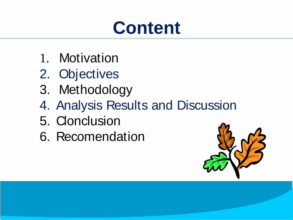
Content1. Motivation2. Objectives3. Methodology4. Analysis Results and Discussion5. Clonclusion6. Recomendation

Map of Research

Flood disasters frequently occur throughout all regionsof Indonesia including Regencies of Jember.
In Jember, the floods occurred two times; at thebeginnings of 2006 and 2009.
The year 2006 the worst-affected floods wasDistrict of Panti.
The year 2009, flood disasters occurred in theDistricts of Silo.
This disaster resulted in damages to homes, fieldsand both material and immaterial losses .
57 people died, 15 people were missing, tens peoplewere injured, 1900 people were evacuated, 300 peoplehad not been evacuated, 36 houses were swept away,2400 houses were damaged, six bridges were broken,140 hectares of rice field were damaged
MOTIVATION

Disaster Picture

Disaster Picture

1. To obtain a description of physical conditions of flood prone areas in Jember Regency
2. To determine the level of hazard risk of flash floods
3. To describe the vulnerability of communities in flood-prone areas
4. To determine the risk level of disaster of vulnerability of communities in flood-prone areas
5. To describe the capacity of communities in disaster-prone areas
6. To determine the risk description of capacity of communities in disaster-prone areas
OBJECTIVES

Surrounding Community at Gumitir andArgopuro mountains. the communities thatexist at the surroundings of the mountains, the
Districts of Panti and Silo.
Samples were taken 'in a balance' with a total of100 samples.
The number of samples was divided for eachregion and population.
METHODOLOGYThe research objects:

RESEARCH AREA
METHODOLOGY
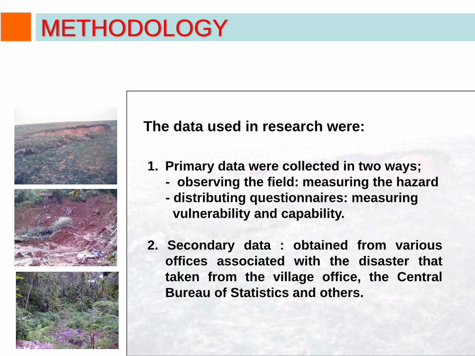
The data used in research were:
1. Primary data were collected in two ways;- observing the field: measuring the hazard- distributing questionnaires: measuringvulnerability and capability.
2. Secondary data : obtained from variousoffices associated with the disaster thattaken from the village office, the CentralBureau of Statistics and others.
METHODOLOGY
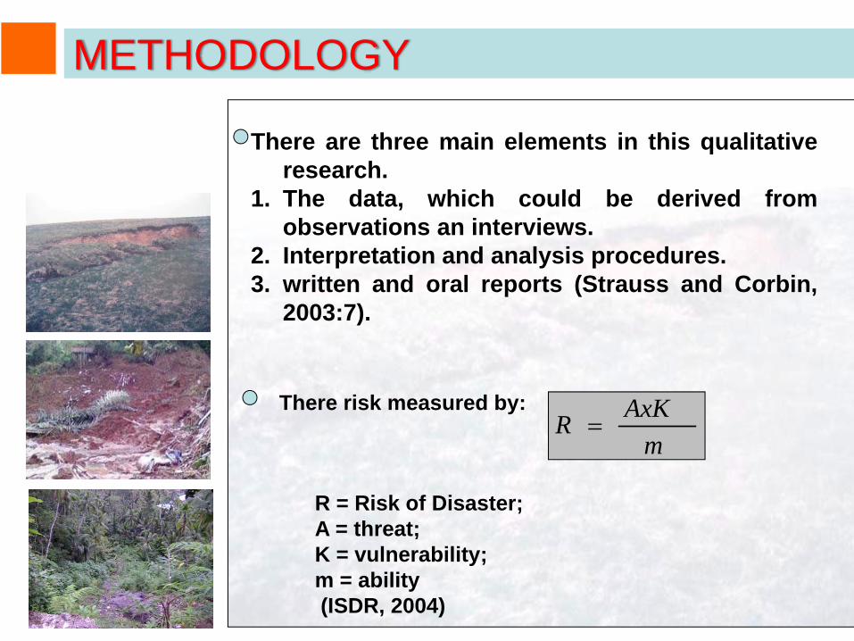
There are three main elements in this qualitativeresearch.
1. The data, which could be derived fromobservations an interviews.
2. Interpretation and analysis procedures.3. written and oral reports (Strauss and Corbin,
2003:7).
mAxKR =
R = Risk of Disaster; A = threat; K = vulnerability; m = ability(ISDR, 2004)
There risk measured by:
METHODOLOGY

The Geology of Jember Regency consists of Young Volcano sediment (sandstone ) which has good properties to flow the water
ANALYSIS RESULTS AND DISCUSSION
1. Physical Condition

The slope over 15 percent (30 degree) makes the watershed of District of Panti vulnerable to soil movement potential.
1. Physical Condition of Panti District …
ANALYSIS RESULTS AND DISCUSSION
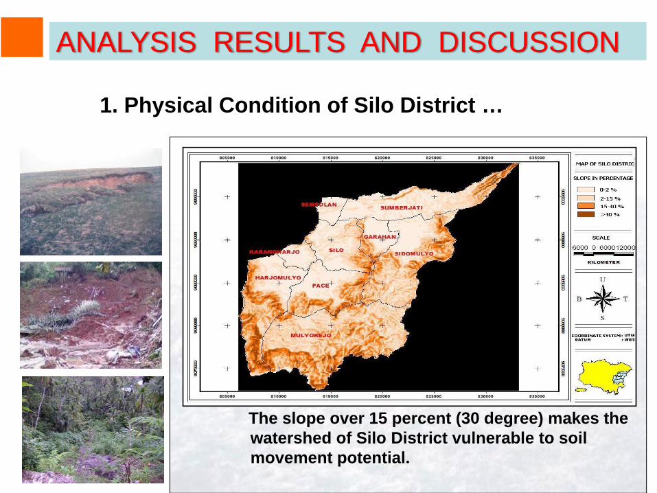
The slope over 15 percent (30 degree) makes the watershed of Silo District vulnerable to soil movement potential.
ANALYSIS RESULTS AND DISCUSSION
1. Physical Condition of Silo District …

In Silo, whose altruistic spirit remained high both before and after the disaster. Unlike Silo, Panti made the spirit of mutual help among residents (altruism) of Panti community that was originally fair become high.
2. Social Condition
ANALYSIS RESULTS AND DISCUSSION

ANALYSIS RESULTS AND DISCUSSION
2. Social Condition …

In Silo, There was no structured mechanism in running the early warning system. Everything was spontaneous and modest. While, Panti Community described their early warning system was structured mechanism.
3. Instutional Arrangement
ANALYSIS RESULTS AND DISCUSSION

The majority of officers and the community in Silo stated that the Executing Unit for Disaster Management has none of the six functions This is contrary to Panti residents and officials where that the Executing Unit for Disaster Management in their region already had run the six functions.
ANALYSIS RESULTS AND DISCUSSION3. Instutional Arrangement ….

Communities and Local Government awareness about flash floods can be seen from the things done, starting from the normal condition, the condition of pre-flash flood occurrence to the condition of early warning and evacuation.
ANALYSIS RESULTS AND DISCUSSION
3. Instutional Arrangement….
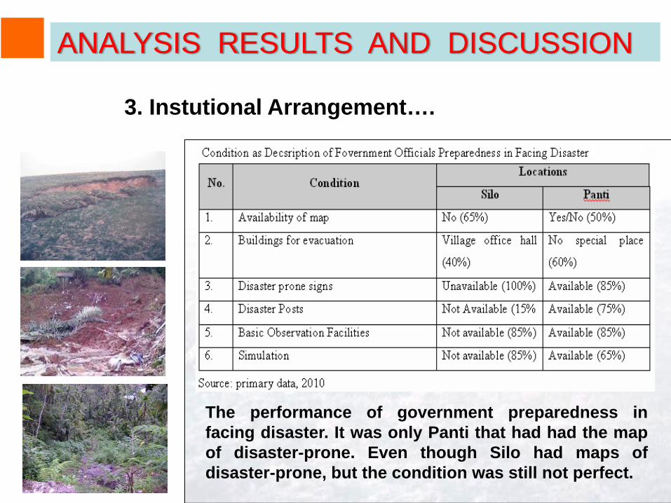
The performance of government preparedness infacing disaster. It was only Panti that had had the mapof disaster-prone. Even though Silo had maps ofdisaster-prone, but the condition was still not perfect.
ANALYSIS RESULTS AND DISCUSSION
3. Instutional Arrangement….

Both in Silo and in Panti, most respondents were withlower education (primary school graduation).
4. Economic Condition …
ANALYSIS RESULTS AND DISCUSSION

The majority of respondents were self-employed and farmers with their respective percentages of 32% and 28%, either as owning farmers, working farmers or the combination of both (owners and workers).
ANALYSIS RESULTS AND DISCUSSION
4. Economic Condition ….

Majority of respondents in Silo and Panti did not have second jobs exactly (75%)and (73%).
ANALYSIS RESULTS AND DISCUSSION
4. Economic Condition…

In Panti the average income of people in disaster areas was IDR 415,000, while in Silo was IDR 395,000 per month.
ANALYSIS RESULTS AND DISCUSSION
4. Economic Condition…

Flood disasters in the Districts of Silo and Panti were caused by natural dams clogged by sediment from landslides and erosion in upstream areas.
In Panti area, debris materials were boulder-sized while those in Silo area were mud and remnant materials of logging which were more than boulder-sized materials.
The potential amount of sediment or potential source of sediment in the area of Panti and Silo was materials derived from volcanically sedimentary deposits and the effect of slope and rain.
5. Flash Flood Hazard in Jember Regency
ANALYSIS RESULTS AND DISCUSSION
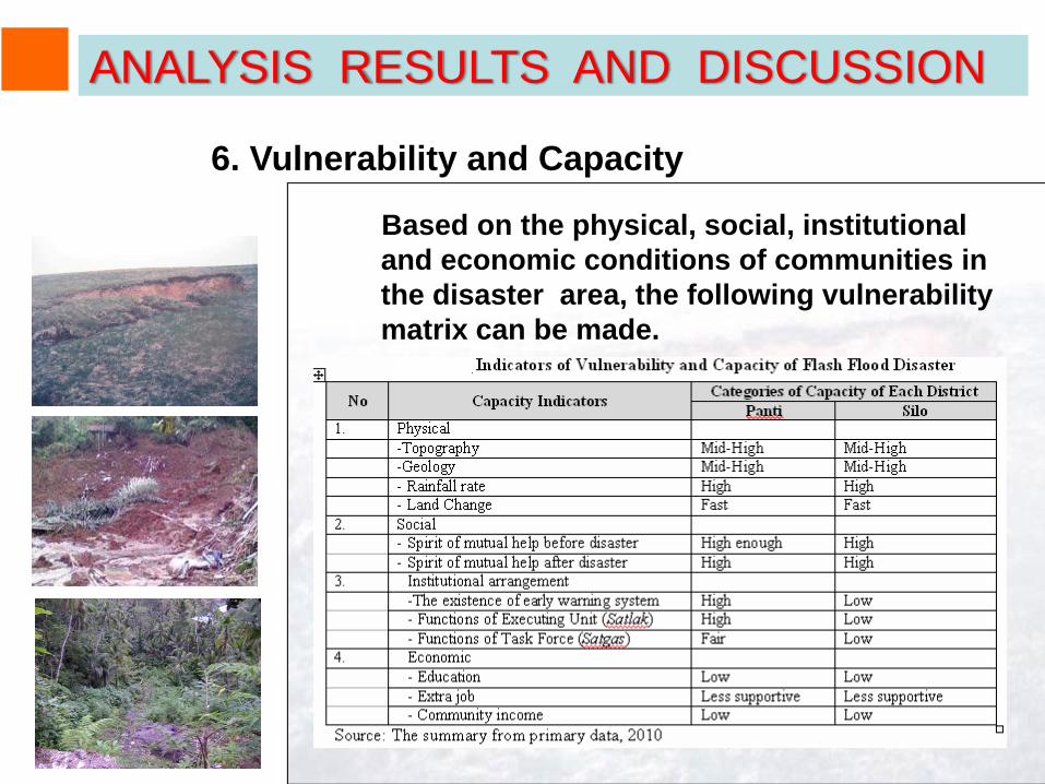
Based on the physical, social, institutional and economic conditions of communities in the disaster area, the following vulnerability matrix can be made.
6. Vulnerability and Capacity
ANALYSIS RESULTS AND DISCUSSION

Based on the conditions of threats and capacities, the risk of disaster in Jember regency is highly susceptible to floods disaster because of physical condition
While the economy that is quite low less supports the disaster mitigation.
However, with the social conditions that can be relied upon to cope with the flood disaster, a set of rules in institutional arrangement can be made in the disaster-affected areas for disaster anticipation and post-disaster mitigation.
7. Disaster Risk
ANALYSIS RESULTS AND DISCUSSION

8. Rule of Anticipation and Post-Disaster Mitigation
Disaster management will run effectively and efficiently if there is cooperation between government, private and public, especially in the surroundings of disasters-prone areas (Silo and Panti).
Local Government of Jember needs to prepare strategies related to empowerment and increase of participation of communities as well as nongovernmental organizations (NGOs)
. It is very necessary because it will greatly assist local governments in protecting the public from the threat of disaster.
ANALYSIS RESULTS AND DISCUSSION
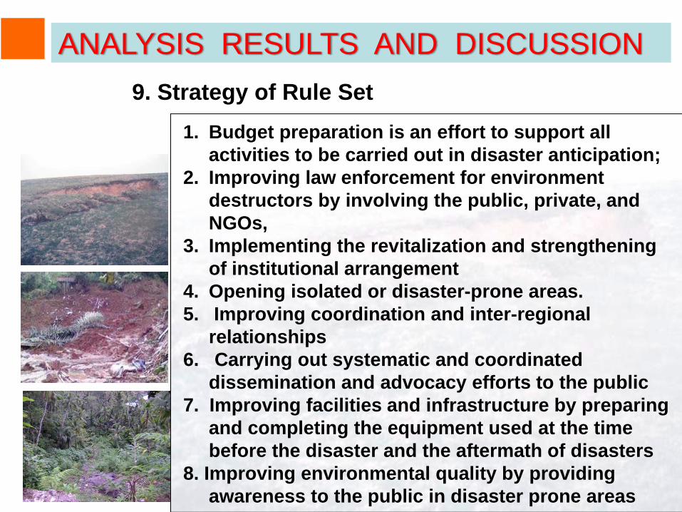
9. Strategy of Rule Set1. Budget preparation is an effort to support all
activities to be carried out in disaster anticipation;2. Improving law enforcement for environment
destructors by involving the public, private, and NGOs,
3. Implementing the revitalization and strengthening of institutional arrangement
4. Opening isolated or disaster-prone areas.5. Improving coordination and inter-regional
relationships6. Carrying out systematic and coordinated
dissemination and advocacy efforts to the public7. Improving facilities and infrastructure by preparing
and completing the equipment used at the time before the disaster and the aftermath of disasters
8. Improving environmental quality by providing awareness to the public in disaster prone areas
ANALYSIS RESULTS AND DISCUSSION
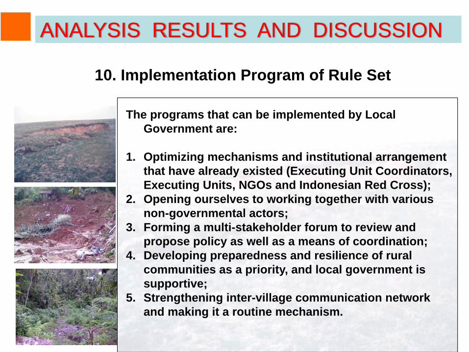
10. Implementation Program of Rule Set
The programs that can be implemented by Local Government are:
1. Optimizing mechanisms and institutional arrangement that have already existed (Executing Unit Coordinators, Executing Units, NGOs and Indonesian Red Cross);
2. Opening ourselves to working together with various non-governmental actors;
3. Forming a multi-stakeholder forum to review and propose policy as well as a means of coordination;
4. Developing preparedness and resilience of rural communities as a priority, and local government is supportive;
5. Strengthening inter-village communication network and making it a routine mechanism.
ANALYSIS RESULTS AND DISCUSSION

Based on field observation and analysis results, it canbe concluded that:
1. Physical conditions at the disaster sites arevulnerable enough
2. Spirit of mutual help among people in disasterareas is quite high.
3. Community institutional arrangement Panti is solidenough either in cope with disasters, while in Siloexisting institutional arrangement is less solid. 4.Economic condition in the disaster area iscategorized low.
4. In Jember regency, the disaster risk in Silo greatherthan in Panti.
CONCLUSION
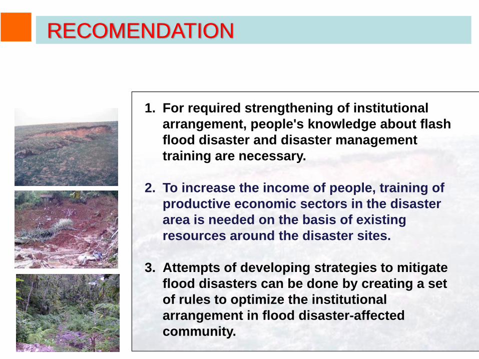
1. For required strengthening of institutional arrangement, people's knowledge about flash flood disaster and disaster management training are necessary.
2. To increase the income of people, training of productive economic sectors in the disaster area is needed on the basis of existing resources around the disaster sites.
3. Attempts of developing strategies to mitigate flood disasters can be done by creating a set of rules to optimize the institutional arrangement in flood disaster-affected community.
RECOMENDATION
Thank you for your attentionXin cam on