Budget Analysis for the Acquisition of a Class of Arctic/Offshore ...
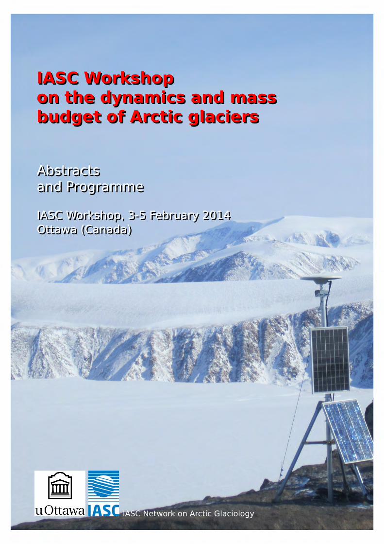
IASC WorkshopIASC Workshopon the dynamics and masson the dynamics and massbudget of Arctic glaciersbudget of Arctic glaciers
AbstractsAbstractsand Programmeand Programme
IASC Workshop, 3-5 February 2014IASC Workshop, 3-5 February 2014Ottawa (Canada)Ottawa (Canada)
IASC Network on Arctic Glaciology
IASC Workshop on the dynamics andmass budget of Arctic glaciers
Abstracts and program
IASC Workshop &Network on Arctic Glaciology annual meeting,3-5 February 2014, Ottawa (Canada)
Organised by L. Copland and C.H. Tijm-Reijmer
Network on Arctic Glaciology

Cover photo: Belcher Glacier, Devon Ice Cap, Nunavut. Photo by M. Sharp.
ISBN: 978-90-393-6169-6

Contents
Preface . . . . . . . . . . . . . . . . . . . . . . . . . . . . . . . . . . . . . . . . . . . . . 4
Program . . . . . . . . . . . . . . . . . . . . . . . . . . . . . . . . . . . . . . . . . . . . 5
Posters . . . . . . . . . . . . . . . . . . . . . . . . . . . . . . . . . . . . . . . . . . . . . 8
Participants . . . . . . . . . . . . . . . . . . . . . . . . . . . . . . . . . . . . . . . . . 11
Minutes of the Open Forum meeting . . . . . . . . . . . . . . . . . . . . . . . 12
Abstracts . . . . . . . . . . . . . . . . . . . . . . . . . . . . . . . . . . . . . . . . . . . 15
Using various mass-balance observations to improve the resolution of aglobal-scale elevation dependent surface mass balance model . . . . . . . 15
A.C. Beedlow, A.K. Bliss, V. Radic, R. Hock, A.A. Arendt, J.G. Cogley and D. Hill
High density monitoring to better understand dynamics of a small Arc-tic glacier basin: six years of measurements on the Austre Lovénbreen,Svalbard, 79◦N . . . . . . . . . . . . . . . . . . . . . . . . . . . . . . . . . . . . . . . 15
E. Bernard, F. Tolle, J.M. Friedt, Ch. Marlin and M. Griselin
Estimating Synoptic Scale Surface Mass Balance of Ice Caps in the QueenElizabeth Islands, Canada: 1960-2050 . . . . . . . . . . . . . . . . . . . . . . . . 16
D. Burgess
Summer melt regulates winter glacier flow speeds throughout Alaska . . . 17
E.W. Burgess, C.F. Larsen and R.R. Forster
The 2009-10 surge of Lowell Glacier, Yukon, and its context within fivesurges since 1948 . . . . . . . . . . . . . . . . . . . . . . . . . . . . . . . . . . . . . 17
L. Copland and A. Bevington
An Improved Mass Budget for the Greenland Ice Sheet . . . . . . . . . . . . . 18
E.M. Enderlin, I.M. Howat, S. Jeong, M.-J. Noh, J.H. van Angelen and M.R. vanden Broeke
Tracking Summer Melt Conditions on Arctic Ice Caps using the MODIS LandSurface Temperature (LST) Product . . . . . . . . . . . . . . . . . . . . . . . . . . 18
M.-L. Geai and M. Sharp
Cryosat reveals significant recent elevation change for some Arctic Ice Caps. 19
L. Gray and D. Burgess
Repeat high-resolution 3D mapping of tidewater glaciers in Greenland . . 20
G. Hamilton, D. Finnegan, A. Lewinter, A. Fowler and L. Stearns
Relationships between iceberg plumes and sea ice conditions on northeastDevon Ice Cap, Nunavut, Canada . . . . . . . . . . . . . . . . . . . . . . . . . . . 20
E. Herdes, L. Copland, B. Danielson and M. Sharp
Response of glacier mass balance and discharge to future climate changein the upper Susitna basin, Alaska . . . . . . . . . . . . . . . . . . . . . . . . . . 21
R. Hock, A. Bliss, J. Braun, C. Aubry-Wake, J. Zhang, A. Liljedahl, J. Schulla andG. Wolken
1
Seismic data reveal subglacial ponding under the Greenland Ice Sheet . . 22
C. Hofstede, R. Petterson, D. Fritzsche, F. Wilhelms and A. Hubbard
A whale of a tale in 1710: East Greenland’s oldest weather and sea icerecords . . . . . . . . . . . . . . . . . . . . . . . . . . . . . . . . . . . . . . . . . . . . 22
H. Jiskoot, C. Bonifacio, M. Mueller and J. Palardy
Coastal Arctic fog and its influence on glacier surface energy balance . . . 23
H. Jiskoot, S.Y. Gueye and J.H. van Boxel
Derivation of a multitemporal set of transient snowlines for Alaska’s glaciers 23
C. Kienholz, A. Arendt and R. Hock
Validation of CryoSat-2 measured surface elevations over Austfonna . . . . 24
K. Langley, T. Dunse, T. Eiken, J.O. Hagen, L. Langhammer, V. Helm and H. Skourup
Catchment’s hydrology of high-Arctic glacier (Werenskioldbreen, Spitsber-gen): Changes in the ablation Season . . . . . . . . . . . . . . . . . . . . . . . . 24
E. Majchrowska
Alaska tidewater glacier surface velocities and frontal ablation, 1985-2013 25
R. McNabb
Changes to the glaciers at Novaya Zemlya . . . . . . . . . . . . . . . . . . . . . 26
A.K. Melkonian, M.J. Willis, M.E. Pritchard, A. Stewart and J. Ramage
Recent ice shelf loss, Ellesmere Island, Nunavut, Canada . . . . . . . . . . . 27
D.R. Mueller, L. Copland, A. White and T. Wohlleben
What do McCall Glacier, caribou, and monster truck tires have in common? 28
M. Nolan
Monitoring Baffin Island glaciers melt using RADARSAT-2 Stereo Radar-grammetry . . . . . . . . . . . . . . . . . . . . . . . . . . . . . . . . . . . . . . . . . 28
C. Papasodoro, A. Royer and A. Langlois
Assessment of sea ice conditions and shipping activity in Canadian Arcticwaters between 1990 and 2012 . . . . . . . . . . . . . . . . . . . . . . . . . . . . 29
L. Pizzolato, S.E.L. Howell, C. Derksen, J. Dawson and L. Copland
How deep does a typical crevasse in Western Greenland carry meltwater? 30
K. Poinar and I. Joughin
Estimating Supraglacial Lake Depth with Landsat 8 . . . . . . . . . . . . . . . 31
A. Pope, T. Scambos and M. Moussavi
The surface mass and energy balance of Nordenskiöldbreen, Svalbard: 7years of in situ observations. . . . . . . . . . . . . . . . . . . . . . . . . . . . . . . 31
C.H. Reijmer, V. Pohjola, W.J.J. van Pelt and R. Petterson
Internal layering and stratigraphy from RES data on outlet glaciers in theCanadian Arctic . . . . . . . . . . . . . . . . . . . . . . . . . . . . . . . . . . . . . . 32
A. Rutishauser
Volume and mass changes over Penny Ice Cap, Baffin Island, from 2005-2013 determined from repeat airborne laser altimetry. . . . . . . . . . . . . . 33
N. Schaffer, L. Copland, C. Zdanowicz, J. Nilsson and D. Burgess
Changes to the dynamics of Arctic mountain glaciers: Case study of WhiteGlacier, Axel Heiberg Island, Nunavut . . . . . . . . . . . . . . . . . . . . . . . . 33
L. Thomson and L. Copland
Interannual and multi-decadal velocity variations in the eastern St. EliasIcefields, Yukon Territory, Canada . . . . . . . . . . . . . . . . . . . . . . . . . . . 34
A. Waechter, L. Copland, E. Herdes, L. Gray and J. Poitevin
Documenting multidecadal recession of Grinnell and Terra Nivea ice caps,Baffin Island, Canada . . . . . . . . . . . . . . . . . . . . . . . . . . . . . . . . . . . 35
R.G. Way
Velocity and ice thickness changes at the Rusanov and Karpinsky ice capsin response to the destruction of the Matsuevich Ice Shelf, SevernayaZemlya, Russian High Arctic. . . . . . . . . . . . . . . . . . . . . . . . . . . . . . . 36
M.J. Willis, A.K. Melkonian, A.J. Stewart, E.M. Golos, M.E. Pritchard and J.M. Ramage
Subglacial lake volume changes due to replenishment by supraglacial melt,Northeast Greenland. . . . . . . . . . . . . . . . . . . . . . . . . . . . . . . . . . . . 37
M.J. Willis, B. Herried and M. Bevis

Preface
For the 2014 meeting it was time again for us to go to North America. I was happyto accept the invitation of Dr. Luke Copland to organize the meeting at the Univer-sity of Ottawa, Canada. There we were part of an Arctic week which included ourannual workshop and open forum meeting, the Ottawa Carleton Student NorthernResearch Symposium, a GlacioEx project meeting, and celebrations on the 125thAnniversary of the Faculty of Arts at the University of Ottawa, the 500th meetingof the Arctic Circle and of course the 20th Anniversary of our own Network onArctic Glaciology.
Somewhere in 1992-1993 the initiative was taken to start the ’Working group onArctic Glaciology (WAG)’ within IASC. This took shape in 1994 and the first meetingtook place in Wisla, Poland in September 1994. The Network on Arctic Glaciology(NAG) was formed out of the working group in 2010 after a reorganisation ofIASC. Already as a working group, and now also as a network, NAG is one of themore active networks within IASC with annual meetings and coordinated researchactivities.
The meeting in Ottawa again proved how active our community is with 37 par-ticipants representing about 10 different countries. IASC generously supportedseven young scientists to attend the meeting. These 37 participants presentedcutting edge science in 24 talks and 10 posters. We also had a demonstration ofhow a UAV can be used in glaciology. The open forum meeting again providedmany ideas to initiate as a community.
Our meeting took place in the middle of the Winterlude, an annual winter festi-val in Ottawa. This provided the opportunity to skate on the largest ice rink in theworld: the Rideau Canal Skateway. So the discussions related to, amongst others,science and fieldwork continued on the ice instead of on skiing slopes resultingonce again in a succesful and informal event.
Finally, I want to thank Luke Copland for the excelent local organisation of themeeting. He also arranged financial support from the University of Ottawa andfrom the GlacioEx project, which helped keeping the registration fee for the par-ticipants reasonably low.
Next year the meeting will take place in the University Center Obergurgl from23 - 25 March, 2015. I hope to meet you all there.
C.H. Tijm-ReijmerApril 2014
4

Program
The meeting took place in the Desmarais building of the University of Ottawa,Canada. (see map below the program)Presentations were in Desmarais room 12102, posters, coffee and lunches in Des-marais room 12110.
Monday 3 February
08:30 - 09:00 Registration
Convener: Carleen Reijmer
09:00 - 09:10 Welcome L. Copland / C.H. Reijmer
09:10 - 09:30 Validation of CryoSat-2 measured surface elevations overAustfonna Kirsty Langley, T. Dunse, T. Eiken, J.O. Hagen, L.Langhammer, V. Helm and H. Skourup
09:30 - 09:50 Cryosat reveals significant recent elevation change for someArctic Ice Caps Laurence Gray and D. Burgess
09:50 - 10:10 Monitoring Baffin Island glaciers melt using RADARSAT-2 StereoRadargrammetry Charles Papasodoro, A. Royer and A.Langlois
10:10 - 10:30 Tracking Summer Melt Conditions on Arctic Ice Caps using theMODIS Land Surface Temperature (LST) Product M.-L. Geai andMartin Sharp
10:30 - 11:00 Coffee break
Convener: Kirsty Langley
11:00 - 11:20 What do McCall Glacier, caribou, and monster truck tires have incommon? Matt Nolan
11:20 - 11:40 Repeat high-resolution 3D mapping of tidewater glaciers inGreenland Gordon Hamilton, D. Finnegan, A. Lewinter, A.Fowler and L. Stearns
11:40 - 12:00 Velocity and ice thickness changes at the Rusanov andKarpinsky ice caps in response to the destruction of theMatsuevich Ice Shelf, Severnaya Zemlya, Russian High Arctic.Michael J. Willis, A.K. Melkonian, A.J. Stewart, E.M. Golos, M.E.Pritchard and J.M. Ramage
12:00 - 12:20 Estimating Supraglacial Lake Depth with Landsat 8 Allen Pope,T. Scambos and M. Moussavi
12:20 - 14:00 Lunch
Convener: Carleen Reijmer
14:00 - 14:30 Poster presentations by authors
5
14:30 - 16:00 POSTER SESSION
15:00 - 15:30 Coffee break
16:00 - 17:30 IASC Network on Arctic Glaciology Open Forum meeting C.H.Reijmer / M. Sharp
18:30 - Dinner at Mother Tucker’s restaurant (Optional, own cost,http://www.tuckersmarketplace.ca/)
Tuesday 4 February
Convener: Christian Zdanowicz
09:00 - 09:20 Using various mass-balance observations to improve theresolution of a global-scale elevation dependent surface massbalance model A. Cody Beedlow, A.K. Bliss, V. Radic, R. Hock,A.A. Arendt, J.G. Cogley and D. Hill
09:20 - 09:40 Response of glacier mass balance and discharge to futureclimate change in the upper Susitna basin, Alaska RegineHock, A. Bliss, J. Braun, C. Aubry-Wake, J. Zhang, A. Liljedahl, J.Schulla and G. Wolken
09:40 - 10:00 Coastal Arctic fog and its influence on glacier surface energybalance Hester Jiskoot, S.Y. Gueye and J.H. van Boxel
10:00 - 10:20 The surface mass and energy balance of Nordenskiöldbreen,Svalbard: 7 years of in situ observations Carleen H. Reijmer,V. Pohjola, W.J.J. van Pelt and R. Petterson
10:20 - 11:00 Coffee break
Convener: Alan Pope
11:00 - 11:20 Estimating Synoptic Scale Surface Mass Balance of Ice Caps inthe Queen Elizabeth Islands, Canada: 1960-2050 DavidBurgess
11:20 - 11:40 An Improved Mass Budget for the Greenland Ice Sheet Ellyn M.Enderlin, I.M. Howat, S. Jeong, M.-J. Noh, J.H. van Angelen andM.R. van den Broeke
11:40 - 12:00 High density monitoring to better understand dynamics of asmall Arctic glacier basin: six years of measurements on theAustre Lovénbreen, Svalbard, 79◦N Eric Bernard, F. Tolle, J.M.Friedt, Ch. Marlin and M. Griselin
12:00 - 12:20 Changes to the dynamics of Arctic mountain glaciers: Casestudy of White Glacier, Axel Heiberg Island, Nunavut LauraThomson and L. Copland
12:20 - 16:00 Lunch, visit winter festival, skating
16:00 - 17:00 Demonstration: How to fly a UAV Matt Nolan
6

17:00 - 18:00 Demo: How to construct a DEM from UAV collected images MattNolan
18:00 - 20:00 Celebration 20 years Network on Arctic Glaciology
18:00 - 19:00 Pizza Dinner19:00 - 20:00 Celebration lecture Hugh Dale-Haris New Land 2013: A
journey through Otto Sverdrup’s High Arctic
Wednesday 5 February
Convener: Hester Jiskoot
09:00 - 09:20 How deep does a typical crevasse in Western Greenland carrymeltwater? Kristin Poinar and I. Joughin
09:20 - 09:40 Seismic data reveal subglacial ponding under the Greenland IceSheet Coen Hofstede, R. Petterson, D. Fritzsche, F. Wilhelmsand A. Hubbard
09:40 - 10:00 Subglacial lake volume changes due to replenishment bysupraglacial melt, Northeast Greenland Michael J. Willis, B.Herried and M. Bevis
10:00 - 10:20 The 2009-10 surge of Lowell Glacier, Yukon, and its contextwithin five surges since 1948 Luke Copland and A. Bevington
10:20 - 11:00 Coffee break
Convener: Michael J. Willis
11:00 - 11:20 Interannual and multi-decadal velocity variations in the easternSt. Elias Icefields, Yukon Territory, Canada AlexandraWaechter, L. Copland, E. Herdes, L. Gray and J. Poitevin
11:20 - 11:40 Alaska tidewater glacier surface velocities and frontal ablation,1985-2013 Robert McNabb
11:40 - 12:00 Summer melt regulates winter glacier flow speeds throughoutAlaska Evan W. Burgess, C.F. Larsen and R.R. Forster
12:00 - 12:20 A whale of a tale in 1710: East GreenlandÕs oldest weather andsea ice records Hester Jiskoot, C. Bonifacio, M. Mueller and J.Palardy
12:20 - 12:30 Final words L. Copland / C.H. Reijmer
12:30 - Lunch / Departure / Skating / Skiing
Thursday 6 February
Ottawa Carleton Student Northern Research Symposium(Desmarais building room 12102) Information will be available at:http://www3.carleton.ca/northernresearch/OCSNRS.html
7
Posters
• Controls on intra-annual variations in motion of the Kaskawulsh Glacier, YukonTerritory Emilie Herdes and L. Copland
• Relationships between iceberg plumes and sea ice conditions on northeastDevon Ice Cap, Nunavut, Canada Emilie Herdes, L. Copland, B. Danielsonand M. Sharp
• Derivation of a multitemporal set of transient snowlines for Alaska’s glaciersChristian Kienholz, A. Arendt, R. Hock
• Catchment’s hydrology of high-Arctic glacier (Werenskioldbreen, Spitsbergen):Changes in the ablation Season Elzbieta Majchrowska
• Changes to the glaciers at Novaya Zemlya. A.K. Melkonian, Michael J. Willis,M.E. Pritchard, A. Stewart and J. Ramage.
• Recent ice shelf loss, Ellesmere Island, Nunavut, Canada. Derek R. Mueller,L. Copland, A. White and T. Wohlleben
• Assessment of sea ice conditions and shipping activity in Canadian Arcticwaters between 1990 and 2012 Larissa Pizzolato, S.E.L. Howell, C. Derksen,J. Dawson and L. Copland
• Internal layering and stratigraphy from RES data on outlet glaciers in theCanadian Arctic Anja Rutishauser
• Volume and mass changes over Penny Ice Cap, Baffin Island, from 2005-2013determined from repeat airborne laser altimetry. Nicole Schaffer, L. Copland,C. Zdanowicz, J. Nilsson and D. Burgess.
• Documenting multidecadal recession of Grinnell and Terra Nivea ice caps,Baffin Island, Canada Robert G. Way
8

Map: Arrow indicates the location of the Desmarais building.
9

Map: Red arrow indicates the location of the Desmarais building, green arrow MotherTucker’s restaurant.
10

Participants
1. A. Cody Beedlow ([email protected])
2. Eric Bernard* ([email protected])
3. David Burgess ([email protected])
4. Evan Burgess ([email protected])
5. Luke Copland ([email protected])
6. Anna Crawford ([email protected])
7. Ellyn Enderlin* ([email protected])
8. Laurence Gray ([email protected])
9. Gordon Hamilton ([email protected])
10. Emilie Herdes ([email protected])
11. Regine Hock ([email protected])
12. Coen Hofstede ([email protected])
13. Hester Jiskoot ([email protected])
14. Christian Kienholz ([email protected])
15. Kirsty Langley* ([email protected])
16. Gregory Lewis-Paley ([email protected])
17. Elzbieta Majchrowska* ([email protected])
18. Robert McNabb ([email protected])
19. Derek Mueller ([email protected])
20. Matt Nolan ([email protected])
21. Charles Papasodoro* ([email protected])
22. Larissa Pizzolato ([email protected])
23. Kristin Poinar* ([email protected])
24. Allen Pope* ([email protected])
25. Alain Royer ([email protected])
26. Anja Rutishauser ([email protected])
27. Nicole Schaffer ([email protected])
28. Martin Sharp ([email protected])
29. Laura Thomson ([email protected])
30. Carleen Tijm-Reijmer ([email protected])
31. Wesley Van Wychen ([email protected])
32. Alexandra Waechter ([email protected])
33. Robert Way ([email protected])
34. Adrienne White ([email protected])
35. Michael J. Willis ([email protected])
36. Bert Wouters ([email protected])
37. Christian Zdanowicz ([email protected])
(Young scientists receiving support are marked *).
11

Minutes of the Open Forum meeting
Chair: Carleen Tijm-ReijmerVice Chair: Martin SharpMinutes: Anja RutishauserInvited to attend: all participants of the workshop.
Agenda
1. Other items for the agenda2. Background on IASC and NAG3. Meeting minutes 20154. Location IASC-NAG workshop5. Network activities6. National contacts7. Extended Abstracts8. Anything else
Ad. 1
Coen Hofstede has an input with some information on what the AWI plans to sur-vey in the Canadian Arctic. Carleen decided to discuss it under Ad. 5 (Networkactivities).
Ad. 2
Introduction to International Arctic Science Committee (IASC): There are five work-ing groups within the IASC, where the Network on Arctic Glaciology is groupedwithin the Cryosphere group. The general idea of the network is to discuss wherethe scientific team should go as a group. The main activity is to organize thismeeting which offers the possibility of talking to each other as a team.
Ad. 3
An overview was given about what was discussed last year. The main pointswere where the meeting 2014 takes place (Ottawa), updating the list of nationalcontacts, the role of the website, and the abstract book. From now on, all abstractbooks are available online, where this year’s book comes with an ISBN number.
Ad. 4
Carleen states that the idea was to have the meeting for two years in Europe, andthen another two years out of Europe. It was previously suggested to have the2015 meeting in the Pyrenees in Spain, and then in 2016 in Obergurgl in Austria.The group agrees and thinks that is a good idea.
Discussion about the dates for the meeting 2015: The general statement of thegroup is that the meeting should not be in January or March, but February wouldwork well. Carleen mentions that the holidays in the Netherlands take place thelast week of February, whereas a meeting in these holiday period would not work
12

for Carleen. The group decides to check what is available at the meeting place inSpain in February, and then take it from there.
Extra information since the meeting:Meeting in Pyrenees Spain has been postponed to 2016 due to overlap withAntarctic fieldwork of the organiser (Francisco Navarro) in winter 2015. There-fore, the meeting in 2015 will take place in Obergurgl, Austria. Unfortunately theonly available dates with sufficient time and rooms available was 23-25 March2015.
Ad. 5
Coen Hofstede presents an outlook of what the AWI (Alfred Wegner Institute) isplanning to survey in the near future: The AWI plans to do airborne radar surveyson the ’79 degree glacier’ and four additional glaciers in Northern Greenland. Theplan is to go there with a ship, collect seismic data, perform ice core drilling (andalso sediment coring) and collect radar profiles to determine the ice dynamics ofthe glacier. There are already existing radar data available from the AWI and theIce Bridge project. If anyone is interested in contributing or has any questions,they can contact the AWI.
Carleen talks about the meeting in Grenoble (glacier and ice-stream calving ÐObservations and Modelling, 2-3 June 2014, Grenoble, France), where around 30people will participate and work on numerical modeling of tidewater glaciers. Theaim of this meeting is to determine which dataset is best suited for testing thenumerical models. The meeting is funded by the Cryosphere group, by IACS, andsome Canadian funds.
Martin Sharp gives a brief overview of how funding works: Sometimes fundingis directly allocated to IASC. There is also funding for meetings/schools etc, whenpeople have an idea they can apply for funding, which is usually around 10’000-20’000 $. Young researchers are often supported by these funds.
For the tidewater glacier initiative, we are in stage three now. The questionis why are there significant differences in ice sheet mass balance results fromdifferent measurements and models. Yet, there is no funding for that, but wecould apply if someone is interested. Martin mentions that this group would liketo get involved; Martin will talk to Jenny????? about this.
Firn processes: Responses of glacier ice caps and the Greenland ice sheet, howare firn processes involved. Martin mentions that if anyone is interested in thatwe can try to build up a group.
Update analysis of in situ mass balance records from Arctic Glaciers: It wouldbe good to take a look at these data again, this would be something the IASCcould support if someone is interested in that.
Albedo feedbacks: The ICAP3 final meeting will be in Tokyo 2015, they have justreceived funding for this. A meeting will probably take place in September 2014to prepare for what has to be done for the upcoming meeting in Tokyo in 2015. Ifsomeone is interested in this get in touch with Martin.
Studying ice sheet-ocean interactions: The meeting in June 2013 was fundedby agencies in the US on that. Development of observing systems for studyingthis would be relevant to our group.
13

Ad. 6
The list of national contacts shows that there is still no contact for China andJapan. The contact listed for Germany (Heinz Miller) is retired, thus the contactfor Germany remains unsure. Someone mentions that Heinz Miller knows a lot ofwhat is going on and could be contacted if needed. Nevertheless, a new contactfor Germany should be announced.
Ad. 7
All books are available in pdf format on the website; they will be distributed inadvance to the meeting. There is the opportunity to extend the abstracts, for thefinal book. The deadline for the extended abstract is March 30, 2014. The bookwill be published before August 1, 2014. The book will not be printed (due to nofunding), but it will be available in pdf format.
Ad. 8
Question to Martin about the firn process studies: Martin explains that the aim isto determine long-term processes in the firn layer to understand the water storageprocesses in the firn in the Greenland ice sheet. We are interested in bringing ’fieldpeople’ with field data and people who do modelling together. We also need multi-temporal data. Someone mentions that the University of Wallington is currentlylooking at this kind of modelling, a contact might be useful.
Closing of the meeting and thank you to Anna for writing the minutes.
14

Abstracts
Using various mass-balance observations to improvethe resolution of a global-scale elevation dependentsurface mass balance model
A.C. Beedlow, A.K. Bliss, V. Radic, R. Hock, A.A. Arendt, J.G. Cogley and D. Hill
Regional- and global-scale surface mass balance models have typically been usedto estimate sea-level rise from glacier volume changes. These models, however,suffer from a lack of observations to adequately calibrate their parameters. Modelparameters derived from a global array of observations are in general unlikely torepresent those found at the regional- or individual-scale. Such models may beadequate for global surface mass-balance simulations, but their precision may de-grade at finer spatial scales. Point mass-balance observations are typically mea-sured in many glaciological field campaigns; however these data are often neverpublished, and rarely used other than in the estimation of whole-glacier massbalance. Here we use an array of available surface mass balance observationsfor Alaska to calibrate and validate an elevation-dependent surface mass-balancemodel applied to all glaciers in Alaska. In particular, we use point mass-balanceobservations to help calibrate the various elevation-dependent model parametersusing a general-purpose global optimization algorithm called the Shuffled Com-plex Evolution Metropolis Algorithm (SCEM-UA). We then compare the modeledvolume projections calibrated with the various mass-balance observations.
High density monitoring to better understand dynam-ics of a small Arctic glacier basin: six years of measure-ments on the Austre Lovénbreen, Svalbard, 79◦N
E. Bernard1, F. Tolle1, J.M. Friedt2, Ch. Marlin3 and M. Griselin1
1 CNRS UMR ThéMA, université de Franche-Comté, Besançon, France2 FEMTO-ST, université Franche Comté, Besançon, France3 CNRS UMR IDES, université Paris-Sud, Orsay, France
Arctic is a reliable indicator of global climate changes. Within this context, theobserved evolutions are becoming faster and more unpredictable. Glacier dy-namics are directly affected, and following processes becomes challenging: somefast but key events can be missed since they are short but significant. Beyondglobal climatic trends, glaciers dynamics are highly dependent on local climaticparameters such as temperatures and precipitation.
Thus, a monitoring protocol based on a network of stakes and complementedwith regular snow drilling campaigns has been carried out for 6 years on the AustreLovén glacier (Spistbergen, 79◦N). Overall, 36 measurement points have beendistributed at regular intervals over the 4.5 km2 glacier surface. For each of these
15

points the snowpack was measured at a period close to its yearly maximum andexpressed in terms of snow height and water equivalent. Mass balance was alsorecorded yearly at the end of September. Furthermore, temperature is measuredover a 20 sensors network on the glacier, which allows to calculate the hourlythermal state. At last, a network of 6 automated digital cameras (which provide asurface coverage of 96% of the glacier) is used to map snowcover dynamics.
From these data, we were able to highlight the significant impact of warmevents. Indeed, results show that there is a strong link between these warmevents, snowpack dynamics and glacier mass balance. In the middle of winter,short-violent warm events together with liquid precipitation could removed nearlyall the snowpack in only a few hours, calling into question the seasonal accumu-lation.
This 6-year period belong to a hot decade which affects Svalbard: the observedtrend is more due to lack of cold in winter than by excess of warm in summer.Observations at a local scale show the main impact of liquid precipitations onsnowpack dynamics and then on glacier’s behavior each season. The result iscomplex: a meanly warm and dry summer will have few incidence on the glaciermass balance, when a warm and very dry winter could be seen as detrimental atlow altitude as it will contribute to an important snow refill of the glaciers over the0◦C isotherm.
Moreover, with respectively -1065 mm weq and -1063 mm weq, 2011 and 2013mass balance seems to show very similar results. But actually, spatial trends arecompletely different for both years. Values are spatially much more smoothed for2013, with minimum and maximum far less important. This will be another topicof this presentation.
Estimating Synoptic Scale Surface Mass Balance of IceCaps in the Queen Elizabeth Islands, Canada: 1960-2050
D. Burgess
Geological Survey of Canada, Ottawa, Canada
Since 2005, ice caps in the Canadian high Arctic have become among the mostimportant contributors to global sea level rise apart from the ice sheets of Antarc-tic and Greenland (Gardner et al, 2011). Providing longer term context to thesechanges is thus of interest for understanding the impacts of accelerated glaciershrinkage in this region on relative sea level rise and other effects associated withfreshening of the ocean waters. In this study, annual estimates of climatic surfacemass balance for the years 1960-2013 are derived across ice caps in the QueenElizabeth Islands, Canada, from a simple model driven by NCEP 850mb air temper-atures and in-situ mass balance records collected from the Devon and Agassiz icecaps since 1961 and 1977 respectively. Good overall agreement with independentsatellite and model data gives confidence that this model provides a reasonableestimate of mass change for the region. As such, estimates of predicted masschange for the QEI ice caps to 2050 were computed based on global temperature
16

warming scenarios (IPCC5) modified to account for arctic amplification. Method-ology and preliminary model results will be presented.
References
Gardner, A.S., G. Moholdt, B. Wouters, G.J. Wolken, D.O. Burgess, M.J. Sharp, J.G. Cogley, C. Braun,and C. Labine, 2011. Sharply increased mass loss from glaciers and ice caps in the CanadianArctic Archipelago. Nature, 473, 357–360.
Summer melt regulates winter glacier flow speeds through-out Alaska
E.W. Burgess1,3, C.F. Larsen1 and R.R. Forster2
1 Geophysical Institute, University of Alaska, Fairbanks, USA2 University of Utah, Department of Geography, Salt Lake City, USA3 U.S. Geological Survey, Anchorage, USA
Increases in surface melt rates are known to accelerate glacier flow in spring andsummer, and decelerate flow in fall; whereas in winter, flow speeds have beenfound to be relatively invariant. Here we find that wintertime flow velocities onnearly all major glaciers throughout Alaska are not only variable but are inverselycorrelated with summertime positive degree days (PDDs). The response is slight,an 11% decrease in wintertime velocity per additional meter of summertime melt.The mechanism is likely due to inter-annual differences in summertime melt af-fecting the efficiency of sub-glacial drainage systems to evacuate water from theglacier bed in fall. Resultant inter-annual variation in bed separation come win-ter leads to the observed differences in flow speed. We find this mechanism tobe ubiquitous in Alaska and thus is likely a global phenomenon. If the dynamicevolves over the long-term, it represents another hydrology-related flow mecha-nism affecting sea level rise contributions.
The 2009-10 surge of Lowell Glacier, Yukon, and its con-text within five surges since 1948
L. Copland and A. Bevington
Department of Geography, University of Ottawa, Canada
Field observations, aerial photographs and satellite images are used to recon-struct the past surges of Lowell Glacier since 1948 based on the timing of termi-nus advances. A total of 5 surges occurred over this time, each with a durationof ∼1-2 yrs. The time between successive surges ranged from 12-20 years, andappears to have been shortening over time. The relatively short advance and qui-escent phases of Lowell Glacier, together with rapid increases in velocity duringsurges, suggest that the surging is controlled by a hydrological switch. The 2009-10 surge saw ablation area velocities increase by up to two orders of magnitudefrom quiescent velocities, and the terminus increase in area by 5.1 km2 and in
17

length by up to 2.85 km. This change in area was the smallest since 1948, andfollows the trend of decreasing surge extents over time. This decrease is likelydriven a strongly negative surface mass balance of Lowell Glacier since at leastthe 1970s, and means that the current town site of Haines Junction is very unlikelyto be flooded by damming caused by any future advances of the glacier under thecurrent climate regime.
An Improved Mass Budget for the Greenland Ice Sheet
E.M. Enderlin1,2,4, I.M. Howat1,2, S. Jeong1,2, M.-J. Noh1,2, J.H. van Angelen3 and M.R. vanden Broeke3
1 Byrd Polar Research Center, The Ohio State University, Columbus, USA2 School of Earth Sciences, The Ohio State University, Columbus, USA3 Institute for Marine and Atmospheric Research, Utrecht University, Netherlands1 Current address: Climate Change Institute, University of Maine, Orono, USA
Extensive ice thickness surveys by NASA’s Operation IceBridge enable over adecade of ice discharge measurements at high precision for the majority of Green-land’s marine-terminating outlet glaciers, prompting a reassessment of the tem-poral and spatial distribution of glacier change. Annual measurements for 178outlet glaciers reveal that, despite widespread acceleration, only 15 glaciers ac-counted for 80% of the 730±26 Gt of ice lost due to acceleration since 2000, andfour accounted for ∼50%. Among the top sources of loss are several glaciers thathave received little scientific attention. The relative contribution of ice dischargeto total loss decreased from 56% before 2005 to 34% between 2009-2012. Assuch, 85% of the increased in mass loss after 2009 was due to increased surfacemelting. These observations support recent model projections that surface massbalance, rather than ice dynamics, will dominate the ice sheet’s contribution to21st-century sea level rise.
Tracking Summer Melt Conditions on Arctic Ice Caps us-ing the MODIS Land Surface Temperature (LST) Product
M.-L. Geai and M. Sharp
Earth and Atmospheric Sciences, University of Alberta, Canada
Much of the inter-annual and long-term variability in the climatic mass balanceof Arctic glaciers arises from variability in the summer balance (from rates ofsurface melt). In the absence of direct mass balance measurements, measure-ments of summer ice surface temperatures and the duration of melting condi-tions may serve as a proxy for the summer balance. They may also shed light onthe spatial pattern of summer balance within the larger regions for which massbalance is calculated using such methods as satellite gravimetry and laser al-timetry. The Moderate Resolution Imaging Spectroradiometer (MODIS), launchedon board the TERRA and AQUA satellites in 1999 and 2002, provides estimatesof surface temperature with a target accuracy of 1 K at 1-km spatial resolution
18

from twice-daily overpasses. However, it can only measure LST under clear-skyconditions, generating a possible bias in measured surface temperatures relativeto air temperatures in cloudy regions. To evaluate the effect of this bias on theutility of the LST data, we compared JJA mean LST derived from 8-day compositesof daytime clear sky LST data for 10 km2 pure snow/ice blocks from the interiorregions of ice masses in major glaciated regions of the Arctic with mean summer700 hPa air temperatures derived from the NCEP/NCAR R1 Reanalysis (NCEP) forthe 2000-2011 period. Inter-annual variability in LST and NCEP air temperaturerecords was well correlated (r>0.65) in regions with >45% LST data recovery.Such regions include the Canadian high Arctic, coastal Greenland, Svalbard andSevernaya Zemlya. Here we will present time series of mean summer LST fromthese regions for the period 2000-2012, and spatial mapping of annual summermean LST and cloud cover (derived from variations in the LST retrieval rate) forice caps in the Canadian high Arctic. Trends and variability in these patterns showgood consistency with both field measurements of annual climatic balance andsatellite-derived measurements of the total mass balance of glaciers and ice capsand glaciers in the region over the same time period.
Cryosat reveals significant recent elevation change forsome Arctic Ice Caps.
L. Gray1 and D. Burgess2
1 Geography Dept., University Ottawa, Canada2 Glaciology Group, GSC, NRCan, Canada
In the past satellite radar altimetry has provided information on ice elevationchange over the central Greenland and Antarctic Ice Sheets, but has had verylimited utility in monitoring change on smaller ice caps like those in the Cana-dian Arctic. Cryosat was developed by the European Space Agency with a specialmode which, it was hoped, would allow the estimation of ice terrain elevationon the sloping edges of the larger ice sheets, and for the smaller ice caps andglaciers in many regions of the world. Indeed with the potential of climate changeand uncertainty in future ice melt, the need for improved tools to monitor changein all the world’s glaciated regions has become more pressing. As the smaller icecaps and glaciers will be a significant contributor to future sea level rise there isa clear need for appropriate satellite monitoring. We show that the Cryosat SARInmode can provide relevant elevation change information for a number of ArcticIce Caps.
The Cryosat SARIn mode has key capabilities that allow the extraction of suit-able height information for smaller ice caps: The footprint size is relatively small;the cross-track interferometry allows mapping of the position of the ’point-of-closest-approach’ (POCA) and the orbit pattern provides for relatively frequentcoverage, particularly for the high latitude ice caps. Height change informationhas been derived for some key Arctic Ice Caps including Penny and Barnes onBaffin Island, the Ice Cap on Devon Island, and the Agassiz Ice Cap on EllesmereIsland. Our preliminary research shows that the summer of 2012 exhibited sig-nificant melt, particularly for the more southerly ice caps, Barnes and Penny on
19

Baffin Island. Where possible, the satellite height change data will be comparedto appropriate airborne and in-situ surface measurements.
Repeat high-resolution 3D mapping of tidewater glaciersin Greenland
G. Hamilton1, D. Finnegan2, A. Lewinter2, A. Fowler3 and L. Stearns4
1 University of Maine, USA2 US Army Cold Regions Research and Engineering Lab, USA3 Riegl Laser Measurement Systems GmbH, Austria4 University of Kansas, USA
The transfer of mass across the glacier-ocean boundary plays a significant role inice sheet dynamics, mass balance and sea level rise, yet the processes control-ling the rates of mass transfer are not fully understood. These processes operateon a range of spatial and temporal scales (cm to km, minutes to years), posinga challenge to traditional observational methods. Remote sensing from satellitesand aircraft offers wide spatial coverage but at an inadequate temporal resolutionfor capturing transient behavior or critical episodic events. In situ observations,such as GPS networks, are capable of resolving short-period behavior and events,but logistic constraints and hazardous terrain limit the number of observations toa few isolated locations on a given glacier. Terrestrial LiDAR scanning is "near-situ" method which combines the strengths of the remote sensing and in situapproaches, i.e., wide spatial coverage and rapid temporal sampling. Most com-mercial LiDAR scanning instruments are not optimized for glaciology because ofvolumetric scattering in snow and ice at infrared wavelengths (1550 nm). Herewe describe the development of a LiDAR scanner based on a green laser (1064nm) which is capable of rapidly scanning the full width (> 10 km) of major out-let glaciers. We deployed the instrument at Helheim Glacier, southeast Green-land, and repeatedly scanned the near-terminus region every ∼0.5 h over a 5-dayperiod. The results provide unique insights into short-term horizontal displace-ments of the glacier, tidally-induced uplift of the terminus, and motion of the fjordmelange.
Relationships between iceberg plumes and sea ice con-ditions on northeast Devon Ice Cap, Nunavut, Canada
E. Herdes1, L. Copland1, B. Danielson2 and M. Sharp2
1 Department of Geography, University of Ottawa, Canada2 Department of Earth and Atmospheric Sciences, University of Alberta, Edmonton, Canada
This study investigates the impact of sea ice conditions on the production of ice-berg plumes from two tidewater glaciers flowing from the northeast margin ofDevon Ice Cap, Nunavut: Belcher Glacier and Fitzroy Glacier. These effects arequantified using a 12-year RADARSAT-1 satellite record from 1997-2008 that con-tains imagery from approximately every 1-2 weeks in the winter and every 1-4
20

days in the summer. Iceberg plumes identified in the satellite record are alsocompared with terrestrial time-lapse photography of Belcher Glacier from 2007-08. Together, these images enable determination of the date of annual sea iceretreat, the date of calving events, and the relative magnitude of iceberg plumes.The dates of calving events are further compared to climate and tidal data toascertain the importance of external controls.
Results suggest that there is a strong relationship between iceberg plumes andthe retreat of sea ice from the glacier termini, with the plumes caused by boththe release of previously calved icebergs (ice mélange) and new glacier calving.Iceberg plumes are also observed at other times in the summer and in midwinter(occasionally on both glaciers simultaneously), with the events likely due to newglacier calving alone. Analysis of tides and air temperatures suggests that theyprovide a minor influence on the timing of iceberg plumes. Instead, it appearsthat changes in the presence of sea ice are dominant on seasonal timescales,although internal glacier dynamics likely play a significant role for winter plumeevents that occur when substantial thicknesses of landfast sea ice are present.The results of this study are important for determining the long-term evolution oftidewater glaciers in the Canadian Arctic.
Response of glacier mass balance and discharge to fu-ture climate change in the upper Susitna basin, Alaska
R. Hock1, A. Bliss1, J. Braun1, C. Aubry-Wake1, J. Zhang2, A. Liljedahl3, J. Schulla4 and G.Wolken5
1 Geophysical Institute, University of Alaska, Fairbanks, USA2 Department of Physics, Department of Energy & Environmental Systems North Carolina A&T StateUniversity, USA3 Water and Environmental Research Center & International Arctic Research Center, University ofAlaska, Fairbanks, USA4 Hydrology Software Consulting, Zurich, Switzerland5 Alaska Division of Geological & Geophysical Surveys, Fairbanks, USA
Understanding and quantifying glacier melt is key to effectively project futurechanges in watershed-scale stream flow from glacierized basins. The SusitnaRiver In South-Central Alaska is the site of a proposed large hydroelectric dam.The catchment of the reservoir in the upper Susitna watershed (13,289 km2, 450-4000 m a.s.l.) is 4% glacierized and is characterized by sparse vegetation, discon-tinuous permafrost, and little human development. Changes in glacier extent inresponse to atmospheric warming and/or altered precipitation regimes have thepotential to substantially alter the magnitude and timing of runoff, thus impactingwater yields to the hydroelectric reservoir.
Here, we focus on the response of discharge in the upper Susitna River basin toprojected climate change through the end-of-the century. We use DETIM, a runoffmodel focused on glacier processes, and WaSIM, a physically-based hydrologicalmodel. Both models are forced by daily temperature and precipitation data. Themodels are calibrated with runoff and glacier mass balance measurements fromthe 1980s and validated with measurements from ongoing field campaigns whichstarted in spring 2012. With the past and present data, the models are able to
21

match both the magnitude and timing of observed river discharge. However, thescarcity of meteorological observations from the upper Susitna basin presents amajor challenge to simulating the catchment hydrology.
Seismic data reveal subglacial ponding under the Green-land Ice Sheet
C. Hofstede, R. Petterson, D. Fritzsche, F. Wilhelms and A. Hubbard
We present seismic survey results 70 km from the western margin of the GrIS.Previous ground-based HF radar indicate the existence of a subglacial body ofwater present under 1000 m of ice. Two 5 km lines were recorded, parallel andperpendicular to local ice flow direction which is east to west. A 200 m longsnow streamer was towed by snow-mobile and explosives at 50 m intervals wereused as a source for two experiments. A constant offset survey reveals a discretelens shaped body at the ice-bed interface with an area of 1800m by 600m and athickness of ∼20 m, elongated in ice flow direction. Combining this data with am-plitude verses offset analysis we further speculate regarding the size, characterand nature of this lens shaped body and the substrate underneath it.
A whale of a tale in 1710: East Greenland’s oldest weatherand sea ice records
H. Jiskoot, C. Bonifacio, M. Mueller and J. Palardy
Department of Geography, University of Lethbridge, Canada
In 1710, the Dutch whaling ship âAYDen Dam’, embarked, together with on anadventurous whaling expedition to the coast of East Greenland. The ship becamebeset in the Arctic sea ice for several months, and slowly moved with the drift-ing ice southwards. A second whaler became shipwrecked and Den Dam took onits survivors. Den Dam eventually reached open sea and, after major repairs inIceland, was able to return safely to Amsterdam. In 1711, the ship’s helmsmanpublished the captain’s logbook and journal of their ordeal. HJ transcribed andtranslated this book. Daily weather, sea ice and other geographical data (e.g.whale, polar bear, iceberg and coast sightings) were extracted. Weather datainclude wind speed and direction, and nominal temperature, precipitation and vis-ibility data. Sea ice data include extent, drift, type, density and pressure. Thesedata were calibrated and verified, systematically classified, and compared to pale-oclimatic data and historical sea ice maps. I will present highlights of this whalingexpedition, its route, lessons in survivorship, and the oldest long-term record ofweather and sea ice along the coast of East Greenland.
22

Coastal Arctic fog and its influence on glacier surfaceenergy balance
H. Jiskoot1, S.Y. Gueye2 and J.H. van Boxel2
1 Department of Geography, University of Lethbridge, Canada2 Institute for Biodiversity and Ecosystem Dynamics (IBED), University of Amsterdam, the Nether-lands
Breakup of sea ice causes advection and steam fog, which can be persistent overoceans and coasts but diminishes inland. Arctic warming has increased summersea ice decline and open water exposure, affecting heat and moisture fluxes andtherefore cloud formation. A slight increase in sea fog and slight decrease inland fog has been reported over the past decades, but regional and pan-Arcticpatterns are equivocal. No studies have focussed on the coast-to-inland tran-sition zone, where many ice sheet outlets and glaciers terminate, and where itis suggested that fog and related temperature inversions suppress glacier melt.In this study, we investigate whether melt season fog frequency and timing haschanged in coastal East Greenland over the past 50 years. Fog occurrence andcharacteristics were analysed using DMI synoptic weather data, supplementedwith Integrated Global Radiosonde Archive and NSIDC sea ice extent data. Oc-currence of Arctic sea fog coincides with the glacier ablation season and peaksin July/August. Fog frequency, daily timing, duration, and temporal trends varywith latitude. Absence of a correlation with sea ice break-up timing suggests astronger atmospheric than oceanic control on fog occurrence. This was furtherinvestigated by correlating monthly/seasonal fog frequency with NAO phase. Fi-nally, using radiosonde data we calculated fog inland extent onto glaciers and itspossible effects on the surface radiation budget.
Derivation of a multitemporal set of transient snow-lines for Alaska’s glaciers
C. Kienholz, A. Arendt and R. Hock
Variability in accumulation has remained a large unknown in glaciology, and hasthus been a major error source, e.g., for mass balance modeling applications. Wereport on a project that aims at investigating spatial and temporal variability, aswell as trends in snowline elevation on glaciers in Alaska and adjacent Canada. Forthis purpose, we derive transient snowlines from optical remote sensing imagerythrough spectral classification. Digital elevation model sampling along the snow-lines, followed by a statistical analysis of the resulting snowline elevations, allowsquantification of variability and trends from individual glaciers to entire regions.In our paper, we detail techniques used and present preliminary results.
23

Validation of CryoSat-2 measured surface elevations overAustfonna
K. Langley, T. Dunse, T. Eiken, J.O. Hagen, L. Langhammer, V. Helm and H. Skourup
Department of Geology, University of Oslo, Norway
CryoSat-2 is the European Space Agency’s newest Earth Observation satellite.It is a mission dedicated to monitoring variations of the earth’s continental andmarine ice cover. The key science instrument is a radar altimeter, SIRAL, capableof SAR and interferometric measurements. The ability to pinpoint the location ofthe measured surface in both the along and the across track directions meansthat, for the first time, the steeper marginal areas of the continental ice bodiescan be monitored.
Validation of the data returned from the new mission is an important step to-ward allowing this satellite to become a useful monitoring tool. Converting mea-surements of changes in surface elevation to changes in volume and further tomass is not necessarily straightforward and requires assumptions about densityas well as knowledge of what "surface" the satellite is measuring. Dedicated vali-dation work has been carried out both prior and during the operation of CryoSat-2,at a number of sites. One such validation site is the ice cap Austfonna, Svalbard.
Here we show what we have learnt about CryoSat-2 and about Austfonna from3 years of CryoSat-2 data acquisition and coincident field observations.
Catchment’s hydrology of high-Arctic glacier (Weren-skioldbreen, Spitsbergen): Changes in the ablation Sea-son
E. Majchrowska
Faculty of Earth Sciences, University of Silesia, Sosnowiec, Poland
A hydrological monitoring program in the watershed of Werenskiold Glacier (Spits-bergen) is the part of an interdisciplinary effort led to the understanding of thefunctioning of the glacier system in the high-Arctic. In the study characteristicsare described of annual hydrographs for basin draining area of 44 km2 (including27 km2 coverage of the glacier). Measurements were conducted by author since2007.
Typically flow season for southern Spitsbergen begins in June and freeze-upstarts at beginning of October, but in the last years the observed river and proglacialstreams are not completely frozen until the end of October and drainage systemis started already in mid-May. The catchment hydrology was influenced the mostby temperature and precipitation changes occurring in the spring and autumntime. The changes in river discharge were driven by higher temperatures at thebeginning of the ablation season and by rainfall at the end. Heavy precipitationduring September and at the beginning of October had the biggest influence onhydrology of glacier basin. In the results we note more intensive flood events
24

from rainfall than from snowmelt. For example, in 2010 and 2011 in the autumnmonths flowed almost 30% of the total outflow and in 2008 this value of outflowexceeded 40% in September.
Furthermore, mean temperature and precipitation data for the hydrologicalyear of the Werenskioldbreen catchment show distinct decadal and seasonal in-creases within the last 30 years (data from Polish Polar Station, Hornsund). Thenumber of days with observed discharge (days with mean temperature abovezero degrees Celsius) varied throughout the whole period of records from 82 to149 days with small increasing trend each year.
Closer investigation showed that there are also significant winter rain episodes.The water percolate into the glacier and becomes a reserve to supply outflowsand river in the next ablation season. Therefore, when calculating water-balanceit should be considered rainfall events for early and late flows and precipitationgardient correction for rain and for snow, having regard to increasing share ofthese first.
Measuring and monitoring the discharge of glacially-fed rivers is a demandingtask because of the temporal instability of their flow regimes, particularly if con-tinuous, complete time series are required, as exemplified by the work presentedhere.
Alaska tidewater glacier surface velocities and frontalablation, 1985-2013
R. McNabb
A significant portion of the world’s glacier ice drains through tidewater outlets,though much remains unknown about the proportion of mass loss due to frontalablation (the sum of ice loss through calving and submarine melt) from tidewa-ter glaciers outside of the Greenland and Antarctic ice sheets. Frontal ablationcontributes about half of the mass loss from the ice sheets, and the lack of bothunderstanding of and data on these processes has been cited as an obstacle toaccurate predictions of global sea level rise, ocean response to freshwater inputs,and impacts on estuarine ecosytems. We present a 28 year record of surfacevelocity for 26 Alaska tidewater glaciers (representing over 90% of the total tide-water glacier area in the region), derived using a feature tracking algorithm andall available cloud-free Landsat 5, 7, and 8 scenes. Ice thickness is estimatedusing an iterative approach, beginning with an initial estimate of ice thicknessthat is refined using surface velocities and estimated ice fluxes. We find the totalmean rate of frontal ablation for these 26 glaciers over the period 1985-2013 is20.4±8.1 Gt/yr. Six glaciers in particular, Hubbard, Columbia, Yahtse, LeConte,Harvard, and Guyot, account for over 70% of the frontal ablation signal of theregion. Seasonal changes in surface velocity match well with seasonal changes inlength, indicating that rates of frontal ablation do not remain constant throughoutthe year. Turner Glacier, the only surge-type tidewater glacier in Alaska, surged5 times over the course of the study period, with an average period of ∼7 years.Despite coming from ∼15% of the glacierized area in the region, frontal ablation isa significant contributor to the regional mass budget. We estimate a specific mass
25

loss through frontal ablation for all Alaska glaciers of 0.19 m w.e./yr, equivalent toestimates from Svalbard, and over three times the rate for Greenland.
Changes to the glaciers at Novaya Zemlya
A.K. Melkonian1, M.J. Willis1,2, M.E. Pritchard1, A. Stewart1 and J. Ramage3
1 Earth and Atmospheric Sciences, Cornell University, Ithaca, USA2 Geological Sciences, University of North Carolina, Chapel Hill, USA3 Earth & Environmental Sciences, Lehigh University, Bethlehem, USA
The Northern Ice Cap of Novaya Zemlya is the largest (22,000 km2) and mostrapidly changing ice cap in the Russian High Arctic, accounting for 80% of theregion’s estimated 0.025 mm/yr contribution to sea level rise between 2003-2009(Moholdt et al., 2012). We use several remote sensing instruments to extendthis time series forward and create a detailed glacier-by-glacier inventory of ele-vation and velocity changes. We focus on three glaciers along the Barents Seacoast of the ice cap: Vil’kitskogo, Inostrantseva and Bunge, all of which expe-rienced area reduction at an average rate of roughly 1 sq. km/yr from 1990to 2000 (Kouraev et al., 2006). Our estimates of the current surface elevationchange rates (dh/dt) and velocities at these glaciers will allow us to determine theconnections between thinning, dynamics and the documented climatic changes– 2004-2009 mean summer temperatures in Novaya Zemlya were anomalouslyhigh, +0.50±0.28◦C greater than mean summer temperatures from 1980-2009(Moholdt et al., 2012), while Meng (2013) found that melt duration increased by1.3 days/yr from 1996 to 2011.
We estimate dh/dt by applying a weighted linear regression to time seriesof ASTER DEMs acquired between 2003/07/29 to 2013/07/27 and Russian car-tographic DEMs from 1952. Velocities are calculated using automated normal-ized cross correlation ("pixel-tracking") applied to ASTER image pairs from 2003to 2013. We supplement our ASTER time series with velocities and DEMs fromvery high-resolution (0.5-2 m/pixel) imagery acquired by QuickBird, WorldViewand GeoEye, from 2010 to the present. These provide far more detailed snapshotsof glacier flow, improve our temporal sampling density, and allow us to better dis-cern seasonal and inter-annual speed variability. We will compare this with ERSinterferometry and pixel-tracking we produce from imagery acquired in the 1990sand pixel-tracking we apply to Landsat imagery acquired from the 1980s throughthe present to detect any longer-term speed changes.
The overall mass loss for Novaya Zemlya is -5.4±0.9 Gt/yr (with 95% coverage),which falls between the 2004-2009 and 2003-2010 mass loss rates estimated fromGRACE data (-5.8±3.0 and -4.1±2.9 Gt/yr, respectively, Moholdt et al. (2012).Inostrantseva and Vil’kitskogo have more negative mass balances (-0.53±0.05and -0.42±0.07 m/yr w.e., respectively) than the average for Novaya Zemlya (-0.26±0.04 m/yr w.e.). Bunge, farthest north and slowest of the three, has a posi-tive mass balance (+0.17±0.10 m/yr w.e.).
We find a spring to summer velocity increase at all three glaciers ranging from30% to 100%. Inostrantseva Glacier shows an inter-annual increase in velocityfrom 2002 to 2013 of roughly 2 m/day where results from the two different time
26

periods overlap. Differencing of two Worldview DEMs over Inostrantseva from2012/06 to 2013/03 reveal a higher thinning rate than the 1952-2013 averagedh/dt, suggesting that the observed acceleration and has led to an increase incalving-induced thinning there.
References
Kouraev, A.V., B. Legrésy and F. Remy, 2006.
Meng, 2013.
Moholdt, M., B. Wouters and A. Gardner, 2012. Recent mass changes of glaciers in the Russian HighArctic. Geophys. Res. Lett., 39(L10502).
Recent ice shelf loss, Ellesmere Island, Nunavut, Canada
D.R. Mueller1, L. Copland2, A. White2 and T. Wohlleben3
1 Carleton University, Ottawa, Canada2 University of Ottawa, Ottawa, Canada3 Canadian Ice Service, Ottawa, Canada
Canadian Arctic ice shelves are thick (30-100 m), extensive (10s-100s km2) andancient (3-5.5 ky-old) features that fringe the northern coast of Ellesmere Island.They are primarily formed by landfast sea ice thickening over time through under-ice accretion and surface accumulation of snow, although glaciers do contributemass in certain places. In 1906, a single ice shelf totaling an estimated 8,900 km2
was present along 400 km of Canada’s northernmost coastline. This ’EllesmereIce Shelf’ broke up into six main ice shelves over the last century, which totaled1043 km2 in 2002. Since 2002, further major changes have occurred, includingthe complete loss of the Ayles Ice Shelf in 2005, the complete loss of the MarkhamIce Shelf in 2008, the loss of 60% of the Serson Ice Shelf in 2008 and the loss of25% of the Ward Hunt Ice Shelf (primarily in 2008 & 2010). Here we describeand quantify further losses of the ice shelves since 2008. We used a combinationof optical (MODIS) and synthetic aperture radar (Envisat ASAR and Radarsat-2)imagery to determine the timing of calving events. Our results show that bothremnant portions of the Serson Ice Shelf began to calve in early August 2011. Thenorthern portion (a sea-ice ice shelf) was reduced to 7 km2 whereas the southernportion (a floating glacier tongue) is currently 18 km2. In August and September2011 the fractured central area of the Ward Hunt Ice Shelf broke away, separatingits eastern and western portions. The eastern Ward Hunt Ice Shelf is now 74 km2
and the western Ward Hunt Ice Shelf is 221 km2 with freely drifting ice islandsbetween them. The Petersen and Milne ice sheves lost several square km of ex-tent over the last two years at their southern margins. The total Ellesmere Islandice shelf area is now 526 km2. Recent Ellesmere ice shelf attrition is thought tobe partly due to air temperature increases (particularly during the winter) and aprevalence of open water shore leads during the summer melt season. A concomi-tant reduction in landfast sea ice along this coast suggests that the ice shelveswill not reform in the current or projected climate.
27
What do McCall Glacier, caribou, and monster truck tireshave in common?
M. Nolan
I have developed an airborne mapping system using unmodified digital SLR cam-eras that creates digital elevation models and orthorectified image mosaics thatcan be used to map anything from glaciers to caribou to truck tires with thesespecs:- Spatial resolution: 5 cm to 50 cm ground sample distance (pixel size)- Absolute x,y,z positioning with no ground control: <50 cm- Absolute x,y,z positioning with ground control: ∼2 cm (or as good as groundcontrol)- Random and systematic errors: <20 cm- Orthoimage co-registration to DEM: Perfect (made with same data)- Processing can take a few hours to a few days depending on project sizeOther systems have been around for a while that can also do this, or somethingclose to it. What’s different about mine is that it is affordable enough to maketime-series of these maps, opening up brand new lines of scientific inquiry.
Monitoring Baffin Island glaciers melt using RADARSAT-2 Stereo Radargrammetry
C. Papasodoro, A. Royer and A. Langlois
Centre d’Applications et de Recherches en Télédétection (CARTEL), Université de Sherbrooke, Sher-brooke, Canada
Given the recent pronounced arctic warming and associated glacier melt (Sharpet al., 2011; Gardner et al., 2012), the development of new innovative monitor-ing tools has become essential to better understand their response to climatechange. Pioneer work from Thierry Toutin on Stereo RadarGrammetry (SRG) usingRADARSAT-2 images now allows overcoming the difficulties of optical technolo-gies, especially given the weather and luminosity independences from radar andits possible use without any ground control points (Toutin and Omari, 2011; Toutinet al., 2013). Aside Toutin et al. (2013) who determined an accuracy of 17.9 m(LE68) on a low slope glacier surfaces, SRG has never been used for glacier mea-surements applications (surface mass balance analysis).
Hence, the main goal of this research is to explore and characterize the po-tential of SRG for glacier mass balance measurements. Specifically, we focus onBarnes and Penny ice caps, as well as Grinnell glacier. RADARSAT-2 Wide UltraFinestereoscopic couples have been acquired in summer 2013 via the SOAR Educa-tion program for Barnes and Grinnell, while Penny images (winter 2012) have beenshared by Luke Copland Team (U. Ottawa). Historical Canadian Digital ElevationModels (CDED) are used for historical elevation changes calculation, as well as2011 Airborne Topographic Mapper (ATM) laser altimetry (exclusively for Barnes)and ICESat for SRG DEMs validation. Preliminary validation results show accuracyof 10 meters (LE68) on the Barnes ablation zone and about 6-7 meters (LE68)
28

outside the glacier. This represents an improvement from Toutin’s recent works,given the low relief that characterizes this area of Baffin Island. We hypothesizethat the penetration depth of the RADARSAT-2 C band signal on the glacier surfaceis between 1 and 4 meters, such as suggested by Rignot et al. (2001). Finally, el-evation changes calculated between CDED and SRG DEMs on Barnes have beenproved to be similar to Gardner et al. (2012). In this presentation, we first describethe necessary steps for accurate SRG DEM extraction and then we discuss theseresults.
References
Gardner, A.S., G. Moholdt, A. Arendt and B. Wouters, 2012. Accelerated contributions of Canada’sBaffin and Bylot Island glaciers to sea level rise over the past half century. The Cryosphere, 6,1103–1125.
Rignot, E., K. Echelmeyer and W. Krabill, 2001. Penetration depth of interferometric synthetic-aperture radar signals in snow and ice. Geophys. Res. Lett., 28(18), 3501–3504.
Sharp, M. et al., 2001. Mountain Glaciers and Ice Caps In Snow, Water, Ice and Permafrost in the Arc-tic (SWIPA): Climate change and the Cryosphere.. Arctic Monitoring and Assessment Programme,Oslo, 553 p.
Toutin, T. and K. Omari, 2011. A new hybrid modeling for geometric processing of Radarsat-2 datawithout user GCP. Photogrammetric Engineering Remote Sensing, 77(6), 601–608.
Toutin, T., E. Blondel, D. Clavet and C. Schmitt, 2013. Stereo Radargrammetry with RADARSAT-2 inthe Canadian Arctic. IEEE Transactions on Geoscience and Remote Sensing, 51(5), 2601–2609.
Assessment of sea ice conditions and shipping activityin Canadian Arctic waters between 1990 and 2012
L. Pizzolato1, S.E.L. Howell2, C. Derksen2, J. Dawson1 and L. Copland1
1 University of Ottawa, Department of Geography, Ottawa, Canada2 Environment Canada, Climate Research Division, Toronto, Canada
Declining sea ice in the Canadian Arctic has attracted attention to the possibilityof increased marine transportation activity. Observational analysis of CanadianArctic maritime activity and sea ice area/age (e.g. total ice, MYI (multi-year ice),and FYI (first year ice)) was undertaken over the NORDREG zone within the Cana-dian Arctic on monthly, shipping season (June 25 to October 15), and annual timescales. Linkages between shipping, sea ice, surface air temperature and meltseason length were also explored.
Non-parametric trend analysis was undertaken on all datasets using the Zhangmethod of Sen’s slope of the trend. Due to a shift in mandatory vessel report-ing to NORDREG in 2010, Rodionov’s statistical regime shift detector was usedto identify breaks in the time series to establish the influence of the reportingchange on the NORDREG dataset (Fig. 1). Subsequently, correlation analysis wasundertaken using Kendall’s Tau rank based correlation for relationships betweensea ice, shipping, melt season length, and surface air temperatures.
Total annual shipping activity in the NORDREG zone has exhibited a step in-crease since 2007 (Fig. 1). While shipping activities have risen significantly in themonths of June, July, and November, sea ice over the same time period has expe-rienced a significant decline. However, only weak correlations exist between the
29

Figure 1. Total sea ice area (km2) (Green) and total annual vessel counts (Blue) in the NORDREGzone over the shipping season. The solid black vertical line indicates the regime shifts detected inthe annual vessel count time series in 2007.
two suggesting that other factors in addition to sea ice (e.g. Community re-supply,tourism demand) are contributing to the shipping increase.
Increasing surface air temperatures are seen across the entire NORDREG zonein January, February, and July through October between 0.7 and 1.8◦C decade−1.Freeze onset increasing at 8 days decade−1 and the melt season length increasingat 11 days decade−1 over the 1990 to 2010 time period.
Moving window correlation analysis indicates that the relationship between to-tal/MYI area and shipping activity has strengthened in recent years. Although MYIarea is declining, the remaining MYI will continue to pose a hazard to shippingroutes within the Canadian Arctic’s NORDREG zone.
How deep does a typical crevasse in Western Greenlandcarry meltwater?
K. Poinar and I. Joughin
University of Washington, USA
A flurry of recent work has shown that cryo-hydrologic warming, the transfer oflatent heat from meltwater back to the ice sheet, may significantly increase thevelocity of large regions of slow-moving ice-sheet ice, causing additional sea levelrise. A key assumption of cryo-hydrologic warming is that crevasses penetratedeep into the ice sheet, preferably all the way to the bed. We test this assump-tion. Given a field of crevasses with typically observed spacing (∼20 to 100 me-ters) and the production rate of meltwater available to fill them, how deep canthe meltwater drive these crevasses, and if they reach the bed, how many yearsdoes that take? We answer these questions by coupling a viscoelastic model forcrevasse shape and depth, which accounts for elastic opening and creep closurerates, to a thermal model for the surrounding ice, which gives us refreezing rates.The elastic opening, creep closure, and healing by refreezing evolve in tandemwith crevasse depth and ice temperature. We apply the model to the Pakitsoq
30
area of Western Greenland and find that crevasses can only reach a few hun-dreds of meters depth over the course of their few-century journey westward tothe ice sheet margin. Our work suggests that current cryo-hydrologic warmingmodels overestimate the depth at which meltwater can be refrozen and thus alsooverestimate the flow enhancement from this process. In some cases, our modelpredicts sizable pods of water at depth that have pinched off from the surface andare too large to refreeze. These features may be detectable by radar.
Estimating Supraglacial Lake Depth with Landsat 8
A. Pope1,2, T. Scambos1,2 and M. Moussavi2,3
1 NSIDC, University of Colorado, Boulder, USA2 CIRES, University of Colorado, Boulder, USA3 ESOC, University of Colorado, Boulder, USA
Supraglacial lakes play a significant role in glacial hydrological systems - for ex-ample transporting water to the glacier bed in Greenland or leading to ice shelffracture and disintegration in Antarctica. To investigate these important pro-cesses, multispectral remote sensing provides multiple methods for estimatingsupraglacial lake depth - either through single-band or band-ratio methods, bothempirical and physically-based. Landsat 8 is the newest satellite in the Landsatseries. With new bands, higher dynamic range, and higher radiometric resolu-tion, the Operational Land Imager (OLI) on board has a lot of potential. This studyuses in situ spectra and depth measurements to investigate the ability of Landsat8 to estimate lake depths using multiple methods, as well as quantify improve-ments over Landsat 7’s ETM+. Preliminary results are applied to a case study inNorthwest Greenland using four images from summer 2013. In addition, altimetrymeasurements from NASA’s Operation IceBridge are used to validate the differenttechniques used to estimate lake depth.
The surface mass and energy balance of Nordenskiöld-breen, Svalbard: 7 years of in situ observations.
C.H. Reijmer1, V. Pohjola2, W.J.J. van Pelt3 and R. Petterson2
1 Institute for Marine and Atmospheric research Utrecht, Utrecht University, The Netherlands2 Department of Earth Sciences, Uppsala University, Sweden3 Norwegian Polar Institute, Tromsø, Norway
In spring 2006 a climate monitoring program on Nordenskiöldbreen, Svalbard, wasinitiated, which is still on going. The program focuses on the dynamics and massbudget of the glacier, and includes mass balance (stake and sonic height ranger)and automatic weather station (AWS) observations.The annual mass balance observations show large variability and no trend overthe observational period (2006-2013). The equilibrium line altitude (ELA) duringthis period is located at about 610 m a.s.l. This is in line with the average ELAover the period 1989-2010 of 631 m a.s.l. based on output of a distributed energy
31

balance model (EBM), and slightly higher than presented in literature for this area.At the AWS site (±600 m a.s.l.) the average annual temperature is about -8.5◦C.Annual mean wind speed is about 4.5 ms−1 and is predominantly directed downglacier with a directional constancy of about 0.65, a predominant katabatic wind.Throughout the year the sensible heat flux is positive due to a constant surfacebased temperature inversion. From May to September this temperature inversionis caused by cooling of the surface by long wave radiation while in the summermonths the surface temperature is limited by 0◦C, the temperature of a meltingsurface. At the AWS site the amount of melt energy available in the summermonths corresponds to about 0.82 m w.e. snow and ice melt. This is less thanderived from the observations (1.1 m w.e. of which 0.7 m w.e. is ice melt). Thisis due to problems with the temperature observations in the summer monthsresulting in an underestimation of the sensible heat flux towards the surface andconsequently an underestimation of the melt flux.
Internal layering and stratigraphy from RES data onoutlet glaciers in the Canadian Arctic
A. Rutishauser
University of Alberta, Department of Earth and Atmospheric Sciences, Canada
Airborne radio-echo sounding (RES) is a powerful tool to investigate the subsur-face properties of ice sheets and glaciers. The most common reflections observedin RES over ice sheets result from the ice surface, the subglacial bedrock and in-ternal layers. Internal layers most likely represent past snow deposits of similarage and thus may be treated as isochrones, whereas the stratigraphy of theseisochrones is a result of the surface accumulation rate (or the burial rate) and theinternal ice flow. Continuous internal layers detected by RES can be used as anindependent tool for stratigraphic control on ice-core data, as well as for synchro-nising ice core records and determining the accumulation rates between individualcore locations. Additionally to calculations of the mass gain through accumulation,the rates of basal melting and the associated mass loss can be determined frominternal layers. Disruptions in the internal layer stratigraphy in areas of relativelyuniform accumulation and melting rates, must result from ice flow and thus mightbe associated to past and present variations in ice flow. Therefore, studies on in-ternal layering can help us understanding changes in past flow processes and icedynamics, which is relevant to understand flow and ice dynamic processes undercurrent conditions.
In this study we present an upcoming research project (starting in spring 2014)involving RES measurements over ice caps and outlet glaciers in the CanadianArctic. A particular interest of the campaign is the analysis of internal layers wherewe hope to derive ice flow processes and the internal ice structures especially atthe transition zones between an ice sheet and the outlet glaciers. Additionally,we plan to correlate the internal layer stratigraphy from RES data to stratigraphyrecorded in ice cores.
32

Volume and mass changes over Penny Ice Cap, Baf-fin Island, from 2005-2013 determined from repeat air-borne laser altimetry.
N. Schaffer1, L. Copland1, C. Zdanowicz2, J. Nilsson3 and D. Burgess4.
1 Department of Geography, University of Ottawa, Canada2 Department of Earth Sciences, Uppsala Universitet, Sweden3 Department of Geodynamics, DTU Space, Technical University of Denmark, Denmark4 Geological Survey of Canada, Ottawa, Canada.
Recent observations of accelerated glacier wastage in Greenland and Alaska haveprompted reassessments of mass balance trends and volume changes on Cana-dian Arctic glaciers and ice caps. While long surface mass balance measurementsare available from glaciers and ice caps in the Queen Elizabeth Islands (e.g., WhiteGlacier, Devon Ice Cap, Meighen Ice Cap), no such records exist for Baffin Islandglaciers. In the absence of such data, air- and space-borne measurements canbe used in combination with in situ data to evaluate historical and recent trendsin ice cover changes. Here, we use repeat laser airborne altimetry surveys con-ducted in 2005 and 2013 by NASA to estimate recent volume and mass changesof Penny Ice Cap, the southernmost large ice cap on Baffin Island ( 66◦N). Thesedata are validated against in-situ surface mass balance measurements from 2013and IceSat derived elevation change from 2003-2009. Once validated, surface el-evation changes along altimetry lines are extrapolated to the entire ice cap usinga digital elevation model (DEM). Changes in areal extent of the ice cap are con-strained using satellite imagery (e.g. Landsat). From these data we estimate thetotal mass wastage of the ice cap and its recent contribution to sea level rise. Thiswork builds on previous surveys for the period 1995-2005 (Abdalati et al., 2004;Gardner et al., 2012).
References
Abdalati, W., W.B. Krabill, E.B. Frederick, S. Manizade, C. Martin, J. Sonntag, R. Swift, R.H. Thomas,J. Yungel, and R. Koerner, 2004. Elevation changes of ice caps in the Canadian archipelago. J.Geophys. Res., 109(F00407).
Gardner, A.S., G. Moholdt, A. Arendt and B. Wouters, 2012. Accelerated contributions of Canada’sBaffin and Bylot Island glaciers to sea level rise over the past half century. The Cryosphere, 6,1103–1125.
Changes to the dynamics of Arctic mountain glaciers:Case study of White Glacier, Axel Heiberg Island, Nunavut
L. Thomson and L. Copland
Department of Geography, University of Ottawa, Canada
Under a changing climate, glacier geometry should be expected to adjust, by themechanics of ice motion, to a hypsometry that is stable in the new climate regime.However, the stability of the physical response for glaciers in the Canadian Arc-tic is essentially unknown. This project examines the internal and environmental
33
controls on the dynamics of White Glacier. It will assess whether contemporaryice motion is creating glacier geometries that are stable under current climateconditions, or whether ice dynamics are forcing glaciers into lower elevations withincreasingly negative mass balance conditions. In particular, the primary objec-tives of this project comprise: 1) Determination of long-term (decadal) changesto ice motion; 2) Detection of changes to the duration and magnitude of short-term (hourly to daily) velocity events in recent decades; and 3) Assessment of thechanges to glacier geometry and the stability of this response when united withcontemporary ice dynamics.
White Glacier provides an ideal location for this study given the 53 year massbalance record and previous measurements of ice velocities during the 1960sand 1970s. By comparison with these early studies, long-term changes to icevelocities are being measured using modern remote sensing techniques includingoffset tracking of optical satellite scenes, speckle tracking of Radarsat-2 imagery,and DInSAR. Changes to short-term velocity fluctuations will be determined usingin situ differential GPS stations and theodolite surveys of prisms drilled into theglacier. Climate data is being gathered at four automated weather stations onthe glacier, and hydrological monitoring is employing time-lapse photography ofstream levels and water pressure sensors. A new model of glacier hypsometrywill be created using LIDAR and oblique stereo photography, and validation willbe derived from in situ differential GPS measurements.
Interannual and multi-decadal velocity variations in theeastern St. Elias Icefields, Yukon Territory, Canada
A. Waechter1, L. Copland1, E. Herdes1, L. Gray1,2 and J. Poitevin3
1 Laboratory for Cryospheric Research, Department of Geography, University of Ottawa, Canada2 Canada Centre for Remote Sensing, Natural Resources Canada, Canada3 Parks Canada, Canada
Gulf of Alaska glaciers, including the St. Elias Icefields contained in the Yukon Terri-tory and adjoining Alaska and British Columbia, have been the largest contributorto sea level rise outside of Greenland and Antarctica (Jacob et al., 2012). Signif-icant mass losses may be expected to engender changes in the rate and natureof flow of these glaciers, but long-term records of ice dynamics are particularlylimited in the St. Elias Mountains.
This work will present the most comprehensive velocity mapping of the east-ern portion of the St. Elias Icefields to date, derived from speckle tracking ofRadarsat-2 imagery acquired in winter 2011 and 2012. The technique employs across-correlation approach to determine the displacement of the ’speckle’ patternof phase returns between two repeat-pass SAR images. Further reconstructionof past velocities is performed on several key glaciers using feature tracking ofLandsat-5 imagery, allowing for the investigation of variability in glacier motionon interannual and decadal time scales. Differential GPS measurements from fourstations on the Kaskawulsh Glacier permit both validation of the remote sensinganalysis and an assessment of the range of seasonal and interannual variabilityin glacier velocity. An updated estimate of the Hubbard Glacier ice flux is pre-sented. With the exception of the non-surge-type Kaskawulsh Glacier and the
34

upper Hubbard Glacier trunk, all major glaciers in the region experienced signifi-cant interannual variability, typically related to surge activity (e.g. Logan, Lowell,Donjek Glaciers). At the Kaskawulsh Glacier, a long-term reduction in velocityrelative to field measurements from the 1960s was noted, the pattern of whichis broadly congruent to measurements of surface elevation change over a simi-lar period. The magnitude of this decrease (∼200 m a−1 near the ELA) cannotbe explained by seasonal or interannual variability and most likely represents adynamic response to mass loss.
ReferencesJacob, T., J. Wahr, W.T. Pfeffer and S. Swenson, 2012. Recent contributions of glaciers and ice caps
to sea level rise. Nature, 482, 514–518.
Documenting multidecadal recession of Grinnell and TerraNivea ice caps, Baffin Island, Canada
R.G. Way
Department of Geography, University of Ottawa, Canada
Figure 1. Three-dimensional oblique of Terra Nivea’s northeastern ice margins for 1984 (toppanel) and 2013 (bottom panel). Obliques were derived by draping 7-4-2 false colour compositesatellite images over a digital elevation model. Areas of significant ice decline are delimited byblack rectangles.
In the Canadian Arctic, ice losses and melt rates have begun to exceed thoserecorded over the past several millennia with some ice caps having receded be-yond their extents during the Holocene thermal maximum. Although there are
35
considerable efforts to document and monitor glacier and ice cap changes inthe western, central and northern Canadian Arctic, the eastern low-Arctic hasbeen comparatively under-studied. The region contains shrinking small moun-tain glaciers (Torngat Mountains) and two small ice caps at the southern tip ofBaffin Island. These ice caps (Grinnell and Terra Nivea) are the southernmost inthe Canadian Arctic and according to recent studies have thinned over the pastdecade. Analysis of multi-temporal satellite imagery (1973-2013) and historicalaerial photography reveals that Grinnell Glacier and Terra Nivea have experiencedconsiderable change over the past several decades (Fig.1). Overall these ice capshave reduced in area by ∼21% or 68 km2 since the late 1950s with total ice lossaccelerating over the past several decades to -1.69 km2/yr. The larger of the two,Terra Nivea, has receded at nearly double the rate (-1.1 km2/yr) of Grinnell Glacier(-0.57 km2/yr) possibly due to factors such as coastal proximity and ice cap ge-ometry. Satellite imagery clearly shows the exposure of Nunataks and ice freeareas far from outer ice cap margins indicating considerable ice thinning. The ob-served rapid reduction in ice area is shown to be linked to increasing summer airtemperatures and suggests that these ice caps are at disequilibrium with currentclimate conditions. A continuation of observed ice decline will lead to a ∼57%reduction in total ice area by 2100 AD and projected Arctic warming may lead tothe disappearance of both ice caps during the next century.
Velocity and ice thickness changes at the Rusanov andKarpinsky ice caps in response to the destruction of theMatsuevich Ice Shelf, Severnaya Zemlya, Russian HighArctic.
M.J. Willis1,2, A.K. Melkonian1, A.J. Stewart1, E.M. Golos1, M.E. Pritchard1 and J.M. Ramage3
1 Earth and Atmospheric Sciences, Cornell University, Ithaca, NY, USA2 Geological Sciences, University of North Carolina, Chapel Hill, NC, USA3 Earth and Environmental Sciences, Lehigh University, Bethlehem, PA, USA
The ∼240 km2 Matusevich Ice Shelf is/was the largest remaining ice shelf in theRussian High Arctic. The constricted, fjord-spanning ice shelf has a cyclical historyof destruction with a period of about 30 years. A break-up occurred in 1985 and,as predicted by Williams and Dowdeswell (2001), the ice shelf disintegrated againin late 2012.
In contrast to previous break-ups, in 2012 the iceberg detritus of the ice shelfquickly evacuated the fjord, clearing the shallow region at the mouth of thefjord, suggesting the 1985-2012 ice shelf was thinner than the incarnations ofthe 1930s, 1950s and 1980s.
We compare pre-break up ICESat and optically derived elevations of the feederglaciers of the 2,480 km2 Karpinsky Ice Cap to the south and the 1,060 km2 Ru-sanov Ice Cap to the north with recent, high-resolution elevations from half-meterstereo imagery from Worldview-1 and -2 in order to examine the evolution of thedynamic response of the glaciers to the removal of backstress caused by the de-struction of the ice shelf.
36

We examine pre-and post-break up speeds at the glaciers from feature trackingon Landsat, ASTER, high-resolution and TerraSAR-X image pairs to search for ac-celerations analogous to those seen at the grounded glaciers after the destructionof the Larsen Ice Shelf on the Antarctic Peninsula. We further examine recent cli-mate, sea surface temperature records and the regional ice surface melt history,and comment upon the causes of the ice shelf break up.
References
Williams, M. and J.A. Dowdeswell, 2001. Historical fluctuations of the Matusevich Ice Shelf, Sever-naya Zemlya, Russian High Arctic. Arctic, Antarctic and Alpine Research, 33, 211–222.
Subglacial lake volume changes due to replenishmentby supraglacial melt, Northeast Greenland.
M.J. Willis1,2, B. Herried3 and M. Bevis4
1 Earth and Atmospheric Sciences, Cornell University, Ithaca, USA2 Geological Sciences, University of North Carolina, Chapel Hill, USA3 Polar Geospatial Center, U. Minnesota, St. Paul, USA4 School of Geosciences, Ohio State University, Columbus, USA
We use a time series of high-resolution digital elevation models (DEM) and im-agery to examine the evolution of an 8.7 km2 basin formed by the drainage ofa subglacial lake beneath the southern summit of the 8500 km2 Flade Isblink IceCap (FIIC) a peripheral icecap in northeastern Greenland. The ∼70 meter deepbasin appeared between August 16th and September 6th, 2011 at the site of arecurring moulin, visible in low resolution MODIS imagery.
DEMs are extracted using the NASA Ames Stereo Pipeline for the period be-tween June 2012 and late 2013 from 0.5 m resolution along-track stereo imagepairs available from Worldview satellites. A 3-m resolution DEM is compared toa contemporary airborne laser altimeter swath flown by NASA Icebridge in mid-April 2013 to derive the volume of the basin and the uncertainties on the high-resolution DEMs.
The "mitten" shaped basin is bounded by crevasses on three sides, with a shal-low ramp to the south. It is ∼70 m deep, 3.7 km north-to-south and 3 km east-to-west and has a volume of ∼0.3 km3. Ice penetrating radar from the Icebridgemission indicates the ice is approximately 550 m thick and that water is presentat the bed.
It is not clear why the basin formed, but the timing, at the end of the 2011 melt-season, suggests overfilling of the subglacial lake. The imagery shows supraglacialmeltwater streams draining into crevasses adjacent to the basin during the ex-traordinary melt season of 2012. The floor of the basin rises 35 meters betweenthe start of the 2012 melt season and the spring of 2013, while its elevation staysconstant during colder periods with no visible supraglacial melt activity. This isthe first documented evidence of the direct connection of supraglacial melt to asubglacial lake in the polar regions that we are aware of.
37