How to Use Drones in Stormwater Management · 2019-03-14 · •Post Disaster Imagery . ... •...
27
Webinar Training Series How to Use Drones in Stormwater Management January 17, 2019 10:30 a.m. – 11:30 a.m. (Eastern) www.SESWA.org
Transcript of How to Use Drones in Stormwater Management · 2019-03-14 · •Post Disaster Imagery . ... •...
Webinar Training Series
How to Use Drones in Stormwater Management January 17, 2019
10:30 a.m. – 11:30 a.m. (Eastern)
www.SESWA.org
Today’s Presenters
Robert Gecy
Application Programmer
Beaufort County, SC
843-255-7013
Eric Larson, PE, CPSWQ, AICP, CFM Director Stormwater Utility
Beaufort County, SC 843-255-2812 [email protected]
Daniel Morgan GIS Director Beaufort County, SC
843-255-2535 [email protected]

Thanks to Our Sponsors
The Drones Are Coming!
How UAVs are being used to improve Stormwater Management
January 17, 2019

Presenter: Robert Gecy
Beaufort County
Mapping and Applications
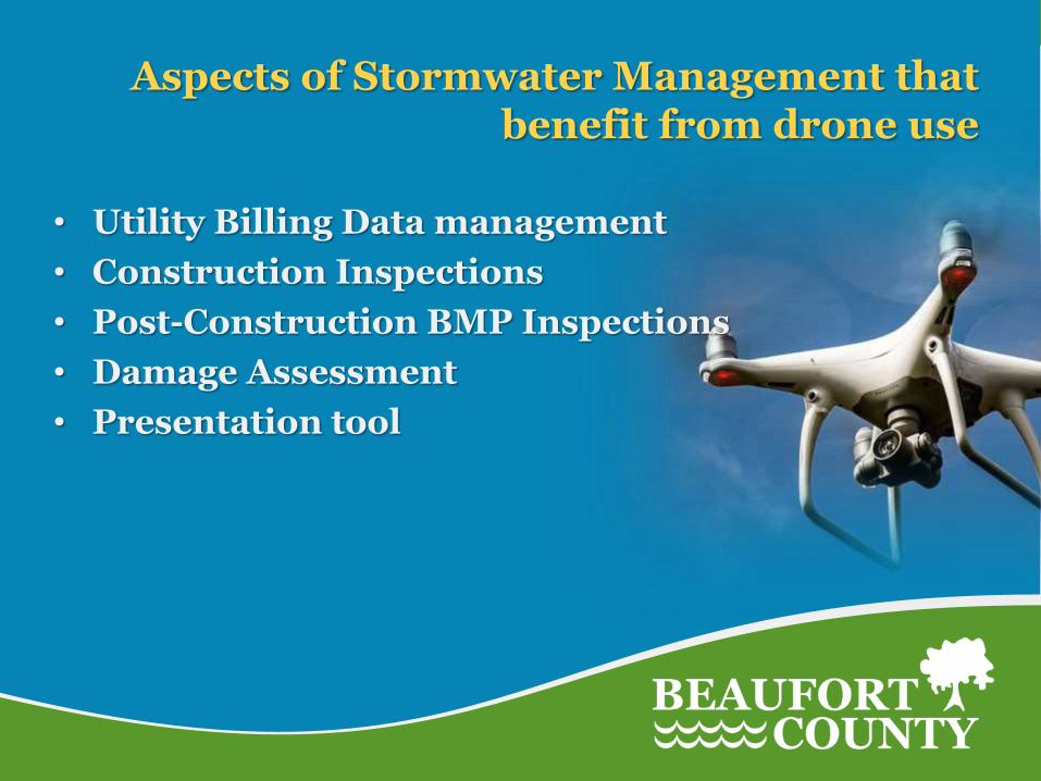
Aspects of Stormwater Management that benefit from drone use
• Utility Billing Data management
• Construction Inspections
• Post-Construction BMP Inspections
• Damage Assessment
• Presentation tool

Why drones are important in Stormwater Management
• Efficient way to gather field information
• Accuracy of data supports better decision making
• Allows for timely updates of data
• Excellent tool for conveying information
• Improved quality of inspections
• Pays for itself in time savings, increased revenue
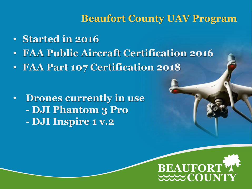
Beaufort County UAV Program
• Started in 2016
• FAA Public Aircraft Certification 2016
• FAA Part 107 Certification 2018
• Drones currently in use - DJI Phantom 3 Pro - DJI Inspire 1 v.2

Types of Drones
• Consumer / Semi-Professional Phantom 3 & 4 Series (12mp camera)
Mavic Series (very compact, Mavic 2 Pro now 20mp camera)
• Professional Phantom 4 Pro (20mp camera, larger 1” image sensor)
Inspire Series (Interchangeable Cameras, FLIR)
• Industrial / Enterprise Matrice Series (Hi-Accuracy GPS, Multiple Cameras, FLIR, LIDAR)
MG Series (Hi-Accuracy GPS, Multiple Cameras, FLIR, LIDAR, multi-
rotor hexacopter)
www.dji.com
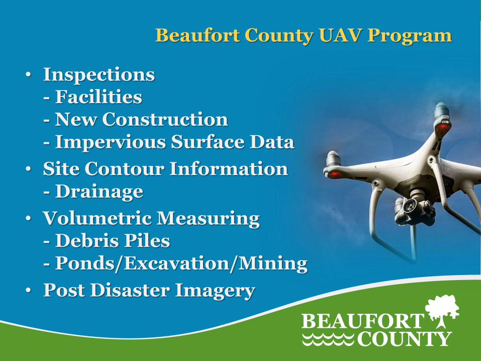
Beaufort County UAV Program
• Inspections - Facilities - New Construction - Impervious Surface Data
• Site Contour Information - Drainage
• Volumetric Measuring - Debris Piles - Ponds/Excavation/Mining
• Post Disaster Imagery

Beaufort County UAV Program
What are the Benefits?
• Real-time up-to-date imagery
• Higher Resolution Images
• Able to reach inaccessible areas
• Time saving
• Cost effective

Impervious Surface Calculations
• Once a project is completed, UAV can be deployed to capture up-to-date aerial imagery
• Higher Resolution Imagery allows for better surface identification and measurement - Current Pictometry - 4 in/pixel (every other year) - UAV – 1 to 2 in/pixel
• Calculations are provided earlier in the billing process
• Increased efficiency vs personnel on the ground
• Minimize loss of revenue
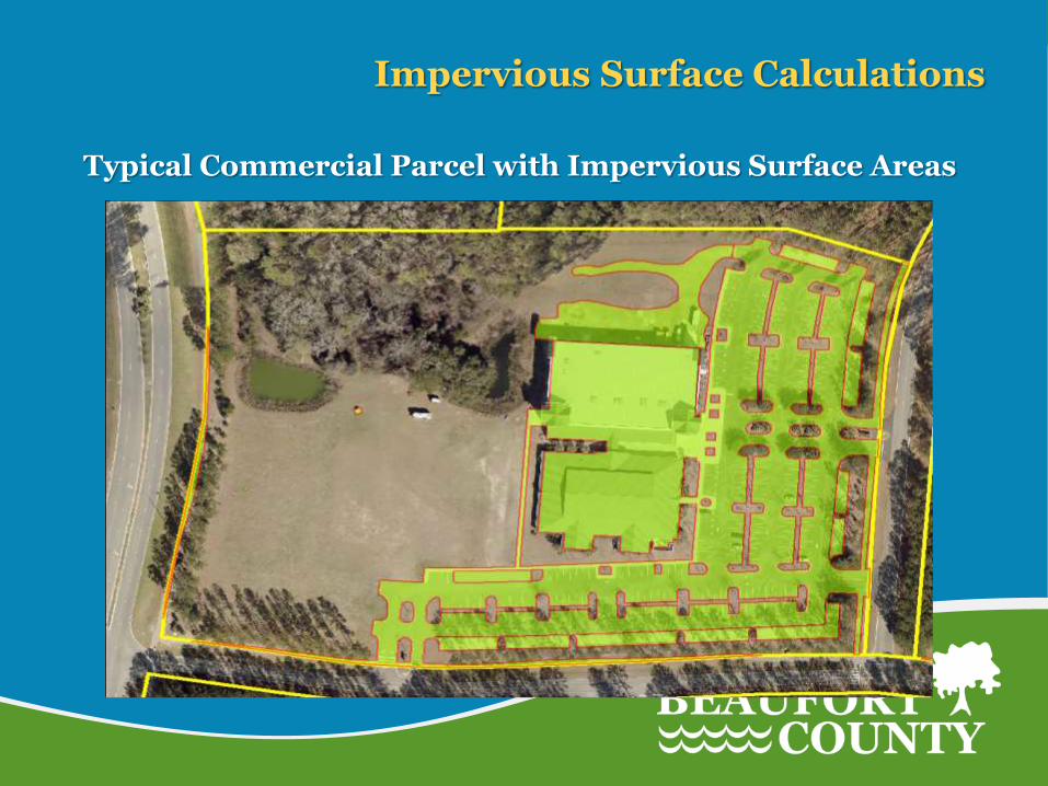
Impervious Surface Calculations
Typical Commercial Parcel with Impervious Surface Areas
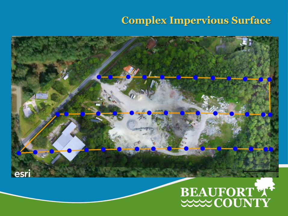
Complex Impervious Surface
• Moultrie Construction
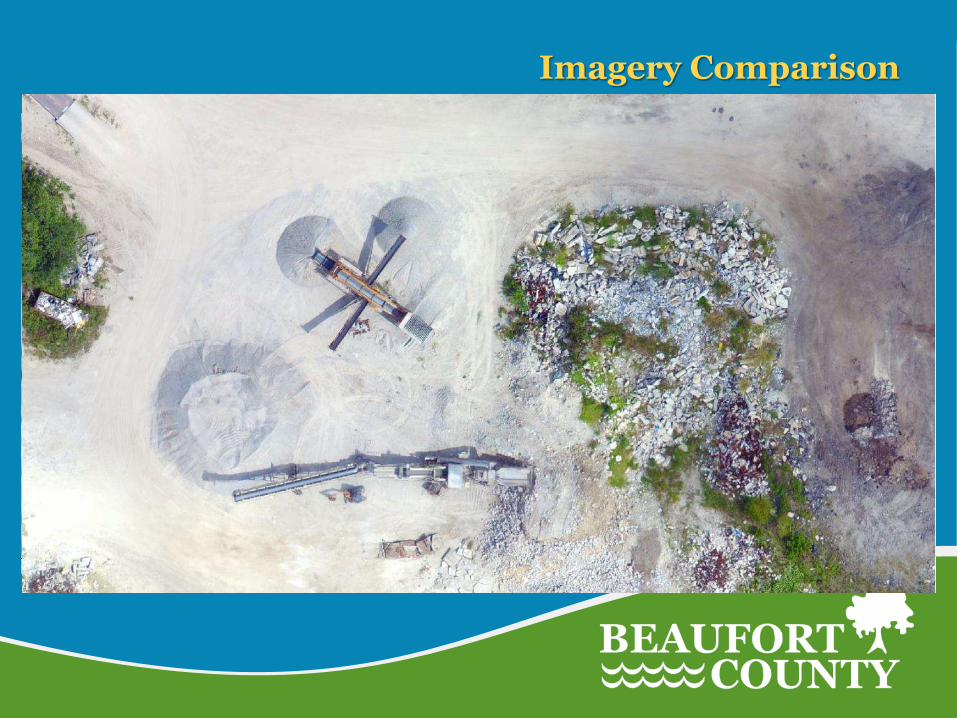
Imagery Comparison
• Moultrie Construction

ESRI - Drone2Map

Post Disaster Survey – Harbor Island
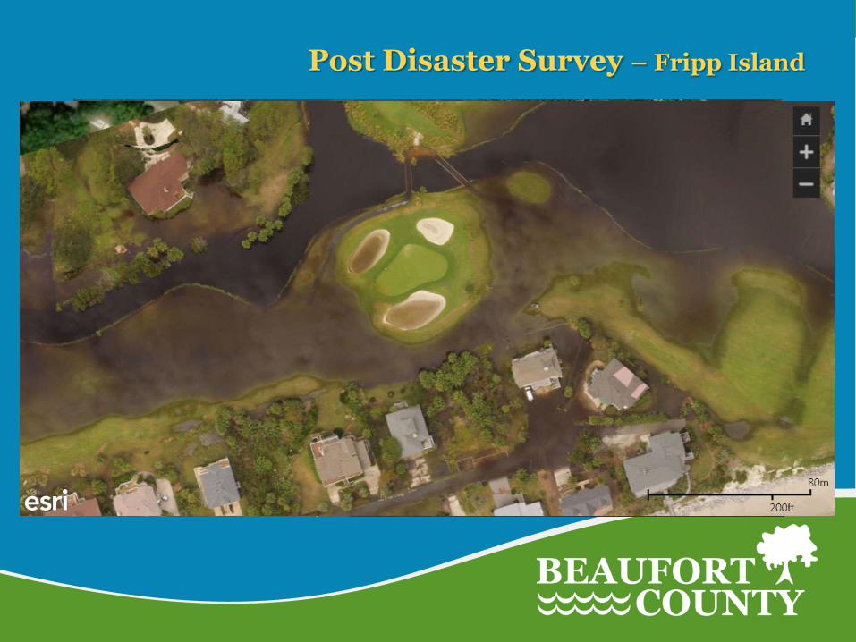
Post Disaster Survey – Fripp Island

Volumetric Measuring– Debris Piles

Resulting DSM (Digital Surface Model)
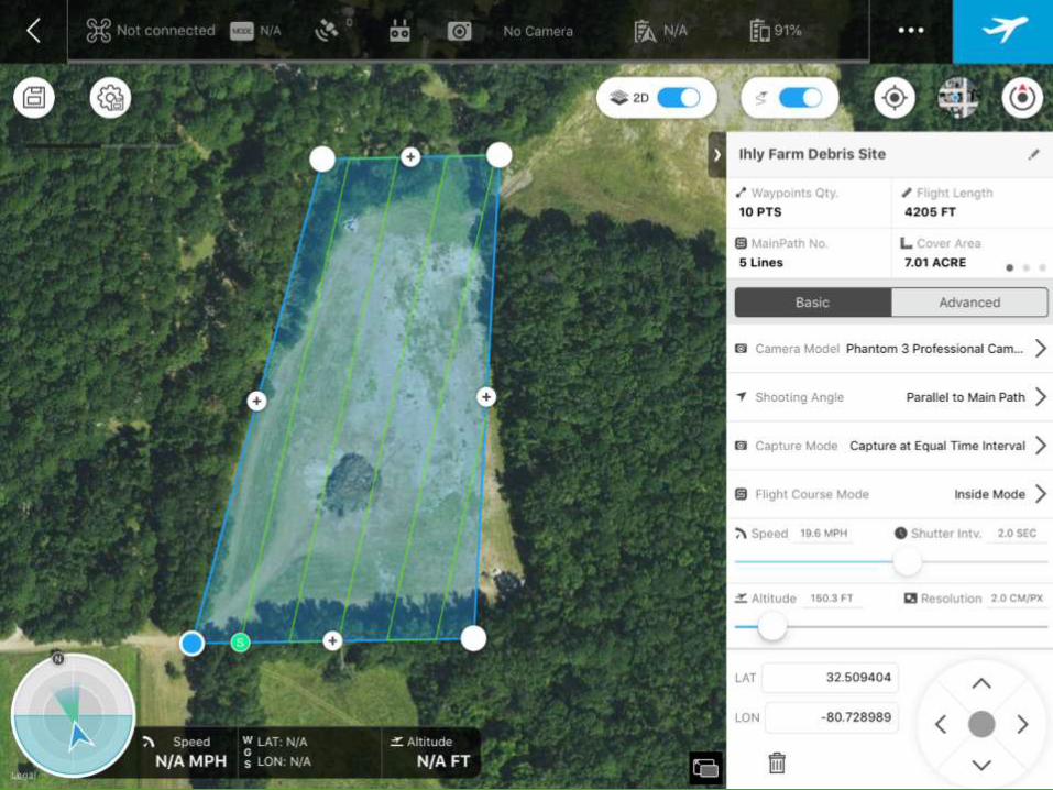
DJI Ground Station Pro
• Preflight planning
• Autonomous flight control / hands off
• Calculates time to complete mission
• Number of batteries needed
• Calculates area of survey
• Can create orthomosaic maps in software for viewing on site
• Resulting images are processed using ArcGIS Drone2Map
DJI Ground Station Pro
• Preflight planning
• Autonomous flight control / hands off
• Calculates time to complete mission
• Number of batteries needed
• Calculates area of survey
• Can create orthomosaic maps in software for viewing on site
• Resulting images are processed using ArcGIS Drone2Map
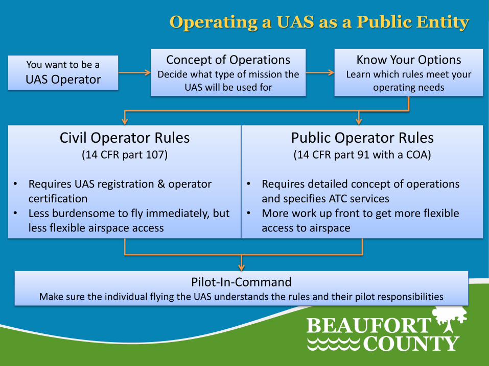
Pilot-In-Command Make sure the individual flying the UAS understands the rules and their pilot responsibilities
Concept of Operations Decide what type of mission the
UAS will be used for
Civil Operator Rules (14 CFR part 107)
• Requires UAS registration & operator
certification • Less burdensome to fly immediately, but
less flexible airspace access
Public Operator Rules (14 CFR part 91 with a COA)
• Requires detailed concept of operations
and specifies ATC services • More work up front to get more flexible
access to airspace
Operating a UAS as a Public Entity
You want to be a
UAS Operator
Know Your Options Learn which rules meet your
operating needs

FAA Part 107 Rules Summary
• Obtain a Remote Pilot Certificate
• Register UAS
• UAV must weigh less than 55 lbs
• Maximum altitude of 400 feet *
• Maximum ground speed of 100 mph
• Fly within visual-line-of-sight
• Fly only during daylight or civil twilight
• Don't fly directly over people
• Don't fly in controlled airspace near airports without FAA Certificate of Authorization (COA)
• Must have ATC approval to fly within controlled airspace

Part 107 Airspace Requirements
• Operations in Class G are allowed without air traffic control authorization
• Operations in Class B, C, D airspaces, and Class E airspace designated for airports require authorization from ATC

Aeronautical Chart

Safety….Safety….Safety!
Set safety standards and always fly within the law!