How Gazetteers Work
154
Transcript of How Gazetteers Work
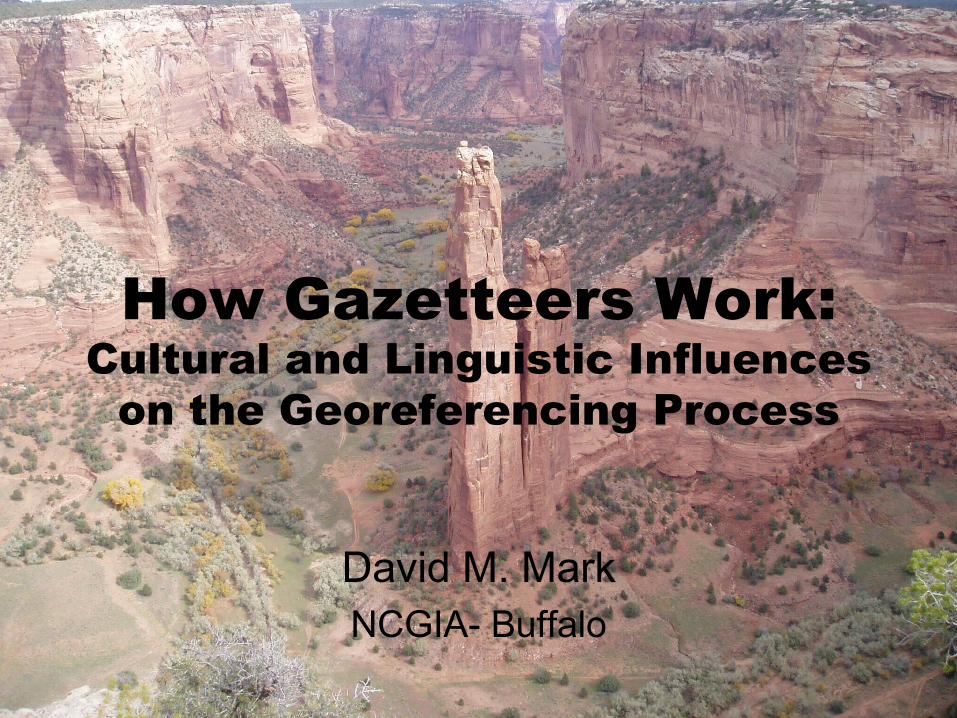
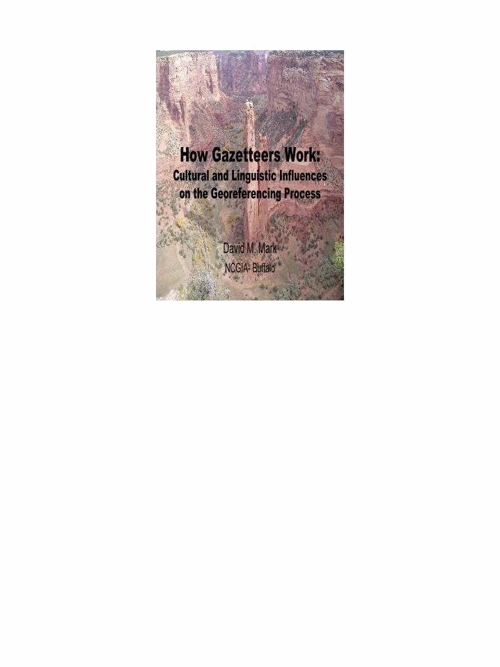
How Gazetteers Work:Cultural and Linguistic Influences
on the Georeferencing Process
David M. MarkNCGIA- Buffalo
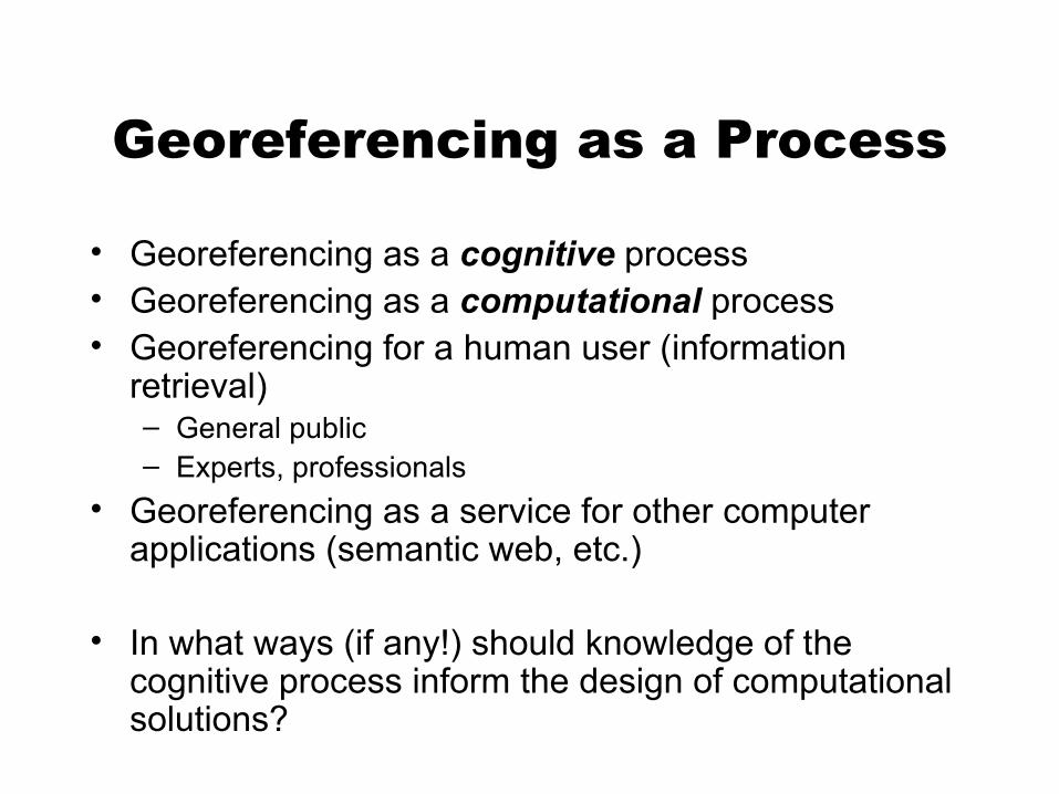
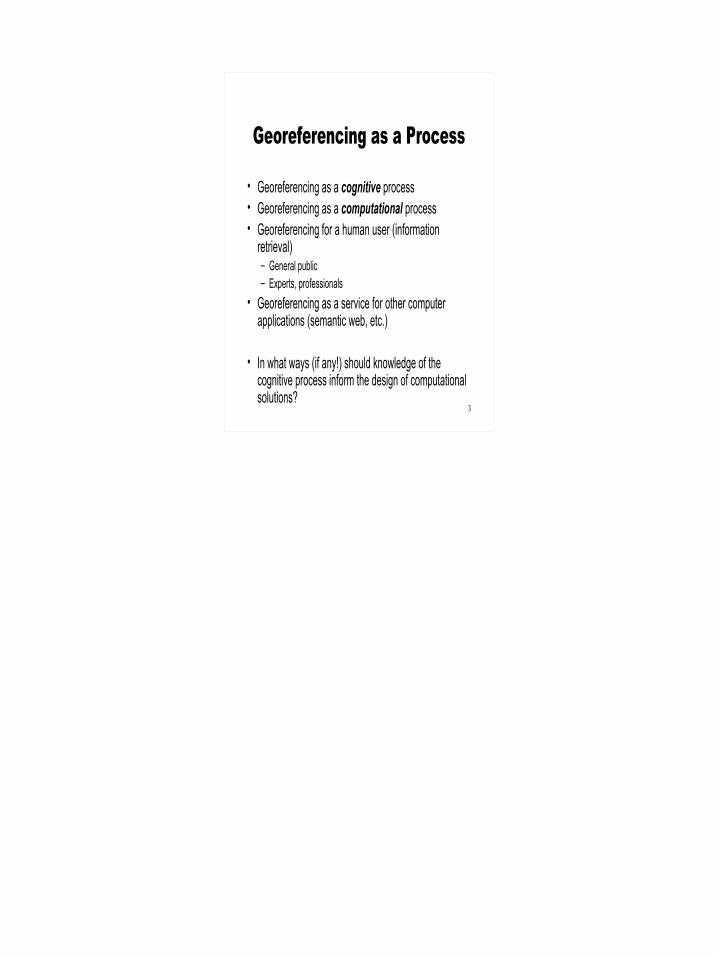
Georeferencing as a Process
• Georeferencing as a cognitive process• Georeferencing as a computational process• Georeferencing for a human user (information
retrieval)– General public– Experts, professionals
• Georeferencing as a service for other computer applications (semantic web, etc.)
• In what ways (if any!) should knowledge of the cognitive process inform the design of computational solutions?
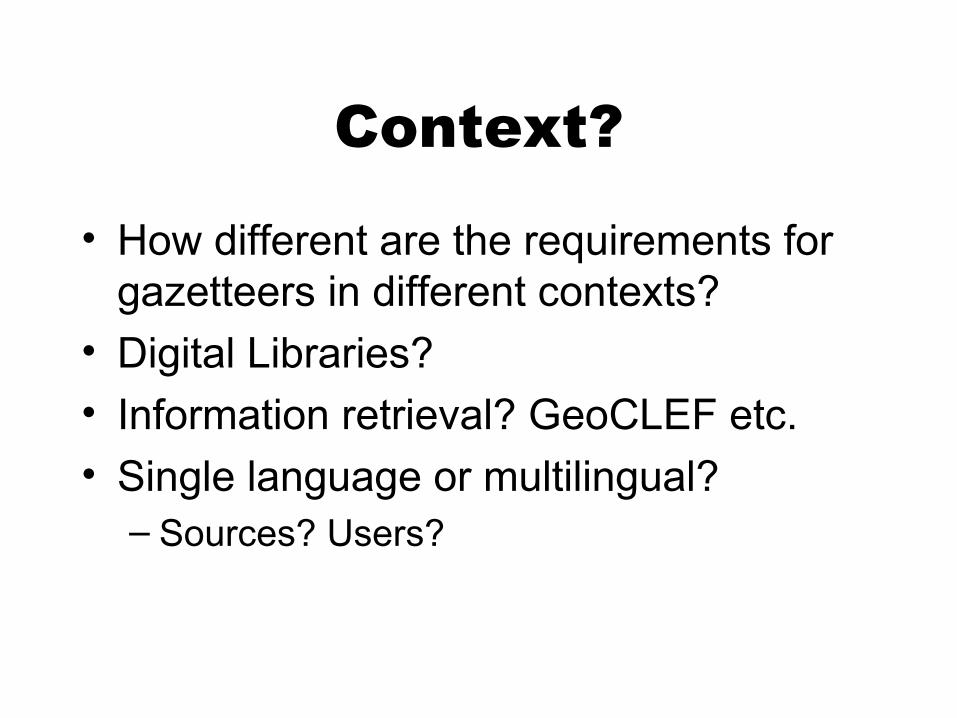
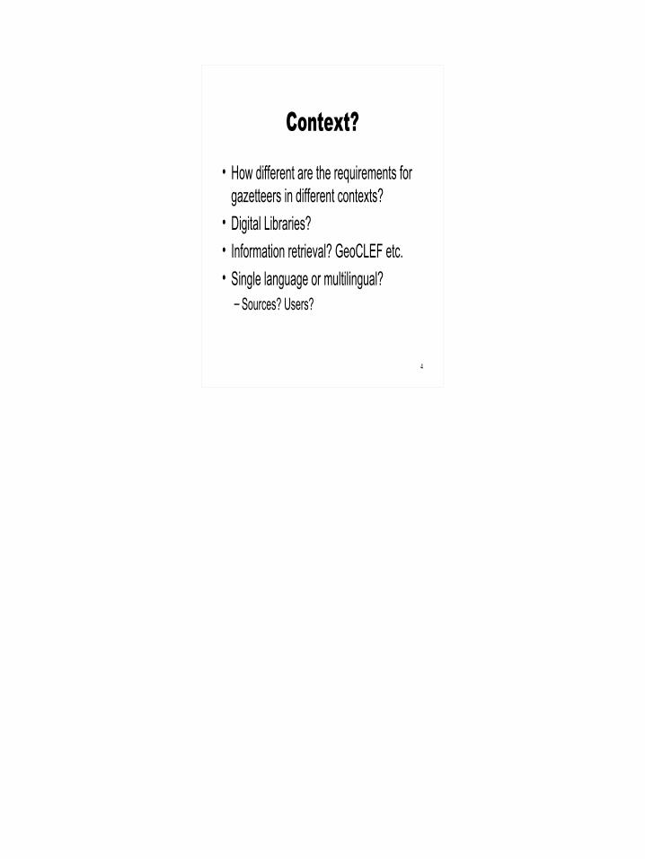
Context?
• How different are the requirements for gazetteers in different contexts?
• Digital Libraries?• Information retrieval? GeoCLEF etc.• Single language or multilingual?
– Sources? Users?
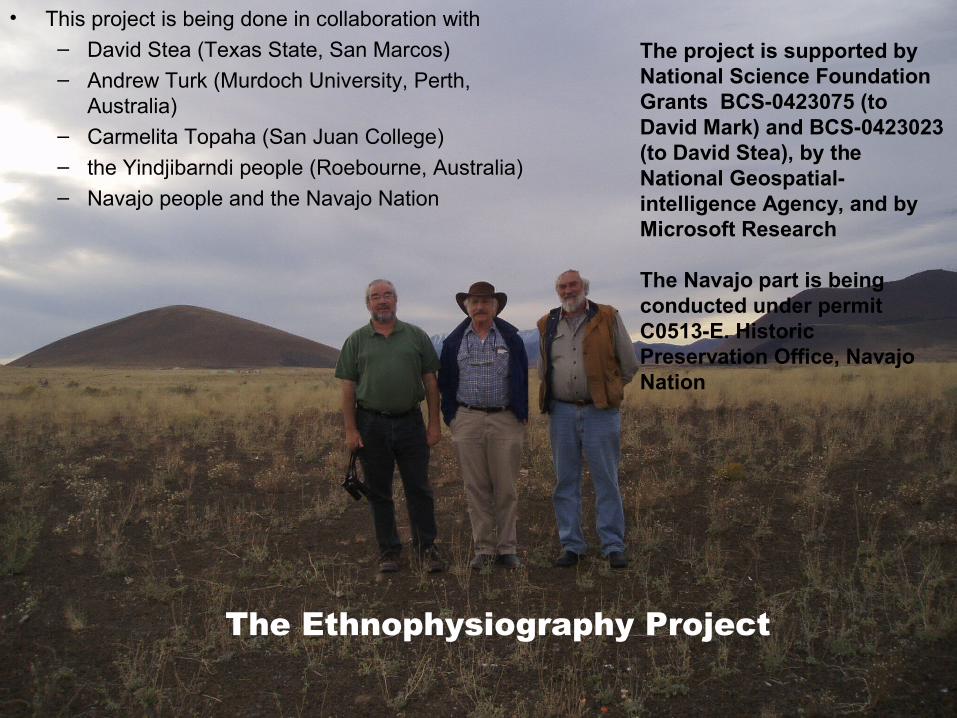
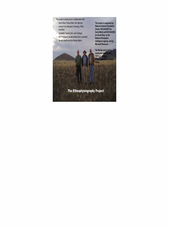
• This project is being done in collaboration with – David Stea (Texas State, San Marcos)– Andrew Turk (Murdoch University, Perth,
Australia)– Carmelita Topaha (San Juan College)– the Yindjibarndi people (Roebourne, Australia)– Navajo people and the Navajo Nation
The project is supported by National Science Foundation Grants BCS-0423075 (to David Mark) and BCS-0423023 (to David Stea), by the National Geospatial-intelligence Agency, and by Microsoft Research
The Navajo part is being conducted under permit C0513-E. Historic Preservation Office, Navajo Nation
The Ethnophysiography Project
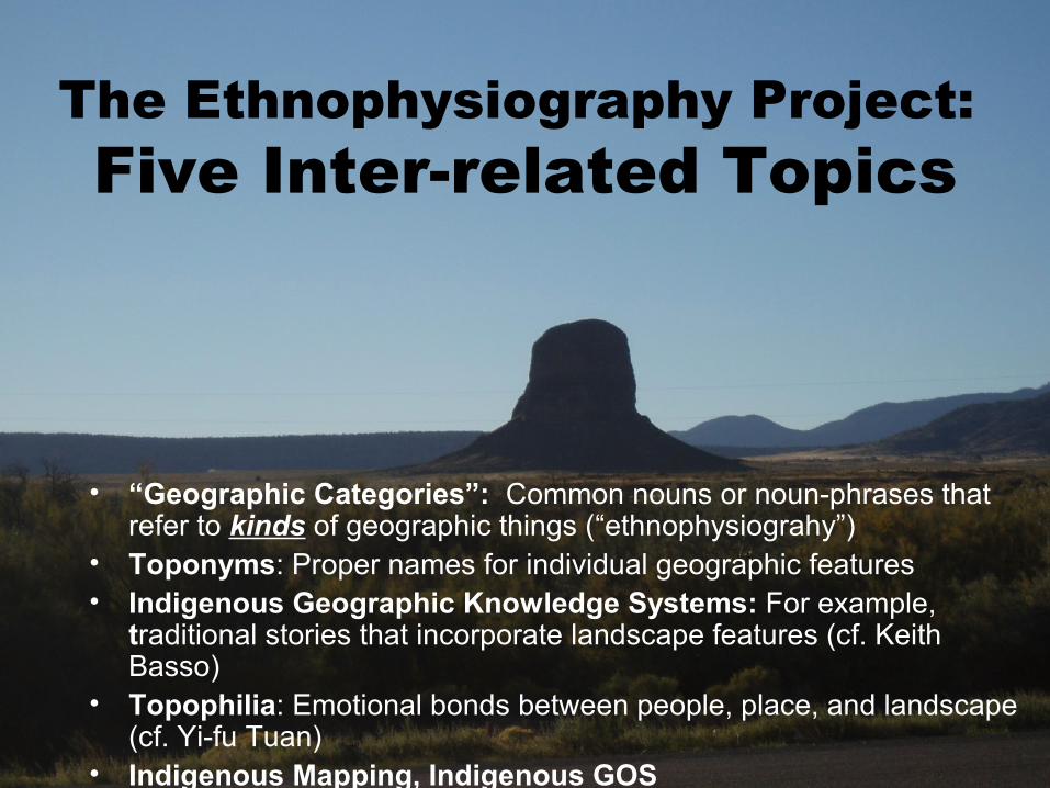
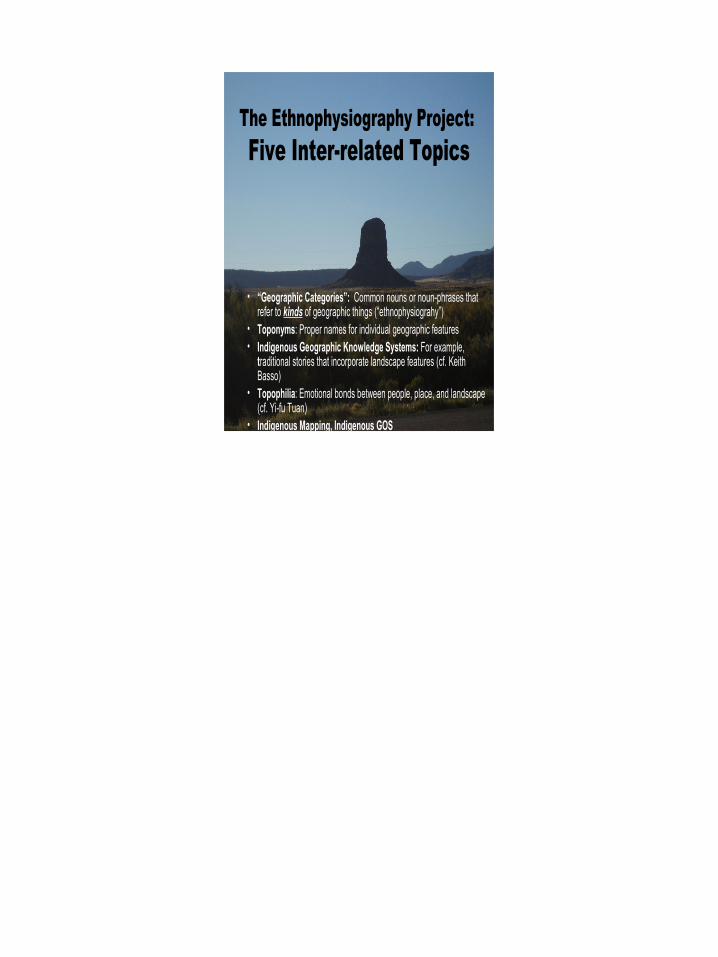
The Ethnophysiography Project: Five Inter-related Topics
• “Geographic Categories”: Common nouns or noun-phrases that refer to kinds of geographic things (“ethnophysiograhy”)
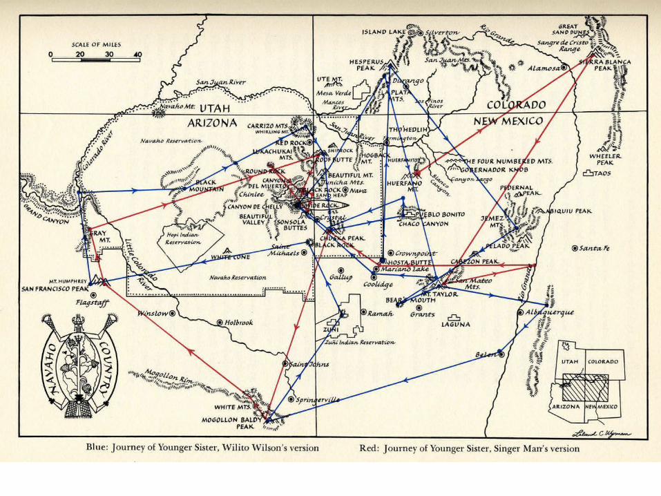
• Toponyms: Proper names for individual geographic features• Indigenous Geographic Knowledge Systems: For example,
traditional stories that incorporate landscape features (cf. Keith Basso)
• Topophilia: Emotional bonds between people, place, and landscape (cf. Yi-fu Tuan)
• Indigenous Mapping, Indigenous GOS
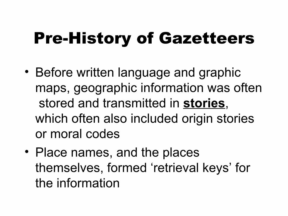
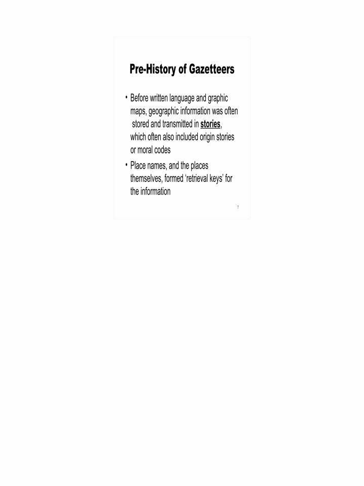
Pre-History of Gazetteers
• Before written language and graphic maps, geographic information was often stored and transmitted in stories, which often also included origin stories or moral codes
• Place names, and the places themselves, formed ‘retrieval keys’ for the information
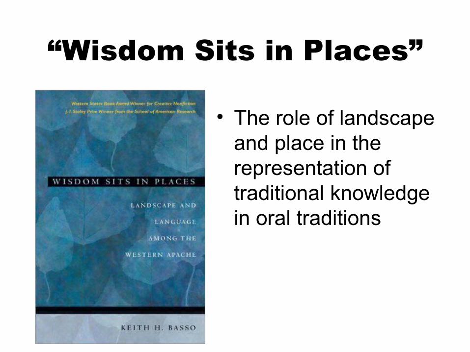
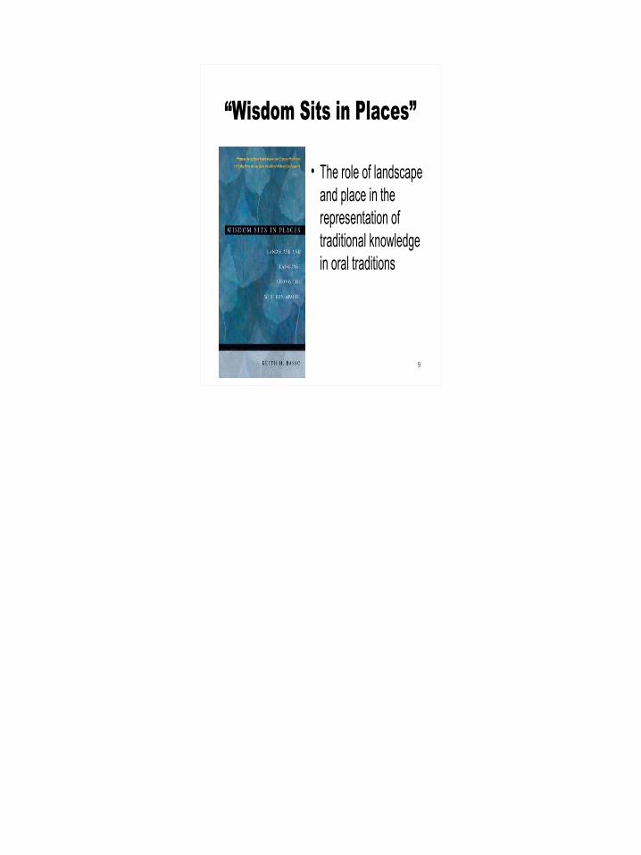
“Wisdom Sits in Places”
• The role of landscape and place in the representation of traditional knowledge in oral traditions
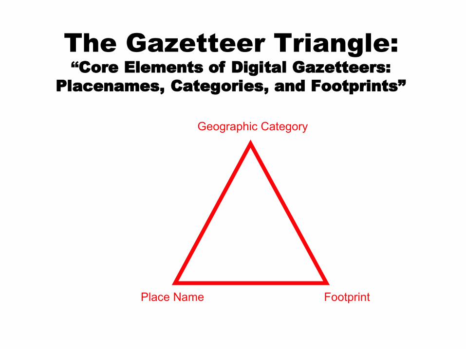
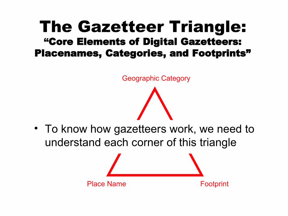
Place Name
Geographic Category
The Gazetteer Triangle:“Core Elements of Digital Gazetteers:
Placenames, Categories, and Footprints”
Footprint
Place Name
Geographic Category
The Gazetteer Triangle:“Core Elements of Digital Gazetteers:
Placenames, Categories, and Footprints”
Footprint
• To know how gazetteers work, we need to understand each corner of this triangle
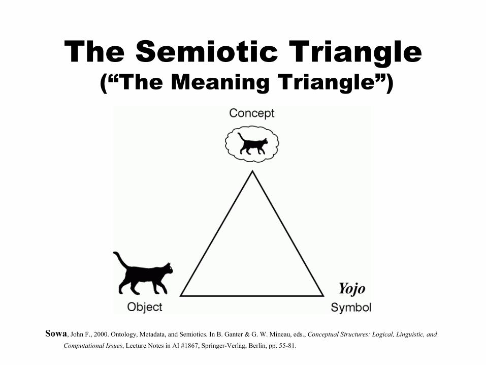
The Semiotic Triangle (“The Meaning Triangle”)
Sowa, John F., 2000. Ontology, Metadata, and Semiotics. In B. Ganter & G. W. Mineau, eds., Conceptual Structures: Logical, Linguistic, and
Computational Issues, Lecture Notes in AI #1867, Springer-Verlag, Berlin, pp. 55-81.
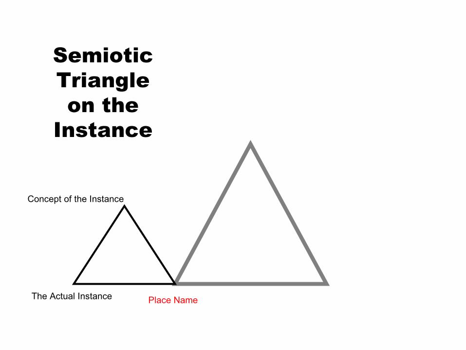
Place Name
Concept of the Instance
The Actual Instance
Semiotic Triangle on the
Instance
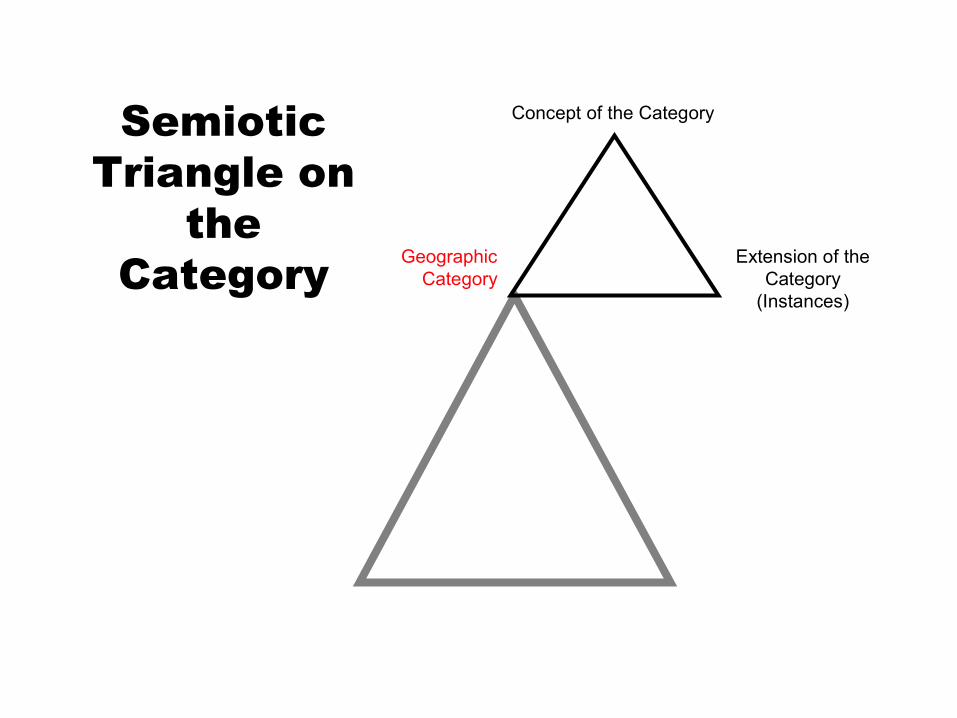
Concept of the Category
Geographic Category
Semiotic Triangle on
the Category Extension of the
Category (Instances)
Extension of the Category
(Instances)
Geographic Category
Concept of the Category
Concept of the Instance
The Actual Instance
Three Triangles
Place Name Footprint
Concept of the Category
Concept of the Instance
Instance- to-class
(Is-A)for
Concept
Concept of the Instance
The Actual Instance
Instance- to-class
(Is-A)for
Reality Extension of the Category
(Instances)
The Actual Instance
Location of the
Instance
Footprint
Geographic Category
The Actual Instance
Delimitation of the
Instance
Footprint
The Delimitation Problem
Concept of the Category
Delimitation details may depend on the Category (crisp or graded, etc.)
Extension of the Category
(Instances)
Concept of the Category
Concept of the Instance
The Actual Instance
Cultural Differences
in Place Names Geographic
Category
Place Name Footprint
Extension of the Category
Concept of the Category
Concept of the Instance
The Actual Instance
Cultural Differences
in Categories Geographic
Category
Place Name Footprint
Extension of the Category
Concept of the Category
Concept of the Instance
The Actual Instance
Cultural Differences in Delimitation?
Geographic Category
Place Name Footprint
Delimitation
Extension of the Category
Concept of the Category
Concept of the Instance
The Actual Instance
Geographic Category
Place Name Footprint
Aside: Do we really need categories in a “Geo-referencing System”?
Cultural & Linguistic Differences
• My main research the last four years has been on cultural and linguistic differences in geospatial conceptualization and referencing
Proper Names• I won’t say much about the “names” corner• Except for this sobering complication: for the
Navajo, many (most?) geographic features have at least two different proper names: one for traditional (origin) stories and one for every-day use
• It gets even more ‘interesting’: at least some of the sacred names are only to be used in the winter!
Categories:Concepts with no Word in English
• Here are some English-language descriptions of some landscape features that have single words in some other language, but no single word in English– “A canyon wall receiving sunlight”– “A spot of level ground in the mountains, surrounded
by ridges”– “A type of hollow in a sandhill, used as camping
place, especially in cold weather”– “An ‘island’ of land completely surrounded by one or
more younger lava flows”– “An island of grassland left unburnt after a
surrounding wildfire”– …
Example: Hawai’ian has a word “Kipuka”
• Kipuka: A Hawai’ian word for an ‘island’ of land completely surrounded by one or more younger lava flows
• Icelandic Has a Word for a lava ‘island’ too!– Óbrinnishólmi– Literally, “un-burnt-hill”
• And the Walmajarri (in Australia) language has a word with a similar meaning: – Nyirirr: an island of grass left unburnt by
surrounding fire
• So, if we based our ideas about geographic categories only on the meanings of the words in English, we would miss out on a lot!
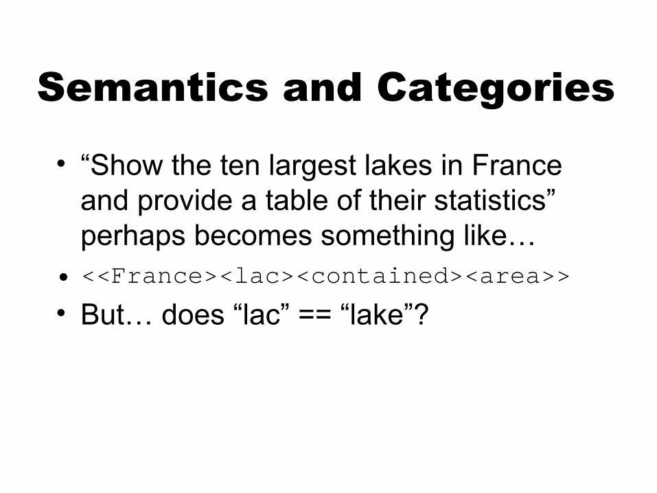
Semantics and Categories
• “Show the ten largest lakes in France and provide a table of their statistics”
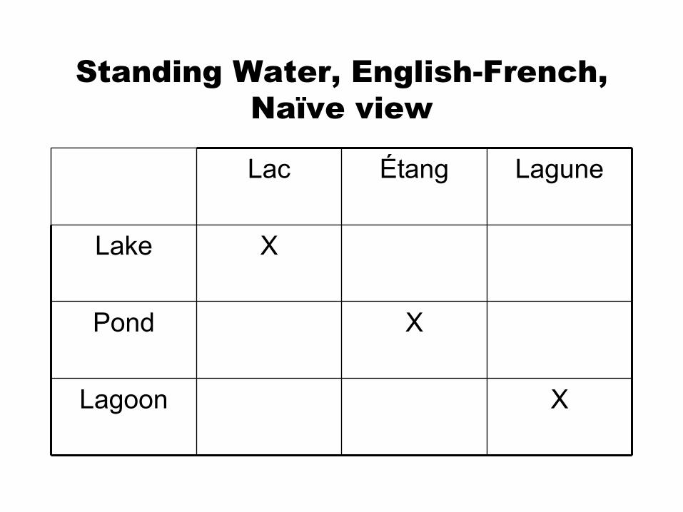
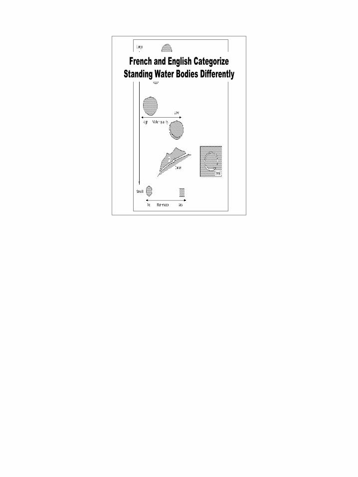
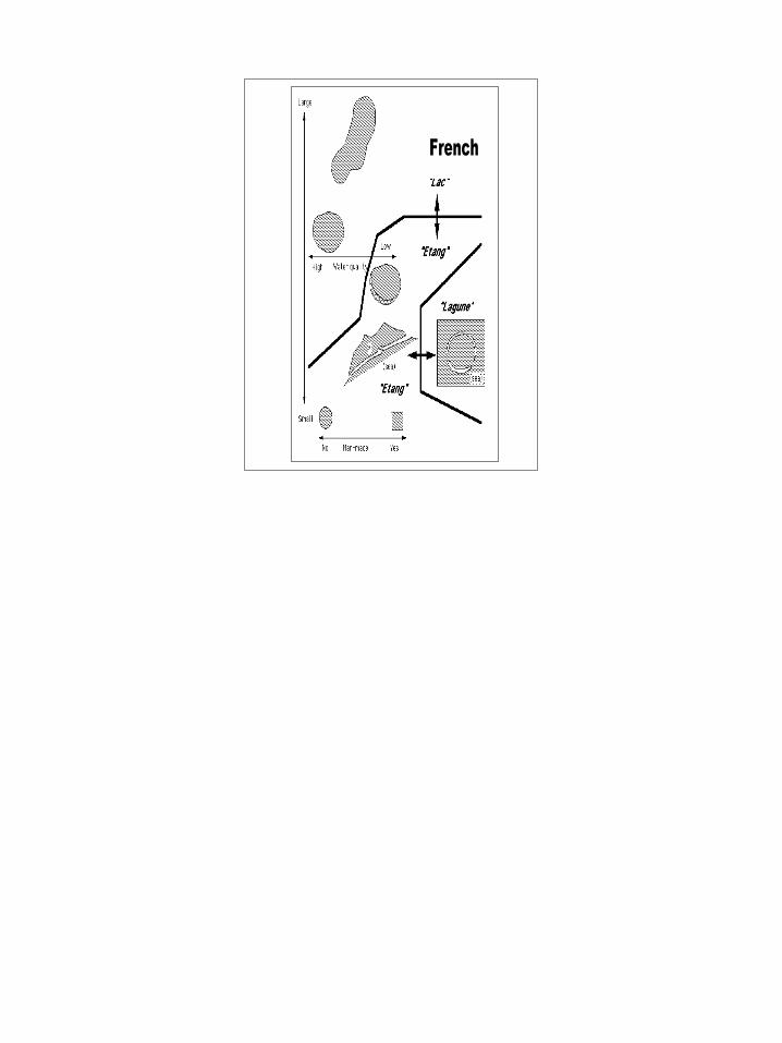
Standing Water, English-French, Naïve view
XLagoon
XPond
XLake
LaguneÉtangLac
Semantics and Categories
• “Show the ten largest lakes in France and provide a table of their statistics” perhaps becomes something like…
• <<France><lac><contained><area>>
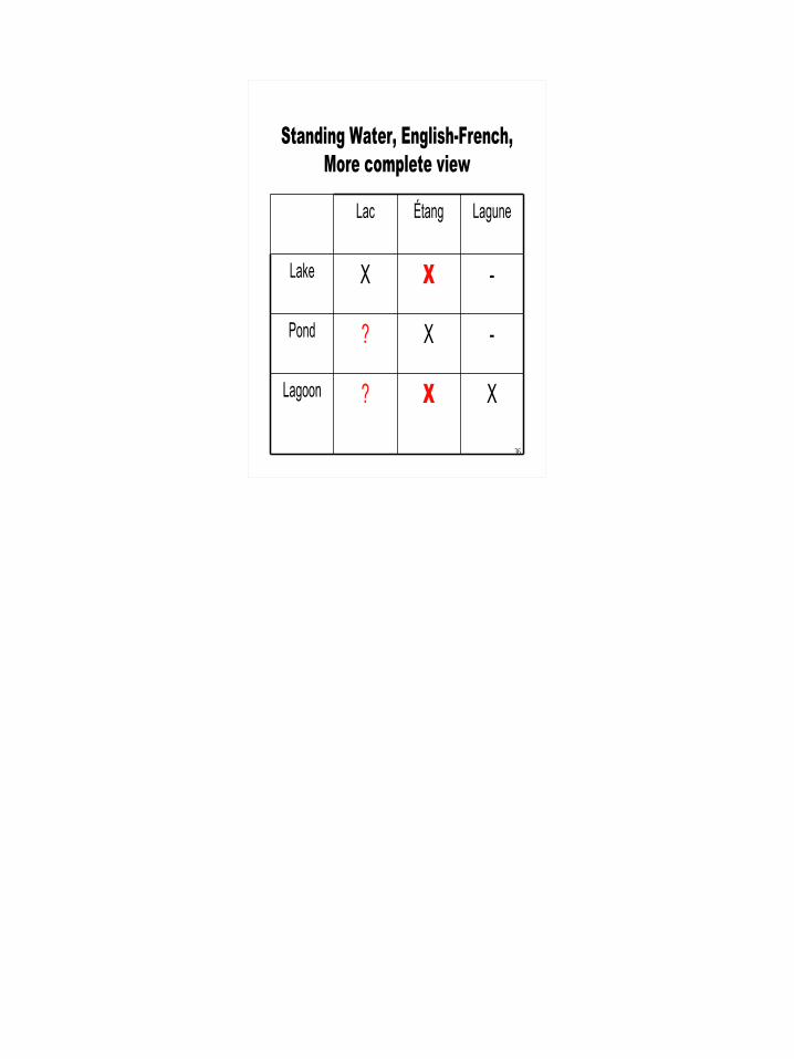
• But… does “lac” == “lake”?
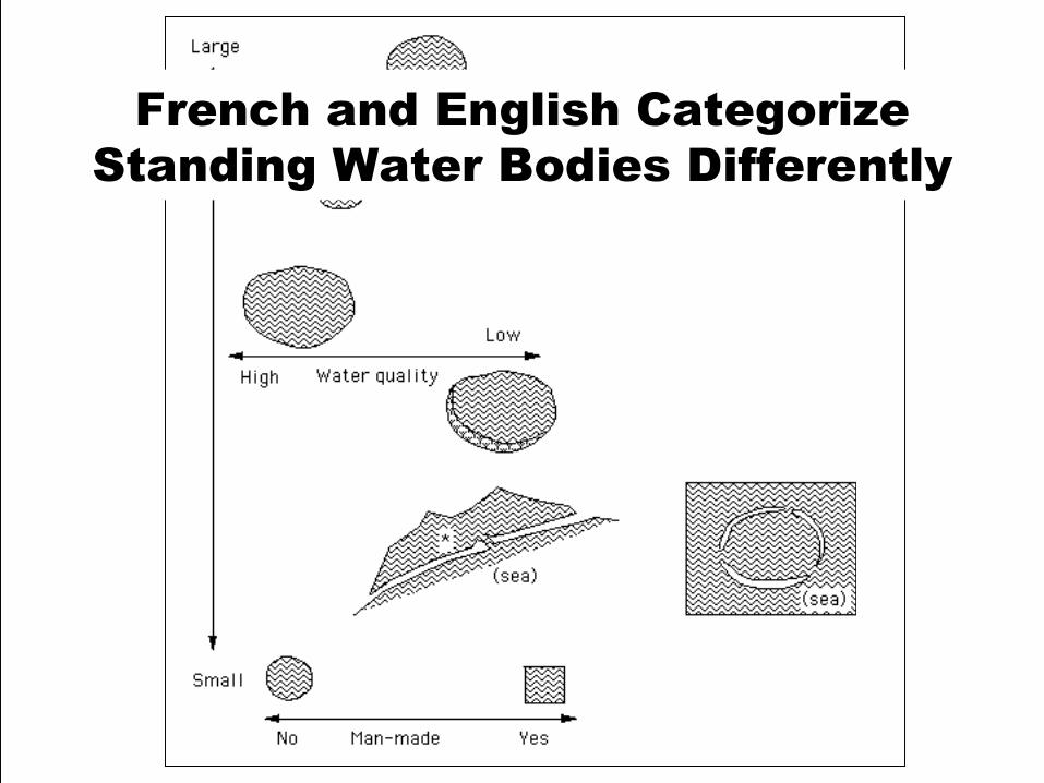
French and English Categorize Standing Water Bodies Differently
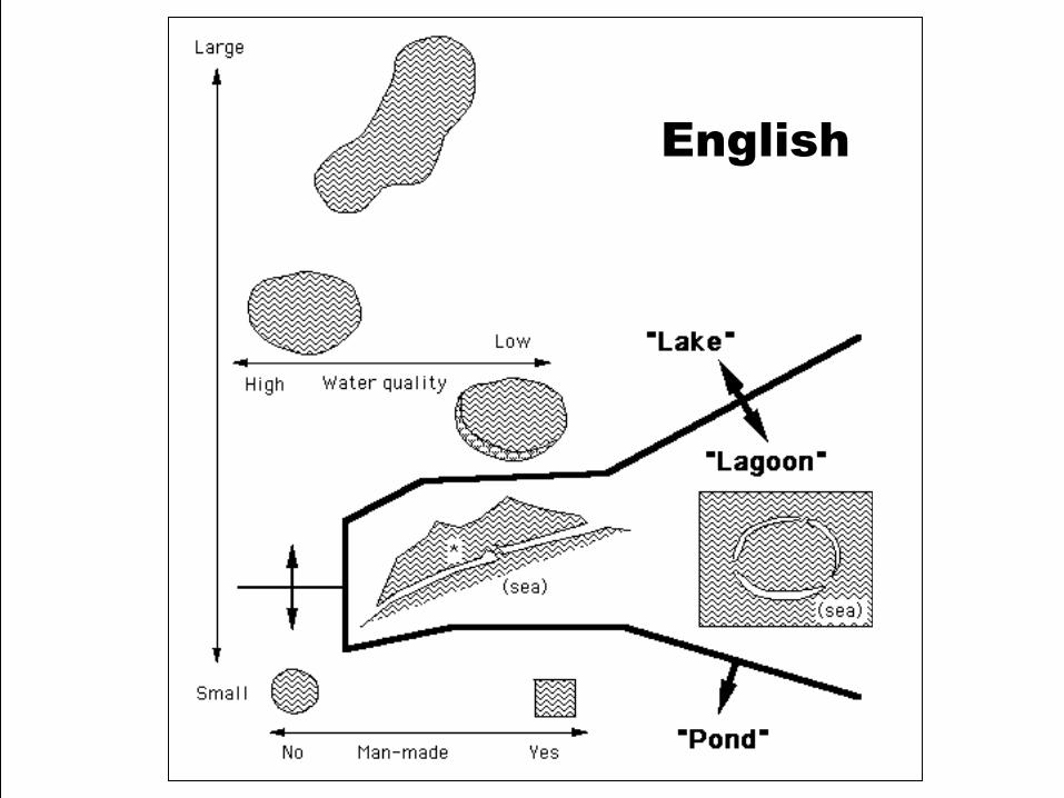
English
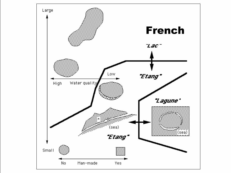
French
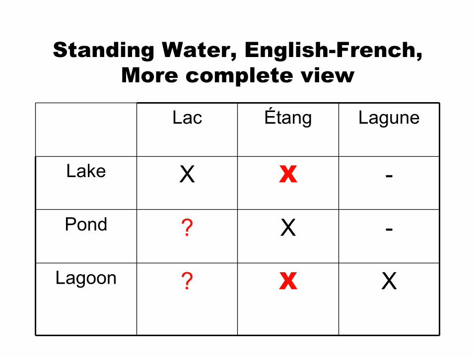
Standing Water, English-French, More complete view
XX?Lagoon
-X?Pond
-XXLake
LaguneÉtangLac
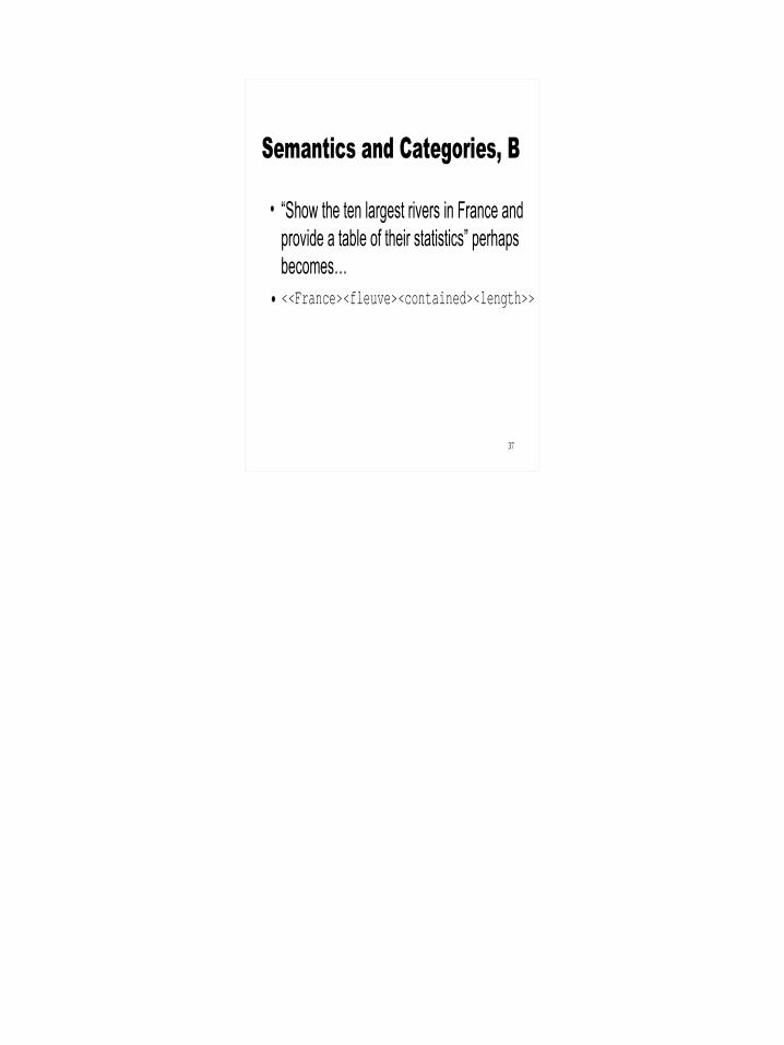
Semantics and Categories, B
• “Show the ten largest rivers in France and provide a table of their statistics” perhaps becomes…
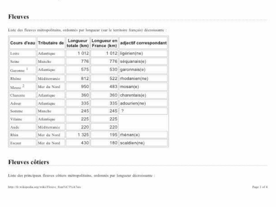
• <<France><fleuve><contained><length>>
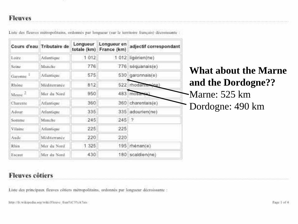
What about the Marne and the Dordogne??Marne: 525 kmDordogne: 490 km
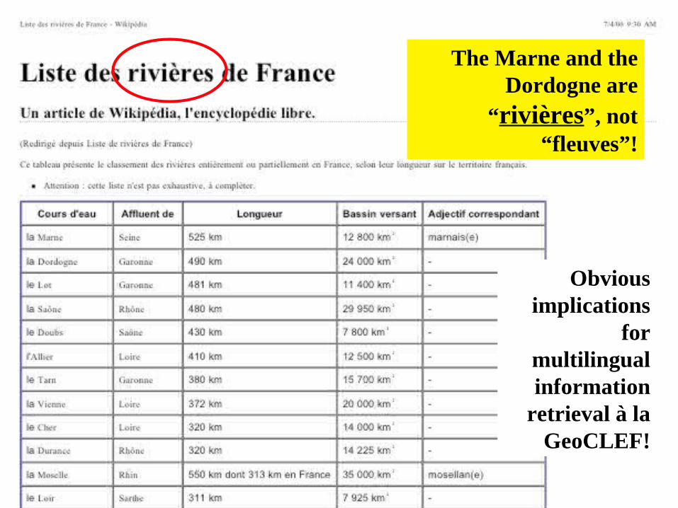
The Marne and the Dordogne are
“rivières”, not “fleuves”!
Obvious implications
for multilingual information
retrieval à la GeoCLEF!
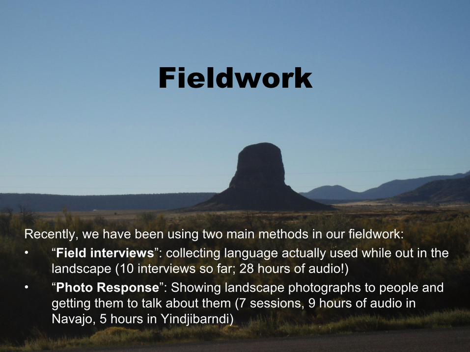
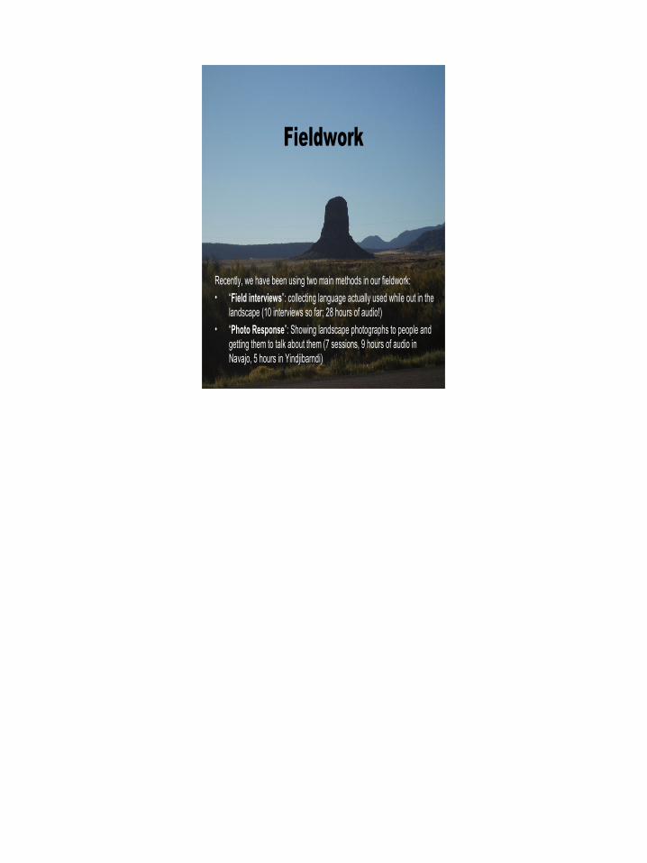
Recently, we have been using two main methods in our fieldwork:• “Field interviews”: collecting language actually used while out in the
landscape (10 interviews so far; 28 hours of audio!)• “Photo Response”: Showing landscape photographs to people and
getting them to talk about them (7 sessions, 9 hours of audio in Navajo, 5 hours in Yindjibarndi)
Fieldwork
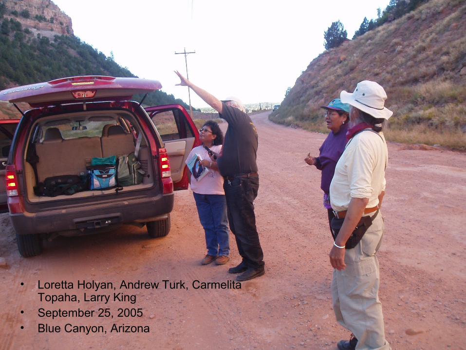
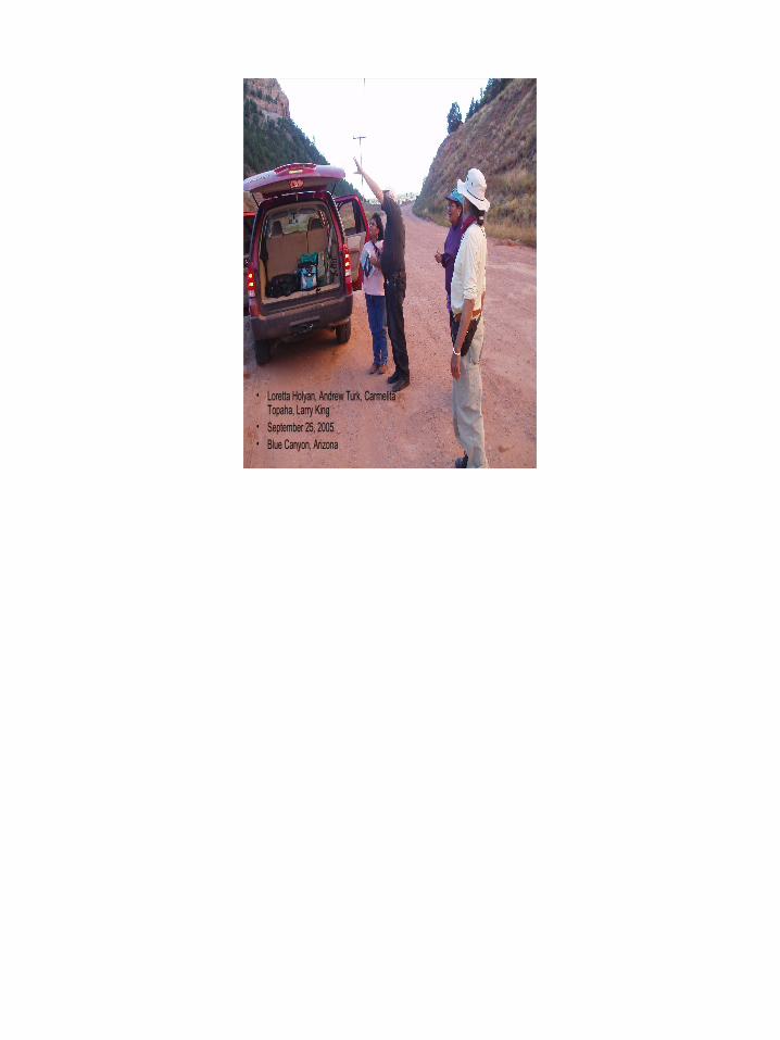
• Loretta Holyan, Andrew Turk, Carmelita Topaha, Larry King
• September 25, 2005• Blue Canyon, Arizona
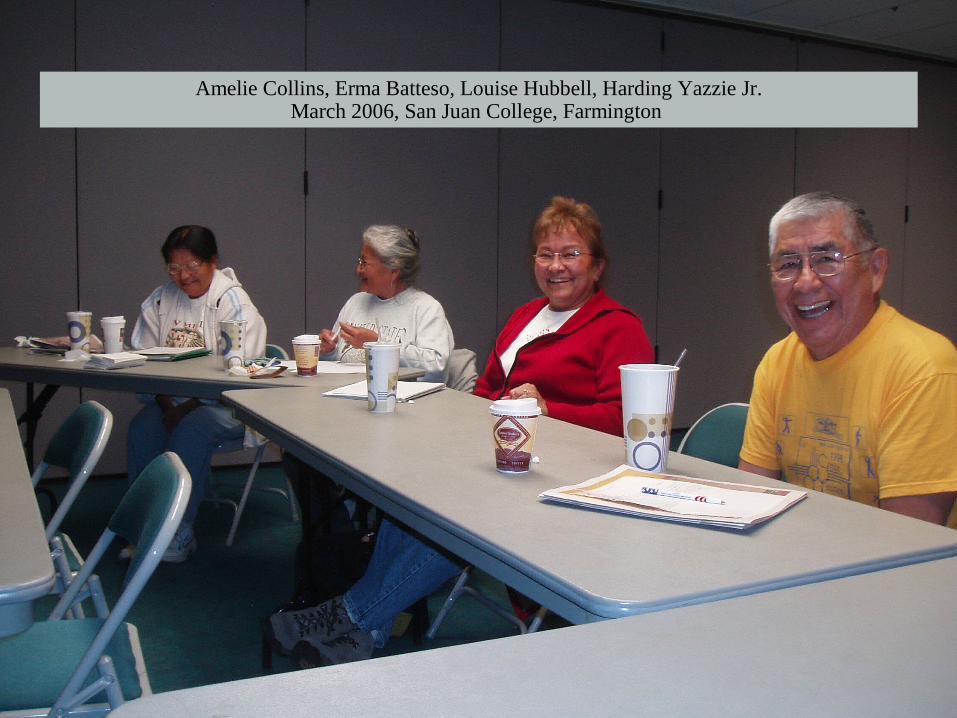
Amelie Collins, Erma Batteso, Louise Hubbell, Harding Yazzie Jr.March 2006, San Juan College, Farmington
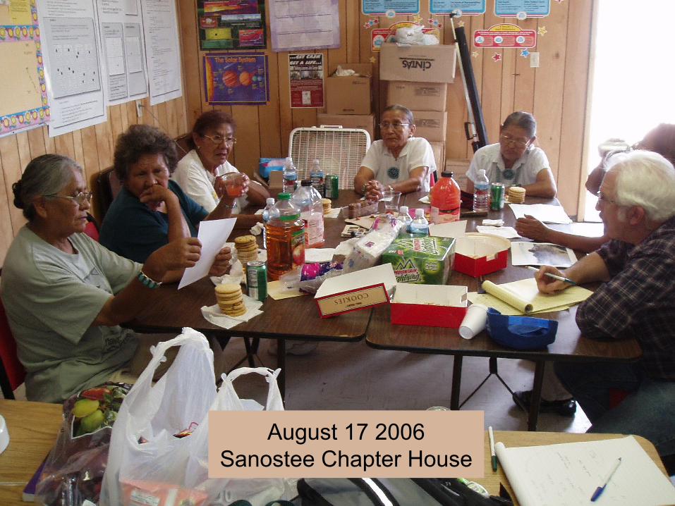
August 17 2006Sanostee Chapter House
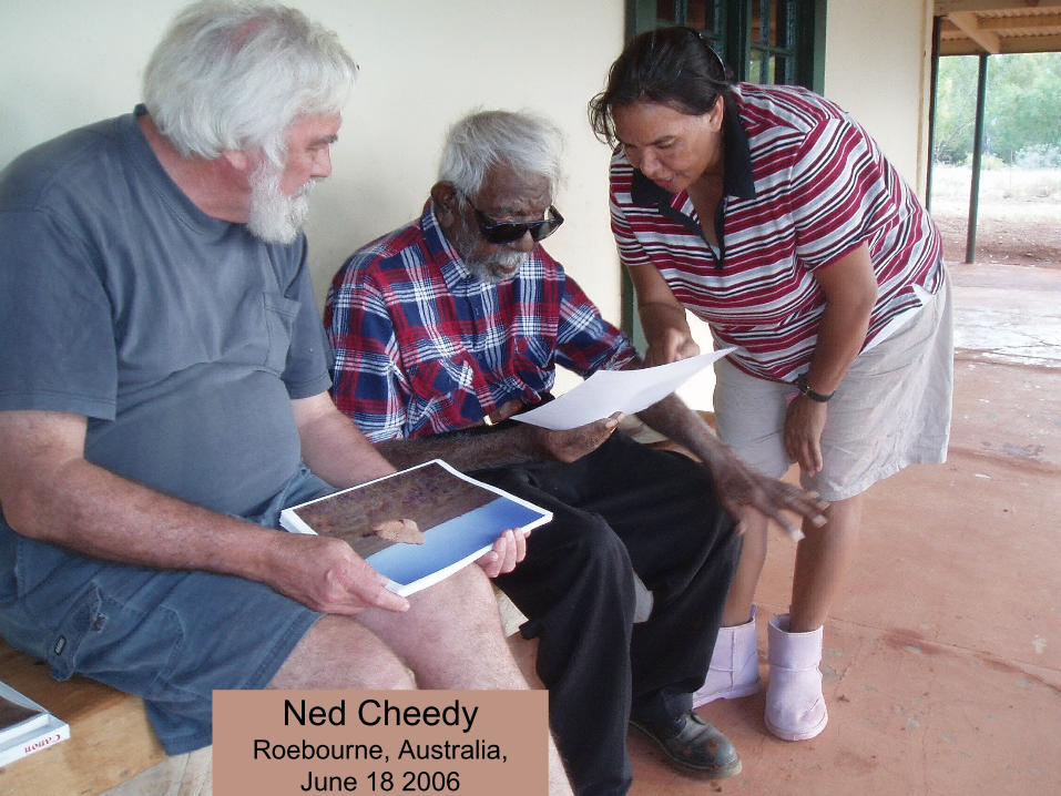
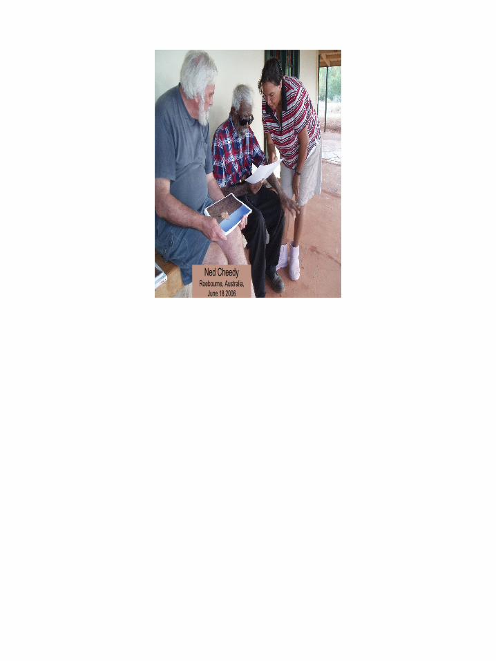
Ned Cheedy
Roebourne, Australia, June 18 2006
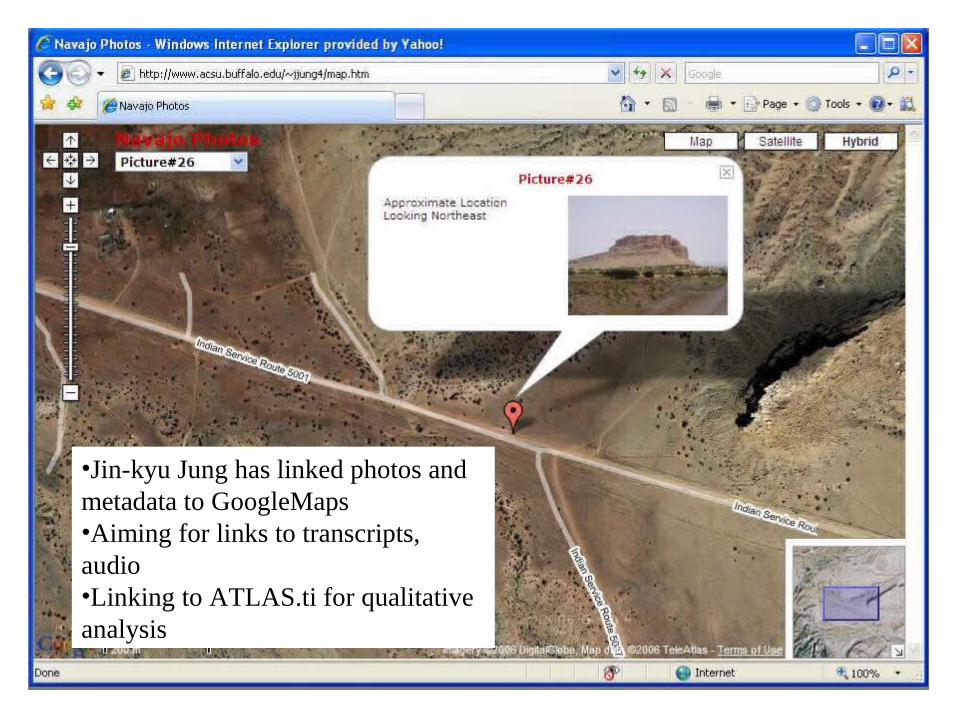
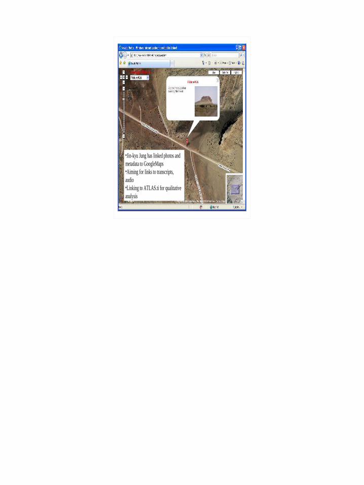
•Jin-kyu Jung has linked photos and metadata to GoogleMaps•Aiming for links to transcripts, audio•Linking to ATLAS.ti for qualitative analysis
Footprints
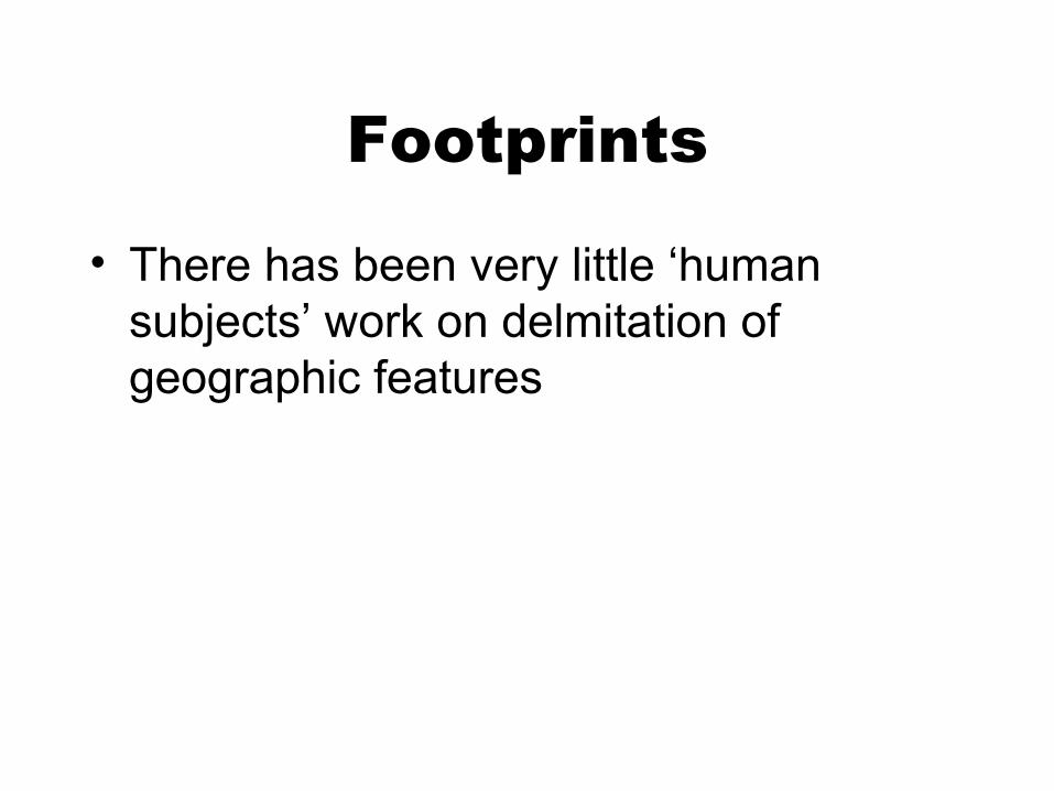
• There has been very little ‘human subjects’ work on delmitation of geographic features
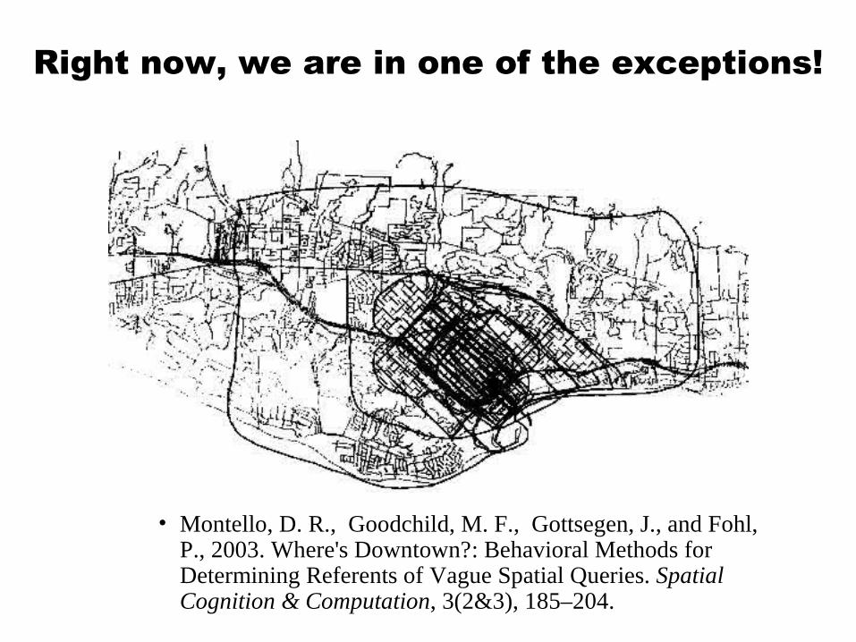
Right now, we are in one of the exceptions!
• Montello, D. R., Goodchild, M. F., Gottsegen, J., and Fohl, P., 2003. Where's Downtown?: Behavioral Methods for Determining Referents of Vague Spatial Queries. Spatial Cognition & Computation, 3(2&3), 185–204.
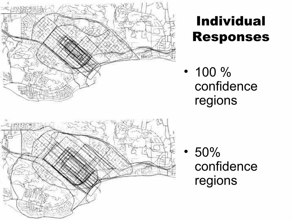
Individual Responses
• 100 % confidence regions
• 50% confidence regions
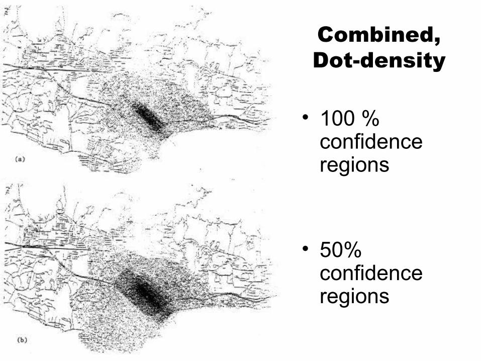
Combined, Dot-density
• 100 % confidence regions
• 50% confidence regions
Landforms
• Claim: A landform is a shape-based part of the Earth's surface, occupying a finite region, that has some degree of perceptual or functional coherence of form (shape)
• This definition has some circularity: – an arbitrary region is unlikely to contain
topography that has a coherent shape– yet without specifying the region in
advance, there is no ‘object’ for which shape can be determined
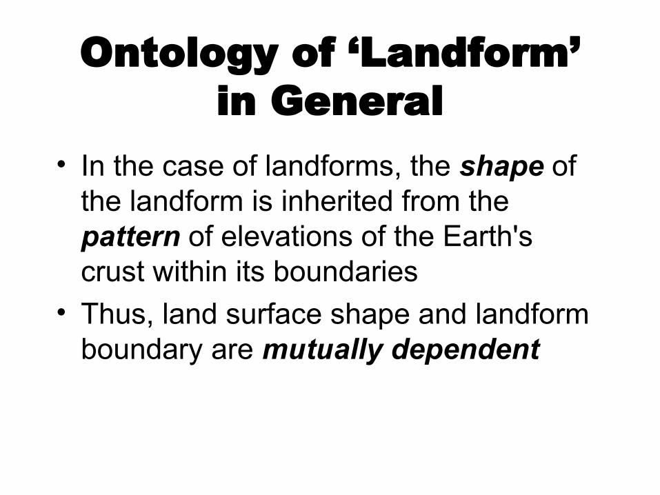
Ontology of ‘Landform’ in General
• In the case of landforms, the shape of the landform is inherited from the pattern of elevations of the Earth's crust within its boundaries
• Thus, land surface shape and landform boundary are mutually dependent
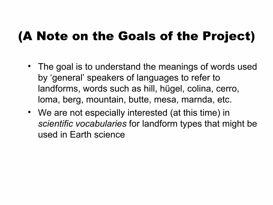
(A Note on the Goals of the Project)
• The goal is to understand the meanings of words used by ‘general’ speakers of languages to refer to landforms, words such as hill, hügel, colina, cerro, loma, berg, mountain, butte, mesa, marnda, etc.
• We are not especially interested (at this time) in scientific vocabularies for landform types that might be used in Earth science
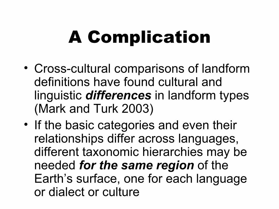
A Complication• Cross-cultural comparisons of landform
definitions have found cultural and linguistic differences in landform types (Mark and Turk 2003)
• If the basic categories and even their relationships differ across languages, different taxonomic hierarchies may be needed for the same region of the Earth’s surface, one for each language or dialect or culture
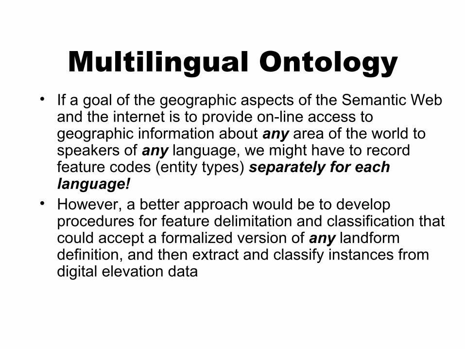
Multilingual Ontology• If a goal of the geographic aspects of the Semantic Web
and the internet is to provide on-line access to geographic information about any area of the world to speakers of any language, we might have to record feature codes (entity types) separately for each language!
• However, a better approach would be to develop procedures for feature delimitation and classification that could accept a formalized version of any landform definition, and then extract and classify instances from digital elevation data
Topographic Eminences• In this paper, we present first steps toward
such a system by outlining a strategy for definition-dependent extraction of topographic eminences
• We have chosen the term “eminence” as a super-ordinate term for hills, mountains, buttes, mesas, and other such landforms that stand above their immediate neighborhoods, because no other English word fits, and because Voegelin and Voegelin (“Hopi Domains”) used eminence in this sense
Topographic Eminences• Perceptual characteristics such as size, shape, color,
texture and material character may influence the perception and classification of eminences
• Whereas shape and size alone may not always be sufficient to define eminence types completely, we believe that size and shape are the most important factors that determine how people perceive and categorize eminences
• Today, we focus on form-based extraction and classification of eminences for categories commonly recognized in ‘every-day’ English
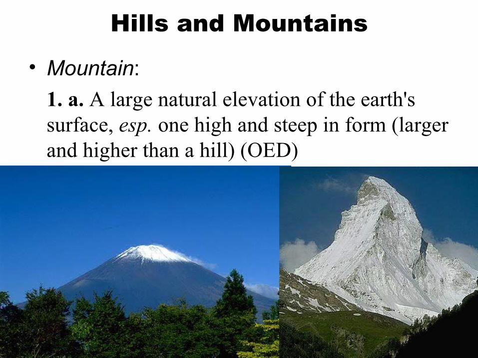
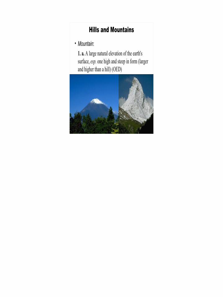
Hills and Mountains
• Mountain:1. a. A large natural elevation of the earth's surface, esp. one high and steep in form (larger and higher than a hill) (OED)
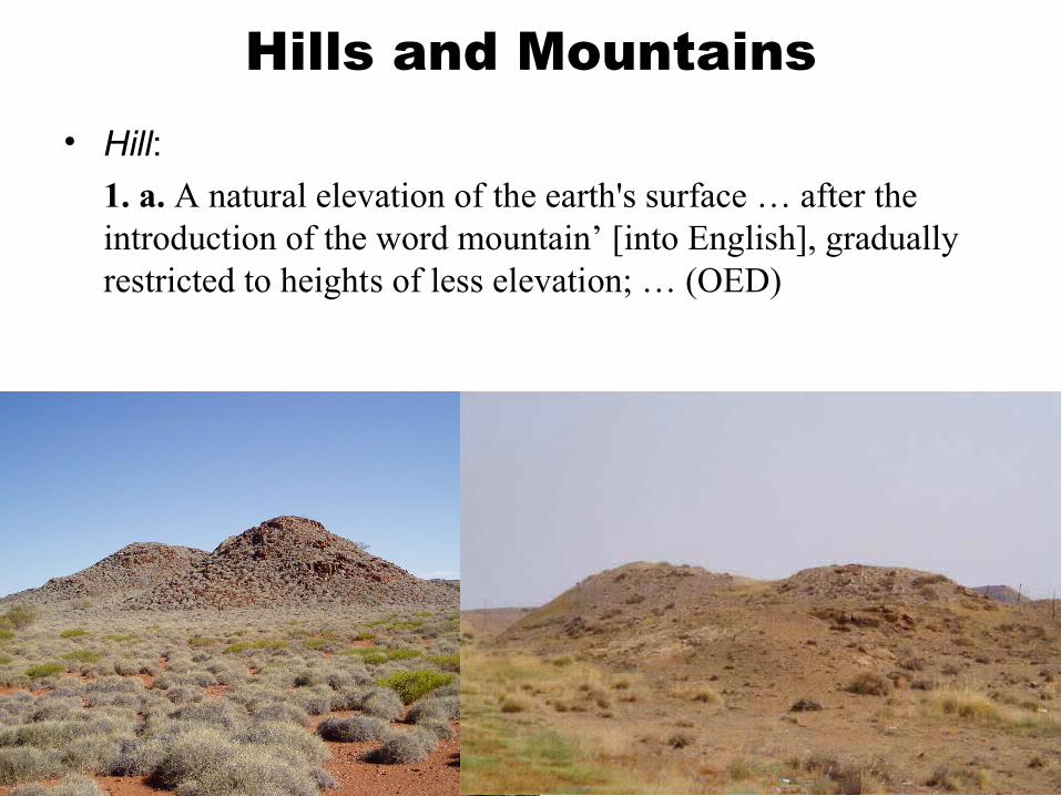
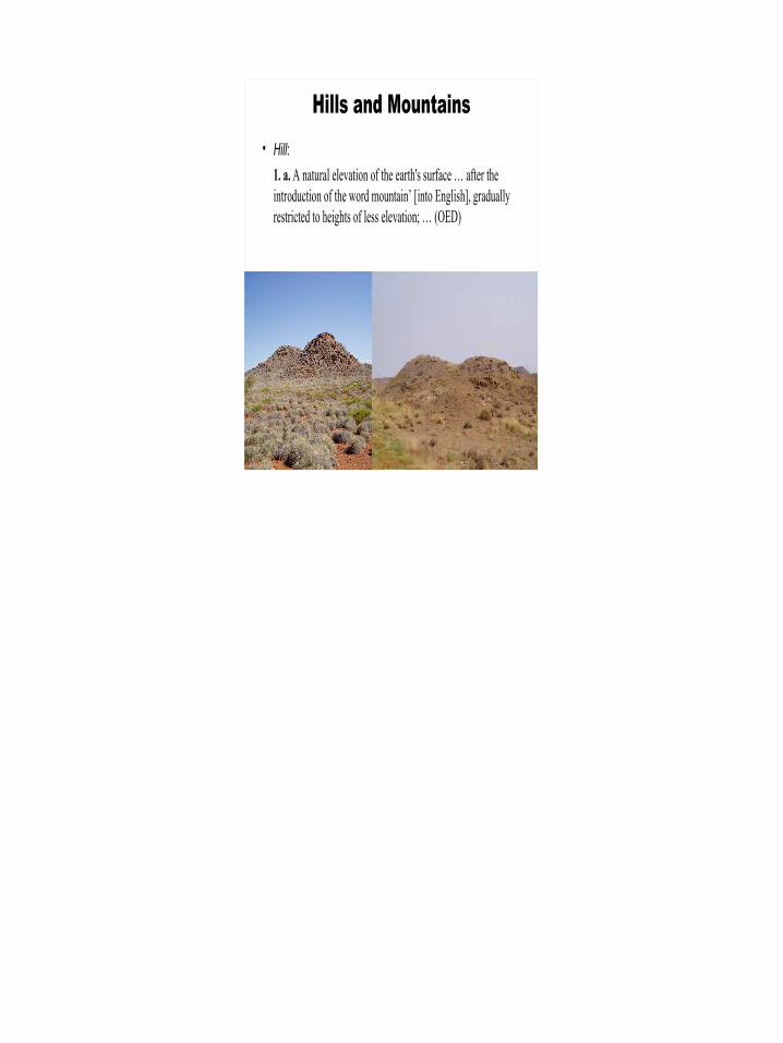
Hills and Mountains• Hill:
1. a. A natural elevation of the earth's surface … after the introduction of the word mountain’ [into English], gradually restricted to heights of less elevation; … (OED)
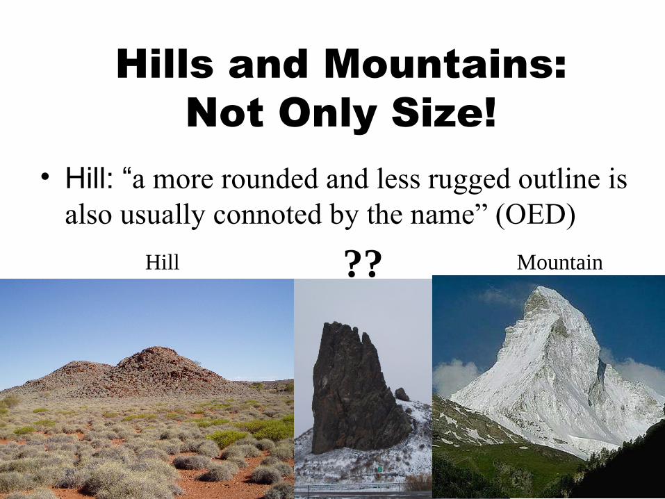
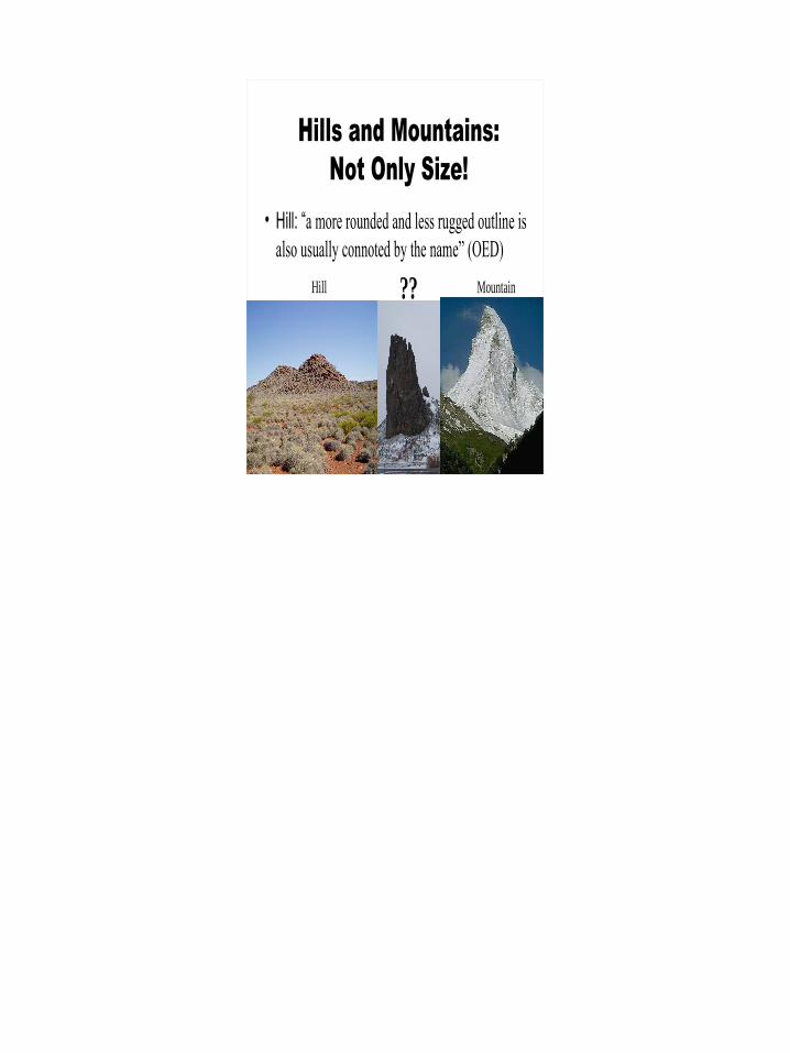
Hills and Mountains: Not Only Size!
• Hill: “a more rounded and less rugged outline is also usually connoted by the name” (OED)
Hill Mountain??
#76
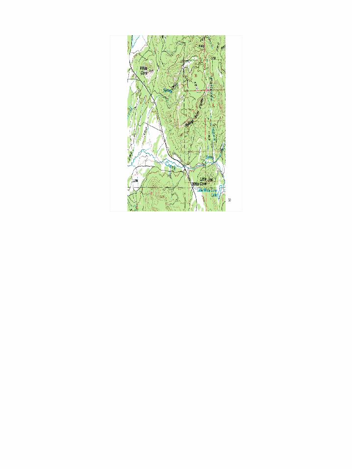
• 4• B• Shiprock area• buttes/ monoliths• P9250035
“Finger Rock”
“Mitten Buttes”
“Shiprock”
“Picacho Peak”
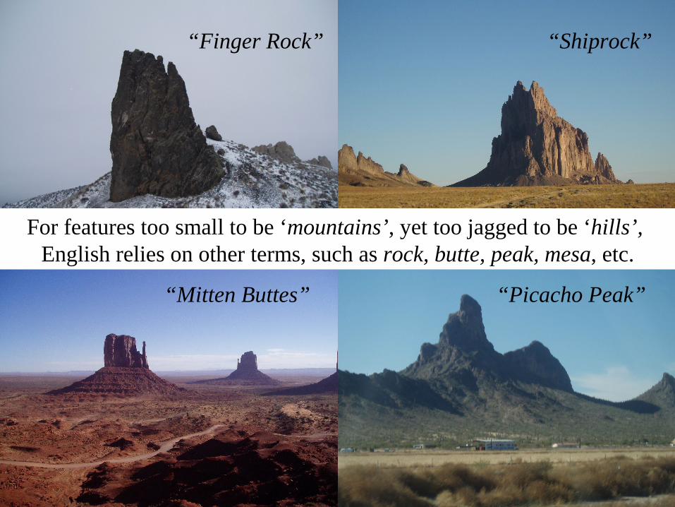
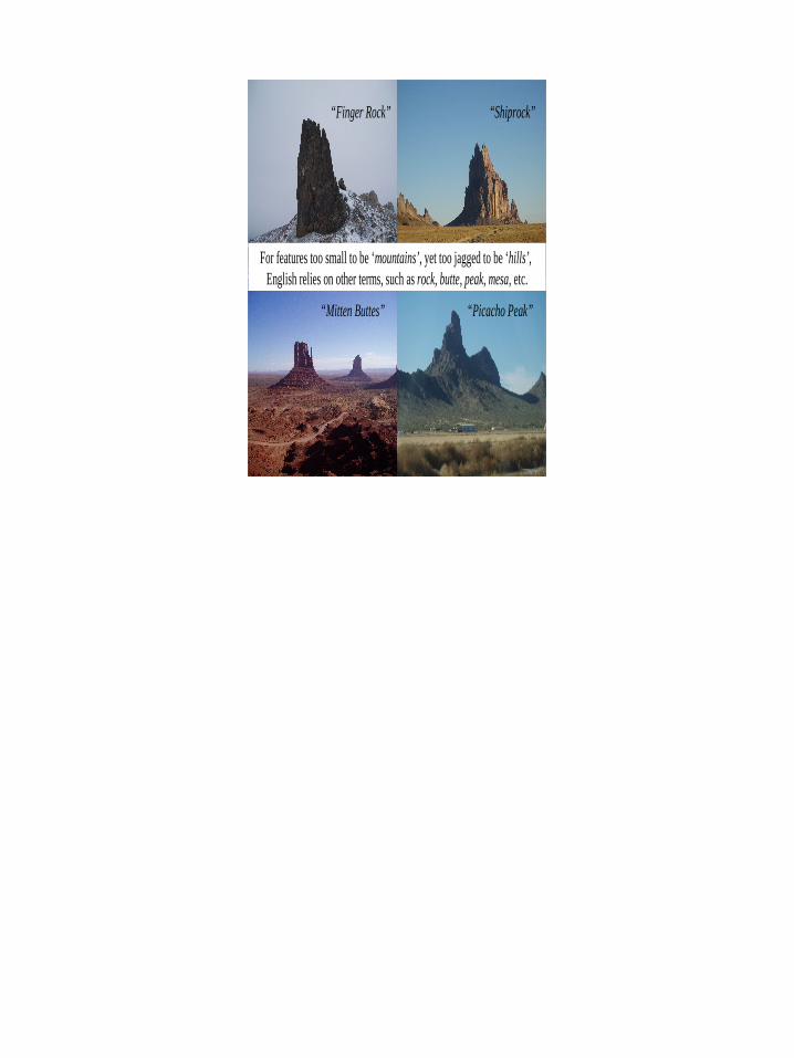
For features too small to be ‘mountains’, yet too jagged to be ‘hills’, English relies on other terms, such as rock, butte, peak, mesa, etc.
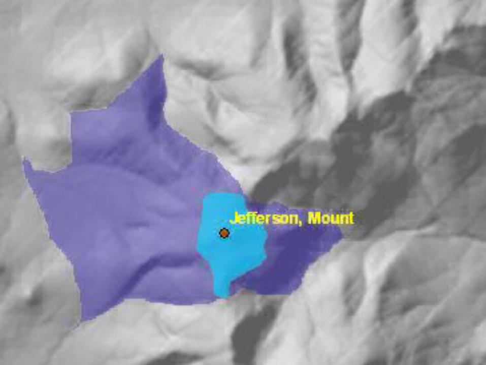
Extraction of Eminences• Wood (1996) identified morphometric peaks
as representatives of eminences and later defined summit regions as inclusive of all points on the eminence within a user-specified elevation difference from the peaks (Wood 2004)
• Summit regions can also be defined and delimited by prominence, defined as the elevation difference from the summit to the highest neighboring saddle
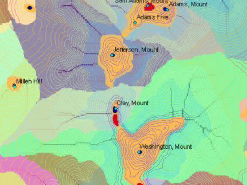
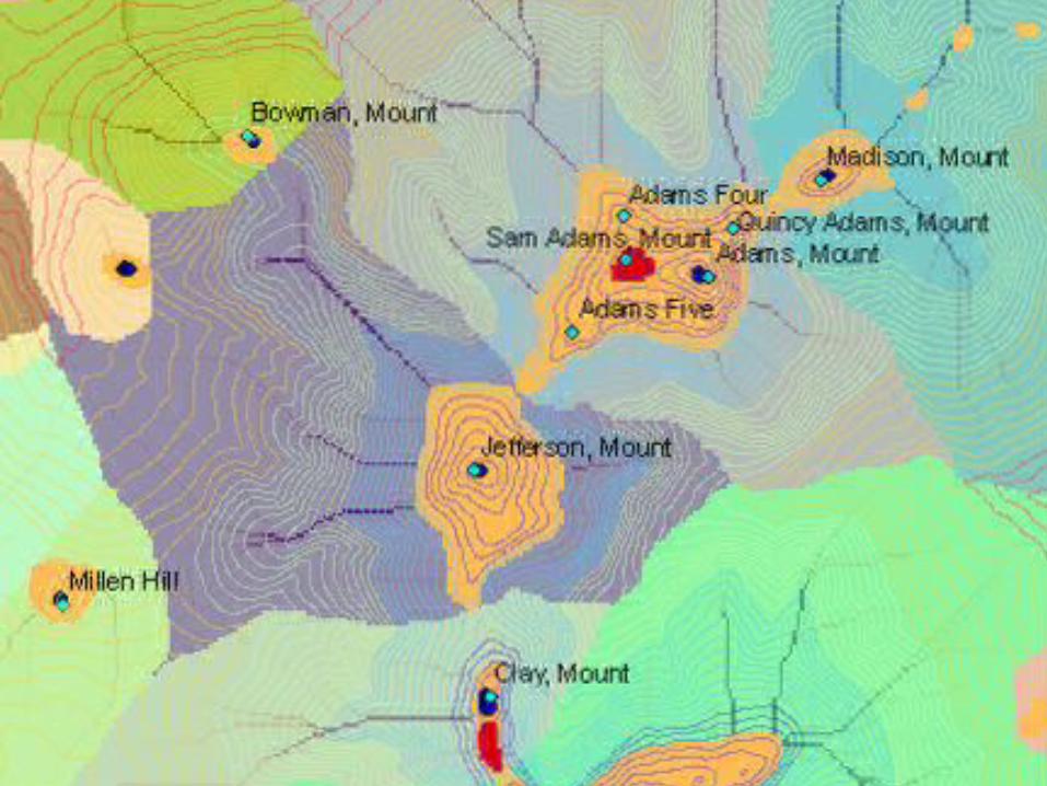
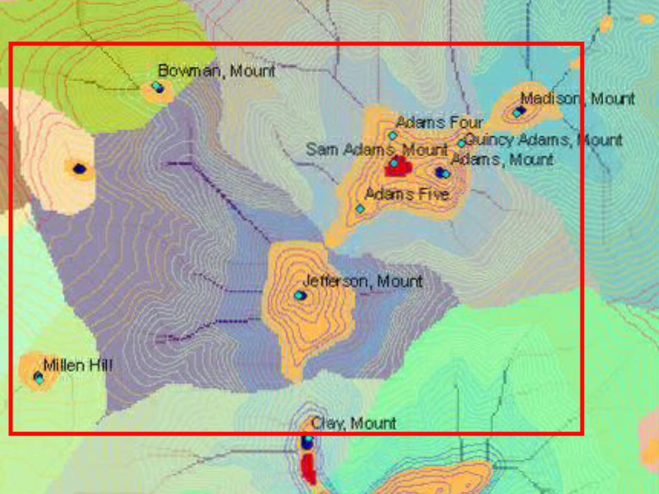
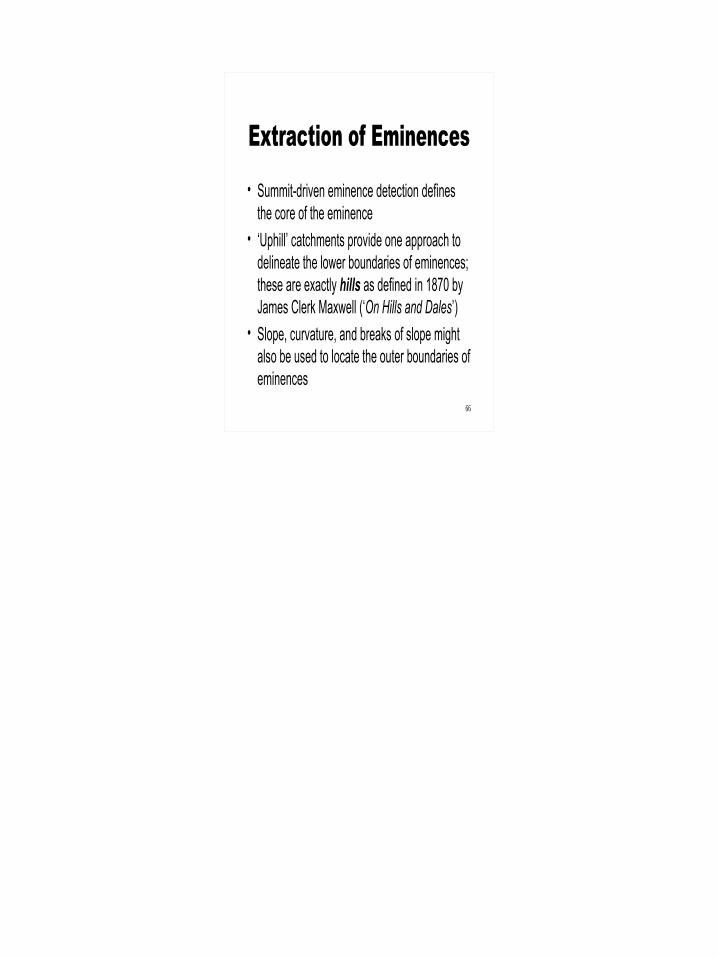
Extraction of Eminences• Summit-driven eminence detection defines
the core of the eminence• ‘Uphill’ catchments provide one approach to
delineate the lower boundaries of eminences; these are exactly hills as defined in 1870 by James Clerk Maxwell (‘On Hills and Dales’)
• Slope, curvature, and breaks of slope might also be used to locate the outer boundaries of eminences
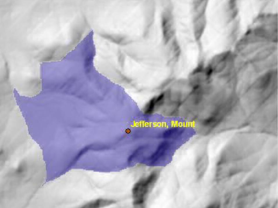
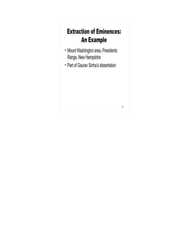
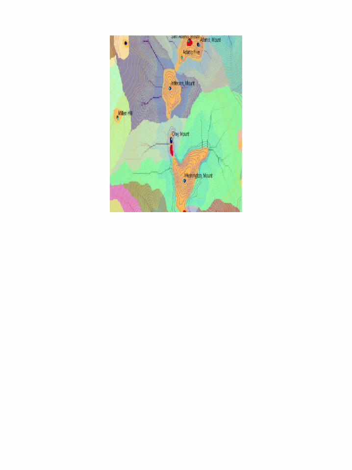
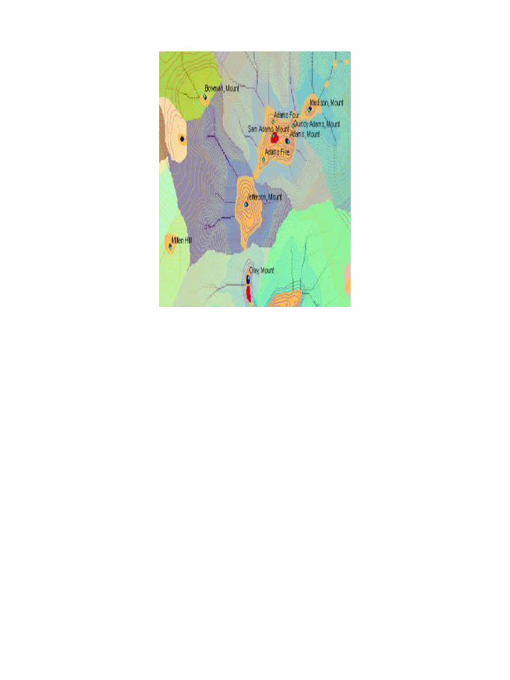
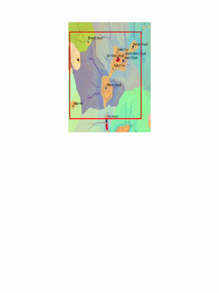
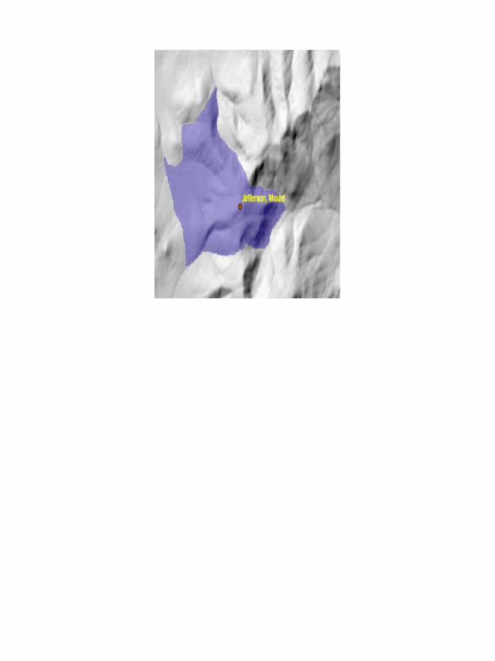
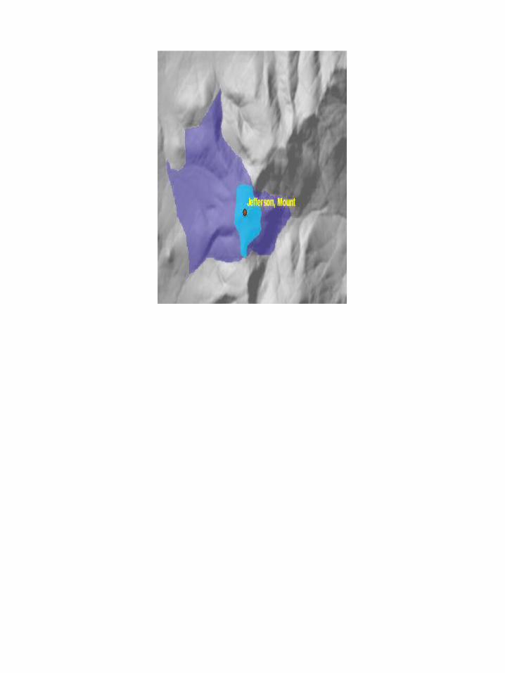
Extraction of Eminences:An Example
• Mount Washington area, Presidents Range, New Hampshire
• Part of Gaurav Sinha’s dissertation
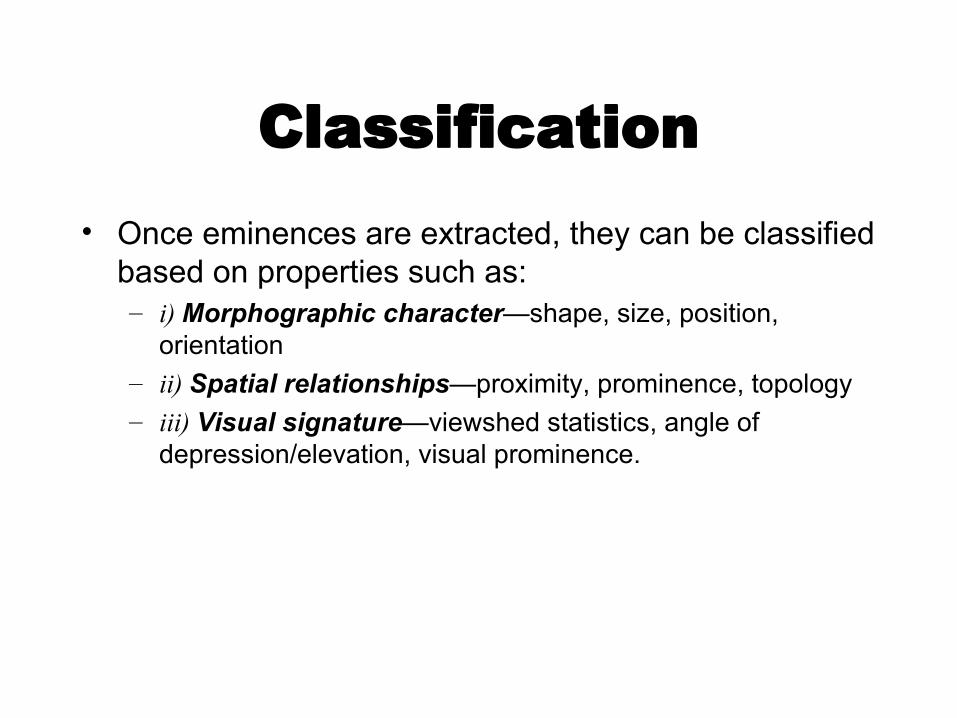
Classification• Once eminences are extracted, they can be classified
based on properties such as: – i) Morphographic character—shape, size, position,
orientation– ii) Spatial relationships—proximity, prominence, topology– iii) Visual signature—viewshed statistics, angle of
depression/elevation, visual prominence.
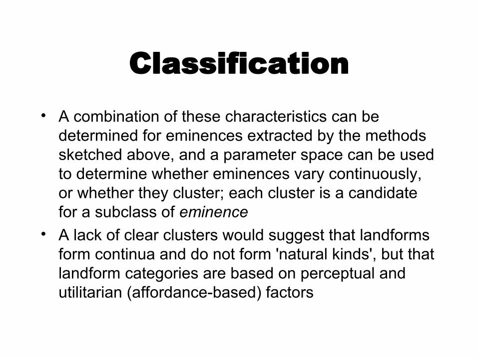
Classification• A combination of these characteristics can be
determined for eminences extracted by the methods sketched above, and a parameter space can be used to determine whether eminences vary continuously, or whether they cluster; each cluster is a candidate for a subclass of eminence
• A lack of clear clusters would suggest that landforms form continua and do not form 'natural kinds', but that landform categories are based on perceptual and utilitarian (affordance-based) factors
Future Work on Feature Extraction• Determine and implement a suite of measures of the
3-dimensional shapes of eminences• Look for clusters of features in a parameter space • Try to distinguish eminence types named and used in
English, based on these measures• Apply the method to DEMs from the Navajo
reservation• See whether eminence types named and used in the
Navajo can also be defined from there parameters of detected in the parameter space
• Extend to other regions and other languages• Eventually, develop methods for other higher-level
landform types such as canyons and valleys
The Challenge
• There are about 5,000 languages in the world that still have 1,000 or more speakers
• There may be about 100 ‘geographical’ terms per language
• 500,000 terms that need to be defined and implemented!
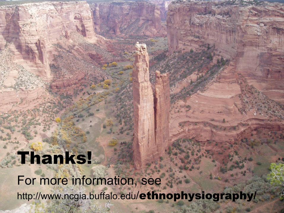
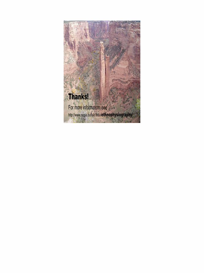
Thanks!For more information, see http://www.ncgia.buffalo.edu/ethnophysiography/
1
2
How Gazetteers Work:Cultural and Linguistic Influences
on the Georeferencing Process
David M. MarkNCGIA- Buffalo
3
Georeferencing as a Process
• Georeferencing as a cognitive process• Georeferencing as a computational process• Georeferencing for a human user (information
retrieval)– General public– Experts, professionals
• Georeferencing as a service for other computer applications (semantic web, etc.)
• In what ways (if any!) should knowledge of the cognitive process inform the design of computational solutions?
4
Context?
• How different are the requirements for gazetteers in different contexts?
• Digital Libraries?• Information retrieval? GeoCLEF etc.• Single language or multilingual?
– Sources? Users?
5
• This project is being done in collaboration with – David Stea (Texas State, San Marcos)– Andrew Turk (Murdoch University, Perth,
Australia)– Carmelita Topaha (San Juan College)– the Yindjibarndi people (Roebourne, Australia)– Navajo people and the Navajo Nation
The project is supported by National Science Foundation Grants BCS-0423075 (to David Mark) and BCS-0423023 (to David Stea), by the National Geospatial-intelligence Agency, and by Microsoft Research
The Navajo part is being conducted under permit C0513-E. Historic Preservation Office, Navajo Nation
The Ethnophysiography Project
6
The Ethnophysiography Project: Five Inter-related Topics
• “Geographic Categories”: Common nouns or noun-phrases that refer to kinds of geographic things (“ethnophysiograhy”)
• Toponyms: Proper names for individual geographic features• Indigenous Geographic Knowledge Systems: For example,
traditional stories that incorporate landscape features (cf. Keith Basso)
• Topophilia: Emotional bonds between people, place, and landscape (cf. Yi-fu Tuan)
• Indigenous Mapping, Indigenous GOS
7
Pre-History of Gazetteers
• Before written language and graphic maps, geographic information was often stored and transmitted in stories, which often also included origin stories or moral codes
• Place names, and the places themselves, formed ‘retrieval keys’ for the information
8
Click to add title• Click to add an outline
9
“Wisdom Sits in Places”
• The role of landscape and place in the representation of traditional knowledge in oral traditions
10
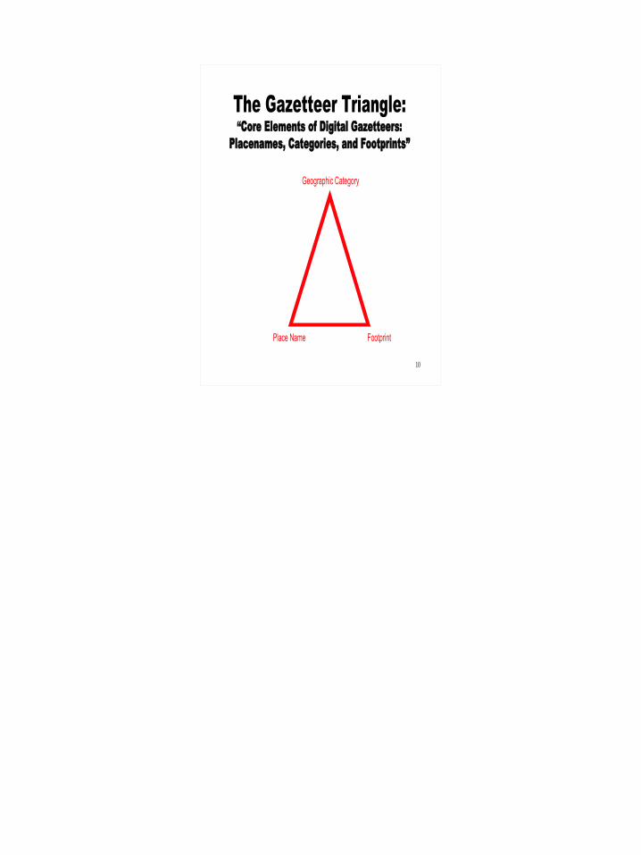
Place Name
Geographic Category
The Gazetteer Triangle:“Core Elements of Digital Gazetteers:
Placenames, Categories, and Footprints”
Footprint
11
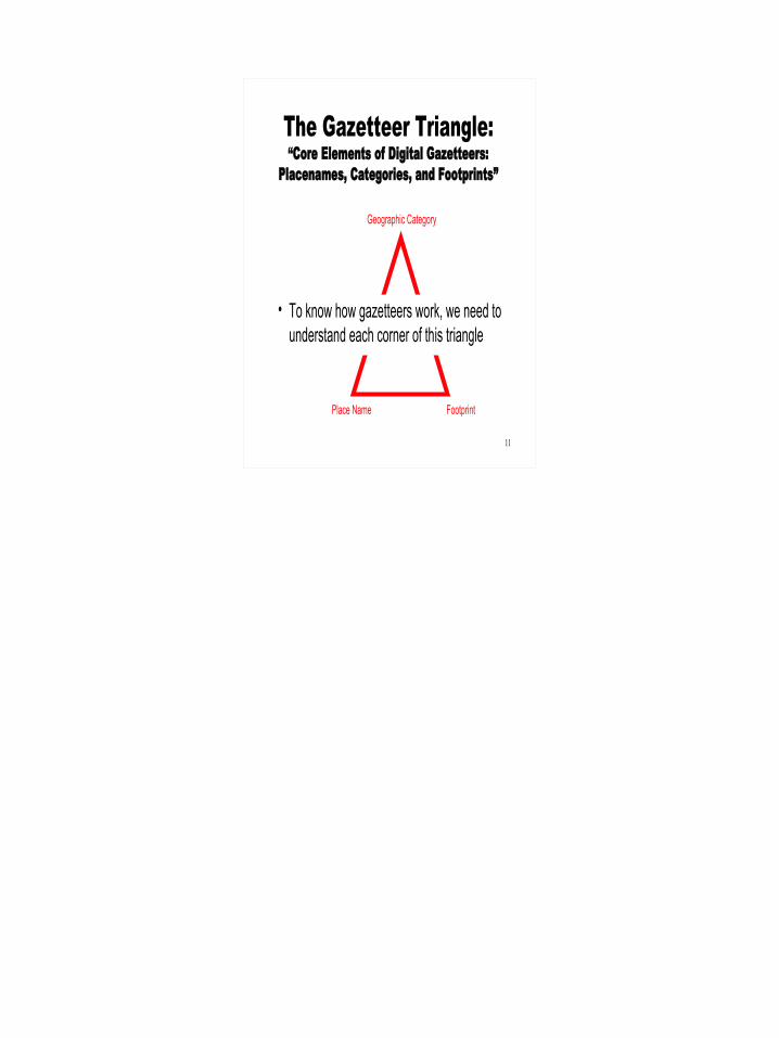
Place Name
Geographic Category
The Gazetteer Triangle:“Core Elements of Digital Gazetteers:
Placenames, Categories, and Footprints”
Footprint
• To know how gazetteers work, we need to understand each corner of this triangle
12
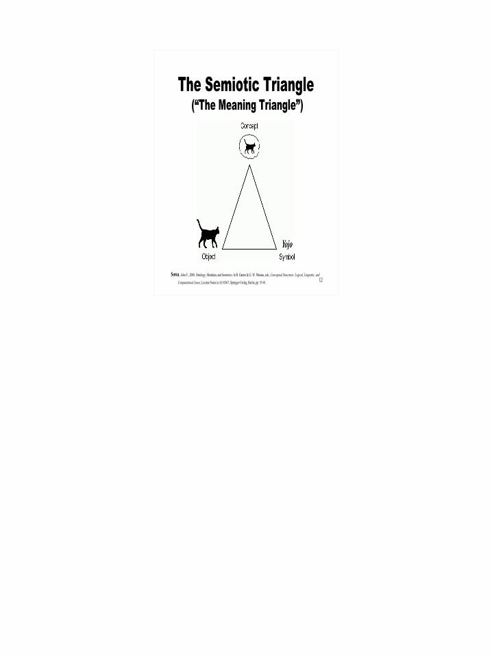
The Semiotic Triangle (“The Meaning Triangle”)
Sowa, John F., 2000. Ontology, Metadata, and Semiotics. In B. Ganter & G. W. Mineau, eds., Conceptual Structures: Logical, Linguistic, and
Computational Issues, Lecture Notes in AI #1867, Springer-Verlag, Berlin, pp. 55-81.
13
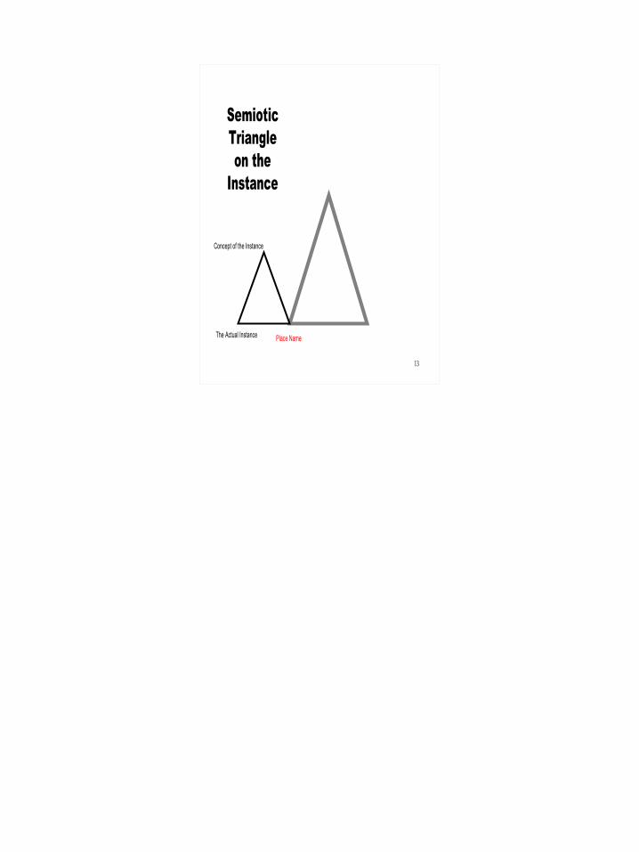
Place Name
Concept of the Instance
The Actual Instance
Semiotic Triangle on the
Instance
14
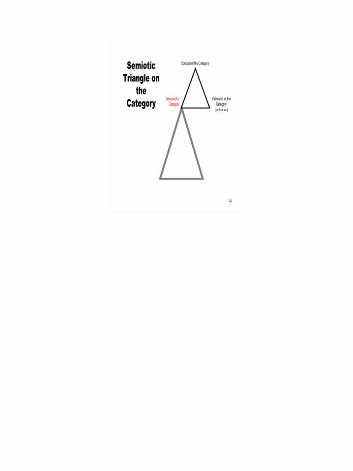
Concept of the Category
Geographic Category
Semiotic Triangle on
the Category Extension of the
Category (Instances)
15
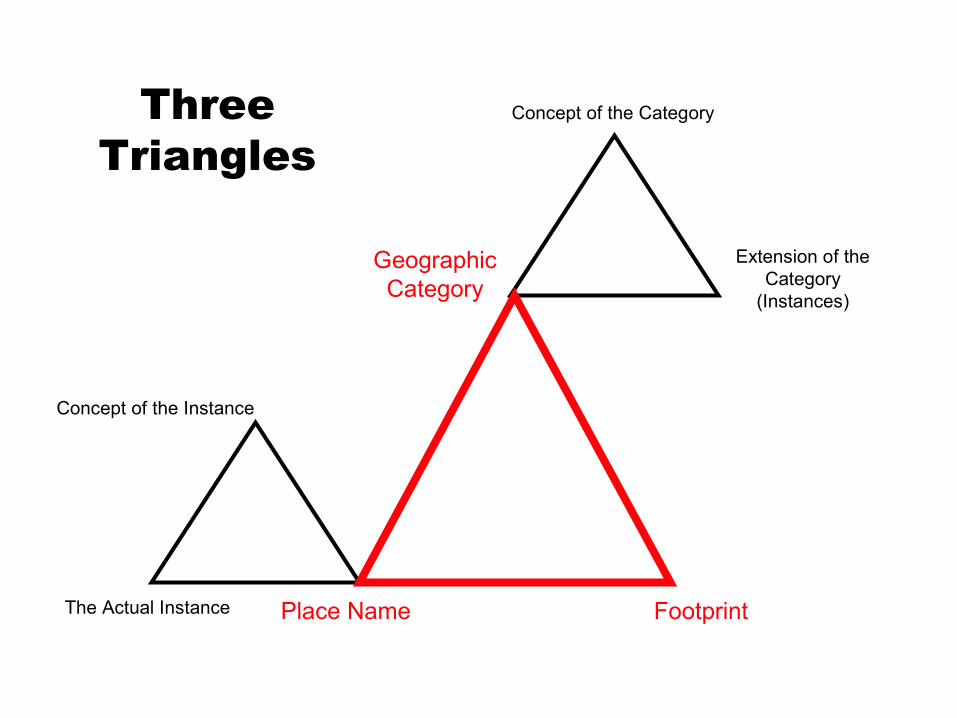
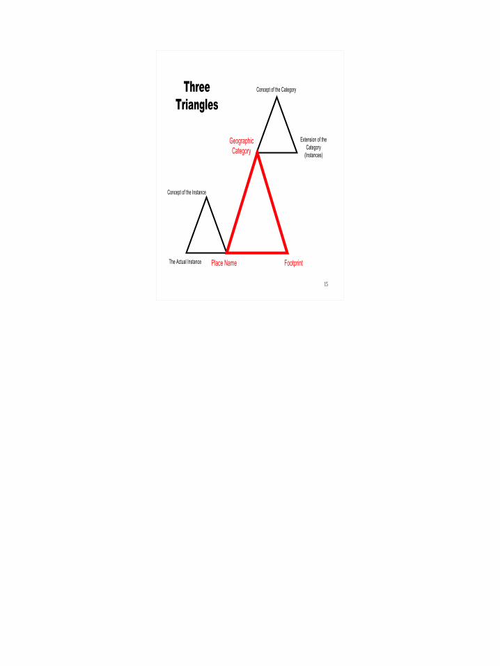
Extension of the Category
(Instances)
Geographic Category
Concept of the Category
Concept of the Instance
The Actual Instance
Three Triangles
Place Name Footprint
16
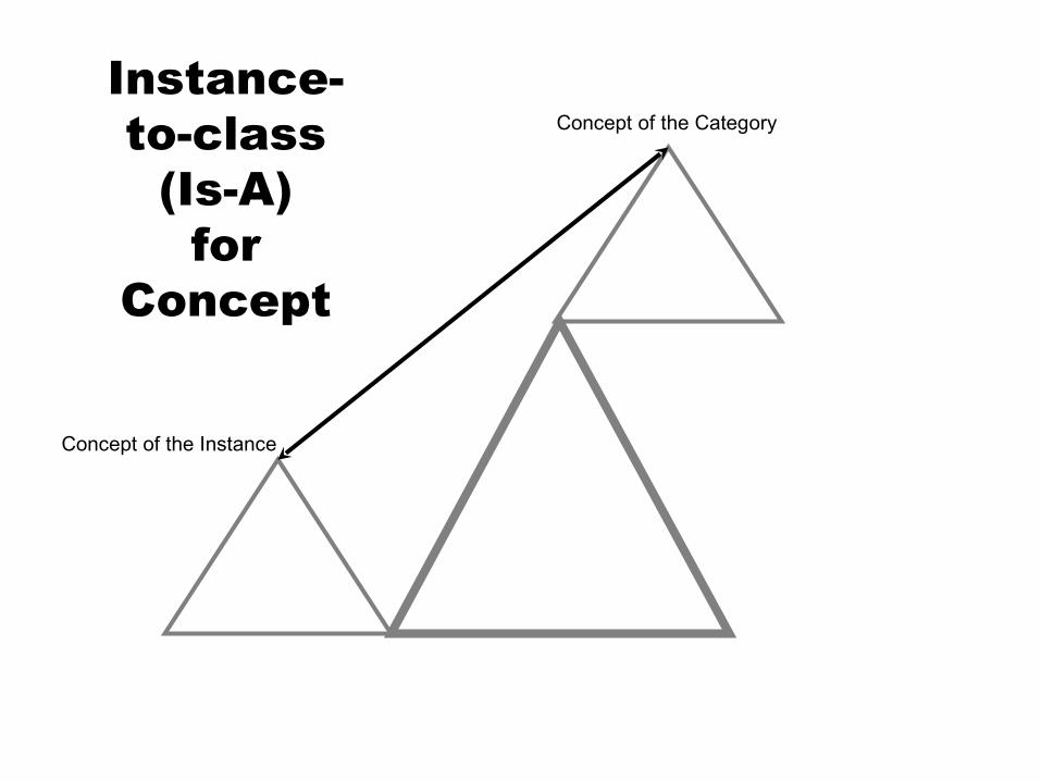
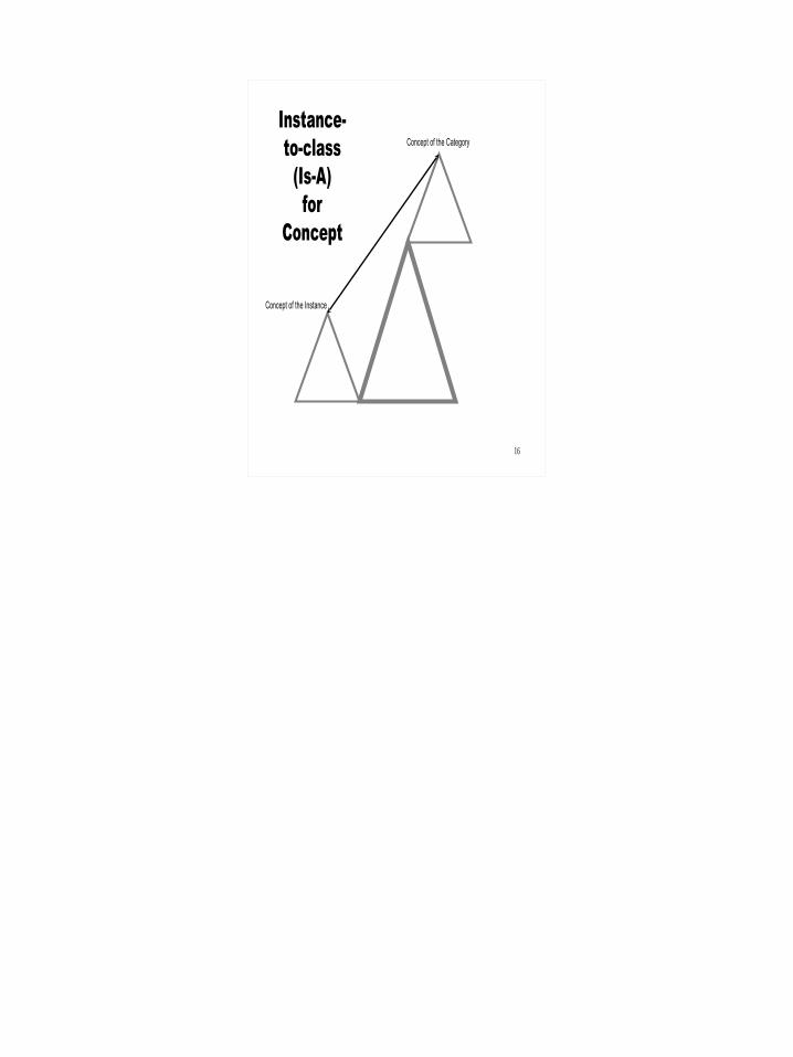
Concept of the Category
Concept of the Instance
Instance- to-class
(Is-A)for
Concept
17
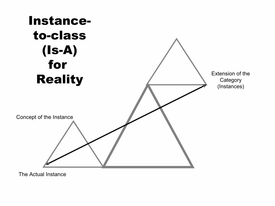
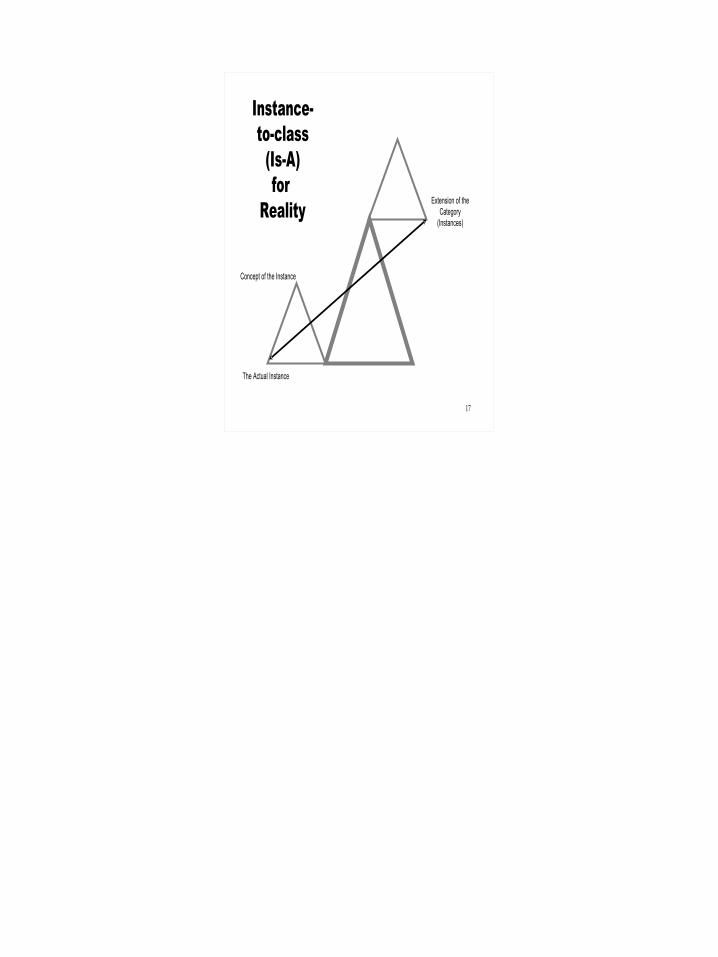
Concept of the Instance
The Actual Instance
Instance- to-class
(Is-A)for
Reality Extension of the Category
(Instances)
18
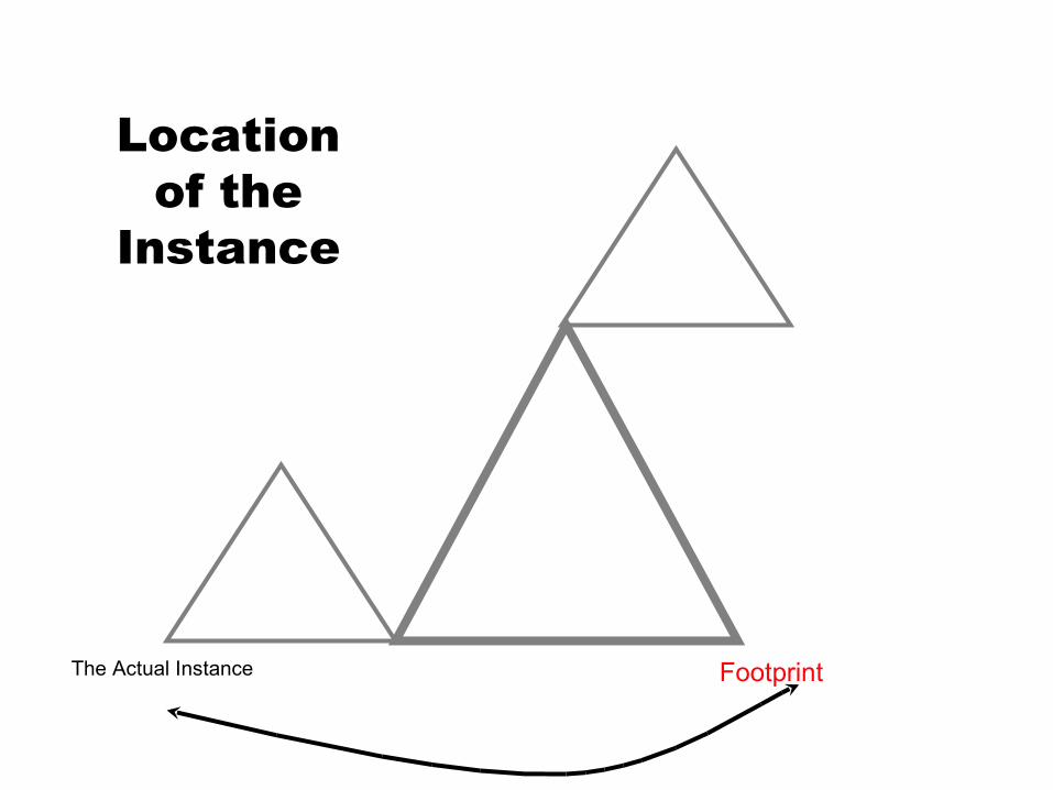
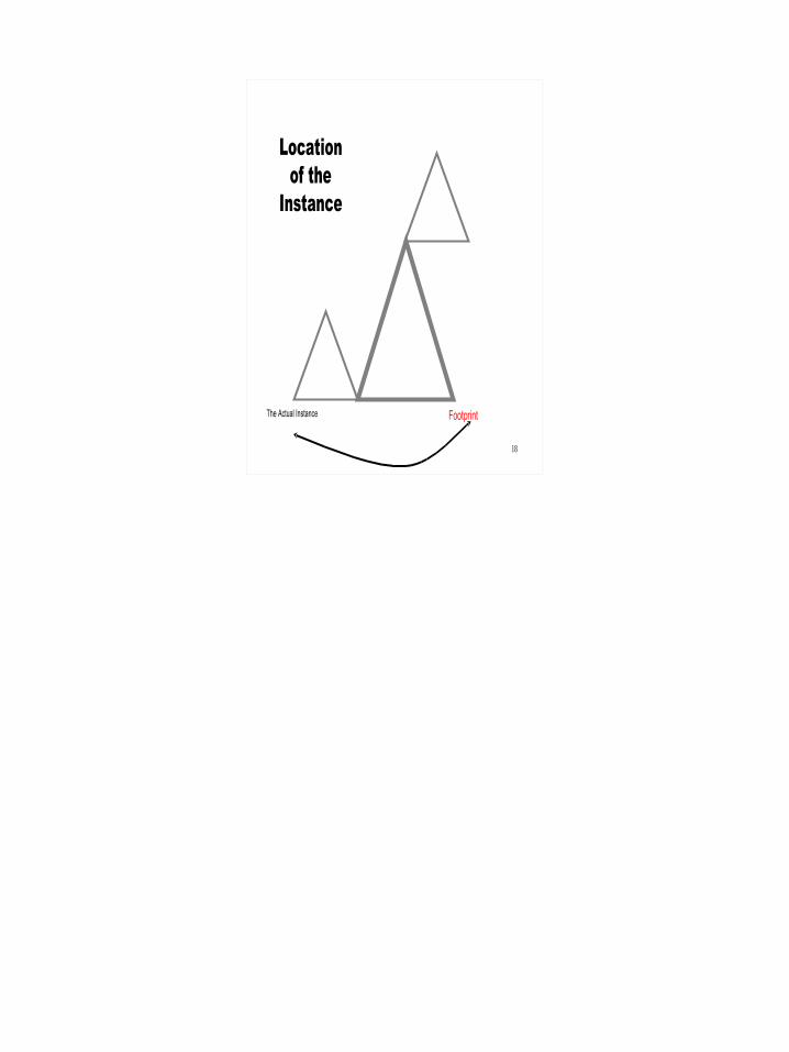
The Actual Instance
Location of the
Instance
Footprint
19
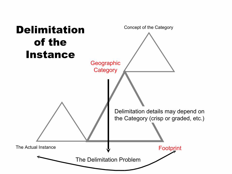
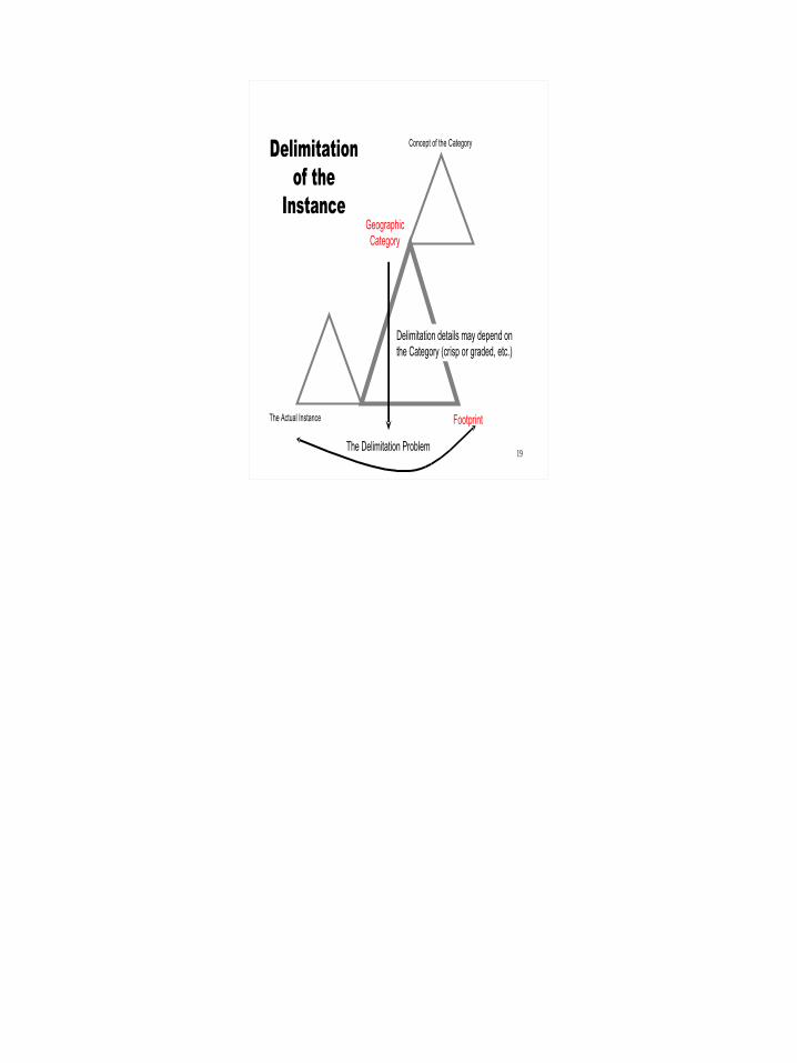
Geographic Category
The Actual Instance
Delimitation of the
Instance
Footprint
The Delimitation Problem
Concept of the Category
Delimitation details may depend on the Category (crisp or graded, etc.)
20
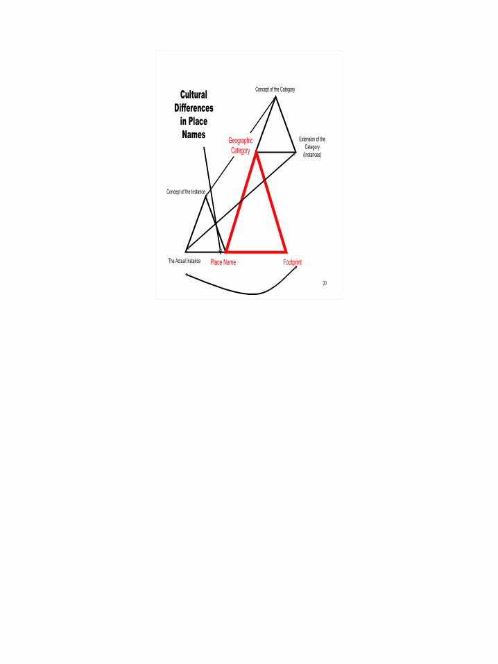
Extension of the Category
(Instances)
Concept of the Category
Concept of the Instance
The Actual Instance
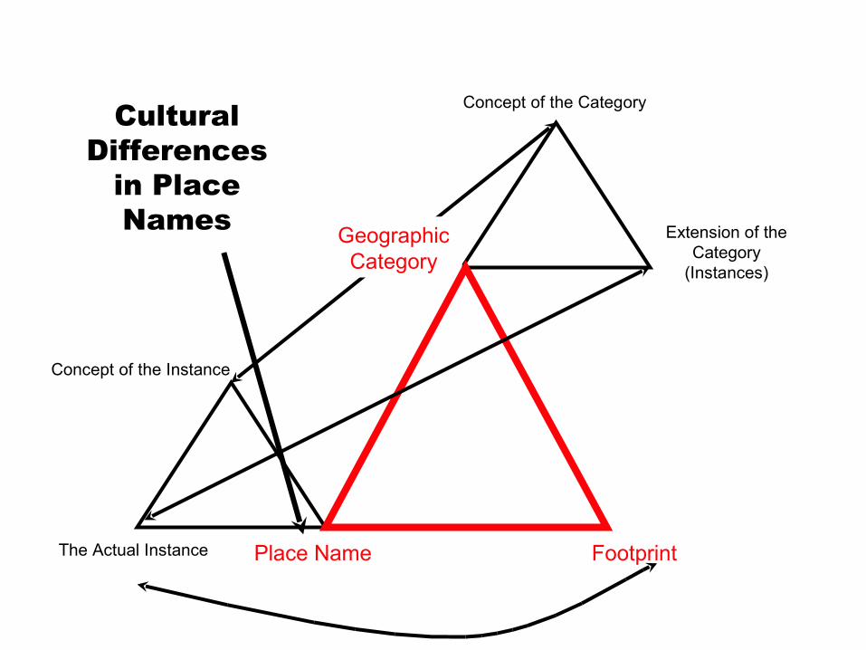
Cultural Differences
in Place Names Geographic
Category
Place Name Footprint
21
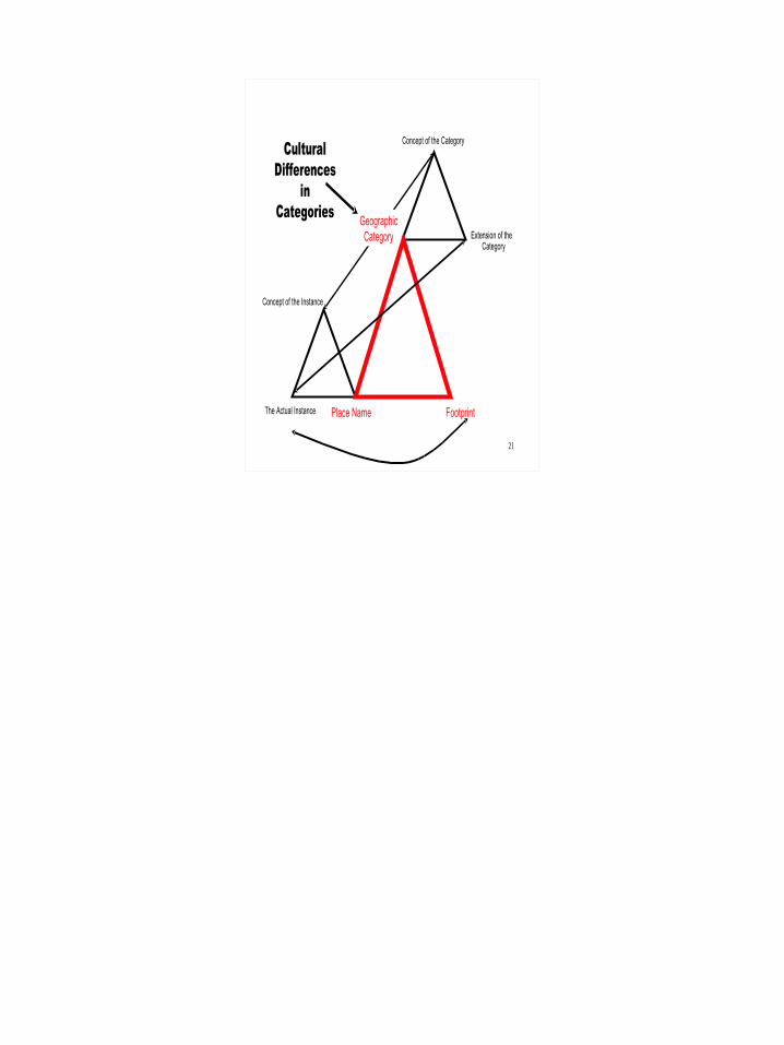
Extension of the Category
Concept of the Category
Concept of the Instance
The Actual Instance
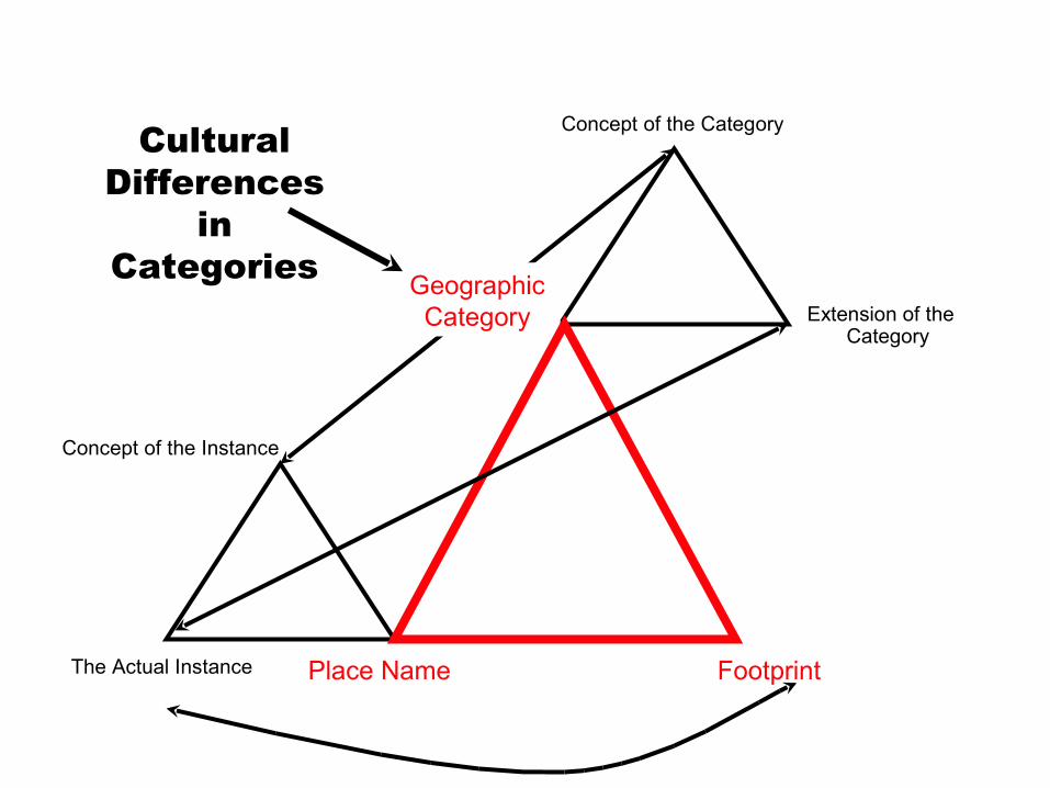
Cultural Differences
in Categories Geographic
Category
Place Name Footprint
22
Extension of the Category
Concept of the Category
Concept of the Instance
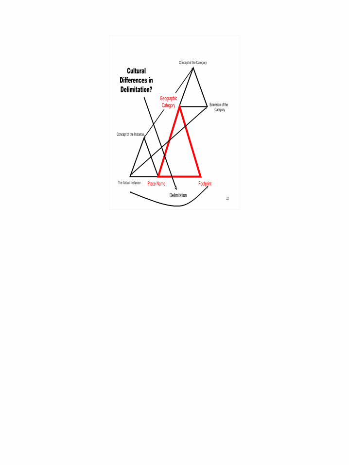
The Actual Instance
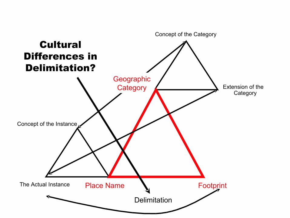
Cultural Differences in Delimitation?
Geographic Category
Place Name Footprint
Delimitation
23
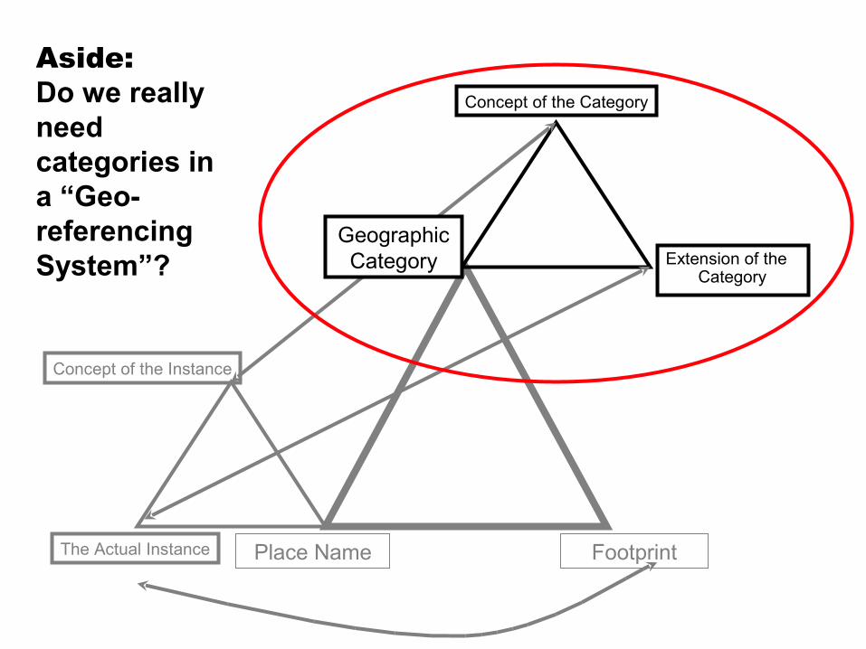
Extension of the Category
Concept of the Category
Concept of the Instance
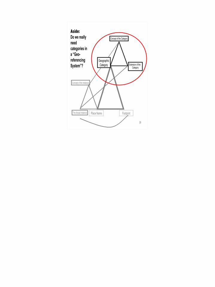
The Actual Instance
Geographic Category
Place Name Footprint
Aside: Do we really need categories in a “Geo-referencing System”?

24
Cultural & Linguistic Differences
• My main research the last four years has been on cultural and linguistic differences in geospatial conceptualization and referencing

25
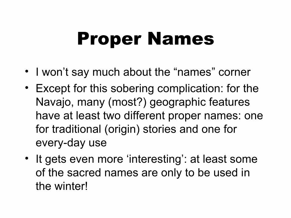
Proper Names• I won’t say much about the “names” corner• Except for this sobering complication: for the
Navajo, many (most?) geographic features have at least two different proper names: one for traditional (origin) stories and one for every-day use
• It gets even more ‘interesting’: at least some of the sacred names are only to be used in the winter!
26
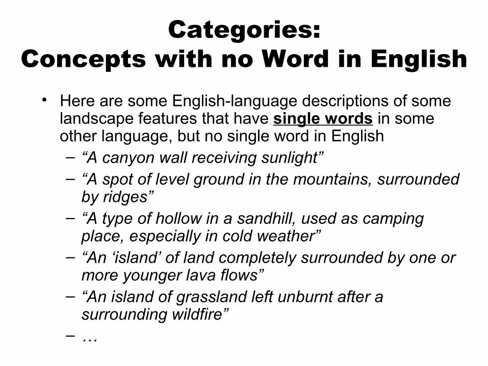
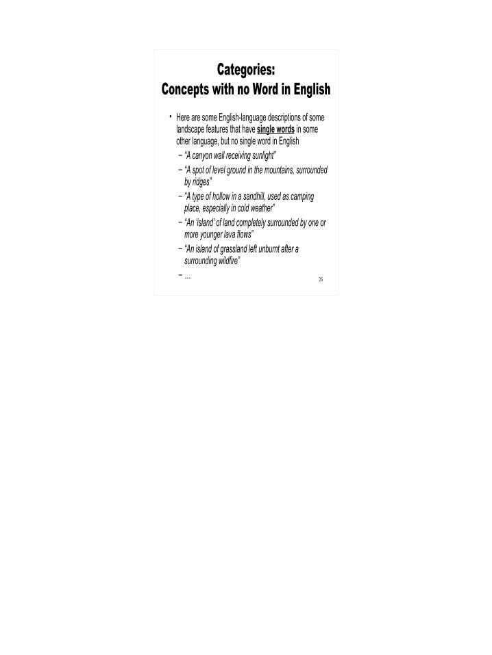
Categories:Concepts with no Word in English
• Here are some English-language descriptions of some landscape features that have single words in some other language, but no single word in English– “A canyon wall receiving sunlight”– “A spot of level ground in the mountains, surrounded
by ridges”– “A type of hollow in a sandhill, used as camping
place, especially in cold weather”– “An ‘island’ of land completely surrounded by one or
more younger lava flows”– “An island of grassland left unburnt after a
surrounding wildfire”– …
27
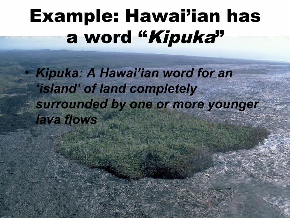
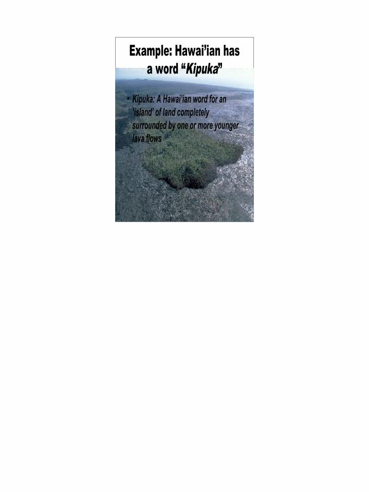
Example: Hawai’ian has a word “Kipuka”
• Kipuka: A Hawai’ian word for an ‘island’ of land completely surrounded by one or more younger lava flows

28
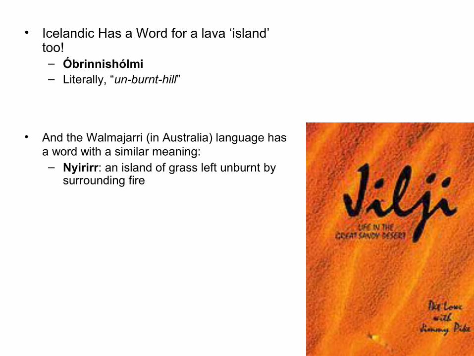
• Icelandic Has a Word for a lava ‘island’ too!– Óbrinnishólmi– Literally, “un-burnt-hill”
• And the Walmajarri (in Australia) language has a word with a similar meaning: – Nyirirr: an island of grass left unburnt by
surrounding fire
29
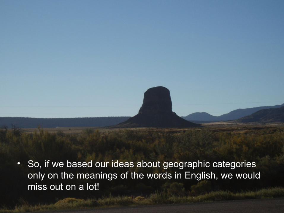
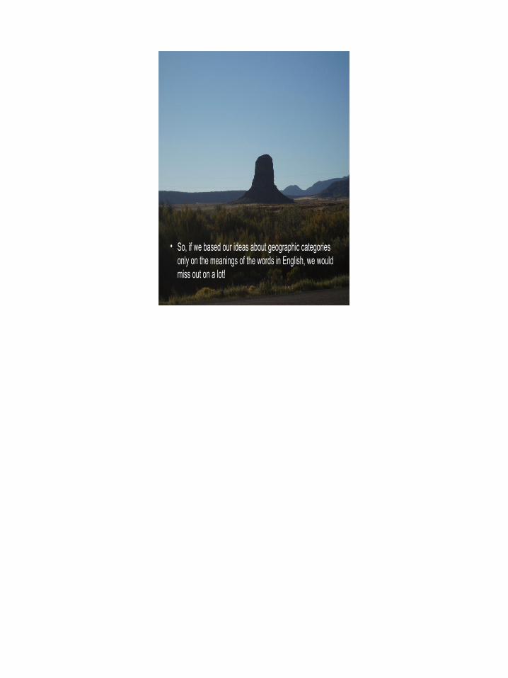
• So, if we based our ideas about geographic categories only on the meanings of the words in English, we would miss out on a lot!
30
Semantics and Categories
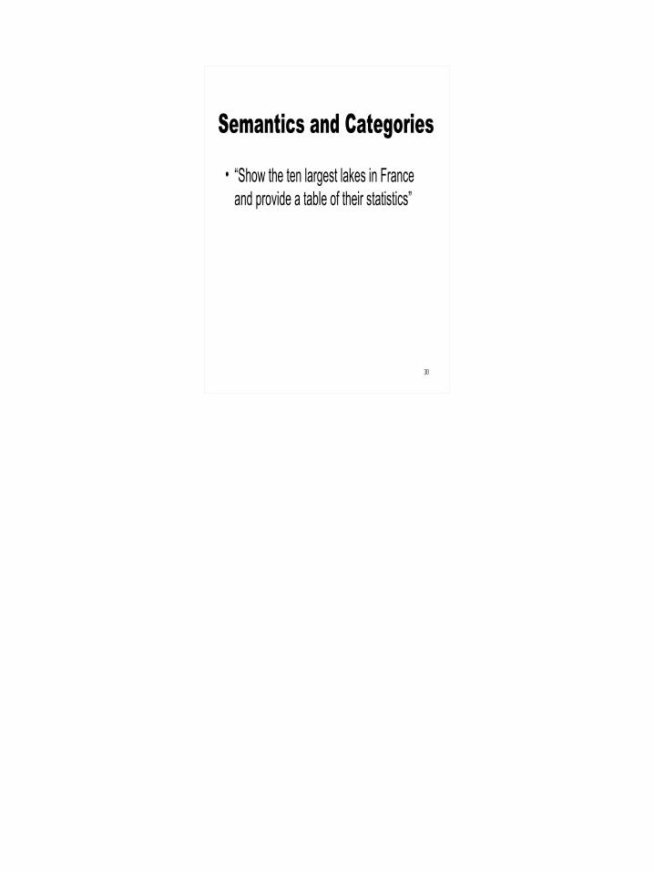
• “Show the ten largest lakes in France and provide a table of their statistics”
31
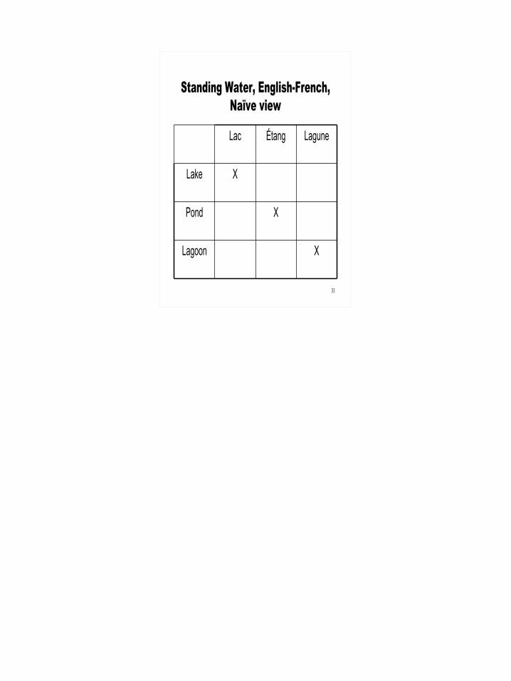
Standing Water, English-French, Naïve view
XLagoon
XPond
XLake
LaguneÉtangLac
32
Semantics and Categories
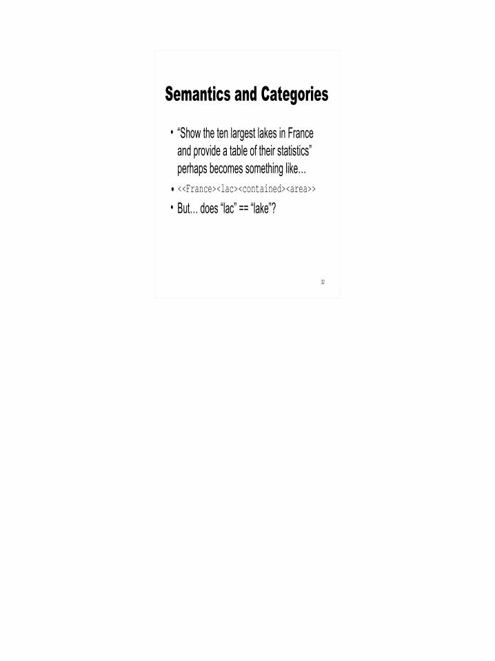
• “Show the ten largest lakes in France and provide a table of their statistics” perhaps becomes something like…
• <<France><lac><contained><area>>
• But… does “lac” == “lake”?
33
French and English Categorize Standing Water Bodies Differently

34
English
35
French
36
Standing Water, English-French, More complete view
XX?Lagoon
-X?Pond
-XXLake
LaguneÉtangLac
37
Semantics and Categories, B
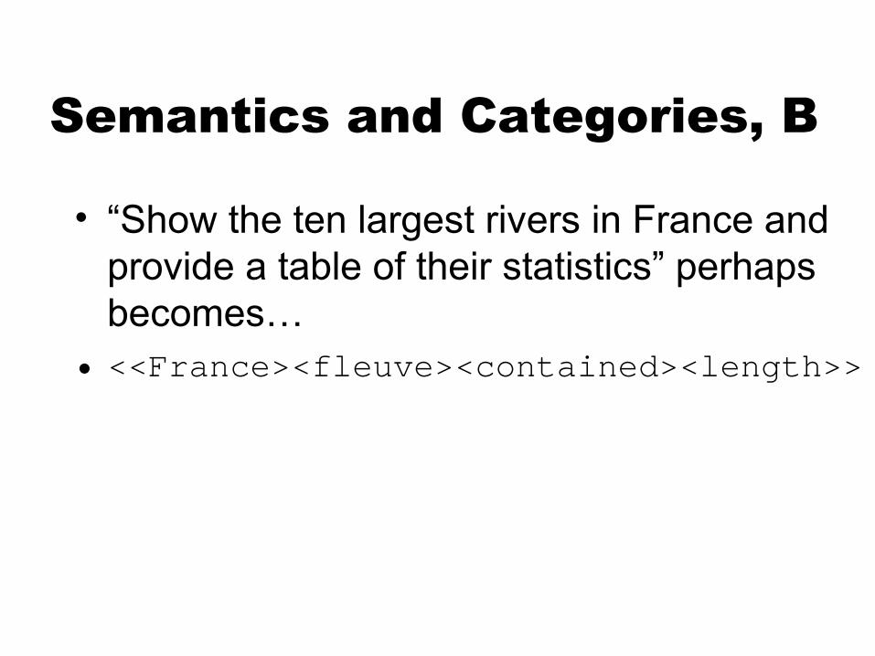
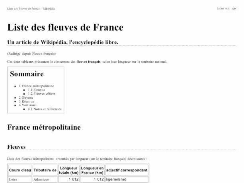
• “Show the ten largest rivers in France and provide a table of their statistics” perhaps becomes…
• <<France><fleuve><contained><length>>

38

39

40
What about the Marne and the Dordogne??Marne: 525 kmDordogne: 490 km

41
The Marne and the Dordogne are
“rivières”, not “fleuves”!
Obvious implications
for multilingual information
retrieval à la GeoCLEF!
42
Recently, we have been using two main methods in our fieldwork:• “Field interviews”: collecting language actually used while out in the
landscape (10 interviews so far; 28 hours of audio!)• “Photo Response”: Showing landscape photographs to people and
getting them to talk about them (7 sessions, 9 hours of audio in Navajo, 5 hours in Yindjibarndi)
Fieldwork
43
• Loretta Holyan, Andrew Turk, Carmelita Topaha, Larry King
• September 25, 2005• Blue Canyon, Arizona
44
Click to add title• Click to add an outline

45
Click to add titleAmelie Collins, Erma Batteso, Louise Hubbell, Harding Yazzie Jr.
March 2006, San Juan College, Farmington

46
August 17 2006Sanostee Chapter House
47
Click to add title• Click to add an outline
Ned CheedyRoebourne, Australia,
June 18 2006
48
•Jin-kyu Jung has linked photos and metadata to GoogleMaps•Aiming for links to transcripts, audio•Linking to ATLAS.ti for qualitative analysis

49
Footprints
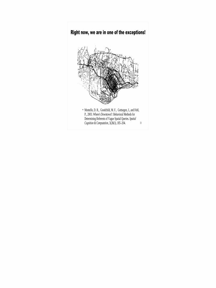
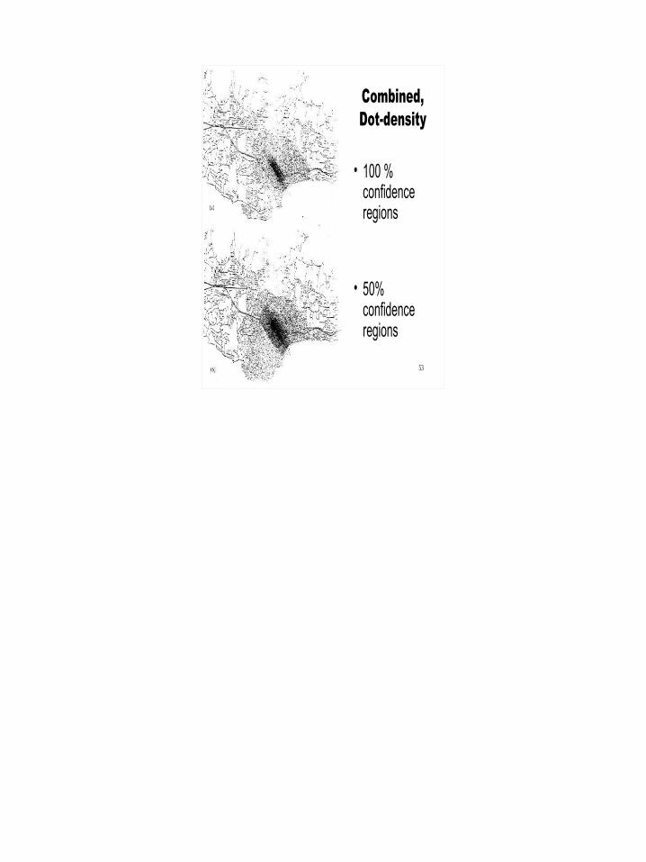
• There has been very little ‘human subjects’ work on delmitation of geographic features
50
51
Right now, we are in one of the exceptions!
• Montello, D. R., Goodchild, M. F., Gottsegen, J., and Fohl, P., 2003. Where's Downtown?: Behavioral Methods for Determining Referents of Vague Spatial Queries. Spatial Cognition & Computation, 3(2&3), 185–204.
52
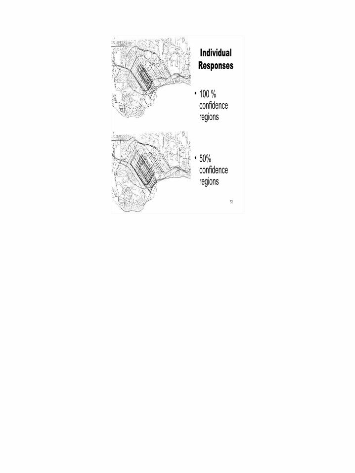
Individual Responses
• 100 % confidence regions
• 50% confidence regions
53
Combined, Dot-density
• 100 % confidence regions
• 50% confidence regions
54
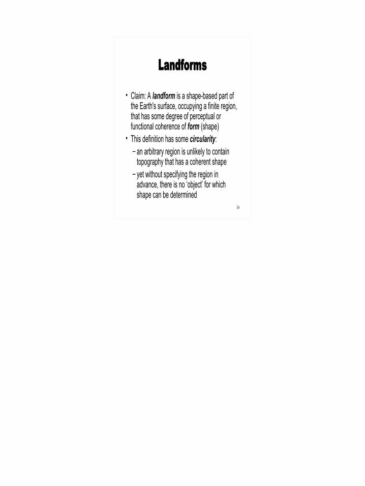
Landforms
• Claim: A landform is a shape-based part of the Earth's surface, occupying a finite region, that has some degree of perceptual or functional coherence of form (shape)
• This definition has some circularity: – an arbitrary region is unlikely to contain
topography that has a coherent shape– yet without specifying the region in
advance, there is no ‘object’ for which shape can be determined
55
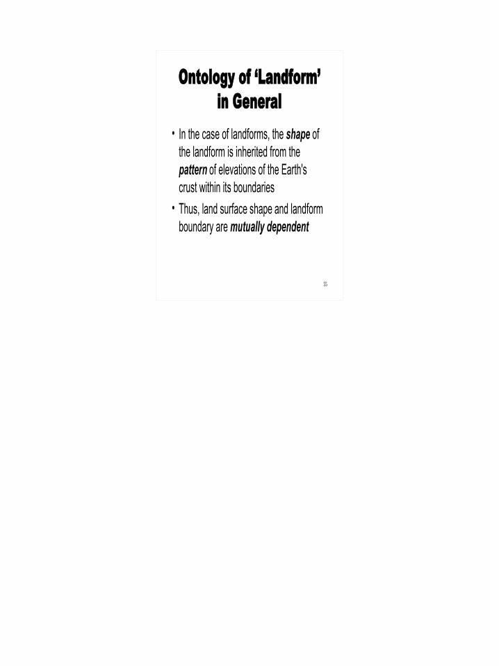
Ontology of ‘Landform’ in General
• In the case of landforms, the shape of the landform is inherited from the pattern of elevations of the Earth's crust within its boundaries
• Thus, land surface shape and landform boundary are mutually dependent

56
(A Note on the Goals of the Project)
• The goal is to understand the meanings of words used by ‘general’ speakers of languages to refer to landforms, words such as hill, hügel, colina, cerro, loma, berg, mountain, butte, mesa, marnda, etc.
• We are not especially interested (at this time) in scientific vocabularies for landform types that might be used in Earth science
57
A Complication• Cross-cultural comparisons of landform
definitions have found cultural and linguistic differences in landform types (Mark and Turk 2003)
• If the basic categories and even their relationships differ across languages, different taxonomic hierarchies may be needed for the same region of the Earth’s surface, one for each language or dialect or culture
58
Multilingual Ontology• If a goal of the geographic aspects of the Semantic Web
and the internet is to provide on-line access to geographic information about any area of the world to speakers of any language, we might have to record feature codes (entity types) separately for each language!
• However, a better approach would be to develop procedures for feature delimitation and classification that could accept a formalized version of any landform definition, and then extract and classify instances from digital elevation data
59
Topographic Eminences• In this paper, we present first steps toward
such a system by outlining a strategy for definition-dependent extraction of topographic eminences
• We have chosen the term “eminence” as a super-ordinate term for hills, mountains, buttes, mesas, and other such landforms that stand above their immediate neighborhoods, because no other English word fits, and because Voegelin and Voegelin (“Hopi Domains”) used eminence in this sense
60
Topographic Eminences• Perceptual characteristics such as size, shape, color,
texture and material character may influence the perception and classification of eminences
• Whereas shape and size alone may not always be sufficient to define eminence types completely, we believe that size and shape are the most important factors that determine how people perceive and categorize eminences
• Today, we focus on form-based extraction and classification of eminences for categories commonly recognized in ‘every-day’ English
61
Hills and Mountains
• Mountain:1. a. A large natural elevation of the earth's surface, esp. one high and steep in form (larger and higher than a hill) (OED)
62
Hills and Mountains• Hill:
1. a. A natural elevation of the earth's surface … after the introduction of the word mountain’ [into English], gradually restricted to heights of less elevation; … (OED)
63
Hills and Mountains: Not Only Size!
• Hill: “a more rounded and less rugged outline is also usually connoted by the name” (OED)
Hill Mountain??
64
#76
• 4• B• Shiprock area• buttes/ monoliths• P9250035
“Finger Rock”
“Mitten Buttes”
“Shiprock”
“Picacho Peak”
For features too small to be ‘mountains’, yet too jagged to be ‘hills’, English relies on other terms, such as rock, butte, peak, mesa, etc.
65
Extraction of Eminences• Wood (1996) identified morphometric peaks
as representatives of eminences and later defined summit regions as inclusive of all points on the eminence within a user-specified elevation difference from the peaks (Wood 2004)
• Summit regions can also be defined and delimited by prominence, defined as the elevation difference from the summit to the highest neighboring saddle
66
Extraction of Eminences• Summit-driven eminence detection defines
the core of the eminence• ‘Uphill’ catchments provide one approach to
delineate the lower boundaries of eminences; these are exactly hills as defined in 1870 by James Clerk Maxwell (‘On Hills and Dales’)
• Slope, curvature, and breaks of slope might also be used to locate the outer boundaries of eminences
67
Extraction of Eminences:An Example
• Mount Washington area, Presidents Range, New Hampshire
• Part of Gaurav Sinha’s dissertation
68
Click to add title
69
Click to add title
70
Click to add title
71
Click to add title
72
Click to add title
73
Classification• Once eminences are extracted, they can be classified
based on properties such as: – i) Morphographic character—shape, size, position,
orientation– ii) Spatial relationships—proximity, prominence, topology– iii) Visual signature—viewshed statistics, angle of
depression/elevation, visual prominence.
74
Classification• A combination of these characteristics can be
determined for eminences extracted by the methods sketched above, and a parameter space can be used to determine whether eminences vary continuously, or whether they cluster; each cluster is a candidate for a subclass of eminence
• A lack of clear clusters would suggest that landforms form continua and do not form 'natural kinds', but that landform categories are based on perceptual and utilitarian (affordance-based) factors

75
Future Work on Feature Extraction• Determine and implement a suite of measures of the
3-dimensional shapes of eminences• Look for clusters of features in a parameter space • Try to distinguish eminence types named and used in
English, based on these measures• Apply the method to DEMs from the Navajo
reservation• See whether eminence types named and used in the
Navajo can also be defined from there parameters of detected in the parameter space
• Extend to other regions and other languages• Eventually, develop methods for other higher-level
landform types such as canyons and valleys
76
The Challenge
• There are about 5,000 languages in the world that still have 1,000 or more speakers
• There may be about 100 ‘geographical’ terms per language
• 500,000 terms that need to be defined and implemented!
77
Thanks!For more information, see http://www.ncgia.buffalo.edu/ethnophysiography/