High Altitude Ballooning Using The Raspberry Pi for · Using The Raspberry Pi for High Altitude...
38
Using The Raspberry Pi for High Altitude Ballooning
Transcript of High Altitude Ballooning Using The Raspberry Pi for · Using The Raspberry Pi for High Altitude...

Using The Raspberry Pi forHigh Altitude Ballooning

Space Shuttle Picture: Cost per mission £300,000,000
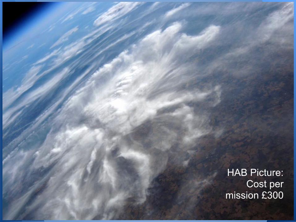
HAB Picture: Cost per
mission £300
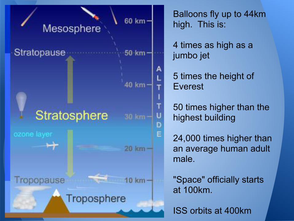
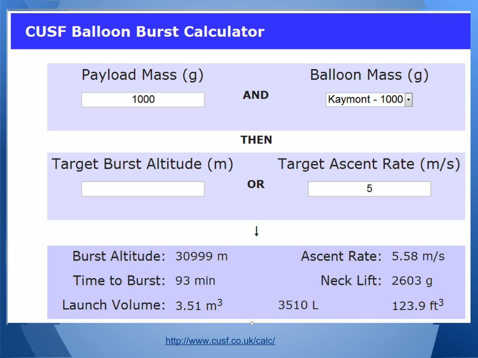
Balloons fly up to 44km high. This is:
4 times as high as a jumbo jet
5 times the height of Everest
50 times higher than the highest building
24,000 times higher than an average human adult male.
"Space" officially starts at 100km.
ISS orbits at 400km
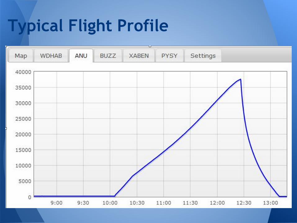
Typical Flight Profile
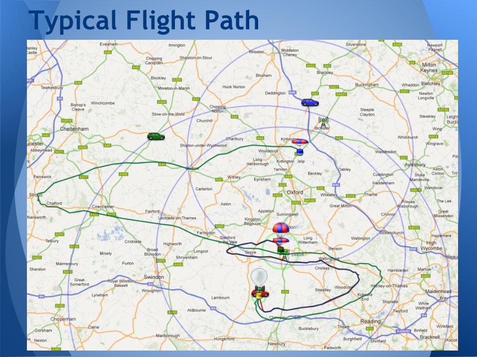
Typical Flight Path
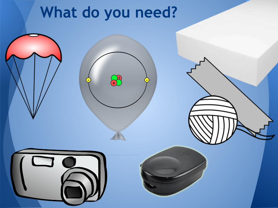
What do you need?
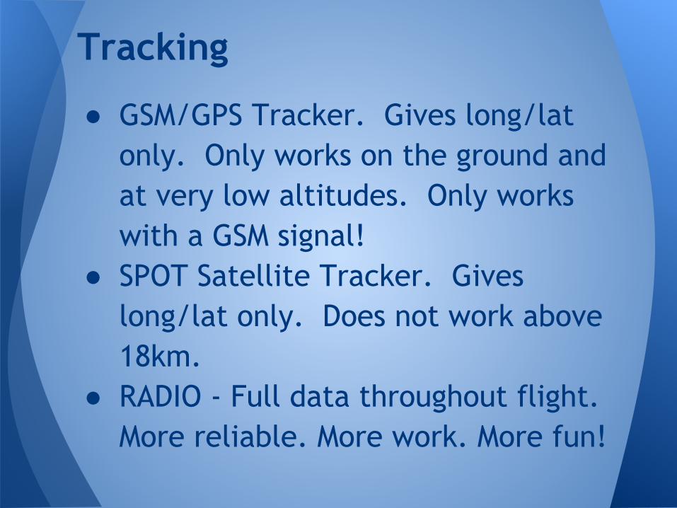
● GSM/GPS Tracker. Gives long/lat only. Only works on the ground and at very low altitudes. Only works with a GSM signal!
● SPOT Satellite Tracker. Gives long/lat only. Does not work above 18km.
● RADIO - Full data throughout flight. More reliable. More work. More fun!
Tracking
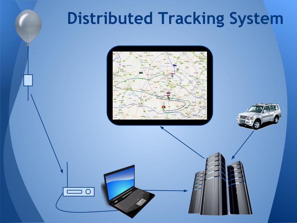
Distributed Tracking System
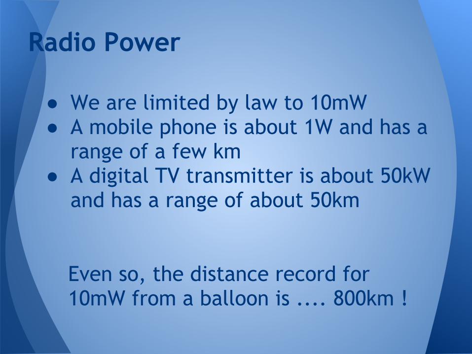
● We are limited by law to 10mW● A mobile phone is about 1W and has a
range of a few km● A digital TV transmitter is about 50kW
and has a range of about 50km
Radio Power
Even so, the distance record for 10mW from a balloon is .... 800km !
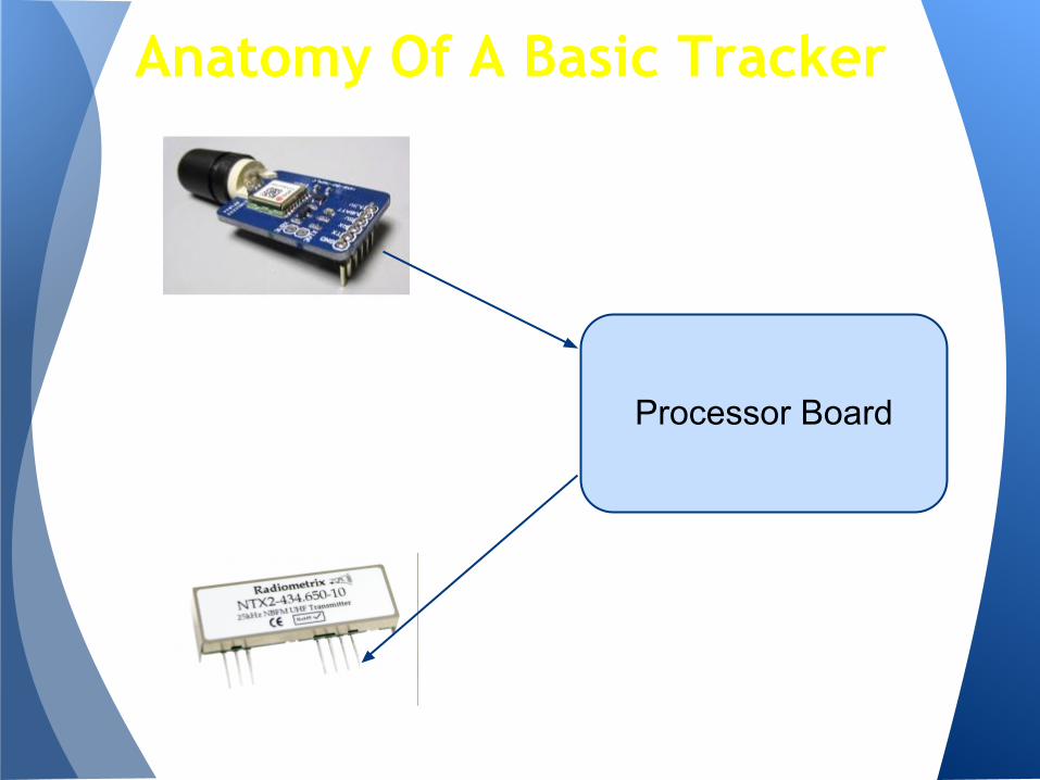
Anatomy Of A Basic Tracker
Processor Board
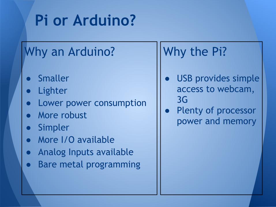
Why the Pi?
● USB provides simple access to webcam, 3G
● Plenty of processor power and memory
Pi or Arduino?
Why an Arduino?
● Smaller● Lighter● Lower power consumption● More robust● Simpler● More I/O available● Analog Inputs available● Bare metal programming
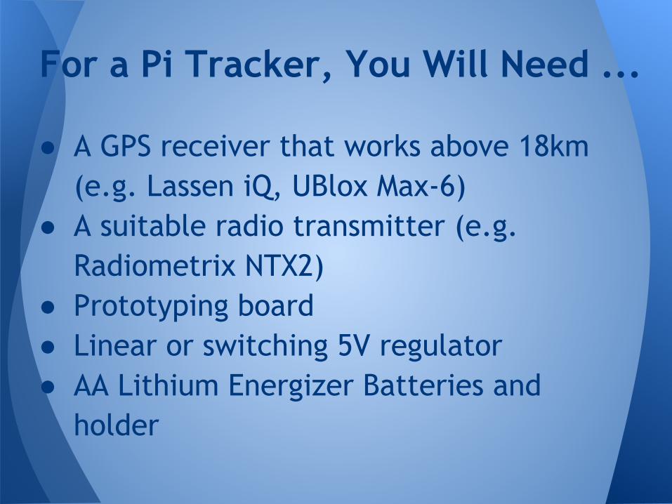
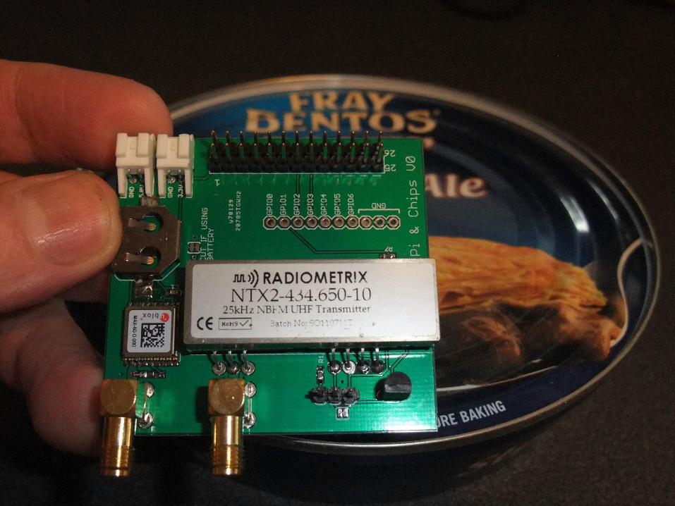
● A GPS receiver that works above 18km (e.g. Lassen iQ, UBlox Max-6)
● A suitable radio transmitter (e.g. Radiometrix NTX2)
● Prototyping board● Linear or switching 5V regulator● AA Lithium Energizer Batteries and
holder
For a Pi Tracker, You Will Need ...
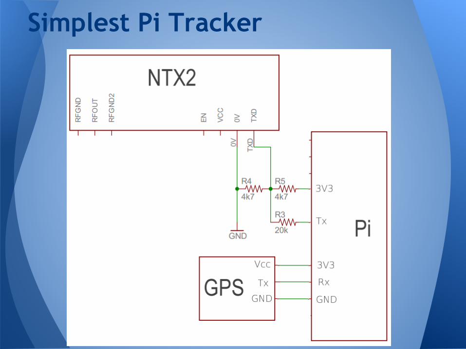
Simplest Pi Tracker
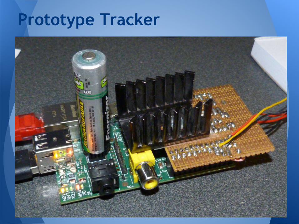
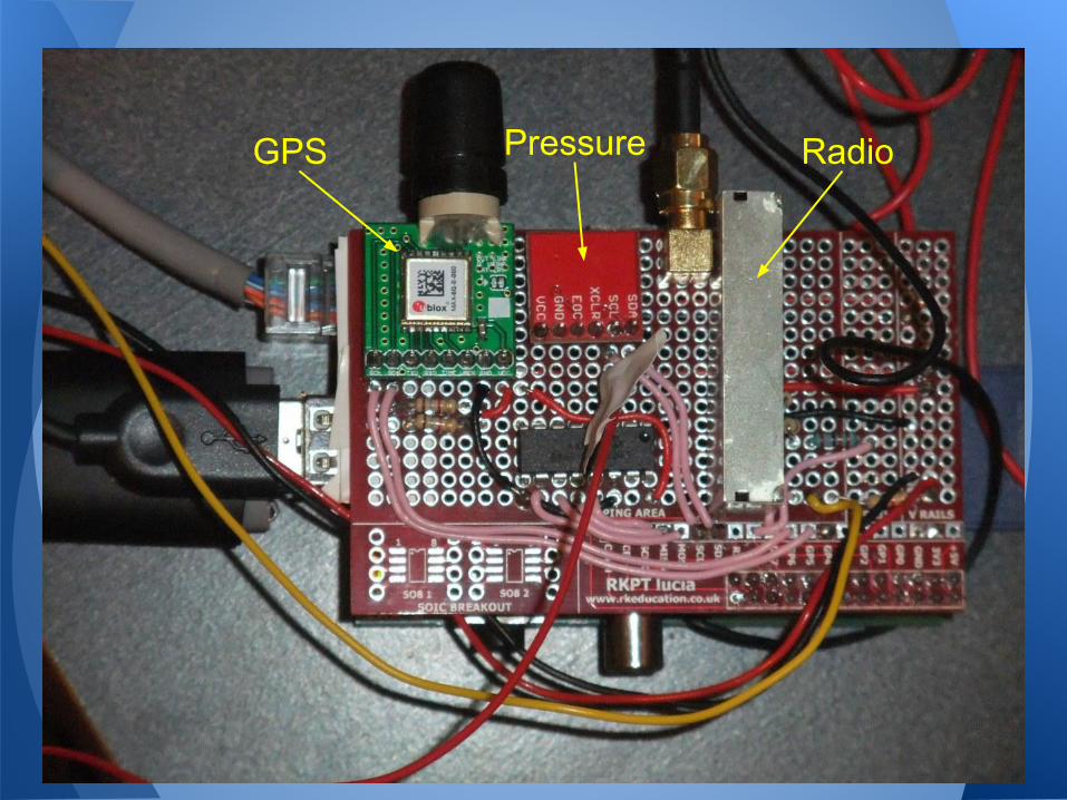
Prototype Tracker
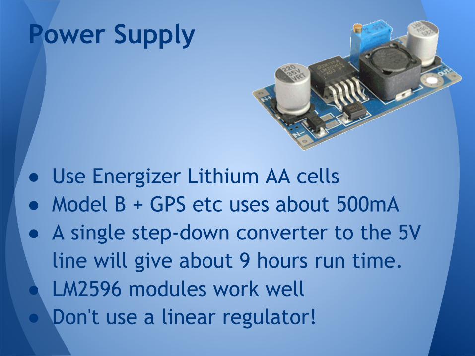
● Use Energizer Lithium AA cells● Model B + GPS etc uses about 500mA● A single step-down converter to the 5V
line will give about 9 hours run time.● LM2596 modules work well● Don't use a linear regulator!
Power Supply
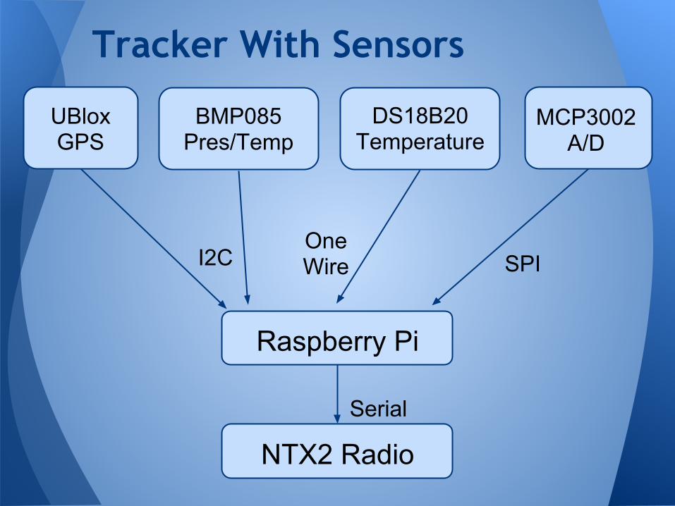
Tracker With Sensors
Raspberry Pi
UBloxGPS
BMP085 Pres/Temp
MCP3002 A/D
DS18B20 Temperature
I2COneWire SPI
NTX2 Radio
Serial
GPS Pressure Radio
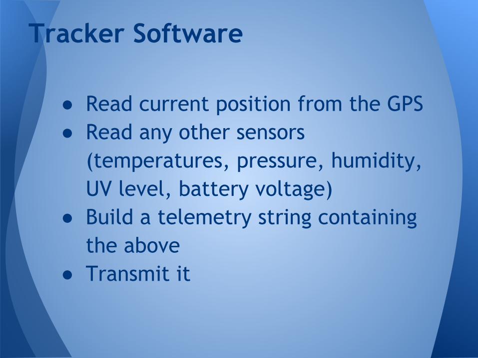
● Read current position from the GPS● Read any other sensors
(temperatures, pressure, humidity, UV level, battery voltage)
● Build a telemetry string containing the above
● Transmit it
Tracker Software
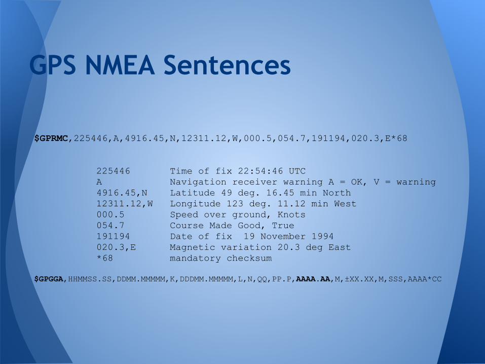
GPS NMEA Sentences
$GPRMC,225446,A,4916.45,N,12311.12,W,000.5,054.7,191194,020.3,E*68
225446 Time of fix 22:54:46 UTC A Navigation receiver warning A = OK, V = warning 4916.45,N Latitude 49 deg. 16.45 min North 12311.12,W Longitude 123 deg. 11.12 min West 000.5 Speed over ground, Knots 054.7 Course Made Good, True 191194 Date of fix 19 November 1994 020.3,E Magnetic variation 20.3 deg East *68 mandatory checksum
$GPGGA,HHMMSS.SS,DDMM.MMMMM,K,DDDMM.MMMMM,L,N,QQ,PP.P,AAAA.AA,M,±XX.XX,M,SSS,AAAA*CC
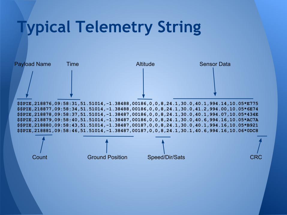
$$PIE,218876,09:58:31,51.51014,-1.38488,00186,0,0,8,24.1,30.0,40.1,994.14,10.05*E775$$PIE,218877,09:58:34,51.51014,-1.38488,00186,0,0,8,24.1,30.0,41.2,994.00,10.05*6E74$$PIE,218878,09:58:37,51.51014,-1.38487,00186,0,0,8,24.1,30.0,40.1,994.07,10.05*434E$$PIE,218879,09:58:40,51.51014,-1.38487,00186,0,0,8,24.1,30.0,40.6,994.16,10.05*AC7A$$PIE,218880,09:58:43,51.51014,-1.38487,00187,0,0,8,24.1,30.0,40.1,994.16,10.05*B921$$PIE,218881,09:58:46,51.51014,-1.38487,00187,0,0,8,24.1,30.1,40.6,994.16,10.06*0DC8
Typical Telemetry String
Payload Name Time Altitude Sensor Data
Count Ground Position Speed/Dir/Sats CRC
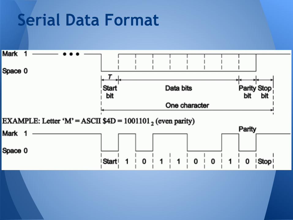
Serial Data Format
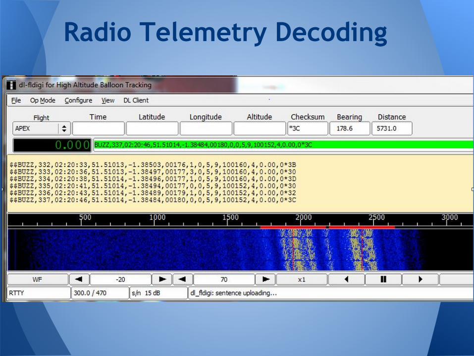
Radio Telemetry Decoding
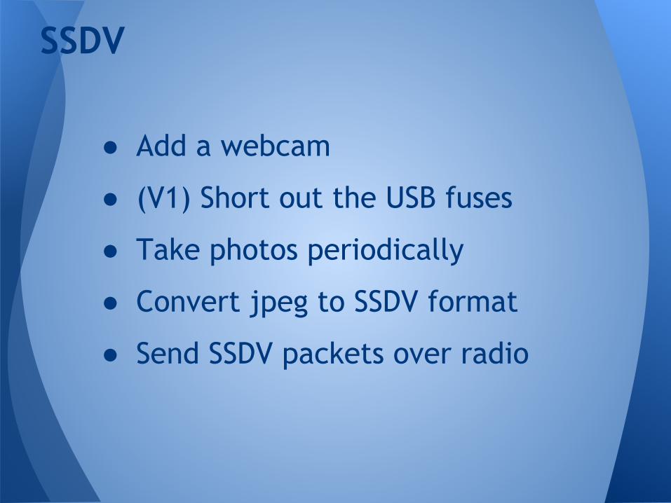
● Add a webcam
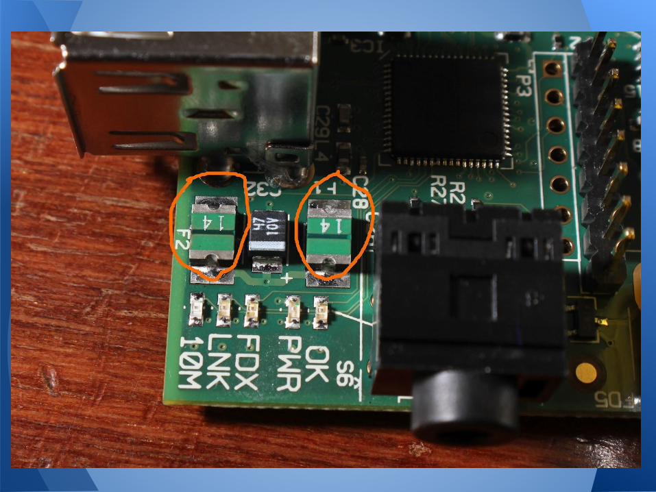
● (V1) Short out the USB fuses
● Take photos periodically
● Convert jpeg to SSDV format
● Send SSDV packets over radio
SSDV
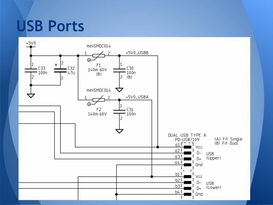
USB Ports
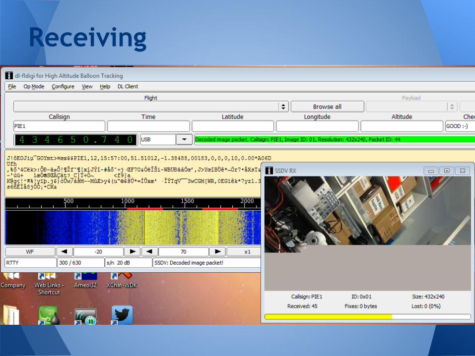
Receiving
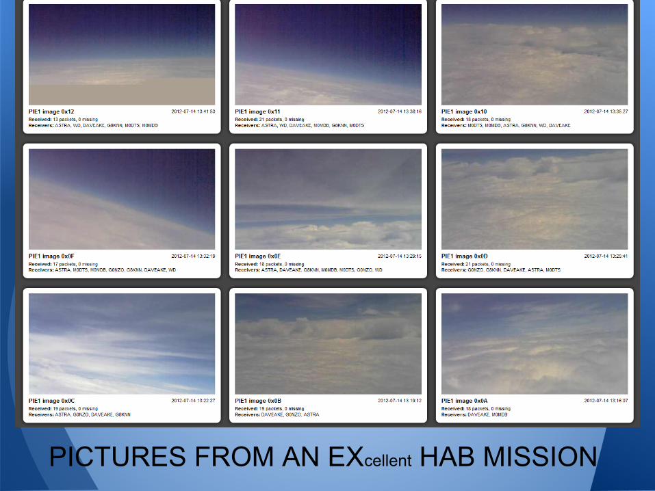
PICTURES FROM AN EXcellent HAB MISSION
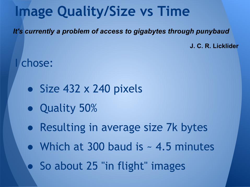
I chose:
● Size 432 x 240 pixels
● Quality 50%
● Resulting in average size 7k bytes
● Which at 300 baud is ~ 4.5 minutes
● So about 25 "in flight" images
Image Quality/Size vs TimeIt's currently a problem of access to gigabytes through punybaud
J. C. R. Licklider
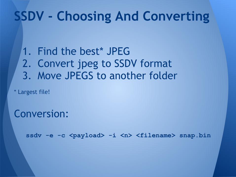
1. Find the best* JPEG2. Convert jpeg to SSDV format3. Move JPEGS to another folder
* Largest file!
Conversion:
ssdv -e -c <payload> -i <n> <filename> snap.bin
SSDV - Choosing And Converting

Choosing The "Best" Image
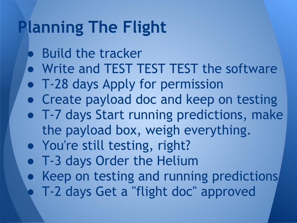
● Build the tracker● Write and TEST TEST TEST the software● T-28 days Apply for permission● Create payload doc and keep on testing● T-7 days Start running predictions, make
the payload box, weigh everything.● You're still testing, right?● T-3 days Order the Helium● Keep on testing and running predictions● T-2 days Get a "flight doc" approved
Planning The Flight
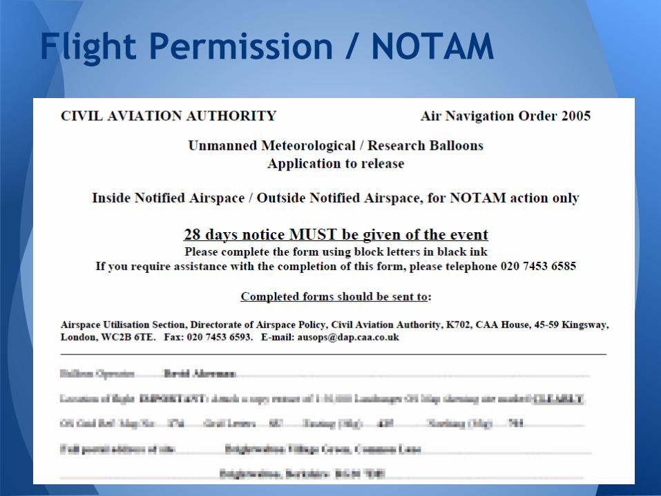
Flight Permission / NOTAM
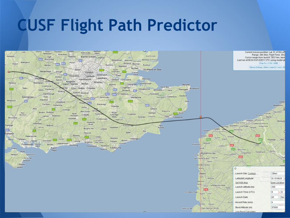
CUSF Flight Path Predictor
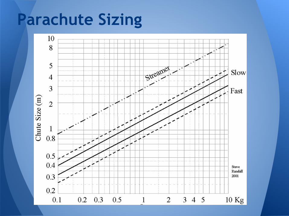
Parachute Sizing

My Blog
www.daveakerman.com
More Information about HAB
www.ukhas.org.uk
Tracking System / Predictor Links
habhub.org
Links