HAZARD RANKING SCORE SHEETS AND DOCUMENTATION … · (ZI Divid Unae Q) ) byKM(O and mgtaoiy B y iOO...
31
Rose Hill Regional Landfill Rose Hill Road, South Kingstown, Rhode Island Town of South Kingstown John Schock, Utilities Director Barbara Felitti, NUS/FIT 9/15/87 Wi * Rose Hill Regional Landfill is a municipal landfill at which • municipal and industrial wastes were disposed of between 1967 - 1983. Analyses of groundwater samples collected from onsite monitoring well indicated contamination with several volatile organic compounds. The onsite disposal areas were closed in 1983. Three residential wells adjacent to the site are contaminated with low levels of volatile organic and/or organic compounds. 65.62, 6.30. NA ROUK11 HR* COVtM SHUT
Transcript of HAZARD RANKING SCORE SHEETS AND DOCUMENTATION … · (ZI Divid Unae Q) ) byKM(O and mgtaoiy B y iOO...
Rose Hill Regional Landfill
Rose Hill Road, South Kingstown, Rhode Island
Town of South Kingstown
John Schock, Utilities Director
Barbara Felitti, NUS/FIT 9/15/87
Wi*
Rose Hill Regional Landfill is a municipal landfill at which •
municipal and industrial wastes were disposed of between 1967- 1983.
Analyses of groundwater samples collected from onsite monitoring well
indicated contamination with several volatile organic compounds. The
onsite disposal areas were closed in 1983. Three residential wells
adjacent to the site are contaminated with low levels of volatile
organic and/or organic compounds.
65.62, 6.30.
NA
ROUK11 HR* COVtM SHUT
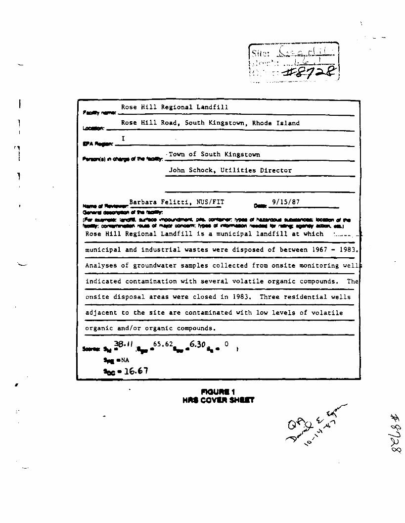
Site Name: Rose Hill Regional Landfill Date: 9/15/87
Ground water ftouto wont Sheet
Asaigned value MUID- Max. Bating factor Score Circle One) QII«* Score isilL UJ Observed Heieaae 0 (49) i 49 3.1 45
if oeservod raieeae a given a score of 49. proceed to line [7]. if ooaerved raiease s given a score of 0. proceed to tine \Q
Q] Boute Clwractenattca . 3.2 Oeotft to Aquifer of 0 1 2 3 2 • Concern
Net Precioitatton 0 1 2 3 1 3 PermeeOHIlv of me 0 1 2 3 t 3 Unsaturated Zone
Physical State 0 1 2 3 1 3
Total Aouto Charactenattca Score 19
UJ Containment 0 1 2 3 1 3 3.3
CH waato Cnaractortettca 3.4 Toxfcity/Persiatonco 0 3 • » 12 19(1§) i 18 it Hazarooua Waat* 0 ( T ) 2 3 4 9 « 7 I i 1 1
Total waete OartetenatJea Score 19 20
3.9 Ground Water UN 0 1 2 ( 3 ) 3 9 9 Piatanee to Nearei 4 • I 10 1 35 40
12 10 it 20 1 0
24 30 32 (B) 40
Tota. Tar** Scar* 44 40,
03 if line Q it 4*. rnutaary Q] • H i Q) J7.62C
Q '• °- mu<t>0|V 97.330 if tine (2 * Ca * 3 ' 00
G3 Divide line (U by 97.330 and mgittary Oy 100 Sflw- 65.62
FIOURI 2 GROUND WATER ROUTE WORK SHEET
li
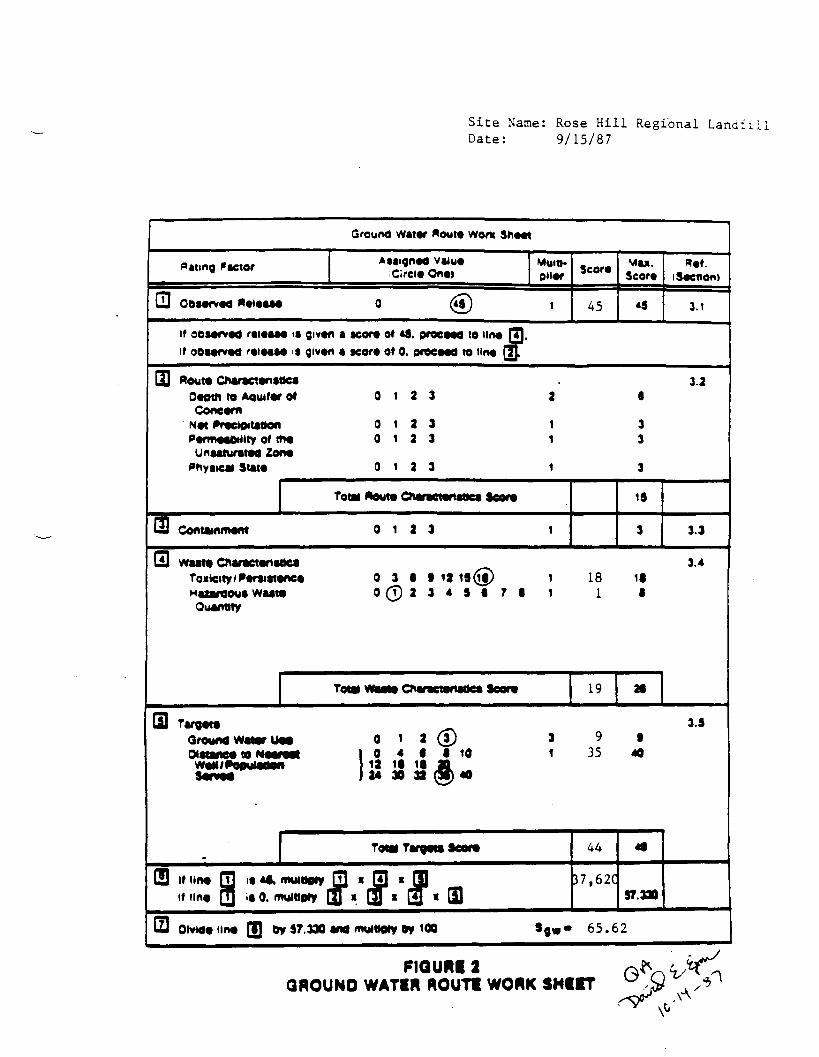
Site Name: Rose Hill Regional Landfill Date: 9/15/87
Surface water Aouto Worn Sri«« i
Aaaigned value Mult*. Mai. ftef.Hating 'actor Score (Circle One) Score (Secttoni
LU Obsarved Rotaae* © 4« 1 0 « 4.1
if oeaarved reieaaa ia given a value of 4f, proceed to line QJ-if ooaarved reieaae ia given a value of 0. proceed to tine 3J.
GD floute Cnaractanattea 4.2
facility Slope and intervening 0 1 @) 3 1 Z 3Terrain
i-yr. 2**r. MalnfaM 0 1 (?) 3 1 2 3 Olatanca to Nearaat Surface 0 i 2 (f) 2 6 1 water
Pnyaicat Slat* 0 i a (D 1 3 3
Total "wut* Cnaractanaoca Sear* IB 19
3Ql Contammant 0 1 a (5) t 3 4.3
O waate CnaraetanafJe a 4.4
Toiicity/Foreiatani M 0 3 It (S)19 11 1 12 If
o (T) a 3 4 9 • T • Quantity
T^W^Ow^W^cator, 13 20
rnLai Targeta 4.9
Surfaca water Uaa 0 1 (2) 3 3 6 t Olatanca to a Sam M M 0 0 2 3 a •2
OManm 1 (5) 4 • 1 10 1 ° 40 I iff 10 11 20 j 24 30 33 3f 40
8TotM Targeta Soore M
(3 if line QJ ia4a\ nviMtiy Q] » 5) «J3) «B» if line Q] ia 0. murttofy (J « Lu * 13 * 0 •4.310
(ZI Divide Una) Q) by(KMO and mgtaoiy By iOO •-•6.30
P1QURI 7 SURFACI WATIR ROUTI WORK SHEIT
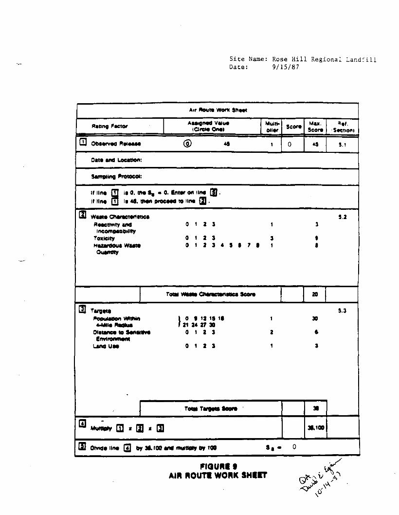
Site Name: Rose Hill Regional Landfill
Date: 9/15/87
Air Aouto Worfc 9h«ot
flattng factor Aaaignod vaiuo (drew Ono>
Muitt- Seer* Maa. Seor* 'Section)
Obaorvod 5.1
Oat* and Location:
Sampling Protocol:
if lino Q it 0. m« $, - 0. Intor on lino QQ .
If lino Q i» «•. Won proMOd to lino Q) •
waato Charoctontttea 9.2 Roacttvity and 0 1 2 3 incowpaMOillty
Toxieity 0 1 2 3 3 9 Maxardoua waato 0 1 2 3 4 9 1 7 1 1 a Quantity
Total CDonctoni 20
Targota 9.3 0 • 12 19 it 30
21 24 27 30 0 1 2 3 ft
tfhji i
Lanouao 0 1 2 3 3
Tot* Tanjow Sooro
(JJ 39,100
SI Otwioiino (3 oy 3i,iOO and muiiio»y BY 100 - 0
F1QUMI t AIM ROUT! WORK SHUT
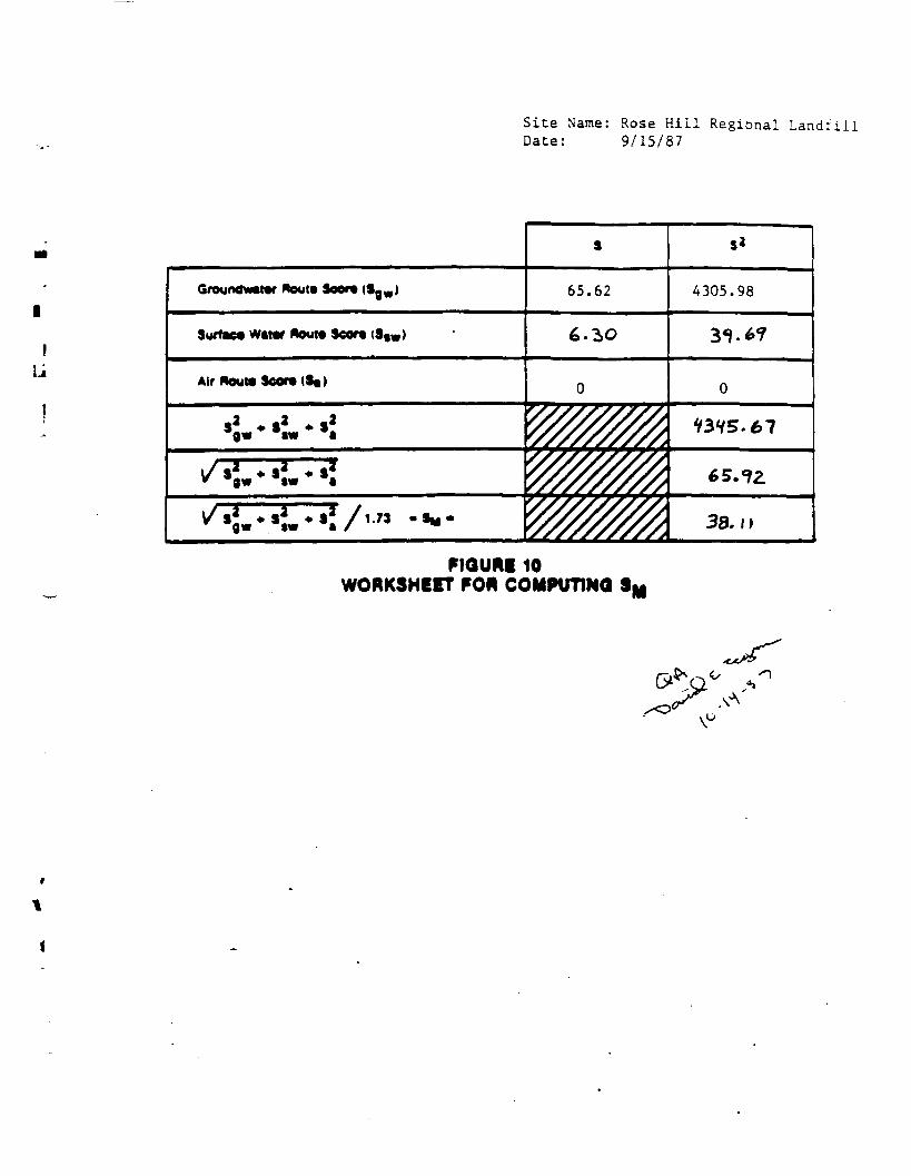
Site Name: Rose Hill Regional Landfill Date: 9/15/87
GregndxMMr newt* Seer* (Sgw) 65.62 4305.98
Surface Winr Aeut* Seor* <S«W) 6.30
Air Route Seer* (S«)
V3V5.67
6S.1Z
38. l l
FIGURE 10 WORKSHEET FOR COMPUTING SM
xx/*>
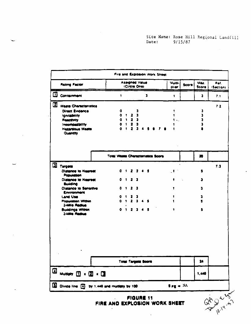
Site Name: Rose Hill Regional Landfill
Date: 9/15/87
and fxo«o*on went Sn*«t
vaiua M4«. «af. Acting Factor Seer* (Greta Onai Oli«r Seer* i Section)
.J Containment 7 1
waaw Cnaractansttca Wract Iwdanca 0 ignitaBMity 0 1 2
o 1 a tneomOMlMllty o 1 a Hax^aom W o i 2 « 3 « 7 Quanmy
Total ChmcMrti
01 7.3 01: 0 1 2 3 4 S 9
Oiaanc* to 0 1 2 3 3
0<»t»nc« te 0 1 2 3 3
UndUM 0 1 2 3 3 Population wwtn 0 1 2 3 4 S S
BuiMlnga VMthM 0 1 2 3 4 5
Total T, 24
Mg|«0* QJ
01 Olvttciina Dy 1.440 and muioetyOy 100 S ff - NA
FIGURE 11 FIRE AND CXPtOSION WORK SHUT
Site Name: Rose Hill Regional Landfill Date: 9/15/87
Oirwt Contact Worn Sh««i
•mna, P V«lM (Orel* On«» Scar* MW.
Sew* ••f.
1.1
if Una Q] i«4i Mima
if Una 01 )• 0. to una |
o i a
15 1f
WMM 10 o t If 1.4
ffl IS 0 1 (jp» 4 I 4 8
»« (0) 1 2 1 4 0
If IUM 3600 If Kn« >• 0,
soc 16-67
mouniu OIMCT CONTACT WORK SHUT
/;
/ . .
DOCUMENTATION RECORDS FOR
HAZARD RANKING SYSTEM
FACILITY NAME: Rose Hill Regional Landfill
LOCATION: Rose Hill Road, South Kingstown, RI
DATE SCORED: September 29, 1987
PERSON SCORING: Barbara Felitti/NUS/FIT
PRIMARY SOURCE(S) OF INFORMATION (e.g., EPA region, state, FIT, etc.):
1). U.S. Environmental Protection Agency, Region I, Boston, MA 2). Region I NUS/FIT 3). Rhode Island Dept. of Environmental Mgt., Providence, RI
FACTORS NOT SCORED DUE TO INSUFFICIENT INFORMATION:
COMMENTS OR QUALIFICATIONS:
The Rose Hill Regional Landfill is not regulated under Subtitle C of RCRA. Industrial process wastes containing trichloroethylene have been disposed of at the Rose Hill Regional Landfill by Peacedale Processing Company. Copper and zinc sludge were also disposed of at the landfill .
The towns of North Kingstown and Narragansett were unable to provide information as to the location of private wells within a three mile radius of the site. This population was excluded from the target population score, however, it represents a small percentage of the total target population.
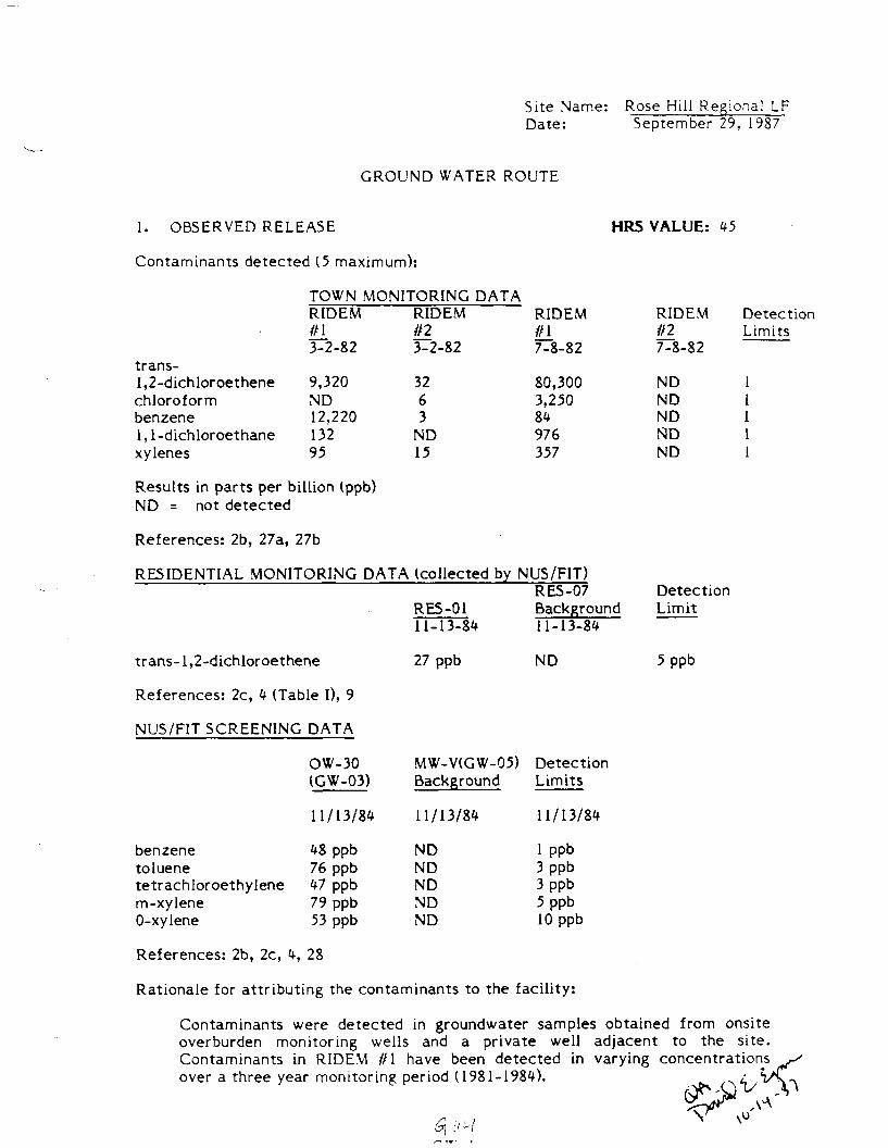
Site Name: Rose Hill Regional IF Date: September 29, 1987
GROUND WATER ROUTE
1. OBSERVED RELEASE HRS VALUE: 45
Contaminants detected (5maximum):
TOWN MONITORING DATA RIDEM ILL 3-2-82
RIDEM #2 3-2-82
RIDEM £L 7-8-82
RIDEM ill 7-8-82
Detection Limits
trans-1,2-dichloroethene chloroform benzene 1,1-dichloroethane xylenes
9,320 ND 12,220 132 95
32 6 3
ND 15
80,300 3,250 84 976 357
ND ND ND ND ND
Results in parts per billion (ppb) ND = not detected
References: 2b, 27a, 27b
RESIDENTIAL MONITORING DATA (collected by NUS/FIT) RES-07
RES-01 Background 11-13-8411-13-84
Detection Limit
trans-1,2-dichloroethene 27 ppb ND 5 ppb
References: 2c, 4 (Table I), 9
NUS/FIT SCREENING DATA
OW-30 (GW-03)
MW-V(GW-05) Background
Detection Limits
11/13/8* 11/13/84 11/13/84
benzene toluene tetrachloroethylene m-xylene 0-xylene
48 ppb 76 ppb 47 ppb 79 ppb 53 ppb
ND ND ND ND ND
1 ppb 3 ppb 3 ppb 5 ppb 10 ppb
References: 2b, 2c, 4, 28
Rationale for attr ibuting the contaminants to the facility:
Contaminants were detected in groundwater samples obtained from onsite overburden monitoring wells and a private well adjacent to the site. Contaminants in RIDEM //I have been detected in varying concentrationss *s over a three year monitoring period (1981-1984). / VC-»
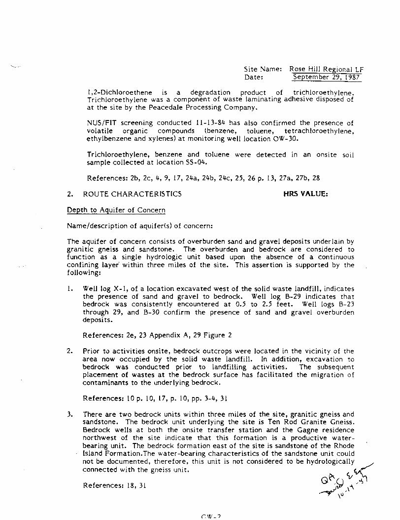
Site Name: Rose Hill Regional LF Date: September 29, 1987
1,2-Dichloroethene is a degradation product of trichloroethylene. Trichloroethylene was a component of waste laminating adhesive disposed of at the site by the Peacedale Processing Company.
NUS/FIT screening conducted 11-13-8*1 has also confirmed the presence of volatile organic compounds (benzene, toluene, tetrachloroethylene, ethylbenzene and xylenes) at monitoring well location OW-30.
Trichloroethylene, benzene and toluene were detected in an onsite soil sample collected at location SS-04.
References: 2b, 2c, *, 9, 17, 24a, 2<fb, 2*c, 25, 26 p. 13, 27a, 27b, 28
2. ROUTE CHARACTERISTICS HRS VALUE:
Depth to Aquifer of Concern
Name/description of aquifer(s) of concern:
The aquifer of concern consists of overburden sand and gravel deposits underlain by granitic gneiss and sandstone. The overburden and bedrock are considered to function as a single hydrologic unit based upon the absence of a continuous confining layer within three miles of the site. This assertion is supported by the following:
1. Well log X-l, of a location excavated west of the solid waste landfill, indicates the presence of sand and gravel to bedrock. Well log B-29 indicates that bedrock was consistently encountered at 0.5 to 2.5 feet. Well logs B-23 through 29, and B-30 confirm the presence of sand and gravel overburden deposits.
References: 2e, 23 Appendix A, 29 Figure 2
2. Prior to activities onsite, bedrock outcrops were located in the vicinity of the area now occupied by the solid waste landfill. In addition, excavation to bedrock was conducted prior to landfilling activities. The subsequent placement of wastes at the bedrock surface has facilitated the migration of contaminants to the underlying bedrock.
References: 10 p. 10, 17, p. 10, pp. 3-4, 31
3. There are two bedrock units within three miles of the site, granitic gneiss and sandstone. The bedrock unit underlying the site is Ten Rod Granite Gneiss. Bedrock wells at both the onsite transfer station and the Gagne residence northwest of the site indicate that this formation is a productive water-bearing unit. The bedrock formation east of the site is sandstone of the Rhode Island Formation. The water-bearing characteristics of the sandstone unit could not be documented, therefore, this unit is not considered to be hydrologically connected with the gneiss unit.
References: 18, 31
Site Name: Rose Hill Regional LF Date: September 29, 1987
H. r*e *=»<f*•«•*' «• corxc««-r\ -f-Ke.
There are no barriers to contaminant migration to the target wells, based upon the following:
1. Three supply wells for the University of Rhode Isalnd (URI) are located within three miles of the site. The well log for well no. 92, one of the three supply wells, indicates fine to coarse sand, and gravel to bedrock.
References: 30 p. 36 well no. 92, p. 37 well no. 138, p. 55 well log
2. There are three wells for the Kingston Fire District within three miles of the site, of which two are used as a regular water supply (well nos. 8 and 109). The third well, no. 108 is an alternate supply well.
Well no. 109 is a 30 foot bedrock well, in which bedrock was encountered at 11 feet. Previous discussion indicates that the granitic gneiss unit within which the well is completed, is hydrologically connected with the aquifer of concern.
The second well in use, well no. 8, is a four foot shallow dug well which is spring fed. Due to the shallow bedrock surface in the area, resulting in a seven foot distance to bedrock at this location, the well is also considered to be hydrologically connected with the aquifer of concern.
References: *, 9, 10 (pp. 10, 27,) 17 (well logs), 17, p. 10, 18, 23 (well logs), 26 p. 13
Depth(s) from the ground surface to the highest seasonal level of the saturated zone (water table(s)) of the aquifer of concern:
Depth from the ground surface to the lowest point of waste disposal/storage:
Net Precipitation HRS VALUE:
Mean annual or seasonal precipitation (list months for seasonal):
Mean annual lake or seasonal evaporation (list months for seasonal):
Net precipitation (subtract the above figures):
Permeability of Unsaturated Zone HRS VALUE:
Soil type in unsaturated zone:
GW-3
Site Name: Rose Hill Regional LF Date: September 29, 1987
Permeability associated with soil type:
Physical State HRS VALUE:
Physical state of substances at time of disposal (or at present time for generated gases):
3. CONTAINMENT HRS VALUE:
Containment
Method(s) of waste or leachate containment evaluated:
Method with highest score:
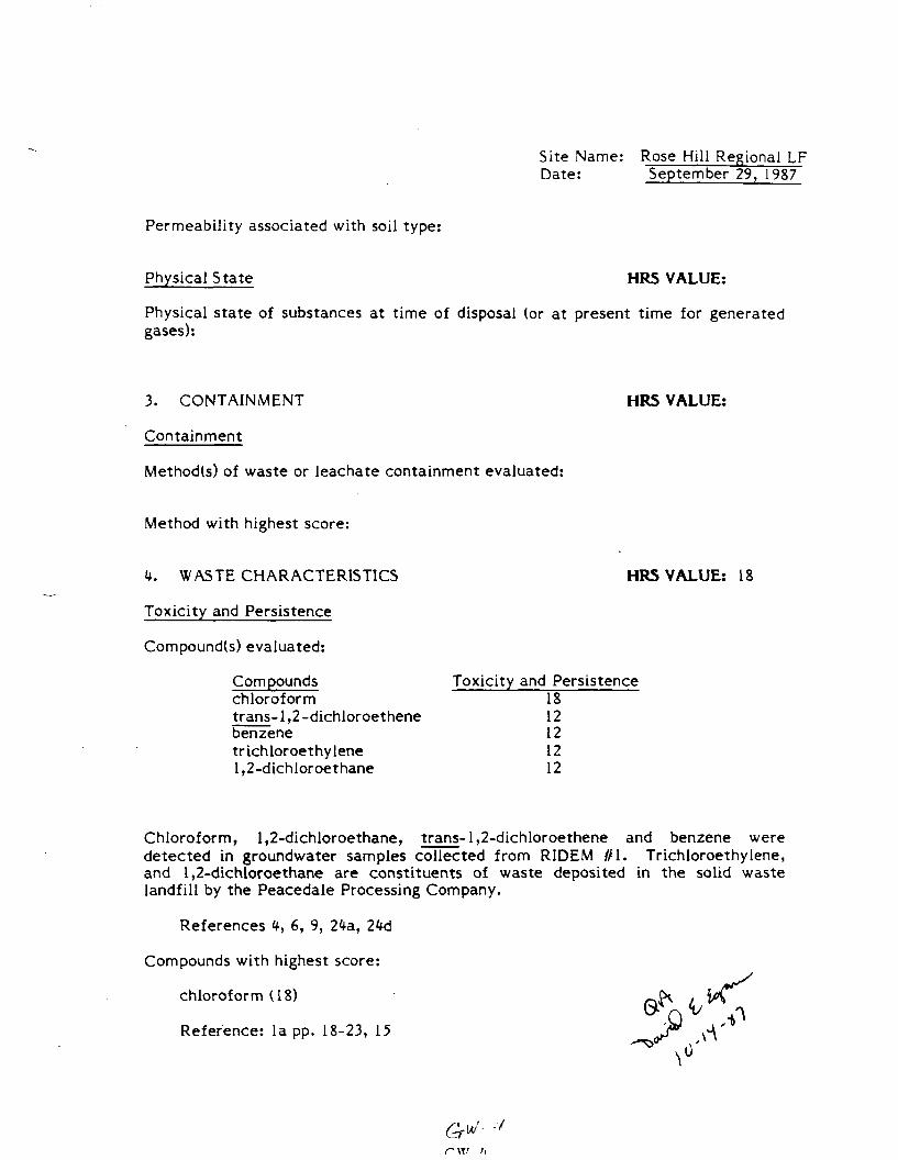
4. WASTE CHARACTERISTICS HRS VALUE: 18
Toxicity and Persistence
Compound(s) evaluated:
Compounds Toxicity and Persistence chloroform 18 trans-1,2 -dichloroethene 12 benzene 12 trichloroethylene 12 1,2-dichIoroethane 12
Chloroform, 1,2-dichloroethane, trans-1,2-dichloroethene and benzene were detected in groundwater samples collected from RIDEM //I. Trichloroethylene, and 1,2-dichloroethane are constituents of waste deposited in the solid waste landfill by the Peacedale Processing Company.
References *f, 6, 9, 2^a, 2W
Compounds with highest score:
chloroform (18) • ^^ . fy\
Reference: la pp. 18-23, 15 ^^><
r~ XT/
Site Name: Rose Hill Regional LF Date: September 29, 1987
Hazardous Waste Quantity HRS VALUE: 1
Total quantity of hazardous substances at the facility, excluding those with a containment score of 0 (Give a reasonable estimate even if quantity is above maximum):
An unknown quantity of hazardous substances has been deposited at the Regional Landfill along with municipal and industrial waste. A local area industry is known to have utilized Rose Hill Regional Landfill for the disposal of process wastes.
References: 24b, 2M
Basis of estimating and/or computing waste quantity:
Value of "1" given to reflect presence of hazardous substances on site despite the unknown quantity.
Reference: Ib
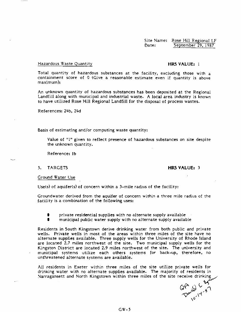
5. TARGETS HRS VALUE: 3
Ground Water Use
Use(s) of aquifer(s) of concern within a 3-mile radius of the facility:
Groundwater derived from the aquifer of concern within a three mile radius of the facility is a combination of the following uses:
• private residential supplies with no alternate supply available I municipal public water supply with no alternate supply available
Residents in South Kingstown derive drinking water from both public and private wells. Private wells in most of the areas within three miles of the site have no alternate supplies available. Three supply wells for the University of Rhode Island are located 2.7 miles northwest of the site. Two municipal supply wells for the Kingston District are located 2.9 miles northwest of the site. The university and municipal systems utilize each others systems for back-up, therefore, no unthreatened alternate systems are available.
All residents in Exeter within three miles of the site utilize private wells for drinking water with no alternate supplies available. The majority of residents in Narragansett and North Kingstown within three miles of the site receive drinking^
GW-5
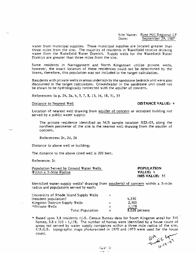
Site Name: Rose Hill Regional LF Date: September 29, 1987
water from municipal supplies. These municipal supplies are located greater than three miles from the site. The majority of residents in Wakefield receive drinking water from the Wakefield Water District. Supply wells for the Wakefield Water District are greater than three miles from the site.
Some residents in Narragansett and North Kingstown utilize private wells, however, the exact location of these residences could not be determined by the towns, therefore, this population was not included in the target calculation.
Residents with private wells in areas underlain by the sandstone bedrock unit were also discounted in the target calculation. Groundwater in the sandstone unit could not be shown to be hydrologically connected with the aquifer of concern.
References: la p. 24, 2a, 4, 5, 7, 8, 13, 16, 18, 31, 33
Distance to Nearest Well DISTANCE VALUE: 4
Location of nearest well drawing from aquifer of concern or occupied building not served by a public water supply:
The private residence identified as NUS sample location RES-03, along the northern perimeter of the site is the nearest well drawing from the aquifer of concern.
References: 2c, 2d, 26
Distance to above well or building:
The distance to the above cited well is 200 feet.
Reference: 2c
Population Served by Ground Water Wells POPULATION Within a 3-Mile Radius VALUE: 4
MRS VALUE: 35
Identified water-supply welKs^ drawing from aquifer(s) of concern within a 3-mile radius and populations served by each:
University of Rhode Island Supply Wells = (resident population) 4,350 Kingston District Supply Wells = 2,500 *Private Wells = 1,178
Total Population = 8,028 persons
* Based upon 3.8 residents (U.S. Census Bureau data for South Kingston area) for 310 homes, 3.8 x 310 = 1,178. The number of homes were identified by a house count of areas not served by water supply companies within a three mile radius of the site. U.S.G.S. topographic maps photorevised in 1970 and 1975 were used for the house count.
Site Name: Rose Hill Regional LF Date: September 29, 1987
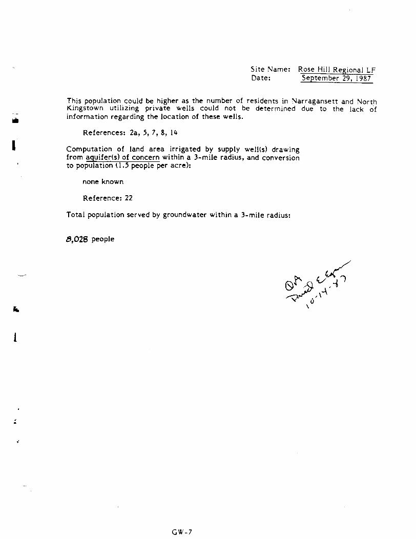
This population could be higher as the number of residents in Narragansett and North Kingstown utilizing private wells could not be determined due to the lack of information regarding the location of these wells.
References: 2a, 5, 7, 8, 1*
Computation of land area irrigated by supply well(s) drawing from aquifer(s) of concern within a 3-mile radius, and conversion to population (1.5 people per acre):
none known
Reference: 22
Total population served by groundwater within a 3-mile radius:
5,028 people
0\
GW-7
"~ Site Name: Rose Hill Regional LF Date: September 29, 1987
SURFACE WATER ROUTE
j| 1. OBSERVED RELEASE HRS VALUE: 0
Contaminants detected in surface water at the facility or downhill from it (5 . maximum):
i_i Contaminants were detected in surface water by RI DEM on 9-17-82, however, no upgradient location was sampled. Therefore contaminants cannot be conclusively attributed to the site, and the analytical data cannnot be used to score an observed release.
Reference: 4
Rationale for attributing the contaminants to the facility:
NA
2. ROUTE CHARACTERISTICS HRS VALUE: i
Facility Slope and Intervening Terrain
Average slope of facility in percent:
Surficial contamination has been detected at one location only, SS-04, therefore the facility slope is 0%.
References: 2c, 2d, k,
Name/description of nearest downslope surface water:
The nearest downslope surface water to sample location SS-CM is the Saugatucket River, east of the bulky waste disposal area and the sewage sludge landfill. In addition, Mitchell Brook flows through the site, east of the solid waste landfill.
References: 2c, ^
XA
1\M . 1
Site Name: Rose Hill Regional LF Date: September 29, 1987
Average slope of terrain between facility and above cited surface water body in percent:
Soil sample location SS-04, at which contamination was detected, is located 30 feet from the Saugatucket River with an elevation change of 10 feet.
10ft . x 100 = 33% 30 ft.
References: 2c, 2d, 4
Is the facility located either totally or partially in surface water?
No
Reference: 2a
Is the facility completely surrounded by areas of higher elevation?
No
Reference: 2a
1-Year 24-Hour Rainfall in Inches HRS VALUE: 2
2.5 inches
Reference: la p. 33
Distance to Nearest Downslope Surface Water HRS VALUE: 3
The Saugatucket River is located 30 feet from soil sample location SS-04, at which contamination was detected.
References: 2c, 2d, ^
Physical State of Waste HRS VALUE: 3
Liquid and solid wastes were disposed of at the site. Jy- v .«
Reference: 10 p. 3, 6, 24b, 24d, 24e ^ 0
Site Name: Rose Hill Regional LF Date: September 29, 1987
* * *
3. CONTAINMENT MRS VALUE: 3
Containment
Method(s) of waste or leachate containment evaluated:
Uncontained and uncovered contaminated soil was detected onsite.
References: 4, 11
Method with highest score:
Uncontained, uncovered contaminated soil = 3
Reference: la, p. 35
4. WASTE CHARACTERISTICS MRS VALUE: 12
Toxicity and Persistence
Compound(s) evaluated
Toxicity/Persistence
trichloroethene 12 toluene 9
Benzene, trichloroethene and toluene were detected in a soil sample collected from location SS-04. The above compounds were detected with the NUS/FIT in-house headspace screening technique utilizing a Photvac 10A10 Gas Chromotagraph. The presence of the above compounds is confirmed by the technique, but the concentrations are not quantifiable.
Reference: 4 ,*^
Compound with highest score: (£/* - {s^-*
trichloroethene = 12 s*^<r^ . ̂
\.o ,n References: la pp. 18-23, 15 x
SW-3
Site Name: Rose Hill Regional LF Date: September 29, 1987
Hazardous Waste Quantity HRS VALUE: 1
Total quantity of hazardous substances at the facility, excluding those with a containment score of 0 (Give a reasonable estimate even if quantity is above maximum):
An unknown quantity of hazardous substances has been deposited at the Regional Landfill along with municipal and industrial waste. However, contaminants detected at sample SS-04 are available to the surface water route.
References: 2c, 2d, it,
Basis of estimating and/or computing waste quantity:
A value of "1" is given to reflect the presence of hazardous substances onsite despite unknown quantity.
Reference: Ib * * *
5. TARGETS HRS VALUE: 1
Surface Water Use
Use(s) of surface water within 3 miles downstream of the hazardous substance:
Saugatucket Pond, located 3,800 feet downstream of sample location SS-04, is used for fishing and swimming.
Reference: 12
Is there tidal influence?
No
Reference: 2a
Distance to a Sensitive Environment HRS VALUE: 2
Distance to 5-acre ( m i n i m u m ) coastal wetland, if 2 miles or less:
Coastal wetlands are not located within two stream miles of the site.
Reference: 2a
Site Name: Rose Hill Regional LF Date: September 29, 1987
Distance to 5-acre (min imum) fresh-water wetland, if 1 mile or less:
A ten acre freshwater wetland is located 2,500 feet downstream of the solid waste landfi l l , along Mitchell Brook.
Reference: 2d, 19
Distance to critical habitat of an endangered species or national wildlife refuge, if 1 mile or less:
There are no critical habitats of an endangered species or national wildlife refuges within one mile of the site.
Reference: 20
Population Served by Surface Water MRS VALUE: 0
Location(s) of water-supply intake(s) within 3 miles (free-flowing bodies) or 1 mile (static water bodies) downstream of the hazardous substance and population served by each intake:
Peacedale Processing Industries, Inc., located one mile south of Regional Landf i l l , has a surface water intake on the Saugatucket River. This intake is used for process water only and not as a drinking water supply.
Reference: 21
Computation of land area irrigated by above-cited intake(s) and conversion to population (1.5 people per acre):
None known
Reference: 22
Total population served:
Not applicable
Name/description of nearest of above water bodies: t j^
Saugatucket River
Reference: 2d
Distance to above-cited intakes, measured in stream miles. HRS VALUE:
Not applicable
SW-5
0
Site Name: Rose Hill Regional LF Date: September 29, 1987
AIR ROUTE
1. OBSERVED RELEASE MRS VALUE: 0
Ambient air monitoring was conducted during the NUS/FIT Site Inspection utilizing a Foxboro Organic Vapor Analyzer (OVA) 128. No readings above background were detected.
Reference: 4
Contaminants detected:
NA
Date and location of detection of contaminants
NA
Method used to detect the contaminants:
NA
Rationale for attributing the contaminants to the site:
NA
# * *
2. WASTE CHARACTERISTICS MRS VALUE:
Reactivity and Incompatibility
Most reactive compound: „ V"
Most incompatible pair of compounds:
NA
A A _
Site Name: Rose Hill Regional LF Date: September 29, 1987
Toxicity HRS VALUE:
Most toxic compound:
NA
Hazardous Waste Quantity MRS VALUE:
Total quantity of hazardous waste:
NA
Basis of estimating and/or computing waste quantity:
NA
* * *
3. TARGETS HRS VALUE:
Population Within fr-Mile Radius
Circle radius used, give population, and indicate how determined:
0 to 4 mi 0 to 1 mi 0 to 1/2 mi 0 to I/* mi
NA
Distance to a Sensitive Environment HRS VALUE:
Distance to 5-acre (min imum) coastal wetland, if 2 miles or less:
NA
Distance to 5-acre ( m i n i m u m ) fresh-water wetland, if 1 mile or less:
NA
Site Name: Rose Hill Regional LF Date: September 79, 1987
Distance to critical habitat of an endangered species, if 1 mile or less:
NA
Land Use MRS VALUE:
Distance to commercial/industrial area, if 1 mile or less:
NA
Distance to national or state park, forest, or wildlife reserve, if 2 miles or less:
NA
Distance to residential area, if 2 miles or less:
NA
Distance to agricultural land in production within past 5 years, if 1 mile or less:
NA
Distance to prime agricultural land in production within past 5 years, if 2 mile or less:
NA
Is a historic or landmark site (National Register or Historic Places and National Natural Landmarks) within the view of the site?
NA
Site Name: Rose Hill Regional LF Date: September 29, 1987
FIRE AND EXPLOSION
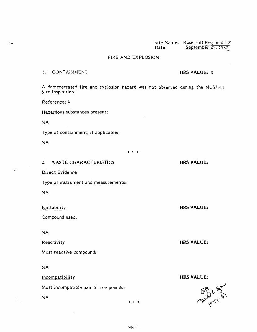
1. CONTAINMENT HRS VALUE: 0
A demonstrated fire and explosion hazard was not observed during the NUS/FIT Site Inspection.
Reference: 4
Hazardous substances present:
NA
Type of containment, if applicable:
NA
2. WASTE CHARACTERISTICS HRS VALUE:
Direct Evidence
Type of instrument and measurements:
NA
Ignitability HRS VALUE:
Compound used:
NA
Reactivity HRS VALUE:
Most reactive compound:
NA
Incompatibility HRS VALUE:
Most incompatible pair of compounds:
NA
FE-l
Site Name: Rose Hill Regional LF Date: September 29, 1987
Hazardous Waste Quantity
Total quantity of hazardous substances at the facility:
NA
Basis of estimating and/or computing waste quantity:
NA
3. TARGETS
Distance to Nearest Population
NA
Distance to Nearest Building
NA
Distance to Sensitive Environment
Distance to v/etlands:
NA
Distance to critical habitat:
NA
Land Use
Distance to commercial/industrial area, if 1 mile or less:
NA
MRS VALUE:
MRS VALUE:
MRS VALUE:
HRS VALUE:
MRS VALUE:
FE-2
Site Name: Rose Hill Regional LF Date: September 29, 1987
Distance to national or state park, forest, or wildl ife reserve, if 2 miles or less:
NA
Distance to residential area, if 2 miles or less:
NA
Distance to agricultural land in production within past 5 years, if 1 mile or less:
NA
Distance to prime agricultural land in production within past 5 years, if 2 miles or less:
NA
Is a historic or landmark site (National Register or Historic Places and National Natural Landmarks) within the view of the site?
NA
Population Within 2-Mile Radius HRS VALUE:
NA
Buildings Within 2-Mile Radius HRS VALUE:
NA
r- •
Site Name: Rose Hill Regional LF Date: September 29. 1987
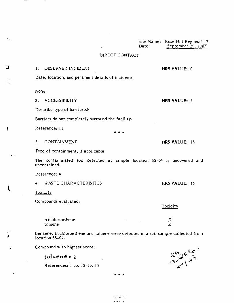
DIRECT CONTACT
1. OBSERVED INCIDENT HRS VALUE: 0
Date, location, and pertinent details of incident:
None.
2. ACCESSIBILITY HRS VALUE: 3
Describe type of barrier(s):
Barriers do not completely surround the facility.
Reference: 11 # # *
3. CONTAINMENT HRS VALUE: 15
Type of containment, if applicable
The contaminated soil detected at sample location SS-04 is uncovered and uncontained.
Reference: <*
4. WASTE CHARACTERISTICS HRS VALUE: 15
Toxicity
Compounds evaluated: Toxicity
trichloroethene 2 toluene 2
Benzene, trichloroethene and toluene were detected in a soil sample collected from location SS-04.
Compound with highest score:
toluene -z
References: 1 pp. 18-23, 15
Site Name: Rose Hill Regional LF Date: September 29, 1987
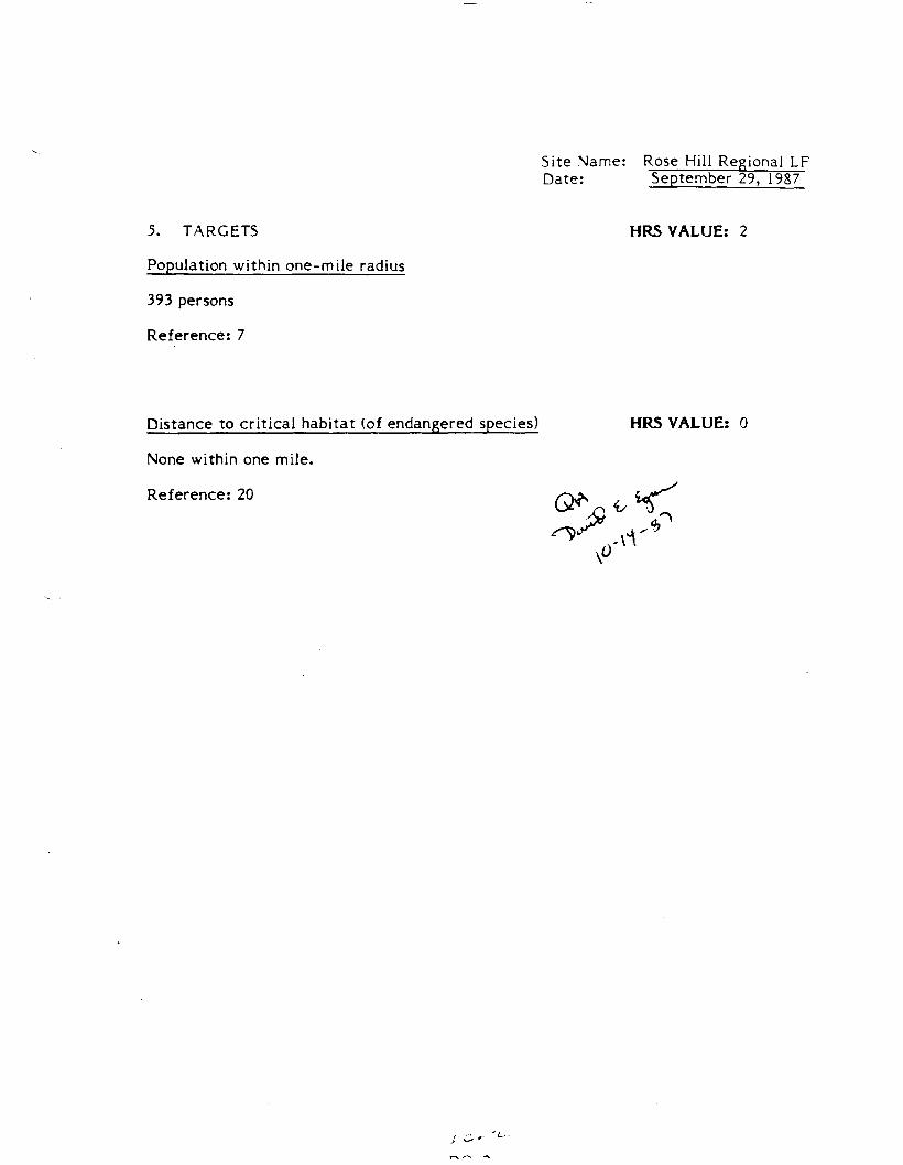
5. TARGETS HRS VALUE: 2
Population within one-mile radius
393 persons
Reference: 7
Distance to critical habitat (of endangered species) HRS VALUE: 0
None within one mile.
Reference: 20
References
la. Uncontrolled Hazardous Waste Site Ranking System; A Users Manual. National Oil and Hazardous Substances Contingency Plan, Appendix A (40 CFR 300X47 FR 31219), July 16, 1982.
Ib. Supplemental Instructions for the Hazard Ranking System, Steve Caldwell, U.S. Environmental Protection Agency, September 15, 1982.
2a. Three Mile Radius Map, U.S.G.S. Topographic Maps Narragnasett Pier, Wickford and Kingstown, Rhode Island 1957, photorevised 1970 &. 1975, Slocum, RI 1955, Photorevised 1970.
2b. Monitoring Well Locations Map
2c. NUS/FIT Sample Location Map
2d. Site Map/Targets
2e. Location Map for Subsurface Exploration Logs.
3. Preliminary Assessment of the Rose Hill Regional Landfill, NUS/FIT, TDD No. Fl-8212-15. January 20, 1983.
4. Site Inspection of the Rose Hill Regional Landfill, NUS/FIT, TDD No. Fl8409-07, September 20, 1985.
5. Telecon, Henry Meyer, Kingston Water Supply District and Barbara Felitti, NUS, 7/23/85.
6. Analytical results, Rhode Island Analytical Labs, 12/16/80 to 6/25/84.
7. Letter from David A. Webster, South Kingstown Utilities Dept. to Colin P. Young, NUS Corporation, April 11, 1985.
8. Telecon, Town Clerk, Town of Exeter and Barbara Felitti, NUS, 7/23/85.
9. Analytical results, Spectrix Laboratory, Houston, Texas.
10. "Engineering and Hydrogeological Assessment of the Rose Hill Landfill," prepared by York Wastewater Consultants, Inc. February 17, 1984.
11. NUS/FIT Site Visit Project Notes, November 13, 1984.
12. Telecon, Jeff O'Hara, Town of South Kingstown and Barbara Felitti, NUS/FIT, May 11, 1987.
13. Telecon, receptionist, North Kingstown Town Hall and Barbara Felitti, NUS, 7/22/85.
14. Telecon, Cal Jones, University of Rhode Island and Barbara Felitti, NUS, 7/23/85.
15. Dangerous Properties of Industrial Materials, Sax, N.I., Van Nostrand Rheinhold Co., New York, 4th Edition, 1975.
16. Telecon, receptionist, Narragansett Water Department and Barbara Felitti, NUS, 7/22/85.
17. Assessment of Groundwater Contamination from a Municipal Landfill and Evaluation of Remedial Measures by Mark Brickell, University of Rhode Island (URI), 1982.
18 Telecon, David A. Webster, South Kingstown Utilities Department and Barbara Felitti, NUS, 7/22/85.
19. Letter to Susan Patz, U.S. EPA from Alicia Good, Rhode Island Department of Environmental Management, July 1, 1985.
20. Telecon, Dick Dyer, U.S. Fish and Wildlife Service and Barbara Felitti, NUS, 8/15/85.
21. Telecon, David Webster, South Kingstown Utilities Department and Barbara Felitti, NUS, 8/15/85.
22. Telecon, Mr. Volpe, Rhode Island Department of Environmental Management and Barbara Felitti, NUS, 8/15/85.
23. "Phase II Site Evaluation and Orientation Plan for Municipal Sanitary Landfill, Rose Hill Road, prepared by C.E. Maguire, Inc., August, 1977.
24. Rhode Island Department of Environmental Management (RIDEM), Division of Air and Hazardous Materials, Agency File Information:
a. Letter from Stephen Majkut, RIDEM, to Ken Perez dated December 1, 1980.
b. Letter from Richard Curtis, Peacedale Processing Company, to the U.S. EPA Region I, dated June 2, 1981.
c. Bulletin, October 25, 1979, Section B, "Suspected Carcinogen Uncovered at Landfill" by C. Eugene Emery, Jr.
d. Letter from Norman Bampton, South Kingstown Water-Wastewater Department, to James Fester, RIDEM, dated August 6, 1981.
e. Letter from John S. Quinn, RIDEM, Solid Waste Management, to John E. DiPretoro, Director of Public Works, dated January 8, 1970.
25. Wood, P., Lang, R. and Payan, I. "Anaerobic Transformation, Transport, and . Removal of Volatile Chlorinated Organics in Groundwater." Groundwater
Quality. Ward, C., W. Giger and P. McCarty,editors. New York: John Wiley &Sons. 1985.
26. NUS Logbook #87-814. Rose Hill Regional Landfill TDD No. Fl-8701-32, p. 13.
27a. Rhode Island Analytical Laboratories, Inc. Report to Town of South Kingstown. March 22, 1982.
27b. Rhode Island Analytical Laboratoris, Inc. Report to Town of South Kingstown. August 3, 1982.
28. Internal Correspondence to Colin Young (NUS/FIT) from Tom Woodard (NUS/FIT). December 7, 1984.
29. "Investigation of Groundwater at Landfill, Rose Hill Road, South Kingstown, R.I.". Prepared by William E. Kelly, P.E. Ph.D. No date noted.
30. Groundwater Resources of the Kingstown Quandrangle, Rhode Island by William H. Bierschenk U.S. Geological Survey. 1956.
31. Bedrock Geologic Map of Rhode Island, U.S. Geological Survey. Bulletin 1295, Plate 1. No date noted.
32. Surficial Geology of the Narragansett Pier Quadrangle, Rhode Island by J.P. Shafer. U.S. Geological Survey. 1961.
33. Telecon, Cal Jones. University of Rhode Island and Barbara Felitti, NUS, 9/14/87.