Harris - insites for a better world - Weather Edition world, NOAA is introducing a major leap in...
9
A HARRIS SPACE AND INTELLIGENCE SYSTEMS PUBLICATION GOES-R Lifts Off! Beyond GOES-R Shedding Light on Carbon Management TRANSFORMING WEATHER FORECASTING
Transcript of Harris - insites for a better world - Weather Edition world, NOAA is introducing a major leap in...
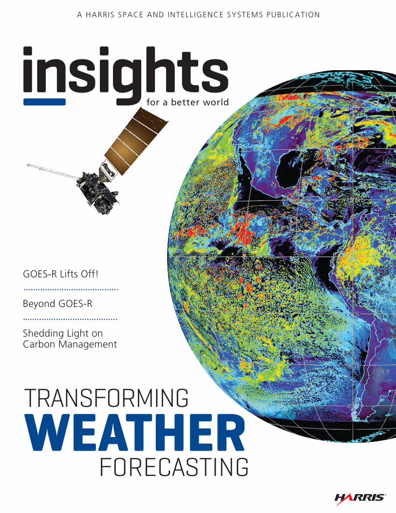
A HARRIS SPACE AND INTELLIGENCE SYSTEMS PUBLICATION
GOES-R Lifts Off!
Beyond GOES-R
Shedding Light on Carbon Management
TRANSFORMING
WEATHER FORECASTING

harris.com | 1
2
8
12Harris is a registered trademark of Harris Corporation. Trademarks and tradenames are the property of their respective companies.© 2016 Harris Corporation 55858 09/16
Non-Export-Controlled Information
harris.com | #harriscorp
CONTENT:1 Executive Note: Transforming
Weather Forecasting
2 GOES-R Lifts Off!
8 Beyond GOES-R
12 Shedding Light on Carbon Management
On The Cover: Simulated GOES-R imagery from the Harris Advanced Baseline Imager Satellite illustration courtesy of NOAA
Because weather impacts decisions we make every day, the ability to forecast the weather has long been important to our lives. In fact, North America’s oldest continuing publication, the Old Farmer’s Almanac, was
created in 1792 to provide astronomical and weather predictions for the agricultural community.
The dawn of the Space Age and the 1960 launch of the first Television Infrared Observation Satellite, or TIROS-1, transformed weather forecasting by demonstrating the tremendous value of satellites for surveying Earth’s weather conditions. The transmitter that sent back those revolutionary satellite weather pictures was built by Harris, marking our company’s entrance into the world of meteorology.
We provided more telemetry for weather satellites during that decade; our pulse code modulation telemetry was the first to be used in an orbiting space vehicle. We developed the U.S. military’s first tactical terminal for the Defense Meteorological Satellite Program (DMSP), establishing a partnership with the U.S. Air Force that has continued to today. In the 1970s, we started developing space-based imagers and sounders to collect images and data for NASA-NOAA polar-orbiting environmental satellite missions. And in the 1980s, we began developing instruments for geostationary use. Today we are proud to point out that our instruments have been on board every GOES satellite since 1994.
Our environmental solutions for meteorological satellite missions have expanded to include assignments like the integration of NOAA weather satellite programs with those of the European meteorological community and development of the first hyperspectral weather instrument, the Cross-track Infrared Sounder, for the National Polar-orbiting Operational Environmental Satellite System.
Now, we are on the threshold of new era in weather satellites—one that will once again transform weather forecasting—and we are proud to be playing an integral role. This edition of Harris Space and Intelligence Systems’ Insights for a Better World, shares our experience and perspective of this exciting time.
Our lead article, “GOES-R Lifts Off,” discusses the dramatic changes in weather sensing, collection, and processing that NOAA’s next-generation meteorological satellite will bring to forecasters in the Western Hemisphere.
One of Harris’ weather experts, Jack Hayes, a former director of the National Weather Service and the World Weather Watch (among many other distinctions), looks “Beyond GOES-R” at other, potentially game-changing solutions for forecasters on page 8.
You may not know it, but Harris’ environmental solutions are also working to transform the way we address broader climate-related concerns. You can find out how our air, ground, and space technologies help monitor greenhouse gas emissions—and carbon dioxide, in particular—in the article entitled “Shedding Light on Carbon Management” on page 12.
We hope that you are as excited as we are for what’s ahead. If you’d like to learn about our solutions, check out our website at www.harris.com/what-we-do/environmental-solutions.
[Executive Note]
Transforming Weather Forecasting
Vice President, Environmental [email protected]
“We are on the threshold of a new era in weather satellites—one that will once again transform weather forecasting—and we are proud to be playing an integral role. ”
Eric Webster
harris.com | 32 | insights
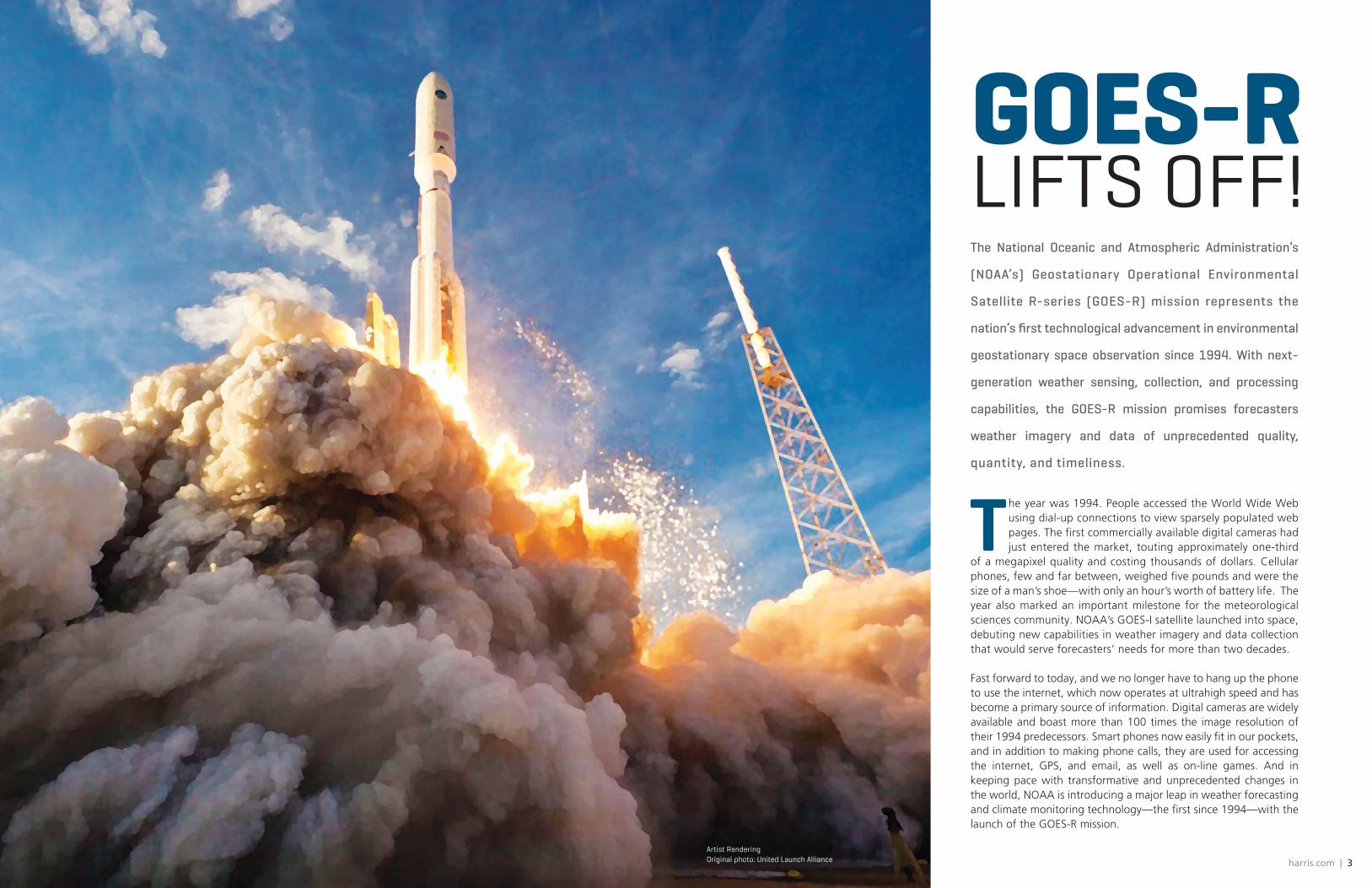
The year was 1994. People accessed the World Wide Web using dial-up connections to view sparsely populated web pages. The first commercially available digital cameras had just entered the market, touting approximately one-third
of a megapixel quality and costing thousands of dollars. Cellular phones, few and far between, weighed five pounds and were the size of a man’s shoe—with only an hour’s worth of battery life. The year also marked an important milestone for the meteorological sciences community. NOAA’s GOES-I satellite launched into space, debuting new capabilities in weather imagery and data collection that would serve forecasters’ needs for more than two decades. Fast forward to today, and we no longer have to hang up the phone to use the internet, which now operates at ultrahigh speed and has become a primary source of information. Digital cameras are widely available and boast more than 100 times the image resolution of their 1994 predecessors. Smart phones now easily fit in our pockets, and in addition to making phone calls, they are used for accessing the internet, GPS, and email, as well as on-line games. And in keeping pace with transformative and unprecedented changes in the world, NOAA is introducing a major leap in weather forecasting and climate monitoring technology—the first since 1994—with the launch of the GOES-R mission.
The National Oceanic and Atmospheric Administration’s
(NOAA’s) Geostationary Operational Environmental
Satellite R-series (GOES-R) mission represents the
nation’s first technological advancement in environmental
geostationary space observation since 1994. With next-
generation weather sensing, collection, and processing
capabilities, the GOES-R mission promises forecasters
weather imagery and data of unprecedented quality,
quantity, and timeliness.
GOES-RLIFTS OFF!
Artist Rendering Original photo: United Launch Alliance

harris.com | 54 | insights
Bridging the Technology Gap
“The GOES-R program bridges an 18-year technology gap,” states Eric Webster, vice president and general manager of Harris Environmental Solutions. “We anticipate getting so much environmental data that it will make your head spin. Plus this data will give us near-real-time color imagery in sharp detail—much different than the current black and white, time-delayed images from GOES. It will be almost like switching from an old black-and-white TV to high-definition TV.”
Webster and his team of scientists and engineers have been involved in both the space and ground components of GOES-R since the program’s beginning. According to Webster, the GOES-R mission will provide this richer data in 30-second image updates, compared to the current update time of 7.5 minutes. Meteorologists will know more about the early formations of storms, track and follow the storms more effectively, and improve severe weather warnings.
Beyond storm events and weather forecasting, the information gained from GOES-R’s higher-resolution images can be used to improve aviation flight route planning, air quality warnings and alerts, drought outlook planning, climate studies, and maritime forecasts. It will also provide information to enhance wildfire detection and monitoring, identify flash flooding risk areas, and monitor areas of smoke and dust which, in addition to respiratory health hazards, can reduce visibility and put people in danger.
GOES-R’s additional detailed information could give people precious extra time to evacuate when a hurricane is eminent, seek shelter before a tornado, get their cars off the road prior to a flash flood, and ensure thier children are secure when severe weather threatens their safety.
The Hemisphere’s Best Continuous Weather Imagery
“The advancement that GOES-R brings starts in space with the Advanced Baseline Imager (ABI). ABI is the primary instrument on the satellite for imaging Earth’s weather, climate, oceans, and environment,” Webster says.“It is one of a class of Harris instruments delivering the most advanced meteorological sensing capability in the world for operational weather forecasting. ABI offers three times the spectral information, like adding more color; four times the spatial resolutions for higher quality imagery; and more than five times the speed of coverage provided by the previous GOES system.”
This new capability is the result of ABI’s 16 sensing channels—11 more than current GOES instruments. Each channel receives specific frequencies of energy and light reflected from elements on Earth’s surface and in its atmosphere. “Think of a prism,” explains Paul Griffith, Harris’ chief engineer for the development of ABI. “When you hold a prism towards the sun, the light is broken into a rainbow of colors, each of which indicates a different energy frequency. Likewise energy types not visible to the human eye have defined frequencies.” According to Griffith, each ABI channel seeks out a particular frequency range in the visible, near-infrared, and infrared spectrums and collects information about its unique characteristics. This becomes data that is sent to Earth and used in mapping and forecasting tools.
The addition of 11 more channels is like adding sight, taste, and smell to senses that previously included only hearing and touch. More channels, like more senses, provide information that give better insight into the surrounding environment. As a result, ABI will provide new information about sea ice, volcanic ash, water vapor, ice formations, snow pack, vegetation changes, cloud formations, winds, and carbon dioxide—all of which will help meteorologists
High-resolution color imagery from Japan’s operational Advanced Himawari Imager (developed by Harris) compared to GOES black-and-white imagery.
Imagery courtesy of N
OAA
improve weather forecasts and gain valuable insights into long-term climate cycles. During the night hours, ABI will continue to scan Earth and receive emitted energy in the form of infrared and near-infrared frequencies.
ABI further advances image collection capability with the incorporation of a two-mirror scanner. “Current GOES imagers use a one-mirror scanner, which causes the image to rotate as the instrument scans the earth,” Griffith explains. “Since the current imager only has eight detector elements, the rotation is not observable. However, ABI has 1,460 detector elements, so the same image rotation would complicate the ground processing. The two-mirror design doesn’t rotate the image.”
It also provides much faster data gathering from one image to the next. “With independent east/west and north/south scan mirrors, the system can be
repositioned quickly, freeing more time for data collection. It also uses less power,” shares Griffith. “It’s the only weather instrument
able to provide flexible, custom scanning that is configurable on-orbit.”
Improving Local Storm Tracking
ABI’s innovative scanning technology delivers continuous imagery and atmospheric measurements with a higher level of detail and at faster intervals than other weather sensor systems. It does this by building data images one swath—or image strip—at a time. By interleaving those swaths, the imager enables simultaneous scans of a hemisphere, called a “full disk”; a regional or country-level area; and a local event, such as a storm or forest fire.
Rapid updates—every 30 seconds—of local events can be obtained without impacting the cadence of the routine 10-minute full-disk images and five-minute regional images. So when a storm approaches a major metropolitan area, meteorologists can better forecast its path and severity without interrupting imaging the bigger picture that provides context and a sense of other weather events.
“ABI is kind of like an mp3 player,” says Paul Griffith. “With an mp3 player, you can create and upload playlists that contain multiple albums and tracks. ABI lets you create configurations—the playlists—that tell the system which scenes—the albums—to collect and which swaths—the tracks—of those scenes to image. You can have multiple ‘playlists,’ or various timelines that govern which image swaths to collect, in what order, and when.”
Simulated GOES-R imagery of the “red” visible channel 2 gives insight into low-level cloud-drift winds, smoke and fire hotspots, volcanic ash activity, and severe winter storms or hurricanes.
harris.com | 76 | insights
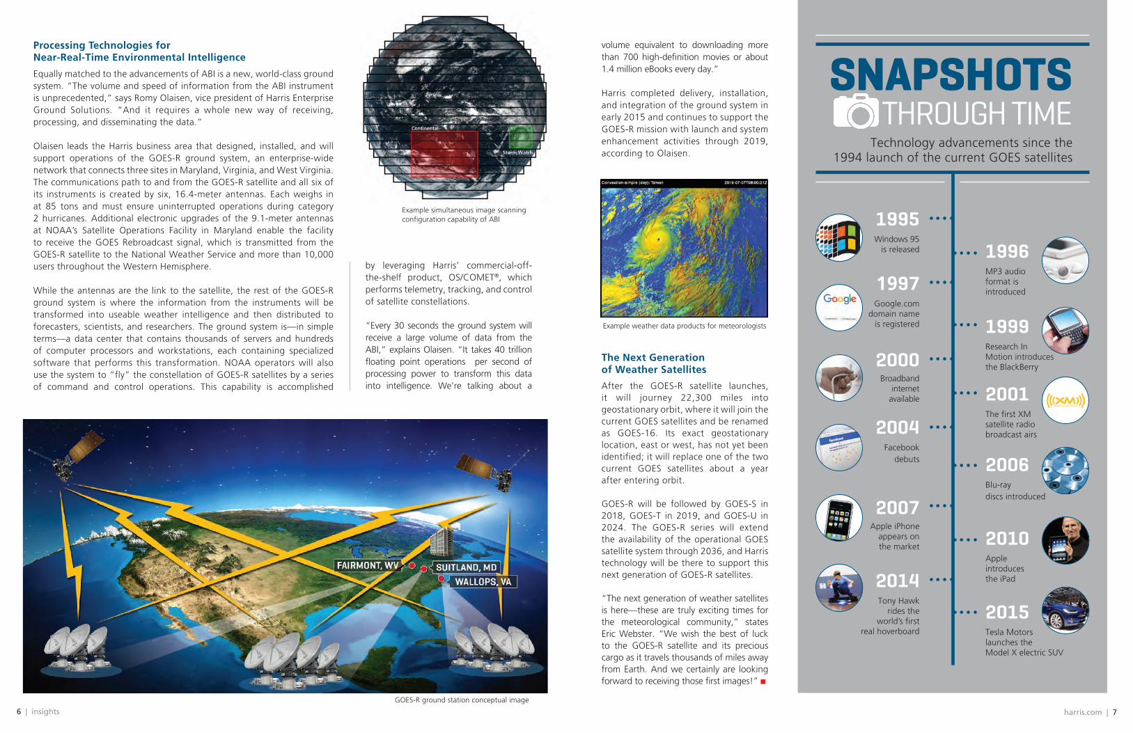
Processing Technologies for Near-Real-Time Environmental Intelligence
Equally matched to the advancements of ABI is a new, world-class ground system. “The volume and speed of information from the ABI instrument is unprecedented,” says Romy Olaisen, vice president of Harris Enterprise Ground Solutions. “And it requires a whole new way of receiving, processing, and disseminating the data.”
Olaisen leads the Harris business area that designed, installed, and will support operations of the GOES-R ground system, an enterprise-wide network that connects three sites in Maryland, Virginia, and West Virginia. The communications path to and from the GOES-R satellite and all six of its instruments is created by six, 16.4-meter antennas. Each weighs in at 85 tons and must ensure uninterrupted operations during category 2 hurricanes. Additional electronic upgrades of the 9.1-meter antennas at NOAA’s Satellite Operations Facility in Maryland enable the facility to receive the GOES Rebroadcast signal, which is transmitted from the GOES-R satellite to the National Weather Service and more than 10,000 users throughout the Western Hemisphere.
While the antennas are the link to the satellite, the rest of the GOES-R ground system is where the information from the instruments will be transformed into useable weather intelligence and then distributed to forecasters, scientists, and researchers. The ground system is—in simple terms—a data center that contains thousands of servers and hundreds of computer processors and workstations, each containing specialized software that performs this transformation. NOAA operators will also use the system to “fly” the constellation of GOES-R satellites by a series of command and control operations. This capability is accomplished
by leveraging Harris’ commercial-off-the-shelf product, OS/COMET®, which performs telemetry, tracking, and control of satellite constellations.
“Every 30 seconds the ground system will receive a large volume of data from the ABI,” explains Olaisen. “It takes 40 trillion floating point operations per second of processing power to transform this data into intelligence. We’re talking about a
GOES-R ground station conceptual image
Example simultaneous image scanning configuration capability of ABI
SNAPSHOTS THROUGH TIME
volume equivalent to downloading more than 700 high-definition movies or about 1.4 million eBooks every day.”
Harris completed delivery, installation, and integration of the ground system in early 2015 and continues to support the GOES-R mission with launch and system enhancement activities through 2019, according to Olaisen.
The Next Generation of Weather Satellites
After the GOES-R satellite launches, it will journey 22,300 miles into geostationary orbit, where it will join the current GOES satellites and be renamed as GOES-16. Its exact geostationary location, east or west, has not yet been identified; it will replace one of the two current GOES satellites about a year after entering orbit.
GOES-R will be followed by GOES-S in 2018, GOES-T in 2019, and GOES-U in 2024. The GOES-R series will extend the availability of the operational GOES satellite system through 2036, and Harris technology will be there to support this next generation of GOES-R satellites.
“The next generation of weather satellites is here—these are truly exciting times for the meteorological community,” states Eric Webster. “We wish the best of luck to the GOES-R satellite and its precious cargo as it travels thousands of miles away from Earth. And we certainly are looking forward to receiving those first images!”
Example weather data products for meteorologists
Technology advancements since the 1994 launch of the current GOES satellites
1995Windows 95
is released 1996MP3 audio format is introduced1997
Google.com domain name
is registered 1999Research In Motion introduces the BlackBerry2000
Broadband internet
available 2001The first XM satellite radio broadcast airs2004
Facebook debuts 2006
Blu-ray discs introduced
2007Apple iPhone
appears on the market 2010
Apple introduces the iPad2014
Tony Hawk rides the
world’s first real hoverboard
2015Tesla Motors launches the Model X electric SUV
8 | insights
The technological leaps that GOES-R brings to weather forecasting are just the beginning. Other, potentially game-changing solutions are in the wings.
harris.com | 9
GOES-R More and more often,
we’re seeing reports of extreme weather on the nightly news. Heavy rains
flooding 100,000 homes in Baton Rouge, Louisiana. Raging forest fires threatening houses and businesses in drought-stricken California. Tornadoes devastating the lives and property of families across the nation.
These events are not isolated to the United States; virtually every continent is experiencing similar catastrophes and threats. And in addition to the emotional trauma they cause are serious financial ramifications. Munich Re, one of the world’s leading reinsurers, estimates that the cost of recovering from weather-related disasters has increased five-fold since 1980.
The good news is that ongoing advancements in environmental sciences—some might even be considered game changers—will significantly improve the way we are able to anticipate and prepare for extreme weather and manage resources.
A New Generation of Atmospheric Imagers And Sounders
Internal research and development at Harris is producing a new generation of atmospheric sensors for geostationary-Earth-
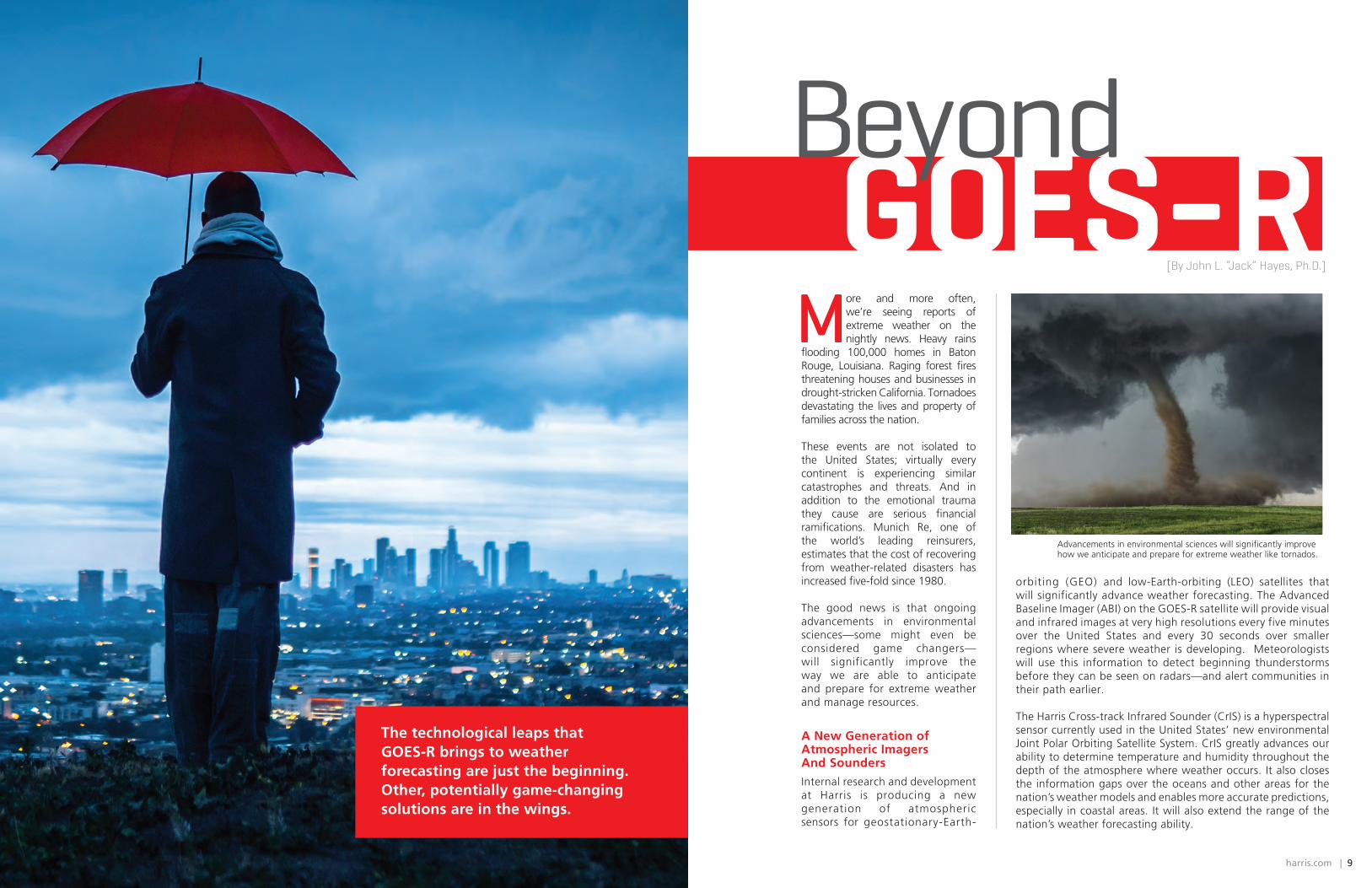
orbiting (GEO) and low-Earth-orbiting (LEO) satellites that will significantly advance weather forecasting. The Advanced Baseline Imager (ABI) on the GOES-R satellite will provide visual and infrared images at very high resolutions every five minutes over the United States and every 30 seconds over smaller regions where severe weather is developing. Meteorologists will use this information to detect beginning thunderstorms before they can be seen on radars—and alert communities in their path earlier.
The Harris Cross-track Infrared Sounder (CrIS) is a hyperspectral sensor currently used in the United States’ new environmental Joint Polar Orbiting Satellite System. CrIS greatly advances our ability to determine temperature and humidity throughout the depth of the atmosphere where weather occurs. It also closes the information gaps over the oceans and other areas for the nation’s weather models and enables more accurate predictions, especially in coastal areas. It will also extend the range of the nation’s weather forecasting ability.
Beyond
Advancements in environmental sciences will significantly improve how we anticipate and prepare for extreme weather like tornados.
[By John L. “Jack” Hayes, Ph.D.]

harris.com | 1110 | insights
U.S. Armed Forces rely on GPS signals to carry out operations worldwide.
NOWCASTING WITH WXCONNECT™
There’s no doubt that Advanced Baseline Imager class sensors can greatly improve the ability of meteorologists to predict the weather, but getting that data into
their hands quickly can be a challenge. With the IntelliEarth™ WxConnect™ system from Harris, forecasters have the ability to directly receive GOES-R and HimarwariCast environmental satellite information without reliance on terrestrial communications. WxConnect™ processes the high-density data streams so
that real-time, standards-based products can be generated for distribution, data fusion, advanced analytics, and visualization.
Built on open standards, WxConnect™ systems are modular and scalable, and they are compatible with standard industry weather visualization and forecasting applications. Harris ENVI®
visualization software is available for WxConnect™ systems to assist in creating custom imagery. Powered by IDL® software, Harris developed an interactive, real-time Advanced Product Preview (APP) tool for WxConnect™ to more effectively utilize the 16 channels of imagery.
Three-Dimensional Wind Measurement
Ask a meteorologist what one new thing could take weather forecasting to a new level, and he or she will likely answer with a decisive “more accurate, available wind measurements!” Certainly the availability of quality wind data has lagged behind other types of data fed into prediction models. But one new solution on the horizon has the possibility to change that.
HyperCube™ is a space-based, three-dimensional sounding instrument that Harris has designed to measure the speed, direction, and elevation of wind. It evolved from CrIS hyperspectral sounder technology and
delivers hundreds of hyperspectral bands and more vertical layers of wind vector data at fine spatial resolution. But what makes HyperCube™ truly groundbreaking is that it packs the power and high qual i ty of larger, more complex LiDAR systems into a l ightweight, less expensive cubesat form, which can be launched more quickly than larger systems.
Real-Time, Local Weather Intelligence
If you have ever listened to your local media meteorologist predict weather conditions that do not seem to occur, you are not alone. The reason may well be that the radars and other Earth-based sensors used for local forecasts still have large information gaps. Local terrain can hide growing thunderstorms in their early stages, and many times Earth-based sensors are spaced tens of miles apart. These sensors can often miss a localized thunderstorm or fog bank. But a ground-based environmental intelligence platform called Helios® could go a long way toward fixing that—and as a result, the system could become an essential part of the forecaster’s toolkit in the near future.
Helios® provides immediate confirmation of ground weather conditions and complete, accurate local weather pictures by integrating ground surveillance from existing public and private video cameras with conventional weather tracking technologies and National Weather Service warnings. Analytics are refreshed every five to ten minutes with more than 90 percent accuracy. In addition to helping meteorologists validate their forecasts, Helios® intelligence could help individual drivers as well as shipping and logistics fleet managers choose the safest and most efficient routes, retail stores protect the customers on their property, and emergency responders better plan their actions.
Forecast: A Safer, More Prepared World
With advancements like these and others now under development, we can expect to see some significant benefits in the future. It is highly possible that threatened cities will know which communities will be hit by a tornado hours in advance of its arrival. Regions will have more than a week’s warning of torrential rainfall and potentially catastrophic flooding. Major snowstorms with the potential to disrupt travel will be predicted a week or more in advance, allowing airlines to plan around weather that today impacts thousands of travelers. And the formation of tropical storms and hurricanes will be forecast days before the first clouds can be seen in weather satellite imagery.
One thing, however, is certain: the technologies we are working on today will enable people, businesses, and governments to better prepare for weather events and reduce—or even eliminate—negative impacts on lives and property.
What if you could have one system that combines the spatial resolution and update rates of an Advanced Baseline
Imager (ABI) class instrument with the spectral profile detail and accuracy of a hyperspectral, advanced Fourier transform spectrometer like NOAA’s Cross-track Infrared Sounder (CrIS) or EUMETSAT’s Infrared Atmospheric Sounding Interferometer?
“You’d get the ABI-based Geostationary Combined Sounder/Imager, or CSI,” says Ron Glumb, chief solutions engineer for Harris Environmental Solutions. “It’s a hyperspectral instrument that offers the best of both worlds: full-Earth-disk (hemispheric) images every ten minutes, regional images every five minutes, and precise mesoscale-size area soundings every minute for advanced (up to six hours) warning of severe storms plus near-real-time, three-dimensional winds.”
CSI will also provide the first geostationary day/night band images. ”All this means faster, 24-hour-a-day tracking coverage of active weather, like tornadoes, hurricanes, and other severe storms,” Glumb adds.
CSI is being developed under a Harris internal research and development effort. The team shared their progress at the 21st Satellite Meteorology, Oceanography and Climatology Conference. “Results are showing that the CSI easily meets ABI imaging requirements and has noise equivalent differential radiance (NEdN) levels similar to CrIS,” Glumb reports.
According to Glumb, CrIS’ on-orbit NEdN has exceeded mission requirements and performed better than other hyperspectral sensors in orbit. Key technologies for CSI have been demonstrated at a technology readiness level of 6.
WHAT’S NEXT? A GEOSTATIONARY COMBINED SOUNDER/IMAGER!
John L. “Jack” Hayes, Ph.D., is vice president and senior executive account manager for Environmental Solutions. He is a former director of the National Weather Service, served as permanent representative for the U.S. with the United Nation’s World Meteorological Organization (WMO), and is a former director of the World Weather Watch Department for the WMO. He also previously
served as deputy director of NOAA’s National Ocean Service and Office of Oceanic and Atmospheric Research. Hayes culminated a distinguished U.S. Air Force career as Commander of the Air Force Weather Agency. He received the Presidential Rank Award and was recognized in 2003 as one of the Top 100 IT Executives in the federal government.

12 | insights
SHEDDING LIGHT ON
CARBON MANAGEMENT Technologies to measure greenhouse gas emissions
Scientists argue that if temperatures continue to increase as they have since the Industrial Revolution, sea levels will rise, severe weather events will become more frequent, and there will be irreparable
environmental consequences. The stabilization of greenhouse gas concentrations thought to contribute to that increase in temperature was the impetus for the formation of the United Nations Framework Convention on Climate Change (UNFCCC) in the early 1990s.
In late November - early December 2015, the UNFCCC’s supreme decision-making body, the Conference of Parties (COP), met and adopted a milestone agreement that established the goal of limiting the warming of Earth to below 2 degrees Celsius. For those countries that choose to ratify the agreement, measuring progress will be important to know whether they have chosen the right paths to mitigate their greenhouse gas emissions.
The year 2015 has the distinction
of being not only the hottest year
in recorded history1, but also
the year that representatives
from 196 countries negotiated
an agreement to limit global
warming and reduce greenhouse
gases. How will those who ratify
that agreement measure their
progress? Air, ground, and space
technologies from Harris will help.
harris.com | 13
developed with Atmospheric and Environmental Research, recently demonstrated continuous long-term monitoring of a carbon sequestration site in Illinois, while making the data available live on the internet. “In the near future, using a combination of measurements, complex algorithms, and data processing, information can be produced in easily understood formats that can be used at a local level to monitor real-time conditions,” believes Dobler. In fact, Harris engineers worked with the Laboratoire des Sciences du Climat et de l’Environnement to set up a demonstration in downtown Paris to measure ground-level carbon dioxide during the 2015 COP event, COP21. The system used, called GreenLITE™, is still operational. Having this type of detailed data can help reduce uncertainties, which is critical for verification and improved decision making.
The View from Space
Researchers are also collecting climate data from space. As recently as 2009, Japan launched the world’s first spacecraft to measure CO2 and methane from space. Since then, the Greenhouse Gases Observing Satellite has collected data over some of the world’s largest cities to better understand carbon cycles. The data show a higher concentration of greenhouse gases over these cities than surrounding areas.
A second satellite scheduled to launch in 2017 will carry the Harris-built primary instrument, the Thermal and Near-infrared Sensor for Carbon Observation. It will observe infrared light emitted from the sun and reflected at the surface. Only specific wavelengths, or colors, are absorbed when infrared light passes through CO2 and methane, providing detailed measurements to help us understand the density of greenhouse gases.
“As nations target emission reductions, air-, ground-, and space-based technologies are needed to fully address the data at local or global scales in order to measure progress and fill the knowledge gaps for better decision making,” says Dobler.
1 Source: NASA press release, “NASA, NOAA Analyses Reveal Record-Shattering Global Warm Temperatures in 2015,” January 20, 2016.
GreenLITE™ deployment in Paris, France, during the 21st Conference of Parties
“Current policy makers rely on inventory data and sparse measurements to estimate emissions, and the residual uncertainty for some greenhouse gases can be as much as 100 percent,” says Jeremy Dobler, Ph.D., a chief scientist for Harris Environmental Solutions. “There is currently not enough actionable data for verification and to make informed decisions.”
Yet, this is how policy makers, regulators, local government officials and others have built their climate actions. Scientists are working to fill the climate data gaps, like where carbon dioxide (CO2) goes.
Following CO2 Emissions
At Penn State University, scientists are leading a five-year study funded by NASA to learn more about poorly understood CO2 and methane sources and sinks—where they come from and where they go—to fill in some of the data gaps. The Atmospheric Carbon and Transport-America, or ACT-America, mission is the first to use a CO2 remote sensing instrument for a sustained scientific mission, according to Ken Davis, principal investigator for ACT-America and Penn State meteorology professor. Through precise measurements, the team will learn more about the movement of carbon in the atmosphere, the carbon cycle, and how to better inform climate-change mitigation efforts. “About 25 percent of carbon dioxide emissions from burning fossil fuel gets absorbed by terrestrial ecosystems, and about another 25 percent gets absorbed by oceans so only about half of the CO2 that we emit stays in the atmosphere,” Davis said in a Penn State announcement. The ACT-America mission is examining space-borne, airborne, and ground-based data to learn what happens to the remaining CO2.
One of the technologies the team is using is Harris-built active LiDAR (light detection and ranging), an airborne remote sensing method that uses a laser to measure the difference in absorption of the atmosphere at two closely spaced wavelengths. Unlike passive instruments measuring CO2, active LiDAR can take measurements at night, at high altitudes, and through thin clouds, enabling the collection of a more complete data set. “This LiDAR takes accurate measurements of CO2 concentrations in the lower atmosphere where sources and sinks of the gas are located and where the data is relevant for addressing adaption and mitigation efforts,” says Dobler.
Ground-Based, Localized Monitoring
Similarly, LiDAR can be used for ground measurements. The U.S. Department of Energy has provided grants to public and private organizations to test various methods to assess carbon sequestration initiatives at different sites.
An operational demonstration using the Harris LiDAR measurement approach and tomographic methods,

harris.com | #harriscorp
Harris Corporation is a leading technology innovator, solving customers' toughest mission-critical challenges by providing solutions that connect, inform and protect. Harris supports customers in more than 100 countries and has approximately $7.5 billion in annual revenue and 21,000 employees worldwide. The company is organized into four business segments: Communication Systems, Space and Intelligence Systems, Electronic Systems and Critical Networks.
FLORIDA | NEW YORK | VIRGINIA | BRAZIL | UNITED KINGDOM | UAE | SINGAPORE