Harmony Corridor Plan - Fort Collins, Colorado CORRIDOR PLAN An Element of the City of Fort Collins...
88
Harmony Corridor Plan An Element of the City of Fort Collins Comprehensive Plan February 7, 2006
Transcript of Harmony Corridor Plan - Fort Collins, Colorado CORRIDOR PLAN An Element of the City of Fort Collins...

HarmonyCorridor Plan
An Element of the City of Fort Collins Comprehensive Plan
February 7, 2006

HARMONYCORRIDOR
PLANAn Element of the City of Fort Collins
Comprehensive Plan
February 7, 2006
Community Planning & Environmental ServicesAdvance Planning Department281 N College Av/PO Box 580Fort Collins, CO 80522-0580
Tel: 970-221-6376Email: [email protected]
Web: www.fcgov.com/advanceplanning

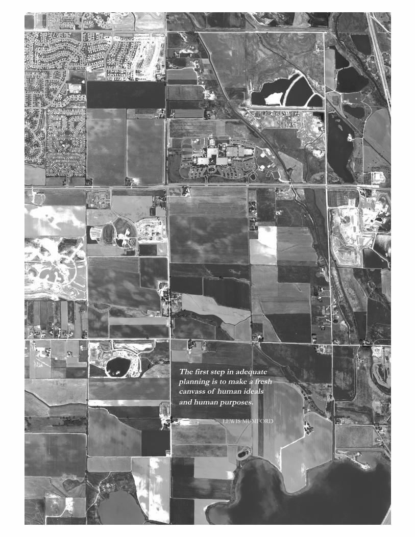
The first step in adequateplanning is to make a freshcanvass of human idealsand human purposes.
LEWIS MUMFORD
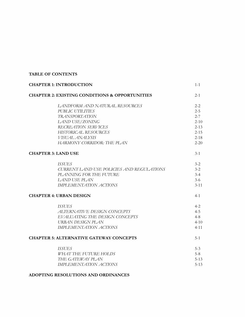
TABLE OF CONTENTS
CHAPTER 1: INTRODUCTION 1-1
CHAPTER 2: EXISTING CONDITIONS & OPPORTUNITIES 2-1
LANDFORM AND NATURAL RESOURCES 2-2PUBLIC UTILITIES 2-5TRANSPORTATION 2-7LAND USE/ZONING 2-10RECREATION SERVICES 2-13HISTORICAL RESOURCES 2-15VISUAL ANALYSIS 2-18HARMONY CORRIDOR: THE PLAN 2-20
CHAPTER 3: LAND USE 3-1
ISSUES 3-2CURRENT LAND USE POLICIES AND REGULATIONS 3-2PLANNING FOR THE FUTURE 3-4LAND USE PLAN 3-6IMPLEMENTATION ACTIONS 3-11
CHAPTER 4: URBAN DESIGN 4-1
ISSUES 4-2ALTERNATIVE DESIGN CONCEPTS 4-5EVALUATING THE DESIGN CONCEPTS 4-8URBAN DESIGN PLAN 4-10IMPLEMENTATION ACTIONS 4-11
CHAPTER 5: ALTERNATIVE GATEWAY CONCEPTS 5-1
ISSUES 5-3WHAT THE FUTURE HOLDS 5-8THE GATEWAY PLAN 5-13IMPLEMENTATION ACTIONS 5-13
ADOPTING RESOLUTIONS AND ORDINANCES

CREDITS
CITY COUNCIL
Ann Azari, MayorGina Janett, Mayor Pro TemAlan AptChris KneelandBob McCluskeyWill SmithCharles Wanner
PLANNING AND ZONING BOARD
René Clements, ChairJan Cottier, Vice-ChairJennifier FontaneGwen BellBernie StromLloyd WalkerGary W. Carnes
CITY STAFF
Diane Jones, Interim City ManagerFrank Bruno, Interim Deputy City ManagerGreg Byrne, Director of Community Planning and Environmental ServicesJoe Frank, Director of Advance PlanningClark Mapes, City PlannerPaul Eckman, Deputy City Attorney

1-1
1INTRODUCTION
Genuine planning is an attempt,not arbitrarily to displace reality,but to clarify it and to grasp firmlyall the elements necessary to bringthe geographic and economic factsin harmony with human purpose.
LEWIS MUMFORD
1-2
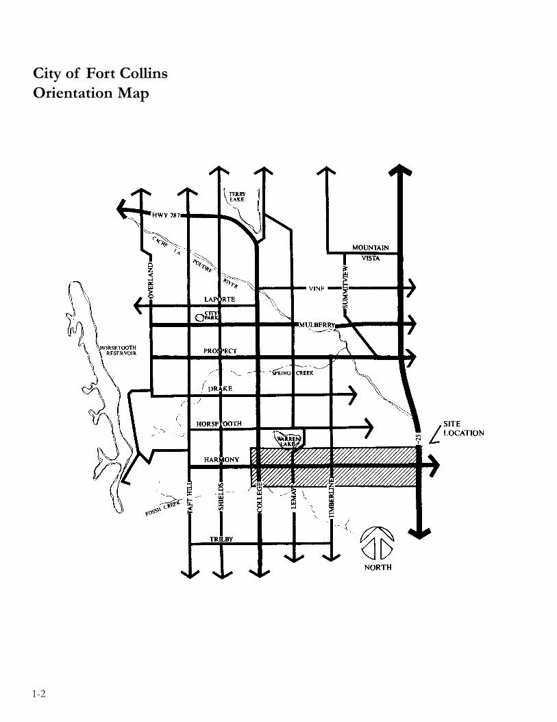
City of Fort CollinsOrientation Map

1-3
THE HARMONY CORRIDOR
The Harmony Corridor planning area extends for five miles, fromthe I-25 interchange to the Burlington-Northern railroad trackslocated west of College Avenue. The area extends approximatelyone-half mile north and south of Harmony Road. Over 7,000people live and work in the corridor. Linking I-25 to U.S. High-way 287, Harmony Road carries approximately 28,000 vehicles toand from Fort Collins each day. It is anticipated that this figurewill grow to 35,000 by the time the corridor is fully developed.The I-25/Harmony Road interchange is the most southerly en-trance point to Fort Collins and a primary route for commutersand travelers going to and from the Denver metropolitan area.Most of the people visiting Fort Collins for the first time enterthe city through this corridor.
Key physical features of the corridor include: close proximity tothe Poudre River, lakes wetlands and associated wildlife habitat aswell as spectacular views of Longs Peak and the Front Range.With approximately one-half of the corridor already developed,the visual quality of the area is exceptional. An unusually wideright-of-way and spacious median provide an excellent opportu-nity to develop a well landscaped parkway. Harmony Road hasthe potential to become one of the most attractive entryway cor-ridors in northern Colorado.
View from the I-25interchange looking west.

1-4
In terms of development potential, the Harmony Corridor is un-rivaled in the Fort Collins area. The corridor has nearly 2000acres of land available for business, industrial, and residential de-velopment, with relatively few development constraints. Uniquelysituated between I-25 and U.S. Highway 287, the corridor has ex-cellent community and regional access. Close proximity to hous-ing, schools, shopping and recreation facilities makes the corridoran obvious choice for business or industry seeking to locate innorthern Colorado. The fact that most of the developable landhas not been subdivided into small parcels is an additional advan-tage for attracting large scale business/industrial land uses. Highlyrespected companies like Hewlett-Packard, Comlinear, ESAB andMountain Crest Hospital have chosen to locate and/or expandtheir facilities in the corridor.
Along with its attractive physical features and tremendous devel-opment potential, the corridor has another vital attribute — thededication and creative energies of its residents and businesspeople. Property owners in the corridor have been instrumentalin organizing this planning effort and have been closely involvedthroughout the planning process.
THE PURPOSE OF THE STUDY
With one-half of the corridor already developed and another onefourth planned, Harmony Corridor faces a turning point. Whilecontinued business and industrial development looks promising,the corridor and the community are facing many challenges. Howcan we attract the kinds of business and industry that will providea strong economic base and be compatible with community val-ues? How do we ensure a continuation of wide setbacks, attrac-tive landscaping and other amenities that enhance the quality oflife for people who live and work in the corridor? The Cache laPoudre River floodplain, numerous lakes, wetlands and spectacu-lar mountain views combine to create an impressive and scenicgateway at the I-25 interchange. The gateway area offers uniqueopportunities and challenges the community to discover creativeways to balance development potential with natural resource as-sets. The Harmony Corridor Plan is a response to these commu-nity wide issues. Since the corridor is currently a very healthy andvital segment of our community, the Plan emphasizes the need totake advantage of its assets for our future.
Hewlett-Packard employeesrelax in a shadedcourtyard.

1-5
The Plan focuses on encouraging a land use pattern and urbandesign framework that protects community values and at the sametime recognizes the need for flexibility in response to market de-mand. Taking advantage of the corridor’s unique physical andcultural features, the Plan seeks to create a “vision” for HarmonyCorridor that is dynamic, diverse, economically successful, envi-ronmentally sound and uniquely attractive.
THE PLANNING PROCESS
The Harmony Corridor planning process involved two parallelwork efforts – a technical planning effort and a public participa-tion process. The technical planning effort analyzed existing con-ditions and opportunities, defined focus areas and generated al-ternative approaches which led to the planning and urban designrecommendations of the Plan. At the same time, a public partici-pation process attempted to identify all potentially affected inter-ests and work with them using a number of different techniquesdesigned to inform as well as solicit ideas. Advisory committees,public open houses, presentations to boards and commissions, aswell as numerous meetings with special interest groups and indi-viduals have all been used to get comments and ideas, many ofwhich have helped shape the Plan.
A group deserving special recognition is the steering committee, agroup of volunteers representing people owning property front-age along Harmony Road. Staff has welcomed the interest andenthusiasm demonstrated by this group throughout the process.The role of the steering committee was to help staff understandthe values and concerns of the landowners that will be most di-rectly affected by the Plan. The Plan is richer as a result of theirdedication and responsiveness.
Citizen values, ideas andconcerns were recorded atpublic open houses.

1-6
PLAN REVISION PROCESS
On July 5, 1994, City Council directed City Staff to review thePlan and identify and suggest needed amendments that wouldstrengthen the “vision” of the Corridor that it become a majoremployment center in northern Colorado attracting a variety ofbusinesses and industries serving local as well as regional markets.City staff and the Planning and Zoning Board, aided by an ad hocadvisory committee, intensively reviewed the document and rec-ommended changes to the Harmony Corridor Plan, together withimplementation regulations. These changes were adopted by CityCouncil on January 3, 1995 and the changes have been incorpo-rated herein.
DEFINE THE PROBLEMSET GOALSAND OBJECTIVES
ANALYZEEXISTING CONDITIONS
GENERATEALTERNATIVE SOLUTIONS
DEFINE IMPACTSOF SOLUTIONS EVALUATE THE IMPACTS
DECISION-MAKERSCHOOSE COURSE OF ACTION
IMPLEMENT THECOURSE OF ACTION MONITOR AND ADJUST
Technical Planning Process Diagram

1-7
THE PLAN
The next chapter describes physical and cultural existing condi-tions in the corridor. Analysis of existing conditions helped de-fine the three focus areas of the Plan – LAND USE, URBANDESIGN and THE GATEWAY. Each focus area is elaboratedon independently. Issues are described, problems and opportuni-ties defined and alternative directions for the future are analyzed.The discussion of each focus area concludes with a plan in theform of a goal statement, policies and implementation actions.Maps and graphic illustrations are used to supplement the textand clarify its intent. Design guidelines for new development inthe corridor, one of the primary implementation mechanismsproposed in the Plan, have been developed and are available un-der separate cover.
The three focus areas together create a comprehensive “vision”for the Harmony Corridor of the future. In order for the fullpotential of the corridor to be realized, both the City and theprivate sector need to make a commitment to implementation. Itis envisioned that the implementation actions spelled out in thisPlan will be underway within the next five years.
LAND USE
URBANDESIGN
THE GATEWAY

1-8
IMPLEMENTATION
A series of recommended implementation actions are containedat the conclusion of each focus area discussion. Actions includeseveral public improvement projects that require additional plan-ning and design work. Sources of funding for construction andmaintenance need to be identified. Strategies for attracting tar-geted industries need to be developed.
Coordination efforts with other City departments, Larimer County,the Town of Timnath and the State Division of Highways shouldbe continued. Phase two planning of the I-25 interchange area iscritical if we want to maximize the potential of this scenic gate-way before development pressures eliminate options for the fu-ture. Important opportunities may be missed if the City does notplay an active role in intergovernmental coordination and masterplanning this scenic and environmentally sensitive area.
This Plan recommends that the City assign staff to work on imple-mentation tasks, giving priority to opportunities that may be missedif action is delayed. The Harmony Corridor Plan is a starting point.Effective implementation actions can turn the “vision” created bythis Plan into reality for residents in the community now and forfuture generations. The majesty of Longs Peak and the FrontRange depicted on the cover is one of the few elements of thecorridor that is not expected to change in the foreseeable future.With this spectacular view as an inspiration, how can we do lessthan strive for excellence?

2-1
2EXISTING CONDITIONSAND OPPORTUNITIES
All good planning must begin witha survey of actual resources: thelandscape, the people, the work-a-dayactivities in a community. Goodplanning does not begin with anabstract and arbitrary scheme that itseeks to impose on a community; itbegins with a knowledge of existingconditions and opportunities.
LEWIS MUMFORD

2-2
INTRODUCTION
The technical portion of the planningprocess began by documenting physicaland cultural existing conditions. Thischapter provides information about thecorridor and highlights special opportu-nities. Maps located at the end of thechapter provide graphic illustration.
LANDFORM AND NATURALRESOURCES
LANDFORM
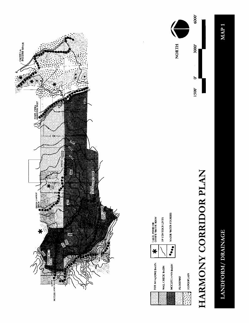
The Harmony Corridor contains threedominant topographic features: thefloodplain of the Cache la Poudre River,bluffs known as the Poudre River ValleyWall at the edge of the floodplain androlling plains beyond. Longs Peak, theFront Range and the foothills are highlyvisible and constitute a dramatic back-drop for the corridor landscape.
The elevation of the study area rangesfrom approximately 4,850 feet at the topof the bluffs located west of I-25 to ap-proximately 5,025 feet near College Av-enue. Formed by down-cutting action ofthe Poudre River as it meandered withinits floodplain, the bluffs represent the onlydramatic change in elevation within thestudy area. The elevation drops 50 feetin 550 feet resulting in an average 9%slope. At the bottom of the slope thetopography levels out on to the Cache laPoudre River floodplain. See Map 1.
Draining approximately 1,900 squaremiles, the Cache la Poudre River is thelargest river on the northern ColoradoFront Range. The river and its associatevegetation and wildlife habitat is a valu-able natural resource that offers uniquerecreational and educational opportuni-ties. Along with these assets the riverposes some development constraints.Generally speaking, no development isallowed within the designated floodway.Land area between the floodway and the100-year floodplain offers some develop-ment potential if flood proofing is ad-dressed.
DRAINAGE BASINS ANDIRRIGATION CANALS
Three drainage basins occur within thestudy area. The Mail Creek andMcClelland Drainage basins drain thewestern and southern portions of thestudy area to Mail Creek and McClellandCreek respectively. See Map 1. The FoxMeadows Basin is located in
Cut-away sectionillustrates the PoudreValley Wall.
2-3
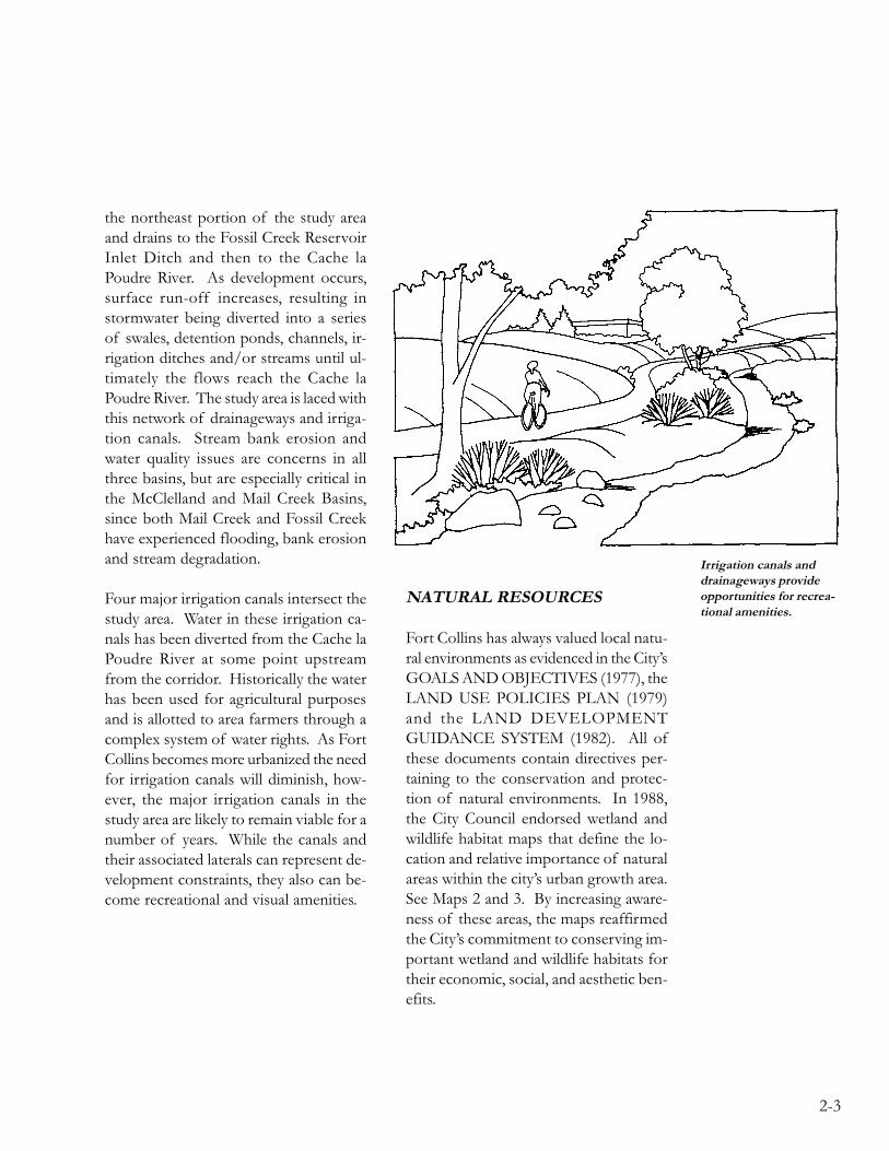
Irrigation canals anddrainageways provideopportunities for recrea-tional amenities.
the northeast portion of the study areaand drains to the Fossil Creek ReservoirInlet Ditch and then to the Cache laPoudre River. As development occurs,surface run-off increases, resulting instormwater being diverted into a seriesof swales, detention ponds, channels, ir-rigation ditches and/or streams until ul-timately the flows reach the Cache laPoudre River. The study area is laced withthis network of drainageways and irriga-tion canals. Stream bank erosion andwater quality issues are concerns in allthree basins, but are especially critical inthe McClelland and Mail Creek Basins,since both Mail Creek and Fossil Creekhave experienced flooding, bank erosionand stream degradation.
Four major irrigation canals intersect thestudy area. Water in these irrigation ca-nals has been diverted from the Cache laPoudre River at some point upstreamfrom the corridor. Historically the waterhas been used for agricultural purposesand is allotted to area farmers through acomplex system of water rights. As FortCollins becomes more urbanized the needfor irrigation canals will diminish, how-ever, the major irrigation canals in thestudy area are likely to remain viable for anumber of years. While the canals andtheir associated laterals can represent de-velopment constraints, they also can be-come recreational and visual amenities.
NATURAL RESOURCES
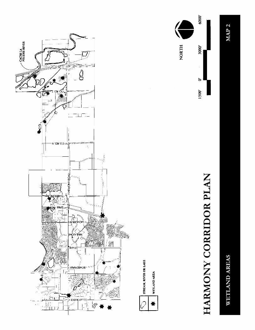
Fort Collins has always valued local natu-ral environments as evidenced in the City’sGOALS AND OBJECTIVES (1977), theLAND USE POLICIES PLAN (1979)and the LAND DEVELOPMENTGUIDANCE SYSTEM (1982). All ofthese documents contain directives per-taining to the conservation and protec-tion of natural environments. In 1988,the City Council endorsed wetland andwildlife habitat maps that define the lo-cation and relative importance of naturalareas within the city’s urban growth area.See Maps 2 and 3. By increasing aware-ness of these areas, the maps reaffirmedthe City’s commitment to conserving im-portant wetland and wildlife habitats fortheir economic, social, and aesthetic ben-efits.

2-4
THE GATEWAY
The most significant natural areas in theHarmony Corridor are associated withthe Cache la Poudre River and locatednear I-25. This area has been termed the“gateway” because it is the first point ofentry to Fort Collins from the south.Several lakes, wetlands and associated ri-parian vegetation are found on both sidesof I-25 in the floodplain of the river.Most of the lakes and wetlands are a re-sult of gravel mining operations that haveand continue to alter the natural environ-ment. With creative management and ap-propriate reclamation practices, these ar-eas have the potential to become recre-ational, educational and scenic resourcesfor the community. In addition, wetlandareas like these may act as filtering sys-tems for stormwater run off, preventingpollutants from entering the river. Thepotential value of these natural areasshould not be underestimated. The factthat the area is located at the gateway toFort Collins intensifies its importance.
In 1989, Fort Collins completed a feasi-bility study regarding the possibility ofdesignating a National Recreation Areaalong the Cache la Poudre River. Al-though City Council chose not to pursueNRA designation it did make a commit-ment to implementing an exemplary andcomprehensive river management pro-gram. This river management programmay affect the future of the gateway area.
GRAVEL RESOURCES
The land area between the Cache laPoudre River and the Poudre Valley Walllocated just east of Hewlett-Packard isunderlain with gravel deposits classifiedas F1 by the Department of Natural Re-sources, Colorado Geologic Survey. Thisclassification means that the resource is afloodplain deposit and is composed ofrelatively clean and sound gravel. Theoverburden ranges from 2-9 feet and thedepth of gravel ranges from 8-24 feet.Roughly one-third of the area has beenor is in the process of being mined.
Gateway view showingcottonwood trees andgravel mining operations.

2-5
MATURE TREES
Mature trees, both evergreen and decidu-ous, are important natural resourcesthroughout the study area. Besides theirimportance as wildlife habitat, tree massesprovide scale, frame views and add visualinterest to the landscape. The corridor isfortunate to have significant numbers ofmature trees. Most of them are visiblefrom Harmony Road.
ENVIRONMENTAL ISSUES
Air quality and water quality are two criti-cal environmental questions which affectthe Harmony Corridor. In 1989, the com-munity took important steps toward ad-dressing these issues comprehensively.The City’s Natural Resource Division be-gan working on a comprehensive envi-ronmental management plan that will fo-cus on a variety of environmental con-cerns, including air quality. At the sametime the City’s Transportation Divisionstarted work on a comprehensive trans-portation plan that relates directly to airquality issues. These two divisions andthe community are working together in aparticipatory process to establish the bestway to balance the trade-offs and addressthe air quality problem in this commu-nity. At the same time the StormwaterUtility is studying the issue of stormwaterrunoff and water quality.
PUBLIC UTILITIES
ELECTRICAL
The City provides electrical service withinthe incorporated city limits. As areas areannexed the City assumes service. Por-tions of the corridor still in the countyreceive electrical service from either thePublic Service Company of Colorado(PSCO) or the Poudre Valley Rural Elec-tric Association (REA). Conversion froman existing electric utility to City electricutility service is done at no cost to thecustomer. The City is committed to pro-viding electrical service undergroundrather than through overhead power lines.
Mature trees alongHarmony Road frameviews and add visualinterest to the corridor.

2-6
Street lighting along Harmony Road willbe installed as development and streetimprovements occur. Standard lightingfor arterial streets uses 30 foot poles, withextended arm, cobra-head type fixtures.It is anticipated that in general, light polesalong Harmony Road will be placed atthe edge of the roadway in an alternat-ing pattern, approximately 175 feet oncenter. The light source will be 400 watthigh pressure sodium bulbs.
Funding for standard lighting comesfrom development fees and lighting dis-trict assessments. Lighting is installedalong entire improvement areas, and costsare recaptured from undeveloped areasat the time of development.
WATER AND WASTEWATER
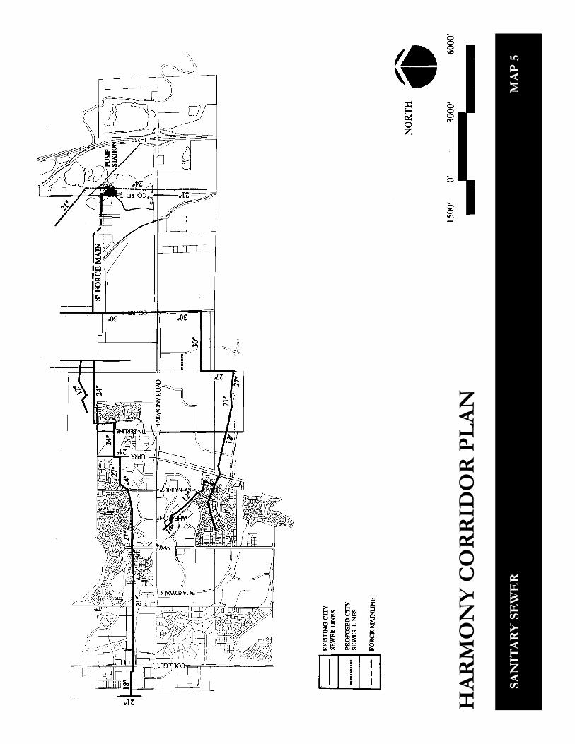
It is anticipated that most of the Har-mony Corridor will be serviced by theCity’s Water and Wastewater Utility, al-though the Fort Collin/Loveland WaterDistrict will continue to provide serviceto developed areas near College Avenue.The City’s system of existing and pro-posed water and sanitary sewer mains isshown on Maps 4 and 5. Currently wa-ter service is provided through a seriesof relatively small water lines. As growthin the corridor continues, a major trans-mission line will be needed to provideservice. The City Water Utility has com-pleted the conceptual design and routeselection for the Harmony TransmissionMain, which extends between ShieldsStreet and County Road 9.
Currently, wastewater service at the ex-treme eastern edge of the corridor wouldrequire a force main and pump station.However, the Wastewater Treatment Mas-ter Plan completed in 1990 calls for con-struction of a new wastewater treatmentplant downstream. This would allow theeastern part of the Harmony Corridor tobe served by gravity flow. The new waste-water treatment facility would not be online before 1999.
The extension of water mains and sani-tary sewers which are in or near the exist-ing water distribution and wastewatercollection systems is dependent uponmany factors. In most cases, new devel-opment and the associated increases inwater demand and wastewater flows arethe primary reasons for these improve-ments. The installation and the cost ofwater mains and sanitary sewers to servenew developments are the responsibilityof the developer. When the City requiresimprovements to serve areas beyond theimmediate development, the City pays foroversizing.
STORMWATER UTILITY
The City’s Stormwater Utility is a specialpurpose division within the City that pro-tects the public’s health, safety and wel-fare through effective stormwater man-agement. Its responsibilities include floodcontrol, development plan review, con-struction, operation and maintenance ofstormwater facilities and long range
2-7
planning. Regional drainage facilitiesidentified in the master storm drainageplans for the Harmony Corridor includea major drainage channel to carry flowsfrom the Fossil Creek Reservoir Inlet tothe old quarry just east of County Road7. The concept plan indicates that thechannel would be visible from HarmonyRoad.
Although the Stormwater Utility currentlydoes not regulate stormwater quality, it ismoving in that direction. The Environ-mental Protection Agency (EPA), anagency of the Federal government, pub-lished regulations in 1990. These regula-tions emphasize best management prac-tices to control the pollutant source andapply to all municipalities in the UnitedStates. Fort Collins has already initiatedactivities in regard to these regulations.
The Stormwater Utility has started to in-form the public about stormwater qual-ity, inventory the City’s storm drainagesystem and monitor water quality in localstreams and major outfalls. In addition,the utility is conducting research at tworecently developed commercial projectsin Fort Collins. The two pilot projectsuse state of the art technology to moni-tor and improve the quality of stormwaterrunoff before it leaves the site. The util-ity is in the process of developing ero-sion control criteria for construction ac-tivities in the Fort Collins area and is col-lecting information to initiate a waterquality management plan for the MailCreek and Fossil Creek drainage basins.
All of these advance planning measurescombined will enable the utility to deter-mine the magnitude of the problem andthe best way to effectively managestormwater quality in Fort Collins.
TRANSPORTATION
TRAFFIC AND ACCESS
Harmony Road’s importance as a trans-portation corridor for the City of FortCollins cannot be overestimated. Carry-ing in excess of 28,000 vehicles to andfrom Fort Collins each day, HarmonyRoad is one of the community’s majortransportation links to Denver and othercommunities along the Front Range. Inresponse to increasing development pres-sure and in recognition of the importanceof Harmony Road as a gateway corridorand major arterial street, the HarmonyRoad Access Plan was adopted in 1989.In this intergovernmental agreement theCity, the State Division Highways andLarimer County agreed to access pointsand future signal locations betweenBoardwalk Drive and I-25. Future accessfor development along Harmony Roadmust be in conformance with the AccessPlan. See Map 6. Any change to accesslocation or access type from those iden-tified in the Access Plan requires anamendment.

2-8
Traffic counts for Harmony Road weretaken in the fall of 1989. Currently allintersections operate at level of service“C” or better, meaning that the highwayis operating below its maximum capacityand is providing acceptable levels of ser-vice. It is anticipated that when the cor-ridor is built out, traffic volumes on Har-mony Road will approach 30,000 vehiclesa day. It is anticipated that HarmonyRoad will eventually be widened to threetravel lanes in each direction to maintainacceptable levels of service.
At the present time the State Division ofHighways controls the speed limit alongHarmony Road. It varies from 55 MPHnear I-25 to 40 MPH closer to CollegeAvenue. It is expected that when thecorridor is fully developed, the speed limitwill be reduced to 40-45 MPH. How andwhen the speed limit will change is de-pendent on a variety of factors, includ-ing traffic volume and safety.
STATE VERSUS LOCALCONTROL
Since Harmony Road is a state highway,decisions regarding roadway improve-ments, future widening, landscaping inthe right-of-way and maintenance aredecisions made by the State Division ofHighways. The goals and objectives ofthe State may not always parallel thoseof the community. In recent years, Citystaff has maintained a good working re-lationship with the Division of Highways,and has been able to negotiate accept-able solutions when State and local goals
have varied. A good example of this co-operative spirit is the Harmony RoadAccess Plan.
While the Access Plan will provide a ba-sis for agreement on transportation issuesfor years to come, it is likely that as thecorridor continues to urbanize, the Stateand City will differ on issues relating tothe visual quality of the roadway. Al-though plans for future widening of Har-mony Road are not finalized, indicationsare that the State plans to widen the road-way to the center rather that to the out-side and greatly reduce or eliminate themedian. In regard to landscaping, theDivision of Highways has a policy thatdiscourages planting trees in the right-of-way and/or the median.
In recent years Harmony Road has func-tioned more as a local arterial street andless as a state highway. Recognizing thistrend, the State has indicated a desire towork toward placing Harmony Road un-der local control.
LAND USE PLANNING
For the past ten years, the City has pro-moted a mixed land use concept in FortCollins because of the associated social,economic and environmental benefits.One of the most important reasons formixing land uses relates to transportation.Locating employment centers, shoppingcenters, recreational opportunities andresidential areas in close proximity to eachother shortens the distance people needto drive to

2-9
work, shop and play. It also encouragesalternative modes to transportation suchas walking and bicycling. Besides the con-venience and associated lifestyle benefits,mixed land use, by shortening trip lengthand eliminating some trips altogether, canhave a positive effect on air quality.
The present trend of large employers todevelop in “campus-like” settings is evi-dent along Harmony Road. While thesesettings are visually attractive and offerrecreational benefits for employees, thiskind of low density development makesefficient transit service difficult.
ALTERNATIVE MODES
While land use planning attempts to pro-vide opportunities to work, shop and playclose to home, the lack of pedestrian link-ages, bikeways and safe crossings alongHarmony Road make it difficult to walkor use a bicycle as an alternative mode oftransportation. Sidewalks are built as de-velopment occurs. Signalized intersec-tions and crosswalks are added as trafficvolumes increase. As the corridor getscloser to complete build out, pedestrianlinkages will be more complete and use-ful.
At the present time, Harmony Road doesnot have a designated bike lane. Somebicycle commuters use the road shoulder;however, the shoulder does not exist inall locations. The speed and proximityof passing vehicles can be dangerous forbicyclists.
Public transit does not serve the corridornow but may be available in the future, asemployment opportunities increase. Lowdensity development makes it difficult toprovide transit service cost effectively.The Transit Development Program, a 5-year strategic plan adopted by City Coun-cil in 1990, focuses on serving transit de-pendent populations, including the eld-erly, people with low incomes, the disabledand students. Demographics show thatthe highest concentrations of transit de-pendent people live in the northwest por-tion of the city. Focusing of limited re-sources has resulted in the elimination oftransit service along Harmony Road eastof College Avenue for the short term fu-ture.
Mixed land uses encouragealternative modes oftransportation such aswalking and bicycling.

2-10
Some commuters that use I-25 to travelto other cities to work have started carpooling. Currently, people park their carson the north side of Harmony Road justwest of the I-25 interchange and travelwith other people commuting to the samelocation. Commuter Pool is a ride share/car pool program operated by the Citywhich currently serves this area and couldprovide service to local employees as wellas those who drive to Denver.
LONG RANGE PLANNING
Another factor affecting the future oftransportation in the Harmony Corridorwill be the Fort Collins Area Transpor-tation Plan expected to be complete in1991. The Plan will identify all transpor-tation systems needs and evaluate thesocial, economic and environmental im-pacts of alternative land use and trans-portation models. The goal of the Planis to establish transportation policies, fa-cilities and implementation schedules thatwill guide the future development of thiscommunity through the year 2010. ThePlan will identify future street needs, iden-tify new street locations, create opportu-nities for bicycle and pedestrian travel anddetermine the role of transit in our com-munity.
LAND USE/ZONING
EXISTING LAND USE
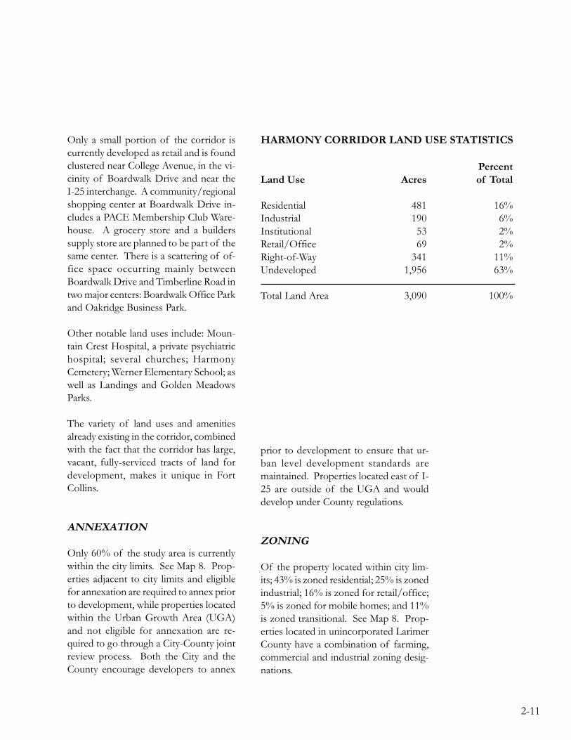
Harmony Corridor contains approxi-mately 3,090 acres and is 37% developed.It already contains a wide variety of landuses. See Maps 7A and 7B. The Charton the next page summarizes some landuse statistics that help describe the corri-dor.
Residential land uses occupy the largestamount of developed property. There areapproximately 2,322 dwelling units in theplanning area for a total population ofapproximately 6,150 residents. Althoughthe residential areas are single family ori-ented, there is significant multi-familydevelopment. The corridor also containstwo large mobile home parks. Single fam-ily lots range from approximately 6,300square feet to nearly an acre in size andhome prices vary considerably from$55,000, to over $350,000 in current dol-lars. Almost all of the residential areaswere constructed within the last decade,with the exception of Fairway Estateslocated south of Harmony Road nearCollege Avenue, which has existed formore than twenty-five years.
Industrial uses occur at dispersed loca-tions in the corridor area. The uses arepredominantly research, manufacturingand office/warehouse. With the excep-tion of Hewlett-Packard, the major usersare located in Golden Meadows andOakridge industrial parks. Collectivelythese industrial developments representa significant portion of the community’semployment base.
2-11
Only a small portion of the corridor iscurrently developed as retail and is foundclustered near College Avenue, in the vi-cinity of Boardwalk Drive and near theI-25 interchange. A community/regionalshopping center at Boardwalk Drive in-cludes a PACE Membership Club Ware-house. A grocery store and a builderssupply store are planned to be part of thesame center. There is a scattering of of-fice space occurring mainly betweenBoardwalk Drive and Timberline Road intwo major centers: Boardwalk Office Parkand Oakridge Business Park.
Other notable land uses include: Moun-tain Crest Hospital, a private psychiatrichospital; several churches; HarmonyCemetery; Werner Elementary School; aswell as Landings and Golden MeadowsParks.
The variety of land uses and amenitiesalready existing in the corridor, combinedwith the fact that the corridor has large,vacant, fully-serviced tracts of land fordevelopment, makes it unique in FortCollins.
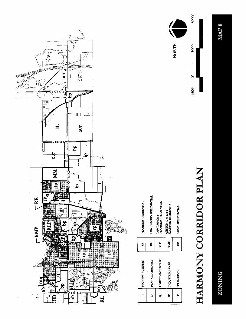
ANNEXATION
Only 60% of the study area is currentlywithin the city limits. See Map 8. Prop-erties adjacent to city limits and eligiblefor annexation are required to annex priorto development, while properties locatedwithin the Urban Growth Area (UGA)and not eligible for annexation are re-quired to go through a City-County jointreview process. Both the City and theCounty encourage developers to annex
prior to development to ensure that ur-ban level development standards aremaintained. Properties located east of I-25 are outside of the UGA and woulddevelop under County regulations.
ZONING
Of the property located within city lim-its; 43% is zoned residential; 25% is zonedindustrial; 16% is zoned for retail/office;5% is zoned for mobile homes; and 11%is zoned transitional. See Map 8. Prop-erties located in unincorporated LarimerCounty have a combination of farming,commercial and industrial zoning desig-nations.
HARMONY CORRIDOR LAND USE STATISTICS
PercentLand Use Acres of Total
Residential 481 16%Industrial 190 6%Institutional 53 2%Retail/Office 69 2%Right-of-Way 341 11%Undeveloped 1,956 63%
Total Land Area 3,090 100%

2-12
It is important to note that most of theproperties within the city limits and cur-rently undeveloped have a PUD condi-tion attached to the zoning designation.This does two things: 1) Properties willbe developed as planned unit develop-ments (PUD) and reviewed under the cri-teria of the LAND DEVELOPMENTGUIDANCE SYSTEM (LDGS). 2) De-velopers will be allowed to propose awider range of land uses than otherwisepermitted under the zoning classification.When properties are annexed into the city,the City Council has typically attached aPUD condition to the zoning. In effect,most of the currently undeveloped prop-erty within the corridor will eventually beplanned and developed under the criteriaof the LDGS. The guidance system giveslandowners considerable flexibility in de-veloping their property as long as theproject conforms to certain criteria de-signed to protect and improve the health,safety, convenience and general welfareof the people of Fort Collins.
The City’s GOALS AND OBJECTIVESand the LAND USE POLICIES PLANencourage mixed land use for the social,economic and environmental benefitsassociated with it. Locating employmentcenters, shopping centers, recreational op-portunities and residential areas in closeproximity to each other encouragespeople to drive less and walk or use bi-cycles more. The LAND DEVELOP-MENT GUIDANCE SYSTEM is a de-velopment review system designed toimplement the City’s land use goals, ob-jectives and policies. Under this system,
the development potential of any particu-lar site is evaluated on its own merits –size, shape, location, natural features, sitedevelopment concept and its effect onsurrounding land uses – rather than ac-cording to a predetermined zoning dis-trict classification. This performancezoning system, developed and used ex-tensively in Fort Collins for the past dec-ade, has achieved national recognition asa creative and effective land use manage-ment tool.
LARIMER COUNTY
Larimer County adopted a comprehen-sive land use plan in 1988. Land areas inthe Harmony Corridor, but outside of theFort Collins city limits are categorized inthe plan. Properties west of I-25 are des-ignated “Municipal Expansion Area/Ur-ban Development Area” meaning thatfuture municipal boundaries are expectedto expand to include these areas. Proper-ties east of I-25 are designated “Rural”meaning that “these areas are protectedfor agricultural uses and other low inten-sity uses requiring large land areas and lowservice needs.” The Larimer CountyZoning Ordinance, however, indicatesthat these areas (east of I-25), are zonedC-Commercial and I-Industrial. Thesezoning district designations allow a muchwider array of land uses.

2-14
PLANNED RECREATIONFACILITIES
The City has already purchased 100 acresof land including Portner Reservoir, todevelop Fossil Creek Community Park.In addition, the City’s 1989 PARKS ANDRECREATION MASTER PLAN rec-ommends that a community park be de-veloped to serve the southeast portion ofthe community. A tentative location forthis park is near the Cache la Poudre Rivernortheast of the study area. The historicStrauss Cabin, combined with the natu-ral setting of the Cache la Poudre River,make this area an ideal location. Themaster plan also projects that an addi-tional 18-hole golf course will be neededby the community by the year 2000. Thenatural features of this site would pro-vide an attractive setting for a golf course.
The City’s proposed recreational trail sys-tem intersects and surrounds the studyarea. At this time only a general locationfor the trail has been defined. As devel-opment occurs, more specific trail loca-tions will be selected and easements forthe trail will be acquired through dedica-tion and/or purchase. Acquisition ofopen space in the foothills, along theCache la Poudre River and in the FossilCreek floodplain is emphasized in theCity’s PARKS AND RECREATIONMASTER PLAN. Since part of the studyarea lies within the floodplain of theCache la Poudre River, there may be po-tential for open space acquisition as wellas park and trail development in this sce-nic corridor.
Neighborhood parks are acquired anddeveloped when funds become availablethrough parkland fees paid by residentialdevelopment. Community parks are usu-ally funded through bond issues or spe-cial sales taxes, after population in the vi-cinity grows and demand for the facilityincreases. The City uses Colorado lot-tery funds for acquiring and developingtrails and open space. The City is com-mitted to completing as much open spaceand trail development as lottery funds willfinance.
Landing’s Park providesrecreational opportunitiesfor neighborhood residents.
2-15
CULTURAL SERVICES
Currently all cultural services offered bythe City – Lincoln Center, the museumand the public library, are located neardowntown. It is likely that additional fa-cilities, such as a branch library to servethe south part of Fort Collins, will beneeded at some point in the future.
HISTORICAL RESOURCES
Before there was a Harmony Road therewas a small agricultural community named“Harmony”. The Settlement was estab-lished as early as 1870. Farming was themainstay of the community with over4000 acres being cultivated in 1881. Cropsincluded fruit trees, small fruits, grasses,wheat, corn, barley, oats, and timothy.Names of local farmers such as McNally,Brown, Preston, Baxter, Brockway andWebster suggest predominantly Englishand Scottish heritage.
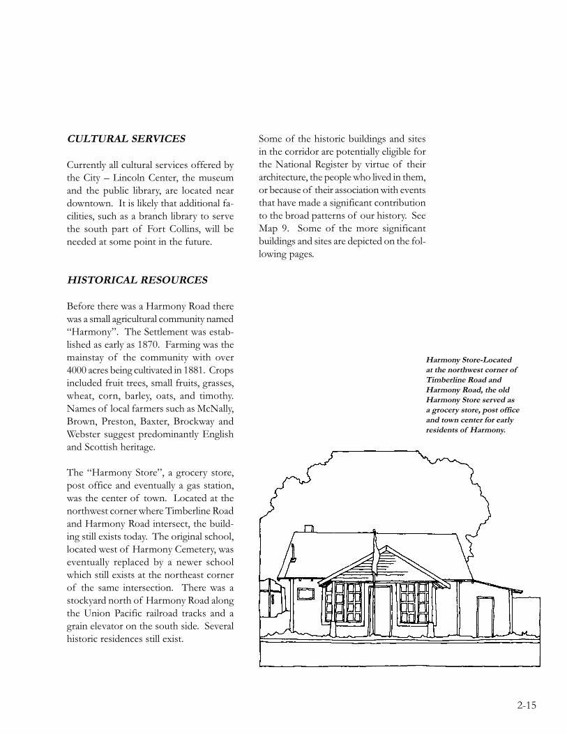
The “Harmony Store”, a grocery store,post office and eventually a gas station,was the center of town. Located at thenorthwest corner where Timberline Roadand Harmony Road intersect, the build-ing still exists today. The original school,located west of Harmony Cemetery, waseventually replaced by a newer schoolwhich still exists at the northeast cornerof the same intersection. There was astockyard north of Harmony Road alongthe Union Pacific railroad tracks and agrain elevator on the south side. Severalhistoric residences still exist.
Some of the historic buildings and sitesin the corridor are potentially eligible forthe National Register by virtue of theirarchitecture, the people who lived in them,or because of their association with eventsthat have made a significant contributionto the broad patterns of our history. SeeMap 9. Some of the more significantbuildings and sites are depicted on the fol-lowing pages.
Harmony Store-Locatedat the northwest corner ofTimberline Road andHarmony Road, the oldHarmony Store served asa grocery store, post officeand town center for earlyresidents of Harmony.

2-16
Brownell House-Builtcirca 1890, this two-storybrick house located at3105 East Harmony Roadis architecturallysignificant because it isdistinctively characteristicof the type, period andmethod of constructionof the American QueenAnne Style.
Preston Farm-BenjaminPreston, Jr. was animmigrant who came tothe area in the 1860’s,started with very little andeventually becamea respected farmer andsomewhat of anagricultural innovator. ThePreston Farm is significantbecause of Mr. Preston’sprominent role in localhistory, the elaborate andessentially unalteredVictorian frame houseand because it is acomplete working farmassociated with the historyof this area.

2-17
Harmony School-Built in1931 during thedepression, this buildingis a good example ofart moderne.
Harmony Road Cemetery-This original cemetery isan important part of thecommunity’s heritage. Ithas been tastefullyrenovated and ismaintained by Oakridge,the business/industrialpark located adjacent to it.
2-18
VISUAL ANALYSIS
Visual analysis is a complex concept.Photography and field investigationswere used to analyze the visual qualityof the Harmony Corridor as perceivedby a motorist driving along HarmonyRoad from I-25 to College Avenue.Three factors combine to create the per-ceived visual quality of the corridor: qual-ity and maintenance of the built environ-ment, visual orderliness and vegetation.Long range views to Longs Peak and theFront Range are evident throughout thecorridor and also play an important rolein the overall visual quality.
The gateway to the corridor at the I-25interchange has many positive visual at-tributes. Riparian vegetation identifiesthe river’s meandering path. The naturalscenic qualities of the river, the flood-plain, wetlands and associated vegetation
is enhanced by the dramatic backdrop ofLongs Peak and the Front Range. Exist-ing development located immediatelywest of I-25 detracts from the scenicqualities of this entry. The commercialbuildings rate low in both architecturalquality and visual orderliness. Significantvegetation helps soften the general ap-pearance.
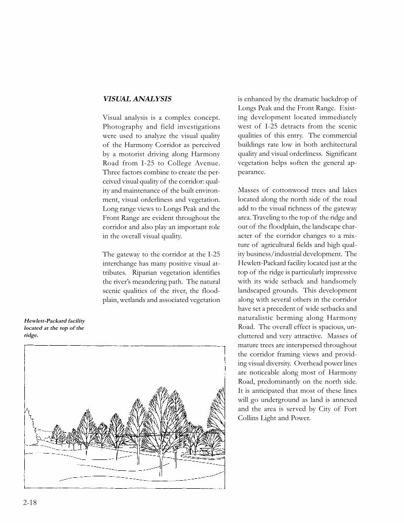
Masses of cottonwood trees and lakeslocated along the north side of the roadadd to the visual richness of the gatewayarea. Traveling to the top of the ridge andout of the floodplain, the landscape char-acter of the corridor changes to a mix-ture of agricultural fields and high qual-ity business/industrial development. TheHewlett-Packard facility located just at thetop of the ridge is particularly impressivewith its wide setback and handsomelylandscaped grounds. This developmentalong with several others in the corridorhave set a precedent of wide setbacks andnaturalistic berming along HarmonyRoad. The overall effect is spacious, un-cluttered and very attractive. Masses ofmature trees are interspersed throughoutthe corridor framing views and provid-ing visual diversity. Overhead power linesare noticeable along most of HarmonyRoad, predominantly on the north side.It is anticipated that most of these lineswill go underground as land is annexedand the area is served by City of FortCollins Light and Power.
Hewlett-Packard facilitylocated at the top of theridge.

2-19
Traveling further west, development in-creases, the type of development becomesmore diverse and the overall visual qual-ity decreases. The area around the UnionPacific railroad tracks located at about themidpoint of the study area is problem-atic because of visual clutter created bywarehouse-type structures, railroad andtraffic control devices, overhead powerlines and signage. On the positive side,Oakridge and Golden Meadows businessparks located just west of the railroadtracks are further examples of high qual-ity business/industrial development andlandscape sophistication, helping to setthe tone for future development in thecorridor.
As one approaches College Avenue, set-backs become much narrower and arenonexistent in some areas, the quality ofdevelopment decreases, the median endsand there is less vegetation at eye level tosoften the visual clutter and intense de-velopment. This area is however, notwithout positive aspects. Recent devel-opments located on the west side of theCollege Avenue intersection have pro-vided wider setbacks and generousamounts of plant material to help softenthe appearance of the intersection. Ri-parian vegetation along Mail Creek andan abundance of mature trees associatedwith the Pioneer Mobile Home Park aresignificant natural amenities which willbecome even more valuable as this arearedevelops over time.
Visual clutter near theUnion Pacific railroadtracks detracts from theattractiveness of thecorridor.
2-20
HARMONY CORRIDOR:THE PLAN
Analyzing existing conditions in the cor-ridor led to the identification of poten-tial problems and also revealed a myriadof opportunities. The corridor has largetracts of fully serviced land available fordevelopment. We have an opportunityto attract the kinds of business and in-dustry we want for the corridor, insteadof just reacting to what comes. The vi-sual appearance of the corridor is linkedto its livability and is also important eco-nomically. We have an opportunity toaffect how the corridor will look in thefuture. The gateway area, located in thefloodplain of the Cache la Poudre Riveris largely undeveloped. We have an op-portunity to successfully balance naturalresource assets and economic develop-ment at this important gateway entrance.
Three focus areas are defined in the Plan– LAND USE, URBAN DESIGN andTHE GATEWAY. In each focus area is-sues are delineated and potential problemsare identified. Alternative approaches forsolving the problems and for taking ad-vantage of the opportunities were gener-ated and analyzed, resulting in recom-mended courses of action. The HarmonyCorridor Plan is a projection of thecorridor’s future, indicating ways to re-solve conflicts and take advantage ofunique opportunities.
HA
RM
ON
Y C
OR
RID
OR
PL
AN
LA
ND
FO
RM
/ D
RA
INA
GE
MA
P 1
HA
RM
ON
Y C
OR
RID
OR
PL
AN
WE
TL
AN
D A
RE
AS
MA
P 2

HA
RM
ON
Y C
OR
RID
OR
PL
AN
WIL
DL
IFE
HA
BIT
AT
AR
EA
SM
AP
3

HA
RM
ON
Y C
OR
RID
OR
PL
AN
WA
TE
RM
AP
4
HA
RM
ON
Y C
OR
RID
OR
PL
AN
SAN
ITA
RY
SE
WE
RM
AP
5

HA
RM
ON
Y C
OR
RID
OR
PL
AN
AC
CE
SS P
LA
NM
AP
6

HA
RM
ON
Y C
OR
RID
OR
PL
AN
LA
ND
USE
- E
XIS
TIN
GM
AP
7A

HA
RM
ON
Y C
OR
RID
OR
PL
AN
LA
ND
USE
- A
PP
RO
VE
D M
AST
ER
PL
AN
AR
EA
SM
AP
7B
HA
RM
ON
Y C
OR
RID
OR
PL
AN
ZO
NIN
GM
AP
8

HA
RM
ON
Y C
OR
RID
OR
PL
AN
HIS
TO
RIC
RE
SOU
RC
ES
MA
P 9

3-1
3LAND USE
The final test of an economic systemis not the tons of iron, the tanks of oil, ormiles of textiles it produces. The finaltest lies in its ultimate products – the sortof men and women it nurtures and theorder and beauty and sanity of theircommunities.
LEWIS MUMFORD

3-2
INTRODUCTION
The national image enjoyed by Fort Col-lins as an excellent place to live and dobusiness is well deserved. Few cities inthe nation have a more spectacular set-ting, a more qualified work force, or amore pleasing climate. The HarmonyCorridor represents a key opportunity tomaintain and enhance the community’spositive image and quality of life.
As the Harmony Corridor emerges as afocus of development activity in south-east Fort Collins, this is an opportunetime to look at current developmenttrends and determine what specific fu-ture land uses would be most desirableto complement other development in thearea.
ISSUES
The issues surrounding future land usein the Harmony Corridor appear to fo-cus on the need to manage developmentto achieve a level of quality consistentwith the economic, environmental, visualand other “quality of life” objectives ofthe community; while guiding the corri-dor to become a major business centerin northern Colorado that attracts desir-able industries and businesses and, at thesame time, provides effective transitionsfrom residential neighborhoods.
Another important issue is the concernthat the Harmony Corridor should notdevelop as a typical commercial “strip”with frequent curb cuts, inadequate land-scaping, and highly fragmented develop-ment lacking coordinated site planning.
Finally, the corridor offers unique oppor-tunities to attract desirable industries anduses that can provide long-term economicstability for the community. Fort Collinshas the opportunity to choose which in-dustries are important for its future.These choices will set the direction forthe community’s economy for the nextforty years. In this regard, the issue ap-pears to focus on the need for more pre-dictability in guiding industries and busi-nesses choosing to locate in the corridorarea.
CURRENT LAND USE POLLICIESAND REGULATIONS
The City’s LAND USE POLICIESPLAN and LAND DEVELOPMENTGUIDANCE SYSTEM (LDGS) are thetwo documents which have been usedmost frequently to guide the planning anddevelopment of the corridor for the pastten years. The LAND USE POLILCIESPLAN (1979), an element of the City’sCOMPREHENSIVE PLAN, is the offi-cial statement of long range planningpolicy regarding a broad variety of landuse planning issues including growthmanagement,

3-3
environmental protection, and locationalpolicies for specific land use classifica-tions. The LAND USE POLICIESPLAN does not dictate specific kinds orspecific locations of land uses that couldoccur in the community, but does pro-vide general guidance, with special em-phasis that development be well-designedand mitigate any negative impacts beforethey be allowed to develop.
Once the Harmony Cor ridor Plan isadopted, it will serve as an element of theCOMPREHENSIVE PLAN and willsupplement the LAND USE POLICIESPLAN for this section of the community.
The LDGS, on the other hand, is not aPlan. It is a land use regulatory mecha-nism, like zoning, which is used to imple-ment the goals, objectives and policies ofthe LAND USE POLICIES PLAN andthe COMPREHENSIVE PLAN.
The LAND USE POLILCIES PLANpromotes the maximum utilization ofland within the corridor, higher densitydevelopment, phased growth, a mix ofuses and concentrated building activity.The availability of public facilities, includ-ing streets, sewer, water, natural gas, andelectricity, establishes the corridor as apreferred location for intense urban ac-tivity including a mix of residential, in-dustrial, commercial and recreational uses.Properly designed, multiple use develop-ments make sense from both a public andprivate standpoint. People can and shouldhave the opportunity to live near wherethey work, where they shop where they
go out to eat, and where they find recre-ation. The auto becomes less necessary,thereby relieving the transportation sys-tem and reducing air pollution. Direct-ing growth to those areas of the commu-nity where utilities are already in place,saves money and makes more efficient useof the existing public investment in in-frastructure improvements.
The adopted LAND USE POLICIESPLAN also encourages a variety of retailactivity in the corridor, including commu-nity and regional shopping centers. Onlyneighborhood scale shopping centers areallowed in residential areas. Strip com-mercial development is discouraged in theLAND USE POLLICIES PLAN in fa-vor of compact shopping centers.
Transitional land uses or areas are alsoprovided for in the Plan to be locatedbetween residential and commercial ar-eas. All residential areas are encouragedto include a mix of single family andmulti-family dwelling units of differingtypes and densities. Other uses such asparks and schools are also expected todevelop in the future to serve the expand-ing residential areas.
Since the late 1970’s, development in theHarmony Corridor has been especiallyattractive and sensitive to the unique char-acteristics and importance of the area.The decision by Hewlett-Packard to lo-cate in this corridor has had the positiveeffect of attracting other light industriesand office users. The quality of recentcommercial and

3-4
residential development in the area hasalso been very good. The challenge athand is to determine if any additionalland use policies are needed which couldimprove upon, reinforce and enhance thepattern of land use occurring within thecorridor.
PLANNING FORTHE FUTURE
INTRODUCTION
Both the City Council and the Planningand Zoning Board have the responsibil-ity and the authority to undertake thepreparation of long range plans and poli-cies. This planning effort offers an op-portunity to establish a refined vision forthe corridor. It includes creating a desir-able living and working environment forfuture inhabitants, an exciting gatewayinto the community, as well as an impor-tant center for business and commerce.
The land use plan for the Harmony Cor-ridor is intended to improve upon, rein-force and enhance the City’s COMPRE-HENSIVE PLAN. It offers a vision ofa future that many people and interestscan identify with and seek to implement.
THE PROCESS
Several different land use alternativeswere considered before finally arriving atthe recommended one. These alterna-tives ranged considerably in intensity of
development, character and practicality.They were reviewed by the property own-ers in the study area and the general pub-lic. The recommended land use plan wassynthesized by staff based on severalmonths of public review and commentat a variety of forums.
The land use plan is depicted on Map 10.The intent of the land use plan and mapis to provide for an orderly, efficient andattractive transition of vacant rural landto urban use; and to:
(a) Maximize the use of existing servicesand facilities (streets and utilities).
(b) Promote the development of thecorridor as a high quality, self-con-tained and compact business center.
(c) Provide for the location of industryand business in the city by identifying prime locations for such uses.
(d) Provide shopping and service areasconvenient to both residents and em-ployees of the corridor.
(e) Provide for a variety of housingtypes.
(f) Preserve and protect existing residen-tial neighborhoods from intrusive ordisruptive development.

3-5
THE VISION
The vision for the corridor area is that itbecome a major business center in north-ern Colorado attracting a variety of busi-nesses and industries serving local as wellas regional markets. It should also includea mixture of land uses including openspace, residential, office, recreational, andretail activities.
The focus of most development activity,especially commercial, should be at themajor street intersections. The intensityof land use should decrease as distancefrom Harmony Road increases and as thedistance from the major intersections in-creases. To promote pedestrian, bicycleand transit use, development in the areashould be compact. Buildings, spaces andstreet frontages should be well-designedand of high quality materials and work-manship.
Business and industry provide the majoreconomic focus of the corridor area. Theland use mix also includes a variety ofcommercial uses to meet tenant andneighborhood resident needs.
Community and regional commercial ac-tivities are introduced in well-plannedshopping centers or industrial parks, de-signed to draw shoppers from the sur-rounding community and region.
Free-standing highway related commer-cial (convenience stores, fast-food restau-rants, gas stations and the like) are notpermitted to locate outside of plannedshopping centers or industrial parks. Onlyneighborhood scale shopping centers areallowed in residential areas.
Hotels to serve business tenants withinthe park will grow in importance. Thesehotels will be sited near major industrialparks, and in most cases be visible fromHarmony Road.
Low intensity retail, restaurants, day carefacilities, health clubs, personal serviceshops, business services (print shops, of-fice supply, etc.), banks and other similarcommercial activity is concentrated in at-tractively designed centers and integratedinto planned industrial parks.
Buffer areas (transitional land uses, lineargreenbelts, or other urban design ele-ments) are provided to serve as cushionsbetween the adjacent residential neighbor-hoods and the commercial areas. Theexisting, low density residential uses in thesurrounding neighborhoods are main-tained and enhanced. As business activ-ity expands, new housing stock of a mixof types and densities is introduced asintegral parts of the business and indus-trial parks.

3-6
LAND USE PLAN
GOAL STATEMENT
Encourage and support mixed land use development in the Harmony Corridor while dis-couraging “strip commercial” development and promoting the vitality and livability ofexisting residential neighborhoods.
POLICIES
LU-1 Strive for excellence and high quality in the design and construction ofbuildings, open spaces, pedestrian and bicycle facilities, and streetscapesby establishing and enforcing design guidelines specific to the corridorarea.
An important part of the Harmony Corridor Plan is the desire to continue the high standardof quality established by recent development projects in the corridor area. One way thatthis can be accomplished is through the development and implementation of design guide-lines specific to the corridor itself. These guidelines should be adopted as a part of thecriteria that the City uses to review development of the corridor area. These guidelinesshould address the following issues:
Streetscapes, including fencing and screening.Landscaping.Street and parking lot lighting.Building setbacks.Architectural design and materials.Pedestrian and bicycle access and circulation.
LU-2 Locate all industries and businesses in the “Basic Industrial and Non-Retail Employment Activity Centers” in the areas of the Harmony Cor-ridor designated for such uses on Map 10. Secondary supporting useswill also be permitted in these Activity Centers, but shall occupy no morethan 25 percent (25%) of the total gross area of the Overall DevelopmentPlan or Planned Unit Development, as applicable.
The Harmony Corridor offers an opportunity for creating a major business and industrialcenter in northern Colorado, due to its desirable location, accessibility, available infrastruc-ture, and land ownership pattern. Attracting desirable industries and businesses into thecommunity, and in particular, the Harmony Corridor, achieves an important public pur-pose because it promotes primary and secondary jobs and generally enhances the localeconomy.

3-7
Basic Industrial and Non-Retail Employment Activity Centers are locations where indus-trial uses and/or office or institutional type land uses are planned to locate in the future inbusiness park settings. Base industries are firms that produce goods and services whichare produced for export outside the city, and thereby import income into the city. Typicalbusiness functions include research facilities, testing laboratories, offices and other facili-ties for research and development; industrial uses; hospitals, clinics, nursing and personalcare facilities; regional, vocational, business or private schools and universities; finance,insurance and real estate services; professional offices; and other uses of similar character,as determined by the Planning and Zoning Board.
Secondary uses include hotels/motels; sit-down restaurants; neighborhood convenienceshopping centers; childcare centers; athletic clubs; and, a mix of single family and multi-family housing. If single family housing is provided, at least a generally equivalent numberof multi-family dwelling units must also be provided. “Multi-family” shall mean attachedsingle family dwellings, 2-familly dwellings or multi-family dwellings.
Secondary uses shall be integrated both in function and in appearance with an office (orbusiness) park, unless a special exemption is granted by the Planning and Zoning Board.In order for such an exemption to be granted, the applicant must demonstrate to thesatisfaction of the Board that the granting of the exemption would neither be detrimentalto the public good nor impact the intent and purposes of the foregoing requirement andthat by reason of exceptional narrowness, small parcel size, or other special conditionpeculiar to a site, undue hardship would be caused by the strict application of this require-ment.
The essence of the Basic Industrial and Non-Retail Employment Activity Center is a com-bination of different types of land uses along with urban design elements that reducedependence on the private automobile, encourage the utilization of alternative transporta-tion modes, and ensure an attractive appearance.
LU-3 Provide for the advance planning of large, undeveloped properties in thecorridor area.
Coordinated planning of large parcels of land in the corridor area can generally providegreater opportunity for more innovation and variation in design, increase efficiency inutility services, and accomplish many more of the policies and objectives of the commu-nity than does a more piecemeal approach to development planning.

3-8
LU-4 Locate a broader range of land uses in the areas of the Harmony Corri-dor known as Mixed-Use Activity Centers as shown on Map 10.
Mixed-Use Activity Centers are areas where a broader range of land uses may locate. TheMixed-Use Activity Center permits, in addition to the uses listed in the “Basic Industrialand Non-Retail Employment Activity Center,” a range of retail and commercial uses tooccur in shopping centers. If single-family housing is provided, at least a generally equiva-lent number of multi-family dwelling units must also be provided. Neighborhood servicecenters, community shopping centers, and regional shopping centers, and a lifestyle shop-ping center shall be limited to those locations shown on Map 10.
The essence of the Mixed-Use Activity Center is a combination of different types of landuses along with urban design elements that reduce dependence on the private automobile,encourage the utilization of alternative transportation modes, and ensure an attractiveappearance.
LU-5 All retail and commercial land uses, except those permitted as second-ary uses in the Basic Industrial and Non-Retail Employment ActivityCenters, shall be located in shopping centers. All shopping centers, ex-cept neighborhood convenience shopping centers, shall be limited tothe locations show on Map 10. Neighborhood convenience shoppingcenters shall also be permitted in the Basic Industrial and Non-RetailEmployment Activity Center as described in LU-2.
The Plan allows for a broad range of retail uses to occur in shopping centers which satisfythe consumer demands of residents and employees who live and work in adjacent neigh-borhoods, as well as from the community or region. Coordinated planning of a “center”rather than isolated individual uses is the most effective means of avoiding the “strip” typeof development.
The scale and design of the shopping centers should be compatible with neighboring uses.Shopping centers can and should play an important role in the identity, character andsocial interaction of surrounding neighborhoods. They should be easily accessible toexisting or planned segments of public transit. Adequate auto accessibility, especially forcommunity and regional shopping centers, is important. Shopping centers should have aphysical environment that is conducive to pedestrian and bicycle travel.

3-9
LU-6 Recognize the importance of the continued livability and stability ofexisting residential neighborhoods as a means to expanding future eco-nomic opportunities in the corridor.
The corridor area contains existing residential areas whose existence contributes to thefuture economic health of the corridor area. Future development in the corridor shouldbe sensitive to these areas.
LU-7 Preserve a transition or cushion of lower intensity uses or open spacebetween existing residential neighborhoods and the more intense indus-trial/commercial areas.
An important goal of the Harmony Corridor Plan is to provide a harmonious relationshipbetween land uses and to protect the character of new and existing residential neighbor-hoods against intrusive and disruptive development. Open space, setbacks, landscaping,physical barriers and appropriate land use transitions can be effective was to provide acushion between different uses. The following are generally considered to be appropriatetransitional land uses:
low intensity professional officesmulti-family housingchurcheschildcare centers; andnursing homes and/or elderly retirement homes.

3-10
HA
RM
ON
Y C
OR
RID
OR
PL
AN
LA
ND
USE
PL
AN
MA
P 1
0
Po
ten
tia
lL
ife
sty
le/R
eg
ion
al
Sh
op
pin
g C
en
ter
3-11
IMPLEMENTATION ACTIONS
The following actions need to be taken by the City to ensure that the land use section ofthe Plan is implemented over the years to come.
1. The City Council and the Planning and Zoning Board should adopt the Plan.
2. The City should annex all unincorporated areas within the Harmony Corridor, inaccordance with the parameters of the Urban Growth Agreement.
3. The City should adopt design standards and guidelines which reinforce the dis-tinctiveness and quality of the corridor area.
4. When reviewing new development proposals in the corridor, the City shall evalu-ate such proposals according to the standards and guidelines adopted as part ofthe Harmony Corridor Plan. The Harmony Corridor Standards and Guidelines are inaddition to existing development regulations that apply to specific developmentproposals.
5. The City should prepare design guidelines which further elaborate on the effectiveuse of design measures for buffering between residential and non-residential landuses.
6. The City should establish means of effectively encouraging industries and busi-nesses to locate in the Harmony Corridor.
7. The City should consider adopting a “superblock” planning requirement whichassures the coordinated planning of large parcels of land.
8. The City should explore local landmark district designation of existing historicstructures.
9. The City should study the distribution of basic industrial and non-retail jobs aspart of the update of the Comprehensive Plan. The planning effort should alsodetermine the relative importance of the Harmony Corridor in achieving commu-nity-wide employment objectives. And, based on the results of the study, the Cityshould prepare incentives and/or regulations to assure implementation of theemployment objectives in the Harmony Corridor. Revise policies of the Plan asneeded.

3-12
10. The City of Fort Collins, Larimer County and the Town of Timnath should joinefforts to plan for the appropriate development of Harmony Road east of I-25compatible with the Harmony Corridor Plan.
11. Pioneer Mobile Home Park, located on the northeast corner of Harmony Roadand College Avenue, is home for many low-income families and elderly personson fixed incomes. Although the Plan indicates future redevelopment of the site,the displacement of persons in the neighborhood should be carefully planned andsensitive to the particular needs of the residents.
12. The “Harmony Bikeway Study” (currently underway) should be prepared to rein-force the goals and vision of the Harmony Corridor Plan, as well as the City’s overalltransportation objectives.

4-1
4URBAN DESIGN
The success of a work of design may besoundly evaluated only by its overall long-term effect on the healthy, happy survivalof humans. Any other evaluation ofarchitecture, landscape architecture, orcity planning makes little if any sense.
NORMAN NEWTON
4-2
INTRODUCTION
Urban design encompasses a wide vari-ety of topics having to do with the physi-cal environment in an urban setting.Existing development, open space, pe-destrian and vehicular linkages, historicbuildings and places, trees and other natu-ral features all combine to create a senseof place. The challenge for the HarmonyCorridor Plan is to take all of these diverseurban design elements and shape them,so that the resulting sense of place en-hances the quality of life for people wholive and work in the corridor.
ISSUES
VISUAL CONSIDERATIONS
As one enters the corridor from the east,the landscape character along HarmonyRoad is a unique blend of rural sceneryand high quality, campus-like office andindustrial development. Moving furtherwest and closer to fully urbanized areas,the variety of land uses becomes morediverse and includes commercial busi-nesses. The landscape character changesfrom a wide floodplain, dominated byspectacular views of the Front Range toa predominantly paved urban environ-ment near College Avenue. It is prob-able that the diversity of land uses andarchitectural styles will continue to in-crease.
As Harmony Road continues to develop,an urban design character will be estab-lished. It can become like many othercommunities and be visually clutteredwith a wide variety of land uses, architec-tural styles and landscapes or it can be awell-planned corridor with a cohesivelandscape design theme that capitalizes onits strengths and down plays it weaknesses.One purpose of the Harmony Corridor Planis to create an urban design frameworkthat can unify the visual diversity into acohesive whole. Building on the area’snatural scenic qualities, the Plan seeks tocreate a vision of what the HarmonyRoad of the future will look like.
ECONOMIC DEVELOPMENTCONSIDERATIONS
Harmony Corridor represents an oppor-tunity for this community to make a posi-tive first impression and demonstrate thatFort Collins is a great place to live, workand play. Harmony Corridor already hasmany positive locational and site devel-opment characteristics, such as good com-munity/regional access and large fullyserviced tracts of undeveloped land. Auniquely attractive and well-planned land-scape character can reinforce these posi-tive qualities and give Fort Collins an edgewhen competing against other commu-nities for quality business and industrialdevelopment.
4-3
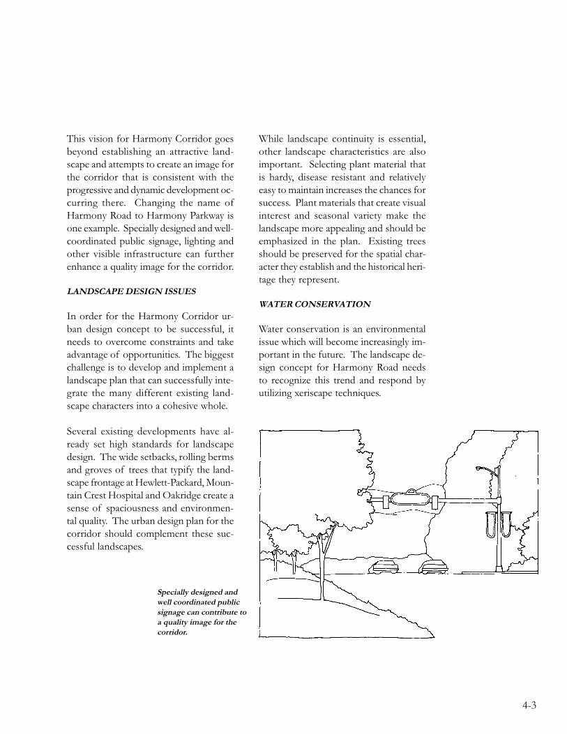
This vision for Harmony Corridor goesbeyond establishing an attractive land-scape and attempts to create an image forthe corridor that is consistent with theprogressive and dynamic development oc-curring there. Changing the name ofHarmony Road to Harmony Parkway isone example. Specially designed and well-coordinated public signage, lighting andother visible infrastructure can furtherenhance a quality image for the corridor.
LANDSCAPE DESIGN ISSUES
In order for the Harmony Corridor ur-ban design concept to be successful, itneeds to overcome constraints and takeadvantage of opportunities. The biggestchallenge is to develop and implement alandscape plan that can successfully inte-grate the many different existing land-scape characters into a cohesive whole.
Several existing developments have al-ready set high standards for landscapedesign. The wide setbacks, rolling bermsand groves of trees that typify the land-scape frontage at Hewlett-Packard, Moun-tain Crest Hospital and Oakridge create asense of spaciousness and environmen-tal quality. The urban design plan for thecorridor should complement these suc-cessful landscapes.
While landscape continuity is essential,other landscape characteristics are alsoimportant. Selecting plant material thatis hardy, disease resistant and relativelyeasy to maintain increases the chances forsuccess. Plant materials that create visualinterest and seasonal variety make thelandscape more appealing and should beemphasized in the plan. Existing treesshould be preserved for the spatial char-acter they establish and the historical heri-tage they represent.
WATER CONSERVATION
Water conservation is an environmentalissue which will become increasingly im-portant in the future. The landscape de-sign concept for Harmony Road needsto recognize this trend and respond byutilizing xeriscape techniques.
Specially designed andwell coordinated publicsignage can contribute toa quality image for thecorridor.

4-4
PEDESTRIAN AND VEHICULARLINKAGES
Other factors that contribute to the ur-ban design character of the corridor in-clude the design of streets, sidewalks andtrail systems. Roadway geometrics anddesign detail influence the visual appear-ance of a streetscape. In the HarmonyCorridor it is especially important to con-sider future roadway geometrics for Har-mony Road.
The fact that Harmony Road is a statehighway complicates the issue. The Cityand State agree that eventually HarmonyRoad will need to be widened to accom-modate three travel lanes in each direc-tion. Indications are that the State in-tends to widen the roadway to the inside,greatly reducing the width of the medianor, in some cases, eliminating it entirely.Landscaping in the median also must becoordinated with the State Division of
Highways and designed to their standards.At the preset time, these standards do notallow planing trees in the median. Theneed for curb, gutter, and splash blocksin the future also needs to be examined.In order to successfully implement ameaningful urban design concept, the Citymust work with the State toward a com-mon vision for the future.
Transportation planning in the corridorshould respond to the needs of motor-ists, commuters, bicyclists and pedestri-ans. Well-planned and sensitively de-signed trail systems serving bicyclists andpedestrians can contribute to the visualattractiveness of the area, help create asense of place and enhance the qualityof life for people who live and work inthe Harmony Corridor.
HISTORICAL HERITAGE
The historical heritage associated with theoriginal community of Harmony is oneof the interesting facts that make theHarmony Corridor unique. The colorfulpersonalities associated with that era andtheir labor which created irrigated farm-land, built charming Victorian houses,established a church, school and cemeteryshould not be forgotten. The persistenceand hard work of these early pioneersplayed an important role in the evolutionof the corridor.
Even though historic farmhouses andother buildings in the corridor may even-tually be replaced by more modern struc-tures, the historical heritage they repre-sent can be preserved in a variety of ways.Encouraging property owners
The spacious median isimportant to the visualquality of the corridor.

4-5
to have the historical significance of theirstructures documented is important. Oneof the future neighborhood parks in thecorridor could be named “HarmonyPark” and emphasize a historical theme.Historical markers along trail systemscould enhance this concept. The Har-mony Corridor urban design plan shouldcapitalize on these opportunities to pre-serve the past for the benefit of futuregenerations.
COORDINATION WITH UTILITIES
Utility systems in the corridor can affectthe visual quality of the corridor in a va-riety of ways. The City’s Water and Waste-water Utility has completed the concep-tual design and route selection for a ma-jor water transmission main in the corri-dor. Utility engineers and planners willneed to balance the needs of the utilitywith the aesthetic purposes of the urbandesign plan. A 40-foot wide drainagechannel designed to carry stormwaterflows from the Hewlett-Packard site tothe lake east of County Road 7 is anotherexample of utility systems affecting thevisual appearance of the streetscape.Communication and coordination are keyfactors in resolving conflicts before theybecome problems. In most cases theneeds of the utility can be met withoutsacrificing visual aesthetics if the systemsare carefully planned with the corridorlandscape design objectives in mind.
ALTERNATIVE DESIGNCONCEPTS
The design process began with a visualanalysis of the corridor, detailed in Chap-ter 2, followed by the generation of threealternative urban design concepts – Har-mony Orchard, Harmony Rhythm, andHarmony Oaks. The basic elements ofeach design concept are described below.
HARMONY ORCHARD
In this design concept, ornamental treesare planted in a grid pattern to create anorchard effect along Harmony Road fromI-25 and to College Avenue. The tree gridis continuous in the median and occursrandomly along the road edges skippingproperties that are already developed.Developers are encouraged to plant ev-ergreens and tall deciduous canopy treesto act as a backdrop for the orchard. Spe-cies of orchard trees are selected for har-diness and disease resistance, as well asfor spring and fall color.
The median and adjacent properties aregraded to continue the rolling berms al-ready becoming a hallmark of HarmonyRoad. A meandering bike trail parallelsboth sides of the street and connects toexisting bike trails. The ground plain isplanted with a bluegrass, brome and fes-cue mix to provide turf

4-6
that is green during the growing seasonand still conserves significant amounts ofwater over conventional bluegrass. Themowing height is six inches, in keepingwith an orchard theme. Thousands ofdaffodils are naturalized all along themedian creating a spectacular flower dis-play in early spring. Low stone walls areencouraged as an architectural design el-ement at intersections and anywhere re-taining walls or low screen walls areneeded. Distinctive lighting and signgraphics are used to further build on thedesign concept.
HARMONY RHYTHM
A repetition of plant material and sculp-ture combine to create a rhythm alongHarmony Road that the viewer perceiveswhether he is entering Fort Collins forthe first time or is a resident taking ad-vantage of the bike trail system parallel-ing the road. A narrow range of plantmaterial is selected to provide seasonalinterest. For example “Burning Bush”might be selected as a shrub that is re-peated in the landscape of new develop-ments, resulting in a dramatic display ofglowing red shrubs during that few weeksin the fall when that shrub turns color.Other trees, shrubs and perennials areselected to provide similar effects allthrough the growing season.
Sculpture is promoted along the corridormaking a statement about Fort Collins’interest in the arts. Occurring at inter-sections and at prominent points alongthe trail system, sculptural elements couldbe individually unique or work togetheraround a common theme.
Plan view of the HarmonyOrchard design concept.

4-7
Perspective view of theHarmony Rhythm designconcept.
HARMONY OAKS
The Harmony Oaks concept is charac-terized by wide setbacks, naturalisticberming, a meandering sidewalk, andgroves of oak trees alternating with wild-flower meadows. Oaks have been selectedas the dominant tree species for severalreasons. Two types of trees are native toColorado: Coniferous species usually as-sociated with higher elevations, and de-ciduous species found along streams. Oneof the few deciduous hardwood treesnative to Colorado is the Gambel Oak.This combined with the oak’s reputationfor longevity, hardiness, disease resistance,low water demand, fall coloring, and at-
tractive appearance led to the conclusionthat the Gambel Oak along with otheroaks known to thrive in this climate wouldbe the best tree to dominate in the corri-dor landscape. Although the oaks arecombined with a substantial number ofother tree species to avoid a mono-cul-ture, they are planted in sufficient quanti-ties to have a unifying effect. The oak’srugged appearance makes it ideally suitedto the informal naturalistic landscapeemerging along Harmony Road. Driftsof pines occur randomly to provide win-ter interest and add to the naturalistic for-ested effect.
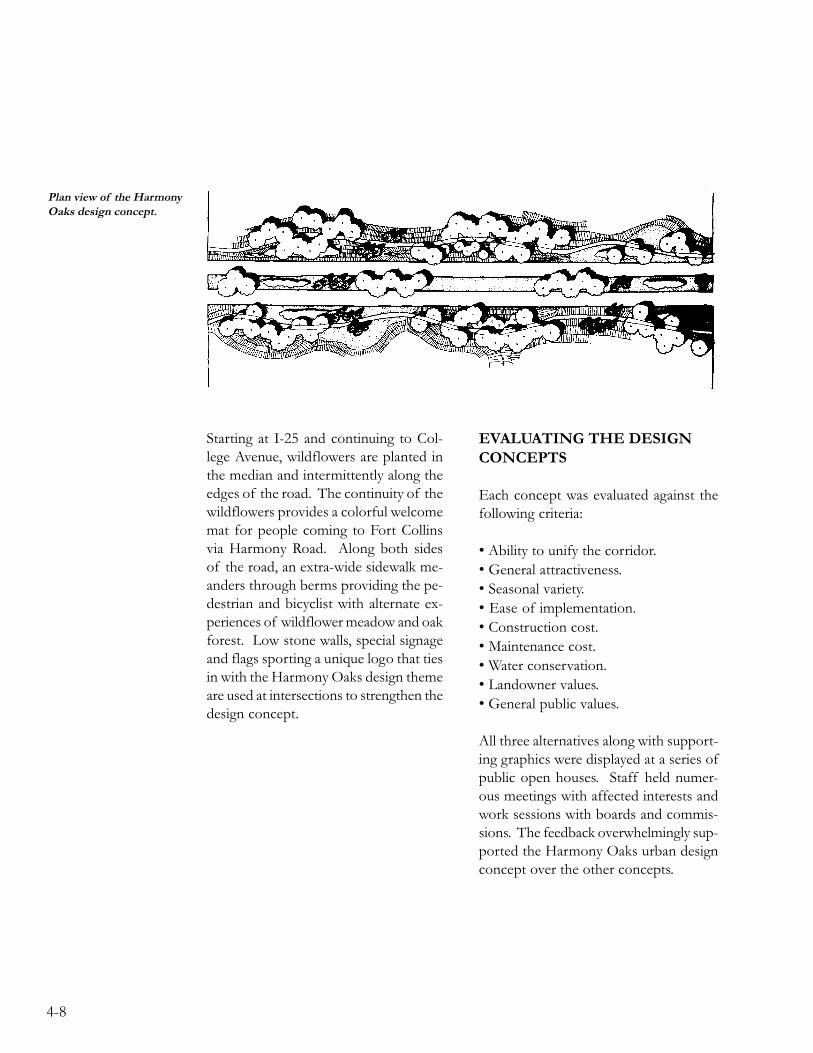
4-8
Plan view of the HarmonyOaks design concept.
Starting at I-25 and continuing to Col-lege Avenue, wildflowers are planted inthe median and intermittently along theedges of the road. The continuity of thewildflowers provides a colorful welcomemat for people coming to Fort Collinsvia Harmony Road. Along both sidesof the road, an extra-wide sidewalk me-anders through berms providing the pe-destrian and bicyclist with alternate ex-periences of wildflower meadow and oakforest. Low stone walls, special signageand flags sporting a unique logo that tiesin with the Harmony Oaks design themeare used at intersections to strengthen thedesign concept.
EVALUATING THE DESIGNCONCEPTS
Each concept was evaluated against thefollowing criteria:
• Ability to unify the corridor.• General attractiveness.• Seasonal variety.• Ease of implementation.• Construction cost.• Maintenance cost.• Water conservation.• Landowner values.• General public values.
All three alternatives along with support-ing graphics were displayed at a series ofpublic open houses. Staff held numer-ous meetings with affected interests andwork sessions with boards and commis-sions. The feedback overwhelmingly sup-ported the Harmony Oaks urban designconcept over the other concepts.

4-9
Perspective view of theHarmony Oaks designconcept.
In the final analysis, the Harmony Or-chard concept was rejected because of thedifficulty of implementation, high costsand lack of support from the landown-ers and general public. Although theHarmony Rhythm design concept scoredhigh when evaluated against the criteria,it was also eliminated because of highinstallation costs and lack of landownersupport. The Harmony Oaks alternativewas selected as the urban design conceptwith the most potential.
A dominant tree species combined witha narrow plant palette will be very effec-tive in unifying the corridor over time,while the use of wildflowers can providea dramatic unifying effect in a muchshorter time frame. The combination ofplant material, rolling berms and mean-dering trail system will create a pleasantand attractive setting for future develop-ment and at the same time complementexisting developments. The naturalistic,informal design will provide developerswith needed flexibility and the cost ofimplementation and maintenance will beequal to or less than the typical landscapecurrently proposed for Harmony Road.
The Harmony Oaks concept emphasizesxeriscape, a term for water conservationthrough appropriate landscaping, in twoways. The plant palettes will consist of avariety of low to moderate water demandplant materials, and the recommendedturf and wildflower ground covers willconsume significantly less water than tra-ditional blue grass turf.

4-10
URBAN DESIGN PLAN
GOAL STATEMENT
Guide development in the corridor so that collectively a perceivable, unified urban designtheme and landscape character is created along Harmony Road. Utilize urban designprincipals to ensure that Harmony Corridor continues to be a great place to live, work andplay.
POLICIES
UD-1 Implement the Harmony Oaks design concept through design standardsand guidelines for private and public sector development projects.
UD-2 Promote water conservation by providing design guidelines that encour-age xeriscape landscape techniques.
UD-3 Establish a well-planned and attractive gateway entrance to the commu-nity at the I-25 interchange, emphasizing the natural scenic qualities ofthe area.
UD-4 Promote the development of an extensive recreational trail that connectsto the city-wide trail system.
UD-5 Promote the development of a commuter bikeway system that supportsbicycling as an alternative mode of transportation in the corridor.
UD-6 Coordinate the long range planning efforts of other City departmentsand governmental agencies with the goals and objectives of the Har-mony Corridor Plan.
UD-7 Support efforts to preserve the historical heritage associated with theoriginal community of “Harmony”.
UD-8 Adopt design guidelines and standards for retail development in the cor-ridor to create better neighborhoods by promoting safe, pleasant walk-ing and bicycling environments, more lively commercial centers, conve-nient transit access, and human scale design.

4-11
IMPLEMENTATION ACTIONS
The following implementation actions are intended as a guide for implementing the urbandesign section of the Plan.
1. DESIGN GUIDELINES
The Planning and Zoning Board and the City Council should adopt the Plan along withdesign standards and guidelines for new development. The design standards and guide-lines will set expectations for private and public sector improvements along HarmonyRoad. (Design standards and guidelines are available under separate cover.)
2. RECREATIONAL TRAIL/BICYCLE COMMUTER SYSTEMS
The City should develop a master plan for a recreational trail system and for a commuterbicycle system to serve bicyclists and pedestrians in the corridor. Additional field investi-gations and coordination efforts are needed to develop a strategy for implementing effec-tive systems for commuting and recreation. Analyzing cost/benefit relationships and de-veloping appropriate funding mechanisms are a part of this work effort.
3. WILDFLOWER RESEARCH
For wildflowers to be done well and create a spectacular seasonal display, careful planningis required. The City should establish test plots along Harmony Road to determine themost appropriate seed mix and best maintenance practices. Ideally the test plots would bemonitored for three years before large areas are seeded.
4. SPECIAL SIGNAGE
The City should develop a coordinated public signage system to enhance the HarmonyOaks theme. Special colors and unique Harmony Road design detail for public signage,traffic control devices and light standards along Harmony Road are envisioned. A fundingmechanism needs to be developed.
5. NAME CHANGE
The City should change the name of Harmony Road to Harmony Parkway, which is morein character with the future vision of the Harmony Corridor.

4-12
6. COORDINATION WITH THE STATE DIVISION OF HIGHWAYS
The City should work with the State Division of Highways to answer questions about thefuture operation and physical appearance of Harmony Road. January 1993 should be setas a target date to resolve the following issues:
Ownership of Harmony Road.Future widening.Curb, gutter, and splash block detailing.Planting in the median.Future interchange design and construction.Frontage roads.Bicycle commuting along Harmony Road.Car-pooling at I-25.
7. LANDSCAPE PLAN FOR THE MEDIAN
The City should complete a design development plan for the median that addresses curb,gutter, splash block, plant material, and irrigation. Establishing a funding source for con-struction and maintenance of the median landscape is part of this work effort.
8. LANDSCAPE PLAN FOR THE I-25 INTERCHANGE
The City should design and implement a well-integrated landscape plan for the I-25 inter-change at Harmony Road. Creative use of plant material and carefully designed entryfeature should introduce the Harmony Oaks concept to motorists leaving I-25 and enter-ing Fort Collins. Landscaping the interchange should also present a positive first impres-sion to motorists continuing on the interstate. The Plan needs to be integrated with thegateway planning effort described in Chapter 5.
9. COLLEGE AVENUE/HARMONY ROAD INTERSECTION PLAN
The City should develop a conceptual design plan for the College Avenue/Harmony Roadintersection along with a specific implementation strategy. In addition to being the westgateway to the Harmony Corridor, this intersection is a major gateway to Fort Collinsfrom the south. The importance of this intersection should be reflected in its appearance.Landscape elements on each corner can be coordinated to achieve

4-13
a well designed urban intersection that creates an impressive gateway to Fort Collins fromthe south and at the same time introduces the Harmony Oaks design concept for motor-ists entering the Harmony Corridor. This intersection is an ideal location for a specialsignage demonstration project.
10. HISTORIC INTERPRETATION
Opportunities for historic interpretation of the historic “Harmony” community shouldbe explored as part of any future bicycle planning efforts in the corridor.

4-14

5-1
5ALTERNATIVE
GATEWAY CONCEPTS
The psychology of arrival is moreimportant than you think. If it is notobvious where to park, if there is noroom to park when you get there, ifyou stumble into the back door lookingfor the front entrance, or if the entranceis badly lighted, you will have subjectedyour guests to a series of annoyanceswhich will linger long in theirsubconscious. No matter how warmyour hearth or how beautiful yourview, the overall effect will be dimmedby these first irritations.
THOMAS D. CHURCH

5-2

5-3
View of the I-25interchange at HarmonyRoad looking north.
INTRODUCTION
The gateway area located between I-25and the bluffs east of Hewlett-Packardhas many unique physical qualities includ-ing open water, wetlands, wildlife habi-tat, and spectacular mountain views. Thearea is underlain with high quality gravelresources. Past, present, and future min-ing operations have changed and will con-tinue to change the character of the land-scape. Most of the area lies within the100-year floodplain of the Cache laPoudre River and significant portions arelocated in the floodway. These physicalconditions create a variety of develop-ment constraints and at the same timeoffer many recreational and educationalopportunities.
Located at the crossroads of an interstatehighway and a state highway, this majorgateway entrance to Fort Collins has agreat deal of development potential de-spite the constraints mentioned above.The commercial development that alreadyexists in the gateway, as well as the kindsof development that interchange loca-tions typically attract, do not mesh wellwith the scenic and natural resource val-ues of the area. This combination of cir-cumstances challenges the community tofind a way to balance natural resourceassets with economic development.
ISSUES
ECONOMIC CONSIDERATIONS
The gateway area is literally the “FrontDoor” to this community. The psychol-ogy of arrival is important. If anewcomer’s first impression is marred bysights and sounds that are distasteful,those irritations will linger no matter howwonderful the rest of the visit to FortCollins might be. How this area is plannedmakes a statement about the people ofthis community – what our values are andthe pride we take in our community. Thisis why it is important to establish a par-ticularly well-planned and attractive gate-way entry.
From an economic standpoint, a positivefirst impression can encourage quality

5-4
development to locate in the HarmonyCorridor versus other Front Range com-munities. Quality development can cre-ate jobs and generate tax revenues thatpay for a variety of public services. Afavorable first impression can give FortCollins an edge and help put the commu-nity in the driver’s seat when it comes toselecting business and industry that isconsistent with local values, as opposedto merely reacting to development whenit comes.
SCENIC RESOURCE VALUE
The setting, being located in the flood-plain of the Cache la Poudre River, is whatmakes the gateway area unique in theHarmony Corridor and significant in thecommunity. The area is bounded by I-25on the east, and the bluffs on the west.The bluffs, known as the Poudre RiverValley Wall, area a result of the river’sdown-cutting action as it meandered andmigrated within its floodplain for thou-sands of years. The bluffs are a domi-nant visual element that identifies theriver’s floodplain while mature riparianvegetation seen in the distance defines themeandering path of the river. The re-sulting visual quality of this area is sig-nificant. Standing in the gateway area, onecan see the whole spectrum of local eco-systems, from snow capped peaks in thefar distance, to forested mountaintops, tochaparral foothills, to grass covered plains,down to the wetlands and the riparianvegetation associated with the river val-ley. To have such a sweeping vista at thefront door to our community can be avaluable asset.
THE FLOODPLAIN
The 100-year floodplain is the most sig-nificant development constraint in thegateway area. Most of the property inthe gateway area lies within the 100-yearfloodplain, and significant portions of thearea are within the floodway. Land lo-cated in the 100-year floodplain has a oneper cent chance of flooding in a givenyear. The floodway is the land area thatmust be reserved in order to dischargethe base flood without cumulatively in-creasing the water surface more than sixinches. Under current policies, no devel-opment is allowed within the floodway.The areas between the floodway and the100-year floodplain have some potentialfor development if flood-proofing is ad-dressed. Since serious land developmentrestrictions are associated with the flood-plain and natural resource areas, the gate-way is an excellent resource for alternate,less intensive land uses. The river and itsfloodplain along with associated wetlandsand wildlife habitat is an integrated sys-tem. The ability to manage floodplainlands for appropriate uses is importantto the river’s natural resource value.

5-5
WATER QUALITY CONSIDERATIONS
Wetlands have historically been consid-ered to have little value and generally goodfor nothing unless they could be filled andput to productive use. Only recently havewetlands come to be appreciated for thevital role they play. Besides providingwildlife habitat, wetlands have a uniquecapability to filter and enhance water qual-ity. Located at the edge between land andwater, the plant and animal life found inthe saturated soil conditions of wetlandscreates an environment that naturallybreaks pollutants down into harmless sub-stances. Portions of the gateway area holdpotential for being utilized to clean upstormwater run-off before it reaches theCache la Poudre River.
GRAVEL RESOURCES
Gravel mining operations will affect thefuture of this area. Parts of the gatewayhave already been mined, parts are cur-rently being mined and still other areashave gravel resources that could be minedin the future. All of these areas are pres-ently outside of the city limits. LarimerCounty has a permit process for extrac-tion of mineral resources that requiresprovisions for safety during the extrac-tion operations and for reclamation. Boththe City and County encourage the re-moval of gravel resources prior to devel-opment. There has been a recent trendin other areas of the community for prop-erty owners to donate land to the Cityafter the gravel resources are depleted.This practice has advantages for theowner and provides opportunities for the
City to acquire open space at minimalcost.
RECREATIONAL OPPORTUNITIES
The Parks and Recreation Departmenthas developed a rating system used toevaluate property in order to determinewhether or not acquisition of the prop-erty fulfills the City’s objectives in regardsto open space. Scenic qualities of the sitecombined with development limitationsmake land in the gateway area a viablecandidate for public acquisition. Closeproximity to the Strauss Cabin and theNorthern Colorado Nature Center is im-portant and the ease of accessibility is alsoa plus. The rating system also prioritizesacquisition of land based on developmentpressure, meaning that land most likelyto be developed should be acquired first.The fact that there are man-made struc-tures on the site and an interstate high-way is located adjacent to the propertyare negative factors when evaluating thearea as public open space.
In addition to the property’s value as openspace, the area also provides opportuni-ties for various forms of both active andpassive recreation. A series of old quar-ries and lakes associated with gravel min-ing operations provide opportunities forfishing, swimming, boating and skating inwinter. Quarries, lakes, wetlands, the river,and scenic views combine to make thearea ideally suited for bicycling, leisurelyhiking and cross country skiing. Oppor-tunities for viewing wildlife and birdwatching are

5-6
good and could be enhanced further.Existing groves of cottonwood trees addto the visual interest and create shelteredareas for picnicking. The area may alsohold potential for more active recre-ational uses such as golfing, field sports,and camping.
EDUCATIONAL RESOURCE VALUE
Resources for learning about history andthe environment are abundant in the gate-way area. The Cache la Poudre Riverfloodplain with the Front Range as ahighly visible backdrop creates an oppor-tunity to learn about Colorado landformsand ecological systems. A diversity ofvegetation and wildlife habitat is there tobe observed. In addition, there are op-portunities to learn about mining opera-tions and reclamation as well as drainagebasins, stream flows, and water quality.
There are a variety of ways to take ad-vantage of these educational opportuni-ties. Preserving all or part of the area asopen space and providing an interpretivecenter is one example. Simply providinginterpretive markers along a bike trail sys-tem would be another way to increaseenvironmental awareness.
WILDLIFE HABITAT VALUE
Significant portions of the gateway areahave been identified as having wetland,wildlife or vegetative interest. These ar-eas include the open water created by oldquarries left from mining operations, wet-lands, groves of cottonwood trees and theriparian habitat along the river itself. (SeeMaps 2 and 3) The result of the habitatis a significant community of wildlife spe-cies, which include birds, mammals, rep-tiles and fish. Bald eagle, great blue heron,horned owl and peregrine falcon are im-portant bird species known to occur alongthe river. Mule deer and whitetail deerare also commonly found along the rivercorridor.
The Cache la Poudre Riverand numerous lakes in thegateway area couldprovide opportunities forrecreational fishing.
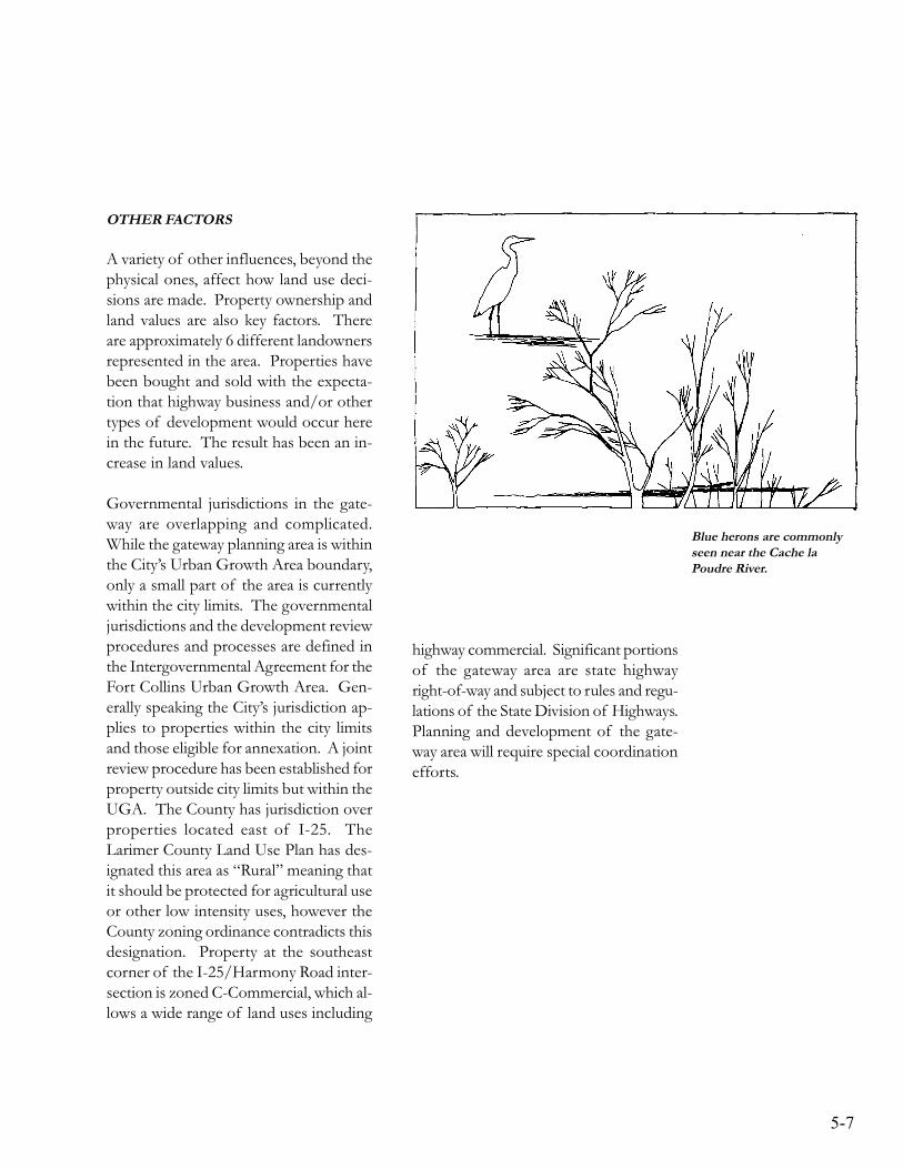
5-7
OTHER FACTORS
A variety of other influences, beyond thephysical ones, affect how land use deci-sions are made. Property ownership andland values are also key factors. Thereare approximately 6 different landownersrepresented in the area. Properties havebeen bought and sold with the expecta-tion that highway business and/or othertypes of development would occur herein the future. The result has been an in-crease in land values.
Governmental jurisdictions in the gate-way are overlapping and complicated.While the gateway planning area is withinthe City’s Urban Growth Area boundary,only a small part of the area is currentlywithin the city limits. The governmentaljurisdictions and the development reviewprocedures and processes are defined inthe Intergovernmental Agreement for theFort Collins Urban Growth Area. Gen-erally speaking the City’s jurisdiction ap-plies to properties within the city limitsand those eligible for annexation. A jointreview procedure has been established forproperty outside city limits but within theUGA. The County has jurisdiction overproperties located east of I-25. TheLarimer County Land Use Plan has des-ignated this area as “Rural” meaning thatit should be protected for agricultural useor other low intensity uses, however theCounty zoning ordinance contradicts thisdesignation. Property at the southeastcorner of the I-25/Harmony Road inter-section is zoned C-Commercial, which al-lows a wide range of land uses including
highway commercial. Significant portionsof the gateway area are state highwayright-of-way and subject to rules and regu-lations of the State Division of Highways.Planning and development of the gate-way area will require special coordinationefforts.
Blue herons are commonlyseen near the Cache laPoudre River.

5-8
WHAT THE FUTURE HOLDS
THE NULL ALTERNATIVE
If the governmental agencies, which havejurisdiction over land in and adjacent tothe gateway area continue to operate un-der current policies, we can make somepredictions about the future of this area.The following development scenario isbased on current trends and developmentpatterns of interchange locations in othercommunities.
Properties on the east side of the inter-state would develop under County regu-lations. The area north of HarmonyRoad but east of I-25 is currently beingmined for gravel resources. It is antici-pated that the area will be mined for atleast ten more years before the gravelresources are depleted. The landowner’splans for the future of the property afterthe resources are removed are not deter-mined. The land is zoned for agricul-tural use, but could conceivably be re-zoned to allowed commercial or indus-trial land uses.
Land located south of Harmony Roadand east of I-25 is zoned C-Commercialin the county. This zoning district allowsa variety of highway business uses suchas gas stations, fast food restaurants andmotels. Large-scale commercial usessuch as automobile sales, mobile homesales and storage warehouses are alsopermitted.
Land on the west side of I-25 is withinthe Fort Collins Urban Growth Area(UGA) and is subject to Larimer Countyland use regulations and to the Fort Col-lins Urban Growth Area Intergovernmen-tal Agreement. Development proposalson land not eligible for annexation, wouldbe reviewed by the Urban Growth AreaReview Board, with representatives fromboth Larimer County and Fort Collins.This board makes a recommendation tothe Larimer County Board of Commis-sioners.
Land that is eligible for annexation mustannex prior to development. Property iszoned at the time of annexation. TheCity Council typically places a plannedunit development condition on the zon-ing, meaning that development of theproperty must satisfy the criteria of theLAND DEVELOPMENT GUID-ANCE SYSTEM (LDGS). Under exist-ing City or County regulations, we canreasonably anticipate a mixture of landuses that would include highway businessoriented uses near the interstate, morecommercial development along HarmonyRoad and office and/or industrial landuses both north and south of HarmonyRoad. The prominence of the interstatehighway coupled with floodplain restric-tions make residential uses unlikely in thisarea, although it is a possibility for landareas closer to the bluffs.
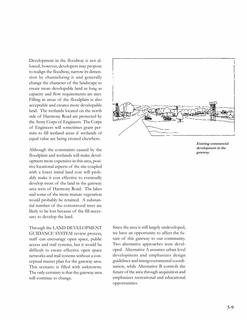
5-9
Existing commercialdevelopment in thegateway.
Development in the floodway is not al-lowed, however, developers may proposeto realign the floodway, narrow its dimen-sion by channelizing it and generallychange the character of the landscape tocreate more developable land as long ascapacity and flow requirements are met.Filling in areas of the floodplain is alsoacceptable and creates more developableland. The wetlands located on the northside of Harmony Road are protected bythe Army Corps of Engineers. The Corpsof Engineers will sometimes grant per-mits to fill wetland areas if wetlands ofequal value are being created elsewhere.
Although the constraints caused by thefloodplain and wetlands will make devel-opment more expensive in this area, posi-tive locational aspects of the site coupledwith a lower initial land cost will prob-ably make it cost effective to eventuallydevelop most of the land in the gatewayarea west of Harmony Road. The lakesand some of the more mature vegetationwould probably be retained. A substan-tial number of the cottonwood trees arelikely to be lost because of the fill neces-sary to develop the land.
Through the LAND DEVELOPMENTGUIDANCE SYSTEM review process,staff can encourage open space, publicaccess and trail systems, but it would bedifficult to create effective open spacenetworks and trail systems without a con-ceptual master plan for the gateway area.This scenario is filled with unknowns.The only certainty is that the gateway areawill continue to change.
Since the area is still largely undeveloped,we have an opportunity to affect the fu-ture of this gateway to our community.Two alternative approaches were devel-oped. Alternative A assumes urban leveldevelopment and emphasizes designguidelines and intergovernmental coordi-nation, while Alternative B controls thefuture of the area through acquisition andemphasizes recreational and educationalopportunities.

5-10
ALTERNATIVE A
This development scenario places certaindevelopment restrictions upon the prop-erty, in order to take advantage of someof the recreational, educational and aes-thetic opportunities the gateway offers.In exchange for having to comply withadditional land use and/or design restric-tions, developers gain the advantage ofmore predictability and the economicedge provided by a spacious and well-planned gateway.
The intent is to create a gateway entrancethat integrates quality development withthe natural characteristics of the existinglandscape. Wetlands, lakes and floodwayareas are left undeveloped and becomethe focus of an elaborate open spacenetwork. The open space areas are lacedwith an extensive system of trails. Thecharacter of the gateway area as a whole
is naturalistic with heavy emphasis onnative plants and wildlife habitat. Thechallenge for development is to blend intothe natural scheme of things with as littlevisual disruption as possible.
Although more work is required to de-termine how this development scenariocould be implemented, the following issuggested as a starting point for discus-sion purposes. Light industrial and of-fice uses are encouraged. Commercialland uses are discouraged unless they canbe shown to blend unobtrusively into thenaturalistic setting. Setbacks would be inthe magnitude of 80-100 feet from theright-of-way, creating a significantgreenbelt around the interchange. Boththe architecture and landscape planswould be subject to design standards andguidelines that emphasize the naturalisticcharacter of the gateway area.
Open space and a trail system associatedwith the floodway, wetlands and lakeswould be for public use. Ownership,maintenance and liability issues wouldhave to be negotiated. Retaining signifi-cant amounts of open space may requirethe expenditure of public funds or a re-investment of tax dollars created by thedevelopment. Property owners may bewilling to dedicate some non-developableland to the City as open space.
The primary goal of Alternative A is topreserve the naturalistic character of thelandscape and ensure that developmentprojects are well integrated and contrib-ute to the visual quality of the gatewayarea.
Alternative A proposesdevelopment that is wellintegrated into the naturalsetting of the gatewayarea.
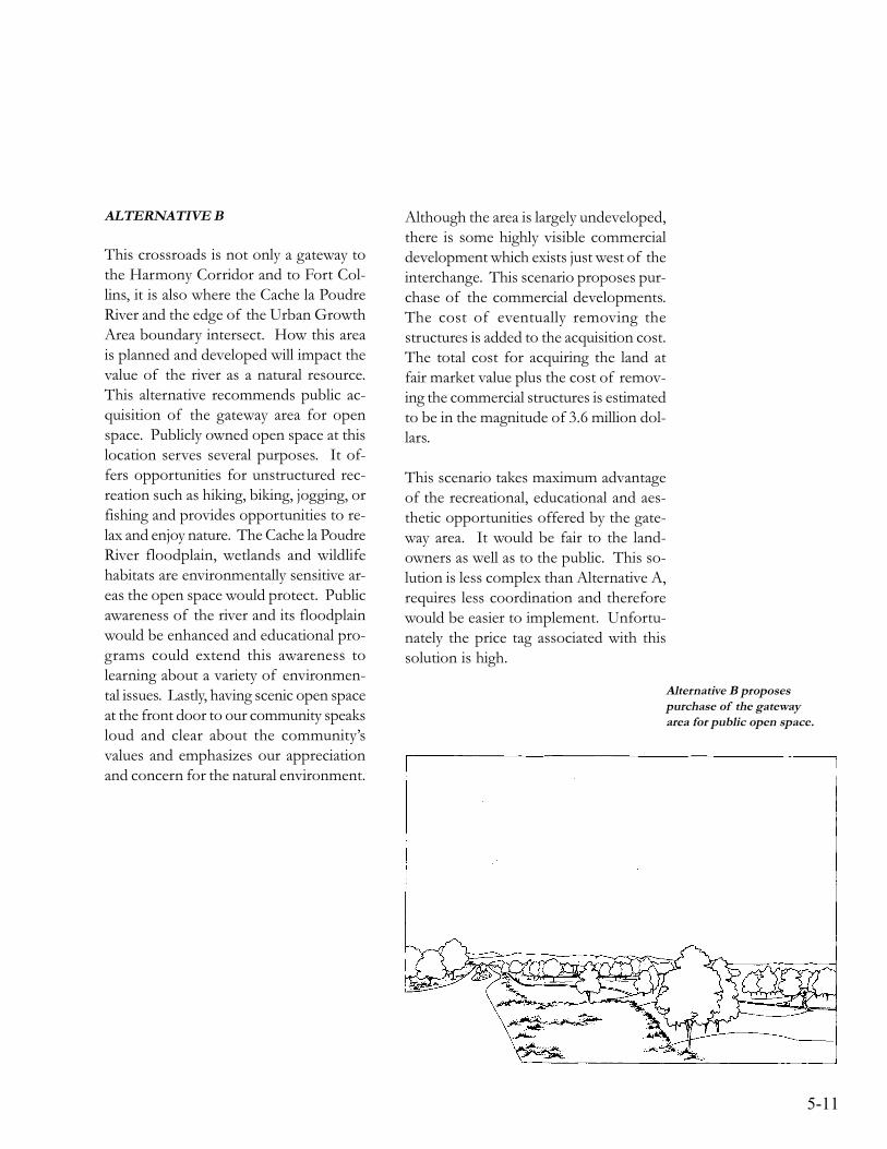
5-11
Alternative B proposespurchase of the gatewayarea for public open space.
ALTERNATIVE B
This crossroads is not only a gateway tothe Harmony Corridor and to Fort Col-lins, it is also where the Cache la PoudreRiver and the edge of the Urban GrowthArea boundary intersect. How this areais planned and developed will impact thevalue of the river as a natural resource.This alternative recommends public ac-quisition of the gateway area for openspace. Publicly owned open space at thislocation serves several purposes. It of-fers opportunities for unstructured rec-reation such as hiking, biking, jogging, orfishing and provides opportunities to re-lax and enjoy nature. The Cache la PoudreRiver floodplain, wetlands and wildlifehabitats are environmentally sensitive ar-eas the open space would protect. Publicawareness of the river and its floodplainwould be enhanced and educational pro-grams could extend this awareness tolearning about a variety of environmen-tal issues. Lastly, having scenic open spaceat the front door to our community speaksloud and clear about the community’svalues and emphasizes our appreciationand concern for the natural environment.
Although the area is largely undeveloped,there is some highly visible commercialdevelopment which exists just west of theinterchange. This scenario proposes pur-chase of the commercial developments.The cost of eventually removing thestructures is added to the acquisition cost.The total cost for acquiring the land atfair market value plus the cost of remov-ing the commercial structures is estimatedto be in the magnitude of 3.6 million dol-lars.
This scenario takes maximum advantageof the recreational, educational and aes-thetic opportunities offered by the gate-way area. It would be fair to the land-owners as well as to the public. This so-lution is less complex than Alternative A,requires less coordination and thereforewould be easier to implement. Unfortu-nately the price tag associated with thissolution is high.
5-12
LOCAL VALUES
Alternatives A and B only scratch thesurface of a multitude of possibilities forthe gateway area. The alternatives wereused to clarify distinct directions andcourses of action. Both options, alongwith the “null” alternative were displayedat a series of public open houses. Staffheld numerous meetings with affectedinterests and work sessions with boardsand commissions. The feedback over-whelmingly supported Alternative A.Responses indicated that people are nottotally comfortable with the ability ofexisting City policies to coordinate andguide development in this area. They areconcerned that natural resource value willbe lost and important opportunities willbe missed if we do not put forth a con-scious effort to coordinate and plan thisarea with community values in mind.
Staff has studied the natural and scenicresource value of the gateway area, andspeculated on the types of recreationaland educational opportunities that thearea can provide. The citizen participa-tion component of the planning processhas helped determine a direction. Addi-tional work is required to develop a strat-egy for shaping the future of this impor-tant segment of the community. Thevision described in Alternative A is thestarting point for the next work phase.
5-13
THE GATEWAY PLAN
GOAL STATEMENT
Shape the future of the gateway area, so that scenic qualities are emphasized and naturalresources are protected. Enable the community to take advantage of recreational andeducational opportunities associated with the Cache la Poudre River, lakes and wetlands.
POLICIES
GW-1 Establish a well-planned and attractive gateway entrance to Fort Collinsat the I-25 interchange, emphasizing the natural scenic qualities of thearea.
GW-2 Protect and enhance the natural resource value of the Cache la PoudreRiver.
GW-3 Encourage master planning efforts in the gateway area.
GW-4 Establish design guidelines for development in the gateway area thatemphasize scenic and natural resource values.
GW-5 Discourage development from encroaching upon the bluffs that definethe edge of the floodplain.
GW-6 Create networks of open space and trail systems, that incorporate wet-lands and wildlife habitat.
IMPLEMENTATION ACTIONS
The following actions need to be taken by the City to ensure that the gateway section ofthe Plan is implemented.
1. PLAN ADOPTION
The Planning and Zoning Board and City Council should adopt the Plan.

5-14
2. GATEWAY PLANNING PHASE TWO
The City should continue the gateway planning effort through the following research,design, coordination and citizen participation activities:
RESEARCH
• Analyze both short term and long term costs associated with development in thefloodplain.
• Research funding sources for acquisition of open space
• Investigate what implications gravel mining operations have on future develop-ment of the area:
State statutes.Reclamation standards and practices.Value of mineral rights.Ownership of mineral rights.Time frame for extracting gravel resources.Development restrictions for mined land.Open water and wetlands.Water rights.
• Investigate how the area can be serviced with water and sanitary sewer.
• Explore the potential for using wetlands in the gateway as stormwater filteringsystems.
• Analyze the need for and best layout for frontage roads.
• Investigate how car-pooling can be provided for in future development plans.
• Investigate economic development opportunities.
5-15
DESIGN
• Develop design guidelines for development in the gateway.
• Design a gateway entry feature and develop a funding mechanism.
• Develop a conceptual plan for an open space network and recreational trail sys-tem.
COORDINATION
• Coordinate with the City’s river management program.
• Coordinate with the Natural Resources Department both in regards to the envi-ronmental management plan and the prioritization of wetlands.
• Coordinate with the long range planning efforts of other City departments – Trans-portation, Parks and Recreation, Water, Wastewater and Stormwater Utilities.
• Coordinate with Larimer County and the Town of Timnath, in regards to existingplans and policies and expectations for the future.
• Coordinate with the State Division of Highways in regards to future design of theinterchange, frontage roads, and landscaping in the highway right-of-way.
CITIZEN PARTICIPATION
• Work directly with landowners to understand their values and plans for the future.
• Develop a systematic process for developing informed consent.
• Identify potentially affected interests.
• Identify the issues.
• Determine citizen participation objectives and select techniques to achieve theobjectives.
• Develop substantial effective agreement on a course of action.

5-16
ADOPTING ORDINANCE AND RESOLUTIONS
• Resolution PZ 91-4 of the Planning and Zoning Board of the City of Fort Collinsapproving the City of Fort Collins Harmony Corridor Plan and recommending its inclu-sion as an element of the Comprehensive Plan of the City of Fort Collins.
• Resolution 91-42 of the Council of the City of Fort Collins approving the City of FortCollins Harmony Corridor Plan and including it as an element of City Plan, the Compre-hensive Plan of the City of Fort Collins.
• Ordinance No. 187, 1994 of the Council of the City of Fort Collins amending theHarmony Corridor Plan and the Harmony Corridor Standards and Guidelines.
• Resolution 2003-086 of the Council of the City of Fort Collins amending the HarmonyCorridor Plan.
The full text of these resolutions and ordinances are available for inspection from the CityClerk’s office.

5-17