guide to trail-oriented development
16
guide to trail-oriented development LafitteGreenway.org 504.462.0645 P.O. Box 791727 New Orleans, LA 70179 LafitteGreenway LafitteGreenway Photo Credit: NORD
Transcript of guide to trail-oriented development

guide to trail-oriented development
LafitteGreenway.org
504.462.0645
P.O. Box 791727
New Orleans, LA 70179LafitteGreenway LafitteGreenway
Photo Credit: NORD
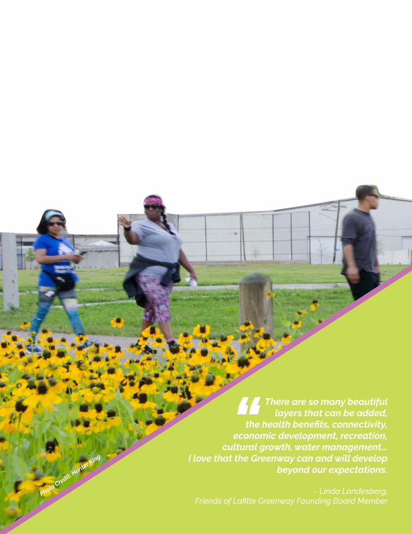
There are so many beautiful layers that can be added,
the health benefits, connectivity, economic development, recreation,
cultural growth, water management...I love that the Greenway can and will develop
beyond our expectations.
- Linda Landesberg, Friends of Lafitte Greenway Founding Board Member
“Photo Credit:
Hunter King

33
This guide provides a comprehensive set of planning and design principles for new development along the Lafitte Greenway. Community leadership and engagement have been at the center of the Greenway’s development, the principles outlined here are codified in the following public documents:• The City of New Orleans Master Plan for the 21st Century• The Comprehensive Zoning Ordinance (CZO) • The Lafitte Greenway Master Plan• The Lafitte Corridor Revitalization Plan
Developers, city officials, and community members should use this guide in combination with the above public documents to ensure successful and responsible development that honors the community’s vision and benefits the city as a whole.
YOUR GUIDE to Successful Development Along the Lafitte Greenway
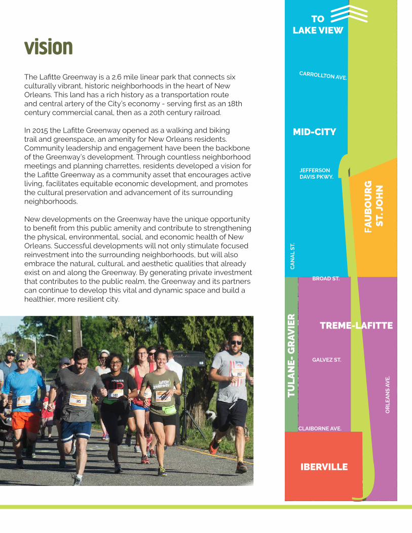
visionThe Lafitte Greenway is a 2.6 mile linear park that connects six culturally vibrant, historic neighborhoods in the heart of New Orleans. This land has a rich history as a transportation route and central artery of the City’s economy - serving first as an 18th century commercial canal, then as a 20th century railroad.
In 2015 the Lafitte Greenway opened as a walking and biking trail and greenspace, an amenity for New Orleans residents. Community leadership and engagement have been the backbone of the Greenway’s development. Through countless neighborhood meetings and planning charrettes, residents developed a vision for the Lafitte Greenway as a community asset that encourages active living, facilitates equitable economic development, and promotes the cultural preservation and advancement of its surrounding neighborhoods.
New developments on the Greenway have the unique opportunity to benefit from this public amenity and contribute to strengthening the physical, environmental, social, and economic health of New Orleans. Successful developments will not only stimulate focused reinvestment into the surrounding neighborhoods, but will also embrace the natural, cultural, and aesthetic qualities that already exist on and along the Greenway. By generating private investment that contributes to the public realm, the Greenway and its partners can continue to develop this vital and dynamic space and build a healthier, more resilient city.
IBERVILLE
MID-CITY
FAU
BO
UR
G S
T. J
OH
N
TO LAKE VIEW
TU
LA
NE
- G
RA
VIE
R
JEFFERSON DAVIS PKWY.
BROAD ST.
OR
LE
AN
S A
VE
.
CA
NA
L S
T.
GALVEZ ST.
CLAIBORNE AVE.
CARROLLTON AVE.
TREME-LAFITTE
55
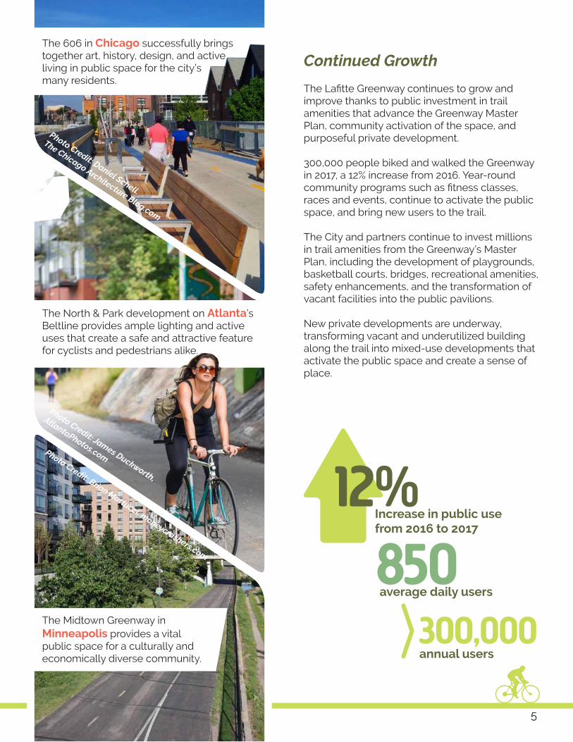
12% 850Increase in public use from 2016 to 2017
average daily users
300,000annual users
Photo Credit: Daniel Schell.
The Chicago Architecture Blog.com
Photo Credit: James Duckworth,
AtlantaPhotos.comPhoto Credit: Brian Martucci. moneycrashers.com
The Midtown Greenway in Minneapolis provides a vital public space for a culturally and economically diverse community.
The North & Park development on Atlanta’s Beltline provides ample lighting and active uses that create a safe and attractive feature for cyclists and pedestrians alike.
The Lafitte Greenway continues to grow and improve thanks to public investment in trail amenities that advance the Greenway Master Plan, community activation of the space, and purposeful private development.
300,000 people biked and walked the Greenway in 2017, a 12% increase from 2016. Year-round community programs such as fitness classes, races and events, continue to activate the public space, and bring new users to the trail.
The City and partners continue to invest millions in trail amenities from the Greenway’s Master Plan, including the development of playgrounds, basketball courts, bridges, recreational amenities, safety enhancements, and the transformation of vacant facilities into the public pavilions.
New private developments are underway, transforming vacant and underutilized building along the trail into mixed-use developments that activate the public space and create a sense of place.
Continued GrowthThe 606 in Chicago successfully brings together art, history, design, and active living in public space for the city’s many residents.
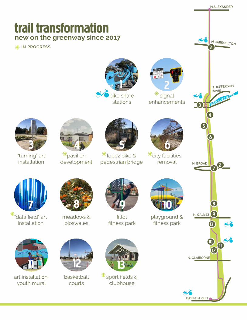
IN PROGRESS
new on the greenway since 2017
art installation: youth mural
11basketball
courts
12
meadows & bioswales
8fitlot
fitness park
9playground & fitness park
10
2signal
enhancements
“turning” art installation
3pavilion
development
4lopez bike &
pedestrian bridge
5 6city facilities
removal
trail transformation
BAYOU ST JOHN
N. CLAIBORNE
BASIN STREET
N ALEXANDER
N CARROLLTON
N. JEFFERSON
DAVIS
N. BROAD
N. GALVEZ
N ALEXANDER
13
2
3
4
5
6
7
8
9
1011
12
“data field” art installation
7
2
bike share stations
1
sport fields & clubhouse
13

77
central elements of high quality development
1. land use
2. site design
3. building design
principles of high quality development
Equity Support neighborhood reinvestment, affordability, and local economic development.
Active-Living Promote bikeable, walkable neighborhoods and provide non-motorized access to neighborhood amenities and open space.
Safety Increase safety on the Greenway and its surrounding neighborhoods, and provide connectivity to local schools.
Environmental Resilience Create green infrastructure and responsible stormwater management with aesthetically pleasing, low-impact design techniques.
Placemaking Create new open spaces and public art that incorporates the historical and cultural narrative of each neighborhood.
Community Involve the community in the planning, design, and implementation of new developments.
N. JEFFERSON
DAVIS

ZONING ADJACENT TO THE GREENWAY
High Intensity Mixed-UsedThe MU-2 District encourages walkable neighborhood centers and corridors conducive to transit, with a mix of residential and supportive commercial and office uses.
Greenway Corridor Design Overlay DistrictProperties adjacent to the Lafitte Greenway are subject to the GC Greenway Corridor Design Overlay District, which provides design review to activate the public edge along the Greenway, integrate pedestrian and bicycle amenities, and enhance the natural environment.
Historic Urban Multi-Family ResidentialThe HU-RM1 District provides for low to medium residential densities appropriate for a variety of housing types such as single-family, two-family, townhouse and lower density multi-family dwellings.
Historic Urban Neighborhood Mixed-UseThe HU-MU District encourages mixed-use development that is close to residential neighborhoods, including active retail and personal service uses along the ground floor with residential uses above.
Medium Intensity Mixed-UseThe MU-1 District encourages walkable neighborhood centers and corridors, with a mix of residential and commercial uses.
1. land useWhat was once an industrial corridor centered around a canal and railroad, is today a mixed-use, bike- and pedestrian-friendly corridor oriented to a central greenway. The Lafitte Greenway connects neighborhoods with differing architecture, density and land use types. New developments along the Greenway should knit these together, creating harmonious transitions between use and scale, and promote active transportation.
Images from City of New Orleans.czo.nola.gov

99
ZONING ADJACENT TO THE GREENWAY Equity / Building Community Prosperity
Following Hurricane Katrina, New Orleans has experienced rapid redevelopment and population shifts. These changes have brought significant challenges, including rising housing costs that outpace income growth and lack of equity in housing for different New Orleans populations.
Today, more than 60% of all New Orleans households are cost-burdened, paying one-third or more of their income towards housing expenses. Affordability challenges are exacerbated along the Lafitte Greenway, where public investment has spurred an increase in property values and housing costs. While home to some of the city’s largest investments in affordable housing, including redevelopment of Lafitte and Iberville public housing, demand for affordable units in neighborhoods along the Greenway continues to outpace supply. Greenway-adjacent neighborhoods have some of the highest proportions of cost-burdened renters in the City, and African American residents are disproportionately cost-burdened.
In order for New Orleans to evolve to meet the housing needs for a broad range of lifestyles, ages, and incomes while also retaining its traditions and distinctive way of life, there is need for substantial investment in high-quality, safe, and accessible housing that is affordable to individuals and families of all income levels.
Displacement Index Rating by NeighborhoodAll content on this page from HousingNOLA. Map: HousingNOLA, Aug. 2017
VIAVANT - VENETIAN ISLES
VILLAGE DE LEST
LITTLE WOODS
LAKE CATHERINE
NEW AURORA - ENGLISH TURN
CITY PARK
OLD AURORA
AUDUBON
READ BLVD EAST
MID-CITY
LAKEVIEW
DESIRE AREA
BEHRMAN
ST. ROCH
BYWATER
FILLMORE
TALL TIMBERS - BRECHTEL
DILLARD
LEONIDAS
CENTRAL CITY
PINES VILLAGE
ST. CLAUDE
MILAN
WEST RIVERSIDE
LOWER NINTH WARD
HOLY CROSS
SEVENTH WARD
UPTOWN
NAVARRE
WEST LAKE FOREST
GERT TOWN
LAKE TERRACE & OAKS
U.S. NAVAL BASE
MILNEBURGPLUM ORCHARD
FAIRGROUNDS
IRISH CHANNEL
READ BLVD WESTLAKESHORE - LAKE VISTA
McDONOGH
TOURO
GENTILLY WOODS
DIXON
MARIGNY
FRERET
LAKEWOOD
WEST END
WHITNEY
GENTILLY TERRACE
ST. ANTHONY
HOLLYGROVE
PONTCHARTRAIN PARK
BROADMOOR
LOWER GARDEN DISTRICT
TREME - LAFITTE
CENTRAL BUSINESS DISTRICT
TULANE - GRAVIERFRENCH QUARTER
BLACK PEARL
ALGIERS POINT
BAYOU ST. JOHN
B. W. COOPER
ST. THOMAS DEV
MARLYVILLE - FONTAINBLEAU
FLORIDA AREA
EAST CARROLLTON
ST. BERNARD AREA
EAST RIVERSIDE
FISCHER DEV
GARDEN DISTRICT
IBERVILLE
FLORIDA DEV
Displacement Index RatingTotal Score
Lowest (21)
Low (14)
Moderate (12)
High (13)
Highest (11)
Lafitte Greenway
HousingNOLA defines displacement as homeowners and renters being pushed out either due to displacement by neglect or involuntary displacement. Displacement by neglect is usually the result of substandard conditions. Involuntary displacement is associated with increasing rents, home prices, or other related causes such as property taxes, insurance, and utility expenses.

➔Setbacks & Open SpaceActivate the public space by orienting buildings and entrances to the Greenway. Create a welcoming transition between public and private realms and encourage attractive, active uses to expand the public realm.
SITE DESIGN GUIDELINES
This patio bar features ample bicycle parking and pedestrian access from the Greenway trail, creating an attractive and functional transition from public to private space.
2. site designDevelopment along the Greenway trail should advance the following key goals: expand and active public space, promote bike and pedestrian friendly design, and invest in responsible stormwater management.
Design to Encourage Active TransportationActive transportation is a means of getting around powered by human energy, such as biking and walking. Development along the Greenway should welcome and engage people on foot and on bicycles through site design: creating safe and convenient bicycle and pedestrian access and connections, orienting buildings to the trail, and providing ample bike parking. Some of the benefits are:• Reduces reliance on carbon-emitting motor vehicles• Promotes community health by expanding opportunities for
physical activity and exercise in daily living• Improves access to community amenities and resources
Bike Parking
ParkingLocate parking away from the Greenway’s edge, with ample bicycle parking, permeable paving, and tree cover that reduces heat-island effect.
Parkway Bakery has installed 72 new trees and permeable pavement in its parking lot to expand green space onto their historic site and manage stormwater on their property.
Permeable Paving
LightingIncrease aesthetics, safety, and security with lighting on site.
Trees, Plants & Seating Open Space
Lights
Photo Credit: Robert Becker

1111
Stormwater Management / Resiliency Best Practices
Every new development can and should bolster the Greenway’s capacity to hold and process stormwater and help ease the load on the city’s pumping system. Protecting against floodwaters and sinking land is essential to the lasting success of new developments and their physical environments. As the Greenway acts as a model for environmental resilience, new developers have the opportunity to expand sustainable practices into surrounding neighborhoods. Over time, the Greenway and its surrounding development could be a powerful and natural public utility for the long-term sustainability of the city.
The public and private sectors in New Orleans are increasingly taking “green” and resource-efficient approaches to development activities through investments in stormwater management, active transportation, and efficient buildings. New private and public enhancements featuring innovative practices in green enterprise, planning, and design continue to strengthen the resilience of the city’s landscape. As the nation’s attention turns increasingly to the economic, ecological and health benefits of more sustainable development and active lifestyles, New Orleans is poised to become a national leader in these trends.
LandscapingCreate desirable, functional, and safe environments for multiple users and incorporate stormwater management practices.
Bioswales & Rain Gardens
Green RoofsFrench Drains & DrywellsDisconnected Roofs, Recycling & Integration
Photo Credit: Jeff Loux, ucdesustainability.blogspot.com
Photo Credit: werf.orgPhoto Credit: greenroofs.org
Photo Credit: Robert Becker

2. site design
Respect the scale and massing of buildings in historic areas and provide pedestrian-scaled design elements. Promote pedestrian-scale signage, limit inappropriate signage, and create an attractive business environment along the Greenway.
3. building design
BUILDING DESIGN GUIDELINES
Rosedale’s patio, which faces the railway and surrounding green space, activates the public
space and embraces the neighborhood’s existing architecture. Activity on the greenway promotes
safety and placemaking.
Pedestrian-scale design encourages walking and biking in the area.
Design building facades to provide visual interest to facilitate access to the greenway, with articulations, materials, windows, and other openings. ●Ensure that infill buildings in neighborhoods respond to the architectural context.
The mixture of building types in the neighborhoods adjoining the Greenway reflects the diverse history of this area. The character of new development along the Greenway must be responsive to the residential scale of many of these neighborhoods. Cohesive building design is important in building an active, appropriately scaled edge for the public space of the Greenway. New developments should create an attractive environment and foster a vibrant sense of place.
Photo Credit: J.T. Blatty, The Advocate

1313
REFERENCES & RESOURCES
Find more information here on resources used throughout this guide:
City of New Orleans. City of New Orleans Comprehensive Zoning Ordinance (CZO), 2017
City of New Orleans. The Plan for the 21st Century (City of New Orleans Master Plan), 2010.
City of New Orleans. Lafitte Greenway Master Plan, May 2013.
City of New Orleans. Lafitte Corridor Revitalization Plan, Jan. 2013.
The mural at Lemann Pool, painted by volunteer community members, creates a sense of place and embodies the spirit of the community.
Photo Credit: Spencer Thayer
Photo Credit: Sophia Germer, The AdvocatePhoto Credit: Edmund D., npr.org
Photo Credit: neworleanscitybusiness.com
Photo Credit: J.T. Blatty, The Advocate

I enjoy being a part of something that I grew up in… The greenway really made this area come back
- Felix Rainey, Greenway Ambassador
It has transformed a once-blighted industrial corridor into an amenity for residents and businesses in the Treme and Mid-City neighborhoods, it’s already spurring commercial projects, and it holds rainwater during storms, reducing run-off and flooding. Recreation, economic stimulus and resilience: it perfectly fits our mission to recover safer, stronger and smarter than before.
- Pat Forbes, Executive Director of the State of Louisiana Office of Community Development
(FSNA Article) 2015
It also promises a vibrant space to live, shop, and grab a drink...the Lafitte Greenway has quickly become the central artery of New Orleans’ bike culture...
- CityLab, 2017
“““

1515
The Guide to Trail-Oriented Development is made possible thanks to support from Helene Lovett, Harrah’s New Orleans, and the New Orleans City Council Community Supports Grant.
A team of professional volunteers and community leaders generously shared their time and resources to create this guide. We offer sincere thanks to the volunteer members of the Trail-Oriented Development Steering Committee: Daniel Samuels, Ben Allen, Susannah Burley, Katie Fronek, Jack Greenwood, Nick Jenisch, Stosh Kozlowski, Andreanecia Morris, Jeffrey Schwartz, and Daniel Winkert; the staff of Friends of Lafitte Greenway - Nellie Catzen, Nicole Reeder, Meagan Riche, Polly Sawabini, and Sophie Harris Vorhoff.
Special thanks to Larry Massey and the New Orleans City Planning Commission team, Billy Fields, and Design Workshop.
Graphic Design by Concordia: Connor McManus & George Silvertooth
Acknowledgements
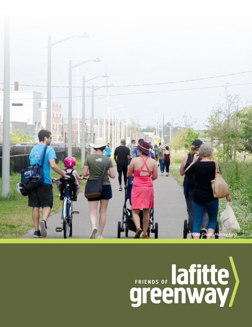
Photo Credit: Hunter King
Photo Credit: Hunter King