Guide to Oakland’s Creek Ordinance channel straightening, placement of concrete or retaining...
38
Guide to Oakland’s Creek Ordinance presented by:
-
Upload
nguyenkien -
Category
Documents
-
view
215 -
download
1
Transcript of Guide to Oakland’s Creek Ordinance channel straightening, placement of concrete or retaining...
Guide to Oakland’s Creek Ordinance
presented by:

Creek Protection, Storm Water Management and Discharge Control Ordinance, OMC 13.16
Purpose and Intent:• Safeguard, preserve, and restore creeks• Control sedimentation and erosion• Enhance beneficial uses of creeks• Protect infrastructure• Protect public health and safety• Improve water quality and prevent pollution
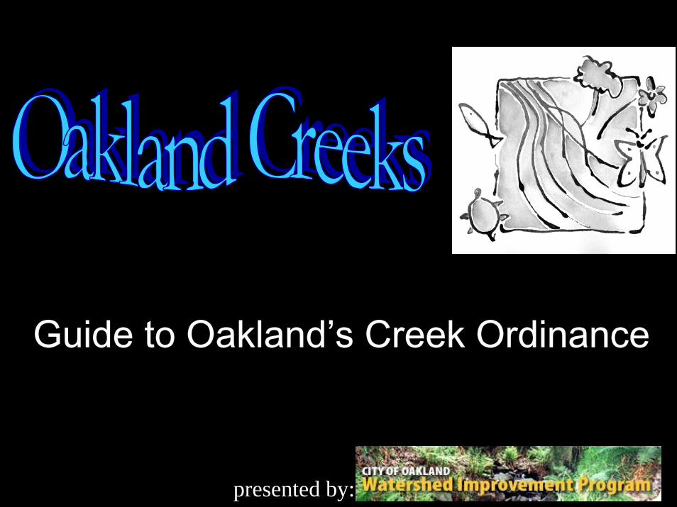
Creek basics:What is a Creek?
•Creeks are portions of the natural drainage network. They are channels that carry water along this network.
•Creek networks are interconnected systems that facilitate the exchange of water, sediment, nutrients, and wildlife.
•Creek networks have many forces (such as flowing water, plant roots, and underlying geology) that interact to create a relatively stable state and provide important functions.
•While occasional natural events (such as floods, earthquakes, orfires) will significantly alter creek networks, the many forces involved will then interact to create a new equilibrium of form and function.

Hydrologic CycleCreek basics:
water vapor
rainopenwater
surface flow/groundwater

WatershedCreek basics:
A watershed is a unit of land where all of the water that rains on or enters it drains out at the same point (A).
Point A
watershed boundary
Creek basics:
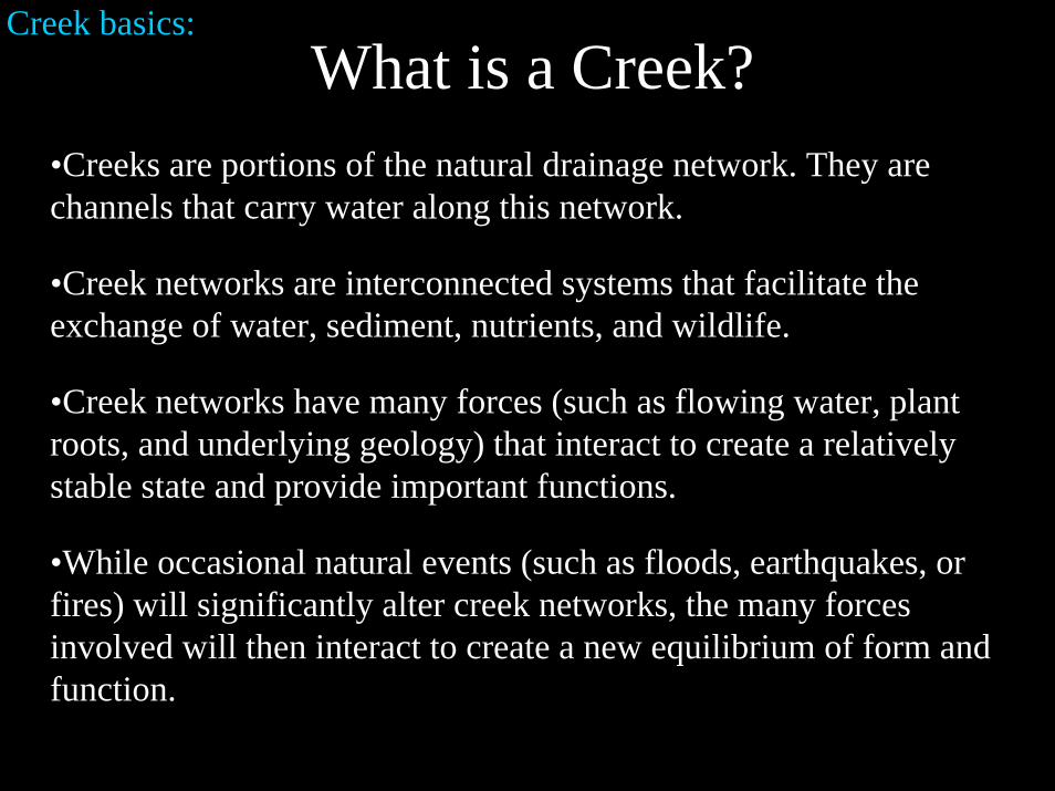
Drainage Pattern AlterationChanges to the drainage pattern of a watershed (such as increased impervious surfaces, culverts, channel straightening, placement of concrete or retaining structure in channels, etc.) can significantly alter the delicate equilibrium of the system.
Altered water flow can cause:• Incision: The downcutting of a creek bottom.• Headcutting: The upstream migration of incision.• Bank/Slope Instability: The removal of portions of the bank, resulting in land slides.• Erosion• Sedimentation • Flooding• Pollution• Property Damage• Unsafe Conditions• Blight
Storm drains and gutters carry polluted water to creeks and the BayHigh quality water flows from undisturbed land

Impact of Increased ImperviousnessCreek basics:40% evapotranspiration 38% evapotranspiration
10% runoff
20% runoff
55% runoff
35% evapotranspiration 30% evapotranspiration
30% runoff

Creek basics:
Impervious Surfaces Result in Higher Runoff Velocity of More Water
In urbanized watersheds,
•High impervious surface area results in reduced natural plant and soil uptake of water, and the speedy runoff of water from concrete and other impervious surfaces.
•This results in an increase in stormwater runoff volume over a shorter period of time.
•Since there is less water infiltrated into the soil, there is less groundwater seepage to creeks and the creeks dry up faster.
•Urbanization causes conditions of higher shorter duration flood flows with lower base flows.
•The impact of this change in flow characteristics include increased erosion and flooding, and decreased habitat value and vegetation survival.

Creek basics:Change in the Hydrograph

Downstream Effects of Upstream Development
5% Impervious Surface Coverage in the Watershed: This watershed has little impervious surface to alter drainage characteristics. Therefore the form of the channel has not been significantly altered.
20% Impervious Surface Coverage in the Watershed: Significant impervious surface area in this watershed has resulted in higher and faster peak flows which has in turn resulted in bank erosion and downcutting of the channel. This channel alteration will get worse as the channel will now contain higher, faster, more powerful flows than before, causing increased erosion anddowncutting, in a cycle of channel and property damage.
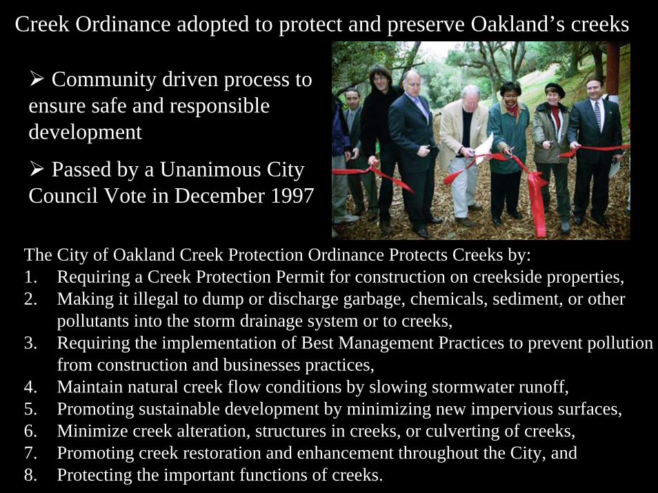
Creek Ordinance adopted to protect and preserve Oakland’s creeks
Community driven process to ensure safe and responsible development
Passed by a Unanimous City Council Vote in December 1997
The City of Oakland Creek Protection Ordinance Protects Creeks by:1. Requiring a Creek Protection Permit for construction on creekside properties,2. Making it illegal to dump or discharge garbage, chemicals, sediment, or other
pollutants into the storm drainage system or to creeks, 3. Requiring the implementation of Best Management Practices to prevent pollution
from construction and businesses practices,4. Maintain natural creek flow conditions by slowing stormwater runoff,5. Promoting sustainable development by minimizing new impervious surfaces,6. Minimize creek alteration, structures in creeks, or culverting of creeks,7. Promoting creek restoration and enhancement throughout the City, and8. Protecting the important functions of creeks.

Why are creeks important?Creeks provide numerous critical functions for plants, animals, and the environment in general. Some of the most important functions of creeks include:
• Improve Water Quality:Water is slowed and cleaned by plant uptake, infiltration into the soil, and other biological and chemical process in the riparian (creek) ecosystems.
• Provides Habitat:The interaction of so many diverse physical and biological elements make riparian ecosystems critical habitat areas for a large number of plant and animal species, including many endangered species.

Why are creeks important?• Community / Economic Benefit:Creeks are a resource for community development and interaction.Creeks also encourage economic activity though recreation and increased property values. Some communities, such as San Antonio Texas, have turned creek corridors into important commercial areas that draw tourism and development.
• Recreation / Aesthetics:Creeks are some of the most beautiful areas of the City acting as a vital recreational and aesthetic resource to the urban environment.
San Antonio’s Riverwalk

Why are creeks important?
• Flood Control:Undisturbed watersheds slow storm water through infiltration, plant uptake, storage areas, and turbulence, and then convey the water to the bay.
• Storm Water Conveyance:Creeks are natural storm drainage systems and are integrated with man-made culverts and channels to provide Oakland’s storm water drainage.
• Sediment:Undisturbed creeks balance erosion and sediment deposition.
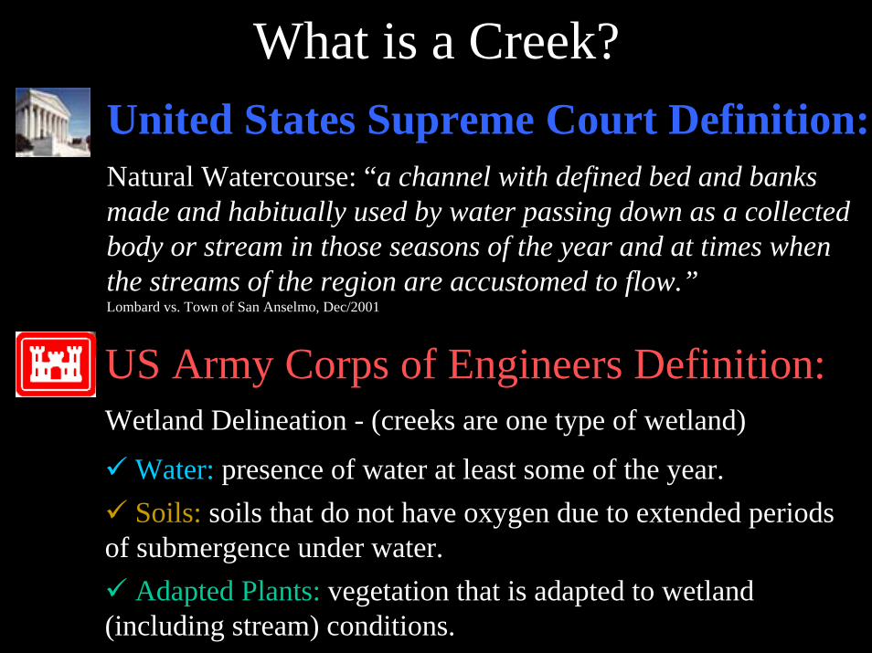
What is a Creek?
Natural Watercourse: “a channel with defined bed and banks made and habitually used by water passing down as a collected body or stream in those seasons of the year and at times when the streams of the region are accustomed to flow.”Lombard vs. Town of San Anselmo, Dec/2001
United States Supreme Court Definition:
US Army Corps of Engineers Definition:Wetland Delineation - (creeks are one type of wetland)
Water: presence of water at least some of the year.Soils: soils that do not have oxygen due to extended periods
of submergence under water.Adapted Plants: vegetation that is adapted to wetland
(including stream) conditions.

What is a Creek?Seminal Court Case (Locklin v. City of Lafayette (1994) 7 Cal. 4th 327)
“a channel with defined bed and banks made and habitually used by water passing down as a collected body or stream in those seasons of the year and at those times when the streams in the region are accustomed to flow. It is wholly different from a swale, hollow, or depression through which may pass surface waters in time of storm not collected into a defined stream. A canyon or ravine through which surface water runoff customarily flows in rainy seasons is a natural watercourse. Alterations to a naturalwatercourse, such as the construction of conduits or other improvements in the bed of the stream, do not affect its status as a natural watercourse. A natural watercourse includes all channels through which, in the existing condition of the country, the water naturally flows, and may include new channels created in the course of urban development through which waters presently flow. Once surface waters have become part of a stream in a watercourse, they are no longer recognized as surface waters.” (page 345)

What is a Creek?Oakland’s Definition:“A Creek is a watercourse that is a naturally occurring swale or depression, or engineered channel that carries fresh or estuarine water whether seasonally or year round…” OMC 13.16.030

Creek Identification:Creek
“... as identified on the watershed map...and as modified by the City and/or any area identified through field investigation by the Environmental Services Manager.”
Creekside properties: “are those properties located in Oakland, as identified by the Environmental Services Manager, as having a Creek or Riparian Corridor crossing the property and/or are contiguous to a Creek or Riparian Corridor.”
Creekside properties require a creek protection permit, administered through the City of Oakland Community and Economic Development Agency (CEDA) for any work done on the property.
NOT a Creek

Required Criteria:1) Part of a contiguous waterway: a creek must be hydrologically
connected upstream and/or downstream to a creek headwaters, waterway or waterbody. Creeks are often connected through underground culverts.
2) There is a bed (channel sides), bank (channel bottom), topography(‘U’ or ‘V’ shaped micro and/or macro) and signs of scour (signs of water induced sediment movement).
Indicators: common to creeks but not required• A riparian corridor: a line of denser vegetation, often adapted to be creekside,
adjacent to channel. • Bed material: Material at the bottom of the channel that differs from the
surrounding material, often sorted by size.• Man-made structures: Some structures common to waterways include bank
retaining walls, trash racks, culverts, inlets, bend in roads, etc.)
Criteria for Creek Determinations
Clarification Criteria Available in the Guide to Oakland’s Creek Ordinance

Creek Determinations
Bed
Bank
Topography
ConnectivityRiparian VegetationBed Material
CREEKSIDE

Examples of Creekside Properties

Examples of NOT-Creekside Properties

Impacts of Poorly Planned DevelopmentImperviousness
• Incision• Gully Formation• Bank Failure• Flooding• Erosion
Encroachment• Habitat Loss• Pollution

Impervious Surfaces –Result in Higher Total Runoff of More Water, More Quickly, and quicker reduction of peak flow to a lower base flow. These changes in the drainage pattern, causing more extreme flow characteristics, greatly destabilize creek form and function.

Incision and Bank Failure
This undermined bank in Oakland was a result of increased creek flow, due to increased impervious surfaces upstream, causing bank erosion and slope instability. This slope required a $1 Million publicly funded repair project.

Gully FormationConcentrated stormwater runoff from streets and developments cause the erosion of soil under the point of discharge of a stormdrain. Over time, this erosion removes the base of the slope causing gully formation, gully migration uphill, and slope instability.

Costs of Culverting• Lakeshore Culvert Retrofit: This 1 million dollar per block project is required because of increased flooding danger due to increased impervious surfaces in the watershed. The project will cause tremendous community and business disruption with limited potential for success.
• Lose Water Treatment & Habitat Value: When creeks and watersheds are covered up and culverted, in addition to downstream flooding and erosion problems, there is a loss of important plant and wildlife habitat, of water quality improvement benefits of natural riparian areas, and of beautiful areas for people to enjoy.

Flooding• Concentrated Peak Flows: All the water comes quicker.
• Culvert / Creek Capacity: Culvert size is insufficient with increased flows.
• Clogged Culverts: More soil and debris moved by higher flows.
The combination of increased storm water peak volume and the reduction of storm water drainage capacity in creeks and culverts (due to culverting impervious surfaces, erosion, sedimentation, and blockage) results in an increased frequency of damaging floods.

Encroachment• Concrete is Not Permanent: Engineered concrete structures are not permanent. The erosive forces in creeks eventually destroy concrete structures requiring expensive repairs.
• Undercutting: An example of downstream impact of a straightened concrete channel, and the impermanent nature of concrete repair structures in creeks.
•Causes Downstream Problems: Concrete structures increase creek water velocity resulting in increased downstream erosion.

Loss of HabitatRiparian corridors provide critical habitat functions that are often lost due to poorly planned development.
These pictures were taken from the same spot, one looking upstream and the other looking downstream. The riparian corridor and most of its aesthetic and habitat value have been lost in the picture on the left.

Creek Protection Permits
The Ordinance protects waterways in part through preventing poorly planned development by requiring a creek protection permit for work on creekside properties.
Criteria for Approval of Creekside Projects:• Be Consistent with the Intent & Purposes of the Ordinance • Not Discharge Pollutants (incl. dirt, pesticides, auto, etc.)• Not Modify Natural Flow or Volume of Water • Not Cause Erosion or Instability• Not Adversely Affect Creek Habitat• Not Degrade Aesthetic Value of Corridor • Not Endanger Anyone’s Property, Health, or Safety

How to DevelopSite Design• Smaller Footprints• Buffer / Setbacks
Storm Water Runoff• Minimize Pavement• Infiltration / Detention• Bioengineering• Energy Dissipaters
Habitat Quality• Clean Water• Plant Native Vegetation• Minimize Infrastructure Impact
Village Homes in Davis, CA

Site Design• Buffer / Setback: A protected corridor along creeks ensures the protection of property and the preservation of creek and riparian corridor stability and function.
• Smaller Footprints: Minimizing the increase of impervious surfaces maintains the natural drainage pattern in the area, making creek channels more stable, protecting water quality and habitat quality, and preventing downstream problems such as flooding.

Storm Water Runoff• Minimize Pavement / Impervious Surfaces: Thereby maximizing the area available for water to percolate into the ground, slowing it and cleaning it.
• Detention / Infiltration: Onsite slowing of water through holding it in a basin,through slow release from a basin, or by allowing it to percolate into the ground.
Pervious Pavement
Infiltration Trench
Cistern

BioengineeringUsing plants and other organic materials to strengthen and stabilize creek channels and slopes. These methods use growing plant material so that they get stronger over time. These techniques can provide sustainable solutions that do not cause downstream problems or impair creek functioning.
Slope Bioengineering
Branch Layering
Rock Weir

Habitat Quality• Native Vegetation: Provides critical habitat value and natural creek conditions. Native vegetation can also clean the water and provide fire safe landscaping
Biofiltration Swale
• Clean Water: Biofiltration swales and other techniques clean storm water through percolation in the soil and plant uptake before the water reaches the Estuary, lakes, or the Bay. In addition to creating a clean and safe environment, this is a requirement of local, state, and federal environmental regulation.

If you have any questions, call the Clean Water/ Creeks hotline at 510 238-6600
• Creeks in Oakland are a valued asset for open space and aesthetic value, habitat and water quality, storm drainage, and as part of our natural heritage.
• New development in Oakland can recognize the value of our creeks by preserving and enhancing them. Ultimately, this will improve environmental quality, increase property value, and preserve public health and safety.
Conclusions
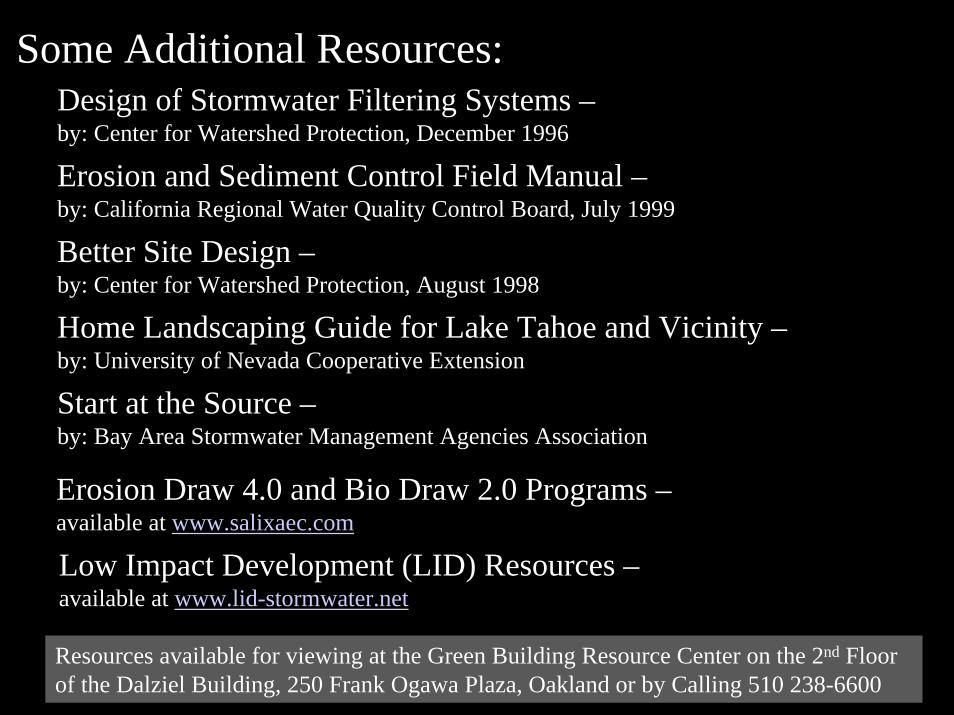
Some Additional Resources:Design of Stormwater Filtering Systems –by: Center for Watershed Protection, December 1996
Erosion and Sediment Control Field Manual –by: California Regional Water Quality Control Board, July 1999
Better Site Design –by: Center for Watershed Protection, August 1998
Home Landscaping Guide for Lake Tahoe and Vicinity –by: University of Nevada Cooperative Extension
Start at the Source –by: Bay Area Stormwater Management Agencies Association
Erosion Draw 4.0 and Bio Draw 2.0 Programs –available at www.salixaec.com
Low Impact Development (LID) Resources –available at www.lid-stormwater.net
Resources available for viewing at the Green Building Resource Center on the 2nd Floor of the Dalziel Building, 250 Frank Ogawa Plaza, Oakland or by Calling 510 238-6600