Ground Water: Water Flowing Underground. A Spring: Ground Water Becomes Surface Water.

GROUNDWATER & SURFACE WATER:UNDERSTANDING THE INTERACTION
A GUIDE FOR WATERSHED PARTNERSHIPS
SECOND EDITION

GROUNDWATER: A HIDDEN RESOURCE.INTRODUCTION.Water. It’s vital for all of us. We depend onits good quality—and quantity—for drink-ing, recreation, use in industry and growingcrops. It’s also vital to sustaining thenatural systems on and under the earth’ssurface.
Groundwater is a hidden resource. At onetime, its purity and availability were takenfor granted. Now, contamination andavailability are serious issues.
Some facts to consider...
Scientists estimate groundwateraccounts for more than 95% of allfresh water available for use.
Approximately 50% of Americansobtain all or part of their drinking waterfrom groundwater.
Nearly 95% of rural residents rely ongroundwater for their drinking supply.
About half of irrigated cropland usesgroundwater.
Approximately one third of industrialwater needs are fulfilled by usinggroundwater.
About 40% of river flow nationwide(on average) depends on groundwater.
Thus groundwater is a critical componentof management plans developed by anincreasing number of watershed partner-ships.
GROUNDWATER ABC’S.Groundwater is the water that saturatesthe tiny spaces between alluvial material(sand, gravel, silt, clay) or the crevices offractures in rocks. (See illustration ofgroundwater profile.)
Aeration zone: The zone above the watertable is known as the zone of aeration(unsaturated or vadose zone). Water in thesoil (in the ground but above the watertable) is referred to as soil moisture.Spaces between soil, gravel and rock arefilled with water (suspended) and air.
Aquifer: Most groundwater is found inaquifers—underground layers of porousrock saturated from above or from
structures sloping toward it. Aquifer
2

capacity is determined by the porosity ofsubsurface material and its area. Undermost of the United States, there are twomajor types of aquifers: confined andunconfined.
Capillary water: Just above the watertable, in the aeration zone, is capillarywater that moves upward from the watertable by capillary action. This water canmove slowly in any direction, from a wetparticle to a dry one. While most plantsrely on moisture from precipitation in theunsaturated zone, their roots may also tapinto capillary water or the saturated zone.
Confined aquifers: (also known asartesian or pressure aquifers) exist wherethe groundwater system is between layersof clay, dense rock, or other materials withvery low permeability.
Water in confined aquifers may be veryold, even millions of years old. This wateris under more pressure than water inunconfined aquifers. Thus, when tapped bya well, water is forced up, sometimesabove the soil surface. This is how aflowing artesian well is formed.
Evapotranspiration: Water returned tothe atmosphere by evaporation from waterand land surfaces, and by the activity ofliving plants.
Hydrologic cycle: Complete cycle throughwhich water passes from the atmosphereand, eventually, returns to the atmosphere(See illustration on page 4).
Impermeable: Having texture that doesnot permit water to move through quickly.
Infiltration: Movement of water intoand through soil.
Permeability: The capacity of rock orsoil to transmit fluid, usually water.
Saturation zone: The portion that’ssaturated with water is called the zoneof saturation. The upper surface of thiszone, open to atmospheric pressure, isknown as the water table (phreaticsurface).
Unconfined aquifers: More commonthan confined aquifers, unconfinedaquifers have a permeable deposit thatleads into the aquifert. Water may havearrived by percolating through the landsurface. This is why water in anunconfined aquifer is often very young,in geologic time. The top layer of theaquifer is also the water table. Thus, it’saffected by atmospheric pressure andchanging hydrologic conditions.
Vadose zone: The area of soil and rockjust above the water table.
Water-bearing rocks: Several types ofrocks can hold water, including...
Sedimentary deposits (i.e. sand andgravel),
Channels in carbonate rocks (i.e.limestone),
Lava tubes or cooling igneousfractures in igneous rocks,
Fractures in hard rocks.
3

THE HYDROLOGIC CYCLE.It’s crystal clear. Groundwater and surfacewater are fundamentally interconnected. Infact, it’s often difficult to separate the twobecause they ‘feed’ each other. This iswhy one can contaminate the other.
A CLOSER LOOK.To better understand the connection, take acloser look at the various zones andactions. A logical way to study this is byunderstanding how water recycles, thehydrologic (water) cycle. (See illustra-tion.)
As rain or snow fall to the earth’s surface: Some water runs off the land to rivers,
lakes, streams, and oceans (surfacewater).
Some water returns to the atmosphereby evaporation or transporation.
Some water infiltrates the soilwhere it can...- Be absorbed by plant roots, or- Continue to move down to become
groundwater, or- Move down and then sideways
(laterally) or backup (via capillaryaction) to become surface water
4
GROUND WATER ACCESSEDTHROUGH WELL
PLANT INTAKE
INFILTRATION
RUNOFF
TRANSPIRATION
CLOUDS FORMPRECIPITATION
through wells, natural springs,marshes, streams, etc.
Although its rate of movement varies,groundwater very slowly movestoward low areas (including streamsand lakes) where it is discharged.
Here it becomes surface water again. And, upon evaporation, it completes
the cycle.
This movement of water between the earthand the atmosphere through runoff andinfiltration, evaporation, transpiration, andprecipitation is continuous.
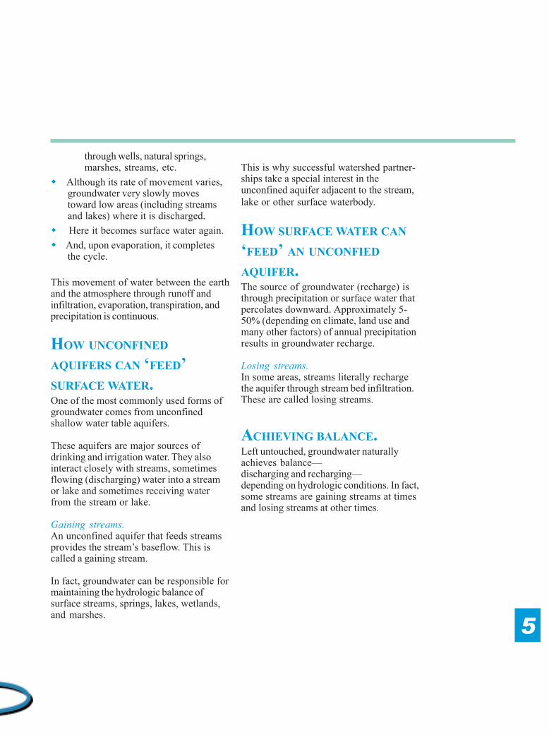
HOW UNCONFINED
AQUIFERS CAN ‘FEED’SURFACE WATER.One of the most commonly used forms ofgroundwater comes from unconfinedshallow water table aquifers.
These aquifers are major sources ofdrinking and irrigation water. They alsointeract closely with streams, sometimesflowing (discharging) water into a streamor lake and sometimes receiving waterfrom the stream or lake.
Gaining streams.An unconfined aquifer that feeds streamsprovides the stream’s baseflow. This iscalled a gaining stream.
In fact, groundwater can be responsible formaintaining the hydrologic balance ofsurface streams, springs, lakes, wetlands,and marshes.
This is why successful watershed partner-ships take a special interest in theunconfined aquifer adjacent to the stream,lake or other surface waterbody.
HOW SURFACE WATER CAN
‘FEED’ AN UNCONFIED
AQUIFER.The source of groundwater (recharge) isthrough precipitation or surface water thatpercolates downward. Approximately 5-50% (depending on climate, land use andmany other factors) of annual precipitationresults in groundwater recharge.
Losing streams.In some areas, streams literally rechargethe aquifer through stream bed infiltration.These are called losing streams.
ACHIEVING BALANCE.Left untouched, groundwater naturallyachieves balance—discharging and recharging—depending on hydrologic conditions. In fact,some streams are gaining streams at timesand losing streams at other times.
5
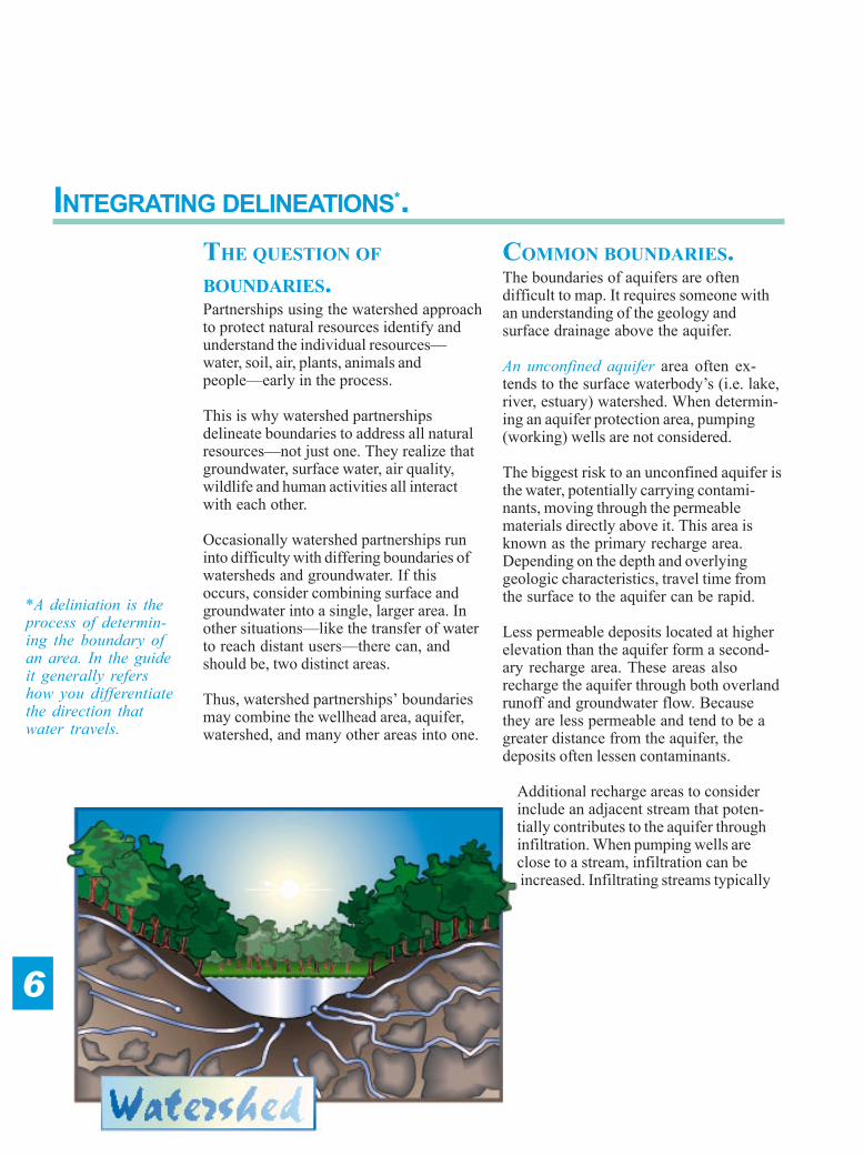
INTEGRATING DELINEATIONS*.THE QUESTION OF
BOUNDARIES.Partnerships using the watershed approachto protect natural resources identify andunderstand the individual resources—water, soil, air, plants, animals andpeople—early in the process.
This is why watershed partnershipsdelineate boundaries to address all naturalresources—not just one. They realize thatgroundwater, surface water, air quality,wildlife and human activities all interactwith each other.
Occasionally watershed partnerships runinto difficulty with differing boundaries ofwatersheds and groundwater. If thisoccurs, consider combining surface andgroundwater into a single, larger area. Inother situations—like the transfer of waterto reach distant users—there can, andshould be, two distinct areas.
Thus, watershed partnerships’ boundariesmay combine the wellhead area, aquifer,watershed, and many other areas into one.
COMMON BOUNDARIES.The boundaries of aquifers are oftendifficult to map. It requires someone withan understanding of the geology andsurface drainage above the aquifer.
An unconfined aquifer area often ex-tends to the surface waterbody’s (i.e. lake,river, estuary) watershed. When determin-ing an aquifer protection area, pumping(working) wells are not considered.
The biggest risk to an unconfined aquifer isthe water, potentially carrying contami-nants, moving through the permeablematerials directly above it. This area isknown as the primary recharge area.Depending on the depth and overlyinggeologic characteristics, travel time fromthe surface to the aquifer can be rapid.
Less permeable deposits located at higherelevation than the aquifer form a second-ary recharge area. These areas alsorecharge the aquifer through both overlandrunoff and groundwater flow. Becausethey are less permeable and tend to be agreater distance from the aquifer, thedeposits often lessen contaminants.
Additional recharge areas to considerinclude an adjacent stream that poten-tially contributes to the aquifer throughinfiltration. When pumping wells areclose to a stream, infiltration can beincreased. Infiltrating streams typically
6
*A deliniation is theprocess of determin-ing the boundary ofan area. In the guideit generally refershow you differentiatethe direction thatwater travels.

provide an aquifer with large quantities ofwater and a pathway for bacteria andviruses.
A confined aquifer area may be limited tothe outcrop of the aquifer unit and itsimmediate contributing area. This area mayactually be isolated from the location ofwater supply wells within the aquifer.Semi-confined aquifers may receivewater from both outcrop areas and overly-ing aquifers. Delineating the aquiferprotection area can be extensive andcomplex.
Sole-source aquifers are delineated basedon aquifer type—confined, semi-confinedor unconfined—and local geologic andhydrologic conditions. Defined as providinga minimum of 50% of the water used by itsusers, sole-source aquifers usually existonly where there are simply no viablealternative water sources.
Wellhead protection areas (also known aszone of contribution and contributing areas)are the surface and subsurface areassurrounding a well or field of wells (well-field), supplying a public water system.
The area is calculated by determining thedistance contaminants are reasonably likelyto move before reaching a well. Somecommon methods for determining thewellhead protection area include: Arbitrary fixed radius, Calculated fixed radius,
Simplified variable shapes,Analytical method,Numerical method,Hydrogeologic mapping.
When selecting the best method, consideravailable funds and the level of concern.Also be sure to consider the cone ofdepression and drawdown.
Surface waterbody watershed areashave been delineated through a simpleprocess of identifying the highest elevationsin land that drains to the surface waterbody(i.e. lake, pond, river, estuary, etc.). Water-sheds are in all shapes and sizes, rangingfrom just a few acres to several millionacres ... many smaller watersheds ‘nested’inside a larger watershed.
Most successful watershed partnershipswork with the smallest size feasible yetencompass all the different, but integrated,areas. This enables faster measurableprogress and stronger ties between stake-holders and thewaterbodies theiractions affect ...positively or nega-tively.
7
WHO MAPSWATERSHEDS?The larger sizes—ranging fromthe entire Missouri or Ohio RiverBasins—to three nested stepssmaller are mapped by U.S.Geologic Survey (USGS).
Even smaller areas, like a creek’sor small lake’s watershed, havebeen deliniated and catalogued inmany states. The State Geologi-cal Survey, USDA NaturalResources Conservation Service,USDI Fish & Wildlife Service,and USDI Bureau of Reclama-tion are all agencies that mayhave mapped these. Call yourlocal office for details.

QUANTITY.To meet demands of a growing populationand other uses, an increased amount ofgroundwater has been used. Some typicalthreats to water quantity include overdraft,drawdown, and subsidence.
Overdraft occurs when groundwater isremoved faster than recharge can replaceit. This can result in... A permanent loss of a portion of its
storage capacity. A gradual change that can cause
water of unusable quality to contaminategood water. In coastal basins, salt water intrusion
can occur.
Generally, any withdrawal in excess ofsafe yield (theamount that canbe withdrawnwithout producingan undesirableresult) is anoverdraft.
Drawdowndiffers signifi-cantly fromoverdraft.Results in atemporarilylowered watertable generallycaused bypumping. In this
situation, water table recovers when supplyis replenished.
Subsidence (sinkhole) is one dramaticresult from overpumping. As the watertable declines, water pressure is reduced.This causes fine materials that held waterto become compacted. In addition topermanently reducing storage capacity,land above the aquifer can sink ... from afew inches to several feet.
QUALITY.Inorganic compounds, pathogens andorganic compounds can negatively affectwater quality. Scientists continually learnabout contaminants, sources, and preven-tion practices.
Inorganic Compounds include all com-pounds that do not containing carbon.Nutrients (nitrogen and phosphorus) andheavy metals are two examples. Nitrates can cause problems in
drinking water or marine waters. Phosphorus can reduce uses of fresh
surface waters. Heavy metals include selenium,
arsenic, iron, manganese, cadmium andchromium and others.
Various levels of some inorganic com-pounds, like iron, manganese, arsenic,nitrogen, and phosphorus, occur naturally.Therefore, naturally occuring levels mustbe considered when addressing thesecompounds.
Pathogens including bacteria and viruses,have been attributed for more than 50% ofthe waterborne disease outbreaks in theU.S. Cryptosporidium parvum andGiardia both commonly cause illnesseswhen consumed.
THREATS TO GROUNDWATER.
8
WHAT’S A WATER USE?
The Clean Water Act defines water uses for
groundwater, surface waters, and wetlands as
fishable, swimmable, drinkable, capable of
supporting recreation, etc.
But what does that mean in ‘real’ terms?
Each state defines standards for these uses and
specifies water use(s) for individual
waterbodies. For example, while most rivers are
assigned to be used for fishing, a few river
sections are assigned to be used for drinking
water.
The same is true for groundwater. Uses are
defined and standards identified. A few ground-
water uses and corresponding standards are:
Groundwater Use Water Standards
Drinking water Meet MCL for pollutants
(Quality)
Industrial process Quality & quantity criteria vary
Stream baseflow Discharge quantity & quality
criteria vary
Note: For most water uses both quality and
quantity are important.

Organic Compounds include VolatileOrganic Compounds (VOCs) like benzene,toluene, xylene, etc.; and Semi-VolatileOrganic Compounds (SVOCs) likenapthaline and phenol; PCB’s and pesti-cides.
POTENTIAL SOURCES.Point sources are easily identified. Ex-amples: sewage treatment plants, largeinjection wells, certain industrial plants,certain livestock facilities, landfills, andothers. They are regulated by the statewater quality agency and the EPA, and areissued a National Pollutant DischargeElimination System (NPDES) permit whenthey meet regulations.
Point sources established generations agoare often ‘grandfathered’ into compliancewith some areas of the law. Hence, youmay find some point sources located inwhat would now be considered an inappro-priate location.
Nonpoint sources refer to widespread,seemingly insignificant amounts of con-taminates which, cumulatively, threatenwater quality. Examples: septic systems,road drainage, agricultural runoff, lawnfertilizers, underground fuel storage tanks,and small businesses.Most are not required to have a permit.Individually, each may not be a seriousthreat, but together they may be a signifi-cant threat.
Petroleum stored in underground stor-age systems is one of the greatest threatsto groundwater quality. Although a largenumber of systems have been removed orupgraded, a significant number remain.
Septic system tanks, where separation ofsolids and liquids takes place, allow liquids
(effluent) to flow through the leach field.While the leach field removes somecontaminants, a few can remain. Theseinclude nitrogen, phosphorus, sodium,chloride, VOC’s, and pathogens. Whenconcentrations are very high, groundwatercontamination can occur.
Agricultural pest, nutrient and manuremanagement practices can also threatengroundwater quality. Potential contamina-tion depends on the type, method, amount,and timing of application, soil qualities, andhydrologic conditions. Using managementpractices can dramatically reduce risk ofcontamination.
Large and small industries and busi-nesses like dry cleaners and automotiverepair shops can also threaten groundwaterwith a widevariety ofpotentiallycontaminatingsubstances.
9
POTENTIAL CONTAMINANTSOURCES
Potential PotentialSource ContaminantSalting practices & storage ChloridesSnow dumping ChloridesAgricultural fertilizers NitratesManure handling Nitrates, pathogensHome fertilizer NitratesSeptic systems Nitrates, pathogensUrban landscapes Hydrocarbons,
pesticides, pathogensAgricultural dealers Hydrocarbons,pesticides,nitratesAgricultural feedlots Nitrates, pathogensSolid waste landfills Hazardous materialsIndustrial uses RCRA ‘C’ Hazardous materialsIndustrial uses RCRA ‘D’ Hazardous materialsSmall quantity generators Hazardous materialsHouseholds Hazardous materialsGas stations HydrocarbonsAuto repair shops HydrocarbonsRecycling facilities HydrocarbonsAuto salvage yards HydrocarbonsUnderground storage tanks HydrocarbonsIndustrial floor drains HydrocarbonsInjection wells HydrocarbonsJunkyards Hydrocarbons

THE WATERSHED APPROACH.A quick review of key components of thelocal, voluntary watershed approach toprotecting natural resources will help youevaluate groundwater management ap-proaches and how they may be used inyour particular situation.
Key watershed management approachcomponents include: All natural resources—soil, water, air,
plants, animals, and people—includinggroundwater are assessed andaddressed by stakeholders.
Measurable objectives—based on localenvironmental, economic and socialgoals—are developed by stakeholders.
Solutions are identified andimplementation strategies are agreedupon by stakeholders.
Implementation is carried out by thestakeholders.
Some of these activities, as they pertain togroundwater, are described in this guide.For example: Boundary delineation is typically part
of assessment. The discussion of uses (current and
future) is part of setting goals. Contaminant information is part of
assessment, goal setting and solutionidentification.
Understanding various tools is part ofidentifying and implementing solutions.
GROUNDWATER PROGRAMS.Over the past 20 years many federal andstate programs have been developed toimprove management of groundwater.
Four of the most useful can also easily beincorporated into your watershed plan.These include: Comprehensive State Groundwater
Protection Program, Sole Source Aquifer Program, Source Water Protection Program, Wellhead Protection Program.
These programs can be used in a compli-mentary fashion to manage all resources,including groundwater, for multiple uses—ranging from human consumption toindustrial processes to maintaining thehydrologic regime (geologic structure as iteffects the travel of water) and ecologicalintegrity of a wetland.
Comprehensive State GroundwaterProtection Program is a statewide pro-gram that looks at groundwater’s uses (inaddition to drinking water use) to considerthe role of groundwater in sustaining thehealth of surface waterbodies (rivers,streams, wetlands, marshes).
The Sole Source Aquifer Program,Source Water Protection Program, andWellhead Protection Program all areintended to protect a drinking water supply.The programs generally are compatiblewith the Comprehensive State Ground-water Protection Program, but are appliedto very defined geographic areas... Sole Source Aquifer Program applies
to the aquifer boundaries. Source Water Protection Program
applies to watersheds that drain into awaterbody used as a drinking watersource (reservoirs, intake areas, etc.).
Wellhead Protection Program appliesto defined wellhead areas.
MANAGEMENT APPROACHES.
10

11
SPECIAL ISSUES.Although groundwater programs are often used within the water-shed framework, there are some problematic issues that may ariseas you attempt to completely integrate them.These issues have been listed below simply to make you aware ofthem. Each is best addressed through cooperation and consensus.
Water quality use designations often do not reflect the presenceof groundwater intakes for drinking water. Water quality criteria and drinking water maximum contaminantlevels (MCLs) often are not consistent in terms of chemicalspecific values and parameters. Minor dischargers and permitted management measures underthe NPDES program may not sufficiently reduce the risk tomaking a significant impact to drinking water intakes. Where agriculture activities are reducing drinking water quality,changes in management practices may take a long time to resultin water quality improvements. Source water areas for groundwater drinking supplies (wellheadareas) generally do not coincide with surface water drainageareas. Long-term drinking water treatment may be necessary forcertain public water supply systems because of the nature ofthe contaminant sources and the size of the contributing area.

There are many, many tools that can beused to manage groundwater resources.Although your partnership may not use anyof them, they will help start discussion overviable options.
Zoning: Regulations used to segregatedifferent, and possibly conflicting, activitiesinto different areas of a community. Thisapproach can be limited in its ability toprotect groundwater due to grandfatheringprovisions.
Overlay Water Resource ProtectionDistricts: These ordinances and bylawsare similar to zoning regulations in theirgoals of defining the resource by mappingzones of contributing boundaries andenacting specific legislation for land usesand development within these boundaries.
Prohibition of Some Land Uses: Theseare not typically considered very creativetools. However, prohibition of land usessuch as gas stations, sewage treatmentplants, landfills, or the use/storage/transportof toxic materials is a first step towards thedevelopment of a comprehensive ground-water protection strategy.
Special Permitting: The special permittingprocess can be used to regulate uses andstructures that may potentially degradewater and land quality.
Large Lot Zoning: Large lot zoning seeksto limit groundwater resource degradationby reducing the number of buildings andseptic systems within a groundwaterprotection area.
Eliminating Septic Systems: By extend-ing or developing a community sewagetreatment system, septic system problemscan be reduced.
Transfer of Development Rights: Agovernment entity prepares a plan that
MANAGEMENT TOOLS.
12
Groundwater Protection Tools
Technique ToolZoning Overlay Groundwater protection
Districts Prohibit Various Land UsesSpecial PermittingLarge Lot ZoningTransfer of Development Rights
Cluster/PUD DesignGrowth Controls/TimingPerformance StandardsGeographic Information Systems
Overlay WetlandsIdentify Local Wellhead Protection Areas
Subdivision Drainage Requirements
Control Growth Management in Sensitive Areas
Health Underground Fuel Storage Systems
Regulations Small Sewage Treatment Plants
Septic Cleaner BansSeptic System UpgradesToxic & Hazardous Material Regulations
Private Well Protection
Voluntary Sale or Donation
Restrictions Conservation EasementsLimited Development
Other MonitoringNonregulatory Contingency Plans
Hazardous Waste CollectionPublic EducationLand Banking

designates land parcels from which devel-opment rights can be transferred to otherareas. This allows land uses to be pro-tected (i.e. for a gas station) while assuringthat these uses are outside sensitive areas.
Growth Control/Timing: Growth controlsare used to slow or guide a community’sgrowth, ideally in concert with its ability tosupport growth. One important componentis in regards to groundwater’s carryingcapacity.
Performance Standards: This assumesthat any given resource has a threshold,beyond which it deteriorates to an unac-ceptable level. Performance standardsassume that most uses are allowable in adesignated area, provided that the use oruses do not and will not overload theresource. With performance standards, it isimportant to establish critical thresholdlimits as the bottom line for acceptability.
Underground Storage Tanks: Threeadditional protection measures are oftenadopted to enhance local water resourceprotection, include: Prohibit new residential underground
storage tanks, Remove existing residential
underground storage tanks, and Prohibit all new underground storage
tank installation in groundwater andsurface water management areas.
Septic System Maintenance: Septicsystem maintenance is frequently over-looked. Many times, the system will not
13
function properly, causing “breakout” ofsolids at the surface. This can lead tobacterial contamination. In addition, whensystems fail, any additives used canbecome contaminants.
Land Donations:Land owners areoften in the positionof being able todonate some land tothe community or toa local land trust.
ConservationEasements: Conser-vation easementsallow for a limitedright to use the land.Easements caneffectively protectcritical lands fromdevelopment.
Purchase Lands:Many communitiespurchase selectedparcels of land thatare deemed signifi-cant for resourceprotection.
Well Construction/Closure Standards: Adirect conduit to groundwater, standardsfor new well construction as well asidentification and closure of abandonedwells can make a big difference.
Groundwater Management Practices
Purpose Management Practices
Groundwater Impervious area
recharge restrictionsArtificial wetlandsGrass lined channelsImpoundment structures(ponds)Subsurface drains (tiles)Infiltration trenchesNative tree and shrub plantings
Pollutant Buffer stripsreduction Filter strips
Riparian zones
Pollution Soil nitrate testing
prevention Integrated pest managementManure testingVariable rate applicationsAbandoned well closure

GROUNDWATER IQ QUIZ ANSWERS.
14
ANSWERS.1. d. All of the aboveAlthough most movement is lateral (sideways), it can move straight up or down. You see, groundwatersimply follows the path of least resistance by moving from higher pressure zones to lower pressure zones.2. d. Feet per yearGroundwater movement is usually measured in feet per year. This is why a pollutant that enters groundwaterrequires many years before it purifies itself or before it’s carried to a monitored well.3. a. Feet per secondWater flow in streams/rivers is measured in feet per second.4. d. Size of materialsCoarse materials like sand and gravel allow water to move rapidly. (They also form excellent aquifersbecause of their holding capacity.) In contrast, fine-grained materials, like clay or shale, are very difficult forwater to move through. Thus, water moves very, very slowly in these materials.5. a. YesWater table elevations often fluctuate because of recharge and discharge variations. They generally peak inthe winter and spring due to recharge from rains and snow melt. Throughout the summer the water tablecommonly declines due to evaporation; uptake by plants (transpiration); increased public us; industrial use;and crop, golf course and lawn irrigation. Elevations commonly reach their lowest point in early fall.
TEST YOUR GROUNDWATER IQ.1. Which way(s) can groundwater move?
a. Upb. Downc. Sidewayd. All of the above
2. How is the speed of groundwater movement measured?a. Feet per dayb. Feet per weekc. Feet per monthd. Feet per year
3. How is stream flow usually measured?a. Feet per secondb. Feet per minutec. Feet per hourd. Yards per hour
4. What determines how fast groundwater moves?a. Temperatureb. Air pressurec. Depth of water tabled. Size of materials
5. Can the water table elevation change often?a. Yesb. No

SOURCES OF INFORMATION.
15
To start down the road toward an effective local watershed partnership, you may wantto read some of these other guides from the Conservation Technology InformationCenter by calling 765-494-9555. A $2.00 fee is charged to cover postage and handling.
Getting to Know Your Watershed Building Local Partnerships Putting Together a Watershed Plan Water Monitoring: The Basics Reflecting on Lakes Wetlands: A Key Link in Watershed Management Leading & Communicating Managing Conflict State & Regional Watershed Contacts/NPS Directory
OTHER SOURCES.The author acknowledges some of the following sources of information were used indeveloping this guide. You may also find these publications helpful, too. There may befees for some publications.
Layperson’s Guide to Ground Water, 1993, Water Education Foundation, 717 K Street, Ste 517,Sacramento, CA 95814.A Primer on Ground Water, US Geological Survey Open-File Reports Section, Federal Center, Box25425, Denver, CO 80225.Citizen’s Guide to Ground Water Protection, April 1990, EPA 440/6-90-004, U.S. EPA Office ofWater, RC-4100, 401 M Street SW, Washington, DC 20460. Order from NCEPI, 11029 Kenwood Rd,Bldg 5, Cincinnati, OH 45242. Fax: 513-489-8695.Managing Ground Water Contamination Sources in Wellhead Protection Areas: A PrioritySetting Approach, October 1991, EPA 570/9-91-023, U.S. EPA, RC-4100, 401 M Street SW, Wash-ington, DC 20460. Order from NCEPI, 11029 Kenwood Rd, Bldg 5, Cincinnati, OH 45242. Fax:513-489-8695.National Assessment of Contaminated Ground Water Discharge to Surface Water, April 1991,U.S. EPA Office of Water, 401 M Street SW, Washington, DC 20460. Order from NCEPI, 11029Kenwood Rd, Bldg 5, Cincinnati, OH 45242. Fax: 513-489-8695.A Review of Methods for Assessing Nonpoint Source Contaminated Ground Water Dischargeto Surface Water, EPA 21T-1002, U.S. EPA, RC-4100, 401 M Street SW, Washington, DC 20460.Order from NCEPI, 11029 Kenwood Rd, Bldg 5, Cincinnati, OH 45242. Fax: 513-489-8695.National Water Quality Inventory: 1996 Report to Congress, April 1998. EPA 841-F-97-003. U.S.EPA Office of Water, 401 M Street SW, Washington, DC 20460. Order from NCEPI, 11029 KenwoodRd, Bldg 5, Cincinnati, OH 45242. Fax: 513-489-8695.Groundwater: Protecting Wisconsin’s Buried Treasure;Wisconsin Department of Natural Resources, Tel: 608-267-7375
For additional assistance...Contact your...Local or state water quality agencyState lake associationLocal natural resources agencyLocal conservation districtLocal extension officeLocal water utility

Bridget ChardCass County (MN)
Tom DavenportEPA, Region 5, Water Division
Nancy GarlitzUSDA Natural Resources Conservation Service
Susan KaynorEnvironmental Consultant
Frank SagonaTennessee Valley Authority
Susan SeacrestThe Groundwater Foundation
ABOUT THIS GUIDE...
Because the characteristics of eachwatershed are unique; you may wish toselect and use the portions of this guidethat are applicable to your particularsituation.
This guide is one of a series of guides forpeople who want to organize a localpartnership to protect their watershed. Theseries is designed to provide guidance forgoing through the process of building avoluntary partnership, developing a water-shed management plan and implementingthat plan.
The series of guides will not solve all yourproblems and will not replace the collective
minds of partners who, together,represent of those with a stake in yourwatershed and the technical adviceavailable through local governmentagencies.
Although this series is written forwatershed-based planning, the ideasand process can be used for developingother types of plans (such as wildlifeareas) to match the concerns of thepartnership. Regardless of the area,remember a long-term, integratedperspective — based on a systematic,scientific assessment — can be used toaddress more than one concern at atime.
SPECIAL THANKS...
The Know Your Watershed campaign is coordinated by the ConservationTechnology Information Center (CTIC), a nonprofit public/private partnershipdedicated to the advancement of environmentally beneficial and economically
viable natural resource systems. It provides information and dataabout agricultural and natural resource management systems,practices and technologies. The center was established in 1982under the charter of the National Association of ConservationDistricts.
Special thanks to Nancy Phillips, Environ-mental Consultant, who dedicated longhours to writing this guide.
Illustrations were provided by StephanAdduci, Sudio d’addici, Los Galos, Califor-nia.
Special thanks also to the following profes-sionals (below) who carefully reviewed thisguide. Their experience and thoughtfulguidance enriched it. Their time and insightis deeply appreciated.
Conserv. Tech. Info.Center1220 Potter Dr Rm 170W Lafayette IN 47906Tel: 765 494-9555Fax: 765 [email protected]://ctic.purdue.edu/kyw/kyw.html
John SimonsEPA, Office of Groundwater & Drinking Water
Perri Standish-LeeBrown and Caldwell
Ceceilia StetsonMinnesota Pollution Control Agency
Joan WarrenEPA, Office of Wetlands,Oceans & Watersheds
Darlene VogelCounty of Erie (NY)