GRADE 12 SEPTEMBER 2017 GEOGRAPHY P1 MARKING GUIDELINE
15
NATIONAL SENIOR CERTIFICATE GRADE 12 SEPTEMBER 2017 GEOGRAPHY P1 MARKING GUIDELINE MARKS: 225 This marking guideline consists of 15 pages.
Transcript of GRADE 12 SEPTEMBER 2017 GEOGRAPHY P1 MARKING GUIDELINE
NATIONAL SENIOR CERTIFICATE
GRADE 12
SEPTEMBER 2017
GEOGRAPHY P1 MARKING GUIDELINE
MARKS: 225
This marking guideline consists of 15 pages.
2 GEOGRAPHY P1 (EC/SEPTEMBER 2017)
Copyright reserved Please turn over
SECTION A: CLIMATE, WEATHER AND GEOMORPHOLOGY QUESTION 1 1.1 1.1.1 C (off shore) 1.1.2 D (1012) 1.1.3 B
1.1.4 A (Winter) 1.1.5 D (southwest) 1.1.6 B (weaker) 1.1.7 C (southeast) (7 x 1) (7) 1.2 1.2.1 Confluence 1.2.2 Interfluve 1.2.3 Water table 1.2.4 River system 1.2.5 Watershed 1.2.6 Abstraction 1.2.7 Stream orders 1.2.8 Infiltration (8 x 1) (8) 1.3 1.3.1 Warm moist air.
Ocean temperatures above 26,5 °C. (2 x 1) (2) 1.3.2 (a) A – Eye B – Eye wall (2 x 1) (2) (b) The air is descending at A, and rising/ascending at B.
(1 x 2) (2) (c) A – High pressure in the upper layers of the atmosphere is
causing some of the air to descend. B – Convergence of air on the surface because of low
pressure is forcing the air to rise. (2 x 1) (2)
(EC/SEPTEMBER 2017) GEOGRAPHY P1 3
Copyright reserved Please turn over
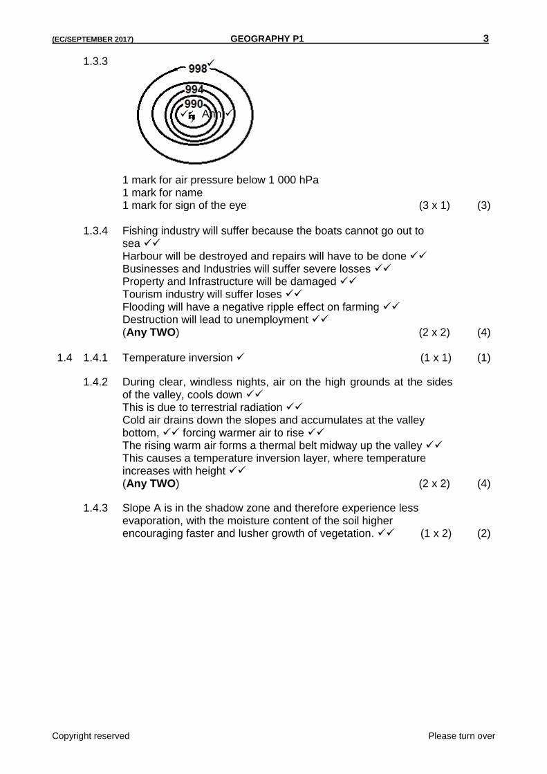
1.3.3
1 mark for air pressure below 1 000 hPa 1 mark for name 1 mark for sign of the eye (3 x 1) (3)
1.3.4 Fishing industry will suffer because the boats cannot go out to
sea Harbour will be destroyed and repairs will have to be done Businesses and Industries will suffer severe losses Property and Infrastructure will be damaged Tourism industry will suffer loses Flooding will have a negative ripple effect on farming Destruction will lead to unemployment (Any TWO) (2 x 2) (4)
1.4 1.4.1 Temperature inversion (1 x 1) (1)
1.4.2 During clear, windless nights, air on the high grounds at the sides of the valley, cools down This is due to terrestrial radiation Cold air drains down the slopes and accumulates at the valley bottom, forcing warmer air to rise The rising warm air forms a thermal belt midway up the valley This causes a temperature inversion layer, where temperature increases with height (Any TWO) (2 x 2) (4)
1.4.3 Slope A is in the shadow zone and therefore experience less evaporation, with the moisture content of the soil higher encouraging faster and lusher growth of vegetation. (1 x 2) (2)
Ann
4 GEOGRAPHY P1 (EC/SEPTEMBER 2017)
Copyright reserved Please turn over
1.4.4 Reasons for the temperature at B Sunrays strike the area more slanted/obliquely, therefore less heating during the day Larger area to be heated Sunrays penetrates a denser atmospheric layer causing more heat to be absorbed or dispersed, before it reaches the slope, therefore less heating Katabatic flow during the night causes cold air to accumulate on the valley floor Temperatures drop to below freezing point (0 °C) Influence on crops Oranges are frost resistant, therefore they are grown on the valley floor where cold air accumulates (Any FOUR – BOTH REASONS FOR TEMPERATURE AND INFLUENCE ON CROPS MUST BE MENTIONED.) (4 x 2) (8)
1.5 1.5.1 The manner in which the streams are arranged in a particular drainage
basin. (Concept) (1 x 1) (1)
1.5.2 A – Rectangular B – Trellis (2 x 1) (2) 1.5.3 A – The mainstream and its tributaries have right angled bends B – The mainstream flows in a valley area and the tributaries join the
mainstream at right angles from a high lying area. (2 x 2) (4) 1.5.4 Developed due to underlying horizontally layered igneous rocks which
has cracked or jointed. The cracks and joints are exposed to erosion, and the water from stream/river will flow/incise along the cracks and joints. (2 x 2) (4)
1.5.5 A – Hard resistant rocks are causing less channels to be eroded
and fewer streams in the basin will result in low density. B – Softer less resistant rocks can easily be eroded as a result
more channels are created for stream flow and higher drainage density is the result. (2 x 2) (4)
(EC/SEPTEMBER 2017) GEOGRAPHY P1 5
Copyright reserved Please turn over
1.6 1.6.1 Upper course (1 x 1) (1) 1.6.2 Narrow (1 x 1) (1) 1.6.3 (a) Turbulent (1 x 1) (1) (b) Resistant layer or outcrop is dipping upstream.
The bedrock upstream and downstream is less resistant and is easily eroded, exposing the outcrop. The slope created on the more resistant bedrock is causing the stream water to flow faster.
(Any TWO) (2 x 2) (4) 1.6.4 In the upper course of the river, there will be downward erosion and
deep, V-shaped valleys occurs. Temporary base levels of erosion like rapids and waterfalls will be eroded away through headward erosion. In the middle course lateral erosion dominates. This will widen the river valley and will remove the remaining spurs and other high lying areas. The lower course is dominated by deposition. The area is relatively flat in the lower course and this gentle gradient is maintained through deposition. (Any FOUR) (4 x 2) (8)
[75]
6 GEOGRAPHY P1 (EC/SEPTEMBER 2017)
Copyright reserved Please turn over
QUESTION 2 2.1 2.1.1 B to A 2.1.2 B 2.1.3 A 2.1.4 A 2.1.5 B 2.1.6 A 2.1.7 B 2.1.8 A (8 x 1) (8) 2.2 2.2.1 Laminar 2.2.2 Turbulent 2.2.3 Turbulent 2.2.4 Laminar 2.2.5 Turbulent 2.2.6 Turbulent 2.2.7 Laminar (7 x 1) (7) 2.3 2.3.1 Winter (1 x 1) (1) 2.3.2 Mid-latitudes are low pressure systems (1 x 1) (1) 2.3.3 From Friday to Monday heavy rain and cold conditions are
forecasted. As one mid latitude cyclone moves away from Cape Town another approaches This results in continuous frontal conditions. (Any TWO) (2 x 2) (4)
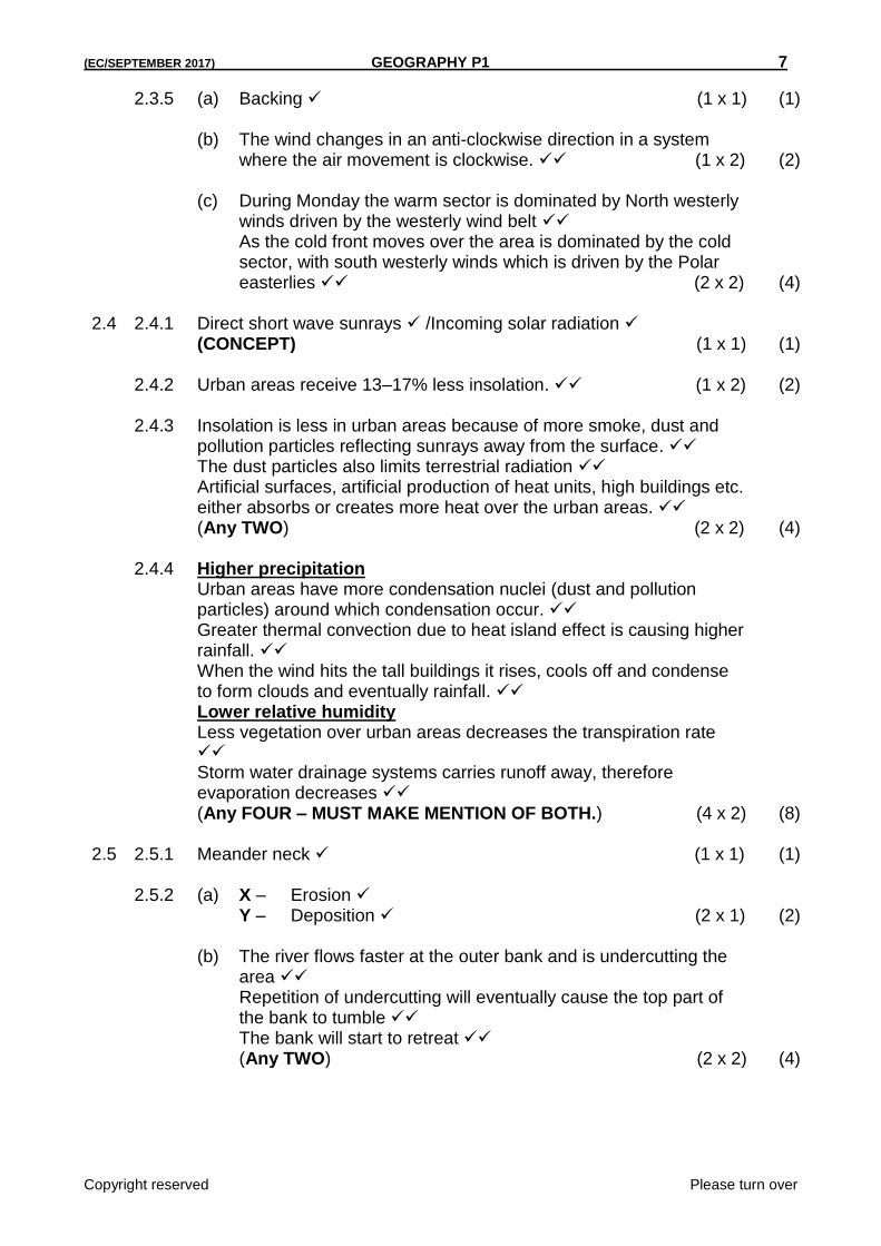
2.3.4
(2 x 1) (2)
(Any ONE)
(EC/SEPTEMBER 2017) GEOGRAPHY P1 7
Copyright reserved Please turn over
2.3.5 (a) Backing (1 x 1) (1) (b) The wind changes in an anti-clockwise direction in a system
where the air movement is clockwise. (1 x 2) (2) (c) During Monday the warm sector is dominated by North westerly
winds driven by the westerly wind belt As the cold front moves over the area is dominated by the cold sector, with south westerly winds which is driven by the Polar easterlies (2 x 2) (4)
2.4 2.4.1 Direct short wave sunrays /Incoming solar radiation
(CONCEPT) (1 x 1) (1) 2.4.2 Urban areas receive 13–17% less insolation. (1 x 2) (2) 2.4.3 Insolation is less in urban areas because of more smoke, dust and
pollution particles reflecting sunrays away from the surface. The dust particles also limits terrestrial radiation Artificial surfaces, artificial production of heat units, high buildings etc. either absorbs or creates more heat over the urban areas. (Any TWO) (2 x 2) (4)
2.4.4 Higher precipitation
Urban areas have more condensation nuclei (dust and pollution particles) around which condensation occur. Greater thermal convection due to heat island effect is causing higher rainfall. When the wind hits the tall buildings it rises, cools off and condense to form clouds and eventually rainfall. Lower relative humidity Less vegetation over urban areas decreases the transpiration rate Storm water drainage systems carries runoff away, therefore evaporation decreases (Any FOUR – MUST MAKE MENTION OF BOTH.) (4 x 2) (8)
2.5 2.5.1 Meander neck (1 x 1) (1) 2.5.2 (a) X – Erosion Y – Deposition (2 x 1) (2) (b) The river flows faster at the outer bank and is undercutting the
area Repetition of undercutting will eventually cause the top part of the bank to tumble The bank will start to retreat (Any TWO) (2 x 2) (4)
8 GEOGRAPHY P1 (EC/SEPTEMBER 2017)
Copyright reserved Please turn over
2.5.3 The river bend in STAGE 2 is very pronounced reducing the speed of the river, hence causing water to build-up because of the delay and will eventually overflow. A straighter channel in STAGE 4 will increase the speed of the river, therefore no accumulation of water takes place. (2 x 2) (4)
2.5.4 During heavy rainfall periods or flooding the river will cut through the
neck of the meander. Deposition next to the bank will eventually block off the meander completely. (2 x 2) (4)
2.6 2.6.1 A – Wind gap B – Elbow of capture (2 x 1) (2) 2.6.2 (a) Watershed (1 x 1) (1) (b) Due to headward erosion the watershed will be removed or
lowered River at D will eventually cut through the watershed due to headward erosion (Any ONE) (1 x 2) (2)
2.6.3 Transport routes can be constructed through the gap in the
mountain, which was the result of river capture. This will shorten the distance to either side of the mountain. (1 x 2) (2)
2.6.4 The environment will be negatively affected
Biodiversity will be destroyed Aquatic life will be reduced or will totally disappear Ecosystems disturbed Natural habitats will be destroyed The river will eventually dry up if extensive periods of low rainfall occur The water table will be lowered (Any FOUR) (4 x 2) (8)
[75]
(EC/SEPTEMBER 2017) GEOGRAPHY P1 9
Copyright reserved Please turn over
QUESTION 3
3.1 3.1.1 Ribbon development
3.1.2 CBD
3.1.3 Regional shopping centre
3.1.4 Isolated shops
3.1.5 CBD
3.1.6 Outlying business centre
3.1.7 Neighbourhood shopping centre (7 x 1) (7)
3.2 3.2.1 Gross Domestic Product
3.2.2 Informal sector
3.2.3 Beneficiation
3.2.4 Footloose
3.2.5 Import replacement
3.2.6 Food security
3.2.7 Decentralisation
3.2.8 Foreign Exchange (8 x 1) (8)
3.3 3.3.1 It is unifunctional because primary economic activities dominate (1 x 1) (1)
3.3.2 Isolated / Dispersed (1 x 1) (1)
3.3.3 Relief Hilly and mountainous areas influenced the isolated pattern. Water availability When water is readily and easy available it encourages dispersed settlements. (2 x 2) (4)
3.3.4 Its extensive because a large area is being used for farming AND ANY ONE OF COMMERCIAL
It is commercial because outbuildings for the storage of either equipment or products can be identified It is commercial because the farm area is divided into camps to reduce soil erosion [LEARNERS MUST REFER TO BOTH ASPECTS TO OBTAIN MAXIMUM MARKS.] (2 x 2) (4)
3.3.5 Farmer can use his machinery extensively The farmer does not need to share any of his equipment The farmer’s land is not fragmented The farmer decides on his own how he want to manage the farm Makes his own decisions (Any TWO) (2 x 2) (4)
10 GEOGRAPHY P1 (EC/SEPTEMBER 2017)
Copyright reserved Please turn over
3.4 3.4.1 It is a situation on the public roads that occurs because of more vehicles than the road can handle. (Concept) (1 x 1) (1)
3.4.2 Separation between residence and workplace Commuter population Overconcentration of activities in the CBD of cities Outdated street plan and pattern Rapid urbanisation Rural-urban migration (Any TWO) (2 x 1) (2)
3.4.3 If people used public transport it would decrease traffic congestion
The driver expects others to use public transport when he himself is not (1 x 2) (2)
3.4.4 (a) Road rage / Frustration / Anger
(ANY NEGATIVE EMOTION) (1 x 1) (1) (b) Health problems like heart attacks, respiratory problems etc. may
occur. Because of frustration more accidents may happen Conflict between drivers may result in violence
(Any ONE) (1 x 2) (2) 3.4.5 Building of ring roads around the congested area
Synchronised robots One way streets Subsidise public transport so that more people are encouraged to use it Designated lanes for busses and other public transport services to encourage faster travelling Use of flexitime for businesses to encourage different start and closing times to regulate the in- and outflow of traffic in the CBD Encourage lift clubs
Park and ride schemes (Any FOUR) (4 x 2) (8)
3.5 3.5.1 (a) 2014 (1 x 1) (1) (b) Construction (1 x 1) (1)
3.5.2 (a) Decrease (1 x 1) (1) (b) 1,8% (1 x 1) (1) (c) Negative growth rate because both the primary and secondary
sectors experienced a huge (14%) negative growth rate compared to the 1,1% positive growth rate of the tertiary sector (2 x 2) (4)
(EC/SEPTEMBER 2017) GEOGRAPHY P1 11
Copyright reserved Please turn over
3.5.3 There might have been more imports than exports Exports decreased because of decrease in primary and secondary production (Any ONE) (1 x 2) (2)
3.5.4 Food prices will increase and will affect the poorest the most Increased unemployment because of job losses directly linked to agriculture (2 x 2) (4)
3.6 3.6.1 Rooibos tea (1 x 1) (1) 3.6.2 (a) Koeberg nuclear power plant (1 x 1) (1) (b) Cheaper electricity is available if the industry is stationed near
Koeberg Decreases production costs of goods Koeberg’s nuclear energy provides alternative energy as coal generated energy is expensive (Any ONE) (1 x 2) (2)
3.6.3 The cold Benguela current is causing upwelling, bringing nutrients to
the water surface Increases phytoplankton and zooplankton which attracts larger fish Fishing flourishes because of this upwelling Huge shoals pass along the Cape coast (Any TWO) (2 x 2) (4)
3.6.4 There is a lack or shortage of minerals
The region is very far from the power stations of Mpumalanga, making electricity very expensive despite Koeberg being in the region
Initial slow development caused lack of job opportunities for the fast growing population
High transport costs and the large distance to the Gauteng market places disadvantages the SW Cape compared to the other industrial regions
The availability of fresh water can become a problem in the future The region has not attracted new industries because salaries are generally lower, and the buying power of the growing population is reduced Large, flat industrial sites are limited close to Cape Town, and therefore land is expensive Many of the sites set aside for industrial use have been taken over by informal settlements (Any FOUR) (4 x 2) (8)
[75]
12 GEOGRAPHY P1 (EC/SEPTEMBER 2017)
Copyright reserved Please turn over
QUESTION 4 4.1 4.1.1 F (Specialisation) 4.1.2 K (Rural depopulation) 4.1.3 J (Rural-urban migration) 4.1.4 E (Mechanisation) 4.1.5 G (Market orientated) 4.1.6 H (Push factors) 4.1.7 A (Fragmentation) 4.1.8 C (Consolidation) (8 x 1) (8) 4.2 4.2.1 A 4.2.2 B 4.2.3 A 4.2.4 A 4.2.5 B 4.2.6 B 4.2.7 A (7 x 1) (7) 4.3 4.3.1 The process of compensating people for the land they lost due to
forced removals (Concept) (1 x 1) (1)
4.3.2 To redress the injustices of apartheid
For national reconciliation and stability To promote economic growth To alleviate poverty (Any TWO) (2 x 1) (2)
4.3.3 Beneficiaries have been neglected by the government
The people lack support to start ploughing The people do not have the finances (3 x 1) (3)
4.3.4 People were given land simply to redress the injustices of past
policies, but no support to generate income and make an adequate and meaningful living (1 x 2) (2)
(EC/SEPTEMBER 2017) GEOGRAPHY P1 13
Copyright reserved Please turn over
4.3.5 Provide financial assistance to make sure that farmers can buy the basic equipment Have workshops and training services available to make sure that the skills in farming and business management is on par Help the farmers understand how the labour policies should be implemented The development of local community forums so that the community can discuss how land should be developed and maintained Provision of proper infrastructure like roads, electricity, computer literacy etc. Government/NGO support (Any FOUR) (4 x 2) (8)
4.4 4.4.1 Rural-urban fringe (1 x 1) (1) 4.4.2 Area in the photo has mixed functions of rural and urban (1 x 1) (1) 4.4.3 Land is cheaper
There is more space for further expansion Factory will be near to raw materials Close to labour force Close to transport networks (Any TWO) (2 x 1) (2)
4.4.4 The market is nearby so transport costs of products will
decrease The farmer has the advantages of the urban services, without paying for it Demand/competition for land increases the land value (Any TWO) (2 x 2) (4)
4.4.5 Rural areas and life will be destroyed and could result in a decrease
in food production Biodiversity and aesthetic appeal will be destroyed The balance of climatic conditions may be destroyed Informal settlements may develop, which can increase the social and economic problems in the area To prevent neighbouring towns from merging into one another To preserve the special character of historic rural life (Any THREE) (3 x 2) (6)
4.5 4.5.1 When raw materials are being transformed into finished goods on a
large scale/Add value to an article (Concept) (1 x 1) (1)
4.5.2 Secondary sector (1 x 1) (1) 4.5.3 Employment creation
Economic empowerment (Any ONE) (1 x 1) (1)
14 GEOGRAPHY P1 (EC/SEPTEMBER 2017)
Copyright reserved Please turn over
4.5.4 Upgrading of skills and knowledge in the production of manufactured goods More beneficiation of raw materials improving the quality of manufactured goods Foreign exchange can be earned Creation of higher paid employment opportunities (Any TWO) (2 x 2) (4)
4.5.5 Labour supply South Africa consists of a very large unschooled labour force, with very few entrepreneurs Production per worker in South Africa is very low Strikes and stay away actions for higher wages and salaries hinders production International competition South Africa finds it very difficult to compete against countries like China, which produces low cost products South Africa in some instances has had to implement trade restrictions in order to protect local markets, which hinders trade relationships (Any FOUR)
[LEARNER MUST MENTION AT LEAST ONE FACT FROM LABOUR SUPPLY OR INTERNATIONAL COMPETITION.] (4 x 2) (8)
4.6 4.6.1 It is an integrated network of infrastructure within a geographical area designated to stimulate economic development and growth (Concept) (1 x 1) (1)
4.6.2 Swaziland (1 x 1) (1)
4.6.3 Maputo is the nearest export harbour to Johannesburg To strengthen relationships between South Africa and Mozambique (Any ONE) (1 x 1) (1)
4.6.4 The upgrading of infrastructure made it easier to visit major tourist destinations along the corridor (1 x 2) (2)
4.6.5 To rehabilitate the core infrastructure along the corridor To maximise investment with the corridor area To ensure development in previously disadvantaged communities To promote sustainable job creation for people living in underdeveloped areas along the corridor [Any THREE] (3 x 2) (6)

(EC/SEPTEMBER 2017) GEOGRAPHY P1 15
Copyright reserved Please turn over
4.6.6 A large bulk of the coal mined in Mpumalanga is exported to the Maputo harbour The corridor passes through vast primary and industrial production areas Mpumalanga has many international tourist destinations through which the corridor passes The largest national conservation area, the National Kruger Park can also be found along the corridor (Any TWO) (2 x 2) (4)
[75] GRAND TOTAL: 225