Global Observation of Forest and Land Cover...
27
Global Observation of Forest and Land Cover Dynamics GOFC-GOLD Activities & Recommended Practices for Land Cover/Forest Cover Change Assessment Brice Mora SCERIN-4 Capacity Building Workshop Zvolen, Slovakia, July 19-22, 2016
Transcript of Global Observation of Forest and Land Cover...

Global Observation of Forest and Land Cover Dynamics
GOFC-GOLD
Activities
&
Recommended
Practices for Land
Cover/Forest Cover
Change Assessment
Brice Mora SCERIN-4 Capacity Building Workshop
Zvolen, Slovakia, July 19-22, 2016

What is GOFC-GOLD?
• Developed in 1997, originally under the Committee on Earth
Observation Satellites (CEOS):
- To improve use of Earth Observation data to address
major problems of global concern
- To improve coordination of national programs
- To improve co-operation between providers and users of
Earth Observation data for regional and global
applications
• Has become one of the Panels of the Global Terrestrial
Observing System GTOS (FAO GTOS Secretariat)
- Helping to address the Carbon Theme of the IGOS
Partners
• Sponsors: FAO, WMO, UNEP, UNESCO, ICSU, EC-JRC, ESA,
NASA, USGS, CSA, CFS

Background to GOFC-GOLD
1. RedLatiF – Latin America
2. SAFNET – Southern. Africa
3. Miombo – Southern Africa
4. OSFAC – Central Africa
5. WARN – West Africa
6. SEARRIN – S.E. Asia
7. NERIN – Northern Eurasia
8. CARIN – Central Asia
9. SCERIN – S.Central Europe.
10. SARIN – South Asia
11. BARIN – Baltic-Arctic
GTOS
User Outreach
Science and
Technical Board
GOFC-GOLD
Executive Committee Project Office
Implementation
Teams
- Land Cover
- Fire
Partnerships e.g. UNISDR WFAG;
CEOS WGCV
Global Strategies &
Frameworks e.g. GEOSS, GCOS IP
Regional
Networks
Working Groups
- REDD
- Biomass

Global Observation of Forest and Land Cover Dynamics
Development of in
situ Reference
Network for Land
Cover

Available Land Cover Reference Datasets on GOFC-
GOLD Portal
www.gofcgold.wur.nl/sites/gofcgold_refdataportal.php
GLC 2000
GlobCover 2005
STEP
VIIRS
GLCNMO 2008
Urban Dataset

Global Observation of Forest and Land Cover Dynamics
Land cover Products
at Moderate
Resolutions

Land Cover Products at Moderate Resolutions
• Users requirements
• New LC concept
• Efficient prototype system
• 4 major products
MERIS FR & RR 7-day composites
SR time series from 2003 to 2012
3 LC state products
for the 2000, 2005 and 2010 epochs
Global open permanent WB map
Snow
occurrence
VGT
greenness
BA
occurrence 3 LC condition products
Data access:
http://maps.elie.ucl.ac.be/CCI
/viewer/index.html

Copernicus Global Land Service - Land Cover
• Provides a series of bio-geophysical products at global
scale at mid and low spatial resolution since 2013
• Land cover is included as one of the variables in the
Copernicus Global Land Operations (C-GLOPS) project
(2016-2019).
C-GLOPS- Land Cover • Annual Global land cover map from 2015 onwards -initially
Africa
• 100 m resolution Proba-V data
• Build upon knowledge and data available
• Engaging users and addressing their needs
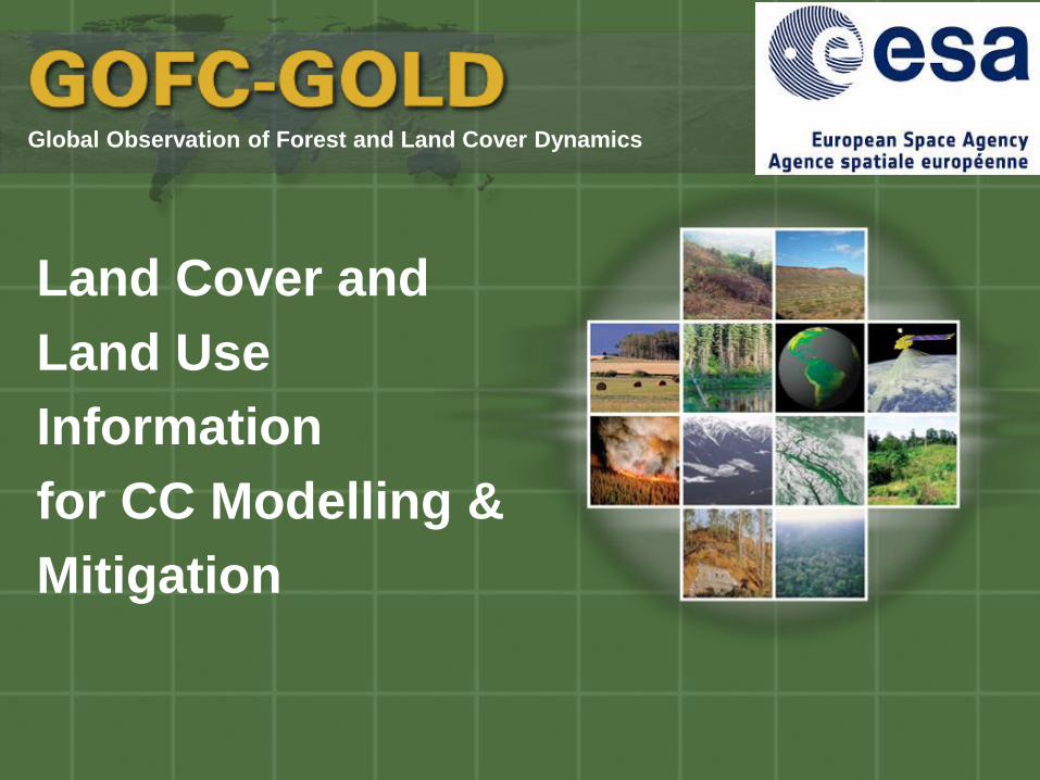
Global Observation of Forest and Land Cover Dynamics
Land Cover and
Land Use
Information
for CC Modelling &
Mitigation

Starting the dialog between observation and
mitigation community
Representatives from UNFCCC,
FAO, IPCC, ICRAF, ESA, etc.
Focus on Land-based mitigation
(land use and land management)
ECVs in the context of mitigation
Users and data requirements
Recommendations and actions
Workshop website:
http://www.wmo.int/pages/prog/gcos/index.p
hp?name=ObservationsforMitigation

Land use following
deforestation 1990-
2005
Area (1000 ha) % Smallholder crop 12123 18.8 Commercial crop 4326 6.7 Tree crop 5584 8.7 Pasture 27305 42.3 Mixed agriculture 404 0.6 Total Agricult. 49781 77.1 Infrastructure 2210 3.4 Other land use 11230 17.4 Water 1073 1.7 Unknown 200 0.3 Total other 14748 22.9 Total 64529 100.0
De Sy et al., 2015, ERL (LA)
Using JRC TREES III and FAO remote
sensing survey data
(preliminary)
Land Use Change
after Deforestation

Global Observation of Forest and Land Cover Dynamics
Biodiversity
Monitoring
in Tropical Forests

UNCBD COP 13
SOURCEBOOK
A SOURCEBOOK OF METHODS AND PROCEDURES FOR
MONITORING ESSENTIAL BIODIVERSITY VARIABLES IN
TROPICAL FORESTS WITH REMOTE SENSING

Global Observation of Forest and Land Cover Dynamics
Recommended
Practices for Land
Cover/Forest Cover
Change Assessment
Credits:
Pontus Olofsson, Boston U.,
Ronald McRoberts, US Forest Service
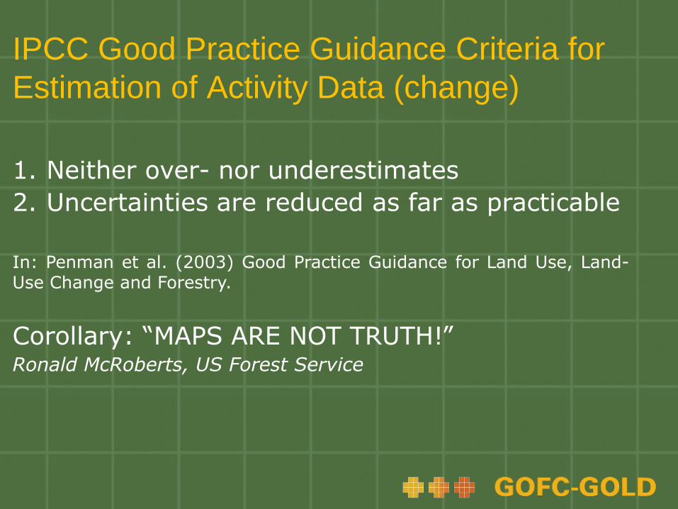
IPCC Good Practice Guidance Criteria for
Estimation of Activity Data (change)
1. Neither over- nor underestimates
2. Uncertainties are reduced as far as practicable
In: Penman et al. (2003) Good Practice Guidance for Land Use, Land-Use Change and Forestry.
Corollary: “MAPS ARE NOT TRUTH!” Ronald McRoberts, US Forest Service

Estimation of Activity Data (change)
• To find change, compare images, not maps
• Frequently magnitude of change less than cumulative
error of individual map products.
• Use time-series whenever possible: allows capture of
forest growth cycles
• Reference data necessary to compensate for
classification errors in map data
• Stratified random sampling useful for rare classes

Reference Data
• Greater accuracy than map data
- Ground data (e.g., NFI plot data)
- Finer resolution remotely sensed data
- More careful classification of remotely sensed
data
- Use of additional data sources
• Acquired using a probability sampling design
- Simple random sample
- Stratified random sample
- Systematic sample

Estimation of Activity Data for Forest to
Non-Forest Conversion
• Construct a forest/non-forest change map
• Use map classes to define four strata
- Deforestation
- Forest gain
- Stable forest
- Stable non-forest
• Collect reference data in the form of change observations
- Stratified random sampling
- Greater sampling intensity for Deforestation stratum

Reference
Map
Estimation of Activity Data for Forest to
Non-Forest Conversion
Source: Penman et al. (2016)
in map Pixel counts

Map
Estimation of Activity Data for Forest to
Non-Forest Conversion
Cochran, 1977: Eq. 5.52
Area
proportions

= 0.0259 * 10,000 000 pixels = 258,933 = 23,304 ha
Cochran, 1977: Eq. 5.57
Estimation of Activity Data for Forest to
Non-Forest Conversion
Area estimate:
Estimate from map: 200,000 pixels, i.e., 18,000 ha
=> underestimation of 58,933 pixels, i.e., 5,303 ha
Confidence intervals (95%):

Estimation of Activity Data for Forest to
Non-Forest Conversion
Confidence interval calculation (Cochran’s Eq. 5.57):
= 0.0048 * 10,000 000 = 48,000
48,000 * 1,96 = 94,08 pixels = 8,467 ha
0.0048

Deforestation class: Estimated area: 23,304 ha.
“I am 95% confident that the true area estimate for the deforestation
class is comprised between 14,755 ha and 31,853 ha.”
Estimation of Activity Data for Forest to
Non-Forest Conversion

Take-home Messages
• IPCC Good Practice Guidance criteria
- neither over- nor underestimates
- uncertainties are reduced as far as practicable
• Because map data are subject to error, estimates
based on map data alone do not satisfy IPCC GPG
criteria
• Reference data necessary to adjust map-based
estimates for classification error
- of greater quality than map data
- acquired using probability sampling design
References • Cochran W.G. (1977) Sampling techniques, 3rd Edition.
• New York: Wiley. 428 p.
• McRoberts & Walters. (2014). Remote Sensing of
Environment 124: 394-401.
• Sannier et al. (2014). Remote Sensing of Environment
151: 138-148.
• Næsset et al. (2016). Remote Sensing of Environment
175: 282-300.
• Olofsson et al. (2014). Remote Sensing of Environment
148: 42–57.
• Penman et al. (2016). Methods and Guidance Document,
ed 2.0. Chapters 4 & 5.
• Sannier et al. (2016). Remote Sensing of Environment
173: 326-338.

References • McRoberts et al. (2016). Canadian Journal of Forest
Research 46: 924-932.
Online http://beeoda.org/
developed by Pontus Olofsson et al., Boston U.

Follow us:
Twitter: @gofcgold_lc
Facebook: www.facebook.com/gofcgold.lc.po
Newsletter: www.gofcgold.wur.nl