GIS for Transportation Corridor Planning
14
GIS for Transportation Corridor Planning West Corridor
-
Upload
olga-mathews -
Category
Documents
-
view
55 -
download
0
description
GIS for Transportation Corridor Planning. West Corridor. Zach Van Gemert Born and Raised in Denver, CO. Education in Land Use/GIS Employed at RTD for 11+ years Systems support for Call-n-Ride, GIS, INIT, Ridecheck Plus, Trapeze. Regional Transportation District ( ). - PowerPoint PPT Presentation
Transcript of GIS for Transportation Corridor Planning
GIS for Transportation Corridor Planning
West Corridor
Zach Van Gemert• Born and Raised in Denver, CO.• Education in Land Use/GIS• Employed at RTD for 11+ years
– Systems support for Call-n-Ride, GIS, INIT, Ridecheck Plus, Trapeze
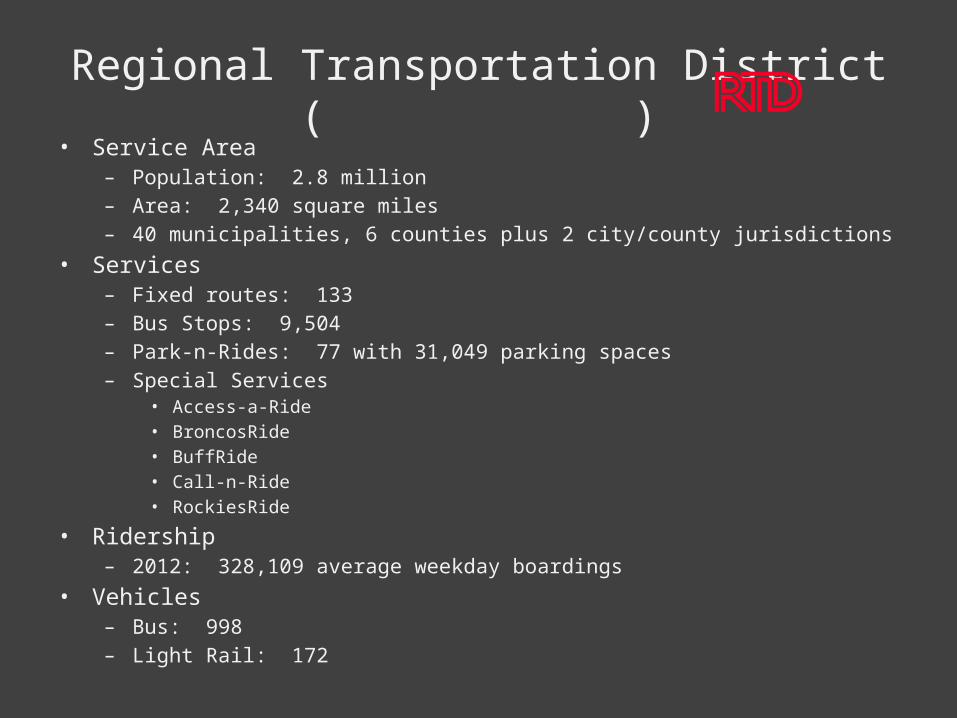
• Service Area– Population: 2.8 million– Area: 2,340 square miles– 40 municipalities, 6 counties plus 2 city/county jurisdictions
• Services– Fixed routes: 133– Bus Stops: 9,504– Park-n-Rides: 77 with 31,049 parking spaces– Special Services
• Access-a-Ride• BroncosRide• BuffRide• Call-n-Ride• RockiesRide
• Ridership– 2012: 328,109 average weekday boardings
• Vehicles– Bus: 998– Light Rail: 172
Regional Transportation District ( )
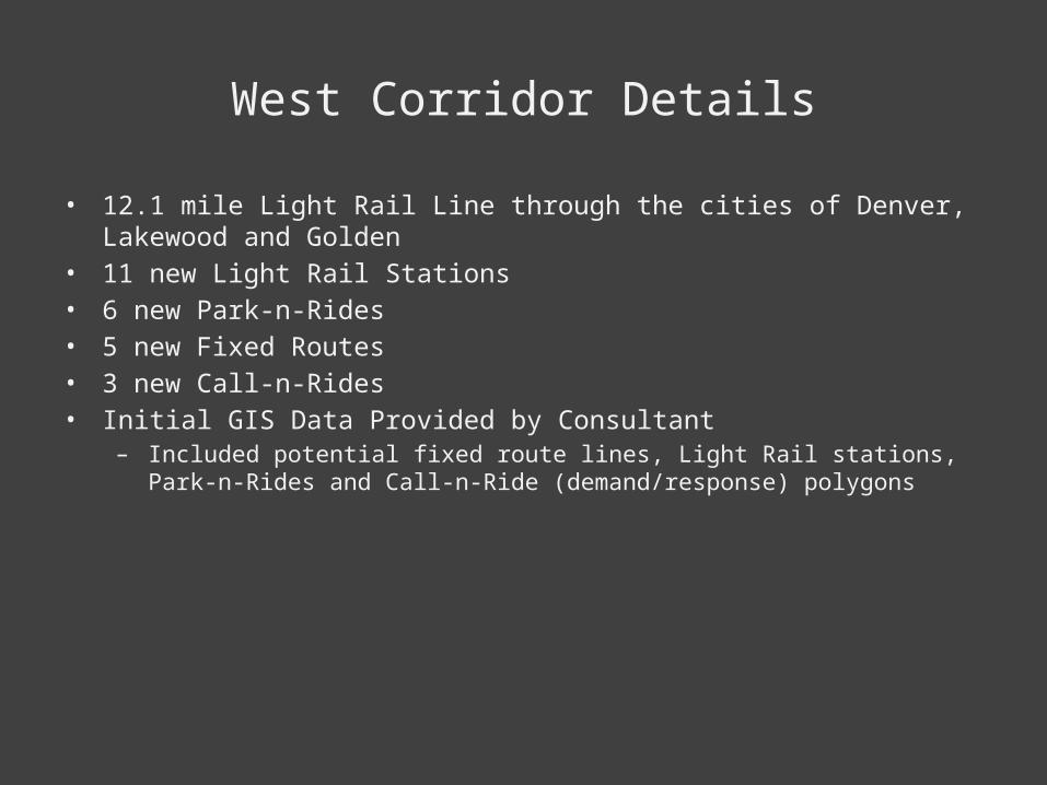
West Corridor Details
• 12.1 mile Light Rail Line through the cities of Denver, Lakewood and Golden• 11 new Light Rail Stations• 6 new Park-n-Rides• 5 new Fixed Routes• 3 new Call-n-Rides• Initial GIS Data Provided by Consultant
– Included potential fixed route lines, Light Rail stations, Park-n-Rides and Call-n-Ride (demand/response) polygons
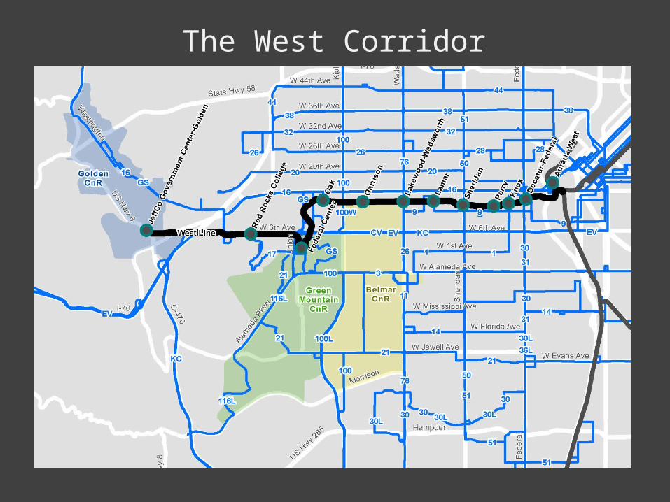
The West Corridor
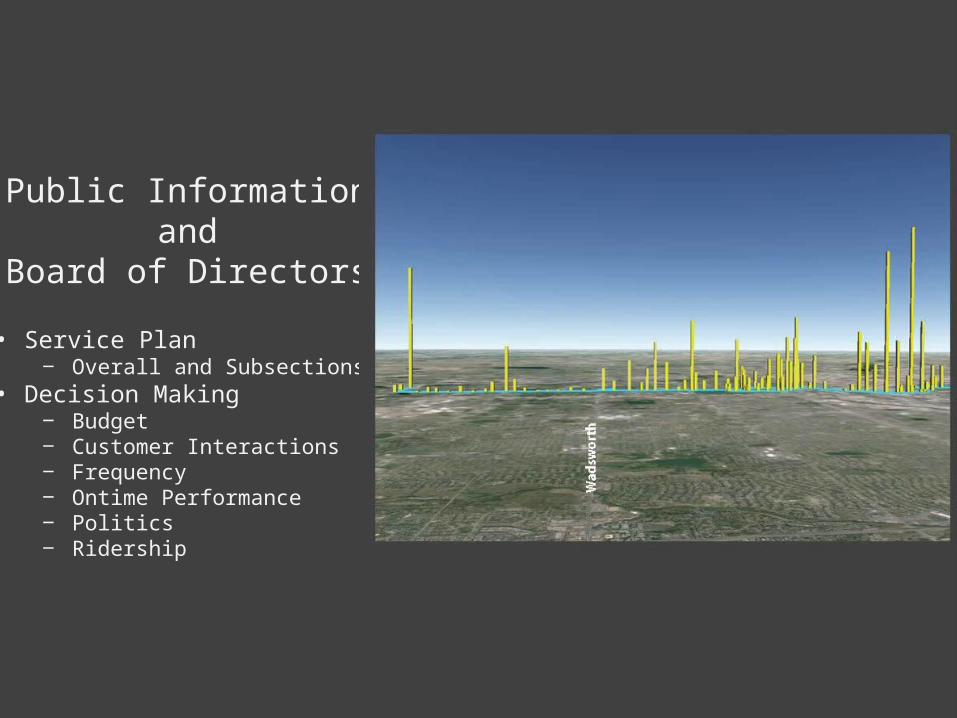
Public Informationand
Board of Directors• Service Plan
‒ Overall and Subsections• Decision Making
‒ Budget‒ Customer Interactions‒ Frequency‒ Ontime Performance‒ Politics‒ Ridership
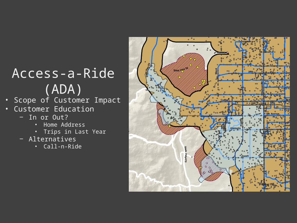
Access-a-Ride (ADA)• Scope of Customer Impact• Customer Education
‒ In or Out?• Home Address• Trips in Last Year
‒ Alternatives• Call-n-Ride
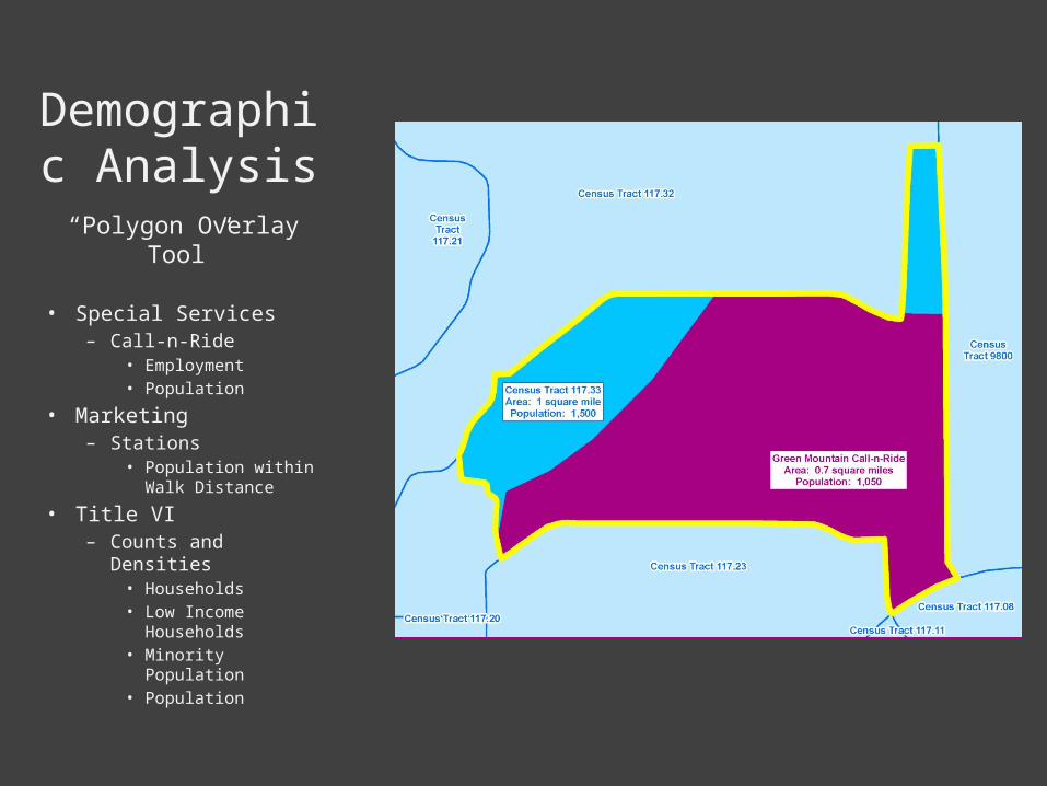
Demographic Analysis
“Polygon Overlay Tool”
• Special Services– Call-n-Ride
• Employment• Population
• Marketing– Stations
• Population within Walk Distance
• Title VI– Counts and Densities
• Households• Low Income
Households• Minority
Population• Population
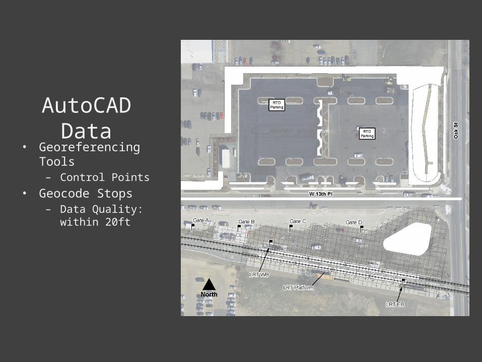
AutoCAD Data• Georeferencing Tools
– Control Points• Geocode Stops
– Data Quality: within 20ft
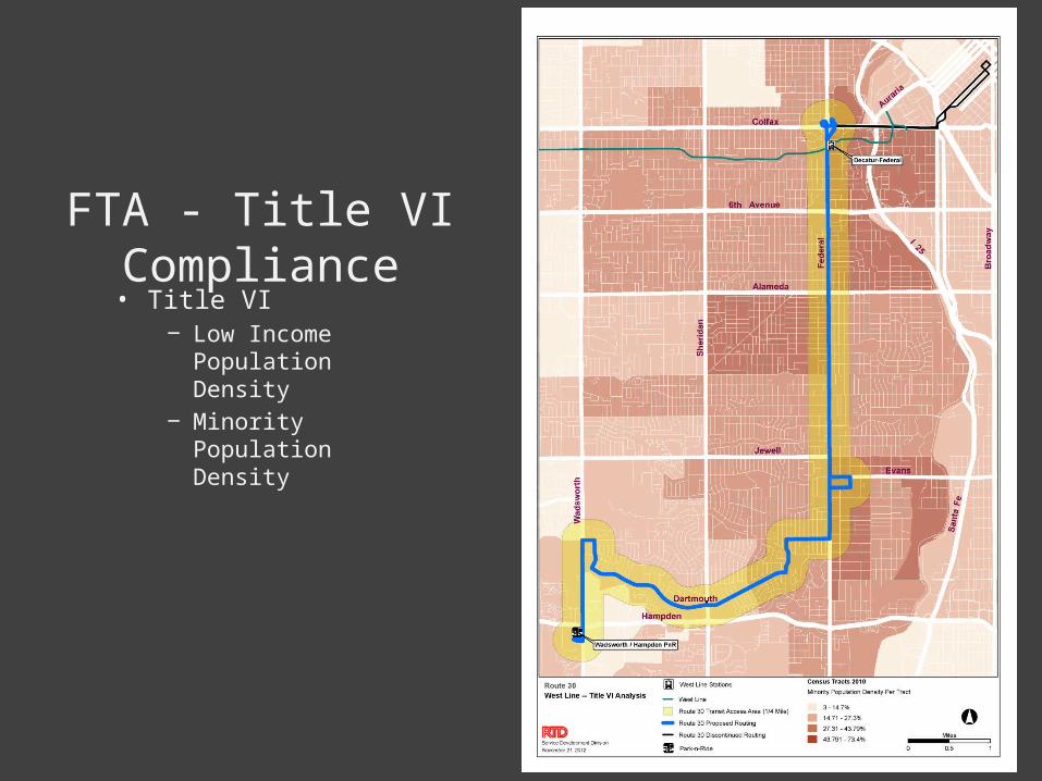
FTA - Title VI Compliance• Title VI
‒ Low Income Population Density
‒ Minority Population Density
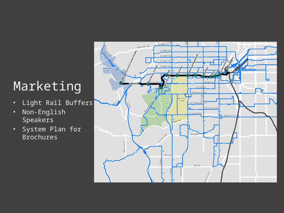
Marketing• Light Rail Buffers• Non-English Speakers• System Plan for
Brochures
Sales• Pass Pricing
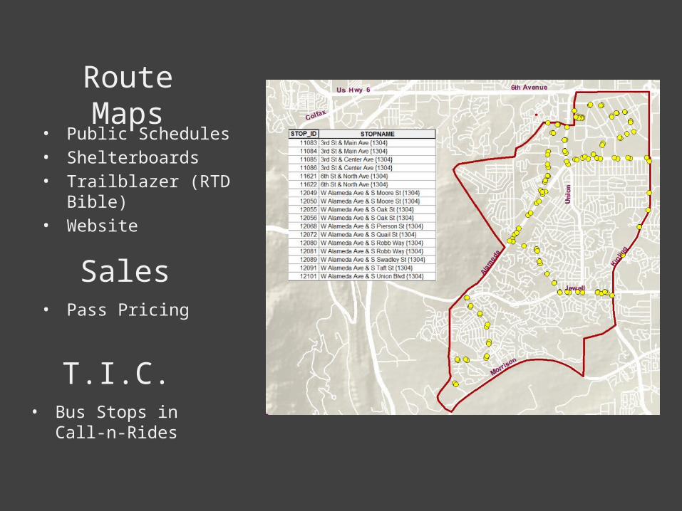
Route Maps
T.I.C.• Bus Stops in Call-n-Rides
• Public Schedules• Shelterboards• Trailblazer (RTD Bible)• Website
Summary
• RTD reliance on GIS– Board of Directors– Bus Operations– Civil Rights– Communications– Customers– Marketing– Sales– Service Development– Special Services