GIS Brownbag Series Part 2: How does GIS model our world?
26
GIS Brownbag Series Part 2: How does GIS model our world?
-
date post
20-Dec-2015 -
Category
Documents
-
view
219 -
download
0
Transcript of GIS Brownbag Series Part 2: How does GIS model our world?
GIS Brownbag Series
Part 2:
How does GIS model our world?
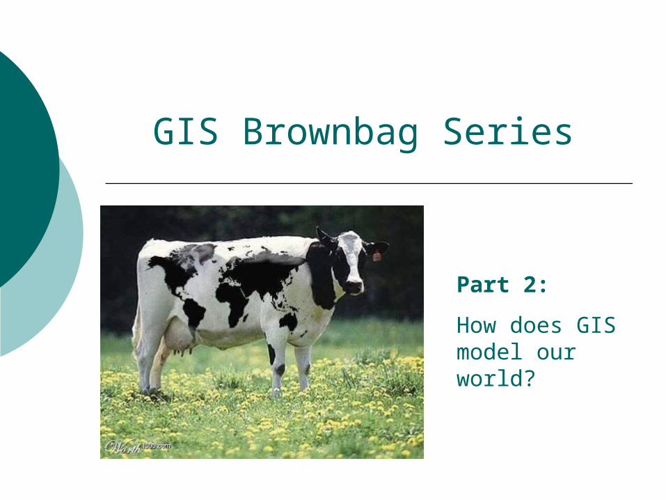
Chimpanzees?!?
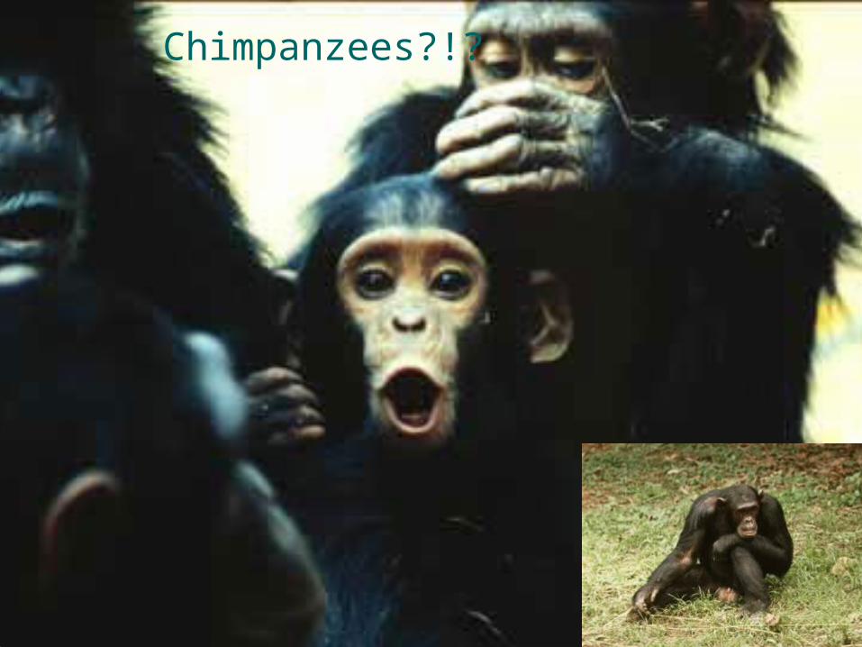
Jane Goodall studies Chimpanzees in Gombe Park in Tanzania
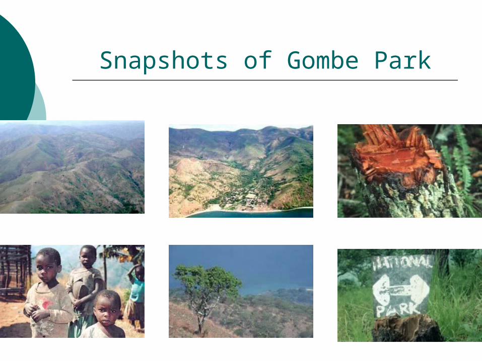
Snapshots of Gombe Park
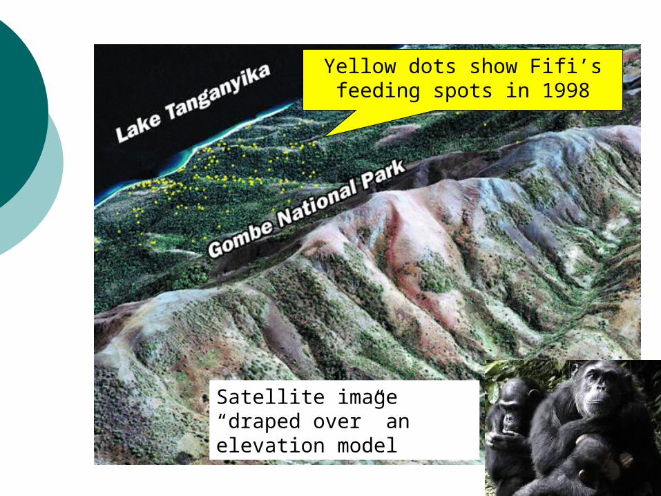
Satellite image “draped over” an elevation model
Yellow dots show Fifi’s feeding spots in 1998
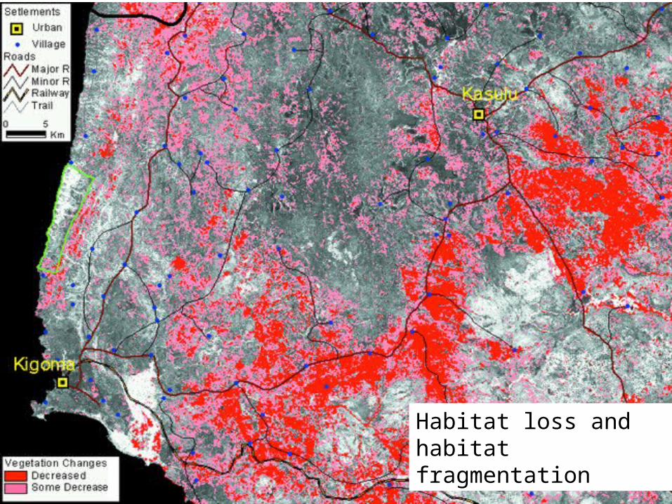
Habitat loss and habitat fragmentation
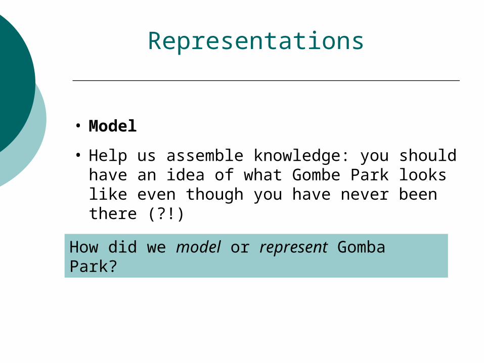
Representations
• Model
• Help us assemble knowledge: you should have an idea of what Gombe Park looks like even though you have never been there (?!)
How did we model or represent Gomba Park?
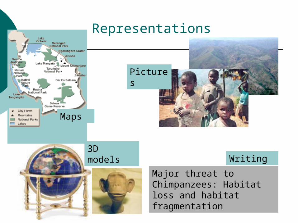
Representations
Pictures
3D models
Major threat to Chimpanzees: Habitat loss and habitat fragmentation
Writing
Maps
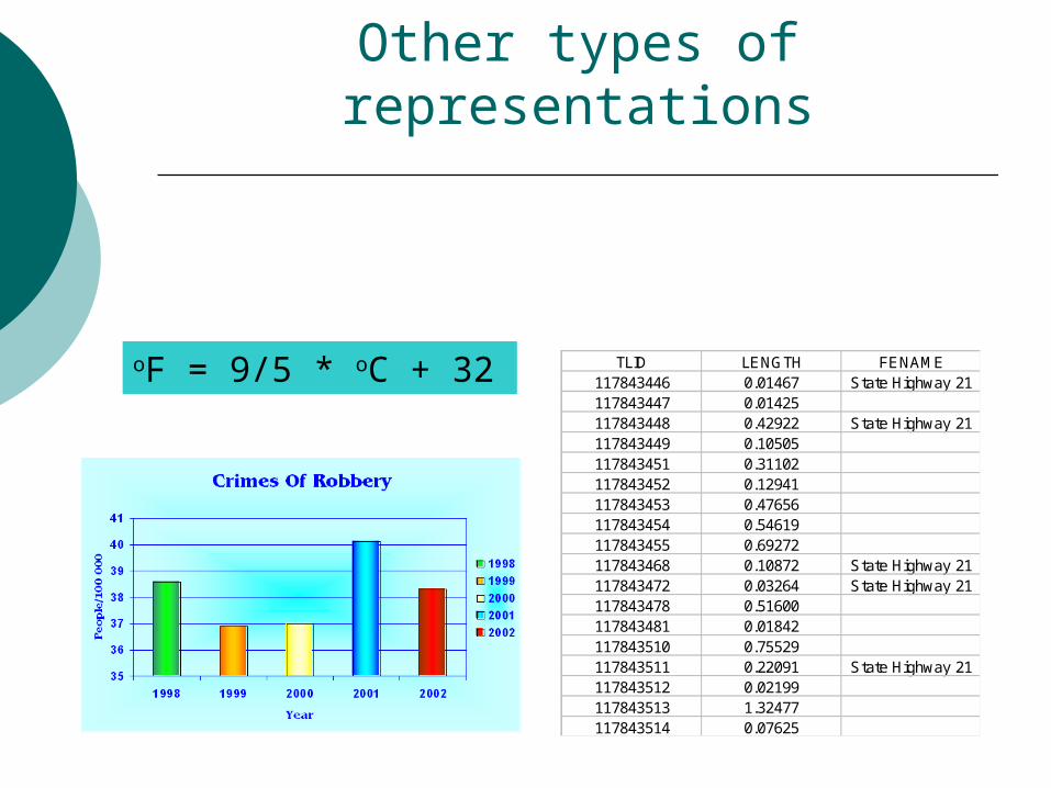
TLID LENGTH FENAME117843446 0.01467 State Highway 21117843447 0.01425117843448 0.42922 State Highway 21117843449 0.10505117843451 0.31102117843452 0.12941117843453 0.47656117843454 0.54619117843455 0.69272117843468 0.10872 State Highway 21117843472 0.03264 State Highway 21117843478 0.51600117843481 0.01842117843510 0.75529117843511 0.22091 State Highway 21117843512 0.02199117843513 1.32477117843514 0.07625
oF = 9/5 * oC + 32
Other types of representations
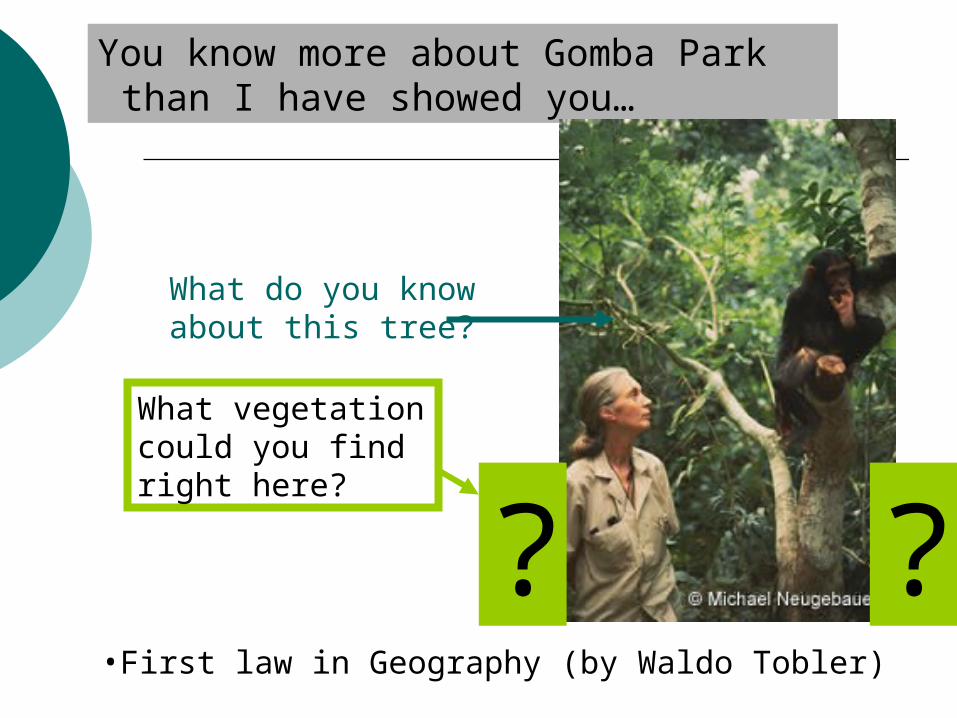
You know more about Gomba Park than I have showed you…
•First law in Geography (by Waldo Tobler)
What do you know about this tree?
?What vegetation could you find right here?
?
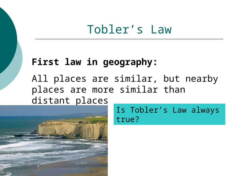
Tobler’s Law
First law in geography:
All places are similar, but nearby places are more similar than distant places
Is Tobler’s Law always true?
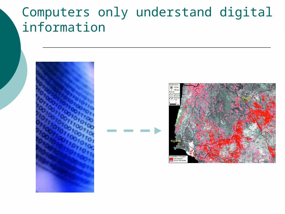
Computers only understand digital information
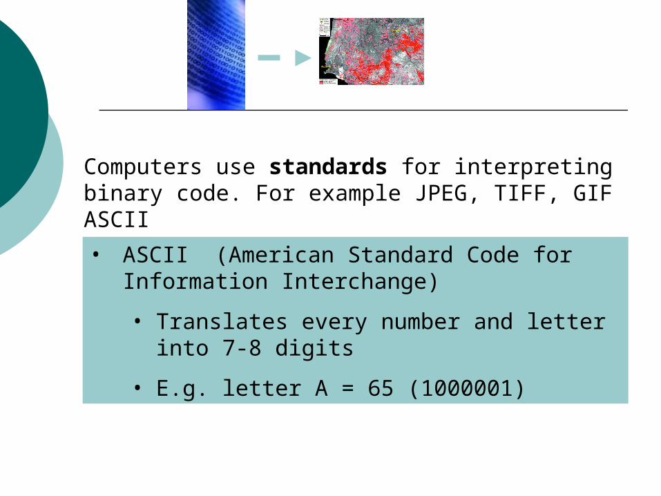
Computers use standards for interpreting binary code. For example JPEG, TIFF, GIF ASCII
• ASCII (American Standard Code forInformation Interchange)
• Translates every number and letter into 7-8 digits
• E.g. letter A = 65 (1000001)
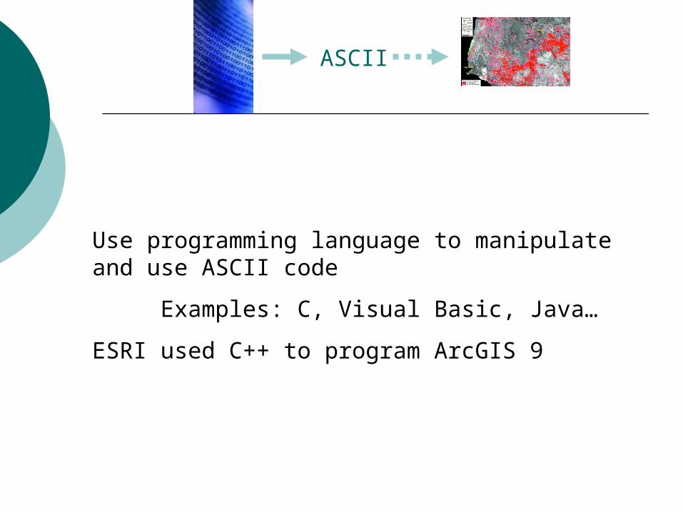
ASCII
Use programming language to manipulate and use ASCII code
Examples: C, Visual Basic, Java…
ESRI used C++ to program ArcGIS 9
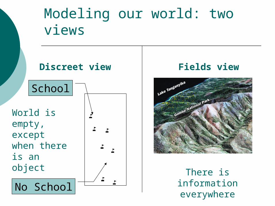
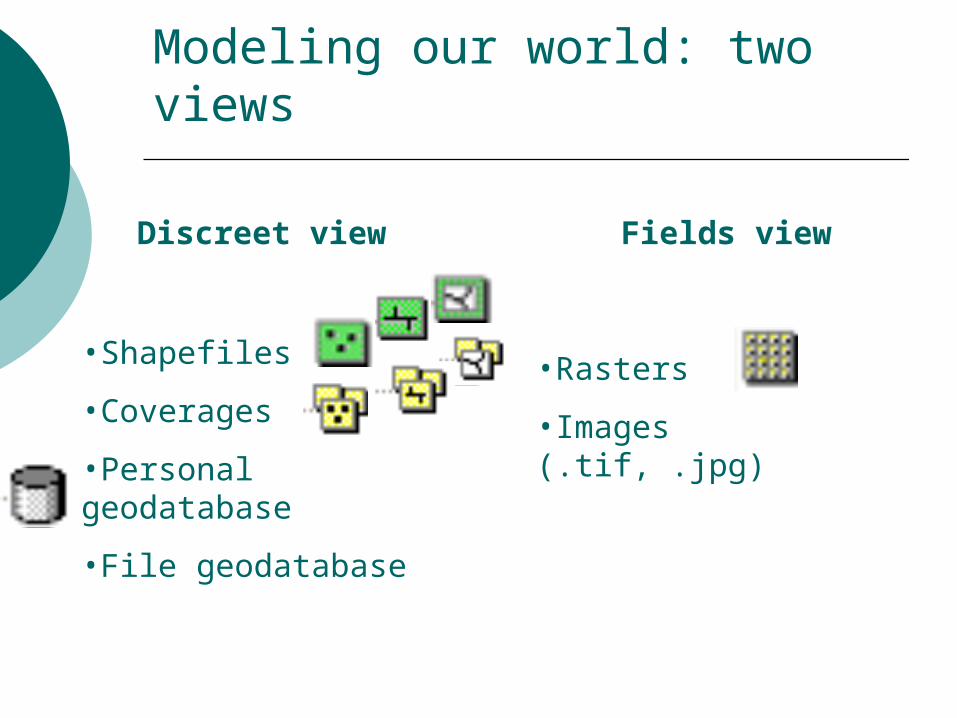
Modeling our world: two views
Discreet view Fields view
School
No School
World is empty, except when there is an object
There is information everywhere
Modeling our world: two views
Discreet view Fields view
•Shapefiles
•Coverages
•Personal geodatabase
•File geodatabase
•Rasters
•Images (.tif, .jpg)
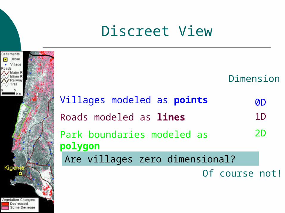
Discreet View
Villages modeled as points
Roads modeled as lines
Park boundaries modeled as polygon
Dimension
0D
1D
2D
Are villages zero dimensional?
Of course not!
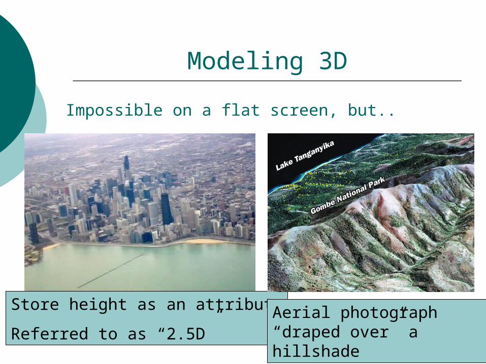
Modeling 3D
Impossible on a flat screen, but..
Store height as an attribute
Referred to as “2.5D”Aerial photograph “draped over” a hillshade
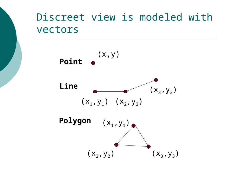
Point(x,y)
Line
(x1,y1) (x2,y2)
(x3,y3)
Polygon (x1,y1)
(x2,y2) (x3,y3)
Discreet view is modeled with vectors

Key advantages of using vectors
1. You can store information for every object in attribute table
• Allows for many types of analysis
• Easy to manipulate data
2. Only need to store data for areas that have a discreet object
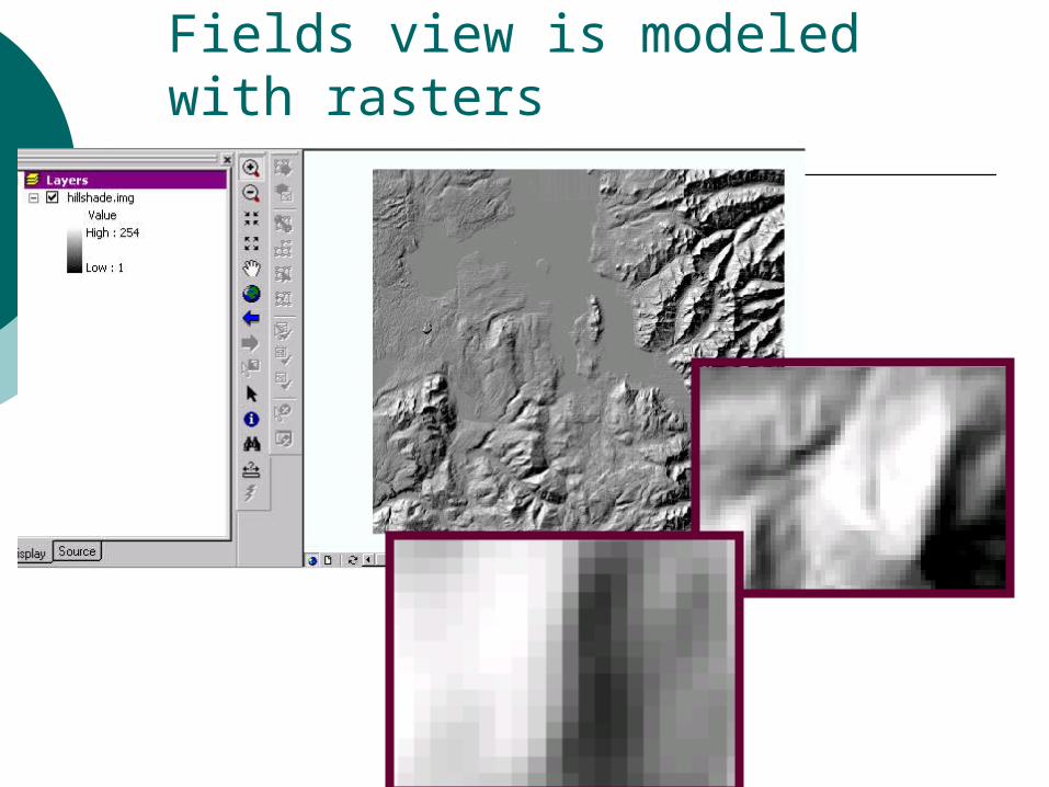
Fields view is modeled with rasters
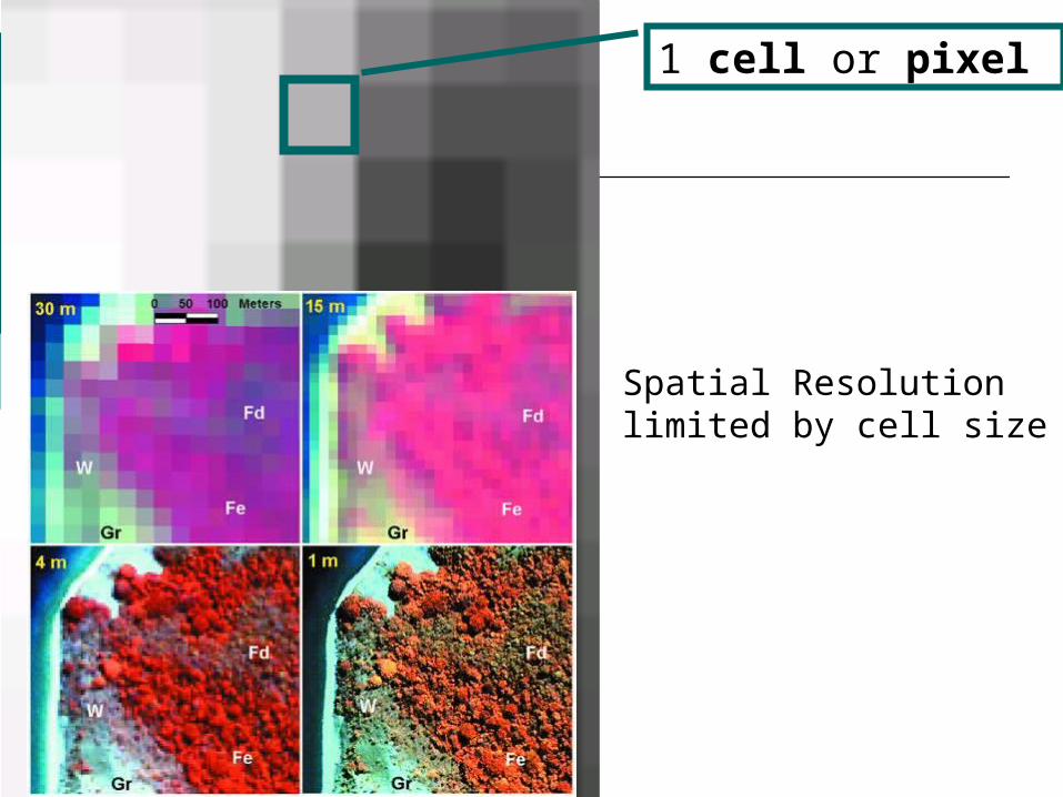
1 cell or pixel
Spatial Resolution limited by cell size

Sources of Raster Data:
• Digital Elevation Models
• Satellite Imagery
• Airphotos, Orthophotos
Processed airphotos to remove distortions
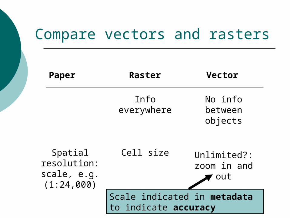
Compare vectors and rasters
Paper Raster Vector
Info everywhere
No info between objects
Spatial resolution: scale, e.g. (1:24,000)
Cell size Unlimited?: zoom in and out
Scale indicated in metadata to indicate accuracy
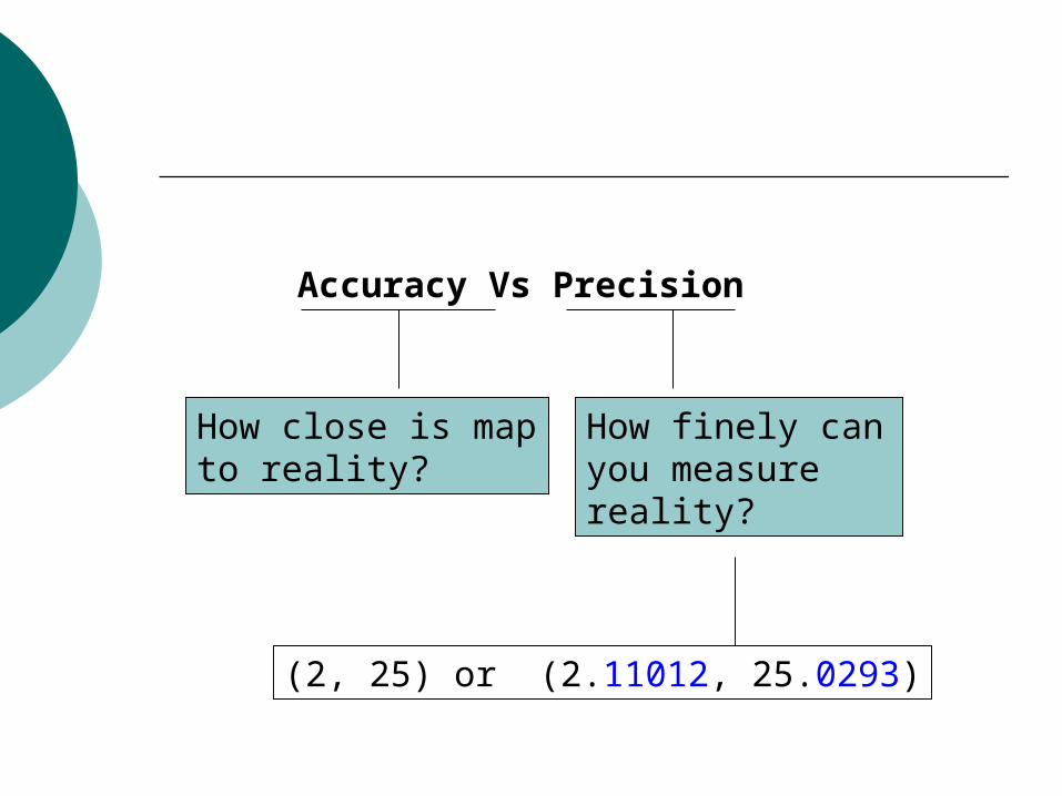
Accuracy Vs Precision
How close is map to reality?
How finely can you measure reality?
(2, 25) or (2.11012, 25.0293)
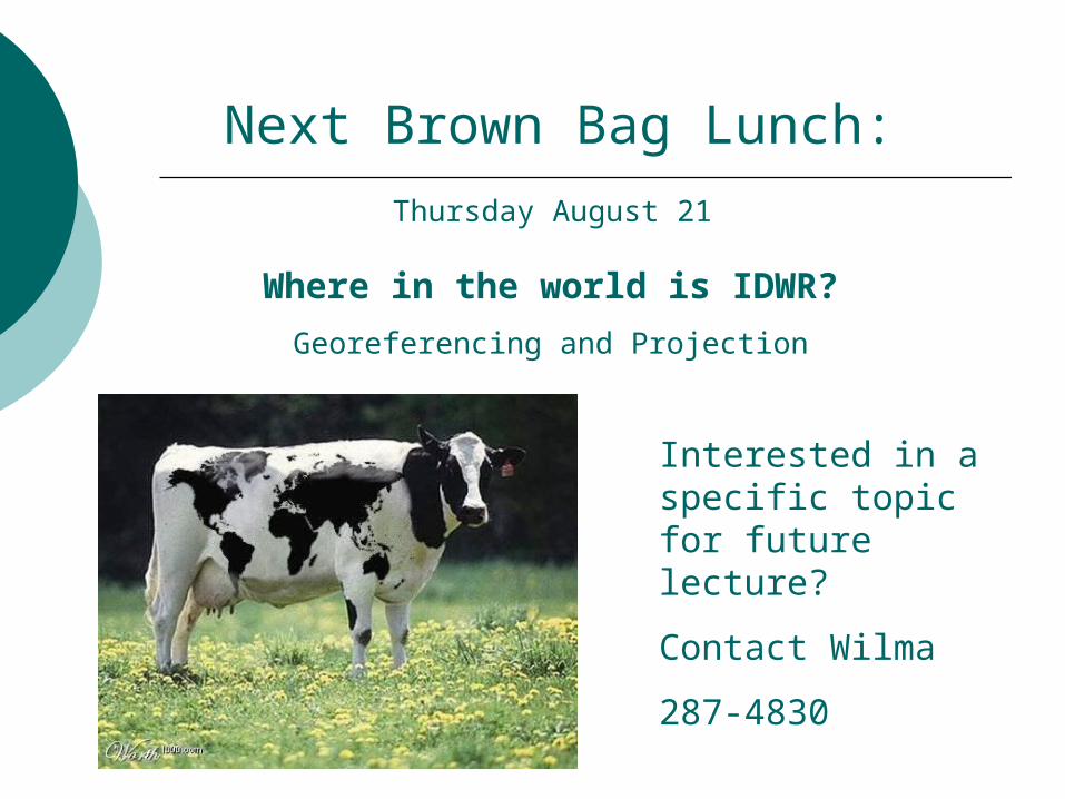
Next Brown Bag Lunch:
Where in the world is IDWR?
Georeferencing and Projection
Thursday August 21
Interested in a specific topic for future lecture?
Contact Wilma
287-4830