Getting to know GIS - GRANIT
15
Shane Bradt, Geospatial Extension Specialist, UNH Cooperative Extension [email protected] 603-862-4277 Getting to know GIS Getting to know GIS
Transcript of Getting to know GIS - GRANIT
Shane Bradt, Geospatial Extension Specialist, UNH Cooperative [email protected] 603-862-4277
Getting to know GISGetting to know GIS
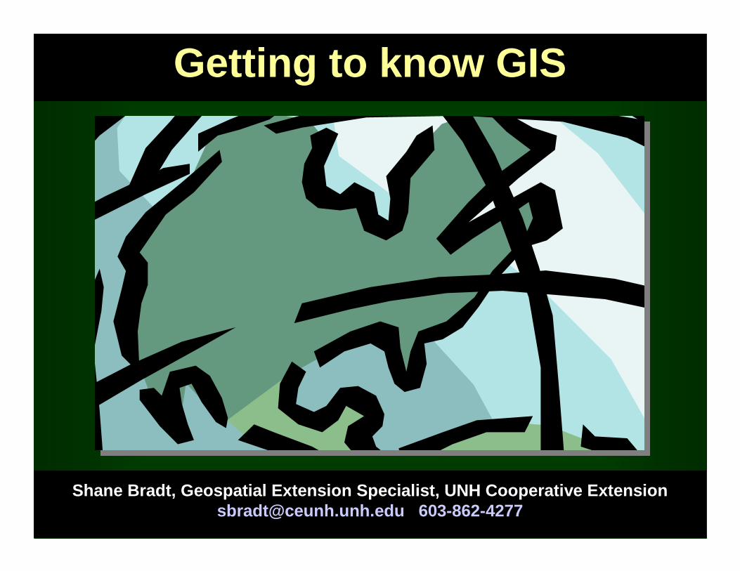
GIS: GEOGRAPHIC INFORMATION SYSTEM
• Geographic information made digital and aligned to a common reference system (georeferenced)
• GIS layers are by national, state and local sources
• Can provide information on a many types of features, both natural resource and societal
• Combines geographic layers with descriptive data about those layers
UNH Cooperative Extension 2007
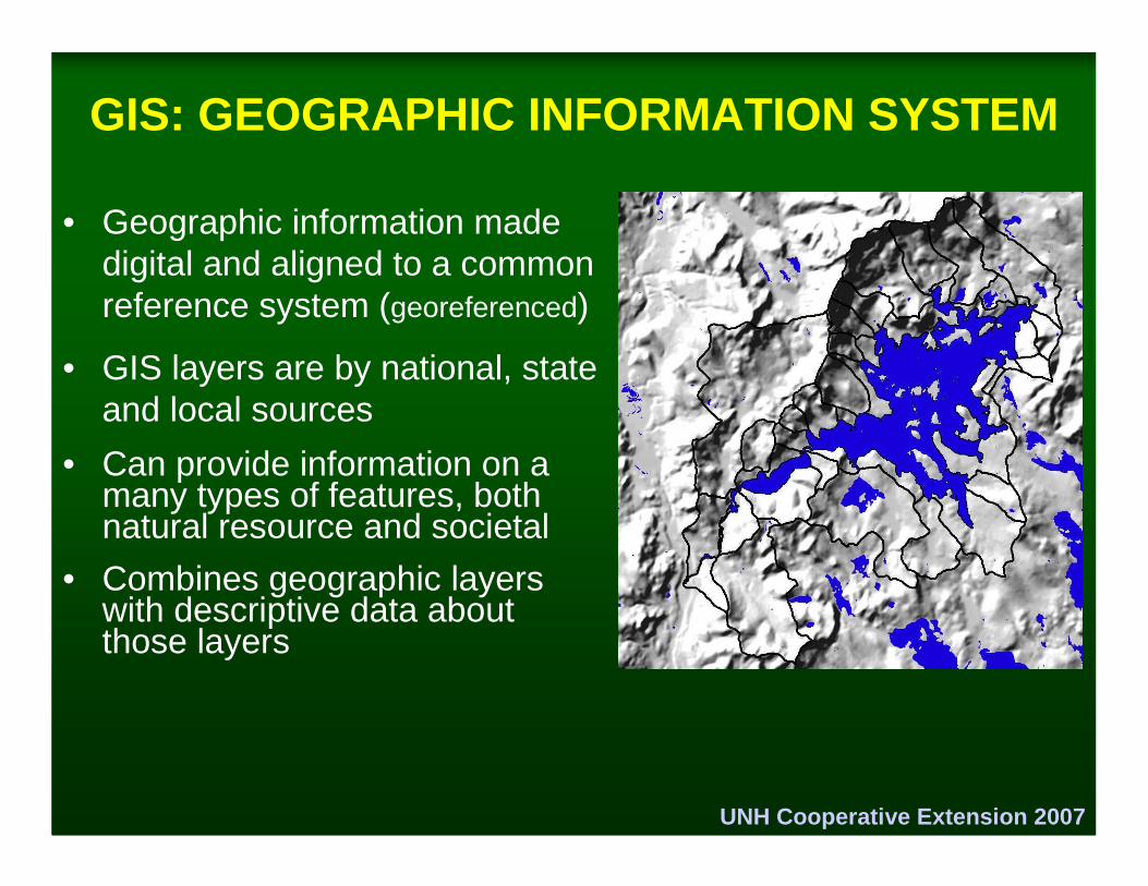
Remote Sensing
GPS
GIS Data Sources
Paper Maps
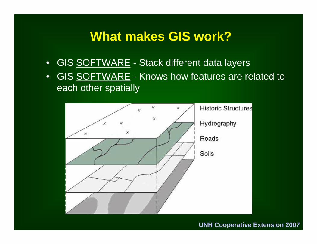
What makes GIS work?
• GIS SOFTWARE - Stack different data layers• GIS SOFTWARE - Knows how features are related to
each other spatially
UNH Cooperative Extension 2007
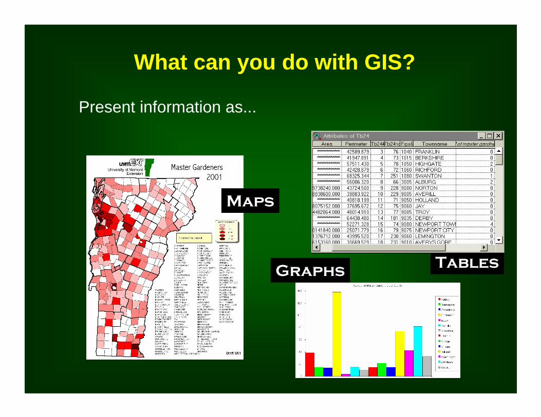
Graphs
Maps
Tables
What can you do with GIS?
Present information as...
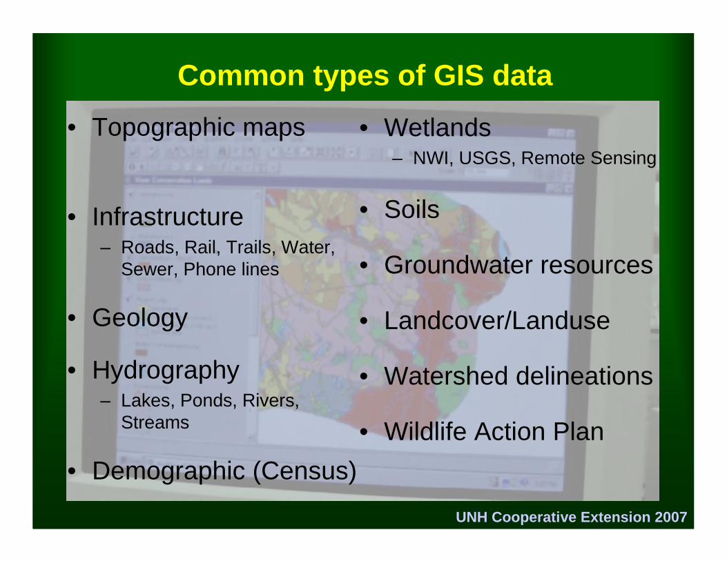
Common types of GIS data
• Topographic maps
• Infrastructure– Roads, Rail, Trails, Water,
Sewer, Phone lines
• Geology
• Hydrography– Lakes, Ponds, Rivers,
Streams
• Demographic (Census)
• Wetlands– NWI, USGS, Remote Sensing
• Soils
• Groundwater resources
• Landcover/Landuse
• Watershed delineations
• Wildlife Action Plan
UNH Cooperative Extension 2007
UNH Cooperative Extension 2007
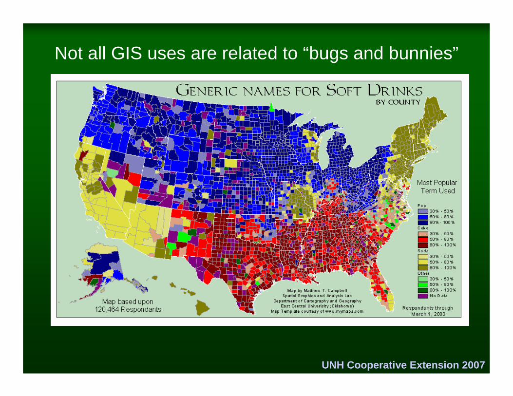
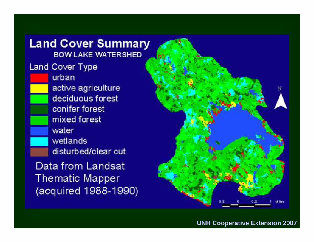
Not all GIS uses are related to “bugs and bunnies”
UNH Cooperative Extension 2007
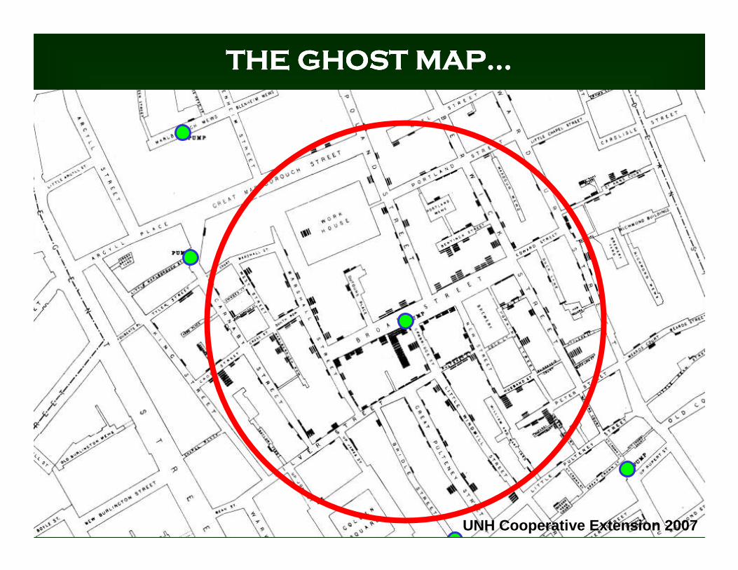
THE GHOST MAPTHE GHOST MAPTHE GHOST MAPTHE GHOST MAP…………
UNH Cooperative Extension 2007
UNH Cooperative Extension 2007
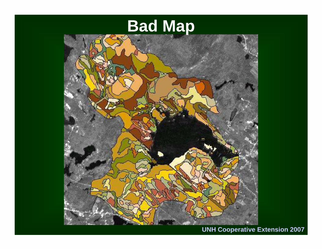
Bad Map
UNH Cooperative Extension 2007
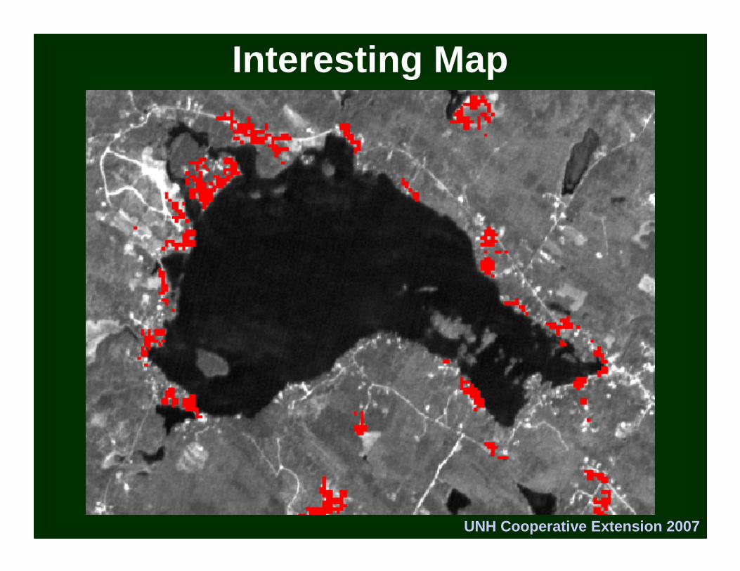
Interesting Map
UNH Cooperative Extension 2007
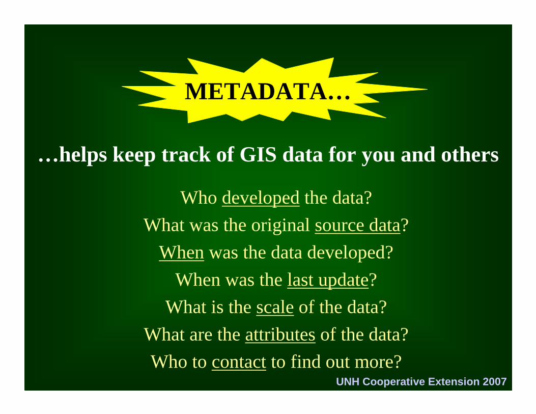
METADATA…
Who developed the data?
What was the original source data?
When was the data developed?
When was the last update?
What is the scale of the data?
What are the attributes of the data?
Who to contact to find out more?
…helps keep track of GIS data for you and others
UNH Cooperative Extension 2007
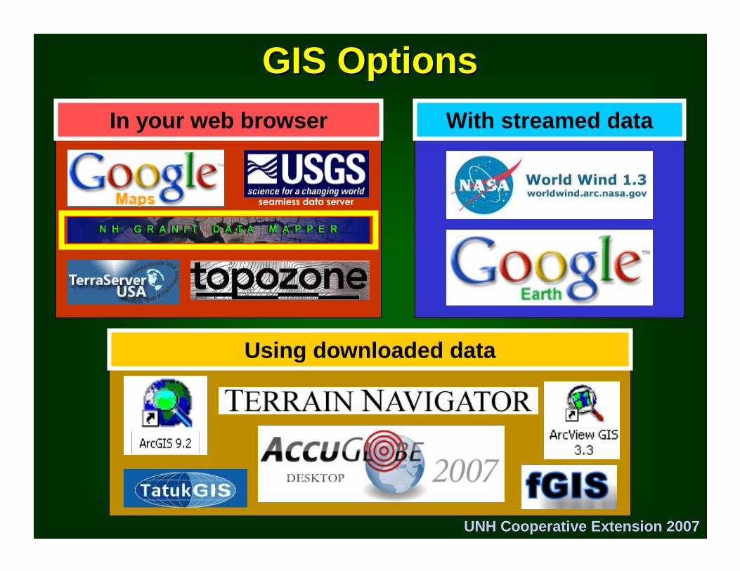
GIS OptionsGIS Options
seamless data server
In your web browser With streamed data
Using downloaded data
UNH Cooperative Extension 2007
Questions?
UNH Cooperative Extension 2007