GEOTECHNICAL STUDY AREA G14 SCARBOROUGH, NORTH · PDF fileGeotechnical Study Area G14...
22
Geotechnical Study Area G14 Scarborough, North Yorkshire, UK 1 GEOTECHNICAL STUDY AREA G14 SCARBOROUGH, NORTH YORKSHIRE, UK Plate G14 Holbeck Hall landslide – after stabilisation (Scarborough BC) 1. INTRODUCTION 1.1 Background Scarborough is a major seaside resort on the north-east coast of the United Kingdom (see Figure G14.1), with a population in excess of 100,000 in the holiday season. The town originally existed as a fishing port, centred around the harbour below Castle Hill (Plate G14a). The town developed as a health spa after waters with healing properties were discovered in South Bay in 1620. In 1660 a local doctor became an advocate of sea-bathing and Scarborough became one of Britain’s first seaside resorts. As the town expanded during the Victorian era, much of the North and South Bays were developed, with large hotels and private dwellings built in many cliff top areas. During the 1890's a seawall was constructed throughout much of the North Bay, and from the harbour to Holbeck Cliff, in South Bay. The walls were linked with the completion of Marine Drive below Castle Hill in 1908 and development took place behind the walls at the base of the cliff in the South Bay. Around this time, the cliffs in both bays were landscaped and drained as part of a series of slope treatment measures. The landscaped slopes have since become a major feature of the town and are covered with an elaborate network of paths. The coastal defences of the area which protect 6km of cliff line are constructed either as breakwaters, as at the Harbour, or as seawalls. Many of the defences are now in a poor state of repair and much of the defences are considered to have only a limited residual life. The present poor condition of many of the walls is a result of deterioration due to marine attack plus in some areas structural damage resulting from land movement in the area behind the walls. The coastal cliffs behind the sea walls of Scarborough's North and South Bays are developed in Jurassic-age sedimentary rocks overlain by varying thicknesses of glacial till and were probably
Transcript of GEOTECHNICAL STUDY AREA G14 SCARBOROUGH, NORTH · PDF fileGeotechnical Study Area G14...

Geotechnical Study Area G14 Scarborough, North Yorkshire, UK
1
GEOTECHNICAL STUDY AREA G14
SCARBOROUGH, NORTH YORKSHIRE, UK
Plate G14 Holbeck Hall landslide – after stabilisation (Scarborough BC) 1. INTRODUCTION 1.1 Background
Scarborough is a major seaside resort on the north-east coast of the United Kingdom (see Figure G14.1), with a population in excess of 100,000 in the holiday season. The town originally existed as a fishing port, centred around the harbour below Castle Hill (Plate G14a). The town developed as a health spa after waters with healing properties were discovered in South Bay in 1620. In 1660 a local doctor became an advocate of sea-bathing and Scarborough became one of Britain’s first seaside resorts. As the town expanded during the Victorian era, much of the North and South Bays were developed, with large hotels and private dwellings built in many cliff top areas. During the 1890's a seawall was constructed throughout much of the North Bay, and from the harbour to Holbeck Cliff, in South Bay. The walls were linked with the completion of Marine Drive below Castle Hill in 1908 and development took place behind the walls at the base of the cliff in the South Bay. Around this time, the cliffs in both bays were landscaped and drained as part of a series of slope treatment measures. The landscaped slopes have since become a major feature of the town and are covered with an elaborate network of paths. The coastal defences of the area which protect 6km of cliff line are constructed either as breakwaters, as at the Harbour, or as seawalls. Many of the defences are now in a poor state of repair and much of the defences are considered to have only a limited residual life. The present poor condition of many of the walls is a result of deterioration due to marine attack plus in some areas structural damage resulting from land movement in the area behind the walls. The coastal cliffs behind the sea walls of Scarborough's North and South Bays are developed in Jurassic-age sedimentary rocks overlain by varying thicknesses of glacial till and were probably
Geotechnical Study Area G14 Scarborough, North Yorkshire, UK
2
created during the post-glacial rise in sea-level around 8,000-2,000 years ago. Marine erosion at the foot of the cliffs before seawall construction oversteepened the slopes and fashioned a range of slope instability features, with the mechanism of failure being controlled largely by the nature of the slope materials. The toe of the coastal slopes have been protected by seawalls for around 100 years. On the small-scale ground failure can result in disrupted footpaths or small losses of cliff top land leading to falling debris blocking roads and damaging properties; or, on a larger scale more damaging landslide events. The most recent large scale event occurred in June 1993 where a major landslide occurred on the 70m high coastal cliffs in front of the Holbeck Hall hotel. Over 60m of the cliff was lost overnight, leaving the hotel in a very dangerous position as cracks began to develop in the building. A further 35m of cliff collapsed over the next 3 days undermining the hotel which gradually toppled over the cliff edge. In addition to causing the loss of the hotel, the landslide overwhelmed the existing coastal defences, burying them beneath a large debris lobe which extended over 100m across the shore platform. Subsequent engineering works at the site have involved constructing replacement coastal defences and slope stabilization works (Plate G14). The Holbeck Hall landslide heightened awareness of potential cliff instability problems on the Scarborough urban coastline and concerns were expressed locally about the level of risk that such events pose to the coastal defences and property. For this reason, the Local Coast Protection Authority (Scarborough Borough Council) commissioned an investigation to provide a preliminary assessment of the risks associated with potential cliff instability, between Peasholm Gap and Holbeck Cliff. The Preliminary Risk Assessment was undertaken in 1994, based on a review of historical records (e.g. local newspaper articles held at the local library), a structural assessment of the seawalls and geomorphological mapping of the cliffs. The study highlighted: · the poor condition of some of the existing coast defence structures; · the nature and extent of coastal cliff instability; · the landslide potential in different areas and the threat to coastal assets; · the range of management strategies proposed to reduce the impact of cliff instability. A previous study noted that construction of sea defences has considerably enhanced the stability of the coastal cliffs and provided protection for property and infrastructure that would otherwise have been lost due to marine erosion. However, since their construction, the oversteepened slopes have continued to degrade towards long-term angles of stability. It is now recognised that the stability of protected cliffs may gradually decline with time, introducing the potential for delayed failures. Of particular concern in South Bay is the potential for the shallow landslides on the intact coastal slopes to expand and trigger a major landslide (a sequence of events that is believed to be a factor in the Holbeck Hall landslide). The potential consequences of such large-scale events are self evident, presenting a significant threat to cliff top property and the structural stability of the seawalls. In turn, seawall failure, which can result from undermining by foreshore erosion or wave attack, presents a significant threat to the cliff stability. Should the seawalls fail, it is likely that a renewal of marine erosion at the cliff foot will quickly lead to major landslides. The seawalls are essential for the sustainability of the town’s tourist industry. The integrity of the seawalls and slope stability are, therefore, interrelated issues that are at the centre of the coastal problems in Scarborough.
1.2 Geological Conditions

Geotechnical Study Area G14 Scarborough, North Yorkshire, UK
3
The geology of the study area comprises sedimentary rocks of Jurassic age overlain, in most places, by a varying thickness of glacial deposits from the last (Devensian) glaciation. The oldest strata present in the cliffs are those of the Scalby Formation. This is generally composed of a maximum thickness of 25m of mudstones and siltstones and 5m of current-bedded sandstone, overlying a 13m thick, massive quartz sandstone known as the Moor Grit. The formation is present in the lower part of the cliffs throughout much of the study area and it has been influential in shaping the coastal slope morphology. Where the sandstones outcrop above sea-level near-vertical cliffs have been formed. Alternatively, in those areas where the overlying softer mudrocks are exposed in the cliffs much gentler slopes are present. Castle Headland is comprised largely of younger Jurassic rocks of the Oxford Clay and Lower Calcareous Grit horizons. The Oxford Clay comprises typically thickly bedded, weak siltstones and mudstones, and weathers to a shaley talus on the surface. The Lower Calcareous grit is a far more competent, strong sandstone. The Castle Headland has been formed as a result of two faults which have caused younger rocks to be downthrown to the east. There is a regional bedrock dip of 1.5_-2_ to the south but this can vary locally, as is evident in the cliffs at Scarborough. In the southern section of the study area the strata are sub-horizontal but those in North Bay and Castle Headland dip gently to the south and north respectively. Much of South Cliff is formed from glacial deposits (Tills) which overly the Jurassic, Scalby Formation. These are heterogenous materials of variable thickness. The Till is principally stiff silty clay with occasional gravels, although the proportions may vary considerably and there is often some sand present. Within this deposit there are large lenses and channels of granular material (mainly loose to dense silty fine sands) ranging in thickness from a few centimetres to in excess of 10m. These granular materials are significantly more permeable than the clay deposits and act to drain the latter and transport water through the Till. The seepages and springs found on the cliffs are invariably associated with these lenses. The glacial Tills form a highly complex intercolated sequence of clay, silt, sand and gravel deposits, and it is often not possible to trace individual “strata” between boreholes. A geomorphological map has been produced which summarises the surface form of the Scarborough coastline (a summary map of Castle Headland and the North and South Bay’s is shown in Figure G14.2). This map shows the relative positions of the main geomorphological units i.e. coastal slopes and the characteristic steep-sided ravines that occur at Holbeck Ravine, Valley Road and Peasholm Gaps. These features are all relict valleys cut by fluvial action probably during the Devensian when the melting ice would have given rise to large quantities of meltwater. Under these conditions the valleys would have been formed quickly with rapid downcutting resulting in oversteep, inherently unstable side slopes. The coastal cliffs of Scarborough's North and South Bays were probably created during the post glacial rise in sea-level around 8,000-2,000 years ago. Marine erosion at the foot of the cliffs oversteepened the slopes resulting in a range of slope instability features, with the mechanism of failure being controlled largely by the nature of the slope materials. The coastal slopes have been protected by seawalls for over 80-100 years; they are, therefore, abandoned sea cliffs. The absence of marine erosion at the cliff foot does not, however, mean the slopes are stable. Indeed, most of the slopes examined show signs of degradation. Failures range from small-scale minor superficial slumping to large, dramatic events such as the Holbeck Hall slide and rockfalls off Castle Headland. Different parts of the coastal slopes can be expected to behave differently because the sensitivity to the effects of destabilising factors (e.g. rainfall, human activity) will vary from one cliff unit to another. A clear understanding of the variety of landslide types, their extent and inter-relationships is, therefore, central to explaining the pattern of recent movements and the threat to the seawalls and other property.
1.3 Landslides

Geotechnical Study Area G14 Scarborough, North Yorkshire, UK
4
From the morphological evidence the following range of landslide features can be recognised: 1) Multiple Rotational Landslides; rotational landslides develop where slope failure occurs
along a well-defined, curved slip surface. This surface, being concave upwards, imparts a degree of backward rotation or tilt to the failed mass, which is accompanied by sinking at the rear and heaving at the toe (Hutchinson, 1988). In the study area 2 types of multiple rotational failure occur:
Type A : Large Multiple Rotational Slides in North Bay with shear surfaces in the Scalby Formation mudstones. These slides form a large landslide complex, comprising a series of interrelated multiple rotational failures.
Type B : Multiple Rotational Slides in South Bay with shear surface in the Scalby Formation mudstones, but whose form is largely controlled by the presence of the overlying till. Indeed, it is the relatively weak nature of this material that results in the rapid cliff top recession that occurred during the Holbeck Hall failure. At the Holbeck landslide this was further exacerbated by the deposition of the debris on the beach some way below the shear surface. Furthermore the failure was at low tide which allowed a long run out probably attributed to foreshore water lubricating the base of the debris. This meant that the slipped mass, which normally serves to counter-balance further movement up slope, was largely absent and did not provide the toe support thus encouraging additional failures.
Both Type A and B failures are currently affected by slow, intermittent degradation of the landslide masses through:
· shallow superficial failure in weathered materials (see ii) below; · settlement and disruption of failed blocks.
It is important to recognise that the development of major Type B failures have occurred historically at several locations in South Bay but have only affected part of this coastal section. The slopes between these failures (bluffs or spurs) have experienced the removal of passive support from either or both sides, and hence, these intact coastal slopes may be regarded as areas of potential failure.
ii) Shallow Translational Slides in mudrocks and till; this type of failure along an inclined
but straight shear surface is common throughout the coastal slopes at South and North Bay. They are associated with:
· failure of the steep rear scarps and flanks of Type A and Type B multiple rotational
slides; · superficial failure of the intact coastal slopes in the South Bay.
They are generally caused by a gradual loss of strength and an increase in permeability associated with weathering of shallow materials over time. This creates conditions where, particularly after heavy or prolonged rainfall, the superficial materials may slide over the less-weathered material beneath.
Many of the failures of this nature have occurred on oversteepened slopes formed in the past. In at least one instance, the failure beneath the putting green at South Cliff, a shallow failure has occurred on a landscaped slope. Following a failure, or failures, at the start of the century it appears that significant land drainage was installed and disturbed material removed and replaced with an engineered fill. The same area is now showing some sign of movement again which may in part be due to the drainage system becoming inoperable.

Geotechnical Study Area G14 Scarborough, North Yorkshire, UK
5
For the most part this type of failure poses only a small hazard to the cliff top assets, generally being limited to the loss of paths on the slopes. The exception is where debris may cascade over the near vertical sandstone slopes at the toe of the cliff, thus posing a risk to public safety at the lower level, and where failure of the rear scarps of multiple rotational slides is occurring. However, if failures of this type are left untreated their size can increase which in time can decrease the overall factor of safety of the slope.
iii) Rockfalls; most of the mass movements on the Castle Headland take the form of
rockfalls, rockslides, and possibly topples of the stronger rocks forming the near vertical, upper, part of the cliff. These are controlled by discontinuities (e.g. bedding planes, joints, faults) in the rock. The locations at which rockfalls are likely to occur can be determined by simple analysis of the relative relationship between discontinuity sets and the orientation of the cliff face and the strength across discontinuities. A catchwall has been constructed along the landward side of Marine Parade to limit the potential for damaging events.
In addition to these hardrock slides and falls, the Oxford Clay, which forms the gentler slopes at the toe of the cliff is susceptible to shallow mudslides as it weathers. Whilst, this in itself is a minor process, it can lead to the formation of overhangs and consequently further rockfalls from above. Although long-term marine erosion has created the conditions for slope instability, actual incidents of landsliding appear also to be triggered by other factors, such as periods of heavy rainfall. However, owing to the slow intermittent nature of much of the ground movement and the lack of systematic records it has not been possible to relate landslide activity with individual rainfall periods. Even when the precise timing of an event is clear, as for the Holbeck Hall failure, there remains considerable uncertainty about the significance of the relationship between the antecedent rainfall conditions and landslide activity. It is important to stress that many failures are probably not ‘Acts of God’, ie: completely natural and unpredictable events. Human activity may have a major role in promoting landsliding. It is probably no coincidence that the number of reported landslide events was found to have increased with the spread of development over the past 100 years or so. Whilst this partly reflects better records of ground movements, it is also true that development itself has acted as a destabilising influence in parts of coastal slopes. Potentially the most serious destabilising activity associated with development has been artificial recharge of the groundwater table. Uncontrolled discharge of surface water through soakaways and highway drains may have contributed to raising the groundwater table to a level where heavy winter storms could trigger movement. In addition, progressive deterioration and leakage of services such as slope drains, foul sewers, storm sewers, water mains and service pipes and the late 19th century landscaping are considered to have possibly added to the problems.
2. THE IMPACT OF INSTABILITY 2.1 The Problems

Geotechnical Study Area G14 Scarborough, North Yorkshire, UK
6
The existing coastal defences are showing obvious signs of distress and, in most places, will not provide an adequate level of protection against erosion, flooding and cliff instability over the next 60 years. Many of the more important coastal defence structures are approaching the end of their serviceable life and are in urgent need of major improvements. Failure of the coastal defences either as a result of marine attack or from landsliding will expose the toe of the cliffs to further marine erosion which will exacerbate the situation. The main problems include: 1. the limited residual life of the structures and high estimated annual probability of major
structural failure, resulting from high wave pressures; 2. severe wave overtopping resulting from near vertical seawalls or breakwaters with low
crest elevations and, in places, low foreshore elevations;
3. a residual landslide risk, with the more significant potential problems associated with:
· major “first-time” landslides caused by renewed cliff foot erosion should the seawalls fail, the expansion of shallow landslides, extreme groundwater levels and slope drainage failure;
· major reactivation of “pre-existing” landslides caused by renewed cliff foot erosion should the seawalls fail, extreme groundwater levels and slope drainage failure;
The range of potential problems vary along the coastline, according to the nature and condition of the defences, the exposure to wave attack and the geological setting. Figures G14.3 and G14.4 show the ground behaviour and elements at risk along the coastline of the North and South Bay’s, Scarborough. These problems will be further compounded by the predicted effects of sea-level rise, climate change and, in places, continued foreshore lowering. These factors will combine to create greater wave loadings on the defences and increased overtopping problems.
2.2 Assessment of Risk
Failure of the coastal cliffs presents a significant hazard to the seawalls and other coastal zone property, infrastructure and services. However, it is important to recognise that the potential problems vary along the coast, according to the geomorphological setting and the type of failure that may occur. On this basis it is possible to develop a general indication of the level of risk by defining: · landslide systems characterised by a unique range of instability problems (i.e.
contemporary processes);
· the landslip potential within each landslide system, expressed in terms of the likelihood of different types of failure that may occur;
· the elements at risk from instability ie. property, infrastructure and services on and adjacent to individual landslide systems;
· the severity of the potential consequences of each possible type of landslide event within each system (potential impact); the consequences are considered on a scale of losses

Geotechnical Study Area G14 Scarborough, North Yorkshire, UK
7
from minor (inconvenience and slight to moderate damage), partial (moderate to severe property damage) to total (injury and severe damage to complete destruction.
It is important to examine how the interrelationships between coastal processes, seawalls and coastal cliffs are central to defining landslip potential. The causes of slope instability are complex generally involving the variable interaction of a number of destabilising factors over time. Here it is useful to distinguish between: · external factors which lead to an increase in shear stress. Marine erosion, for example,
can promote failures by the removal of support and slope steepening;
· internal factors which lead to a decrease in shear strength. On coastal cliffs, weathering and water regime changes are often important internal factors.
On the Scarborough coast both sets of factors have influenced slope instability. The role of marine erosion can be clearly seen on the unprotected slopes outside the built up areas where rates of cliff recession may reach average rates of around 0.3m a year. However, prevention of marine erosion has not eliminated the potential for landslides, highlighting the importance of internal factors in promoting instability. Whilst slope degradation behind the defences generally involves relatively small and minor failures, large-scale landslide events do occur and can result in important losses. For example: · movements in the North Bay between 1915-1922 led to the displacement of the seawalls;
· the problems experienced on the slopes within Clarence Gardens North since the mid-1980's;
· the 1993 Holbeck Hall landslide which led to the complete destruction of the hotel and the seawalls below.
The continuation of slope instability problems after the construction of seawalls clearly demonstrates the importance of internal factors (e.g. water regime changes) in promoting instability. Whilst landscaping and slope drainage have been undertaken in the past, these have not been totally effective in preventing slope failure; it is possible, of course, that such measures may have contributed to local problems through subsequent leakage from defective drains and inappropriate excavations. It is important to stress that the continuation of slope instability problems presents a threat to the integrity of some seawall sections. The most concerning problems appear to be associated with pre-existing landslides where the basal shear surfaces pass below the seawall. When these failures show signs of reactivation, the resultant ground movement may cause displacement or heave of part of the structure. Cracks will create discontinuities and thus reduce the ability of the wall to spread loads. In turn it follows that unless the wall is adequately repaired it will become progressively more susceptible to the effects of ground movement and wave attack.
Geotechnical Study Area G14 Scarborough, North Yorkshire, UK
8
2.3 Holbeck Cliff Landslide, 1993
Holbeck Cliff was the scene of the dramatic landslide in 1993 that led to the loss of the Holbeck Hall Hotel. The cliffs are around 65-70m high and developed in a sequence of glacial tills overlying Jurassic mudstones and siltstones. Prior to the landslide the cliff face had sloped at
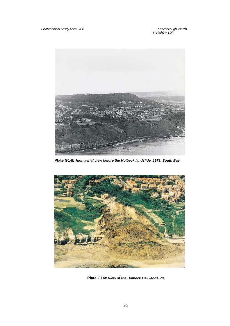
around 35°, becoming steeper at the base where a concrete seawall and promenade has provided protection from wave attack (Plate G14b). The cliffs had been purchased by the Council in 1887, at which time they were drained and landscaped. A series of footpaths were cut into the cliff, supported by small walls and revetments. A 275m long seawall was built between 1889 and 1893. The foreshore comprises a broad, gently sloping shore platform developed in the Jurassic rocks.
The slopes appear to have had a history of shallow landslide problems, although few events have been recorded.
The 1993 landslide involved a complex series of retrogressive movements and overwhelmed the seawall, with a debris lobe extending some 100m across the shore platform (Plate G14c). Failure is believed to have occurred along a composite shear surface developed on:
a) weathered mudstone bed, around 2.5m below the till/rock interface. It is not clear whether the same mudstone bed was utilised along the shear surface, although the 2° apparent dip on this layer suggests that this remains a possibility;
b) soft silty clay layer at the till/rock interface, believed to be a glacial gouge material.
c) various soil units within the glacial till sequence. The tills on the Holbeck Hall cliffs appear to be dominated by stiff, plastic silty clays and, locally, substantial thicknesses of water-bearing sands and silty sands.
A ground investigation was undertaken subsequent to the landslide of 1993. The investigation clearly indicated the presence of the basal slip plane of the landslide.
A characteristic feature of the Holbeck failure was the unusually large and rapid displacement of material. This is likely to be a reflection of the brittleness of the materials along the shear surfaces. This would have resulted in high strain energies being stored in the ground mass prior to failure, and meant that once failure had begun a sudden release of energy occurred, and the mass would only come to rest at a much lower slope angle. The key factors involved in the Holbeck landslide can be identified in Table 1.

Geotechnical Study Area G14 Scarborough, North Yorkshire, UK
9
)
1)
A steep cliff, 60m high and standing at around 35°, that had been protected from marine erosion, drained and landscaped around 100 years ago. Despite these works there has been a history of small-scale shallow landsliding and subsequent slope repairs.
2)
Between 17.5 - 33m of overconsolidated glacial till overlying Scalby Formation sandstone and argillaceous beds, including siltstones and mudstones.
3)
A till profile dominated by stiff plastic silty clays (Soil 3) with occasional slickensided surfaces and, locally, substantial thickness of water-bearing sands and silty sands (Soil 2). The stiff plastic silty clays are likely to be brittle and prone to progressive failure.
4)
The presence of a soft silty clay, probably a glacial gouge material, at the interface of the till and underlying bedrock.
5)
A till/rock interface that dips seaward at around 2°. There is also evidence to suggest that this interface was stepped on the lower portions of the original slope, steepening locally to around 20°.
6)
Highly weathered, weak mudstone beds, containing closely spaced fissures and polished slickenside surfaces, dipping seawards.
Table 1 The key factors of the Holbeck Hall site, Scarborough, prior to failure. Although heavy rainfall in the 6 months preceding June 1993 is believed to have been a major contributory factor, the failure was probably also the consequence of long-term progressive failure of the till and mudstones. Progressive failure has been observed in glacial tills elsewhere and is an indirect effect of marine erosion which unloads the cliff and induces shear stresses in the ground mass, leading to strain-softening as the in situ materials expand as a result of the removal of confining lateral stresses. If the strains are concentrated at a particular horizon (e.g. a bedding plane) then the available shear strength of the material may be exceeded and a shear surface forms. This weakened surface can then lead to the development of a deep-seated slide as the shear surface propagates upwards the cliff top. Evidence of the possible effects of progressive failure of the material at Holbeck Hall was identified in the boreholes on the cliff top, behind the landslide where polished slickensided surfaces were found in both the stiff, plastic silty clay till and the mudstones.
Geotechnical Study Area G14 Scarborough, North Yorkshire, UK
10
Following the landslide, a programme of emergency coast protection and cliff stabilization works were undertaken to prevent the rapid landward spread of the landslide, at a cost of £2M. The works involved: · a rock armour revetment placed at the toe of the eroding front of the landslide debris lobe
on the shore platform. The design included 30,000 tonnes of rock placed against an inner core of 1 cubic metre heavy duty geotextile bags filled with slip material.
· reprofiling the failed slope to an overall angle of 24_ for cut slopes, with the lower slopes
filled with the excess material to between 6_ and 20_. During construction the surface of the regraded slope was compacted and sealed to reduce infiltration and minimise surface erosion.
· slope drainage, including an interceptor drain at the cliff top, a perimeter drain, localised piped drains and counterfort drains.
A rock armour revetment with a crest elevation of approximately 6mOD has been placed as protection of the landslide toe. As described earlier, the slopes have been regraded and drained to improve the stability (Plate G14). A recent condition survey undertaken in 1999 revealed the existing sea defences to be in good condition. The purpose of these defences is to prevent toe erosion and the landward expansion of the landslide and further loss of property. A rapid unloading of the toe zone would almost certainly reactivate the landslide causing the material in the body of the landslide to move forward onto the foreshore. This in turn would unload the rear cliff resulting in a new landslide extending a considerable distance inland. Such an event would damage houses behind the original landslide and if the area was abandoned the cliff top would gradually degrade and eventually reach a main road. The current overtopping performance and structural integrity of the rock revetment is satisfactory, and improvements are not considered necessary. The performance of the existing coast defences will need to be reviewed through routine inspection in order to assess deterioration in condition and effect maintenance repair as required. Monitoring and maintenance of the structure is of obvious importance.
30 ROLE OF KEY AGENCIES
The Coast Protection Authority for the Scarborough coastline is Scarborough Borough Council. They are being proactive in this role and have commissioned a major review and strategy study into the performance of all the coastal defences and cliffs in the Scarborough urban area funded by central government (MAFF).
4. MONITORING 4.1 Introduction
Geotechnical Study Area G14 Scarborough, North Yorkshire, UK
11
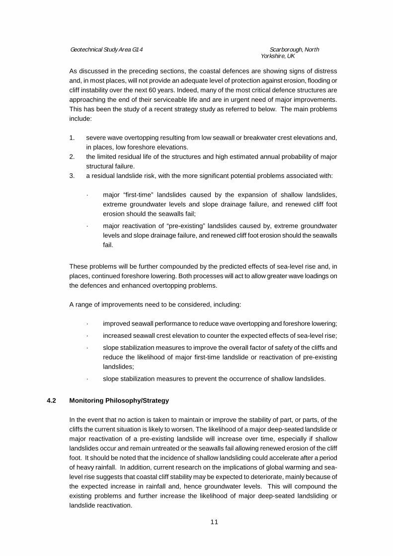
As discussed in the preceding sections, the coastal defences are showing signs of distress and, in most places, will not provide an adequate level of protection against erosion, flooding or cliff instability over the next 60 years. Indeed, many of the most critical defence structures are approaching the end of their serviceable life and are in urgent need of major improvements. This has been the study of a recent strategy study as referred to below. The main problems include: 1. severe wave overtopping resulting from low seawall or breakwater crest elevations and,
in places, low foreshore elevations. 2. the limited residual life of the structures and high estimated annual probability of major
structural failure. 3. a residual landslide risk, with the more significant potential problems associated with:
· major “first-time” landslides caused by the expansion of shallow landslides, extreme groundwater levels and slope drainage failure, and renewed cliff foot erosion should the seawalls fail;
· major reactivation of “pre-existing” landslides caused by, extreme groundwater levels and slope drainage failure, and renewed cliff foot erosion should the seawalls fail.
These problems will be further compounded by the predicted effects of sea-level rise and, in places, continued foreshore lowering. Both processes will act to allow greater wave loadings on the defences and enhanced overtopping problems. A range of improvements need to be considered, including:
· improved seawall performance to reduce wave overtopping and foreshore lowering;
· increased seawall crest elevation to counter the expected effects of sea-level rise;
· slope stabilization measures to improve the overall factor of safety of the cliffs and reduce the likelihood of major first-time landslide or reactivation of pre-existing landslides;
· slope stabilization measures to prevent the occurrence of shallow landslides.
4.2 Monitoring Philosophy/Strategy
In the event that no action is taken to maintain or improve the stability of part, or parts, of the cliffs the current situation is likely to worsen. The likelihood of a major deep-seated landslide or major reactivation of a pre-existing landslide will increase over time, especially if shallow landslides occur and remain untreated or the seawalls fail allowing renewed erosion of the cliff foot. It should be noted that the incidence of shallow landsliding could accelerate after a period of heavy rainfall. In addition, current research on the implications of global warming and sea-level rise suggests that coastal cliff stability may be expected to deteriorate, mainly because of the expected increase in rainfall and, hence groundwater levels. This will compound the existing problems and further increase the likelihood of major deep-seated landsliding or landslide reactivation.

Geotechnical Study Area G14 Scarborough, North Yorkshire, UK
12
All aspects of the remedial works would be forms of stability betterment aimed primarily at the local failures. However, there would tend to be an improvement in the overall cliff stability if the drainage improvements were able to reduce the groundwater levels rather than just control shallow seepage. It is recognised that there is a need for this option to be supported by a monitoring programme to provide early warning of potential problems and to further define the risk of major landsliding. This programme should involve: · the installation of inclinometer access tubing to allow the detection of signs of deep-
seated ground movement. These were installed as part of ground investigations during March 1996 and the Summer of 1997;
· piezometers to enable changes in groundwater level in the cliffs to be recorded. These
were installed as part of the ground investigation; · seawall inspections to identify signs of damage which may lead to structural failure.
4.3 Borehole Inclinometers
Inclinometers were installed in 14 boreholes throughout Scarborough in order to detect rates, direction and magnitude of lateral movement below the ground surface. The inclinometers range in depth between 20m and 65.m below ground level. All inclinometers extend below the glacial till and bedrock interface. Monitoring of inclinometer boreholes was initially undertaken on a monthly basis until a base line of data had been established. Subsequent monitoring has been at an interval of once every two months unless wet weather periods dictate that the monitoring frequency be increased to once a month. In addition to this, if any movement trends identify accelerated movement, monitoring frequency is further increased. To date all inclinometers installed during the 1997 ground investigation are still operational. To date the only significant trend of ground movement is at The Holms, on the northern side of Castle Headland; further investigation and additional borehole instrumentation have been proposed to confirm any movement.
4.4 Standpipe Piezometers and Standpipes
Standpipes and standpipe piezometers were installed in order to determine the piezometric pressures and groundwater levels across the site. A total of 31 Standpipe piezometers and 3 standpipes were installed to depths between 48m and 56.5m below ground level during the 1997 ground investigation along the Scarborough frontage. All boreholes are read manually at regular intervals.
4.5 Historic Records of Ground Movement

Geotechnical Study Area G14 Scarborough, North Yorkshire, UK
13
Scarborough has had a long history of instability and landsliding, which since the 1750’s has been recorded in a variety of published reports, press cuttings, local accounts and photographic archives. This historic information has been incorporated into a comprehensive record of ground movement. Where appropriate this information has been used in ground models developed for the site.
5. CURRENT STATUS AND APPROACH 5.1 Coastal Defence
The entire frontage, from Holbeck Gardens in South Bay to Scalby Beck in North Bay, some 7.7km (including the harbour walls) is protected predominantly by concrete block seawalls, with significant use of masonry and mass concrete in the harbour, masonry blockwork walls at the Spa and locally throughout the study area. The variety of different constructions reflect the different phases of construction during the 19th and early 20th centuries. Since construction a range of repairs have been carried out. Major additions were made to the North Bay wall at the start of the century in an attempt to stabilize ground movement, but the majority of repairs have been more minor works carried out in response to localised damage. Inspections as part of the Strategy Study have revealed that many of the walls are in a poor state of repair and that much of the seawall now has a residual life of less than ten years. The consequence of failure of the sea walls varies from place to place, from very severe in the case of the Harbour walls, to of little immediate consequence at some locations elsewhere. The walls can be considered as two distinct types, those being either breakwaters (as is the case for the harbour walls) or sea walls (as is the case for the promenade walls). The function and construction of these wall types differs in response to the differing requirements. However, it is the case that many of the walls by virtue of their age were constructed with a masonry blockwork facing. The primary function of the harbour breakwaters is to provide an area of calm water within the harbour. The wave forces acting on the outer face of the breakwater impose severe localised forces on the components of the structure. In the case of the Scarborough South Bay, the harbour walls act not only in providing a safe haven, but provide breakwater protection for much of the South Bay area development against the effects of prevailing north easterly storms. The breakwater, therefore, is an integral part of the overall security of the South Bay area.
5.2 Problems with the Current Approach
To address these problems at Scarborough the Coastal Defence Strategy Study, which was undertaken during 1997 and 1998 in order to review all aspects of the coastal defences, identified relative priorities and approaches for remedial action. The study forms the guideline for the management of the coastal defences for the next 60 years by identifying scheme

Geotechnical Study Area G14 Scarborough, North Yorkshire, UK
14
options, maintenance regimes, priorities, estimates of capital spend and programmes for action. Analysis and interpretation of the information available has been to define the nature of the problems along each part of the coast and to identify appropriate management strategies. This has involved: · a quantitative risk assessment of seawall and breakwater failure as a result of wave
impact forces and structural condition;
· an assessment of the consequences of seawall and breakwater failure;
· assessment of wave overtopping problems;
· a quantitative risk assessment of the threat to the seawalls from landslides;
· Identification of coastal defence options for the next 60 years;
· Preliminary environmental assessment of the defence options.
The results of these activities have been used to consider the sustainability of the existing coastal defences on the Scarborough urban coastline, to develop the fundamental principles and outline of the Strategy and to establish criteria in order to prioritise potential coast protection and flood defence improvement schemes. The study has identified specific recommendations for 15 “sections” of coastal defences, which includes the entire defended urban coastline. These recommendations form part of the management strategy being developed for the next 60 years, taking into account the technical, environmental and economic considerations. The potential losses resulting from defence failure are, in places, very high reflecting the relatively high probability of damaging events and the significant concentration of assets within the coastal zone. The damaging events considered include a range of seawall structural failure, overtopping and seawall disruption by landslide scenarios.
6. THE MANAGEMENT STRATEGY
A number of fundamental principles have been established as part of the numerous studies undertaken in Scarborough to provide a framework for the development of the management strategy. These are:
· to undertake urgent improvements to the condition and performance of high risk seawalls and breakwaters;
· to make allowances for sea-level rise in the design of improved seawalls and breakwaters;
· to undertake a regular programme of seawall and breakwater inspection and maintenance;
· to make contingency plans for the prompt emergency response to rare, but potentially very serious, problems e.g. seawall breaches;
Geotechnical Study Area G14 Scarborough, North Yorkshire, UK
15
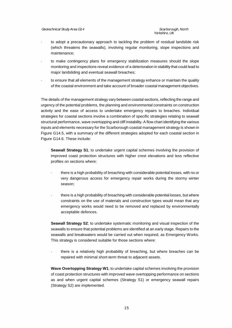
· to adopt a precautionary approach to tackling the problem of residual landslide risk (which threatens the seawalls), involving regular monitoring, slope inspections and maintenance;
· to make contingency plans for emergency stabilization measures should the slope monitoring and inspections reveal evidence of a deterioration in stability that could lead to major landsliding and eventual seawall breaches;
· to ensure that all elements of the management strategy enhance or maintain the quality of the coastal environment and take account of broader coastal management objectives.
The details of the management strategy vary between coastal sections, reflecting the range and urgency of the potential problems, the planning and environmental constraints on construction activity and the ease of access to undertake emergency repairs to breaches. Individual strategies for coastal sections involve a combination of specific strategies relating to seawall structural performance, wave overtopping and cliff instability. A flow chart identifying the various inputs and elements necessary for the Scarborough coastal management strategy is shown in Figure G14.5, with a summary of the different strategies adopted for each coastal section in Figure G14.6. These include:
Seawall Strategy S1; to undertake urgent capital schemes involving the provision of improved coast protection structures with higher crest elevations and less reflective profiles on sections where:
· there is a high probability of breaching with considerable potential losses, with no or
very dangerous access for emergency repair works during the stormy winter season;
· there is a high probability of breaching with considerable potential losses, but where
constraints on the use of materials and construction types would mean that any emergency works would need to be removed and replaced by environmentally acceptable defences.
Seawall Strategy S2; to undertake systematic monitoring and visual inspection of the seawalls to ensure that potential problems are identified at an early stage. Repairs to the seawalls and breakwaters would be carried out when required, as Emergency Works. This strategy is considered suitable for those sections where:
· there is a relatively high probability of breaching, but where breaches can be
repaired with minimal short-term threat to adjacent assets.
Wave Overtopping Strategy W1; to undertake capital schemes involving the provision of coast protection structures with improved wave overtopping performance on sections as and when urgent capital schemes (Strategy S1) or emergency seawall repairs (Strategy S2) are implemented.
Geotechnical Study Area G14 Scarborough, North Yorkshire, UK
16
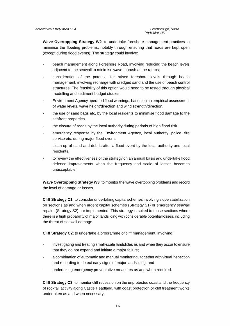
Wave Overtopping Strategy W2; to undertake foreshore management practices to minimise the flooding problems, notably through ensuring that roads are kept open (except during flood events). The strategy could involve:
· beach management along Foreshore Road, involving reducing the beach levels
adjacent to the seawall to minimise wave uprush at the ramps;
· consideration of the potential for raised foreshore levels through beach management, involving recharge with dredged sand and the use of beach control structures. The feasibility of this option would need to be tested through physical modelling and sediment budget studies;
· Environment Agency operated flood warnings, based on an empirical assessment of water levels, wave height/direction and wind strength/direction.
· the use of sand bags etc. by the local residents to minimise flood damage to the seafront properties.
· the closure of roads by the local authority during periods of high flood risk.
· emergency response by the Environment Agency, local authority, police, fire service etc. during major flood events.
· clean-up of sand and debris after a flood event by the local authority and local residents.
· to review the effectiveness of the strategy on an annual basis and undertake flood defence improvements when the frequency and scale of losses becomes unacceptable.
Wave Overtopping Strategy W3; to monitor the wave overtopping problems and record the level of damage or losses.
Cliff Strategy C1; to consider undertaking capital schemes involving slope stabilization on sections as and when urgent capital schemes (Strategy S1) or emergency seawall repairs (Strategy S2) are implemented. This strategy is suited to those sections where there is a high probability of major landsliding with considerable potential losses, including the threat of seawall damage.
Cliff Strategy C2; to undertake a programme of cliff management, involving:
· investigating and treating small-scale landslides as and when they occur to ensure
that they do not expand and initiate a major failure;
· a combination of automatic and manual monitoring, together with visual inspection and recording to detect early signs of major landsliding; and
· undertaking emergency preventative measures as and when required.
Cliff Strategy C3; to monitor cliff recession on the unprotected coast and the frequency of rockfall activity along Castle Headland, with coast protection or cliff treatment works undertaken as and when necessary.

Geotechnical Study Area G14 Scarborough, North Yorkshire, UK
17
These specific strategies are to be complemented by: · Maintenance to ensure that structures and slopes are not allowed to deteriorate to a
condition where serious problems become likely;
· Further studies to assist the development of sustainable seawall and breakwater improvements i.e. sediment transport studies, physical model studies, additional monitoring sites and automatic monitoring etc.
7. LESSONS LEARNT
The famous landslide at the Holbeck Hall Hotel at Scarborough has resulted in actions of both local and national importance. Locally it has led to the Council seeking government financial support for engineering remedial measures and the development of a comprehensive coastal strategy for the whole of the Scarborough frontage. The approach to the Strategy task, which is highlighted in this case study, is seen as a particularly successful example of an holistic approach to shoreline management. Nationally the legal actions arising from the Holbeck Hall landslide and the subsequent appeal have helped to clarify the responsibility of landowners and Coast Protection Authorities in areas of instability. Owners of the land need to ensure that through either action or lack of action they do not cause a nuisance to adjacent landowners either upslope or downslope. This can best be achieved through monitoring of ground conditions. The extent of monitoring necessary is likely to be dependent upon the resources of the landowner or responsible authority and the practicality of monitoring and investigation; in many cases these responsibilities may be shared by adjacent owners. All landowners need to give careful consideration to their land management techniques following the Scarborough judgement.
8. REFERENCES
Clark A. and Guest S. 1994. The design and construction of the Holbeck Hall landslide coast protection and cliff stabilisation emergency works. Proc MAFF Conference of River and Coastal Engineers.
High-Point Rendel. 1999. Holbeck-Scalby Mills, Scarborough; Coastal Defence Strategy, November 1999 (Volume 1, H421/R/2).

Figure G14.1 Scarborough Location map.

Figure G14.2 Geomorphological map, Scarborough.
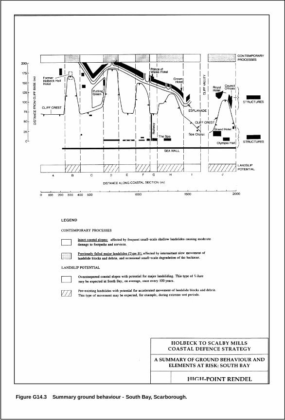
Figure G14.3 Summary ground behaviour - South Bay, Scarborough.

Geotechnical Study Area G14 Scarborough, North Yorkshire, UK
18
Plate G14a High aerial view of the town of Scarborough
Geotechnical Study Area G14 Scarborough, North Yorkshire, UK
19
Plate G14b High aerial view before the Holbeck landslide, 1978, South Bay
Plate G14c View of the Holbeck Hall landslide