Geospatial World Excellence Award Khing Chong.pdf · Field-to-Finish survey with electronic ......
39
Transcript of Geospatial World Excellence Award Khing Chong.pdf · Field-to-Finish survey with electronic ......


Geospatial World
Excellence Award
2012
in
Land
Administration

1. About Us
2. LASIS Applications
3. System Walk-Through
4. Conclusion
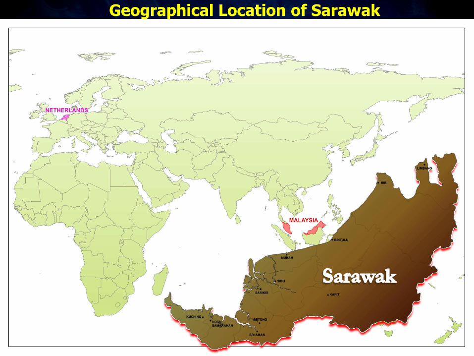
Geographical Location of Sarawak

One of the 13 states in Malaysia.
Practice Torrens Land System.
11 Divisions in Sarawak
Land size of 124,500 sq. km
Land Administration in
Sarawak

6
Land and Survey Information System

An integrated GIS centric land
administration and land
management system with
modular and flexible design

Enforcement
Information
System (EIS)
Cartographic
Mapping &
Publishing System
(CMAPS)
Land
Tenure
Land Development
Land Value
Land Use

Field-to-Finish survey with electronic field book.
Maintain a register of all land parcels in Sarawak.
Maintain the basemap for Sarawak.
Survey & Mapping System


Provide facility to register titles and land instruments.
Automated maintenance of rent records.
Automated maintenance of Personnel Profile.
Title Registration & Revenue
System

One Day Registration (since 2008).
Automated processing of land instruments.
Automated email notification to clients.
Key Features

Ease of Doing Business: World Bank Report

System Walk Through

Cadastral Map

Search by UPI

Land Tenure & Ownership

Title Information

Check Commitments

Private Development

Private Development & Government Projects

Land Require for Public Purpose

Physical Site Details

Land Use

Close View

Surrounding Land Use


Applications for Development


Checking Surrounding Land Use

Close View : Before

Close View : After

Surrounding Land Use

1. Improved productivity and integrity.
– Standardization for process automation
– Integrated system (do more with less)
– Embed business intelligence
– Digital transmission: No constraint of geographic distance or location
– Accurate, current, comprehensive and reliable data for planning, analysis and decision making
2. Upgrade skill and knowledge manpower.
– Integrated processes (Data and functions sharing)
Conclusion
Quality Service Delivery