Geoportal of Wallonia : discover geographic data in Wallonia
31
The Geoportal of Wallonia : come in and discover geographic data of Wallonia Vincent Bombaerts – Public Service of Wallonia Open Belgium 2015 Conference - 23d of February 2015 - Palais des Congrès, Namur
-
Upload
vincent-bombaerts -
Category
Presentations & Public Speaking
-
view
303 -
download
1
Transcript of Geoportal of Wallonia : discover geographic data in Wallonia
The Geoportal of Wallonia : come in and discover geographic data of Wallonia
Vincent Bombaerts – Public Service of Wallonia
Open Belgium 2015 Conference - 23d of February 2015 - Palais des Congrès, Namur


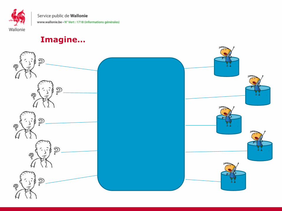
Imagine…

Imagine… a spatial data infrastructure
SDI
Spatial data
Metadata
Web services
Agreements on data sharing
Coordination
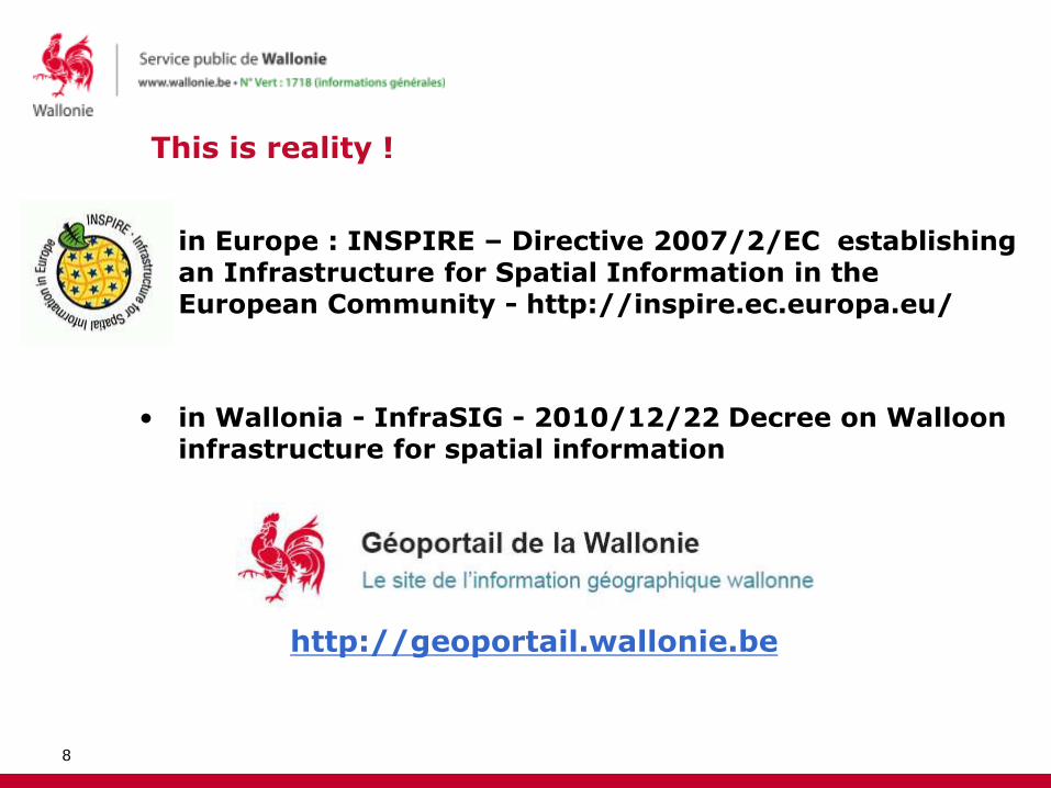
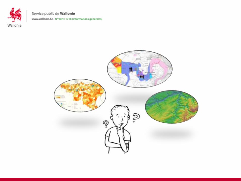
This is reality !
• in Europe : INSPIRE – Directive 2007/2/EC establishing an Infrastructure for Spatial Information in the European Community - http://inspire.ec.europa.eu/
• in Wallonia - InfraSIG - 2010/12/22 Decree on Walloon infrastructure for spatial information
8
http://geoportail.wallonie.be
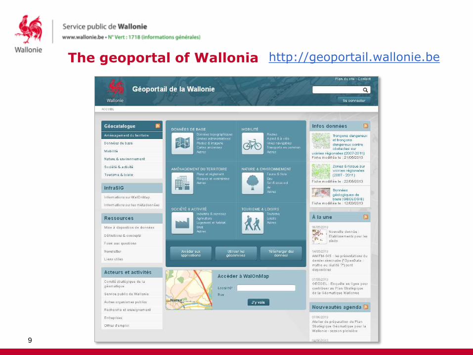
The geoportal of Wallonia
9
http://geoportail.wallonie.be
The Geoportal of Wallonia : come in and discover geographic data
• Introduction
• Enhance geographic data discoverability through a standardised metadata catalogue
• Focus on the main options for accessing geographic data through the Geoportal of Wallonia
• Conclusion

Metadata = data about the data
11
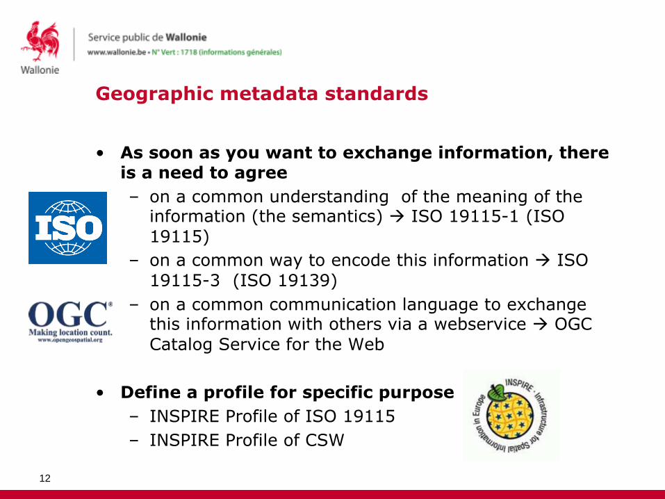
Geographic metadata standards
• As soon as you want to exchange information, there is a need to agree
– on a common understanding of the meaning of the information (the semantics) ISO 19115-1 (ISO
19115)
– on a common way to encode this information ISO
19115-3 (ISO 19139)
– on a common communication language to exchange this information with others via a webservice OGC
Catalog Service for the Web
• Define a profile for specific purpose
– INSPIRE Profile of ISO 19115
– INSPIRE Profile of CSW
12
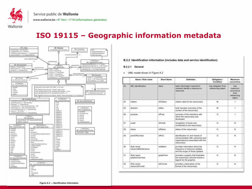
ISO 19115 – Geographic information metadata
13

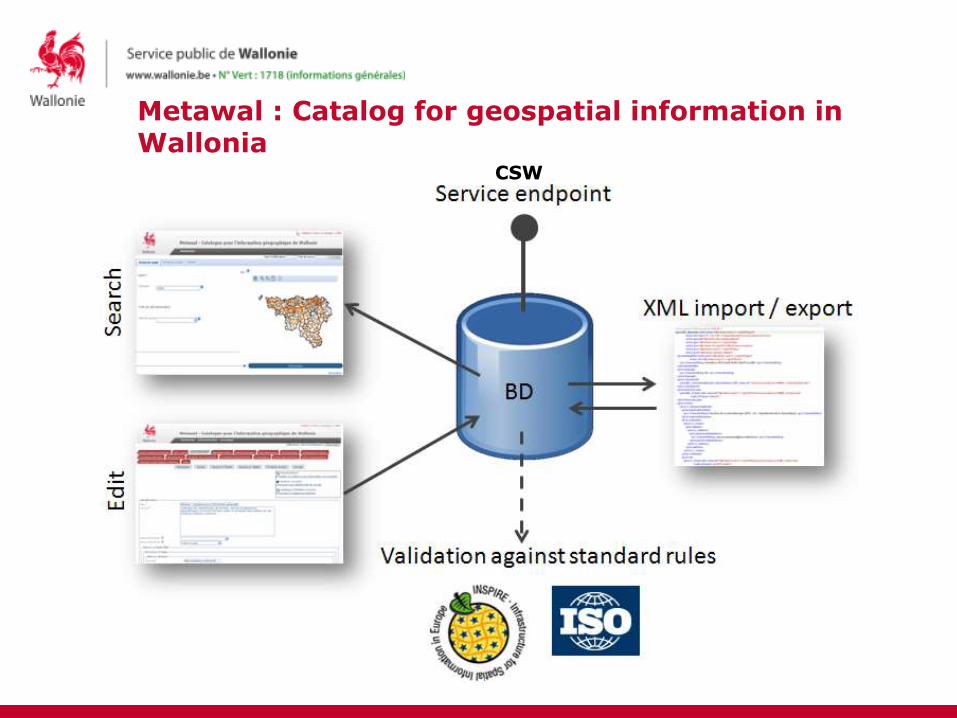
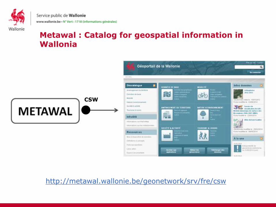
Metawal : Catalog for geospatial information in Wallonia
• The official metadata catalog and one of the basic component of InfraSIG , the Walloon SDI
– Whoever wants to enter InfraSIG as a producer must document its data in Metawal
• Based on GeoNetwork Opensource
http://geonetwork-opensource.org/
14
http://metawal.wallonie.be
Metawal : Catalog for geospatial information in Wallonia
CSW
Metawal : Catalog for geospatial information in Wallonia
CSW
http://metawal.wallonie.be/geonetwork/srv/fre/csw

Create once, reuse many times
CSW
Metawal
The Geoportal of Wallonia : come in and discover geographic data
• Introduction
• Enhance geographic data discoverability through a standardised metadata catalogue
• Focus on the main options for accessing geographic data through the Geoportal of Wallonia
• Conclusion

The geoportal of Wallonia : a quick overview
19
http://geoportail.wallonie.be
Find the data
View the data
Staticinformation
Dynamicinformation
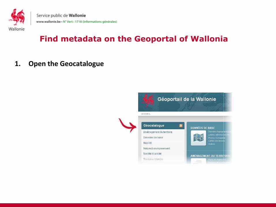
Find metadata on the Geoportal of Wallonia
1. Open the Geocatalogue
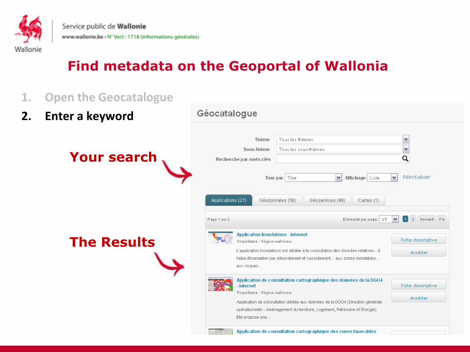
Find metadata on the Geoportal of Wallonia
1. Open the Geocatalogue
2. Enter a keyword
Your search
The Results
Find metadata on the Geoportal of Wallonia
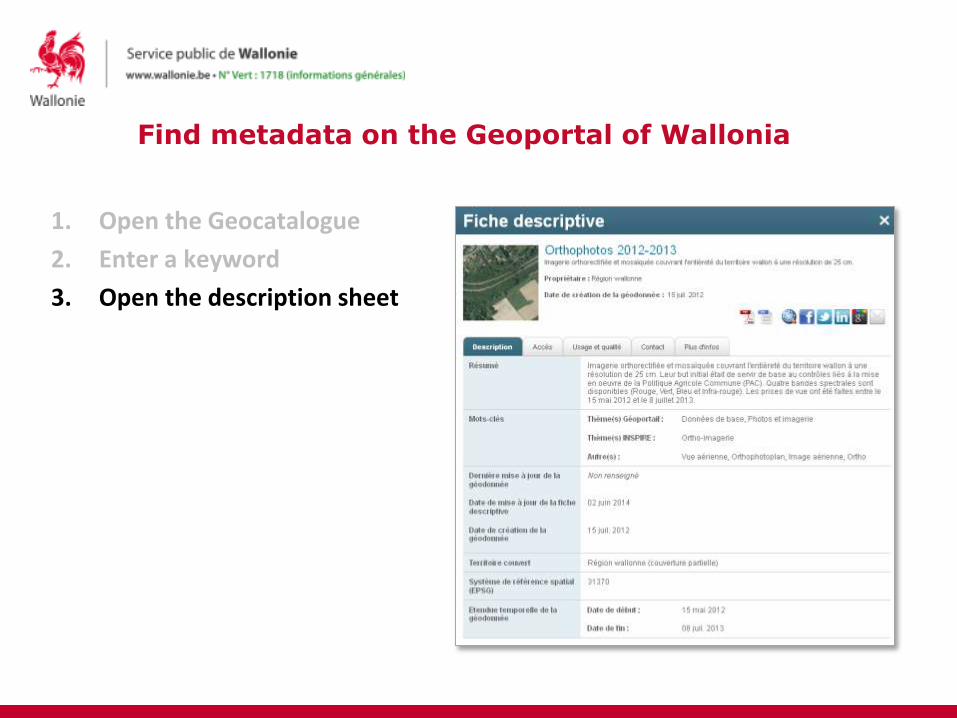
1. Open the Geocatalogue
2. Enter a keyword
3. Open the description sheet
Find access metadata
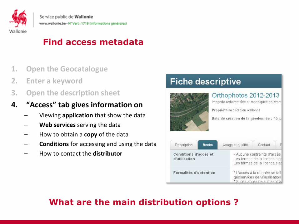
1. Open the Geocatalogue
2. Enter a keyword
3. Open the description sheet
4. “Access” tab gives information on– Viewing application that show the data
– Web services serving the data
– How to obtain a copy of the data
– Conditions for accessing and using the data
– How to contact the distributor
What are the main distribution options ?
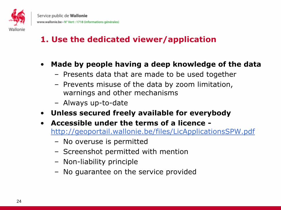
1. Use the dedicated viewer/application
• Made by people having a deep knowledge of the data
– Presents data that are made to be used together
– Prevents misuse of the data by zoom limitation, warnings and other mechanisms
– Always up-to-date
• Unless secured freely available for everybody
• Accessible under the terms of a licence -http://geoportail.wallonie.be/files/LicApplicationsSPW.pdf
– No overuse is permitted
– Screenshot permitted with mention
– Non-liability principle
– No guarantee on the service provided
24

2. Use a web service
• Dynamic access to the data
– Always up-to-date
– Zoom limitations may exist to prevent misinterpretation
• Various protocols : REST Geoservices, WM(T)S, KML
• Unless secured freely available for everybody
• Accessible under the terms of a licence -http://geoportail.wallonie.be/files/LicServicesSPW.pdf
– No overuse is permitted
– Non-liability principle
– No guarantee on the service provided
25
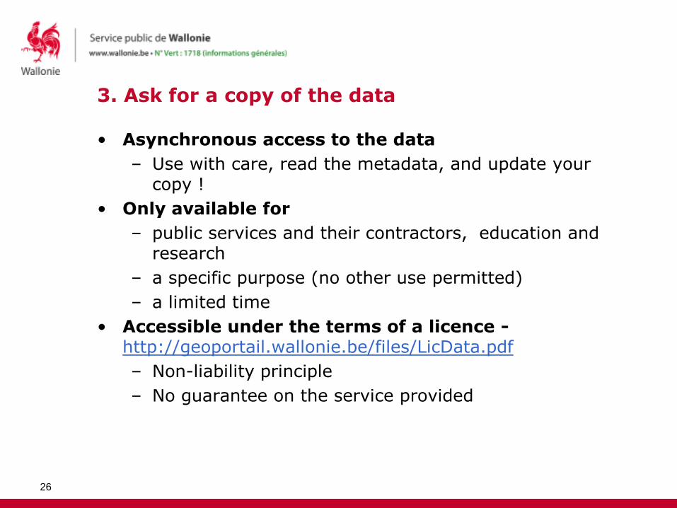
3. Ask for a copy of the data
• Asynchronous access to the data
– Use with care, read the metadata, and update your copy !
• Only available for
– public services and their contractors, education and research
– a specific purpose (no other use permitted)
– a limited time
• Accessible under the terms of a licence -http://geoportail.wallonie.be/files/LicData.pdf
– Non-liability principle
– No guarantee on the service provided
26

4. Freely download and use the data ?
• Try the keyword “open data” in the catalogue...
• More and more producer are willing to open up their data, but we lack a clear framework to do it.
• Strategic plan for geomatics in Wallonia (PSGW) -http://geoportail.wallonie.be/files/docs/PlanStrategiqueGeomatique/PSGW_approuve.pdf
– Adopted by the government on May 8th 2014
– Towards open data for geographic data in Wallonia
• 2014-2019 Policy Statement (DPR)
27

The Geoportal of Wallonia : come in and discover geographic data
• Introduction
• Enhance geographic data discoverability through a standardised metadata catalogue
• Focus on the main options for accessing geographic data through the Geoportal of Wallonia
• Conclusion
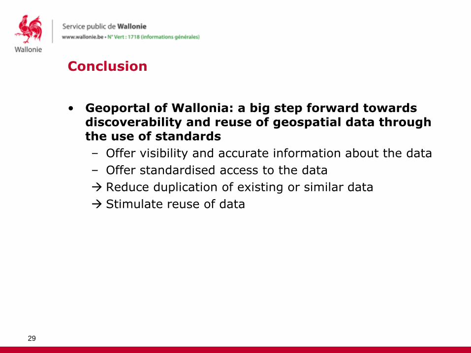
Conclusion
• Geoportal of Wallonia: a big step forward towards discoverability and reuse of geospatial data through the use of standards
– Offer visibility and accurate information about the data
– Offer standardised access to the data
Reduce duplication of existing or similar data
Stimulate reuse of data
29
Conclusion
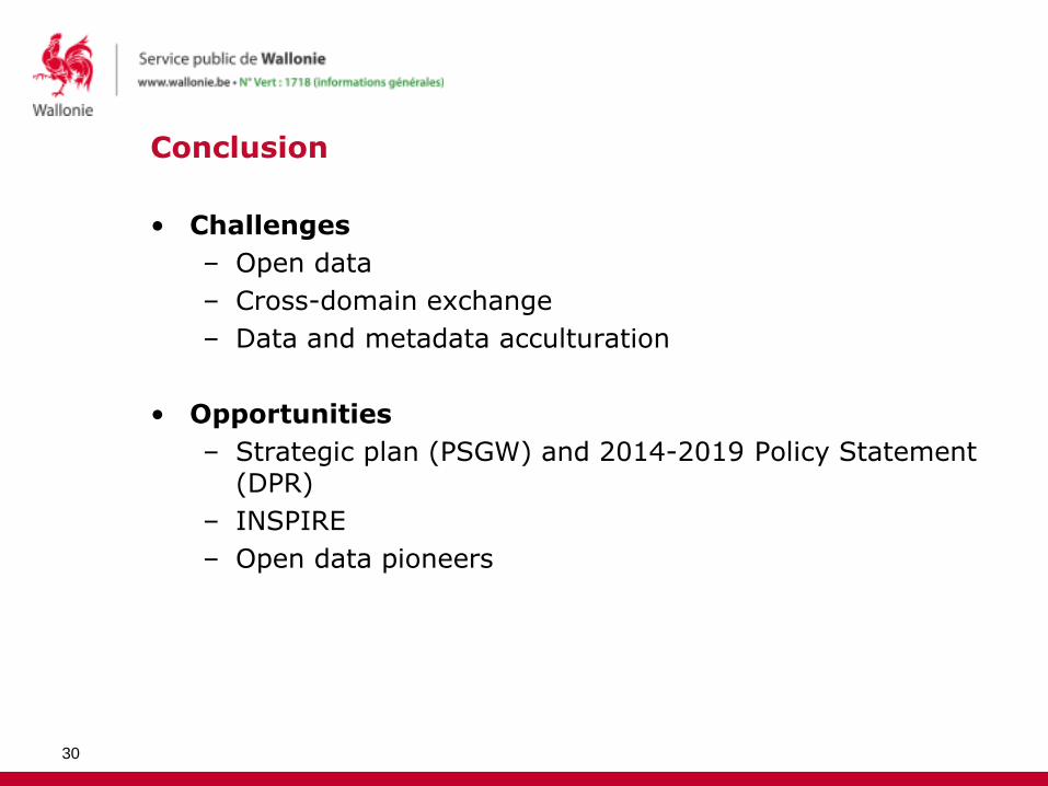
• Challenges
– Open data
– Cross-domain exchange
– Data and metadata acculturation
• Opportunities
– Strategic plan (PSGW) and 2014-2019 Policy Statement (DPR)
– INSPIRE
– Open data pioneers
30
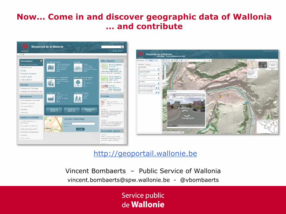
Now... Come in and discover geographic data of Wallonia... and contribute
Vincent Bombaerts – Public Service of Wallonia
[email protected] - @vbombaerts
http://geoportail.wallonie.be