GeoODK for Cropland & Crop type data collect
12
GeoODK for Cropland & Crop type data collect Xavier BLAES, François WALDNER, Thomas DE MAET Steffen FRITZ, Mathias KARNER
Transcript of GeoODK for Cropland & Crop type data collect
GeoODK for Cropland & Crop type data collect
Xavier BLAES, François WALDNER, Thomas DE MAET
Steffen FRITZ, Mathias KARNER

“JECAM Guidelines for Cropland and Crop Type definition and Field Data Collection”
• Annual cropland definition
• Crop types and land cover classes (legend definition)
eForm Cropland/Crop type data collect

• 3 components:
– Mobile (GeoODK collect app)
– Data storage (cloud) & access (ODK Aggregate)
– Web based form builder (Build or XLSForm)
• mobile data collection solutions• free and open-source
• for geo-referenced information

Field survey with "GeoODK Collect" app

Take picture & Record geo-position
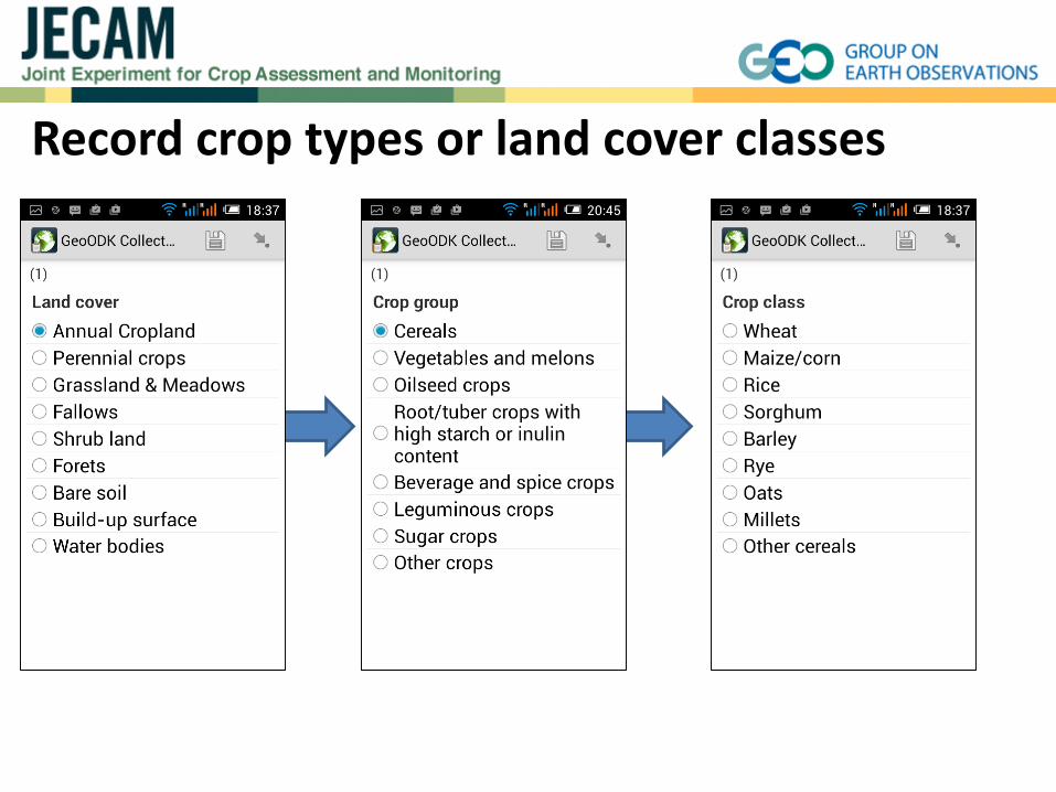
Record crop types or land cover classes

Record 1 or n crop type(s) for a single location

Possibility to record cropping practices info
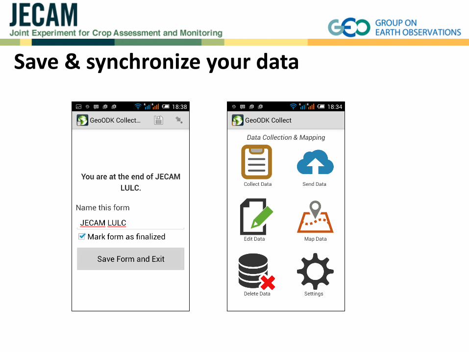
Save & synchronize your data

Multi language supported
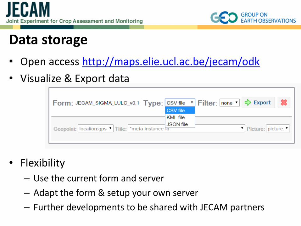
Data storage
• Open access http://maps.elie.ucl.ac.be/jecam/odk
• Visualize & Export data
• Flexibility
– Use the current form and server
– Adapt the form & setup your own server
– Further developments to be shared with JECAM partners

Thank you!