GEOLOGICAL SURVEY SWAYZE PROJECT SWAYZE, DENYES, AND DORE …
55
41015SE8111 8.7716 DORE 010 GEOLOGICAL SURVEY SWAYZE PROJECT SWAYZE, DENYES, AND DORE TOWNSHIPS, ONTARIO NTS: 41 O 15 RECEIVED j AN 29 1985 MINING LANDS SECTION Robert Bell Geologist Canadian Nickel Company Ltd. Copper Cliff, Ontario December, 1984 i 2- ri i
Transcript of GEOLOGICAL SURVEY SWAYZE PROJECT SWAYZE, DENYES, AND DORE …

41015SE8111 8.7716 DORE010
GEOLOGICAL SURVEY
SWAYZE PROJECT
SWAYZE, DENYES, AND DORE TOWNSHIPS,
ONTARIO
NTS: 41 O 15
RECEIVED
j AN 29 1985
MINING LANDS SECTION
Robert BellGeologistCanadian Nickel Company Ltd.Copper Cliff, OntarioDecember, 1984
i 2- ri i

SUMMARY AND CONCLUSIONS
The property consists of 359 contiguous claims, of which 237 are covered in this report, located in parts of Swayze, Denyes and Dore townships, approximately 240 km northwest of Sudbury.
A total of approximately 400 kilometres of line was cut and detail mapped at a scale of 1:2500. The claims are underlain by a synclinally folded sequence of volcanics, ranging in composition from ultramafic to felsic, and metasedi- ments. Several areas of pervasive carbonate alteration were outlined. Gold values are very low to weakly anomalous.
In many parts of the property outcrop exposure is very poor, hence prospecting by conventional methods has not upgraded or downgraded the potential for economic deposits.

——————K————————|——
^i__I.
Woman Rlv*r i
FIGURE l Canadian Nickel Company Limited
SWAYZE PROJECT, ONTARIO Location MapSCALE t' 250 000

4101SSE0H1 2.7716 DORE
TABLE OF CONTENTS010C
SUMMARY AND CONCLUSIONS
I.0 INTRODUCTION
2.0 LOCATION AND ACCESS
3.0 PROPERTY
4.0 PREVIOUS WORK
5.0 REGIONAL GEOLOGY
6.0 GEOLOGICAL SURVEY
6.1 Ultramafic Rocks6.2 Mafic Volcanics6.3 Intermediate Volcanics6.4 Acid Volcanics6.5 Metasedimentary Rocks6.6 Intrusive Rocks
7.0 MINERALIZATION
8.0 STRUCTURE AND ALTERATION
9.0 CONCLUSIONS AND RECOMMENDATIONS
10.0 REFERENCES
II.0 CERTIFICATE OF QUALIFICATIONS
Page
l
l
l
3
4
4
666778
9
9
10
10
11

FIGURES
Figure Number Scale
1 General Location Map 1:250,000
2 Claim Map . 1:50,000
3 Geology (Sheets 1-23) 1:2500
Table Number Page
l Geological Legend 5

1.0 INTRODUCTION
As a result of a study made to identify the most promising gold belts with unexplored potential, Canadian Nickel Company Limited (Canico) staked 560 contiguous claims in the Swayze township area in 1981. The present survey covers 237 contiguous claims located in parts of Swayze, Denyes and Dore townships.
The horseshoe shaped claim block covers a synclinally folded sequence of ultra mafic to felsic flows and intrusives, and metasediments. The claims were evalu ated for their gold potential by gridding and detail mapping. Any altered outcrops (carbonatized, sericitized, silicified, pyritized, quartz veins, etc.) were sampled and assayed for gold.
Favourable stratigraphy and alteration were encountered, but gold values were typically very low to only weakly anomalous.
2.0 LOCATION AND ACCESS
The property consists of 237 contiguous claims located in parts of Denyes, Dore and Swayze townships, approximately 240 km northwest of Sudbury, Ontario, and 55 km east of Chapleau, Ontario (Figure 1). The property lies within the Porcupine Mining Division. The NTS is 41-0-15.
Access is by float plane, utilizing numerous lakes located within the claim block. Airbases are located in Sudbury, Gogama, Folyet, and Chapleau.
The northeast corner of the property can now be accessed via a new gravel road, established by Heron Resources, originating in the Ivanhoe Provincial Park near Folyet, and leading to the former Kenty Mine.
3.0 PROPERTY
The property consists of 359 contiguous claims owned by Canico {Figure 2), of which 237 are covered in this report. The claims in Dore township, although contiguous with those in Swayze township, form an isolated block as the connecting claims are not gridded or included in the 237 claims under discussion.
Two years assessment work derived from a 1981 airborne geophysical survey kept the claims in good standing until April, 1984. The claims were then put under extension. Four additional claims in Denyes township were staked in 1984 to close open fractions found within the existing claim block.
The claims are as follows:
P606312.313 Recorded April 14, 1981; currently under extension to Dec. 14, 1984P606317P606320.321P606324.325P607075-080P607100-102 " " "

- 2 -
Claims recorded April 14, 1981 and currently under extension to April 12, 1985:
P574149P574150P574151P574154P576194P576195P588859P588860P588861P588862P588863P588864P588997P588998P588999P589000P605017P605077P605078P605125P605126P605127P605128P605129P605130P605131P605132P605135P606243P606244P606245P606246P606247P606248P606249P606250P606251P606252P606273P606274P606308P606309P606310P606311P606318P606319
P606326 P606327 P606328 P606329 P606330 P606331 P606332 P606333 P606334 P606335 P606336 P606339 P606340 P606341 P606342 P606343 P606344 P606345 P606349 P606350 P606399 P606400 P606401 P606402 P606403 P606404 P606405 P606406 P606407 P606408 P606409 P616410 P606411 P606412 P606413 P606414 P606415 P606416 P606417 P606435 P606436 P606437 P606438 P606439 P606442 P606443
P606444 P606445 P606446 P606447 P606448 P606451 P606452 P606455 P606458 P606459 P606460 P606461 P606462 P606473 P606474 P606475 P606476 P606486 P606487 P606488 P606489 P606490 P606491 P606492 P606496 P606497 P606498 P606499 P606500 P607001 P607002 P607005 P607006 P607007 P607008 P607009 P607010 P607011 P607012 P607013 P607020 P607021 P607022 P607023 P607024 P607025
P607026 P607062 P607073 P607074 P607081 P607082 P607085 P607086 P607088 P607089 P607090 P607097 P607098 P607099 P607106 P607107 P607108 P607109 P607110 P607111 P607112 P607113 P607114 P607115 P607116 P607117 P607118 P607119 P607120 P607121 P607122 P607123 P607124 P607125 P607126 P607127 P607128 P607129 P607130 P607131 P607132 P607133 P607134 P607135 P607136 P607137

- 3 -
Claims recorded April 15, 1981 and currently under extension to April 12, 1985:
P615989 P615997P615990 P615998P615991 P615999P615992 P616000P615993 P616005P615994 P616006P615995 P616007P615996 P616010
Claims staked in 1984:
P616011 P616012 P616014 P616015 P616016 P616025 P616026 P616027
P616030 P616031 P616032 P616035 P616036 P616037 P616040 P616041 P616042
P807250 Recorded June 21, 1984, due Oune 21, 1985 P808244 Recorded Aug. l, 1984, due Aug. l, 1985 P808245 P808246
4.0 PREVIOUS WORK
The discovery of the Kenty Mine in 1931 sparked considerable exploration acti vity throughout the Swayze belt. Gold mineralization at the Kenty Mine is related to quartz-carbonate veining within mafic volcanics and intrusives, and metasediments. Two ore shoots were reported to occur on surface: No. l vein - 6.3 feet wide, 50 feet long, averaging 0.39 oz/ton Au, and No. 2 - 3.7 feet wide, 72 feet long, averaging 0.67 oz/ton Au. Between 1931 and 1934, Kenty Gold Mines Ltd. sank 2 shafts, with some 6,750 feet of lateral development. The number l shaft is 510 feet deep and the number 2 shaft 534 feet deep.
The 1948 Financial Post Survey of Mines reported possible reserves of 69,000 tons in the number one shaft area and 290,000 tons in the number 2 shaft area of undetermined grade.
Vancouver based Heron Resources currently hold the property, and to date have carried out geology, soil sampling, magnetometer and IP surveys, as well as extensive stripping and trenching, dewatering of the number l shaft, and diamond drilling.
Following the discovery of the Kenty Mine, gold was subsequently found on an island in Cree Lake, and later 3500 feet east on the mainland. Gold was reported to be in a quartz-carbonate-sulfide vein system within sheared tuffs and andesite-basalts, averaging 2 feet in width. Flint Rock Mines Ltd. carried out a 34 hole drill program in 1961-62.
Gold was also discovered east of Cree Lake in the early 1930's, south of the lake referred to as Hook Lake. Buffalo-Canadian Gold Mines Ltd. trenched and stripped the showing, and carried out some drilling in the 1930's. Mineralized quartz within "silicified and carbonatized shear zones" assayed from 0.02 to 0.08 oz/ton Au.

- 4 -
Goldstar Explorations Ltd. carried out an electromagnetic survey and sub sequently drilled 5 boreholes in 1964 in Denyes township.
Canadian Nickel Company Ltd. carried out an airborne geophysical survey in the fall of 1981. The magnetometer survey helped to delineate the structure of the area. A series of ultramafic flows, sills and intrusives with a broad, high magnetic signature, was outlined in a horseshoe shape, revealing the synclinal folding present. The electromagnetic survey detected only two medium strength conductors, both attributable to graphitic metasedimerits. Reconnaiss ance geological and humus sampling surveys were carried out prior to gridding.
5.0 REGIONAL GEOLOGY
The claims are underlain by Archean rocks of the Swayze greenstone belt. The belt is about 45 km long and 29 km wide and is truncated at its western extre mity by the Kapuskasing structural zone; the Michipicoten-Wawa belt is probably the westerly equivalent or extension of the Swayze belt west of the Kapuskasing structure. To the east the belt bifurcates, with one arm trending towards the Porcupine area of the Abitibi belt, and the southern arm trending towards Gogama and Shiningtree.
The claims cover a large east-west synclinal structure, which appears to close near the west end of the property. The syncline is slightly overturned, as all structures dip steeply to the north, and plunges to the west. The location of the synclinal axis was traced with the aid of stratigraphic tops indicators such as graded bedding and pillow facings. On the north limb such features face south, but since they dip steeply north, the structure must be overturned.
Basal to the section is a series of ultramafic to mafic flows, sills and intru sives. These are overlain by a series of mafic to felsic flows, frequently fragmental, and tuffs. Several metasedimentary horizons are also present. The core of the syncline is occupied by a thick section of felsic volcanics and intrusives, primarily feldspar porphyritic rhyolites. The section is intruded by numerous dykes and sills of quartz-feldspar porphyry, and 2 minor granite plutons. A broad band of northeast trending metasediments crosses the west end of the property. A strongly magnetic northeast trending diabase dyke crosses the northwest portion of the claim block, slightly obscuring the magnetic interpretation of the western closure of the syncline.
6.0 GEOLOGICAL SURVEY
A total of approximately 400 km of line at 100 m line spacing was cut in Dore, Denyes and Swayze townships to facilitate the geological survey. Pickets were marked at 25 m intervals along the lines. The field data was plotted at the scale of 1:2500 and copies of the maps are appended.
Four additional claims were added to the claim block during the field season. Three were staked in the southwest corner of the block, east of Sylvanite Lake to close a gap in the original staking. A fourth claim was picked up in the northwestern part of the block. This claim had been held by foreign interests at the time of the original staking.

- 5 -
The table below outlines the rock units mapped. Note that no age connotation is implied as volcanism is cyclical. A description of the rock units follows:
TABLE l
LEGEND
6) INTRUSIVE ROCKS 6e lamprophyre6d alkalic aphanitic sill, dykes 6c diabase 6b granite 6a quartz-feldspar porphyry
5) METASEDIMENTARY ROCKS5f felsic polymictic conglomerate5e alkalic conglomerate5d grit, conglomerate, reworked tuff5c quartzite5b shale, argillite, siltstone, interflow sediments5a chert, interflow sediments
4) ACID VOLCANICS4f chlorite-carbonate-sericite schist4e quartz-feldspar-sericite schist4d fragmental4c felsic tuff4b porphyritic rhyolite4a massive rhyolite
3) INTERMEDIATE VOLCANICS3d fragmental, locally reworked intermediate conglomerate3c intermediate tuff3b porphyritic andesite-dacite3a massive andesite-dacite
2) MAFIC VOLCANICS2h granitized basalt2g agglomerate2f fragmental2e basic tuff2d gabbro-thick flow2c porphyritic basalt2b pillowed basalt2a massive basalt
1) ULTRAMAFIC ROCKSle flowtop rubble/brecciaId high MgO basaltle serpentinitel b peridotite {^pyroxenite)la ultramafic flows (komatiite)
Note that tuffs have not been mapped as discrete units; in order to distinguish their composition they are classified as mafic, intermediate, or acid tuffs and coloured accordingly.

- 6 -
6.1 Ultramafic Rocks
The ultramafic rocks occur as a series of ultramafic flows and subvolcanic sills intercalated with mafic flows. Flow textures were found only in the southeast portion of the block, southeast of Dyment Lake, as far west as claim P616025.
The komatiites are characterized by pyroxene spinifex with skeletal crystals ranging in size from l mm to 8 cm. Stratigraphically above^the spinifexoid horizons are flow top breccia-rubble zones, up to several metres thick, con sisting of numerous highly packed subrounded fragments of ultramafic material, often spinifexoid. The rubble zones often grade into poorly developed ultra mafic to (high MgO) basaltic pillows. The entire sequence grades, both laterally and vertically, into "normal" basalts.
Along the north limbs of the syncline no ultramafic rocks were seen. Magnetic mafic rocks occur as intrusives or subvolcanic sills, which are fine to medium- grained and typically oxide rich (magnetite) quartz gabbros in composition.
6.2 Mafic Volcanics
The most frequently exposed rock type on the property is basaltic in compo sition, occuring as massive flows, pillows, tuffs, fragmentals and agglomerate.
The typical basalt is fine-grained, massive, and variably foliated. Pillows are generally absent or poorly developed and hence are poor tops indicators.
Frequently fine-grained basalts can be found which grade into medium-grained varieties, probably representing thick flow centres. Medium to coarse-grained gabbroic basalts, frequently magnetic, are common northwest of Brett Lake.
These coarse-grained basalts are typically oxide rich (magnetite) quartz gabbros, interpreted to be thick flows, and responsible for the broad high magnetic zones delineated by the air magnetometer survey.
Locally the basalts are feldspar porphyritic, with phenocrysts up to several centimetres in size. Fragmental flows are also found locally. Subangular frag ments of basalt and andesite, generally several centimetres in size, occur in a matrix of fine-grained basalt. Finely bedded to massive ash and lapilli tuffs are probably more common than indicated; they are frequently indis tinguishable from mafic flows.
Thin conformable interflow sedimentary horizons are often found between indi vidual basalt flows. These are generally chert and argillite-siltstone. It is assumed many more such horizons are present but not encountered due to their recessive weathering, especially along contacts.
6.3 Intermediate Volcanics
Andesites and dacites were lumped together as intermediate volcanics for mapping purposes. These rocks generally occur as transition phases between the basalts and rhyolites, hence are often located Stratigraphically below

- 7 -
the felsic volcanics. They are typically pale green to greenish-white on weathered outcrops, and light green on the fresh surface. The flows are fine grained, and typically massive. However, a broad band of fragmental andesites {lapilli tuffs) trends easterly north of Brett Lake. Intermediate to felsic subangular fragments, up to several centimetres in size, are found in a matrix of andesitic composition. The fragments are usually aligned subparallel to parallel to the predominant regional foliation. Locally these fragmental s appear reworked, and are hence actually conglomeratic in nature.
6.4 Acid Volcanics
Acid volcanics are very common in the Swayze area. The core of the syncline is occupied by a thick section of rhyolite flows and intrusives, frequently feldspar porphyritic. The claims cover the favourable stratigraphy basal to the acid volcanics, on both limbs of the syncline. Numerous thin lenses and horizons of acid volcanics are intercalated with the basal basalts and koma- tiites. Metasediments such as shales and sandstones appear to have a spatial relationship with the acid volcanics.
Massive rhyolite flows are typically white weathering and white to whitish brown or green on the fresh surface. Subhedral phenocrysts of feldspar, up to several millimetres in size, are very common. The rhyolites are frequently strongly foliated and sericitized, such that they were mapped as sericite schists. Such alteration makes it impossible to distinguish between acid flows and tuffs. Carbonatization along foliation planes is also very common, giving the rocks a rusty weathering colour.
As mentioned above, (feldspar) crystal tuffs are fairly common but difficult to distinguish from feldspar porphyritic flows. Fragmental rhyolite flows can also be found, with angular to subangular fragments of rhyolite, and occasionally chert, within a rhyolite matrix.
Waterlain lapilli tuffs with interstitial pyrite {up to 650 are very common in the northeast corner of the property, in Dore township.
6.5 Met a sedi me ntary Rocks
Metasediments within the claim area represent approximately ID-15% of the rocks exposed. They can be divided into 2 major types:
a) thin interflow sediments representing short breaks or hiatuses between volcanic cycles, and
b) major sedimentary "breaks" representing a lengthy period of erosion and volcanic quiescence.
Metasediments of section (b) occur as a broad band which trends east-west south of Cree Lake, then swings northwest through Halcrow township then north east through Denyes township, crossing to the north of the northwest corner of the claim block. This horseshoe shape mimics the structural sequence found within the claim block, and hence may represent a synclinally folded section basal to the rocks within the claim block.

- 8 -
Metasediments outcropping on the property include:
5a) and 5b) interflow cherts, shales, argillites, and siltstones, found inter calated with volcanic flows. One such horizon in the northwest corner of the property can be traced for l kilometre.
5c) and 5d) quartzites, grits, reworked tuffs. These rocks occur as uncon formable lenses within the volcanics, especially the acid volcanics. They are probably derived from paleotopographic high acid centres and domes. An interesting assemblage of drag folded shales, greywackes, and sandstone is interfingered with acid and basic volcanic rocks in the southwest corner of the property south of Dyment Lake.
5e) "syenitic agglomerate" - this unit, the most unique formation on the pro perty, makes an excellent marker horizon. In hand specimen, it resembles a diatreme breccia, however it occurs as a conformable horizon up to 150 metres thick and can be traced for over a kilometre, south of Dyment Lake. Angular fragments of brick red, fine-grained, occasionally feldspar porphyritic syenite(?) are hosted in a chloritic glassy matrix. Lesser amounts of pyroxene- rich basalt fragments are also present, and to the west subrounded quartz pebbles are present. Pseudo-graded bedding is exhibited, with fragments ranging from metre size blocks to lapilli and ash size. The unit is probably a high- energy agglomerate {the syenitic fragments having been ripped up at depth), although locally it resembles a lapilli or ash tuff.
5f) felsic polymictic conglomerate. This is also a fairly high-energy sedi mentary rock, found interbedded with massive rhyolite flows, north of Freymond Lake and not on the present grid. Subangular to rounded fragments of slate, argillite, chert, quartz, and rhyolite, ranging in size from one millimetre to several centimetres, are hosted in a fine-grained felsic matrix. The rock contains S-5% fine-grained disseminated pyrite and is weakly carbonatized. Pyrite has also replaced fragments of slate and argillite.
6.6 Intrusive Rocks
Intrusive rocks within the claim block can be divided into 4 major types.
a) Quartz-feldspar-porphyry - the claim area is intruded by innumerable sills and dykes of feldspar-quartz porphyry, ranging in width from less than l metre to 50 metres. Individual sills can be traced for up to 1.3 km. These rocks are white to pinkish white both on the fresh and weathered surfaces with numerous phenocrysts of feldspar and locally of quartz. They are dacitic to rhyolitic in composition. There may be a genetic relationship between these rocks and some of the fragmental and or porphy ritic andesite-dacite flows as the two are often on strike with each other. North of Brett Lake a 200 metre wide unit mapped as intrusive porphyry may be a porphyritic acid volcanic flow.
b) Diabase - a major diabase dyke, up to 75 metres wide, crosses the property at 060 to 070 . The diabase is coarse-grained, extremely friable and strongly magnetic. It can be mapped for 9 km across the property and has been traced via geophysics (mag) along strike south of Timmins, through Lake Abitibi and on into Quebec. A thinner northwesterly trending arm branches off the main dyke north of Dyment Lake.

- 9 -
c) Alkalic, aphanitic sills, dykes - these rocks are very fine-grained to aphanitic, with a chilled, quenched appearance. They are generally wine coloured, often magnetic, and contain minor amounts of pyrite. They may represent quenched oxide-rich gabbros.
d) Lamprophyre - a black, medium-grained magnetic biotite lamprophyre dykeoutcrops west of Swayze Lake. The magnetic survey suggests that the dyketrends at 135 .
7.0 MINERALIZATION
Northeast of Swayze Lake a carbonate alteration zone was discovered on claim 607130. Highly carbonatized mafic and felsic tuffs with disseminated pyrite (up to 530 host a number of large quartz veins trending at about 340 and 070 . The veins carry variable amounts of pyrite and chalcopyrite (up to 5ft). All Au assays were low, the highest being 15 ppb.
The gridded claims in Dore township cover felsic lapilli tuffs with an inter stitial pyrite content of up to 6ft. Such rocks are locally anomalous 1n gold, with typical values of 50-80 ppb and a high of 2.12 ppm. A persistent set of thin north-south trending quartz veinlets is present which also carry weakly anomalous gold values.
8.0 STRUCTURE AND ALTERATION
The rocks in the claim area have been folded into a slightly overturned syn cline; all units dip steeply north, and yet pillow facings and graded bedding give contradictory tops on opposite sides of the syncline. Small draa folds indicate that the syncline has a north-westerly plunge, typically 65 towards 3200 .
The ground magnetometer survey indicates that local shearing and faulting is common. Only 2 major faults are obvious. Both trend 340-350 , and both are sinistral with apparent offsets of approximately 500 metres. One fault crosses the eastern end of the Cree Lake grid, passes through the northwest arm of Brett Lake and off the property. The second fault runs up the southeast arm of Dyment Lake. The ground mag survey readily identifies this fault.
The regional structure is well reflected within the outcrops exposed along the shores of the long lake south of Dyment Lake. Intercalated volcanics and sediments show rapid facies variations and are drag folded, Z style, showing a plunge of roughly 65 to the northwest. This suggests an anticlinal axis to the south, which is shown to exist on ODM map 2221. The area is pervasively carbonatized but no anomalous gold values were recorded.
All the rock names used in this report should be prefixed with a "meta", as a regional metamorphism of lower greenschist facies is present. Locally the rhyolitic tuffs and flows, and mafic and ultramafic rocks, have undergone varying degrees of iron-carbonatization. The ultramafic rocks are frequently serpentinized, and locally have undergone a talc-chlorite-carbonate alteration. The rhyolitic rocks have experienced varying degrees of sericitization.

- 11 -
11.0 CERTIFICATE OF QUALIFICATIONS
I, Robert C. Bell, of the City of Sudbury, in the Province of Ontario,
HEREBY CERTIFY:
1. That I reside at 1149 Southview Drive, Sudbury, Ontario, P3E 217.
2. That I am a graduate of the University of Western Ontario, London, Ontario with a degree of Bachelor of Science (1980).
3. That I am a Geologist with the Canadian Nickel Company Limited (subsidiary of Inco Limited) of Copper Cliff, Ontario, POM 1NO.
4. That I have practised my profession as a geologist since 1980, having worked in British Columbia, Ontario, Quebec and the Northwest Territories.
5. That I visited the areas discussed in this report and that the work described in this report was carried out under my supervision.
6. That I am an associate of the Geological Association of Canada.
Dated at Copper Cliff, this 21st. day of January, 1985.
Robert CrBeTT

- 10 -
9,0 CONCLUSIONS AND RECOMMENDATIONS
The claims are underlain by a folded sequence of volcanics and metasediments intruded by late porphyry dykes. The volcanic rocks range in composition from ultramafic to felsic. Favourable alteration such as carbonatization was observed in several areas. Gold values are only rarely anomalous.
Outcrop exposure is generally poor, especially at the western end of the pro perty. Hence vast areas of the property remain essentially unexplored and would require further evaluation via (basal till) reverse circulation drilling, IP, etc.
10.0 REFERENCES
Cunningham, L.J. (1982): Report on the Swayze Township property of Troudor Resources Inc., O.G.S. Assessment Records, Timmins, Ontario.
Donovan, J.F. (1965): Swayze and Dore Townships, O.G.S. G.R. No. 33.
Evelegh, F.J. (1982): Report on Geophysical Surveys, Sylvanite Group ofClaims, Denyes Township, Porcupine Mining Division, Province of Ontario, O.G.S. Assessment Records, Timmins, Ontario.
Lewin, E.M. (1962-63): Drill Logs, Flint Rock Mines Ltd., Swayze Township, O.G.S. Assessment Records, Timmins, Ontario.
MacQuarrie, D.R., and Sheldrake, R.F. (1982): VLF-EM and Magnetometer Survey on the Cree Lake Gold Prospect of Troudor Resources Inc., O.G.S. Assessment Files, Timmins, Ontario.
McKechnie, D.L. (1962): Report on Flint Rock Mines Ltd., Swayze Township, O.G.S. Assessment Records, Timmins, Ontario.
Northern Miner Press Ltd., April 12, 1984; "The Northern Miner".
Phelan, L.G. (1964): Drill Logs, Goldstar Ltd., O.G.S. Assessment Records, Timmins, Ontario.
Rickaby, H.C. (1934): Swayze Gold Area, O.D.M. AR 43, Part 3.


-
FIGURE 2 Canadian Nickel Company Limited
SWAYZE PROJECT, ONTARIO Claim Location Map
SCALE P5OOOO

Canadian Nickel Company LimitedCopper Cliff * Ontario POM 1NO
REGISTERED MAIL
January 23, 1985
Mr. F. W. MatthewsSupervisor, Projects SectionMinistry of Natural ResourcesRoom 6450Whitney Block, Queen's ParkToronto, OntarioM7A 1X1
Dear Mr. Matthews:
Enclosed is a geological report in duplicate being submitted under the Special Provisions Section as assessment work on the following 237 claims located in Swayze, Denyes, and Dore Townships, Porcupine Mining Division,
P574149 P574154 P576194 P588859 P588997 P605017 P605077 P605125 P605135 P606243 P606273 P606308 P606317 P606324 P606339
•51 incl.
•95•64 incl.•9000 incl
•78•32 incl.
•52 incl.•74•13 incl.•21 incl.•36 incl.•45 incl.
P606349 P606399 P606435 P606442 P606451 P606455 P606458 P606473 P606486 P606496 P607001 P607005 P607020 P607062 P607073
•50•417 incl,•39 incl.•48 incl.•52
•62 incl.•76 incl.•92 incl.•500 incl•02•13 incl.•26 incl.
•82 incl.
P607085 P607088 P607097 P607106 P615989 P616005 P616010 P616014 P616025 P616030 P616035 P616040 P807250 P808244
•86•90•102 incl.•37 incl.•6000 incl•07 incl.•12 incl.•16 incl.•27 incl.•32 incl.•37 incl.•42 incl.
•46 incl.
The report of work covering this submission was forwarded to the Mining Recorder in Timmins and subsequently recorded on December 11, 1984.
I trust that this report will be considered satisfactory by your department.
Yours
W. V. Rodney Exploration Departr
IM/nk
RECEIVED
JA * 2 l J 1985
WINING LANDS SECTION
Exploration subsidiary of
INCO LIMITED

41015SE8111 2 .7716 DORE 900
Mining Lands Section
Control Sheet
File No s3. 77/6-
TYPE OF SURVEY GEOPHYSICAL ^ GEOLOGICAL
GEOCHEMICAL
EXPENDITURE
MINING LANDS COMMENTS:
Signature of Assessor
Date

1985 03 OG Your File: 530/84 Our File: 2.7716
Mining RecorderMinistry of Natural Resources60 Wilson AvenueTliiiwins, OntarioP4N 2S7Dear Sir;RE; lw tice of Intent dated February 8, 1985
Geological Survey on Mining Claims P 574149, et.aal., 1n Swayze, Denyes 4 Dore Townships
The assessment work credits, as listed with the above-mentioned Notice of Intent, have been approved as of the above date.
Please Inform the recorded holder of these mining claims and so Indicate on your records.
Yours sincerely,
S.E. YundtDirectorLand Management Branch
Whitney Block. Room 6643 Queen's Park Toronto, Ontario M7A 1W3 Phone:(416)965-4888
S. Hurst:me
cc: Canadian Nickel Company Limited Copper Cliff, Ontario POM 1NO Attention: I.D. McCasklll
cc: Mr. G.H. FergusonMining ft Lands Commissioner Toronto, Ontario
Encl.
cc: Resident Geologist Timmins, Ontario

Ministry of Natural
jurcesOntario
Technical Assessment Work Credits Date
1985 02 08
File2.7716
Mining RecorderU Reop/t of Work No. 530/84
Recorded Holder
CANADIAN NICKEL COMPANY LIMITEDTownship or Area
SWAYZE. DENYES. DORE TOWNSHIPS
Type of survey and number ofAssessment days credit per claim
i . —— . ————————————————————————i Geophysical1* Elartrnmagnatic
1 Mflf)nttnmat"l: -
lppHinmatrlr
f-;
'Sil:
1 nth.rt", P::':
days
days
days
days
days
.g Section 77 (19) S** "Mining Clalmt AitetMd" column
l' 40| Geologicali: :-" ftanohemiral1
l Man days Q Airborne
Special provision ED Ground
*
days
days
D
0
JH Credits have been reduced because of partialcoverage of claims.
CD Credits have been reduced because of correctionsto work dates and figures of applicant.
#' ;V,::
Mining Claims Assessed
P 574151-54576194-95588859 to 864 incl.588997 to 9000 incl.605017605077-78605125 to 131 incl.605135606244 to 252 incl.606273-74606308 to 313 incl.606317-18606325 to 336 incl.606339-40-41-42606344-45-49-50-99606400-01-02-03-06-07606409 to 417 incl.
P 607098-99-100607106 to 125 incl.607127 to 137 incl.615992 to 6000 Incl.616005-06-07616010-11-12-14-15616025-26-27-30-31-32616035-36-37-40-41-42807250808244-45
606435 to 439 incl. 606442-43-44-46-47-48-51-52-55606458 to 462 incl. 606473 to 476 incl.606486 to 492 incl.606496 to 500 incl.607001-02607005 to 013 incl.607020 to 025 incl.607062607073 to 082 incl.607085-86-88-89-90
Special credits under section 77 (16) for the following mining claims
30 DAYS CREDIT
P 605132 606243606319-24-43 606404-08 607026-97
P 607101-02-26 615^89-90-91
20 DAYS CREDITP 574149-50
606320-21 606405-45 616016 808246
credits have been allowed for the following mining claims
LJ not sufficiently covered by the survey Q Insufficient technical data filed
The Mining Recorder may reduce the above credits if necessary in order that the total number of approved assessment days recorded on each claim does not exceed the maximum allowed as follows: Geophysical — 80; Geological — 40; Geochemical — 40; Section 77(19)—60:

Ministry ofNaturalResources
1.985 02 089, -111 (o
Your File: 5 30/84
Mining RecorderMinistry of Natural Resources60 Wilson AvenueTimmins, OntarioP4N 2S7
Dear Sir:
Enclosed are two copies of a Notice of Intent with statements listing a reduced rate of assessment work credits to be allowed for a technical survey. Please forward one copy to the recorded holder of the claims and retain the other. In approximately fifteen days from the above date, a final letter of approval of these credits will be sent to you. On receipt of the approval letter, you may then change the work entries on the claim record sheets.For further information, if required, please contact Mr. R.J. Pichette at 416/965-4888.
Yours sincerely,
;.E. YundtDirectorLand Management Branch
Whitney Block, Room 6643 Queen's Park Toronto, Ontario M7A 1W3S. Hurst:mc
Encls.
cc: Canadian Nickel Company Limited Copper Cliff, Ontario POM l NO Attention: I.D. McCaskill
cc: Mr. G.H. FergusonMining 4 Lands Commissioner Toronto, Ontario
845

Ministry ofNaturalResources
Ontario
Notice of Intent
for Technical Reports
1985 02 08
2.7716/530-84
An examination of your survey report indicates that the requirements of The Ontario Mining Act have not been fully met to warrant maximum assessment work credits. This notice is merely a warning that you will not be allowed the number of assessment work days credits that you expected and also that in approximately 15 days from the above date, the mining recorder will be authorized to change the entries on his record sheets to agree with the enclosed statement. Please note that until such time as the recorder actually changes the entry on the record sheet, the status of the claim remains unchanged.
If you are of the opinion that these changes by the mining recorder will jeopardize your claims, you may during the next fifteen days apply to the Mining and Lands Commissioner for an extension of time. Abstracts should be sent with your application.
If the reduced rate of credits does not jeopardize the status of the claims then you need not seek relief from the Mining and Lands Commissioner and this Notice of Intent may be disregarded.
If your survey was submitted and assessed under the "Special Provision-Performance and Coverage" method and you are of the opinion that a re-appraisal under the "Man-days" method would result in the approval of a greater number of days credit per claim, you may, within the said fifteen day period, submit assessment work breakdowns listing the employees names, addresses and the dates and hours they worked. The new work breakdowns should be submitted direct to the Land Management Branch, Toronto. The report will be re-assessed and a new statement of credits based on actual days worked will be issued.
846 (82/5)

\
•if
SCHEDULE A
P574149P574150P574151P574154P576194P576195P588859P588860P588861P588862P588863P588864P588997P588998P588999P589000P605017P605077P605078P605125P605126P605127P605128P605129P605130P605131P605132P605135P606243P606244P606245P606246P606247P606248P606249P606250P606251P606252P606273P606274P606308P606309P606310P606311P606312P606313P606317P606318
P606319P606320P606321P606324P606325P606326P606327P606328P606329P606330P606331P606332P606333P606334P606335P606336P606339P606340P606341P606342P606343P606344P606345P606349P606350P606399P606400P606401P606402P606403P606404P606405P606406P606407P606408P606409P606410P606411P606412P606413P606414P606415P606416P606417P606435P606436P606437P606438
P606439'P606442P606443P606444P606445P606446P606447P606448P606451P606452P606455P606458P606459P606460P606461P606462P606473P606474P606475P606476P606486P606487P606488P606489P606490P606491P606492P606496P606497P606498P606499P606500P607001P607002P607005P607006P607007P607008P607009P607010P607011P607012P607013P607020P607021P607022P607023P607024
P607025P607026P607062P607073P607074P607075P607076P607077P607078P607079P607080P607081P607082P607085P607086P607088P607089P607090P607097P607098P607099P607100P607101P607102P607106P607107P607108P607109P607110P607111P607112P607113P607114P607115P607116P607117P607118P607119P607120P607121P607122P607123P607124P607125P607126P607127P607128P607129
P607130P607131P607132P607133P607134P607135P607136P607137PSI 5989P615990P615991P615992PSI 5993PSI 5994PSI 5995PSI 5996PSI 5997PSI 5998PSI 5999PSI 6000PSI 6005P616006P616007P616010P616011P616012P616014P616015P616016P616025P616026P616027P616030P616031P616032P616035PSI 6036P616037P616040P616041P616042P807250P808244P808245P808246
Total = 237

Ministry o!NaturalResources
Ontario
t.-
Report of Work(Geophysical, Geological, Geochemical and Expenditures)
f"3 3 l O/
' ^.^ \i
The Mining Act
Instructions: — Please type or print.— If number of mining claims traversed
exceeds space on this form, attach a list. Note: — Only. days credits calculated in the
"Expenditures" section may be entered in the "Expend. Days Cr." columns.
- Do not use shaded areas below.Type of Survey(s)
GEOLOGICALClaim HolderU)
CANADIAN NICKEL COMPANY LIMITEDAddress
COPPER CLIFF. ONTARIO POM 1NOSurvey Company . Date of Sur
CANADIAN NICKEL COMPANY LIMITED ' fflv l W*Nome and Address of Author (of Geo-Technical report)
J. PERRY c/o CANADIAN NICKEL COMPANY LIMITED
Township or Area
SWAYZE .DENYES, DORE TWPS.Prospector's Licence No.
A 17527
vey (from St to), 84 30 , 08 841 Yr. Bay \ Mo. \ Y r.
Total Miles of line Cut
412 km
Credits Requested per Each Claim in Columns at right Mining Claims Traversed (List in numerical sequence)Special Provisions
For first survey:
Enter 40 days. (This includes line cutting)
For each additional survey: using the same grid:
Enter 20 days (for each)
Man Days
Complete reverse side and enter total(s) here
Airborne Credits
Note: Special provisions credits do not apply to Airborne Surveys.
Geophysical
- Electromagnetic
- Magnetometer
- Radiometric
- Other
Geological
Geochemical
Geophysical
- Electromagnetic
- Magnetometer
- Radiometric
- Other
Geological
Geochemical
Electromagnetic
Magnetometer
Expenditures (excludes power 5 t fiftf?i n6*
Days perClaim
40
Days per Claim
Days per Claim
K K n M f?Type of Work Performed \ [j) {3 ^ lia U V te
Performed on Claim(s) OtU * * tiB4i
A.M.7iftiOilOtll l2il|2|~o|4
Calc ulation of Expenditure Days Credits
Total Expenditures
s . * 15
cTotal
)ays Credits
Instructions Total Days Credits may be apportioned at the claim holder's choice. Enter number of days credits per claim selected in columns at right.
ip.
Date RecqrdecLHolder or Agent (Signature)
Dec. 4, 1984 J 'j? W40&S4&/
Mining ClaimPrefix j Number
SE!E SCHEDULE '
1f.
-ft-E^-O-
DEC lRfcciot No
Expend. Days Cr,
A"
R—— H
-i&im
* p E\ — s? — t
1 figtfrf
1
EOf
^
i
Mining ClaimPrefix
CE1c u
19
INDS
Total nu claims cc report of
For Office Use OnlyTotal Days Cr. Dais-"Becorded Recorded 1 j .f l&tf/t
yfl *)(J Date Approved at'Reco/ded
Number
Vft) —————
4984 — —
SECTION
Expend. Days Cr.
Tiber of mining vered by this l)"i~l work. '
-"T S
^•^:. /?,^S2S2Sr/
Certification Verifying Report of Work1 hereby certify that 1 have a personal or witnessed same during and/or after
and intimate knowledge of the facts set forth in the Report of Work annexed hereto, having performed the work its completion and the annexed report is true.
Name and Postal Address of Person Certifying
I. D. McCASKILL c/o CANADIAN NICKEL COMPANY LIMITED
COPPER CLIFF, ONTARIODate Certified
POM 1NO Dec. 4, 1984Certified by (Signature) s -s S
G2 (81/9!

SCHEDULE A
P574149 P574150 P574151 P574154 P576194 P576195 P588859 P588860 P588861 P588862 P588863 P588864 P588997 P588998 P588999 P589000 P605017 P605077 P605078 P605125 P605126 P605127 P605128 P605129 P605130 P605131 P605132 P605135 P606243 P606244 P606245 P606246 P606247 P606248 P606249 P606250 P606251 P606252 P606273 P606274 P606308 P606309 P606310 P606311 P606312 P606313 P606317 P606318
P606319 P606320 P606321 P606324 P606325 P606326 P606327 P606328 P606329 P606330 P606331 P606332 P606333 P606334 P606335 P606336 P606339 P606340 P606341 P606342 P606343 P606344 P606345 P606349 P606350 P606399 P606400 P606401 P606402 P606403 P606404 P606405 P606406 P606407 P606408 P606409 P606410 P606411 P606412 P606413 P606414 P606415 P606416 P606417 P606435 P606436 P606437 P606438
P606439 P606442 P606443 P606444 P606445 P606446 P606447 P606448 P606451 P606452 P606455 P606458 P606459 P606460 P606461 P606462 P606473 P606474 P606475 P606476 P606486 P606487 P606488 P606489 P606490 P606491 P606492 P60649S P606497 P606498 P606499 P606500 P607001 P607002 P607005 P607006 P607007 P607008 P607009 P607010 P607011 P607012 P607013 P607020 P607021 P607022 P607023 P607024
P60702B P607026 P607062 P607073 P607074 P607075 P607076 P607077 P607078 P607079 P607080 P607081 P607082 P607085 P607086 P607088 P607089 P607090 P607097 P607098 P607099 P607100 P607101 P607102 P607106 P607107 P607108 P607109 P607110 P607111 P607112 P607113 P607114 P607115 P607116 P607117 P607118 P607119 P607120 P607121 P607122 P607123 P607124 P607125 P607126 P607127 P607128 P607129
PS'07130 P607131 P607132 P607133 P607134 P607135 P607136 P607137 P615989 P615990 P615991 P615992 P615993 P615994 P615995 P615996 P615997 P615998 P615999 P616000 P616005 P616006 P616007 P616010 P616011 P616012 P616014 P616015 P616016 P616025 P616026 P616027 P616030 P616031 P616032 P616035 P616036 P616037 P616040 P616041 P616042 P807250 P808244 P808245 P808246
Total * 237

Ministry of Natural Resources
GEOPHYSICAL - GEOLOGICAL - GEOCHEMICAL TECHNICAL DATA STATEMENT
File.
TO BE ATTACHED AS AN APPENDIX TO TECHNICAL REPORTFACTS SHOWN HERE NEED NOT BE REPEATED IN REPORT
TECHNICAL REPORT MUST CONTAIN INTERPRETATION, CONCLUSIONS ETC.
Type of Survey(s). GeologicalTownship or Ar.a Swayze. Denyes. Dore Twps. ClaimHolder(s). Canadian Nickel Company Limited
Copper Cliff, Ontario POM 1 NO______ Surveycompany Canadian Nickel Company Limited——-^—- Author of Report R- Be11 ' c/0 Canadian Nickel Company Address of A,.thnr Limited. Copper Cliff. Ontario POM 1NO
June 1 - August 30, 1984————Covering Dates of Survey.
Total Miles of Line rut 412 km(linecutting to office)
SPECIAL PROVISIONS CREDITS REQUESTED
ENTER 40 days (includes line cutting) for first survey.
ENTER 20 days for each additional survey using same grid.
Geophysical
Electromagnetic.
Magnetometer.
Radiometric
Other-^————.
DAYSper claim
Geological.
Geochemical.
40
AIRBORNE CREDITS (Special provision credit* do not apply to airborne surveys)
Magnetometer. .Electromagnetic. . Radiometric(enter day* per claim)
PATF.! J an- 25, 1985 SIHMATTTRF.; ' *fc- ^JjAtrtKbr of Report or Agent
Res. Geol.. .Qualifications.
Previous Surveys File No. Type Date Claim Holder
MINING CLAIMS TRAVERSED List numerically
'(prefix)' (number)
See Schedule "A"
m
l
TOTAL CLAIMS. 237
837 (6/79)
GEOPHYSICAL TECHNICAL DATA
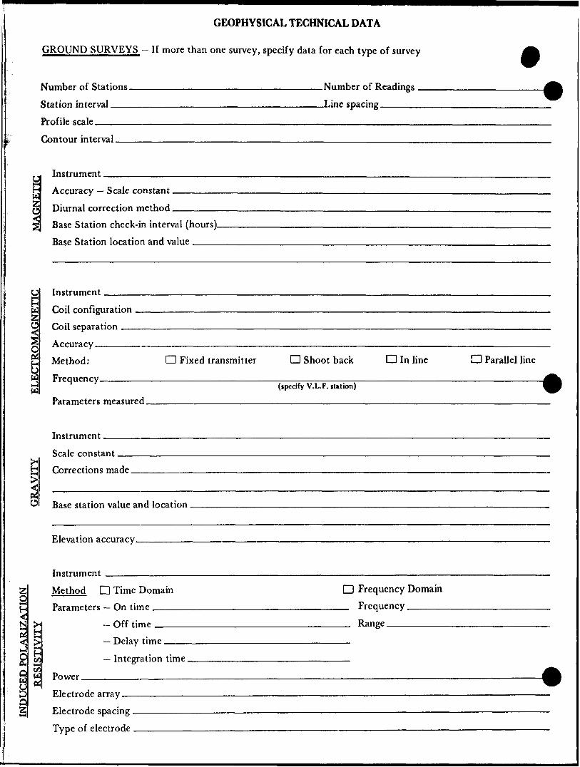
GROUND SURVEYS — If more than one survey, specify data for each type of survey
Number of Stations _________________________Number of Readings — Station interval ____________________________Line spacing.————Profile scale ———-———^—-——-—-——-—-—--—^-————^———————^——..Contour interval.
Instrument ——yf. Accuracy — Scale constant.
Diurnal correction method.Base Station check-in interval (hours). Base Station location and value ___
ELECTROMAGNETIC
Instrument
Coil configurationToil spparatinn
AccuracyMethod: CD Fixed transmitter D Shoot back Q In lineFrequency , . ~...... ,,,, — ,,,.. ,,,... ,,, , ,— ...- .,.,.,,,—.
(specify V.L. F. station)
D Parallel line
—————— 4Parameters measured.
Instrument.Scale constantCorrections made.
^ Base station value and location .
Elevation accuracy.
Instrument -—^—Method D Time Domain D Frequency Domain Parameters - On time __________________________ Frequency —————
— Off time __________________________ Range ———————— Delay time.——————————————————————————
— Integration time —————..^———-—————^— Power.____-_____________________________.—————————————a*
D Electrode array —Q"Z E lectrode spacing .
Type of electrode

SELF POTENTIAL
Instrument_______________________________________ Range.Survey Method ———————————————————————————————————————————
Corrections made.
RADIOMETRIC
Instrument-——.Values measured.
Energy windows (levels) ———^^—^^-^^^—-—————————^^-^—^^^———— Height of instrument___________________________Background Count. Size of detector———-———————^^—^—^^——————————^^^^^—.—..———-Overburden ———.--———.-—.——-—.^^^^——————-—-——-™—.——.—...——
(type, depth - include outcrop map)
OTHERS (SEISMIC, DRILL WELL LOGGING ETC.)
1 Type of survey——————————————————————
Instrument ^——————-—-^—^^^——————-^
Accuracy.^-—™--^^^^^——-——————-————-Parameters measured.
Additional information (for understanding results).
AIRBORNE SURVEYS
Type of survey(s)____
Instrument(s) —————(specify for each type of survey)
Accuracy-——————————^-—.^——(specify for each type of survey)
Aircraft used^-———————-.———————....————.——-—..
Sensor altitude-Navigation and flight path recovery method.
Aircraft altitude_________________________________Line Sparing Miles flown over total area________________________Over claims only.

GEOCHEMICAL SURVEY - PROCEDURE RECORD
Numbers of claims from which samples taken.
Total Number of Samples. Type of Sample.
(Nature of Material)
Average Sample Weight——————— Method of Collection————————
Soil Horizon Sampled. Horizon Development. Sample Depth———— Terrain————————
Drainage Development———————————— Estimated Range of Overburden Thickness.
ANALYTICAL METHODSValues expressed in: per cent
p. p.m. p. p. b.
D D D
Cu, Pb,
Others—
Zn, Ni, Co, Ag, Mo, As.-(circle)
Field Analysis (.Extraction Method. Analytical Method- Reagents Used——
Field Laboratory AnalysisNo. ^^———^——.
SAMPLE PREPARATION(Includes drying, screening, crushing, aihing)
Mesh size of fraction used for analysis ————
Extraction Method. Analytical Method . Reagents Used——
Commercial Laboratory (- Name of Laboratory— Extraction Method- Analytical Method —— Reagents Used -^—^—-
.tests)
.tests)
.tests)
GeneraL General.

Birc
h A
Pop
lar"
S
pruc
e
Pop
lar
Spr
uce
Ced
ar
Ced
arS
pruc
eJa
ckpi
ne
Pop
lar
Spru
ce
Ced
ar
larg
e P
opla
r B
alsa
mS
pruc
e
Pop
lar
Birc
hP
60
64
73
Pop
lar
Spr
uce
Ced
ar
P 606474
Spr
uce
popl
arB
irch
Bal
sam
Pop
lar
INT
ER
ME
DIA
TE
V
OLC
AN
ICS
frogm
en*a
., lo
cally
rew
orke
d i
inte
rmed
iate
tuf
f po
rphy
ritic
and
esite
-dac
ite
mas
sive
ande
site
-dac
ite
j. P
opla
r l
Spr
uce
Spru
ceB
irch
Ced
ar
Spr
uce
Ald
erB
irch
Jack
pine
P
opla
r C
edar
S
pruc
e
VO
LCA
NIC
S
gror
itize
d ba
salt
aggl
omer
ate
frag
men
tal
basi
c tu
ff
gaS
bro-
thic
k flo
w
porp
hyrit
ic
basa
lt
pillo
wed
bas
alt
mas
sive
basa
lt
Spr
uce
Pop
lar
Ced
arW
hite
pin
e P
opla
r C
edar
B
irch
Ald
er
Birc
hC
edar
, P
opla
r S
pruc
e Ja
ckpi
neC
edar
P
opla
r B
irch
Spr
uce
NjO
TE:
No a
ge c
onno
tatio
ns a
re i
mpl
ied
as v
olca
nism
is
cycl
ical
—i
Birc
h S
pruc
e A
lder
C
edar
Spr
uce
Birc
h A
lder
Spr
uce
Ced
ar
Birc
h
Jack
pine
S
pruc
e
P 60
6476
high
gro
und
--
Ced
ar
Whi
te p
ine
ULT
RA
MA
FIC
R
OC
KS
flow
top
rub
ble
/bre
ccia
high
M
gO b
asal
tse
rpen
tinite
perid
otite
(tp
yroxe
nite
)
ultr
amaf
ic f lo
ws
(kom
atii
te)
Ceda
rP
opla
rB
irch
..S
pru
ce
Ceda
r l
Tag
alde
rs
- Sp
ruce
Birc
h A
lder
B
eech
Jt A
lder
C
edar
P606475
SY
MB
OLS
Ced
ar
Spr
uce
Out
crop
Sub
crop
Flo
at
Clif
f
Bal
sam
Pop
lar
21 S
pruc
e ^f
Ced
arP
opla
r
Ald
erS
pruc
eB
irch
Whi
te
S S
ilver
Birc
h hi
gh g
roun
d ce
dor
Slo
pe d
irect
ion
; m
oder
ate,
ste
epLe
vel
grou
nd
Geo
logi
c co
ntac
tG
eolo
gic
cont
act
(ass
umed
)P
illow
fac
ings
Foha
rion
and
dip
; in
clin
ed,
verti
cal
Bed
ding
; in
clin
ed,
vert
ical
Plu
nge
Join
ting
Sw
amp
outli
ne
Swam
pF
ault
Spr
uce
Pop
lar
fJB
I07
. T
lX 0
1836
6 (*5
Ald
erS
pruc
eB
irch
Birc
h A
lder
G
rass
Spr
uce
Jack
pine
--
B
irch
Pop
lar
Birc
hth
ick
Spr
uce
Silv
ers
Whi
te B
irch
Silv
er a
Whi
te B
irch
. B
alsa
mS
ilver
a W
hite
Birc
h B
alsa
mS
pruc
eS
iivera
Whi
te B
irch
Ald
er
Spr
uce
Birch
Birc
h A
lder
C
edar
Spr
uce
Ald
er
Birch
C
edar
RBI0
8RX
018
367(
^5)
Ced
ar
Spr
uce
A S
ilve
rs W
hite
Birc
hNE
-84-
57,
AN 7
7 RB
ZS.P
ESO
^VPI
O
DE
-84-
40Fi
eld
sam
ple
num
ber
Birc
h A
ider
S
pruc
eRo
ck s
ampl
e nu
mbe
r an
d go
ld a
ssay
in
ppb
Tren
chC
arbo
natiz
ed
Qua
rtz-c
arbo
nate
ve
ins
Cha
lcop
yrite
Pyr
ite
Esk
er
Ced
ar
Ald
er
Birc
hS
iiver
a W
hite
Birc
hS
ilver
3 W
hite
B
irch
Ald
er
Spr
uce
Birc
hC
edar
A
lder
S
pruc
e
Ced
ar
Birc
h A
lder
Silv
er b
irch
Bal
sam
Silv
ers
Whi
te B
irch
P606487
t-
vJac
kpin
eS
pruc
eA
lder
Ced
arS
ilver
Birc
h B
alsa
mP
606488
P 6
06
48
6C
edar
Spr
uce
Birc
h
Alde
rS
pruc
eB
irch
Spr
uce
Ald
erB
irch
Spr
uce
v
Pop
lar
RB
I09
RX
OI8
368K
5)S
pruc
e
v\ir
Ced
arS
pruc
eC
edar
Silv
er a
Whi
te B
irch
Silv
er a
Whi
te B
irch
Bol
sam
Spr
uce
Silv
erb
irch
B
alsa
mA
ide
r C
edar
B
irch
Pop
lar
Birch
Ced
ar
r :: J
OCK
p i m
f™
Spru
ceW
hite
pin
e Ce
dar
Spru
ce
Birc
h
Spr
uce
Ald
erP
opla
r
Spr
uce
Jack
pine
Birc
h A
lder
S
pruc
e
Spr
uce
Birc
hC
edar
Silv
er b
irch
Ash
Ced
or
Spr
uce
Tarn
a ra
kSp
ruce
Ald
erB
irch
f~,4
a R.X
OI8
374(
(5)
Ced
ar
Whi
te p
ine
Spr
uce
Spr
uce
Bal
sam
B
irch
Whi
te p
ine
Ced
arP
opla
r S
pruc
eB
irch
Spr
uce
Bal
sam
B
irch
Pop
lar
Ald
er
Spr
uce
Ced
ar
Whi
te p
ine
Birc
h C
edar
S
pruc
e
Birc
h C
edar
A
lder
P
opla
r
Ced
arSp
ruce
Pop
lar
Spr
uce
Pop
lar
Ald
er
Pop
tar
Ald
er
Ced
arW
hite
pin
eB
irch
Pop
lar
Spr
uce
Pop
lar
Birc
h
Pop
lar -
Ald
er
Ced
ar
Birc
h•P
opla
r B
alsa
mW
hite
pin
e P
opla
rP
opla
r S
pruc
e A
lder
C
edar
Spru
ce
l B
irch,
Popl
arB
irch
Bals
am
Spr
uce
Jack
pine
Spr
uce
Ced
ar
Pop
lar
Birc
h
Pop
lar
Ald
erB
irch
Pop
lar
Ald
erC
edar
Popl
arA
lder
Ced
arP
607
I08
Birc
h,Ja
ckpi
neS
pruc
e P
opla
r
Ash
Whi
te p
ine
high
gro
und
Ced
arPo
plar
Birc
hP
6064
9IP
opla
r S
pruc
eP
60
64
90
Pop
lar
Spr
uce
Ald
er
Birc
hS
pruc
eJa
ckpi
ne
Birc
hP
opla
rB
alsa
m
Spr
uce
Ald
er
Pop
lar
Whi
tepi
ne
Pop
iar
Bal
sam
Spr
uce
Spr
uce
Ald
er
Pop
lcr
Whi
te p
ine
Pop
lar
Spr
uce
Ald
er
Birc
h
Pop
lar
Spr
uce
Ced
arJa
ckpi
ne
Popl
arP
opla
r Sp
ruce
Pop
lar
Ald
er
Birc
h
Pop
lar
Birc
hS
pruc
ePo
plar
Ja
ckpi
ne
Popl
ar P
60
70
0I
P6
06
50
0A
lder
S
pruc
e P
opla
r W
hite
pin
e
Pop
lar
Spr
uce
Ced
ar
Cana
dian
Nick
el Co
mpan
y Li
mite
dC
op
per
Cliff
,
On
tario
PO
M
INO
GEO
LOG
Y SU
RVE
Y
Deny
es, S
wayz
e an
d Do
re T
wps
SW
AY
ZE
PR
OJE
CT
vey
dole
Ju
ne -
Au
gu
st f 1
984
Sup
ervi
sor:
J,
P
ER
RY
July
-August
/83
J. P
erry
, B.
Bel
lC
ompi
led
by
s. A
nder
son,
N.
Nem
eth
R D
enom
me
Dal
e dr
awn
. S
ept. /
84
Dra
wn
by
RO
N
JOH
NSO
N
41015S
E0M
1
2.7
716
DO
RE

mix
ed
Ced
arS
pruc
e B
irch
Bal
sam
Spru
ce
AN52
RX"0
6448
5(5)
crbd'l?
AN
SI R
X064
484
[5]
AN 5
3RX
0644
86(*5
]AN
50
RX 0
6448
3 fc
5]AN
61RX
0644
91 W
]iA
N49
RX
0644
82 (5
)
W^;
*6c-
@!P
;;
AN
62--
06
4492
45*
mat
ure
. P
opla
r
ANSI
RX
OI8
928(
*5)
'l AN
82
RX 0
1892
9 (1
0)qt
z ve
in
P 60
7120
Jack
pine
L
Birch
P60
7II2
P607II9
, ,
'i RX
0)8
365
*5)
P 60
7135
Pop
lar
Jack
pine
Spru
ceP
607I
27P
6071
28-,-
*- 8
4-48
2a
*RX
0530
l3 (
AN 4
7 ,
, RX
064
4801
*5)
--
Pop
lar
Spr
uce
Jack
pme
Spr
uce
AN48
,
, R
X06
448l
(*5
RX
0526
86(I
O)*
)crb
d J XB
.L.
OO
OO
N
Tag
ald
ers
RBI6
RX
0526
90(IO
)P
6071
26
P 60
7129
P 60
7134
-.
larg
e P
opla
rR
6I04
RX
018
364^
5)
P 60
712*
P 6
07
3
P 60
71 8
Tag
alde
r, B
irch
Pop
lar
Jack
pine
--
Pop
lar
--
Spr
uce
P 607 3
0Ta
g al
ders
, C
edar
Jack
pme
Po
pla
rTa
g al
ders
C
edar
sw
amp
*,7\P
607I3
3
P 60
7114
Pop
lar
Jack
pine
high
gro
und
Ced
ar
Jack
pine
P
opla
r
R82
6 ,
RX 0
5 27
00(1
0)/q
tz v
n cp
.py
RB RB2
4 RX
052
697
RB
25/R
X 0
5269
8P
6071
222a
.e R
B 21
cr
bd
RX 0
5269
4(10
)
NE
-84-
50
,^R
X 0
4314
7(10
)fet
y 3 a
crbd
RB
II yl
RX
0526
87(I
O)
c/B
irch
/Spru
ce
RX0
43I5
9 *5
NE
-84-
72
Jack
pme
Pop
lar
P 60
7115
P 60
7132
P 60
7131
P 60
7124
P 60
7116
P 60
7123
ackp
ine
apla
r v
bJ
Lake
i
Cana
dian
Nick
el Co
mpan
y Li
mite
d
GEO
LOG
Y S
UR
VE
Y
projec
t; S
WA
YZE
P
RO
JEC
T
J. Pe
rry,
B. B
ell
Com
pile
d Dy
5.
And
erso
n, N
. Nem
eth
R
41
0I5
SE
01
11
2
.77
16
DO
RE

Lake
Spru
ce
Birc
h . \i-
2a
IOO
OO
N Ced
ar
Swam
p
Za
RX05
2683
(IO)
Birc
h
Jack
pine
Pop
lar
Birc
hJa
ckpi
ne P60
7I36
2b2d
'Rfl4
2*.
Pop
lar
Pin
e
Pop
lar
Pop
lar
2a'
E-84
-9
-^RX
049
591(
51
SRB
l 72
aP
ine
Pop
lar
Map
le
Ald
er
Map
le
Pop
lar
Ald
er
Pop
lar
Jack
pine
^, * R
X 05
2684
(10)
P 60
7134
2d 4 ^
2d
P 60
7133
9500
N
P 60
7132
UJ
Pop
lar
Ald
er
Pop
lar
Birc
hA
lder
Pop
lar
Ald
er
Birc
hPo
plar
Ald
er
2aP
opla
r
Ald
erA
lder
Pop
lar
Birc
h
'2a
v
Pop
lar
lP
6071
37-
Pop
lar
Pine
B
irch
Map
le
Pop
lar
Birc
h M
aple
i
dens
e A
lder
Pop
lar
Map
le
Ald
er
Pop
lar
Birc
h
Birc
h A
lder
P
opla
r
Pop
lar
Pin
e B
irch P6
0627
3
NE-8
4-| 8
Pop
lar
Map
le
Pop
lar
Ald
er
Map
le
Birc
h P
opla
r
Ald
er
Map
le
Ald
er
Pop
lar
Mop
le
Pop
lar
Ald
er
Map
le
Birc
h
Birc
h P
opla
r S
pruc
e
P58
8864
Birc
h P
opla
r A
lder
Mm
. A
sh
Spr
uce
Birc
h
.Pop
lar
Birc
h Po
plar
Ald
er
Map
le
Pop
lar
Ald
er
Map
le
Pop
lar
Birc
h
Ald
er
Birc
h1 e . — —
- \ \
r i
Po
pla
r
Popl
arM
aple
Ald
er'
— —
P
ine
\
Map
le
Aid
erM
aple
\ \A
lder
Pop
lar
^ . ——
——
--" -'
P5f
f ^ _ _
jS
pruc
eA
lder
Map
le
Pop
lar
/f^
^^
j
Pop
lar
Map
le
^——
— —
" f
Map
leP
opla
r
Spr
uce
^
^v^ \
3886
3
Pop
lar
Pine
f
f ^^^\
s**
i ^——
——
^
i
i s
^,, J
u?
p B
irch
t
Bal
sam
Birch
Bal
sam
x x
Pop
lar
Ald
er
Pop
lar
Ald
er
^ •i
Pop
lar
Ald
er
s
Birc
hP
opla
r A
lder
^
R
Birc
hAs
hM
aple
P*5i
f ^j\
Birc
h A
lder
dens
e A
lder
Pop
lar
Birc
h A
lder
AN 26
Pop
lar
JacK
pine
Map
le
Pop
lar
dens
e A
lder
P
opla
r
Map
le
Pop
lar
Birc
h
Map
le
Birc
h
Pop
lar
Birc
h
Pop
lar
Birc
h P
opla
r
P 58
8997
Pop
lar
Birc
hB
irch
Ald
er
P 58
8998
! Pop
lar
Ald
er
Birc
h A
lder
P
opla
r
Pop
lar
Birc
h
Pop
lar
Ald
er
Pop
lar
Pine
B
irch
Pop
lar
Birc
h P
opla
r A
lder
Pop
lar
Birc
h A
lder
.Birc
h A
lder
,
Pop
lar
Birc
h A
lder
Pop
lar
Pine
P 60
6274
Pop
lar
Birc
hA
lder
Birch
P
op
lar
Ald
er
Pop
lar
Ald
erA
lder
Bi
rch
Pop
la r
Birc
hP
opla
rA
lder
Birc
h A
lder
P 60
6247
Birc
h A
lder
—
—- ii,
B
irch
Ald
er
Pop
lar
Ald
er
Ced
arP
opla
rB
irch
P 60
6248
Pop
lar
Map
le
s:i
Spr
uce
RX 06
4476
*5
RX06
4475
('5
AN 29
P58
8859
Tr
P 58
8860
Larg
e Ja
ckpi
ne
Birc
h
Jack
pine
P
opla
rR6
14
RX 0
5268
9(50
] 2a
cr
bd.p
y
Pop
lar
Jack
pine
mat
ure
Pop
lar
Pop
lar
Jack
pine
Pop
lar
JacK
pine
P 58
8861
AN
4RX
064
465(
10)
Spr
uce
Birc
h Ja
cKpi
ne
Pop
lar
Spr
uce
Birc
hJa
ckpi
ne
Birc
h. 8
4-26
WR
X 06
4462
(10)
*^
RX04
9598
(t5]
T l Ja
ckpi
ne
Pop
lar
Ced
ar P58
9000
P588
999
Spr
uce
Pin
e B
ircri
Jack
pine
B
irch
Spr
uce
Jack
pine
rt:
Jack
pine
A
Birch
/Aid
er^
Popl
ar / S
pruc
e
P606
243
Tag
alde
rs
.,M
tn.
Ash
P
opla
r B
irctl
P606
245
Jack
pine
B
irch
Pop
lar
Spr
uce
Jack
pine
B
irch
RX06
4477
(*5)
P606
244
RB11
7 (
RXO
B372
k5P
6062
46
AN 3
3 Sp
ruce
RX
0644
74(*
5]P
opla
r S
pruc
eP
opla
r Ja
ckpi
ne
Birc
hB
irch/
Spr
uce
Birc
h P
opla
rSp
ruce
Birc
hP
opla
rA
lder
Birc
h
Pop
lar
Ald
er
11 P
opla
r/S
pruc
e B
irch
Birc
h Ja
ckpi
ne
Spr
uce
Birc
h Ja
ckpi
ne
Spr
uce
Birc
h Ja
ckpi
neP
6062
52PE
G RX
0526
81(1
0]C
edar
B
irch
Spru
cei f c
tt^4^
S^:t^
i ;'A^
RBII6
R
KO
W37
IMN
E-84
-24
RX 0
4959
7 5!
P 60
6249
Spr
uce
Pop
lar
Birc
hJa
ckpi
ne
Pop
lar
Pop
lar
Jack
pine
Bre
tf La
keP
6062
50TR
ENCH
Birc
hR
X064
478(
IO)
Spr
uce
Ced
ar —
Ta
g al
ders
—2
Spr
uce
Sw
amp
Jack
pine
, B
alsa
m
Birc
hP
6062
5I.
41
01
5S
E0
11
I 2
.77
16
D
OR
E2
20
8 16 2O
9 17 21
10 18 22
1 II 19 23
2 12 24 28
X 13 35 29
4 K 26 30
5 27 31
6 15
7
Cana
dian
Nick
el Co
mpan
y Li
mite
d
GEO
LOG
Y
SW
AY
ZE
P
RO
JEC
TD
enye
s, S
way
ze a
nd
Dor
e Tw
ps-f
R ^
Y

P 60
5129
P 60
5130
P 60
5126
P 60
5127
Bir
chJa
ckpi
ncP
opla
r, A
lder
Jack
pine
, B
irch
P 60
5017
5888
59\
RX 0
6446
7(5)
S
pruc
e, P
opla
r f
\
P 60
5128
P 60
5125
P 60
5078
P 57
6194
Jack
pine
,Spr
uce
l Ja
ckpi
ne,
Spru
ceB
irch
Jack
pine
Spr
uce,
Birc
h \
P 58
8861
Sp
ruce
Ced
arS
wam
p
.i
- ~
~'-
. -.
-
'"'^
''v* -
*^l
nift!L
!'r''[
1-
ijrir
::
:;i'
-
" ;'-
- •
" "^
!J ^
'^r^
vT
lv^
1 ^'^
^L '
z '
•-To
g-al
ders
-
" .
-^U^
-4**
J^—
—^"
W*-
^^-'*
---^
--.^
••-"
^Bii^
!?.^
^il
li!i.s2
asaJ
*1"''
"r"'"
-. "
'"^--"
"V
- "•"
r " "
P 60
5135
Popl
ar
P57
4I5I
P 60
5132
P 57
6195
Ceda
r, ta
g-al
ders
P 57
4154
^-Jid
aWJf
tM^
P60
5077
NE-8
4-35
,
, RX
043
140(
^5)
crbd
Birch
/Sp
ruce
Ja
ckpi
ne
" '
41015S
E®
I11
2.7
71
6
DORE

P 57
4149
10
50
0 N
IOO
OO
N
95O
O N
4101
SS
E01
11
2.7
71
6
DO
RE
8 16 20
9 17 21
IO 18 22
1 II 19 23
2 12 24 26
3 13 25 29
4 14 26 30
X 27 31
6 15
7
July
-Aug
ust/8
3
Cana
dian
Nick
el Co
mpan
y Li
mite
dL
o p p
P -
r O
M
GEO
LOG
Y S
UR
VE
Y
SW
AY
ZE
PR
OJE
CT
Deny
es, S
wayz
e an
d Do
re T
wps.
Superv
isor
J.
PE
RR
Yv'
v :.;
'. Ju
ne -
Aug
ust
7 19
84
Com
p.ie
d Dy
S
And
erso
n, N
Nem
eth
| D
raw
D,
RO
N
JOH
NS
ON
_
__
__
_R
. D
enom
me
Sca
le
1=25
00-t-
....
....
. .1
Sep
t 7
84
j
41 O
/ 15

Pop
lar
Jack
pine
Spr
uce
Spr
uce/
Ta
mar
ck
Mus
keg
l
Spr
uce/
Mus
keg
l.RX
0189
31 (
5)
PVP
607I
OO
P 60
7077
P 60
7078
CI
AN 1
09
RX 0
1893
7(5]
py
Jack
pine
P
opla
r S
pruc
e
P 60
7099
Ir
PE33
RX 0
5292
5 (5
0)
Spr
uce/
Birc
h
PE35
RX 0
5292
7 (7
5) C
u 15
ppm
In
55
ppm
Pb
5 pp
m Ag
0-5
ppm
Cu'
25 p
pm-—
VP3
P60
7076
P 60
7101
RX
0529
29(8
0pE
38
P60
7098
X04
3l8l
(?-I2
pp
Spr
uce
Birc
h
Spru
ce/
Bir
ch
Ald
er
Birch
/Sp
ruce
Popla
r/S
pru
ce
^^C
?
RX 0
4318
4(51
—'
spruce
\P60
7097
8B
irch
Spr
uce/
Birc
h A
lder
AN99
RX
OI89
32[3
0)
2aRX
052
944
(20)
PE
55
AN 7
3 RX
1892
2 5
Spru
ce/
Birc
hPE
42
(10)
R
X05
2930
Cu
* 5
ppm
,~
rnniit
~i A
f'T*
10
ppm
Birch
/ S
pruc
e
"P607075
P 60
7102
^-
Ald
er / S
pruc
e
Birc
h
Spr
uce /
Jack
pine
4C
E 84
-84
RX
043I
65(IO
)A
lde
r/ P
opla
r
VP2I
RX
043
197(
4751
AN
I02
RXO
I893
3fl-5
3ppm
!
P 60
7086
6070
81S
pruc
e /
Birc
h *
VP(4
RX
043I
90(*
5)
R X 0
4318
9 (*
5^
Spr
uce
S B
irch
P 60
707
Ag
f-5 pp
m Jo
ckpi
ne17
X
043I
93II5
)Cu
10
pp
m Zn
80
ppm
Pb
5
ppm
Ag
^5
ppm
Cana
dian
Nick
el Co
mpan
y Li
mite
d
GEO
LOG
Y S
UR
VE
Y
Deny
es, S
wayz
e an
d D
oreT
wps
SW
AY
ZE
PR
OJE
CT
-):te
Ju
ne -
Aug
ust /
1984
J. P
erry
, B. B
ell
Com
pile
d Dy
S
.And
erso
n,N
.Nem
eth
Dro
wn
n,
RO
N
JOH
NSO
N
4101
5SE
B11
1 2
.77
16
D
OR
E

Den
se
alde
r yo
ung
popl
ar
thic
k al
der
Birc
h, P
opla
r
T
Ald
er
Birc
h P
opla
r S
pruc
e
/41
015S
E01
11
2.7
71
6
DORE
2G
0
8 16 20
9 17 21
10 18 22
1 II 19 23
2 12 24 28
3 13 25 29
4 14 26 30
5 27 31
6 15X
July
-Aug
ust/8
3
Cana
dian
Nick
el Co
mpan
y Li
mite
d
GEO
LOG
Y SU
RVE
Y
SW
AY
ZE
PR
OJE
CT
J.
PE
RR
Y
——
——
——
—J.
Per
ry,
B. B
ell—
——
—
Com
pile
d by
S.
Ande
rson
, N
.Nem
eth
__
__
__
__
_R
Den
omm
e_^_
_^__
__
Scal
e 1=
2900
, R -
Deny
es, S
wayz
e an
d D
oreT
wps
.
RON
JOH
NSO
N
June
- A
ugus
t / 1
984
Sept
/
84
NTS
41
O
X 15

90
0O
N.
9 D
OO
N
85
00
N.
80
00
N.
rch
jpla
r
der
H- —
— —
Birc
hP
opla
rA
lder
tall
Pop
lar
Ald
er
Pop
lar
p 6
06
4
Birc
hA
lder
Pop
lar
Spr
uce
^*~~
*tt
^ f
u Ash
S
pruc
e sw
amp
4c
i
Jack
pine
Spru
ceB
irch
thic
k C
edar
Ald
er
4
thic
k C
edar
A
lder
V
.DE-
84-5
9l R
X 05
3015
(10)
Spr
uce
Jack
pine
4
Ald
erB
irch
Pop
lar
fDE
-84-
60
2a tall
Pop
lar
Ald
er
A Vta
ll P
opla
r A
lde
r
Ced
ar
Pop
lar P
6064
42Sp
ruce
thic
k
Jack
pine
Birc
hPo
plar
8
thic
k A
lder
Jack
pine
P
opla
r
Ald
er
4^06448
Ald
er
Pop
lar
Pop
lar
Spr
uce
no b
edro
ck
Ald
er
Pop
lar
Jack
pine
B
irch
Ald
er
Pop
lar
Bal
sam
Jack
pine
.DE
-84-
65
*6o
Jack
pine
P
opla
r
Spr
ue*
39
Pop
lar
Ald
er
Pop
lar
Ald
er
Ald
er
Pop
lar
Ald
er
Pop
lar
Jack
pine
Pop
lar
4,S
pruc
e
Birc
h
Ash
Po
pla
r
Pop
lar
Bal
sam
Spr
uce
Spr
uce
A
'DE
-84-
66
F6a Ja
ckpi
ne
Birc
h S
pruc
e
Jack
pine
Birc
hS
pruc
e
Pop
lar
Ald
erB
irch
Jack
pine
Bir
chA
lder
Birc
h Sp
ruce
Pop
lar
Ald
er
Jack
pine
Pop
lar
Ald
er
Birc
hJa
ckpi
ne
Spr
uce
Jack
pine
S
pruc
e
tall
Pop
lar
Birc
h A
lder
Ald
er
Birc
h
lino
bed
rock
Ald
er
Birc
h
P60
6438
A?
Spru
ce
Birc
h
Bal
sam
S
pruc
e B
irch
Bir
ch
Aid
er
Pop
lar
Ald
er
P606
443
Pop
lar
Spr
uce
Ald
er
Birc
h
Birc
h A
sh
Jack
pine
B
irch
Birc
h As
h
Pop
lar
Ald
er
Pop
lar
Ald
er
Ald
er
Pop
lar
Jack
pine
Birc
h P
opla
r
Jack
pine
Birc
hA
lder
Birc
h A
lder
Ja
ckpi
ne
Spr
uce
Ald
erB
irch
Spr
uce
6a V
Spr
uce
Jack
pine
P
opla
r
Jack
pine
Pop
lar
Spru
ce
DE
-M-6
8 60 S
pruc
e B
irch
W
Spr
uce
Ald
er
Ald
er
Pop
lar
DE-
84-7
0
Jock
pine
Po
plar
Pop
lar
Alde
r
Jack
pine
B
irch
Ald
er
Ald
er
Ash
Pop
lar
Ald
er
4Ja
ckpi
ne
Spr
uce
Birch
Pop
lar
Ald
er
Jack
pine
P
opla
r B
irch
Ald
er
Spr
uce
Birc
h Ja
ckpi
ne
Spr
uce
Ald
er
Spru
ceA
lder
\
sk
Pop
lar
Spr
uce
Spr
uce
mus
keg
Ald
er
Spr
uce
•-_R
6064
47Ja
ckpi
neB
ircli
Spr
uce
Birc
hJa
ckpi
ne
Pop
lar \ S
thic
k Al
der
Spr
uce
M
V
i
Pop
lar
Bal
sam
Jack
pine
bA
lder
As
h
Pop
lar
Ald
er
Spr
uce
mus
keg
Pop
lar
Spr
uce
Spru
ce
mus
keg
Spr
uce
Ald
er
Pop
lar
Spr
uce
Ald
er
Pop
lar
Spr
uce
tall
Pop
lar
Ald
er
tall
Pop
lar
Ald
er
Ald
er
Spr
uce
P 60
6437
4th
ick
Spr
uce
Ald
erth
ick
Ald
er
thic
k S
pruc
e m
uske
g
Spr
uce
mus
keg
Ald
er
Spr
uce
mus
keg
Ald
erS
pruc
em
uske
g
Jack
pine
Birch
Spr
uce
i
Spru
ce
Jack
pine P
6064
44S
pruc
e B
irch
l th
ick
wet
Ald
ers
thic
k S
pruc
e
Ald
er
Jack
pine
S
pruc
eB
irch
Jack
pine
P
opla
r
Jack
pine
P
opla
rS
pruc
e B
irch
!*
79 N
T
ie
Line
l no
l be
droc
k
^S
Jack
pine
Popl
arSp
ruce
S
Spr
uce
Ald
er
mus
keg
thic
k
Ald
er
thic
k A
lder
Spr
uce
Spr
uce
Pop
lar
Pop
lar
Spr
uce P6
0644
6
Pop
lar
Spr
uce
Jack
pine
Spr
uce
Birc
h
thic
k A
lder
P
opla
r
thic
k A
lder
P
opla
r
Pop
lar
Jack
pine
Spr
uce
84
N Ti
e Li
ne ,
.
Pop
lar
Jack
pine
Spr
uce
Spr
uce
Birc
h A
irier
Spr
uce
Pop
lar
Ald
er
l ^
f fl
pavp
r l
Beav
er
Pond
Jack
pine
Jack
pine
Ald
er
Jack
pine
P606
436
k,f—
Ald
er
Jack
pine
Jock
pine
S
pruc
e
, Ald
erB
irch
,-——
-
^, J
ackp
ine
Spr
uce
A ipru
ce
Ald
er
Pop
lar
Jack
pmi
Jack
pine
Pop
lar
Jack
pine
:: J
ackp
ine
(S--
Po
plar
A
lder
Ja
ckpi
ne
Jack
pine
P
opla
r
Ald
er
Pop
lar
85
00
N
Jack
pine
:-
Jack
pin
e
Pop
lar
l'.
Jock
pine
" P
6064
35P
opla
r Ja
ckpi
ne
thic
k S
pruc
e
4th
ick
wet
A
lder
S
pruc
e
Jack
pine
S
pruc
e
thic
k A
lder
Spr
uce
tall
Pop
lar
Spr
uce
80
00
N
X 16 20
9 17 2i
iO 18 22
i ii 19 23
2 12 24 28
3 13 25 29
4 14 26 30
5 zr 31
6 15
7
•Jul
y-A
ugus
t /8
3
Cana
dian
Nick
el Co
mpan
y Li
mite
dC
opp
er
Clif
f ,
Onta
rio
PO
M
INO
GEO
LOG
Y S
UR
VE
Y
SW
AY
ZE
PR
OJE
CT
Sup
ervi
sor
J.
PE
RR
Y
J. P
erry
, B.
Bef
l by
S
.And
erso
n, N
.Nem
eth
R. D
enom
me-
—.—
——
.
Scale
: 1=
2500
FIG
UR
E
Deny
es, S
wayz
e an
d Do
re T
wps
Inst
rum
en
t.
Dra
wn
by :
RO
N
JOH
NSO
N
File
Surv
ey d
ate
June
- A
ugus
t X
1984
Date
dro
wn .
Sept
. f
84R
evis
ed
N.T.
S.
41
O X
15

P60
6435
Pop
lar
Joct
tpin
e l
Ald
er
P606
404
RX
043I
77K
5J;
P606403
RX OI8
353(*5
)
* P
6064
02P 606405
Spru
ce
.Mus
keg P
606406
P606459
RX
OI8
97I(
<5)
'3C
Birc
h
Jock
pin
eBirc
hP60
6409
P606
408
P 60
6411
P 60
6410
P60
6407
A J
ackp
ine
::
Pop
lar
Birc
h
Pop
lar
Spr
uce
A
Jock
pin
P 60
6416
P 60
6417
4P
6063
08
Nick
el Co
mpan
y Li
mite
dCa
nadia
nC
op
pe
r C
liff
, Q
ntQ
n o
PO
M
INO
GEO
LOG
Y S
UR
VE
Y
Den
yes,
Sw
ayze
and
D
ore
Twps
.pro
ject
SW
AY
ZE
PR
OJE
CT
Sur
vey
date
J
une
- A
ugus
t f
1984
J. Pe
rry,
B. B
ell
Com
pile
d by
S
.And
erso
n, N
.Nem
eth
R.D
enor
nme
Dra
wn
by
RO
N
JOH
NS
ON
4101
5SE
0111
2
-771
6 DO
RE
rb

Birc
hW
hite
pin
eS
pruc
ehi
gh g
roun
d C
edar
P 60
6399
Pop
lar
high
gro
und
Ceda
rW
hite
pin
e
Ced
ar4a
DE-
84-5
7 R
X053
0I4{
5)C
edar
S
pruc
e f *
Whi
te p
ine
Popl
arC
edar
Whi
te p
ine
Pop
lar
Spr
uce
P6
06
40
2
P60
640I
Popl
ar
Red
pine
P 60
6400
Spr
uce
Pop
lar
Birc
h
Tag
QM
er s
wam
pP
opla
r S
pruc
e
Popl
ar
Birc
h S
pruc
eC
edor
P
opla
r B
irch
Spr
uce
Pop
lar
Spr
uce
Ald
er
P6064II
P 60
6412
P 60
6413
P 60
7023
P607022
P60
702I
Ced
ar
swam
p
ANI7
I ,
RXO
I895
8(*5
. ,2
a
Ced
ar
Spr
uce
Tag
ald
er
swam
pP
6064
15 r
P 60644
P60
7024
Cana
dian
Nick
el Co
mpan
y Li
mite
dC
op
pe
r C
liff
,
On
tario
P
OM
1N
O
GEO
LOG
Y
Deny
es, S
wayz
e an
d D
oreT
wps
SW
AY
ZE
PR
OJE
CT
Sur
vey
date
J
une
- A
ugus
t X
1984
Superv
isor
! J
. P
ER
RY
July
-Aug
ust/8
3J.
Per
ry,
B.B
eli
Com
pile
d Dy
S
.And
erso
n,N
.Nem
elh
Deno
mm
eD
ate
draw
n .
Sep
t. /
84
Dra
*n b
y R
ON
JO
HN
SO
N
4101
5SE
0111
2
.77
16
D
ORE

Birc
h B
alsa
m
Spr
uce
Pop
lar
Ced
ar
Birc
h S
pruc
e la
rge
Ced
ar
Pop
lar
larg
e ce
dar
Pop
lar
Spr
uce
larg
e P
opla
r S
pruc
e Ba
lsam
6070
01
^f^^
S2
^^P
6070
02hi
gh g
roun
d C
edar
P
opla
r
Spru
ce
P 6
07
10
7
P 60
6499
P60
6498
Ced
ar-
Spr
uce
-Tag
ald
ers
high
gro
und
Ced
ar
Pop
lar
Birc
h P
opla
r Sp
ruce
W
hite
pin
e
P 60
7006
Spr
uce
mos
tly i
mm
atjr
e b
ush
P 60
7005
P 60
7013
P6
07
02
0
P 60
7021
Topb
oot 8 o
Cana
dian
Nick
el Co
mpan
y Li
mite
d
GEO
LOG
Y
SW
AY
ZE
PR
OJE
CT
Den
yes,
Sw
ayze
and
D
ore
Twos
Surv
ey d
ale
June
- A
ugus
t i 19
84
J. P
erry
, B.~B
eTl
by
S. A
nder
son,
N.N
emet
h pt n
o m m
eD
raw
n hy
RO
N JO
HN
SON
4101
5SE
0111
2
.77
16
DO
RE

Pine
S
pruc
e --
P
opla
rB
irch
Sway
ze
L ok
e
larg
eJ-
Pop
lar
Jack
pine
4101
5SE
0111
2.7
716 D
OR
E310
8 16
1
2O
9 17 21
10 18 22
1 M 19 23
2 X 24 28
3 13 25 29
4 14 26 3O
5 27 31
6 15
*
- Jul
y-A
ugus
t/83
Cana
dian
Nick
el Co
mpan
y Lim
ited
Cop
per
Clif
f ,
On
tario
P
OM
1N
O
GEO
LOG
Y
SW
AY
ZE
PR
OJE
CT
Superv
isor.
J
, P
ER
RY
Com
pile
d by
J Pe
rry,
B Be
ll——
——
S.
Ande
rson
, N. N
emet
h R.
Den
omm
e___
___
Scal
e:
1=25
00
SH
EE
T 12F
IGU
RE
Are
aDe
nyes
, Swa
yze
and
Dor
eTw
psIn
str
um
ent
Dra
wn
by
RO
N
JOH
NS
ON
File
Surv
ey d
a'e
Jun
e-A
ug
ust
X
1984
Dat
e dr
awn
. Se
pt f
1984
Rev
ised
NT
S
4 l
O f
15

p60
7132
:: P
60625I
Popl
ar
Jack
pine P 60
6252
1Bi
rch
P60
6248
P60
6274
I*a
P60
6249
no60
6250
/, C
edar
sw
amp
^X
80
00
N8
DO
ON
e 16 20
9 f7 21
10 18 22
1 II 19 23
2 12 24 28
3 X as 29
4 14 26 30
5 27 31
——
——
Julv
-Aua
ust/
83
——
— 1
6 15
7
Cana
dian
Nick
el Co
mpan
y Lim
ited
Cop
per
CU
ff ,
Onta
rio
P
OM
IN
O
GEO
LOG
Y
SWAYZE PROJECT
Sup
ervi
sor
j,
PE
RR
Y
J. Pe
rry,
B. B
ell
Com
pile
d by
.s.A
nder
son,
N.N
emet
h __
____
___R
. Den
omm
e—^
—^
^Sc
ale:
1 =
2500
SHEE
T
13FIG
URE
Are
aDe
nyes
,Sw
ayze
and
Do
reTw
ps.
Inst
rum
ent
Dra
wn
Dy;
RO
N
JOH
NS
ON
File
'
Surv
ey d
ote
June
- A
ugus
t /
1984
Dot
e dr
own
. S
ept.
f 19
84
NT.
S
41 0
/15

90
00
N.
9000N
8500 N
85
00
N
80
00
N8
000
N
UJ O
o
in
o
o
o
UJ
O
O
LJ O
O o If) CM
UJ o O in
in (M
l8 16 20
9 17 21
10 18 22
1 M 19 23
2 12 24 28
3 13 25 29
4 X 26 30
5 27 31
6 15
7
July
-Aug
ust/8
3
41
01
5S
E0
1I1
2
.77
16
D
OR
E3
30
Cana
dian
Nick
el Co
mpan
y Li
mite
dC
op
pe
r C
liff
, O
nta
rio
PO
M
INO
GEO
LOG
Y
projec
t-. S
WA
YZE
P
RO
JEC
T
Sup
ervi
sor.
J.
P
ER
RY
~
J. P
erry
, B.
Bel
l C
ompi
led
by;s
.And
erso
n,N
.Nem
eth
________R
Den
om
me_
____
_
Sca
le:
M 2
500
SH
EE
T
14FI
GU
RE
Deny
es, S
wayz
e an
d D
oreT
wps
Inst
rum
ent
Dra
wn
By
RO
N
JOH
NS
ON
Fde'
Surv
ey d
ale
June
- A
ugus
t /
198
4
Dat
e dr
own
Sept
Rev
ised
'
NT
S41
O
X 15

3P
W-"
W
j'-rt
iH*
-SV
'Vri
lWSW
-:-
* i*
MM
**
mi*
i PI i in
li nm
iiMB
imiii
iMiin
i'ii
" IIIH
JIM m
iMiiii
iiipii
uw*i
PE47
5o
RX
052
932 (
'5
Cu <
5 pp
m Zn
15
ppm
Pb <
5ppm
P60
7086
Jack
pine
S
pruc
e
Spr
uce
Mus
keg
VPII
, ,
RX 04
3187
(5]
Spr
uce/
Birc
h Ja
ckpi
ne45
* f
RXO
I899
9^5)
VP
IO
RX04
3186
(5)
P 60
7081
P 60
7074
Jack
pine
Sp
ruce
Tag-
aide
r
Swam
p
P 60
7082
s"
8500 N
80O
O N
8500
N
8OO
ON
4l0
15S
Eai1
l 2
.77
16
D
OR
E
l3
40
8. 16 20
9 17 Z\
10 18 32
1 II 19 23
Z 12 24 28
3 13 25 29
4 14 26 3O
5 27 31
6 X7
-Jul
y-A
ugus
t/83
Cana
dian
Nick
el Co
mpan
y Li
mite
d
GEO
LOG
Y
SW
AY
ZE
PR
OJE
CT
Sup
ervi
sor
J.
PE
RR
Y"T
15De
nyes
, Swa
yze
and
Dor
eTw
ps.
J. P
erry
, B.
Bel
lC
ompi
led
Dy
S.A
nder
son,
N.N
emet
h _
__
__
__
R.
Den
omm
eSc
ale
h 25
00
June
-A
ugust
/1984
Dra
wn
nv
RO
N
JOH
NS
ON
Sept
. X
1984
j
, ' ^
41
0/1
5

Jack
pine
Pop
lar
Spru
ceta
ll Po
plar
A
lder
Jack
pine
Po
pla*
1
tall
Popl
a Sp
ruce
Ja
ckpi
neP
6064
47Sp
ruce
mus
keg
Jack
pine
Pop
lar
P 60
6445
tall
Popl
ar
Jack
pine
B
irch
P60
6446
tall
Popl
ar
Spru
ceSp
ruce
mus
keg
Spr
uce
mus
keg
~-
Popl
ar
Jack
pine
.. P
opla
r Ja
ckpi
neP
6064
58Ja
ckpi
ne
Pop
lar
P60
6448
P60
6455
Jack
pine
Po
plar
Jack
pine
A
lder
Jack
pine
B
irch
Jack
pine
Popl
ar
Ald
erac
kpm
e Po
plar
Jack
pine
Spr
uce
:: J
ackp
ine
Birc
hSp
ruce
mus
keg
Jack
pine
Po
plar
A J
ackp
ine
Popl
arJa
ckpt
ne
Birc
h Po
plar
Jack
pine
Sp
ruce
Jack
pine
Pop
lar
Jack
pine
Po
plar
Sp
ruce
-
Spru
ce
mus
keg
Jack
pine
Po
plar
Popl
ar
Jack
pine
open
m
uske
g Sp
ruce
sw
amp
Jack
pine
Birc
hPo
plar
Spru
ce
Tag
alde
rJa
ckpi
ne
Birc
hJa
ckpt
ne
Spru
ceP
opla
rJa
ckpi
neB
irch
Jack
pine
Sp
ruce
Spr
uce
mus
keg
Jack
pine
Po
plar
Jack
pine
"
Popl
arJa
ckpi
ne P606
456
Spru
ce
mus
keg
Spru
ce
mus
keg
J837
9K5)
•""•
'^G
thic
k Sp
ruce
m
uske
gSp
ruce
m
uske
gth
ick
Spru
ce
mus
keg
Ald
er
, Sp
ruce
V
sw
amp
Spru
ce
mus
keg
- -
Popl
ar
Jack
pine
Popl
ar
Jack
pine
Gol
dsta
r &
M5
Jack
pine
B
irch
Ald
ersw
amp
R 6
06451
Spru
ce
mus
keg
Jack
pine
Sp
ruce
Jack
pine
S
pruc
eth
ick
Spru
ce
mus
keg
-84-
63
m 0
5301
7(10
)no
sam
ple
Jack
pine
Sp
ruce
thic
k Sp
ruce
Spru
ce
Birc
h Ja
ckpi
ne
-^ S
pruc
e RB
I38
-- J
ackp
ine
P60
6454
tall
Pop
lar
Jack
pine
P 60
6452
Jack
pine
P
opla
r;: P
opla
r Ja
ckpi
neth
ick
Spr
uce
mus
keg
Jack
pine
S
pruc
eJa
ckpi
ne
Pop
lar
Gol
dst
B H.
44S
0S.
P606
453
Spr
uW
JL
mus
keg
~
Lil
*
RBI3
9 Jack
pine
Po
plar
sg s
S&
s^i
*P
opla
r Ja
ckpi
nePo
plar
Jo
ckpi
ne
Jack
pine
Popl
arSp
ruce
-:
Ba
lsam
^
Pop
lar
Jack
pine
Po
plar
•Jac
kpin
eBi
rch
Popl
ar
Jack
pine
A
lder
--
Sond
y Ov
erbtt
rden
toll
Popl
ar
Spru
ce
Ald
erJa
ckpt
ne
Birc
h
Spru
ce
Popl
ar
Jack
pine
Spru
ce
mus
keg
Spru
cem
uske
gSp
ruce
m
uske
gRB
98
, r,
RX
OI8
358(
*5)
Jack
pine
Pop
lar
Birc
h
open
Spr
uce
mus
keg
swam
p
Popl
ar
Spru
ceSp
ruce i
mus
keg
Spru
ce
mus
keg
P 60
6318
P 60
6317
P 60
6316
P 60
6315
Jack
prne
P
opla
rP
opla
r Sp
ruce
Spru
ce
mus
keg
open
Spr
uce
mus
keg
swam
pop
en S
pruc
em
uske
g sw
amp
Jack
pine
Sp
ruce
Jack
pine
Bi
rch
Spru
ce
mus
keg
Spr
uce
Jack
pine
Jack
pine
P
opla
rth
ick
Spr
uce
Ced
ary J
ackp
ine
Popl
arS
pruc
e Ja
ckpi
neJa
ckpi
ne
Spr
uce
Spr
uce
Jack
pine
SITE
^G
o/ds
tar
8.H
. 2
Q B
H 7
2501
NR
B95
RX 0
1835
71*5
]Ja
ckpi
ne
Spr
uce
Spru
ce
mus
keg
larg
e P
opla
r
r: J
ackp
ine
Spru
ce
Pop
lar
Jack
pine
Ba
lsam
A
B
irch
Spru
ceP
6063
21Ta
g al
ders
As
hJa
ckpi
ne
Pop
lar
Spru
ce
P 60
6322
P 60
6320
Jack
pine
Popl
ar
*P60
6323
Birc
h Ja
ckpi
neP
6063
19Ja
ckpi
ne
Birc
hPo
plar
Ja
ckpi
neJa
ckpi
ne
v
Popl
arla
rge
Popl
ar
Jack
pine
Jack
pine
Popl
ar
Cana
dian
Nick
el Co
mpan
y Li
mite
dC
oppe
r C
liff
, O
nton
o P
OM
IN
O
GEO
LOG
Y SU
RVE
Y
SWA
YZE
PRO
JEC
TD
enye
s,Sw
ayze
and
D
oreT
wps
Superv
isor!
J
. P
ER
RY
Surv
ey d
ate.
Jun
e -
Au
gu
st/1
98
4Ju
ly -A
ug
ust
/63
Dote
dra
wn;
S
ept.
/ 84
awn
by
RO
N
JOH
NS
ON
Com
pile
d by
.3. A
nder
son,
N. N
emet
h R.
Den
omm
e
41
01
5S
Ee
it1
2.7
71
6
DOR
E

P60
6459
Pop
lar
Jack
pine
—
r--v
Spru
ceAN
22 1
, f
RX 0
1897
3 (l4
5fe
238p
pm
W 0
)897
2
Spru
ceB
irch
Jack
pine
AN27
2 RX
018
993
(10)
P 60
6308
,,
RX
OI8
989l
lO)4
^qtz
sto
ckw
ork
P 6
06
45
8P
opla
rS
pruc
eJa
ckpi
neP
8072
50AN
261
RX 0
1898
8(10
]P
6063
09::
Jac
kpin
e v S
pruc
eqt
z vn
sS
pruc
eB
irch
Pop
lar
Pop
lar
Spr
uce
s^ J
ackp
ine
Jack
pine
P
opla
r
P60
6460
y S
pruc
e jQ
Ckp
ine
Pop
lar
P60
6462
6063
14..
P 60
6312
:: S
pruc
e P
opla
r A
A
lder
P 60
6311
Spr
uce
P 60
6313
2cR
B87
RXO
I835
5(<5
)
P 60
6324
2dfD
E-8
4-O
I
4Ja
ckpi
ne
— S
pruc
e ^.
F^
opla
rP
6063
27P
6063
28,
P606
323
DE-8
4-26
l
RX 0
5300
7(5)
P 60
6325
P 60
6326
60O
O N
Bi
rch
Popl
ar
Jack
pine
Cana
dian
Nick
el Co
mpan
y Li
mite
d
GEO
LOG
Y SU
RVE
Y
Deny
es, S
wayz
e an
d D
ore
Twos
SW
AY
ZE
PR
OJE
CT
J. P
erry
, B.B
ell
Com
pile
d Dy
S
.And
erso
n,N
.Nem
etti
Dro
wn
Cy
RO
N
JOH
NS
ON
date
. Ju
ne -
Aug
ust ;
' 198
4
R e M
i s e j
4I0
1S
SE
0111
2.7
71
6
DO
RE
36
0

70OON
7OOON
6500 N
65OON
6000 N.
O O in
LJ O 8 m
Ul O O in
m
6000 N
UJ o
o
o
to
/8 16 20
9 17 21
10 V 22
\ II 19 23
2 12 24 28
3 13 25 29
4 14 26 30
5 27 31
6 15
7
' Jul
y-A
ugus
t/63-
1 D
7
71
K
DO
RE
Cana
dian
Nick
el Co
mpan
y Li
mite
dpp
e-
Ci-"
'NO
GEO
LOG
Y
SW
AY
ZE
PR
OJE
CT
Superv
isor
J.
PE
RR
Y~7
j.T
erfy
,"B
.Bel
i"'"
"Co
mpi
led
by
S.An
ders
on, N
.Nem
eth.
________R
. Den
omm
e _ .
__.
Sca
le
h 2
50
0
18
—lF
IGU
RE
Deny
es, S
wayz
e an
d Do
reTw
ps.
Dra
wn
Dy
RO
N
JO
HN
SO
N
File
date
J
une
- A
ugus
t f
I984
Dj'e
^S
e
NTS
4
I O
/I5

Ceda
r""
Spru
ce (w
et)
P607020
Topb
oot
Lake
Dym
ent
Lake
7500
N
70
00
N,
7OO
ON
6500
N.
6500
N
600O
N.
6000 N
4101
5SE
6111
2
.77
16
DO
RE3
80
8 16 20
9 17 21
10 18 22
1 11
Ss'
x x
23
Z 12 24
28
3 13 25 29
4 14 26 30
5 27 31
6 15
7
July
-Au
qu
st/8
3-
Cana
dian
Nick
el Co
mpan
y Li
mite
dC
oppe
r C
liff
, PO
M
INO
GEO
LOG
Y SU
RVE
Y
pr0jec
, SW
AYZ
E P
RO
JEC
TS
uper
viso
r J.
PE
RR
Y
~
J. Pe
rry7
8. B
ell"
""
Com
pile
d by
s.
Ande
rson
, N.N
emet
h_
__
__
___
R. D
enom
mt.^
____
_Sc
ale:
l-
2500
SH
EFT 19
FIG
UR
E
Deny
es,S
way
ze a
nd D
oreT
wps
.In
^lru
me
nt
Dra
wn
by
RO
N
JOH
NS
ON
File
'
Surv
ey d
ote
June
- A
ugus
t /
1984
Dot
e dr
own
Sept
. /
84
NTS
0/1
5

Birc
h
Spr
uce
Pop
lar
Spr
uce
Balsa
m
Pop
lar
P 60
6320
5500 N
50
00
N.
45
00
N
P 60
6323
5 D
OO
N
45
00
N
410I
5SE
C11
1 2
.77
16
D
OR
E
l 3308 16 V
9 17 21
10 18 22
1 II 19 23
2 12 24 28
3 13 25 29
4 14 26 30
5 27 311 —
——
Jul
y-A
uqus
t/83
——
6 15
7
Cana
dian
Nick
el Co
mpan
y Li
mite
d
GEO
LOG
Y S
UR
VE
Y
SW
AY
ZE
PR
OJE
CT
Superv
isor
J.
PE
RR
Y
. , B
."Bel
T"
Com
pile
d Oy
S.
Ande
rson
, N
.Nem
eth
Sca
le
1 = 2
500
20De
nyes
, Swa
yze
and
Dore
Twp
s.
Dra
wn
by
RO
N
JOH
NS
ON
sir
jev
ds'e
Ju
ne -
Aug
ust
X 19
84
i S
ept.
7 84
" -
~
~-
-~
—T
~
~
--—
— -
-
NTS
4
t 0/1
5

P 60
6323
Pop
lar
Bal
sam
Spr
uce
Jack
pi n
eR
X05
3004
N5)
Pop
lar
Bal
sam
3al
DE
-84-
07H
T/
RX
0530
02("
5)i
A S
pruc
e P
opla
r
Jack
pme
A S
pruc
eS
pruc
e
Jack
pme
Pop
lar
Jack
pine
A P
opla
r a:
S
pruc
eJa
ckpm
e P
opla
rSp
ruce
Ja
ckpi
neB
alsa
mP
606332 l
spruce
P 606334
DE-
84-3
3 *2
a
P 60
6333
mus
keg
*4*
Ald
erP
opla
rA
lder
Spr
uce
Pop
lar
Jack
pine
A
lder
Birc
hP
opla
rA
lder
2aA
DE-
84-3
7G
olds
tar
BM l
T?
N 226
45"N
i (
core
]P
opla
rA
lder
Spr
uce
Jack
pme
Pop
lar
Birc
hJa
ckpi
ne
Pop
lar
Bal
sam
Pop
lar
mus
keg
Ald
er
Bal
sam
Pop
lar
Spr
uce
Pop
lar
Spr
uce
Pop
lar
Ald
erSp
ruce
Pop
lar
P 6
06
33
8
Spru
e.
Pop
lar
VS
pruc
e ; 't'
mix
ed b
ush
V
P 606339
Spr
uce
Pop
lar
E-84
-14
RX 0
5300
3(^5
)
Spr
uce
Jack
pine
Ba
lsam
Jack
pine
Sp
ruce
v Ja
ckpi
ne
Spr
uce
Pop
lar
5000 N
AN
45O
ON
LJ
O o
o ro
tun i: ir
- n
7l8 16 2
0
9 17
^2
!
L/
X
10 18 22
i II 19 23
2 12
ui
J
Spru
ce
!
Pop
lar
Pop
lar
Birc
h ;
2-j
Jack
pine
,-
L '
Jfi
RB 7
9| i
R6 B
OM
calc
areo
us
f
u O o o ro
Cana
dian
Nick
el Co
mpan
y Lim
ited
llT™
-™0'*
3 13
4567
SH
EE
T
FIG
UR
E
GEO
LOG
Y S
UR
VE
Y
s-^3
^/
21
24 28
25 29
26
27
Pro
ject
; S
WA
YZ
f
30
3I
Sup
ervi
sor^
J,
P
ER
RY
i P
RO
JEC
T Ar
ea:D
enye
s, S
way
ze a
nd
Dor
e Tw
ps.
Inst
rum
ent;
Sur
vey
date
Ju
ne -
August/ 1
984
ik J
ackp
ine
Birc
h j
\ '
i H. Sp
ruce
Pop
lar
——
— t —
——
——
——
——
——
——
——
——
| op
en
Pop
lar
Jack
pine
f i
J ^
——
— J
ul,^..,,
83 —
——
co
mp
.|ed
^ P
jgjF
.,^
Dra
wn
by ;
RON
JOH
NS
ON
D
**T
^
""^
R D
enom
me
Sept
. X
84
[lS
cale
: 1 =
2500
File
N
TS
. 4
0/1
5
r Pop
lar
Jack
pine
^ :
*2a
'*"i
"".^
P 60
6349
V ~ P
opla
r S
pruc
e ~
Birc
h i
Jack
pine
"v
Pop
lar
Birc
h ,^
S
pruc
e ,s
Ja
ckpi
ne
f A
l
t \^
A
4t0
15
SE
eU
1t
2.7
71
6
DO
RE
JacK
pme
Pop
lar
Spr
uce
Pop
lar
Jack
pine
Pop
lar
Jack
pine
Cedo
rP
opla
rB
irch
Ald
erP
opla
r As
hC
edar
P
opla
r A
Ald
er
Sire
n Ja
ckpi
ne
Spr
uce
Pop
lar
Jack
pine
P6
06
33
0P
6063
29P
6063
31
Ced
arP
opla
rS
pruc
eth
ick
Ald
erP
opla
r
Ced
ar
Spr
uce
Birc
h
Ald
er
Birc
h
Pop
lar
,. C
edar
Ba
lsam
B
irch
Jack
pin
e Sp
ruce
Ced
arP
opla
rS
pruc
ePo
plar
S
pruc
e
Ald
erJa
ckpi
ne
Pop
lar
Ald
er
Birc
h P
opla
r
Bals
am
.. B
irch
Jack
pine
S
pruc
e C
edar
550O
NSp
ruce
Pop
lar
Jack
pine
Jack
pine
--
P
opla
rP
opla
r Sp
ruce
C
edar
Pop
lar
Spr
uce
Pop
lar
Spr
uce
Bal
sam
P
opla
r
Ald
er
Birc
hP
opla
r
Pop
lar
Spr
uce
Jack
pine
P 60
6341
P 6
06
34
2
Ced
arA
lder
Birc
h P
opla
rC
edar
Spr
uce
Pop
lar
P60
6340
Bal
sam
•~
Pop
lar
Ald
er
Birc
h As
h
Pop
lar
Ced
ar
Ald
erB
irch
popl
arJa
ckpi
neSp
ruce
Pop
lar
Pop
lar
Spr
uce
Jack
pine
Pop
lar
Birc
h A
lder
Jack
pine
TP
Pop
lar
wet
Spr
uce
L
Ceda
r'
Jack
pine
Pop
lar
Spru
ce
Ald
er
Birc
h Sp
ruce
Jack
pme
Birc
h
4c AN 1
58
RXO
I895
2(*5
)Ja
ckpi
ne
Pop
lar
P 60
6343
dPff
l 016
336 (
j)~
~ '
RX
OI8
954
5 AN
160
RX
0180
53 (
5b
-w |5
4RXQ
ie95
0(*5
)sj
tss*
**3^*^
'
-—--
—.j"
^ iR
o 73
c cr
bd
RX 5
1833
7 [f 5
Jack
pine
S
pruc
e
P80
824
Ald
er
Birc
h S
pruc
e
P 6
06
35
0P
opla
rSp
ruce
Ja
ckpi
nePo
plar
—
Spr
uce
Pop
lar
Spr
uce
Ced
ar
Pop
lar
Spr
uce
Birc
hP
opla
r C
edar
Sp
ruce
JacK
pine
Pop
lar
Pop
lar
Spru
ce
Ced
ar
,. P
opla
r S
pruc
e
2:
Pop
lar
v J
ackp
ine
Birc
hSp
ruce
Popl
arS
pruc
eJa
ckpi
ne
Spru
ce
Ced
ar
Tarn
ara
kS
pruc
e m
uske
g
-——
Spr
uce
Ale
ler
- N
——
1— —
'
^\
] y-^
Spru
ce
\
6a
Pop
lar
Jack
pine
' Bil
ehAl
der
Spru
ce
qtt
vn
i4)
R6 70
D'
R
XOI8
335(
*5)
:
\ \
\ -
\
Spru
cem
uske
g
Spru
cem
uske
g
Birc
h Ja
ckpi
neP
opla
r
Jack
pine
;
Spr
uce
f Pop
lar
Spr
uce
t Pop
lar
Jack
pine
r* —
-.
. -
l P
opla
r Ja
ckpi
ne
Spru
ce
Pop
lar
Ald
er
Spr
uce P 606345
Jack
pine
Pop
lar
Spr
uce
Spr
uce
mus
keg
Birc
h
Pop
lar
Spru
ce
thic
k A
lder
Pop
lar
Spr
uce
42 +
75
Tie
Li
ne

Cana
dian
Nick
el Co
mpan
y Lim
ited
Cop
per
Clif
f,
Ont
ario
P
OM
IN
O
GEO
LOG
Y S
UR
VE
Y
SW
AY
ZE
PR
OJE
CT
Deny
es, S
wayz
e an
d Do
re T
wos
Surv
ey d
ote
: Ju
ne
-Au
gu
st/
198
4
, -^
J.
Per
ry,
B Be
. C
ompi
led
by-s
. And
erso
n, H
Nem
eth
R.P
finom
me
Dra
wn
by;
RO
N
JOH
NS
ON
P 61
6040
HE
-84-
100
RX 0
43I7
2(<5
}P
6160
05P
8082
44 2a**
RX
018
321(
20)
P 61
6014
Ced
ari ^
Popl
ar
P 61
6036
'AN 18
1 RX
018
965
(5
P 61
6015
P 61
6006 2.
P808
245
P 61
6011
Po"
ar
Pop
lar
Jack
pine
Birc
h S
pruc
e
RX 0
1832
9(53
RXO
I833
0(IO
)
P 80
8246
33(5)
^
^ggs^
toD
cic
nio
Jc
1'^^^^;^
g^^^^l6
0l2
sf
7^-^
y^-'^.^
'^i^
^S
^v^?^^"
1;-^-*
s.,
^c
^'•^
^^i^
^^^^^^^
.RX
018
332
(10]
5b,C
qtz
vn*
P6I
60I6
P 61
6042
P 61
6037
P 61
6007

Cana
dian
Nick
el Co
mpan
y Li
mite
d
GEO
LOG
Y S
UR
VE
Y
Area D
enye
s, S
way
ze a
nd D
ore
Twps
projec
t S
WA
YZE
P
RO
JEC
TSu
rvey
daf
e: J
une
-Aug
ust f
1984
, w
J. Pe
rry,
B. B
ell
Com
pile
d by
-s. A
nder
son,
N-N
emet
h R-
Den
omm
eD
raw
n by
: R
ON
JO
HN
SO
N
P 61
5997
Ald
er
Birc
h l
Spru
ce
6I60
35
P 61
5992
P 61
6030
titt*
*3^i
x8g8
t *
P 61
6025
P 61
5999
P 61
5993
P 61
6026
P6I6
03I
6160
36P
6159
96
_ J
ockp
ine
Popl
ar
Spru
ceP
6I60
27\
Ceda
rP
6159
95
P 61
5994
P 61
6037
41
01
5S
E*1
11
2
.77
16
DO
RE

^b—
-^—
c^-~
——
—..
——
——
._
v lo
^
-*-
P 61
5940
P 61
5953
P 61
5963
P 61
5928
P 61
5958
V ^R
X 05
7943
(*5)
RX05
7940
(20)
P 61
9546
P 61
5935
7"io~
73
l——
.—.—
.
Siftf
cx 05
7944
(
P 61
5952
P 615
959
LA
KE
P 6
9547
P 61
5934
P 615
962
P 61
5941
8X05
7971
(10)
s
- —
*^" rw
W^*-^^
P 61
5951
P 615
961
P 61
9548
-
P 615
942
6159
33
P 615
930
Fore
ign
P 61
5960
CU
CK
OO
LA
KE
P 615
931
P 61
5932
For
eign
P6I
5943
P 61
595 O
, liSX 1
0609
9(4,
5)k
8X10
6096
(2,8
)
Cana
dian
Nick
el Co
mpan
y Lim
ited
Cop
per
Clif
f ,
Ont
ario
P
OM
l N
O
NOTE: GEOLOGICAL LEGEND ON SHEET 27
GEO
LOG
Y S
UR
VE
Y
Area:
Deny
es, S
wayz
e an
d Do
re T
wp.
Proje
ct; S
WA
YZE
PR
OJE
CT
Surv
ey d
ate:
Ju
ly - A
ugus
t. 19
83S
uper
viso
r.
T. M
ocG
IBB
ON
Dra
wn
Dy!
R
.A.J
OH
NS
ON
Com
pile
d by
.BO
B B
ELL
.C.B
ATT
OC
HIO