GEOG3025 Exploratory analysis of neighbourhood data.
25
GEOG3025 Exploratory analysis of neighbourhood data
-
Upload
lillian-dennis -
Category
Documents
-
view
233 -
download
1
Transcript of GEOG3025 Exploratory analysis of neighbourhood data.

GEOG3025
Exploratory analysis of neighbourhood data

GEOG3025
Census and administrative data
• Lecture overview*Change to Census Registration System*
Objectives of lecture
Introductory questions
Exploratory (spatial) data analysis
Neighbourhood Statistics
CASWEB/CommonGIS
GEOG3025
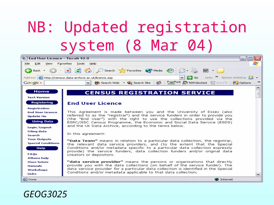
NB: Updated registration system (8 Mar 04)

GEOG3025
Special conditions…

GEOG3025
Objectives
• To review the principles of exploratory data analysis
• To examine tools for exploratory spatial analysis of neighbourhood data– (Not using the Neighbourhood Statistics
Service)– (Not Using GIS software)– Using CASWEB/CommonGIS

GEOG3025
Introductory questions…
What is exploratory spatial data analysis?
How might it apply to neighbourhood data?
Which tools should I use?

GEOG3025
NeSS Interactive Mapping

GEOG3025
NeSS thematic mapping
Owner occupation: wards

GEOG3025
NeSS thematic mapping
• Conventional choropleth (shaded area) mapping
• One variable at a time• Little control over class breaks• No interactivity• No linked plots

GEOG3025
Exploratory spatial data analysis
• Spatial pattern detection• Hypothesis formulation• Some aspects of spatial model fitting• Specifically:
– What makes neighbourhoods different?– Why might these patterns be present?– Can we explain/predict the observed
relationships?

GEOG3025
Login to Casweb

GEOG3025
Select data as usual…
GEOG3025
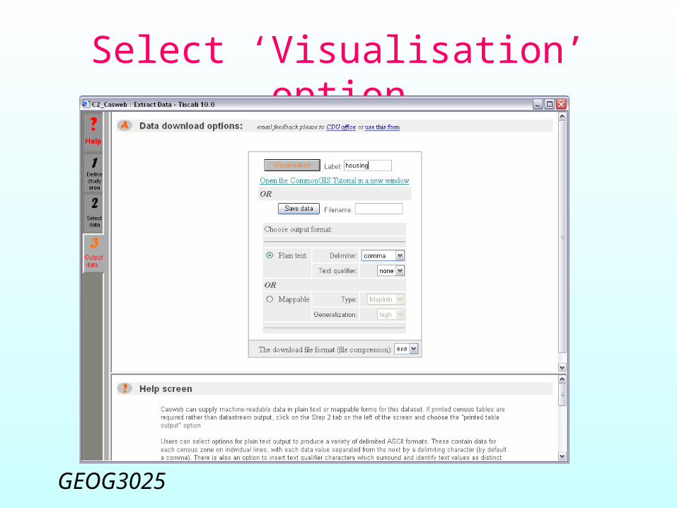
Select ‘Visualisation’ option

GEOG3025
Why not use GIS?
• Data management philosophy rather than data exploration
• Sophisticated spatial data manipulation
• Few statistical and analytical tools
• Cartographic rather than statistical approach to mapping
• Less interactivity• Rarely offering
dynamically linked plots
GEOG3025
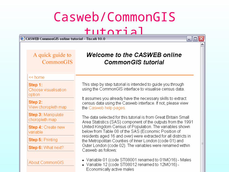
Casweb/CommonGIS tutorial

GEOG3025
CommonGIS window
Hampshire wards

GEOG3025
Calculation of new variables
Selecting home ownership (outright, buying)

GEOG3025
Interactive thematic mapping
Home ownership

GEOG3025
Neighbourhood ESDA
• Spatial patterns and statistical distributions:– Univariate patterns– Multivariate patterns
• EDA focus on level, shape, spread, outliers

GEOG3025
CommonGIS display wizard
• Select 1 or more variables to visualise
• Map(s) and/or chart(s)• Explore spatial distributions and
attribute relationships• Linked windows• Interactive data exploration

GEOG3025
Linked windows
Home ownership vs no car

GEOG3025
Alternative visualizations
Home ownership vs no car

GEOG3025
Cross-classification
Home ownership vs no car

GEOG3025
Assignment
• Run Casweb/CommonGIS• Work through the tutorial• Use a study area bigger than, but
containing, your original neighbourhood
• Investigate how your neighbourhood fits into the local pattern
• Use 1- and 2- variable measures

GEOG3025
Lecture summary
• Exploratory spatial data analysis• Relevance to understanding the
complex pattern of neighbourhood identities
• Introduction to the CommonGIS tool for exploring and visualising census data
• Assignment