Geog 463: GIS Workshop May 17, 2006 Exploratory Spatial Data Analysis.
Upload
vivian-rogersCategory
view
230download
7
Geog 463GIS Workshop
April 12, 2006
Outlines
• GIS Software– Evolution of GIS software– Terms related to GIS software– Types of GIS software systems– GIS software vendors
• System requirements – Classifying system functions– Two types of network configuration– Four types of system interface (client/server
architectures)– Determining adequate system interface and network
configuration
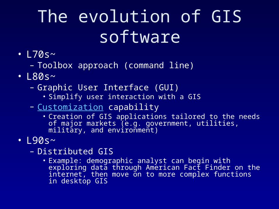
The evolution of GIS software
• L70s~– Toolbox approach (command line)
• L80s~– Graphic User Interface (GUI)
• Simplify user interaction with a GIS– Customization capability
• Creation of GIS applications tailored to the needs of major markets (e.g. government, utilities, military, and environment)
• L90s~– Distributed GIS
• Example: demographic analyst can begin with exploring data through American Fact Finder on the internet, then move on to more complex functions in desktop GIS
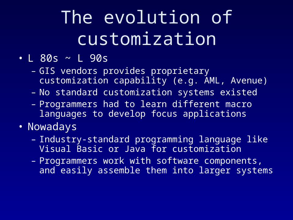
The evolution of customization
• L 80s ~ L 90s– GIS vendors provides proprietary customization
capability (e.g. AML, Avenue)– No standard customization systems existed– Programmers had to learn different macro languages
to develop focus applications
• Nowadays– Industry-standard programming language like Visual
Basic or Java for customization– Programmers work with software components, and
easily assemble them into larger systems
Terms related to GIS software
• Presentation, business logic, data
• Client, server
• Stand-alone vs. client/server
• Thin client vs. thick client
• Middleware (application server)
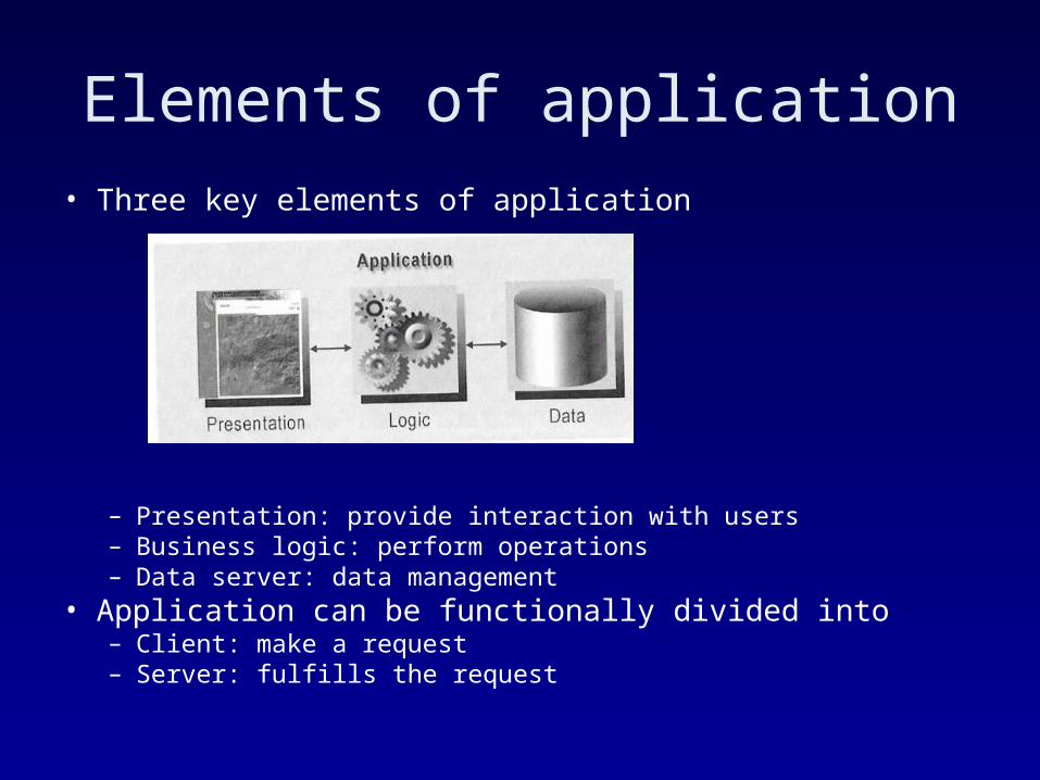
• Three key elements of application
– Presentation: provide interaction with users– Business logic: perform operations– Data server: data management
• Application can be functionally divided into– Client: make a request– Server: fulfills the request
Elements of application
Stand-alone GIS vs. Client/server GIS
• If the three elements reside in the same machine, the application is called stand-alone– e.g. ArcGIS in the Sherman lab
• If the three elements reside in different machines, the application is called client/server– e.g. American fact finder where web browser acts as
client remote from the server where data and business logic reside
– Can be implemented with different network configurations (e.g. LANs, WANs)
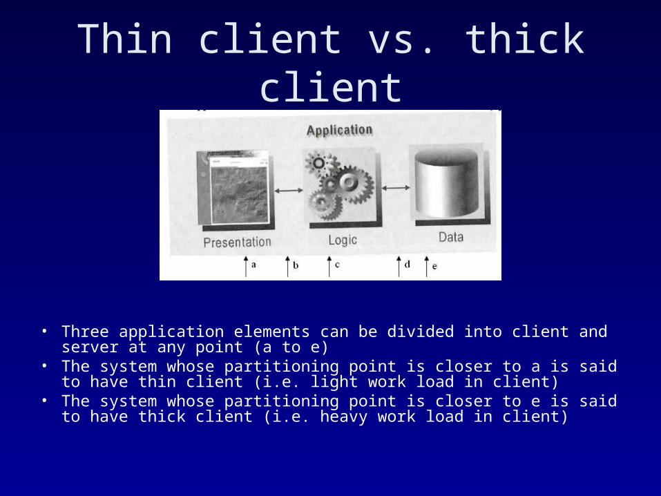
Thin client vs. thick client
• Three application elements can be divided into client and server at any point (a to e)
• The system whose partitioning point is closer to a is said to have thin client (i.e. light work load in client)
• The system whose partitioning point is closer to e is said to have thick client (i.e. heavy work load in client)
Middleware
• In order for the client to communicate with the server, we need translator to link them together.
• This intermediate connection component is called middleware or application server
• e.g. ArcSDE link ArcGIS (client) to DBMS (server) in enterprise-wide GIS project
Types of GIS software systems
• Desktop GIS software
• Server GIS
• Developer GIS
• Hand-held GIS
• Other types of GIS software
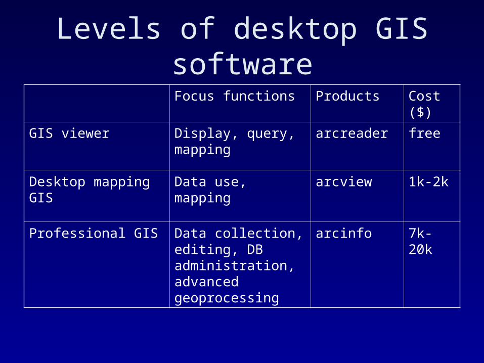
Levels of desktop GIS software
Focus functions Products Cost ($)
GIS viewer Display, query, mapping
arcreader free
Desktop mapping GIS Data use, mapping arcview 1k-2k
Professional GIS Data collection, editing, DB administration, advanced geoprocessing
arcinfo 7k-20k
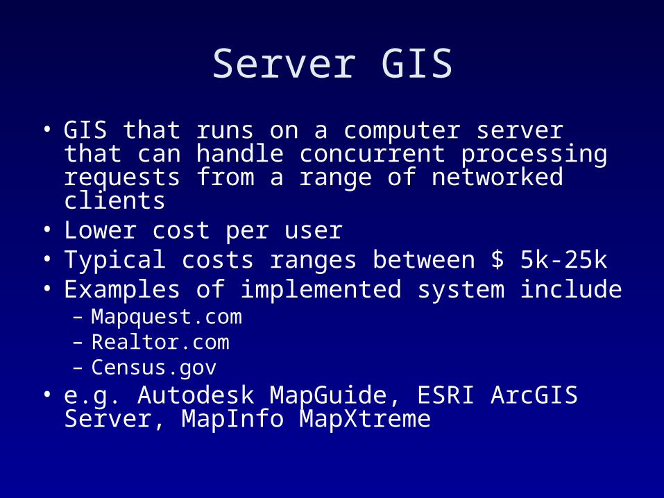
Server GIS
• GIS that runs on a computer server that can handle concurrent processing requests from a range of networked clients
• Lower cost per user• Typical costs ranges between $ 5k-25k• Examples of implemented system include
– Mapquest.com– Realtor.com– Census.gov
• e.g. Autodesk MapGuide, ESRI ArcGIS Server, MapInfo MapXtreme
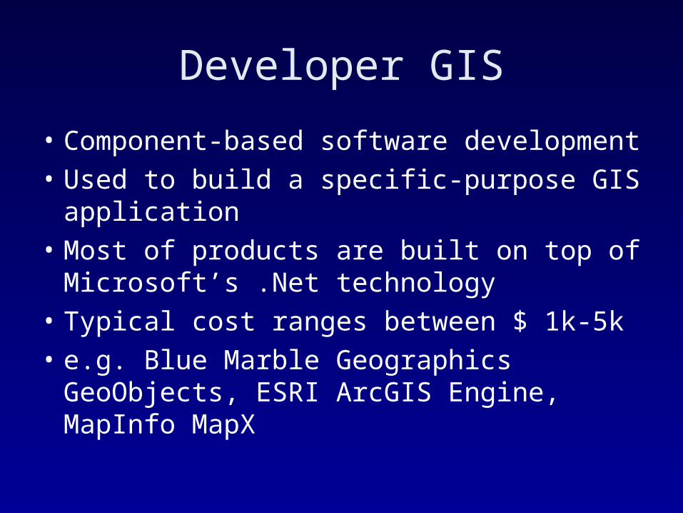
Developer GIS
• Component-based software development• Used to build a specific-purpose GIS
application• Most of products are built on top of
Microsoft’s .Net technology• Typical cost ranges between $ 1k-5k• e.g. Blue Marble Geographics GeoObjects,
ESRI ArcGIS Engine, MapInfo MapX
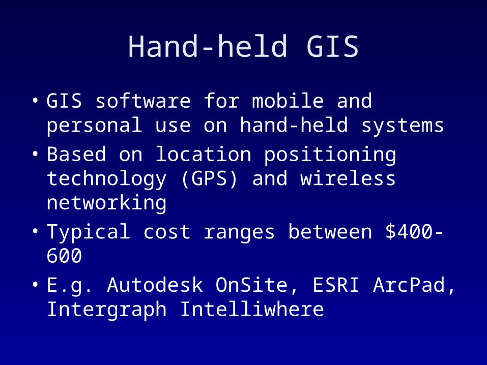
Hand-held GIS
• GIS software for mobile and personal use on hand-held systems
• Based on location positioning technology (GPS) and wireless networking
• Typical cost ranges between $400-600
• E.g. Autodesk OnSite, ESRI ArcPad, Intergraph Intelliwhere
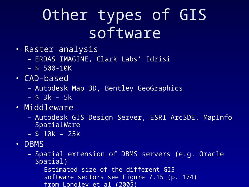
Other types of GIS software
• Raster analysis– ERDAS IMAGINE, Clark Labs’ Idrisi– $ 500-10K
• CAD-based– Autodesk Map 3D, Bentley GeoGraphics – $ 3k – 5k
• Middleware– Autodesk GIS Design Server, ESRI ArcSDE, MapInfo
SpatialWare– $ 10k – 25k
• DBMS– Spatial extension of DBMS servers (e.g. Oracle Spatial)
Estimated size of the different GIS software sectors see Figure 7.15 (p. 174) from Longley et al (2005)
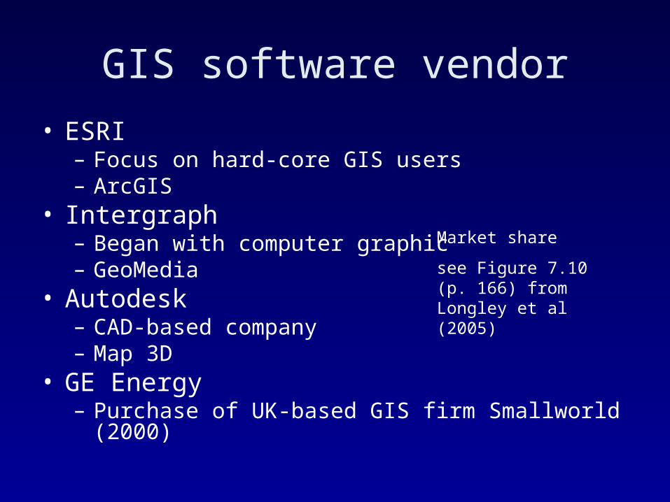
GIS software vendor
• ESRI– Focus on hard-core GIS users– ArcGIS
• Intergraph– Began with computer graphic– GeoMedia
• Autodesk– CAD-based company– Map 3D
• GE Energy– Purchase of UK-based GIS firm Smallworld (2000)
Market share
see Figure 7.10 (p. 166) from Longley et al (2005)
GIS software survey 2005
• http://www.pobonline.com/POB/Protected/Files/PDF/POB0605-GISsoftwareSurvey.pdf
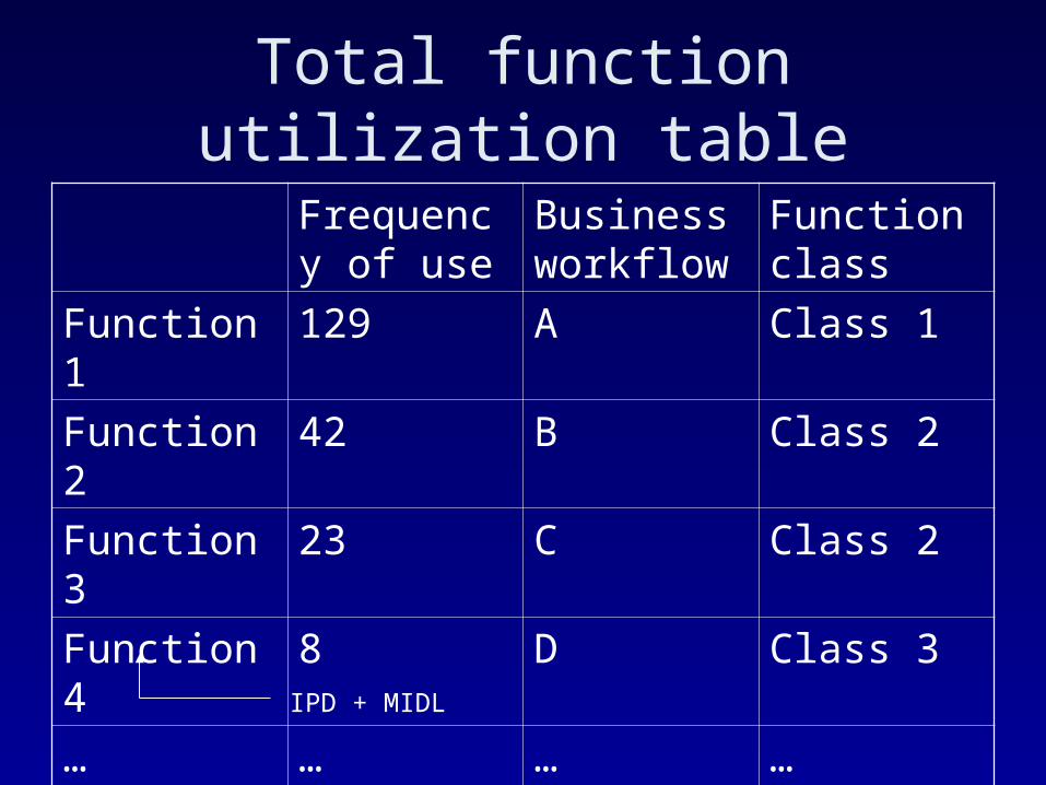
Total function utilization table
Frequency of use
Business workflow
Function class
Function1 129 A Class 1
Function2 42 B Class 2
Function3 23 C Class 2
Function4 8 D Class 3
… … … …
IPD + MIDL
Classify system functions
• Class 1 functions– Functions that have an extremely high frequency of
use; your systems heavily relies on them– Must be proven to present, and operationally efficient
• Class 2 functions– Functions that are essential and are heavily used– Must be in place and be efficient
• Class 3 functions– Least-used functions– Need to be present, but not necessarily efficient
This classification will be helpful in making a recommendation of softwareFor example, if the software which doesn’t support class 1 functions will be automatically disqualified. Also affect system design
Two basic network types
• LANs (Local Area Networks)– Support high-bandwidth communications over short
distances – Provide high-speed access data– Within a building or localized environment
• WANs (Wide Area Networks)– Support communications between remote locations– Support lower-bandwidth than LAN– The internet is a global WAN
Four types of system interface:client/server architectures
1. Central file server with workstation clients
2. Central DBMS server with workstation clients
3. Centralized application processing with terminal clients
4. Web transaction processing with browser or workstation clients
How does it look? Which one to choose? How do I choose them?
1. Central file server with workstation clients
• Data is retrieved from the server and processed on the workstation – Client contains presentation and business
logic (i.e. thick clients)– Server contains data management
• Requires the transfer of large amounts of data from the server to the client
• High demand for bandwidth • Thus it will be best deployed over LANs
2. Central DBMS server with workstation clients
• Data is retrieved from the server by the DBMS and map rendering is processed on the workstation
• Only the data required to support the client display be transferred because DBMS filters data needed
• Reduce demands on the network
• Will be best deployed over LANs
3. Centralized application processing with terminal clients
• Data and application software are both stored and run on servers
• Significantly reduces network bandwidth requirements
• Will be best deployed over WANs
4. Web transaction processing with browser or workstation clients
• Application software and data files reside on servers
• Web browser display information products via the internet or intranet (i.e. thin clients)
• Requires sequential support to a large number of user transactions
• Can be best deployed over WANs

Four types of system architecture
1 2 3 4
Thick clients Thin clients
Large amount of data transfer
Small amount of data transfer
Low # users High # users
What to consider in determining interface and communication technologies
• The relation between system interface and network configuration (See p. 159)
• Data volume– File server or DBMS server?
• Level of computing complexity, number of users– Thick client or thin client? Web transaction?
• Wait tolerance– Emergency dispatch will require low wait tolerance,
and thus demand high bandwidth• Technology life cycle• Organization policies and standards

Typology of GIS software• Software type
– Desktop• Viewer• Mapping• Professional
– Server– Developer– Hand-held– Middleware…
• System architecture– Stand-alone– Client/server
• Thick clients {file server, DBMS server}• Thin clients {citrix, web}
Activities
• Classify functions based on frequency of use – Make sure you identify all GIS functions needed to
create information products as well as to put data into the system (data readiness)
– Identify Class 1, 2, 3 functions• Look at GIS software survey handouts• Identify which software is disqualified based on
class 1 functions• Make several recommendations for software
suitable for your project• Justify your recommendations
Each group should turn in answers by Friday noon