General Certificate of Education - geography...
30
Version General Certificate of Education (A-level) June 2012 Geography (Specification 2030) GEOG3 Unit 3: Contemporary Geographical Issues Post-Standardisation Mark Scheme
Transcript of General Certificate of Education - geography...
Version
General Certificate of Education (A-level) June 2012
Geography
(Specification 2030)
GEOG3
Unit 3: Contemporary Geographical Issues
Post-Standardisation
Mark Scheme
Mark schemes are prepared by the Principal Examiner and considered, together with the relevant questions, by a panel of subject teachers. This mark scheme includes any amendments made at the standardisation events which all examiners participate in and is the scheme which was used by them in this examination. The standardisation process ensures that the mark scheme covers the students’ responses to questions and that every examiner understands and applies it in the same correct way. As preparation for standardisation each examiner analyses a number of students’ scripts: alternative answers not already covered by the mark scheme are discussed and legislated for. If, after the standardisation process, examiners encounter unusual answers which have not been raised they are required to refer these to the Principal Examiner. It must be stressed that a mark scheme is a working document, in many cases further developed and expanded on the basis of students’ reactions to a particular paper. Assumptions about future mark schemes on the basis of one year’s document should be avoided; whilst the guiding principles of assessment remain constant, details will change, depending on the content of a particular examination paper.
Further copies of this Mark Scheme are available from: aqa.org.uk Copyright © 2012 AQA and its licensors. All rights reserved. Copyright AQA retains the copyright on all its publications. However, registered schools/colleges for AQA are permitted to copy material from this booklet for their own internal use, with the following important exception: AQA cannot give permission to schools/colleges to photocopy any material that is acknowledged to a third party even for internal use within the centre. Set and published by the Assessment and Qualifications Alliance. The Assessment and Qualifications Alliance (AQA) is a company limited by guarantee registered in England and Wales (company number 3644723) and a registered charity (registered charity number 1073334). Registered address: AQA, Devas Street, Manchester M15 6EX.
Mark Scheme – General Certificate of Education (A-level) Geography – GEOG3 – June 2012
3
GEOG3 General Guidance for GCE Geography Assistant Examiners The mark scheme for this unit includes an overall assessment of quality of written communication. There are no discrete marks for the assessment of written communication but where questions are "Levels" marked, written communication will be assessed as one of the criteria within each level. Level 1: Language is basic, descriptions and explanations are over simplified and lack clarity. Level 2: Generally accurate use of language; descriptions and explanations can be easily
followed, but are not clearly expressed throughout. Level 3: Accurate and appropriate use of language; descriptions and explanations are expressed
with clarity throughout. Level 4: Accurate and mature use of language; descriptions and explanations are expressed
coherently and confidently Marking – the philosophy Marking is positive and not negative. Mark schemes – layout and style The mark scheme for each question will have the following format: a) Notes for answers (nfa) – exemplars of the material that might be offered by candidates b) Mark scheme containing advice on the awarding of credit and levels indicators. Point marking and levels marking a) Questions with a mark range of 1-4 marks will be point marked. b) Levels will be used for all questions with a tariff of 5 marks and over. c) Two levels only for questions with a tariff of 5 to 8 marks. d) Three levels to be used for questions of 9 to 15 marks. e) Four levels to be used for questions of 40 marks. Levels Marking – General Criteria Everyone involved in the levels marking process (examiners, teachers, students) should understand the criteria for moving from one level to the next – the “triggers”. The following general criteria are designed to assist all involved in determining into which band the quality of response should be placed. It is anticipated that candidates’ performances under the various elements will be broadly inter-related. Further development of these principles will be discussed during the standardisation process. In broad terms the levels will operate as follows:
Mark Scheme – General Certificate of Education (A-level) Geography – GEOG3 – June 2012
4
Level 1: attempts the question to some extent (basic) An answer at this level is likely to:
• display a basic understanding of the topic • make one or two points without support of appropriate exemplification or application of
principle • give a basic list of characteristics, reasons and attitudes • provide a basic account of a case study, or provide no case study evidence • give a response to one command of a question where two (or more) commands are stated
e.g. “describe and suggest reasons” • demonstrate a simplistic style of writing perhaps lacking close relation to the terms of the
question and unlikely to communicate complexity of subject matter • lack organisation, relevance and specialist vocabulary • demonstrate deficiencies in legibility, spelling, grammar and punctuation which detract from
the clarity of meaning.
Level 2: answers the question (well/clearly) An answer at this level is likely to:
• display a clear understanding of the topic • make one or two points with support of appropriate exemplification and/or application of
principle • give a number of characteristics, reasons, attitudes • provide clear use of case studies • give responses to more than one command e.g. “describe and explain...” • demonstrate a style of writing which matches the requirements of the question and
acknowledges the potential complexity of the subject matter • demonstrate relevance and coherence with appropriate use of specialist vocabulary • demonstrate legibility of text, and qualities of spelling, grammar and punctuation which do not
detract from the clarity of meaning. Level 3: answers the question very well (detailed) An answer at this level is likely to:
• display a detailed understanding of the topic • make several points with support of appropriate exemplification and/or application of principle • give a wide range of characteristics, reasons, attitudes • provide detailed accounts of a range of case studies • respond well to more than one command • demonstrate evidence of discussion, evaluation, assessment and synthesis depending on the
requirements of the assessment • demonstrate a sophisticated style of writing incorporating measured and qualified explanation
and comment as required by the question and reflecting awareness of the complexity of subject matter and incompleteness/ tentativeness of explanation
• demonstrate a clear sense of purpose so that the responses are seen to closely relate to the requirements of the question with confident use of specialist vocabulary
• demonstrate legibility of text, and qualities of spelling, grammar and punctuation which contribute to complete clarity of meaning.
Mark Scheme – General Certificate of Education (A-level) Geography – GEOG3 – June 2012
5
Level 4: answers the question with depth, flair, creativity and insight In addition to the requirements of Level 3, an answer at this level is likely to:
• provide strong evidence of thorough, detailed and accurate knowledge and critical understanding of concepts and principles and of specialist vocabulary.
• give explanations, arguments and assessments or evaluations that are direct, logical, perceptive, purposeful, and show both balance and flair.
• demonstrate a high level of insight, and an ability to identify, interpret and synthesise a wide range of material with creativity.
• demonstrate evidence of maturity in understanding the role of values, attitudes and decision-making processes.
Annotation of Scripts It is most important that examiners mark clearly, according to the procedures set out below. • All marking should be done in red (except online marking). • The right hand margin should be used for marks only. • The overall mark for a question must be ringed at the end of the answer. • The total mark for the question must be transferred to the front of the script. • Where an answer is marked using a levels response scheme, the examiner should annotate the
scripts with ‘L1’, ‘L2’, ‘L3’ or ‘L4’ at the point where that level has been reached in the left hand margin. In addition, examiners may want to indicate strong material by annotating the script as “Good Level… “. Further commentary may also be given at the end of the answer. The consequent mark should then appear in the right-hand column. Where an answer fails to achieve Level 1, zero marks should be given.
Other mechanics of marking • All errors and contradictions should be underlined. • Various codes may be used such as: ‘rep’ (repeated material), ‘va’ (vague), ‘NAQ’ (not answering
question), ‘seen’, etc. • Use a wavy line to indicate weak dubious material (avoiding crossing out). • If the rubric is contravened, then all answers should be marked, but with the best answer being
counted and the mark transferred to the front of the script. Then cross out the material which has been discounted.
• Unless indicated otherwise, always mark text before marking maps and diagrams. Do not give double credit for the same point in text and diagrams.
Mark Scheme – General Certificate of Education (A-level) Geography – GEOG3 – June 2012
6
Section A
01 AO2 - 5 AO3 - 2
Notes for answers The satellite image shows evidence of previous eruptions, and hazards that have resulted from them. There may be a lava flow to the south east of the crater, but there is extensive evidence of mudflows/lahars. (Accept lava flows here), some of which have flowed close to the settlement of Legazpi, and into Lagonoy Gulf. However, most of these appear to have been confined to narrow valleys. The main hazard threat however is that to the settlement of Legazpi – it is at risk of lava, ash, gases, pyroclastic flows, lahars etc. The summit could be snow capped – greater threat of mudflows? Inhabitants would have to evacuate the area – there does not appear to be extensive evidence of routeways out, except by sea. Mark scheme Level 1 (1-4 marks) Mid point 3 Simple listing of features from the photograph such as lava, mudslides/lahars, city nearby etc. with no commentary on any aspect. Generic comments without clear reference to photograph. Level 2 (5-7 marks) Mid point 6 Some sophistication and/or evidence of geographical thinking. Clear references to the photograph to create commentary on the nature of the hazards.
(7 marks)
Mark Scheme – General Certificate of Education (A-level) Geography – GEOG3 – June 2012
7
02 AO1 - 8
Notes for answers The main types of volcanic landforms are:
• Basic/shield volcanoes are formed from free-flowing lava. The resulting volcanoes have gentle sides and cover a large area, for example Mauna Loa, Hawaii.
• Acid/dome volcanoes are steep-sided convex cones, consisting of viscous lava, which is probably rhyolite. Examples can be seen in the Puy region of central France.
• Ash and cinder cones are formed from ash, cinders and volcanic bombs ejected from the crater. The sides are steep and symmetrical, for example Paricutin, Mexico.
• Composite cones are the classic pyramid-shaped volcanoes, consisting of layers of ash and lava, which is usually andesitic. Examples include Mt Etna on Sicily, and Mt Fuji in Japan.
• Calderas occur when the build-up of gases becomes extreme and a huge explosion removes the summit of the cone, leaving an opening several kilometres in diameter. The caldera may become flooded by the sea, or a lake may form within it.
Mark scheme Level 1 (1-4 marks) Mid point 3 Simple identification of volcanoes and/or features, with limited detail of characteristics or reasoning; or 1 type only. Level 2 (5-8 marks) Mid point 6 Detail of characteristics and reasoning, possibly with some use of supportive material. The answer progresses through the level as more is added at this level. Full mark answers show breadth of knowledge.
(8 marks)
Mark Scheme – General Certificate of Education (A-level) Geography – GEOG3 – June 2012
8
03 AO2 - 8 AO3 - 2
Notes for answers It is easy to locate volcanoes, but it is very difficult to predict exactly when activity will take place, particularly a major eruption. The Colombian volcano, Nevado del Ruiz, came to life in late 1984 with small-scale activity. Vulcanologists knew the danger a major eruption could pose to the surrounding area, but were unable to predict when the major event would take place. Small-scale volcanic activity continued for several months and people were not prepared to evacuate their homes on the basis of this threat. A study of the previous eruption history of a volcano is important in prediction, along with an understanding of the type of activity produced. At present, research is being conducted to see if it is possible to predict the time of an eruption accurately using the shock waves that are produced as magma approaches the surface, expanding cracks and breaking through other areas of rock. There was some success in predicting the recent eruption (2000) of Popocatépetl in Mexico, but it remains to be seen if such techniques can be applied to all volcanoes. With volcanic activity, protection means preparing for the event. Monitoring of the volcano may suggest a time when the area under threat should be evacuated. Such monitoring includes observations of land swelling, earthquake activity, changes in groundwater level and chemical composition, emission of gases, magnetic field studies and the shock wave analysis mentioned above. Several governments of countries in volcanic areas have made risk assessments and from them produced a series of alert levels to warn the public. Geological studies of the nature and extent of deposits from former eruptions and associated ash falls, lahars and floods may also provide evidence for hazard assessment. Following assessments, it is possible to identify the areas at greatest risk, and land use planning can be applied to avoid building in such places. Once the lava has started to flow, it is possible, in certain circumstances, to divert it from the built environment by digging trenches, using explosive activity, by building artificial barriers, which also protect against lahars, or by pouring water on the lava front. Foreign aid to developing countries suffering volcanic eruptions may be required for considerable periods of time as volcanic events can be prolonged and devastating to the local economy. Such aid is needed for monitoring, evacuation, emergency shelters and food, long-term re-settlement of the population and restoration of the economic base and the area’s infrastructure.
(10 marks)
Mark scheme Level 1 (1-4 marks) Mid point 3 Simple statements of management which could apply to any volcanic event. No specific detail provided. Level 2: (5-8 marks) Mid point 6 Specific statements of management strategies which can be clearly attributed to named areas and/or volcanoes access this level. Basic comparison – max 6 marks. Comparison is clear and purposeful for 7-8 marks. Level 3 (9-10 marks) Mid point 9 A fully developed answer, with good elaboration of the management strategy of two volcanic events. A rounded answer with a full comparison of the two events.
Mark Scheme – General Certificate of Education (A-level) Geography – GEOG3 – June 2012
9
04 AO2 - 5 AO3 - 2
Notes for answers The photo shows a clear, sunny and ‘blue sky’ summer’s day, with signs of high wispy (cirrus or cirro-stratus) clouds. The atmospheric conditions are anticyclonic – high pressure, and the atmosphere appears to be stable. This can be seen from the evidence of the balloons which are making use of the stable air conditions. Candidates may refer to the fact that balloonists control their height by heat from below, and fall back to the ground under subsiding air conditions (this is NOT a requirement). However, the lack of wind should be able to be inferred. Comments on temperature could also be inferred. There is a lack of cloud development as the air is not rising, it is more likely to be subsiding, warming the air as it sinks, and thereby reducing relative humidity leading to dry and clear conditions. Allow possible approach of warm front (very unlikely) - would need to be justified. Mark scheme Level 1 (1-4 marks) Mid point 3 Simple statements of description from the photo; comments are simplistic. Range of evidence (2 or 3 pieces) linked to high pressure or anticyclonic is Level 2. Level 2: (5-7 marks) Mid point 6 Commentary that is more precise, developed or sophisticated.
(7 marks)
Mark Scheme – General Certificate of Education (A-level) Geography – GEOG3 – June 2012
10
05 AO1 - 8
Notes for answers A depression affecting the British Isles originates in the North Atlantic where two different air masses meet along the polar front. The two air masses involved here are:
• Polar maritime air, which is dense, moist and cold • Tropical maritime air, which is light, moist and warm.
As these two bodies of air move towards each other the warmer, less dense air from the south rises above the colder, dense air from the north. The rising air is removed by strong upper atmosphere winds (known as a jet stream), but as it rises the Earth’s rotational spin causes it to twist. This twisting vortex produces a wave at ground level in the polar front, which increases in size to become a depression. Two separate parts of the original front have now developed:
• The warm front at the leading edge of the depression where warm, less dense air rises over the colder air ahead
• The cold front at the rear of the depression where colder dense air pushes against the warmer air ahead.
In between these two fronts lies the warm sector-an area of warm and moist air. Accept alternative origins that are appropriate for the development of depressions. Mark scheme Level 1 (1-4 marks) Mid point 3 Simple statements of origin/reasons for depressions. Which may include limited depth of understanding of processes. Level 2 (5-8 marks) Mid point 6 More detailed and sophisticated statements of origin/reasons for depressions. Understanding of processes is more clear.
(8 marks)

Mark Scheme – General Certificate of Education (A-level) Geography – GEOG3 – June 2012
11
06 AO2 - 8 AO3 - 2
Notes for answers Storm events consist of strong winds and/or heavy rain over relatively short periods of time (max 24-36 hours) e.g. the Cockermouth floods (November 09)
Impacts: • Floodwater reached a height of 2.5m in Cockermouth town centre • 200 people had to be rescued (50 of them by RAF helicopter – some
off roof tops) • Evacuated people spent the night in rescue centres • 1200 people left without electricity • Bridge collapsed at Workington (downstream from Cockermouth) –
killed a policeman. Another crucial bridge closed due to damage. • Disrupted traffic and communications in the area - 1,800 bridges
across Cumbria had to be closed and checked for safety • £100 million of insurance claims expected • Many businesses and schools forced to close • Homes filled with mud and raw sewage • Residents have to be temporarily re-homed • Farm animals stranded and drowned.
Responses:
• Construction work by the army to build a new temporary footbridge crossing the River Derwent in Workington, uniting communities cut off on the north and south side of the river.
• Flood support centres established in Keswick, Cockermouth, Workington and Ulverston by a range of public sector agencies. Mobile centres in Keswick and Workington provided support to communities cut off by the floods. A newsletter offering advice and information was distributed via the flood support centres.
• A temporary rail station built by Network Rail just north of the River Derwent to improve links on the two sides of the river.
• Extra bus services provided for school children and the public. • Health services maintained throughout the disruption and temporary
clinics set up to help people. • Support for businesses has also been established. The North West
Regional Development Agency (NWDA) pledged up to £1 million for small businesses and is working closely with Cumbria County Council to assist businesses which suffered. Temporary accommodation organised for many small businesses displaced through the floods.
• Charitable funds and grant aid established for affected individuals, families and community organisations suffering hardship through the floods.
• Mobile banking services and food deliveries arranged for cut-off communities north of Workington.
N.B. Other examples quoted may have a strong wind focus.
Mark scheme
Level 1 (1-4 marks) Mid point 3 Simple statements of impacts/responses which could apply to any storm event. No specific detail provided.
Level 2 (5-8 marks) Mid point 6 Specific statements of impacts/responses which can be clearly attributed to named areas access this level. Discussion is clear and purposeful.
Level 3 (9-10 marks) Mid point 9 A fully developed answer, with good elaboration of the impacts/responses. A rounded answer with full discursive points made.
(10 marks)
Mark Scheme – General Certificate of Education (A-level) Geography – GEOG3 – June 2012
12
07 AO2 – 5 AO3 - 2
Notes for answers Socotra is a fragile environment where there is a need to balance conservation and exploitation. Many of its flora and fauna species are endemic – peculiar to that island, caused by its geographical isolation (as shown in the map) e.g. one third of the plants and the great majority of its reptiles can only be found here. Biodiversity is therefore being protected on the island. Under the management plan, approximately 75% of the land area is now subject to protection, (National Parks and Nature sanctuaries) some of which will not be allowed to have any human access. A large area is allowed to be accessed but only for scientific, educational and recreational purposes. Only a very small proportion of the land area can be used for development – even the remainder which can be farmed has to be done with one eye being kept on biodiversity (Resource use reserve). Even many coastlines are either protected or monitored. Mark scheme Level 1 (1-4 marks) Mid point 3 Simple statements of description from the data; comments are simplistic. Level 2 (5-7 marks) Mid point 6 Statements of description that are more precise, developed or sophisticated; commentary is also sophisticated. Commentary on either nature or management access Level 2 but both needed for max.
(7 marks)

Mark Scheme – General Certificate of Education (A-level) Geography – GEOG3 – June 2012
13
08 AO1 - 8
Notes for answers Characteristic features of tropical biomes:
Equatorial rainforest Savanna grassland Monsoon forest Evergreen appearance due to year-long growing season. Forest has a 5 layered structure, tallest trees called emergents are up to 45m tall. Upper and lower canopy layers provide continuous cover. Tallest trees have developed buttress roots to support their great height. Leaves have drip-tips to help shed rain. Trunks are branchless under the canopy, where it is too dark for photosynthesis. Plants, such as lianas, grow on trees as there is insufficient light on the forest floor. Tree roots are generally near or on the surface as soil is nutrient deficient deep down.
Trees dominate over grasses where the wet season is longer. Grasses dominate in locations where the dry season is longer further away from the equator. Grasses may be higher than 2m tall, their long roots reach down to underground moisture. Both grasses and trees are deciduous, losing their leaves in the dry season. Trees have adapted to survive drought, e.g. baobabs store water in their swollen trunks to survive the dry season. Trees develop xerophilous features: deep, branched roots seek moisture underground. Evergreen trees also occur, with hard leathery leaves to reduce transpiration loss. Acacia trees have developed flattened crowns, to cope with strong trade winds. Vegetation has adapted to cope with fire.
The indigenous vegetation has been largely cleared for agriculture in the lowlands. Mangrove forest dominates in the coastal lowlands, where vegetation has adapted to cope with salty conditions. The trees are lower in height than in the rainforest, providing a less continuous cover. Most trees are deciduous, losing their leaves in the dry season. Different species all fruit and flower at the same time in line with the seasons. The open canopy allows a dense undergrowth of bamboo to develop.
(8 marks)
Mark scheme Level 1 (1-4 marks) Mid point 3 Simple statements of description. Depth of knowledge of the characteristics is limited. Max Level 1 if just climate. Level 2 (5-8 marks) Mid point 6 Detailed statements of description. There is a clear understanding of characteristics with some evidence of sophistication, for example stratification and species types. Max 7 if just vegetation.
Mark Scheme – General Certificate of Education (A-level) Geography – GEOG3 – June 2012
14
09 AO2 - 8 AO3 - 2
Notes for answers A clear understanding of the terms ‘development’ and ‘sustainability’ (and possibly biodiversity) is crucial here, and of how they apply in the chosen biome. Examples of where development is taking place should be referred to, together with comments on how sustainability is being influenced. For example, The Serengeti is an area whose biodiversity is under threat by human activity and development. The national park is in the tropical grassland ecosystem of Tanzania and Kenya. It is a very diverse area with a large variety of animals and plants, all of which have adapted to the climate. One conservation method/development activity adopted is ecotourism. Tanzania is Africa’s 3rd poorest country with a GDP of only 17% of Africa’s average. One of the main problems the area faces is over-cultivation. 90% of the workforce in Tanzania is employed in agriculture and 85% of the country’s exports are agricultural. Due to the increasing population the land is under even more pressure. This is leading to the degradation of the land and for that reason the ‘Ngorongoro Conservation Area’ was established. The Ngorongoro Conservation Area aims to reduce these problems. Wildlife Tourism, Managed Hunting and Cultural Tourism are three ways in which they plan to increase the amount of tourists they receive each year, whilst at the same time conserving the environment. Positives include more money to invest in park management, reduced poaching due to structured and managed hunting, more money and employment for locals as tour guides, and/or educating tourists about the local area and its culture. These types of tourism and sources of income are sustainable and do not put the area’s biodiversity under great threat. Tour companies also employ local people to teach their tour guides about the area. Further investment follows. This format of development could be extremely sustainable and beneficial to all involved. Mark scheme Level 1 (1-4 marks) Mid point 3 Simple generalised statements of development issues. No specific detail provided, nor any attempt to link to sustainability. Level 2 (5-8 marks) Mid point 6 Specific descriptive statements of one or more development issues which can be clearly attributed to the biome. Linkage to sustainability is tentative and implicit. Level 3 (9-10 marks) Mid point 9 A fully developed answer, with good elaboration and clear detail of the chosen development issue(s). Linkage to sustainability is explicit.
(10 marks)
Mark Scheme – General Certificate of Education (A-level) Geography – GEOG3 – June 2012
15
Section B 10 AO2 - 5 AO3 - 2
Notes for answers The Freiburg Transport Policy is: Integrated: at the main station there are links with the intercity railway system; cycling lanes link into the public transport system – ‘bike and ride’; traffic calming measures in residential areas – allowing pedestrians/cyclists/car users to be in the same area safely. Efficient: 65% of the population live within the catchment of a tram stop; a large number (9000) of places to park a bike, and then join the rest of the network. Sustainable: extensive provision of cycle routes – 500km within the city; extensive areas of pedestrianisation; upgrading of urban spaces to continue; all aimed at reducing car use within the city. Mark scheme Level 1 (1-4 marks) Mid point 3 Simple processing of material from the figure with no basis of commentary re any of integrated, efficient and sustainable. Level 2 (5-7 marks) Mid point 6 Some attempt to categorise as given above together with suitable comment. Implicit references, max 5.
(7 marks)
Mark Scheme – General Certificate of Education (A-level) Geography – GEOG3 – June 2012
16
11 AO1 - 8
Notes for answers Reduction - businesses are encouraged to reduce the amount of packaging associated with products. Consumers can play a part by refusing to accept plastic bags, or by opting for products that do not use excessive packaging. Re-use - some re-use of milk containers, soft drinks bottles and jam jars has been attempted. However, the most successful example of re-use is the sale of bags for life. Some shops charge cash deposits on glass bottles to encourage their return. Recycling - waste products such as paper, glass, metal cans, plastics and clothes can be recycled if they can be collected economically. However, recycling has costs – start up costs, transport from collection points to the processing plants, and the hot water and other materials needed for cleaning and processing. Energy recovery - waste material can be converted into energy. The main method is incineration. However, many old, polluting incinerators have been closed down. Some modern incinerators generate electricity or power neighbourhood heating schemes and are considered by some to be a sustainable option for waste disposal. Composting - on a small scale, organic waste (kitchen scraps and garden waste) can be used to make compost to fertilise gardens or farmland. On a much bigger scale, ‘anaerobic’ digestion is an advanced form of composting taking place in an enclosed reactor. The biogases produced can be used to provide an energy supply and the solid residue can be used as a soil conditioner. Landfill - waste is dumped in old quarries or hollows, which is convenient and cheap. However, it is unsightly and is a serious threat to groundwater and river quality because toxic chemicals can leach out and contaminate the water. Decaying matter at landfill sites also produces methane gas, which can be explosive, and is a greenhouse gas. Other aspects of waste management may be creditworthy. Mark scheme Level 1 (1-4 marks) Mid point 3 Simple generalised statements of management with no depth or detail, and not attributed to any named area. 1 strategy, max Level 1. Level 2 (5-8 marks) Mid point 6 More specific and sophisticated statements of management which may be attributed to a named area, or demonstrate greater depth of understanding and/or knowledge.
(8 marks)

Mark Scheme – General Certificate of Education (A-level) Geography – GEOG3 – June 2012
17
12 AO2 - 8 AO3 - 2
Notes for answers Partnerships must have some cooperation between at least two of national government, local government and the private sector. A sense of partnership is essential for Level 2 and above. For example: East Manchester regeneration 2000-2008 New East Manchester Ltd was one of the first urban regeneration companies in the UK. Promoted by the government and working with local partner organisations, this newly formed company has worked with the local community to produce plans to regenerate the area. The First Regeneration Framework contained several ambitious aims that included redeveloping shopping areas, building 12 500 new homes, establishing a business park and constructing a world class sporting facility called ‘Sportcity’. In addition, public transport systems, educational facilities and the physical environment were improved and upgraded. Through these improvements the new urban regeneration company hopes to attract 30 000 new people into the area. Several projects have been created since 2000 to support local residents by improving literacy levels and ICT skills and by offering advice on financial matters. The Metrolink light tram network is being extended into East Manchester with new stations under construction to act as pedestrian hubs with easy public access and the provision of nearby retail facilities. As part of an integrated transport plan, bus services, footpaths and cycle ways are being improved and extended. The aim is to promote sustainable transport by encouraging people to use public transport rather than private cars. Sportcity The City of Manchester Stadium was built to host the Commonwealth Games in 2002 and it is now the home of Manchester City. Other world class facilities include outdoor and indoor athletics arenas, the National Squash Centre and the National Cycling Centre. In addition, some 350 new apartments have been constructed alongside the Ashton Canal. Has it been a success? In a recent survey 60% of the residents said that the area was improving and 68% were satisfied with the developments that have taken place. Unemployment has fallen from 14.2% in 1998 to 5.7% in 2007. Several large retail outlets, including ASDA, Matalan and Next, have moved into the area, providing over 300 jobs for local people. East Manchester has been transformed and may continue to witness improvements in the future with the launch of the Second Regeneration Framework (2008-2018).
(10 marks)
Mark scheme Level 1 (1-4 marks) Mid point 3 Simple statements of a partnership scheme(s) which could apply to any area. No specific detail provided, nor any attempt to evaluate. Level 2 (5-8 marks) Mid point 6 Specific descriptive statements of a partnership scheme(s), some of which can be clearly attributed to a named example. Evaluation is tentative and implicit. Level 3 (9-10 marks) Mid point 9 A fully developed answer, with good elaboration and clear detail of the partnership scheme(s). Evaluation is thorough and explicit.
Mark Scheme – General Certificate of Education (A-level) Geography – GEOG3 – June 2012
18
13 AO2 - 5 AO3 - 2
Notes for answers The area shown is the tar sands development in Beaver Lake Cree, Alberta; the purpose being to extract oil from the open cast mining of tar sands. Impacts: Socio-economic: jobs are provided in a remote area where jobs may have been in short supply; living standards will be raised; social facilities will increase for locals as well as workers, e.g. health and education; indigenous people may have to be moved from the land; traditional ways of life affected; better transport systems constructed – roads and railways. Environmental: scarring of the land by open cast mining; massive deforestation and subsequent impacts on fauna; atmospheric pollution – visible smoke from the chimneys; pollution of the rivers and lakes in the area; pipelines affecting migration routes. Mark scheme Level 1 (1-4 marks) Mid point 3 Simple statements of impact(s), such as jobs created, environment damaged, smoke pollution, trees felled with no commentary on subsequent/wider issues. Generic points with no clear reference to the photograph. Level 2 (5-7 marks) Mid point 6 Awarded to comments that go beyond the statements in Level 1, i.e. there is some commentary (intellectual processing) on what lies behind or beyond the statements given, or some attempt to categorise the main impacts. Clear reference to the photograph.
(7 marks)
Mark Scheme – General Certificate of Education (A-level) Geography – GEOG3 – June 2012
19
14 AO1 - 8
Notes for answers A transnational corporation is a company which operates in at least two countries. The organisation is hierarchical, with the headquarters and research and development (R&D) often located in the country of origin, with centres of production overseas. As an organisation becomes more global, regional R&D and even regional headquarters will develop. Candidates are likely to refer to examples, which do not have to be manufacturing e.g. Tesco (UK based): The company operates stores in 12 countries outside of the UK and in 2009 this totalled over 2000 stores. In the UK Tesco operates stores of different sizes and product ranges (Tesco Extra, Tesco Metro, Tesco Express, One Stop, Tesco Homeplus) which in February 2008 totalled over 2100 outlets. The company increasingly saw other countries not just as places to source goods from, but as markets in which to operate. After opening stores in Hungary and Poland, entry into the Asian markets began in 1998 with a joint venture in South Korea. In 2004, the company entered the Chinese market where rising wealth meant an increasing number of affluent customers. Tesco now employs around over 450 000 people worldwide and operates in the following countries, UK, China (70 stores in 2009), Czech Republic (113), Hungary (149), Ireland (116), Japan (135), Malaysia (29), Poland (319), Slovakia (70), South Korea (242), Thailand (571), Turkey (96) and USA (115). Recently, the company has begun operations in India, where it is not allowed to open its own brand retail stores but can sign up to joint ventures and operate wholesale cash-and-carry businesses. Mark scheme Level 1 (1-4 marks) Mid point 3 Simple generalised statements of spatial organisation with no depth or detail, and not attributed to any named TNC. Level 2 (5-8 marks) Mid point 6 More specific and/or sophisticated statements of spatial organisation which may be attributed to a named TNC, or demonstrate greater depth of understanding and/or knowledge.
(8 marks)
Mark Scheme – General Certificate of Education (A-level) Geography – GEOG3 – June 2012
20
15 AO2 - 8 AO3 - 2
Notes for answers Candidates must understand the question of whether economic sustainability can be compatible with environmental sustainability. Sustainability has been defined as ‘development that meets the needs of the present without compromising the ability of future generations to meet their own needs’. Within the process:
• Human potential (level of wellbeing) is improved • The environment (resource base) is used and managed to supply
people on a long-term basis • This implies social justice as well as long-term environmental
sustainability • The global economy depends upon the natural environment as a source
of resources and as a sink for emissions • The capacity of the environment to provide resources and absorb
increasing levels of pollution is the critical threshold controlling how far population can increase and economies expand.
Environmental objectives include, to:
• maintain ecological processes and life-support systems • preserve genetic diversity • ensure the utilisation of species and ecosystems without destroying
them. Economic objectives include:
• the ability of economies to maintain themselves when resources decline or become too expensive
• to maintain standards of living when the populations that are dependent on resources are growing.
Candidates may wish to illustrate or exemplify some of these principles. Mark scheme Level 1 (1-4 marks) Mid point 3 Simplistic statements regarding the issue which could apply to any area of the world, and to any context. No specific detail or depth provided Level 2 (5-8 marks) Mid point 6 Specific or sophisticated statements regarding the issue which can be clearly attributed to named areas and/or contexts access this level. There is some evidence of depth of understanding. Level 3 (9-10 marks) Mid point 9 A fully developed answer, with good elaboration and discussion of a variety of aspects of the issue each clearly attributed and being different from each other. There is strong evidence of depth of understanding.
(10 marks)
Mark Scheme – General Certificate of Education (A-level) Geography – GEOG3 – June 2012
21
16 AO2 - 5 AO3 - 2
Notes for answers All five states have varying degrees of separatist pressures. It can be seen that Arunachal Pradesh, possibly the most remote from the rest of India, does not have an insurgent group – the others all have two such groups. Each of the areas is geographically peripheral to the rest of India – this in itself is often the reason for separatist pressures. Access is also very difficult by land – all through the Siliguri Corridor. There are also other cultural differences with the main body of India, which is Hindu, with Hindi being its main language. Candidates could discuss the impact of differences in religion and language in detail. The population of each of the states is low, with the exception of Assam, which is nearest to the rest of India. Are any of the others large enough to justify complete independence on economic grounds? Mark scheme Level 1 (1-4 marks) Mid point 3 Simple processing of material from the figure with no basis of commentary. Level 2 (5-7 marks) Mid point 6 Some attempt to categorise and comment on the main elements of separatist pressures and why they exist.
(7 marks)
Mark Scheme – General Certificate of Education (A-level) Geography – GEOG3 – June 2012
22
17 AO1 - 8
Notes for answers This can be answered at a variety of levels, and in a variety of contexts: Within the UK most conflicts over the use of land at a local level are resolved by reference to planning authorities. At first the application is made to the local authority planning officer who then decides whether to award planning permission. If permission is refused then the applicant can appeal, either to the local planning committee, and if unsuccessful there to DEFRA. In addition, a developer can be asked to make modifications to the original proposal, or to provide additional facilities to make the proposal more acceptable to the public and/or council. Internationally, the United Nations (UN) was founded to prevent and resolve international conflicts and help build a culture of peace in the world. These intentions are transferred into action by the different agencies, departments and programmes within the umbrella of the UN. Under its supervision, specialised programmes and agencies such as the UN Development Programme (UNDP), the UN Educational, Scientific and Cultural Organisation (UNESCO), the UN Environment Programme (UNEP), the UN High Commissioner for Human Rights (UNHCHR), the UN Institute for Disarmament Research (UNIDIR), are trying to prevent deadly conflicts from proliferating by attacking the roots of conflicts and not the acts of violence that are the symptoms. Blue-helmeted UN forces, made up soldiers from contributing nations, are frequently involved in policing actions in conflict zones around the world. Mark scheme Level 1 (1-4 marks) Mid point 3 Generalised statements of processes which are either simplistic or lacking in a sense of place or exemplification; or one developed process. Non-geographical conflict resolution – max Level 1. Level 2 (5-8 marks) Mid point 6 Detailed, specific and/or sophisticated processes that clearly apply to conflict resolution in a geographical sense. A greater range of processes will move the answer up the level, as will recognition of the complexity of the topic.
(8 marks)

Mark Scheme – General Certificate of Education (A-level) Geography – GEOG3 – June 2012
23
18 AO2 - 8 AO3 - 2
Notes for answers The key word in this question is the word ‘environment’. Candidates must endeavour to keep their answer focused on this element of the conflict. An example could be in Darfur: NB These nfa were written in late 2010. Darfur is a semi-arid province in the west of Sudan. Arab Janjaweed have been accused of riding into the villages of the black African people and attacking people and setting fire to the villages. As a result the women and their children have left the villages and their land in order to go to somewhere that is safe. They have settled near the main towns of the area, where food, water and medical help are being provided by charities. The environmental costs are many. The former villages now stand idle, many in burnt ruins. The plots of land around them are untended and they are reverting back to some form of natural vegetation. The area is on the edge of the Sahara Desert and drought resistant plants are being re-established. Many of these plants have long roots, and once established are very difficult to remove again. The former farmland is going to ruin too. Around the refugee camps, the people continue to try and find fuelwood for cooking and heating. Areas of woodland have been disappearing fast, adding to the processes of desertification.
(10 marks)
Mark scheme Level 1 (1-4 marks) Mid point 3 Simple statements of impact, which are generalised and non-specific to the identified conflict. Level 2 (5-8 marks) Mid point 6 Detailed statements of impact with a clear sense of place being generated. The answer is detailed and makes sophisticated comments on impact. Level 3 (9-10 marks) Mid point 9 A fully developed answer, with good elaboration and clear and appropriate detail. Recognition of the complexity of impact. Recognition of the changing impact over time.
Mark Scheme – General Certificate of Education (A-level) Geography – GEOG3 – June 2012
24
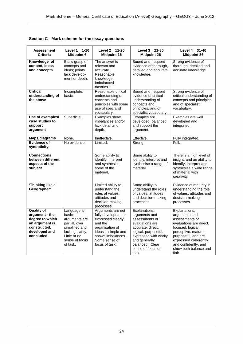
Section C - Mark scheme for the essay questions
Assessment Criteria
Level 1 1-10 Midpoint 6
Level 2 11-20 Midpoint 16
Level 3 21-30 Midpoint 26
Level 4 31-40 Midpoint 36
Knowledge of content, ideas and concepts
Basic grasp of concepts and ideas; points lack develop-ment or depth.
The answer is relevant and accurate. Reasonable knowledge. Imbalanced theories.
Sound and frequent evidence of thorough, detailed and accurate knowledge.
Strong evidence of thorough, detailed and accurate knowledge.
Critical understanding of the above
Incomplete, basic.
Reasonable critical understanding of concepts and principles with some use of specialist vocabulary.
Sound and frequent evidence of critical understanding of concepts and principles, and of specialist vocabulary.
Strong evidence of critical understanding of concepts and principles and of specialist vocabulary.
Use of examples/ case studies to support argument Maps/diagrams
Superficial. None.
Examples show imbalances and/or lack detail and depth. Ineffective.
Examples are developed, balanced and support the argument. Effective.
Examples are well developed and integrated. Fully integrated.
Evidence of synopticity: Connections between different aspects of the subject ‘Thinking like a Geographer’
No evidence. Limited. Some ability to identify, interpret and synthesise some of the material. Limited ability to understand the roles of values, attitudes and decision-making processes.
Strong. Some ability to identify, interpret and synthesise a range of material. Some ability to understand the roles of values, attitudes and decision-making processes.
Full. There is a high level of insight, and an ability to identify, interpret and synthesise a wide range of material with creativity. Evidence of maturity in understanding the role of values, attitudes and decision-making processes.
Quality of argument - the degree to which an argument is constructed, developed and concluded
Language is basic; arguments are partial, over simplified and lacking clarity. Little or no sense of focus of task.
Arguments are not fully developed nor expressed clearly, and the organisation of ideas is simple and shows imbalances. Some sense of focus of task.
Explanations, arguments and assessments or evaluations are accurate, direct, logical, purposeful, expressed with clarity and generally balanced. Clear sense of focus of task.
Explanations, arguments and assessments or evaluations are direct, focused, logical, perceptive, mature, purposeful, and are expressed coherently and confidently, and show both balance and flair.
Mark Scheme – General Certificate of Education (A-level) Geography – GEOG3 – June 2012
25
19 AO1 - 14 AO2 - 16 AO3 - 10
Notes for answers Appropriate content for a response to this question might include:
• An understanding of the causes and characteristics of seismic events • An understanding of vulcanicity and volcanic events • An understanding of plate tectonics theory • The distribution and movement of the earth’s major plates – sea-floor
spreading, subduction and conservative margins • The distribution of plate boundaries and their relationship to volcanoes
and vulcanicity, and seismicity. Synopticity could emerge with some of the following:
• Critical understanding of continental drift theory and the evidence to support it, both geological and biological
• Critical understanding of the ideas of plate tectonics which may explain plate movements, and the emergence of palaeomagnetism and its significance
• Recognition that there is a variety of scales upon which evidence can be collated
• Recognition of the range of scales by which volcanic and seismic events can be identified and measured
• Recognition that evidence occurs throughout the world, including continental and oceanic
• A critical understanding of other factors that may cause volcanic and seismic events, such as at hot spots and some human activities.
This question clearly requires an evaluative response that should try to summarise the purpose of the task. Any conclusion is valid and can be credited as long as it is measured and reasonable, and related to the content of the answer.
(40 marks)
Mark Scheme – General Certificate of Education (A-level) Geography – GEOG3 – June 2012
26
20 AO1 - 14 AO2 - 16 AO3 - 10
Notes for answers Appropriate content for a response to this answer might include:
• An understanding of the general atmospheric circulation • An understanding of the role of the sub-tropical high pressure areas in
creating climatic characteristics in the chosen tropical region • An understanding of the role of the inter-tropical convergence zone in
creating climatic characteristics in the chosen tropical region • Detailed knowledge of the climate characteristics (temperature,
precipitation and wind) in the chosen tropical region.
Synopticity emerges with the following:
• A critical understanding of the relative importance of the two key factors in the chosen tropical region
• Awareness of the inter-relationships between the two key factors • Use of detailed case study support (breadth/depth), possibly from
differing areas within the same tropical region, which may illustrate the role of other factors (as given above)
• Evaluative comments relating to the relative importance of the two key factors over time.
• Understanding of other factors that may influence climate in the chosen tropical region, such as altitude and ocean currents.
This question requires an overall judgement to be expressed and the response should come to a view. Any conclusion is creditable as long as it is reasonable and related to the preceding content and argument.
(40 marks)
Mark Scheme – General Certificate of Education (A-level) Geography – GEOG3 – June 2012
27
21 AO1 - 14 AO2 - 16 AO3 - 10
Notes for answers Appropriate content for a response to this answer might include:
• An understanding of the factors causing succession towards climatic climax of a range of plant communities found in the British Isles, including at least one of lithosere, psammosere, hydrosere or halosere
• An understanding of the characteristics of the climatic climax community, the temperate deciduous woodland biome, and the extent to which this has been modified. There might be some understanding of regional differences in the biome
• An understanding of the human factors affecting plant successions: secondary succession and plagioclimax
• Recognition of the changes to ecosystems resulting from urbanisation, colonisation of wasteland; the development of distinctive ecologies along routeways and in the urban-rural fringe
• Recognition of the impact of conservation in a variety of settings: urban and rural, and natural environments such as sand dunes.
Synopticity emerges with the following:
• A critical understanding of both physical and human factors in relation to changes in plant communities over time, either short or long term
• A critical awareness of the inter-relationships between physical and human factors
• Use of detailed case study support (breadth/depth) from contrasting ecosystems, man-made and natural
• Evaluative comments relating to the relative importance of physical and human factors over the short and long term.
This question clearly requires an evaluative response that should try to summarise the purpose of the task. Any conclusion is valid and can be credited as long as it is measured and reasonable, and related to the content of the answer.
(40 marks)

Mark Scheme – General Certificate of Education (A-level) Geography – GEOG3 – June 2012
28
22 AO1 - 14 AO2 - 16 AO3 - 10
Notes for answers Appropriate content for a response to this question might include:
• An understanding of the factors causing the decentralisation of retailing and other services
• An understanding of the impacts of the decentralisation of retailing and other services in the regions where out of town centre areas have been established
• An understanding of the impacts of decentralisation (as above) on city centre retailing and service areas
• An understanding of the responses to decentralisation (as above) by city centre retailing and service areas
• Use of case studies/exemplars of both out of town retailing areas and urban centre retailing areas.
Synopticity emerges from some of the following:
• evidence in the breadth/depth of case-study material • detailed critical understanding of the range of impacts (social,
economic, environmental, political) and the interrelationships between them
• detailed critical understanding of the responses to the impacts above • detailed critical understanding of the degree to which impacts and
responses may change/vary over time and space • a recognition of the importance of values and attitudes, and of the role
of decision makers at a variety of levels, e.g. national government, local government, individual companies and developers.
This question requires an overall judgement to be expressed and the response should come to a view. Any conclusion is creditable as long as it is reasonable and related to the preceding content and argument.
(40 marks)
Mark Scheme – General Certificate of Education (A-level) Geography – GEOG3 – June 2012
29
23 AO1 - 14 AO2 - 16 AO3 - 10
Notes for answers Appropriate content for a response to this question might include:
• an understanding of the economic growth of the Asian Tiger economies, causes and impacts
• an understanding of the growth of the second phase NICs, particularly India and China
• an understanding of the growth of the emerging economies e.g. Brazil, Russia, Dubai and some eastern European countries
• an understanding of the role of the USA, EU and Japan as more established economic powers
• an understanding of the complexity of the global economy, and the factors that have led to globalisation
• use of case studies/exemplars. Synopticity emerges from some of the following:
• evidence in the breadth/depth of case-study material • detailed critical understanding of the impacts and issues identified • detailed critical understanding of the responses to the impacts and
issues above • detailed critical understanding of the management, where applicable,
of the impacts and issues identified • a recognition of the importance of values and attitudes, and of the role
of decision makers at a variety of levels e.g. TNCs and national governments.
This question requires an overall judgement to be expressed and the response should come to a view. Any conclusion is creditable as long as it is reasonable and related to the preceding content and argument.
(40 marks)
Mark Scheme – General Certificate of Education (A-level) Geography – GEOG3 – June 2012
30
24 AO1 - 14 AO2 - 16 AO3 - 10
Notes for answers NB this question can be addressed from a wide range of scales: local, national and international. Appropriate content for a response to this question might include:
• an outline of the basis and/or reasons for the conflict(s) identified, as contextual material
• an understanding of the nature and expression of the chosen conflict(s)
• an understanding of the impacts of the chosen conflict(s) • an understanding of the responses to, and possible resolution of, the
chosen conflict(s) • use of case studies of the chosen conflict(s).
Synopticity emerges from some of the following:
• evidence in the depth (or breadth) of the chosen case study material • detailed critical understanding of the impacts and/or consequences of
conflict • detailed critical understanding of the complexity of impact – social,
economic and environmental • recognition of variation in the means by which conflict can be resolved,
and the subsequent consequences • recognition that the impacts and responses may change over time • recognition of the importance of values and attitudes, and of the role of
decision-makers at a variety of levels. This question requires an overall judgement to be expressed and the response should come to a view. Any conclusion is creditable as long as it is reasonable and related to the preceding content and argument.
(40 marks)