GCSE SETTLEMENT Variation 1: SITE FACTORS 1 - Protection / Defence It was especially important to...
51
GCSE SETTLEMENT
-
Upload
joy-mccarthy -
Category
Documents
-
view
215 -
download
1
Transcript of GCSE SETTLEMENT Variation 1: SITE FACTORS 1 - Protection / Defence It was especially important to...

GCSE SETTLEMENT

Variation 1:
SITE FACTORS
1 - Protection / DefenceIt was especially important to protect settlements from those who wished to attack. A good vantage point to watch for this was a hill, and many castles and forts were built on hills to watch for attackers.
2 – Plenty of WaterWashing, drinking and cooking all need water, and it was vital to have an adequate supply especially during the summer. Rivers are also good for transport. Springs, wells and rivers provided supplies.
Variation 1:
SITE FACTORS
3 – Not Too Much WaterIt was important then and is still important to ensure that settlements are not built on areas that will flood, or are marshy (as the settlement will sink). This isn't always possible to see, particularly if the floods only occur every few years, or there isn't a flood whilst building the settlement.
Variation 1:
SITE FACTORS
4 – RiversRivers can be useful supplies of water in themselves, or agents of flooding. But what is important about rivers as a site factor is that they can be crossed, either by bridge or ford. A river that couldn't be crossed would have been a problem for early settlements, if they couldn't escape across a river during an attack. Rivers can now be crossed by building bridges, but these are expensive.
Variation 1:
SITE FACTORS
5 – Building MaterialsEither wood or stone was needed to build early settlements, so a forest, wood or hillside with crags was needed to provide the materials. This is not so important today, as houses are built of brick and slate, which are easily provided.
Variation 1:
SITE FACTORS
6 – Supply of WoodNot as important today, but early settlements would need wood for fuel. It was therefore vital that the settlement was near trees.
Variation 1:
SITE FACTORS
7 – Flat LandIt is extremely difficult to build a settlement on land with a gradient (such as a hillside) and so land should be flat wherever possible. This should not be confused, as it often is, with low-lying land: the top of a high hill or plateau could be flat too. It is possible to build a settlement now on a gradient, but it is much more time consuming and expensive.
Variation 1:
SITE FACTORS

8 – ShelterIt is important the direction that the settlement faces, and this is geographically known as aspect. In early settlements, it was important that agricultural land faced south so that the sun shone directly on the land. Building a settlement in a valley provided a way to keep out of harsh winter winds.
Variation 1:
SITE FACTORS
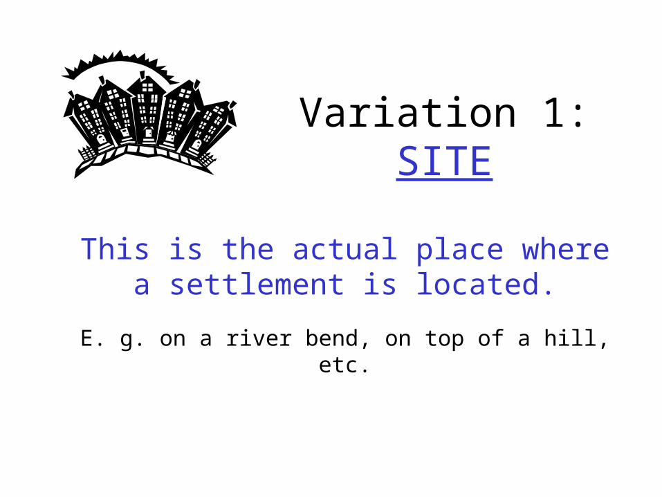
This is the actual place where a settlement is located.
E. g. on a river bend, on top of a hill, etc.
Variation 1: SITE
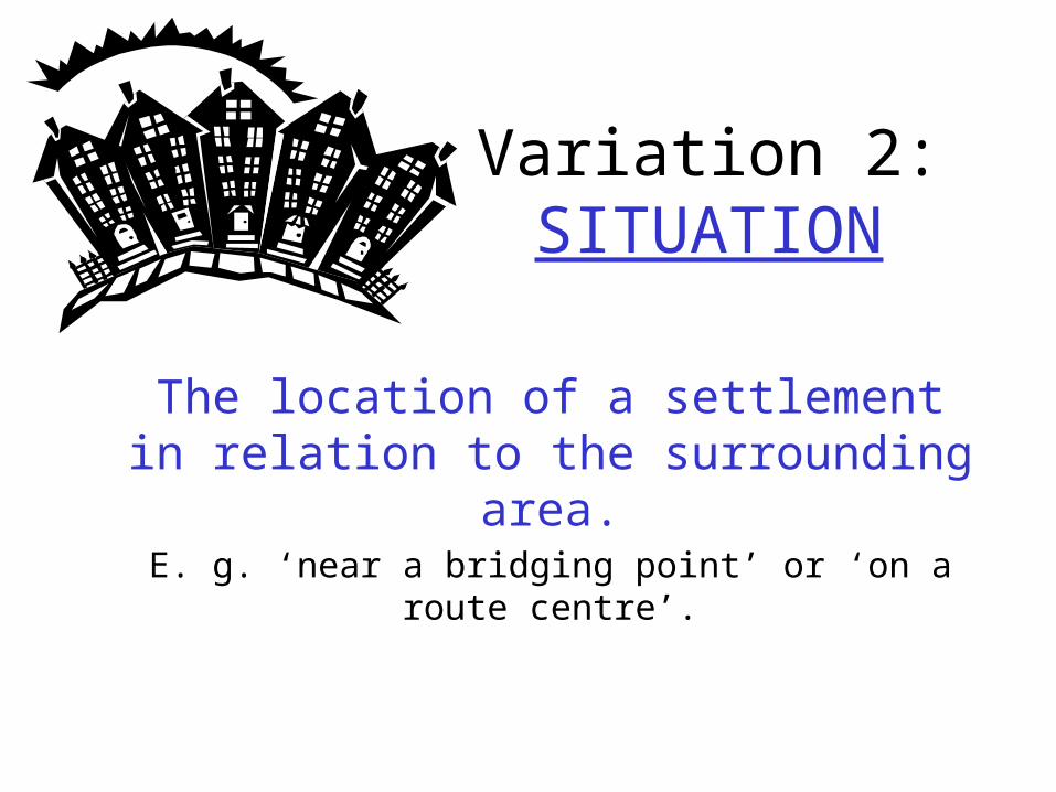
The location of a settlement in relation to the surrounding area.
E. g. ‘near a bridging point’ or ‘on a route centre’.
Variation 2: SITUATION
The purpose for which the settlement grew up.
E. g. port, ecclesiastical centre, regional centre, industrial centre, newtown, etc.
Variation 3: FUNCTION
The shape of the settlement.
Variation 4: FORM
There are six forms shown on your handout which will now be covered in detail. Add any
extra notes to your sheet.

1 – IsolatedThis is usually a farmhouse found either in areas of extreme adverse physical conditions or in areas of pioneer settlement where land was divided into planned lots.
Variation 4: FORM

2 – DispersedThis consists of 2 - 3 buildings, perhaps forming a hamlet, and separated from the next small group of buildings by 2 - 3 km.
Variation 4: FORM

3 – NucleatedBuildings grouped together, originally for defensive purposes as well as for social and economic reasons. Usually found around a cross-roads
Variation 4: FORM

4 – Loose KnitSimilar to the nucleated type, but the buildings are not so close together. They are spread out around the settlement.
Variation 4: FORM
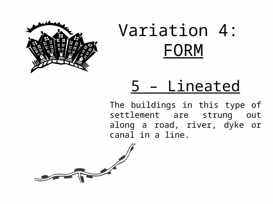
5 – LineatedThe buildings in this type of settlement are strung out along a road, river, dyke or canal in a line.
Variation 4: FORM

6 – PlannedThese are near enough to large cities to house the workforce. Tend to contain small crescent shaped estates with individual buildings on.
Variation 4: FORM
PULL FACTORS (Why people are attracted to another place)•Better job opportunities •Electricity and a better standard of living•EDUCATION for themselves and their children – education is seen as the way out of the poverty trap•HOSPITALS – better health care and vaccinations•Feel safe – police force
PUSH FACTORS (Why people leave a particular area)•Disease•To escape a natural disaster•Not enough land to go around•Large family sizes and absence of contraception (condoms,pill) means that there are many unemployed•Crop failure – people are starving so flee to the city to start a new life•Lack of government investment in rurul areas•Heard of friends / family who have “made it” in the city and so go and join them

Urbanization: (= an increasing number of people living in urban areas (cities)). There are 3 main causes of this:
1. People migrating from the countryside to the city (common in LEDCs – eg Mexico City)
2. People migrating from other countries (international migration)
3. More babies born to the people who migrate to the city – who are generally young anyway
In MEDCs the reverse is often occuring where people are moving from the city into the countryside = COUNTER-URBANIZATION
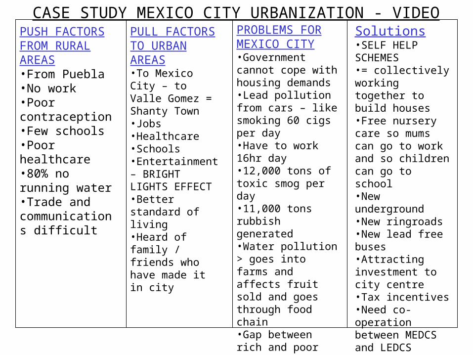
CASE STUDY MEXICO CITY URBANIZATION - VIDEOPUSH FACTORS FROM RURAL AREAS•From Puebla•No work•Poor contraception•Few schools•Poor healthcare•80% no running water•Trade and communications difficult
PULL FACTORS TO URBAN AREAS•To Mexico City – to Valle Gomez = Shanty Town•Jobs•Healthcare•Schools•Entertainment – BRIGHT LIGHTS EFFECT•Better standard of living•Heard of family / friends who have made it in city
PROBLEMS FOR MEXICO CITY•Government cannot cope with housing demands•Lead pollution from cars – like smoking 60 cigs per day•Have to work 16hr day•12,000 tons of toxic smog per day•11,000 tons rubbish generated•Water pollution > goes into farms and affects fruit sold and goes through food chain•Gap between rich and poor
Solutions•SELF HELP SCHEMES•= collectively working together to build houses•Free nursery care so mums can go to work and so children can go to school•New underground•New ringroads•New lead free buses•Attracting investment to city centre•Tax incentives•Need co-operation between MEDCS and LEDCS
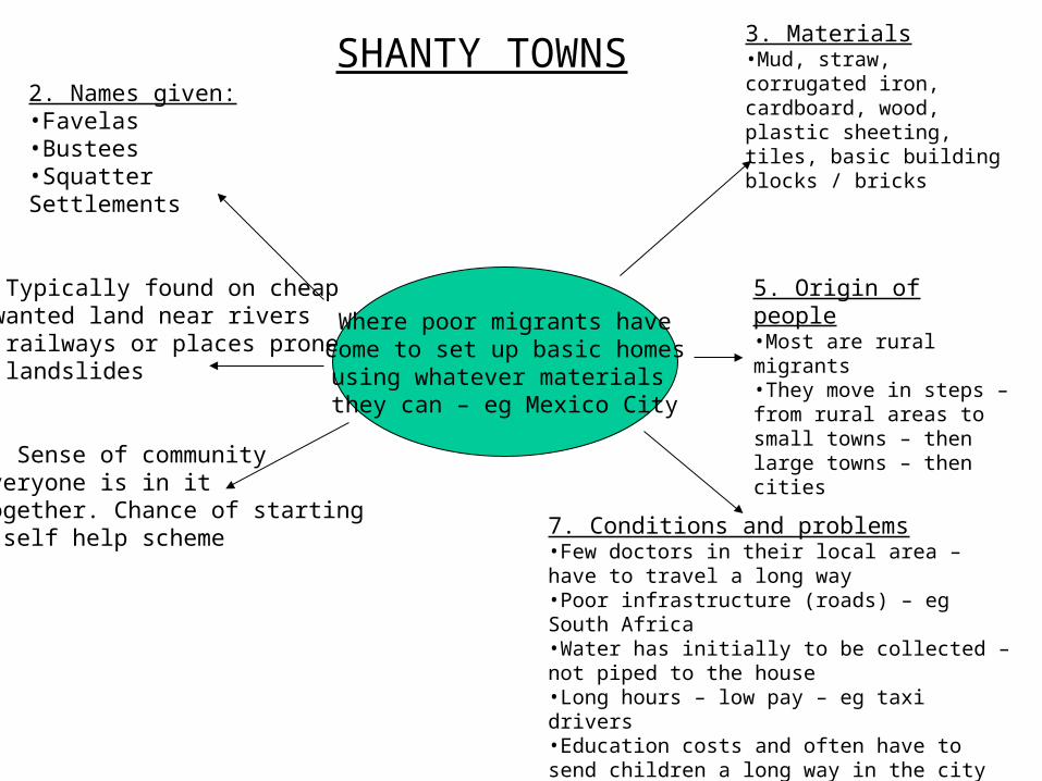
SHANTY TOWNS
Where poor migrants have come to set up basic homes
using whatever materials they can – eg Mexico City
2. Names given:•Favelas•Bustees•Squatter Settlements
4. Typically found on cheapUnwanted land near riversOr railways or places proneTo landslides
6. Sense of communityEveryone is in it Together. Chance of startingA self help scheme
3. Materials•Mud, straw, corrugated iron, cardboard, wood, plastic sheeting, tiles, basic building blocks / bricks
5. Origin of people•Most are rural migrants•They move in steps – from rural areas to small towns – then large towns – then cities
7. Conditions and problems•Few doctors in their local area – have to travel a long way•Poor infrastructure (roads) – eg South Africa•Water has initially to be collected – not piped to the house•Long hours – low pay – eg taxi drivers•Education costs and often have to send children a long way in the city
Case Study:Case Study:Urbanisation In Urbanisation In
Cairo, EgyptCairo, Egypt(Geoactive 156)(Geoactive 156)
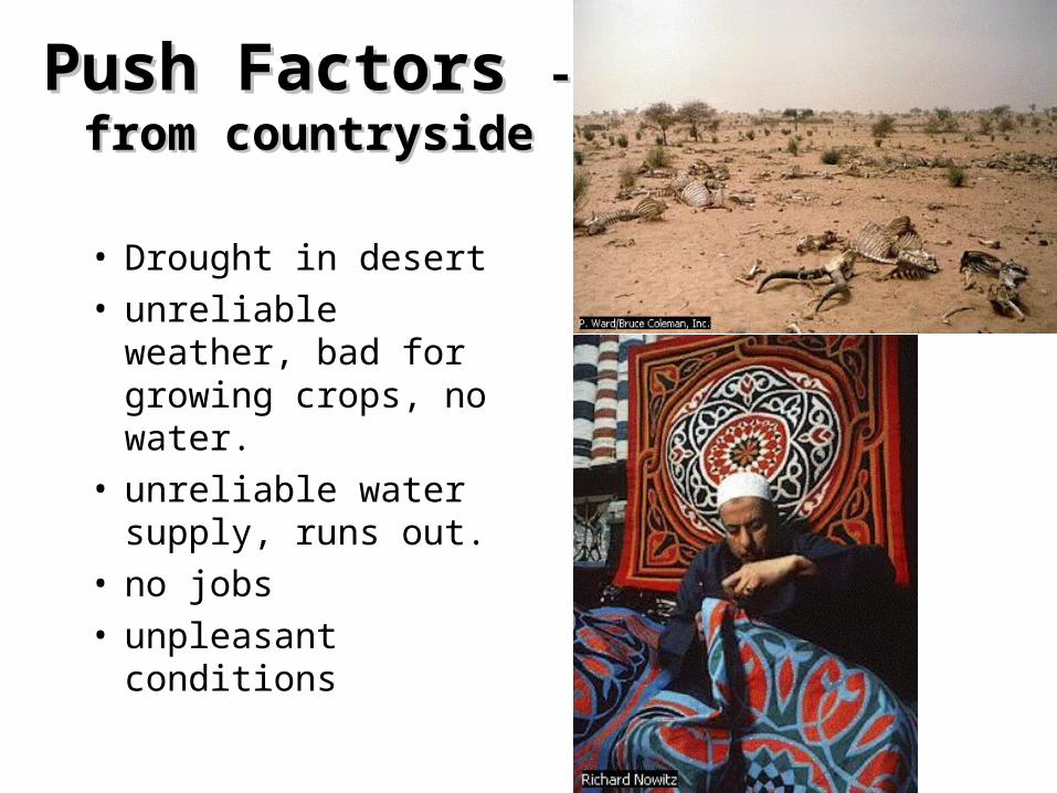
Push Factors Push Factors - from - from countrysidecountryside
• Drought in desert• unreliable weather,
bad for growing crops, no water.
• unreliable water supply, runs out.
• no jobs• unpleasant conditions
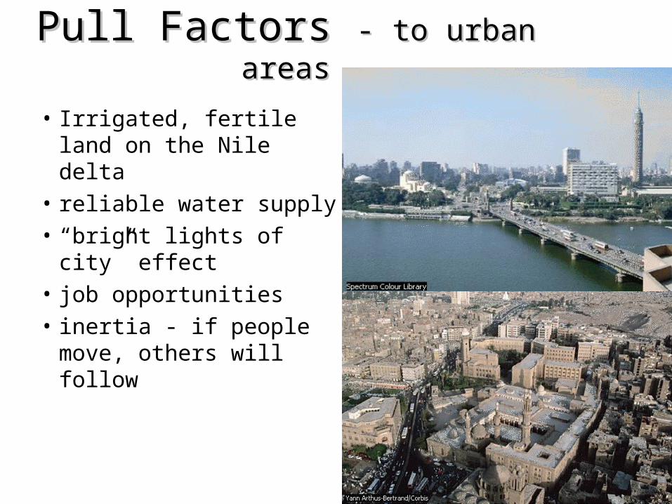
Pull Factors Pull Factors - to urban areas- to urban areas
• Irrigated, fertile land on the Nile delta
• reliable water supply
• “bright lights of city” effect
• job opportunities
• inertia - if people move, others will follow

• New, modern European additions to the city, such as Parisian style boulevards and commercial centres, as well as bridges and transport links.
• New suburbs built.
• Egypt becomes free of European control.
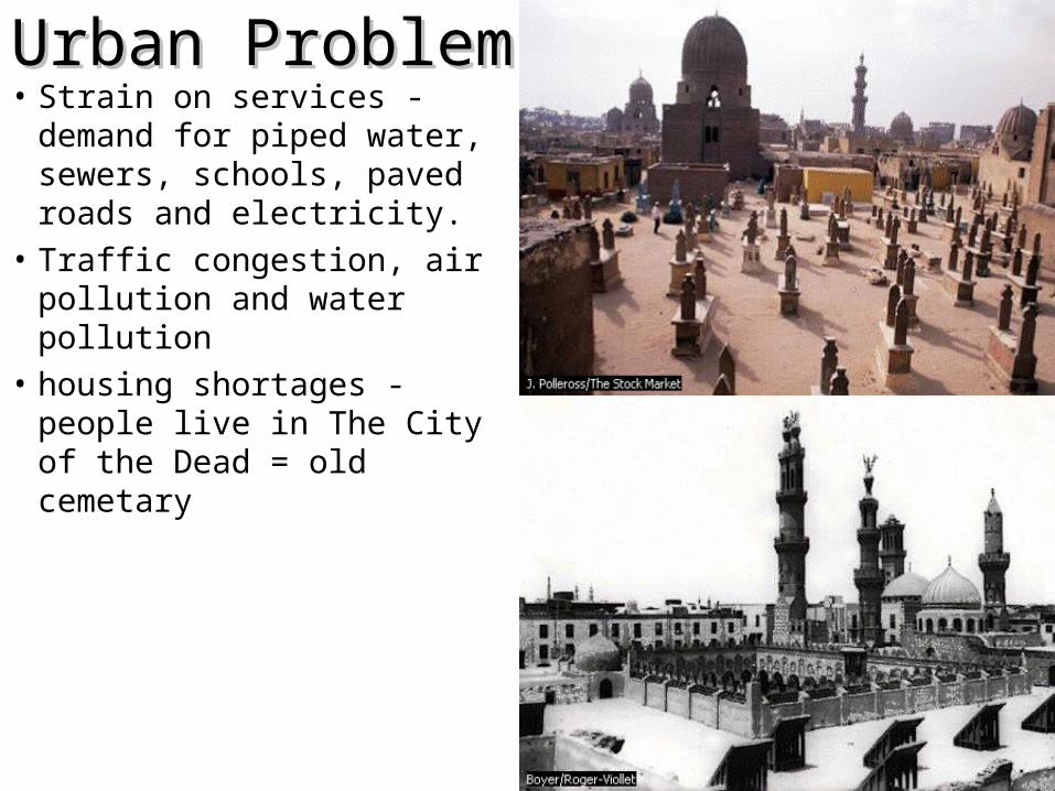
Urban ProblemsUrban Problems• Strain on services - demand
for piped water, sewers, schools, paved roads and electricity.
• Traffic congestion, air pollution and water pollution
• housing shortages - people live in The City of the Dead = old cemetary
• Lack of permanent jobs
• illegal housing is built on ‘green’ land, and protected farmland
• overcrowding, lack of basic sanitation and poor refuse collection, in temperatures of 40oC +, leads to disease and illness.
• 3 million people now live in the city of the dead in the tombs of old Cairo
• people are squatters on rooftops of office buildings and flats in home made huts
• Private landlords illegally add extra storeys to their existing blocks of flats
• rich poor imbalance - very few rich, many poor
• no enforcement of catalytic converters on cars, or unleaded fuel, this leads to toxic smog
• low pay for jobs, and unskilled jobs are hard to come by
• polluted sewage water raises the water table, and rots the foundations of buildings

SolutionsSolutions• Gentrification -
improving city• building a new sewage
system (greater Cairo sewage project)
• Zabbaleen people given official contract to collect waste and sewage
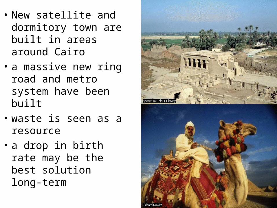
• New satellite and dormitory town are built in areas around Cairo
• a massive new ring road and metro system have been built
• waste is seen as a resource
• a drop in birth rate may be the best solution long-term

Urban Structure
What do you need to know today?
1. Differences in the structure of urban areas can lead to differences in the quality of life of the inhabitants.
2. Urban models attempt to show those differences.


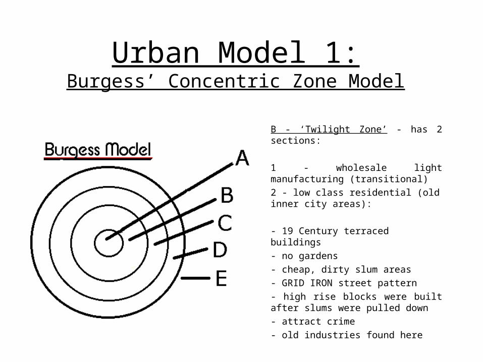
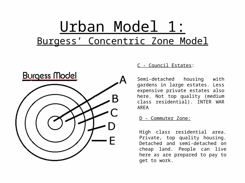
Urban Model 1:Burgess’ Concentric Zone Model
Burgess suggested that towns grew outward from the centre in a concentric pattern. This means that buildings become more recent closer to the edge of a city. It is possible that up to 5 rings may develop:
A - Central Business District (CBD):- most accessible to the largest number of people- contains services such as shops, offices, banks, etc.- multi-storey buildings as land is very expensive (build upwards to save cost)
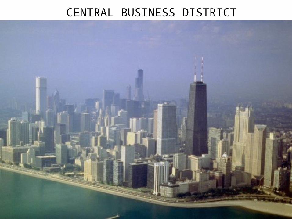
CENTRAL BUSINESS DISTRICT
Urban Model 1:Burgess’ Concentric Zone Model
B - ‘Twilight Zone’ - has 2 sections:
1 - wholesale light manufacturing (transitional)2 - low class residential (old inner city areas):
- 19 Century terraced buildings- no gardens- cheap, dirty slum areas- GRID IRON street pattern- high rise blocks were built after slums were pulled down - attract crime- old industries found here
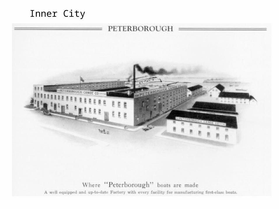
Inner City
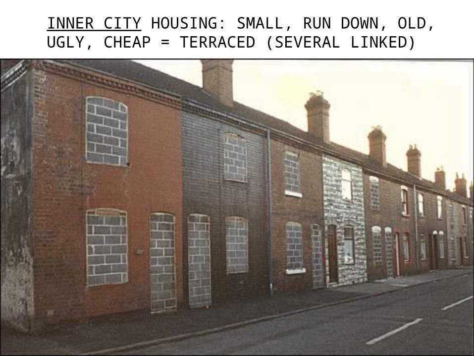
INNER CITY HOUSING: SMALL, RUN DOWN, OLD, UGLY, CHEAP = TERRACED (SEVERAL LINKED)

£49,500 INNER CITY
Urban Model 1:Burgess’ Concentric Zone Model
C - Council Estates: Semi-detached housing with gardens in large estates. Less expensive private estates also here. Not top quality (medium class residential). INTER WAR AREA
D - Commuter Zone: High class residential area. Private, top quality housing. Detached and semi-detached on cheap land. People can live here as are prepared to pay to get to work.
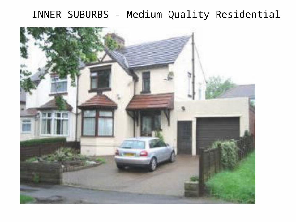
INNER SUBURBS - Medium Quality Residential
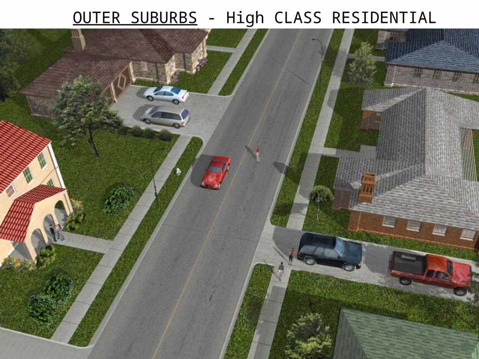
OUTER SUBURBS - High CLASS RESIDENTIAL
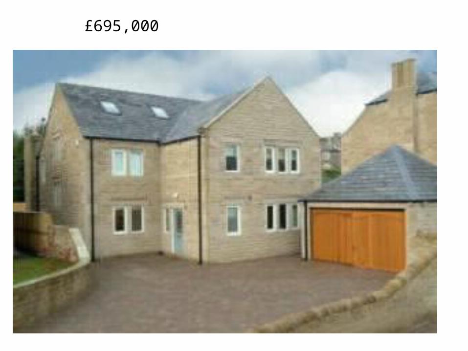
£695,000

Urban Model 1:Burgess’ Concentric Zone Model
E - Countryside Areas (suburb / exurbs): Countryside surrounding the urban area. Can also contain villages / hamlets in which town / city workers live.

Countryside and Greenbelt land
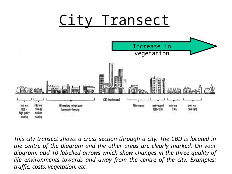
City Transect
This city transect shows a cross section through a city. The CBD is located in the centre of the diagram and the other areas are clearly marked. On your diagram, add 10 labelled arrows which show changes in the three quality of life environments towards and away from the centre of the city. Examples: traffic, costs, vegetation, etc.
Increase in vegetation

City TransectExamples of labels
Increase in crimeDecrease in traffic congestion
Increase in housing cost
Decrease in land costs
Decrease in services
Increase in building heightIncrease in vegetation
Decrease in space
Increase in competition for land
Decrease in car ownership

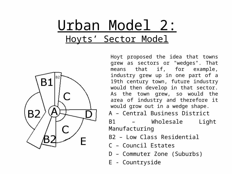
Urban Model 2:Hoyts’ Sector Model
A – Central Business DistrictB1 – Wholesale Light ManufacturingB2 – Low Class ResidentialC – Council EstatesD – Commuter Zone (Suburbs)E - Countryside
Hoyt proposed the idea that towns grew as sectors or "wedges". That means that if, for example, industry grew up in one part of a 19th century town, future industry would then develop in that sector. As the town grew, so would the area of industry and therefore it would grow out in a wedge shape.

Urban Model 3:LEDC Model
Cities in LEDCs have a very different land use pattern to those in MEDCs. The CBD is dominated by modern administrative and commercial activities. Richer people live in modern high-rise apartments around the CBD. Recently arrived migrants from rural areas live in derelict land and on the outskirts.
Housing quality decreases with distance from the CBD, unlike in MEDCs, where quality increases with distance from the CBD.