Fwd - edcgov.us · TIMOTHY A. GONZALES ATTORNEY AT LAW 6 VUELO DE LAS PALOMAS CARMEL, CALIFORNIA...
67
41912015 Fwd: 1 message Aaron Mount <[email protected]> To: Julie Saylor <[email protected]> More comments for Friday, please post. Aaron Mount Associate Planner County of EI Dorado Community Development Agency Planning Services 2850 Fairlane Court Placerville, CA 95667 (530) 621-5355/ FAX (530) 642-0508 [email protected] Edcgov.us Mail - Fwd: Julie Saylor <[email protected]> Wed, Apr 8,2015 at 3:29 PM ------- Forwarded message ----- From: Tim Gonzales <[email protected]> Date: Wed, Apr 8,2015 at 2:48 PM Subject: To: [email protected], [email protected], [email protected] I am submitting the present letter and accompanying report of Arborist John Kipping in connection with the April 10,2014 Tri-County Technical Advisory Committee's meeting as it relates to Village East, LLC's October 15, 2014 application for a zoning change. If I have not directed this e-mail to the correct person, please forward it to the correct person. A hard copy has been sent by Federal Express and will arrive tomorrow. Thank you NOTICE: This e-mail and any files transmitted with it may contain confidential information, and are intended solely for the use of the individual or entity to whom they are addressed. Any retransmission, dissemination or other use of the information by persons other than the intended recipient or entity is prohibited. If you receive this e-mail in error please contact the sender by return e-mail and delete the material from your system. Thank you. https:llmail.googIe.com/maillulOl?ui=2&ik=da55f4e1b7&view=pt&search=inbox&th=14c9b26f40164ae3&siml=14c9b26f40164ae3 112 TC-TAC Public Comment PC Rcvd 04-08-15
Transcript of Fwd - edcgov.us · TIMOTHY A. GONZALES ATTORNEY AT LAW 6 VUELO DE LAS PALOMAS CARMEL, CALIFORNIA...

41912015
Fwd:1 message
Aaron Mount <[email protected]>To: Julie Saylor <[email protected]>
More comments for Friday, please post.
Aaron MountAssociate Planner
County of EI DoradoCommunity Development AgencyPlanning Services2850 Fairlane CourtPlacerville, CA 95667(530) 621-5355/ FAX (530) [email protected]
Edcgov.us Mail - Fwd:
Julie Saylor <[email protected]>
Wed, Apr 8,2015 at 3:29 PM
------- Forwarded message ----From: Tim Gonzales <[email protected]>Date: Wed, Apr 8,2015 at 2:48 PMSubject:To: [email protected], [email protected], [email protected]
I am submitting the present letter and accompanying report of Arborist John Kipping in connectionwith the April 10,2014 Tri-County Technical Advisory Committee's meeting as it relates to Village East,LLC's October 15, 2014 application for a zoning change.
If I have not directed this e-mail to the correct person, please forward it to the correct person.
A hard copy has been sent by Federal Express and will arrive tomorrow.
Thank you
NOTICE: This e-mail and any files transmitted with it may contain confidential information, andare intended solely for the use of the individual or entity to whom they are addressed.
Any retransmission, dissemination or other use of the information by persons other than theintended recipient or entity is prohibited.If you receive this e-mail in error please contact the sender by return e-mail and delete the
material from your system.Thank you.
https:llmail.googIe.com/maillulOl?ui=2&ik=da55f4e1b7&view=pt&search=inbox&th=14c9b26f40164ae3&siml=14c9b26f40164ae3 112
TC-TAC Public Comment PC Rcvd 04-08-15

41912015
2 attachments
Edcgov.usMail- Fwd:
~ Letter to TC-TAC re parking lot opposition.pdf3002K
~ Arborist Kipping Report.pdf1794K
https:llmail.googIe.com/maillulOl?ui=2&ik=da55f4e1b7&view=pt&search=inbox&th=14c9b26f40164ae3&siml=14c9b26f40164ae3 212
TC-TAC Public Comment PC Rcvd 04-08-15

TIMOTHY A. GONZALES
ATTORNEY AT LAW
6 VUELO DE LAS PALOMAS
CARMEL, CALIFORNIA 93923
(415) 706-1799
April 8, 2015
Chuck BeattyAmador County Planning Dept.810 Court StreetJackson, Ca 95642
Aaron MountEl Dorado County Planning Dept.2850 Fairlane CourtPlacerville, Ca 95667
Zach WoodAlpine County Planning Dept.50 Diamond Valley RoadMarkleeville, Ca 96120
Re: Kirkwood Park to Parking Lot Rezone Proposal
Dear Planners:
I am submitting the present letter and accompanying report of Arborist John Kipping inconnection with the April 10,2014 Tri-County Technical Advisory Committee's meeting as itrelates to Village East, LLC's October 15,2014 "Application For Zone Change." I am a residentof Kirkwood and am opposed to the application. I am making this submission in writing as Imay not be able to attend the meeting due to prior commitments.
It is very common for developers who seek approval of large or complex projects to dedicateland for public purposes and recreation as a part of an overall development plan. Fewdevelopers, however, have the nerve to turn around and try to escape that commitment after theproject is approved. This, of course, is what Kirkwood is seeking to do here. (Unless otherwisestated, "Kirkwood" as used in this letter refers to Kirkwood Mountain Resort, LLC as it relates toits action prior to the Vail sale, Kirkwood Associates, Inc., Kirkwood Capital Partners, VillageEast, LLC, and the various other companies related to and controlled by the former companiesand their principals. )
The proposed rezoning application should be rejected out of hand. This conclusion isinescapable. When Kirkwood drafted the Specific Plan it was fairly clear the school would notbe built, and it stated in the plan that, "[i]n the event that a school is not constructed on thededicated parcel and the area reverts to KMR or its successor, the parcel is restricted from any
TC-TAC Public Comment PC Rcvd 04-08-15

April 8, 2015Page 2
use or uses except parks and recreation facilities." (Specific Plan, p. 35, fn 2. to Table 4.3.,Exhibit 1.) The Specific Plan also affirmatively states the School Site could not be used as alocation for a surface parking lot or garage. (Specific Plan, p. 34, Table 4.3.) Kirkwood addedthe foregoing to the Specific Plan because it knew the site was an unsuitable location for aparking lot and the plan would not have been approved without such limiting language. Nothinghas changed since that time except for that fact that now Kirkwood's actions are not beingsubjected to the same level of scrutiny.
1. The School Site
At the time the Specific Plan was adopted there were seven children in school at Kirkwood,taking classes in the basement of the Sun Meadows Condominium Project. Property was setaside to build a small elementary school. (Specific Plan, pp. 50-51.) The property was deeded tothe Alpine County School District on April 12, 1992. The deed provided that the property wouldbe deeded back in the event a school was not built. The property was deeded back to Kirkwoodon August 18,2006. The property was subsequently deeded to the applicant, Village East, LLCon December 12,2013.
The school was to be accessed from the Loop Road. Presumably the school would have beenbuilt towards the North end of the six acre parcel, as the parcel is bisected by a major seasonalstream, two acres being on the south bank, i.e., the area of the proposed parking lot, and fouracres being on the north bank.
The application does not mention the stream or show it on the maps. The USGS topographicalmap of the area shows the stream and appears to reflect the stream has a catchment area ofover200 acres.
TC-TAC Public Comment PC Rcvd 04-08-15

April 8, 2015Page 3
It is difficult to decipher the staking Kirkwood placed around the site, but stakes appear on bothsides of the stream bank.
TC-TAC Public Comment PC Rcvd 04-08-15

April 8, 2015Page 4
A conservative estimate of the flow of the stream is well over 100 million gallons a year. (In anormal year I estimate the stream flows at a rate of no less than 5 cubic feet a minute for at leasta month . A similar minimum volume figure can be deduced by looking at the catchment area.)
The undeveloped land and plant life along the stream, which Kirkwood seeks to replace withasphalt , acts as an important riparian buffer, filtering out sediment before it reaches the streamand protecting the stream bank.
The undeveloped land also represents a corridor for wildlife to reach and transit the meadow. Aswill be noted by reviewing the USGS topographical map set forth above, the land north of thestream and south of Highway 88 is fully developed, and wildlife would need to cross as many asfour roads to get to the meadow by a route other than following the stream . The land south ofthe stream is Timber Creek, the Loop Road area and the ski area. I have personally seen deer,bear, and coyote following the stream bed on the way to the meadow.
Just as important as the undeveloped land is for the environment, it serves its intended purposesas a visual buffer against the industrial area of the Loop Road. The photograph foundimmediately below was taken from next to the two massive propane tanks. It shows that evenwith the existing trees screening the loop, the meadow and houses in Alpine County situated inEast Meadows, can clearly be seen, and by definition the industrial area of the loop can be seenfrom those locations. Clear cutting the two acres of trees would exacerbate this condition andcreate a visual blight.
TC-TAC Public Comment PC Rcvd 04-08-15

April 8, 2015Page 5
The Specific Plan zones the property for recreational purposes . It would not be anunderstatement to say that it is likely that every resident of Kirkwood, and thousands of visitors ,have used this site for recreation. The outer loop of the cross-country trail goes through what isto be the middle of the two proposed parking lots. What is left of the cross- country trail isshown in the photograph below. Notably, not withstanding the narrow field of vision, fivehomes in Alpine County are clearly visible. Under Kirkwood's proposal these homes, and allwho use the meadow, would not be looking out on a dense forest , but rather a parking lot andpropane tanks . It should also noted that the property is unique . It is the only place on themeadow where a person can cross-country ski through a dense stand of trees and only one of twoplaces where there is a perceptible change in elevation.
TC-TAC Public Comment PC Rcvd 04-08-15

April 8, 2015Page 6
The photograph below, taken last week after a few inches of fresh snow, shows the path of thecross-country trail through the proposed parking lot and Kirkwood's staking. (Due to lack ofsnow Vail stopped grooming the trail .)
2. Kirkwood's Application for Zone Chan2e
On October 15, 2014, Kirkwood filed an "Application for Zone Change." In its application,Kirkwood states it "is proposing approval of a Specific Plan Amendment / Rezone for a parkinglot at the currently zoned school site at Kirkwood." Kirkwood disingenuously fails to addressthe fact the Specific Plan expressly identifies the parcel in question by parcel number, andexpressly states that is cannot be used for parking but rather only as a park and for recreationaluses. Notably , the parcel in question is the only parcel expressly identified in the 160 page planby its APN, and the only parcel that has this restriction.
On the "Project Description" page offered in support of its application Kirkwood states, "[t]heparking lot is necessary to provide parking spaces for Kirkwood skiers and this effort is anoutstanding requirement of the sale to of Kirkwood Mountain Resort to Vail Resorts ." Not asingle fact is offered in support of the foregoing conclusory statements. More importantly, not asingle fact is offered in support of the conclusion that the parcel is no longer needed or useful aspresently zoned, i.e., useful for recreation purposes and a buffer.
TC-TAC Public Comment PC Rcvd 04-08-15

April 8, 2015Page 7
Factual support is critical. The California Supreme Court made this clear long ago in TopangaAssn. for a Scenic Community v. County ofLos Angeles, 11 Cal.3d 506, 515 (1974):
we hold that regardless of whether the local ordinance commandsthat the variance board set forth findings, that body must renderfindings sufficient both to enable the parties to determine whetherand on what basis they should seek review and, in the event ofreview, to apprise a reviewing court of the basis for the board'saction. We hold further that a reviewing court, before sustainingthe grant of a variance, must scrutinize the record and determinewhether substantial evidence supports the administrative agency'sfindings and whether these findings support the agency's decision.
The fact there may not be as many parking spaces as desired, or envisioned in the Special Plandoes not establish need, the Special Plans sets forth aspirational goals, not mandates. Kirkwood,and now Vail, fall short in meeting countless goals set forth in the Special Plan.
I personally dispute the fact additional parking is needed. I have seen very few days over the lastten years when parking was full, and none during the last two years since Vail took over theresort and raised day ticket prices to $92.
The Forest Services Environmental Impact Statement states that, "parking demand has notexceeded supply more than an average of two times per year." (Exhibit 2.) Meaning parkingdemand is met 99.5% of the time.
One ofthe mitigation measures Kirkwood was required to comply with as part of the EIS was tosubmit an annual report to TC-TAC regarding parking. (Exhibit 3.) Any discussion regardingthe need for more parking should start with a review of these annual reports. Ifno reports havebeen filed recently it can be presumed there is no longer any parking shortages or a need tomitigate shortages by creating more spaces.
To the extent additional parking is needed, the Specific Plan, the EIS, and Master Parking Planall indicate that Kirkwood would build parking structures:
If demand indicates the need, the greatest number of expansionspaces would come from the creation of one or more multi-floorparking lots on the site ofexisting surface parking areas. Althoughno design or detailed analysis has been done, the concept is to set aparking structure into a hillside, thus providing a minimalizedvisual impact., Half of the structure, more or less could be underthe ground surface.
Kirkwood Master Parking Plan, Exhibit 4, p. 4.
In isolation, it may be difficult to rationalize the cost of a parking structure given the limitedneed for the spaces it would provide i.e., overflow parking two days a year. The appropriate
TC-TAC Public Comment PC Rcvd 04-08-15

April 8, 2015Page 8
focus though is not on the value of the parking space itself, but its ancillary value, e.g., allowingKirkwood to sell the resort to Vail for $18 million, allowing Kirkwood to make millions ofdollars of profit by building homes in the Timber Creek parking lot, etc.
Kirkwood states that one of the reasons it is seeking to convert the park land into a parking lot isan "outstanding requirement of the sale to of Kirkwood Mountain Resort to Vail Resorts." Anyprivate contractual obligation is irrelevant. To the extent Kirkwood contends to the contrary itneeds to support its application with a copies ofthe relevant contracts so the nature of thatobligation can be determined. Is it an obligation to provide one additional parking spot or ten?What happens if it fails to do so? A cynical person might believe Kirkwood is merely trying toconvert the park land into a parking lot so it can convert other parking lots into home sites.
3. Misstatements In The Environmental Information Form
Kirkwood has responded "no" to a number of the enumerated questions on the EnvironmentalInformation Form that makes up part of the Application for Zone Change. I strongly dispute thenegative response given to a number ofthe questions posed by the form. Each of these questionswill be discussed separately.
17. Change in existing features or any lakes or hills, or substantial alteration ofground contours.
Using the land for the proposed parking lot will greatly change the contour. The entry oftheparking lot is on Loop Road. The opposite ends of the proposed lots are many feet lower. TheNovember 5, 2014 drawing of the lot I reviewed contains contour lines, but does not provide acontour interval or otherwise label the contours. (Exhibit 5.) Constructing the parking lot mayentail the placement many hundreds ofyards offill, or many thousands. That there will be asubstantial amount of fill can be gleaned by looking at the many closely spaced contour linessurrounding the "Existing Tree to Remain" symbol found between the two parking lots.
One thing the contour lines do show is that the proposed parking lot will lie at an oblique angle,thus giving residence of Alpine County and users of the meadow a broadside view of the asphalt.
The contour lines also show that cars are to be parked perpendicular to the fall line, which is notconducive to a parking lot covered with ice and snow. How often the cars slide into the side ofeach other when pulling in and out of the slots is any ones guess.
18. Change in scenic views or vistas from existing residential areas, public lands,or roads.
As discussed earlier in this letter, the proposed parking lot will result in a drastic change inscenic views for the people using the meadow and residents of Alpine County. Instead ofviewing park land, they will view cars, asphalt, massive propane tanks, dumpsters and otherindustrial equipment stored around Loop Road.
TC-TAC Public Comment PC Rcvd 04-08-15

April 8,2015Page 9
An even greater change will be experienced by the four homes in Amador County that occupythe lots contiguous to the School Site. These homes, which are located in two duplexes, make upthe "Dnit 3 Owners Association." The close proximity of the home to the site can be seen on thefollowing excerpt from the map submitted by Kirkwood in support of its application.
J
SCALE 1
The photograph below shows the view of the homes are directed towards the proposed lot.
TC-TAC Public Comment PC Rcvd 04-08-15

April 8, 2015Page 10
One of these homes is owned by my wife and myself. The view out of the front window of ourhouse will be, under Kirkwood's proposal, a parking lot, not the current park land.
Given the presence of screening trees on the parking lot drawing, Kirkwood appears to recognizethe parking lot will have a detrimental effect on scenic views, not only from the adjacentresidences but also from the meadow and Alpine County. As discussed extensively in arboristJohn Kipping's report which accompanies this letter, any attempt to screen the parking lot andthe propane tanks and other equipment on Loop Road would be futile. Not only would thescreening trees not grow, the trees left in place may die, and even if they lived, would do little inthe way of screening.
It is not difficult to draw screening trees on a plan, it is another thing to actually plant them andget them to grow. This is exemplified by Kirkwood's rendering of the Red Cliffs parking lot inthe Specific Plan (below left) and a current aerial photo of the lot (below right). The only treeson or near the lot of any size are mature trees, and they have no branches on the first thirty feet orso of their trunks.
TC-TAC Public Comment PC Rcvd 04-08-15

April 8,2015Page 11
The trees left standing in the Timber Creek parking lot also have no branches for the first thirtyfeet.
TC-TAC Public Comment PC Rcvd 04-08-15
April 8,2015Page 12
If permission was granted to build the proposed parking lot it is unlikely that any trees stillstanding after five years would have any branches that would screen the parking lot.
The creation of the parking would be detrimental to all residents and visitors to Kirkwood asthere would be a drastic change in scenic views or vistas.
The parking lot would be even more detrimental to the adjoining homes. At the time ofpurchasing our property Kirkwood expressly represented that it was unlikely the School wouldbe built and if it was not, the parcel would be park land. This representation may becomerelevant at a later time in a different forum.
19. Change in pattern, scale, or character of general area of project.
The parcels fronting on Loop Road are of a fairly uniform depth. Kirkwood is proposing to, inessence double or triple the useable depth of the parcel compared to its neighbors and have theuse intrude into a residential area. This expansion of the Loop Road area also changes the natureofthe use of the area. Currently this area of Loop Road is used primarily by employees andresidents, not hundreds of day visitors.
20. Significant amounts of solid waste or litter.
It is inevitable that the proposed parking lot is going to generate a substantial amount of liter. Inits Master Parking Plan, Kirkwood estimates their are about 2.5 people per car. That meansclose to 500 people will be using the parking lot. What ever liter they drop will either be blownby the wind into the stream bed or meadow, or shot into those areas by a snow blower.
21. Change in dust, ash, smoke, fumes, or odors in the vicinity.
By definition there will be a substantial change in the level ofpollutants released on the parcel ifits use is changed from a park to a parking lot. This will be in the form of noise, exhaust, andlight associated with a parking lot. If the proposed parking lot is anything like other parking lotsat Kirkwood, it will also be the source of tail gate parties, loud rap music blaring out of carstereos, the smells of barbecuing and marijuana, and copious amount of beer bottles.
22. Change in lake, stream, or ground water quality or quantity, or alteration ofexisting drainage patterns.
The proposed parking lot will have a substantial impact on water quality and the streams. Asmentioned above, there is basically two places to dump the snow from the parking lot. To thenorth which is the stream bed, or to the east which is the meadow. What ever liter or pollutantsare left from the people and cars using the parking lot will quickly find their way into the streamand Kirkwood Creek.
The large amount of asphalt, the asphalt's slope towards the meadow and stream, coupled withthe steep slope of the grading at the periphery of the asphalt will likely result, when it rains, in
TC-TAC Public Comment PC Rcvd 04-08-15

April 8, 2015Page 13
surface water causing abnormal erosion of the both the fill soil supporting the parking lot andnative soil.
4. Goals of the Specific Plan
A reading of the Specific Plan reflects an overriding goal of maintaining the beauty of Kirkwood,particularly as it relates to vistas from the meadow. Parking is also referenced in the specificplan, but the plans speaks of minimizing parking at adequate levels, i.e., levels far below the99.5% demand level currently being met.
a. Specific Plan Provisions relating to Parking
Section 4.5.2 of the plan provides for, "Policies for the Service Facilities/Parking Areas." Itstates the policy is to "[p]rovide adequate parking for patrons, day skiers and employees. "Section 5.2.1, "Objectives for Parking," again states, "[p]rovide adequate parking for residentsand day visitors alike" and "[m]inimize large expanses of unnecessary surface parking."
Merriam-Webster's online dictionary defines adequate as, "good enough: ofa quality that isgood or acceptable: of a quality that is acceptable but not better than acceptable."
As previously referenced, the Forest Services Environmental Impact Statement states that,"parking demand has not exceeded supply more than an average of two times per year." (Exhibit2.) Meaning parking demand is met 99.5% of the time. Clearly an acceptable level.
If a planner had to determine an "adequate" level of parking for a large retail store it wouldhardly be reasonable for him to conclude "adequate" meant enough parking spaces toaccommodate every shopper who may want to shop at the store on Black Friday.
To the extent more parking is needed, then Kirkwood should construct a parking structure inKirkwood Village as envisioned in the EIS, the Master Parking Plan and the Specific Plan:
Although the Snowkirk/Red Cliffs parking lot located northeast ofthe Village is zoned so that expansion may take place, thetopography of the site does not readily lend itself to surfaceparking expansion. However, a parking garage may be well suitedto this area due to the topography and the ability to top-load thegarage from parking bays higher on the slope. This garage could bedesigned so that it blends into the mountain.
Specific Plan, 4.5.4 Proposals for Service Facilities/Parking Areas Development.
A structure would be consistent with the goal of"" [m]inimize large expanses of unnecessarysurface parking." (5.2.1, Objectives for Parking.) It would also be consistent with the plan's goalor reducing in-valley traffic. (4.5.2, Policies for the Service Facilities/Parking Areas.)
TC-TAC Public Comment PC Rcvd 04-08-15

April 8, 2015Page 14
b. Specific Plan Provisions relating to Maintaining Scenic Beauty
The objectives of the Specific Plan are 3.2.1:
1. To create a year-round destination resort with a diversity ofresidential, commercial, recreational, and cultural activities.
2. To balance Kirkwood development with the skiing capacity ofthemountain while protecting the environmental and visual quality of thearea.
3. To develop a full-service resort with lodging, restaurants, shopsand attendant services to accommodate the summer and winter visitor,while paying particular attention to preservation of the natural beauty andmountain atmosphere that makes Kirkwood unique.
4. To develop Kirkwood in such a way as to emphasize the quality ofthe visitor/resident experience by the types and designs of buildings, thetypes of services offered and the protection ofvaluable open space.
5. To concentrate development at Kirkwood in the Village Centerwhere residential, commercial and recreational uses are closely intermixedpromoting a strong pedestrian
6. To enhance the quality ofthe skier experience by maintaining andimproving mountain support facilities.
The sensitive nature of the view shed of the meadow and maintaining the natural beauty ofKirkwood is exemplified by the second item on the Committee's agenda for the April 10, 2015meeting, "[r]eview and possible approval ofcolors and materials for the re-siding of the Dekayresidence. "
The meadow is surround by million dollar plus homes, and in each case they are screened bynative trees in order to not degrade the vista. The Kirkwood Tree Ordinance requires a hearing ifa resident seeks to cut down a single tree. Yet here, Kirkwood seeks to clear cut two acres offorest that screen the industrial area it created on the Loop Road and to shoe hom in two sloped,awkwardly conceived slabs of asphalt which will be seen by all users of the meadow and manyof the residents of Alpine County.
The introduction to the plan's "Chapter 7 - Natural Resource Conservation And VisualSensitivity Introduction", rightly states that, "[a]s a mountain resort, KMR's success is largelydependent upon protection of the natural resources that make Kirkwood a unique area." Thechapter goes on to stated that an objective of the plan is to "[m]aintain and protect the ripariancorridor of Kirkwood Creek, both within and outside Kirkwood Meadow and to "[m]inimizeunnecessary tree removal." Neither objective is furthered by turning the park into a parking lot.
TC-TAC Public Comment PC Rcvd 04-08-15
April 8,2015Page 15
The Specific Plan also identifies the School Site as a visually sensitive area, specificallyMidground, Zone B. (Exhibit 6.) The most appropriate place for more parking, if needed, underthe Specific Plan is in the Background, Zone C, e.g., a parking structure in the Red Cliff parkingarea. This would be consistent with paragraph 6., cited above, " to concentrate development atKirkwood in the Village Center."
As rezoning the park land would not be consistent with the objectives of the plan, Kirkwood'sapplication must be denied. The plan provides:
3.10 PROJECTS REQUIRED TO BE CONSISTENT WITH THEKIRKWOOD SPECIFIC PLAN
Rezoning, Tentative and Final subdivision maps and public worksprojects within Kirkwood are required by law to be consistent withthe Plan. All residential, commercial, mixed-use, public works,recreation and conservation projects must comply and beconsistent with polices of the Plan and implementation of thoseprojects must comply with the Ordinances of the Plan.
As discussed above, the plan specifies that only adequate levels of parking should be providedand that unnecessary surface parking should be minimized. There is more than adequate parkingat Kirkwood as demand is met 99.5% of the time. This in itself forms a sufficient basis to denythe request to rezone the property.
The most obvious basis for denying the application though is that the overriding objective of theplan is to protect the beauty of Kirkwood and protect the water flowing into the meadow and thatpolicy would be inconsistent with clear cutting a two acre forest and putting in parking lotadjacent to a major stream. As discussed in Arborist Kipping's report, what trees left after clearcutting will likely die, and any planted would not provided screening in our life time. Nomeasure is sufficient to cure or mitigate the environmental effects of the proposed parking lot.
An additional ground for denying the zoning change is estoppel. A developer should not beallowed to dedicate a parcel ofland for public purposes in order to obtain development rights forother parcels and then turn around and seek to renege on the commitment to the public. Thedeed Kirkwood prepared conveying the property back to itself from the Alpine County SchoolDistrict should have had an appropriate restrictive covenant in it, but as it was prepared byKirkwood, did not. (Copies of the deeds conveying the property, to the School District, back toKirkwood, and then to Village East, LLC are attached respectively as Exhibits, 7, 8 and 9.)
Ifyou have any questions, or comments, or would like further input, please contact me at yourconvemence.
Very truly yours,
ra~Timothy A. Gonzales
TC-TAC Public Comment PC Rcvd 04-08-15

TC-TAC Public Comment PC Rcvd 04-08-15

S-P Servlce ! * Sheriff SubstationFaciliti es and * Fire Station (with employee housing)parking * Day Care
* Parks and Recreation Facilities* Wastewater Treatment and Distribution Facilities* W~t~rPr.Q.d~ctiQn, Treatment and Distribution Facilities\~ . Sctlool (Amador COAPN# 026-279-018-000}.(2)* Snow-making Facilities* Road and Slope (grooming) Maintenance Equipmentand Facilities (ski mountain operations)* Telephone/Communication Facility* Power Generation/Conveyance Facilities* Construction-related Facility* Waste transit/storage* Library* Propane/Natural Gas Facilities* Cable Television Facilities* Transportation Facilities
* Surface parking lots (does not include 6 acre school11.site) · .
* Areas for Short Term recreational vehicle parking
I t* Parking garages(does not include 6 acres school sitel
* Appropriately located effluent absorption beds
M Meadow * No development of permanent above-ground structures,excluding utility enclosures such as well pump enclosuresand creek crossings (bridges)* Temporary structures on skids for winter activities* Maintenance of existing utility facilities* Maintenance of winter uses (trail grooming)
* Trailhead markers
OS-R Open Space * Outdoor recreational facilities (e.g., tennis courts,and Recreation playing fields, playgrounds, park & recreational facilities)
OS Open Space * Recreational trails* Trailhead Markers* Outdoor recreational activities that do not lead to thedegradation of the environment
* Recreational trail development and use
* Ski mountain operations and equipment (i.e., ski lifts)
* Appropriately located effluent absorption beds
Notes to Table 4.3(1) Typical "home occupations" are allowed. Should the occupation be a true 'business out of the home',such as a dentist's office, and not simply a telecommuter, then approval must be obtained from theappropriate County.
2003 Kirkwood Specific PlanAmador County Resolution 03-319 and Ordinance No. 1569, Exhibit A
PAGE 34
TC-TAC Public Comment PC Rcvd 04-08-15

·(2) Six (6) acre site deeded by KMR to Alp ine CountY Unified schooi District for school use only . This doesnot preclude the use of the exlstinq: school locatedin Sun Meadows 4. In the' event that a schoo l is notconstructed on the dedicated parcel and thearea reverts to' KMR or its successor, the (:larcel is restrictedfrotnany use or uses except parks and recreation faciliti es. ,.
4.10 DEVELOPMENT CONTROLS
A variety of development controls are part of the Plan. First, a population estimatebased on unit count and type and the associated land use designations, as shown inTable 4.2, is employed to control density. Second, mapped building envelopes areutilized to dictate the area suitable for development within a particular parcel. Third, toaid in minimizing negative visual effects , building heights are restricted for all structures.These items are reviewed for general architectural and site design elements by variousdesign review and architectural control entities and other appropriate local, State, andFederal agencies . All controls are discussed in more detail below.
4.10.1 Population Estimate By Unit Type and Land Use
By the assignment of a population density by unit type , the developer will have flexibilityto provide a mixture of residential unit types and sizes while staying within the allowable6,558 population limit. At Kirkwood, density within particular parcels is considered aspopulation potential and not necessarily a limit to a number of units per acre, therebyreducing the focus on maximizing the number of units that can be constructed on a site.
Kirkwood retained the services of RRC Associates, a firm experienced in the study andprediction of population trends in resort areas. RRC has analyzed Kirkwood's plan andfrom surveys and experience developed a methodology to estimate population in theresort at buildout. The following factors are RRC's recommendation to estimateultimate population, based on unit type, size and assuming 100% pillow occupancy.
Single-family homes are counted at 5.8 persons per household .
The following population assignment calculat ions are for multi-family projects. Apopulation count is assigned to the bedroom count for residential units as follows :
Studio: 2.2 people per occupied unit1 bedroom: 2.2 people per occupied unit2-bedroom: 4.3 people per occupied unit3-bedroom : 6.5 people per occupied unit4-bedroom: 8.6 people per occupied unitservice 2.2 People per occupied unit(Factors developed by RRC Associates)
4.10.2 Building Envelopes
Building envelopes are identified at the time of the subdivision requests. For eachsingle-family lot, building envelopes will outline the area that can be occupied byresidential uses. Driveways are not included in building envelopes. The identification of
2003 Kirkwood Specific PlanAmador County Resolution 03-319 and Ordinance No. 1569, Exhibit A
PAGE 35
TC-TAC Public Comment PC Rcvd 04-08-15

TC-TAC Public Comment PC Rcvd 04-08-15

Chapter 3: Affected Environment and Environmental ConsequencesF. Traffic, Parking and Ski Area Access
F. TRAFFIC, PARKING AND SKI AREA ACCESS
SCOPE OF THE ANALYSIS
The scope ofthis analysis is limited to State Road (SR) 88 (in Amador and northern Alpinecounties), Kirkwood Meadows Drive and Kirkwood's parking facilities are located on privateland.
EXISTING CONDITIONS
This analysis of traffic conditions on SR 88 and Kirkwood Meadows Drive incorporates byreference the 2002 EIR Traffic and Circulation analysis (Section 4.7 of the 2002 EIR).223 At therequest ofKirkwood, the 2002 EIR Traffic and Circulation analysis was reviewed by LSCTransportation Consultants, Inc. (LSC).224 Therefore, the Final EIS also incorporates theconclusions of the LCS review by reference.
Ski Area Access
Kirkwood is accessed via SR 88, which is the principal east-west arterial in Amador County andnorthern Alpine County, and the only through-road in the project vicinity. SR 88 is a major transSierra route from the town of Stockton through the Sierra Nevada Mountains, ending at theborder with Nevada. SR 88 is a year-round, two-lane, designated State Scenic Highway andNational Forest Scenic Byway. SR 88 is kept open year-round, with the California Department ofTransportation (Caltrans) taking responsibility for highway snow removal, highway sanding, andthe snow safety/avalanche control programs associated with the Carson Pass and Carson Spurareas. Although a year-round highway, it can be temporarily closed during major winter storms.At its intersection with Kirkwood Meadows Drive, SR 88 has an eastbound auxiliary lane fortraffic turning right into Kirkwood, and a left tum lane for westbound traffic turning intoKirkwood.
Kirkwood Meadows Drive is a two-lane paved roadway, providing the only access from SR 88 tothe ski area base facilities and residential areas within Kirkwood. An emergency access roadconnects East Meadows Drive to SR 88, but it is not open to the public during normal conditions.
Parking
As indicated in the 2003 Kirkwood Specific Plan'Rarking demand at Kirkwood is highest duringwinter months when skiing activity is at its peak.2 5 For this reason, Kirkwood has developed anumber of surface parking areas that are in the vicinity of the skiing facilities. All of Kirkwood'sparking facilities are located on private lands in the base area. On-site, day parking is available infour major surface parking areas - one at the Red Cliffs portal, one at the Village, and two at theTimber Creek portal- plus parking on the shoulder of Kirkwood Meadows Drive.
223 Cirrus Ecological Solutions, Inc. 2002c224 Shaw, 2003
225 Kirkwood Mountain Resort, 2003 p 41-44
Kirkwood Mountain ResortMountain Master Development Plan Final Environmental Impact Statement
3-105
TC-TAC Public Comment PC Rcvd 04-08-15

Chapter 3: Affected Environment and Environmental ConsequencesF. Traffic, Parking and Ski Area Access
Currently there are approximately 2,500 parking spaces available on a daily basis for dayvisitors, and approximately 10 percent more during the summer when snow storage is notrequired. At an average ofapproximateli 2.5 guests per vehicle, these 2,500 spaces provideparking for approximately 6,250 guests. 26 Kirkwood estimates that the ratio ofday todestination skiers is in the approximate 60 percent to 40 percent (respectively) range. Therefore,under the current CCC of 6,460, day skiers are estimated to account for approximately 3,876guests, or 1,550 vehicles.
Destination skier parking for individual residences and condominium buildings is not included inthe 2,500 spaces previously mentioned. Through the 2003 Kirkwood Specific Plan, Kirkwoodstrives to provide adequate parking for both residents and destination/day visitors.
Heavy snow loads, combined with sometimes disorderly parking, can lead to a decrease in thetotal number of vehicles that can be parked, particularly on busy weekends or after big storms.As detailed in the 2002 EIR, the Kirkwood Master Parking Plan outlines parking procedures atKirkwood. Kirkwood has a policy that, should the number of vehicles entering Kirkwood exceedthe number ofavailable parking spaces, visitors are turned away. Historically, lots do notapproach capacity more than ten times throughout the ski season (e.g., popular weekends andholidays) and parking demand has not exceeded supply more than an average of two times peryear.
The Cross Country Day Lodge parking lot contributes approximately 105 vehicles (the surfaceParking lot on the north side of SR 88) and another 25 spaces are available at the Schneidertrailhead.
Kirkwood issued approximately 315 employee parking passes for the 2005/06 season. It isestimated that employees consume approximately 200 parking spaces on weekends andconsiderably less on mid-week days. Kirkwood designates some areas for employee parking,including middle #7 lot, middle Snowkirk lot, as well as other areas near employee housing.
Traffic on SR 88 & Kirkwood Meadows Drive
Caltrans records traffic volumes on state highways. Traffic volumes are expressed in terms ofAverage Daily Traffic (ADT) and Average Annual Daily Traffic (AADT). ADT is the number ofvehicles passing a count location in both directions in a 24-hour period. The peak month ADT isthe average daily traffic for the month of heaviest traffic flow; peak-hour traffic is also measuredto show how near capacity the highway operates at peak-hour conditions. Raw data is processedand converted to AADT volumes. AADT is defined as the total volume of traffic on a roadsegment for one year, divided by 365 days. Both directions of traffic volumes are reported.AADT can be adjusted to compensate for monthly and daily fluctuations in traffic; the basicintent being to provide traffic volumes which best approximate the use ofa given highwaysection for a typical day of the year.
Traffic congestion is typically described using the concept of Level of Service (LOS), in which aletter grade from 'A' (completely free flow) to 'F' (forced flow, roadway service breaks down)
226 Basedon surveysconductedbetween 1998and 2000.
Kirkwood Mountain ResortMountain Master Development Plan Final Environmental Impact Statement
3-106
TC-TAC Public Comment PC Rcvd 04-08-15

TC-TAC Public Comment PC Rcvd 04-08-15

fee system would be based on a similar mitigation fee program already in place within AmadorCounty, which is applicable to development at Kirkwood within Amador County.
Status of Compliance
Both Alpine and Amador County are now collecting traffic impact mitigation fees. Three of thetarget highway widening projects in Amador County were completed in the summer of2006 andthese fees made important contributions to these projects.
ADEQUACY OF PARKING
Mitigation Measure 4.7 ldl
Kirkwood will prepare an annual report that includes a detailed analysis ofday-visitor parkingduring peak periods such as the Christmas holiday, Presidents Day weekend and other weekendsduring the ski season, peak periods during the summer, and special events, when more than4,000 day-use visitors are at the resort. The study will compare day-visitor parking demandduring these periods to day-visitor parking capacity at the resort. The results will be reported toTC-TAC in June of each year. If the study shows that the number of day-visitor related vehiclesparked within the resort exceeds the amount of parking spaces available for day visitors(approximately 2,500 spaces), TC-TAC will require Kirkwood to implement a mitigation planwhich will include one or more of the following actions:
• Provide additional parking spaces in surface lots or parking structures.
• Implement methods to provide greater efficiency in the use of existing parking lots.
• Reduce parking demand through greater utilization of mass transit, increased vehicleoccupancy, car/van pools or other programs that will result in reduced parking demandduring peak periods.
• Restrict day-visitor use to a level that allows parking demand to be accommodated inexisting day-visitor parking areas.
• Implementation of the actions under this mitigation measure will result in adequate dayvisitor parking capacity for the expected day-visitor demand at the resort in a manner thatdoes not result in potentially significant adverse environmental effects that have not beenidentified and evaluated in the EIR.
Status of Compliance
In the summer of 2006, Kirkwood conducted a full engineering field study of its main parkinglots. The study recommended a four-phase parking lot improvement plan to improve theefficiency and therefore capacity of Kirkwood's largest parking lots. The eventual goal is a 10 to
Kirkwood Mountain ResortMountain Master Development Plan Final Environmental Impact Statement
0-3
TC-TAC Public Comment PC Rcvd 04-08-15

TC-TAC Public Comment PC Rcvd 04-08-15

KIRKWOOD MASTER PARKING PLAN2001
The following plan and description is best understood by reference to the attached figure l.andassociated detailed site maps.
Within Kirkwood there are six major areas to park guests. Four major areas have beendesignated and developed with guest ability and guest services as initial criteria. The fifth isdesignated entirely for cross country skiing and related activity along hwy 88 east and west ofthe Kirkwood Inn. The sixth is resident parking. The major parking are identified as follows:
••••••
Red Cliffs Parking (day use for intermediate to advanced)Village Parking (village use, paid parking and overnight guests)Timber Creek Parking (day use for intermediate skiers, beginners and children.)Kirkwood Meadows Drive Parking (overflow)North ofHwy 88 parking for cross country skiers, stables and the Kirkwood InnResident Parking associated with the various multi-family and condo units
Parking Procedures at Kirkwood:
Entry signage along Kirkwood Meadows Drive greets day visitors and informs guests to park byability and services. The directional signs continue along Kirkwood Drive giving more detailsand direction. In addition to the signage there are strategic points where parking attendants arelocated to give direction and information for parking purposes. Parking attendants valley wideare connected via radio communications.
The typical parking procedure is as follows:
The parking attendants begin by directing the efficient and compact filling of the parking areasclosest to the appropriate guest services and/or lifts. The parking attendants encourage theguest to park first by ability and proximity to the guest services and/or lifts they need, then byparking availability.
When the southern parking areas fill up, (Red Cliffs & Village) the parking attendants begindirecting the guests to park in the next available parking along Kirkwood Meadows Driveproceeding northward toward Timber Creek.
When parking in Red Cliffs and the Village is full, a control station is set up at the junction ofKirkwood Meadows Drive and the Loop Road from which attendants direct traffic into theTimber Creek area lots.
If the Timber Creek lots become full, the attendants begin parking guests along the east side ofKirkwood Meadows Drive towards Highway 88.
On the rare occasion when the shoulders of Kirkwood Drive become full and no there are nomore approved parking spaces available, the guest is intercepted at the entrance to Kirkwoodand politely told that the resort is full and there is no admittance.
TC-TAC Public Comment PC Rcvd 04-08-15

In times of high traffic and large numbers of vehicles entering Kirkwood, vehicles entering aregrouped in a quantity of25-50 and directed by group the four major areas by parkingattendants. The concept is to avoid backup by splitting the traffic to spread the flow to all ofKirkwood parking areas. Higher traffic days require a greater number of parking attendants tomaintain traffic flow and to ensure that guests park at maximum density.
Red Cliffs Parking
Red Cliffs Parking includes all areas that are North of the Red Cliffs Lodge and before theentrance to the East Meadows subdivision. This area has three basic sections for guest parkingand one that is specifically for buses. The guest parking sections within the Red Cliffs ParkingArea are divided into three bays with lower, middle and upper divisions. The operation planprovides for the parking attendants to fill the lower parking bay first, then the middle and finallythe upper bay.
The Village Parking
The Village Parking at Kirkwood has four major components; Preferred Parking, Guest Parking,resident parking and Limited Time Zone Parking. The Preferred Parking (for guests) has twosections, one adjacent to The Lodge (VIP Parking) and one in front of the Snowcrestdevelopment at the base ofChair Lift #6 (Preferred Parking). VIP and preferred parking chargea fee, all other areas are free. Resident parking is located under and adjoining the various multifamily and condominium units within the village development. The Limited Time Zone Area islocated around the General Store and Post Office to allow non-skiing guests short term access toretail and service areas. The Guest Parking is located on the north and east side of the preferredparking near the base of Chair #6. Limited time parking is not included in the totals indicated forday skier or event parking.
Timber Creek Parking
The Timber Creek Parking Area has two main sections, one is on the mountain side of KirkwoodMeadows Drive (Chair #9 Lot) and the other is located on the meadow side of KirkwoodMeadows Drive (The Chair 7 Lots). The Chair 9 lot is designated for the beginners, ski schoolparticipants and children. The Chair 7 lots are designated for all skiers and also serve toaccommodate overflow parking on higher demand days.
Kirkwood Meadows Drive Parking
Kirkwood Meadows Drive Parking is restricted to the east side of the road and guest vehicles areparked in a south to north direction by filling the closest spots first. On low traffic days cars areparked parallel; on higher traffic days diagonal parking is used for more space availability.
Shuttle System
In order to transport guests throughout the valley at Kirkwood there is a transportation systemprovided. There are six 14-passenger vans, three 28-passenger trailers and a bus which holdsabout 35 passengers. The shuttle system operates along Kirkwood Meadows Drive andcompletes constant loops, running until shortly after the lifts shut down.
TC-TAC Public Comment PC Rcvd 04-08-15

Parking Area Capacity (March 31, 2001)
The range of cars accommodated as shown is due to individual daily conditions, which includesnow removal conditions, icy or bare ground in the areas, and the ability of staff to facilitatemaximum or minimum car density.
Red Cliffs 780-850Kirkwood Meadows Drive 500-700VIP 30-40Preferred Parking 140-150Village parking 75-80The 7 Lots 450-580Chair 9 Lots 370-400Cross Country N ofHwy 88 125-175Totals: Minimum 2470; maximum 2975
On average, 2500 day visitor cars can be parked without problem.
Persons per vehicle / Parking Capacity in Persons
Over the winters of 1998/1999 and 199912000, observed persons per vehicle from surveysranged from 2.1 to 2.9 persons per vehicle, averaging approximately 2.5 overall.
Therefore, considering the 2.5 average occupancy per vehicle, the parking plan provides forbetween 6175 and 'j/437 guests considering only current parking areas. This range does not takeinto consideration guests who come by bus, therefore is biased on the low side. Four to eightbusses per day, carrying an average of 50 people each are usual. The effective occupancy pervehicle is higher than 2.5 due to the effect of the 200 to 400 bus transported guests. Withaverage bus traffic of 6, the number of day skiers capable of being accommodated is 6475 ~o
"737..
Accommodation for Special Events
Special events of short duration have the potential to reach the upper limits of existing parkingcapacity. Most Special events will be of 1 to 3 day duration in warm seasons, where ski traffic isnot a factor. In the warmer seasons, the absence of snow allows snow storage areas in existingparking lots to be utilized for vehicle parking. This marginal increase is estimated at 10 percentof the total, or approximately 275 additional spaces, valley wide.
Parking Area capacity, at Buildout
The EIR and Draft Specific Plan estimates that at buildout, 6647 day skiers will need to beaccommodated. This will require 2659 parking spaces at the 2.5 persons per vehicle rate, whichis within the range of spaces available under this plan.
If skier capacity increases, or if day use vs residential/destination skiers grows, a need foradditional parking capacity may be experienced.
TC-TAC Public Comment PC Rcvd 04-08-15

Alternate Plans
Past practice has, by special arrangement, used areas not normally considered for guest parking.These included the use of both sides of portions of Kirkwood Meadows Drive, along FremontStreet at its lower extremes, and the Juniper Ridge lower areas. This Master Parking Plan doesnot depend on or plan to use these areas for guest parking.
Planned Changes in Parking Capacity
There are planned changes in parking areas that will increase capacity slightly. These changesare in connection with proposed development under both the 1988 existing master plan and theproposed Specific Plan. Specifically, abandonment of the chair 9 lot to development isplanned, with the transfer of these spaces to an expansion of the lower 7 lots across KirkwoodMeadows Drive. This expansion of the chair 7 lots is already approved.
Additionally, the ongoing development ofthe Village will provide additional parking up hill tothe east from East Meadows drive, along the access road to Whiskey Towers. As many as 100new spaces are possible in this area with minimal grading.
Future Additional Capacity IfNeeded
The future parking expansion needs, if required, have several options.
Additional parking on an opportunistic basis can be created by dressing the edges of the mainaccess roads to be wider and thus accommodate additional cars.
If demand indicates the need, the greatest number of expansion spaces would come from thecreation of one or more multi -floor parking lots on the site of existing surface parking areas.Although no design or detailed analysis has been done, the concept is to set a parking structureinto a hillside, thus providing a minimalized visual impact., Half of the structure, more or lesscould be under the ground surface. This design can provide for multi level ramp access, andreduced snow removal requirements in addition to possibly providing areas for comercila orresidential development on the top of the structure.
Parking associated with Development
Local regulations provide that parking must be furnished for single and multifamilydevelopment within Kirkwood. For greater clarity, and for full understanding of this plan, itshould be noted that the parking requirements for development, present or planned, are notincluded in the parking capacity outlined in this parking plan. At buildout, conservativelyestimating an average of 1.5 parking space per unit, there will be in excess of 2200 spacesconnected with the various single, multi-family, commercial and employee housing unitsprojected at buildout.
Parking appurtenant to development is in excess of the parking that is the subject of this planand not included in the totals described as available for the day use visitor.
TC-TAC Public Comment PC Rcvd 04-08-15

TC-TAC Public Comment PC Rcvd 04-08-15

/-----------...,."
.../"
---:
//
-'
/»<
/'
/»
:.>
zoiiiz~tjIo..J
~~~2
Wa:~co~a:i:
_........
--------
--....---
.:->
-~~
~~~~
,.~~~
!1i.----
,.I!'r'f~~,.::>""
,U~II!!;!
Z;:0:
:..,
&;
...-
---.._--------.
/I
,~'5.u
,W
'zir·
.-,•
<[
TC-TA
C P
ublic Com
ment
PC
Rcvd 04-08-15

TC-TAC Public Comment PC Rcvd 04-08-15

5. Residents shall be informed of the Landscape Guidelines so that new landscaping iscompatible with existing landscaping and is appropriate for the climate, elevation andother conditions at Kirkwood.
6. Lighting of public areas (including recreational facilities, commercial plazas, andparking areas) shall avoid light and glare impacts to nearby residents by incorporatingshielding and other means to direct lighting to specific target areas.
7. New signs shall comply with the Kirkwood Sign Ordinance in effect at the time ofsign construction.
8. Short-term, special events to be held at Kirkwood shall follow Use Permit regulationsfrom the appropriate agency and shall not result in visual degradation. Such specialevents shall include programs for litter control and monitoring of cleanup.
9. All new development shall comply with the Kirkwood Tree Ordinance to preventunnecessary tree removal.
7.6.3 Kirkwood Meadow
Preservation of the Kirkwood Meadow and the viewshed corridor from State Route 88are important issues to KIVIR and the U.S. Forest Service. A Scenic Agreement hasbeen adopted as part of the Special Use Permit that KMR has with the U.S. ForestService (Ref. FSM 2710, dated 12/29/94). This agreement identifies the boundaries ofthe meadow where no new development shall be allowed. In addition, the ScenicAgreement identifies a second scenic zone, which is the balance of the private landforming part of the scenic backdrop to the meadow and visible from State Route 88.
7.6.4 Visually Sensitive Areas
This Plan identifies "visually-sensitive areas", defined as "foreground", "midground" and"background" and shown in Figure 7.1:
Foreground. Most highly visible and most sensitive area from State Route 88. Extendsfrom State Route 88 to the first major promontory on the west.
Midground. Has moderate visibility and sensitivity. Extends from the promontory (edgeof foreground) to naturally-occurring "neck down" in the meadow.
Background. Least visible from State Route 88. Extends from the meadow "neckdown" to the ski slopes south of the Village Center.
As can be seen by comparing Figure 4.1 with Figure 7.1, most of the new developmentproposed for Kirkwood is planned for the "background" area.
2003 Kirkwood Specific PlanAmador County Resolution 03-319 and Ordinance No. 1569, Exhibit A
PAGE 81
TC-TAC Public Comment PC Rcvd 04-08-15

7.6.5 Landscape Zones
Three landscape zones have been identified within the valley to determine the amountand type of modification or development as related to visual sensitivity and revegetation.These areas are based primarily on predominant vegetation types, topographic reliefand soil type, as illustrated in Figure 7.2. Zone A consists of the stream, riparian edgecondition, willows and flat grasslands. Zone B is the transition zone frommeadow/willow/grass edge to dryer soils, predominately sagebrush and isolatedclusters of conifers. Zone C is similar to Zone B except rockier and dominated by heavytree cover and steeper slopes.
Although all three zones are found in each of the visually sensitive areas, they will betreated differently in each area based on their visual sensitivity from Highway 88. 1\.10development, except as previously described and exempted from this condition, willoccur throughout Zone A.
Some parts of Zone B, when found in the foreground area, will be visible from Highway88, while other areas will not be as visible. Care in sighting, construction andrevegetation will be necessary to develop this area. However, Zone B in the middle andbackground areas will be less visible from Highway 88, which will allow for moredevelopment flexibility.
Heavily forested Zone C is the most amenable zone for development in terms ofmodifying visual impacts in all three areas. Again, care in bUilding siting and retentionof vegetation will be maximized in all visually sensitive areas.
2003 Kirkwood Specific PlanAmador County Resolution 03-319 and Ordinance No. 1569, Exhibit A
PAGE 82
TC-TAC Public Comment PC Rcvd 04-08-15

Foreground
,~ ~BOCkgrOUnd~
FIGURE 7.1Visual Sensitivity Areas
TC-TAC Public Comment PC Rcvd 04-08-15

Zone A: stream, riparian edge, willows, flat grasslandsZone B: transition zone, sagebrush, isolated conifersZone C: heavy tree cover, steep side slopes
Figure 7.2Landscape Zones
2003 Kirkwood Specific PlanAmador County Resolution 03-319 and Ordinance No. 1569, Exhibit A
PAGE 84
TC-TAC Public Comment PC Rcvd 04-08-15

TC-TAC Public Comment PC Rcvd 04-08-15

\
-1-
...................................INOEXW IOOIt ?Y~
.. ~,
Whon rocord.d ..11 to'1I11"n R. Vinoon, t:.q.cUrOM • arlttlnJ47a aU.klrk /lvenu.. Suit. ;;0Pl ....nt IiUl. C.IUomi. '4UJ
GR/IIIT DIUISub'eot to conditi_~t allIS e .ateSl*S Itttllt of
ftrllln.tlon In rayor of ~ Cll'llnt.,
roll GOO/) AIfIJv~ CGIflJ:rc.:uUClll,~~DCIATB8, I"C., • califOn'll. CO~POnlt101l, tIld A;U'IlllI:~I/lIXFIllD 'CllOOL OlS'l'llllC'l:, • poUtlCll1. .udl'i,1I10ll or tile ...- orCaUfoni., awne •• follo'"11
1. IloDgn1UCI.lI.I. .. -' bodlJl. u.. ana -. e-tllbelOW ohaU 11$" e iMllJ\lnp ..I: to,Rla IltilWI
Ce) -mIl" ....U _ kldcwocId~. :bo. I11III£te _ ..on ..nd ....£v- v.lt.b~ to u.. ~l'"~or vnntt4 bvel,1l.
lb' ~"IIIIlI1;l... ,(UplM ca.t:I' -.u.l.._001 o£.tl'£CIt. an4 le. INIlOIIIU• ...a..t..- ~tIl~ toall)' pen' 01' .u. ot tbe~.
(01 ·~ ...1 ..... tlMt cacu1Ia ..=,..rul PJ:OllOr1:Y I_ted 111 A.MOcI' e-t:r. c.11ftZ'11.1a. .. __do.odbtocl .on fUUy 1.. 1lIllUt&L1 _-'1ICI:IlId M¥tto ... a...-ttIM1I.....I.n toy ~.I.. nfftlD_.
Id) .1£1rbpp4 ArM" ....11 _ tMo N' Mf!8CnMl__ -niI t'eferl:'ed'to ..~. caUhnl1.- IIIL"~R..dow. etl fo"".I.t, If vlIlcb i. 1_t.4 111 fOI'tl- or u. CItiIM:l.
Rrtc.'\H-J1nq '""SlUM' t to •1~/r,1oJt. ",... fl/(.'. J••..•.••'l>t5.71~'....1._.._,. ~_•. 00 •
llpac;. abOY", thl.
".il t •••t.ta..nt. to./llpln:o~t~i~;f~:"U H.Wkdde DriYe"arkle.YUle, C,Ufarni" '0120r.ttonUanl _
.t~Min. , • ..../L.Li. M
AUG:' 319930l\I0lIl AIaHdt
eii~, Rtcordtr
.@
=,.="
f
il(I
ii., aJ, sT'• i~.
J,
=
=,', "
s-iii;,;' .5: ,-..••Ii' ..;.
i
··'1
;a"::
TC-TAC Public Comment PC Rcvd 04-08-15

,,, ._-_ ..._~_ ..--:- .
1993 007796
c ,
-"'Or----" _
"
", ,',
..
_ _--- - - _. ~. _ -.-.-..---.-......-_ _'.-- _ _ .
f
....
"f
;'it':~,,
"i",:Ii
:fif!'\:
TC-TAC Public Comment PC Rcvd 04-08-15

.,,
J,!l 1993 007796
',1
I
II
I, !
-:. I.' .r... •
of Alpin•• "'•• ~Ol , , "\ l>Oudo. c:aUto~n1a, .nd vhich i ••hown inL'IIlUl.l.r.j, to \1\. ~ '" ~,w<>4 """.r Plan (aa tilt inR "1.... '.
(II olUJ:.l!.vood "p,tt.c...E1JLtl" .haU It..n thl 1\1..1cYoOd""at... ~llOn Mo_nd_d 19", •••PPI"OVR by or'l5/.nano., adopted by thocount1., DC 1I1pln•• "".dor Ind 11 Dorldo, cdifarnh.
(fl "Pl!bllQ IishR01 V••- .h111 ....n tho II'. at thlproperty.' • dt' to~ I """""nlnt, t"pcIr,no. or port"bl',trllctllrl vh1ch 1. II.R for .1...ntny ,nct/eor I_ildarr cl..l-.cSIICIUOIId plll1'<" ...
(",) "2QI I:!l!Ip,.UgD 1M"'" "'aU _n the 4at. Oftvhich .t 1.,.t ftLn.ty r'1'C4II''' of ell. "linit.' antlc.1pate4 unci... til.1\1rlNO<><l ""tlr Plan IIIVI ....n conltruottd and ~l.. te4. ~""nit" 'MlU "" d..,"" ....n.tnlctld and COIIPlottd CIft l:bOI lilt- onvltolCh " OIrtit1el". of OOCUpatICIY to.. IllllII "llnlt." "-I - l....-.sb)' the IpPl'Opriat. 90vln-nt.l a",ollCl1.'
:z • IIran!: pt 1>rps!llr!;lC. llllb'ect to thtI t ..... andeornllt.lanl lot forth III~in (and RbjlOt to t.I\I Jetl1M4 '-" ort ....lnatlon in tavor of I\U •• lit fol:'tll blI1OW), IlA% bIre&tr IIJftI'l:Ilind COnv.yll till ~pal:ty teo the pin..ict.
3. R'" 'ad peyeJgseent; qf' tv,.......,...(II h,nllUlt I:eo thtI ItlrQooCl """'~ Pl-.. tile
Property 11&. lleln dlltcm-te4 ••••1to hI" tIMl~~oC ,"clIool tor thl I\bkwood MM-
(bl ~.~aftlll~~tot:bl1 Ch'Mt Deed /.. M4, on _ COIl41UClft Ula~ ~ ~'" .. IIIIIl10101y ,114 IICOl\,lllY11y fot tIMl fOUowllWJ I'QI'POIM'
(1) PIlbUo sc;Ilo01 '1M. .-J
ttl) ~~W~ - ..,..1IIIldlpWlUO 4!Chlio1 UII.~ ~ Ce."••QWWftlt.r -l:!alI8. CIlIb ~. pI~_t1ncl'. etc.) 01&' _ *lee. ,.Uo .... -.t .......• nlllbl. l,UIdor awllcabl. 1IlW.
(e) on- _ ...~ till~~ ..t:bit GJ:Mt DMIl 1, __ Oft t._ u...... .,n.. tilt 1.......any laO_til 011 tho~. tIM! Dl*lct eMU t&-. •lI..rl119 lnol dat,a:alno....... tile ........ jC. ,a4 ....IIMrlMl, tbat till~oaMIl l_~ or - ~ •__nt. 1. _"'1)' rOIl' ICIlOO!. - .......0lnton.I: ot til. Dbulot 11IO CIt~ nas ~<:IC til, JtllrkV004 Anll. "1011' to tile~ ofw.,114 lo;ocatlon ot any lapro;_ta oa ..~. --.
,I.
I"j"f,i;'
'j
~',.,
•2'i;I
.. j ; .=( I IIJCPId!.
-~ .. -,.•--:~U1 &.... _1.'0\"""" T"'...... , ",," -_.~.-.......__ ...- ---•••_-_ .._. ...... I' .... •• ...-. _ .. - - .... - ..
J _I': • ..ko • •-.- ........~,'.".~/.;~~m'..·.~ ...~l'.: ' •.••.,. ,~,Descript:Lon' Amad C'" ........ ,~'Iit, J~~':"6'::"~YEi!ii~-,"'-~-' --~,.
. or, n Document: - Year.DocID 1993 7796 D • --'.----~-~Order: cary Comment:: .. .age. 3 of 9
TC-TAC Public Comment PC Rcvd 04-08-15

007796
tn••'.' 1IJ
...",.........•".,tI
..'.f~".·~ '1 ............ "".- - _
4. ClUlIIJirypS;lPD 1M In'$,11,ttp" pC lb••qbOP' &DO6IIIl'O'Y'lw tor -Sht.Jls:J1llll1.
la) ,",a pllbUo .chIlO! to'" ~rat'" 011 tilePI'O~rt.y In vell •• any Ieee.' Nail and othtC' ...."".-tJI to .,.Ina".U"ll on th. p.,Clpar1:yl .h.ll be QOlIlItMte4 and lY1eUUe4 ..,.and at till ll!P4'n.. of. th. abtdO\;.
Ibl '1'lI1 DlatrSO\; aaJcllOWll6V" W~ 1t ,,111 ta"qUIre<! to ob",ln alL n~""'''' ~$U, ...tbGrl••tl- andapproval. I'WqIIll:'eClo In COIIMCtl~ wlth tilt dInllO\lllflllt of tilePrOP'!'rty 1114 t.l\lt ...eh per-la. IlItbO"l..tl- aid ~1' w111rlqUl" COIIPUanca vlt.l\ the fo1101111191
(1) tile Kl~ ",.c.1: Piu" .. ......."t~ '"" to t1M1
Ill) tile 'lMl Ind~~....."oft,J:lrlNOO4 lC..4_ aid. _l.-t -SCI 1.0520»' aid
fl U I til-. r~-~ ---".KlrlNOO4 If lite&'~~~.........'dOlI,cautomla b9iOl'l (tta'" C1....~ lID. na""U).
(01 '1'lIa !liatdO\; lMlIlJIClW1eoa- ... .- tMt tMl_tlem of anY l",,-m:a OIl~~ .su- nd--' III aplIb110 lleadll9 bY the 'r&'loClNlltr ila1~~ e-.lt;t;all••tQUah<04 .., Alp",",. AIIIdClI:'. iaot K1 I/OIIlIG~. lid_ tothe _-"t ot 1:IIa tn-t:lIUat.lOll~.
II. l:W""tSgn V t ~. Dt" u.t.within two (:II t;lallnoSar pa;IO or _ e-.aeu- ...Dlatdot .... IIC>t 1~tal1i14 ..........~ _ ~.aobooL Oil tolltI hO\MlrtYW Cl_~~ wa.iIIlS-l:Hral'l\, tIleft IW: aba11 III'.- _ ".- '"~ .ct ••lnatlon proYlal_ Nt~ III -.othII·t .
I. C'm/Utl~ 1; ....... _Dt,~ Rany t'" tile DbtdO\;- r.-l~.-- ..ftOPIrty tor l'@110~ OM. t.- au 1 ~~=t:.tIle powel' ot teDlM- MIt ..
7. J:lIJld1tl';ftl, " .. J. .. ftany ti_ artall' tha clat. do 111 twO (ll ,... -- ..
• .. yz ~
1993
... , ....
I--~
•
.. ~
.:~: ' .. I,
~I
~- --.,.,I
..3~ ,.~ ••••
,_ '..j
':.', I
::', ','I:;:';'" : \:
=,' :.=', I!.': I_."
TC-TAC Public Comment PC Rcvd 04-08-15
I,I
"·f
':j
=
, -
1993
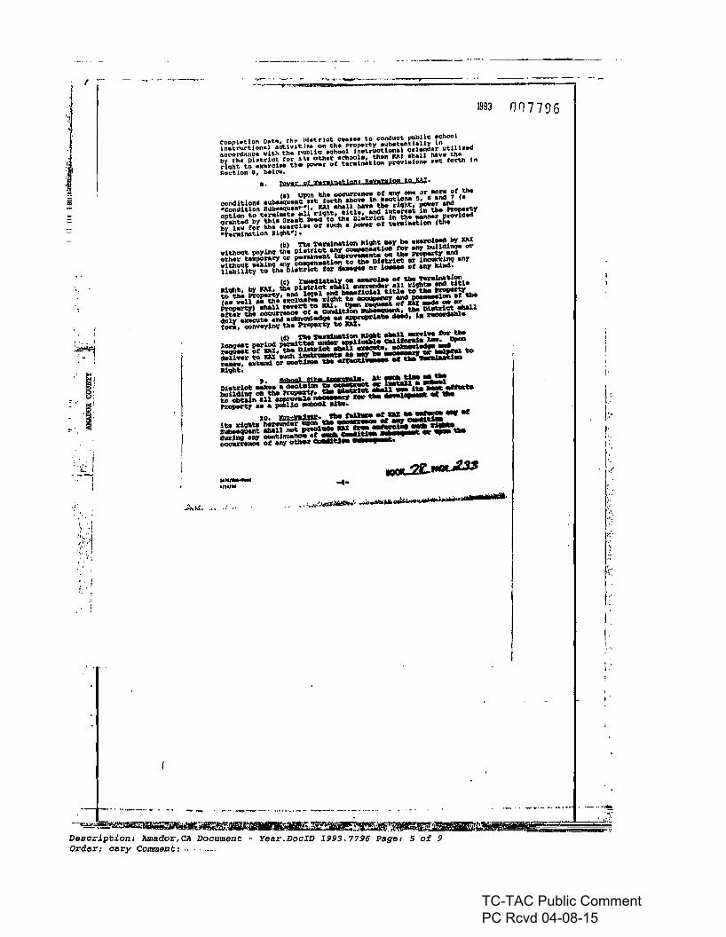
CD..pllttlDn DDt., th~ l'lot.-lct e••••• to conduet pllbllc ....11001
~~~~~~~~:n:ith~~:I~:il:n.~~:..r~~~C:l:~:tn:~:~~t~nutlll'~by th. llbtdot for 1t. ot:ll.r .ehool., t.b.n lelia .11.11 htv. til"rlqht to .K.rel•• the ~r of tl~ln.tlon provl"lDn. "lOt forth Ins.ctlon 8, bel"".
I. ~ gt t-nintt1p"' ,,,,.gIQD to p,;-la) UpOn t:hoo OOCUl'nnce Of anr _ "I' 1IDl:W of til.
eonditlon••Ilt>••qu."c ~It: forth aba..,. In Bao1: on. &, • anes 1 (a.ComUtlon tlllb••qu."""l' JCAI II!IllU haYtI tile d9ht, pewr andopUon to t:erainah ...l rl9l1t, tiU., .1lIS Int.....t: in tile fl'Operty9r.nt~ by t:hl. altane IlM<S to til. ll~.t:dct In tile __I' Pl'OYld~by lav fOI' Ilh. IX.l'Q1a. of .Ilcll a power or t.nl....Uon (tha"~."'lnatlon R19nt"l·
(bl 'nit or.nlnation a1qtlt ..y 1M _.rel"" b)' JW:vlt.bollt payln9 the Dhtl'101: any 0-._1:1_ fOll' _ lNUdlll9. altotlln t.lIporary 01' penaMllt &qI~t8 0l'I the I'l'ol*"' .ncsvlthollt lIllIkll19 any "'OIlI'InNtlonto the Di.~lct or ineun'il19 anri!abiUty to \:h. bl.b-Iet. tor daM9U OX' 1__ or elQI' ~.
(01 X1M4iat81y on _rol.. or tIM orwalM\:.lonRl9ht, by ICAJ, tile Dl..trJ.01: ••n ~X' .U dtbU~ titleto the l'ropertV, and l",al ~ ....r1cna1 t:J.tla to tIM~tea ...11 a' ttl- alCQllUl",lL'ivht to -.....tlOl' lIIl4.~DII or tbaPrOpa~ ahall _rt to W. ~~ orm .... - ....atter theOO~_ or • COI'Il.I1t1Oft lNJl"~, tIM DUtrict ..11""lV .-t_ and ac1alOl4..sg. ... ~l.ate ...-4, &11~aron, <::ollYtlyln9 the hGperty to W.
14) TIll tuJdMUon 11£'-':~l ....1.. 0iIC' tbelong_a!: ...dod ,.m~~ .-liaali1a calirenta a-. ...l:'eCI'Ma1: of DX. the Dl....ct IIIlaU ...-te.~~daUwX'to DX IIICb~ .. MF"~.. to~. axl:an4 Olo'_~ tbe errecu..- or tM 1M
Ilivbt;.,. "Sb991 f're -'a. &1: .... u.. - .-
Dl.~lat ...... cJeaS:a~Oft ",o;;;iiiii(an ..~ • ..-.ellNU\s11l9 on tIM~. tbe~• ....u - ita .rMtato Obtain .U.~~ IW"'" ....lnl arc or .....nopeort:1 ._ a publio -e-l dte. '
,"0. 1lPD;:b'w. tdl.. til DJ: ... ., .tiu d9llU n.nunder ... tbe WIIIi or ., c.au.~"t: -.n not;~ DJ: ",.. ......01 ~dad-no all)' _1;1__ or CllaUtl.. lEI: I I , ..~ 01: ~y~ CllIIII1d_ lEI:. C t.
......,' ,-
nn7796
j:'.'II~."!." .
,.".'v ,
I::'"
II·!""
I.I·
I'
-- . _ --.-- ---- _-- _ _ .-~~~. . . . ,-_., _... -.•.-....Descr.ipt.ion: Amador,CA Docum~nt~~~~~'~~;ijI...ji.ij!il!III}~Order: cary Comment: ......__ . ear.DocID 1993. 779(i Page: 5 of 9
.._....\."f,·
__'...J.,·I~
TC-TAC Public Comment PC Rcvd 04-08-15

.i...,.~ J
f --
., : -, . ........ -. -.._-_ .. ~.-
te93 00779 &
:!f.j·A
Ia
I'. I
!I
, .
;~~I
:; .;r
.~... _-,,',.:.
" ..
c:
~.
... ~" • , ,t ,.,. I ..~lt ••...-.., ' , d J" It t'.tr-·i
lI,i
I
t:,/.,'r·',rf.
'Ii'.:.~(~
~~~..-;....
t':::.
"0'
"."I"
i .r./'I"rI
i'I
"I ,
...-....~..- ..... -..--.....~~-, ...~~0!2...~ ...._~.. -- .........- ....- .•----.--.----........... - ~" 0' '. '-.. •
o:a:...."olIil'.~~~l'~~.• •.-. '-_•• ,•• _.. .. "-Des i i -=~I: - ::r
cr pt: on: Amador,CA Do " .-.~.. -'~" ......l...'iflNJ>~;!,~j?4;,:?1(.-''''':'O':-_. __ . " : :.Order: cary COllllllen/;: _. cument; Year.DoCID 2993.7796 Page: 6 00-'-.1---=;;--=====,··- .
TC-TAC Public Comment PC Rcvd 04-08-15

I,
007796
._-------
$'5 "at"IS"w·
CATB 0' ACKNOWUlDGMllNT
'-
1993
.........". 'Ill .....
lind .tteet .nd "hall ... enforced to tile run..t elrtent poedble .0•• to <,alrr')' OU~ 1:110 ,m.-po•••n4 lnt.ent DC tI1h Gr."t: lMed.
ZMD01itecl O~ .....!.~. lP9Z, It ~/'~K'!.f!:!JCaUfonla.
mil I 1.1 .
lUl\lCIIllOO ASSOCu,'ru, Elle.,
BY; s:e&7Sr l tlon
i"I~~At'Clll'TAIfCIl or 'ftlI DI~C'l'
I,Ll'rtIll ClMlTY UHEPlJD SCIIOQL OllftJCT MnIIt -" ttl.CDlr1I<t"lnq Or"""~ .n<t 1.,ntlI to ... bound bY, .nos too ClClllPl)'vUh, .11 ot the c..hOI .1llS pC\l¥i.l_ Nt tertii tMnUl.
ALP;~vgmo
m~Q~(AtTlleR IlO'I'AIlUWA~ ftlllUIlDllOO UD .... DDftIIC'l'.J
(A'I"1'IlCII All am...,. ..... tIIilWo llUCUft'lW or .... ....-rr.J
-,
- ..,...oII..........·..-_._. ....,.;........., ...'IIIOIIIWll......... ...lIIiIl••iIlIIlilIII•••••k;MH, •• ,O tr
I
't'
"
.' "-:
: ~::... I '
J!J:/:/;.\~...;,~ ,
" "
~ ,
• 1
, ... ":':'
i
1
ii
1~
'::~. '.' I. '1
~.
: '.
: ,,' ~ - .. -' ..'" -.,... _ - _ _._--_ .._..-.-- - -,.. "
-'=..:;:i.;:?ii.a:~_•••M\1!Pil' ~ "" :Description: Amador CA D '. ..~'f~.~~!lI~II~e~§..~4~~.E1~===::======;;~Order: cary comment; ocument - Year.DocID 1993.7796 ;age: 7 of
TC-TAC Public Comment PC Rcvd 04-08-15

...:-:....~, • f .~.
007796
...--- -,.,.._-._--
1993
iWN: " • (Ii U;
....---- _..at' . }
f:lH/mCUlDIY......SWtcl _,I/tUU,6'
.j O~
\~cl 0'tJ:U
(, DCOI"OMlll
On '1'H;,{"!, 1t/1d ......... ~...tiUoi tt.J1iMif41LCI'QIIIIII ......
ptlIClllIIIw IflIIM'CI ga l' I" fr· &. to! ",,r...I;
0.......0.'.......-_..- a---)i'J~limM'Itolllt-Oft.c ptO'ItdlOlnfOll.....cl......,..... a----
to lie fie ,...onIIl ..... lWIIICN·... au a :, .........................-....... =:& - ~' '"D1,qJ~....-..........,---1"_111......". ......... -=".".... WllIIl/MlIMItllI'l....................
1qCP?"-_~
• t''''''''~"..-.=...............ldId. ........
~:tf*llQWINII, TllONOTTl ..."'....,........... 1IO__< .......011·~ I
"'..:..--==" ....I.."--_..._-_._._-- •• •
llIIlI~1'e lIMllI''''''clooc-t....,.,_ATTM:IlED .........-... ....0..-'I'01HI! 0QQl,lIIENI'~"'TNIlH1'l
8IIlI*lIIge..,l1l.-......,... =.....----oM ......-. .. , ,. ... ,
.-
;". "
.' ..~ ....
::,',.I·'
I.' 1
.....
.. j!
': ,'t'.. _..;....1...... I'''''j. '.
')', ~ v
.> :;'.:,;..:.J
.':':..... _.. ", .._-...._..... _.• •• ,. o~ -'-'-' ••• ro-_o ....-r--....- .. .....~'"'!S'""'l9M"'C~ •• '
Description: Amador,CA Do~ument' -Order: cary Comment: v Year.DocID 1993.7796 Page: 80f----;----
TC-TAC Public Comment PC Rcvd 04-08-15

r r:':
f
._. _ -'~----r----
1993
EXIIIIJ1'r 1
LEeA!. D£SCR1$"1'IOIl or 'nil 1'lIOPEIITV
That ce~ta1n ~ell PfOpe~ty e1tUIted 1n ~dor county.CIUforn1e and which h d"c'l"ibed •• follo".:
------_.
087796
i·I·
let ."''#.'.......
.......n ................... bel', PJ . ass tat
. ..
"END OF DOCUMf'Nl"
AU ",.1 portIon 01 lilt ,"1 hall 01 \tot llOI1hw,,' qu,ntr allll \lit .... hi- 01 1MnoM'as' qua"e, 01$"lIon 27. T, 10 N. R. 17 II.. MOliM. mOltP1~ dt$OlllltClIt lollowt:8tQlnnlnQ I' '1'1 SOIIlhWtst COlntr 01 Lo1 HI7 a. IhQ1fllOR lhl flnll ~ llllldI<Irfcwood M.,don UIlII f2 mol4td on 00t0\MIf 11. \.n In IIoot. a .. SubdMsIOI'lMo,I .t P'lI! .,. In \l\I Olfiot 01 lhtA~ GI Amadof~,~\IltIlCt N..1 14' 01' e. ut,SS '"I;\hMlCt NlSi" 5" W, 115.(10 !ttIilMlIeI NM' 24' 01' e, '00.00 Ittl;\htfIC' • 21' 5t' 55'1. 761.07lte1;\htflCt S 00"00' 4" W, S31•• '"' to M bIQlnlIInI GI • non-tIII(ItIll ,cs.oo fOOl'IdIUll curtt to \he ..II;tMncea_ tit 110 01 .,Id CUNI lIOftl •~ tlNIiI9 ofH... zr ..WfftIUIIIt •etn\f1lI Ingle 01 a:P2r n', •~ et ,3Ut ......~ S '12-. W.71.11 ltcl\llhtnCt N,.' t# W, , ...n ftttlhtf\Ct N34'51' ar W.II4,~-";IhInce N."4' 00"W. 124.01 '"' 10..~ 01 ............ -.110 toolrtd1ua GVIft to IN lilt\tIIlICt alollt tit 110 _ Ml4 elM \lOllI .1aftOtI'I ..... - " ,.. .. E ...... •CtII\fII anglt of 55' 0$' 5'" • cIlIlMC* 01 ,.7.'. MI;1Mnct N near $1' W.144.1' "" 10 POk'401 tlIDInl*'t-
C~lnlne III .... 01UVI ICftt of InON " .....
::','
" :
,',' .
, .';:'.~ :
.":-ili
"L.,. ',.~ .'.;~, i.
.:.~ '. !
~~j. :. . ~
:/.·'Ii:. lI!l!
- 'I!
.....-......-.c.: ...:.i~~
_ _..............,........;~~........:e~~-_. __.._--~---_.__._.... .. .._-_. ~.__._._ .•~.~~~~~'4ll:7.'~.......Description: Amador CA D -. ,",,",,~:'~.:~D:F.~"'-"""'.,.............~. -.----.-.-.-
Order: cary Comment: _ ocwnent - Year.DocID 1993.7796 Page: 9 of9- ------
TC-TAC Public Comment PC Rcvd 04-08-15

1\1 II1\' \11""", 1111I ''''\11111111' III~mador County RecorderSheldon D. JohnsonDOC- 2006-0013060-00C~.ok Humber 639REQO B~ HAlE UHALEV
GRANT DEED Tuesday. NOV 07, 2006 08: 5": 00Ttl Pd $12,00 Nbr-00001a7672
SDJ/RH1-JRecording Requested by,When Recorded Returnto andMail Tax Statements to:
Kirkwood Mountain ResortAttn.: DaveLikinsP.O.Box IKirkwood, CA 95646
SPACE ABOVE THIS LINE FORRECORDING USE·
GRANT DEED
THEDOCUMENTARY TRANSFER TAXIS NOTFORPUBLIC RECORD.
FORVALUABLE CONSIDERATION, receiptof which is herebyacknowledged,Alpine CountyUnified School District, ("ACUSD"), hereby grants to Kirkwood MountainResort, LLC, (HKMR"), that certainrealproperty located in the County o:f..6l¥iiliE:, StateofCalifornia, moreparticularly described in Exhibit "1" attached hereto (th~!~d"), together withall right, title and interest in andto all buildings and improvements now located or hereafterconstructed on the Land, subjectto all liens, encumbrances, easements, covenants, conditionsand restrictions of record.
Grantor hereby further grants to Grantee all of Grantor's right, title and interest in andtoall easements, privileges and rights appurtenant to the Land and pertaining or held and enjoyed inconnection therewith.
IN WITNESS WHEREOF, Grantor hasexecuted this Grant Deed asoft- tV ,200.6.
GRANTOR:ALPINE C UNTY UNIFIED SCHOOL DISTRICT
By:
Description: Amador,CA Document - Year.DocID 2006.13060 page: 1 of 3Order: cary Comment:
TC-TAC Public Comment PC Rcvd 04-08-15

WITNESS my hand and officlat seal.
Slgnal1Jre~ lU¥
ACKNOWLEDGMENT
State of Callfor1et JVf1/l1J . ' ' ,CountyOf_._L,~f"'~
On .A11/;\ I CI ")1YY,.,.efore me, '5ANo'1~ .N07M~ PtYSU (..~ (here Insertname and title of the officer)
personally appeared~.~}uA..9JeL 'Ba"""'k3dV!b""'--""u;.....,...-.'----~ _
personally known to me (or proved to me on thebasis of satisfactory evidence) to be
the person(s) whose name(s) is/are subscribed to the within lneuurnent and
acknowledged to me that he/she/they executed the same In his/her/their authorized
capacity(ies), and that by his/her/their signature(s) on the instrument the person(s),
or the entity upon behalf of which the personts) acted, executed the instrument.
~~4'SANiNMC~t "'1...., COMM.#13H2121 e@ '/ NOTARY f't.li1UC:. CJ\UFORI"lIA ~p.: I. .l1d.PlfIlE c.o\'~~w
MY Comm. El\lllrO$ No'J. 5.2000
(Seal)
Description: Amador,CA Document - Year.DocID 2006.13060 Page: 2 of 3Order: cary Commen t :
TC-TAC Public Comment PC Rcvd 04-08-15

EXHIBIT 1
LEGAL DESCRIPTION OF THE PROPERTY
That certain real property situated in Amador County, Californiaand which is described as follows;
All that portion of the east halt of the northwest quarter and the west half of the northeastquarter of Section 27, T. ION., R. 17 E., MDBM, more particularly described as follows:
Beginning at the Southwest comer of Lot 157 as shown on the Final Map titledKirkwood Meadows Unit #2 recorded on October 11, 1972 in Book 3 of SubdivisionMaps at page 91, In the Office of the Recorder of Amador County, California; thenceN 68 °24' 09' E, 119.53 feet;
thence N 25035' 51' W, 25.00 feet;
thence N 66° 24' 09' E, 100.00 feet;
thence S 28 0 58' 55' E, 761.07 feet;
thence S 00° 00' 49' W, 338.99 feet to the beginning of a non-tangent 145.00 footradius curve to the left;
thence along the arc of said curve from a tangent bearing ofN 54° 2T 35' W through acentral angle of 53,02T 25" a distance of 135.29 feet,
thence S 720 05' W, 79.21 feet;
thence N 14° 00' W, 186.72 feet;
thence N 34°59' 27' W, 254.39 feet;
thence N 39° 54' 00' W, 124.06 feet to the beginning of a non-tangent 205.00 footradius curve to the left;
thence along the arc of said curve from a tangent bearing ofN 310 30' E through acentral angle of 55° 05' 51', a distance of 197.14 feet;
thence N 23°35' 51' W, 244.89 feet to the Point of Beginning.
Containing an area of 6.29B acres of land, more or less.
2
END OF DOCUMENT
Description: Amador,CA Document - Year.DocID 2006.13060 Page: 3 of 3Order: cary Comment:
TC-TAC Public Comment PC Rcvd 04-08-15

TC-TAC Public Comment PC Rcvd 04-08-15

1111111'11"111II 11111 UUlI"1111' ,IIIAmador CQun~y RecorderSheldon D, JohnsonDOC-2006-0013060-00Ch¥ok Number 639REQD e'i tl~"E \,l"'AlE't
GRANT DEED T....sday. NOV 07, 2006 08:5$:00Tll Pd $12.00 Nbr-0000137672
SDJ/R1/1-JRecording Requested by,When Recorded Returnto andMail Tax Statements to:
Kirkwood Mountain ResortAttn.: DaveLikinsP.O.Box 1Kirkwood. CA 95646
SPACE ABOVE THIS LINE FORRECORDING USE
GRANT DEED
THEDOCUMENTARY TRANSFER TAXIS NOT FORPUBLIC RECORD.
FORVALUABLE CONSIDERATION, receipt of which is herebyacknowledged,Alpine CountyUnified School District, ("ACUSD"), hereby grants to Kirkwood MountainResort, LLC, ("KMR"), that certain realproperty located inthe County oa~¥1~, StateofCalifornia, moreparticularly described in Exhibit "1" attached hereto (tht!~d"), together withall right, titleand interest in and to all buildings and improvements now located or hereafterconstructed on the Land, subject to all Hens, encumbrances, easements, covenants, conditionsand restrictions of record.
Grantor hereby further grants to Grantee all ofGrantor's right, title and interest in and toall easements, privileges and rightsappurtenant to the Land and pertaining or heldand enjoyed inconnection therewith.
IN WITNESS WHEREOF, Grantor hasexecuted this Grant Deed as of /{- IV ,200.6.
GRANTOR;ALPINE C UNTY UNIFIED SCHOOL DISTRICT
By:
Desoription: Amador,CA Document - Year.DocID 2006.13060 Page: 1 ot 3Order: cary COllUllen (;:
TC-TAC Public Comment PC Rcvd 04-08-15

ACKNOWLEDGMENT
State of Califor1et j\}(J1I /) • . . .
Countyof_._L.~~
On .A1, '" I q ~efore me, '5IrNQ1j~ , NO~~ PlAJSu. c...~ (here insert name and title of the officer)
personally appeared ~~ WA..R1eL 'B...I/.~¥"~I.-al.JI:-,Jo.~. _
personally knownto me (or proved to me on the basisof satisfactory evidence) to be
the person(s) whosename(s)isfare subscribed to the within Instrument and
acknowledged to me that he/she/they executed thesame In his/her/their authorized
capacity(ies), and that by his/her/their signature(s) on the instrument the person(s),
WITNESS my hand and official seal.
$Ignalo'"~~(Seal)
Description: Amador,CA Document ~ Year.DooID 2006.13060 Page: 2 of 3Order: cary Comment:
TC-TAC Public Comment PC Rcvd 04-08-15
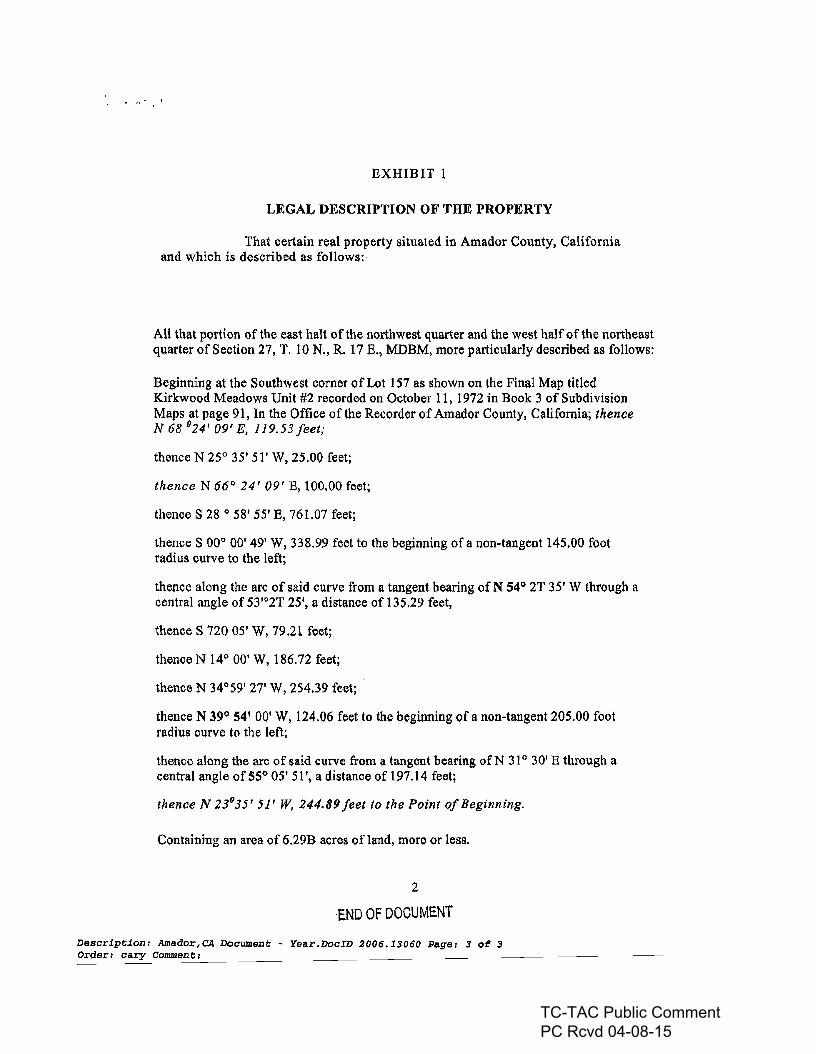
EXHIBIT 1
LEGAL DESCRIPTION OF THE PROPERTY
That certain real property situated in Amador County, Californiaand which is described as follows:
All that portion of the east halt of the northwest quarter and the west half of the northeastquarter of Section 27, T. 10 N., R. 17 E., MDBM, more particularly described as follows:
Beginning at the Southwest corner of Lot 157 as shown on the Final Map titledKirkwood Meadows Unit #2 recorded on October 11, 1972 in Book 3 of SubdivisionMaps at page 91, In the Office of the Recorder of Amador County, California; thenceN 68 °24' 09' E, 119.53 feet;
thence N 25035' 51' W, 25.00 feet;
thence N 66° 24' 09' E, 100.00 feet;
thence S 28 0 58' 55' E, 761.07 feet;
thence S 00° 00' 49' W, 338.99 feet to the beginning of a non-tangent 145.00 footradius curve to the left;
thence along the arc of said curve from a tangent bearing of N 54Q 2T 35' W through acentral angle of 53,o2T 25', a distance of 135.29 feet,
thence S 720 05' W, 79.21 feet;
thence N 14° 00' W, 186.72 feet;
thence N 34°59' 27' W, 254.39 feet;
thence N 39Q 54' 00' W, 124.06 feet to the beginning of a non-tangent 205.00 footradius curve to the left;
thence along the arc of said curve from a tangent bearing of'N 310 30' E through acentral angle of 55° 05' 51', a distance of 197.14 feet;
thence N 23°35' 51' W, 244.89 feet to the Point ofBeginning.
Containing an area of 6.29B acres of land, more or less.
2
END OF DOCUMENT
Description: Amador,CA Document - Year.DocID 2006.13060 Page: 3 of 3Order: cary Cornmen t:
TC-TAC Public Comment PC Rcvd 04-08-15

TC-TAC Public Comment PC Rcvd 04-08-15

Branch :AM1,User :PT06 Comment: Station Id :OREW
RecordingRequested byand whenRecorded Mail Documents to:
VillageEast LLCAttn: Nate Whaley. CFOPost OfficeBox 2'Kirkwood, California·956.46'
1111111111111111111111111111111111111111Rmador County RecorderKimberly L. Gra~DOC- 2013-0010914-00Check NUMber 1046REQD BY VILLAGE EAST LLCFriday, DEC 27, 2013 10:30Ttl Pd $13.00' Nbr-0000248641
~T1l~1/1-~
"
-...
SPACE ABOVE THIS LINE FOR RECORDING USE
GRANT DEED
The undersigned Grantor declares:
Documentarytransfer tax is $ ..e- .( ) computedon full value of property conveyed, or( ) computedon full value of liens and encumbrances remaining at time ofsale(x) Unincorporated area [Kirkwood] ( ) City of _
FOR VALUABLECONSIDERATION, receipt ofwhich is hereby acknowledged,
KirkwoodCapital Partners, LLC, a Delaware limited liability company(formerlyknown as KirkwoodMountain Resort LLC)
hereby grants to
VillageEast, a California limited liability company
that certainreal property located in the County ofAmador,State of California, more particularlydescribed Exhibit "A" attachedhereto (the "Land"). togetherwith all right, title and interest inand to all buildings and improvements now located or hereafterconstructed on the Land, subjectto all liens, encumbrances, easements, covenants, conditions and restrictionsofrecord.
Grantor herebyfurther grants to Grantee all of Grantor's right, title and interest in and to alleasements,privileges and rights appurtenant to the Land and pertaining or held and enjoyed inconnectiontherewith.
IN WITNESS WHEREOF,Grantorhas executed this Grant Deed asofDecember 1'2-,2013.
GRANTOR:KIRKWOOD CAPITALPARTNERS, LLC(f.k.a, KIRKWOOD MOUNTAIN RESORT, LLC)
By:
AMADOR,CADocument: GRT 2013.10914
Page 1 of3 Printedon 3/23/20151:24:48 PM
TC-TAC Public Comment PC Rcvd 04-08-15

Branch :AMI,User :PT06 Comment: Station Id :OREW
STATE OF California
COUNTY OF A\,?\.t'e,. ...'.On \)ec8H\ber III 20I?> befor~ me, S~m~ Q. ~ II ,Notary Public, personally appeared Nathan S. Whaley, v.vho~ve9 to me on the basis of~atisfactory evidence to be the personW~~ose nam~ tfp/are subscribed. to ~e withi.ninstrument and acknowledged to me fu~t ~shettfl.ey executed the samem~authorized capacity(~ and that by~ir signature~ on the instrument the perso~,or the entity upon behalf of which the person~ acted, executed the instrument.
I certify under PENALTY OF PERJURY under the laws of the State of California that theforegoing paragraph is true and correct.
~ITNESSL~~SIgnature: -77-f#-=-'---:;l:"'~7"'lf-~+--==--~;:::=-
2
AMADOR,CA
Document:GRT 2013.10914Page 2 of3 Printed on 3/23/2015 1:24:48 PM
TC-TAC Public Comment PC Rcvd 04-08-15

CERTfFI.ED ARBORIST WC-0205
6 April 2016
Mr. Timothy A. Gonzales6 Vuelo de las PalomasCarmel, CA 93923
RE: Loop Road North Parking Lot Project, Kirkwood
DearMr. Gonzales:
I am.a Consulting andGertifledArborist, as well as a Certified Tree RIskAssessor. fieldbiologist. andnaturalist You contacted mefor assistanceln addressingyourconcerns about the proposed parking lot at Kirkwood. Atyourreqvest,on31 March 2015, I metwith your neighbor Mr. ... Sapp andMr.Michael Sharp ofKirkwood Meadows Public Utility Dlstrl.ct. Wewalked thesitewiththe Kirkwood Parkinglot expansion map in hand. Myobservations and concerns areas follow:
1. Although the Application for Zone Change to AmadorCounty describes thesite as ~lightly treed," infering that tree losswould be minimal, 1observed numerouslarge redfir and lodgepole pines (see photographs 1 and2). Mostdevelopmentplansshowthe locations, species, and sizes of all trees on site, but thisproposal listsonlyfourtrees proposed for Preservation, as well as twootherold-growth trees to be removed.This lackofdatamakes total lossof canopy cover difficult to assess.
2. Deforestation of these two acres will expose neighboring properties androads to views of the KMPUD facilities. such as buildings and la Propane tanks,existing parking lots, ande. housing (see photograph S). . applicantseeksto mitigate the lossof screening retaining four mature lodgepo~pines onsite andinstalling newlandscape trees on the north and northeast edges of the project.
S.I have concerns regarding these mitigation measures. One tree to besparedis listed as a 48"diameter breast height (dbh) specimen located In adralnaQeswale
raph 4). This specimen hastwin trunks growing parallel to each other with barkbetween theirunion and no common band of wood con them.
Structurally, thisunion is veryweak, andsuch trees areat greatrisk reo Asaprofesaional tree risk assessor, I would advise Its removal as it is notcompatible witha. se area. There would then only remain three large trees onthe lots. prOViding very
e screen.
4. Altering a forested stand by radical thl exposes the remaining trees toforces to which theyareunaccustomed. Stro loads can uProot or break trunks.Isolated trees and those withh:igh can . 'onand poortrunk taper (such asoccur Indenser stands) areespecially erable to wind throw. Some of the largelodgepoles on siteshowevidence of surviving past fire events: seams in thebark,
Five spot CA95726phone/fax: (530) 644...5929
mobile: (530) 957..0126Contractor lie,
TC-TAC Public Comment PC Rcvd 04-08-15

open hollows bounded by wo..-nd..wood,and cerbonlzed wood.~ire"wOU"d;ngofth~trunk usually results in heart decey, reducing treestrength, andincreased·risk.ofbreakage.
I noted on nearbY lot 160 a recently fallen, large lodgepole that.hase)(te.nsivebasal heart rotat.the faiIure site (see phOtograpo 5). This.tree.ml~eda nearby dweJlf.ng~but a faiIure in a crowded parking lot cen have severe COrlSE:Jquences.
5.Twotrees proposed for retention in thewest lot are marked 42"dbh. Thaplaoshows very little space being reserved for thetree·roots,withencroachment wltOin sj~feetof the trunks. Onedoesn't require a chalnsaw to kill a tree; destroying the rootingareaIs also effective. Most\Jovemlng ;bodiesreallze thaBreesneed healthy root .systems and try to ensure thlsb¥ rE:JqUlring thai the rootl.ng zooebeneath thecanopy ISprotected from construction activities, such ascompaction, grade cuts or fills, trenching,and pavi This Is known as theTree Protection Zone and is often defined as a circleWhose r s is scribed by the length of the longest limb. KirkWood Specific Plan ·1.1.1calls for tree rootproteetion ensuring adequate setbacks during construction, butdoes notdefine l<adE:Jquate." opinion is thattoo mUch encroachment of theremaillingtrees by proposed fin and paving will terminally affectthem.
5.The applicant proposes to mitigate visual andsound Impacts of thispro~byplanting trees to replace the natural screen. Revegetation has been a diffiCUlt task atKirkwood. KMPUD manager Michael Sharp showed me a group ofspruce planted 15years agotore. lostduring buildlngconstruetion. The trees shown Inphotograph 6 have faired and have losttheirtops Inwinter storms. Despite
care andon6"and-a decedes, they havenotyet providedeffeetive screemng.esident AlanSappdrove me·to some buUdings at Kirkwood thathe 0Cid
constructed more thana decade ago;his landscaping withn~w treeswasnotsuccesstul,despite professional care. Thecurrent drought makes mestabllshmenteven moredoubtful.
WhiIe .examlng.the parking site, 1noted numerous signs of actiVe poCketgophers., These voracious rodents aremajor predators.of newly planted conifenlandhave caused failure of numerous red fir plantations onthe nearbyEI Dorado NationalForest
Natural revegetation·ofconlfersseems more sUccessfUfthan traditional landscapeendeavors here, but the timeframe Is qUite slow. I doubtthatpresent KI.rkwoodresidents and visitors will live long enough to enjoythe screenings promised ;by theappllcent.
6. The2003 Kirkwood Specific Plan Section 1.2.arefers to wetlandartd ripar.protections. I note thatthe stream that bounds the northern.sideof th~proposal is notlocated on thesite map, . entsabout impaetsdifficult. However,photograph 7 shows some. .. .. placed red survey stakes nearand in thecreel< bedthat seem to approximate locations of proposed screening treesas shown ontheproject map.
TC-TAC Public Comment PC Rcvd 04-08-15

7. The stream, and·hence meadow. will be impacted p<>llutants,suChaspetroleum produet8, coolants, and brakedustfrom park • fcles, Snowremovaloperations canharmsurrounding woody vegetBtic,n by·fli snow. Ice, and
avelagainstgreen.leaves and branches and bark. occurs atthepresentlotwhere.mostlower branChes of surrounding trees aredead..1 believe that this
advity will impact the success of the proposed screening trees as well as possiblyharming the four retained largetrees.
8. In the Application fot ZOning Change.contained in the EnvironmentalInformation Form, page 2 Additional Information itemshave all beenCheckeq"No"exceptthe last Item-.1disputenumbers 17,18, 19, and 23. Number 17 dentes that theprojectchanges existing features; I believe thata two-acre stand··oftrees constitutes afeature. Nljmber.18 relates to views from neighboring properties.; mostOf thescreenwillbe eliminated wifhno realistic replacement for decades,lfever. Number~9 says thtattherewill be no change In character at this site. Number 23 eovers noiselevels; removalof the evergreen forestwill certainly bringth.e noiseof hvndreds of additional vehicles, aswell as sounds fromthe PUDand housing areas.
In.summation, I believe that this prop<>sal has serious consequences for theneighboring residents. Th.e treesprovide visual and·audltory screening. Themltig.onmeasures propc;>sed In the zoning taPplication of installing·.ne all trees areinadequate to ensure timelyeffectiveness. Leaving a han Id trees asvisualbuffers is quite Inadequate. Theymay be exposed to extreme Winds in a hlghta tarea, and this creates a risky scenariO, especially if support roots are.. .. ... .bycutting, compaction, fnt, .. . Loss of the conifer standalso increases exposureof down-wind trees on ne:ig g properties.
This Vf!Jry sensitive.riparian area Is a tributary to Kirkwood Cref!Jkand:theooeCaptesCreek, which eventually provides EIDorado Countywith preci.ous .water.
If I maybeaf further assistance, please.do contact me.
John L. Kipplng, MA.
ISACertified Arborlst I WE.. 205Member, American Society of ConSulting.ArboristsCertified Tree Risk Assessor 11850 PNWJSA
TC-TAC Public Comment PC Rcvd 04-08-15

Photograph 1. View of "lightly treed" project site , view looking southfrom Lot 159. Note stream bordering proposed project .
TC-TAC Public Comment PC Rcvd 04-08-15

Photograph 2 . View of project site looking north from LOaD Road.
TC-TAC Public Comment PC Rcvd 04-08-15

Photograph 3. KMPUD facility vi~wed through lodgepole pines from nroposed parking lot.
TC-TAC Public Comment PC Rcvd 04-08-15

Photograph 4. View of proposed retention tree with co-dominant weakunion ,
TC-TAC Public Comment PC Rcvd 04-08-15

Photograph 5 . Storm-broken mature lodgepole pine which snapped off 3 tofive feet above grade at decayed bole. Decay was resultof old fire injury; trees of similar size and age on theproposed project also bear signd of fire injury to trunks.
TC-TAC Public Comment PC Rcvd 04-08-15

Photograph 6. Hr. Hichael Sharp of HliPUD stands next to trees he plantedfifteen years ago to provide visual screening. Despiteprofessional care, they have ~rown very little,
TC-TAC Public Comment PC Rcvd 04-08-15

Photograph 7 , Creek flowing along northern boundary of proposed project.Note several dark red stakes , perhaps denoting locationsof proposed landscape replacement trees .
TC-TAC Public Comment PC Rcvd 04-08-15