From the Section Head - IAEA
20
In this Issue Photo Courtesy: O.Azucena / IAEA From the Section Head . . . . . This edition of the Newsletter brings together developments at the IAEA in global isotope data management, laboratory facilities and projects related to transboundary groundwater management. For several years we have strived to improve the availability and accessibility of isotope data and I am happy to note that a new web-based platform – WISER – is now ready that allows searching, downloading and manipulation of isotope data from precipitation, surface water, and groundwater sources. GIS functionalities would allow better integration of spatial and/or temporal components into research investigations. A set of gridded values for the GNIP data is also available through WISER. Isotope data from surface water and groundwater studies in Asia, Africa, Latin America and Eastern Europe, collected mostly through IAEA projects over the last 50 years, are also being made available through WISER and as an Atlas of Isotope Data in hard copy. The Africa atlas contains over 10,000 data points. Most of these surface and groundwater data were previously not accessible and were never synthesized and evaluated on a regional or continental scale. Availability of these global data should facilitate the integration of isotopes into regional and transboundary groundwater studies. This edition of the Newsletter contains a number of examples where the IAEA is collaborating with other organizations to fully integrate isotopes for developing resource management and policy options. The 12th IAEA symposium on isotope hydrology will be held in Vienna from 21 to 25 May 2007 and I hope to see many of you then. Pradeep Aggarwal Newsletter of Isotope Hydrology Section Issue No. 22, May 2007 From the Section Head . . . . . . . . . 1 Project Story – Guarani . . . . . . . . . . 2 Counterpart Focus – Argentina . . . . .6 WISER – On-line Application. . . . . . .8 LabData . . . . . . . . . . . . .. . . . . . . . 10 News in Brief . . . . . . . . . . . . . . . . .11 Meetings. . . . . . . . . . . . . . . . . . . . .13 Extension of the Isotope Hydrology Laboratory . . . . .15 Vienna Facility for Noble Gas Measurements in Groundwater . . . . 16 Highlight on the Northwest Sahara Aquifer System . . . . . . . . . . . . . . . 18
Transcript of From the Section Head - IAEA

In this Issue
Photo Courtesy: O.Azucena / IAEA
From the Section Head . . . . .This edition of the Newsletter brings together developments at the IAEA inglobal isotope data management, laboratory facilities and projects related totransboundary groundwater management. For several years we have strivedto improve the availability and accessibility of isotope data and I am happyto note that a new web-based platform – WISER – is now ready that allowssearching, downloading and manipulation of isotope data from precipitation,surface water, and groundwater sources. GIS functionalities would allowbetter integration of spatial and/or temporal components into researchinvestigations. A set of gridded values for the GNIP data is also availablethrough WISER. Isotope data from surface water and groundwater studies inAsia, Africa, Latin America and Eastern Europe, collected mostly throughIAEA projects over the last 50 years, are also being made available throughWISER and as an Atlas of Isotope Data in hard copy. The Africa atlascontains over 10,000 data points. Most of these surface and groundwater datawere previously not accessible and were never synthesized and evaluated ona regional or continental scale. Availability of these global data shouldfacilitate the integration of isotopes into regional and transboundarygroundwater studies. This edition of the Newsletter contains a number ofexamples where the IAEA is collaborating with other organizations to fullyintegrate isotopes for developing resource management and policy options.The 12th IAEA symposium on isotope hydrology will be held in Vienna from21 to 25 May 2007 and I hope to see many of you then.
Pradeep Aggarwal
Newsletter of Isotope Hydrology SectionIssue No. 22, May 2007
From the Section Head . . . . . . . . . 1
Project Story – Guarani . . . . . . . . . . 2
Counterpart Focus – Argentina . . . . .6
WISER – On-line Application. . . . . . .8
LabData . . . . . . . . . . . . .. . . . . . . . 10
News in Brief . . . . . . . . . . . . . . . . .11
Meetings. . . . . . . . . . . . . . . . . . . . .13
Extension of the Isotope Hydrology Laboratory . . . . .15
Vienna Facility for Noble GasMeasurements in Groundwater. . . . 16
Highlight on the Northwest SaharaAquifer System . . . . . . . . . . . . . . . 18
Water & Environment News No. 22, May 2007
2
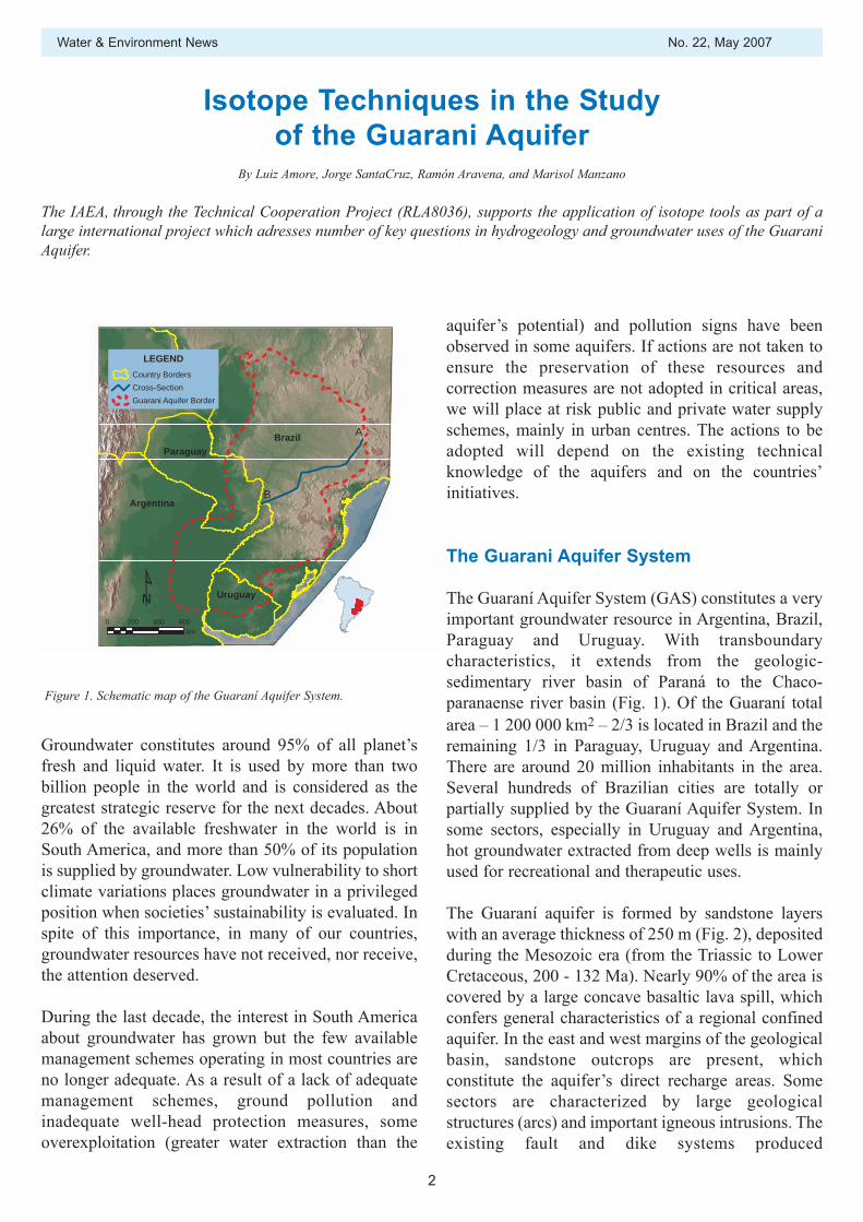
Isotope Techniques in the Study of the Guarani Aquifer
A
B
Brazil
Argentina
Bolivia
Paraguay
Uruguay
0 200 400 600km
LEGENDCountry BordersCross-SectionGuarani Aquifer Border
Groundwater constitutes around 95% of all planet’sfresh and liquid water. It is used by more than twobillion people in the world and is considered as thegreatest strategic reserve for the next decades. About26% of the available freshwater in the world is inSouth America, and more than 50% of its populationis supplied by groundwater. Low vulnerability to shortclimate variations places groundwater in a privilegedposition when societies’ sustainability is evaluated. Inspite of this importance, in many of our countries,groundwater resources have not received, nor receive,the attention deserved.
During the last decade, the interest in South Americaabout groundwater has grown but the few availablemanagement schemes operating in most countries areno longer adequate. As a result of a lack of adequatemanagement schemes, ground pollution andinadequate well-head protection measures, someoverexploitation (greater water extraction than the
aquifer’s potential) and pollution signs have beenobserved in some aquifers. If actions are not taken toensure the preservation of these resources andcorrection measures are not adopted in critical areas,we will place at risk public and private water supplyschemes, mainly in urban centres. The actions to beadopted will depend on the existing technicalknowledge of the aquifers and on the countries’initiatives.
The Guarani Aquifer System
The Guaraní Aquifer System (GAS) constitutes a veryimportant groundwater resource in Argentina, Brazil,Paraguay and Uruguay. With transboundarycharacteristics, it extends from the geologic-sedimentary river basin of Paraná to the Chaco-paranaense river basin (Fig. 1). Of the Guaraní totalarea – 1 200 000 km2 – 2/3 is located in Brazil and theremaining 1/3 in Paraguay, Uruguay and Argentina.There are around 20 million inhabitants in the area.Several hundreds of Brazilian cities are totally orpartially supplied by the Guaraní Aquifer System. Insome sectors, especially in Uruguay and Argentina,hot groundwater extracted from deep wells is mainlyused for recreational and therapeutic uses.
The Guaraní aquifer is formed by sandstone layerswith an average thickness of 250 m (Fig. 2), depositedduring the Mesozoic era (from the Triassic to LowerCretaceous, 200 - 132 Ma). Nearly 90% of the area iscovered by a large concave basaltic lava spill, whichconfers general characteristics of a regional confinedaquifer. In the east and west margins of the geologicalbasin, sandstone outcrops are present, whichconstitute the aquifer’s direct recharge areas. Somesectors are characterized by large geologicalstructures (arcs) and important igneous intrusions. Theexisting fault and dike systems produced
By Luiz Amore, Jorge SantaCruz, Ramón Aravena, and Marisol Manzano
The IAEA, through the Technical Cooperation Project (RLA8036), supports the application of isotope tools as part of alarge international project which adresses number of key questions in hydrogeology and groundwater uses of the GuaraniAquifer.
Figure 1. Schematic map of the Guaraní Aquifer System.
No. 22, May 2007 Water & Environment News
3
Figure 2. Schematic cross-section of the Guaraní Aquifer System along A–B shown in Figure 1.
the aquifer; c) Itapua (PY), related to agricultural usesand deforestation; and, d) Ribeirao Preto (BR),oriented towards groundwater management in anurban-rural area with intensive pumping and with alarge amount of historical information.The implementation of the project is possible due tothe common agreement signed between the fourcountries in which GAS is located, a donation of theGlobal Environmental Facility (GEF), the support ofthe World Bank (WB), as implementing agency ofGEF resources, and the Organization of the AmericanStates (OAS), as regional executing agency. Thedevelopment of technical studies also has the supportof the government of the Netherlands, the World Bankprogram, the German Geological Service (BGR) andof the International Atomic Energy Agency (IAEA).
The four beneficiary countries established a SteeringCommittee that is constituted by representatives of theinstitutions responsible for water resources,environment and foreign affairs of each country. Inorder to support the project’s execution, a Co-ordination Group was established, composed by fourNational Coordinators and one General Secretariatestablished in Montevideo that implements theactivities. In each country, a National ProjectExecuting Unit was structured, that has the support ofregional/state units and local support commissions.Since groundwater uses and potential problems arelocally based in the four critical areas, it was
discontinuities in the aquifer, which may modify theregional groundwater flow patterns.
The climate is characterized as humid or sub humid,with annual precipitation ranging from 1200 to 1500mm. The pumping rate of the existing wells variesfrom a few m3/h, up to 200 m3/h in the areas adjacentto the outcrops, and from 200 to 400 m3/h and evenmore, in the confined sectors.
Presentation of the Guarani project
The Environmental Protection and SustainableDevelopment of the Guaraní Aquifer System Projectwas created to support Argentina (AR), Brazil (BR),Paraguay (PY), and Uruguay (UY) in the elaborationand implementation of an institutional, legal andtechnical common framework for the managementand preservation of the Guaraní aquifer for presentand future generations. The project is beingimplemented for the period 2003–2008, following awell defined list of components and activities.
In the project preparation phase, four pilot projects insome critical areas were identified and studies wereinitiated. The areas are: a) Concordia (AR) – Salto(UY), to promote sustainable use of the thermalgroundwater; b) Rivera (UY) – Santana (BR), bi-national urban centres located on a recharge area of
Water & Environment News No. 22, May 2007
4
information (191 sheets) was produced. More detailedhydrogeological information has also been plotted onthe Digital Basic Map of the GAS area at scalesranging from 1:50 000 to 1:10 000 in the Pilot Projectareas. The main studies under execution are: a) inventory and sampling of wells and some waterbodies of interest; b) the GAS hydrogeological database; c) a regional geological-stratigraphic survey of crosssections; d) a geophysical survey, including seismicreinterpretation, gravimetric, magneto-telluric andgeo-electric methods; e) hydrochemical and isotope characterization of thegroundwater in the different regions of the Guaraníaquifer; f) design and implementation of the Hydrogeologyand Hydrochemical Monitoring Network and of theGAS Information System; g) preparation of thematic maps, h) regional and local hydrogeology in the 4 PilotProjects, i) mathematical modelling of groundwater flow atlocal level in the 4 pilot regions, andj) preparation of a technical procedures handbook.
In addition, some other activities have been planned:
a) analysis of new sustainable geothermal uses andanalysis of related social aspects. c) communication and diffusion of initiatives; d) training plan and institutional strengthening,through the incorporation of trainees and on the jobtraining professionals in the General Secretariat andthe companies, specially oriented to managementrelated agencies of the region; e) participatory meetings and elaboration of theTransboundary Diagnosis Analysis and the StrategicAction Plan, as the main and final project document.
Isotope and hydrochemistry studies
Environmental isotopes are well established toolsused for the evaluation of the origin and residencetime of groundwater in regional aquifers. Theapplication of environmental isotopes in the Guaraníaquifer started in the 1970s with a local study in theRibeirao Preto region. Then a regional study thatcovered most of the Brazilian region of the Guaraníaquifer was carried out in the late 1980s. Since then,a number of isotope data were obtained in some more
established a local management support commissionwith governmental, private and NGOs representativesand a facilitating consultant was hired.
The Project is organized in seven ‘components’ withinterrelated activities that characterize the GuaraníAquifer System, based on its particularities andbehaviour, its advantage and preservation, itsrelationship to communities and institutions and mainneeds for planning and ordering to improve thesustainable management of its waters.
The challenges facing the Guaraní Aquifer System aremany and depend, on one hand, on the geological,hydraulic and hydrogeochemical characteristics of theaquifer (technical scientific challenges) and, on theother hand, on the society’s and States’ capacity toimplement a sustainable management plan of theresource (social and institutional challenges).
In the present Project’s execution stage, somepotential critical topics are under consideration:
a) Risk associated to over-extraction in some wells orset of wells that caused reduction of the wateravailability and an increase in the operational costs;
b) Risk associated to contamination in some wells orareas of the Guaraní Aquifer System, either fromnatural or anthropogenic activities;
c) Difficulties to promote exchange of informationand institutional strengthening as well as to obtainmore participation in the process of groundwatermanagement at national, state and local levels.
Geothermal resources in Paraná and Chaco-Paranaense geological basin region (Guaraní Aquiferregion) are due to the natural geothermal gradient ofthe terrestrial crust. A geothermal sustainablemanagement of the aquifer should avoid somecommon negative effects related to inappropriateoperation of some wells and/or lack of protectionmeasures, such as reduction of volumes; hydrostaticpressure; temperature; or increase in salinity as well asanthropogenic contamination.
Main tasks executed and under execution
A set of Digital Basic Maps of the GAS area at scale1:250 000, containing all hydrogeological related
No. 22, May 2007 Water & Environment News
5
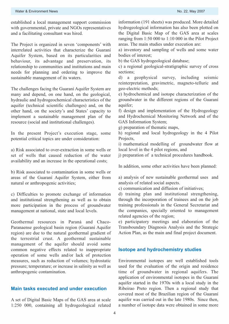
Deep boreholes extracting hot groundwater from the Guaraní AquiferSystem
or less local studies developed in the rest of theaquifer in Argentina, Paraguay, and Uruguay.
The Brazilian studies found a wide range in theisotopic composition in the groundwater, which variesbetween -4.9 and -9.6 ‰ for δ18O and -28 and -67 ‰for δ2H. These studies also found than the moreisotopically depleted groundwaters correspond to theolder groundwater, located in the deepest part of theaquifer. This isotopic pattern suggested than the oldergroundwaters were recharged under cooler climaticconditions than the present ones. The hydrochemicaldata obtained in these studies showed thatgroundwater in the recharge area is characterized bylow salinity (~10-500 μS/cm) and a Ca-HCO3 watertype, and that it evolves toward a Na-HCO3 type alongthe groundwater flow system.
Furthermore, in some areas salinity increases up to4500 μS/cm in some deep wells close to the ParanáRiver in the Paraguayan sector. Here, the highestsalinity waters show a marked increase in the contentsof sulphate and chloride (Na-Cl-SO4 water type). Thispattern is observed only in older groundwater. Thisinformation was used to establish the preliminaryconceptual model for the mentioned area, whichhowever does not have necessarily to apply to otherareas of the GAS.
The new isotope and hydrogeochemical study withinthe framework on the Guaraní project will contributeto improve the present understanding of thegroundwater flow system (origin and residence time),the interaction between the northern and southern partof the aquifer and the role of deeper formations in thesalinity of groundwater.
This new study also include the application of newisotope tools, such as 36Cl for the evaluation ofresidence time of the older groundwater, Sr isotopes toevaluate the interaction between the basalt and thesandstone, and 34S and Br isotopes to evaluate thesources of salinity in the oldest groundwater. In manysectors of the aquifer the historical information isscarce or null, so a great effort must be done toachieve a degree of knowledge comparable of thewhole aquifer. To accomplish that, hydrogeochemistryand isotope results must be supported by groundwaterflow modelling both at local and regional scales.
Conclusions
The results of this project will be incorporated by therelevant institutes of the four countries, depending onproject transparency and direct involvement ofprofessionals from all national related institutions inall activities. Only a management scheme based onadequate knowledge can be sustainable over time, andhydrochemical and environmental isotope studies willcontribute to a better comprehension of intrinsiccharacteristics of the aquifers, groundwater fluxes, aswell as recharge and discharge sources andmechanisms of the Guaraní aquifer.
Based on the information generated in the project, thecountries will establish some measures for thesustainable management and protection of the GAS.The monitoring network and all information availablein a comprehensive GIS are supposed to becontinuously updated. Cooperation between countriesconstitutes a central element to promote the neededchanges to support new generations based on asustainable development model.
For further information please contact Luis Araguasat [email protected] or Andy Garner [email protected]
Water & Environment News No. 22, May 2007
6
Environmental Isotope Tracking of HydrologicalProcesses in the Pampa Plain of Argentina
By Daniel E. Martínez and Héctor E. Massone
Argentinian research group shares the good experience with participation in an IAEA Coordinated Research Project in Isotope Hydrology.
In November 2004, the Isotope Hydrology Section ofthe IAEA in Vienna organized the first ResearchCoordination Meeting of the Coordinated Researchproject on Isotopic Age and Composition ofStreamflow as Indicators of GroundwaterSustainability, aiming at the use of isotopes for tracingthe amount, pathways and age of the subsurfacecontribution of groundwater to rivers. Among the 16research teams worldwide participating in this projectfrom 2004 until 2010 is the Grupo de Hidrogeologíadel Centro de Geología de Costas y del Cuaternario dela Universidad Nacional de Mar del Plata, workingtogether with the isotope laboratory of the InstitutoNacional de Geocronología y Geología Isotópica inBuenos Aires on the hydrology and hydrogeology ofthe Quequén Grande basin in the Pampa plain ofArgentina. This article briefly describes ourexperience after two years and highlights the positiveimpact of the Agency’s support on the waterknowledge and management in the Quequén Grandebasin.
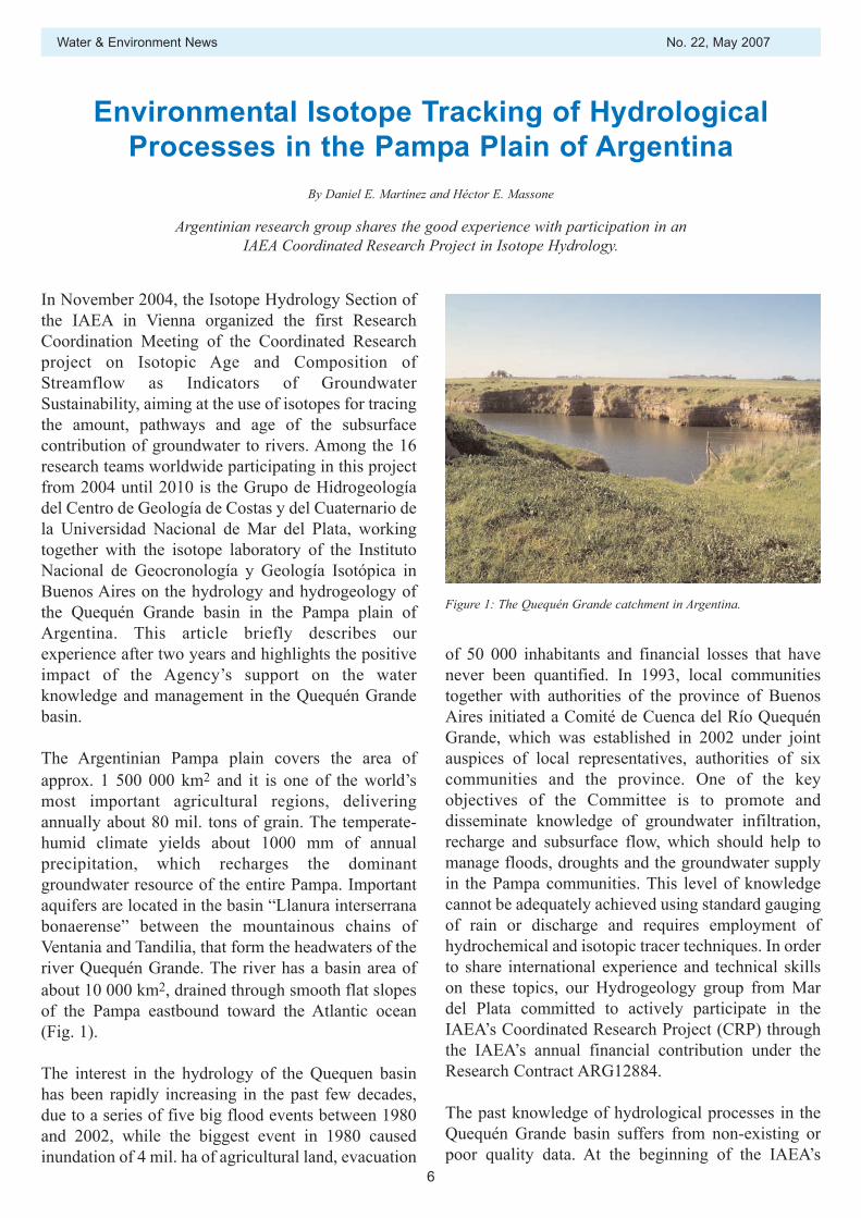
The Argentinian Pampa plain covers the area ofapprox. 1 500 000 km2 and it is one of the world’smost important agricultural regions, deliveringannually about 80 mil. tons of grain. The temperate-humid climate yields about 1000 mm of annualprecipitation, which recharges the dominantgroundwater resource of the entire Pampa. Importantaquifers are located in the basin “Llanura interserranabonaerense” between the mountainous chains ofVentania and Tandilia, that form the headwaters of theriver Quequén Grande. The river has a basin area ofabout 10 000 km2, drained through smooth flat slopesof the Pampa eastbound toward the Atlantic ocean(Fig. 1).
The interest in the hydrology of the Quequen basinhas been rapidly increasing in the past few decades,due to a series of five big flood events between 1980and 2002, while the biggest event in 1980 causedinundation of 4 mil. ha of agricultural land, evacuation
of 50 000 inhabitants and financial losses that havenever been quantified. In 1993, local communitiestogether with authorities of the province of BuenosAires initiated a Comité de Cuenca del Río QuequénGrande, which was established in 2002 under jointauspices of local representatives, authorities of sixcommunities and the province. One of the keyobjectives of the Committee is to promote anddisseminate knowledge of groundwater infiltration,recharge and subsurface flow, which should help tomanage floods, droughts and the groundwater supplyin the Pampa communities. This level of knowledgecannot be adequately achieved using standard gaugingof rain or discharge and requires employment ofhydrochemical and isotopic tracer techniques. In orderto share international experience and technical skillson these topics, our Hydrogeology group from Mardel Plata committed to actively participate in theIAEA’s Coordinated Research Project (CRP) throughthe IAEA’s annual financial contribution under theResearch Contract ARG12884.
The past knowledge of hydrological processes in theQuequén Grande basin suffers from non-existing orpoor quality data. At the beginning of the IAEA’s
Figure 1: The Quequén Grande catchment in Argentina.
No. 22, May 2007 Water & Environment News
7
project in 2005, only daily discharge data at the outletstation since 1964 and some meteorological andgroundwater level data for the year 2002 wereavailable. They were mostly collected by localinhabitants. When our group became participants inthe IAEA’s project, we presented our plans to theComité de Cuenca del Río Quequén Grande, whoimmediately considered it as a priority activity andprovided fieldwork logistics support. Collaborationwas also established between our group and theisotope laboratory of the Instituto Nacional deGeocronología y Geología Isotópica in Buenos Aires,which covers the isotope analysis from the QuequénGrande basin and helps overcome the all to frequentbarrier in many isotope hydrology projects in thedeveloping countries — easy availability of isotopeanalysis.
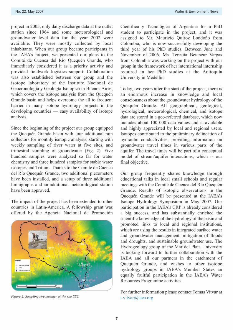
Since the beginning of the project our group equippedthe Quequén Grande basin with four additional raincollectors for monthly isotopic analysis, starting withweekly sampling of river water at five sites, andtrimestral sampling of groundwater (Fig. 2). Fivehundred samples were analyzed so far for waterchemistry and three hundred samples for stable waterisotopes and Tritium. Thanks to the Comité de Cuencadel Río Quequén Grande, two additional piezometershave been installed, and a setup of three additionallimnigraphs and an additional meteorological stationhave been approved.
The impact of the project has been extended to othercountries in Latin-America. A fellowship grant wasoffered by the Agencia Nacional de Promoción
Figure 2. Sampling streamwater at the site SEC
Científica y Tecnológica of Argentina for a PhDstudent to participate in the project, and it wasassigned to Mr. Mauricio Quiroz Londoño fromColombia, who is now successfully developing thethird year of his PhD studies. Between June andNovember of 2006, Ms. Teresita Betancur Vargasfrom Colombia was working on the project with ourgroup in the framework of her international internshiprequired in her PhD studies at the AntioquíaUniversity in Medellín.
Today, two years after the start of the project, there isan enormous increase in knowledge and localconsciousness about the groundwater hydrology of theQuequén Grande. All geographical, geological,hydrological, meteorological, chemical, and isotopedata are stored in a geo-referred database, which nowincludes about 100 000 data values and is availableand highly appreciated by local and regional users.Isotopes contributed to the preliminary delineation ofhydraulic conductivities, providing information ongroundwater travel times in various parts of theaquifer. The travel times will be part of a conceptualmodel of stream/aquifer interactions, which is ourfinal objective.
Our group frequently shares knowledge througheducational talks in local small schools and regularmeetings with the Comité de Cuenca del Río QuequénGrande. Results of isotopic observations in theQuequén Grande will be presented at the IAEA’sIsotope Hydrology Symposium in May 2007. Ourparticipation in the IAEA’s CRP is already considereda big success, and has substantially enriched thescientific knowledge of the hydrology of the basin andpromoted links to local and regional institutions,which are using the results in integrated surface waterand groundwater management, mitigation of floodsand droughts, and sustainable groundwater use. TheHydrogeology group of the Mar del Plata Universityis looking forward to further collaboration with theIAEA and all our partners in the catchment ofQuequén Grande, and wishes to other isotopehydrology groups in IAEA’s Member States anequally fruitful participation in the IAEA’s WaterResources Programme activities.
For further information please contact Tomas Vitvar [email protected]
WISER, New GIS-based Online Software for DataAnalysis, Visualization, and Electronic Retrieval
Powerful new features and major enhancements of tools, information, and isotope data have been added to the IAEA Water Resources Programme webpage.
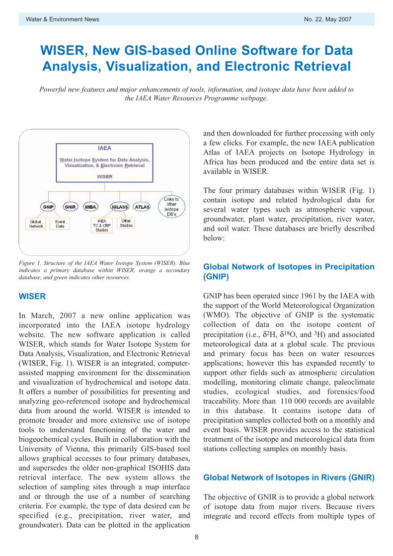
WISER
In March, 2007 a new online application wasincorporated into the IAEA isotope hydrologywebsite. The new software application is calledWISER, which stands for Water Isotope System forData Analysis, Visualization, and Electronic Retrieval(WISER, Fig. 1). WISER is an integrated, computer-assisted mapping environment for the disseminationand visualization of hydrochemical and isotope data.It offers a number of possibilities for presenting andanalyzing geo-referenced isotope and hydrochemicaldata from around the world. WISER is intended topromote broader and more extensive use of isotopetools to understand functioning of the water andbiogeochemical cycles. Built in collaboration with theUniversity of Vienna, this primarily GIS-based toolallows graphical accesses to four primary databases,and supersedes the older non-graphical ISOHIS dataretrieval interface. The new system allows theselection of sampling sites through a map interfaceand or through the use of a number of searchingcriteria. For example, the type of data desired can bespecified (e.g., precipitation, river water, andgroundwater). Data can be plotted in the application
and then downloaded for further processing with onlya few clicks. For example, the new IAEA publicationAtlas of IAEA projects on Isotope Hydrology inAfrica has been produced and the entire data set isavailable in WISER.
The four primary databases within WISER (Fig. 1)contain isotope and related hydrological data forseveral water types such as atmospheric vapour,groundwater, plant water, precipitation, river water,and soil water. These databases are briefly describedbelow:
Global Network of Isotopes in Precipitation(GNIP)
GNIP has been operated since 1961 by the IAEA withthe support of the World Meteorological Organization(WMO). The objective of GNIP is the systematiccollection of data on the isotope content ofprecipitation (i.e., δ2H, δ18O, and 3H) and associatedmeteorological data at a global scale. The previousand primary focus has been on water resourcesapplications; however this has expanded recently tosupport other fields such as atmospheric circulationmodelling, monitoring climate change, paleoclimatestudies, ecological studies, and forensics/foodtraceability. More than 110 000 records are availablein this database. It contains isotope data ofprecipitation samples collected both on a monthly andevent basis. WISER provides access to the statisticaltreatment of the isotope and meteorological data fromstations collecting samples on monthly basis.
Global Network of Isotopes in Rivers (GNIR)
The objective of GNIR is to provide a global networkof isotope data from major rivers. Because riversintegrate and record effects from multiple types of
Water & Environment News No. 22, May 2007
8
Figure 1. Structure of the IAEA Water Isotope System (WISER). Blueindicates a primary database within WISER, orange a secondarydatabase, and green indicates other resources.
No. 22, May 2007 Water & Environment News
9
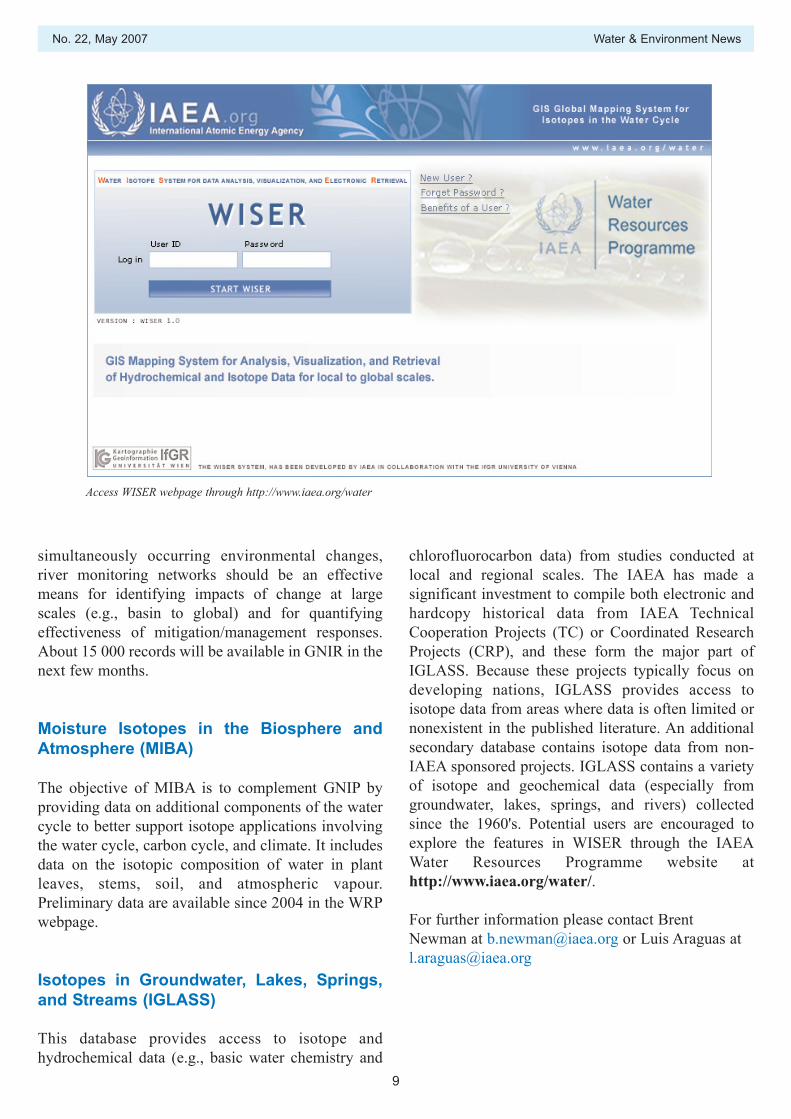
Access WISER webpage through http://www.iaea.org/water
simultaneously occurring environmental changes,river monitoring networks should be an effectivemeans for identifying impacts of change at largescales (e.g., basin to global) and for quantifyingeffectiveness of mitigation/management responses.About 15 000 records will be available in GNIR in thenext few months.
Moisture Isotopes in the Biosphere andAtmosphere (MIBA)
The objective of MIBA is to complement GNIP byproviding data on additional components of the watercycle to better support isotope applications involvingthe water cycle, carbon cycle, and climate. It includesdata on the isotopic composition of water in plantleaves, stems, soil, and atmospheric vapour.Preliminary data are available since 2004 in the WRPwebpage.
Isotopes in Groundwater, Lakes, Springs,and Streams (IGLASS)
This database provides access to isotope andhydrochemical data (e.g., basic water chemistry and
chlorofluorocarbon data) from studies conducted atlocal and regional scales. The IAEA has made asignificant investment to compile both electronic andhardcopy historical data from IAEA TechnicalCooperation Projects (TC) or Coordinated ResearchProjects (CRP), and these form the major part ofIGLASS. Because these projects typically focus ondeveloping nations, IGLASS provides access toisotope data from areas where data is often limited ornonexistent in the published literature. An additionalsecondary database contains isotope data from non-IAEA sponsored projects. IGLASS contains a varietyof isotope and geochemical data (especially fromgroundwater, lakes, springs, and rivers) collectedsince the 1960's. Potential users are encouraged toexplore the features in WISER through the IAEAWater Resources Programme website athttp://www.iaea.org/water/.
For further information please contact BrentNewman at [email protected] or Luis Araguas [email protected]
Water & Environment News No. 22, May 2007
10
The IAEA Isotope Hydrology Laboratory (IHL) hasswitched to a new database and laboratorymanagement system. This transition was necessarysince the former database system SaDat, based onDOS and DBase, did not fulfil the requirements anymore. Some of these missing requirements were:SaDat included no results obtained for standards.Therefore assessment of quality assuranceinformation was not possible and had to be handledexternal to the result database system. The number ofpossible result values of the same kind (e.g. 18O) persample was limited to a maximum of three in SaDat.There was no bookkeeping of sub-samples like e.g.stable isotope, tritium, 14C, CFC, noble gas sub-samples from the same well. SaDat included no post-processing, like for instance the computation ofaverage values for multiple measurements. It was notable to deal with the comparable complex dataobtained by the new noble gas facility.
Since one of the present members of the IsotopeHydrology Section and Laboratory (Axel Suckow)had developed a database system for his formeremployer, the Leibniz Institute for AppliedGeosciences (GGA), this was considered among otherdatabase systems and tested. The software, called‘LabData’, was found to cover all tasks SaDat hadcovered. Additionally LabData was found to fulfil allthe requirements mentioned above and several more.Therefore it was decided in late 2005 to import thewhole existing digital data in SaDat to LabData,covering the IHL history since 1989. After thoroughtesting of system performance and some minoradjustments concerning details of laboratoryworkflow in the IHL, LabData became fullyoperational as database and laboratory managementsystem for the IAEA Isotope Hydrology Laboratory inthe second half of 2006.
With a MS SQL Server® back end and a MS Access®front end and graphical user interface, LabData is amodern client-server database system, running underMicrosoft Windows® family. The code is not
specialized to any application or technique: The datamodel was used successfully for geochemical,geochronological and isotope hydrologicallaboratories. Any kind and any number of samples,with any number of SubSamples per sample and anynumber of measurements per SubSample can bestored. New techniques introduced to a laboratory donot require changes in the data model but just a newentry in an existing table. It covers the laboratoryworkflow from the moment samples enter the lab tothe final result, including attribute data like theinterdependence with projects, exposures (wells), andgeographical data. Additionally it covers several post-processing methods necessary for the interpretation ofisotope hydrological data like correction formula forradiocarbon or tritium-helium groundwater ages andlumped parameter models similar to the FlowPC andMULTIS codes. Algorithms to deconvolute heavynoble gas concentrations to determine infiltrationtemperatures and excess air are in preparation. Datacan be imported from and exported to MicrosoftExcel®.
While LabData is a multi-purpose system flexibleenough to cover many laboratory applications, it is ofcourse not a priori able to perform any kind of rawdata evaluation. For instance renormalization of stableisotope raw data as they come from a certain massspectrometer or laser device to the VSMOW/SLAPscale is not yet included. This important example willbe one of the future developments. At present LabDatacan perform the raw data evaluation of proportionalgas counters (from raw counts to % 14C or TU) and tohandle isotope enrichment of tritium samples withalgorithms developed for the GGA-Institute,Hannover. It also cooperates smoothly with theNobleControl software controlling the new IHL noblegas facility (see this Newsletter).
For further information please contact Axel Suckow [email protected]
LabData: Database and Laboratory ManagementSystem for Isotope Hydrology Laboratories
In 2006 a new Database and Laboratory Management system was installed in the isotope hydrology laboratory. This software is a very versatile multi-purpose tool able to handle workflow and data storage of geochemical,
geochronological and isotope laboratories with special post processing capabilities for isotope hydrology. The open source code is available for other laboratories.

No. 22, May 2007 Water & Environment News
11
News in Brief
Awards, Presentations, and Publications
Michelle Davin received an IAEA Merit Award for2005 recognizing her good performance andcontributions to the Isotope Hydrology Section.
Luis Araguás Araguás, Pradeep Aggarwal, OrnanetteAzucena, Andy Garner, Andrew Herczeg, K.M.Kulkarni, and Türker Kurttas of the IAEA IsotopeHydrology Section received an IAEA OutstandingTeamwork Award for their work on the Global WaterChallenge Event during the 2005 IAEA GeneralConference.
Pradeep Aggarwal, Andy Garner and K.M. Kulkarnireceived an Department of Nuclear Sciences andApplications Award for Best Public Information andOutreach in 2005, for the new IAEA Water ResourcesProgramme Information Materials (folder, brochure,fact sheets, etc.)
Preliminary results from a new water isotope lasermethod were presented by Pradeep Aggarwal at theDecember, 2006, American Geophysical Unionmeeting. A poster was presented which describes thispromising new technology for rapid and less costlyanalyses for δ18O and δ2H on water samples.
An article discussing the importance of isotopehydrology appeared in the January 2007 edition of theSueddeutsche Zeitung science magazine, Wissen. Thearticle describes the IAEA’s role in addressing local toglobal scale water problems and how isotopes canprovide unique hydrological and geochemicalinsights.
Departing Staff Member
Mr. Shawan Dogramaci joined the Isotope HydrologySection in September 2006. He was formerly atechnical staff member in the Western Australian StateDepartment of Water, Australia. His interestsincluded application of isotope techniques in tracinghydrological processes in large scale basins and the
salinisation processes in arid and semi arid regions.Mr. Dogramaci worked on incorporation of data intothe ISOHIS (Isotope Hydrology Information System)database and preparation of the isotope atlas for theAfrican Continent.
New Staff Member
Mr. Brent Newman joined the Isotope HydrologySection in October, 2006. He was formerly a technicalstaff member in the Earth and Environmental SciencesDivision at Los Alamos National Laboratory, USA.His interests include contaminant hydrology and theapplication of environmental tracer methods(including isotope techniques) to understandprocesses in the vadose zone and groundwater,especially in arid/semi-arid regions. He has also beeninvolved in ecohydrological studies. Ecohydrologyinvolves the interface between biological andhydrological processes, and understanding the linksbetween these systems is critical for addressing manyof the important environmental change/disturbanceproblems that we face today. Isotope techniques canbe very revealing about processes that occur at thisinterface. Mr. Newman will be working on waterissues in Africa and Asia.
Regional Training Courses
A regional training course on Isotope Hydrology witha focus on case studies in Central America wasorganized under the framework of regional projectRLA8040 in Panama, October 16–22. This activityincluded a standard course of isotope hydrology,hydrochemistry, and hydrogeology, combined with aworkshop on interpretation of respective case studiesof each country under assistance of regional experts.This scheme was highly appreciated by theparticipants because it allowed immediate applicationof the taught methods to project problems. It wasrecommended that this model be followed in furthereducational activities.
Meetings
A joint Research Coordination Meeting of regionalprojects RLA8038 and RLA8040 was conducted inSan Salvador, 29–31 May 2007, to review andprogress and adjust workplans for 2006. The objectiveof RLA8038 is to support the establishment of amanagement plan for an integrated watershedmanagement programme in the transboundary Trifinioregion (El Salvador, Guatemala, Honduras).RLA8040 focuses on an integrated groundwaterresources management system within areas of intensegeothermal water exploitation. Because of thethematic similarities, joint implementation of bothmeetings was appreciated by the participants. Itallowed them to plan and coordinate commonactivities, such as capacity building or laboratoryanalysis, in an efficient manner.
A meeting was held in late 2006 with the InternationalJoint Commission on the Great Lakes (NorthAmerica). The meeting discussed how the IAEAIsotope Hydrology Section can partner with otherresearch institutions studying water/atmosphereinteractions in the Great Lakes area. Isotope methodsappear to be very promising for understanding waterbalance issues of this large inland lake system, and fortesting and calibrating regional atmospheric models.
The GNIP steering committee met in Vienna from 6 to7 November 2006 to discuss the status of the networkand ideas for improving global spatial coverage. Thismeeting was immediately followed by a consultantsmeeting on the Establishment of National Networksfor monitoring isotope contents in precipitation. Heldin Vienna from 8–10 November 2006, it was attendedby representatives from India, Morocco, Thailand,Turkey and Venezuela. The main objective was forparticipants to obtain basic information on the GlobalNetwork of Isotopes in Precipitation (GNIP)programme, including relevant operational aspects, sothat participating countries could launch initiativesleading to the establishment or reactivation ofNational Precipitation Networks within GNIP. As aresult of the meeting, several precipitation monitoringstations (and runoff in some cases) for isotopes havebeen established in the mentioned countries.
A WHYMAP consultant meeting was held at theIsotope Hydrology Section at the IAEA 20–21November 2006. WHYMAP is a project to produce a
World HYdrological MAP which describes thedistribution of different types of groundwater aquifersworldwide. In addition, map coverage of globaldiffuse recharge estimates will be included. The IAEAis a partner with UNESCO for the development andproduction of WHYMAP. The first edition ofWHYMAP is intended to be released later in 2007.
The important roles of wetlands have receivedpolitical and scientific attention in recent years inwater resource management, environmentalprotection, and conservation. The first researchcoordination meeting for coordinated research projecton Isotopic Techniques for Assessment ofHydrological Processes in Wetlands was held inVienna, Austria, from 4 to 8 December 2006. Themeeting was attended by nineteen participants whoconduct wetland-related research using isotopetechniques in Africa, Asia, Europe, and North andSouth America. Following the presentations onwetland research projects by the participants and onthe water resource programme in IAEA by the staffmembers in the Isotope Hydrology Section, theparticipants discussed developing internal CRPcooperation and how the studies should contribute toimproved management of wetlands and waterresources in general. The second CRP meeting isplanned in 2008.
New Developments
Substantial progress has been made towardcompletion of the Isotope Hydrology Atlas of Africa.This activity has been a significant effort to documentthe many years of IAEA Water Resource Programmetechnical cooperation work and data from the Africancontinent. The atlas is in final production and it isanticipated that it will be released by the third quarterof 2007. It will be available in hard copy and throughthe Water Resources Programme web-site.
The use of isotopes to improve understanding ofgroundwater/river interactions, river water balanceand human impact on river discharge under presentand future climate conditions was the subject of theCRP completed in 2006. Seventeen research teamsprovided a set of novel methods on the interpretationof isotope data in rivers and elaborated a rationale forthe continuous collection of river isotope data in theGlobal Network of Isotopes in Rivers (GNIR). This
Water & Environment News No. 22, May 2007
12
No. 22, May 2007 Water & Environment News
13
worldwide data collection highlights the role ofisotopes in quantitative constraints of hydrologicalprocesses that are difficult to obtain throughconventional discharge gauging, and contributes to asustainable management of river basins. The data willbe publicly available through the water resourcesprogram website and stored in the GNIR database. AnIAEA technical document is also in progress.
The IAEA Water Resources Programme has recentlycompleted an instructional video on water samplingfor isotopes and geochemistry. The video provides a
Meetings in 2006
• Fifth meeting of the scientific steering committee of GNIP, Vienna, 6–7 November 2006
• Consultants meeting on the establishment of national networks for monitoring isotope contents of precipitation,Vienna, 8–10 November 2006
• Scientific steering committee meeting of global estimation of groundwater recharge for WHYMAP, Vienna,20–21 November 2006
• First research coordination meeting of the CRP on geostatistical analysis of spatial isotope variability to mapthe sources of water for hydrological studies, Vienna, 27–29 November 2006
• First research coordination meeting of the CRP on the use of isotopes in understanding hydrological cycle inwetlands, Vienna, 4–8 December 2006
• Technical meeting of laboratory managers active in external analysis network (Isotope Hydrology AnalysisNetwork, IHAN), Vienna, 11–13 December 2006
Meetings in 2007
• Second coordination meeting on use of isotopes and geochemical techniques in the study of artificial rechargein groundwater (ARASIA3), Dubai, United Arab Emirates, 29 January–1 February 2007
• IAEA/ GEF IW Learn/ USGS Aquifer Exchange Study Tour, USA, 16–26 April, 2007
step by step introduction to proper techniques andmethods for collecting a variety of isotope andgeochemical water samples, and also includes anoverview of laboratory methods for analysis ofisotopes. It is intended to be a learning tool for thoseconducting field work in Member State projects, forstudents, and those interested in a betterunderstanding what is required for proper fieldcollection of samples for isotope hydrology studies.The video will be available in 2007 through the IAEAWater Resources Programme website and throughCD-ROM.
Water & Environment News No. 22, May 2007
14
• International symposium on advances in isotope hydrology and its role in sustainable water resourcesmanagement, Vienna, 21–25 May 2007
• Research coordination meeting on isotope methods for the study of water and carbon cycle dynamics in theatmosphere and biosphere, Vienna, 21–25 May 2007
• Sixth meeting of the scientific steering committee of GNIP, Vienna, 21–22 May 2007
• Research coordination meeting on optimization of irrigation water use efficiency by using isotope techniquesto evaluate water flux below the root zone in flood and drip irrigation, Vienna
• Research coordination meeting on optimization of irrigation water use efficiency by using isotope techniquesto evaluate water flux below the root zone in flood and drip irrigation, Vienna
• Consultants meeting on the use of isotopes in the assessment of river-aquifer interactions: A case study of thetri-country Austrian-Slovak-Hungarian part of the Danube basin, Vienna
• Research coordination meeting on isotope age and composition of streamflow as indicators of groundwatersustainability, Vienna
• Technical meeting on the development of isotope methodologies for water quality assessment andmanagement, Vienna
Editor’s Note
To receive a free copy of Water & Environment Newsregularly, please write to:
Isotope Hydrology SectionInternational Atomic Energy AgencyWagramer Strasse 5, P.O. Box 100 A-1400, Vienna, Austria
Email: [email protected].: +43-1-2600-21736Fax: +43-1-2600-7
Alternatively it is also available on the websitehttp://www.iaea.org/water
Contributions to the newsletter are welcome.
No. 22, May 2007 Water & Environment News
15
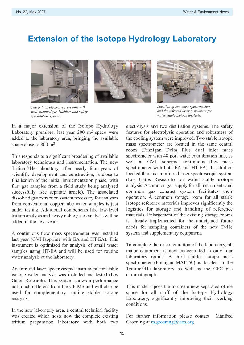
In a major extension of the Isotope HydrologyLaboratory premises, last year 200 m2 space wereadded to the laboratory area, bringing the availablespace close to 800 m2.
This responds to a significant broadening of availablelaboratory techniques and instrumentation. The newTritium/3He laboratory, after nearly four years ofscientific development and construction, is close tofinalisation of the initial implementation phase, withfirst gas samples from a field study being analysedsuccessfully (see separate article). The associateddissolved gas extraction system necessary for analysesfrom conventional copper tube water samples is justunder testing. Additional components like low-leveltritium analysis and heavy noble gases analysis will beadded in the next years.
A continuous flow mass spectrometer was installedlast year (GVI Isoprime with EA and HT-EA). Thisinstrument is optimised for analysis of small watersamples using HT-EA and will be used for routinewater analysis at the laboratory.
An infrared laser spectroscopic instrument for stableisotope water analysis was installed and tested (LosGatos Research). This system shows a performancenot much different from the CF-MS and will also beused for complementary routine stable isotopeanalysis.
In the new laboratory area, a central technical facilitywas created which hosts now the complete existingtritium preparation laboratory with both two
electrolysis and two distillation systems. The safetyfeatures for electrolysis operation and robustness ofthe cooling system were improved. Two stable isotopemass spectrometer are located in the same centralroom (Finnigan Delta Plus dual inlet massspectrometer with 48 port water equilibration line, aswell as GVI Isoprime continuous flow massspectrometer with both EA and HT-EA). In additionlocated there is an infrared laser spectroscopic system(Los Gatos Research) for water stable isotopeanalysis. A common gas supply for all instruments andcommon gas exhaust system facilitates theiroperation. A common storage room for all stableisotope reference materials improves significantly thelogistics for storage and handling of referencematerials. Enlargement of the existing storage roomsis already implemented for the anticipated futureneeds for sampling containers of the new T/3Hesystem and supplementary equipment.
To complete the re-structuration of the laboratory, allmajor equipment is now concentrated in only fourlaboratory rooms. A third stable isotope massspectrometer (Finnigan MAT250) is located in theTritium/3He laboratory as well as the CFC gaschromatograph.
This made it possible to create new separated officespace for all staff of the Isotope HydrologyLaboratory, significantly improving their workingconditions.
For further information please contact ManfredGroening at [email protected]
Two tritium electrolysis systems withwall-mounted gas bubblers and safetygas dilution system.
Location of two mass spectrometersand the infrared laser instrument forwater stable isotope analysis.
Extension of the Isotope Hydrology Laboratory

Water & Environment News No. 22, May 2007
16
The Vienna Facility for Noble Gas Measurements in Groundwater
Noble gases have proven to be a very important toolin modern isotope hydrology. The T/3He datingmethod of groundwater is probably the most knownand prominent noble gas method in IsotopeHydrology. In contrast to Tritium alone, which forprincipal reasons is not able to distinguish rechargeafter 1980 from recharge after 1990 or 2000, theT/3He dating method allows to compute apparent agesin this time range. But Noble Gases have a muchwider range of applications: since uranium andthorium is contained in nearly all kinds of rocks andsince their decay produces alpha particles (heliumions), helium can be used as an age tracer ingroundwater beyond the time scale of the applicationof tritium. The heavy noble gases neon, argon,krypton and xenon can be used to derive theconditions of recharge, such as temperature, altitudeand salinity. This are very useful constrainingparameters both to derive the origin of groundwaterand to better correct for excess air in T/3He dating. Forvery old waters 40Ar, produced from radioactive decayof potassium (40K) can be used as an age tracer.Finally the detection limit of tritium can be improvedby approximately an order of magnitude as comparedto radiometric methods using the 3He ingrowthtechnique. All these applications together make noblegases one of the most versatile tools in modern isotopehydrology.
Early in 2003, the IAEA began the installation of anoble gas facility within the Isotope HydrologyLaboratory. It is the first one not situated in auniversity environment but dedicated to watermanagement applications within projects in theMember States. The IAEA laboratory is one of only adozen laboratories worldwide able to carry out similardetermination. Experience from these laboratories hasshown that typical installation time from purchasing amass spectrometer capable to measure the 3He/4Heratio to the first water measurements for neon, heliumand the 3He/4He ratio is three years. Reasons for this
comparably long installation time are that everymachine in this scientific field is still unique and thatthe techniques of measurement automation andsoftware control still vary drastically within a timespan of some years. Consequently installation of anynoble gas facility has to occur in several steps, usuallystarting with the most prominent application, theT/3He groundwater dating.
We studied some of the established approaches ofnoble gas measurement in water, rock and gas samplesand tried to combine as many well proven techniquesas possible to reach the targets defined above. Allapproaches together can be summarized in thefollowing sample preparation and measurement steps:
separate gases from water;separate noble gases from reactive gases;separate the noble gas species from each other (He,Ne, Ar, Kr, Xe);measure each noble gas component and its isotopiccomposition in a mass spectrometer;
The goals stated above define the targets for the finalstate of the system to be installed: it has to be capableof measuring the 3He/4He ratio which implies that amass spectrometer is necessary capable to resolvemasses 3.016 (3He) from 3.022 (HD and H3). It shouldbe able to handle any type of sampler routinely usedin groundwater studies, may it be the typical pinch-offcopper tubes or passive samplers. In contrast to otherinstallations dedicated e.g. to oceanographic samplesit has to be able to handle samples with higher load ofreactive gases like CO2, CH4 etc. It also has to be ableto measure samples with helium contents severalorders of magnitude above solubility equilibrium. Itshould be able to measure as many of the heavy noblegases argon, krypton and xenon as possible. The largersample numbers per site in modern studies makes ahigh sample throughput desirable. This in turn needshigh degree of automation with simultaneous parallel
The first step of installation of a new Noble Gas facility for Isotope Hydrology applications in the member states iscompleted. The system is capable of measuring helium and neon concentrations and their isotopic composition in
water samples. Some of the goals and concepts are explained. The next steps will be the measurement of the heavy noble gases Ar, Kr, Xe, and tritium measurements via ingrowth of 3He.

No. 22, May 2007 Water & Environment News
17
measurement of different gas components in differentmass spectrometers and also points towards an off-line extraction system.
After an investment of nearly US $1 000 000 and fouryears of scientific development, in early 2007 thefacility consists of a MM5400 sector field massspectrometer plus two quadrupole mass spectrometers(QMS) and a very recently finished off-line extractionsystem for 10 samples in parallel in one run. An eight-fold multiport and a calibration system using aliquotsof air is connected to a noble gas purification systemthat consists of traps and getters and one QMS. Thispurification system will be dedicated to measuring theheavy noble gases, but it can be bypassed to a cryopurification and cryo charcoal trap system similar tooceanography-dedicated installations. After these cryotraps a precise spinning rotor gauge (SRG) togetherwith a system of split volumes allows us to determinethe absolute helium concentration and to partitionlarge helium amounts. This ensures that the signalrange for 3He/4He determination in the MM5400sector field mass spectrometer is less than a factor offive for 4He. Simultaneous to the heliummeasurement, the neon fraction is desorbed from thecryo trap, the absolute neon concentration is measuredwith the SRG and the 20Ne/22Ne isotopic ratiodetermined in the second QMS.
The measurement system is controlled by our ownsoftware, ‘NobleControl’. It is a very modular code inLabView that runs under MS Windows XP and can beeasily adapted to new hardware. Very flexible controlover the measurement process itself is possible inNobleControl with a script language having thetypical syntax features of present day high-levelprogramming languages including Variables, Repeatand While loops and nested blocks. To savepreparation time and enhance sample throughput ituses parallel processing of several command queuesand the communication between these tasks bymessages. A typical sequence in our actual approachcomprises seven command queues. Theysimultaneously control the measurements of the threemass spectrometers, the gas inlet, the cryopurification, manual commands and a master dispatchqueue. All system state parameters like pressures,valve states, temperatures, MS signals etc. are storedat user-defined intervals and can be displayed duringthe run. The typical amount of data produced from aone-day run is around 20 MByte as ANSI text files.
Post-processing is achieved using a noble gasdedicated sub-system of the LabData laboratorymanagement and data-base system (see thisNewsletter). Both NobleControl and LabData areopen source codes and the entire software is availablefree of charge for other groups.
To date we have achieved an internal reproducibility,defined as the standard deviation of the efficiency(signal/ccSTP) of air aliquots through the wholemeasurement process over six weeks, of better than1.5% for 3He and better than 1% for 4He, 20Ne, 22Ne.A typical gas inlet (reference air split or unknown) isprocessed through the whole system within 45minutes. This is comparably slow for helium and neonmeasurement only and can be further optimized. But itis to be expected that during future runs including themeasurement of heavy noble gases one hour will be atypical time for the whole process. We aim for the fullprocessing of noble gases of eight unknowns withinan automated 24 h run. The system is the first oneworldwide that has demonstrated to measure helium-neon ratios up to 100 000 times the atmospheric valuein fully automated mode. Such high amounts ofhelium are splitted automatically where each splitreduces the helium amount by a factor of 2.62 andneeds five minutes. Test measurements using passivesamplers equilibrated under laboratory conditionsshow to agree well with the expected values of heliumand neon concentration and to better than 1% and0.5% respectively with the expected helium and neonisotope ratio. The first water samples to date areprocessed by the off-line extraction system. The nextsteps are the investigation and optimization ofparameters of the extraction system (first half of 2007)followed by the necessary steps to measureconcentrations of argon, krypton and xenon inautomated mode.
For further information please contact Axel Suckow [email protected]
Water & Environment News No. 22, May 2007
18
IAEA and Transboundary Aquifers: Highlight on theNorthwest Sahara Aquifer System
Isotopic techniques predict wateravailability
Every year, the pressure to use groundwater resourcesfrom underground aquifers increases across the globe,especially in arid regions. Rising human populations,demands from thirsty industrial and agriculturalsectors and a global decline of accessible and cleansurface waters, in part due to climate change, are alldrivers for national and local water managers to bettheir hopes on underground reservoirs.
Many of these aquifers are transboundary — sharedby two or more countries. And sometimes, countriessharing aquifers are not always the best of friends.That’s not great news when the action of one country,for example the over-abstraction of groundwater,leads to a rapid depletion of groundwater throughoutthe aquifer including that in neighbouring countries. Itbecomes an even bigger problem if the aquifer is notbeing naturally recharged over time, say from rain oradjacent rivers.
Experience now shows that improving the wisemanagement of shared aquifers depends on two keystrategies. The first is to enhance cooperation betweenthe countries sharing the aquifer, for example fromexchanging information and lessons learned. Anotherexample is to create a regional legal framework suchas a joint convention that will help prevent negativeimpacts by one country affecting another. The secondstrategy is to gain a better understanding of how theaquifer works through the most advanced scienceavailable – namely, through the use of cutting-edgeisotopic techniques.
The IAEA is helping countries to implement bothstrategies through a variety of projects targeted attransboundary aquifers. Some focus only on theimprovement of scientific understanding. Others, likethe new ‘Nubian Project’, are working on both fillinginformation gaps and improving inter-governmentalcooperation, with financial support from the Global
Environmental Facility (GEF).
Based on its experiences with transboundary aquifers,the IAEA has already achieved a number of successstories where the scientific understanding of howshared aquifers work has been enhanced. Thisinformation has further been used to help watermanagers better meet the needs of the populations thatthey serve who are dependent on groundwaterresources.
For example, over the last 20 years, the IAEAconducted a wide range of studies using isotopictechniques for the Northwest Sahara Aquifer System(NWSAS), an area covering over one million sq kmbetween the countries of Algeria, Libyan ArabJamahariya, and Tunisia. About four million peopleare dependent on the system for water. In southTunisia, it’s the most important source.
Water exploitation in the NWSAS started around1950. Today, the landscape is dotted with possibly asmany as 3000 water bore holes, as use increased from14 m3/s in 1950 to 82 m3/s in 2000. Current problemsinclude declining water levels, increased pumpingcosts, drying up springs (e.g. Nefzaoua and Jeridregions in Tunisia) and an increased risk of waterquality decline from salinization.
Gaining a Better Understanding of the NWSahara System
Isotopic studies, in parallel with hydrogeologicalinvestigation, found that the entire system actuallyconsists of three separate aquifer basins, in some partssuperimposed on top of each other. The ‘ContinentalIntercalaire (CI)’ was found to be the biggest anddeepest with some bore holes as far as 2700 m down.The ‘Complexe Terminale (CT)’ and ‘Djefarra’aquifers reach depths of only 200 to 1000 m. Thesetwo aquifer systems are laterally the most extensive.They underlay the three countries and are
IAEA supported investigations are leading to a better understanding of this important shared aquifer resource in theNorthern African countries of Algeria, Libyan Arab Jamahariya, and Tunisia.

No. 22, May 2007 Water & Environment News
19
conventionally named the NWSAS. The Djefarraaquifer, shared between Tunisia and Libya, covers anarea of 15 000 km2, is a coastal littoral aquifer withmajor salt water intrusion problems in Libya in partbecause of past over-exploitation. This, in fact, forcedTripoli to get its freshwater piped up from the NubianAquifer System in the south through the world’sbiggest water transport project.
Different isotopic studies from the NWSAS show thatthere is a high level of inter-communication betweenthe three aquifers, with the CI significantly rechargingboth the CT and Djefarra. It is now clear that some 80 % of the total recharge of the Djefarra now comesfrom the CI through El Hamma-Chenchou fault, in thesouth of Tunisia, flowing from west to east. The samesituation is observed in the Amguid area in Algeriawhere the contribution from the CI to CT has beenestimated to 65%.
This situation shows the important role played by thealimentation by ascending leakage compared with thecurrent modern recharge which remains limited in theperiphery of the domain, particularly around the
Saharian Atlas, the Dahar Mountains, Tademaït andTinrhert plateaus.
Regarding the Djefarra aquifer, a preliminaryassessment of modern recharge contribution toDjeffara groundwater resources has been carried outusing the isotopic mass balance. Proportions havebeen calculated for Tunisian and Libyan part of thebasin. The mean proportion of modern water in theTunisian part of the basin is less than in the Libyanpart where it ranges around 70%.
For further information please contact: Andy Garnerat [email protected]
Coordination Meeting for IAEA Northwest Sahara Project, November 2006
The current RAF8035 project aims to gatheressential and updated information on groundwatergeochemical and isotopic characteristics that wouldbe usable by water managers of the three involvedcountries to develop or refine appropriate models.This should facilitate the implementation of atransboundary integrated management of the sharedresources. Indeed, the fourth co-ordination meetingand technical workshop held in Algiers from 11–15November 2006 with the presence of therepresentatives of Algeria, Libyan Arab Jamahariya,and Tunisia, has permitted to review the data and tocompile in a single common database. The datagathered so far represented approximately 900water samples.
The samples were collected from the differentaquifers, all subject of intensive exploitation foragricultural practices and other use: a) fromContinental Intercalaire and equivalent aquifers; b)from the Complexe Terminale and equivalentaquifers; c) from Djeffara; and d) from the shallowunconfined aquifers and the remaining from springsand reservoirs. The samples were collected fromseveral study sites. These include (i) the Saouravalley, the Occidental Erg, the Southern foothills ofAtlas Mountains, the Tidikelt region and theGhadames in Algeria; (ii) the Jefara plain, JabelNafusa area and Ghadames area in Libya; and (iii)the Dahar mountains, the Djerid area, the Nefzaoua,and the extreme South and the Djeffara plain inTunisia. Ghadames is the region straddling theboundary of the three countries.
Water & Environment News No. 22, May 2007
The Water and Environment News are prepared twice per year by the Isotope Hydrology Section, Division of Physical and ChemicalSciences, Department of Nuclear Sciences and Applications.
International Atomic Energy AgencyWagramer Strasse 5, P.O. Box 100, Printed by the IAEA in Austria,
A-1400 Wien, Austria May 2007
Water and Environment NewsNo. 22 May 2007
07-180
01