For personal use only - asx.com.au · PDF fileresource in-fill and extension ......
33
Corporate Details Ordinary Shares: 780,917,069 Market Capitalisation: ~$150 million Cash and bullion at 30 June 2017: ~$27.7 million Debt: NIL ASX Code: MOY Board of Directors Greg Bittar Non-Executive Chairman Michael Chye Non-Executive Director Tim Kennedy Non-Executive Director Peter Lester Non-Executive Director Management Peter Cash Chief Executive Officer Dean Will Chief Operating Officer Richard Hill Chief Financial Officer Pierre Malherbe Company Secretary Contact Details 10 Kings Park Road West Perth, WA, Telephone: + 61 (08) 9216 9011 Facsimile: + 61 (08) 9481 0288 Email: [email protected] Website: millenniumminerals.com.au 7 August 2017 Growth strategy gains momentum with maiden underground Resource Phase 1 underground resource estimate at Nullagine helps underpin Millennium’s plan to increase production and mine life based on +850,000oz fresh resource inventory Phase 1 Mineral Resource estimate completed for Bartons deposit, located below the existing Bartons pit at the Nullagine Gold Project in WA: o Indicated and Inferred Resource of 475,900 tonnes grading 5.3g/t Au for 80,400 ounces of contained gold. Resource calculated only to a nominal maximum of ~200 metres, with the mineralisation remaining open at depth and along strike to the south- west and north-east. Recent high-grade results are not included in the Resource calculation, including the latest intercept of 41m @ 6g/t Au. Potential Resource upside from revised interpretation of the south- western portion of the Bartons deposit, where three separate hanging- wall lodes may converge into a single mineralised zone at depth – priority target for future drilling. High level studies now underway to determine optimal development pathway, to be conducted in parallel with resource infill and expansion drilling. Results confirm strong potential to establish the Company’s maiden underground mining operation at Bartons, one of many pits which remain open at depth. Millennium Minerals Limited (Millennium or Company – ASX: MOY) is pleased to report a maiden JORC 2012 Indicated and Inferred Mineral Resource estimate for Bartons Underground, located below the existing Bartons pit at its Nullagine Gold Project in WA. The Mineral Resource estimate comprises 475,900 tonnes grading 5.3g/t Au for 80,400 ounces of contained gold (see Table 1). It represents the first Underground Resource to be completed by the Company as part of its strategy to develop a significant underground mining operation at Nullagine. The Phase 1 Resource, which was completed by leading global mining consultant Entech, was based on drilling results received up to the For personal use only
Transcript of For personal use only - asx.com.au · PDF fileresource in-fill and extension ......

Corporate Details
Ordinary Shares: 780,917,069
Market Capitalisation: ~$150 million
Cash and bullion at 30 June 2017: ~$27.7 million Debt: NIL
ASX Code: MOY
Board of Directors
Greg Bittar Non-Executive Chairman
Michael Chye Non-Executive Director
Tim Kennedy Non-Executive Director
Peter Lester Non-Executive Director
Management
Peter Cash
Chief Executive Officer Dean Will Chief Operating Officer Richard Hill Chief Financial Officer Pierre Malherbe Company Secretary
Contact Details
10 Kings Park Road West Perth, WA, Telephone:
+ 61 (08) 9216 9011
Facsimile:
+ 61 (08) 9481 0288
Email: [email protected]
Website:
millenniumminerals.com.au
7 August 2017
Growth strategy gains momentum
with maiden underground Resource
Phase 1 underground resource estimate at Nullagine helps
underpin Millennium’s plan to increase production and mine life based on +850,000oz fresh resource inventory
Phase 1 Mineral Resource estimate completed for Bartons deposit,
located below the existing Bartons pit at the Nullagine Gold Project in
WA:
o Indicated and Inferred Resource of 475,900 tonnes grading 5.3g/t
Au for 80,400 ounces of contained gold.
Resource calculated only to a nominal maximum of ~200 metres, with the
mineralisation remaining open at depth and along strike to the south-
west and north-east.
Recent high-grade results are not included in the Resource calculation,
including the latest intercept of 41m @ 6g/t Au.
Potential Resource upside from revised interpretation of the south-
western portion of the Bartons deposit, where three separate hanging-
wall lodes may converge into a single mineralised zone at depth – priority
target for future drilling.
High level studies now underway to determine optimal development
pathway, to be conducted in parallel with resource infill and expansion
drilling.
Results confirm strong potential to establish the Company’s maiden
underground mining operation at Bartons, one of many pits which remain
open at depth.
Millennium Minerals Limited (Millennium or Company – ASX: MOY)
is pleased to report a maiden JORC 2012 Indicated and Inferred Mineral
Resource estimate for Bartons Underground, located below the existing
Bartons pit at its Nullagine Gold Project in WA.
The Mineral Resource estimate comprises 475,900 tonnes grading
5.3g/t Au for 80,400 ounces of contained gold (see Table 1). It
represents the first Underground Resource to be completed by the
Company as part of its strategy to develop a significant underground
mining operation at Nullagine.
The Phase 1 Resource, which was completed by leading global mining
consultant Entech, was based on drilling results received up to the
For
per
sona
l use
onl
y

second week of July 2017. It has been calculated to a maximum depth of only 200 metres, with
the mineralisation remaining open at depth and along strike to the south-west and north-east.
The Resource does not include several recent high-grade intercepts including the recently
reported high-grade result of 41m @ 6g/t Au (see ASX Announcement dated 24 July 2017). In
addition, recent exploration results have led to a revised interpretation of the south-western
portion of the Bartons deposit, where the Company now considers three separate lodes may
converge into a single mineralised zone at depth.
Further testing of this revised interpretation, as well as the latest drilling results and ongoing
drilling data will be incorporated into a Phase 2 resource estimate for the Bartons Underground as
further results come to hand.
Millennium Chief Executive Peter Cash said the Phase 1 Resource provides a strong foundation for
the Company’s plans to develop its first underground mining operations at the Nullagine Project.
“This is a very pleasing result, providing the basis for what we believe will rapidly progress as a
high-quality, long-life underground mining operation at Nullagine.
“The latest high-grade drilling results from Bartons, including a 41 metre intercept grading 6
grams per tonne gold, provide immediate potential for Resource upside, with a new geological
interpretation of the south-western end of the deposit also providing a key target for upcoming
drilling.
“Bartons is the first underground opportunity we have targeted as part of the Nullagine Expansion
Study, and this Phase 1 resource estimate provides us with a very strong base from which we can
grow our gold resource inventory and mine life.
“We will now commence preliminary studies to consider the optimal development pathway for the
Bartons Underground, in parallel with additional exploration work both at Bartons and at other
key exploration targets at Nullagine,” he said.
Phase 1 Resource
The Statement of Mineral Resource estimate is reported in accordance with the requirements of
the JORC 2012 Code and is therefore suitable for public reporting.
The Phase 1 (August 2017) Mineral Resource estimate for the Bartons Underground, reported
using a 2.0/t gold lower cut-off grade is summarised in Table 1 below:
Resource Category Tonnes (000's) Grade (g/t) Ounces (000's)
Indicated 62.0 5.1 10.1
Inferred 413.9 5.3 70.4
Total 475.9 5.3 80.4
The Mineral Resource was estimated by Entech and is based on 4,141.65 metres of drilling (comprising 4
diamond holes and 804 RC holes) completed up to 24 July 2017. Tonnages are dry metric tonnes. Minor
discrepancies may occur due to rounding. Entech’s resource summary for the deposit is provided in
Appendix 1, including details on the approaches and methodologies utilised in derivation of the reported
Mineral Resources.
The Mineral Resource estimate is based on three (3) domains – the Main Lode Footwall (Domain
1); the Main Lode Hanging-wall (Domain 2); and the East Lode (Domain 3), as highlighted in
Figures 1 and 2.
For
per
sona
l use
onl
y

Geology
The Bartons deposit is associated regionally with the NE-trending section of the ENE-trending
Mosquito Fault Zone. Mineralisation is associated with a -60° SE dipping, broad (15-20m) sericite-
altered shear zone with the highest gold grades associated with 0.5-2m wide quartz lodes.
Three main zones have been defined for underground mining - the Main lodes (which consist of a
footwall lode and a north-plunging hanging wall lode) and the East lode. A shorter strike length,
high-grade splay structure has also been identified near the intersection of the Main lodes and the
East lode.
Figure 1: Oblique view of Bartons Underground lodes, showing the three domains included in the Phase 1 JORC 2012 Resource estimate, as well as the interpreted convergence zone at the south-west end of the deposit
For
per
sona
l use
onl
y

Figure 2: Oblique view of Bartons Underground lodes, showing the interpreted convergence zone and the location of BARD0285, which returned an intercept of 41m @ 6g/t Au
Figure 3: Cross section of the Bartons Underground Resource
For
per
sona
l use
onl
y

The Next Steps
Following the completion of the Phase 1 Resource estimate, Millennium will now work with Entech
to undertake high-level studies to determine the optimal development pathway for the Bartons
Underground.
The results of these studies will be used to define the scope of further technical work and mining
studies.
In parallel with the completion of these studies, the Company will also undertake additional
resource in-fill and extension drilling to further expand and increase confidence in the Phase 1
resource estimate.
ENDS
For further information, please contact: For media inquiries, please contact:
Peter Cash – Chief Executive Officer Paul Armstrong – Read Corporate
+61 8 9216 9011 +61 421 619 084
Competent Persons Statements – Exploration Results
The information relating to exploration results from the Nullagine project is extracted from the
announcement titled ‘Millennium hits 41m at 6g/t including 2m at 87g/t in latest drilling at Bartons’ dated 24
July 2017 which is available to view at www.millenniumminerals.com.au.
The Company confirms that it is not aware of any new information or data that materially affects the
information included in the original market announcements relating to the drill results and that all material assumptions and technical parameters underpinning the drill results in the relevant market announcement continue to apply and have not materially changed. The Company confirms that the form and context in which the Competent Person’s findings as presented here have not been materially modified from the original market announcement.
For
per
sona
l use
onl
y

Appendix 1: Nullagine Gold Project Location Plan over regional geology
For
per
sona
l use
onl
y

Appendix 2:
Executive Summary: Bartons Underground Mineral Resource Estimation
Mineral Resource Statement
The Mineral Resources Statement for Bartons Underground Maiden Mineral Resource
Estimate (“MRE”) is reported according to the Australasian Code for Reporting of Exploration
Results, Mineral Resources and Ore Reserves (the ‘JORC Code’) 2012 edition (Table 1).
In the opinion of Entech, the resource evaluation reported herein is a reasonable representation
of the global underground gold mineral resources within the Bartons deposit, based on available
sampling data.
Table 1. Bartons Underground Maiden Mineral Resource at a 2.0 g/t gold cut-off, by
Resource Category.
Tonnages are dry metric tonnes.
Minor discrepancies may occur due to rounding
Competent Persons Statement
The information in the report to which this statement is attached that relates to the Estimation
and Reporting of Gold Mineral Resources is based upon information compiled by Ms. Jillian Irvin
BSc., a Competent Person who is a member of the Australian Institute of Geoscientists (MAIG
3035). Ms. Irvin is Principal Geologist at Entech Pty Ltd. and an independent consultant to
Millennium Minerals Ltd. Ms. Irvin has sufficient experience relevant to the style of mineralisation
and deposit type under consideration and to the activities being undertaken to qualify as a
Competent Person as defined in the 2012 Edition of the “Australasian Code for Reporting of
Exploration Results, Mineral Resources and Ore Reserves”. Ms. Irvin consents to the inclusion in
the report of matters based on her information in the form and context in which it appears.
Domaining Approach
Interpretations of domain continuity were initially undertaken within Geovia SurpacTM software,
with mineralisation intercepts correlating to the Main and East Lodes manually selected prior to
creation of a vein model within Leapfrog implicit modelling software. Interpretation was a
collaborative process with MOY Geologists to ensure modelling appropriately represented site
based observations and current understanding of geology and mineralisation controls.
Mineralisation volume domains were delineated using a combination of:
Geological information comprising of logged Quartz percentage and Alteration Halo;
Nominal lower grade minimum cut-off of 2.0 to 3.0 g/t gold. This number was based on
exploratory data analysis of mineralisation sample population as well as visual review of
the mineralisation tenor and strike, and dip continuity.
Historical underground mining documentation, mapping, stope void locations, preferential
orientations, and widths.
For instances where the intercept gold value fell below the nominal cut-off, however was
supported by geological indicators (quartz and alteration), the intercept was included to maintain
Resource Category Tonnes (000's) Grade (g/t) Ounces (000's)
Indicated 62.0 5.1 10.1
Inferred 413.9 5.3 70.4
Total 475.9 5.3 80.4
For
per
sona
l use
onl
y

domain homogeneity and represent the structural continuity evident in surface mapping, pit
observations, historical mapping, and stoping.
Using this approach two narrow sub-parallel mineralised lodes were modelled within the Bartons
Main Lode (Main Lode Hangingwall and Main Lode Footwall), trending north-east and dipping
steeply to the south-east. A third domain, East Lode, was modelled as a splay from the Bartons
Main Lode, trending east-north-east and dipping steeply to the south-east. All reported
mineralised domains were considered to be within fresh material, based on MOY supplied
weathering surfaces and drill hole logging data.
Interpretations were predominantly informed by Reverse Circulation drilling (804 holes), with
limited amounts of Diamond Drilling (4 holes), for a total of 4,142 m of drilling. The MRE
contained all drill hole data available at 24th July 2017.
Estimation Approach
A two dimensional (“2D”) Ordinary Kriging interpolation approach was selected for the MRE to
address some of the main issues encountered when estimating narrow vein mineralisation, such
as those at Bartons, which were:
Additivity issues due to non-uniform support and resulting grade bias. Instances of highly
variable individual intercepts (e.g. 0.1 m to 4.5 m) which would be difficult to incorporate
and represent statistically using downhole composites of equal lengths (e.g. 0.5, 1.0 or
2.0 m);
Varying mineralisation geometry across lode, down dip, and along strike; and
Block size required for adequate volume fill of narrow geometry is generally too small,
introducing conditional bias to the MRE outcome.
Key assumptions for this estimation approach, which were tested and met prior to
implementation of this approach, were:
Intrinsic correlation between grade and length;
Homogeneity, and thus stationarity, within the mineralised domain; and
Non-selective mining within the mineralised vein. The entire vein width is likely to be
extracted during the mining process and selectively mining portions of the vein, across the
width, is unlikely.
The 2D interpolation approach utilised for the MRE varies from a three-dimensional approach
(“3D”) in that estimation of both an accumulation variable (intercept gold composite multiplied by
true width) and the true width variable, is undertaken in a 2D plane using identical variogram and
search parameters to ensure consistency for subsequent back-calculation of gold block grades.
The gold accumulation variable was assessed for statistical and spatial outliers. Top cuts were
applied to East Lode domain with metal reduction of 3.44%. Geostatistical analysis was
undertaken in IsatisTM software on the cut gold accumulation variable for each of the three
mineralisation lodes with robust variogram models delineated and search neighbourhoods
optimised (Qualitative Kriging Neighbourhood Analysis).
Ordinary Kriging of cut gold accumulation and true width variables was undertaken in 10m x 10m
parent cell blocks, within Geovia SurpacTM software. Once the 2D interpolation was optimised and
validated, block centroid data was transformed into 3D space and imported into a 3D block
model. The 3D block model was coded with density, depletions, and classification, prior to global,
local validations and evaluation for resource reporting.
For
per
sona
l use
onl
y

Classification Approach and Resource Constraints
Mineral Resources were classified to appropriately represent confidence and risk with respect to
geological and grade continuity, mineralisation volumes and metal distribution.
Primary considerations utilised in defining criteria for Indicated and Inferred Mineral Resources
included, but were not limited to:
Mineralisation continuity and volume models;
Mineralisation continuity and preferential orientation of high grade shoots;
Drill hole spacing and drill data quality;
Recent and historical mining activity;
Modelling technique; and
Estimation properties including search strategy, number of composites, average distance
of composites from blocks, and kriging quality parameters such as slope of regression.
Indicated Mineral Resources were defined where a moderate level of geological confidence in
geometry, continuity and grade was demonstrated, and were identified as areas where:
Blocks were well supported by drill hole data, with drilling averaging a nominal 20m or less
between drill holes; and
Estimation quality was considered reasonable, as delineated by a slope of regression
above 0.6.
Inferred Mineral Resources were defined where a low level of geological confidence in
geometry, continuity and grade was demonstrated, and were identified as areas where:
Drill spacing was averaging a nominal 40m or less, or where drilling was within 50m of the
block estimate; and
Estimation quality was considered low, as delineated by a slope of regression between 0.2
– 0.6.
The reported Mineral Resource for Bartons underground was constrained at depth by the available
drill hole spacing outlined for Inferred classification, nominally 220m below surface. Upper limit
constraints on the Mineral Resources were demarcated by Life of Mine (“LOM”) pit designs and
40m below topographic surface to the north, 60m below topographic surface to the south of LOM
pit designs.
For
per
sona
l use
onl
y

Appendix 2: JORC 2012 Edition - Table 1
Section 1 Sampling Techniques and Data
Criteria JORC Code Explanation Commentary
Sampling
techniques
Nature and quality of sampling (e.g. cut channels, random
chips, or specific specialised industry standard measurement
tools appropriate to the minerals under investigation, such as
down hole gamma sondes, or handheld XRF instruments,
etc.). These examples should not be taken as limiting the
broad meaning of sampling.
Include reference to measures taken to ensure sample
representatively and the appropriate calibration of any
measurement tools or systems used.
Aspects of the determination of mineralisation that are
Material to the Public Report.
In cases where ‘industry standard’ work has been done this
would be relatively simple (e.g. ‘reverse circulation drilling
was used to obtain 1 m samples from which 3 kg was
pulverised to produce a 30 g charge for fire assay’). In other
cases more explanation may be required, such as where there
is coarse gold that has inherent sampling problems. Unusual
commodities or mineralisation types (e.g. submarine nodules)
may warrant disclosure of detailed information.
No surface samples were used in any estimation of Mineral
Resources or Ore Reserves.
Sampling at Bartons was predominately carried out using the
Reverse Circulation (RC) drilling.
Standard samples were inserted to the sampling stream at a
ratio of 1:50.
RC drilling was carried out with a 5.5 inch face-sampling bit,
1m samples collected through a cyclone and cone splitter to
form a 2‐3kg sub-sample. All sub-samples were fully
pulverised at the laboratory to >85% passing‐75um, to
produce a 50g charge for Fire Assay with AAS finish.
Diamond HQ3 triple tube drilling has been carried out for the
lower portions BARD0225 and BARD0228. Both BARD0225
and BARD0228 have been cut with a core saw with half-core
submitted for analysis. These samples were crushed and
pulverisation to produce a 50 gram charge for fire assay.
Drilling
techniques
Drill type (e.g. core, reverse circulation, open-hole hammer,
rotary air blast, auger, Bangka, sonic, etc) and details (e.g.
core diameter, triple or standard tube, depth of diamond tails,
face-sampling bit or other type, whether core is oriented and
if so, by what method, etc).
Reverse circulation (RC) drilling was carried out with a 5.5
inch face-sampling bit.
Diamond HQ3 triple tube drilling is currently been used for the
tails of BARD0225 and BARD0228.
Drill Method of recording and assessing core and chip sample A record of the RC sample recovery and moisture content was
For
per
sona
l use
onl
y

Criteria JORC Code Explanation Commentary
sample
recovery
recoveries and results assessed.
Measures taken to maximise sample recovery and ensure
representative nature of the samples.
Whether a relationship exists between sample recovery and
grade and whether sample bias may have occurred due to
preferential loss/gain of fine/coarse material.
recorded by on rig geologists. Overall sample weight and
quality were good to very good (2 to 3.5 kg).
ALS records sample weights on receipt of samples. This was
used to help track sample recovery.
There is no observed correlation between sample recovery and
gold grade.
Core recoveries from diamond drilling are generally >98%.
Logging Whether core and chip samples have been geologically
and geotechnically logged to a level of detail to support
appropriate Mineral Resource estimation, mining
studies and metallurgical studies.
Whether logging is qualitative or quantitative in nature.
Core (or costean, channel, etc) photography.
The total length and percentage of the relevant
intersections logged.
All of the drilling has been captured in chip trays.
Geological logging is both qualitative and quantitative in
nature. Logging is carried out for lithology, colour, grain size,
regolith, alteration, weathering, veining and mineralisation.
Sulphide and vein content were logged as a percentage of the
interval.
RC chip trays are retained at site.
Half core is being retained on site for the diamond tails.
All of the intersections were logged.
Structural logging and orientations will be collected from the
oriented core.
Sub-sampling
techniques and
sample
preparation
If core, whether cut or sawn and whether quarter, half
or all core taken.
If non-core, whether riffled, tube sampled, rotary split,
etc and whether sampled wet or dry.
For all sample types, the nature, quality and
The recent 1 metre RC samples were split using a rig
mounted cone splitter. The vast majority of the samples were
dry with moist and wet samples were recorded.
The sample sizes are industry-standard and considered to be
appropriate to correctly represent mineralisation at the
deposits based on: the style of mineralisation, the thickness
For
per
sona
l use
onl
y

Criteria JORC Code Explanation Commentary
appropriateness of the sample preparation technique.
Quality control procedures adopted for all sub-sampling
stages to maximise representivity of samples.
Measures taken to ensure that the sampling is
representative of the in situ material collected,
including for instance results for field duplicate/second-
half sampling.
Whether sample sizes are appropriate to the grain size
of the material being sampled.
and consistency of the intersections, the sampling
methodology and assay ranges for gold.
Field duplicates were taken from the second aperture of the
cone splitter at a rate of 1 in 50 with additional field
duplicates taken in the expected mineralised zones.
For core samples, the core was split using a core saw. ½ core
samples assayed; ½core was retained.
Quality of assay
data and
laboratory tests
The nature, quality and appropriateness of the
assaying and laboratory procedures used and whether
the technique is considered partial or total.
For geophysical tools, spectrometers, handheld XRF
instruments, etc, the parameters used in determining
the analysis including instrument make and model,
reading times, calibrations factors applied and their
derivation, etc.
Nature of quality control procedures adopted (e.g.
standards, blanks, duplicates, external laboratory
checks) and whether acceptable levels of accuracy (i.e.
lack of bias) and precision have been established.
The industry best practice standard assay method of 50g
charge Fire Assay with AAS finish was used to determine total
Au content.
Commercially prepared, predominantly matrix-matched low,
medium & high value certified reference QAQC standards
were inserted at a rate of 1:50 into the sample stream.
The QAQC results from this protocol were considered to be
acceptable.
No geophysical tools were used to determine any element
concentrations used for these results.
Sample preparation checks for fineness were carried out by
the laboratory as part of their internal procedures to ensure
the grind size of 85% passing 75 microns was being attained.
Laboratory QAQC involves the use of internal lab standards
using certified reference material, blanks, splits and replicates
as part of the in-house procedures.
Results highlight that sample assay values are accurate.
For
per
sona
l use
onl
y

Criteria JORC Code Explanation Commentary
Verification of
sampling and
assaying
The verification of significant intersections by either
independent or alternative company personnel.
The use of twinned holes.
Documentation of primary data, data entry procedures,
data verification, data storage (physical and electronic)
protocols.
Discuss any adjustment to assay data.
Intersections were checked by alternative company personnel
to check they were reported correctly.
No twin holes were drilled in the programme. Previous
significant intersections were verified with close spaced
drilling.
Sampling is directly uploaded to the LogChief software and it
is synchronised to the SQL database.
Assay results were not adjusted.
Location of data
points
Accuracy and quality of surveys used to locate drill
holes (collar and down-hole surveys), trenches, mine
workings and other locations used in Mineral Resource
estimation.
Specification of the grid system used.
Quality and adequacy of topographic control.
Post completion of the drilling the RC collars were surveyed
with a Real Time Kinematic (RTK) DGPS device to a ±10mm
positional precision. All collars are then validated against
planned positions as a cross check. Surveyed collar co-
ordinates are uploaded into the Company SQL database.
Grid datum is GDA94 51K (East Pilbara).
Downhole surveys were completed on all holes at 30m
maximum downhole intervals with a preference of an initial
survey at ~12m downhole. Surveys were taken using a single
shot camera or via electronic multi-shot survey tool (Reflex,
Camprodual or Camteq), lithologies have negligible magnetic
susceptibility (greywacke). Selected re-surveying was carried
out to check the quality of measurements.
Aerial Photogrammetry± LIDAR was produced by Fugro
Surveys (±0.2m vertical & ±0.1m horizontal). Survey control
points were marked out by licensed surveyor for the Fugro
Survey. An error was noted in early RC drilling collar RL co-
ordinates (ellipsoid not geoid model); these holes were
adjusted to the Fugro DTM surface RL and recorded as DTM
For
per
sona
l use
onl
y

Criteria JORC Code Explanation Commentary
RL in the SQL database; the original survey RL was retained.
Otherwise there was good agreement of surveyed collars and
Fugro DTM.
Data spacing and
distribution
Data spacing for reporting of Exploration Results.
Whether the data spacing and distribution is sufficient
to establish the degree of geological and grade
continuity appropriate for the Mineral Resource and
Ore Reserve estimation procedure(s) and classifications
applied.
Whether sample compositing has been applied.
RC drilling was conducted at nominal 80 to 40m x 40m
spacing.
Thus far the drill spacing has been sufficient to establish
geological and grade continuity.
None of the reported sample intervals were composited. In
previous resource estimates some >1m RC assay composites
were used. A small number of core composites were
retained with a length of less than 1m (minimum 0.3m).
Orientation of
data in relation
to geological
structure
Whether the orientation of sampling achieves unbiased
sampling of possible structures and the extent to which
this is known, considering the deposit type.
If the relationship between the drilling orientation and
the orientation of key mineralised structures is
considered to have introduced a sampling bias, this
should be assessed and reported if material.
Geological mapping and structural measurements have been
taken from the Bartons and largely confirms the interpreted
orientation of mineralisation as defined by the drilling. Based
upon the above information the drilling was largely
perpendicular to the mineralisation.
No significant orientation bias has been identified in the data
at this point.
Sample security The measures taken to ensure sample security. Samples were given an ID, cross checked by field personnel
that they corresponded to the assigned interval. Samples
were collected on completion of each hole and delivered to
the onsite assay laboratory for dispatch to Perth. Monitoring
of sample dispatch is undertaken for samples sent from site
and to confirm that samples have arrived in their entirety and
intact at their destination.
Sample security is managed with dispatch dates noted for
each samples by the technician, this is checked and confirmed
For
per
sona
l use
onl
y

Criteria JORC Code Explanation Commentary
at the Perth laboratory on receipt of samples and
discrepancies are corrected via telephone link up with the on-
site and Perth laboratories.
Audits or
reviews
The results of any audits or reviews of sampling
techniques and data reviews.
Internal lab audits conducted by Millennium have shown no
material issues.
For
per
sona
l use
onl
y

Section 2 Reporting of Exploration Results
(Criteria listed in the preceding section also apply to this section.)
Criteria JORC Code Explanation Commentary
Mineral
tenement and
land tenure
status
Type, reference name/number, location and ownership
including agreements or material issues with third parties
such as joint ventures, partnerships, overriding royalties,
native title interests, historical sites, wilderness or
national park and environmental settings. The security of
the tenure held at the time of reporting along with any
known impediments to obtaining a licence to operate in
the area.
The Bartons deposit lie within fully granted Mining Leases
within the Pilbara Gold Field (46), as detailed below. All the
tenements are in good standing with no known impediments.
Bartons* - M46/3, M46/44+ & M46/164 (100% MML);
*These tenements are located within the Njamal title claim
(WC99/8).
Exploration
done by other
parties
Acknowledgment and appraisal of exploration by other
parties.
Exploration by other parties has been reviewed and taken into
account when exploring. Previous RAB & RC drilling. Millennium
has re-drilled in areas that other parties had drilled to gain a
greater confidence in those results.
Geology Deposit type, geological setting and style of
mineralisation.
The Nullagine Project deposits are structurally controlled,
sediment hosted, lode Au style of deposit. They are all situated
in the Mosquito Creek Basin that consists predominantly of
Archean aged, turbidite sequences of sandstones, siltstones
and shales.
For
per
sona
l use
onl
y
Criteria JORC Code Explanation Commentary
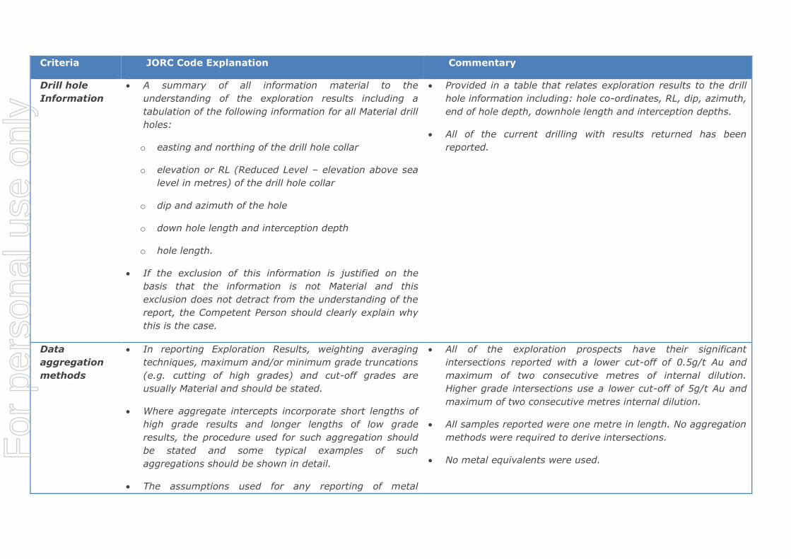
Drill hole
Information
A summary of all information material to the
understanding of the exploration results including a
tabulation of the following information for all Material drill
holes:
o easting and northing of the drill hole collar
o elevation or RL (Reduced Level – elevation above sea
level in metres) of the drill hole collar
o dip and azimuth of the hole
o down hole length and interception depth
o hole length.
If the exclusion of this information is justified on the
basis that the information is not Material and this
exclusion does not detract from the understanding of the
report, the Competent Person should clearly explain why
this is the case.
Provided in a table that relates exploration results to the drill
hole information including: hole co-ordinates, RL, dip, azimuth,
end of hole depth, downhole length and interception depths.
All of the current drilling with results returned has been
reported.
Data
aggregation
methods
In reporting Exploration Results, weighting averaging
techniques, maximum and/or minimum grade truncations
(e.g. cutting of high grades) and cut-off grades are
usually Material and should be stated.
Where aggregate intercepts incorporate short lengths of
high grade results and longer lengths of low grade
results, the procedure used for such aggregation should
be stated and some typical examples of such
aggregations should be shown in detail.
The assumptions used for any reporting of metal
All of the exploration prospects have their significant
intersections reported with a lower cut-off of 0.5g/t Au and
maximum of two consecutive metres of internal dilution.
Higher grade intersections use a lower cut-off of 5g/t Au and
maximum of two consecutive metres internal dilution.
All samples reported were one metre in length. No aggregation
methods were required to derive intersections.
No metal equivalents were used. For
per
sona
l use
onl
y

Criteria JORC Code Explanation Commentary
equivalent values should be clearly stated.
Relationship
between
mineralisation
widths and
intercept
lengths
These relationships are particularly important in the
reporting of Exploration Results.
If the geometry of the mineralisation with respect to the
drill hole angle is known, its nature should be reported.
If it is not known and only the down hole lengths are
reported, there should be a clear statement to this effect
(e.g. ‘down hole length, true width not known’).
Only selected historic exploration data related to the included
targets and prospects are presented.
Most of the drilling is perpendicular to the mineralisation;
however, in early exploration the dip direction is sometimes
uncertain and thus holes some holes can be drilled sub-parallel
to the mineralisation producing longer and higher grade
intersection than the true intercept. Quoted widths are down-
hole widths. True-widths are likely to be approximately 70-
90% of down-hole widths.
The drill hole orientations relative to the ore zones have
ensured accurate interpretations and 3D modelling.
Diagrams Appropriate maps and sections (with scales) and
tabulations of intercepts should be included for any
significant discovery being reported These should include,
but not be limited to a plan view of drill hole collar
locations and appropriate sectional views.
Significant exploration results are tabulated in the release with
drill hole plans to show them in context.
Representative maps have been included in the report along
with documentation.
Balanced
reporting
Where comprehensive reporting of all Exploration Results
is not practicable, representative reporting of both low
and high grades and/or widths should be practiced to
avoid misleading reporting of Exploration Results.
All of the current drill results have been reported for the
project.
Other Other exploration data, if meaningful and material, The outcrops of quartz veins have been previously mapped at
For
per
sona
l use
onl
y

Criteria JORC Code Explanation Commentary
substantive
exploration
data
should be reported including (but not limited to):
geological observations; geophysical survey results;
geochemical survey results; bulk samples – size and
method of treatment; metallurgical test results; bulk
density, groundwater, geotechnical and rock
characteristics; potential deleterious or contaminating
substances.
Bartons. The mineralisation at Bartons is primarily associated
with a combination of quartz veining, moderate foliation,
strong sericite alteration and strong limonite staining or pyrite
content. Higher grade mineralisation is associated with discrete
quartz veining.
Further work The nature and scale of planned further work (e.g. tests
for lateral extensions or depth extensions or large-scale
step-out drilling).
Diagrams clearly highlighting the areas of possible
extensions, including the main geological interpretations
and future drilling areas, provided this information is not
commercially sensitive.
These have been incorporated into a maiden Underground
MRE. Subsequently, a high level underground stope
optimisation will be carried to determine the likely economics.
Further RC drilling and diamond tails will be carried to infill,
extend and close off open mineralisation, if warranted.
Section 3 Estimation and Reporting of Mineral Resources
(Criteria listed in section 1, and where relevant in section 2, also apply to this section.)
Criteria JORC Code explanation Commentary
Database
integrity
Measures taken to ensure that data has not been
corrupted by, for example, transcription or keying
errors, between its initial collection and its use for
Mineral Resource estimation purposes.
Data validation procedures used.
Geological metadata is centrally stored in a SQL database and
is managed using DataShed Software. MOY employ a
database manager who is responsible for the integrity of data
imported and modified within the system.
Logging and sampling data is collected on LogChief software
and synchronised digitally to the database by the database
manager.
Collars of completed drill holes were surveyed with a Real
For
per
sona
l use
onl
y

Criteria JORC Code explanation Commentary
Time Kinematic (RTK) DGPS device. All collars were validated
against planned positions. Surveyed collar co-ordinates are
uploaded into the SQL database using LogChief software.
Grid datum used is GDA94 51K (East Pilbara).
Down hole surveys were taken using a single shot camera or
electronic multi-shot survey tool. Survey measurements are
entered into the LogChief software and digitally synchronised
to the SQL database.
Assay data is received from the laboratory in digital format.
Quality Assurance and Quality Control data is vetted prior to
uploading.
Drill holes, once uploaded, are checked visually within Surpac
software by MOY geologists.
MOY conducts regular database audits on collar, survey, and
assay metadata.
MOY Competent Person is responsible for the veracity of drill
hole data underpinning the Bartons Underground Mineral
Resources.
Entech understands MOY have suitable processes and due
diligence in place to ensure acceptable integrity of the drill
hole metadata underpinning the Mineral Resource. Entech
has utilised the drill hole data as supplied with data audits and
visual verification undertaken as part of the Entech due
diligence process.
The drill hole data, as supplied by MOY and underpinning the
resource, was considered in good standing and utilised for the
Mineral Resource.
For
per
sona
l use
onl
y

Criteria JORC Code explanation Commentary
The Mineral Resource incorporates drilling results available up
to, and including, 24th July 2017.
Site visits Comment on any site visits undertaken by the
Competent Person and the outcome of those visits.
If no site visits have been undertaken indicate why
this is the case.
Jill Irvin is the Competent Person for the Bartons Underground
Mineral Resource Estimate and is Principal Geologist at
Entech. Andrew Finch is a Senior Geologist at Entech and
undertook the mineralisation volume interpretations for the
MRE. Mr Finch visited the site on 12th and 13th July 2017.
Primary focus for the site visit was to observe, review, and
document drilling and sampling including:
o QAQC, practices;
o geological, collar, survey and assay data collection;
o data storage;
o data verification processes;
o drill hole core and open pit mapping comparison against
current understanding of mineralisation controls and
existing approach to mineralisation interpretation.
o Additionally, to discuss with site geologists observations
relating to historical mining at Bartons, particularly issues
or risks relating to mineralisation continuity and
reconciliation.
Outcomes from the site visit were utilised to aid interpretation
of mineralisation domains of the Barton Main and East Lodes,
and to assess any risk to the Mineral Resource from historical
mining and milling experience.
The site visit confirmed that drill hole data collection and
verification procedures, with respect to current and recent
For
per
sona
l use
onl
y

Criteria JORC Code explanation Commentary
drilling programs, appropriately managed and maintained data
integrity.
Geological
interpretation
Confidence in (or conversely, the uncertainty of) the
geological interpretation of the mineral deposit.
Nature of the data used and of any assumptions
made.
The effect, if any, of alternative interpretations on
Mineral Resource estimation.
The use of geology in guiding and controlling Mineral
Resource estimation.
The factors affecting continuity both of grade and
geology.
Geological and structural modelling of the mineralisation
controls within a regional framework was still underway for
Bartons at the time of the MRE. Lithology and structure are
considered the predominant controls on mineralisation.
Factors which limited the confidence of geological
interpretation included limited diamond drilling for
volume/structural identification and delineation; poor
consistency of logged lithological data due to the subjective
nature of logging the sandstone/siltstone interbedded host
lithology, and an absence of a structural model and
understanding of preferential structural orientations for high
grade mineralisation shoots.
Factors which aided the confidence of geological interpretation
included; strong strike and dip continuity of structural
‘corridor’ apparent in surface mapping, pit observations,
underground historical mapping, and drilling intercepts; close
spaced resource definition drilling (20 m x 20 m), grade
control drilling (10 m x 10 m) obtained during mining and/or
infill drilling within the pit extents, and historical stoping
voids. Note historical stope voids were compiled by MOY
geologists from historical documentation and paper records.
Entech considers confidence is high in the geological
interpretation and continuity of the Main Lode and East Lode
structures. The mineralisation orientation and continuity
within the Main and East Lodes is considered uncertain due to
the presence of a bimodal mineralisation population apparent
as high grade ‘shoots’. Consideration of these shoots within a
For
per
sona
l use
onl
y

Criteria JORC Code explanation Commentary
structural framework at Bartons would improve the confidence
for future estimates.
Mineralisation interpretations were informed by 804 Reverse
Circulation drill holes, four diamond drill holes, pit
mapping/observations and historical underground cross-cut
mapping.
Interpretation of mineralisation domain volumes was based on
a combination of geological logging (quartz percentage,
alteration halo) and a nominal minimum cut-off grade (2.0 to
3.0 g/t gold). Two mineralised domains (Main Footwall and
Main Hangingwall) were defined within the Bartons Main Lode,
and a third domain represented the East Lode.
For instances where the intercept was supported by geological
indicators of structural intersection (quartz percentage,
alteration halo), although mineralisation values fell below the
nominal cut-off, the intercept was included within the domain
due to the commodity and style of deposit.
Assumptions with respect to mineralisation continuity (strike
and dip) and shoot orientation within the underground Mineral
Resource were drawn directly from:
o historical underground mining documentation
o historical stope spatial locations, preferential orientations
and widths
o drive continuity
o underground cross-cut mapping
o these assumptions were then tested with geostatistical
For
per
sona
l use
onl
y

Criteria JORC Code explanation Commentary
analysis, using close spaced drill hole data at depth
(10 m x 10 m), prior to being applied within the Mineral
Resource Estimate where drill spacing was nominally
20 m x 20 m, and up to 40 m x 40 m.
Alternate interpretations would consider alternate preferential
orientations of the high grade shoots within the Main Lode FW,
Main Lode HW and East Lode.
Entech ran sensitivity interpretations using Leapfrog Software
to assess the influence of variable metal distributions (north
plunge, south plunge and isotropic). Metal content was
similar between northsouth orientations and varied up to
10% with an isotropic interpretation. Given the stage of the
Barton’s project Entech considers risk to the Mineral Resource
lies in the spatial location and projection of the high grade
shoots for detailed mine design. This risk can be mitigated
with infill drilling and targeted drilling to test the interpolated
shoot locations down plunge.
Weathering surfaces were interpreted by MOY geologists from
drill logging, and extended laterally beyond the limits of the
Mineral Resource model. The Bartons underground Mineral
Resource lies nominally 20m below the ‘top of fresh’
interpreted surface and therefore the weathering profile was
not taken into consideration during interpretation or
subsequent Mineral Resource estimation approaches.
Dimensions The extent and variability of the Mineral Resource
expressed as length (along strike or otherwise), plan
width, and depth below surface to the upper and
lower limits of the Mineral Resource.
Bartons Main Lode – comprises two sub-parallel stacked lodes
trending north-east and dipping steeply to the south-east.
The main lode is mineralised over a strike length of 1,000 m;
the mineralisation plan widths are highly variable, typically
For
per
sona
l use
onl
y

Criteria JORC Code explanation Commentary
ranging from 0.1 to 4.5 m.
Bartons East Lode – comprises a single lode trending east-
north-east and dipping steeply to the south-east.
The East Lode is mineralised over a strike length of 300 m;
the mineralisation plan widths are highly variable, typically
ranging from 0.1 to 3.5 m.
Depth from surface to the current vertical limit of the Mineral
Resource is approximately 360 m.
Mineralisation within the model which did not satisfy the
criteria for Mineral Resource remained unclassified.
Estimation
and modelling
techniques
The nature and appropriateness of the estimation
technique(s) applied and key assumptions, including
treatment of extreme grade values, domaining,
interpolation parameters and maximum distance of
extrapolation from data points. If a computer
assisted estimation method was chosen include a
description of computer software and parameters
used.
The availability of check estimates, previous
estimates and/or mine production records and
whether the Mineral Resource estimate takes
appropriate account of such data.
The assumptions made regarding recovery of by-
products.
Estimation of deleterious elements or other non-
grade variables of economic significance (eg sulphur
Interpretations of domain continuity were initially undertaken
within Geovia SurpacTM software, with mineralisation
intercepts correlating to the Main and East Lodes manually
selected prior to creation of a vein model within Leapfrog
implicit modelling software. Interpretation was a collaborative
process with MOY Geologists to ensure modelling
appropriately represented observations and current
understanding of geology and mineralisation controls.
A two dimensional (“2D”) Ordinary Kriging interpolation
approach was selected for the MRE to address some of the
main issues encountered when estimating narrow vein
mineralisation, such as those at Bartons, which were:
Additivity issues due to non-uniform support and resulting
grade bias. Instances of highly variable individual intercepts
(e.g. 0.1 m to 4.5 m) which would be difficult to incorporate
and represent statistically using downhole composites of equal
lengths (e.g. 0.5, 1.0 or 2.0 m);
For
per
sona
l use
onl
y

Criteria JORC Code explanation Commentary
for acid mine drainage characterisation).
In the case of block model interpolation, the block
size in relation to the average sample spacing and
the search employed.
Any assumptions behind modelling of selective
mining units.
Any assumptions about correlation between
variables.
Description of how the geological interpretation was
used to control the resource estimates.
Discussion of basis for using or not using grade
cutting or capping.
The process of validation, the checking process used,
the comparison of model data to drill hole data, and
use of reconciliation data if available.
Varying mineralisation geometry across lode, down dip, and
along strike; and
Block size required for adequate volume fill of narrow
geometry is generally too small, introducing conditional bias
to the MRE outcome.
Drillholes were composited for the full width of the domain
intercept, followed by calculation of width by draping against
hangingwall and footwall surfaces and then accumulation by
multiplication of intercept grade by width.
Composited sample data, was pressed onto a cartographic
plane and statistical analysis undertaken on accumulation,
width and grade variables to assist with determining
estimation search parameters, top-cuts etc.
Assessment and application of top-cutting for the 2D estimate
was undertaken on the gold accumulation variable, with a top
cut being applied to East Lode (Domain 3) and 3.44% metal
reduction after cutting.
Variography analysis of individual domains was undertaken on
gold accumulation variables in 2D space, followed by
Qualitative Kriging Neighbourhood Analysis to assist with
determining appropriate search parameters.
The 2D block models for interpolation were created using a
block size of 10 mN x 10 mRL x 1 mE with no sub-celling.
Considerations relating to appropriate block size include:
drillhole data spacing: conceptual mining method SMU
analysis: variogram continuity ranges and search
neighbourhood optimisations.
For
per
sona
l use
onl
y

Criteria JORC Code explanation Commentary
Grade estimation was then undertaken of cut gold
accumulation and width with Ordinary Kriging. There were no
assumptions made about recovery.
Post estimation, gold was calculated by dividing estimated
accumulation by width. Back calculated gold value were
transformed from 2D to 3D and pressed across the full width
of the corresponding domain in the final host compilation
model.
There was no assumptions made with respect to by-product.
No estimation was made for deleterious elements or other
non-grade variables.
Compilation of the 2D models in 3D, along with estimation of
the low-grade halo material, was carried out in a master block
model with a 5 mE x 10 mY x 10 mRL parent blocks and sub-
celled to 0.3125 mE x 0.625 mY x 0.1325 mRL to honour
wireframe volumes.
Only Diamond and RC data was utilised during the estimate.
Average sample spacing is variable ranging from 10 m x 10 m
within 50m of topographic surface to a nominal 40 m x 40 m
in the upper portions of the underground resource and 100m
x 100m at depth (approximately greater than 220m).
The 2D estimation technique assumes full horizontal
extraction of the modelled vein.
The assumption of intrinsic correlation between grade and
horizontal width was tested with variography as part of the 2D
estimate and prior to back-calculation of gold.
The geological interpretation was used as a hard boundary for
For
per
sona
l use
onl
y

Criteria JORC Code explanation Commentary
volume delineation as well as containment of the imported 2D
estimate. Imported 2D block values were applied across the
full width of the domain volume.
Check estimates for each vein were carried out in 3D using
Inverse Distance Squared and a Dynamic Anisotropy
approach. Both accumulation and horizontal width were
estimated before back calculation of the check estimate gold
grade. Outcomes were within 5% metal ounces of the
reported MRE resource.
Validation of the accumulation and horizontal width estimates
as well as the back calculated gold was completed by visual
inspection in 2D and 3D as well as global statistical and swath
analysis.
No deposit specific reconciliation data was available at the
time of publication.
Moisture Whether the tonnages are estimated on a dry basis
or with natural moisture, and the method of
determination of the moisture content.
The tonnages were estimated on a dry basis.
Cut-off
parameters
The basis of the adopted cut-off grade(s) or quality
parameters applied.
The Mineral Resource cut-off grade for reporting was 2.0 g/t
gold. This was based upon conceptual economic evaluations,
and consideration of comparable size deposits of similar
mineralisation style and tenor.
Mining factors
or
assumptions
Assumptions made regarding possible mining
methods, minimum mining dimensions and internal
(or, if applicable, external) mining dilution. It is
always necessary as part of the process of
determining reasonable prospects for eventual
economic extraction to consider potential mining
It was assumed that the deposit could be potentially mined
via medium to small scale mechanised underground mining
methods. This assumption was based on conceptual economic
evaluations and extraction methodologies utilised in
comparable size deposits of similar mineralisation style and
For
per
sona
l use
onl
y

Criteria JORC Code explanation Commentary
methods, but the assumptions made regarding
mining methods and parameters when estimating
Mineral Resources may not always be rigorous.
Where this is the case, this should be reported with
an explanation of the basis of the mining
assumptions made.
tenor.
No dilution or cost factors have been applied to the estimate.
The MRE extends nominally 220 m below surface. Entech
considers material at this depth suitable to consider a
reasonable prospect of eventual economic extraction within an
underground mining framework.
Metallurgical
factors or
assumptions
The basis for assumptions or predictions regarding
metallurgical amenability. It is always necessary as
part of the process of determining reasonable
prospects for eventual economic extraction to
consider potential metallurgical methods, but the
assumptions regarding metallurgical treatment
processes and parameters made when reporting
Mineral Resources may not always be rigorous.
Where this is the case, this should be reported with
an explanation of the basis of the metallurgical
assumptions made.
Metallurgical testwork undertaken on recent drilling data (143
samples) indicated a gold recovery in fresh ore material
ranging from 57.7% to 99.7% from leachwell analysis. The
average gold recovery for fresh material beneath the current
pit design is 85%. Higher grade material returned better gold
recoveries than lower grade.
Testwork is in early stages and optimisation studies are
underway at the time of the Mineral Resource to test variable
grind and treatment options for increased recovery.
Historically, graphitic shales when mixed with ore affected
recovery outcomes, and this material forms part of upcoming
testwork. However, it is also noted that the treatment options
to be tested were not available historically and that graphitic
shales are stratigraphically constrained, discrete, localised
occurrences near mineralisation but not coincident with
mineralisation.
No recovery factors have been applied to the Mineral
Resources or Resource Tabulations.
Environmen-
tal factors or
assumptions
Assumptions made regarding possible waste and
process residue disposal options. It is always
necessary as part of the process of determining
Environmental surveys have been completed within the
Bartons project and expected infrastructure areas, including
flora and fauna surveys and surface water assessments
For
per
sona
l use
onl
y

Criteria JORC Code explanation Commentary
reasonable prospects for eventual economic
extraction to consider the potential environmental
impacts of the mining and processing operation.
While at this stage the determination of potential
environmental impacts, particularly for a greenfields
project, may not always be well advanced, the status
of early consideration of these potential
environmental impacts should be reported. Where
these aspects have not been considered this should
be reported with an explanation of the environmental
assumptions made.
required for ongoing approvals. These assessments will
compliment previous surveys and studies and will lead into
the assessment for Bartons Underground. Heritage surveys
have been completed over the Bartons resource and likely
infrastructure areas.
Bulk density Whether assumed or determined. If assumed, the
basis for the assumptions. If determined, the method
used, whether wet or dry, the frequency of the
measurements, the nature, size and
representativeness of the samples.
The bulk density for bulk material must have been
measured by methods that adequately account for
void spaces (vugs, porosity, etc), moisture and
differences between rock and alteration zones within
the deposit.
Discuss assumptions for bulk density estimates used
in the evaluation process of the different materials.
Bulk density (223 records) was determined using the following
methods:
Diamond Drilling – weight in air / weight in water –
measurements every 0.2 m in fresh. Approximately 0.1 m
core length per sample.
SGs for drillhole BARD0006 were obtained using the Calliper
method – ~ 0.15 m long core lengths were selected, ends cut
to produce a cylinder, with diameter measured 3 times to give
average diameter and measured length of cylinder to calculate
a volume. Weighed undried and dried in the onsite oven for 24
hours and weighed again. Dry density = dry weight/ volume.
Displacement method (DIS) testing was carried out by SGS
Pty Ltd.
Specific gravity measurements were grouped into oxidation
and lithology domains defined in the geological model. Mean
values were applied as a dry bulk density factor on this basis.
Blocks were assigned densities using weathering classification
For
per
sona
l use
onl
y

Criteria JORC Code explanation Commentary
(oxide, transition or fresh).
Classification The basis for the classification of the Mineral
Resources into varying confidence categories.
Whether appropriate account has been taken of all
relevant factors (ie relative confidence in
tonnage/grade estimations, reliability of input data,
confidence in continuity of geology and metal values,
quality, quantity and distribution of the data).
Whether the result appropriately reflects the
Competent Person’s view of the deposit.
Mineral Resources have been classified on the basis of
geological and grade continuity confidence, geological
domaining, estimation quality parameters and nominal drill
spacing.
The delineation of Indicated and Inferred Mineral Resources
appropriately reflect the Competent Person’s view on the
deposit.
Consideration has been taken of all factors material to the
Mineral Resource outcomes including but not limited to:
confidence in volume and grade delineation, continuity and
preferential orientation of high grade shoots; quality of data
underpinning Mineral Resources: historical mining stope and
drive continuity: mineralisation continuity experienced during
open pit operations and variability of alternate volume
interpretations and grade interpolations (sensitivity analysis).
In addition to the above factors the classification process
considered nominal drill hole spacing and estimation quality
(conditional bias slope, number of samples).
Indicated Mineral Resources were defined where a moderate
level of geological confidence in geometry, continuity and
grade was demonstrated, and were identified as areas where:
o Good support from drilling – averaging a nominal 20 m or
less between drill holes; and
o Estimation quality was considered reasonable, as
delineated by a conditional bias slope above 0.6.
Inferred Mineral Resources were defined where a low level of
For
per
sona
l use
onl
y

Criteria JORC Code explanation Commentary
geological confidence in geometry, continuity and grade was
demonstrated, and were identified as areas where:
o Drill spacing was averaging a nominal 40 m or less, or
where a drill hole was within 50 m of the block estimate;
and
o Estimation quality was considered low, as delineated by a
conditional bias slope between 0.2 – 0.6.
Audits or
reviews
The results of any audits or reviews of Mineral
Resource estimates.
Internal Audits and peer review were undertaken by Entech
with a focus on independent resource tabulation; block model
validation; verification of technical inputs, and approaches to
domaining, interpolation and classification.
Discussion of
relative
accuracy/
confidence
Where appropriate a statement of the relative
accuracy and confidence level in the Mineral
Resource estimate using an approach or procedure
deemed appropriate by the Competent Person. For
example, the application of statistical or
geostatistical procedures to quantify the relative
accuracy of the resource within stated confidence
limits, or, if such an approach is not deemed
appropriate, a qualitative discussion of the factors
that could affect the relative accuracy and confidence
of the estimate.
The statement should specify whether it relates to
global or local estimates, and, if local, state the
relevant tonnages, which should be relevant to
technical and economic evaluation. Documentation
should include assumptions made and the procedures
used.
Variances to the tonnage, grade, and metal of the Mineral
Resource estimate is expected with further definition drilling.
It is the opinion of the Competent Persons that these
variances will not significantly affect economic extraction of
the deposit.
The Mineral Resource statement relates to global tonnage and
grade estimates.
No formal confidence intervals nor recoverable resources were
undertaken or derived.
With respect to Mineral Resources estimated at the deposits,
the geological interpretation for geology, weathering, and
mineralisation domains are adequate for the estimation of
Indicated and Inferred Mineral Resources.
Discussions were held with site geologists who retain tacit
knowledge of the Bartons’ pit production performance. It was
conveyed that reconciliation and continuity issues were rare at
For
per
sona
l use
onl
y

Criteria JORC Code explanation Commentary
These statements of relative accuracy and confidence
of the estimate should be compared with production
data, where available.
the Bartons pit. However, no raw data was available to
independently conclude this information.
For
per
sona
l use
onl
y