Fog Forecasting at Roissy Airport (Paris) with 1D model Thierry Bergot and Joël Noilhan...
13
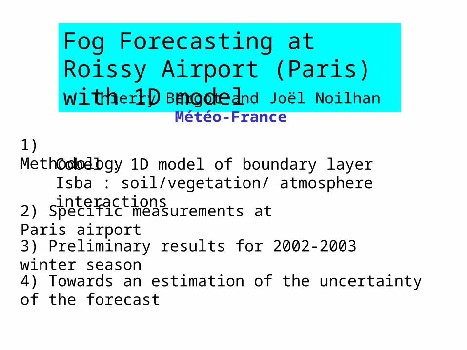
Fog Forecasting at Roissy Airport (Paris) with 1D model Thierry Bergot and Joël Noilhan Météo-France 1) Methodology Cobel : 1D model of boundary layer Isba : soil/vegetation/ atmosphere interactions 2) Specific measurements at Paris airport 3) Preliminary results for 2002-2003 winter season 4) Towards an estimation of the uncertainty of the forecast
-
date post
18-Dec-2015 -
Category
Documents
-
view
216 -
download
1
Transcript of Fog Forecasting at Roissy Airport (Paris) with 1D model Thierry Bergot and Joël Noilhan...
Fog Forecasting at Roissy Airport (Paris) with 1D model
Thierry Bergot and Joël NoilhanMétéo-France
1) MethodologyCobel : 1D model of boundary layerIsba : soil/vegetation/ atmosphere interactions
2) Specific measurements at Paris airport
3) Preliminary results for 2002-2003 winter season
4) Towards an estimation of the uncertainty of the forecast

•6th world airport in term of aircraft landing•42 days / year of fog (visibility < 600m)•Saturation during fog events : it is necessary to improve the forecast of low visibility at very short range (1 to 6 hours)
Roissy (Paris) airport
Research at Météo-France
•Beginning of a research program in 2002•Goal : study how to improve the forecast of low visibility at very short range for specific site (numerical model, observations)•Roissy : selected site for testing the method

Mesoscale terms•Advections•Geostrophic wind•clouds
Turbulent processes (stable cases)
Radiative processes (IR+vis)
Microphysical processes (condensation-evaporation, sedimentation)
Exchanges between soil, vegetation and atmosphereISBA
COBEL
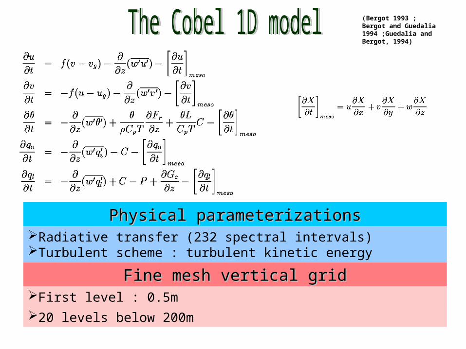
Fine mesh vertical gridFine mesh vertical gridFirst level : 0.5m
20 levels below 200m
(Bergot 1993 ; Bergot and Guedalia 1994 ;Guedalia and Bergot, 1994)
Physical parameterizationsPhysical parameterizationsRadiative transfer (232 spectral intervals)Turbulent scheme : turbulent kinetic energy
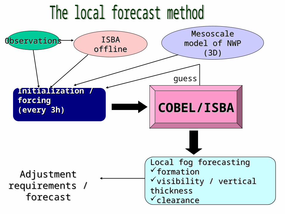
Initialization / forcing Initialization / forcing (every 3h)(every 3h)
ObservationsObservations ISBA offlineISBA offline
COBEL/ISBACOBEL/ISBA
Local fog forecastingLocal fog forecastingformationformationvisibility / vertical thickness visibility / vertical thickness clearanceclearance
Adjustment Adjustment requirements / forecastrequirements / forecast
guess
Mesoscale model of Mesoscale model of NWP (3D)NWP (3D)

30 meters height tower : measurement of temperature and
humidity at 1, 5 10, 20, 30m
observations near the ground :• temperature and water content inside the soil• radiative fluxes

observations at 45m :• radiative fluxes• temperature / humidity
Other instruments :• Sodar (detection of the fog top)• 12 PTA (RVR) (visibility)• 4 cloud telemetersbeginning : December 2002
data : mean every 15 minutes

Number of events not enough for statistical evaluation10 events in December 2002-March2003 periodrepresentativeness of these events?
Requirement of local observationsthe forecast of mesoscale NWP model is not precise enough to initialize the local COBEL/ISBA model
Forecast performancefog piloted by the radiative processes are well forecasted (3 hours)the effect of the mesoscale processes (advection, clouds) is predominant after 3-6 hours
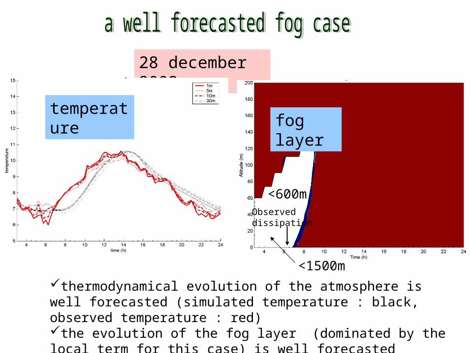
28 december 2002
temperature
thermodynamical evolution of the atmosphere is well forecasted (simulated temperature : black, observed temperature : red)the evolution of the fog layer (dominated by the local term for this case) is well forecasted
fog layer
Observed dissipation
<600m
<1500m
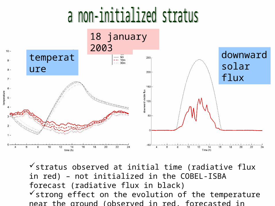
18 january 2003
temperature
stratus observed at initial time (radiative flux in red) – not initialized in the COBEL-ISBA forecast (radiative flux in black)strong effect on the evolution of the temperature near the ground (observed in red, forecasted in black)
downward solar flux
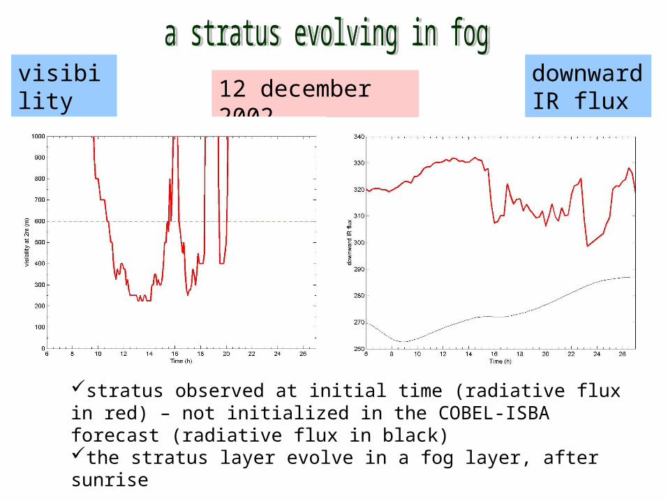
12 december 2002visibility at 2m
stratus observed at initial time (radiative flux in red) – not initialized in the COBEL-ISBA forecast (radiative flux in black)the stratus layer evolve in a fog layer, after sunrise
downward IR flux

Not enough documented cases !
The field experiment will continue in Roissy!The field experiment will continue in Roissy!
•situations dominated by local effect are well forecasted•influence of mesoscale forcing after 3-6h•importance of the low level clouds (initialization)
Some preliminary results

Study of fog predictability
statistical postprocessing of COBEL-ISBA forstatistical postprocessing of COBEL-ISBA foreecastcast :•local parameters (nocturnal inversion, etc)•physical processes (microphysics, etc)
ensemble forecastensemble forecast : •1D ensemble forecast (on PC!)•uncertainty on mesoscale forcing terms (clouds!)•uncertainty on local conditions
Optimal use of local observations
•atmosphere / soil : 1D-Var•low clouds : telemeters, radiative fluxes, sodar
How to use the local observations?How to use the local observations?