Floyds Fork Greenway Presentation of Greenway Concept & Trail Alternatives: Public Meeting #2 June...
17
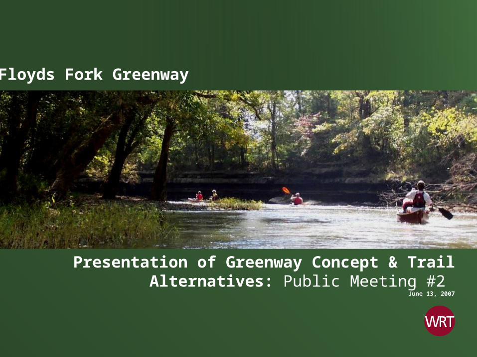
Floyds Fork Greenway Presentation of Greenway Concept & Trail Alternatives: Public Meeting #2 June 13, 2007
-
Upload
aleesha-williamson -
Category
Documents
-
view
216 -
download
0
Transcript of Floyds Fork Greenway Presentation of Greenway Concept & Trail Alternatives: Public Meeting #2 June...
Floyds Fork Greenway
Presentation of Greenway Concept & Trail Alternatives: Public Meeting #2
June 13, 2007
Floyds Fork Greenway…at the Edge of the 21st Century
Floyds Fork Greenway

Floyds Fork Greenway
Floyds Fork Greenway
21st Century Parks, Inc.
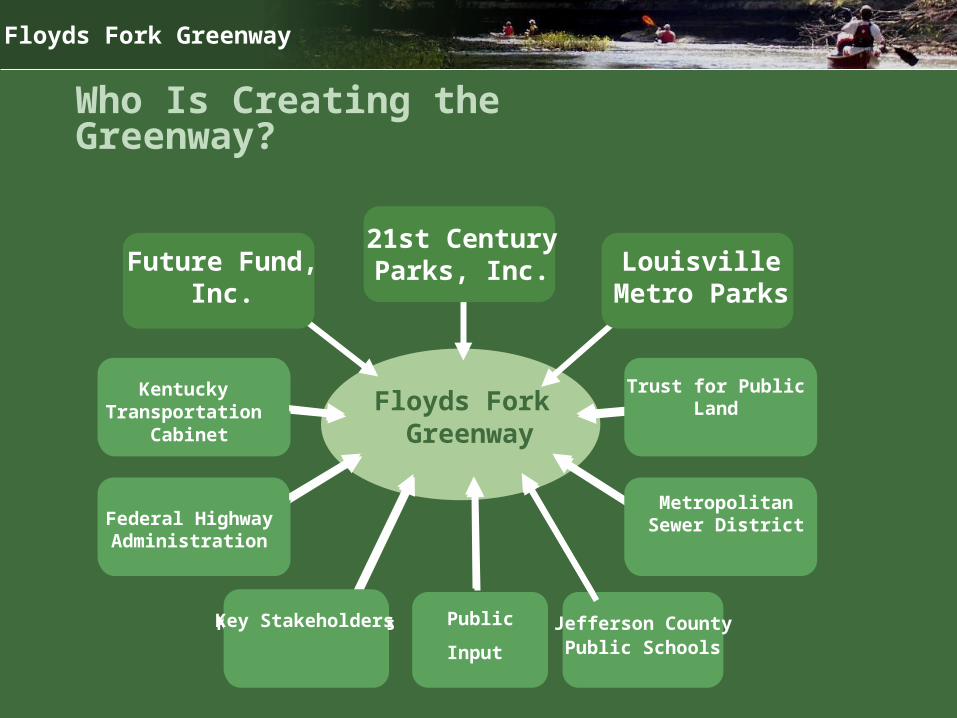
Who Is Creating the Greenway?
Future Fund, Inc. Louisville Metro Parks
Floyds Fork Greenway
Floyds Fork Greenway
21st Century Parks, Inc.
Who Is Creating the Greenway?
Future Fund, Inc. Louisville Metro Parks
Kentucky Transportation
Cabinet
Federal Highway Administration
Key Stakeholders
Metropolitan Sewer District
Trust for Public Land
Jefferson CountyPublic Schools
Public
Input
Kentucky Transportation
Cabinet
Federal Highway Administration
Key Stakeholders
Metropolitan Sewer District
Trust for Public Land

Floyds Fork Greenway
WRT Team
Wallace Roberts & Todd, LLC Park and Open Space Planning, Landscape Architecture, Architecture, Urban Design
John Milner Associates, Inc.
Cultural Resources, Regulatory Compliance
Biohabitats, Inc. / Eco-Tech, Inc.
Natural Resources
HNTB Corporation
Regulatory Compliance, Structural Engineering
Burgess and Niple Engineering
Civil Engineering

Floyds Fork Greenway
Agenda
• Introduction
• Inventory and Analysis Conclusions
• Recreation Needs Analysis and Feedback
• Action Program
• The Greenway Concept
• Metro Loop Trail Alternatives
• Public Feedback

Floyds Fork Greenway
Communication Goals for Tonight’s Meeting
Tonight’s presentation will explain:
– What we mean by a “greenway”– Where the parks and open spaces are, and who owns them – What is the “big idea” that underlies the greenway concept plan– Where the Metro Loop trail will be, and what alignment alternatives
exist– What activities might occur in the park

Floyds Fork Greenway
Key Points
1. Water: Floyds Fork is the most important feature of the Greenway.2. Green Infrastructure: The Greenway is a 21st Century Community Life
Support System, as critical to successful, sustainable community development as roads, sewers, utilities and schools.
3. Diverse Goals: The Greenway will give visitors opportunities to experience many different recreational activities woven into a variety of natural, cultural and agricultural resources.
4. Varied Character: The Greenway will change subtly in character from north to south, from culturally-based and active recreation to naturally-based and more passive recreation.
5. Firm Foundation: Greenway Plan is derived from public input and the opportunities and constraints of existing natural and cultural resources.

Floyds Fork Greenway
OCTOBER ‘06 FEBRUARY ‘07
Phase 1: Project Initiation
Inventory and
Analysis Summary
Land Ownership Analysis
Park and Open Space Needs
Analysis
Natural Resources Analysis
Cultural and Scenic
Resources Analysis
4Land
Acquisition Concepts
Activity and Facility
Programming
Water Quality/Habitat
Concepts
Interpretive Framework Concepts
Concept Alternat-
ives
Select Preferred
NEPA / CE Process
Schematic Design Process
Draft Master
Plan Documents
FinalMaster
Plan Documents
Phase 2: Inventory & Analysis
Phase 3: Conceptual Alternatives
Phase 4: Master Plan Dev.
Phase 5: Draft & Final Plan
Public Forum
Public Forum
Public Forum
Public Forum
Park Components
Park System Recommenda-
tions
Implementation Program
Design Guidelines
Data Collection and
Review
Stakeholder Interviews
Tour of Floyd’s Fork
Basin
JUNE ‘07 FALL WINTER
The Planning Process

Floyds Fork Greenway
For Future Public Review
This presentation is focused on understanding the greenway and the trail system.
In the fall there will be opportunity for public review of: • Potential locations for recreation uses and facilities• Potential locations for environmental education and interpretation of
historic sites• The park road system

Floyds Fork Greenway
What is a Greenway?
• A linear open space frequently located along a watercourse
• A mix of park, recreation, conservation, and transportation features
• A range of public, non-profit, and cooperative ownership types
• A wide range of activities and land management approaches
• A community amenity and frontage for adjacent development

Floyds Fork Greenway
Summary of Inventory and Analysis
Aerial oblique photography by Michael Mason Frank

Floyds Fork Greenway
Supports Mayor’s Healthy Hometown Movement
Floyds Fork Greenway
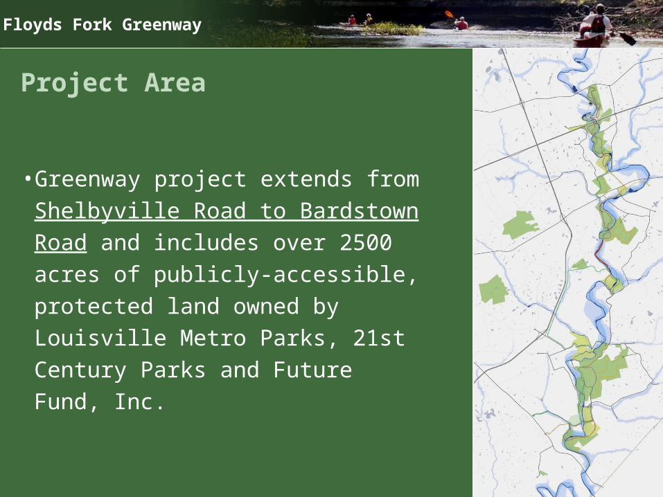
Project Area
• Greenway project extends from Shelbyville Road to Bardstown Road and includes over 2500 acres of publicly-accessible, protected land owned by Louisville Metro Parks, 21st Century Parks and Future Fund, Inc.
Floyds Fork Greenway
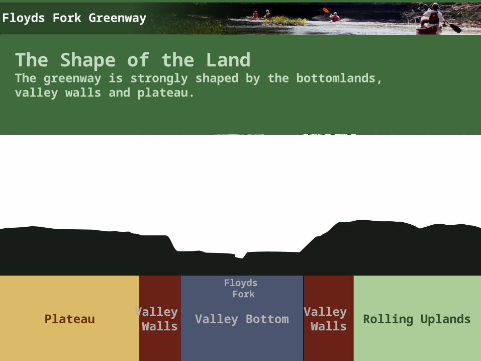
The Shape of the LandThe greenway is strongly shaped by the bottomlands, valley walls and plateau.
Plateau Valley Bottom Rolling UplandsValley Walls
Valley Walls
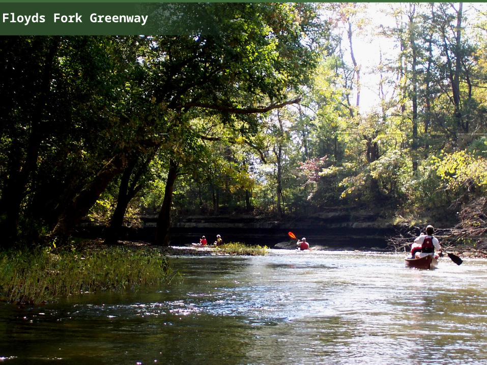
Floyds Fork

Floyds Fork Greenway
Inventory and Analysis TopicsThe plan is based on a broad and evolving understanding of the planning context and the natural and cultural resources of the project area.
Prehistoric Cultural Resources
Archaeology
Historic Cultural Resources• Historic Architecture• Cultural Landscape• Thematic Resources
– Transportation– Residential– Religious / Military / Ethnic– Agricultural
Natural Systems• Geology• Groundwater Hydrology• Surficial Hydrology• Soils
– Depth to Bedrock– Hydric Soils– Prime Agricultural Farmland
• Vegetation• Land Cover• Rare, Threatened and
Endangered Species • Habitat Sensitivity / Potential
Analysis
Contemporary Planning Context • Land Cover • Community Form • Viewshed Analysis• Design Review Overlay District
Regulations• Regulatory Framework• Transportation Projects• Utilities• Special Places and Recreational
Facilities

Floyds Fork Greenway
Analysis Summary
• The northern greenway is more developed, accessible, and fragmented than the southern greenway.
As a result of this:• There are more opportunities for easily accessible
active community facilities in the north.• There are more opportunities for conservation-based
activities in the south.