
FITCHBURG RECONNAISSANCE REPORT - … Heritage Landscape Inventory Program 1 Fitchburg...
34
FITCHBURG RECONNAISSANCE REPORT FREEDOM’S WAY LANDSCAPE INVENTORY MASSACHUSETTS HERITAGE LANDSCAPE INVENTORY PROGRAM Massachusetts Department of Conservation and Recreation Freedom’s Way Heritage Association
Transcript of FITCHBURG RECONNAISSANCE REPORT - … Heritage Landscape Inventory Program 1 Fitchburg...

FITCHBURG RECONNAISSANCE REPORT
FREEDOM’S WAY LANDSCAPE INVENTORY
MASSACHUSETTS HERITAGE LANDSCAPE INVENTORY PROGRAM
Massachusetts Department of Conservation and Recreation
Freedom’s Way Heritage Association

PROJECT TEAM Massachusetts Department of Conservation and Recreation Jessica Rowcroft, Preservation Planner Division of Planning and Engineering Freedom’s Way Heritage Association Mary Whitney, President Marge Darby, Chair, Advisory Committee Project Consultants Shary Page Berg Gretchen G. Schuler Local Project Coordinators Mary McCaffrey, Office of Planning Coordinator David Streb, Office of Planning Coordinator Local Heritage Landscape Participants Samuel Blair Keith Chenot David Clark Ellen DiGeronimo Mike Donnelly Tom Donnelly Phyllis Eckfeldt Kelly Hertel Ken Jones David McCaffrey Mary McCaffrey Mary Ellen McKenna Michael McLaughlin John McNamara Dan Mylott Rosemary Reynolds Susan Roetzer Roger Rose David Streb Terri Thomas Mary Whitney June 2006 Cover Photographs Pleasant Street Neighborhood Mount Elam Road Coggshall Park

CONTENTS Introduction . . . . . . . . . . . . . . . . . . . . . . . . . . . . . . . . . . . . . . . . . . . . . . . . . . . . .1 Fitchburg History . . . . . . . . . . . . . . . . . . . . . . . . . . . . . . . . . . . . . . . . . . . . . . . . 2 Priority Heritage Landscapes . . . . . . . . . . . . . . . . . . . . . . . . . . . . . . . . . . . . . . 3 Academy Street School – The Annex Coggshall Park Dean Hill Cemetery Mt. Elam Road Nashua River The Patch Neighborhood Prichard – Pleasant Streets Neighborhood The Rapids Footpath System Rollstone Hill Upper Common Area Waites Corner Critical Concerns . . . . . . . . . . . . . . . . . . . . . . . . . . . . . . . . . . . . . . . . . . . . . . . 14 Churches and Steeples as Social and Physical Place Makers Federal and Greek Revival Brick Buildings Granite Walls Stone-Arched Bridges Topics of Interest Existing Resource Documentation and Planning Tools . . . . . . . . . . . . . . . . 16 Inventory of Historic and Archaeological Assets State and National Registers of Historic Places Planning Documents and Tools General Preservation Planning Recommendations . . . . . . . . . . . . . . . . . . . . 18 Inventory of Heritage Landscapes National Register Program Downtown and Neighborhood Character Agricultural Landscapes Scenic Roads Funding of Preservation Projects Conclusion . . . . . . . . . . . . . . . . . . . . . . . . . . . . . . . . . . . . . . . . . . . . . . . . . . . . . 22 Appendix: Heritage Landscapes Identified by Community . . . . . . . . . . . . 24
Massachusetts Heritage Landscape Inventory Program 1 Fitchburg Reconnaissance Report
INTRODUCTION The Freedom’s Way Heritage Association includes 37 Massachusetts communities that are linked by historic events that helped to shape America’s democratic form of governance and the intellectual traditions that underpin American freedom, democracy, conservation and social justice. Freedom’s Way communities extend from Arlington on the east to Winchendon on the west. They represent a wide range of cities and towns, each shaped by the relationship between nature and culture. Heritage landscapes are special places created by human interaction with the natural environment that help define the character of a community and reflect its past. They are dynamic and evolving; they reflect the history of a community and provide a sense of place; they show the natural ecology that influenced land use patterns; and they often have scenic qualities. The wealth of landscapes is central to each community’s character, yet heritage landscapes are vulnerable and ever changing. For this reason it is important to take the first steps towards their preservation by identifying those landscapes that are particularly valued by the community – a favorite local farm, a distinctive neighborhood or mill village, a unique natural feature or an important river corridor. To this end, the Massachusetts Department of Conservation and Recreation (DCR) and the Freedom’s Way Heritage Association (FWHA) have collaborated to bring the Heritage Landscape Inventory program (HLI) to communities in the Freedom’s Way area. The primary goal of the program is to help communities identify a wide range of landscape resources, particularly those that are significant and unprotected. The focus is on landscapes that have not been identified in previous survey efforts in a given community. Another important goal of the program is to provide communities with strategies for preserving heritage landscapes. The methodology for the Heritage Landscape Inventory program was developed in a pilot project conducted in southeast Massachusetts and refined in Essex County. It is outlined in the DCR publication Reading the Land which has provided guidance for the program since its inception. In summary, each participating community appoints a Local Project Coordinator (LPC) to assist the DCR-FWHA consulting team. The LPC organizes a heritage landscape identification meeting at which interested residents and city officials offer community input by identifying heritage landscapes. This meeting is followed by a fieldwork session including the consulting team and the LPC, often accompanied by other community members. This group visits the priority landscapes identified in the meeting and gathers information about the community. The final product is this Reconnaissance Report, prepared for each participating community. It outlines the history of the community; describes the priority heritage landscapes; discusses planning issues identified by the city; identifies planning tools available in the community; and concludes with preservation recommendations. A list of all of the heritage landscapes identified by the community is included in the Appendix.

Massachusetts Heritage Landscape Inventory Program 2 Fitchburg Reconnaissance Report
FITCHBURG HISTORY
The Nashua River and the hills and valleys form a most dramatic topographical landscape in this unique city in the Freedom’s Way Heritage Area. Trails that ran along the river, three east-west routes through this territory and some confirmed sites indicate Native American activity near these waterways – rivers and ponds. European settlement began in 1719 when Fitchburg was known as South Town. This area was incorporated as Lunenburg in 1728. In 1764 the western section of Lunenburg was set off as a separate town called Fitchburg and the new town’s first meetinghouse was built soon after in 1766. The population grew slowly in the town’s early years so that by the 1760s only 250 residents lived here. This changed in the third quarter of the 18th century when the population grew substantially to 643 by the end of the Revolution and doubled to over 1,200 by 1790.
Fitchburg’s topography of steep rocky terrain and pine and walnut forests was not as conducive to farming as some other areas in the region, so during the 18th century there were only scattered farmsteads. The town’s industrial history took root from ca. 1750 when the Kimball family established the first grist mill on the upper part of the Nashua River near Punch Brook where they built a dam. A second dam was constructed in 1794 for a saw mill and textile mill. Additional dams were built in the early 19th century and manufacturing on the Nashua was firmly established with a paper mill (1803), the Fitchburg Cotton Manufacturing Corporation (1807) and other companies producing chairs, scythe and edge tools, as well as machine shops.
Just as these early industries were being constructed the Fifth Massachusetts Turnpike passed through Fitchburg in 1800, followed by the North Branch Turnpike in 1805. A pivotal change in industrial activity occurred with the arrival of the first railroad line, the Fitchburg Railroad which connected Boston (Charlestown) with Fitchburg in 1844, and the Vermont & Massachusetts Railroad in 1847. Other lines – the Fitchburg & Worcester RR, the Agricultural Branch Railroad (Boston, Clinton & Fitchburg RR), and the Troy & Greenfield Railroad – ran through Fitchburg in the mid 19th century so that the town became the railroad crossroads of the region.
Improvements in transportation and growth of manufacturing industries led to continued population growth. Between 1790 and 1830 the number of residents doubled again to 2,169. This trend continued throughout the 19th century with an over 500% increase by 1872 when Fitchburg became a city with 11,260 residents. Immigrant workers were integral to the success of this industrial community with the Irish arriving to build the railroads followed by the French Canadians, Finns and English who worked in the many factories; in 1860 there were 136 industrial companies in Fitchburg.
Additional transportation arrived in the form of the Fitchburg Street Railway which opened in 1886. A steady rise in the industrial economy continued to the end of the 19th century. The need for immigrant workers paralleled industrial growth so that by the early 20th century the immigrant population comprised one-

Massachusetts Heritage Landscape Inventory Program 3 Fitchburg Reconnaissance Report
third of Fitchburg’s population and new groups to join those already here were Italians and Jews. By 1915 the population had reached nearly 40,000.
In the 1920s the industrial growth began to reverse and businesses as well as population declined. The Street Railway went out of business and use of the railroads also declined slightly with the rise of the automobile and the construction of regional highways such as the Mohawk Trail (now Route 2A) and the north-south Route 12 along Water Street and Main Street. By the close of the 20th century many industrial buildings were vacant and some railroad service had been abandoned. The population was even for some time; however, according to the 2000 Census, the city of Fitchburg’s population decreased since the 1990 Census. Fitchburg’s population is now estimated at 39,102.
PRIORITY HERITAGE LANDSCAPES Fitchburg's Heritage Landscape Identification meeting, attended by approximately 20 residents, some representing city boards and local non-profit organizations, was held on February 23, 2006. During the meeting residents compiled a lengthy list of the city's heritage landscapes, which is included in the Appendix. Once the comprehensive list was created, attendees were asked to articulate the value of each landscape and the issues relating to its preservation. Based on the information gathered, community members identified a group of priority landscapes to be visited by the consulting team during the fieldwork. Each of the priority landscapes is highly valued, contributes to community character and is not permanently protected or preserved.
These landscapes, which are listed alphabetically, represent a range of scales and types of resources from individual properties to entire neighborhoods. Several of
Massachusetts Heritage Landscape Inventory Program 4 Fitchburg Reconnaissance Report
these priority landscapes describe areas that have multiple layers. For example the east-west river corridor flows along forming boundaries to some neighborhoods that are considered heritage landscapes demonstrating the layering of landscapes. Such layering shows the complexity and interdependence that are characteristic of most heritage landscapes. The descriptions and recommendations included here are an initial step in identifying resources valued by the community and suggesting action strategies.
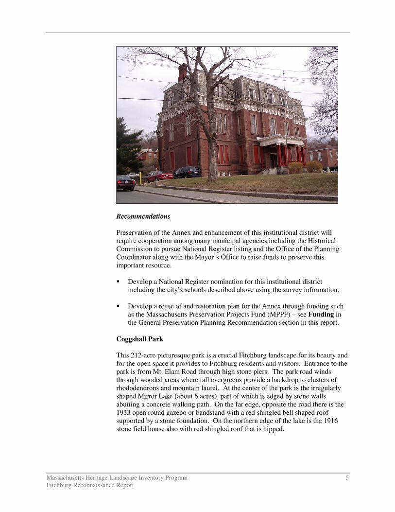
Academy Street School – The Annex
The Academy Street School (76 Academy Street), later known historically as the Annex to the former Fitchburg High School, is located on a knoll overlooking Academy Street. The site is framed by High Street on the west, Davis Street on the east and Pleasant Street on the north. The large three-story Second Empire structure built in 1869 has a grassy lawn between the building and Academy Street running in front of the building (the southern side). Several trees have been placed on this grassy lawn including one planted in 1924 in memory of Clara Barton, a Civil War nurse whose birthplace was in nearby Oxford. The brick building rests on a granite foundation and is covered by a slate mansard roof. The main five-bay block has a three-bay projecting pavilion with a centered projecting open entrance porch. Brownstone is used to trim windows, doors and form corner quoins as well as horizontal string courses marking the water table and the division between stories. Wood trim includes heavy brackets decorating the wide raking cornice, modillion blocks marking the cornice of the open porch and the segmental arched and pediment hoods of the roof dormers. This Annex is at the core of a small institutional district that represents a continuum in the history of Fitchburg’s schools and institutional buildings. West of the Annex is the B. F. Brown Junior High School (62 Academy Street, designed by J. D. Leland & Co., Architects in 1922) displaying the Classical Revival style. On the east side is the former Fitchburg High School, now called the Fitchburg Middle School (98 Academy Street, designed by Coolidge, Shepley, Bulfinch & Abbott in 1937) in front of which is the long flight of granite stairs (Wallace Way, 1903) leading from Academy Street down to Prichard Street. The Modern Classical style High School, which is long and horizontal, served as the High School until recently. Across High Street from the Annex is a high granite wall lining the sidewalk. Situated down below the west side of High Street, behind the Brown Middle School, now called the B.F. Brown Arts Vision School, is the historic City Stables, a distinctive 1885 brick building with slate roof. A new high school was built in 2000 at 140 Arn-How Farm Road. The Annex recently has been vacated and now is boarded up. Due to its deteriorated condition, lack of funds to rehabilitate and lack of re-use plan it is threatened by demolition. However this is an important local resource that is architecturally and historically significant.
Massachusetts Heritage Landscape Inventory Program 5 Fitchburg Reconnaissance Report
Recommendations Preservation of the Annex and enhancement of this institutional district will require cooperation among many municipal agencies including the Historical Commission to pursue National Register listing and the Office of the Planning Coordinator along with the Mayor’s Office to raise funds to preserve this important resource. � Develop a National Register nomination for this institutional district
including the city’s schools described above using the survey information. � Develop a reuse of and restoration plan for the Annex through funding such
as the Massachusetts Preservation Projects Fund (MPPF) – see Funding in the General Preservation Planning Recommendation section in this report.
Coggshall Park This 212-acre picturesque park is a crucial Fitchburg landscape for its beauty and for the open space it provides to Fitchburg residents and visitors. Entrance to the park is from Mt. Elam Road through high stone piers. The park road winds through wooded areas where tall evergreens provide a backdrop to clusters of rhododendrons and mountain laurel. At the center of the park is the irregularly shaped Mirror Lake (about 6 acres), part of which is edged by stone walls abutting a concrete walking path. On the far edge, opposite the road there is the 1933 open round gazebo or bandstand with a red shingled bell shaped roof supported by a stone foundation. On the northern edge of the lake is the 1916 stone field house also with red shingled roof that is hipped.
Massachusetts Heritage Landscape Inventory Program 6 Fitchburg Reconnaissance Report
The land and $14,500 for improvements were donated to the city by H. F. Coggshall in 1894. The 1916 Stonehouse at the head of the lake was built as a memorial to Mr. and Mrs. H. F. Coggshall. The city has been working with Bay State Forestry to develop a Forest Management Plan which includes a cutting plan to address the long term health of the woods. The management plan pays for itself through the sale of harvested timber. In addition there is a Friends of Coggshall Park working on raising funds and implementing plans for preservation of the resources in the park. Thus this heritage landscape is not threatened; however such an important resource would always benefit from additional stewardship as well as appreciation by the general public. Recommendations Preservation and public enjoyment of Coggshall Park will be enhanced if the Historical Commission and Historical Society work with the Parks and Recreation Department and the Friends of Coggshall Park. � Develop a brochure that tells the park’s history and provides a map with
trails and activities. � Engage boy and girl scouts and similar youth groups in park maintenance.
� Develop a maintenance plan with designated responsibilities. Dean Hill Cemetery This one-acre cemetery is located on Caswell Road, a dirt and gravel road at the top of Ashburnham Hill near the ca. 1777 Georgian Dean Hill Tavern (also known as Upton Tavern). The ancient burial ground, which is in a secluded location on a little-traveled road, has a moss-covered ground plane and is surrounded by a low dry-laid stone wall. The entrance is marked by tall triangular rough cut stones. Each has a shadow of a rectangular plaque with four holes of fasteners – part of the Daughters of the American Revolution (DAR) marker program in 1903. The plaques were installed in memory of Revolutionary soldiers including the names of those known from Fitchburg. Vandalism in 1974 resulted in the loss of the tablets. Within the burial ground there are some clusters of tall pine trees amongst the scattered slate and marble grave markers. Stones documenting burials from 1791 to 1901 are in various states of disrepair with broken and leaning stones as well as many that have been damaged by spray painted graffiti or by excessive moss and fungus growth. Monument conservation and protection is the most pressing issue, as loose stones present hazards to visitors to the cemetery and are highly vulnerable to theft.

Massachusetts Heritage Landscape Inventory Program 7 Fitchburg Reconnaissance Report
Recommendations Preservation of the Dean Hill Cemetery will require coordination between the Fitchburg Historical Commission and the Cemetery Commission. Most of Fitchburg’s survey of historic resources was completed nearly 30 years ago therefore it is appropriate to review and update this recording. � Document this burial ground by updating or completing a new Burial Ground
form using Massachusetts Historical Commission methodology. � Consult the DCR publication Preservation Guidelines for Municipally
Owned Historic Burial Grounds and Cemeteries for guidance on developing a preservation plan for this burial ground including identification and evaluation of the resources as well as preservation strategies.
Mt. Elam Road One of Fitchburg’s scenic roads is Mt. Elam Road which connects Route 2, a divided highway, with the downtown and is the primary access to Coggshall Park. The rural scenic character of this road is an important feature in Fitchburg and it was designated a scenic road when Fitchburg adopted the Scenic Road Act. Wooded areas on the east side of Mt. Elam Road border Coggshall Park. Stone piers mark the entrance to the park and are remnants of the former Coggshall estate that bordered Mt. Elam Road. Housing bordering the road is mixed from some historic properties to modest 1950s and 1960s ranches and some modern late 20th century modest structures. Part of the road is lined with stone walls and there are many mature trees forming canopies along sections of the roadway. Power lines cut through near the Route 2 end of the road. The character of the road can be partially preserved by enforcement of the Scenic Road Act which regulates the removal of trees and stone walls. Road widening and excessive cutting on private property, often as a result of demolition of

Massachusetts Heritage Landscape Inventory Program 8 Fitchburg Reconnaissance Report
modest housing for construction of large dwellings, changes the character of the road substantially; however such activities are not regulated by the Scenic Road Act. Recommendation Preservation of the character of Mt. Elam Road will require coordination and agreement between the Planning Coordinator and the Public Works Department. The Historical Commission may be the liaison encouraging such participation. Refer to Scenic Roads in the General Preservation Planning Recommendations section of this report. � Document resources along Mt. Elam Road on MHC forms. � Maintain the character of the road by enforcing the Scenic Road Act and by
consulting with the Fitchburg Public Works Department to ensure that the present pavement width is maintained and that tree trimming, particularly trimming that does not trigger a Scenic Road hearing, is conservative. Generally the Public Shade Tree hearings are held in conjunction with a Scenic Road hearing.
Nashua River This most vital resource has shaped the development of Fitchburg geologically and economically. The Nashua River, derived from the Native American word Nashaway (“river with the pebbled bottom”), has two branches that join near its origin at the Wachusett Reservoir just north of Worcester. Fitchburg is on the North Nashua River that flows from the west in a southeasterly direction through Fitchburg to join with the South Nashua River at Lancaster. From this confluence the Nashua River flows northeasterly to the Merrimack River in Nashua, New Hampshire. Just over 6.7 miles of the river’s length are in Fitchburg. The river has shaped the distinctive topography of the community, which includes a narrow flood plain (used in part for railroad lines), a bowl where the center evolved and upland areas separated from the flood plain by steep banks. These steep banks along much of the river accentuate the geology of the hills and valleys and cause the river to be relatively inaccessible and not very visible. The river is relatively shallow as it courses through the city as observed from the River Street Bridge. Many of the mills on the river at the city center are supported by high stone retaining walls, such as Mill B of the old Parkhill Manufacturing Company (356 Broad Street). Issues relating to the river have been pollution due to the many industries, reuse of the many mill buildings and access to the river, visually and physically.

Massachusetts Heritage Landscape Inventory Program 9 Fitchburg Reconnaissance Report
Recommendations The Nashua River Watershed Association, established in 1969, continues to be the leading advocate for clean water, open space protection along the river and appropriate land use adjacent to the river. Local efforts should be coordinated with the NRWA; however the emphasis locally is likely to be on access and re-use of mill buildings along the river. The Fitchburg Historical Commission should take the lead in documentation. � Document resources relating to the river on Massachusetts Historical
Commission inventory forms. This should be a priority. � Identify owners and land uses – historical and present uses – along the river
corridor. � Develop an interpretive plan of the river corridor explaining the historical
and present uses.
� Seek public points of access to the river. Conduct a visioning charrette to plan and develop points of access.
The Patch Neighborhood The neighborhood known as the Patch is located along the railroad and Water Street, between First and Fifth Streets. This immigrant neighborhood first was settled in the mid 19th century by Irish families who came to build the railroad and later work in the mills. Later it became predominately an Italian neighborhood and now it is home to many Latino households. The neighborhood was developed along a grid pattern in a relatively flat area just south of the river. Modest workers’ houses are situated on small lots. The large brick 1869 Gothic

Massachusetts Heritage Landscape Inventory Program 10 Fitchburg Reconnaissance Report
Revival St. Bernard’s Catholic Church (240 Water Street) with 1883 High Victorian Gothic Rectory is central to the neighborhood. Behind the Rectory and Church, is the old Convent, a ca. 1870s Second Empire building fronting on Middle Street. The parish once included two schools – Boys and Girls – both of which were replaced in the late 1960s and have since been demolished. The closing of the St. Bernard’s schools located here, as well as the lack of use of the convent has removed a certain level of activity and vibrancy in this neighborhood. The demolition of many modest houses for the construction of the Fitchburg Green housing development in the 1980s alters the neighborhood character substantially. Recommendations The Historical Commission is the appropriate agency to address documentation and preservation of this neighborhood. Although the church and rectory were documented about 30 years ago these records should be updated and possibly started anew due to changes in survey procedures. � Document the resources of this neighborhood on an MHC Area Form
augmented with some individual building forms for the church, rectory and convent.
� Work with Planning Coordinator to direct CDBG funds to rehabilitate
housing in this neighborhood in a historically sensitive manner. Prichard – Pleasant Streets Neighborhood High on the hill north of the river and overlooking the city is this mid-to-late 19th century neighborhood of commodious dwellings adjacent to the institutional area described above under Academy Street School. Pleasant Street is north and above Prichard Street; both run in an east-west direction from High Street easterly to Spring Street. Views west are of Rollstone Hill and south are of the city along the Nashua River. Houses on the north side of Pleasant Street are set up off the street with granite block retaining walls at the sidewalk. Most on Prichard Street have small front lawns separated from the sidewalk by low fences or granite curbs and low stone piers marking path entrances. Of particular note are the Wallace Way steps that lead from Prichard Street up to the entrance to the 1937 High School (built on the site of an early high school that burned in 1934). These broad granite steps (originally with bronze lighting fixtures that have since been removed) were designed by local architect Henry M. Francis and built in 1902. Early dwellings in the area were built in the Greek Revival style such as the Miles House (138 Pleasant Street, ca. 1830) and the Wood House (128 Prichard Street, ca. 1845). On Pleasant Street a full streetscape of gable front dwellings with Greek Revival and Italianate detail were constructed by the 1850s. An example of a spacious house in the Italianate style was the Towne-Billings House (114-116 Prichard Street, ca. 1857). Prichard Street also has a couple of brick row houses from the 1850s.

Massachusetts Heritage Landscape Inventory Program 11 Fitchburg Reconnaissance Report
Many of the dwellings have been converted to multiple family units while others have been taken over by professional or non-profit offices. These changes in use alter the neighborhood dynamic and often result in changes to the character of the buildings and their settings. Public amenities such as the steps, the Annex which is on the western edge of this neighborhood (see description above) and the Rapids (see description below) have not been maintained. Recommendations The Historical Commission is in the best position to take a leadership role in promoting the preservation of this neighborhood, which has been documented on an MHC area form. To preserve the integrity of this architecturally and historically significant neighborhood: � Prepare a National Register Nomination for the Prichard-Pleasant Street
neighborhood. � Develop a study report to consider a local historic district or a neighborhood
conservation district both of which will require ordinances and specific designations of this area in order to reap the benefits of the design review for changes that are visible from public ways. These districts are a way in which to preserve the neighborhood character and important architectural features. Refer to Downtown and Neighborhood Character in the General Preservation Planning Recommendations section of this report.
� Develop rehabilitation standards to assist property owners in preserving
character defining features of these architecturally significant properties. The Rapids Footpath System Known as “passways” these 19th century footpaths made of granite steps and asphalt surface were constructed in several different areas of the city to allow workers to walk up and down the hills without following the more circuitous route of the roads. A single pathway that remains is the Rapids Passway (ca. 1868) leading from Mt. Vernon Street down to Prichard Street. Although this route is visible, it is no longer passable due to fencing blocking the entrances, because of its hazardous condition. Parts of the pathway were covered with asphalt and had iron pipe railings installed; however presently the pathway is considered dangerous due to broken railings, deteriorating steps and pathway surface and its steepness. Parts of the passage appear to have been incorporated into private driveways; while other sections are clearly demarcated by chain link fencing separating the passage from private property. This footpath may be lost due to its condition, the lack of safety associated with a deteriorating steep path in the middle of the city and due to neighbor encroachment where fences do not define the edges.

Massachusetts Heritage Landscape Inventory Program 12 Fitchburg Reconnaissance Report
Recommendations The Rapids Passway described above has been documented on MHC inventory forms. Preservation would require restoration and reconstruction. The Historical Commission would have to initiate this task and request cooperation from the Planning Coordinator and the Public Works Department. � Identify ownership of parcels making up the Rapids Passway and resolve any
ownership issues before commencing with any planning or development. � Develop plan to restore including materials and installation of gates at the top
of each street entrance. � Apply for funding to reconstruct Rapids Passway. � Develop a brochure telling the history of these passages and how they related
to getting around the city in the late 19th century. Rollstone Hill A prominent feature in the Fitchburg landscape is Rollstone Hill which rises high above the downtown area and forms a backdrop for views to the west. Due to its rugged topography the top of the hill has remained undeveloped for the most part. The city owns 75 acres of woodland and an old granite quarry at the top of the hill. The Rollstone Boulder located on the Upper Common came from the top of the hill, as well as most of the walls and other stonework throughout the city. Presently the top of the hill is not permanently protected and is owned by the city; any construction including towers or antennae would compromise the view of this hill.
Recommendation The appropriate agency to work towards protecting Rollstone Hill is the Conservation Commission with assistance from the Historical Commission and the Office of the Planning Coordinator.

Massachusetts Heritage Landscape Inventory Program 13 Fitchburg Reconnaissance Report
� Develop a conservation easement or a scenic overlay district that would prohibit construction on top of the hill.
Upper Common Area The Upper Common area is an institutional and commercial part of the city that extends along Main Street which runs through the heart of the area. Central to the area is the long oval Upper Common which is bordered by many important resources such as the Fitchburg City Hall (718 Main Street, 1852); the Calvinistic Congregational Church, now called Faith United Parish (820 Main Street, 1896, NR), designed by Henry M. Francis in the Richardsonian Romanesque style; the Swedish Congregational Church (Rollstone Street, 1893), also designed by Francis; the Universalist Church (840-850 Main Street, 1847-48) a Greek Revival building that now is in commercial use; Old Town Hall /Second Meetinghouse (900-904 Main Street, 1796, moved here ca. 1836), now in commercial use; the First Parish Unitarian Universalist Church (on Upper Common, 1837); the Swedish Emanuel Lutheran Evangelical Church (1 Caldwell Street, 1896). The Common was owned by the First Parish Church which deeded it to the city in 1882. On the Common is the “Boys Playing with the Turtles” Fountain, designed by Herbert Adams and built in 1888. Also there is a World War I monument designed by Herbert Adams on the Common. The neighborhood also includes a series of brick townhouses (910, 914, 918, 924 Main Street, ca. 1840s), one of which was the home of Fitchburg’s first mayor (#924, Amasa Norcross) and extends to Crocker Field (25 Circle Street, 1917, NR) which was built for the city by the Crockers and includes playing fields, a field house, a stadium and fence and gate. It is an Olmsted Brothers designed landscape. Inconsistency in commercial building treatment tends to adversely affect the Main Street streetscape. Publicly owned property such as Crocker Field, the City Hall and the Upper Common itself often suffer due to lack of municipal funds to maintain these public amenities. The larger neighborhood is bound by Prospect, Bond and Circle Streets on west; Mechanic Street on east; Nashua River and Broad Street on south; and Burbank Hospital on the north. Along Prospect and Chestnut Street, in the broader area are several commodious and architecturally significant dwellings of important Fitchburg residents. Changes in ownership, reuse of residential property and lack of knowledge of the significance of some of the architecture in the residential areas has resulted in some loss of the neighborhood character. Recommendations This area has been documented on an MHC area form and some individual forms. The Historical Commission is the appropriate agency to carry out and coordinate preservation measures with the Office of the Planning Coordinator. � Develop a National Register Nomination for the Upper Common area as was
recommended by 2000 survey project.

Massachusetts Heritage Landscape Inventory Program 14 Fitchburg Reconnaissance Report
� Seek the Office of the Planning Coordinator’s input on directing CDBG grants to rehabilitate significant structures.
� Amend the Sign and Façade Design Guidelines to discuss appropriate
treatment of historic buildings.
Waites Corner Located in West Fitchburg, Waites Corner is the village area along Westminster Street between Parsons Cascade Street and Warner Street. It also has been known as Crockerville for the Crocker family that helped shape the community by constructing the mills and much of the housing. The surrounding area is relatively rural while the actual intersection of the village center has workers’ housing built by local mill companies, the James River Inc. Mill #8 and a city owned central steam plant that once provided steam to 13 factories. The Nashua River flows through Waites Corner and the James River Inc. Mill #8 is situated on Snow Mill Pond, an impoundment fronting on Westminster Street. this former paper mill is now abandoned. A bike trail is planned for the former steamline right-of-way that is east of the river in this area. Many of the house types are gable roofed duplexes and include several modest brick gable-front dwellings. Vacant mills, including the city-owned steam factory and James River Inc. Mill #8, are concerns for the future of the village center. Recommendations The Historical Commission is the appropriate agency to take the lead in documenting this area and in preparing a preservation plan. � Document the Waites Corner heritage landscape on an MHC area form and
evaluate for National Register eligibility. � Work with the Office of the Planning Coordinator to develop a preservation
plan that incorporates the bike path and an interpretive sign or brochure conveying this history of Waites Corner.
CRITICAL CONCERNS In addition to the priority landscapes listed in the previous section, residents also identified critical concerns related to heritage landscapes and community character. These are city-wide issues that are linked to a range or category of heritage landscapes, not to a particular place. They are listed in alphabetical order. Community members also expressed interest in learning about preservation tools and strategies that have been effective in other Massachusetts communities and in identifying sources for preservation funding.

Massachusetts Heritage Landscape Inventory Program 15 Fitchburg Reconnaissance Report
Churches and Steeples as Social and Physical Place Makers Due to Fitchburg’s topography with the Nashua River running through a deep valley surrounded by steep hills, views of the many churches and their steeples are striking as one approaches the river and the downtown area. These steeples have become “placemakers” for local residents in that they identify areas within the city and tell of Fitchburg’s neighborhood development. Concern about closing Catholic parishes is due to the potential loss of the buildings and steeples that are part of the welcoming vistas when approaching the river and downtown area. Federal and Greek Revival Brick Buildings Fitchburg has many early 19th century brick buildings including houses, mills and institutions. There are a number of row houses; examples from the mid 19th century are found on Grove Street and on Prichard Street. They are important features of certain neighborhoods and should be preserved. Documentation is critical, followed by consideration of preservation strategies discussed below.
Granite Walls Throughout the city there are stone walls, berms and foundations made of granite, much of which came from Rollstone Hill. Some granite blocks have marks of craftsmanship. Some examples include the wall opposite Mill #3 – a factory site of an old box company and the high retaining wall near the City Stable supporting High Street. The walls are an important resource architecturally and historically; yet the expense of maintaining and restoring these walls is extremely high. A maintenance plan is critical to the preservation of this important city characteristic.
Massachusetts Heritage Landscape Inventory Program 16 Fitchburg Reconnaissance Report
Stone–Arched Bridges Fitchburg has many high stone-arched bridges carrying the railroad lines and roads over the Nashua River and it tributaries. Views of these 19th century bridges are striking due to their size and engineering accomplishments. The maintenance of these granite structures is enormously expensive, which leads to the concern for their future. Topics of Interest Fitchburg residents expressed a strong interest in two topics that they believe are important aspects of the city that are undervalued and perhaps little known. One is the geology of Fitchburg. The other is related to the views of the city, which of course is related to the topography. Neither is a typical planning issue; however educational programs to inform people of the unique characteristics embodied in Fitchburg’s topography may be of value. These two topics are discussed below. Geology of Fitchburg The City of Fitchburg’s developmental history is linked to its geology. The hills and valleys – the steepness of the hills and the river running through the valley – have shaped the way in which the city grew. The bowl shaped area in which the city was built was formed in the Ice Age and is part of the geological story of this area. There are several types of rocks in Fitchburg including gneissic rock in the northwest section of the city; Merrimack schist in the southeast part of the city; and the granite of Rollstone Hill. Fitchburg’s geology is evident throughout the city in the many stone retaining walls and bridges that have come from the quarry on top of Rollstone Hill. Local geology is an important factor in the city’s formation that is little known or understood. Views of the City Due to the topography and geology of Fitchburg, which is built in a bowl formed by the hills and river valley, the views of the city from many different prospects are dramatic. Views from bridges, from the gateways into the city and from the hills looking down on the city are enhanced by the church steeples, the mills, the river where visible and the neighborhoods that are viewed from afar. EXISTING RESOURCE DOCUMENTATION AND PLANNING TOOLS Fitchburg already has important planning tools in place to document current conditions within the city; identify issues of concern to city residents; and develop strategies for action. This section of the Reconnaissance Report identifies some of the existing planning documents and tools that provide information relevant to the Heritage Landscape Inventory program.
Massachusetts Heritage Landscape Inventory Program 17 Fitchburg Reconnaissance Report
Inventory of Historic and Archaeological Assets The Massachusetts Historical Commission’s (MHC) Inventory of Historic and Archaeological Assets is a statewide list that identifies significant historic resources throughout the Commonwealth. In order to be included in the inventory, a property must be documented on an MHC inventory form, which is then entered into the MHC database. This searchable database, known as MACRIS, is now available online at http://www.sec.state.ma.us/mhc. According to the MHC, Fitchburg’s inventory documents over 700 historic resources ranging from mid-18th century dwellings to modern late 20th century structures. Over 600 properties were documented in the late 1970s. In 2000, a new effort resulted in documentation of over 400 resources included in eight area forms, 141 individual forms and updating of 41 resources already documented. This approach of describing large neighborhoods is effective in understanding development patterns that formed this unique city. Fitchburg has one documented ancient Native American site of an unknown date and 12 documented historic archaeological sites. Because of the known information about this region as well as the apparent Native American activity in Fitchburg, it is assumed that there is significantly more archaeology potential in the city. State and National Registers of Historic Places The National Register of Historic Places is the official federal list of districts, sites, buildings, structures and objects that have been determined significant in American history, architecture, archaeology, engineering and culture. Fitchburg’s National Register (NR) program includes four individually listed properties: Duck Mill (60 Duck Mill Road), the Fay Club (658 Main Street), the Fitchburg Historical Society (50 Grove Street), the Calvinistic Congregational Church (820 Main Street); and two historic districts: the Crocker Field Historic District and the Monument Park Historic District. All National Register listings are also listed in the State Register of Historic Places. Other recordings in the State Register are properties for which preservation restrictions (PR) have been developed. In Fitchburg three properties have PRs: the Fitchburg Armory (14 Wallace Avenue), the Fitchburg Historical Society (50 Grove Street) and the Civil War Monument (Main Street); all of which are listed also due to their NR status. The PRs are drawn up in accordance with MGL Chapter 184, Sections 31-33 and run with the deeds. They are one of the strongest preservation strategies available. All properties for which preservation restrictions have been filed under the state statute are automatically listed in the State Register. Planning Documents and Tools The city developed a preservation plan titled Preservation Plan: A Comprehensive Historic Preservation Plan for the City of Fitchburg Massachusetts which was written in 1998. It includes an archaeological context with predictive modeling and lays out a recommended survey program.
Massachusetts Heritage Landscape Inventory Program 18 Fitchburg Reconnaissance Report
Fitchburg’s Master Plan, Vision 2020 also was completed in 1998. Other plans pertinent to heritage landscapes include the Open Space and Recreation and Recovery Action Plan 2001-2006 Update and the Fitchburg Downtown Urban Revitalization Development Plan – 2000. In addition, Fitchburg has a Sign and Façade program which is applicable to certain areas of the city (such as Upper Common, Main Street, Monument Square) for which there are design review guidelines, which are a result of the Urban Revitalization Plan mentioned above. Fitchburg adopted M.G.L. Chapter 40-15C, the Scenic Road Act and designated five roads (Mt. Elam, Pearl Hill, Williams, Caswell and part of Rindge Roads) for which there must be public hearings before the Planning Board for removal of trees and stone walls within the right-of-way. In 2005 the city adopted a Right-to-Farm Code in Chapter 92 of the General Code of Fitchburg. GENERAL PRESERVATION PLANNING RECOMMENDATIONS Recommendations pertaining to priority heritage landscapes can be found beginning on page 3. This section of the Reconnaissance Report offers more general recommendations relevant to preserving the character of the community that would be applicable to a wide range of community resources. Fitchburg’s residents place high value on the community's strong sense of place, which is created by its varied natural features and land use patterns adapted to the unique setting of the hills and river valley. Fitchburg's inland location on the Nashua River played a critical role in the community’s historical development and the river, mills and housing associated with the mills remain among the city's most important assets. The city has already taken measures to document and evaluate its most significant buildings and natural areas. It is now looking beyond the traditional resources to the landscapes, streetscapes, rural roads, urban neighborhoods and other natural and cultural assets that define the overall fabric of the community. Like most municipalities, Fitchburg is facing multiple pressures for change that threaten land-based uses and natural resources, especially its river frontage and remaining farming areas. Special places within the community that were once taken for granted are now more vulnerable than ever to change. Preservation planning is a three-step process: identification, evaluation and protection. Four useful documents to consult before beginning to implement preservation strategies are: � Department of Conservation and Recreation, Reading the Land
� Freedom’s Way Heritage Association, Feasibility Study
� Massachusetts Historical Commission, Survey Manual
� Massachusetts Historical Commission, Preservation through Bylaws and
Ordinances

Massachusetts Heritage Landscape Inventory Program 19 Fitchburg Reconnaissance Report
Recommendations that apply to a broad range of resources are discussed below. These recommendations are listed in the order in which they are most logically addressed when applying the three-step preservation planning process as described above. Thus the goal will be to (1) identify, (2) evaluate, (3) protect. Inventory of Heritage Landscapes and Other Historic Assets The goals and methodology of Fitchburg’s 1998 Preservation Plan and those of the Heritage Landscape Inventory program are similar and should be considered together. Many resources will appear on both lists. The vital first step in developing preservation strategies for heritage landscapes is to record information about the resources on MHC inventory forms. One cannot advocate for something unless one knows precisely what it is – the physical characteristics and the historical development. Phase I of Fitchburg’s new inventory of historic resources was completed in 2000 with recommendations for additional inventory work. Many of the resources discussed in this Reconnaissance Report have not been documented and should be included in the Phase II inventory. These include: churches, neighborhoods, some agricultural structures, as well as archaeological sites and landscapes, which are particularly vulnerable to development. Many resources could be documented on area forms, particularly residential neighborhoods, mill complexes and village centers. Thus, using the Massachusetts Historical Commission survey methodology: � Compile a list of resources that are under-represented or not sufficiently
documented, beginning with heritage landscapes and considering those recommended by the 2000 project – Rockville, Cleghorn, South Street and Waites Corner.
� Document unprotected resources first, beginning with the most threatened
resources. � Make sure to document secondary features on rural and residential
properties, such as outbuildings, stone walls and landscape elements.
� Record a wide range of historic resources including landscape features and industrial resources.
� Conduct a community-wide archaeological reconnaissance survey to identify
patterns of ancient Native American and historic occupation and to identify known and probable locations of archaeological resources associated with these patterns. Known and potential ancient Native American and historic archaeological sites should be documented in the field for evidence of their cultural association and/or integrity. All survey work should be completed by a professional archaeologist who meets the professional qualifications (950 CMR 70.01) outlined in the State Archaeologist Permit Regulations (950 CMR 70.00). The Inventory of Archaeological Assets of the Commonwealth contains sensitive information about archaeological sites. The inventory is confidential; it is not a public record (G.L. c. 9, ss. 26A (1)). Care should be taken to keep archaeological site information in a secure
Massachusetts Heritage Landscape Inventory Program 20 Fitchburg Reconnaissance Report
location with restricted access. Refer to the MHC article "Community-Wide Archaeological Surveys" which appeared in the Preservation Advocate, Fall 2005 which can be found at the following MHC link:http://www.sec.state.ma.us/mhc/mhcpdf/pafall05.pdf.
National Register Program Survey work will require an evaluation as to whether resources meet the qualifications for National Register listing. Using the information generated in the survey work and the accompanying National Register evaluations, Fitchburg should expand its National Register program. � Develop a National Register listing plan, taking into consideration a
property’s integrity and vulnerability. Properties that are in need of recognition in order to advance preservation strategies should be given priority.
� Consider potential district National Register nominations for the Upper
Common, Prichard-Pleasant Streets Area and Prospect Hill Area.
Downtown and Neighborhood Character Nearly all preservation strategies address neighborhood character in some manner. As described above, thorough documentation on MHC inventory forms is an important first step in the preservation planning process, followed by National Register listing where appropriate. Three preservation tools that may be applicable to Fitchburg’s historic neighborhoods are demolition delay, local historic district designation (M.G.L. Chapter 40C) and neighborhood architectural conservation district designation. � Demolition delay ordinances provide a time period in which the city can
explore alternatives to demolition. The Fitchburg Historical Commission should work with MHC staff to develop an ordinance that would best suit Fitchburg’s needs and should work with other city groups to publicize the advantages of a demolition delay ordinance to the community.
� Local historic districts, adopted through a local initiative, recognize special
areas within a community where the distinctive characteristics of buildings and places are preserved and protected by the designation. These districts are the strongest form of protection for the preservation of historic resources. They are adopted by a 2/3 vote of the City Council and administered by a district commission appointed by the Mayor and City Council. The MHC staff can assist the Fitchburg Historical Commission in developing the necessary study report to determine appropriate local historic district designation.
� Neighborhood architectural conservation districts also are local initiatives
that recognize special areas within a community where the distinctive characteristics of buildings and places are preserved and protected. They are

Massachusetts Heritage Landscape Inventory Program 21 Fitchburg Reconnaissance Report
less restrictive than local historic districts but still embrace neighborhood character. Neighborhood architectural conservation district designation is appropriate for residential neighborhoods that may have less integrity and where more flexibility is needed. The Fitchburg Historical Commission should work with MHC staff to determine how a neighborhood architectural conservation district can help to preserve Fitchburg’s residential neighborhoods and downtown commercial district.
Agricultural Landscapes Preservation of agricultural landscapes means preservation of the farming activities, particularly in Fitchburg where there are so few working farms remaining in a relatively densely developed area. It is important to know what the features of these agricultural landscapes are and which features the community treasures in order to make a case for preservation of these farms. Some preservation tools are available that can assist communities in preserving the actual farming activities. Although Fitchburg’s farmland is limited the city has recognized its importance to the character of the community by adopting a right-to-farm code in Chapter 92 of the General Code of Fitchburg in 2005. In addition the city may want to consider the following options: � Document farms using MHC Area Forms as recommended in 2000 survey
project. � Adopt a cluster ordinance that requires a buffer between development and
farmland. � Purchase development rights on farms. � Determine areas where denser development would be appropriate and
develop a transfer of development rights from the farms to certain areas that can sustain more density.
� Foster public-private partnerships to preserve farm land through purchase of
the land or conservation restrictions.
Funding of Preservation Projects Funding for preservation projects is an important aspect of implementing preservation strategies. Both the MHC and DCR have had funding programs to assist communities in preservation related issues including: � Survey and Planning Grants, administered by the MHC, support survey,
National Register and preservation planning work. � The Massachusetts Preservation Projects Fund (MPPF), administered by
the MHC, funds restoration and rehabilitation projects.
Massachusetts Heritage Landscape Inventory Program 22 Fitchburg Reconnaissance Report
� The Historic Landscape Preservation Grant Program (HLPGP), administered by DCR, funds planning, rehabilitation, education and stewardship projects focused on historic landscapes, including cemeteries.
Funding for state programs varies from year to year. When planning Fitchburg’s heritage landscape inventory program, contact relevant agencies to determine whether funding is available. Cities and towns that have adopted the Community Preservation Act (CPA) find it to be an excellent funding source for many heritage landscape projects; however Fitchburg first would have to adopt the Act. While tricky to pass in lean economic times, the number and types of projects that are currently benefiting across the Commonwealth make the CPA worthy of consideration. Fitchburg projects that would be eligible for CPA funding would include MHC inventory, National Register nominations, cemetery preservation, open space acquisition and preservation and restoration of public buildings. The CPA (M.G.L. Chapter 44B) establishes a mechanism by which cities and towns can develop a fund dedicated to historic preservation, open space and affordable housing. Local funds are collected through a .5% to 3% surcharge on each annual real estate tax bill. At the state level, the Commonwealth has established a dedicated fund which is used to match the municipality’s collections under the CPA. The amount of the surcharge is determined as a ballot question proposed at a city election. Adoption of the Community Preservation Act, by a majority vote on a ballot question, fosters partnerships among historic preservationists, conservationists and affordable housing advocates. At least 10% of the funds must be used to preserve historic resources; at least 10% must be used to protect open space; and at least 10% must be used to advance affordable housing. The remaining 70% must be used for one of these three uses as well as recreational needs and can be distributed in varying proportions depending upon the projects that the city believes are appropriate and beneficial to the municipality. Additional information about the CPA can be found at www.communitypreservation.org. CONCLUSION The Fitchburg Reconnaissance Report is a critical tool in starting to identify the rich and diverse heritage landscapes in Fitchburg and in beginning to think about preservation strategies. Fitchburg will have to determine the best way to implement the recommendations discussed above. One approach that might help Fitchburg begin the process is to form a Heritage Landscape Committee, as described in Reading the Land. Landscapes identified in this report, especially the priority landscapes, will typically need further documentation on MHC inventory forms. The documentation in turn can be used in publicity efforts to build consensus and gather public support for their preservation. Implementation of recommendations

Massachusetts Heritage Landscape Inventory Program 23 Fitchburg Reconnaissance Report
will require a concerted effort of and partnerships among municipal boards and agencies, local non-profit organizations, and state agencies and commissions. Distribution of this Reconnaissance Report to the municipal land use boards and commissions will assist in making this one of the planning documents that guides Fitchburg in preserving important features of the community’s character. The recommended tasks will require cooperation and coordination among boards and commissions, particularly Fitchburg's Historical Commission, Planning Board and Conservation Commission. It also is advisable to present this information to the Mayor and City Council, who were the applicants to the Heritage Landscape Inventory program on behalf of the city. Finally distribution of the report to the Historical Society, neighborhood associations, and any other preservation minded organizations will broaden the audience and assist in gathering interest and support for Fitchburg's heritage landscapes.

Massachusetts Heritage Landscape Inventory Program 24 Fitchburg Reconnaissance Report
APPENDIX: HERITAGE LANDSCAPES IDENTIFIED BY COMMUNITY This list was generated by local participants at the Heritage Landscape Identification meeting held in Fitchburg on February 23, 2006 and the follow-up fieldwork on April 3, 2006. There are undoubtedly other heritage landscapes that were not identified at the HLI meeting noted above. The chart has two columns, the names and locations of resources are in the first; notes about resources are in the second. Landscapes are grouped by land use category. Abbreviations used are listed below. APR = Agricultural Preservation Restriction CR = Conservation Restriction LHD = Local Historic District NR = National Register PR = Preservation Restriction * = Priority Landscape + = Part of a Priority Landscape
Agriculture
Arn-How Farm Arn-How Farm Rd.
Vista and farm at Fitchburg High School that may be lost. The farm of Arnold and Howard Sumner was sold to the city for construction of the high school; hence the name of the road.
Hertel Farm Ashburnham Hill Rd.
APR on 207 acres. Farming is for the production of hay/grass silage and corn silage for feed.
Marshall Farm Marshall Rd.
APR on 99 acres. This is the Marshall Apple Orchard.
Orchard 267 Pearl Hill Rd.
The property has been subdivided into 9 house lots in the apple orchards leaving the late 19th century house on its own lot.
Orchards on Pearl Hill High Rock Rd.
Several orchards, most no longer in commercial use, one of which has 250 old orchard trees.
West Orchard 239 Fisher Rd.
Orchard and early 20th century house of Eleanora West. Vacant and for sale. Three dwellings on the property surrounded by apple orchard that is no longer in use.
Burial Grounds and Cemeteries
Alpine Cemetery Alpine Rd.
This cemetery is in a corner of the field on the old Burnap farm. Deacon Tilden and his family are buried here and there are no markers.
Dean Hill Cemetery* Caswell Rd.
Just over an acre. Established ca. 1800. Some refer to this as Revolutionary Cemetery although it had not been established by that time. Tablets at entrance installed on large triangular stones by the DAR in 1903 were stolen in 1973-74. Burial ground stones date from 1791 to 1901. The tablets were in memory of Revolutionary soldiers; listed many names and stated that also those in unmarked graves were included.
First Cemetery South St.
Less than one acre. Also called South Street Cemetery. It is the city’s oldest dating from the Revolutionary War.

Massachusetts Heritage Landscape Inventory Program 25 Fitchburg Reconnaissance Report
Forest Hill Cemetery 109 Mt. Elam Rd.
Approximately 43 acres. Dating from 1855 to present day. The cemetery gate at Mt. Elam is reported to have been designed in the 1870s by Amasa Farrier of Stoneham, MA. The pathway within the cemetery, Laurel Avenue, is elliptical in shape.
Greek Orthodox Cemetery Main St.
Next to church which was founded in 1908.
Jewish Cemetery Rollstone Street
A privately owned cemetery of 5.2 acres.
Laurel Hill Cemetery Laurel St.
Just over 13 acres. Established in 1792, but the earliest death date is 1763. The cemetery is on a steep slope. The town acquired the burial ground in ca. 1800 when it first was called Mt. Laurel Cemetery.
St. Bernard’s Cemetery St. Bernard St.
A privately-owned Catholic cemetery of 48.6 acres.
St. Joseph’s Cemetery Clarendon St.
A privately-owned Catholic cemetery of 16 acres.
West Street Cemetery West St.
Smallest cemetery at only 7,259 square feet it was established around 1800. It was in use only until 1847.
Civic /Commercial
Dean Hill Tavern Ashburnham Hill Rd.
Federal house at the top of Ashburnham Hill Road at Caswell Street. Was a stage coach stop.
Downtown Fitchburg +
This area includes the Upper Common as well as the civic/institutional center and the commercial downtown.
Fitchburg City Hall + 718 Main St.
This Greek Revival building was constructed in 1852 by local tradesmen led by Col. Ivers Phillips as architect. The rear addition was designed by local architect, Henry Francis in 1879. The original composite capitals of the pilasters were changed to Ionic capitals in ca. 1960.
Town Pound Ashburnham Hill Rd.
A forgotten resource. A square stone wall enclosure with some pine trees growing within. Side walls are double stone walls. Between two house lots. Built 1797-98, the town pound was reconstructed in ca. 1960 by Barbara Crocker.
Upper Common * Main St.
Institutional and commercial area as well as residential neighborhood on Prospect Street. Rollstone Boulder is a feature at Upper Common. The neighborhood includes a series of townhouses (early row houses) – the first mayor’s house. His daughter founded the Fitchburg Art Museum. Neighborhood extends across to Crocker Field (25 Circle Street, 1917), an Olmsted Brothers designed landscape. Other resources are Fitchburg Mutual Fire Insurance Company (Phoenix Building), Faith United Church (NR), Townhouses, First Parish Church, Bullock House, Vickery Cottage, R. Wallace House, Crocker House, Simonds House, Herbert Adam House.

Massachusetts Heritage Landscape Inventory Program 26 Fitchburg Reconnaissance Report
Industrial
Heywood Chair Manufacturing Co. 109 River St.
Five buildings were built for the Heywood Chair Manufacturing Company most in 1870 in the Italianate style. Three additional buildings on this manufacturing campus were Iver Johnson Arms & Cycle Works Company building constructed in ca. 1880, 1920 and 1950.
Mill Housing Mill owner/manager housing in Pleasant Street area and mill workers’ housing in other neighborhoods such as the Patch, Cleghorn and Tarhill. See Residential.
Parkhill Manufacturing Company – Mill #5 1 Oak Hill Rd.
This mill complex located in the Cleghorn area started as the Alonzo Davis Chair Factory on the Nashua River. It became a textile mill in 1881 when taken over by John Parkhill, Thomas R. B. Dole and Arthur H. Lowe of Parkhill Manufacturing. Original mill buildings were Mill A on Broad Street (still standing) and Mill B. Mill C and Russell Mill were built after 1885 between the river and Cleghorn Street.
Snow Mill Westminster Road
Located at Waites Corner, this mill is on Snow Mill Pond which is fed by the Whitman River. The mill also is known as James River Inc. Mill #8; was built by the Crocker family; and now is abandoned.
West Fitchburg Mills 12 Baltic Lane
These mill buildings were built just below McTaggarts Pond at the point where the Whitman River rushes through.
Institutional
Academy Street School – The Annex * 76 Academy St.
Originally the Fitchburg High School built in 1869 in the Second Empire style and served as the high school until 1895. A new high school was built at that time and burned in 1934 and was replaced by the 1937 Modern high school also called Academy Street School. In the 20th century this 1869 High School became the Annex to the 1937 High School located at 98 Academy Street.
Armory, Court House, Church and Post Office
NR – part of Monument Park Historic District. The Fitchburg Armory (14 Wallace Avenue) was built in 1891 for Companies B & D of the Sixth Regiment and designed by Robert Wait & Olin W. Cutter, Architects. The Worcester County Courthouse (84 Elm Street) was built in 1871 in the Gothic Revival style, designed by E. Boyden & Son of Worcester. Christ Church (569 Main Street), an Episcopal church, is a Gothic Revival building on land that was purchased with funds donated by Alvah Crocker in 1896; it was designed by Richard Upjohn and consecrated in 1898. The old U.S. Post Office is a Classical Revival style building (100 Elm Street) built in 1904.
Churches Known as the city of steeples for the view of church steeples as one looks across Fitchburg particularly from the hills.
Fitchburg Art Museum 20 Merriam Pky.
It was a ca. 1885 is a brick building that showed Norman influence which burned in ca. 1930 and was rebuilt on the same foundation. The Art Museum was founded by Eleanor Norcross, the first mayor’s daughter. She had studied art in France and upon returning founded the museum. The addition was built in 1975.
Fitchburg City Stable High & Academy
Built in 1885.

Massachusetts Heritage Landscape Inventory Program 27 Fitchburg Reconnaissance Report
Fitchburg Historical Society 50 Grove St.
NR. This 1912 Georgian Revival building was designed by local architect Henry M. Francis & Sons. It was built for the Society which was founded in 1892 on land given by James. F.O. Garfield, a founder of the Society. House and adjacent park (The Grove) where social reformers would speak outdoors are significant. Historical Society is moving to a new location and there are no plans for this historic property.
Fitchburg State College 160 Pearl St.
Established in 1894 as State Normal School with two-year teachers’ training program. Four-year program in 1930 and State Teachers College in 1932. Original building is the 1896 Thompson Hall, one of 32 buildings on 90 acres.
Stratton Playhouse 60 Wallace Ave.
Built in 1840. Gothic Revival building with a sweeping slate roof.
Natural
Rollstone Boulder + Main St.
A geological formation that was on top of Rollstone Hill and served as a landmark. It was moved to the Upper Common on Main Street in 1929 when it was threatened by quarrying, which probably would have dislodged the boulder; therefore it was moved in pieces and reassembled on the traffic island next to the Upper Common.
Open Space /Parks
Bird Sanctuary 50 acres adjacent to Coggshall Park
. Brigham Park
A 19th century park.
Candlewood Park Richardson Rd.
There is a 100-year old tree in this park.
City Forest Rindge Rd.
31.9 acres.
Coggshall Park * Mt. Elam Rd.
Coggshall Park comprises 212.7 acres and has trails, a loop road for vehicles, picnic areas, bandstand, Mirror Lake, the 1916 stone field house and the 1933 bandstand with a bell shaped roof among other features. Mt. Elam Road, a scenic country road, is the 1.5 mile access to the park which is used throughout the year. Ice skating in the winter. Stone structures are WPA projects. Some of the stone walls along the park boundaries have been removed by the Job Corps and incompatible activities are allowed such a paint ball, which denigrates the character of the park.
Crocker Conservation Land
Topographical features leading up to this land from Prospect Street to Water Department property, Audubon property to Crocker – all open undeveloped land overlooking a reservoir.
Oak Hill Country Club
232 acres with 18-hole golf course.
Parkhill Park Pratt Rd.
This 46.9 acre park is located in Cleghorn. It was given by Arthur H. Lowe, a partner at Parkhill Manufacturing (cotton) in 1932. The stone channel and bridge with pond were part of a WPA project. The park was dedicated in 1932.
Massachusetts Heritage Landscape Inventory Program 28 Fitchburg Reconnaissance Report
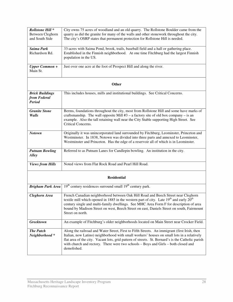
Rollstone Hill * Between Cleghorn and South Side
City owns 75 acres of woodland and an old quarry. The Rollstone Boulder came from the quarry as did the granite for many of the walls and other stonework throughout the city. The city’s OSRP states that permanent protection for Rollstone Hill is needed.
Saima Park Richardson Rd.
33-acres with Saima Pond, brook, trails, baseball field and a hall or gathering place. Established in the Finnish neighborhood. At one time Fitchburg had the largest Finnish population in the US.
Upper Common + Main St.
Just over one acre at the foot of Prospect Hill and along the river.
Other
Brick Buildings from Federal Period
This includes houses, mills and institutional buildings. See Critical Concerns.
Granite Stone Walls
Berms, foundations throughout the city, most from Rollstone Hill and some have marks of craftsmanship. The wall opposite Mill #3 – a factory site of old box company – is an example. Also the tall retaining wall near the City Stable supporting High Street. See Critical Concerns.
Notown Originally it was unincorporated land surrounded by Fitchburg, Leominster, Princeton and Westminster. In 1838, Notown was divided into three parts and annexed to Leominster, Westminster and Princeton. Has the edge of a reservoir all of which is in Leominster.
Putnam Bowling Alley
Referred to as Putnam Lanes for Candlepin bowling. An institution in the city.
Views from Hills Noted views from Flat Rock Road and Pearl Hill Road.
Residential
Brigham Park Area 19th century residences surround small 19th century park.
Cleghorn Area French Canadian neighborhood between Oak Hill Road and Beech Street near Cleghorn textile mill which opened in 1885 in the western part of city. Late 19th and early 20th century single and multi-family dwellings. See MHC Area Form F for description of area bound by Madison Street on west, Beech Street on east, Daniels Street on south, Fairmount Street on north.
Greektown An example of Fitchburg’s older neighborhoods located on Main Street near Crocker Field.
The Patch Neighborhood *
Along the railroad and Water Street, First to Fifth Streets. An immigrant (first Irish, then Italian, now Latino) neighborhood with small workers’ houses on small lots in a relatively flat area of the city. Vacant lots, grid pattern of streets. St. Bernard’s is the Catholic parish with church and rectory. There were two schools – Boys and Girls – both closed and demolished.

Massachusetts Heritage Landscape Inventory Program 29 Fitchburg Reconnaissance Report
Pleasant Street Area*
19th century residential neighborhood along Academy Street, Central, Pleasant (Bankers Row) and Prichard Streets first and then on Grove Street and others. Three schools and former Central Fire Station (1893/1895) are in this neighborhood. Same as Prichard Street neighborhood which also has municipal buildings: former High School, Academy Street School (1869), B.F. Brown Junior High School, Hastings School (1860), City Stables (ca. 1880s), Central Fire Station (1893).
Prospect Hill Area
Residential neighborhood near Upper Common on Prospect Street.
Tar Hill Small immigrant neighborhood on the north side of the river. Mostly English immigrants originally. Boylston Street, Harvard Street, etc.
Waites Corner * In West Fitchburg which is relatively rural. Parsons Cascade Street, Westminster Road and Warner Street area. Workers’ housing built by local mills, possibly the Crocker family. Note building type of gambrel roofed duplexes. James River Mill #8. A city-owned central steam plant here that had a steam line to factories– city is planning a bike trail.
Transportation
Bridges Granite stone arched bridges over the railroad and over roads. The Y-shaped granite bridge at Water and Laurel Streets. Evaluation of bridges by the MHC recommends National Register eligibility of Lower Rollstone Bridge and Fifth Street Bridge (demolished). A new Fifth Street Bridge was built to replace old one.
Cobblestones on steep roads
Remaining cobblestones are removed when roads are repaired so they are disappearing. Jay Street is an example of a cobblestone street on a hillside. It leads from Pleasant/Spring Street intersection to Garnet Street and was laid out as an extension of Pleasant Street east between 1830 and 1851. It was paved with paving stones in 1935.
Damon Road A scenic road that is under development pressure.
Fisher Road This is Old Northfield Road in Lunenburg which becomes Fisher Road in Fitchburg. An old battered bridge carries Fisher Road across a tributary of Falulah Brook. This crossing appears on the 1764 map.
Fitchburg Municipal Airport Airport Rd.
First built in 1919. Some appreciate the sound of small aircraft overhead.
Laurel Street Bridge
This is an 1899 bridge carrying Route 2A over the Nashua-B & M Railroad.
Mt. Elam Road *
Scenic views from this rural road which connects a divided highway with the downtown and is access to Coggshall Park. The rural scenic character of this road is an important feature in Fitchburg. Designated scenic road when Fitchburg adopted M.G.L. 40-15C, the Scenic Road Act.
The Rapids * Nineteenth century footpath and granite steps leading from Prichard Street to Mt. Vernon Street used historically particularly prior to public transportation. A way to traverse the hills. One leads over Blossom Way.

Massachusetts Heritage Landscape Inventory Program 30 Fitchburg Reconnaissance Report
Wallace Way Stairs leading to the old high school – the Annex, from the area of the Fitchburg Armory,
the Episcopal Church, Monument Park and Stratton Playhouse.
Waterbodies
Falulah/Baker Brook
The source for the 8.6 miles of this brook in Fitchburg is in Ashby.
McTaggert’s Pond and Gorge of Phillip’s Brook
In West Fitchburg. An 8 acre pond fed by Phillip’s Brook which has a gorge/chasm and runs under a bridge and a building at West Fitchburg Mills on Baltic Lane.
Mirror Lake +
A 10-acre pond in Coggshall Park
Nashua River *
18.6 miles in Fitchburg. Integral to the formation of the city – from the geology to the economy. Steep banks along much of the river which is not very accessible, nor is it visible. Mills on river at city center with stone retaining walls.
Phillips’s Brook
7.5 miles of river in Fitchburg with source in Ashburnham.
Scott Reservoir Ashby West Rd.
Walking trails around. Black Canyon which is a chasm and waterfall – where the river way connects to the Falulah Reservoir. Many cellar holes are all that remain following a large fire in the 1940s. This reservoir was constructed in 1875 to 1880 and has a round brick valve house.
Snow’s Mill Pond
A 40-acre pond at the Fitchburg-Westminster line and is fed by Whitman River.
Whitman River The source for the 8.1 miles of river in Fitchburg is Lake Wampanoag.

ASHBURNHAM STREET
£¤2
HIGH
ROC
K ROA
D
£¤ 2
RINDGE ROAD
STICKNEY ROAD
SHELDON ROAD
ALPINE ROAD
HEYWOOD STR
EET
CANTON STREET
OAK H
ILL R
OAD
ASHB
Y STA
TE R
OAD
RICH
ARDS
ON R
OAD
HIGH ROCK ROAD
FIFTH MASSACHUSETTS TURNPIKE
SHEA
STRE
ETTH
ERES
A STR
EET
PEARL
HILL
ROAD
WILLIAMS ROAD
FRANKLIN ROAD
WATER STREET
AIRPORT ROAD
ROLLS
TONE
ROAD
24
44
6
9
7
10
8
1
11
3
5
5
5
5
Moun
t Elam
Roa
d
Nashua River
ASHB
Y WES
T ROA
D
FLAT ROCK ROAD
WESTMINSTER HILL ROAD
INDUSTRIAL ROAD
KAYSHA DRIVE
HURD
STRE
ET
Nashua River
A s h b yA s h b y
L e o m i n s t e rL e o m i n s t e r
L u n e n b u r gL u n e n b u r g
W e s t m i n s t e rW e s t m i n s t e r
T o w n s e n dT o w n s e n d
A s h b u r n h a mA s h b u r n h a m
FITCHBURGOPENSPACE & HISTORIC RESOURCES
1. Academy Street School -The Annex2. Coggshall Park3. Dean Hill Cemetery4. Mount Elam Road5. Nashua River6. The Patch7. Pleasant & Prichard Streets Neighborhood8. The Rapids Footpath9. Rollstone Hill10. Upper Common Area11. Waites Corner
High Priority Heritage Landscapes
DCRDCRS/DFGDFGOther StateCountyMunicipalFederalLand TrustNon-ProfitConservation RestrictionAgricultural Preservation RestrictionCR/APR CombinationOther Legal InterestState Historic ResourcesInterstateState Local Road
Note: Default Legend, all categories may not appear on the map.
0 0.25 0.5 Miles
¹


