458 Estimating Extinction Risk (the IUCN criteria) Fish 458; Lecture 24.
date post
22-Dec-2015Category
view
217download
0
Features, Formats & Features, Formats & AttributesAttributes
GIS 458GIS 458
Spring 2006Spring 2006

Layer TypesLayer Types
VectorVector RasterRaster Terrain and Other SurfacesTerrain and Other Surfaces OtherOther
• AddressesAddresses• Geoprocessing ModelsGeoprocessing Models• Survey DataSurvey Data• NetworksNetworks

Vector DataVector Data
Discrete DataDiscrete Data Have precise shape and positionHave precise shape and position Best for defined shapes and Best for defined shapes and
boundariesboundaries Have attributes and behaviorHave attributes and behavior PointsPoints
• Zero-DimensionalZero-Dimensional• Features too small to be lines or areasFeatures too small to be lines or areas• Stored as single x,y coordinatesStored as single x,y coordinates

Vector DataVector Data LinesLines
• One-DimensionalOne-Dimensional• Features too narrow to be areasFeatures too narrow to be areas• Stored as series of ordered x,y coordinatesStored as series of ordered x,y coordinates• Segments:Segments:
StraightStraight CircularCircular EllipticalElliptical SplinedSplined
PolygonsPolygons• Two-DimensionalTwo-Dimensional• Features that cover a broad geographic areaFeatures that cover a broad geographic area• Stored as series of segments that enclose an areaStored as series of segments that enclose an area
AnnotationAnnotation• Descriptive labelsDescriptive labels• Associated with featuresAssociated with features• Display names and attributesDisplay names and attributes

Raster DataRaster Data
Gridded data composed of cells or pixels Gridded data composed of cells or pixels (picture elements)(picture elements)
Two-DimensionalTwo-Dimensional Values can depict various dataValues can depict various data
• Light values (spectral)Light values (spectral)• Elevation (thematic)Elevation (thematic)• Density (thematic)Density (thematic)
Discrete or ContinuousDiscrete or Continuous Can also be stored in an attribute fieldCan also be stored in an attribute field
• Photo of a buildingPhoto of a building

Terrain & Other SurfacesTerrain & Other Surfaces
Triangulated Irregular Network (TIN)Triangulated Irregular Network (TIN) Model of a surfaceModel of a surface Stored as:Stored as:
• Integrated nodesIntegrated nodes• Triangles with edgesTriangles with edges
Enable surface analysisEnable surface analysis Cannot be stored directly in Cannot be stored directly in
geodatabasegeodatabase

Other Layer TypesOther Layer Types
AddressesAddresses• Data stored in databaseData stored in database• ““Locators” create features for locationsLocators” create features for locations
Geoprocessing ModelsGeoprocessing Models• You create tools and store themYou create tools and store them
Survey DataSurvey Data• Data tables tied to feature coordinatesData tables tied to feature coordinates
NetworksNetworks• Require connectivity & topologyRequire connectivity & topology

AttributesAttributes
Quality of an objectQuality of an object• SizeSize• DensityDensity• NameName• FlowFlow• DateDate• PopulationPopulation
A feature can have a number of attributesA feature can have a number of attributes Allow analysis & symbolizationAllow analysis & symbolization


GIS 458GIS 458
Spring 2006Spring 2006
Instructor: Larry ClampInstructor: Larry Clamp

Course TopicsCourse Topics Design ProcessDesign Process Layer Design & FormatsLayer Design & Formats
• Raster vs. VectorRaster vs. Vector• Point, Line or Polygon?Point, Line or Polygon?
RelationshipsRelationships• SpatialSpatial• Non-SpatialNon-Spatial
Attribute Table DesignAttribute Table Design• Defining Appropriate FieldsDefining Appropriate Fields• Assigning Appropriate Field TypesAssigning Appropriate Field Types
Text, Integer, Double…Text, Integer, Double…

Course Topics, continuedCourse Topics, continued
Database FundamentalsDatabase Fundamentals• PurposePurpose• Personal vs. EnterprisePersonal vs. Enterprise
Database DesignDatabase Design Database ImplementationDatabase Implementation

Course Topics, continuedCourse Topics, continued
Software SelectionSoftware Selection• Database software (Oracle, SQL, etc.)Database software (Oracle, SQL, etc.)• GIS Software…GIS Software…isis ESRI the best? ESRI the best?
Data StandardsData Standards• FGDCFGDC
PersonnelPersonnel Project ManagementProject Management Data MiningData Mining

BREAK!!!!BREAK!!!!

GIS (Geographic Information GIS (Geographic Information System) System)
Consists of:Consists of:• Computer hardwareComputer hardware• SoftwareSoftware• Geographic dataGeographic data• PersonnelPersonnel
Is a computer system that stores and links Is a computer system that stores and links geographically-referenced information with geographically-referenced information with graphic map features to allow a wide range of:graphic map features to allow a wide range of:• Information processing and retrievalInformation processing and retrieval• Display operationsDisplay operations• Map productionMap production• Analysis, andAnalysis, and• ModelingModeling

Benefits of a GIS (Functionality)Benefits of a GIS (Functionality)
Data entry/updating: access the database to Data entry/updating: access the database to update, add or delete informationupdate, add or delete information
Data conversion: take diverse information, Data conversion: take diverse information, formats, etc. and make them compatibleformats, etc. and make them compatible
Data retrieval: take massive amounts of stored Data retrieval: take massive amounts of stored information and access it information and access it
Data manipulation: select via query and classify Data manipulation: select via query and classify (symbolize) in different manners(symbolize) in different manners
Data presentation: present retrieved information Data presentation: present retrieved information in either text, tabular or map format.in either text, tabular or map format.
Spatial analysis: take spatial data and make Spatial analysis: take spatial data and make queries (from simple to complex) and generate queries (from simple to complex) and generate new data from the original setnew data from the original set

Three general operations in a GIS:Three general operations in a GIS:
1. Attribute queries (aspatial queries):1. Attribute queries (aspatial queries):• How many parcels in an attribute table are zoned How many parcels in an attribute table are zoned
R-7 and what is their total acreage?R-7 and what is their total acreage? 2. Spatial queries: 2. Spatial queries:
• How many pulp plants are located within 500 How many pulp plants are located within 500 meters of a river?meters of a river?
3. Generation of new data sets from the 3. Generation of new data sets from the original database:original database:• Out of a marine mammal dataset, where are just Out of a marine mammal dataset, where are just
the Beluga whales located?the Beluga whales located?• Are there areas where ring seals and orcas Are there areas where ring seals and orcas
overlap? overlap?

What is “Spatial Data”?What is “Spatial Data”?
Spatial means it is “mappable”, that is, Spatial means it is “mappable”, that is, every piece of information is attached to a every piece of information is attached to a specific object on the map and that specific object on the map and that object’s location on the map is object’s location on the map is geographically-referencedgeographically-referenced
Reference systems typically use Reference systems typically use latitude/longitude, UTM, SPC or some type latitude/longitude, UTM, SPC or some type of x,y coordinate systemof x,y coordinate system

Where do we get “Spatial Data”?Where do we get “Spatial Data”?
From a variety of sources:From a variety of sources:• U.S. censusU.S. census• Land use surveysLand use surveys• Satellite imagerySatellite imagery• Aerial photographsAerial photographs• Paper mapsPaper maps
Problem: compatibilityProblem: compatibility• Projections/coordinate systems--Albers Equal-Projections/coordinate systems--Albers Equal-
Area Conic vs. UTMArea Conic vs. UTM• Map scale--1:2,000 vs. 1:2,000,000Map scale--1:2,000 vs. 1:2,000,000• Data formats--DRG, (raster), Shapefile (vector)Data formats--DRG, (raster), Shapefile (vector)

Examples of GIS Data Examples of GIS Data StructuresStructures

Organizing Geographic Organizing Geographic DataData
GIS 458GIS 458Spring 2006Spring 2006
Larry ClampLarry Clamp

Parts of the WholeParts of the Whole
GeodatabaseGeodatabase Geographic DatasetsGeographic Datasets Object ClassesObject Classes Feature ClassesFeature Classes Topological ClassesTopological Classes Relationship ClassesRelationship Classes
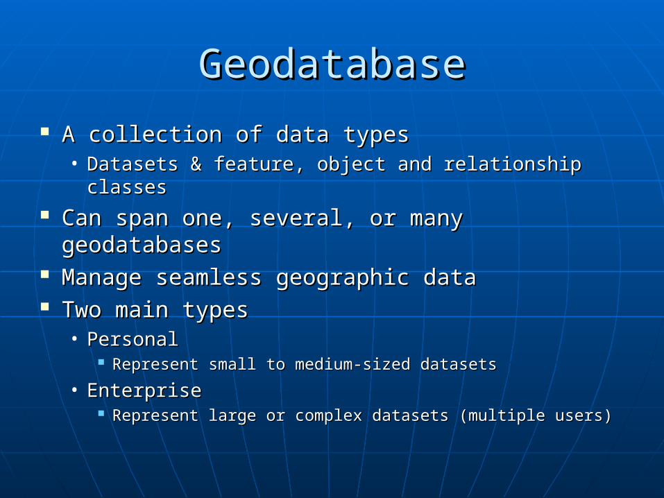
GeodatabaseGeodatabase
A collection of data typesA collection of data types• Datasets & feature, object and relationship Datasets & feature, object and relationship
classesclasses Can span one, several, or many Can span one, several, or many
geodatabasesgeodatabases Manage seamless geographic dataManage seamless geographic data Two main typesTwo main types
• PersonalPersonal Represent small to medium-sized datasetsRepresent small to medium-sized datasets
• EnterpriseEnterprise Represent large or complex datasets (multiple users)Represent large or complex datasets (multiple users)

Geographic DatasetsGeographic Datasets
Feature DatasetFeature Dataset• Collection of feature classesCollection of feature classes• Common coordinate systemCommon coordinate system• FC’s must be in FD’s for topologyFC’s must be in FD’s for topology
Raster DatasetRaster Dataset• Simple (basic GRID)Simple (basic GRID)• Compound (multiple bands, etc.)Compound (multiple bands, etc.)
Triangulated (TIN) DatasetTriangulated (TIN) Dataset

Object ClassesObject Classes
Table that can associate behaviorTable that can associate behavior Descriptive information about objectsDescriptive information about objects
• OwnersOwners• Stream CodesStream Codes• AnnotationAnnotation

Feature ClassesFeature Classes
Collection of features with same Collection of features with same geometrygeometry• Points, lines, polygonsPoints, lines, polygons
Simple feature classesSimple feature classes• No topologyNo topology• Features are independent of one anotherFeatures are independent of one another
Topological feature classesTopological feature classes• Features are bound to one anotherFeatures are bound to one another• Share certain behaviorShare certain behavior

RelationshipsRelationships

RelationshipsRelationships

No…SeriouslyNo…Seriously
Relationship classRelationship class• Table that stores realtionships between Table that stores realtionships between
features or objectsfeatures or objects• Models dependencies between objectsModels dependencies between objects• Can control what happens to related Can control what happens to related
objectsobjects RemovedRemoved ChangedChanged

Keep it Simple…Keep it Simple…
Geodatabase = Filing CabinetGeodatabase = Filing Cabinet
• Feature Dataset = Filing Cabinet DrawerFeature Dataset = Filing Cabinet Drawer
Feature Class = Individual Folder in DrawerFeature Class = Individual Folder in Drawer

Sub-Types & Attribute Sub-Types & Attribute DomainsDomains
GIS 458GIS 458
Spring 2006Spring 2006
Larry ClampLarry Clamp

Sub-TypesSub-Types Objects (rows) in a table or feature class Objects (rows) in a table or feature class
grouped by an attributegrouped by an attribute• Roads by class: Highways, major roads, Roads by class: Highways, major roads,
arterials, etc.arterials, etc. Allow users to make validation rules more Allow users to make validation rules more
specific to dataspecific to data Help insure data qualityHelp insure data quality Speed up data entry and editingSpeed up data entry and editing Help eliminate need for additional classesHelp eliminate need for additional classes
• Wells: Different class for public, agricultural or Wells: Different class for public, agricultural or monitoring wells ormonitoring wells or
• Just different sub-types?Just different sub-types?

Sub-Types, continuedSub-Types, continued
Based on integer attribute fieldBased on integer attribute field Integer codes and descriptions Integer codes and descriptions
enteredentered Editor constrained to entered valuesEditor constrained to entered values In ArcMap, description is displayedIn ArcMap, description is displayed Description used for labelingDescription used for labeling

Setting Sub-TypesSetting Sub-Types
Set as properties of an existing table Set as properties of an existing table or feature classor feature class
Go to Properties dialogGo to Properties dialog Select integer sub-type fieldSelect integer sub-type field Input code and descriptionInput code and description Can also set defaults and domainsCan also set defaults and domains

Attribute DomainsAttribute Domains
Define legal field values for tables, feature Define legal field values for tables, feature classes, or sub-typesclasses, or sub-types
Defined as properties of the geodatabaseDefined as properties of the geodatabase Can be shared across the geodatabaseCan be shared across the geodatabase Assigned to fields by editing field Assigned to fields by editing field
properties of tables & feature classesproperties of tables & feature classes Do not constrain incorrect data entry but Do not constrain incorrect data entry but
will find errorswill find errors• Validation tool on Editor menuValidation tool on Editor menu

Legal ValuesLegal Values
Two Types of domainsTwo Types of domains• Range and Coded ValuesRange and Coded Values
Type used depends on nature of Type used depends on nature of attribute dataattribute data

Range vs. Coded ValuesRange vs. Coded Values
Range domainsRange domains• Apply to values for numeric attributesApply to values for numeric attributes• Used for measured dataUsed for measured data
Well depthWell depth Contamination levelsContamination levels Power pole heightsPower pole heights
• Legal minimum and maximumLegal minimum and maximum

Range vs. Coded ValuesRange vs. Coded Values
Coded valuesCoded values• Apply to any type of attributeApply to any type of attribute
Text, numeric, date, etc.Text, numeric, date, etc.
• Used for coded dataUsed for coded data Land-use codesLand-use codes Water pipe material codesWater pipe material codes Street surfacing codesStreet surfacing codes
• Define list of legal codes and their Define list of legal codes and their descriptionsdescriptions

Splitting & Merging FeaturesSplitting & Merging Features
Domains allow you to define how Domains allow you to define how attributes are handled during attributes are handled during splitting & mergingsplitting & merging
Split policySplit policy Merge policyMerge policy

Split PoliciesSplit Policies
Defines what values are assigned to Defines what values are assigned to resulting featuresresulting features• Default valueDefault value
Each take on a default value you setEach take on a default value you set
• Duplicate valueDuplicate value Each take on a copy of original valueEach take on a copy of original value
• Geometry ratioGeometry ratio Each take on a ratio of the original valueEach take on a ratio of the original value
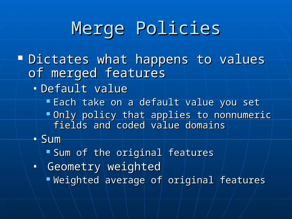
Merge PoliciesMerge Policies
Dictates what happens to values of Dictates what happens to values of merged featuresmerged features• Default valueDefault value
Each take on a default value you setEach take on a default value you set Only policy that applies to nonnumeric fields Only policy that applies to nonnumeric fields
and coded value domainsand coded value domains
• SumSum Sum of the original featuresSum of the original features
• Geometry weightedGeometry weighted Weighted average of original featuresWeighted average of original features

SummarySummary
Field TypesField Types Domain TypeDomain Type Split PoliciesSplit Policies Merge PoliciesMerge Policies
Double, Float, Double, Float, Long Integer, Long Integer, Short Integer, Short Integer, Date, TextDate, Text
Coded ValueCoded Value Default value, Default value, DuplicateDuplicate Default valueDefault value
Double, Float, Double, Float, Long Integer, Long Integer, Short Integer, Short Integer, DateDate
RangeRangeDefault value, Default value, Duplicate, Duplicate, Geometry ratioGeometry ratio
Default value, Default value, Sum, Sum,
Weighted Weighted averageaverage

Table Design & Table Design & Importing DataImporting Data
GIS 458GIS 458
Spring 2006Spring 2006
Larry ClampLarry Clamp
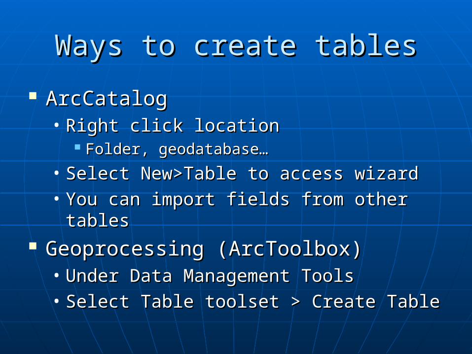
Ways to create tablesWays to create tables
ArcCatalogArcCatalog• Right click locationRight click location
Folder, geodatabase…Folder, geodatabase…
• Select New>Table to access wizardSelect New>Table to access wizard• You can import fields from other tablesYou can import fields from other tables
Geoprocessing (ArcToolbox)Geoprocessing (ArcToolbox)• Under Data Management ToolsUnder Data Management Tools• Select Table toolset > Create TableSelect Table toolset > Create Table

Table Field PropertiesTable Field Properties AliasAlias Allow NULL ValuesAllow NULL Values Default ValueDefault Value DomainDomain OBJECTIDOBJECTID LengthLength PrecisionPrecision ScaleScale BLOBBLOB RasterRaster

AliasAlias
Alternate field name for display in Alternate field name for display in ArcMapArcMap
Less cryptic…Less cryptic… Can be changed after the table is Can be changed after the table is
createdcreated

Allow NULL ValuesAllow NULL Values
Indicates field may or may not Indicates field may or may not contain null datacontain null data
Null value = absence of recorded Null value = absence of recorded valuevalue
Different than 0 (which is a value)Different than 0 (which is a value) May NOT be changed after table is May NOT be changed after table is
created created
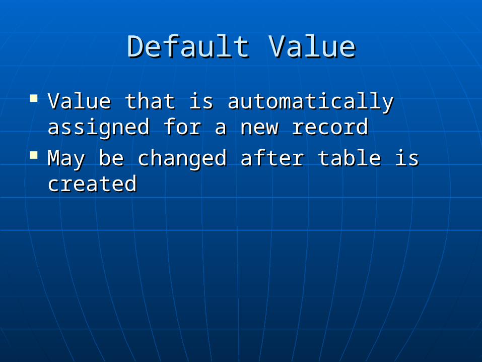
Default ValueDefault Value
Value that is automatically assigned Value that is automatically assigned for a new recordfor a new record
May be changed after table is May be changed after table is createdcreated

DomainDomain
Assigned geodatabase domain for Assigned geodatabase domain for fieldfield
Defines legal valuesDefines legal values Can also define how feature Can also define how feature
attributes are handled if they are attributes are handled if they are merged or splitmerged or split
May be changed after table is May be changed after table is createdcreated

OBJECTIDOBJECTID
Automatically generatedAutomatically generated DO NOT delete or change it in any DO NOT delete or change it in any
way!!way!!

LengthLength
Maximum number of characters to Maximum number of characters to store in text fieldstore in text field
Set as an integerSet as an integer

PrecisionPrecision
Maximum number of digits for a Maximum number of digits for a numeric fieldnumeric field
Set as an integerSet as an integer

ScaleScale
Maximum number of decimal digits Maximum number of decimal digits for a decimal numeric fieldfor a decimal numeric field
Set as an integerSet as an integer

BLOBBLOB
Binary large objectBinary large object Data stored in the geodatabase as a Data stored in the geodatabase as a
long sequence of binary numberslong sequence of binary numbers Stores images, multimedia, or bits of Stores images, multimedia, or bits of
codecode ArcGIS doesn’t provide end-user toolsArcGIS doesn’t provide end-user tools Must write custom objects or Must write custom objects or
applications to manage a BLOB fieldapplications to manage a BLOB field

RasterRaster
New attribute typeNew attribute type Stores raster within or alongside the Stores raster within or alongside the
geodatabasegeodatabase ArcGIS views many file formats but outputs ArcGIS views many file formats but outputs
as a GRID, IMAGINE, or TIFFas a GRID, IMAGINE, or TIFF Will convert for youWill convert for you Only one raster field allowed in a table or Only one raster field allowed in a table or
feature classfeature class Use a different table with a relate to Use a different table with a relate to
associate moreassociate more

Naming ConventionsNaming Conventions
Table name, feature class and field Table name, feature class and field names must be compatible with names must be compatible with underlying RDBMSunderlying RDBMS
For ESRI this means:For ESRI this means:• No spacesNo spaces• Use underscores or run words togetherUse underscores or run words together• Field names limited to ten charactersField names limited to ten characters
Use an alias for more descriptive nameUse an alias for more descriptive name

Field Data TypesField Data TypesData TypeData Type BytesBytes RangeRange ApplicationApplication
Short IntegerShort Integer 22 -32,768 to 32,767-32,768 to 32,767 Numbers without fractions Numbers without fractions within specific ranges; coded within specific ranges; coded valuesvalues
Long IntegerLong Integer 44 -2,147,483,648 to -2,147,483,648 to 2,147,483,6472,147,483,647
Numbers without fractions Numbers without fractions within specific rangewithin specific range
FloatFloat 44 Approx. -3.4EApprox. -3.4E-38-38 to 1.2E to 1.2E3838 Numbers with fractions within Numbers with fractions within specific rangespecific range
DoubleDouble 88 Approx. -2.2EApprox. -2.2E-308-308 to 1.8E to 1.8E308308 Numbers with fractions within Numbers with fractions within specific rangespecific range
TextText VariesVaries Up to 64,000 charactersUp to 64,000 characters Names or other textual Names or other textual qualitiesqualities
DateDate 88 Mm/dd/yyy, hh:mm:ss; Mm/dd/yyy, hh:mm:ss; AMP/PMAMP/PM
Date and/or timeDate and/or time
BLOBBLOB VariesVaries VariesVaries Images or other multimediaImages or other multimedia
RasterRaster VariesVaries Stores ImagesStores Images Storing imagesStoring images
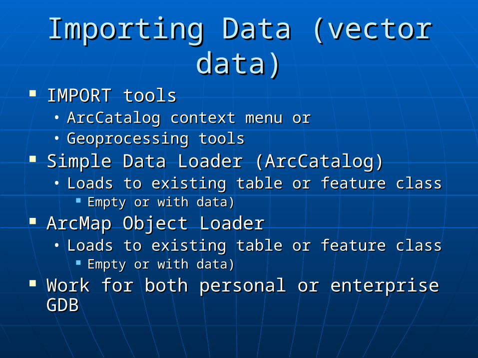
Importing Data (vector data)Importing Data (vector data)
IMPORT toolsIMPORT tools• ArcCatalog context menu orArcCatalog context menu or• Geoprocessing toolsGeoprocessing tools
Simple Data Loader (ArcCatalog)Simple Data Loader (ArcCatalog)• Loads to existing table or feature classLoads to existing table or feature class
Empty or with data)Empty or with data) ArcMap Object LoaderArcMap Object Loader
• Loads to existing table or feature classLoads to existing table or feature class Empty or with data)Empty or with data)
Work for both personal or enterprise GDBWork for both personal or enterprise GDB

IMPORT toolsIMPORT tools
ArcCatalog menusArcCatalog menus• Right click on location to import…Right click on location to import…
Geoprocessing toolsGeoprocessing tools• ArcToolbox > Conversion Tools > To ArcToolbox > Conversion Tools > To
GeodatabasaeGeodatabasae Both use same toolsBoth use same tools
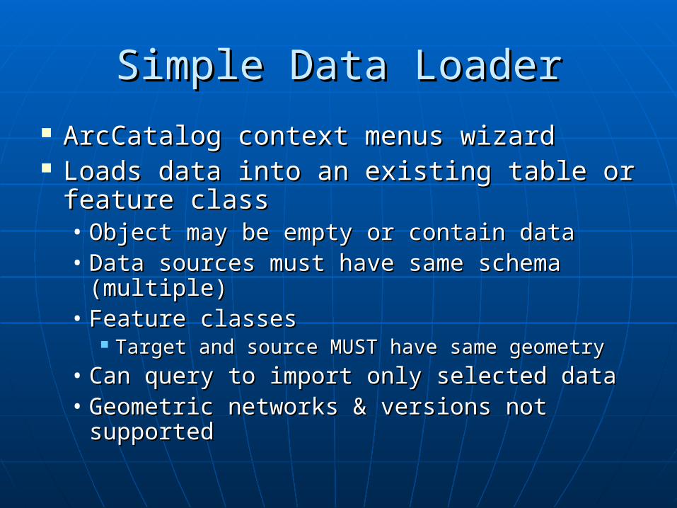
Simple Data LoaderSimple Data Loader
ArcCatalog context menus wizardArcCatalog context menus wizard Loads data into an existing table or Loads data into an existing table or
feature classfeature class• Object may be empty or contain dataObject may be empty or contain data• Data sources must have same schema Data sources must have same schema
(multiple)(multiple)• Feature classesFeature classes
Target and source MUST have same geometryTarget and source MUST have same geometry
• Can query to import only selected dataCan query to import only selected data• Geometric networks & versions not Geometric networks & versions not
supportedsupported

Object LoaderObject Loader
Accessible only in ArcMap edit sessionAccessible only in ArcMap edit session Must add as a custom toolMust add as a custom tool
• Tools>Customize>Commands>Data ConvertersTools>Customize>Commands>Data Converters Loads “complex data” to table or feature classLoads “complex data” to table or feature class
• Supports behavior as it loadsSupports behavior as it loads• Object may be empty or contain dataObject may be empty or contain data• Data sources must have same schema (multiple)Data sources must have same schema (multiple)• Feature classesFeature classes
Target and source MUST have same geometryTarget and source MUST have same geometry
• Can query to import only selected dataCan query to import only selected data
The Geodatabase The Geodatabase Design ProcessDesign Process
GIS 458GIS 458
Spring 2006Spring 2006
Larry ClampLarry Clamp

Why is Good Design Why is Good Design Necessary?Necessary?
Questions to Answer:Questions to Answer:
• How can we employ GIS technology to:How can we employ GIS technology to: Improve existing functions?Improve existing functions?
Change goal achievement?Change goal achievement?
• What data is most beneficial?What data is most beneficial?
• What data can be acquired & stored?What data can be acquired & stored?
• Who will maintain the database?Who will maintain the database?
Establish Process to:Establish Process to:• Define goalsDefine goals• Identify, analyze and evaluate alternativesIdentify, analyze and evaluate alternatives• Agree on implementation planAgree on implementation plan
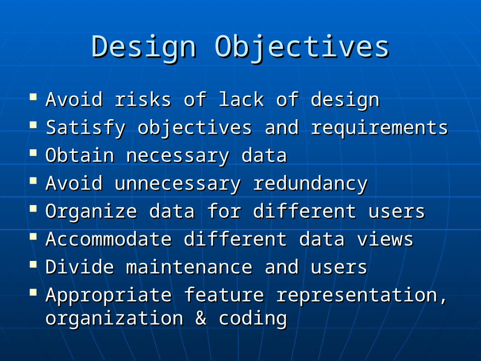
Design ObjectivesDesign Objectives
Avoid risks of lack of designAvoid risks of lack of design Satisfy objectives and requirementsSatisfy objectives and requirements Obtain necessary dataObtain necessary data Avoid unnecessary redundancyAvoid unnecessary redundancy Organize data for different usersOrganize data for different users Accommodate different data viewsAccommodate different data views Divide maintenance and usersDivide maintenance and users Appropriate feature representation, Appropriate feature representation,
organization & codingorganization & coding

Benefits of DesignBenefits of Design
Time consuming…but worth it!Time consuming…but worth it! Increased data retrieval & analysis Increased data retrieval & analysis
flexibilityflexibility Increased user application Increased user application
developmentdevelopment Better cost distributionBetter cost distribution More users supportedMore users supported Support for future developmentSupport for future development Less data redundancyLess data redundancy

Design GuidelinesDesign Guidelines
Involve UsersInvolve Users One Step at a TimeOne Step at a Time Build a TeamBuild a Team Be CreativeBe Creative Create Deliverables & MilestonesCreate Deliverables & Milestones Keep Goals and Objectives in FocusKeep Goals and Objectives in Focus Don’t Add Detail Too SoonDon’t Add Detail Too Soon Document Carefully!!!!!!Document Carefully!!!!!! Be FlexibleBe Flexible Use Model to PlanUse Model to Plan
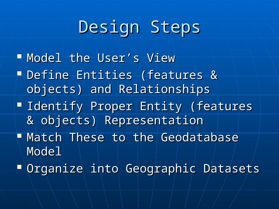
Design StepsDesign Steps
Model the User’s ViewModel the User’s View Define Entities (features & objects) Define Entities (features & objects)
and Relationshipsand Relationships Identify Proper Entity (features & Identify Proper Entity (features &
objects) Representationobjects) Representation Match These to the Geodatabase Match These to the Geodatabase
ModelModel Organize into Geographic DatasetsOrganize into Geographic Datasets

Model the User’s ViewModel the User’s View
Ensure common understanding between Ensure common understanding between designers and usersdesigners and users
Identify Organizational FunctionsIdentify Organizational Functions• Business or service functions & processes Business or service functions & processes
are more stable than business organizationare more stable than business organization• What do they do?What do they do?
Identify Data RequirementsIdentify Data Requirements• Interact!Interact!• Who uses it and what is the nature of Who uses it and what is the nature of
interaction?interaction? Organize Data into Logical GroupingsOrganize Data into Logical Groupings Develop an Initial Implementation Plan Develop an Initial Implementation Plan

Define Entities and Define Entities and RelationshipsRelationships
Broad to NarrowBroad to Narrow Identify & Describe EntitiesIdentify & Describe Entities
• Use detailUse detail• Involve end users!Involve end users!
Identify & Describe RelationshipsIdentify & Describe Relationships• Use descriptive & interpreting statementsUse descriptive & interpreting statements
Use Diagrams to Show E & RUse Diagrams to Show E & R• Unified Modeling LanguageUnified Modeling Language

Identify Proper Entity Identify Proper Entity RepresentationRepresentation
Classify by Type of RepresentationClassify by Type of Representation Will it be used on a map?Will it be used on a map? Is shape significant for analysis?Is shape significant for analysis? Can it be accessed and visualized through Can it be accessed and visualized through
relationship to another feature?relationship to another feature? Will it have different representations at Will it have different representations at
different scales?different scales? Does it need annotation?Does it need annotation? Should it be a:Should it be a:
• Point, line or polygonPoint, line or polygon• A surface, raster, image, photo or drawingA surface, raster, image, photo or drawing• An objectAn object
No point, line or polygon requiredNo point, line or polygon required No geometric or graphic representationNo geometric or graphic representation

Match to the Geodatabase Match to the Geodatabase ModelModel
Determine Geodatabase RepresentationDetermine Geodatabase Representation Simple FeaturesSimple Features
• DiscreteDiscrete• No TopologyNo Topology
Complex FeaturesComplex Features• DiscreteDiscrete• Topology or participation in a networkTopology or participation in a network
PointsPoints LinesLines PolygonsPolygons ImagesImages SurfacesSurfaces ObjectObject

Organize into Geographic Organize into Geographic Datasets Datasets
Identify & Name DatasetsIdentify & Name Datasets Group Feature ClassesGroup Feature Classes
• Large feature classLarge feature class• SubtypesSubtypes
Custom behaviorCustom behavior Substantially different attributesSubstantially different attributes Different access requirementsDifferent access requirements
Define Topology NeedsDefine Topology Needs• Feature classes participating in topology or Feature classes participating in topology or
network must be in the same feature datasetnetwork must be in the same feature dataset Group in Geodatabase(s)Group in Geodatabase(s)
• Different departmentsDifferent departments• Size limitsSize limits


![Title 458 Title 458 WAC REVENUE, DEPARTMENT OFleg.wa.gov/CodeReviser/WACArchive/Documents/2005/WAC458A.pdf · (2005 Ed.) [Title 458 WAC—p. 1] Title 458 Title 458 WAC REVENUE, DEPARTMENT](https://static.fdocuments.us/doc/165x107/5bfc3f4009d3f2bc6e8b6469/title-458-title-458-wac-revenue-department-oflegwagovcodereviserwacarchivedocuments2005.jpg)