HEC-HMS The Hydrologic Engineering Center’s Hydrologic Modeling System (HMS)
Extended Hydrologic OutlookNovember 9, 2021
• The Climate Prediction Center (CPC) is forecasting below normal rainfall for November through January.
• La Niña conditions have developed and are expected to continue with an 87% chance of La Niña in December 2021- February 2022.
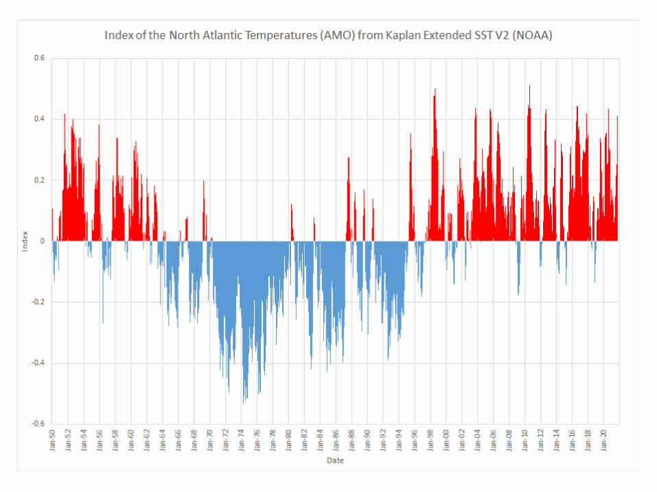
• Atlantic Multidecadal Oscillation (AMO) is currently in the warm phase:• Average annual inflow to Lake Okeechobee is nearly
50% greater during the warm phase compared to the cold phase
Prepared by: Climate Prediction Center/NCEP
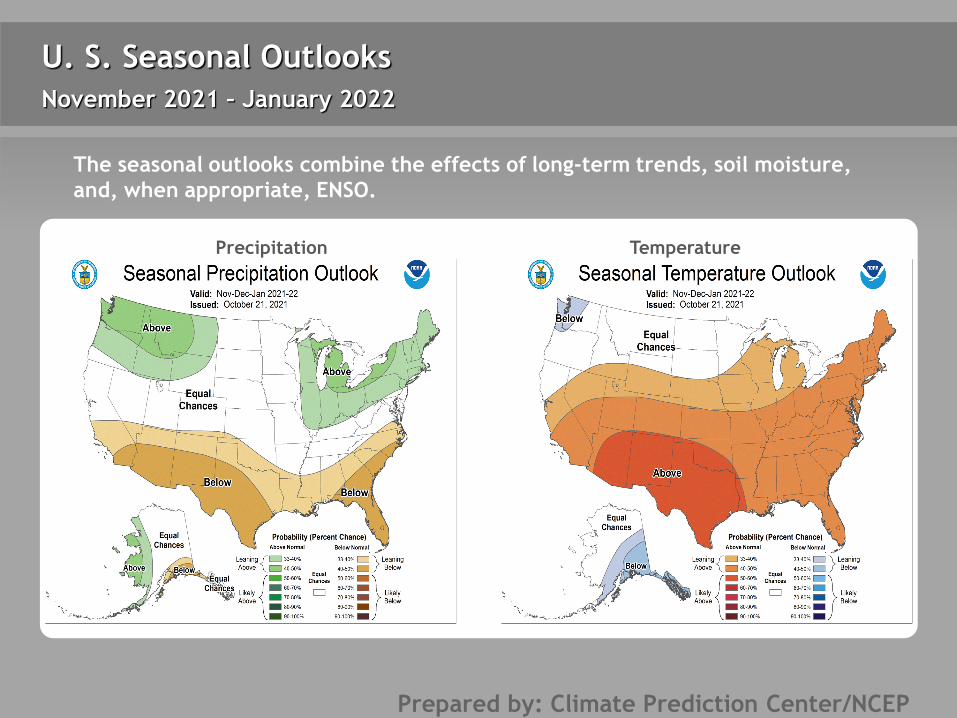
U. S. Seasonal Outlooks
Precipitation Temperature
November 2021 – January 2022
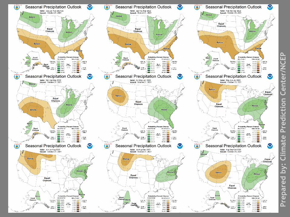
The seasonal outlooks combine the effects of long-term trends, soil moisture, and, when appropriate, ENSO.
Prep
ared
by:
Clim
ate
Pred
icti
on C
ente
r/N
CEP

4
Teleconnections to South FloridaClimate anomalies being related to each other at large distances: El Niño Southern Oscillation (ENSO)
El Niño increases the chances of a wetter-than-normal dry season and decreased tropical activity, La Niña increases the chances of a drier-than-normal dry season and increased tropical activity (both have most influence in south Florida from November through March).
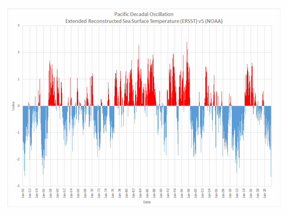
Pacific Decadal Oscillation (PDO)Increases variations of south Florida dry season rainfall
Atlantic Multidecadal Oscillation (AMO)Average annual inflow to Lake Okeechobee is nearly 50% greater during the warm phase compared to the cold phase of the AMO, easterly flow toward south Florida affected by phase
Prepared by: Climate Prediction Center/NCEP
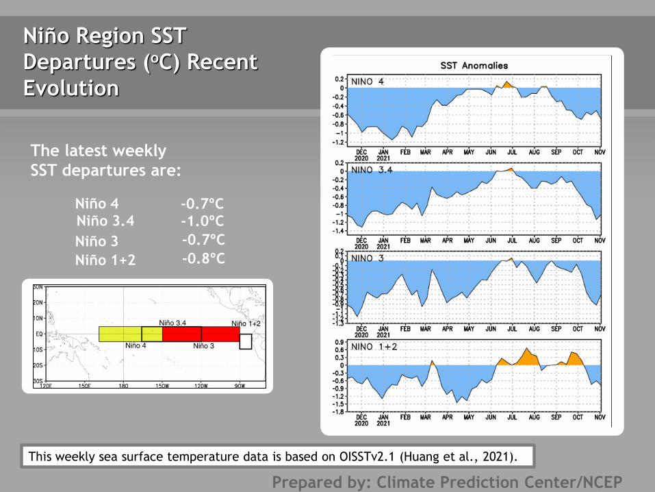
This weekly sea surface temperature data is based on OISSTv2.1 (Huang et al., 2021).
Niño Region SST Departures (oC) Recent Evolution
The latest weekly SST departures are:
Niño 4 -0.7ºCNiño 3.4 -1.0ºCNiño 3 -0.7ºCNiño 1+2 -0.8ºC

Prepared by: NOAA Physical Sciences Laboratory
Prepared by: NOAA Physical Sciences Laboratory

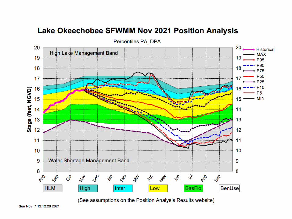
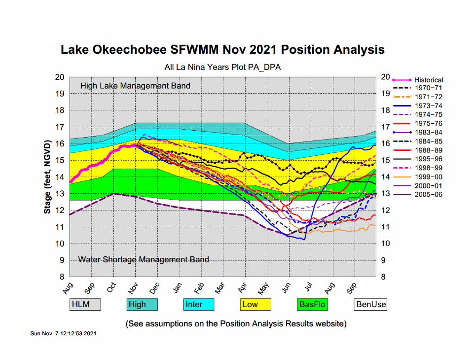
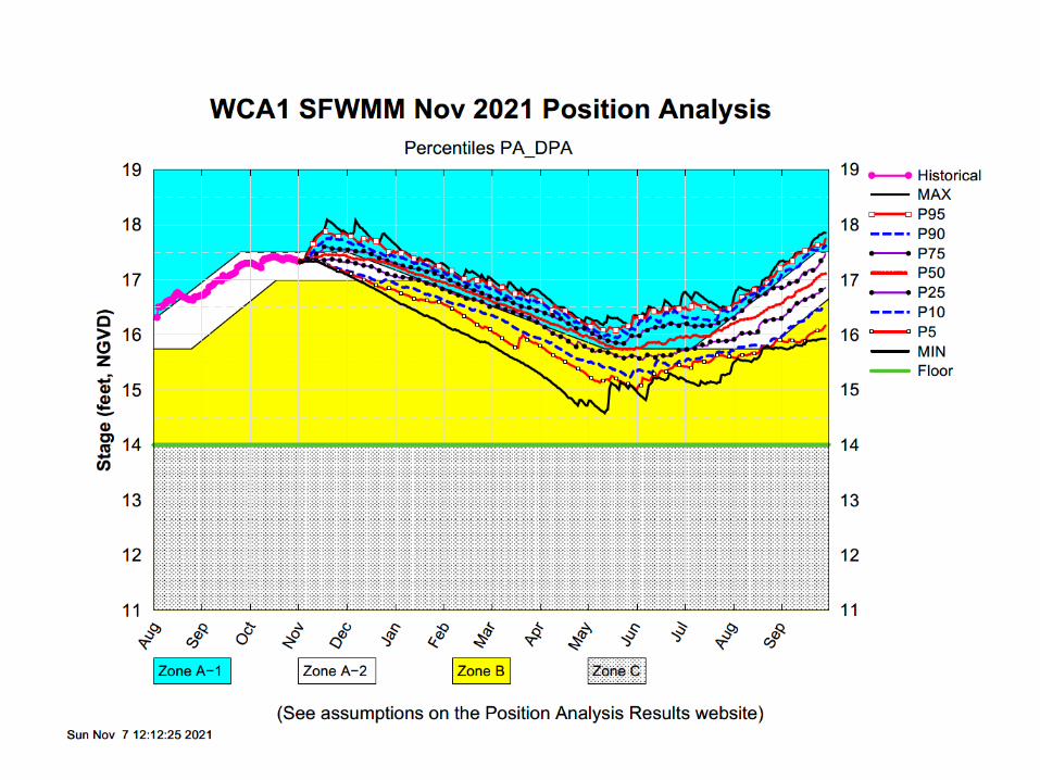
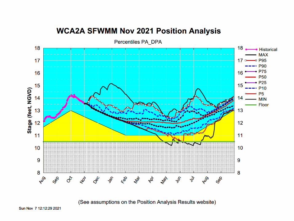
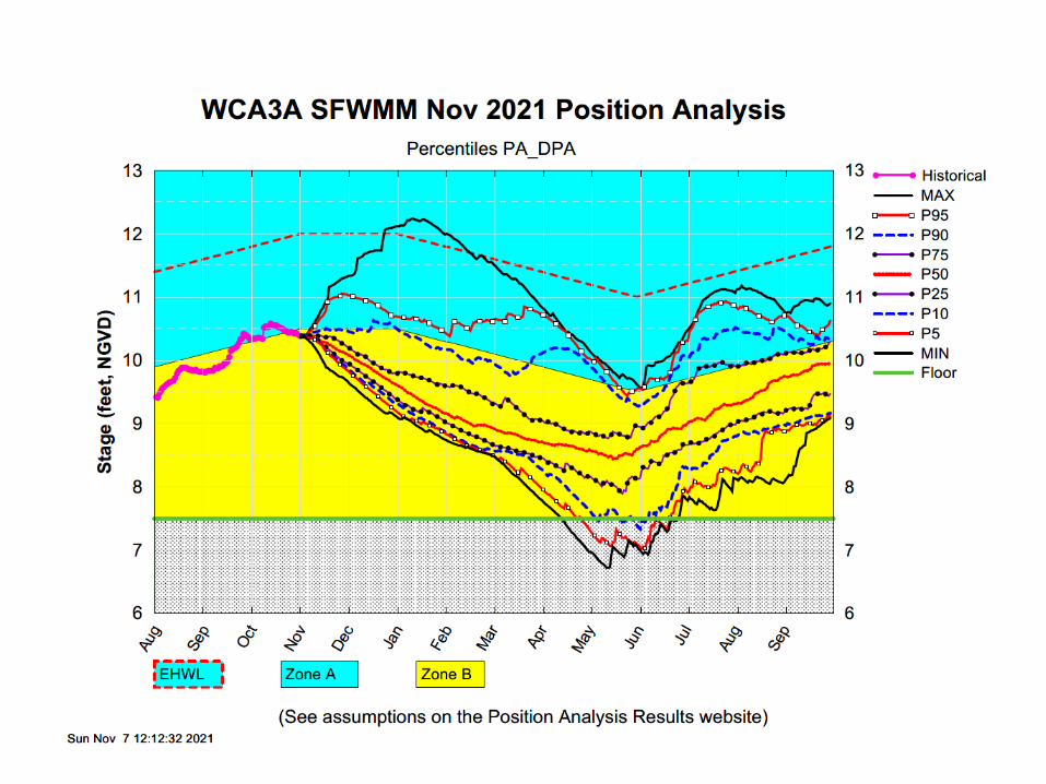
• The November 1, 2021 Dynamic Position Analysis (DPA) simulation is based on historical climatic conditions spanning the period 1965-2005. This DPA posting is made with the South Florida Water Management Model (SFWMM) v6.7.4 (Tamiami Trail) which includes the following improvement(s): – Improvements to include the Combined Operational Plan (COP)
• The November 1, 2021 DPA resets the initial stages for Lake Okeechobee (LOK) and the Water Conservation Areas (WCAs) on October 1st of each year of the DPA simulation and conditions the simulation to real time data during July to achieve real time stages on November 1st for LOK and WCAs.
• The Lake Okeechobee operations follow the Lake Okeechobee Regulation Schedule (LORS2008). Modeling assumptions are consistent with modeling performed for LORS2008 Supplemental Environmental Impact Statement (SEIS).
• LOK Temporary Forward Pump operations will be in place, whenever necessary, to improve water supply deliveries from LOK under low LOK stages.
• STA surface area values are modified to reflect current flowways under operation. STA depths are maintained to a minimum of 6 inches using Lake Okeechobee releases.
November DPA Assumptions