Expedition cruise to the Weddell Sea - Monika SchillatExpedition to the Weddell Sea 13 th – 23 rd...
14
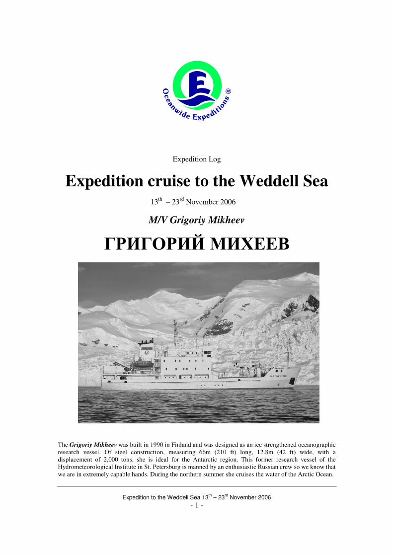
Expedition to the Weddell Sea 13 th – 23 rd November 2006 - 1 - Expedition Log Expedition cruise to the Weddell Sea 13 th – 23 rd November 2006 M/V Grigoriy Mikheev ГРИΓΟΡИЙ МИХЕЕВ The Grigoriy Mikheev was built in 1990 in Finland and was designed as an ice strengthened oceanographic research vessel. Of steel construction, measuring 66m (210 ft) long, 12.8m (42 ft) wide, with a displacement of 2,000 tons, she is ideal for the Antarctic region. This former research vessel of the Hydrometeorological Institute in St. Petersburg is manned by an enthusiastic Russian crew so we know that we are in extremely capable hands. During the northern summer she cruises the water of the Arctic Ocean.
Transcript of Expedition cruise to the Weddell Sea - Monika SchillatExpedition to the Weddell Sea 13 th – 23 rd...
Expedition to the Weddell Sea 13
th – 23
rd November 2006
- 1 -
Expedition Log
Expedition cruise to the Weddell Sea
13th
– 23rd
November 2006
M/V Grigoriy Mikheev
ГРИΓΟΡИЙ МИХЕЕВ
The Grigoriy Mikheev was built in 1990 in Finland and was designed as an ice strengthened oceanographic
research vessel. Of steel construction, measuring 66m (210 ft) long, 12.8m (42 ft) wide, with a
displacement of 2,000 tons, she is ideal for the Antarctic region. This former research vessel of the
Hydrometeorological Institute in St. Petersburg is manned by an enthusiastic Russian crew so we know that
we are in extremely capable hands. During the northern summer she cruises the water of the Arctic Ocean.
Expedition to the Weddell Sea 13
th – 23
rd November 2006
- 2 -
With
Captain – Alexey Zakalashnyuk
and his Russian Crew of 18
and
Expedition Leader – Monika Schillat (Germany/Argentina)
Hotel Manager – Natascha Wisse (The Netherlands)
Head Chef – Benjamin Vdmar (United States of America)
Sous Chef – Richard Arokiasamy (Malaysia)
Guide/Lecturer – Paolo Bernat (Italy)
Guide/Lecturer – Marcelo Zárate (Argentina)
Ship’s Physician – Jenny Kissler (Germany)
13th of November 2006 – Ushuaia / Tierra del Fuego, Argentina Position 54°45' S / 68°30'W We had finally landed in Ushuaia, the place which called itself “El fin del mundo” (the end of the
world). The rugged spine of the Andes mountains stretches the entire length of the South
American continent, coming right down to meet the sea here at the southern tip of Chile and
Argentina. The four-hour flight from Buenos Aires over the flat, dry Argentine Pampas and
Patagonia was highlighted by the plane’s steep descent over the snow and glacier-capped peaks to
the airstrip which projects straight out into the Beagle Channel. The scenery includes many
extensive fjords somewhat reminiscent of parts of Norway.
At four in the afternoon the ship and the crew were ready to welcome us on board., where we got
some time to find our cabins and to unpack
and rest a little.
At 5.30 p.m. we met in the dining room for
the first time to be introduced by our
Expedition Leader Monika Schillat to the
staff and the ship.
The polar bug had long ago bit all members
of the expedition staff. Monika lives actually
in Ushuaia and had been working in
Antarctica, mostly for Oceanwide
Expeditions since 1991! Since then, she had
done countless voyages in both the Arctic and Antarctic. Also Marcelo Zárate from Argentina
and Paolo Bernat from Italy had a lot of experience in the area.
The hotel department on board the Grigoriy Mikheev was run by the always smiling Natascha
Wisse from the Netherlands. The chefs came from the United States of America and Malaysia
and would take excellent care of our wellbeing during the voyage.Jenny Kissler from Germany
brought a wealth of medial skills.
Also Captain Alexey Zakalashnyuk, the most important man on board with countless seasons in
Arctic and Antarctic waters under his belt, came to welcome us on board. He had an experienced
crew of 18 Russian officers, sailers, engineers and service personnel on board.
With a rapidly growing population of 55,000 people,
Ushuaia is a flourishing duty free port with a fishing
industry particularly famous for its crabs. There are
other new industries as well, notably electronics. The
new buildings and roads give the appearance of a latter
day “frontier town” and one of the few remnants of the
last century is a beautiful Victorian timber building
right on the harbor. Its first owner purchased the so-
called Casa Beban building through a catalogue over a
hundred years ago. The museum in the former prison
had a fascinating and well-arranged series of displays.
Expedition to the Weddell Sea 13
th – 23
rd November 2006
- 3 -
In the meantime, the Grigoriy Mikheev had already prepared to
leave the pier in Ushuaia. At 18:30 we were sailing through the
scenic Beagle Channel, heading for the open south Atlantic Ocean.
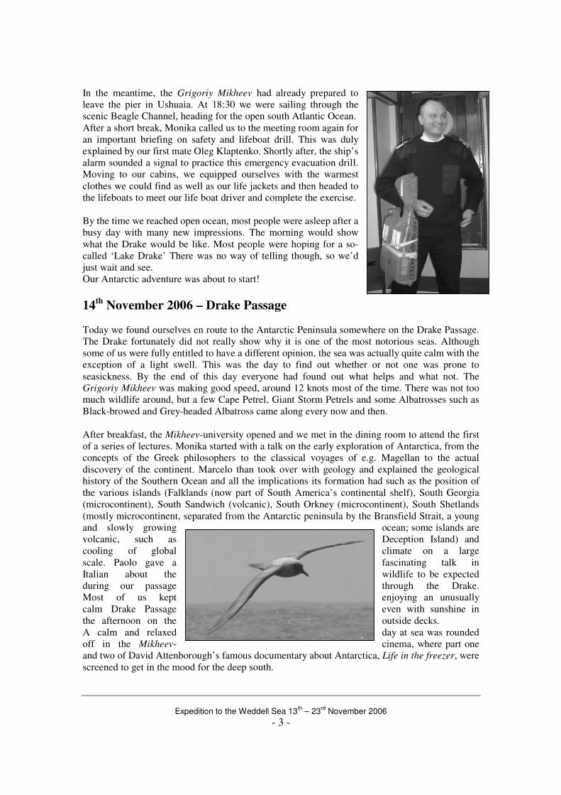
After a short break, Monika called us to the meeting room again for
an important briefing on safety and lifeboat drill. This was duly
explained by our first mate Oleg Klaptenko. Shortly after, the ship’s
alarm sounded a signal to practice this emergency evacuation drill.
Moving to our cabins, we equipped ourselves with the warmest
clothes we could find as well as our life jackets and then headed to
the lifeboats to meet our life boat driver and complete the exercise.
By the time we reached open ocean, most people were asleep after a
busy day with many new impressions. The morning would show
what the Drake would be like. Most people were hoping for a so-
called ‘Lake Drake’ There was no way of telling though, so we’d
just wait and see.
Our Antarctic adventure was about to start!
14th November 2006 – Drake Passage
Today we found ourselves en route to the Antarctic Peninsula somewhere on the Drake Passage.
The Drake fortunately did not really show why it is one of the most notorious seas. Although
some of us were fully entitled to have a different opinion, the sea was actually quite calm with the
exception of a light swell. This was the day to find out whether or not one was prone to
seasickness. By the end of this day everyone had found out what helps and what not. The
Grigoriy Mikheev was making good speed, around 12 knots most of the time. There was not too
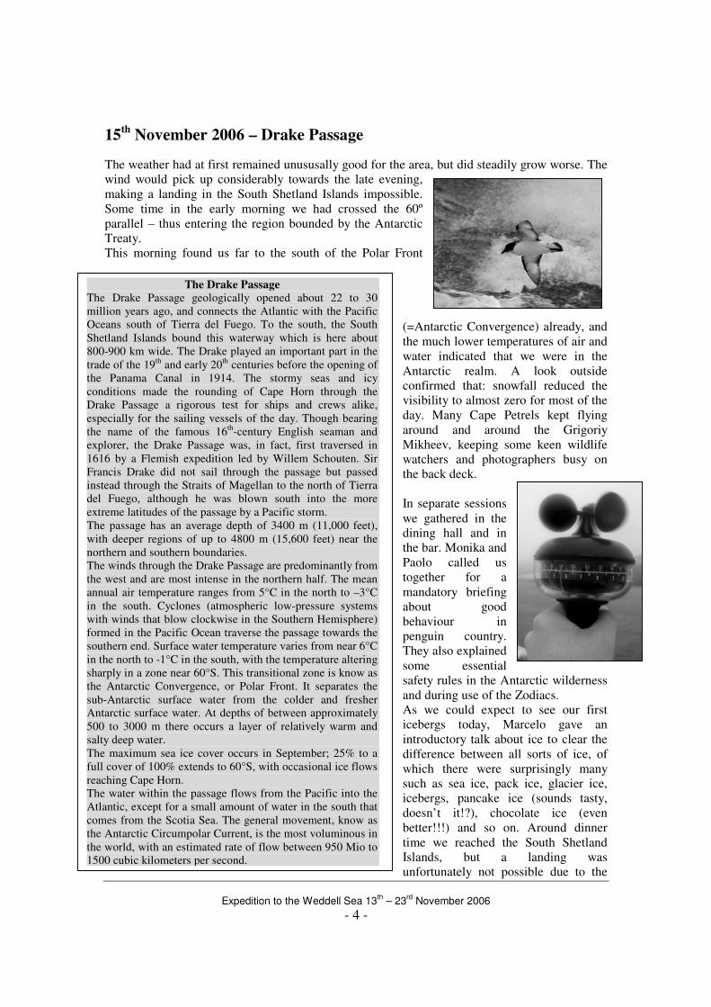
much wildlife around, but a few Cape Petrel, Giant Storm Petrels and some Albatrosses such as
Black-browed and Grey-headed Albatross came along every now and then.
After breakfast, the Mikheev-university opened and we met in the dining room to attend the first
of a series of lectures. Monika started with a talk on the early exploration of Antarctica, from the
concepts of the Greek philosophers to the classical voyages of e.g. Magellan to the actual
discovery of the continent. Marcelo than took over with geology and explained the geological
history of the Southern Ocean and all the implications its formation had such as the position of
the various islands (Falklands (now part of South America’s continental shelf), South Georgia
(microcontinent), South Sandwich (volcanic), South Orkney (microcontinent), South Shetlands
(mostly microcontinent, separated from the Antarctic peninsula by the Bransfield Strait, a young
and slowly growing ocean; some islands are
volcanic, such as Deception Island) and
cooling of global climate on a large
scale. Paolo gave a fascinating talk in
Italian about the wildlife to be expected
during our passage through the Drake.
Most of us kept enjoying an unusually
calm Drake Passage even with sunshine in
the afternoon on the outside decks.
A calm and relaxed day at sea was rounded
off in the Mikheev- cinema, where part one
and two of David Attenborough’s famous documentary about Antarctica, Life in the freezer, were
screened to get in the mood for the deep south.
Expedition to the Weddell Sea 13
th – 23
rd November 2006
- 4 -
The Drake Passage The Drake Passage geologically opened about 22 to 30
million years ago, and connects the Atlantic with the Pacific
Oceans south of Tierra del Fuego. To the south, the South
Shetland Islands bound this waterway which is here about
800-900 km wide. The Drake played an important part in the
trade of the 19th
and early 20th
centuries before the opening of
the Panama Canal in 1914. The stormy seas and icy
conditions made the rounding of Cape Horn through the
Drake Passage a rigorous test for ships and crews alike,
especially for the sailing vessels of the day. Though bearing
the name of the famous 16th
-century English seaman and
explorer, the Drake Passage was, in fact, first traversed in
1616 by a Flemish expedition led by Willem Schouten. Sir
Francis Drake did not sail through the passage but passed
instead through the Straits of Magellan to the north of Tierra
del Fuego, although he was blown south into the more
extreme latitudes of the passage by a Pacific storm.
The passage has an average depth of 3400 m (11,000 feet),
with deeper regions of up to 4800 m (15,600 feet) near the
northern and southern boundaries.
The winds through the Drake Passage are predominantly from
the west and are most intense in the northern half. The mean
annual air temperature ranges from 5°C in the north to –3°C
in the south. Cyclones (atmospheric low-pressure systems
with winds that blow clockwise in the Southern Hemisphere)
formed in the Pacific Ocean traverse the passage towards the
southern end. Surface water temperature varies from near 6°C
in the north to -1°C in the south, with the temperature altering
sharply in a zone near 60°S. This transitional zone is know as
the Antarctic Convergence, or Polar Front. It separates the
sub-Antarctic surface water from the colder and fresher
Antarctic surface water. At depths of between approximately
500 to 3000 m there occurs a layer of relatively warm and
salty deep water.
The maximum sea ice cover occurs in September; 25% to a
full cover of 100% extends to 60°S, with occasional ice flows
reaching Cape Horn.
The water within the passage flows from the Pacific into the
Atlantic, except for a small amount of water in the south that
comes from the Scotia Sea. The general movement, know as
the Antarctic Circumpolar Current, is the most voluminous in
the world, with an estimated rate of flow between 950 Mio to
1500 cubic kilometers per second.
15th November 2006 – Drake Passage
The weather had at first remained unususally good for the area, but did steadily grow worse. The
wind would pick up considerably towards the late evening,
making a landing in the South Shetland Islands impossible.
Some time in the early morning we had crossed the 60º
parallel – thus entering the region bounded by the Antarctic
Treaty.
This morning found us far to the south of the Polar Front
(=Antarctic Convergence) already, and
the much lower temperatures of air and
water indicated that we were in the
Antarctic realm. A look outside
confirmed that: snowfall reduced the
visibility to almost zero for most of the
day. Many Cape Petrels kept flying
around and around the Grigoriy
Mikheev, keeping some keen wildlife
watchers and photographers busy on
the back deck.
In separate sessions
we gathered in the
dining hall and in
the bar. Monika and
Paolo called us
together for a
mandatory briefing
about good
behaviour in
penguin country.
They also explained
some essential
safety rules in the Antarctic wilderness
and during use of the Zodiacs.
As we could expect to see our first
icebergs today, Marcelo gave an
introductory talk about ice to clear the
difference between all sorts of ice, of
which there were surprisingly many
such as sea ice, pack ice, glacier ice,
icebergs, pancake ice (sounds tasty,
doesn’t it!?), chocolate ice (even
better!!!) and so on. Around dinner
time we reached the South Shetland
Islands, but a landing was
unfortunately not possible due to the
Expedition to the Weddell Sea 13
th – 23
rd November 2006
- 5 -
extrem high winds. So we sailed on, crossing the Bransfield Strait and entering the Antarctic
Sound in the very early morning hours. We hoped, that the next morning would find us already in
the Weddell Sea and with suitable conditions to go ashore.
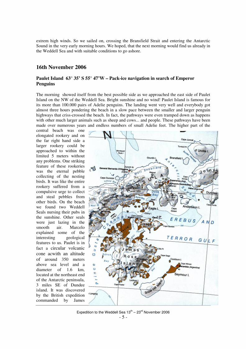
16th November 2006
Paulet Island 63° 35’ S 55° 47’W – Pack-ice navigation in search of Emperor Penguins
The morning showed itself from the best possible side as we approached the east side of Paulet
Island on the NW of the Weddell Sea. Bright sunshine and no wind! Paulet Island is famous for
its more than 100.000 pairs of Adelie penguins. The landing went very well and everybody got
almost three hours pondering the beach in a slow pace between the smaller and larger penguin
highways that criss-crossed the beach. In fact, the pathways were even tramped down as happens
with other much larger animals such as sheep and cows... and people. These pathways have been
made over numerous years and endless numbers of small Adelie feet. The higher part of the
central beach was one
elongated rookery and on
the far right hand side a
larger rookery could be
approached to within the
limited 5 meters without
any problems. One striking
feature of these rookeries
was the eternal pebble
collecting of the nesting
birds. It was like the entire
rookery suffered from a
compulsive urge to collect
and steal pebbles from
other birds. On the beach
we found two Weddell
Seals nursing their pubs in
the sunshine. Other seals
were just lazing in the
smooth air. Marcelo
explained some of the
interesting geological
features to us. Paulet is in
fact a circular volcanic
cone acwith an altitude
of around 350 meters
above sea level and a
diameter of 1.6 km,
located at the northeast end
of the Antarctic peninsula,
3 miles SE of Dundee
island. It was discovered
by the British expedition
commanded by James
Expedition to the Weddell Sea 13
th – 23
rd November 2006
- 6 -
Clark Ross, who named it for a captain of the Royal Navy.
We landed on a narrow beach made up of rounded pebbles mainly composed of volcanic rocks.
Northeast of the landing place is a distinct stack of basaltic rocks formed by marine erosion; this
is the nesting site of some shags and sheathbills. Just in front of it, a colony of shags is nesting on
the steep slope of basaltic rocks.
Going inland from the beach there were two distinct topographic features consisting of relatively
flat surfaces situated about 3 and 6 meters above sea level respectively. These tabular topographic
features extending along 400 meters were also made up of
rounded pebbles. They are likely representing marine terraces, in
other words old beaches formed in the recent geological past
during high stands of sea-level. Eastward from the stack, there is
another flat surface, about 3 meter above sea level and
composed of pebbles likely representing the continuation of
the 3 m high terrace of the landing beach. The Adelie penguins are
nesting on these surfaces as well as along some of the lateral
steep slopes of the volcanic cone. Close to the hut built by
members of the Swedish Norwegian Expedition under Otto von
Nordenskjöld, there was a volcanic rock outcrop intensely weathered by frost action. This
physical process of alteration broke the rock apart into numerous slabs of angular edges being the
raw material used by the overwintering party of the expedition to build the hut. Nearly 400 meters
beyond the hut, a frozen lake is located in a subcircular depression rimmed by volcanic rocks
which may represent the crater of the volcano. Monika told us the amazing story of the Swedish
survivors. Here a part of the Swedish Antarctic Expedition with Captain Larsen was forced to
over winter in 1902/03. Their ship the “Antarctic” was crashed by ice only 25 miles from Paulet
and they took their belongings and some provisions in the lifeboats with them. Dragging and
rowing the boats where possible they finally made it to the shore and built themselves a small hut
of rocks for shelter. Belt buckles turned into fishing hooks, but penguins were as well on the
menu. All men but one survived.
Later that evening Monika gave us a lecture on the topic, so that we got a better understanding of
what life was all about in those days of despair.
After a refreshing meal on board, it was time to go on deck. Our bridge-crew was navigating
through loose pack ice and around huge tabular icebergs en route to the South-Eastern edge of
Snow Hill Island in the southern Weddell Sea. Navigation at times got tricky and the Grigoriy
Mikheev had to push many ice-floes to get further. Finally the captain started zigzagging through
the few leads, which allowed us to go further South. The
scraping of ice on our ship´s hall made some of us nervous.
Our expectation grew from hour to hour as we got further
South. We were searching for Emperor Penguins on their way
towards the open Sea. Only six years ago Argentinean
scientists had discovered a new colony of Emperor Penguins
on the pack-ice south of Snow Hill Island. We knew, that
we couldn´t reach the colony itself, as it was located some
10km from the ice-edge inland, but had high hopes to see
some of these beautiful animals approaching us on
their own search for food. At around dinner time it became
obvious, that the ice would soon stop us completely. We
hurried our meal and soon all eyes were glued to the binoculars
as we were scanning the ice-floes for wildlife. And finally
we did succeed and spotted two emperor penguins in
the pack ice. We were all very excited when our Expedition
Expedition to the Weddell Sea 13
th – 23
rd November 2006
- 7 -
Leader announced that we would take the boats out and actually land ourselves on the packe-ice.
That was a bit scary but also very exciting. We felt like Shackleton´s men as we carefully set one
foot in front of another. Soon we realised, that the ice was holding and got more comfortable. As
we approached the majestic birds the sun was sinking and bathed the icy landscape in beautiful
soft colors. They seemed to rest next to a little iceberg. Undisturbed one hang his head for
comfort and the other one waddled a little closer to him. Penguins love company. From the top
deck, our keen birders soon spotted even more emperor penguins in the distance.
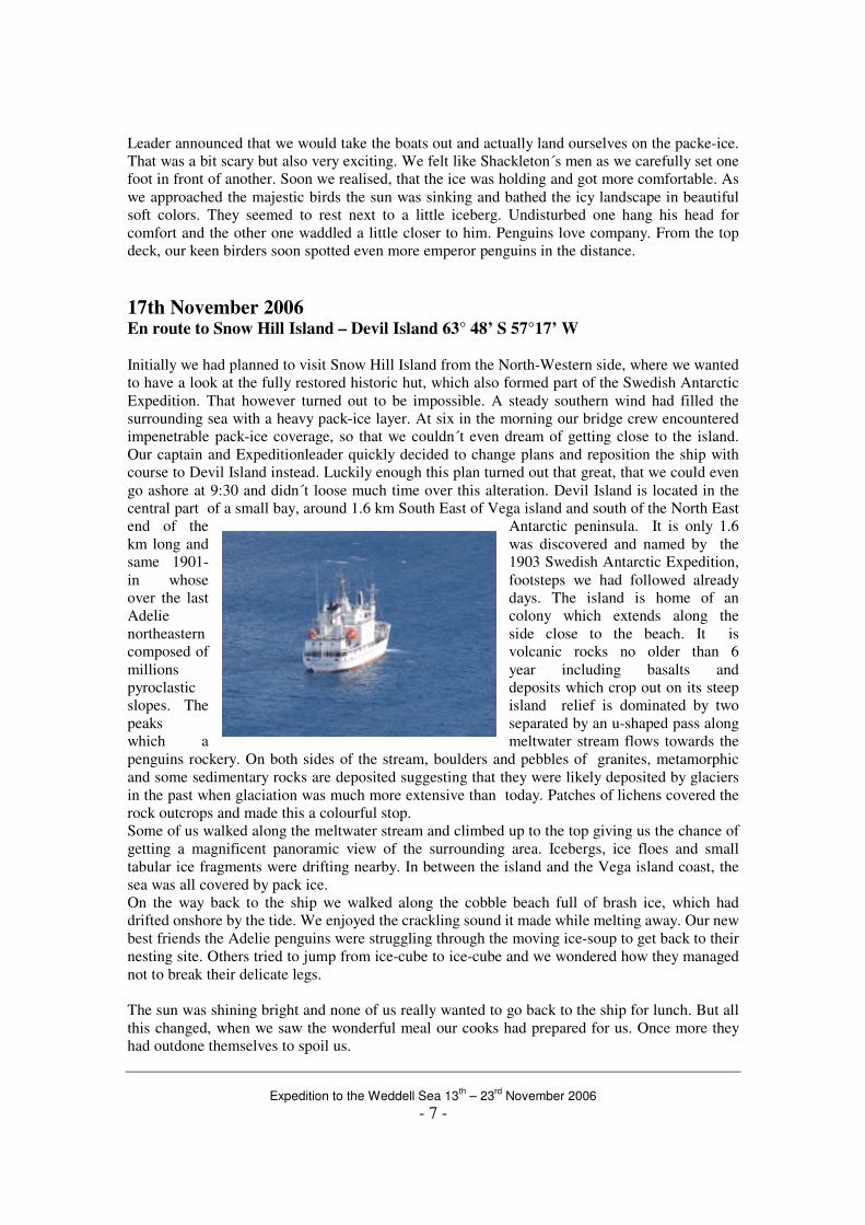
17th November 2006 En route to Snow Hill Island – Devil Island 63° 48’ S 57°17’ W
Initially we had planned to visit Snow Hill Island from the North-Western side, where we wanted
to have a look at the fully restored historic hut, which also formed part of the Swedish Antarctic
Expedition. That however turned out to be impossible. A steady southern wind had filled the
surrounding sea with a heavy pack-ice layer. At six in the morning our bridge crew encountered
impenetrable pack-ice coverage, so that we couldn´t even dream of getting close to the island.
Our captain and Expeditionleader quickly decided to change plans and reposition the ship with
course to Devil Island instead. Luckily enough this plan turned out that great, that we could even
go ashore at 9:30 and didn´t loose much time over this alteration. Devil Island is located in the
central part of a small bay, around 1.6 km South East of Vega island and south of the North East
end of the Antarctic peninsula. It is only 1.6
km long and was discovered and named by the
same 1901- 1903 Swedish Antarctic Expedition,
in whose footsteps we had followed already
over the last days. The island is home of an
Adelie colony which extends along the
northeastern side close to the beach. It is
composed of volcanic rocks no older than 6
millions year including basalts and
pyroclastic deposits which crop out on its steep
slopes. The island relief is dominated by two
peaks separated by an u-shaped pass along
which a meltwater stream flows towards the
penguins rockery. On both sides of the stream, boulders and pebbles of granites, metamorphic
and some sedimentary rocks are deposited suggesting that they were likely deposited by glaciers
in the past when glaciation was much more extensive than today. Patches of lichens covered the
rock outcrops and made this a colourful stop.
Some of us walked along the meltwater stream and climbed up to the top giving us the chance of
getting a magnificent panoramic view of the surrounding area. Icebergs, ice floes and small
tabular ice fragments were drifting nearby. In between the island and the Vega island coast, the
sea was all covered by pack ice.
On the way back to the ship we walked along the cobble beach full of brash ice, which had
drifted onshore by the tide. We enjoyed the crackling sound it made while melting away. Our new
best friends the Adelie penguins were struggling through the moving ice-soup to get back to their
nesting site. Others tried to jump from ice-cube to ice-cube and we wondered how they managed
not to break their delicate legs.
The sun was shining bright and none of us really wanted to go back to the ship for lunch. But all
this changed, when we saw the wonderful meal our cooks had prepared for us. Once more they
had outdone themselves to spoil us.
Expedition to the Weddell Sea 13
th – 23
rd November 2006
- 8 -
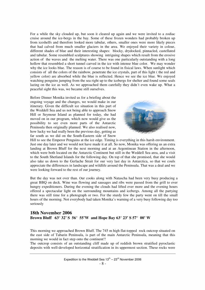
For a while the sky clouded up, but soon it cleared up again and we were invited to a zodiac
cruise around the ice-bergs in the bay. Some of these frozen wonders had probably broken up
from iceshelfs and therefore looked more tabular, others, smaller ones were more likely pieces
that had calved from much smaller glaciers in the area. We enjoyed their variety in colour,
different shades of blue and their interesting shapes: blocky, drydocked, pinnacled, castellated
and tabular. Some resembled sculptures showing intriguing shapes which result from the erosive
action of the waves and the melting water. There was one particularly outstanding with a long
hollow that resembled a short tunnel carved in the ice with intense blue color. We may wonder
why the ice looks blue. The reason is of course to be found in fisical laws. When sunlight which
consists of all the colors of the rainbow, penetrate the ice crystals, part of this light ( the red and
yellow color) are absorbed while the blue is reflected. Hence we see the ice blue. We enjoyed
watching penguins jumping from the sea right up to the icebergs for shelter and found some seals
lazing on the ice as well. As we approached them carefully they didn´t even wake up. What a
peaceful sight this was, we became still ourselves.
Before Dinner Monika invited us for a briefing about the
ongoing voyage and the changes, we would make in our
itinerary. Given the difficult ice situation in this part of
the Weddell Sea and us not being able to approach Snow
Hill or Seymour Island as planned for today, she had
moved on in our program, which now would give us the
possibility to see even more parts of the Antarctic
Peninsula then originally planned. We also realised now,
how lucky we had really been the previous day, getting as
far south as we did on the South-Eastern side of Snow
Hill to see the Emperor Penguins at the ice edge. Timing is everything in this harsh environment.
Just one day later and we would not have made it at all. So now, Monika was offering us an extra
landing at Brown Bluff for the next morning and at an Argentinean Station in the afternoon,
which were both located on the Antarctic Continent but still in the Weddell Sea area, and a visit
to the South Shetland Islands for the following day. On top of that she promised, that she would
also take us down to the Gerlache Strait for our very last day in Antarctica, so that we couls
appreciate the differences in landscape and wildlife around the Peninsula. That was a deal and we
were looking forward to the rest of our journey.
But the day was not over than. Our cooks along with Natascha had been very busy producing a
great BBQ on deck. Wine was flowing and sausages and ribs were passed from the grill to ever
hungry expeditioners. During the evening the clouds had lifted ever more and the evening hours
offered a spectacular light on the surrounding mountains and icebergs. Among all the partying
there was still time for a photograph or two. For the sturdy few the party went on till the small
hours of the morning. Not everybody had taken Monika’s warning of a very busy following day too
seriously
18th November 2006 Brown Bluff 63° 32’ S 56° 55’W and Hope Bay 63° 23’ S 57° 00’ W
This morning we approached Brown Bluff. The 745 m high flat-topped rock outcrop situated on
the east side of Tabarin Peninsula, is part of the main Antarctic Peninsula, meaning that this
morning we would in fact step onto the continent!!
The outcrop consists of an outstanding cliff made up of reddish brown stratified pyroclastic
deposits with well-developed horizontal stratification in its uppermost section. These rocks were
Expedition to the Weddell Sea 13
th – 23
rd November 2006
- 9 -
formed by the same volcanic cycle that gave birth to Devil Island. Fragmentary deposits coming
off from the active erosion of the exposures are deposited at the foot of the cliff giving way to the
formation of an irregular topography of small hills on which adelie penguins are nesting.
Southward of the landing place, a relatively flat surface composed of pebbles was chosen by a
small colony of gentoo penguins to build their nests. Southwards, several big boulders of
volcanic breccias were scattered along with large fragments of pillow lavas which are usually
formed by underwater eruptions.. Also, large and rounded boulders of granitic rocks resulting
from the past action of glaciers were found along the beach. Further away, the rock outcrops
disappear under a thick glacial cover forming a high ice wall.
Brown Bluff is a fantastic place with myriads of adelie penguins along with a small rookery of
gentoos. The adelies came in a continuous flow along the beach towards there respective nests on
the far right hand side of the beach. Constantly they popped out of the water looking perplexed to
see strange two-legged creatures on their beach. After a little bit of quarrelling, a bit of wing
beating followed by a very curious look and a bit of preening, they seemed to realize that we
meant no harm to them and continued their long road to the rookery. Occasionally, penguins
came rushing out of the sea almost on top of us. And that with a good reason; just amidst the ice
floes on the coast were two leopard seals lurking, waiting for their next meal. We had no such
luck as to see that, but the result of leopard seals could be seen on several penguins on the beach.
Severe wounds were evidence of the danger in which penguins all over the region live in.
Back on board we had to hurry with our meal, as we were invited to visit an Antarctic Station this
afternoon. As we enjoyed lunch, the captain repositioned our ship towards Hope Bay. This bay
had also been discovered by the Swedish Antarctic Expedition and the remains of the hut built by
some of their members reminds us still today of the heartships they endured here. Today a
permanent base is operated here by the Argentineans: Base Esperanza. Around 60 people live
here, including 18 children and we were curious to meet them.
Some of us took their passports to get an Antarctic stamp, others had prepared postcards, which
they planned to mail from here and all of us wanted to do some shopping as well. The friendly
base personnel gave us a tour around their facilities. They had even prepared tea and coffee for us
and we felt very welcome inmidst this spectacular panoramic surroundings. Meanwhile the kids
living the station were curious about our ship and Monika invited them along to have cokes and
cookies on board. Not long after we were on our way through the Antarctic Sound en route to
Deception Island, our next days destination.
19th
November 2006 Deception Island: Whalers Bay / ship´s cruise inside the caldera of Deception
62° 56’S 60° 36’W After we had got ready for the day, at 08.30 our captain guided the Grigoriy Mikheev safely
through Neptune’s Bellows and, despite of showers of snow and a fully grown storm, many of us
stood on deck to watch our passage through the narrow neck of Deception Island’s flooded caldera,
with cliffs looming down from either side.
The name Deception Island, which has been in use since 1821, derives from the old English term
‘deceipt’ which means secluded or sheltered. The remains of Southern Hunter, wrecked in 1956,
presented a cautionary tale of the necessity for careful navigation through Neptune’s Bellows.
Once we had passed Neptune’s Bellows, we found ourselves in Port Foster, the history of which
went back to the days of the American sealer Nathaniel Palmer, when he entered the caldera in
1820, shortly after the island had been discovered.
Expedition to the Weddell Sea 13
th – 23
rd November 2006
- 10 -
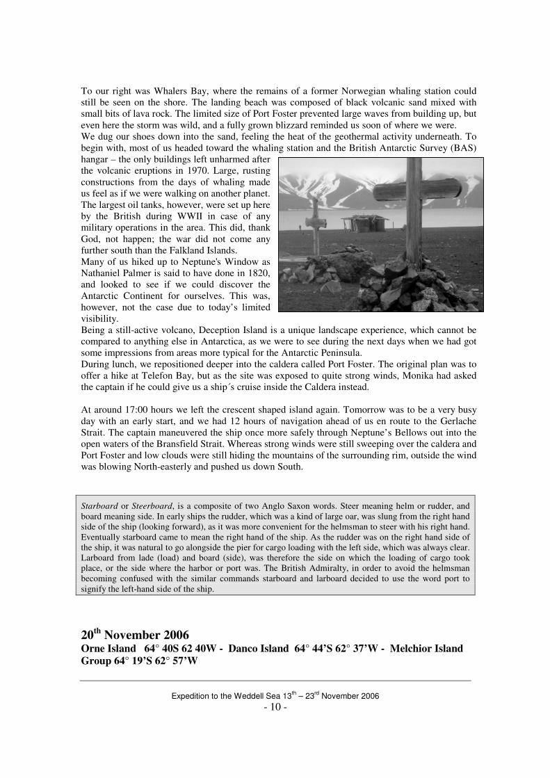
To our right was Whalers Bay, where the remains of a former Norwegian whaling station could
still be seen on the shore. The landing beach was composed of black volcanic sand mixed with
small bits of lava rock. The limited size of Port Foster prevented large waves from building up, but
even here the storm was wild, and a fully grown blizzard reminded us soon of where we were.
We dug our shoes down into the sand, feeling the heat of the geothermal activity underneath. To
begin with, most of us headed toward the whaling station and the British Antarctic Survey (BAS)
hangar – the only buildings left unharmed after
the volcanic eruptions in 1970. Large, rusting
constructions from the days of whaling made
us feel as if we were walking on another planet.
The largest oil tanks, however, were set up here
by the British during WWII in case of any
military operations in the area. This did, thank
God, not happen; the war did not come any
further south than the Falkland Islands.
Many of us hiked up to Neptune's Window as
Nathaniel Palmer is said to have done in 1820,
and looked to see if we could discover the
Antarctic Continent for ourselves. This was,
however, not the case due to today’s limited
visibility.
Being a still-active volcano, Deception Island is a unique landscape experience, which cannot be
compared to anything else in Antarctica, as we were to see during the next days when we had got
some impressions from areas more typical for the Antarctic Peninsula.
During lunch, we repositioned deeper into the caldera called Port Foster. The original plan was to
offer a hike at Telefon Bay, but as the site was exposed to quite strong winds, Monika had asked
the captain if he could give us a ship´s cruise inside the Caldera instead.
At around 17:00 hours we left the crescent shaped island again. Tomorrow was to be a very busy
day with an early start, and we had 12 hours of navigation ahead of us en route to the Gerlache
Strait. The captain maneuvered the ship once more safely through Neptune’s Bellows out into the
open waters of the Bransfield Strait. Whereas strong winds were still sweeping over the caldera and
Port Foster and low clouds were still hiding the mountains of the surrounding rim, outside the wind
was blowing North-easterly and pushed us down South.
Starboard or Steerboard, is a composite of two Anglo Saxon words. Steer meaning helm or rudder, and
board meaning side. In early ships the rudder, which was a kind of large oar, was slung from the right hand
side of the ship (looking forward), as it was more convenient for the helmsman to steer with his right hand.
Eventually starboard came to mean the right hand of the ship. As the rudder was on the right hand side of
the ship, it was natural to go alongside the pier for cargo loading with the left side, which was always clear.
Larboard from lade (load) and board (side), was therefore the side on which the loading of cargo took
place, or the side where the harbor or port was. The British Admiralty, in order to avoid the helmsman
becoming confused with the similar commands starboard and larboard decided to use the word port to
signify the left-hand side of the ship.
20th November 2006 Orne Island 64° 40S 62 40W - Danco Island 64° 44’S 62° 37’W - Melchior Island Group 64° 19’S 62° 57’W
Expedition to the Weddell Sea 13
th – 23
rd November 2006
- 11 -
During the night, we had been cruising through the very scenic Gerlache Strait, named after
Adrien de Gerlache, a Belgian explorer who discovered the area during an expedition which
lasted from late 1897 to 1899 on board the ship Belgica. On board was a who is who of the later
crème of polar explorers: the Polish geologist Henryk Arctowski, the American Frederick Cook
who later claimed the North Pole, and no less than Roald Amundsen, who later was to conquer
the South Pole, was the first mate of the Belgica. They explored and mapped the area around the
Gerlache Strait and then sailed further south, crossing the South Polar Circle, where they were
forced to winter – the first expedition ever to do so in those latitudes. Not without some luck and
quite a bit of effort, they managed to get out of the ice after more than a year!
Many of the islands around us were named by de Gerlache, but not
so Orne Island, where we were about to go ashore before breakfast –
yes, before. Well, we had only a handfull of precious days down here
in the most beautiful part of the Antarctic Peninsula, so we had to
make the most of it. Monika’s dulce voice got us out of bed at 0530,
and not much more than half an hour later we were ready at the
gangway to land on the northern side of rocky Orne Island, a small
group of islands directly at the northern tip of Rongé Island.
There was a bit of wind blowing and some waves came in from the
wide Gerlache Strait, but we would not let this discourage us. The
great advantage was that those of us who had not yet taken the time
to take a shower this morning could make up for this, especially our
brave expedition staff who helped us to disembark on the rocky
shore.
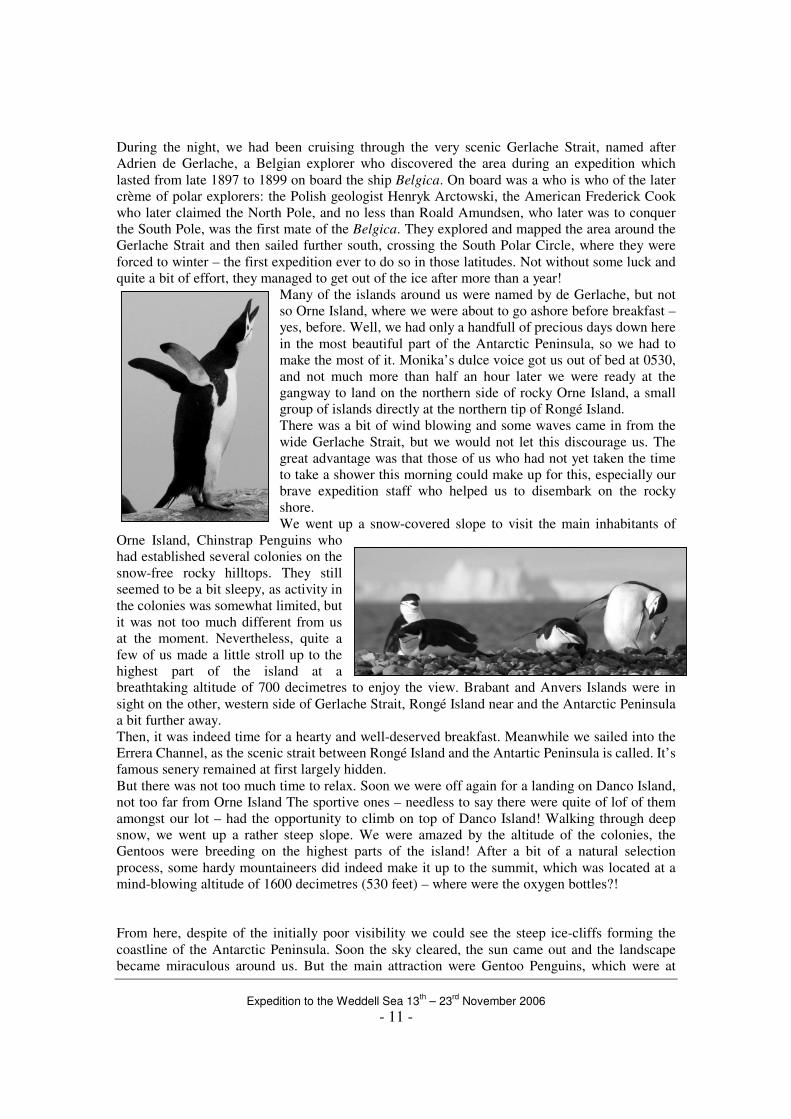
We went up a snow-covered slope to visit the main inhabitants of
Orne Island, Chinstrap Penguins who
had established several colonies on the
snow-free rocky hilltops. They still
seemed to be a bit sleepy, as activity in
the colonies was somewhat limited, but
it was not too much different from us
at the moment. Nevertheless, quite a
few of us made a little stroll up to the
highest part of the island at a
breathtaking altitude of 700 decimetres to enjoy the view. Brabant and Anvers Islands were in
sight on the other, western side of Gerlache Strait, Rongé Island near and the Antarctic Peninsula
a bit further away.
Then, it was indeed time for a hearty and well-deserved breakfast. Meanwhile we sailed into the
Errera Channel, as the scenic strait between Rongé Island and the Antartic Peninsula is called. It’s
famous senery remained at first largely hidden.
But there was not too much time to relax. Soon we were off again for a landing on Danco Island,
not too far from Orne Island The sportive ones – needless to say there were quite of lof of them
amongst our lot – had the opportunity to climb on top of Danco Island! Walking through deep
snow, we went up a rather steep slope. We were amazed by the altitude of the colonies, the
Gentoos were breeding on the highest parts of the island! After a bit of a natural selection
process, some hardy mountaineers did indeed make it up to the summit, which was located at a
mind-blowing altitude of 1600 decimetres (530 feet) – where were the oxygen bottles?!
From here, despite of the initially poor visibility we could see the steep ice-cliffs forming the
coastline of the Antarctic Peninsula. Soon the sky cleared, the sun came out and the landscape
became miraculous around us. But the main attraction were Gentoo Penguins, which were at
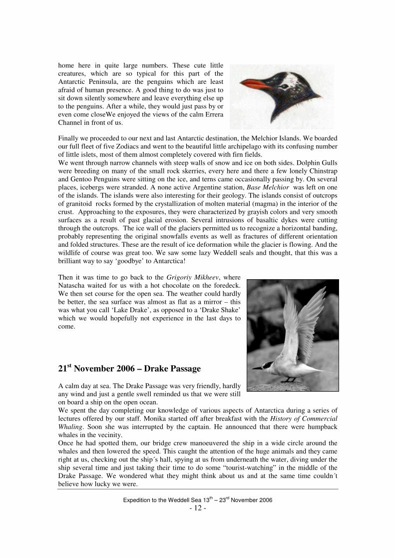
Expedition to the Weddell Sea 13
th – 23
rd November 2006
- 12 -
home here in quite large numbers. These cute little
creatures, which are so typical for this part of the
Antarctic Peninsula, are the penguins which are least
afraid of human presence. A good thing to do was just to
sit down silently somewhere and leave everything else up
to the penguins. After a while, they would just pass by or
even come closeWe enjoyed the views of the calm Errera
Channel in front of us.
Finally we proceeded to our next and last Antarctic destination, the Melchior Islands. We boarded
our full fleet of five Zodiacs and went to the beautiful little archipelago with its confusing number
of little islets, most of them almost completely covered with firn fields.
We went through narrow channels with steep walls of snow and ice on both sides. Dolphin Gulls
were breeding on many of the small rock skerries, every here and there a few lonely Chinstrap
and Gentoo Penguins were sitting on the ice, and terns came occasionally passing by. On several
places, icebergs were stranded. A none active Argentine station, Base Melchior was left on one
of the islands. The islands were also interesting for their geology. The islands consist of outcrops
of granitoid rocks formed by the crystallization of molten material (magma) in the interior of the
crust. Approaching to the exposures, they were characterized by grayish colors and very smooth
surfaces as a result of past glacial erosion. Several intrusions of basaltic dykes were cutting
through the outcrops. The ice wall of the glaciers permitted us to recognize a horizontal banding,
probably representing the original snowfalls events as well as fractures of different orientation
and folded structures. These are the result of ice deformation while the glacier is flowing. And the
wildlife of course was great too. We saw some lazy Weddell seals and thought, that this was a
brilliant way to say ‘goodbye’ to Antarctica!
Then it was time to go back to the Grigoriy Mikheev, where
Natascha waited for us with a hot chocolate on the foredeck.
We then set course for the open sea. The weather could hardly
be better, the sea surface was almost as flat as a mirror – this
was what you call ‘Lake Drake’, as opposed to a ‘Drake Shake’
which we would hopefully not experience in the last days to
come.
21st November 2006 – Drake Passage
A calm day at sea. The Drake Passage was very friendly, hardly
any wind and just a gentle swell reminded us that we were still
on board a ship on the open ocean.
We spent the day completing our knowledge of various aspects of Antarctica during a series of
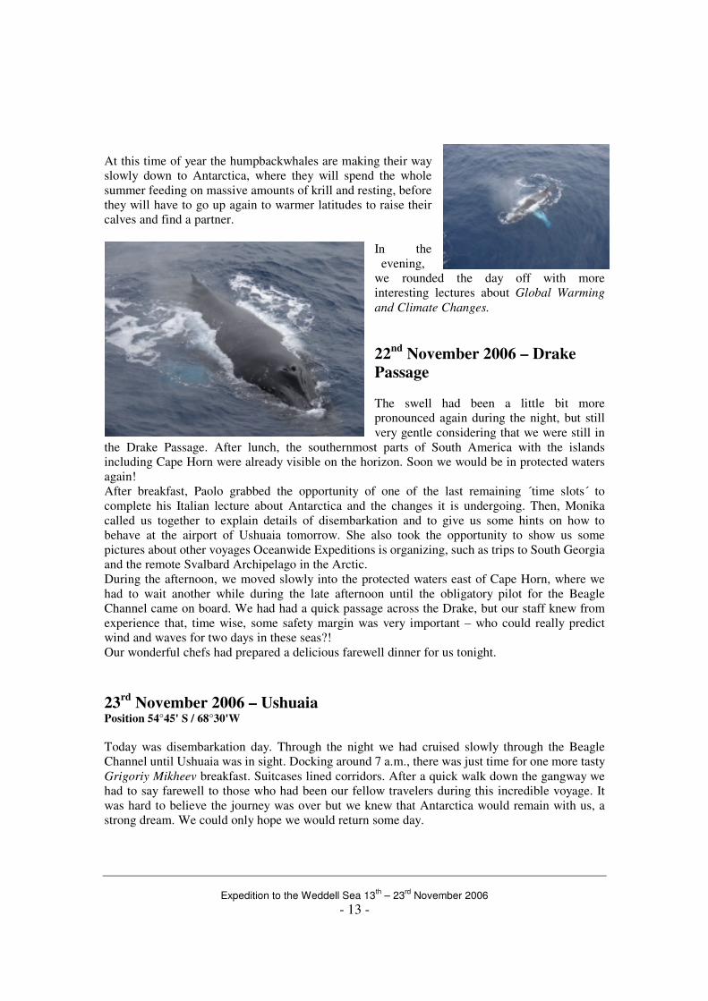
lectures offered by our staff. Monika started off after breakfast with the History of Commercial
Whaling. Soon she was interrupted by the captain. He announced that there were humpback
whales in the vecinity.
Once he had spotted them, our bridge crew manoeuvered the ship in a wide circle around the
whales and then lowered the speed. This caught the attention of the huge animals and they came
right at us, checking out the ship´s hall, spying at us from underneath the water, diving under the
ship several time and just taking their time to do some “tourist-watching” in the middle of the
Drake Passage. We wondered what they might think about us and at the same time couldn´t
believe how lucky we were.
Expedition to the Weddell Sea 13
th – 23
rd November 2006
- 13 -
At this time of year the humpbackwhales are making their way
slowly down to Antarctica, where they will spend the whole
summer feeding on massive amounts of krill and resting, before
they will have to go up again to warmer latitudes to raise their
calves and find a partner.
In the
evening,
we rounded the day off with more
interesting lectures about Global Warming
and Climate Changes.
22nd
November 2006 – Drake Passage
The swell had been a little bit more
pronounced again during the night, but still
very gentle considering that we were still in
the Drake Passage. After lunch, the southernmost parts of South America with the islands
including Cape Horn were already visible on the horizon. Soon we would be in protected waters
again!
After breakfast, Paolo grabbed the opportunity of one of the last remaining ´time slots´ to
complete his Italian lecture about Antarctica and the changes it is undergoing. Then, Monika
called us together to explain details of disembarkation and to give us some hints on how to
behave at the airport of Ushuaia tomorrow. She also took the opportunity to show us some
pictures about other voyages Oceanwide Expeditions is organizing, such as trips to South Georgia
and the remote Svalbard Archipelago in the Arctic.
During the afternoon, we moved slowly into the protected waters east of Cape Horn, where we
had to wait another while during the late afternoon until the obligatory pilot for the Beagle
Channel came on board. We had had a quick passage across the Drake, but our staff knew from
experience that, time wise, some safety margin was very important – who could really predict
wind and waves for two days in these seas?!
Our wonderful chefs had prepared a delicious farewell dinner for us tonight.
23rd
November 2006 – Ushuaia Position 54°45' S / 68°30'W
Today was disembarkation day. Through the night we had cruised slowly through the Beagle
Channel until Ushuaia was in sight. Docking around 7 a.m., there was just time for one more tasty
Grigoriy Mikheev breakfast. Suitcases lined corridors. After a quick walk down the gangway we
had to say farewell to those who had been our fellow travelers during this incredible voyage. It
was hard to believe the journey was over but we knew that Antarctica would remain with us, a
strong dream. We could only hope we would return some day.
Expedition to the Weddell Sea 13
th – 23
rd November 2006
- 14 -
Total length of this trip:
1685 nm / 3120 km
It was a great pleasure to have you with us! We
hope to see you again on one of Oceanwide’s
Expedition Cruises in the
Arctic or the Antarctic!
Marcelo Zárate [email protected]
Monika Schillat [email protected]
Paolo Bernat [email protected]
Text, photos, maps, drawings, layout and all
mistakes by Marcelo Zárate, Paolo Bernat and
Monika Schillat. Species list compiled by Jan Peter
Smith .
Oceanwide Expeditions
Bellamypark 9 NL-4381 CG Vlissingen
The Netherlands Tel. +31 118 410 410 Fax +31 118 410 417
Web www.oceanwide-expeditions.com