EXECUTIVE SUMMARY INTRODUCTION AND … · Ø English posters announcing the proposed project as...
40
EIA PROCESS FOR THE CONSTRUCTION OF ROAD PWV3 Draft Scoping Report APRIL 2008 Prepared by Jeffares & Green (Pty) Ltd for SANRAL 4/18/2008 W:\031205 - SANRAL EAP PWV3 & R512\04 Documents and Reports\J&G Reports\031205 Final Draft Scoping Report (16-04-08).doc Page i of 40 EXECUTIVE SUMMARY INTRODUCTION AND PURPOSE OF THE REPORT The South African National Roads Agency (Pty) Ltd (SANRAL) appointed Jeffares & Green (Pty) Ltd in November 2007, to undertake an Environmental Impact Assessment (EIA) process for the construction of road PWV3 from road P123-1 to road 980. This Draft Scoping Report (DSR) has been compiled and distributed as part of the aforementioned EIA process. The main aim of the report is to highlight the findings of the environmental assessment that has been done thus far, with regards to this project. It also gives the members of the public as well as the other Interested and Affected Parties (I&APs) an opportunity to gain more insight into the proposed project and to know more about the identified possible environmental impacts, enabling them to participate meaningfully in the project. Written comments and/or queries, if any, should be forwarded to Miss Nthabiseng Tlhoaele of Jeffares & Green (Pty) Ltd at the following: Tel: (011) 807 0660 Fax: (011) 807 1607 E-mail: [email protected] Postal address: P. O. Box 1109 Sunninghill APPROACH TO THE STUDY Review of relevant legislation Historical background and review of available information from previous planning process Site visit Issues raised by interested and affected parties Recommendations for the EIA phase
Transcript of EXECUTIVE SUMMARY INTRODUCTION AND … · Ø English posters announcing the proposed project as...

EIA PROCESS FOR THE CONSTRUCTION OF ROAD PWV3 Draft Scoping Report
APRIL 2008
Prepared by Jeffares & Green (Pty) Ltd for SANRAL 4/18/2008 W:\031205 - SANRAL EAP PWV3 & R512\04 Documents and Reports\J&G Reports\031205 Final Draft Scoping Report (16-04-08).doc
Page i of 40
EXECUTIVE SUMMARY INTRODUCTION AND PURPOSE OF THE REPORT The South African National Roads Agency (Pty) Ltd (SANRAL) appointed Jeffares &
Green (Pty) Ltd in November 2007, to undertake an Environmental Impact Assessment
(EIA) process for the construction of road PWV3 from road P123-1 to road 980. This
Draft Scoping Report (DSR) has been compiled and distributed as part of the
aforementioned EIA process. The main aim of the report is to highlight the findings of
the environmental assessment that has been done thus far, with regards to this project.
It also gives the members of the public as well as the other Interested and Affected
Parties (I&APs) an opportunity to gain more insight into the proposed project and to
know more about the identified possible environmental impacts, enabling them to
participate meaningfully in the project.
Written comments and/or queries, if any, should be forwarded to Miss Nthabiseng
Tlhoaele of Jeffares & Green (Pty) Ltd at the following:
Tel: (011) 807 0660
Fax: (011) 807 1607
E-mail: [email protected]
Postal address: P. O. Box 1109
Sunninghill
APPROACH TO THE STUDY
Review of relevant legislation
Historical background and review of available information from previous planning
process
Site visit
Issues raised by interested and affected parties
Recommendations for the EIA phase

EIA PROCESS FOR THE CONSTRUCTION OF ROAD PWV3 Draft Scoping Report
APRIL 2008
Prepared by Jeffares & Green (Pty) Ltd for SANRAL 4/18/2008 W:\031205 - SANRAL EAP PWV3 & R512\04 Documents and Reports\J&G Reports\031205 Final Draft Scoping Report (16-04-08).doc
Page ii of 40
LEGISLATIVE REQUIREMENTS
The main legislation pertaining to this project is the National Environmental Management
Act (Act 107 of 1998). Under this Act are the EIA Regulations which present the
guidelines describing how the proposed project is to be undertaken. Other Acts relevant
to this project include: the Constitution of the Republic of South Africa (Act 108 of 1996)
and the National Heritage Resources Act (Act 25 of 1995).
THE EIA PROCESS
The EIA process constitutes a Scoping Phase, of which this report is a result, as well as
the actual EIA Phase.
The following activities have been undertaken during the Scoping Phase:
Ø An application for the registration of the EIA process was submitted to the
National Department of Environmental Affairs and Tourism (DEAT) on behalf of
SANRAL, in January 2008.
Ø An I&APs database was opened. This database will be updated and managed
throughout the entire duration of the EIA process.
Ø An initial site visit was undertaken by the Jeffares & Green (Pty) Ltd
environmental consultants in January, to assess the scope of work required
2008.
Ø A Background Information Document (BID) was drafted and sent out to pre-
identifies I&AP’s like the Department for Water Affairs and Forestry (DWAF), the
South African Heritage Resources Agency (SAHRA) and the Wildlife and
Environment Society of South Africa (WESSA) as well as to the public for their
perusal and submission of comments or queries.
Ø A newspaper advert announcing the proposed project as well as the public
consultation process was placed in Die Beeld Newspaper on the 06th February
2008.
Ø English posters announcing the proposed project as well as the public
consultation process were placed on site as well as in adjacent areas.

EIA PROCESS FOR THE CONSTRUCTION OF ROAD PWV3 Draft Scoping Report
APRIL 2008
Prepared by Jeffares & Green (Pty) Ltd for SANRAL 4/18/2008 W:\031205 - SANRAL EAP PWV3 & R512\04 Documents and Reports\J&G Reports\031205 Final Draft Scoping Report (16-04-08).doc
Page iii of 40
Ø Following the issuing of the BID, comments from some of the registered I&APs
were received and recorded in a comments and responses report.
Ø The Draft Scoping Report is to be distributed for public review on the
17th April 2008, after which I&APs will have 21 days to review it.
Ø An Open Day session has been planned for the 10th May 2008 to allow the
general public to review and comment on he proposed project.
DESCRIPTION OF THE PROPOSED PROJECT
The proposed project involves the construction of road PWV3 from road P123-1 to road
980, a bridge and on-and-off ramps to the N4 Platinum highway (Figure 2). The Scope of
Work entails:
Ø The construction of one carriageway of the future dual carriageway of road
PWV3 with 2 lanes, each with a width of 3.7m, and surfaced shoulders of 2.7m.
Ø The construction of an approximately 26 m deep maximum and 600 m long
cutting through the Magaliesberg Nature Area at Pampoennek.
Ø The construction of a bridge where road PWV3 passes over road P123-1.
Ø The construction of on-and-off ramps from road PWV3 to road P123-1 and 980.
DESCRIPTION OF THE AFFECTED ENVIRONMENT
5.1 Socio-economic demographic
The study area falls within the jurisdiction of the Madibeng Local Municipality, which in
turn falls under the jurisdiction of the Bojanala Platinum District Municipality. The
Madibeng Local Municipality covers an area of 3 814km2, and is positioned 60km from
Rustenburg and 50km from Pretoria. The municipal area is also situated on the Heritage
route linking the Cradle of Humankind world heritage site with the Pilanesburg and
Madikwe game reserves. It is estimated that there are over 420 000 people within the
municipal area. The economy of this municipal area is mainly comprised of the
agricultural, mining, manufacturing and tourism sectors. The location of the proposed
road is also situated on the Heritage route linking the Cradle of Humankind world
heritage site with the Pilanesburg and Madikwe game reserves

EIA PROCESS FOR THE CONSTRUCTION OF ROAD PWV3 Draft Scoping Report
APRIL 2008
Prepared by Jeffares & Green (Pty) Ltd for SANRAL 4/18/2008 W:\031205 - SANRAL EAP PWV3 & R512\04 Documents and Reports\J&G Reports\031205 Final Draft Scoping Report (16-04-08).doc
Page iv of 40
5.2 The Biophysical environment
The study area consists of the Moot Plain Bushveld as well as the Gold Reef Mountain
Bushveld. The study is situated within a summer rainfall area, with dry winters. The
geology of the area consists predominantly of quartizites, conglomerates, shale, clastic
sediment and minor carbonates of the Pretoria Group. The Magaliesberg area, including
a portion of the proposed project location, is home to a number of breeding pairs of
Cape Vultures (Gyps coprotheres). The proximity of the Hartebeespoort Dam
contributes to the sustainability of tourism and agricultural activities in the area.
ISSUES AND CONCERNS REGARDING THE PROPOSED PROJECT The following are the comments and concerns raised thus far, in no order of importance:
Ø Proposal for the construction of a dual, and not a single carriageway.
Ø Road safety measures.
Ø Regular and proper road maintenance.
Ø Inconveniences and time-delays to road users during the construction phase.
Ø The impact of the proposed road (during the construction phase) on businesses
in the area.
Ø Noise and air pollution.
Ø Compliance with the proposed Magaliesberg EMF.
Ø The historical significance of the proposed construction site to be regarded.
Ø The potential negative impact of the proposed road on the Dan Doryn
Commercial Hub and potential of the initiation of informal trading centres.
Ø Potential disturbance to the fauna and flora life in the Magaliesberg Protected
Area.
Ø Visual impacts
Ø Traffic congestion.
Ø Short life-span of employment created by projects involving road construction.
Positive reaction to the proposed road was also received from various I&AP’s.
REVIEW OF AVAILABLE INFORMATION
The following historical data sources, taken from a 1981 report by Dames & Moore were
looked at as part of the background information available on the project:

EIA PROCESS FOR THE CONSTRUCTION OF ROAD PWV3 Draft Scoping Report
APRIL 2008
Prepared by Jeffares & Green (Pty) Ltd for SANRAL 4/18/2008 W:\031205 - SANRAL EAP PWV3 & R512\04 Documents and Reports\J&G Reports\031205 Final Draft Scoping Report (16-04-08).doc
Page v of 40
• Aquatic impact assessment
• Vegetation assessment
• Faunal assessment
• Soils and geology assessment
• Hydrology and physical chemical water quality assessment
• Land use assessment
• Historical and archaeological assessment
• Socio-economic assessment
• Air quality assessment
• Noise assessment
• Visual assessment
PROPOSED SPECIALISTS STUDIES The consultant’s team will conduct the following specialist studies in view of the possible
impacts considered with regards to the proposed project:
7.1 Floral Assessment
7.2 Faunal Assessment
7.3 Heritage Impact Assessment
7.4 Social Impact Assessment
PLAN OF STUDY FOR EIA The specialist studies proposed in this report will be undertaken. If additional studies are
recommended, they will be motivated for and added to the list of studies currently
proposed. An issues assessment will be conducted and included in the final
Environmental Impact Report (EIR) by integrating the findings of the specialist studies as
well as the outcome of the public consultation process. A synopsis of significant and
possible negative impacts before and after mitigation will be summarised, tabulated and
rated according to the following set of criteria: Extent (Spatial Scale); Duration; Intensity;
Probability; and Significance.

EIA PROCESS FOR THE CONSTRUCTION OF ROAD PWV3 Draft Scoping Report
APRIL 2008
Prepared by Jeffares & Green (Pty) Ltd for SANRAL 4/18/2008 W:\031205 - SANRAL EAP PWV3 & R512\04 Documents and Reports\J&G Reports\031205 Final Draft Scoping Report (16-04-08).doc
Page v i of 40
TABLE OF CONTENTS EXECUTIVE SUMMARY ......................................................................................................i 1. INTRODUCTION AND PURPOSE OF DRAFT SCOPING REPORT................... - 1 -
1.1 Terms of Reference........................................................................................ - 1 - 1.2 Background to the proposed project............................................................... - 1 - 1.3 I&AP comments regarding the Draft Scoping Report .................................... - 2 -
2. THE ENVIRONMENTAL IMPACT ASSESSMENT PROCESS............................. - 2 - 2.1 The Legislative Background ....................................................................... - 2 - 2.1.1 The Constitution of the Republic of South Africa................................... - 2 - 2.1.2 The National Environmental Management Act....................................... - 3 - 2.1.3 The National Heritage Resources Act.................................................... - 4 - 2.1.4 Other applicable legislation..................................................................... - 4 -
2.2 The EIA Process............................................................................................. - 5 - 2.2.1 The Scoping Phase................................................................................. - 5 - 2.2.2 The EIA Phase........................................................................................ - 6 - 2.2.3 Scoping Phase tasks undertaken thus far.............................................. - 7 -
3 DESCRIPTION OF THE PROPOSED PROJECT AND ALTERNATIVES.......... - 10 - 3.1 Project Description ........................................................................................ - 10 - 3.2 Project alternatives ....................................................................................... - 13 -
3.2.1 The No-Go Alternative .......................................................................... - 13 - 3.2.2 Route alternatives ................................................................................. - 13 - 3.2.3 Design alternatives ............................................................................... - 14 -
(a) Alternative 1 (A1) .......................................................................................... - 14 - (b) Alternative 2 (A2) .......................................................................................... - 14 - (c) Alternative 3 (B1) .......................................................................................... - 14 - (d) Alternative 4 (B2) .......................................................................................... - 14 - (e) Alternative 5 (C1).......................................................................................... - 14 - (f) Alternative 6 (C2).......................................................................................... - 15 - General...................................................................................................................... - 15 -
4 DESCRIPTION OF THE AFFECTED ENVIRONMENT ....................................... - 15 - 4.1 Socio-Economic Environment....................................................................... - 17 -
4.1.1 Socio-economic demographic .............................................................. - 17 - 4.1.2 Tourism................................................................................................. - 17 - 4.1.3 Heritage................................................................................................. - 18 -
4.2 Biophysical Environment .............................................................................. - 19 - 4.2.1 Vegetation ............................................................................................. - 19 - 4.2.2 Fauna .................................................................................................... - 20 - 4.2.3 Climate.................................................................................................. - 21 - 4.2.4 Geology and Soils................................................................................. - 22 - 4.2.5 Surface water systems.......................................................................... - 22 - 4.2.6 Land use................................................................................................ - 22 -
5 ISSUES AND CONCERNS REGARDING THE PROPOSED PROJECT........... - 24 - 6 PROPOSED SPECIALIST STUDIES................................................................... - 25 - 7 PROPOSED PLAN OF STUDY FOR EIA............................................................ - 26 -
7.1 Specialist Studies.......................................................................................... - 26 - 7.1.1 Floral Assessment ................................................................................ - 26 - 7.1.2 Faunal Assessment .............................................................................. - 27 - 7.1.3 Heritage Impact Assessment................................................................ - 28 -

EIA PROCESS FOR THE CONSTRUCTION OF ROAD PWV3 Draft Scoping Report
APRIL 2008
Prepared by Jeffares & Green (Pty) Ltd for SANRAL 4/18/2008 W:\031205 - SANRAL EAP PWV3 & R512\04 Documents and Reports\J&G Reports\031205 Final Draft Scoping Report (16-04-08).doc
Page vii of 40
7.1.4 Socio-Economic Impact Assessment................................................... - 29 - 7.2 Assessment of Issues................................................................................... - 31 -
8 PROPOSED WAY FORWARD............................................................................ - 31 - 9 REFERENCES...................................................................................................... - 32 - LIST OF APPENDICES Appendix 1: BID and Covering letters Appendix 2: Newspaper advert Appendix 3: Notice board and photos thereof Appendix 4: Comments and Responses Report Appendix 5: Flora specialist study report Appendix 6: Expertise of EAP LIST OF FIGURES Figure 1: Scoping and EIA process table Figure 2: Map of study area (a) Figure 3: Map of study area (b) Figure 4: Photo of a flee market in Hartebeespoort Figure 5: Photo illustrating water sports at Hartebeespoort Dam Figure 6: Photo illustrating Acacia thorn trees Figure 7: Photo illustrating Acacia caffra Figure 8: Photo illustrating a section of the Magaliesberg Protected Area Figure 9: Photo illustrating mining operations on Magaliesberg Mountain ABBREVIATIONS
BID Background Information Document
COH WHS Cradle of Humankind World Heritage Site
DEAT Department of Environmental Affairs and Tourism
DSR Draft Scoping Report
DWAF Department of Water Affairs and Forestry
EIA Environmental Impact Assessment
EIR Environmental Impact Report
FSR Final Scoping Report
I&APs Interested and Affected Parties
PoS EIA Plan of Study for EIA
RoD Record of Decision

EIA PROCESS FOR THE CONSTRUCTION OF ROAD PWV3 Draft Scoping Report
APRIL 2008
Prepared by Jeffares & Green (Pty) Ltd for SANRAL 4/18/2008 W:\031205 - SANRAL EAP PWV3 & R512\04 Documents and Reports\J&G Reports\031205 Final Draft Scoping Report (16-04-08).doc
Page viii of 40
SAHRA South African Heritage Resources Agency
SANRAL South African National Roads Agency Limited
WESSA Wildlife and Environment Society of South Africa

EIA PROCESS FOR THE CONSTRUCTION OF ROAD PWV3 Draft Scoping Report
APRIL 2008
Prepared by Jeffares & Green (Pty) Ltd for SANRAL 4/18/2008 W:\031205 - SANRAL EAP PWV3 & R512\04 Documents and Reports\J&G Reports\031205 Final Draft Scoping Report (16-04-08).doc
Page - 1 - of 40
1. INTRODUCTION AND PURPOSE OF DRAFT SCOPING REPORT
The South African National Roads Agency (Pty) Ltd (SANRAL) appointed Jeffares &
Green (Pty) Ltd in November 2007, to undertake an Environmental Impact Assessment
(EIA) process for the construction of road PWV3 from road P123-1 to road 980.
This Draft Scoping Report (DSR) has been compiled and distributed as part of the
aforementioned EIA process. The main aim of the Scoping Report is to describe the site
and the dimensions of the study area and to identify possible environmental issues that
may arise as a result of the proposed project.. The report also gives the members of the
public as well as the other Interested and Affected Parties (I&APs) an opportunity to gain
more insight into the proposed project and to know more about the identified possible
environmental impacts, enabling them to participate meaningfully in the project.
1.1 Terms of Reference
In terms of Section 24 (5) of the National Environmental Management Act (NEMA) and
other applicable legislation, environmental authorization is required before the
commencement of this proposed project. The EIA process commenced in November
2007 and authorization is expected in October 2008. The National Department of
Environmental Affairs and Tourism (DEAT) is the lead environmental authority in charge
of this project, while the North West DACE and other local authorities will provide input.
1.2 Background to the proposed project
SANRAL is looking to improve the road link between Johannesburg and Bojanala
District. Two options for making this possible were initially considered. The first was
proposed by the Rustenburg Local Municipality namely that road R24 through
Magaliesburg be upgraded and the second option was identified by SANRAL after a
preliminary investigation, namely the construction of a new portion of road PWV3 in the
vicinity of the Hartbeespoort Dam.
The PWV3 route was considered to be the best alternative as it would serve a wider
purpose. In addition it is envisaged that during the upcoming 2010 FIFA Soccer World

EIA PROCESS FOR THE CONSTRUCTION OF ROAD PWV3 Draft Scoping Report
APRIL 2008
Prepared by Jeffares & Green (Pty) Ltd for SANRAL 4/18/2008 W:\031205 - SANRAL EAP PWV3 & R512\04 Documents and Reports\J&G Reports\031205 Final Draft Scoping Report (16-04-08).doc
Page - 2 - of 40
Cup, this proposed route will serve as an important structure to facilitate easier travel
between Rustenburg and Johannesburg. The proposed route will also serve as an
important link between the major mining houses in Johannesburg and the platinum
mines in Rustenburg, which is currently one of the fastest growing cities in South Africa
as a result of its economy being fuelled by the platinum industry. Additional motivation
for choosing this alternative will be highlighted further on in the report.
1.3 I&AP comments regarding the Draft Scoping Report
The scoping phase provides I&APs with an opportunity to learn more about the
proposed project, and to enable them to make informed comments, in order for the
process to be one of quality.
Written comments and/or queries regarding this document should be forwarded to Miss
Nthabiseng Tlhoaele of Jeffares & Green (Pty) Ltd at the following:
Tel: (011) 807 0660
Fax: (011) 807 1607
E-mail: [email protected]
Postal address: P. O. Box 1109
Sunninghill
2157
2. THE ENVIRONMENTAL IMPACT ASSESSMENT PROCESS This section of the report outlines the EIA process to be followed, the approach to which
comprises a review of the legislative background and requirements to the process;
literature review and historical planning considerations; site assessment and public
participation process.
2.1 The Legislative Background
2.1.1 The Constitution of the Republic of South Africa
Section 24 (a) and (b) of Chapter 2 of the Constitution of the Republic of SA, Act 108 of
1996, also known as the Bill of Rights, states that:

EIA PROCESS FOR THE CONSTRUCTION OF ROAD PWV3 Draft Scoping Report
APRIL 2008
Prepared by Jeffares & Green (Pty) Ltd for SANRAL 4/18/2008 W:\031205 - SANRAL EAP PWV3 & R512\04 Documents and Reports\J&G Reports\031205 Final Draft Scoping Report (16-04-08).doc
Page - 3 - of 40
Everyone has the right
(a) To an environment that is not harmful to their health or well-being; and
(b) To have the environment protected, for the benefit of present and future
generations, through reasonable legislative and other measures that
i. prevent pollution and ecological degradation;
ii. promote conservation; and
iii. Secure ecologically sustainable development and use of natural
resources while promoting justifiable economic and social development.
2.1.2 The National Environmental Management Act
The Preamble of the National Environmental Management Act, Act 108 of 1998,
supports what is highlighted in the Bill of Rights by stating that ‘ecologically sustainable
development and the use of natural resources should be secured, while promoting
justifiable economic and social development’.
Section 2(1) of NEMA states the principles that should be adhered to with regards to
actions that may significantly affect the environment. It also goes on to say that any
‘development must be socially, environmentally and economically sustainable’.
Section 2(1)(4)(a) states that ‘Sustainable development requires the consideration of all
relevant factors including the follow ing:
(i) That the disturbance of ecosystems and loss of biological diversity are
avoided, or, where they cannot be altogether avoided, are minimized and
remedied.
(ii) That pollution and degradation of the environment are avoided, or, where they
cannot be altogether avoided, are minimized and remedied”.
Section 24(5)(1) states that activities that require authorization and may have impacts on
the environment must, before their implementation, be considered, investigated and
assessed, and reported to the relevant organ of state.

EIA PROCESS FOR THE CONSTRUCTION OF ROAD PWV3 Draft Scoping Report
APRIL 2008
Prepared by Jeffares & Green (Pty) Ltd for SANRAL 4/18/2008 W:\031205 - SANRAL EAP PWV3 & R512\04 Documents and Reports\J&G Reports\031205 Final Draft Scoping Report (16-04-08).doc
Page - 4 - of 40
The 2006 EIA regulations, under which this project is undertaken, are controlled by
NEMA. Under the new NEMA Regulations, the proposed project activity falls under
Government Notice no R387(5) where “The route determination of roads and design of
associated physical infrastructure, including roads that have not yet been built for which
routes have been determined before the publication of this notice and which has not
been authorized by a competent authority in terms of the Environmental Impact
Assessment Regulations, 2006 made under section 24(5) of the Act and published in the
Government Notice no R385 of 2006 where -:
a) it is a national road as defined in section 40 of the South African National Roads
Agency Limited and National Roads Act, 1998 (Act No.7 of 1998);
b) it is a road administered by a provincial authority
c) the road reserve is wider than 30metres, or
d) The road will cater for more than one lane of traffic in both directions.”
2.1.3 The National Heritage Resources Act
Section 38(1) of the National Heritage Resources Act (Act 95 of 1995) states that the
following activities require authorization from the relevant heritage authority:
(a) The construction of a road, wall, powerline, pipeline, canal, or any other similar form
of linear development or barrier exceeding 300m in length
(b) The construction of a bridge or similar structure exceeding 50m in length
2.1.4 Other applicable legislation
• The National Environmental Management: Biodiversity Act (Act 10 of 2004)
makes provisions to accomplish the objectives of the United Nation’s Convention
on Biological Diversity.
• The National Water Act (Act 36 of 1998) makes provision for the protection of
surface water and groundwater and their sustainable management for the
prevention and remediation of the effects of pollution, as well as for the control of
emergency instances.
• The National Environmental Management: Air Quality Act (Act 39 of 2004)
provides for the control of dust, noise and offensive odours.

EIA PROCESS FOR THE CONSTRUCTION OF ROAD PWV3 Draft Scoping Report
APRIL 2008
Prepared by Jeffares & Green (Pty) Ltd for SANRAL 4/18/2008 W:\031205 - SANRAL EAP PWV3 & R512\04 Documents and Reports\J&G Reports\031205 Final Draft Scoping Report (16-04-08).doc
Page - 5 - of 40
• The Conservation of Agricultural Resources Act (Act 43 of 1983) provides for the
protection of agricultural land and for the implementation of control measures for
alien plant species.
• The Protected Areas Act (Act 57 of 2003) provides for the protection and
conservation of ecologically viable area representative of South Africa’s biological
diversity, natural landscapes and seascapes.
• The Occupational Health and Safety Act (Act 85 of 1993) provides, in Section 8
of the Act, for the general duties of employers to their employees. Section 9
provides general duties of employers and self-employed persons to persons
other than their employees.
2.2 The EIA Process
The EIA process consists of a Scoping Phase as well as the actual EIA Phase (Figure
1). Both phases involve the environmental assessment of activities listed in Listing
Notice 2, as is the case with this specific project. These are activities that are thought to
have the potential for more significant environmental impacts.
2.2.1 The Scoping Phase
This is the initial phase of the entire EIA process, which involves the compilation of a
Scoping Report which contains:
Ø a description of the proposed activity together with possible alternatives (site
location alternatives and design alternatives);
Ø a description of the property and the environment that might be affected by the
proposed project;
Ø a description of the manner in which the social and economic aspects of the
relevant environment might be affected;
Ø a description of the potential environmental impacts identified;
Ø an account of the public consultation process undertaken up to that stage in the
project.
In addition, the Scoping Report contains the Plan of Study for EIA (PoS EIA), which can
be seen as the ‘roadmap’ for the actual EIA process, to be undertaken at a later stage.

EIA PROCESS FOR THE CONSTRUCTION OF ROAD PWV3 Draft Scoping Report
APRIL 2008
Prepared by Jeffares & Green (Pty) Ltd for SANRAL 4/18/2008 W:\031205 - SANRAL EAP PWV3 & R512\04 Documents and Reports\J&G Reports\031205 Final Draft Scoping Report (16-04-08).doc
Page - 6 - of 40
This Plan of Study for EIA outlines the methodology to be used to assess the identified
potential environmental impacts, as well as the specialist studies, if any, to be
undertaken as part of the assessment process.
The EIA Phase of a proposed project can only be undertaken once the relevant authority
has approved the Scoping Report as well as the PoS EIA.
2.2.2 The EIA Phase
The EIA Phase involves the Specialist Studies Phase as well as the Impact Assessment
Phase.
During the Specialist Studies Phase, the various specialists to be appointed undertake
their specialist work, focusing on key aspects of the environment. The specialists
appointed for their particular role in the project will undertake thorough field
investigations, data collation and interpretation in order to determine the possible effects
that the proposed project would have related to their specific field of study. Specialists
would also make recommendations with regards to mitigation and/or control measures,
to ensure that the impact of the proposed activity, if any, on their specific field of study, is
not exacerbated.
The Assessment and Integration Phase of the EIA Phase will involve colating the
findings and recommendations made by the specialists, as well as ranking the
mentioned potential environmental impacts. A Draft Environmental Impact Report (EIR)
will be put together, and circulated to I&APs for their written comments, if any.
Comments received will be incorporated into the Final EIR. The Final EIR will then be
submitted to the relevant authority in charge of decision-making. The Record of Decision
(RoD) will be released, stating the reasons for the decision as well as any conditions that
may be applicable to the proposed project. An appeal process could also follow the
issuing of the RoD.

EIA PROCESS FOR THE CONSTRUCTION OF ROAD PWV3 Draft Scoping Report
APRIL 2008
Prepared by Jeffares & Green (Pty) Ltd for SANRAL 4/18/2008 W:\031205 - SANRAL EAP PWV3 & R512\04 Documents and Reports\J&G Reports\031205 Final Draft Scoping Report (16-04-08).doc
Page - 7 - of 40
2.2.3 Scoping Phase tasks undertaken thus far
Thus far the following have been undertaken, with regards to the Scoping Phase of the
proposed project:
Ø An application form for the registration of the EIA process was sent to the
National Department of Environmental Affairs and Tourism (DEAT) on behalf of
SANRAL in January 2008. It was assigned project number 12/12/20/1103 by the
DEAT.
Ø An I&APs database was opened. It consists of landowners adjacent to the project
site, adjacent businesses, community forums, affected government departments,
affected parastatal organizations and individual community members. This
database will be updated throughout the entire duration of the process.
Ø A site visit was undertaken by the Jeffares & Green environmental consultants on
the 30th January 2008 to familiarize them with the study area as well as to identify
environmental issues in the study area, and the identification of potential impacts
that may arise as a result of the proposed construction. On the same day a floral
assessment was undertaken by the flora specialist appointed on the project.
Ø A Background Information Document (BID) (Appendix 1) was drafted and sent
out to the public on the 04th February 2008 for their perusal and submission of
comments and/or queries. The distribution of the BID was on the 04th February
2008. Copies of this document were left for general public perusal at Kosmos
Community Library, Madibeng Community Library and Hartebeespoort
Community Library.
Ø A newspaper advert announcing the proposed project as well as the public
consultation process was placed in Die Beeld on the 06th February 2008.
(Appendix 2).
Ø Notice boards (Appendix 3) announcing the proposed project as well as the
public consultation process were placed at the site as well as the adjacent areas
on the 04 February 2008.
Ø Following the issuing of the BID , comments were received from some of the
registered I&APs, and these were collated into a Comments and Responses
Report (Appendix 4).

EIA PROCESS FOR THE CONSTRUCTION OF ROAD PWV3 Draft Scoping Report
APRIL 2008
Prepared by Jeffares & Green (Pty) Ltd for SANRAL 4/18/2008 W:\031205 - SANRAL EAP PWV3 & R512\04 Documents and Reports\J&G Reports\031205 Final Draft Scoping Report (16-04-08).doc
Page - 8 - of 40
Ø The DSR is to be distributed for public review on the 1th April 2008, after which
I&APs will have 21 days to review it (final date for comments and/or queries is
the 10th May 2008). An Open Day session has been planned for the 10th May
2008. On this day I&APs will get the opportunity to ask questions and comment
further on the DSR and the proposed project in general.
Ø After the review of the DSR by I&APs and the open day, additional comments
received will be incorporated into the Final Scoping Report. This report will then
be submitted to DEAT in Pretoria for their consideration. DEAT has 30 days to
review the Final Scoping Report and PoS EIA. Depending on the decision made
by the DEAT, the next step, being the EIA Phase will then follow.

EIA PROCESS FOR THE CONSTRUCTION OF ROAD PWV3 Draft Scoping Report
APRIL 2008
Prepared by Jeffares & Green (Pty) Ltd for SANRAL 4/18/2008 W:\031205 - SANRAL EAP PWV3 & R512\04 Documents and Reports\J&G Reports\031205 Final Draft Scoping Report (16-04-08).doc
Page - 9 - of 40
Figure 1: Flow diagram depicting the generic EIA process
SCOPING & EIA FLOWCHART
Steps to be taken after
submission of Application form
Submission of Application for Environmental Authorisation
CA receives & considers
Scoping Report and EIA plan of
Study
EAP submits Scoping Report and
all relevant documentation to CA
Applicant’s responsibilities
after final decision
EAP submit completed
Application and relevant
documentation to the CA
CA – Competent Authority EAP – Environmental Assessment Practitioner PPP – Public Participation Process I&AP - Interested & Affected Party
Reject Scoping Report or Plan
of Study. Opportunity to
amend and resubmit
Steps in preparing full EIA Report
(including draft EMP)
CA considers the EIA Report and draft EMP
CA’s decision on the
Application
EAP must conduct at least the Basic PPP
EAP to give written notice to CA and any organ of state with jurisdiction over the
activity
EAP must open and maintain a register of all I&APs
EAP must consider all objectives and representations received from I&APs
during the PPP
Subject the Application to Scoping
EAP compiles a Scoping Report including a Plan of Study for EIA
EAP must give registered I&APs opportunity to comment on the Scoping
Report & Plan of Study
Relevant documentation to be submitted together
with Scoping Report: 1. Comments on Scoping Report from I&APs. 2. Copies of minutes of all meetings With I&APs 3. Responses by EAP to comments etc
CA considers Scoping Report
and must in writing:
Accept Scoping Report and advise
EAP to proceed with tasks contemplated in the Plan of Study
Request the EAP to amend
Scoping Report or Plan of Study
EAP prepares EIA Report and draft
EMP
EAP gives all I&APs opportunity
to comment on EIA Report
EAP submits EIA Report and I&APs comments to CA
Applicant must, in writing, notify all registered I&APs of: 1. Application outcome 2. Reason for decision 3. Indicate that an appeal can be lodged against decision, if an appeal is available in the circumstances of the decision
CA must in writing:
CA must in writing:
Refuse Authorisation
Grant Authorisation
Notify Applicant of the decisions and provide written
reasons f or decision
Accept Report
Notify Applicant that Report has been referred for specialist
review
Request the Applicant to make
required amendments to
the Report
Reject Report because it doesn’t
contain material information required.
Opportunity to amend and resubmit
Report
CA receives EIA Report
CA must decide to grant or refuse Environmental Authorisation
Amendment

EIA PROCESS FOR THE CONSTRUCTION OF ROAD PWV3 Draft Scoping Report
APRIL 2008
Prepared by Jeffares & Green (Pty) Ltd for SANRAL 4/18/2008 W:\031205 - SANRAL EAP PWV3 & R512\04 Documents and Reports\J&G Reports\031205 Final Draft Scoping Report (16-04-08).doc
Page - 10 - of 40
3 DESCRIPTION OF THE PROPOSED PROJECT AND ALTERNATIVES
3.1 Project Description
The proposed project currently involves the following (more technical detail can only be
provided following the detailed design phase of the project): Construction of road PWV3
from road P123-1 to road 980, a bridge and on-and-off ramps to the N4 Platinum
highway (Figure 2).
The Scope of Work entails:
Ø The construction of one carriageway of the future dual carriageway of road
PWV3 with 2 lanes, each with a width of 3.7m, and surfaced shoulders of 2.7m.
Ø The construction of an approximately 26m deep and 600m long cutting through
the Magaliesberg Nature Area at Pampoen Nek.
Ø The construction of a bridge where road PWV3 passes over road P123-1.
Ø The construction of on-and-off ramps from road PWV3 to road P123-1 and 980
onto the N4 Platinum highway of approximately 800m in length.
The proposed project forms part of the larger infrastructure development plan of
SANRAL, where at a later stage a new section of road PWV3 might be constructed from
the point where road PWV3 crosses road R512 (just south of Broederstroom) up to the
existing portion of road PWV3 that passes over the Hartebeespoort Dam. However this
does not form part of the scope of environmental work for the current project.

EIA PROCESS FOR THE CONSTRUCTION OF ROAD PWV3 Draft Scoping Report
APRIL 2008
Prepared by Jeffares & Green (Pty) Ltd for SANRAL 4/18/2008 W:\031205 - SANRAL EAP PWV3 & R512\04 Documents and Reports\J&G Reports\031205 Final Draft Scoping Report (16-04-08).doc
Page - 11 - of 40
Figure 2: Locality map (a) of the construction of a new section of road PWV3 (the section indicated between the stars)

EIA PROCESS FOR THE CONSTRUCTION OF ROAD PWV3 Draft Scoping Report
APRIL 2008
Prepared by Jeffares & Green (Pty) Ltd for SANRAL 4/18/2008 W:\031205 - SANRAL EAP PWV3 & R512\04 Documents and Reports\J&G Reports\031205 Final Draft Scoping Report (16-04-08).doc
Page - 12 - of 40
Figure 3: Locality map (b) indicating the proposed road (section indicated by the red doted lines).

EIA PROCESS FOR THE CONSTRUCTION OF ROAD PWV3 Draft Scoping Report
APRIL 2008
Prepared by Jeffares & Green (Pty) Ltd for SANRAL 4/18/2008 W:\031205 - SANRAL EAP PWV3 & R512\04 Documents and Reports\J&G Reports\031205 Final Draft Scoping Report (16-04-08).doc
Page - 13 - of 40
3.2 Project alternatives
3.2.1 The No-Go Alternative
Should the project not go ahead, none of the potential negative environmental impacts
that could occur as a result of this project will occur. However, this is by far the most
undesirable alternative in the sense that the option of not constructing this road at all,
means that access to the N4 Platinum Toll Highway will not be improved and will still
require driving around the Magaliesberg Mountain, in order to access the N4 Highway.
Also the option of not constructing this road will impact negatively on the local economy
as traffic in this fast developing area will become more and more congested such that
the economic and social sector will be negatively affected. In addition, the projected
economic boost as a result of activities related to 2010 will be severely negatively
impacted if the proposed improvement of the roads infrastructure in the study area does
not take place.
3.2.2 Route alternatives
The environmental impacts of three route alternatives were investigated as early as 1981
by the consulting firm known as Dames & Moore that were appointed by Van Wyk &
Louw Incorporated to conduct an Environmental Impact Assessment for the proposed
project. Ekokonsult (1985) gives a summary of the studies undertaken by Dames and
Moore at the time. Dames & Moore (1981) produced a report detailing the pros and cons
for each alternative. Based on this and other investigations Van Wyk & Louw
Incorporated determined the most optimal alignment of the route which was accepted by
the then Transvaal Provincial Administration: Roads Department who requested Van
Wyk & Louw to continue with the designs for the proposed project. Parts of the proposed
road have already been constructed as a result of this previous planning. As such
additional route alternatives will therefore not be considered as part of this study.
According to the 1985 report by Ekokonsult and based on their interpretation of the
Dames and Moore report (1981) the proposed route was found to be the most suitable of
all the alternatives identified.

EIA PROCESS FOR THE CONSTRUCTION OF ROAD PWV3 Draft Scoping Report
APRIL 2008
Prepared by Jeffares & Green (Pty) Ltd for SANRAL 4/18/2008 W:\031205 - SANRAL EAP PWV3 & R512\04 Documents and Reports\J&G Reports\031205 Final Draft Scoping Report (16-04-08).doc
Page - 14 - of 40
3.2.3 Design alternatives
Detailed design alternatives were issued for the chosen route in 1981 by Van Wyk &
Louw Incorporated. The following are the alternative designs suggested in the Detailed
Design report produced by the engineers in 1981.
(a) Alternative 1 (A1)
A1 constitutes a four-lane dual carriageway road with a median width of 38m from the
N4 to the N4 with horizontal and vertical alignments as indicated by the basic planning
conducted in 1974.
• Length of the bridge across Hartebeespoort dam = 320m.
• Side slopes of cuttings = 1:2.
(b) Alternative 2 (A2)
A2 constitutes a two-lane single carriageway alternative to A1 with the same cross-
section, horizontal and vertical alignments and cutting specifications.
(c) Alternative 3 (B1)
B1 has the same horizontal alignment as alternative A, but with a different vertical
alignment and cross-section. Slopes of 6.5% are used and the median width is 24m
from N4 to N4.
• Side slopes of cuttings = 1:1.5.
• Length of the bridge across Hartebeespoort dam = 1 200m.
• Quantities are calculated for from km 71.1 to km 80.92 as a dual carriageway
road and from km 80.92 to 86.8 as a single carriageway road.
(d) Alternative 4 (B2)
B2 constitutes a single carriageway alternative to B1. Cutting specifications remain
unchanged.
(e) Alternative 5 (C1)
C1 constitutes a compilation of alternatives A1 and B1, namely:
• Median width = 39m from N4 to N4
EIA PROCESS FOR THE CONSTRUCTION OF ROAD PWV3 Draft Scoping Report
APRIL 2008
Prepared by Jeffares & Green (Pty) Ltd for SANRAL 4/18/2008 W:\031205 - SANRAL EAP PWV3 & R512\04 Documents and Reports\J&G Reports\031205 Final Draft Scoping Report (16-04-08).doc
Page - 15 - of 40
• Horizontal alignment as for A1 and B1
• Vertical alignment as for B1 i.e. maximum slope = 6.5%
• Side slopes of cuttings and fills = 1:1.5
• Bridge length over Hartebeespoort dam = 1 200m
• Cross-section is that of a 4 lane dual carriage way
(f) Alternative 6 (C2)
C1 constitutes a single carriageway alternative to C1. Cutting specifications remain
unchanged.
General
An extra lane (climbing lane) is provided at all steep areas for alternatives A2, B2 and C1
to accommodate slow moving traffic.
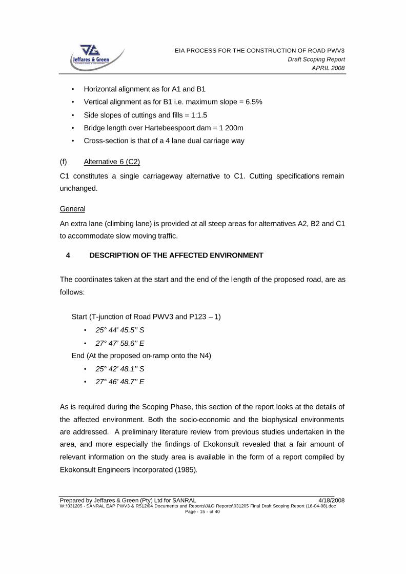
4 DESCRIPTION OF THE AFFECTED ENVIRONMENT
The coordinates taken at the start and the end of the length of the proposed road, are as
follows:
Start (T-junction of Road PWV3 and P123 – 1)
• 25° 44’ 45.5’’ S
• 27° 47’ 58.6’’ E
End (At the proposed on-ramp onto the N4)
• 25° 42’ 48.1’’ S
• 27° 46’ 48.7’’ E
As is required during the Scoping Phase, this section of the report looks at the details of
the affected environment. Both the socio-economic and the biophysical environments
are addressed. A preliminary literature review from previous studies undertaken in the
area, and more especially the findings of Ekokonsult revealed that a fair amount of
relevant information on the study area is available in the form of a report compiled by
Ekokonsult Engineers Incorporated (1985).

EIA PROCESS FOR THE CONSTRUCTION OF ROAD PWV3 Draft Scoping Report
APRIL 2008
Prepared by Jeffares & Green (Pty) Ltd for SANRAL 4/18/2008 W:\031205 - SANRAL EAP PWV3 & R512\04 Documents and Reports\J&G Reports\031205 Final Draft Scoping Report (16-04-08).doc
Page - 16 - of 40
This report is informed to a large extent on the Environmental Impact Study conducted
by Dames & Moore in 1981 and highlights the expected environmental impact as well as
relevant rehabilitation and mitigation measures for the proposed project. The Ekokonsult
(1985) report was used by Jeffares and Green to draw out t the findings of the previous
environmental studies undertaken in the study area. For the current EIA process
Jeffares and Green will take into consideration those previous investigations, and where
necessary, will fill in information gaps.
The following specialist studies were conducted by Dames & Moore (1981):
• Aquatic impact assessment
• Vegetation assessment
• Faunal assessment
• Soils and geology assessment
• Hydrology and physical chemical water quality assessment
• Land use assessment
• Historical and archaeological assessment
• Socio-economic assessment
• Air quality assessment
• Noise assessment
• Visual assessment
Dames & Moore (1981) also provided the following in their report
• Cumulative impact assessment
• Route alternatives
• Environmental monitoring programme
• Recommendations

EIA PROCESS FOR THE CONSTRUCTION OF ROAD PWV3 Draft Scoping Report
APRIL 2008
Prepared by Jeffares & Green (Pty) Ltd for SANRAL 4/18/2008 W:\031205 - SANRAL EAP PWV3 & R512\04 Documents and Reports\J&G Reports\031205 Final Draft Scoping Report (16-04-08).doc
Page - 17 - of 40
4.1 Socio-Economic Environment
4.1.1 Socio-economic demographic The study area falls within the jurisdiction of the Madibeng Local Municipality, which in
turn falls under the jurisdiction of the Bojanala Platinum District Municipality. The
Madibeng Local Municipality covers an area of 3 814km2, and is positioned
approximately 60km from Rustenburg and approximately 50km from Pretoria. The
municipal area is situated on the Heritage route linking the Cradle of Humankind World
Heritage Site (COH WHS) with the Pilansburg and Madikwe Game Reserves. It is
estimated that there are over 420 000 people within the municipal jurisdiction (Madibeng
Municipality: Draft annual report 2005/2006). The economy of this municipal area is
mainly comprised of the agricultural, mining, manufacturing and tourism sectors. The
most prominent sectors are manufacturing, mining and agriculture, with the mining
sector out-performing the agricultural sector. The area is regarded as the world’s third
largest Chrome producer and is also very rich in the Platinum group metals (Madibeng
Municipality: Draft annual report 2005/2006).
4.1.2 Tourism With regards to tourism in the municipal area, there is the Magaliesberg area which is a
popular spot for nature-related outdoor activities such as camping, hiking, horse riding
and others. There is also the Hartebeespoort dam area offering a range of activities
including water sports, golfing, art galleries, flee markets, etc (Figure 4 & Figure 5).

EIA PROCESS FOR THE CONSTRUCTION OF ROAD PWV3 Draft Scoping Report
APRIL 2008
Prepared by Jeffares & Green (Pty) Ltd for SANRAL 4/18/2008 W:\031205 - SANRAL EAP PWV3 & R512\04 Documents and Reports\J&G Reports\031205 Final Draft Scoping Report (16-04-08).doc
Page - 18 - of 40
Figure 4: Flee market in Hartebeespoort
Figure 5: Water sport at Hartebeespoort Dam
4.1.3 Heritage

EIA PROCESS FOR THE CONSTRUCTION OF ROAD PWV3 Draft Scoping Report
APRIL 2008
Prepared by Jeffares & Green (Pty) Ltd for SANRAL 4/18/2008 W:\031205 - SANRAL EAP PWV3 & R512\04 Documents and Reports\J&G Reports\031205 Final Draft Scoping Report (16-04-08).doc
Page - 19 - of 40
The location of the proposed road also situated on the Heritage route linking the COH
WHS with the Pilansburg and Madikwe Game Reserves.
4.2 Biophysical Environment
4.2.1 Vegetation The study area is comprised of the Moot Plain Bushveld as well as the Gold Reef
Mountain Bushveld. The Moot Plains Bushveld consists mainly of thorny Savanna
containing various Acacia species (Thorn trees) (Figure 6) on the plains, as well as in
the woodlands. The Gold Reef Mountain Bushveld consists mainly of dense woody
vegetation with distinct floristic differences. There is a predominance of Acacia caffra
(Common Hook-thorn) (Figure 7) and other trees (Mucina and Rutherford, 2006).
Appendix 5 is the detailed Flora study that was undertaken for this study area.
Figure 6: Protea caffra (Sugarbush) clumps in the slopes of Pampoen Nek

EIA PROCESS FOR THE CONSTRUCTION OF ROAD PWV3 Draft Scoping Report
APRIL 2008
Prepared by Jeffares & Green (Pty) Ltd for SANRAL 4/18/2008 W:\031205 - SANRAL EAP PWV3 & R512\04 Documents and Reports\J&G Reports\031205 Final Draft Scoping Report (16-04-08).doc
Page - 20 - of 40
Figure 7: Acacia caffra (Common Hook-thorn) dominates the study area
The study by Dames & Moore (1981) only entailed a physiographical vegetation
assessment however Ekokonsult conducted a more detailed investigation into the
species composition of the vegetation in the study area in order to assess conservation
status and design site specific rehabilitation measures.
4.2.2 Fauna
The Magaliesberg area is home to a number of breeding pairs of Cape Vultures (Gyps
coprotheres) that form part of three separate colonies, namely Skeerpoort, Robert’s
Farm and Nooitgedacht. These Cape Vultures are a southern African near-endemic
species, listed as vulnerable. Monitoring of vultures at these colonies has been on-going
for over 50 years. However the monitoring has not been continuous and was not always
according to a standard monitoring protocol (Rhino and Lion Wildlife Conservation Non-
Profit Organization).

EIA PROCESS FOR THE CONSTRUCTION OF ROAD PWV3 Draft Scoping Report
APRIL 2008
Prepared by Jeffares & Green (Pty) Ltd for SANRAL 4/18/2008 W:\031205 - SANRAL EAP PWV3 & R512\04 Documents and Reports\J&G Reports\031205 Final Draft Scoping Report (16-04-08).doc
Page - 21 - of 40
4.2.3 Climate
General climate: The study area is situated within an area of summer rainfall, and very
dry winters. The area receives approximately 600mm of precipitation per annum.
Maximum temperature in summer (January) can reach an average of 30°C while the
average minimum temperature in winter (June) is -2°C (Mucina and Rutherford, 2006). A
general climate study was conducted by Dames & Moore in 1981 however since it was
anticipated that the cutting through Pampoennek might have a significant impact on the
micro-climate of the study area, the local climate was taken into consideration in the
report by Ekokonsult Engineers Incorporated compiled in 1985. The following is an
extract of their findings.
Local climate: The Magaliesberg mountain range forms a natural climate barrier between
the bushveld biome of the northern areas and the grasslands of the southern parts. The
average annual rainfall ranges between 888mm on the southern side of Pampoennek to
775mm on the lower-lying northern slopes of the Magaliesberg Mountains. During the
summer months the average maximum temperatures on the northern slopes of the
Magaliesberg is 28.8°C, while it is 28.4°C on the southern slopes. During the winter
months the average maximum temperatures on the northern slopes of the Magaliesberg
is 21°C, while it is 15°C on the southern slopes. Minimum temperatures on the northern
and southern slopes are 6.6°C and 3.2°C respectively. Temperature variations between
the northern and southern slopes can be up to 6°C in winter while it seldom exceeds
0.5°C in summer.
The main wind direction in summer is northwest with rain bearing winds coming from the
northeast. In winter cold winds blow from the southeast that often result in frost on the
southern slopes of the mountain. Snow in this area is extremely rare while dew
precipitates during windless nights especially after rains. Mist is prevalent in the summer
during periods of incessant rain combined with a sharp decline in temperatures.

EIA PROCESS FOR THE CONSTRUCTION OF ROAD PWV3 Draft Scoping Report
APRIL 2008
Prepared by Jeffares & Green (Pty) Ltd for SANRAL 4/18/2008 W:\031205 - SANRAL EAP PWV3 & R512\04 Documents and Reports\J&G Reports\031205 Final Draft Scoping Report (16-04-08).doc
Page - 22 - of 40
4.2.4 Geology and Soils The geology of the study area is dominated by quartizites, conglomerates, shale, clastic
sediment and minor carbonates of the Pretoria Group. The soils are of the Mispah and
Glenrosa forms (Mucina and Rutherford, 2006).
4.2.5 Surface water systems The Hartebeespoort Dam is in the vicinity of the site. The dam was constructed in 1925,
and has a capacity of 205 million cubic meters and a shoreline of 56km when at full
capacity. It falls within the Crocodile-Marico Water Management Area Hartebeespoort
dam has a history of experiencing major algal blooms, especially in the hot summer
months and after heavy rains. However a Resource Management Plan is being
developed to ensure the rehabilitation and mitigation of the mentioned, and other,
problems experienced at the dam (Department of Water Affairs and Forestry Website).
4.2.6 Land use There are various forms of land uses in the study area, including the Magaliesberg
Nature Area (Figure 8), open-cast mining (Figure 9), tourism, agriculture,
manufacturing and industry. Platinum mining is also located within close proximity to the
study area.

EIA PROCESS FOR THE CONSTRUCTION OF ROAD PWV3 Draft Scoping Report
APRIL 2008
Prepared by Jeffares & Green (Pty) Ltd for SANRAL 4/18/2008 W:\031205 - SANRAL EAP PWV3 & R512\04 Documents and Reports\J&G Reports\031205 Final Draft Scoping Report (16-04-08).doc
Page - 23 - of 40
Figure 8: Photo of a section of Magaliesberg Protected Area
Figure 9: Photo showing mining operations on Magaliesberg Mountain

EIA PROCESS FOR THE CONSTRUCTION OF ROAD PWV3 Draft Scoping Report
APRIL 2008
Prepared by Jeffares & Green (Pty) Ltd for SANRAL 4/18/2008 W:\031205 - SANRAL EAP PWV3 & R512\04 Documents and Reports\J&G Reports\031205 Final Draft Scoping Report (16-04-08).doc
Page - 24 - of 40
5 ISSUES AND CONCERNS REGARDING THE PROPOSED PROJECT
This section of the report looks at the various concerns and comments that were raised
by the various I&APs, following the distribution of the BID. The issues raised now as well
as those to follow after the review of the DSR, will be investigated and addressed in the
EIA Phase of the project.
Responses to the concerns and comments mentioned below have been provided by the
project team. All comments raised in the Scoping Phase of the project have been
collated into a Comments and Responses Report (Appendix 4).
The following are the comments and concerns raised thus far, in no order of importance:
Ø Proposal for the construction of a dual, and not a single carriageway.
Ø Methods in place to ensure road safety.
Ø Regular and proper road maintenance.
Ø Inconveniences and time-delays to road users during the construction phase.
Ø The impact of the proposed road (during the construction phase) to the
businesses in the area.
Ø Noise and air pollution
Ø Compliance with the proposed Magaliesberg EMF.
Ø The historical significance of the proposed construction site to be regarded.
Ø The potential negative impact of the proposed road on the Dan Doryn
commercial hub and potential of the initiation of informal trading centres.
Ø Potential disturbance to the animal and plant life in the Magaliesberg Protected
Area.
Ø Visual impacts
Ø Traffic congestion.
Ø Short life-span of employment created by projects involving road construction.
For the full account of the comments and issues raised by the I&APs as well as the
responses by the consulting team, please refer to Appendix 4.
Many I&APs welcomed the idea of the proposed road.

EIA PROCESS FOR THE CONSTRUCTION OF ROAD PWV3 Draft Scoping Report
APRIL 2008
Prepared by Jeffares & Green (Pty) Ltd for SANRAL 4/18/2008 W:\031205 - SANRAL EAP PWV3 & R512\04 Documents and Reports\J&G Reports\031205 Final Draft Scoping Report (16-04-08).doc
Page - 25 - of 40
6 PROPOSED SPECIALIST STUDIES Based on the findings of the site visit as well as the other information received thus far,
the following specialist studies are proposed:
Ø Floral Assessment
Ø Faunal Assessment
Ø Heritage Impact Assessment
Ø Social Impact Assessment
The above mentioned specialist studies were seen as the most relevant by the team of
environmental consultants due to the nature of the study area. As already indicated the
proposed road is to go through the Magaliesberg Nature Area.
The possibility of undertaking Noise Impact Assessment, Air Quality Impacts
Assessment and Visual Impact Assessment studies was considered, but was eventually
decided against. The reasons for this are as follows:
The study area already has mining and manufacturing activities in close proximity to the
proposed project location. Due to this noise pollution is thought to already be an issue.
With regards to the proposed project noise is anticipated to be an issue during the
construction phase of the project. We anticipate that noise pollution will not be a
significant problem during the operational phase of the proposed project due to the
expected smooth flow of traffic. Recommendations for mitigation will be made in the
Environmental Management Plan (EMP)..
Ø Some minor air pollution is already occurring in the study area due to mining and
other activities in the area. Air pollution might be an issue of concern in the
construction phase of the project and measures could be put into place to
minimise this. Air pollution is a potential issue for the operational phase.
However, due to the expected smooth flow of traffic, no localised effects are
anticipated.
Ø Part of the study area already has a negative visual impact due to the already
existing activities . It is thus thought that the inclusion of the road is not to have a
significant negative visual impact in the area.

EIA PROCESS FOR THE CONSTRUCTION OF ROAD PWV3 Draft Scoping Report
APRIL 2008
Prepared by Jeffares & Green (Pty) Ltd for SANRAL 4/18/2008 W:\031205 - SANRAL EAP PWV3 & R512\04 Documents and Reports\J&G Reports\031205 Final Draft Scoping Report (16-04-08).doc
Page - 26 - of 40
7 PROPOSED PLAN OF STUDY FOR EIA
7.1 Specialist Studies The specialists studies proposed in Section 6 of this report will be undertaken. If more
specialist studies are required after consultation with the DEAT and other stakeholder,
then these will be conducted in addition to the list already suggested. All relevant
specialists have prepared an outline of the work they will be undertaking.
The general approach involves that all specialists will collect field data relevant to their
focus area, and make a thorough assessment with regards to the potential impact that
the proposed project might have on their specific focus area. In addition
recommendations and mitigations measures will be proposed.
When undertaking the various studies, the specialists will need to take into account and
also initiate the following:
Ø The list of all the potential impacts identified in the Scoping Phase of the project,
and the responses given.
Ø The legislation and guidelines pertaining to their focus area.
Ø A ranking system, by which the potential impact can be analyzed, based on the
probability, the extent, the significance and the duration of the potential impact.
Ø The possibility that certain constraints (due to matters outside their control) might
be met while undertaking their specific studies and what the way forward would
be in the event of this happening.
Ø The identification of areas in which specialist studies and/or the findings thereof
might overlap.
Ø Provide some input into the management plan for the mitigations of the effects of
the potential impacts.
The following are the proposed specialist studies for this project:
7.1.1 Floral Assessment The study is to focus on the areas proposed for the alignment of the new road section
proposed. Due to the alignment of the road transversing a sensitive area, a floral
assessment is required to identify any red data or endangered plant species that might

EIA PROCESS FOR THE CONSTRUCTION OF ROAD PWV3 Draft Scoping Report
APRIL 2008
Prepared by Jeffares & Green (Pty) Ltd for SANRAL 4/18/2008 W:\031205 - SANRAL EAP PWV3 & R512\04 Documents and Reports\J&G Reports\031205 Final Draft Scoping Report (16-04-08).doc
Page - 27 - of 40
occur along the servitude of the alignment. The proposed methodology will include the
following processes:
Ø A desktop review of available literature
Ø A detailed site investigation to identify any affected plant species
Ø Unidentified plants will be sampled and identified by using either the National
Herbarium’s or the University of Natal’s Herbarium resources
Ø Recommendations on management and mitigation measures will be made with
regards to the construction and operational phases
The final report and any additional mapping will be provided to the client upon
completion of the study.
7.1.2 Faunal Assessment The proposed faunal assessment of the study area is to include the following:
1. A desktop review of available literature
2. A field investigation within the summer months only after sufficient rains have fallen
which will include detailed faunal investigations such as:
Ø Visual observations.
o This is to be performed by walking the site and noting habitat types and the visual
presence of animals or evidence of animals in the form of faeces, pellets, spoor,
nests, burrows, feathers etc.
Ø Trapping.
The following live capture and release trapping methods will be employed:
o Array traps (Campbell & Christman, 1982; Corn, 1994; Simmons, 2002) for
herpetological and invertebrate sampling at a possible three/four sites.
o Five liter pitfall buckets for invertebrate and herpetofaunal sampling.
o Funnel traps for herpetological and invertebrate sampling
o Live mammal traps (Sherman traps), baited for capture, identification,
measurement and release of small mammals.
o Sweep netting with hand nets for sampling insects and spiders.

EIA PROCESS FOR THE CONSTRUCTION OF ROAD PWV3 Draft Scoping Report
APRIL 2008
Prepared by Jeffares & Green (Pty) Ltd for SANRAL 4/18/2008 W:\031205 - SANRAL EAP PWV3 & R512\04 Documents and Reports\J&G Reports\031205 Final Draft Scoping Report (16-04-08).doc
Page - 28 - of 40
o Grab Sampling
o Night investigations to record nocturnal animals such as frogs, bats, snakes,
nocturnal birds and mammals.
From the desktop review and field investigations, a detailed description of the fauna
(including the possibility of Red Data species) in each habitat will be compiled
The creation of a faunal sensitivity map for the area will be undertaken. Species within
the proposed footprint areas that have conservation significance will be recorded using a
Garmin GPS. These will then be mapped and visually presented in the report. Identified
potential impacts of the road construction and operation will be quantified (where
possible) and described. Significance of these impacts will then be determined using the
extensive knowledge of the specialists through a methodology agreed on with the client.
The identification of impacts will focus on:
Ø the loss of general or sensitive faunal habitats;
Ø the potential loss of rare and threatened faunal species;
Ø the loss of open space;
Ø the loss of natural migration corridors; and
Ø an assessment of cumulative impacts
Recommendations on management and mitigation measures (including opportunities
and constraints) with regards to the construction and operation of the proposed
development will also be made.
7.1.3 Heritage Impact Assessment A Desktop investigation involving the following will be undertaken:
Ø Consult archaeological databases (national and provincial);
Ø Consult earlier studies;
Ø Literature search (for contextual evidence); aerial photographs and maps
Following the Scoping Phase a full Heritage Impact Assessment will be undertaken which
will include the following:

EIA PROCESS FOR THE CONSTRUCTION OF ROAD PWV3 Draft Scoping Report
APRIL 2008
Prepared by Jeffares & Green (Pty) Ltd for SANRAL 4/18/2008 W:\031205 - SANRAL EAP PWV3 & R512\04 Documents and Reports\J&G Reports\031205 Final Draft Scoping Report (16-04-08).doc
Page - 29 - of 40
Ø Reconnoiter new corridor and sensitive areas by means of foot;
Ø GPS log, describe photograph heritage resources and mapping in Arch View
The Heritage Impact Assessment report will include:
Ø Maps illustrating layered presence of heritage resources;
Ø Tables reflecting significance of various types and ranges of heritage resources
Ø Proposed management and mitigation measures, and recommendations.
7.1.4 Socio-Economic Impact Assessment This section provides an explanation on the methodology that will be followed in
undertaking the socio-economic impact assessment of the proposed Roads. The
methodology comprises of Part 1 which is the concept report and Part 2, a full Impact
Assessment report.
The Orientation and delineation of areas of impact will cover the following:
Ø The purpose of this step is to make contact with relevant role-players so as to
obtain relevant background, results from previous studies and secondary data
regarding the proposed study and the affected communities.
Ø Furthermore, for the purpose of the social, socio-economic and economic
analysis, a delineation of the areas to impacted upon is required.
Ø The study area and areas of impact will be delineated into a primary, secondary
and tertiary area of investigation.
The development overview and socio-economic base conditions is to include:
Ø The purpose of this step is to determine key social problems, issues and trends
of the community, as well as the other affected areas, towns, etc. This will be
undertaken by evaluating future planning aspects, compiling a social, socio-
economic and economic status and profile of the study area and areas of impact.
Ø A total of 5 group sessions with various focus groups will be attended so that
additional aspects can be attained. Information sheets will also be produced to
obtain required additional information. Discussions with the focus groups will

EIA PROCESS FOR THE CONSTRUCTION OF ROAD PWV3 Draft Scoping Report
APRIL 2008
Prepared by Jeffares & Green (Pty) Ltd for SANRAL 4/18/2008 W:\031205 - SANRAL EAP PWV3 & R512\04 Documents and Reports\J&G Reports\031205 Final Draft Scoping Report (16-04-08).doc
Page - 30 - of 40
entail determining and obtaining all the relevant issues, trends, perceptions,
impacts, such as safety and security, loss of social cohesion, etc.
Part1:
Ø The purpose of this step will be to provide an approach for the next part as well a
report on the social, socio-economic and economic input required. The main
objective of this report will be to identify, rank and ‘score’ each impact and
therefore to provide a brief understanding and indication of the social, socio-
economic and economic issues, trends, perceptions and impacts.
Part 2:
Ø After a detailed analysis and understanding of the social, socio-economic and
economic fabric of the community as well as other surrounding or affected areas,
determination of issues and trends and perceptions, the identification and
quantification of the possible social, socio-economic and economic impacts will
follow.
Ø The identified impacts will be assessed in terms of nature, extent, duration,
intensity, frequency of occurrence, probability, and legal requirements (where
applicable) and will include reference to both positive and negative social, socio-
economic and economic impacts.
Ø The improved access between the two cities (Johannesburg and
Rustenburg/Brits) and resultant increased economic linkages will be taken into
consideration. Furthermore, traffic safety and resultant implications on the social
fabric will be determined.
The proposed management principles are to cover, amongst others:
Ø The purpose of this step is to provide guidelines to minimize any negative
impacts of the envisaged road development, as well as guidelines to maximize
the positive impacts. The management and mitigation options include identifying
alternative ways of meeting needs, bringing about changes in plans, improving
monitoring and management, improving negative perceptions, etc.

EIA PROCESS FOR THE CONSTRUCTION OF ROAD PWV3 Draft Scoping Report
APRIL 2008
Prepared by Jeffares & Green (Pty) Ltd for SANRAL 4/18/2008 W:\031205 - SANRAL EAP PWV3 & R512\04 Documents and Reports\J&G Reports\031205 Final Draft Scoping Report (16-04-08).doc
Page - 31 - of 40
7.2 Assessment of Issues The assessment of issues will be done by integrating the findings of the specialist
studies, the independent assessment done by the environmental practitioners as well as
the outcome of the public consultation process. A synopsis of significant and possible
negative impacts before and after mitigations will be summarised, tabulated and rated
according to the following set of criteria: Extent (Spatial Scale); Duration; Intensity;
Probability; and Significance. A determination of the values associated with these
weightings is provided in the table below:
CRITERIA RATING ABB. DESCRIPTION
Site S Impact restricted to the proposed site and the immediate area surrounding it.
Local Area A Impact restricted to an area within 10km of the proposed site.
Extent: Spatial scale of the impact.
Regional R Impact could affect the entire region and / or beyond. Short S The impact will either disappear with mitigation or through natural
processes in a time span shorter than the duration of the activity. Medium M The impact will last for the duration of the activity; thereafter it will
cease. Long L The impact will last for the duration of the operational life of the
activity; thereafter it will be mitigated by direct human action or by natural processes thereafter within a reasonable / measurable time period.
Duration: Duration of the impact measured in the context of the lifetime of the proposed activity.
Permanent P The impact will be permanent; mitigation whether by human or natural processes will not occur in s uch a way or within such a time span that the impact can be considered transient.
Low L Natural processes are not affected or continue undisturbed, no rare or endangered species are affected, no objection from I&APs. The activity poses a low health risk.
Medium M Natural processes temporarily affected or may continue albeit in a modified way, no rare or endangered species are affected, some concern from I&APs. Activity poses a moderate to serious health risk.
Intensity: The extent to which the environment is modified, or human safety & / or health is compromised. High H Natural processes are permanently affected to the extent where it
temporarily or permanently affects health, Rare or endangered species are affected, Major concern from I&APs. Potentially life threatening.
Unlikely / Low L The event or impact is unlikely to occur. Likely / Medium M The event or impact is likely to occur.
Probability: Degree of probable occurrence.
Definite / High H The event or impact will definitely occur.
Low L Medium M
Significance: Degree of impact’s importance High H
Significance is an indication of the importance of the impact relative to the extent, duration, intensity and probability and therefore indicates the level of mitigation required.
8 PROPOSED WAY FORWARD
Following the review of the DSR by I&APs, a Final Scoping Report will be compiled and
sent to the DEAT for review and adjudication. If the Final Scoping Report is accepted by
the DEAT, the proposed project will then go into the second phase, the EIA Phase, as
indicated in Section 2.2.2 of this report.
EIA PROCESS FOR THE CONSTRUCTION OF ROAD PWV3 Draft Scoping Report
APRIL 2008
Prepared by Jeffares & Green (Pty) Ltd for SANRAL 4/18/2008 W:\031205 - SANRAL EAP PWV3 & R512\04 Documents and Reports\J&G Reports\031205 Final Draft Scoping Report (16-04-08).doc
Page - 32 - of 40
9 REFERENCES
Munica, L and Rutherford, M.C. (Eds). 2006. The vegetation of South Africa, Lesotho
and Swaziland. Strelitzia 19. South African National Biodiversity Institute, Pretoria.
Van Wyk & Louw Consulting Engineers, January 1981. Detailed plan report for Road
P160 – 1 (PWV3) at Hartebeespoort Dam; Report prepared for the Transvaal Provincial
Administration (Roads Department).
Van Wyk & Louw Consulting Engineers, June 1985. Basic planning report for Road
P160 – 1 (PWV3) at Hartebeespoort Dam between farms Zandfontein 447 – JQ and
Broedersroom 481 – JQ in the Brits District. Report prepared for the Transvaal Provincial
Administration (Roads Department).
Ekokonsult Engineers Incorporated, August 1985. Omgewingsinvloed vermindering en
rehabilitasie riglyne vir pad P160-1. Report prepared for the Transvaal Provincial
Administration (Roads Department on behalf of Van Wyk & Louw Consulting Engineers.
www.dwaf.gov.za
www.madibeng.gov.za (Annual Report: 2005/2006)
www.rhinolionconservation.co.za (The Vulture Programme; Non-Profit Organization)