Estimates of Global Sea Level Rise from Tide Gauges Sea level trend, 1994-2008.
27
Estimates of Global Sea Level Rise from Tide Gauges Sea level trend, 1994-2008
-
Upload
barnaby-ward -
Category
Documents
-
view
218 -
download
0
Transcript of Estimates of Global Sea Level Rise from Tide Gauges Sea level trend, 1994-2008.

Estimates of Global Sea Level Rise from Tide Gauges
Sea level trend, 1994-2008

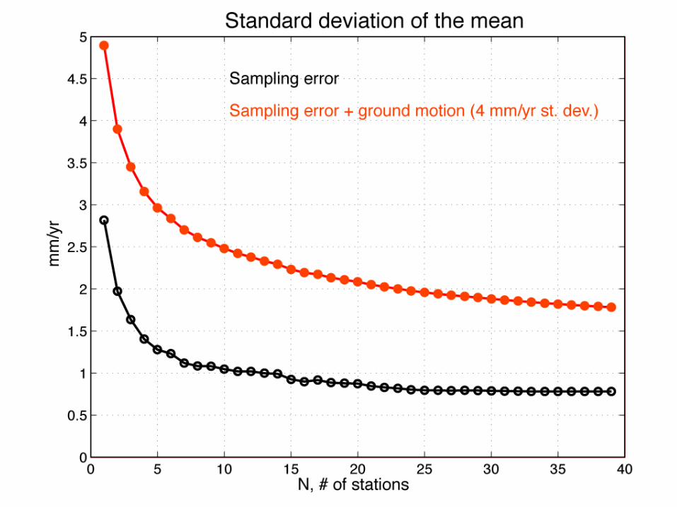
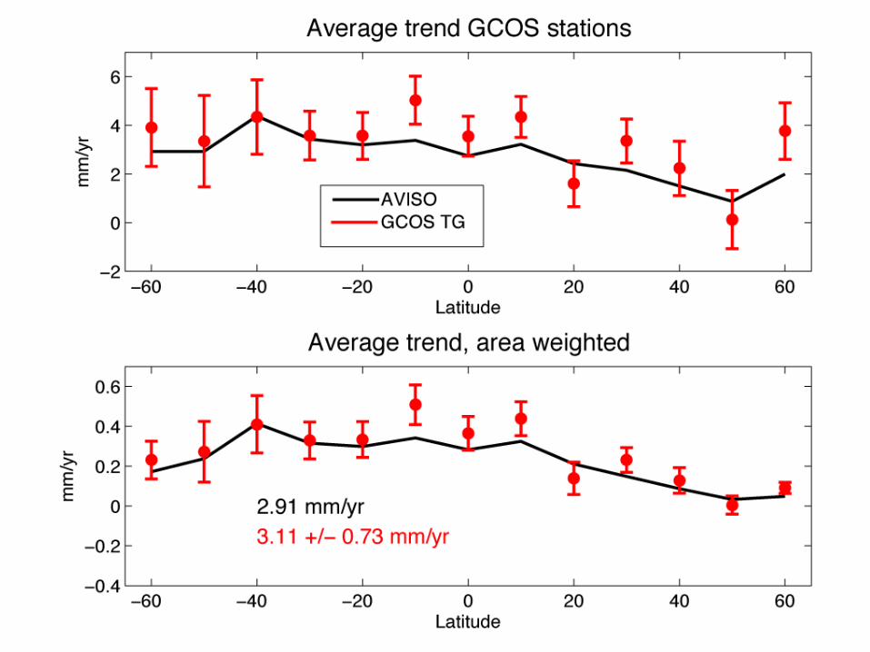
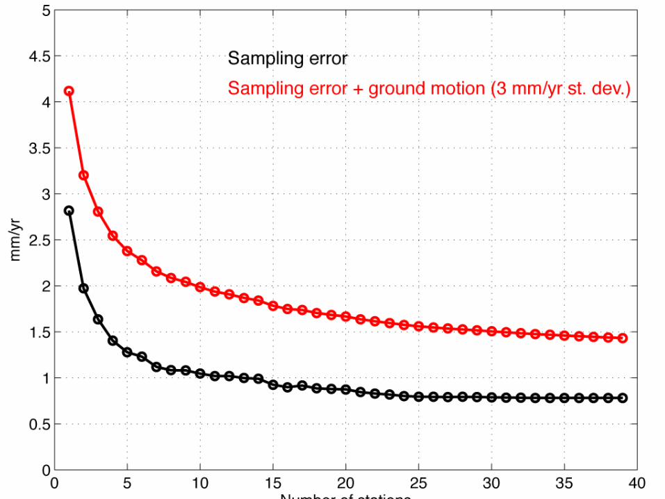
Method• Compute average trend in 10° latitude bands• Estimate sampling error w/ Monte Carlo simulations
• Assess error due to vertical land motion (VLM) using
TG-ALT residual trends

Sampling error
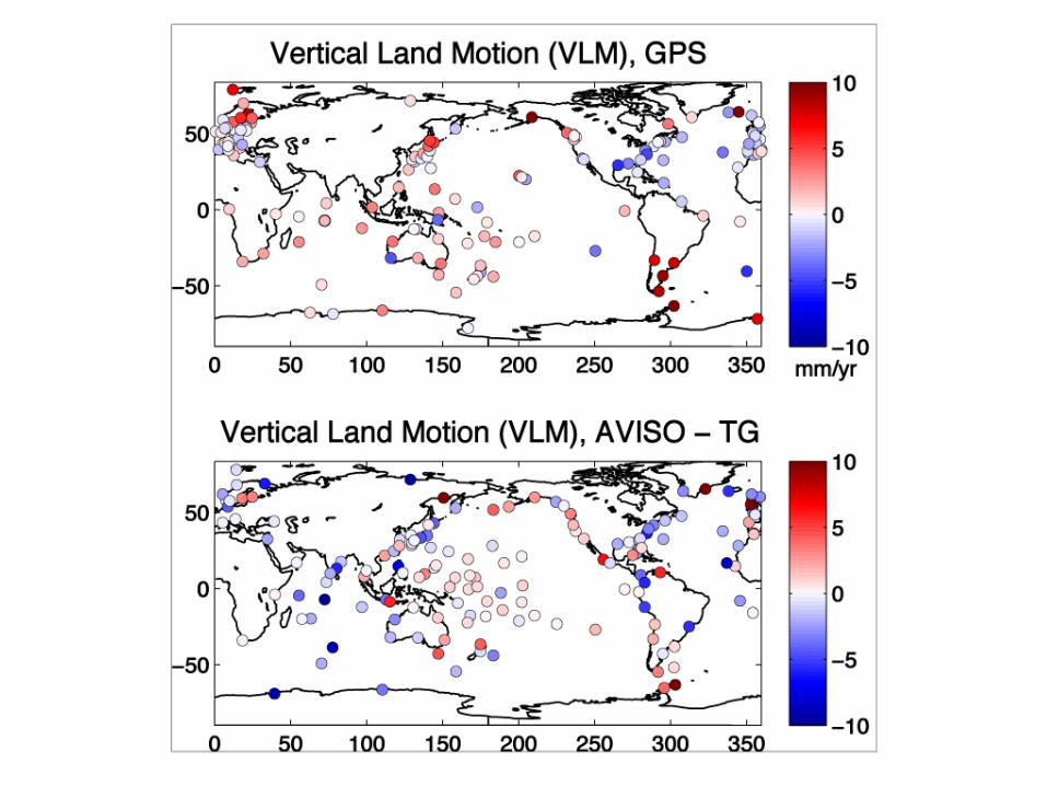
VLM GPS vs. AVISO


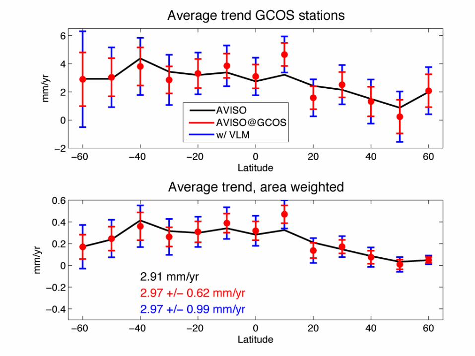
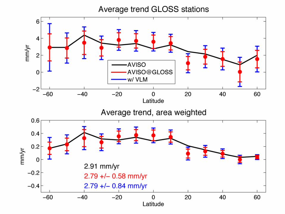
Area of bands


Comparison with Church and White (2006)
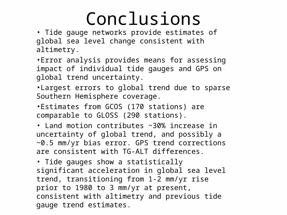
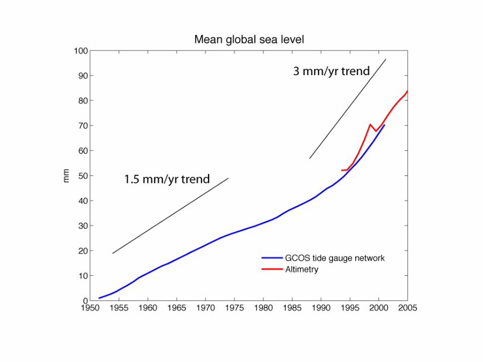
Conclusions• Tide gauge networks provide estimates of global sea level change consistent with altimetry.
•Error analysis provides means for assessing impact of individual tide gauges and GPS on global trend uncertainty.
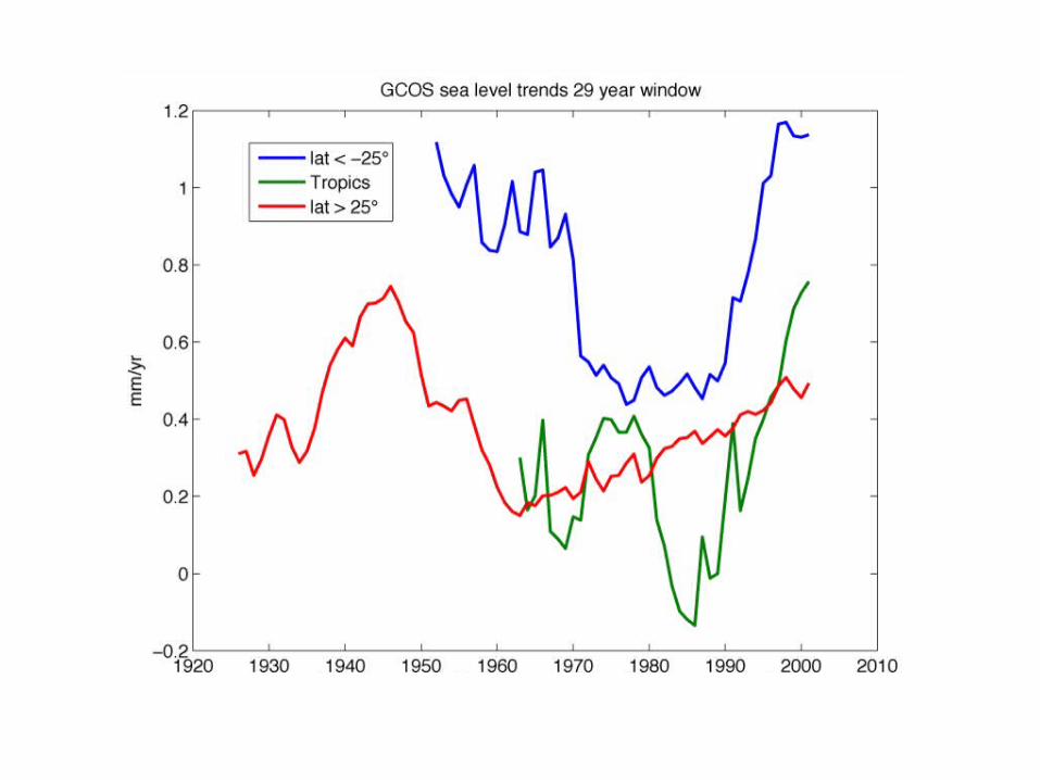
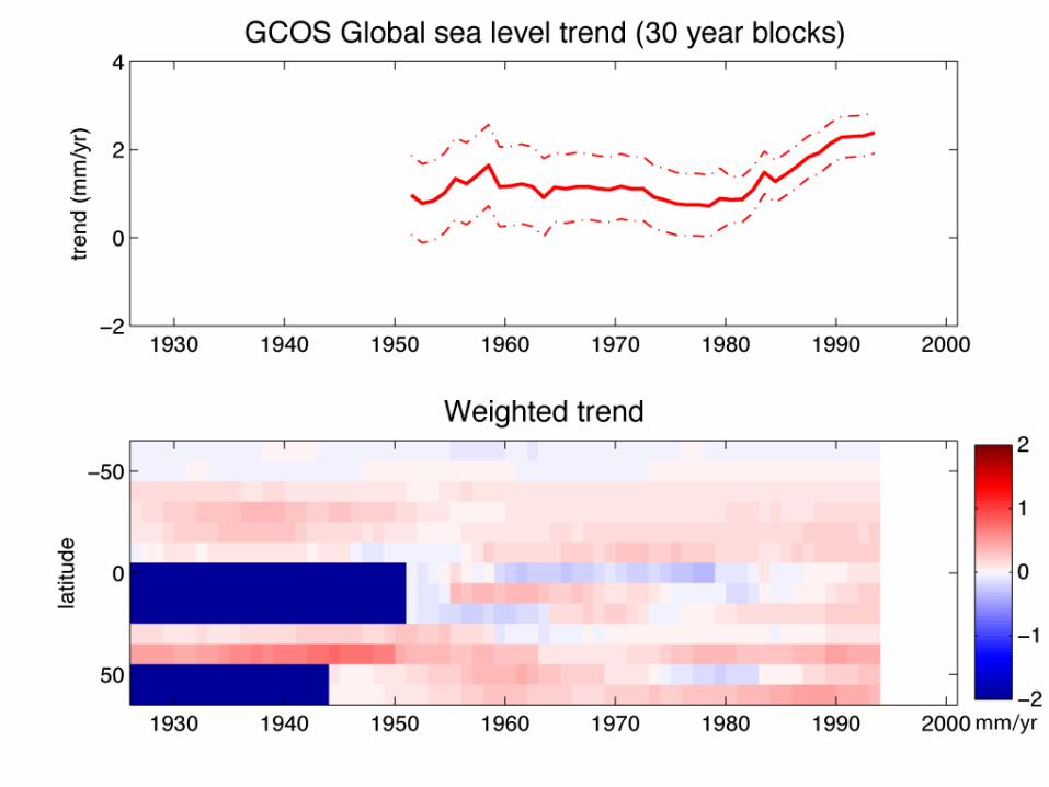
•Largest errors to global trend due to sparse Southern Hemisphere coverage.
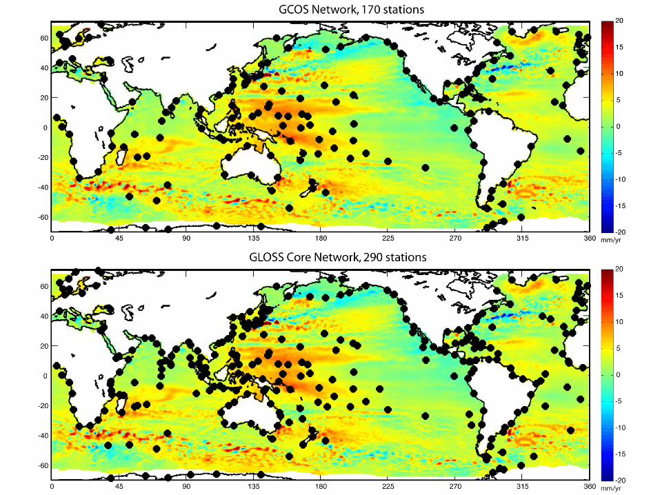
•Estimates from GCOS (170 stations) are comparable to GLOSS (290 stations).
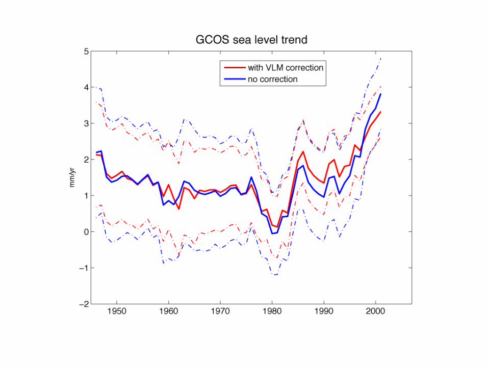
• Land motion contributes ~30% increase in uncertainty of global trend, and possibly a ~0.5 mm/yr bias error. GPS trend corrections are consistent with TG-ALT differences.
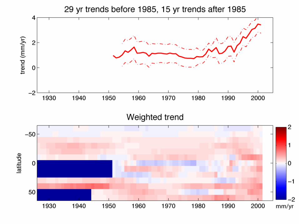
• Tide gauges show a statistically significant acceleration in global sea level trend, transitioning from 1-2 mm/yr rise prior to 1980 to 3 mm/yr at present, consistent with altimetry and previous tide gauge trend estimates.


VLM GIA vs AVISO